Karnak Temple

Karnak Temple

Karnak Temple Latest News

A sweeping new geoarchaeological study has revealed how Egypt’s famed Karnak Temple complex rose from an island amid Nile floods to become one of the ancient world’s most enduring sacred centers.

About Karnak Temple

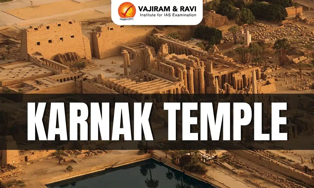
  • The Karnak Temple, or rather the complex of temples of Karnak in Luxor, Egypt, is one of the most impressive of Ancient Egyptian sites and once formed part of the city of Thebes. 
  • It is located in Karnak, Luxor Governorate, south of Egypt on the east side of the Nile River bank.
  • It was built between 2055 BC and around 100 AD. 
  • It was built as a cult temple and was dedicated to the gods Amun, Mut, and Khonsu. 
  • Being the largest building for religious purposes ever to be constructed, the Karnak Temple was known as “most select of places” by ancient Egyptians. 
  • While the height of its importance was during the New Kingdom, and during the reigns of famous pharaohs such as Hatshepsut, Tuthmose III, Seti I, and Ramesses II, all contributed significant additions to the complex, construction continued into the Greco-Roman Period, with the Ptolemies, Romans, and early Christians all leaving their mark there.
  • Together with the Luxor Temple and the Valley of the Kings, the Karnak Temple is a UNESCO World Heritage site.

Source: SD

Karnak Temple FAQs

Q1: Where is the Karnak Temple located?

Ans: It is located in Karnak, Luxor Governorate, south of Egypt on the east side of the Nile River bank.

Q2: The Karnak Temple complex was primarily built as a temple dedicated to which gods?

Ans: It was built as a cult temple and was dedicated to the gods Amun, Mut, and Khonsu.

Q3: Karnak Temple forms a part of which ancient city?

Ans: Thebes

Viridans Streptococci

Viridans Streptococci

Viridans Streptococci Latest News

The new study, by a research team at Tampere University in Finland, examined coronary arteries from 121 sudden-death autopsies and found Viridans streptococci were the most frequent species, present in about 42% of both autopsy and surgical cases.

About Viridans Streptococci

  • It is a group of common oral bacteria.
  • It can form sticky bacterial layers called biofilms deep inside atherosclerotic plaques, remaining hidden from the immune system until the moment of rupture. 
  • Viridans streptococci are commensals in the gastrointestinal, respiratory and female genital tracts and are most prevalent in the oral cavity. 
  • It is a group of gram-positive cocci that are commonly associated with infective endocarditis (IE) and typically colonize previously damaged cardiac tissue.
  • Viridans Streptococcal Biofilm Evades Immune Detection and Contributes to Inflammation.
  • Importantly, the bacterial clusters were often arranged in biofilms, protective layers that allow bacteria to survive unnoticed by the body’s immune system.  

How do Oral Bacteria Trigger Heart Attacks?

  • The biofilm formed by this bacteria remains hidden, parts of it can break loose. Once released, the bacteria trigger inflammation in the artery wall.
  • This weakens the fibrous “cap” covering the fatty plaque, making it more likely to rupture.
  • Plaque rupture is a critical event that leads to clot formation and, ultimately, a heart attack.

Source: TH

Viridans streptococci FAQs

Q1: What is a common antibiotic used to treat Viridans Streptococci infections?

Ans: Penicillin.

Q2: What is a significant disease association of Viridans Streptococci?

Ans: Viridans Streptococci are a common cause of endocarditis, particularly in individuals with pre-existing heart conditions

Mig La Pass

Mig La Pass

Mig La Pass Latest News

Recently, Project Himank of the Border Roads Organisation (BRO) has constructed the world’s highest motorable road at Mig La Pass, 19,400 feet above sea level in Ladakh.

About Mig La Pass

  • Mig La Pass is located on the Changthang Plateau in Ladakh. 
  • World Record Altitude: At 19,400 ft, Mig La Pass is the highest motorable road in the world.
  • Strategic Axis: It connects Likaru–Mig La–Fukche, creating the third vital corridor from Hanle to Fukche near the Indo-China border.
  • All-Weather Road: Built with advanced features to withstand harsh winters, shifting glaciers, and oxygen-thin air, making it the highest all-season road globally.

What is Project Himank?

  • The Project was raised on 04 Dec 1985 at Leh for the development of road communication in Ladakh region.
  • The entire area of responsibility of the Project falls in high altitude with challenging working conditions and limited working season.
  • It has the distinction of supporting the Army during various operations undertaken in the region.
  • The Project ensures the maintenance of communication and access to strategic areas close to the Line of Actual Control with China and had been instrumental in keeping both the Leh - Manali and the Zojila axis open during Op VIJAY.
  • It has done yeoman service in restoration of road communication, clearing landslides and avalanches, constructions of bridges, snow clearance and opening of air fields.

Source: News On Air

Mig La Pass FAQs

Q1: Who constructed the Likaru-Mig La-Fukche road?

Ans: Border Roads Organisation (BRO)

Q2: Where is Mig La Pass located?

Ans: Mig La Pass is situated on the Changthang Plateau in Ladakh.

MY Bharat-National Service Scheme (NSS) Awards

MY Bharat-National Service Scheme (NSS) Awards

MY Bharat-National Service Scheme (NSS) Awards Latest News

Recently, the President of India presented the MY Bharat-National Service Scheme (NSS) Awards for the year 2022-23 at Rashtrapati Bhavan.

About MY Bharat-National Service Scheme (NSS) Awards

  • It was instituted by the Ministry of Youth Affairs and Sports in 1993-94.
  • Objective: To honour and celebrate the outstanding contributions of youth in the fields of social service, community development and nation-building.
  • It is given every year to recognise and reward outstanding contributions towards voluntary community service made by the Programme Officers/NSS Units and NSS Volunteers.

Key Facts about National Service Scheme

  • NSS is a Central Sector Scheme which was launched in the year 1969 during the birth centenary celebrations of Mahatma Gandhi.
  • Objective:  The primary objective of developing the personality and character of the student youth through voluntary community service.
  • The ideological orientation of the NSS is inspired by the ideals of Mahatma Gandhi.
  • It provides an opportunity to the student youth of the 11th & 12th Class of schools at +2 Board level and student youth of Technical Institution, Graduate & Post Graduate at colleges and University level of India to take part in various Government led community service activities & programmes.

Source: PIB

MY Bharat-National Service Scheme (NSS) Awards FAQs

Q1: What is my Bharat NSS award?

Ans: It honours and celebrates the outstanding contributions of youth in the fields of social service, community development and nation-building

Q2: What is MY Bharat?

Ans: It is an autonomous body that has been set up by the Department of Youth Affairs, Ministry of Youth Affairs and Sport.

Bhavani River

Bhavani River

Bhavani River Latest News

The Tamil Nadu Forest Department is monitoring an injured makhna (tuskless male elephant) that has been standing in the river Bhavani along the Tamil Nadu-Kerala border.

About Bhavani River

  • It is a major tributary of the Cauvery River.
  • It flows through the states of Kerala and Tamil Nadu.
  • It is the second largest river in Tamil Nadu.
  • Course
    • It originates from the Western Ghats in the Nilgiri Hills, located in the Tiruppur District of Tamil Nadu.
    • From there, it flows into Kerala, passing through the Silent Valley National Park. 
    • After flowing through Kerala, the river turns and flows back into Tamil Nadu.
    • The river confluences with the Cauvery river at the town of Bhavani in Tamil Nadu.
    • Bhavani Sangameshwarar Temple, situated at the meeting point of the Bhavani and the Cauvery Rivers, is a prominent pilgrim center.
  • Total Length: 217 km.
  • It is a perennial river.
  • The drainage basin of the Bhavani River spans approximately 6,200 sq.km., covering parts of Tamil Nadu, Kerala, and Karnataka:
    • Tamil Nadu: 87% of the basin area
    • Kerala: 9% of the basin area
    • Karnataka: 4% of the basin area
  • About 90 percent of the river water is used for agriculture.
  • Tributaries: The largest tributaries of the Bhavani River are West and East Varagar, which come from the Nilgiris. 
  • There are two major dams on the Bhavani River:
    • Bhavani Sagar Dam
    • Kodiveri Dam

Source: TH

Bhavani River FAQs

Q1: The Bhavani River is a major tributary of which river?

Ans: Cauvery River

Q2: Bhavani River flows through which state?

Ans: It flows through the states of Kerala and Tamil Nadu.

Q3: The Bhavani River originates from which hills?

Ans: It originates from the Western Ghats in the Nilgiri Hills.

Q4: What is the total length of the Bhavani River?

Ans: 217 km

Jal Jeevan Mission (JJM)

Jal Jeevan Mission

Jal Jeevan Mission Latest News

The Union government plans to map all drinking water assets including pipelines created under its Jal Jeevan Mission (JJM) on PM Gati Shakti, a Geographic Information System (GIS)-based platform.

About Jal Jeevan Mission

  • It was launched on August 15, 2019.
  • JJM is envisioned to provide safe and adequate drinking water through individual Functional Household Tap Connections (FHTCs) by 2024 to all households in rural India. 
  • It is based on a community approach to water and will include extensive Information, Education and communication as key components of the mission.
  • Nodal Ministry: Ministry of Jal Shakti.

Components of Jal Jeevan Mission

  • Development of in-village piped water supply infrastructure to provide tap water connections to every rural household.
  • Bottom-up planning: Community engagement in planning, implementation and Operation and Maintenance (O&M)
  • Women empowerment: Involvement of women in planning, decision-making, implementation, monitoring, and O&M
  • Focus on future generations: Provision of tap water supply to schools, tribalhostels, and anganwadi (daycare) centers
  • Skill development and employment generation: Local people are skilled for building and maintaining water supply structures
  • Greywater management: Reuse and recycle waste water for source sustenance
  • Source sustainability: Promote groundwater recharge and water conservation
  • Water Quality: Ensure safe drinking water to reduce water-borne ailments

Funding Pattern for Jal Jeevan Mission

  • 50:50 between Centre and States
  • 90:10 for Himalayan and North-Eastern States.
  • In case of UTs, 100% of the funding is provided by the Central government.

 Source: IE

Jal Jeevan Mission FAQs

Q1: When was the Jal Jeevan Mission launched?

Ans: August 15, 2019.

Q2: What is the primary goal of the Jal Jeevan Mission?

Ans: To provide piped water connection to all rural households.

New START Treaty

New START Treaty

New START Treaty Latest News

Recently, US President Donald Trump said that Russian President Vladimir Putin's idea of the New START Treaty was a good one.

About New START Treaty

  • It is known as The New Strategic Arms Reduction Treaty (New START).
  • It is the last remaining nuclear arms deal between Russia and the United States of America, and it was extended for five years in 2021. (Extended the treaty till February 4 2026.)
  • Objective: The New START caps the number of nuclear warheads well below Cold War limits.
  • This treaty entered into force on February 5, 2011
  • The treaty concerns strategic weapons: usually long-range weapons designed to influence the outcome of a war, not merely a battle, by destroying power centres, command and control facilities, or key infrastructure.
  • Timeline of Treaty
    • It was signed by then-presidents Barack Obama and Dmitry Medvedev in Prague in 2010; it came into force in 2011.
    • New START replaced the 1991 START I treaty, which expired in December 2009, and superseded the 2002 Strategic Offensive Reductions Treaty (SORT), which terminated when New START entered into force.
    • Both Russia and the United States announced that they met New START limitations by Feb. 5, 2018.

Source: IE

New START Treaty FAQs

Q1: The New START Treaty is a treaty between which two countries?

Ans: USA and Russia

Q2: What is the primary goal of the New START Treaty

Ans: To limit the number of nuclear warheads

Black Sea

Black Sea

Black Sea Latest News

Russia recently reported destroying 251 Ukrainian drones overnight, mostly over its southwest and the Black Sea, with one targeting Moscow.

About Black Sea

  • It is a large inland sea situated at the southeastern extremity of Europe.
  • It is one of the marginal seas of the Atlantic Ocean.
  • The roughly oval-shaped body of water has a surface area of  436,000 sq.km.
  • Bordering Regions:
    • West: Balkan Peninsula (Southeastern Europe).
    • East: Caucasus Mountains.
    • North: East European Plains (Russia & Ukraine).
    • South: Anatolia (Turkey, Western Asia).
  • Countries bordering the Black Sea are Turkey to the south, Bulgaria and Romania to the west, Ukraine to the north, Russia to the northeast, and Georgia to the east. The Crimean Peninsula juts into the Black Sea from the north.
  • Russia has the longest coastline (2,300 km), followed by Turkey (1,329 km) and Ukraine (1,282 km).
  • It connects to the Aegean Sea (Mediterranean) via the Bosporus Strait, the Sea of Marmara, and the Dardanelles Strait.
  • To its east, the Kerch Strait links the Black Sea to the smaller Sea of Azov. 
  • The Black Sea has lower salinity than the world’s oceans due to isolation from the Mediterranean.
  • Major rivers flowing into it include the Danube, Dnieper, Southern Bug, Rioni, and Dniester.

Environmental and Strategic Importance of the Black Sea

  • World’s Largest Meromictic Basin: 
    • Movement of water between the lower and upper layers of the Sea is rare
    • This creates considerable temperature and nutrient differences between these layers, with the lower layers being absolutely free of oxygen and anoxic. 
    • This complex water chemistry is fueled by extensive freshwater inputs from multiple large rivers and rainfall, with salt water exchanges with the Aegean Sea only through the Bosphorus and Dardanelles Strait.
  • Anoxic zones: One of the largest anoxic basins, meaning low dissolved oxygen in deeper layers, affecting marine biodiversity.
  • Crucial for global trade, particularly for Russia and Ukraine’s grain and energy exports.
  • NATO and Russia frequently conduct naval operations in the region.
  • Russia’s Black Sea Fleet is stationed in Sevastopol, Crimea, making the region highly militarized.
  • Key Islands: Snake Island (Ukraine); Giresun Island (Turkey); St. Ivan Island (Bulgaria).

Source: ET

Black Sea FAQs

Q1: The Black Sea is a marginal sea of which ocean?

Ans: Atlantic Ocean

Q2: Which countries border the Black Sea to the north?

Ans: Ukraine and Russia

Q3: Which mountain range borders the Black Sea to the east?

Ans: Caucasus Mountains

Q4: The Black Sea connects to the Aegean Sea through which straits?

Ans: It connects to the Aegean Sea (Mediterranean) via the Bosporus Strait, the Sea of Marmara, and the Dardanelles Strait.

Male Mahadeshwara Wildlife Sanctuary

Male Mahadeshwara Wildlife Sanctuary

Male Mahadeshwara Hills Wildlife Sanctuary Latest News

Another 12-year-old male tiger was brutally hunted, dismembered, and buried at Male Mahadeshwara Wildlife Sanctuary recently, four months after a previous poisoning incident.

About Male Mahadeshwara Hills Wildlife Sanctuary

  • It is located at the intersection of the Western and the Eastern Ghats and falls in the Chamarajanagara District of Karnataka.
  • It was declared a wildlife sanctuary in 2013.
  • It is contiguous to Biligiri Rangaswamy Temple (BRT) Tiger Reserve, Sathyamangalam Tiger Reserve, and the Cauvery Wildlife Sanctuary.
  • It's the home of the famous Male Mahadeshwara Temple, dedicated to Lord Shiva, known here as Mahadeshwara.
  • Male Mahadeshwara Hills is bound by the Kaveri River to the northeast and by the Palar River to the south.
  • Vegetation: The forests of MM Hills Wildlife Sanctuary are principally of the dry deciduous type, degrading to scrub forest in the fringe areas, and are interspersed with patches of moist deciduous, semi-evergreen, evergreen and shola forests occurring at varying altitudes.
  • Flora: Anogeissus latifolia, Boswellia serrata, Hardwikia binata and Chloroxylon swietenia etc.
  • Fauna
    • It is home to several animals, including elephants, Indian bison, wild dogs, leopards, foxes, sambars, spotted deer, and many species of birds.
    • It is also a tiger habitat noted for its increasing number of tigers.

Source: TOI

Male Mahadeshwara Hills Wildlife Sanctuary FAQs

Q1: In which state is the Male Mahadeshwara Hills Wildlife Sanctuary located?

Ans: Karnataka

Q2: Which river forms the northeastern boundary of the Male Mahadeshwara Hills Wildlife Sanctuary?

Ans: Kaveri River

Q3: What type of vegetation is predominant in the Male Mahadeshwara Hills Wildlife Sanctuary?

Ans: Dry deciduous forests

Tomahawk Missile

Tomahawk Missile

Tomahawk Missile Latest News

Russian President Vladimir Putin recently warned that US President Donald Trump would severely damage relations between Washington and Moscow if he approved the delivery of long-range Tomahawk missiles to Ukraine.

About Tomahawk Missile

  • It is an American-made long-range cruise missile used for deep land attack warfare.
  • It is launched from ships or submarines through a Vertical Launch System.
  • Tomahawks were first deployed in combat during Operation Desert Storm in 1991. Since then, they have been used in several major conflicts, including strikes in Syria in 2017.

Tomahawk Missile Features

  • Tomahawks measure 18.3 feet in length and weigh about 3,200 pounds (4,400 with booster). 
  • They carry a 1,000-pound conventional warhead or cluster munitions.
  • It is powered by a solid propellant during its launch phase. Thereafter, it is powered by a turbofan engine that does not emit much heat, which makes infrared detection difficult.
  • It flies at low altitudes to strike fixed targets, such as communication and air-defense sites, in high-risk environments where manned aircraft may be vulnerable to surface-to-air missiles.
  • Tomahawks are guided by advanced GPS, inertial navigation, and terrain contour mapping. 
  • This makes them highly accurate-with a margin of error of just 10 meters. 
  • They are built to follow a non-linear path, reducing the chance of interception.
  • It has a range of up to approximately 2,400 km and can travel as fast as 885 km per hour.
  • Each Tomahawk missile reportedly costs around $2 million.

Source: TI

Tomahawk Missile FAQs

Q1: What type of missile is the Tomahawk?

Ans: It is a long-range, subsonic cruise missile.

Q2: Which country developed the Tomahawk missile?

Ans: United States

Q3: What is the approximate range of a Tomahawk missile?

Ans: 1,550–2,500 km

Q4: What feature allows the Tomahawk missile to avoid radar detection?

Ans: Low-altitude flight and non-linear paths

Q5: What is the estimated cost of a single Tomahawk missile?

Ans: $2 million

Enquire Now