Long Range Anti-Ship Missile (LRAShM)

Long Range Anti-Ship Missile (LRAShM)

Long Range Anti-Ship Missile (LRAShM) Latest News

India’s indigenous LR-ASHM missile will be on display at the Republic Day parade on January 26, highlighting the country’s growing maritime strike capability.

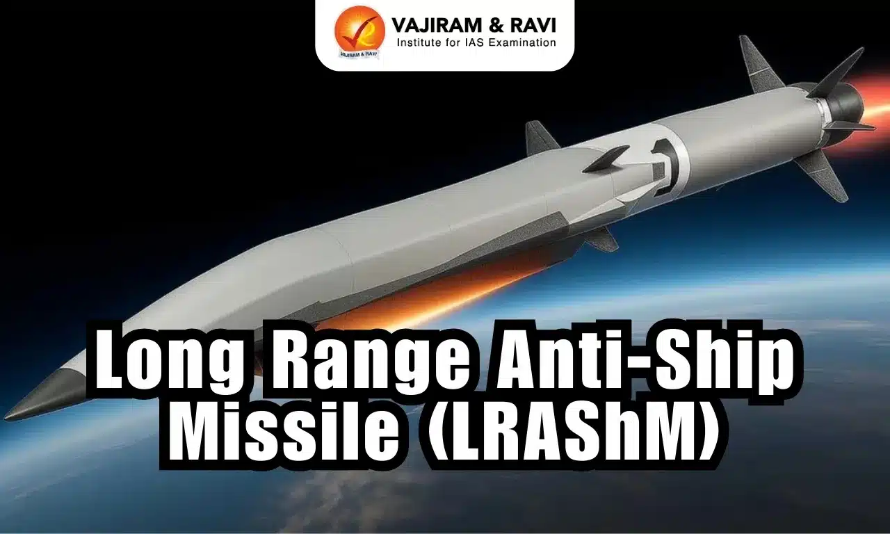
About Long Range Anti-Ship Missile (LRAShM)

  • It is a hypersonic glide missile developed by the Defence Research and Development Organisation (DRDO).
    • Hypersonic glide vehicles (HGVs) like the LRAShM differ from traditional ballistic missiles, which follow a fixed trajectory.
    • HGVs are launched on a rocket, ascend to the upper atmosphere, and then glide towards their target in an unpredictable manner.
    • This combination of exceptional speed and maneuverability makes them extremely difficult to intercept with existing air defense technologies.
  • It outperforms similar missiles like China’s DF-17 in terms of range and technology.
  • It is being built for anti-ship roles (to target enemy warships and carrier groups) and may also evolve into a land-attack variant.

Long Range Anti-Ship Missile (LRAShM) Features

  • The missile’s standout feature is its incorporation of a delta-wing hypersonic glide vehicle (HGV), which allows it to follow highly complex and adaptive flight paths.
  • It is reported to have a range of over 1,500 kilometers.
  • This missile operates at 10 Mach, making it 10 times faster than the speed of sound.
  • This missile can obliterate an enemy ship or warship within 7 to 8 minutes of being launched.
  • The missile's radio frequency (RF) seeker, designed to operate effectively at hypersonic speeds, ensures accurate strikes against moving targets, such as warships, a capability that very few weapons possess.
  • It is configured for launches from both land-based platforms and naval vessels, offering versatility in combat scenarios.
  • It is capable of carrying various payloads, including both conventional and nuclear warheads,
  • The incorporation of special heat-resistant materials ensures the missile can withstand extreme temperatures without disintegrating during flight, setting a new benchmark in scramjet and glide technology.

Source: ZEE

Long Range Anti-Ship Missile (LRAShM) FAQs

Q1: What is the Long Range Anti-Ship Missile (LRAShM)?

Ans: It is a hypersonic glide missile developed by the Defence Research and Development Organisation (DRDO).

Q2: What is the primary role of Long Range Anti-Ship Missile (LRAShM)?

Ans: Anti-ship warfare, targeting enemy warships and aircraft carrier groups.

Q3: What is the reported range of Long Range Anti-Ship Missile (LRAShM)?

Ans: More than 1,500 kilometres.

Kamala Hydroelectric Project

Kamala Hydroelectric Project

Kamala Hydroelectric Project Latest News

The Public Investment Board (PIB) recently gave approval for the Rs 26,070-crore, 1,720 MW Kamala hydroelectric project in Arunachal Pradesh.

About Kamala Hydroelectric Project

  • It is a 1,720 MW hydroelectric project proposed on the Kamala River (a major tributary of the Subansiri River) in Arunachal Pradesh's Kamle district.
  • It is a storage-based scheme with a flood moderation component.
  • The project involves construction of a 216-metre-high concrete gravity dam and an underground powerhouse.
  • The project will generate 6,869.92 MU of green energy annually on completion.
  • In addition to power generation, the project also envisaged to provide flood relief in the Brahmaputra valley.
  • The project will be implemented on a Build-Own-Operate-Transfer (BOOT) basis through a joint venture company with 74% equity by NHPC and 26% by the Govt of Arunachal Pradesh (GoAP).
  • The completion cost of the project is estimated at Rs 26,069.50 crore.
  • The project’s financing structure reflects strong institutional backing, with a 70:30 debt-equity ratio, substantial Central grants—Rs 1,340 crore for enabling infrastructure and Rs 4,743.98 crore for flood moderation—and 100 percent SGST reimbursement by the Arunachal Pradesh Government.

Source: TOI

Kamala Hydroelectric Project FAQs

Q1: Where is the Kamala Hydroelectric Project proposed to be located?

Ans: It is proposed on the Kamala River in Kamle district of Arunachal Pradesh.

Q2: What is the total installed capacity of the Kamala Hydroelectric Project?

Ans: The project has an installed capacity of 1,720 MW.

Q3: Kamala River is a tributary of which major river?

Ans: The Kamala River is a tributary of the Subansiri River.

Q4: Does the Kamala Hydroelectric Project have a flood moderation component?

Ans: Yes, the project includes a flood moderation component.

North Island

North Island

North Island Latest News

A magnitude 5.5 earthquake struck the North Island region of New Zealand recently.

About North Island

  • It is one of the two main islands of New Zealand in the South Pacific Ocean. 
  • It is separated from the South Island by Cook Strait. 
  • It covers an area of about 113,729 sq.km. This makes it the 14th largest island in the world. 
  • The North Island is smaller than the South Island but has more people living on it.
    • About 77% of all New Zealand residents live on the North Island.
    • It is the most populated island in Polynesia.
  • The island’s terrain rises to a central mountain range (a continuation of the South Island range), which parallels the east coast. 
    • The range reaches its highest point at the volcanic Mount Ruapehu (2,797 metres) within Tongariro National Park (designated a UNESCO World Heritage Site in 1990).
  • Many important cities are found on the North Island. 
    • These include Auckland, which is the largest city. 
    • The capital city of New Zealand, Wellington, is also located here. 
    • Other major cities are Hamilton, Tauranga, and Rotorua.
  • Important bodies of water on the island include:
    • Lake Taupō
    • Waikato River
    • Whanganui River
  • The North Island has several active and dormant volcanoes:
    • Auckland Volcanic Field
    • Mount Ruapehu
    • Mount Taranaki (also called Taranaki Maunga)
    • Mount Tarawera
    • Whakaari/ White Island
    • North Island Volcanic Plateau

Source: IT

North Island FAQs

Q1: What is the North Island?

Ans: It is one of the two main islands of New Zealand located in the South Pacific Ocean.

Q2: Which strait separates the North Island from the South Island?

Ans: The Cook Strait separates the two islands.

Q3: What is the highest point on the North Island?

Ans: Mount Ruapehu at 2,797 metres.

Q4: Which is the largest city located on the North Island?

Ans: Auckland is the largest city.

Q5: Which capital city of New Zealand is located on the North Island?

Ans: Wellington is located on the North Island.

Weimar Triangle

Weimar Triangle

Weimar Triangle Latest News

India’s External Affairs Minister recently participated in India’s first-ever engagement in the Weimar Triangle, with French and Polish counterparts along with German representatives.

About Weimar Triangle

  • It is a regional political grouping of France, Germany, and Poland.
  • It was formed on 29 August 1991 by a joint declaration issued in Weimar, Germany, by the Foreign Ministers of the three countries.
  • It had three objectives: 
    • To involve France in German-Polish reconciliation by building on the Franco-German experience; 
    • To strengthen dialogue and political cooperation between the three countries.
    • To support Poland in its process of integration into NATO and the European Union (EU).
  • Regular meetings at levels including heads of government, foreign ministers, and European affairs ministers have enabled coordination on EU policies, with notable outcomes including Poland's accession to NATO in 1999 and the European Union in 2004.
  • Although the Weimar Triangle still has no institutional structure, it remains a framework of reference at the political level.
  • Beyond diplomacy, it encompasses civil society efforts like youth exchanges, academic collaborations, and business networks to promote intercultural dialogue and mobility.

Source: HT

Weimar Triangle FAQs

Q1: What is the Weimar Triangle?

Ans: It is a regional political grouping of France, Germany, and Poland.

Q2: When was the Weimar Triangle formed?

Ans: It was formed on 29 August 1991.

Q3: What was the primary purpose of involving France in the Weimar Triangle?

Ans: To involve France in German-Polish reconciliation using the Franco-German experience.

Q4: What role did the Weimar Triangle aim to play in European cooperation?

Ans: It aimed to strengthen dialogue and political cooperation among France, Germany, and Poland

Q5: How did the Weimar Triangle support Poland’s international integration?

Ans: It supported Poland’s integration into NATO and the European Union.

M-STrIPES

M-STrIPES

M-STrIPES Latest News

Forest staff who are to be involved in the census of tigers and other wild animals at Anamalai Tiger Reserve will be using the advanced Monitoring System for Tigers: Intensive Protection and Ecological Status (M-Stripes/MSTrIPES) app.

About M-STrIPES

  • The MSTrIPES (Monitoring System for Tigers: Intensive Protection and Ecological Status) is a software-based monitoring system created to assist patrol and protect tiger habitats. 
  • It was launched by the National Tiger Conservation Authority (NTCA) along with the Wildlife Institute of India in 2010.
  • It is designed to assist wildlife protection, monitoring, and management of Protected Areas.
  • The programme consists of two parts: an analytical engine with a central desktop software and an online analysis tool, and an Android-based mobile application that records field observations and tracks using real-time GPS.
  • It uses Global Positioning System (GPS), General Packet Radio Services (GPRS), and remote sensing, 
    • to collect information from the field
    • create a database using modern Information Technology (IT)-based tools
    • analyze the information using GIS and statistical tools 
    • to provide inferences that allow tiger reserve managers to better manage their wildlife resources.
  • Under MSTrIPES protocols, forest guards are expected to patrol their beats and record their tracks using a GPS, in addition to recording observations in site-specific data sheets.
    • Beat is the smallest unit of forest administration in India since British time and usually one forest guard is assigned for one beat.

Key Facts about Anamalai Tiger Reserve

  • It is located at an altitude of 1400 m in the Anamalai Hills of Pollachi and Coimbatore District of Tamil Nadu.
  • It lies south of the Palakkad gap in the Southern Western Ghats. 
  • It is surrounded by the Parambikulum Tiger Reserve on the east, Chinnar Wildlife Sanctuary, and Eravikulum National Park on the southwestern side.
  • It is inhabited by six indigenous communities, viz., Kadar, Muduvar, Malasar, Malai malasar, Eravalar, and Pulayar.
  • Vegetation
    • It supports diverse habitat types, viz. Wet evergreen forests, semi-evergreen forests, moist deciduous, dry deciduous, dry thorn, and shola forests. 
    • Other unique habitats like montane grasslands, savannah, and marshy grasslands are also present.
  • Flora: The reserve is rich in wild relatives of cultivated species like mango, jackfruit, wild plantain, ginger (Zingiber officinale), turmeric, pepper (Piper longum), cardamom, etc.
  • Fauna: The important wild animals of the reserve include: Tiger, Asiatic elephant, Sambar, Spotted deer, Barking deer, Jackal, Leopard, Jungle cat, etc.

Source: NIE

M-STrIPES FAQs

Q1: What does M-STrIPES stand for?

Ans: Monitoring System for Tigers: Intensive Protection and Ecological Status.

Q2: What is M-STrIPES?

Ans: It is a software-based monitoring system used for protecting and monitoring tiger habitats.

Q3: Which organisations launched M-STrIPES?

Ans: The National Tiger Conservation Authority (NTCA) and the Wildlife Institute of India (WII).

Q4: Which technologies are used by M-STrIPES to collect field data?

Ans: It uses Global Positioning System (GPS), General Packet Radio Services (GPRS), and remote sensing.

Barak River

Barak River

Barak River Latest News

The Senapati Forest Division recently launched Participatory Rural Appraisal (PRA) exercises as a pilot initiative to rejuvenate the Barak River watershed while simultaneously strengthening local livelihoods.

About Barak River

  • It is a river in northeastern India that flows through Manipur, Mizoram, and Assam before entering Bangladesh.
  • It is the second largest river in Northeast India after the Brahmaputra. 
  • Course:
    • It rises from the Manipur hills, south of Mao in the Senapati district of Manipur, at an elevation of 2,331 m.
    • It flows then along the Nagaland-Manipur border through hilly terrains and enters Assam.
    • In Assam, the Barak Valley gets its name from the river and includes the districts of Cachar, Hailakandi, and Karimganj, forming the southernmost part of the state.
    • Just before flowing into the neighboring country of Bangladesh, the Barak splits into the Surma River and the Kusiyara River. 
    • These two rivers meet to form the Meghna River, which flows southward, joins the Padma River, and finally drains into the Bay of Bengal. 
  • Length: It has a length of about 900 km. It spans 524 km in India, with a significant part along the Indo-Bangladesh border. 
  • The Barak River basin, formed by the Barak and its tributaries, drains India, Bangladesh, and Myanmar.
    • In India the basin spreads over states of Meghalaya, Manipur, Mizoram, Assam, Tripura, and Nagaland.
    • It is bounded by the Barail range separating it from the Brahmaputra basin on the north, by the Naga and Lushai hills on the east, and by the Mizo hills and the territory of Bangladesh on the south and west.
    • The entire basin falls in the Eastern Himalayan region of the Agro Climatic Zone. 
    • The major part of the basin is covered by forest.
    • Due to the hilly topography, terrace farming is common in this region.
  • Tributaries: The principal tributaries of the Barak are Jiri, Chiri, Modhura, Jatinga, Harang, Dhaleswari, Singla, Longai, Sonai, and Katakhal.
  • There are four major dams, namely Khoupum Dam, Mawphlang Dam, Gumti Hydro Dam, and Myntdu-Leshka Dam. 
  • The 121-km stretch of the river between Lakhipur and Bhanga in Assam was declared by the Government of India as National Waterway 16.

Source: ITNE

Barak River FAQs

Q1: In which part of India is the Barak River located?

Ans: The Barak River is located in northeastern India.

Q2: Which Indian states does the Barak River flow through before entering Bangladesh?

Ans: It flows through Manipur, Mizoram, and Assam.

Q3: From where does the Barak River originate?

Ans: It rises from the Manipur Hills south of Mao in the Senapati district of Manipur.

Q4: What is the total length of the Barak River?

Ans: The Barak River is about 900 km long.

Q5: Which countries are drained by the Barak River basin?

Ans: India, Bangladesh, and Myanmar.

Directorate General of Mines Safety (DGMS)

Directorate General of Mines Safety (DGMS)

Directorate General of Mines Safety (DGMS) Latest News

The Directorate General of Mines Safety (DGMS) recently celebrated its 125th Foundation Day at its Headquarters in Dhanbad, Jharkhand.

About Directorate General of Mines Safety (DGMS)

  • It is the Regulatory Agency under the Ministry of Labour & Employment, Government of India, in matters pertaining to occupational safety, health, and welfare of persons employed in mines.
  • It has its headquarters at Dhanbad (Jharkhand) and is headed by the Director-General of Mines Safety.
  • History:
    • For administering the provisions of the Indian Mines Act, 1901, the Government of India set up a "Bureau of Mines Inspection" on the 7th January 1902 with headquarters at Calcutta.
    • The name of the organization was changed to the Department of Mines in 1904, and its headquarters shifted to Dhanbad in 1908. 
    • On 01.01.1960, the organization was renamed as "Office of the Chief Inspector of Mines". 
    • Since 01.05.1967, the office has been redesignated as the DGMS.
  • The mission of the DGMS is to continually improve safety and health standards, practices, and performance in the mining industry and upstream petroleum industry by implementing:
    • proactive safety and health strategies;
    • continuous improvement of processes;
    • effective use of resources;
    • commitment and professional behaviour in its personnel.
  • Under the Constitution of India, the safety, welfare, and health of workers employed in mines are the concern of the Central Government (Entry 55-Union List-Article 246)
    • The objective is regulated by the Mines Act, 1952, and the Rules and Regulations framed thereunder. 
    • These are administered by the DGMS.

Source: PIB

Directorate General of Mines Safety (DGMS) FAQs

Q1: Which Ministry does the Directorate General of Mines Safety (DGMS) function under?

Ans: It functions under the Ministry of Labour & Employment, Government of India.

Q2: Where is the headquarters of the Directorate General of Mines Safety (DGMS) located?

Ans: The headquarters of DGMS is located at Dhanbad in Jharkhand.

Q3: What is the primary mission of the Directorate General of Mines Safety (DGMS)?

Ans: To continually improve safety and health standards and performance in the mining and upstream petroleum industries.

Vera C Rubin Observatory

Vera C Rubin Observatory

Vera C. Rubin Observatory Latest News

Scientists analyzing the first images from the Vera C. Rubin Observatory recently discovered the fastest-spinning asteroid in its size class yet named 2025 MN45.

About Vera C. Rubin Observatory

  • It is located 8,684 feet above sea level atop the Cerro Pachón mountain in the Chilean Andes, where dry air and dark skies provide one of the world's best observing locations.
  • It is named after American astronomer Vera C. Rubin, who provided evidence about dark matter for the first time in the 1970s.
  • It is jointly funded by the U.S. National Science Foundation and the U.S. Department of Energy's Office of Science.
  • The observatory has four main scientific goals:
    • Understand the nature of dark matter and dark energy.
    • Create an inventory of the asteroids, comets, and other objects in the solar system.
    • Map the Milky Way and help reconstruct its history.
    • Explore objects — like exploding stars and black holes — that change position or brightness over time.
  • The centrepiece of the observatory is the Simonyi Survey Telescope. 
    • The 8.4-meter telescope has the world’s largest digital camera, which is the size of a small car, weighs 2,800 kg, and boasts a staggering resolution of 3,200 megapixels.
    • It can capture about 45 times the area of the full moon in the sky with each exposure. 
    • It is the fastest-slewing telescope in the world and takes just five seconds to move and settle from one target to another. 
    • This speed is due to the telescope’s compact structure (owing to the three-mirror design) and its mount, which floats on a film of oil.
  • This observatory will provide comprehensive images of the night sky unlike anything astronomers have seen before.
  • It will constantly scan the sky of the southern hemisphere for 10 years, creating an ultra-wide, ultra-high-definition time-lapse record of the universe.
  • It will produce approximately 20 terabytes of data every night. The amount of data gathered by Rubin Observatory in its first year alone will be greater than that collected by all other optical observatories combined. 
  • It revealed its first images on June 23, 2025

Key Facts about 2025 MN45

  • It is a newly discovered asteroid.
  • It resides in the main asteroid belt between Mars and Jupiter. 
  • It measures about 0.4 miles (710 meters) across.
  • It completes one rotation every 1.88 minutes, making it "the fastest-spinning asteroid with a diameter over 500 meters that astronomers have found.

Source: LS

Vera C.Rubin Observatory FAQs

Q1: Where is the Vera C. Rubin Observatory located?

Ans: It is located atop Cerro Pachón mountain in the Chilean Andes at an elevation of 8,684 feet above sea level.

Q2: After whom is the Vera C. Rubin Observatory named?

Ans: It is named after American astronomer Vera C. Rubin, who provided evidence about dark matter for the first time in the 1970s

Q3: Which organisations jointly fund the Vera C. Rubin Observatory?

Ans: It is jointly funded by the U.S. National Science Foundation and the U.S. Department of Energy’s Office of Science.

Q4: What is the name of the main telescope at the Vera C. Rubin Observatory?

Ans: The Simonyi Survey Telescope.

Q5: Why is the camera of the Vera C. Rubin Observatory considered unique?

Ans: It is the world’s largest digital camera with a resolution of 3,200 megapixels.

Mayon Volcano

Mayon Volcano

Mayon Volcano Latest News

A series of mild eruptions at Mayon Volcano, the most active in the Philippines, has forced nearly 3,000 villagers to evacuate from its foothills recently.

About Mayon Volcano

  • It is an active stratovolcano located in Albay province on Luzon Island in the Philippines.
  • It is part of the Pacific Ring of Fire.
  • It is the Philippines' most active volcano. 
  • Called the world’s most perfect volcanic cone because of the symmetry of its shape, it has a base 130 km in circumference and rises to 2,462 metres from the shores of Albay Gulf.
  • It has steep upper slopes capped by a small summit crater. 
  • Popular with climbers and campers, the volcano is the centre of Mayon Volcano National Park.
  • There are large abaca plantations on its lower slopes. 
  • Historical eruptions date back to 1616 CE that have been characterized by Strombolian eruptions, lava flows, pyroclastic flows, and mudflows. 
    • Mayon's most violent eruption, in 1814, killed more than 1200 people and devastated several towns. 
    • An eruption in 1993 caused 79 deaths. 
    • Subsequent eruptions in 2000, 2006, 2009, 2014, 2018 and 2022 forced tens of thousands of people in nearby villages to evacuate. 

What is a Stratovolcano?

  • It is a tall, steep, and cone-shaped type of volcano.
  • Unlike flat shield volcanoes, they have higher peaks.
  • They are typically found above subduction zones, and they are often part of large volcanically active regions, such as the Ring of Fire that frames much of the Pacific Ocean.
  • Stratovolcanoes comprise the largest percentage (~60%) of the Earth’s individual volcanoes, and most are characterized by eruptions of andesite and dacite, lavas that are cooler and more viscous than basalt.
  • These more viscous lavas allow gas pressures to build up to high levels. Therefore, these volcanoes often suffer explosive eruptions. 
  • They are usually about half-half lava and pyroclastic material, and the layering of these products gives them their other common name of composite volcanoes.
  • At the peak, stratovolcanoes usually have a small crater.

Source: DEVD

Mayon Volcano FAQs

Q1: Where is Mayon Volcano located?

Ans: It is located in Albay province on Luzon Island in the Philippines.

Q2: What type of volcano is Mayon Volcano?

Ans: It is an active stratovolcano.

Q3: Why is Mayon Volcano called the world’s most perfect volcanic cone?

Ans: Because of the remarkable symmetry of its shape.

Q4: What type of eruptions commonly characterize Mayon Volcano?

Ans: Strombolian eruptions, lava flows, pyroclastic flows, and mudflows.

Agricultural and Processed Food Products Export Development Authority (APEDA)

Agricultural and Processed Food Products Export Development Authority (APEDA)

Agricultural and Processed Food Products Export Development Authority (APEDA) Latest News

The commerce ministry's arm, APEDA, recently launched an initiative to support agri-food and agri-tech startups, aimed at promoting innovation and creating new export opportunities for young entrepreneurs.

About Agricultural and Processed Food Products Export Development Authority (APEDA)

  • APEDA is a statutory body established by the Government of India under the Agricultural and Processed Food Products Export Development Authority Act passed by the Parliament in December, 1985.
  • The Authority replaced the Processed Food Export Promotion Council (PFEPC).
  • It works under the Ministry of Commerce and Industry.
  • Objective: To develop and promote the export of scheduled products.
  • The products specified under the APEDA Act are called scheduled products, and exporters of such scheduled products are required to register under APEDA.
  • Examples of scheduled products: Fruits, Vegetables, Meat, Poultry Products. Dairy Products, Confectionery, Biscuits, Bakery Products, Honey, Jaggery, etc.
  • APEDA is responsible for providing financial assistance, information, and guidelines for the development of scheduled products. 
  • In addition to this, APEDA has been entrusted with the responsibility of monitoring the import of sugar as well.
  • APEDA also functions as the Secretariat to the National Accreditation Board (NAB) for the implementation of accreditation of the Certification Bodies under National Programme for Organic Production (NPOP) for Organic exports.
  • Functions:
    • Setting the standards and specifications for the scheduled products.
    • Registration of exporters of the scheduled products on payment of required fees.
    • Improving packaging and marketing of the Scheduled products.
    • Carrying out an inspection of products to ensure the quality of such products.
    • Training in various aspects of the industries connected with the scheduled products.
    • Development of industries relating to the scheduled products and undertaking surveys, feasibility studies, etc.
    • Collection of statistics from the owners of factories or establishments and publication of such statistics.
  • APEDA is headed by a Chairman appointed by the Central Government.
  • Headquarters: New Delhi
  • APEDA has set up 15 Regional Offices at Mumbai, Bengaluru, Telangana, Kolkata, Guwahati, Ahmedabad, Varanasi, Chandigarh, Bhopal, Chennai, Kochi, Tripura, Srinagar, Jammu, and Ladakh.

Key Facts about BHARATI Startup Challenge

  • BHARATI—short for Bharat’s Hub for Agritech, Resilience, Advancement, and Incubation for Export Enablement was launched by the APEDA to encourage innovation and entrepreneurship in the agricultural and processed food export sector. 
  • The initiative aims to support export-ready startups by providing mentorship, market access, and policy facilitation. 
  • The top 10 startups emerging from the challenge will be provided international exposure through participation in Gulfood in Dubai and BIOFACH in Germany, enabling them to explore global market opportunities and strengthen India’s agri-export ecosystem.

Source: HBL

Agricultural and Processed Food Products Export Development Authority (APEDA) FAQs

Q1: What is APEDA?

Ans: APEDA is a statutory body established to develop and promote the export of agricultural and processed food products from India.

Q2: Under which Act was APEDA established?

Ans: It was established under the Agricultural and Processed Food Products Export Development Authority Act, 1985.

Q3: Which Ministry does APEDA function under?

Ans: It functions under the Ministry of Commerce and Industry.

Q4: What is the primary objective of APEDA?

Ans: To develop and promote the export of scheduled products.

Q5: Does APEDA provide financial assistance to exporters?

Ans: Yes, APEDA provides financial assistance, information, and guidelines for development of scheduled products.

Enquire Now