Key Facts about Canada

Key Facts about Canada

Canada Latest News

Recently, India and Canada signed a Joint Statement on Energy Cooperation on the sidelines of India Energy Week (IEW) 2026 in Goa.
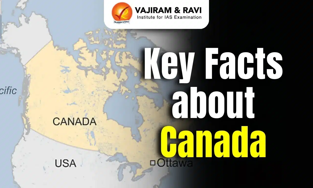
About Canada

  • Location: It is located in the northern part of North America.
  • It is the second largest country in the world in area (after Russia).
  • Bordered by: It shares borders with Alaska, a non-contiguous US state, to the northwest, and 12 other US states to the south.
    • The border of Canada with the US is the longest bi-national land border in the world.
  • Maritime Borders: It is bounded by the Arctic Ocean to the north, by the Atlantic Ocean to the east and the Pacific Ocean to the west.
    • It also shares maritime borders with the island of Greenland in the northeast and the French island regions of Saint Pierre and Miquelon in the southeast. 
  • Capital City: Ottawa

Geographical Features of Canada

  • Climate: Canada has seven climatic regions or zones: the Arctic, Subarctic, Prairie, Great Lakes, Cordilleran, plus the East and West Coasts. 
  • Major Mountains: ​Rocky Mountain, the St. Elias Mountains  and the Laurentian Mountains.
  • Major Rivers:  Mackenzie River, Yukon River, Saint Lawrence River
  • Lakes: The five Great Lakes namely Superior, Michigan, Huron, Ontario, and Erie form a natural boundary between Canada and the United States. (Amongst these five, only Lake Michigan lies entirely within the US).
  • Natural Resources: Bauxite, Iron ore, Nickel, Zinc, copper, gold, lead, uranium, rare earth elements, potash, diamonds etc.

Source: DD News

Canada FAQs

Q1: Which country borders Canada to the south?

Ans: United States

Q2: How many Great Lakes form a natural boundary between Canada and the US?

Ans: 5

Q3: Which Great Lake lies entirely within the US?

Ans: Lake Michigan

NPS Swasthya Pension Scheme (NSPS)

NPS Swasthya Pension Scheme (NSPS)

NPS Swasthya Pension Scheme (NSPS) Latest News

The Pension Fund Regulatory and Development Authority (PFRDA) recently rolled out the NPS Swasthya Pension Scheme (NSPS) on a pilot basis.

About NPS Swasthya Pension Scheme (NSPS)

  • It is a new initiative launched by the Pension Fund Regulatory and Development Authority (PFRDA) as a Proof of Concept (PoC) under its Regulatory Sandbox Framework. 
  • The initiative aims to integrate health-related financial benefits with the existing National Pension System (NPS) framework.
  • The scheme, launched for a limited and controlled period, is designed to provide financial support for out-patient and in-patient medical expenses. 
  • The scheme will function as a sector-specific contributory pension scheme within the Multiple Scheme Framework (MSF) of NPS and will be offered to Indian citizens on a voluntary basis.
  • It will be launched by Pension Funds after obtaining prior approval from PFRDA. 
  • As it is being implemented as a pilot project, only a restricted number of subscribers will be enrolled during the PoC phase.
  • To facilitate the pilot, certain provisions of the PFRDA (Exits and Withdrawals under NPS) Regulations, 2015, have been relaxed. 
  • Pension Funds may also collaborate with FinTech firms and health service administrators to implement the scheme.

NPS Swasthya Pension Scheme (NSPS) Features

  • Any Indian citizen is eligible to join the scheme, but a Common Scheme Account under NPS is mandatory.
  • Subscribers can contribute any amount, in line with existing NPS guidelines applicable to the non-government sector.
  • Subscribers aged above 40 years (excluding government sector subscribers) may transfer up to 30% of their contributions from the Common Scheme Account to the Swasthya Pension Scheme.
  • Partial withdrawals are permitted for medical expenses up to 25% of the subscriber’s own contributions, with no limit on the number of withdrawals, subject to a minimum accumulated corpus of ₹50,000.
  • In cases of critical inpatient treatment, where medical expenses exceed 70% of the available corpus, subscribers may opt for 100% premature withdrawal solely to meet such medical costs.
  • Claim Settlement and Safeguards:
    • Amounts withdrawn under the scheme will be paid directly to the Health Benefit Administrator (HBA), Third Party Administrator (TPA), or hospital, based on valid claims and supporting bills. 
    • Any surplus remaining after settlement of medical expenses will be transferred back to the subscriber’s Common Scheme Account.

Source: BS

NPS Swasthya Pension Scheme (NSPS) FAQs

Q1: Which authority launched the NPS Swasthya Pension Scheme?

Ans: The Pension Fund Regulatory and Development Authority (PFRDA).

Q2: What is the main objective of the NPS Swasthya Pension Scheme?

Ans: To integrate medical expense support with the existing NPS framework.

Q3: What types of medical expenses are covered under the scheme?

Ans: Out-patient and in-patient medical expenses.

Q4: Is participation in the NPS Swasthya Pension Scheme mandatory?

Ans: No, it is offered on a voluntary basis.

Tehri Lake

Tehri Lake

Tehri Lake Latest News

Two paraglider pilots were rescued by the State Disaster Response Force (SDRF) recently after they lost control and fell into Tehri Lake during the three-day Acro Festival & SIV Championship Tehri 2026.

About Tehri Lake

  • It is an artificial dam reservoir located in the Tehri Garhwal town of Uttarakhand.
  • It came into existence during the construction of Tehri Dam when the water from the Bhagirathi River was diverted to fill the dam reservoir. 
  • It lies at an elevation of 1,700 meters.
  • The depth of Tehri Lake is around 262 meters, and the length is 42 kms. 
  • Filled with multi-purpose rock and earth, Tehri Dam Lake was created with the motive of supplying water for generating electricity, drinking, and irrigation.
  • It is surrounded by the majestic Himalayan mountains, making it a picturesque destination.

Key Facts about Tehri Dam

  • It is a multipurpose dam built on the Bhagirathi River (one of the source streams of the Ganges River) in the Garhwal district of Uttarakhand.
  • Reaching a height of 260 meters, it is one of the tallest dams in the world and the tallest dam in India.
  • The construction of the Tehri Dam was completed in 2006. 
  • It is an earth and rock-fill dam, and its primary purpose is to generate hydroelectricity.
  • The installed hydro capacity is 1,000 MW along with an additional 1,000 MW of pumped storage hydroelectricity. 
  • It is managed by Tehri Hydro Development Corporation (THDC) India Limited, a subsidiary of the National Thermal Power Corporation (NTPC) Limited.

Source: TOI

Tehri Lake FAQs

Q1: What is Tehri Lake?

Ans: It is an artificial reservoir created by the Tehri Dam.

Q2: Where is Tehri Lake located?

Ans: Near Tehri Garhwal town in Uttarakhand.

Q3: At what elevation is Tehri Lake situated?

Ans: At about 1,700 metres above sea level.

Q4: What type of dam is associated with Tehri Lake?

Ans: A multi-purpose rock and earth-filled dam.

Pechora Missile System

Pechora Missile System

Pechora Missile System Latest News

Bengaluru-based defence equipment manufacturer Alpha Design Technologies Ltd (ADTL) has completed a major upgrade of the ’s (IAF) Pechora, a surface-toair missile (SAM) system, in line with the Centre’s push for modernising ageing military hardware through indigenous capability.

About Pechora Missile System

  • The Pechora, officially known as the S-125 Neva/Pechora, is a Soviet-origin, medium-range surface-to-air missile (SAM) system designed to intercept low- to medium-altitude targets.
  • It has been a mainstay of India’s air defence network since the 1970s.

Pechora Missile System Features

  • The system consists of a radar-guided missile launcher and a fire control unit, typically employing the V-600 missile. 
  • It uses the 4R90 Yatagan radar, equipped with five parabolic antennas, to detect, track, and lock onto targets.
  • Once a threat is identified, the system can launch missiles to intercept and destroy it mid-air.
  • It is particularly effective against slow-moving or low-flying targets, making it well-suited for countering drones and cruise missiles. 
  • It can operate independently or as part of a larger, integrated air defence network, and is capable of functioning even in environments with heavy electronic jamming.
  • Range: The Pechora system has an operational firing range of up to 30–35.4 km, with some upgraded versions reaching 35.4 km.
  • Altitude: It can engage targets flying at altitudes from as low as 20 meters up to 20–25 km, making it versatile for both low and medium-altitude threats.
  • Detection: The system’s radar can detect targets up to 100 km away, providing early warning and engagement capability.
  • Accuracy: The Pechora boasts a high kill probability of around 92% and can engage up to two targets simultaneously at speeds up to 900 m/s.

Source: TOI

Pechora Missile System FAQs

Q1: What is the Pechora Missile System?

Ans: It is a Soviet-origin, medium-range surface-to-air missile (SAM) system.

Q2: What is the official designation of the Pechora Missile System?

Ans: S-125 Neva/Pechora.

Q3: Which missile is typically employed by the Pechora system?

Ans: The V-600 missile.

Q4: What is the operational firing range of the Pechora missile system?

Ans: Up to about 30–35.4 km.

Q5: What is the maximum radar detection range of the Pechora system?

Ans: Up to about 100 km.

PAIMANA Portal

PAIMANA Portal

PAIMANA Portal Latest News

The Ministry of Statistics and Programme Implementation (MoSPI) has operationalised a new web-based portal, PAIMANA portal for the mandated monitoring of Central Sector Infrastructure Projects worth ₹150 crore and above.

About PAIMANA Portal

  • The Project Assessment, Infrastructure Monitoring & Analytics for Nation-building (PAIMANA) is a flagship initiative of the Ministry of Statistics and Programme Implementation (MoSPI).
  • It functions as a centralised national repository of infrastructure projects, enabling web-generated analytical reports and enhancing data accuracy, and operational efficiency.
  • It is integrated with DPIIT’s Integrated Project Monitoring Portal (IPMP/IIG-PMG) through APIs.

Key Features of the PAIMANA Portal

  • Centralized Project Monitoring: It serves as a centralized project monitoring system, providing a single-window interface for ministries, departments, and implementing agencies to upload, track, and review project information.
  • Real-time Dashboards: It features real-time dashboards with drill-down capabilities, enabling users to monitor progress across sectors, states, and timelines.
  • Advanced Data Analytics: It includes advanced data analytics, role-based user access, interactive dashboards, reporting and query modules, and review cases for identification of data gaps.
  • It is mandated to monitor Central Sector Infrastructure Projects worth ₹150 crore and above.

Source: PIB

PAIMANA Portal FAQs

Q1: What is the primary objective of PAIMANA Portal?

Ans: To monitor infrastructure projects

Q2: Which ministry launched the PAIMANA Portal?

Ans: Ministry of Statistics and Programme Implementation

Kyasanur Forest Disease

Kyasanur Forest Disease

Kyasanur Forest Disease Latest News

A 29-year-old man in Karnataka has tragically lost his life recently after contracting Kyasanur Forest Disease (KFD), commonly known as monkey fever, bringing fresh attention to a disease that often goes unnoticed until it turns fatal.

About Kyasanur Forest Disease 

  • It is a tick-borne viral haemorrhagic disease mostly found in southern India.
  • The disease was first reported from the Kyasanur Forest of Karnataka in India in 1957; hence, it is known as KFD.
  • The causal agent, KFD Virus (family Flaviviridae, genus Flavivirus), is a member of the tick-borne encephalitis (TBE) complex. 
  • It is also known as “monkey disease/monkey fever” because of its association with monkey deaths. 

Kyasanur Forest Disease Transmission

  • Hard ticks (Hemaphysalis spinigera) spread the KFD virus to people and to animals, like monkeys and rodents.
  • Transmission to humans may occur after a tick bite or contact with an infected animal, most importantly a sick or recently dead monkey.
  • KFD does not spread between people.
  • The epidemic period usually begins in October or November and peaks from January to April, then declines by May and June.

Kyasanur Forest Disease Symptoms

  • Sudden onset of high-grade fever, prostration, nausea, vomiting, diarrhea, and occasionally neurological and haemorrhagic manifestations.
  • Between 5 and 10% of people who are known to be affected by KFD die.

Kyasanur Forest Disease Treatment

  • There is no cure for KFD.
  • Supportive care is crucial, including fluid balance, providing oxygen, managing blood pressure, and treating additional infections.
  • With quick medical care, many patients recover from KFD without complications. 

Kyasanur Forest Disease  Vaccine

A vaccine for KFD is available and recommended in the parts of India where KFD is found.

Source: TOI

Kyasanur Forest Disease FAQs

Q1: What is Kyasanur Forest Disease (KFD)?

Ans: It is a tick-borne viral haemorrhagic disease found mainly in southern India.

Q2: Where was Kyasanur Forest Disease first reported?

Ans: In the Kyasanur Forest of Karnataka.

Q3: Why is Kyasanur Forest Disease also called “monkey disease” or “monkey fever”?

Ans: Because it is associated with deaths of monkeys.

Q4: Which vector transmits Kyasanur Forest Disease?

Ans: Hard ticks, mainly Hemaphysalis spinigera.

Q5: Can Kyasanur Forest Disease spread from person to person?

Ans: No, it does not spread between humans.

Solar Cycles

Solar Cycles

Solar Cycles Latest News

Recently, the IIT-Kanpur team developed a new way to predict solar cycles.

About Solar Cycles

  • The solar cycle describes an approximately 11-year cycle of solar activity driven by the sun's magnetic field.
  • It is indicated by the frequency and intensity of sunspots visible on the surface. 
  • Every 11 years or so, the Sun's magnetic field completely flips.
  • This means that the Sun's north and south poles switch places. Then it takes about another 11 years for the Sun’s north and south poles to flip back again.
  • The solar cycle affects activity on the surface of the Sun, such as sunspots, which are caused by the Sun’s magnetic fields.
  • As the magnetic fields change, so does the amount of activity on the Sun’s surface.
  • It can be tracked by counting the number of sunspots.
  • Cycle Stages
    • Solar minimum: It is the beginning of a solar cycle or when the Sun has the least sunspots.
      • Over time, solar activity—and the number of sunspots—increases.
    • Solar maximum: It is the middle of the solar cycle or when the Sun has the most sunspots.
      • As the cycle ends, it fades back to the solar minimum, and then a new cycle begins.
  • Impact: The solar cycle has the potential to impact Earth’s climatic conditions through changes in solar radiation, cosmic rays, and ozone distribution.

Source: TH

Solar Cycles FAQs

Q1: What is the primary driver of the solar cycle?

Ans: Sun's magnetic field

Q2: What is the term for the period of maximum sunspot activity?

Ans: Solar Maximum

Vishwamitri River

Vishwamitri River

Vishwamitri River Latest News

The Vishwamitri River passes through the city of Vadodara in Gujarat and is commonly known as India’s Crocodile River due to the presence of mugger crocodiles in and around the urban area.

About Vishwamitri River

  • It is a small non-perennial river located in Gujarat.
  • Course
    • It originates from the western and southern slopes of the Pavagadh hills in eastern Gujarat. 
    • The river flows westward, through Gujarat’s third-largest city, Vadodara, after which it meets the two tributaries of Dhadar and Jambuva before draining into the Arabian Sea via the Gulf of Khambhat.
  • Total Length: 200 km
  • The highly meandering, sinuous river has a unique ecosystem bearing a plethora of beautiful ravines right from its beginning till its end.
  • Porcupines, the common Indian civet, the jungle cat, cobras, pythons, the checkered keelback, and the Bengal monitor are some of the species found in the ravines on the banks of this river. 
  • Vishwamitri is also where the protected and vulnerable species of the Indian crocodile (Crocodylus palustris), also known as the mugger, resides.
  • A 2025 census recorded 442 mugger crocodiles within a 21-kilometre stretch flowing through Vadodara.
  • Historically, the river has been central to Vadodara’s development, with human settlements along its banks dating back to 1000 B.C.

Key Facts about Mugger Crocodiles

  • It is one of the 24 extant species of crocodilians found globally.
  • The crocodile’s common name comes from magar, which translates loosely to “water monster” in the Hindi and Urdu languages.
  • Distribution
    • The mugger’s geographic range extends from extreme southeastern Iran eastward to Bangladesh and from Nepal and northern India south to Sri Lanka.
    • In India it is found in 15 Indian states, with the largest populations in the middle Ganges (Bihar-Jharkhand) and Chambal (Madhya Pradesh, Gujarat and Rajasthan) basins.
  • Habitat
    • It is most commonly found in freshwater environments such as rivers, lakes, hill streams, and village ponds. 
    • It can live in fresh water and coastal saltwater lagoons.
    • This species makes burrows on land in a wide variety of habitats.
  • Features:
    • The maximum length for this crocodile is 4-5 meters, and maximum weight is 700 kg. 
    • It has rough, thick scales covering the whole body with a muddy brown coloring. It has the widest snout among all crocodile species. 
    • The length of an adult crocodile’s tail is about 1.8 meters long. 
  • Conservation Status:
    • IUCN Red List: Vulnerable

Source: IE

Vishwamitri River FAQs

Q1: What is the Vishwamitri River?

Ans: It is a small, non-perennial river in Gujarat.

Q2: From where does the Vishwamitri River originate?

Ans: From the western and southern slopes of the Pavagadh hills in eastern Gujarat.

Q3: Which major city does the Vishwamitri River flow through?

Ans: Vadodara, Gujarat’s third-largest city.

Q4: Into which water body does the Vishwamitri River finally drain?

Ans: The Arabian Sea via the Gulf of Khambhat.

Sunabeda Wildlife Sanctuary

Sunabeda Wildlife Sanctuary

Sunabeda Wildlife Sanctuary Latest News

Sunabeda Wildlife Sanctuary in Odisha, recently declared 'Maoist-free', is emerging as a promising habitat for leopards, with an estimated population of over 70 individuals, according to forest officials

About Sunabeda Wildlife Sanctuary

  • Location: It is located in the Nuapada district of Odisha.
  • It was declared a sanctuary in 1983.
  • It adjoins the Sitanadi and Udanti sanctuaries of Chhattisgarh. 
  • Terrain: The sanctuary harbors a great diversity of wildlife habitats, with a vast plateau, canyons, and 11 waterfalls.
  • Rivers: It also forms the catchment area of the Jonk River (tributary of the Mahanadi River), over which a dam has been constructed to facilitate irrigation.
  • Vegetation: The important vegetation of this sanctuary comprises dry deciduous tropical forests.
  • Flora: Bija, Teak, Sisoo, Asan, Dharua, Mahul, Char, Sandalwood, Sidha, etc.
  • Fauna:It is an ideal habitat for the Barasingha (swamp deer).
    • Other important animals found are tigers, Leopards, hyenas, Barking Deer, Chital, Gaur, Sambar, Sloth Bear, Hill Myna, etc.

Source: TOI

Sunabeda Wildlife Sanctuary FAQs

Q1: Where is Sunabeda Wildlife Sanctuary located?

Ans: Odisha

Q2: What is the main river flowing through Sunabeda Wildlife Sanctuary?

Ans: Jonk River

National Legal Services Authority

National Legal Services Authority

National Legal Services Authority Latest News

Recently, the Minister of State of the Ministry of Law and Justice informed the Rajya Sabha about district legal services clinics established by the National Legal Services Authority.

About National Legal Services Authority

  • It was established under the Legal Services Authorities (LSA) Act, 1987.
  • Purpose: To provide free and competent legal services to the poor and marginalised sections of the society including Scheduled Caste (SC) and Scheduled Tribe (ST).
  • Structure 
    • NALSA is housed at Supreme Court of India, New Delhi 
    • In every State, a State Legal Services Authority and in every High Court, a High Court Legal Services Committee has been constituted.
    • District Legal Services Authorities and Taluk Legal Services Committees have been constituted in the Districts and most of the Taluks to give effect to the policies and directions of the NALSA.
  • The free legal services include
    • Payment of court fees, process fees, and all other charges payable or incurred in connection with any legal proceedings
    • Providing the service of lawyers in legal proceedings;
    • Obtaining and supply of certified copies of orders and other documents in legal proceedings.
    • Preparation of appeal, paper book, including printing and translation of documents in legal proceedings.
  • Persons eligible for free legal services includes:
    • Women and children
    • Members of SC/ST
    • Industrial workmen
    • Victims of mass disasters, violence, flood, drought, earthquake, and industrial disaster
    • Disabled persons
    • Persons in custody
    • Persons whose annual income does not exceed Rs. 1 lakh (in the Supreme Court Legal Services Committee the limit is Rs. 5,00,000).
    • Victims of trafficking in human beings 

Source: PIB

National Legal Services Authority FAQs

Q1: Under which Act was NALSA constituted?

Ans: Legal Services Authorities Act, 1987

Q2: What is the primary objective of NALSA?

Ans: To promote justice on the basis of equal opportunity

Enquire Now