What’s in today’s article?
- Why in News?
- What is a Cyclone?
- What does landfall of a cyclone mean?
- Bay of Bengal: a cyclone hotspot
- Cyclone management – Steps taken by India
Why in News?
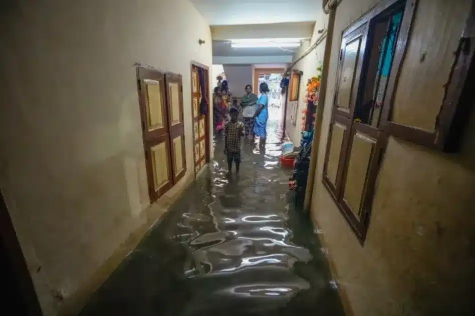
- Cyclone Fengal made landfall near Puducherry on Novemver 30, bringing heavy rainfall and gusty winds to Tamil Nadu’s coastal belt, including Chennai and Puducherry. This is the second cyclone to impact India’s east coast in two months after Cyclone Dana.
- Cyclone Fengal, initially stagnant, intensified as it moved closer to land, reaching about 120 km east of Puducherry and 110 km southeast of Chennai before landfall.
- The cyclone made landfall between Mahabalipuram and Karaikal with wind speeds of 70-80 km/hr, gusting to 90 km/hr. Heavy rainfall and gusty winds disrupted public transport, with buses, trains, and flights affected.
What is a Cyclone?
- About
- A cyclone is a large-scale system of air that rotates around the centre of a low-pressure area. It is usually accompanied by violent storms and bad weather.
- A cyclone is characterised by inward spiralling winds that rotate anticlockwise in the Northern Hemisphere and clockwise in the Southern Hemisphere.
- Characteristics of a Tropical Cyclone:
- The centre of a cyclone is very calm and clear with very low air pressure. The average speed is 120 kmph.
- They have closed isobars which leads to greater velocity.
- Isobars are imaginary lines on a weather map that connect locations with equal atmospheric pressure.
- They develop over oceans and sea only.
- They move from east to west under the influence of trade winds.
- They are seasonal in nature.
- Classification of cyclones
- Cyclones are classified on the basis of wind speed by the Indian Meteorological Department (IMD):
- Depression: Wind speeds of between 31–49 km/h
- Deep Depression: Between 50-61 km/h
- Cyclonic Storm: Between 62–88 km/h
- Severe Cyclonic Storm: Between 89-117 Km/h
- Very Severe Cyclonic Storm: Between 118-166 Km/h
- Extremely Severe Cyclonic Storm: Between 166-221 Km/h
- Super Cyclonic Storm: Above 222 Km/h
- Cyclones are classified on the basis of wind speed by the Indian Meteorological Department (IMD):
What does landfall of a cyclone mean?
- Landfall is the event of a tropical cyclone coming onto land after being over water.
- As per the IMD, a tropical cyclone is said to have made a landfall when the center of the storm – or its eye – moves over the coast.
- The “eye” of a cyclone is a region of relatively calm weather found at the center of the storm.
- It is a circular or oval-shaped area characterized by light winds, clear or partly cloudy skies, and decreased precipitation.
- Within the eye, winds are light and variable, often with clear or only partially cloudy skies.
- The size of the eye can vary significantly, ranging from a few kilometers to over 50 kilometers (30 miles) in diameter in larger cyclones.
- During landfall, the outer bands of the storm may have already reached the coast, bringing strong winds, heavy rain, and storm surge.
- Landfall marks the moment when the cyclone officially reaches the land.
- A landfall should not be confused with a ‘direct hit’, which refers to a situation where the core of high winds (or eyewall) comes onshore but the centre of the storm may stay remain offshore.
Bay of Bengal: a cyclone hotspot

Image Caption: Bay of Bengal – A Cyclonic Hotspot
- Historical data underscore Bay of Bengal’s predisposition to cyclones, with approximately 58% of them making landfall on India’s eastern coast, compared to just 25% in the Arabian Sea.
- The Arabian Sea gets fewer cyclones due to its narrower and deeper nature, cooler water and higher salinity. Its partially landlocked geography also contributes to reduced cyclonic activity.
Cyclone management – Steps taken by India
- National Cyclone Risk Mitigation Project (NCRMP):
- Launched by the MHA, this project aims to reduce the vulnerability of coastal communities and infrastructure to cyclones and storm surges.
- It focuses on capacity building, early warning systems, cyclone shelters, evacuation planning, and community awareness.
- IMD’s Colour Coding of Cyclones
- Four colours – Green, Yellow, Orange, and Red – are used by IMD to make people aware about the severity of cyclones.
- Integrated Coastal Zone Management (ICZM) Project
- Coastal Regulation Zones (CRZ)
- Other general steps taken:
- National Disaster Response Force (NDRF)
- National Disaster Management Plan (NDMP)
- National Institute of Disaster Management (NIDM)
- State Disaster Management Authorities (SDMAs)
Q.1. What is Cyclone Fengal and where did it make landfall?
Cyclone Fengal, a tropical storm, made landfall between Mahabalipuram and Karaikal near Puducherry. It brought heavy rainfall, wind speeds of 70-80 km/hr, and disrupted transportation across Tamil Nadu and Puducherry.
Q.2. How is India managing cyclone-related disasters?
India’s National Cyclone Risk Mitigation Project (NCRMP) focuses on early warning systems, evacuation plans, and cyclone shelters. The IMD’s color-coded warnings help assess severity, while national agencies like the NDRF ensure efficient disaster response.


Source: Heavy rains lash Puducherry, coastal TN as Cyclone Fengal makes landfall
Last updated on June, 2025
→ UPSC Notification 2025 was released on 22nd January 2025.
→ UPSC Prelims Result 2025 is out now for the CSE held on 25 May 2025.
→ UPSC Prelims Question Paper 2025 and Unofficial Prelims Answer Key 2025 are available now.
→ UPSC Calendar 2026 is released on 15th May, 2025.
→ The UPSC Vacancy 2025 were released 1129, out of which 979 were for UPSC CSE and remaining 150 are for UPSC IFoS.
→ UPSC Mains 2025 will be conducted on 22nd August 2025.
→ UPSC Prelims 2026 will be conducted on 24th May, 2026 & UPSC Mains 2026 will be conducted on 21st August 2026.
→ The UPSC Selection Process is of 3 stages-Prelims, Mains and Interview.
→ UPSC Result 2024 is released with latest UPSC Marksheet 2024. Check Now!
→ UPSC Toppers List 2024 is released now. Shakti Dubey is UPSC AIR 1 2024 Topper.
→ Also check Best IAS Coaching in Delhi