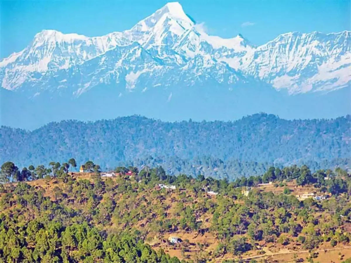
About Kumaon Himalayas:
- It is the west-central section of the Himalayas in northern India.
- Geographical boundary: It lies between the Sutlej River in the west and the Kali River in the East.
- It comprises part of the Siwalik Range in the south and part of the Great Himalayas in the north, lies largely within the state of Uttarakhand, northwest of Nepal.
- Highest peaks of this region: Nanda Devi and Kamet.
- Lakes of this region: Naini Lake, Sattal, Bhimtal, Naukuchiya Tal
- It is home to some of the major hill stations such as Nainital, Ranikhet, and Almora.
- It is also the melting pot of tribal/indigenous people – Tharus, Bhutiyas, Jaunsaris, Buksas, and Rajiswhose.
- Concern: It is an ecologically fragile and seismic-prone area.
Key facts about Shiwalik Range
- Shivalik Hills are a sub-Himalayan Mountain Range running 1,600 km long from the Teesta River, Sikkim, through Nepal and India, into northern Pakistan.
- The range runs parallel with the Himalayan system from Haridwar on the Ganges to the banks of the Beas River. The hills have an average height of 900 to 1,200 m.
- They are chiefly composed of low sandstone and conglomerate hills, the solidified and up-heaved detritus of the great range in their rear, the intermediate valley lying between the outer hills and the Mussoorie.
Q1: What is Plate tectonics?
Plate tectonics is the theory that Earth’s outer shell is divided into large slabs of solid rock, called “plates,” that glide over Earth’s mantle, the rocky inner layer above Earth’s core.
Source: SC halts 90-acre project in Kumaon Himalayas on a plea challenging ‘single window’ clearances


Last updated on June, 2025
→ UPSC Notification 2025 was released on 22nd January 2025.
→ UPSC Prelims Result 2025 is out now for the CSE held on 25 May 2025.
→ UPSC Prelims Question Paper 2025 and Unofficial Prelims Answer Key 2025 are available now.
→ UPSC Calendar 2026 is released on 15th May, 2025.
→ The UPSC Vacancy 2025 were released 1129, out of which 979 were for UPSC CSE and remaining 150 are for UPSC IFoS.
→ UPSC Mains 2025 will be conducted on 22nd August 2025.
→ UPSC Prelims 2026 will be conducted on 24th May, 2026 & UPSC Mains 2026 will be conducted on 21st August 2026.
→ The UPSC Selection Process is of 3 stages-Prelims, Mains and Interview.
→ UPSC Result 2024 is released with latest UPSC Marksheet 2024. Check Now!
→ UPSC Toppers List 2024 is released now. Shakti Dubey is UPSC AIR 1 2024 Topper.
→ Also check Best IAS Coaching in Delhi