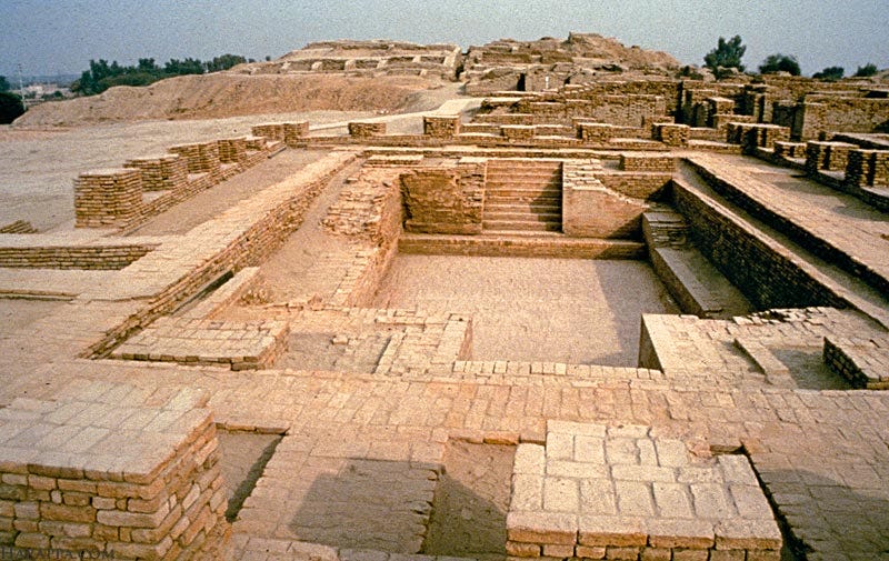
About Morodharo
- It is a fortified settlement dating back to the Harappan-era.
- Location: Kutch District, Gujarat
- Features:
- The settlement looks mature (2,600-1,900BCE) to late (1,900-1,300 BCE) Harappan.
- The fortification measures 102 m east to the west and 58 m north to the south.
- The thickness of the wall is an average of 3.3 m.
- It has a 10×10 m platform on the south-west side and a well on the north-east.
- Burial cairns, which are mounds of stones to demarcate a boundary, are also found here.
- Harappan pottery with perforated jar sherds, reserved slipware, and terracotta cakes were unearthed. All these items have a striking resemblance to those found in Dholavira.
Key Facts about Harappan Civilization
- The Indus Valley/Harappan civilisation was the first urban civilisation in South Asia, coexisting with Mesopotamia and Egypt.
- The Harappan civilisation occupied the largest area (approximately 8,00,000 sq km) among the three civilisations.
- Harappa (Punjab, Pakistan), Mohenjo-Daro (Sindh, Pakistan), Dholavira, Lothal, and Surkotada (Gujarat, India), Kalibangan and Banawali (Rajasthan, India), and Rakhigarhi (Haryana, India) are the major cities in the Harappan period.
- The features of town planning of Harappan civilisation included:
- Rectangular grid pattern: The Harappan cities were designed on a grid pattern, with streets running in a north-south and east-west direction, forming a well-organized layout. Streets and lanes were cutting across one another almost at right angles, thus dividing the city into several rectangular blocks.
- Planned streets and alleyways: The streets and alleyways of Harappan cities were planned and constructed with precision. They were wide enough to allow the movement of carts and pedestrians, and some streets had covered drains running alongside them.
- Fortification: The cities were surrounded by fortified walls made of mud bricks, providing protection against robbers, cattle raiders, and floods.
- Division of cities: The city was divided into two parts: an upraised citadel and the lower part of the city.
- Upper part: An upraised citadel in the western part was used for constructing buildings of large dimensions, such as granaries, administrative buildings, pillared halls, and courtyards.
- Lower part: Below the citadel in each city lay a lower town containing brick houses, which were inhabited by the common people.
- Material used: They used burnt bricks on a large scale in almost all kinds of constructions, and there was the absence of stone buildings during Harappan culture.
- Residential areas: The cities were divided into distinct residential areas. Houses were made of baked bricks, often with multiple stories, indicating a well-developed urban society. The houses were generally built around courtyards, and some had private wells and properly ventilated bathrooms. No window faced the streets, and the houses had tiled bathrooms.
- Sophisticated drainage systems: The drainage system of the Harappans was elaborate and well laid out. Every house had drains, which opened into the street drains. Drains were made of mortar, lime, and gypsum.
- Granaries and storage facilities: The cities had well-planned granaries and storage facilities to store surplus agricultural produce.
Q1) What is Mesopotamia?
Mesopotamia (from the Greek, meaning ‘between two rivers’) was an ancient region located in the eastern Mediterranean bounded in the northeast by the Zagros Mountains and in the southeast by the Arabian Plateau, corresponding to modern-day Iraq and parts of Iran, Syria, Kuwait, and Turkey and known as the Fertile Crescent and the cradle of civilization.
Source: Kutch villagers’ treasure hunt helps unearth Harappan site near Dholavira
Last updated on July, 2025
→ UPSC Notification 2025 was released on 22nd January 2025.
→ UPSC Prelims Result 2025 is out now for the CSE held on 25 May 2025.
→ UPSC Prelims Question Paper 2025 and Unofficial Prelims Answer Key 2025 are available now.
→ UPSC Calendar 2026 is released on 15th May, 2025.
→ The UPSC Vacancy 2025 were released 1129, out of which 979 were for UPSC CSE and remaining 150 are for UPSC IFoS.
→ UPSC Mains 2025 will be conducted on 22nd August 2025.
→ UPSC Prelims 2026 will be conducted on 24th May, 2026 & UPSC Mains 2026 will be conducted on 21st August 2026.
→ The UPSC Selection Process is of 3 stages-Prelims, Mains and Interview.
→ UPSC Result 2024 is released with latest UPSC Marksheet 2024. Check Now!
→ UPSC Toppers List 2024 is released now. Shakti Dubey is UPSC AIR 1 2024 Topper.
→ Also check Best IAS Coaching in Delhi


