Sea of Marmara Latest News
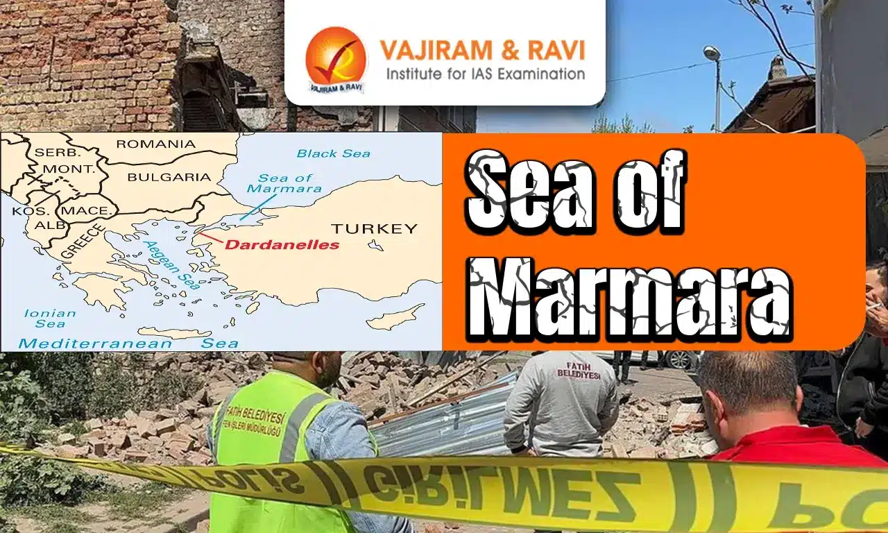
A 6.2 magnitude earthquake whose epicenter was in the Sea of Marmara hit Istanbul recently.
About Sea of Marmara
- It is a small inland sea that is completely bordered by the transcontinental nation of Turkey.
- It covers an area of 11,350 sq.km.
- It is about 280 km long and has a maximum width of 80 km at its widest point.
- It separates the Asian and European parts of Turkey.
- In the northeast, it is connected to the Black Sea via the Bosphorus Strait, whereas in the southwest, it is linked with the Aegean Sea via the Dardanelles Strait.
- It serves as a transitional zone between the Black Sea and the Mediterranean Sea.
- Salinity:
- Cold, fresh Black Sea water entering through the Bosporus meets warm and salty water of Mediterranean Sea origin flowing in through the Dardanelles Strait.
- This creates the situation where fresher water is located near the surface and much saltier water near the bottom.
- Climate: The sea has a humid subtropical climate with hot summers and coldand wet winters.
- Earthquakes: The North Anatolian Fault, which runs beneath the sea, has caused several massive earthquakes in the region.
- Major Islands:
- Marmara Island, Prince Islands, Avşa, Imrali, Ekinlik, and Paşalimani Islands.
- Marmara Island is Turkey’s second-largest island as well as the largest island in the Marmara Sea. It is also a rich source of marble.
- Some of the important coastal towns and cities that are located along the Sea of Marmara include Istanbul, Izmit, Balikesir, Yalova, Tekirdag, Bursa, and Çanakkale.
Source: ET


Last updated on June, 2025
→ UPSC Notification 2025 was released on 22nd January 2025.
→ UPSC Prelims Result 2025 is out now for the CSE held on 25 May 2025.
→ UPSC Prelims Question Paper 2025 and Unofficial Prelims Answer Key 2025 are available now.
→ UPSC Calendar 2026 is released on 15th May, 2025.
→ The UPSC Vacancy 2025 were released 1129, out of which 979 were for UPSC CSE and remaining 150 are for UPSC IFoS.
→ UPSC Mains 2025 will be conducted on 22nd August 2025.
→ UPSC Prelims 2026 will be conducted on 24th May, 2026 & UPSC Mains 2026 will be conducted on 21st August 2026.
→ The UPSC Selection Process is of 3 stages-Prelims, Mains and Interview.
→ UPSC Result 2024 is released with latest UPSC Marksheet 2024. Check Now!
→ UPSC Toppers List 2024 is released now. Shakti Dubey is UPSC AIR 1 2024 Topper.
→ Also check Best IAS Coaching in Delhi
Sea of Marmara FAQs
Q1. What connects Black Sea to Sea of Marmara?+
Q2. Which country is the Sea of Marmara in?+
Q3. Which major fault line lies beneath the Sea of Marmara?+
Tags: Prelims Pointers sea of marmara upsc current affairs upsc prelims current affairs