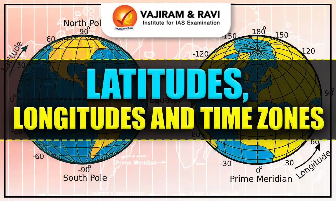
Latitudes and longitudes are also known as geographical coordinates because they provide a systematic network of lines on which the position of various earth's surface features can be represented. The location, distance, and direction of multiple points can be easily determined using these coordinates.
Latitudes and longitudes are represented in degrees (°) as they indicate angular distances. Each degree is further subdivided into 60 minutes (') and each minute into 60 seconds (").
Latitudes
Latitude is one of the two principal geographic coordinates that define a point on the Earth's surface, the other being longitude. It refers to the angular distance of a particular location on the Earth from the equator. Latitudes are imaginary lines running parallel to the equator.
- The latitude of a location on the earth's surface is its distance north or south of the equator, measured as an angle from the earth's centre along that location's meridian. Parallels are lines that connect locations with the same latitude.
- The equator is the imaginary line that divides the Earth into two halves, the Northern Hemisphere and the Southern Hemisphere.
- Because the earth is slightly flattened at the poles, the linear distance of a degree of latitude is somewhat longer at the pole than at the equator.
- The average distance between two latitudes is taken as 69 miles (111 km).
Important Parallels of Latitude
Parallels of latitude are invisible horizontal lines that run around the Earth parallel to the equator. These lines are essential for understanding Earth's geography, climate, and the location of different regions. Important parallels of latitude include the Equator, the Tropic of Cancer, the Tropic of Capricorn, the Arctic Circle and the Antarctic Circle.
| Name of Latitude | Important Features |
| Equator (0° latitude) |
- It serves as the starting point for measuring latitudes. - It is the longest latitude line. (40,075 km) - A tropical climate characterises it and experiences relatively consistent temperatures throughout the year. - Near the equator, the length of daylight hours remains relatively constant, resulting in minimal seasonal variations. - Passes through Colombia, Ecuador, Brazil, Sao Tome & Principe, Republic of the Congo, Gabon, Uganda, Kenya, Democratic Republic of the Congo, Maldives, Somalia, Indonesia and Kiribati. - Passes through water bodies: Indian Ocean, Lake Victoria, Atlantic Ocean, South China Sea, Makassar Strait, Gulf of Tomini, Molucca Sea, Halmahera Sea, Pacific Ocean, |
| Tropic of Cancer (23.5° degrees North of the Equator) |
- It is the northernmost parallel that the sun can be directly overhead. - The Sun reaches its greatest declination north and is directly over the Tropic of Cancer during the summer solstice (21st June) in the Northern Hemisphere. - Passes through Algeria, Niger, Egypt, Saudi Arabia, Libya, United Arab Emirates, Oman, Myanmar, China, India, Bangladesh, Bahamas, Mexico, Mauritania and Mali |
| Tropic of Capricorn (23.5° degrees South of the Equator) |
- It corresponds to the southernmost declination of the Sun’s ecliptic to the equator. - At the winter solstice in the Northern Hemisphere (21st December), the Sun is directly over the Tropic of Capricorn - Passes through Argentina, Chile, Namibia, South Africa, Madagascar, Australia, Brazil, Paraguay, Botswana and Mozambique. |
| Arctic Circle (66.5° degrees North of the Equator) |
- It is the southernmost latitude at which the phenomenon of the Midnight Sun occurs.
- Passes through Denmark (Greenland), Norway, Sweden, Finland, Russia, Canada, Iceland and the USA |
| Antarctic Circle (66.5° degrees South of the Equator) |
- It is the northernmost latitude at which the phenomenon of the Midnight Sun occurs in the Southern Hemisphere. - No country passes through the Arctic Circle. |
Latitudinal Heat Zone of the Earth
The Earth is divided into several latitudinal heat zones based on the intensity and angle of sunlight received. These zones have a direct impact on the climate and biodiversity of the regions within them. These heat zones include the Torrid Zone, Temperate Zone and Frigid Zone.
- Torrid Zone: At least once a year, the midday sun is directly overhead on all latitudes between the Tropics of Cancer and Capricorn. As a result, this area receives the most heat and is known as the Torrid Zone. The temperature range is lowest at the equator and increases towards the tropics.
- Temperate Zone: The midday sun never hits overhead on any latitude other than the Tropics of Cancer and Capricorn. As one moves closer to the poles, the angle of the sun's rays decreases. This zone has moderate temperatures. In this zone, during the winter season, the nights are longer, the days are shorter, and vice versa in summer.
- Frigid Zones: Extremely cold areas exist between the Arctic Circle and the North Pole in the Northern Hemisphere and the Antarctic Circle and the South Pole in the Southern Hemisphere. It's because the sun doesn't rise far above the horizon here. As a result, sun rays are always slanted and emit less heat. These are the world's coldest regions. The surface is permanently frozen due to the accumulation of snow.
Solstice and Equinox
A solstice occurs twice a year, marking the longest and shortest days when the sun is at its highest or lowest point in the sky. An equinox happens twice a year when day and night are of equal length, as the sun is directly above the equator.
- Summer Solstice: The Northern Hemisphere is inclined towards the sun on June 21st, and the sun’s rays are directly above the Tropic of Cancer. As a result, these areas experience more heat. Because the sun's rays are slanted, areas near the poles receive less heat.
- It is summer in the Northern Hemisphere, as large parts of it receive sunlight. On June 21st, these locations experience the longest day and the shortest night.
- Winter is experienced in the Southern Hemisphere. The nights are longer than the days, and this is known as the Summer Solstice.
- Winter solstice: The Tropic of Capricorn receives direct sunlight on December 22nd as the South Pole is tilted towards it.
- A greater part of the Southern Hemisphere receives sunlight because the sun's rays fall vertically at the Tropic of Capricorn (23° S).
- As a result, summer is in the Southern Hemisphere, with shorter nights and longer days. The reverse happens in the Northern Hemisphere.
- Equinox: The equator receives direct sunlight on March 21st and September 23rd. Because neither pole is tilted towards the sun in this position, the entire earth has equal days and equal nights. This is called an equinox.
Horse Latitudes
Horse latitudes are roughly 30 degrees north and south of the equator. They are characterised by calm and stable atmospheric conditions accompanied by little to no precipitation. The air beneath them is dry and subsiding, resulting in arid climates. The Sahara, for example, is located in horse latitude.
- Horse Latitudes continue to be an important area for scientific research. Understanding the dynamics of these subtropical regions contributes to our knowledge of global climate patterns, oceanic currents, and atmospheric circulation.
Longitude
Longitude is an angular distance measured in degrees along the east or west of the Prime (or First) Meridian. On the globe, longitude is shown as a series of semicircles that run from pole to pole, passing through the equator. Such lines are also called meridians. In contrast to latitude parallels, all meridians are the same length.
- Prime Meridian: It is the primary reference point for measuring longitudes, designated as 0° longitude. The Prime Meridian, as established by an international agreement, passes through the Royal Observatory in Greenwich, London, England. It serves as the baseline from which all other longitudes are measured.
- Countries Passing Through: United Kingdom, France, Spain, Algeria, Mali, Burkina Faso, Togo and Ghana.
- Other Meridians From the Prime Meridian: The meridians to the east of the Prime Meridian increase from 0 to 180 degrees east, while those to the west increase from 0° to 180° west. Both the 180° East and 180° West meridians coincide.
- Division in Eastern and Western Hemisphere: The Eastern Hemisphere and Western Hemisphere are equal halves of the earth, divided by the Prime Meridian and 180° meridian. Thus, the letters E for the east and W for the west are placed after a location's longitude.
- Application: Longitudes facilitate navigation, timekeeping, and mapping by providing a reference system for determining east-west positions.
Longitude and Time
Time is linked to longitude. The earth rotates 360°inadayor24hours, so it moves through 15° in an hour or 1° every 4 minutes. Since the planet rotates from west to east, local time advances by an hour for every 15° east. Moving west, on the other hand, advances local time by one hour. Thus, locations east of Greenwich experience the sun earlier and gain time, whilst those west of Greenwich experience the sun later and lose time.


Standard Time and Time Zones
Standard Time is the time that is set uniformly within a region by law or general usage. It is calculated using the mean solar time at the time zone's central meridian. A time zone is an area of the earth where consistent standard time should be maintained for commercial, social, and transportation needs. The world time zone was formed by relating longitude and the rotation of the earth. The Prime Meridian is the centre of the time zone, extending from 7½º W and 7½ º E longitudes.
- Number of Time Zones: The 24-hour time zone system was developed so that all the time zones should be referred to in terms of Greenwich Mean Time (each zone for one hour of the day).
- Time Zone Adoption: Some nations have more than one standard time because of their extensive longitudinal history. For example, France has the most time zones (13), primarily due to its various territories around the world.
- The below table represents the countries with four or more time zones.
| Country | Number of Time Zones |
|---|---|
| France | 13 |
| Russia | 11 |
| United States | 11 |
| Australia | 9 |
| United Kingdom | 9 |
| Canada | 6 |
| Denmark | 5 |
| New Zealand | 5 |
| Brazil | 4 |
| Mexico | 4 |
- Time Zone in India: In India, the longitude of 82½° E (82° 30'E) is treated as the standard meridian (IST), which is five hours, thirty minutes and a half earlier than GMT. IST passes through Uttar Pradesh, Madhya Pradesh, Chattisgarh, Orissa and Andhra Pradesh.
- Earlier, during British rule, India followed two time zones, one of which was the Chaibagaan time zone.
International Date Line
The International Date Line (IDL) is an imaginary line that generally follows the 180-degree longitude meridian. It serves as the demarcation line where one-day ends and the next day begins. When crossing the International Date Line from west to east, the date is adjusted backwards by one day, and when crossing from east to west, the date is adjusted forward by one day.
- For example, if it is Monday on the western side of the line, upon crossing to the eastern side, it will be Sunday.
- The International Date Line's path is not straight and follows political boundaries and geographical considerations to avoid dividing countries or causing significant disruptions. As a result, the IDL deviates from 180 degrees longitude in several places to accommodate these factors.
- Therefore, the International Date Line is drawn in a zigzag pattern to prevent date confusion; this line is drawn through where the sea lies rather than through land.
Latitudes and Longitudes UPSC PYQs
Question 1: On 21st June, the Sun (UPSC Prelims 2019)
(a) Does not set below the horizon at the Arctic Circle.
(b) Does not set below the horizon at the Antarctic Circle.
(c) Shines vertically overhead at noon on the Equator.
(d) Shines vertically overhead at the Tropic of Capricorn.
Ans: (a)
Question 2: Consider the following countries: (UPSC Prelims 2025)
- United Kingdom
- Denmark
- New Zealand
- Australia
- Brazil
How many of the above countries have more than four time zones?
a) All the five
b) Only four
c) Only three
d) Only two
Ans: (b)
Question 3: Consider the following water bodies: (UPSC Prelims 2025)
- Lake Tanganyika
- Lake Tonle Sap
- Patos Lagoon
Through how many of them does the equator pass?
a) Only one
b) Only two
c) All three
d) None
Ans: (d)
![]() Last updated on March, 2026
Last updated on March, 2026
→ UPSC Final Result 2025 is now out.
→ UPSC has released UPSC Toppers List 2025 with the Civil Services final result on its official website.
→ Anuj Agnihotri secured AIR 1 in the UPSC Civil Services Examination 2025.
→ UPSC Marksheet 2025 is now out.
→ UPSC Notification 2026 & UPSC IFoS Notification 2026 is now out on the official website at upsconline.nic.in.
→ UPSC Calendar 2026 has been released.
→ Check out the latest UPSC Syllabus 2026 here.
→ UPSC Prelims 2026 will be conducted on 24th May, 2026 & UPSC Mains 2026 will be conducted on 21st August 2026.
→ The UPSC Selection Process is of 3 stages-Prelims, Mains and Interview.
→ Prepare effectively with Vajiram & Ravi’s UPSC Prelims Test Series 2026 featuring full-length mock tests, detailed solutions, and performance analysis.
→ Enroll in Vajiram & Ravi’s UPSC Mains Test Series 2026 for structured answer writing practice, expert evaluation, and exam-oriented feedback.
→ Join Vajiram & Ravi’s Best UPSC Mentorship Program for personalized guidance, strategy planning, and one-to-one support from experienced mentors.
→ Shakti Dubey secures AIR 1 in UPSC CSE Exam 2024.
→ Also check Best UPSC Coaching in India
Latitudes and Longitudes FAQs
Q1. What do you mean by latitude?+
Q2. How many latitudes are there, 180 or 181?+
Q3. What are longitude and latitude also called?+
Q4. What are lines of longitude?+
Q5. Which is latitude and longitude?+
Tags: latitude and longitude quest