Vajiram & Ravi provides Daily articles for 4 December 2025, tailored for aspirants. We cover all relevant news and events crucial for the exam, ensuring you stay updated & well-prepared.
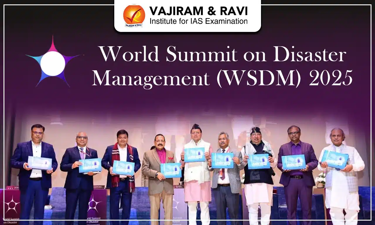
The World Summit on Disaster Management (WSDM) 2025 is a platform dedicated to advancing scientific collaboration, policy innovation, and resilient development. It was organised in Dehradun from 28 to 30 November 2025, the summit convened experts, governments, researchers, and industry leaders to address rising disaster risks amid intensifying climate change. The event is significant for India, especially for disaster-prone Himalayan states, as it focused on strengthening early-warning systems, community preparedness, and international cooperation.
World Summit on Disaster Management (WSDM) 2025
The World Summit on Disaster Management (WSDM) 2025 aims to bridge the gap among research, policymaking, and ground-level disaster management. The summit was jointly organised by the Government of Uttarakhand, the Uttarakhand Council for Science & Technology (UCOST), and the Himalayan Academy of Science & Technology (HAST). Its core message was advancing global resilience which reflects India’s increasing focus on climate-ready infrastructure and improved disaster response mechanisms.
World Summit on Disaster Management (WSDM) 2025 Objectives
The objectives of World Summit on Disaster Management (WSDM) 2025 includes:
Enhancing international cooperation, fostering multi-stakeholder partnerships, and supporting innovative technologies for disaster preparedness.
The summit encourages shared learning across nations to develop scalable and actionable strategies.
It also brings together local communities, scientists, and policymakers to ensure that solutions reflect ground realities and scientific accuracy.
It is also focused to strengthen global commitments to climate action and build systems that can withstand frequent extreme events.
World Summit on Disaster Management (WSDM) 2025 Theme
The central theme of World Summit on Disaster Management (WSDM) 2025 was “Strengthening International Cooperation for Building Resilient Communities”. It reflects the summit’s commitment to aligning disaster management with sustainable development and global climate agendas. Discussions revolved around knowledge-sharing, resilient infrastructure, early-warning advancements, cross-border collaboration, and innovative technologies. The summit also focused on climate adaptation and community-led resilience, giving space to international experts, field practitioners, and Himalayan community representatives to share practical insights.
World Summit on Disaster Management (WSDM) 2025 Significance
The World Summit on Disaster Management (WSDM) 2025 holds major national and global significance as mentioned below:
The event commemorated the anniversary of the Silkyara Tunnel rescue, a milestone showcasing India’s improving disaster response capabilities under national leadership.
It also positioned Uttarakhand as a growing centre for climate resilience research and global dialogue.
The summit further highlighted the importance of Himalayas-focused preparedness, given rising landslides, flash floods, and extreme weather events.
World Summit on Disaster Management (WSDM) 2025 UPSC
During the World Summit on Disaster Management (WSDM) 2025, Union Science & Technology Minister Dr. Jitendra Singh announced a major upgrade to Uttarakhand’s weather forecasting capacity. Three new radars will be installed at Haridwar, Pantnagar, and Auli, adding to existing radars at Surkanda Devi, Mukteshwar, and Lansdowne. This expanded network strengthens real-time forecasting, enabling faster alerts for cloudbursts, landslides, and flash floods, critical for mountainous terrain.
World Summit on Disaster Management (WSDM) 2025 FAQs
Q1: What is the World Summit on Disaster Management (WSDM) 2025?
Ans: WSDM 2025 is an international platform held in Dehradun from 28-30 November 2025, bringing together scientists, policymakers, industry experts, and practitioners to discuss global disaster risks and resilience strategies.
Q2: Who organised World Summit on Disaster Management (WSDM) 2025?
Ans: The summit was jointly organised by the Government of Uttarakhand, the Uttarakhand Council for Science & Technology (UCOST), and the Himalayan Academy of Science & Technology (HAST).
Q3: What was the theme of World Summit on Disaster Management (WSDM) 2025?
Ans: The 2025 theme was “Strengthening International Cooperation for Building Resilient Communities”, focusing on climate adaptation, disaster risk reduction, and cross-border collaboration.
Q4: What major announcement was made during the World Summit on Disaster Management (WSDM) 2025?
Ans: Union Science & Technology Minister Dr Jitendra Singh announced the installation of three new weather radars in Uttarakhand at Haridwar, Pantnagar, and Auli to improve real-time weather forecasting.
Q5: Why is the World Summit on Disaster Management (WSDM) 2025 significant for India?
Ans: WSDM 2025 commemorates the Silkyara Tunnel rescue mission and highlights India’s growing disaster-response capability, strengthening Uttarakhand’s role as a global centre for disaster-management research and cooperation.
The Eastern Ghats is situated along the eastern coast of India stretching about 1750 km. It covers five states under the area roughly measuring to 160,000 km². It is a discontinuous chain of hills. The average elevation is around 600 m with the highest peak being Arma Konda (1,680 m). The geological uniqueness, ecological importance, and role as watershed for major rivers make it a crucial feature of peninsular India.
Eastern Ghats
The Eastern Ghats extend from north of the Mahanadi River in Odisha to the Vaigai River in Tamil Nadu in the south. It covers the states including Odisha, Andhra Pradesh, Telangana, Karnataka, and Tamil Nadu. Its width varies between 100-200 km. The eastern region slopes toward the Bay of Bengal, while the western region connects to the Deccan Plateau. The Ghats are characterised by a discontinuous, fragmented structure, with multiple hill blocks separated by major river valleys.
Eastern Ghats Geography
The Eastern Ghats are among India’s oldest mountain formations, with complex geological history.
The range lies roughly between latitudes 18° 13′ 41” N, and longitudes about 82° 43′ 23” E.
They are Precambrian (Archeozoic era) fold mountains, originally part of ancient continental assemblies.
The primary rock types are charnockite, khondalite, granite, quartzite, calcium silicate and metamorphic rocks.
The terrain shows many faults, thrusts and strike-slip movements, indicating tectonic reworking over geological time.
Mineral deposits such as iron ore, bauxite, limestone and other minerals occur in various hill ranges.
The soils found in the eastern ghats region are majorly Red, Black, Laterite and Alluvial.
Eastern Ghats Divisions
The Eastern Ghats can be broadly divided into northern, central, and southern segments:
Northern section (Odisha): from Mahanadi basin to Andhra border; includes Similipal, Garhjat, Niyamgiri, with heights 900-1400 m and significant mineral wealth.
Central section (Andhra Pradesh & Telangana): two parallel ranges separated by a 160 km gorge through which Godavari and Krishna flow; average height ~ 520 m.
Southern section (Karnataka & Tamil Nadu): appears as fragmented hills (Nallamala, Javadi, Shevaroy etc.), with lower elevation and gentle slopes, merging into Nilgiri Hills where they meet Western Ghats.
Eastern Ghats Mountain Ranges
The discontinuous hills and plateaus form the notable ranges and peaks of Eastern Ghats including several important hill clusters.
Major ranges of the Northern region of the Ghats include Similipal, Garhjat, Gandhamardan, Niyamgiri and Deomali (Odisha).
Important ranges covering the Central to Southern region of the Ghats are: Nallamala, Veligonda, Palakonda, Javadi, Melagiri, Kambakkam, etc. (Andhra Pradesh/ Tamil Nadu/ Karnataka).
The discontinuous nature is especially visible between the Godavari and Krishna rivers, where the hills nearly vanish, giving way to plateaus and Gondwana basins.
Major Peaks of Eastern Ghats: Arma Konda (1,680 m) highest in Andhra Pradesh’s Araku Valley sector of Eastern Ghats; Mahendragiri (≈1,501 m) in Odisha’s northern section.
Eastern Ghats Rivers
Eastern Ghats have several important east-flowing rivers and tributaries as mentioned below:
Major peninsular rivers: Godavari, Krishna, Mahanadi, and Kaveri cross the Ghats and drain into the Bay of Bengal.
Numerous smaller rivers and streams originating in or passing through Eastern Ghats include Nagavali, Vamsadhara, Sabari, Champavathi, Penna, Gundlakamma, Swarnamukhi, etc.
Many rivers have carved deep gorges and valleys through the Ghats, e.g. Godavari gorge (~ 65 km wide) between hills, facilitating river flow and creating unique topography.
These rivers contribute significantly to irrigation, hydropower, and water supply for eastern coastal plains and Deccan region.
The region also consists of numerous wetlands and large coastal lagoons eg: Chilika, Kolleru and Pulicat Lake.
Eastern Ghats Environment
The climate, rainfall and vegetation across Eastern Ghats reflect its fragmented terrain:
The climate is generally tropical to subtropical, with hot, humid summers (up to 44 °C) and moderate winters (~20 to 25 °C).
Rainfall distribution varies: northern hills receive 120-150 cm, southern sections 60-110 cm, largely from monsoon and occasional cyclones.
Vegetation types include nine major forest categories: tropical evergreen, semi-evergreen, moist deciduous, northern dry deciduous, southern dry deciduous, thorn scrub, dry savannah, riverine forests and dry evergreen forests depending on altitude and rainfall.
Evergreen patches occur in limited pockets (e.g. Shevaroy hills, parts of northern Andhra), while dry deciduous and scrub dominate in low rainfall or degraded zones.
Eastern Ghats Biodiversity
Eastern Ghats is ecologically rich with many endemic species and important protected areas.
The Ghats harbour about 4500 flowering plant species, representing ~13% of India’s flowering plants.
Commercial Tree species found are: Indian Rosewood, Teak, Mahogany and Red Sandalwood.
Fauna includes Bengal tiger, Indian elephant, Indian wild dog, leopard, nilgai, Indian vulture, Indian bustards, Indian golden gecko, along with other species nearly 100 mammals, 425 birds, 99 reptiles,100 amphibians, 155 fishes and several diverse insects.
Critically endangered and endemic species such as the Jerdon's courser and several rare reptiles and amphibians are unique to Eastern Ghats.
Protected areas include national parks, wildlife and bird sanctuaries, tiger & elephant reserves, spread across states, supporting conservation of Ghats biodiversity.
Eastern Ghats Significance
The Eastern Ghats play multiple roles including ecological, hydrological, cultural and economic as given below:
They serve as a watershed for major east-flowing rivers which irrigate coastal plains and support agriculture.
It provides minerals (iron ore, bauxite) supporting mining and industry sectors.
It supports forest-based livelihoods of tribal and rural communities; forest produce, non-timber forest produce, traditional medicine sources.
It acts as a biodiversity hotspot, preserving endemic species and ecological balance.
It offers potential for ecotourism, trekking and sustainable development, linking culture, environment and economy.
Eastern Ghats Challenges
Human pressures and ecological changes pose serious threats to Eastern Ghats. The major challenges faced by the Eastern Ghats are:
Deforestation and habitat loss due to logging, mining, shifting cultivation, monoculture plantations and illegal encroachments have degraded forests and biodiversity.
Loss of biodiversity: endemic species under threat from habitat fragmentation and unsustainable exploitation.
Decline in traditional livelihoods for tribal communities as forest produce collection reduces and forest-based income sources shrink.
Mining and quarrying impacts: extraction of bauxite, iron ore and other minerals leading to soil degradation, deforestation, water pollution and ecological imbalance.
Poor enforcement of protection laws and lack of community involvement, weakening conservation efforts.
Eastern Ghats Conservation
Effective conservation of Eastern Ghats requires integrated ecological, social and policy measures. The major steps that can be taken and have been carried out for the conservation of the biodiversity and environment of ghats are:
Protected Area Expansion: Declare and expand protected areas: national parks, wildlife sanctuaries, biosphere reserves, including corridor conservation to support wildlife movement. Eg: Inclusion of Koundinya WLS, Sri Venkateswara NP, Gundla Brahmeswaram WLS to conserve elephants and endemic flora; supports the Asian Elephant Conservation Project.
Community-Based Conservation (JFM Model): Promote community-led forest management and sustainable livelihoods for tribal and local communities to reduce pressure on natural resources. Eg: Joint Forest Management committees in Odisha and Andhra Pradesh manage buffer zones showing improvement in canopy density.
Enforce mining, logging, and land-use regulations strictly, with rehabilitation and ecological restoration plans for degraded areas.
Encourage sustainable ecotourism and environmental education, balancing development with conservation.
Eco-Restoration (MoEFCC): Uses assisted natural regeneration, gap planting, and soil–moisture conservation. Applied in Seshachalam Hills to restore degraded Red Sanders forests after the surveys identified rapid decline.
Special Species-Focused Measures: Formulating a unique measure to protect species, eg: The Andhra Pradesh ‘Red Sanders Anti-Smuggling Task Force’ (RSASTF, 2015) established to curb illegal smuggling and promote restoration with stricter patrol routes and GIS mapping.
Monitoring: Biodiversity Monitoring (ZSI-BSI Surveys) for long-term species assessment across Similipal, Satkosia, Papikonda; Geospatial Monitoring (NRSC Hyderabad) for satellite-based tracking of forest fragmentation.
Eastern Ghats FAQs
Q1: What is the major threat to the Eastern Ghats?
Ans: The major threats include mining, shifting cultivation, encroachment, and habitat fragmentation. FSI and ZSI surveys identify mining as the fastest-growing threat.
Q2: Which species are a conservation priority in the Eastern Ghats?
Ans: Red Sanders, Indian Giant Squirrel, and Asian Elephant are priority species due to habitat loss and illegal trade pressures.
Q3: Which is the highest peak of Eastern Ghats?
Ans: The highest peak of the Eastern Ghats is Arma Konda which is 1680 m in height. It is also known as Jindhagada Peak, located in Araku Valley, Andhra Pradesh.
Q4: Which rivers flow through the Eastern Ghats?
Ans: Many east-flowing rivers pass through eastern ghats and drains into the Bay of Bengal. Examples: Godavari, Krishna, Mahanadi, Kaveri, etc.
Q5: What are the protected areas in the Eastern Ghats?
Ans: Yes, major protected areas include Papikonda National Park, Similipal Biosphere Reserve, Satkosia Tiger Reserve, and Sri Venkateswara National Park.
The Western Ghats are one of the most significant ecological zones in India with exceptional biodiversity, strong influence on climate and major role in hydrological functions. It is spanned across six states- Gujarat, Maharashtra, Goa, Karnataka, Tamil Nadu and Kerala, stretching from Satpura Range to Kanyakumari, covering about 160,000 sq km of area. It has a major role in the regulation of monsoon and is the home to 300+ threatened species. It supports millions of people through water, forests, minerals and agriculture.
Western Ghats
The Western Ghats border the Deccan Plateau of India in the western region. It is sometimes called the "Great Escarpment of India" as they form a continuous chain of escarpments, steep valleys, high plateaus, and deep gorges. It is known as Sahyadri in Maharashtra and Sahya Parvatham in Kerala. These mountains influence climate by intercepting southwest monsoon winds. It supports evergreen, semi-evergreen, moist deciduous, and dry deciduous forests on different slopes.
Western Ghats Geography
The Western Ghats formed through tectonic events shaping the faulted edges of the Deccan Plateau. It is formed by the subduction of the Arabian basin and tilting of the eastern and north-eastern region.
The Ghats are block mountains formed due to downwarping of land towards the Arabian Sea.
Scholars suggest they are not true mountains but represent the western faulted edge of the Deccan Plateau.
Their uplifted edges create steep western cliffs and gentler eastern slopes.
This ancient terrain influences drainage, monsoon interception, soil formation, and biodiversity across peninsular India.
The Ghats contain varied rock systems: basalt, charnockite, granite gneiss, metamorphic gneiss, khondalite and leptynite.
Several important passes cut across the Western Ghats, enabling connectivity between coastal and inland regions like: Thal Ghat, Amba Ghat, Bhor Ghat, etc.
Western Ghats Divisions
The Western Ghats are divided into northern, central, and southern sections with distinct geology, climate, and biodiversity. These divisions reflect sharp variations in elevation, rainfall, forest type, and species distribution.
Northern Western Ghats: Includes the Sahyadri in Maharashtra, Konkan Coast to the west, and Desh region to the east; marked by basaltic plateaus (lava covered). Important Peaks are: Kalsubai (highest), Salher, Mahabaleshwar, etc.
Middle/ Central Western Ghats: It is called Kanara and includes Karnataka’s Ghats, with high rainfall, dense evergreen forests, and key rivers like Sharavathi and Netravati; the region around Malanadu is prominent. Major peaks are Vavul Mala, Kudremukh, etc.
Southern Western Ghats: Includes Kerala and Tamil Nadu regions, Nilgiri malai, and high peaks like Anamudi, Annamalai, Cardamom; includes the Malabar Coast.
Western Ghats Mountain Ranges
The Western Ghats contain interconnected massifs, linking key southern hill systems and hosting the tallest peaks and major hill stations. These ancient highlands support deep valleys, steep escarpments, and plateaus shaping peninsular India’s physical diversity.
Nilgiri: It is located southeast of Mysore and links the Western Ghats to the Eastern Ghats through the Shevaroys and Tirumala range.
Anamudi: It is located in Kerala is the highest peak of the Western Ghats and the tallest mountain in India outside the Himalayas.
Hills: Major hill Stations include Matheran, Mahabaleshwar, Panchgani, Lonavala-Khandala, Amboli Ghat, Kodagu, and Kudremukh.
Western Ghats Rivers
The Western Ghats give rise to major west-flowing and east-flowing rivers that shape peninsular India’s water systems. Most peninsular states depend on Western Ghats rivers for agriculture, drinking water, and hydropower.
West Flowing Rivers:
West-flowing rivers include Periyar, Netravati, Sharavathi, Mandovi, and Bharathappuzha; they are fast-moving due to steep descent.
Their sharp gradients and short travel distances make them major hydropower sources, especially in Karnataka and Kerala.
East Flowing Rivers
East-flowing rivers include Godavari, Krishna, and Kaveri, along with tributaries like Tunga, Bhadra, Bhima, Malaprabha, Hemavathi, and Kabini.
These slower, longer rivers drain into the Bay of Bengal and support major irrigation systems.
Western Ghats Environment
The Western Ghats regulate monsoons and support diverse forest types across western and eastern slopes.
Western slopes host evergreen and moist broadleaf forests with rosewood, mahogany, and cedar; they remain green year-round.
Eastern slopes have dry and moist deciduous forests dominated by teak, sal, sandalwood, and shisham.
The Ghats intercept moisture containing monsoon winds which influence the rainfall patterns over peninsular India.
High montane forests strongly impact monsoon circulation.
The region hosts at least 325 globally threatened species of flora and fauna.
Western Ghats Biodiversity
The Western Ghats form a global biodiversity hotspot with high endemism, protected areas, and rare species.
It is home to 325 globally threatened species (IUCN): 229 plants, 31 mammals, 15 birds, 43 amphibians, 5 reptiles, and 1 fish.
Endemic animals include Nilgiri tahr, lion-tailed macaque, and Nilgiri marten.
Protected areas include 2 biosphere reserves, 13 national parks, and numerous wildlife sanctuaries.
The Nilgiri Biosphere Reserve is the largest contiguous protected forest zone.
Silent Valley National Park protects the last tropical evergreen forest tracts in India
Western Ghats Significance
The Western Ghats are vital for hydrology, climate regulation, biodiversity, economy, and indigenous livelihoods.
Feed major rivers like Godavari, Krishna, and Kaveri; crucial for water supply in peninsular states.
Intercept monsoon winds and influence India's tropical climate.
Sequester nearly 4 million tonnes of carbon annually, about 10 percent of India’s forest-based carbon capture.
Host exceptional plant and animal diversity with high endemism.
Rich in iron, manganese, and bauxite; important for forest-based industries like paper, plywood, poly-fibres, and matchwood.
Indigenous communities depend on forests for non-timber forest produce.
Western Ghat Challenges
The Western Ghats face increasing threats from mining, deforestation, settlements, plantations, and climate change.
Mining violations in Goa and sand mining in Kerala degrade land and water sources.
Over-extraction of forest produce affects sustainability and biodiversity.
Grazing by dense livestock populations causes habitat loss.
Human-wildlife conflict is widespread in human-dominated landscapes.
Hunting using guns, snares, and traps threatens endemic species.
Monoculture plantations like tea, coffee, rubber, oil palm cause forest loss.
Encroachment by settlements fragments protected areas.
Hydropower projects disrupt ecosystems.
Deforestation and illegal logging worsen ecological decline.
Climate change increases rainfall variability and floods.
Western Ghats Conservation
India has taken several measures to conserve the Western Ghats through expert committees and protected area expansion.
Gadgil Committee (2011): Proposed declaring the entire Ghats as Ecologically Sensitive Areas with graded restrictions.
Kasturirangan Committee (2013): Recommended 37 percent of the Ghats be designated ESA with bans on mining and quarrying.
Protected areas expanded through biosphere reserves, national parks, and wildlife sanctuaries.
Conservation efforts focus on controlling mining, regulating plantations, restricting hydropower development, and managing human settlements.
Forest restoration and protection of endemic species remain central strategies.
Western Ghats FAQs
Q1: What are the Western Ghats?
Ans: The Western Ghats are a long mountain chain along India’s west coast, covering about 1,60,000 sq km of area. They are a UNESCO World Heritage Site and one of the eight global biodiversity hotspots.
Q2: Why are the Western Ghats important for biodiversity?
Ans: Western Ghats host over 325 globally threatened species (IUCN), including the lion-tailed macaque and Nilgiri tahr, with very high endemism in plants, amphibians and mammals.
Q3: Which major rivers originate in the Western Ghats?
Ans: Major rivers such as the Godavari, Krishna, Kaveri, Periyar, and Sharavathi originate in the Western Ghats, supporting water needs across peninsular India.
Q4: What are the major threats to the Western Ghats?
Ans: Key threats include mining, deforestation, plantation expansion, hydropower projects, illegal hunting, sand mining, climate-induced rainfall changes, and encroachment.
Q5: What conservation measures exist for the Western Ghats?
Ans: Major initiatives include the Gadgil Committee (2011) and Kasturirangan Committee (2013) recommendations to designate Ecologically Sensitive Areas and regulate mining, construction and large-scale development.
The Daily UPSC Quiz by Vajiram & Ravi is a thoughtfully curated initiative designed to support UPSC aspirants in strengthening their current affairs knowledge and core conceptual understanding. Aligned with the UPSC Syllabus 2025, this daily quiz serves as a revision resource, helping candidates assess their preparation, revise key topics, and stay updated with relevant issues. Whether you are preparing for Prelims or sharpening your revision for Mains, consistent practice with these Daily UPSC Quiz can significantly enhance accuracy, speed, and confidence in solving exam-level questions.
[WpProQuiz 37]
UPSC Daily Quiz FAQs
Q1: What is the Daily UPSC Quiz?
Ans: The Daily UPSC Quiz is a set of practice questions based on current affairs, static subjects, and PYQs that help aspirants enhance retention and test conceptual clarity regularly.
Q2: How is the Daily Quiz useful for UPSC preparation?
Ans: Daily quizzes support learning, help in revision, improve time management, and boost accuracy for both UPSC Prelims and Mains through consistent practice.
Q3: Are the quiz questions based on the UPSC syllabus?
Ans: Yes, all questions are aligned with the UPSC Syllabus 2025, covering key areas like Polity, Economy, Environment, History, Geography, and Current Affairs.
Q4: Are solutions and explanations provided with the quiz?
Ans: Yes, each quiz includes detailed explanations and source references to enhance conceptual understanding and enable self-assessment.
Q5: Is the Daily UPSC Quiz suitable for both Prelims and Mains?
Ans: Primarily focused on Prelims (MCQ format), but it also indirectly helps in Mains by strengthening subject knowledge and factual clarity.
The Peninsular Plateau of India, also known as the Indian Shield, is one of the oldest and most stable landmasses on Earth. It forms the core of the Indian subcontinent and dominates the geographical landscape of central and southern India.
Its geological antiquity, mineral wealth, diverse physiographic divisions, and ecological significance make it an essential topic for UPSC Prelims, Mains, and optional Geography. The plateau has shaped India’s river systems, agriculture, settlement patterns, industrial development, and biodiversity over millions of years.
Peninsular Plateau of India Features
The Peninsular Plateau stands out due to its unique terrain, geological stability, and mineral-rich composition.
The plateau covers nearly 16 lakh sq km, representing almost 50% of India’s total landmass.
It is composed primarily of crystalline, igneous, and metamorphic rocks, dating back to the Archean and Proterozoic ages (over 2.5 billion years old).
The plateau is roughly triangular in shape, drained by both east-flowing and west-flowing rivers, creating deep valleys, escarpments, and basins.
The Peninsular Plateau is bounded by the Aravalli Range, Vindhya, Satpura, Barmer, and Rajmahal Hills in the north; the Western Ghats in the west; and the Eastern Ghats in the east.
It consists of numerous plateaus, uplands, hill ranges, forest belts, and fertile valleys formed by tectonic movements and prolonged erosion.
The region is rich in minerals such as iron ore, coal, manganese, bauxite, gold, mica, making it India’s “mineral heartland.”
Geological Formation of the Peninsular Plateau
The geological evolution of the Peninsular Plateau is linked to tectonic activity, volcanic events, and the breakup of ancient continents.
Part of the Gondwana supercontinent, the plateau separated due to continental drift about 135 million years ago.
The foundation of the plateau is formed by some of the world’s oldest rocks, comparable to those found in Western Australia and South Africa.
Large igneous eruptions known as Deccan Trap volcanic events (around 60-68 million years ago) formed extensive basaltic layers, especially in Maharashtra.
Lineaments, faults, and rift valleys such as the Narmada-Son Lineament and Narmada-Tapti Rift Valley are prominent tectonic features.
Weathering, denudation, and fluvial erosion have shaped its current topography over millions of years.
Major Divisions of Peninsular Plateau of India
The Peninsular Plateau is divided into several physiographic units, each with distinct geological structure, river systems, soil types, ecology, and agricultural patterns. Below are the Major Divisions of the Peninsular Plateau of India
Marwar Upland
The Marwar Upland lies in the northwestern part of the Peninsular Plateau and forms a transitional zone between the Thar Desert and the Aravalli Range. It is characterized by semi-arid climate, rocky terrain, and ancient residual hills.
Location: Western Rajasthan, mainly Jodhpur, Pali, Nagaur, Barmer regions.
Topography:
Rocky uplands, pediments, and residual hills.
Elevation ranges between 250-500 m.
Rivers:
Seasonal rivers such as Luni, Sukri, and Bandi.
Geological Composition:
Predominantly Aravalli schists, gneisses, quartzite, and granite.
Bajra, Jowar, Pulses, Mustard, and limited wheat in irrigated areas.
States Covered: Rajasthan.
Central Highlands
The Central Highlands form the northern segment of the Peninsular Plateau, extending from the Aravallis to the eastern part of Madhya Pradesh. They include important plateaus and river basins.
Location: Rajasthan, Madhya Pradesh, parts of Uttar Pradesh.
States Covered: Rajasthan, Madhya Pradesh, Uttar Pradesh.
Bundelkhand Upland
Bundelkhand Upland is a rugged region between the Yamuna and Narmada river systems known for granite outcrops, uneven terrain, and low water availability.
Ancient Bundelkhand granites, gneisses, quartzite.
Flora & Fauna:
Thorn & dry deciduous vegetation.
Wildlife includes Nilgai, Wild Boar, Indian Wolf.
Major Crops:
Gram, Wheat, Bajra, Urad, limited paddy.
States Covered: Madhya Pradesh, Uttar Pradesh.
Malwa Plateau
The Malwa Plateau is a fertile volcanic region with black soil, forming an important agricultural zone in central India.
Location: Western Madhya Pradesh & southeastern Rajasthan.
Topography:
Flat to gently undulating plateau, elevation 500-600 m.
Northern boundary marked by Chambal ravines.
Rivers:
Western Drainage (towards the Arabian Sea): Includes Narmada, Tapi, and Mahi, which flow westward and drain into the Arabian Sea.
Eastern Drainage (towards the Bay of Bengal): Includes Chambal and Betwa, which flow northeast and join the Yamuna, ultimately draining into the Bay of Bengal.
Geological Composition:
Basaltic lava flows from Deccan volcanism, which formed Black cotton soil.
The Deccan Plateau is the largest and most prominent part of the Peninsular Plateau, covering almost the entire southern part of India. It is a volcanic plateau formed primarily during the Cretaceous period due to massive basaltic lava flows, commonly known as the Deccan Traps.
Location
Bounded by the Western Ghats on the west, Eastern Ghats on the east, and the Satpura and Vindhya ranges in the north.
Topography
Average elevation ranges from 500 to 1000 meters above sea level.
Broad, gently sloping plateau surface, mostly towards the east.
Western Ghats form a steep escarpment with narrow coastal plains; Eastern Ghats are discontinuous and eroded.
Contains hill ranges like Balaghat, Nilgiri, Anaimalai, and Cardamom Hills.
Geological Composition
Dominated by basaltic lava flows of the Deccan Traps.
Some areas with granite, gneiss, schist, and laterite formations.
Rich in minerals: iron ore, manganese, bauxite, and limestone.
Rivers and Drainage
East-flowing rivers: Godavari, Krishna, Kaveri, Tungabhadra, Bhima, Pennar (drain into Bay of Bengal).
West-flowing rivers: Some short rivers along Western Ghats, e.g., Mandovi, Sharavathi (drain into Arabian Sea).
Provides hydropower potential at dams like Srisailam, Nagarjuna Sagar, and Tungabhadra.
Soil and Agriculture
Black soil (Regur): Ideal for cotton cultivation.
Red and laterite soils: Support millets, pulses, oilseeds.
Alluvial soils along river valleys: Rice and sugarcane.
Major crops: Cotton, Jowar, Ragi, Groundnut, Sugarcane, Paddy, Millets.
Horticulture: Coffee, Rubber, Spices (especially in Karnataka, Kerala, and Tamil Nadu).
Flora and Fauna
Dry and moist deciduous forests in plateau areas.
Western Ghats: Biodiversity hotspot with tropical evergreen forests.
Wildlife includes Tiger, Leopard, Gaur, Elephant, Nilgiri Tahr, Sloth Bear.
Economic Significance
Agriculture: Major cotton, sugarcane, and food grain-producing region.
States Covered: Maharashtra, Karnataka, Telangana, Andhra Pradesh, Tamil Nadu, Kerala, Chhattisgarh
Major Hillls of Peninsular Plateau of India
[my_image src="https://vajiramandravi.com/current-affairs/wp-content/uploads/2025/12/Artboard-1.webp" size="full" align="none" width="auto" height="442px" alt="Major Hillls of Peninsular Plateau of India" title="Major Hillls of Peninsular Plateau of India"]
The Peninsular Plateau of India consists of several ancient hill ranges that influence river systems, climate, and biodiversity. These hills include both continuous ranges like the Western Ghats and discontinuous ranges like the Eastern Ghats, along with isolated highlands across central and southern India.
Major Hillls of Peninsular Plateau of India
Hill Range
Location / States
Highest Peak
Significance
Aravalli Hills
Rajasthan, Delhi
Guru Shikhar (1,722 m)
Oldest fold mountains; influence desert ecology
Vindhya Range
Madhya Pradesh, Uttar Pradesh, Rajasthan
1,100 m
Natural divide between north & south India
Satpura Range
Madhya Pradesh, Maharashtra, Chhattisgarh
Dhupgarh (1,350 m)
Source of Narmada river; rich forests
Western Ghats
Maharashtra, Goa, Karnataka, Kerala, Tamil Nadu
Anamudi (2,695 m)
UNESCO Heritage Site; biodiversity hotspot
Eastern Ghats
Odisha, Andhra Pradesh, Tamil Nadu, Karnataka
Jindhagada or Arma Konda (1,690 m, Araku Valley)
Discontinuous hills; many rivers originate
Nilgiri Hills
Tamil Nadu, Kerala, Karnataka
Doddabetta (2,637 m)
Hill station & tourism; rich flora & fauna
Anaimalai Hills
Tamil Nadu, Kerala
Anamudi (2,695 m)
Coffee plantations; wildlife habitats
Cardamom Hills
Kerala
South Cardamom (1,670 m)
Spices cultivation; tropical forests
Meghalaya Hills
Meghalaya (Khasi, Garo, Jaintia Hills)
Shillong Peak (1,965 m)
Wettest region; unique biodiversity
Mineral Resources of the Peninsular Plateau
The Peninsular Plateau is rich in metallic, non-metallic, and fuel minerals due to its ancient geological formations like Archaean rocks, Deccan Traps, and Gondwana sediments. These minerals are crucial for India’s industrial growth, energy production, and infrastructure development.
Chotanagpur Plateau: Coal, iron, mica, copper.
Malwa & Bundelkhand Plateaus: Limestone, bauxite, some iron ore.
Fertile soils like black cotton soil and alluvial soils support cotton, wheat, rice, sugarcane, millets, and oilseeds.
Rivers of the plateau provide irrigation through dams and canals, supporting agriculture.
Rich in iron, manganese, bauxite, copper, coal, mica, limestone, and gold, making it a mineral hub.
Mineral resources have led to the growth of steel plants, cement factories, and mining-based industries.
Plateau forests provide timber, medicinal plants, and other forest products.
Western and Eastern Ghats host biodiversity hotspots, contributing to eco-tourism and research.
Rivers are suitable for hydroelectric power projects, e.g., Srisailam, Nagarjuna Sagar.
Coal deposits in Jharkhand, Chhattisgarh, and Odisha support thermal power plants.
Hill stations, rivers, waterfalls, and scenic plateaus attract tourism.
Environmental Issues and Challenges
Deforestation - India’s forest cover on the plateau is around 21-23%, lower than the national average in some states. Western Ghats and Chotanagpur forests have lost 10-15% of original forest cover in the past two decades due to logging, mining, and urban expansion.
Soil Erosion - Over 35% of Bundelkhand and Malwa plateau areas are prone to soil erosion due to overgrazing, deforestation, and unsustainable farming.
Water Scarcity - Western plateau regions like Marwar and parts of Telangana receive less than 500-800 mm annual rainfall, leading to recurrent droughts and low groundwater levels.
Mining Impacts - Jharkhand and Chhattisgarh account for over 40% of India’s coal production, causing land degradation, deforestation, and siltation in rivers like Damodar.
Biodiversity Loss - Western Ghats are a UNESCO World Heritage site, yet nearly 150 species are critically endangered, including the lion-tailed macaque and Malabar civet.
Air and Water Pollution - Industrial regions in Odisha, Jharkhand, and Chhattisgarh contribute to high levels of suspended particulate matter, and heavy metal contamination in rivers like Brahmani and Mahanadi.
Climate Change Effects - Plateau areas have recorded temperature rise of 0.6-0.8°C over the last 50 years, impacting agriculture (e.g., reduced yields of millets, pulses) and increasing drought frequency.
Invasive Species - Plants like Lantana camara have invaded over 20% of degraded forest areas in Chhattisgarh and Madhya Pradesh, affecting local flora.
Landslides and Flooding - Western Ghats and Meghalaya Hills receive annual rainfall exceeding 2,500-11,000 mm, causing frequent landslides and flash floods during monsoon season.
Way Forward
Afforestation and Forest Management: Increase forest cover in degraded areas; India’s forest cover is 21.7%, lower than the ideal 33%, e.g., Western Ghats restoration projects.
Soil and Water Conservation: Adopt watershed management and rainwater harvesting; Bundelkhand has implemented Jaiv Krishi practices to reduce erosion.
Sustainable Mining Practices: Enforce eco-friendly mining and land reclamation, e.g., coal mining in Jharkhand and Odisha is being regulated under the Mine Environment & Safety Act.
Biodiversity Protection: Strengthen protected areas; the Nilgiri Biosphere Reserve conserves endemic species like lion-tailed macaque and Malabar civet.
Climate Change Adaptation: Promote drought-resistant crops and water-efficient irrigation, e.g., Telangana’s micro-irrigation schemes reduce water stress during erratic monsoons.
Pollution Control Measures: Implement industrial emission and effluent regulations; e.g., Odisha’s steel belt now follows stricter CPCB standards.
Peninsular Plateau Major Divisions
The Peninsular Plateau can be divided into three major divisions:
Deccan Plateau
The boundaries of Deccan Plateau are- Western Ghats in the west, Eastern Ghats in the East
Satpura, Maikal Range and Mahadeo Hills in the North and extends in the south from the Narmada River.
The Deccan plateau is a result of volcanic activity, forming horizontal layers of solidified lava and a distinct trap structure.
The plateau is spread across an area of over 5,00,000 sq. km with an average elevation of 600m.
The highest point is marked at Doddabetta Peak, Tamil Nadu.
The major rivers in the Deccan Plateau are Godavari, Krishna and Kaveri flowing west to east.
The climate is usually tropical, hot and dry summers, accompanied by mild winters with an average rainfall of 600 mm.
Crops grown are usually rice, sorghum, cotton, tobacco and spices.
2. Central Highlands
The Central Highlands have an elevation of 700-1,000m having a slope from north to northeast. The boundaries are aravalli range in the west, satpura range in the north, rajmahal hills in the east and chotanagpur plateau in the south.
The central highlands are wider in the west and narrow in the east and extend towards Bundelkhand and Baghelkhand in the east.
The desert extension reaches Jaisalmer, covered by barchans and sand ridges.
The presence of metamorphic rocks can be found in the form of rocks like marble, slate and gneiss.
The Vindhya and the Kaimur Ranges are a source of Yamuna tributaries and the Banas river is an important tributary of Chambal rising from the Aravallis.
3. Northeastern Plateau
The Northeastern Plateau is formed because of the northeastern drift of the Indian Plate during Himalayan formation, creating the Malda Gap between Rajmahal Hills and Meghalaya Plateau, filled by river deposits.
The area extends in Meghalaya, Karbi- Anglong Plateau and North Cachar Hills.
The hill ranges include Garo, Khasi and Jaintia Hills from west to east.
The Kopili river separates Mikir, Regma and Barail Hills from Meghalaya Plateau.
The northeastern plateau receives a heavy southwest monsoon rainfall and is highly eroded on the surface.
Peninsular Plateau FAQs
Q1: Why is the Peninsular Plateau important for the UPSC exam?
Ans: It forms a major part of India’s physical geography and is crucial for topics like physiography, minerals, environment, and river systems.
Q2: Which is the largest division of the Peninsular Plateau?
Ans: The Deccan Plateau, covering most of southern India.
Q3: Which region of the plateau is richest in minerals?
Ans: The Chotanagpur Plateau, known as India’s mineral heartland.
Q4: What type of rocks dominate the Peninsular Plateau?
Ans: Igneous and metamorphic rocks formed in the Precambrian era.
Q5: Why does the plateau have east-flowing rivers?
Ans: Because the plateau slopes gently toward the east, making rivers like Godavari and Krishna flow into the Bay of Bengal.
Indian Statistical Institute (ISI) Act, 1959 Latest News
More than 1,500 academics have expressed grave concerns and held demonstrations in Kolkata to protest a Central government plan to repeal the Indian Statistical Institute (ISI) Act, 1959.
About Indian Statistical Institute (ISI) Act, 1959
The Indian Statistical Institute was founded by Professor P.C. Mahalanobis in Kolkata on 17th December, 1931.
The ISI, established earlier as a society, plays a crucial role in statistical research, education, and training in India.
The ISI Act 1959 primarily applies to the ISI, its governing body, employees, and students.
The Act aimed to recognize the ISI’s contributions to national development and provide it with the necessary autonomy and support to carry out its functions effectively.
The ISA Act 1959 declared the ISI an institution of national importance.
This Act falls under the Ministry of Statistics and Programme Implementation.
Salient Features of Indian Statistical Institute (ISI) Act, 1959
Empowers the ISI to grant degrees and diplomas in statistics, mathematics, quantitative economics, computer science, and related subjects.
Provides for grants, loans, and other financial assistance from the Central Government.
Mandates the audit of the Institute’s accounts by qualified auditors.
Requires prior approval from the Central Government for certain actions by the Institute, such as altering its objectives, amending its memorandum, or disposing of certain properties.
Provides for the constitution of committees by the Central Government to prepare the Institute’s program of work and review its activities.
Empowers the Central Government to issue directions to the Institute.
Allows the Central Government to assume control of the Institute under certain circumstances.
Recently, researchers at National Centre for Radio Astrophysics - Tata Institute of Fundamental Research (NCRA–TIFR), Pune, have discovered a spiral galaxy and named it as Alaknanda.
About Alaknanda Galaxy
It is located about 12 billion light years away and has textbook spiral structure.
It is named after a Himalayan river Alaknanda and the Hindi word for the Milky Way.
The galaxy has two well-defined spiral arms wrapping around a bright central bulge, spanning approximately 30,000 light-years in diameter.
It is a powerhouse of stellar birth, creating stars at a rate equivalent to about 60 solar masses annually.
It looks remarkably similar to our own Milky Way and formed when the Milky way was only 10 per cent of its current age.
According to the RBI’s Annual Report, the complaints registered under the Reserve Bank of India’s Integrated Ombudsman Scheme (RB-IOS) were up by 13.55 per cent in FY25.
About RBI Integrated Ombudsman Scheme
It was launched on November 12, 2021.
It integrated the erstwhile three Ombudsman schemes of RBI namely: the Banking Ombudsman Scheme, 2006, the Ombudsman Scheme for Non-Banking Financial Companies, 2018 and the Ombudsman Scheme for Digital Transactions, 2019.
It adopted the ‘One Nation One Ombudsman’ approach by making the RBI Ombudsman mechanism jurisdiction neutral.
Objective: To provide customers of regulated entities (REs) a speedy, cost-effective and expeditious alternate grievance redress mechanism.
Features of RBI Integrated Ombudsman Scheme
It defines ‘deficiency in service’ as the ground for filing a complaint, with a specified list of exclusions.
Covered Banks: It covers all commercial banks,Non-Banking Financial Companies (NBFCs), RRBs, Payment System Participants, most Primary (Urban) Cooperative Banks with a deposit size of ₹50 crore and Credit Information Companies.
A Centralised Receipt and Processing Centre has been set up at RBI, Chandigarh, for receipt and initial processing of physical and email complaints in any language.
Under this scheme, compensation up to Rupees 20 lakh, in addition to, up to 1 lakh for the loss of the complainant’s time, expenses incurred and for harassment/mental anguish suffered by the complainant can be awarded.
In the next few months, the Department of Telecommunications (DoT) will mandate telecom operators to show the KYC-registered name of all incoming callers using Indian phone numbers, a feature known as Caller Name Presentation (CNAP).
About Caller Name Presentation
CNAP is a technology that enables mobile users to see an incoming caller’s name, similar to Truecaller.
The system retrieves the caller’s name from a telecom operator’s database and displays it on the recipient’s phone.
Unlike third-party apps, CNAP will rely on the official Customer Application Form (CAF) details provided during SIM registration.
How Will CNAP Work?
Each telecom provider will maintain a database of subscriber names linked to mobile numbers.
When a call is made, the system will fetch the caller’s registered name and display it on the recipient’s screen.
Initially, CNAP will work only within the same network, meaning an Airtel-to-Airtel call will display the caller’s name, but cross-operator name display, such as Jio-to-Vodafone, will require regulatory approval for data sharing between telecom providers.
In February 2024, the Telecom Regulatory Authority of India (TRAI) recommended the adoption of CNAP for all smartphones, urging telecom operators to introduce the feature.
The aim is to reduce customer harassment from unknown or spam callers.
A Rainbow Water Snake was recently spotted for the first time in Uttar Pradesh, with photographic evidence collected from the buffer area of Dudhwa Tiger Reserve.
About Dudhwa Tiger Reserve
It is located on the Indo-Nepal border in the district of Lakhimpur-Kheri in Uttar Pradesh.
It was established in 1988 and covers an area of 1,284 sq.km.
It includes the Dudhwa National Park and two nearby sanctuaries, viz. Kishanpur and Katerniaghat, besides forest areas of North Kheri, South Kheri, and Shahjahanpur forest divisions in its buffer.
Topography: It is a typical Tarai-Bhabar habitat of the upper Gangetic plains biogeographic province.
Rivers: The Sharda River flows by the Kishanpur WL Sanctuary, the Geruwa River flows through the Katerniaghat WL Sanctuary, and the Suheli and Mohana streams flow in the Dudhwa National Park, all of which are tributaries of the mighty Ghagra River.
Vegetation: The vegetation is of the North Indian Moist Deciduous type, containing some of the finest examples of Sal forests in India.
Flora: It consists of Sal Forest along with its associate tree species like Terminalia alata (Asna), Lagerstroemia parviflora (Asidha), Adina cordifolia (Haldu), Mitragyna parviflora (Faldu), Gmelina arborea (Gahmhar), Holoptelea intgrifolia (Kanju), etc.
Fauna:
The main mammals spotted here are Tiger, leopard, Swamp deer, Rhinoceros, chital, hog deer, barking deer, Sambhar, wild boar, and Ratel.
There are about 400 species of birds in the park, such as the Florican and black-necked storks.
Key Facts about Rainbow Water Snake
It is a slightly venomous, fish-eating water snake.
Scientific Name: Enhydris enhydris
Distribution: It is found in southeastern China, Indonesia, Bangladesh, Cambodia, central and eastern India, Laos, Malaysia, Myanmar, Nepal, Pakistan, Singapore , Sri Lanka, Pulau Bangka, Thailand, and Vietnam.
Habitat: It inhabits freshwater habitats, including marshlands, rural ponds, and rice paddies.
Features:
It grows as long as 130 cm.
This snake is easily identified by the two pale stripes running down the full length of the body and tail on either side of the vertebral line: these two stripes converge on the crown.
The body is medium brown to greenish brown, and the head and neck are generally more olive-coloured than the body.
The belly is pale, with a thin brown line running down the middle.
A Dismantling of the Base of Environmental Regulation
Context
The Supreme Court of India’s decision in CREDAI vs Vanashakti (November 18, 2025), delivered by a 2:1 majority, marks a significant and troubling shift in India’s environmental jurisprudence.
By recalling its own May 2025 judgment that had struck down ex post facto environmental clearances (ECs), the Court has reopened the possibility for developers to retrospectively legalise projects built in violation of the law.
The majority justified this reversal on the grounds of public interest, claiming that disallowing such clearances could disrupt or dismantle completed projects.
This logic, however, turns illegality into its own justification, subordinating environmental rule of law to administrative convenience.
Circular Logic and the Normalisation of Illegality
Central to the majority’s reasoning is the assertion that requiring prior ECs may cause hardship when projects are already built.
This approach effectively treats the violation as the rationale for excusing the violation, making compliance appear optional.
What was designed as a mandatory safeguard becomes a flexible post-hoc formality.
This stands in stark contrast to the Court’s long-standing position that environmental protection must be anticipatory, anchored in Article 21’s guarantee of the right to a healthy environment, the precautionary principle, and doctrines of intergenerational equity.
The review judgment signals a shift from principle to expediency. By treating completed construction as an overriding factor, it allows economic momentum to dictate environmental legality.
Justice Ujjal Bhuyan’s dissent highlights this danger, emphasising that bending the law to accommodate violations erodes the very framework created to prevent ecological harm.
The Original Judgment: Returning to First Principles
The May 2025 judgment authored by Justice A.S. Oka had rejected both the 2017 and 2021 government notifications permitting retrospective ECs.
It grounded its reasoning in the evolution of India’s environmental governance, beginning with the Stockholm Conference of 1972, the Environment (Protection) Act of 1986, and the Environmental Impact Assessment (EIA) frameworks of 1994 and 2006.
These legal instruments established prior environmental scrutiny as a central pillar of ecological regulation.
The original ruling underscored that public hearings, expert appraisal, and scientific evaluation are meaningful only when conducted before construction begins.
It reaffirmed that preventing irreversible harm is the essence of environmental regulation, and that ex post facto approvals defeat this purpose.
The Court relied on precedents such as Common Cause vs Union of India (2017), which declared retrospective clearances inherently detrimental, and the M.C. Mehta line of cases, which insisted on prior approval even for lease renewals.
The Review Judgment: A Retreat into Expediency
The review judgment reframes the central question: not whether environmental harm must be prevented in advance, but whether enforcing prior scrutiny inconveniences those who have already broken the law.
Justice Bhuyan’s dissent identifies this shift as a clear retreat from decades of jurisprudence. If violations can be regularised through fines, compliance loses its binding force.
Developers may proceed without an EC, confident that post-facto validation will replace meaningful scrutiny.
This approach weakens both the deterrent value of environmental regulation and the credibility of judicial oversight.
By undoing a carefully reasoned judgment rooted in precedent, the Court signals a willingness to allow economic considerations to override ecological mandates, even when violations are blatant and deliberate.
Consequences for Environmental Governance
The implications of the review judgment are considerable.
First, it hollows out the EIA process, reducing public participation, expert appraisal, and scientific evaluation to perfunctory exercises if projects can later be regularised.
Second, it effectively renders compliance voluntary, diminishing the regulatory authority of the state and weakening enforcement mechanisms.
Most troubling is the message this sends at a time of escalating climate risk and ecological fragility. India faces intensifying floods, heatwaves, and biodiversity loss, yet the ruling further dilutes the already fragile tools of environmental accountability.
An institution long regarded as a leader in environmental protection now appears willing to bend foundational safeguards to accommodate unlawful development.
Conclusion
As the Court prepares to hear the matter again, the stakes extend beyond the validity of two notifications.
At issue is the credibility of India’s environmental rule of law, and the integrity of constitutional commitments to ecological protection.
Restoring the primacy of prior environmental scrutiny is essential not only to prevent irreversible harm but also to reaffirm the legitimacy of governance.
The forthcoming hearings offer an opportunity to correct course and ensure that environmental law remains a shield against harm, not a mechanism for post-hoc rationalisation.
A Dismantling of the Base of Environmental Regulation FAQs
Q1. What did the Supreme Court allow in the CREDAI vs Vanashakti review judgment? Ans. The Supreme Court allowed ex post facto environmental clearances for projects that had begun without prior approval.
Q2. Why is the majority’s reasoning considered circular? Ans. It is considered circular because the Court used the very act of violating the law as justification for regularising the violation.
Q3. What principle did the original judgment emphasise? Ans. The original judgment emphasised that prior environmental clearance is a central safeguard meant to prevent irreversible ecological harm.
Q4. What key concern does Justice Bhuyan’s dissent highlight? Ans. Justice Bhuyan’s dissent highlights that allowing retrospective clearances undermines compliance and rewards unlawful conduct.
Q5. What broader impact does the review judgment have on environmental governance? Ans. The review judgment weakens environmental regulation by making compliance appear voluntary and reducing the deterrent effect of the law.
India’s growing engagement with the global clean-energy and high-technology economy has restored attention to an often-overlooked truth: mining alone does not create prosperity.
The recently approved ₹7,280-crore rare-earth magnet scheme and the new G-20 framework on critical minerals reflect an acknowledgment that value creation lies not in extraction but in refining, processing, and manufacturing.
As geopolitical tensions reshape supply chains, especially amid intensifying S.–China trade frictions, India’s reliance on foreign processing capacity has exposed deep vulnerabilities.
The Strategic Gap in India’s Critical Mineral Chain
India has spent the past decade reforming its mining sector through amendments to the Mines and Minerals (Development and Regulation) Act.
A study by the Council on Energy, Environment and Water (CEEW) finds that although India mines seven critical minerals important for clean energy and defence, copper, graphite, silicon, tin, titanium, rare earths, and zirconium, refining capacity for all of them remains inadequate.
Domestic graphite purity levels fall short of battery requirements; rare earths are processed only into oxides rather than refined metals; and domestic tin supply meets a mere fraction of national demand.
Without addressing these processing deficits, India risks undermining not only its energy transition but also its ambitions in sectors such as pharmaceuticals, automobiles, telecommunications, and semiconductors.
A Global Chokepoint Dominated by China
China controls more than 90% of rare-earth and graphite refining, about 80% of cobalt processing, and around 70% of lithium chemical production.
This dominance has periodically been used as geopolitical leverage, most notably when China imposed controls on rare-earth magnets, lithium-ion batteries, graphite anodes, and processing technologies in 2025.
Although the restrictions were later eased, the episode exposed the fragility of global supply chains and highlighted the strategic significance of processing technologies.
Other countries have responded swiftly. The U.S.–Japan and U.S.–Australia critical mineral partnerships directly tie financial incentives to domestic refining and processing capacity.
These developments offer India a clear lesson: processing strength is now an essential component of economic security, industrial competitiveness, and geopolitical leverage.
Five Pathways to Building India’s Processing Capacity
Transform Centres of Excellence into Hubs of Applied Innovation
India’s nine Centres of Excellence (CoEs) under the National Critical Mineral Mission must become engines of industrial innovation.
Rather than focusing solely on academic research, they must prioritise technologies that can reach commercial readiness quickly.
High-purity compounds, advanced refining methods, and efficiency-enhancing processes should be core priorities.
Collaboration between IITs, NITs, industry players, and think tanks is essential to accelerate the path from laboratory research to market deployment.
Recover Minerals from Secondary Resources
India generates vast quantities of mineral-rich industrial by-products, coal fly ash, red mud, zinc residues, and steel slag.
These waste streams hold significant quantities of rare earths, gallium, cobalt, and vanadium. Pilot projects have already demonstrated recovery potential, but scaling them requires policy support.
Embedding recovery units in proposed Critical Minerals Processing Parks and offering incentives for extracting minerals from waste could simultaneously enhance mineral security and reduce environmental burdens.
Build a Skilled Workforce for Advanced Metallurgy
Critical mineral processing demands specialised hydrometallurgical and advanced refining expertise, not traditionally taught in India’s metallurgical programmes.
A national effort to train technicians, engineers, and researchers is necessary.
Leveraging the NCMM’s skilling allocation to develop new curricula, training academies, and apprenticeship programmes will help create a large, modern workforce capable of supporting processing hubs across mineral-rich states like Odisha, Gujarat, and Jharkhand.
De-risk Private Investment Through Demand Assurance
Critical-mineral markets are notoriously volatile, discouraging long-term private investment.
To counter this, India could adopt mechanisms similar to U.S. price-guarantee models that ensure stable demand for domestic producers.
A national mineral stockpile that acts as a market-maker, buying during downturns and releasing during surges, would help stabilise prices.
Government procurement norms could also require strategic sectors to source a portion of their materials domestically, ensuring consistent demand for Indian refiners.
Link Mineral Diplomacy with Domestic Processing Strength
India’s overseas acquisitions in Argentina, Zambia, and elsewhere are important, but raw ore access alone offers limited leverage.
True influence comes from processing expertise. By demonstrating reliable high-purity refining capabilities, India can shift from transactional buyer-seller arrangements to deeper co-investment partnerships.
Initiatives like the Australia-Canada-India Technology and Innovation Partnership indicate the potential of such alliances.
Including processing technologies in bilateral and multilateral trade dialogues, through G-20, BRICS, and IPEF, can further solidify India’s role in global critical-minerals governance.
Conclusion
China’s recent restrictions make a compelling argument: control over processing equates to control over technology, industry, and power.
For India, the question is no longer whether it possesses adequate mineral reserves but whether it can convert those minerals into high-purity materials essential for modern technologies.
If India can bridge its processing gaps, the country will not only secure its clean-energy transition but also build resilient industrial supply chains across defence, electronics, automotive manufacturing, and pharmaceuticals.
A Missing Link in India’s Mineral Mission FAQs
Q1. Why is processing more important than mining for India’s strategic goals? Ans. Processing is more important because it turns raw ores into high-purity materials essential for clean energy, electronics, and defence industries.
Q2. What makes India vulnerable in global critical-mineral supply chains? Ans. India is vulnerable because it imports most of its refined minerals and lacks large-scale domestic processing capacity.
Q3. How does China’s dominance affect India’s mineral security? Ans. China’s dominance in refining gives it the ability to disrupt global supply chains, which exposes India to potential material shortages and price instability.
Q4. What role can Centres of Excellence play in strengthening India’s mineral sector? Ans. Centres of Excellence can provide applied research and develop commercially ready processing technologies that support domestic industries.
Q5. Why should India integrate mineral diplomacy with processing capacity? Ans. India should integrate mineral diplomacy with processing capacity because strong refining capabilities allow it to form deeper international partnerships beyond simple raw-material agreements.
India’s Seven-Point Energy Transition Agenda for 2035
Context
Under the Paris Agreement, India must submit new Nationally Determined Contributions (NDCs) for the period up to 2035.
India is on track to meet its previous commitments and now needs a comprehensive, economy-wide energy transition plan aligned with the net-zero 2070 target.
The article outlines a seven-point agenda that should guide India's new NDCs.
Seven Pillars of India’s Energy Transition Strategy
Higher emissions intensity reduction target
India will meet its 2030 target of 45% reduction in emissions intensity of GDP (2005 baseline).
Proposed 2035 target - 65% reduction.
With GDP projected to grow at 7.6%, total emissions will still rise but peak around 2035.
Announcing a peaking year enhances credibility, counters criticism of India as the “third-largest emitter”.
Expanding non-fossil-fuel power capacity
India has already met the target of 50% non-fossil fuel capacity by 2030.
New target - 80% non-fossil capacity by 2035.
Total power capacity to reach 1,600 GW by 2035. Of this, solar and wind, which are subject to intermittency, would be around 1,200 GW, , raising their generation share from 13.5% currently to ~50% by 2035.
Energy storage capacity, which is less than 1 GW today, should reach approximately 170 GW by 2035.
The new solar and wind capacities would also require expansion of the grid infrastructure.
Phasing down unabated coal
No new unabated coal plants after 2030.
Coal generation capacity could rise from 255 GW at present, peak at 293 GW around 2030 and then decline gradually to 230 GW by 2040.
Some coal capacity can be retained by 2070, conditional on carbon capture and storage systems becoming cost-competitive.
Coal mining states (Jharkhand, Odisha, Chhattisgarh) must prepare for transition via retraining, economic diversification, and social protection.
Accelerating electrification of transport
Railways: Achieved over 99% railway track electrification, but under 90% of the movement is currently electrically powered. Achieving near-100% electric traction by 2035, imply phasing out diesel locomotives.
Urban buses: 50% electric buses in city fleets by 2035.
Three-wheelers: Move from 50% to 100% electric within the next few years.
Set EV sales targets for all vehicle categories in consultation with manufacturers.
Operationalising and strengthening the Carbon Credit Trading Scheme (CCTS)
CCTS, which becomes operational in (April) 2026, can be part of new NDCs. The scheme will be reviewed at the end of two years based on experience.
It could be expanded over time to cover sectors currently excluded, e.g. power.
Start with lenient emission intensity targets, gradually tighten them to meet net-zero 2070 trajectory.
Managing variability through electricity market reforms
The higher share of renewables will imply much greater intraday and seasonal variability in electricity generation. This poses problems for grid management.
It will necessitate:
Battery and pumped storage,
Reforms in electricity pricing,
Shift from long-term power purchase agreements (PPAs) to exchange-based dynamic pricing,
Time-of-day tariffs for consumers.
A major effort will be needed to create acceptance by the public.
Financing the transition
Required investment: Approximately $62 billion annually during 2026–2035 (or about 0.84% of GDP per annum).
Sources: About 80% of this amount will come from domestic sources (savings, private investment). 20% (~$12.5 bn annually) from international finance, including MDBs for risk mitigation.
Need: A stable reform-oriented growth trajectory (Viksit Bharat vision) can attract foreign capital.
Institutional Strengthening
Strengthen inter-governmental and Centre–state coordination. Need an economy-wide transition plan, jointly executed by Centre, states, and private sector.
Strong case for reviving the Prime Minister’s Council on Climate Change (PMCCC) to -
Coordinate national action plan,
Ensure stakeholder alignment,
Review progress,
Adapt to technological changes.
Way Forward
Securing adequate financing, especially concessional funds.
Submit NDCs reflecting the seven-pillared strategy, with conditionality linked to international finance.
Managing employment and socio-economic impacts in coal regions.
Adopt a phased, predictable approach to coal phase-down and renewable scale-up.
Ensuring grid stability amidst high renewable penetration.
Raising domestic manufacturing capacity for EVs, batteries, and solar components.
Public acceptance of time-of-day tariffs and cost-reflective pricing.
Deepen carbon markets, electricity market reform, and storage capacity expansion.
Build resilience through skilling, diversification, and just transition measures.
Conclusion
India stands at a critical inflection point as it prepares its NDCs for 2035. The proposed seven-point agenda aligns India’s rapid economic growth with its long-term net-zero 2070 commitment.
With coherent planning, adequate financing, and effective institutional mechanisms, India can pursue a just, credible, and ambitious energy transition while maintaining developmental priorities and global climate leadership.
India’s Seven-Point Energy Transition Agenda FAQs
Q1. What is the significance of announcing a peaking year (around 2035) for India’s emissions?
Ans. It enhances India’s credibility, aligns with the Paris Agreement, and counters criticism about being the third-largest emitter.
Q2. How does expanding non-fossil fuel capacity to 80% by 2035 contribute to India’s decarbonisation pathway?
Ans. It will enable large-scale renewable integration and reduce dependence on fossil fuels.
Q3. Why is a phasedown of unabated coal essential for achieving India’s net-zero target by 2070?
Ans. It requires limiting fossil-based emissions and eventually retaining only CCS-equipped coal units.
Q4. What is the role of transport electrification in India’s energy transition strategy?
Ans. Full electric traction in railways and high EV penetration in buses and three-wheelers significantly lower sectoral emissions and reduce fossil fuel dependence.
Q5. How can the Carbon Credit Trading Scheme (CCTS) support India’s low-carbon growth?
Ans. CCTS incentivises emission reductions across sectors through market mechanisms and can be expanded and tightened to align with the net-zero trajectory.
Ans: Editorial analysis is the critical examination and interpretation of newspaper editorials to extract key insights, arguments, and perspectives relevant to UPSC preparation.
Q2: What is an editorial analyst?
Ans: An editorial analyst is someone who studies and breaks down editorials to highlight their relevance, structure, and usefulness for competitive exams like the UPSC.
Q3: What is an editorial for UPSC?
Ans: For UPSC, an editorial refers to opinion-based articles in reputed newspapers that provide analysis on current affairs, governance, policy, and socio-economic issues.
Q4: What are the sources of UPSC Editorial Analysis?
Ans: Key sources include editorials from The Hindu and Indian Express.
Q5: Can Editorial Analysis help in Mains Answer Writing?
Ans: Yes, editorial analysis enhances content quality, analytical depth, and structure in Mains answer writing.
Recently, it was found that Humpback whale populations have surged from 10,000 to nearly 80,000 because of conservation efforts and the species incredible ability to adapt and switch food sources.
About Humpback Whale
The Humpback whale (Megaptera novaeangliae) is a species of baleen whale.
It is a rorqual; a member of the family Balaenopteridae.
They undertake long migrations between polar feeding grounds in summer and tropical or subtropical breeding grounds in winter.
Appearance
It has the distinctive hump on its back.
Its long pectoral fins inspired its scientific name, Megaptera, which means “big-winged”
Humpback females are larger than males.
Distribution: They inhabit all major oceans from sub-polar latitudes to the equator
Behavior: Humpbacks use a unique method of feeding called bubble netting, in which bubbles are exhaled as the whale swims in a spiral below a patch of water dense with food.
Diet: They filter their food through baleen plates. They strain krill, anchovies, cod, sardines, mackerel, capelin, and other schooling fish from the waters.
Lifespan & Reproduction: Humpback whales reach sexual maturity between the ages of 4 and 10 years. Females produce a single calf every 2 to 3 years on average.
The Supreme Court has raised serious concerns over continued delays in victim compensation and non-compliance by private hospitals in offering free critical treatment to acid attack survivors, despite judicial orders issued more than a decade ago.
Judicial Intervention in Acid Attack Cases
Acid attacks in India have long prompted judicial attention due to their devastating physical, psychological, and economic impact on survivors, many of whom are young women.
The Supreme Court initiated sustained oversight beginning in 2006, following the horrific case of Laxmi, who was attacked at the age of 15.
In subsequent years, the Court issued landmark directives:
Minimum Rs. 3 lakh compensation for survivors, with Rs. 1 lakh to be paid within 15 days of the incident.
Free and immediate medical treatment in private hospitals, including medicines, food, and specialised care.
Ban on the over-the-counter sale of acid to curb misuse.
Despite these orders, survivors continue to face procedural delays and denial of essential services.
Current Supreme Court Proceedings
The present plea before the Supreme Court, filed by the Acid Survivors Saahas Foundation, argues that many survivors have either not received full compensation or were denied free critical care by private hospitals.
The Bench acknowledged that these issues persisted despite “repeated judicial orders spanning years.”
During the hearing, significant revelations came to light:
Victims in several States, including Maharashtra and Uttar Pradesh, received only the initial Rs. 1 lakh payout, with no support for expensive reconstructive surgeries.
Private hospitals, in violation of Supreme Court directives, demanded full payment up front before admitting survivors.
Incomplete compliance reports were being furnished, often listing aggregated payments rather than victim-wise details.
As many as eight States and five Union Territories had not yet filed their affidavits explaining compensation delays.
This prompted the Bench to emphasise the urgent need for system-wide accountability.
Supreme Court’s Directions to Authorities
Strengthening Financial Accountability
The Bench ordered State Chief Secretaries to personally ensure that funds flow promptly from State governments to State Legal Services Authorities, and then onward to district bodies, enabling final payment to survivors.
It also highlighted the need for updated compensation amounts, recognising that the earlier fixed sum of Rs. 3 lakh is insufficient given rising medical costs and the need for multiple reconstructive surgeries.
Ensuring Compliance by Private Hospitals
Principal Health Secretaries in States and UTs have been directed to ensure that private hospitals cannot deny free treatment, including critical and emergency care.
Any refusal would amount to a violation of Supreme Court orders and can attract criminal liability.
Demand for Detailed Data from NALSA
NALSA informed the Court that approximately Rs. 484 crore had been disbursed as compensation between March 2024 and April 2025, but agreed to furnish a detailed report on State-wise and victim-wise distribution.
Maintaining Transparent Records
Names of victims
Date of compensation applications
Date of actual payment
Remarks on delays or pending claims
Implications for Victim Rights and Governance
The Supreme Court’s renewed push marks a critical attempt to ensure States honour their obligations toward one of the most marginalised groups.
Acid attack survivors often face lifelong trauma, disfigurement, disability, and stigma, making immediate medical intervention and financial support indispensable.
By directing personal accountability at the highest administrative levels and demanding data transparency from NALSA, the Court is reinforcing a rights-based framework where compensation and healthcare access are guaranteed entitlements, not discretionary support.
Recently, the Indian Navy’s Chief Admiral said that India will soon induct its third nuclear-powered ballistic missile submarine (SSBN), INS Aridhaman.
About INS Aridhaman
It is India's third indigenously built nuclear-powered ballistic missile submarine.
It is the second submarine in the Arihant class.
It is being built under the Advanced Technology Vessel (ATV) project to build nuclear submarines at the Ship Building Centre in Visakhapatnam.
Features ofINS Aridhaman
Displacement Capacity: It can displace 6,000 tonnes on the surface and 7,000 tonnes submerged.
India’s rupee fell below the crucial ₹90-per-dollar mark, unsettling financial markets and raising broader macroeconomic concerns. The currency has now weakened over 5% this year.
Analysts say the rupee’s movement reflects both domestic and global pressures, including a strong US dollar and delays in the first tranche of the India–US trade agreement.
Rupee Breaches the 90-Per-Dollar Mark
The rupee slipped below the psychologically crucial ₹90-per-dollar level, unsettling markets and intensifying concerns over India’s macroeconomic outlook.
The ₹90 mark is a critical psychological threshold for the rupee. Once breached, it can trigger buy-stop orders and fuel sharper depreciation, pushing the currency toward ₹91 or beyond.
The currency has fallen over 5% this year, and the breach reflects a cumulative build-up of pressures, not a single shock.
Strong Domestic Fundamentals Haven’t Stopped the Slide
India’s macro indicators appear supportive:
Crude oil prices have eased
Inflation has dropped below 1%
GDP growth hit 8.2% in Q2
Yet the rupee continues to face sustained downward pressure, revealing a disconnect between strong domestic fundamentals and the currency trend.
Foreign Outflows and Trade Deal Uncertainty Weigh on Sentiment
Persistent foreign portfolio investor (FPI) outflows, driven by profit booking and shifts to other markets, have drained liquidity and raised demand for the US dollar.
Meanwhile, delays in concluding the India–US trade deal have heightened uncertainty about future trade flows, tariff competitiveness, and the balance-of-payments outlook, dampening market confidence.
Exports remain under pressure, while a surge in gold imports during the festive season has amplified dollar demand.
India’s Trade Deficit Shows Signs of Widening
India’s external sector is under growing pressure as early indicators point to a widening trade deficit — a situation where imports exceed exports, increasing demand for dollars and weakening the rupee.
India’s merchandise exports fell 11.8% year-on-year in October 2025, dropping to an 11-month low of $34.4 billion. The decline was driven by:
Lower shipments to the US, a major export market
Higher US tariffs
A high base from strong export growth in 2024
In contrast, imports surged 16.6% year-on-year to a record $76.1 billion in October 2025.
Why the Trade Gap Is Widening
The widening deficit is being shaped by:
Softening demand from major export markets
Strong domestic demand for imported goods
Unfavourable tariff conditions, especially with the US
Weak export competitiveness across major sectors
Gold’s Role in Widening the Trade Deficit
The biggest contributor was gold imports, which tripled to $14.7 billion amid festive-season demand.
Surging gold prices and massive import volumes have become a key force shaping India’s trade dynamics.
They have intensified pressure on the rupee, contributed to a widening trade deficit, and added stress to the overall balance of payments outlook.
Implications for the Rupee and Economy
If these trends continue, India’s trade deficit is likely to worsen, putting additional pressure on the rupee, widening the balance-of-payments gap, and intensifying broader macroeconomic challenges.
Uncertainty Over India–US Trade Deal Adds Pressure on the Rupee
Markets are increasingly worried as the long-awaited India–US trade agreement remains unresolved.
Without a deal, analysts say, the rupee may act as a “pressure valve,” gradually weakening to offset tariff disadvantages faced by Indian exporters.
Until a clear announcement is made, markets are likely to price in the uncertainty—with the rupee reflecting it most visibly.
Foreign Investors Continue to Pull Out of Indian Markets
India’s equity markets have underperformed for over a year, prompting foreign portfolio investors (FPIs) to steadily withdraw funds.
Since January 2025, FPIs have pulled out ₹1.48 lakh crore, exerting consistent downward pressure on the rupee.
Why FPIs Are Selling Despite Strong Macro Indicators
Although India’s macroeconomic backdrop appears stable, stock market performance tells a different story.
Over the past year, India has been one of the weakest performers among major global markets.
Despite occasional record highs, returns have significantly lagged those in faster-growing international markets.
As a result, investors have increasingly treated India as a liquidity source, redirecting capital to more profitable regions.
RBI Allowing the Rupee to Weaken
There is growing debate over whether the RBI is intentionally letting the rupee depreciate.
Many economists argue the central bank is not pushing the rupee down, but simply responding to global shifts and India’s current macroeconomic dynamics.
They note that RBI has been selling dollars only to curb volatility, not to target a specific exchange rate.
Behavioural Factors Driving Sentiment
According to experts:
Importers are buying dollars aggressively
Exporters are holding back, waiting for better rates
The dollar index is below 100, which should normally support the rupee
They note that RBI’s relative silence, combined with IMF criticism of the rupee’s movement, is fueling negative sentiment.
RBI’s Soft-Touch Strategy
RBI appears to be conserving firepower:
Its forward book is already substantially drawn down, including in offshore NDF markets
It is using a measured approach, intervening only to prevent disorderly volatility, not to defend a specific level
This suggests a deliberate balancing act:
Allowing the rupee to find its market-determined level, while remaining poised to step in if the slide becomes excessively disruptive.
Q1: Why did the rupee breach the ₹90-per-dollar level?
Ans: A convergence of pressures—FPI outflows, trade deficit widening, gold import surge, and delayed India–US trade deal—pushed the rupee below the key psychological threshold.
Q2: Why is ₹90 a crucial psychological level?
Ans: Breaching ₹90 can trigger buy-stop orders, fuel speculative bets, and accelerate depreciation toward ₹91 unless the RBI steps in to manage volatility effectively.
Q3: How is India’s trade deficit affecting the rupee?
Ans: Exports fell 11.8% in October 2025 while imports surged 16.6%, especially gold. Rising import bills and weak export competitiveness increase dollar demand and weaken the rupee.
Q4: How are foreign investors impacting the rupee?
Ans: FPIs withdrew ₹1.48 lakh crore in 2025 as India underperformed global markets. Persistent outflows reduced liquidity and placed sustained pressure on the currency.
Q5: Is the RBI allowing the rupee to weaken?
Ans: RBI is intervening minimally, smoothing volatility rather than defending a rate. Analysts say it’s conserving reserves and allowing a market-driven depreciation unless disorderly.
India is preparing to host President Vladimir Putin for a two-day visit, even as it faces punitive U.S. tariffs over its imports of Russian oil.
President Putin is visiting India to attend 23rd India–Russia annual summit.
The visit underscores New Delhi’s intent to deepen ties with Moscow. Analysts say India views Russia as a crucial partner at a time when the U.S. appears unreliable and China increasingly hostile.
Putin’s India Visits: Then and Now
When Putin first visited India in October 2000, both countries were navigating turbulent times:
Putin was newly elected President.
India was under Western sanctions for Pokhran-II.
Russia was weakened after the Soviet collapse.
The U.S. dominated a unipolar world.
India–Pakistan tensions were high after Kargil and IC-814 hijack.
The visit came just months before the Red Fort attack (Dec 2000).
India and Russia were both struggling, albeit for different reasons.
Putin’s upcoming visit (on December 4–5, 2025) — the 23rd annual summit — is his first since the Ukraine invasion (2022).
Today:
Russia faces sweeping Western sanctions.
India faces secondary U.S. sanctions and steep tariffs on Russian oil purchases.
India–Pakistan tensions have resurfaced after May 2025 clashes.
Delhi again saw a blast near the Red Fort.
Despite the parallels, both nations hold stronger positions than 25 years ago.
India’s Evolving Global Alignments
In the past two decades, India has significantly expanded ties with the West:
Deep security and defence cooperation
Strong economic partnerships
Growing people-to-people engagement
Strategic alignment with the U.S. on the Indo-Pacific
At the same time, India has retained its defence partnership with Russia, a Soviet-era legacy, while gradually diversifying to other technology providers.
Russia’s Changing Global Role
Russia is now more isolated due to the Ukraine war but remains strategically important for India:
Defence cooperation
Energy supplies
Diplomatic alignment on some geopolitical issues
Both countries, though facing external pressure, continue to pursue a relationship shaped by mutual strategic interests.
India’s Defence Dependence on Russia: Shrinking but Still Significant
India has diversified its defence imports, but around 60% of its military equipment remains of Russian origin, requiring ongoing spares and maintenance.
Key systems like the S-400 air defence system illustrate this reliance: Russia has delivered 3 of 5 batteries, and India now wants five more.
However, the Ukraine war and Western sanctions have slowed Russia’s ability to supply equipment on time.
While European analysts say sanctions have weakened Russia’s capacity to produce advanced systems, Moscow disputes this claim.
India–Russia Oil Trade: From Discount Bonanza to Sanctions Pressure
After the Ukraine war began, India bought discounted Russian oil, helping keep domestic fuel prices stable.
This pushed bilateral trade to a record $68.7 billion in FY 2024–25, but the balance is heavily one-sided — India exported just $4.9 billion, while imports, mostly oil, were $63.8 billion.
Both countries had set a $100-billion trade target by 2030, but that goal is now uncertain.
With U.S. tariffs, secondary sanctions from the U.S. and Europe, and shrinking cost advantages, Indian refiners are expected to cut Russian oil purchases.
This shift jeopardizes the trade target and places India in a strategic bind between energy security and geopolitical pressures.
What to Expect from Putin’s India Visit
Putin’s visit to Delhi will be closely watched as India faces growing U.S. and European pressure over its ties with Russia.
The trip will feature high optics — a private dinner, state banquet, bilateral talks, and a CEOs’ address — echoing the warm public gestures seen earlier between Modi and Putin.
Q1: Why is Putin’s 2025 visit to India significant?
Ans: Putin’s visit comes amid U.S. tariffs on India and sanctions on Russia, underscoring India’s intent to deepen strategic ties despite geopolitical pressure from the West.
Q2: How have India–Russia ties changed since Putin’s first visit in 2000?
Ans: Both countries were weaker in 2000; today India has stronger Western ties while maintaining defence links with Russia, and both face sanctions-driven external pressure.
Q3: How dependent is India on Russian defence equipment?
Ans: Around 60% of India’s military platforms remain Russian-made, including the S-400 system. Deliveries have slowed due to the Ukraine war and sanctions impacting Russian capacity.
Q4: What is the status of India–Russia oil trade?
Ans: Trade hit $68.7 billion, driven by discounted Russian oil. But U.S. tariffs and secondary sanctions reduce incentives, threatening the $100-billion trade target for 2030.
Q5: What outcomes are expected from Putin’s India visit?
Ans: Likely outcomes include progress on labour mobility, Eurasian trade talks, new defence deals, and expanded Russian market access for Indian perishables and pharmaceuticals.
An Ebola outbreak in the Democratic Republic of Congo is now over, Congolese health officials and the U.N.'s World Health Organization said recently, after the country went 42 consecutive days without recording a new case.
About Ebola
It is a severe and often deadly disease caused by a group of viruses known as orthoebolaviruses (formally ebolavirus).
Orthoebolaviruses were discovered in 1976 in the Democratic Republic of the Congo and are found primarily in sub-Saharan Africa.
It is known as a hemorrhagic fever virus because it can cause problems with the clotting system of the body and lead to internal bleeding as blood leaks from small blood vessels.
Six different species of the virus have been found, but only four are known to cause disease in humans.
It gets its name from the Ebola River, which is near one of the villages in the Democratic Republic of Congo where the disease first appeared.
Ebola can occur in humans and other primates (gorillas, monkeys, and chimpanzees).
Transmission:
The virus is transmitted to people from wild animals (such as fruit bats, porcupines, and non-human primates) and then spreads in the human population through direct contact with the blood, secretions, organs, or other bodily fluids of infected people and with surfaces and materials (e.g., bedding, clothing) contaminated with these fluids.
Ebola cannot be transmitted by air.
Symptoms:
It includes fever, diarrhea, vomiting, bleeding, and often, death.
The average Ebola disease case fatality rate is around 50%. Case fatality rates have varied from 25–90% in past outbreaks.
Treatment:
There is no known cure for Ebola. Experimental treatments have been used, but none have been fully tested to see if they work well and are safe.
For example, there are two FDA-approved monoclonal antibody treatments for the Ebola Zaire strain (Inmazeb and Ebanga).
Recovery seems to depend in part on how much virus a person was initially exposed to, how early treatment is started, and the patient’s age and immune response.
Current therapy consists of maintenance of fluid and electrolyte balance and the administration of blood and plasmato control bleeding.
A huge sunspot that is more than 10 times bigger than Earth recently appeared on the surface of the sun, and scientists say it could lead to several strong solar flares in the coming weeks.
About Solar Flare
A solar flare is an intense burst of radiation coming from the release of magnetic energy associated with sunspots.
A flare appears as a sudden, intense brightening of a region on the Sun, lasting several minutes to hours.
Flares occur when intense magnetic fields on the Sun become too tangled.
Like a rubber band that snaps when it is twisted too far, the tangled magnetic fields release energy when they snap.
The energy emitted by a solar flare is more than a million times greater than the energy from a volcanic eruption on Earth.
Flares are our solar system’s largest explosive events.
In a matter of just a few minutes, they heat the material to many millions of degrees and produce a burst of radiation across the electromagnetic spectrum, including from radio waves to x-rays and gamma rays.
Although solar flares can be visible in white light, they are often more readily noticed via their bright X-ray and ultraviolet emissions.
The biggest flares occur in association with large sunspots that have sharp magnetic gradients and large currents, which are the source of the flare energy.
Solar flares burst forth from intense magnetic fields in the vicinity of active regions on the Sun and are most common during times of peak solar activity.
Coronal mass ejections often accompany solar flares, though scientists are still trying to determine exactly how the two phenomena are related.
Effect of Solar Flare on Earth:
The intense radiation emitted during a solar flare can affect satellite communications, disrupt radio signals, and even pose a risk to astronauts in space.
Additionally, the increased solar radiation can lead to geomagnetic storms, which may impact power grids and cause auroras (northern and southern lights) at lower latitudes.
What are Sunspots?
Sunspots are areas that appear dark on the surface of the Sun.
They appear dark because they are cooler than other parts of the Sun’s surface.
Why are sunspots relatively cool?
It’s because they form in areas where magnetic fields are particularly strong.
These magnetic fields are so strong that they keep some of the heat within the Sun from reaching the surface.
Recently, the Union Minister for Ports, Shipping and Waterways (MoPSW) virtually flagged off the steel-cutting ceremony for India’s first all-electric green tug Deendayal Port Authority (DPA), being developed under the Green Tug Transition Programme (GTTP).
About Green Tug Transition Programme
It aims to transition India's harbour tug fleet from conventional diesel-powered vessels to greener alternatives.
It was launched by the Ministry of Ports, Shipping and Waterways in 2024.
Implementation:
Under this programme, 50 green tugs will be inducted by 2030, with 16 to be deployed in the first phase between 2024 and 2027.
In Phase 1, two green tugs each will be stationed at DPA, Paradip Port Authority, Jawaharlal Nehru Port Authority and V.O. Chidambaranar Port Authority.
One tug each will be deployed at the remaining eight major ports.
This is achieved through a phased approach spanning five phases from 2024 to 2040.
Nodal Agency: National Centre of Excellence in Green Port & Shipping (NCoEGPS) will act as the nodal entity for this programme
‘Green Hybrid Tugs’ will be powered by Green Hybrid Propulsion systems. These Green hybrid tugs will subsequently adopt non-fossil fuel solutions like (Methanol, Ammonia, and Hydrogen).
The Telecommunications (Telecom Cyber Security) Amendment Rules 2025 has been notified by the Department of Telecommunications (DoT) to strengthen cybersecurity in India’s telecom and digital services sector. These rules aim to address rising cyber crimes, financial frauds, and misuse of mobile numbers and devices. With over 7000 cybercrime cases reported per day in the first four months of 2024 alone, majority related to online financial fraud, the government identified the urgent need for stricter regulations. The amendment expands the scope of telecom cybersecurity to include not just operators but also digital platforms using mobile numbers, ensuring better monitoring and protection for users.
The Telecommunications (Telecom Cyber Security) Amendment Rules 2025 Changes Introduced
The list of changes introduced in the The Telecommunications (Telecom Cyber Security) Amendment Rules 2025 has been discussed below:
Introduction of TIUEs (Telecommunication Identifier User Entities): The rules create a new category called TIUEs, covering businesses that use phone numbers to identify customers or provide services, excluding licensed telecom operators. TIUEs must follow government directives on suspending phone numbers, responding to data requests, and verifying customer identities as prescribed by authorities.
Broad Scope of Regulation: The amendment brings all digital services using mobile numbers under telecom cybersecurity regulations. Platforms such as WhatsApp, Paytm, PhonePe, Zomato, Swiggy, Ola, and Uber are now regulated alongside traditional telecom operators like Airtel and Jio. This ensures uniform compliance and accountability across services that rely on mobile numbers.
Mobile Number Verification (MNV) System: A government-run MNV system has been established. Before buying or selling a used mobile phone, users must verify numbers against a government database to ensure they correspond to legitimate telecom subscribers. This step helps prevent the circulation of cloned or fake numbers.
Immediate Action and Account Suspension: The rules empower authorities to act immediately without prior notice if deemed necessary for public interest. Authorities can order the suspension of user accounts across multiple services simultaneously, covering both telecom operators and digital platforms.
Used Phone Sales Verification: Anyone buying or selling a used phone must verify its IMEI (International Mobile Equipment Identity) number against a government database. Devices reported stolen, tampered with, or blacklisted for security reasons cannot be sold. This measure aims to disrupt the stolen phone market that enables fraud.
Government Verification Gateway: Apps and services can use the government verification platform to validate user-provided mobile numbers. Government agencies have assured access to databases maintained by telecom operators, enabling verification both voluntarily and as mandated.
The Telecommunications (Telecom Cyber Security) Amendment Rules 2025 FAQs
Q1: What are the Telecom Cyber Security Amendment Rules 2025?
Ans: These are regulations notified by the Department of Telecommunications to strengthen cybersecurity, regulate digital platforms using mobile numbers, and prevent cyber fraud.
Q2: Who are TIUEs under the Telecommunications (Telecom Cyber Security) Amendment Rules 2025?
Ans: TIUEs (Telecommunication Identifier User Entities) include businesses using phone numbers to identify customers or provide services, excluding licensed telecom operators.
Q3: What is the Mobile Number Verification (MNV) system under the Telecommunications (Telecom Cyber Security) Amendment Rules 2025?
Ans: MNV is a government-run system that verifies mobile numbers before buying/ selling phones to ensure numbers belong to legitimate telecom subscribers.
Q4: How do the Telecommunications (Telecom Cyber Security) Amendment Rules 2025 impact used mobile phone sales?
Ans: All used phones must be checked against a government IMEI database to prevent sales of stolen, tampered, or blacklisted devices.
Q5: Can authorities take immediate action under the Telecommunications (Telecom Cyber Security) Amendment Rules 2025?
Ans: Yes, the rules allow authorities to suspend accounts or take action immediately if it is deemed necessary in the public interest.
Indian Navy Day 2025 is celebrated every year on December 4 to pay tribute to the courage, discipline and strength of the Indian Navy. It honors the role of the Indian Navy in securing sea through Marine boundaries, safeguarding maritime trade routes and responding to the crisis efficiently. The day highlights the growing capability of the Indian Navy and commitment of being a strong maritime power in the Indian Ocean with increased emphasis on self-reliance, indigenous technology and operational readiness.
Indian Navy Day 2025
The Indian Navy Day 2025 has its root in the commemoration of the Operation Trident carried out on December 4, 1971 during the India-Pakistan War 1971. Under this operation, Indian Navy missile boats carried out a decisive strike on Pakistan’s Karachi Harbour. Indian ships destroyed fuel depots, supply vessels and shore installations, significantly weakening Pakistan’s naval capability. Air operations from INS Vikrant simultaneously targeted enemy airfields at Chittagong and Khulna, contributing to India’s victory in the 1971 war. These coordinated attacks established 4 December as a day of remembrance for India’s first major naval offensive and a symbol of naval excellence.
Indian Navy Day 2025 Theme
The theme of the Indian Navy Day 2025 has been announced as- “Combat Ready, Cohesive and Self-Reliant”. The theme highlights being Combat Ready, Cohesive and Self-Reliant guiding the path. Under this theme, indigenous platforms will be prominently featured in the Operational Demonstration 2025, supporting Make in India and strengthening India’s self-reliant defence vision.
Indian Navy Operational Demonstration 2025
Indian Navy Operational Demonstration 2025 will showcase India’s maritime power at Shangumugham Beach, highlighting platforms, precision and coordinated naval actions.
The Indian Navy will conduct the Operational Demonstration on 3-4 December 2025 at Shangumugham Beach in Thiruvananthapuram, continuing its initiative to host celebrations beyond major naval bases.
The President of India, as Supreme Commander of the Armed Forces, will be the Chief Guest, with Admiral Dinesh Kumar Tripathi hosting the event.
Warships, submarines and naval aircraft will perform coordinated manoeuvres demonstrating combat readiness and maritime surveillance strength.
Ans: Indian Navy Day 2025 is celebrated on 4 December to honour the Navy’s victory in Operation Trident (1971) and to showcase India’s maritime strength.
Q2: Where will Indian Navy Day 2025 celebrations be held?
Ans: The main event, the Operational Demonstration, will be held at Shangumugham Beach, Thiruvananthapuram on 3-4 December 2025.
Q3: Who will be the Chief Guest for Indian Navy Day 2025?
Ans: The President of India, the Supreme Commander of the Armed Forces, will attend as the Chief Guest.
Q4: What will be showcased during the Indian Navy Day 2025 event?
Ans: Warships, submarines, aircraft and indigenous naval platforms will demonstrate combat readiness and coordinated maritime operations.
Q5: What is the theme of Indian Navy Day 2025?
Ans: The event reinforces the theme Combat Ready, Cohesive and Self-Reliant, aligning with India’s focus on indigenous defence capability.