ESA’s Biomass Mission Latest News
The European Space Agency (ESA) is preparing to launch a landmark space mission called the Biomass Mission, which will provide the first-ever comprehensive global measurements of forest biomass.
About the Mission
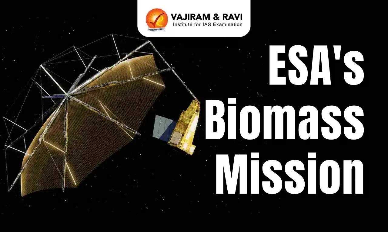
- The European Space Agency (ESA) is launching a pioneering mission called the Biomass Mission, scheduled for April 29, 2025.
- The satellite will be launched aboard a Vega C rocket from Korou Spaceport in French Guiana.
- It will be placed in a sun-synchronous orbit at an altitude of approximately 666 km, ensuring the satellite observes the Earth under consistent lighting conditions.
Objective and Significance
- The Biomass Mission aims to generate the first-ever global measurements of forest biomass, providing data that is currently severely lacking at a planetary scale.
- The mission seeks to map the world’s forests and understand how they are changing over time, contributing to the study of the global carbon cycle.
- Forests are a vital component of the carbon cycle, acting as carbon sinks. They currently store 861 gigatonnes of carbon in vegetation and soils and absorb around 16 billion metric tonnes of CO₂ annually.
- By tracking changes in forest carbon content, the mission will improve our understanding of carbon emissions, deforestation, and climate change.
- The mission responds to urgent concerns: in 2023 alone, the planet lost 3.7 million hectares of tropical forests—equivalent to losing 10 football fields of forest per minute, contributing to about 6% of global CO₂ emissions.
Key Technologies Used
- The satellite is equipped with a 12-meter antenna and utilizes Synthetic Aperture Radar (SAR) to map the Earth’s surface.
- Notably, it is the first satellite in space to use a P-band SAR, which is a long-wavelength radar system capable of penetrating dense forest canopies.
- This advanced technology allows measurement of carbon stored both in the canopy and on the forest floor, offering insights into how much biomass and hence, carbon is present.
- Since longer wavelengths penetrate more deeply than shorter ones, the P-band SAR is uniquely suited for generating 3D images of forests, from the canopy down to the tree roots.
ESA’s Biomass Mission FAQs
Q1. What is ESA’s Biomass Mission?
Ans. It is the Earth Explorer satellite mission to map global forest biomass using a P-band radar, aiding carbon cycle studies and climate change mitigation.
Q2. How does Biomass support climate action?
Ans. By measuring forest carbon stocks, it provides data for REDD+ (Reducing Emissions from Deforestation) initiatives and monitors illegal logging.
Q3. What makes Biomass’s technology unique?
Ans. Its P-band radar penetrates dense canopies to measure tree height/biomass, overcoming limitations of optical sensors in cloudy regions.


Source: IE
Last updated on June, 2025
→ UPSC Notification 2025 was released on 22nd January 2025.
→ UPSC Prelims Result 2025 is out now for the CSE held on 25 May 2025.
→ UPSC Prelims Question Paper 2025 and Unofficial Prelims Answer Key 2025 are available now.
→ UPSC Calendar 2026 is released on 15th May, 2025.
→ The UPSC Vacancy 2025 were released 1129, out of which 979 were for UPSC CSE and remaining 150 are for UPSC IFoS.
→ UPSC Mains 2025 will be conducted on 22nd August 2025.
→ UPSC Prelims 2026 will be conducted on 24th May, 2026 & UPSC Mains 2026 will be conducted on 21st August 2026.
→ The UPSC Selection Process is of 3 stages-Prelims, Mains and Interview.
→ UPSC Result 2024 is released with latest UPSC Marksheet 2024. Check Now!
→ UPSC Toppers List 2024 is released now. Shakti Dubey is UPSC AIR 1 2024 Topper.
→ Also check Best IAS Coaching in Delhi