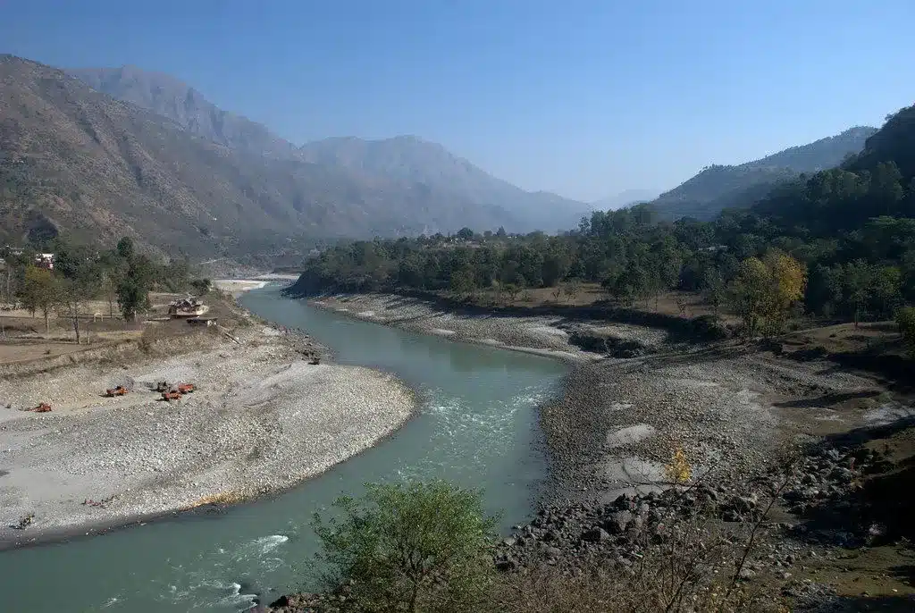
About Sutlej River:
- It is the longest of the five tributaries of the Indus River.
- It is also known as “Satadree”.
- The Sutlej River is primarily located to the north of the Vindhya Range, east of the Pakistani Central Makran Range, and south of the Hindu Kush region.
- Course:
- Origin: It rises on the north slope of the Himalayas in Lake Rakshastal in southwestern Tibet at an elevation above 15,000 feet (4,600 metres).
- It is one of only three Trans Himalayan rivers originating in the high Tibetan Plateau that cuts across the mighty Himalayan ranges. The other two are the Indus and the Brahmaputra.
- The Sutlej enters India by flowing west and south-westwards through the Shipki La Pass in Himachal Pradesh at an altitude of 6,608 metres.
- The river then flows through Punjab near Nangal before meeting the Beas River. The merger of these two rivers goes on to form 105 Km of the India-Pakistan border.
- The river continues to flow for another 350 Km before joining the Chenab River.
- The combination of the Sutlej and Chenab Rivers forms the Panjnad, which finally flows into the Indus River.
- Length: It has a total length of 1550 km, out of which 529 km is in Pakistan.
- The hydrology of the Sutlej is controlled by spring and summer snowmelt in the Himalayas and by the South Asian monsoon.
- Tributaries: It has many tributaries, with Baspa, Spiti, Nogli Khad, and Soan River being its main ones.
- Water from the Sutlej River has been allocated to India according to the Indus Waters Treaty of 1960.
- There are several major hydroelectric projects on the Sutlej, including the 1,000 MW Bhakra Dam, the 1,000 MW Karcham Wangtoo Hydroelectric Plant, and the 1,530 MW Nathpa Jhakri Dam.
Q1: What is the Indus Waters Treaty of 1960?
Indus Waters Treaty is a treaty signed between India and Pakistan regulating the use and distribution of the Indus River system. It was signed by then-Prime Minister Jawaharlal Nehru and former Pakistan President Ayub Khan in 1960. The treaty was brokered by the World Bank, which too is a signatory to the treaty. The pact sought to divide the water of the Indus River and its tributaries (Sutlej, Beas, Ravi, Jhelum, and Chenab) equitably among the two countries. Under the treaty, water from three eastern rivers, Beas, Ravi, and Sutlej, was allocated to India, and water from the three western rivers – Chenab, Indus, and Jhelum were allocated to Pakistan.
Last updated on June, 2025
→ UPSC Notification 2025 was released on 22nd January 2025.
→ UPSC Prelims Result 2025 is out now for the CSE held on 25 May 2025.
→ UPSC Prelims Question Paper 2025 and Unofficial Prelims Answer Key 2025 are available now.
→ UPSC Calendar 2026 is released on 15th May, 2025.
→ The UPSC Vacancy 2025 were released 1129, out of which 979 were for UPSC CSE and remaining 150 are for UPSC IFoS.
→ UPSC Mains 2025 will be conducted on 22nd August 2025.
→ UPSC Prelims 2026 will be conducted on 24th May, 2026 & UPSC Mains 2026 will be conducted on 21st August 2026.
→ The UPSC Selection Process is of 3 stages-Prelims, Mains and Interview.
→ UPSC Result 2024 is released with latest UPSC Marksheet 2024. Check Now!
→ UPSC Toppers List 2024 is released now. Shakti Dubey is UPSC AIR 1 2024 Topper.
→ Also check Best IAS Coaching in Delhi


