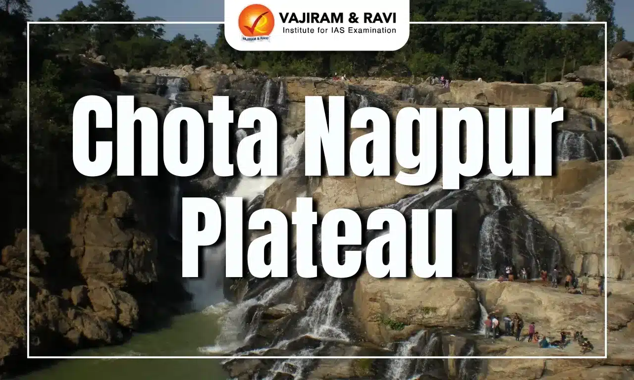
Chota Nagpur Plateau, spanning Jharkhand, Chhattisgarh, Odisha, West Bengal, and Bihar, is rich in mineral resources like coal, iron ore, mica, and bauxite, fueling India’s industrial growth. Key industrial hubs such as Jamshedpur and Bokaro have emerged, driven by its mineral wealth. Chota Nagpur plateau’s rugged terrain also supports agriculture and diverse wildlife, while its tropical forests contribute to the local economy.
Chota Nagpur Plateau
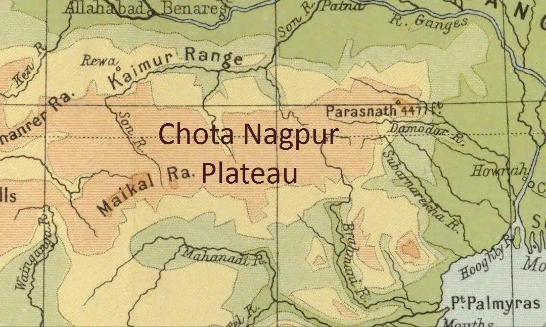
The Chota Nagpur Plateau is a significant geological and cultural region in eastern India. It is predominantly located in the state of Jharkhand, extending into parts of Odisha, West Bengal, Bihar, and Chhattisgarh. Key features of Chota Nagpur Plateau include:
- Area: The plateau spans an area of about 65,000 square kilometres.
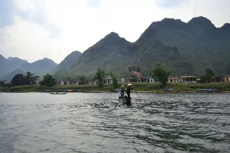
- Terrain and Topography: The region is characterised by rugged terrain, dense forests, hills, valleys, and gneissic formations.
- It features several sub-plateaus, such as the Ranchi Plateau and the Hazaribagh Plateau.
- Erosion has shaped the area into a peneplain, dissected by streams, with isolated peaks adding to its varied landscape.
- Features: It lies between the basins of the Ganges and Son rivers to the north and the Mahanadi River to the south.
- The plateau has an average elevation of 700 meters, with the highest point at Parasnath Hill (1,164 meters).
- Geological Composition: Composed mainly of Precambrian rocks like granite and gneiss, formed over 540 million years ago through tectonic uplift during the Cenozoic era.
- Climate: The plateau experiences a tropical climate with distinct wet and dry seasons, receiving an average annual rainfall of 1,400 millimetres, primarily during the monsoon.
Chota Nagpur Plateau States
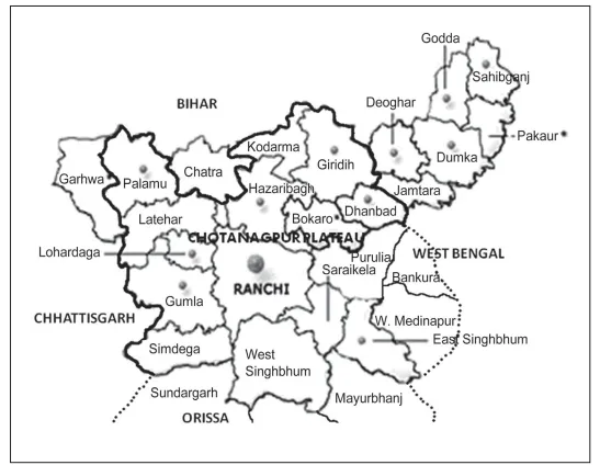
The Chota Nagpur Plateau extends across several states in eastern India, mainly including Jharkhand, Chhattisgarh, Odisha, West Bengal, and Bihar. It collectively refers to the Ranchi, Hazaribagh, and Koderma plateaus.
- Jharkhand: The majority of the plateau is located here, including districts like Ranchi, Hazaribagh, Koderma, Palamu, and Singhbhum.
- Chhattisgarh: The northwestern part of the plateau extends into Chhattisgarh, bordering Jharkhand, with similar geological and mineral characteristics.
- Odisha: Portions of the plateau reach into southern Odisha, particularly in eastern districts bordering Jharkhand.
- West Bengal: The northern edges of the plateau touch Purulia, Bankura, and Medinipur districts, exhibiting similar topographical features to Jharkhand.
- Bihar: The eastern fringes of the plateau influence local geography and ecology in Bihar.
- Geographical context: The Chota Nagpur Plateau lies between the Indo-Gangetic Plain to the north and east, a fertile agricultural region, and the Mahanadi River basin to the south, which plays a crucial role in irrigation and agriculture in the surrounding areas.


Chota Nagpur Plateau Formation
The Chota Nagpur Plateau located in eastern India is primarily found in Jharkhand and is formed mainly of ancient Precambrian rocks, including granite, gneiss, and Dharwar Series metamorphic rocks.
- Geological History: Tied to the Gondwana supercontinent, formed through continental uplift and erosion.
- Three Distinct Steps: The highest step (910-1,070 meters) in the west, intermediate step (around 610 meters), and lowest step (about 300 meters) in the east.
- Stratigraphy: Composed of Archaean granite and gneiss, overlaid by Tertiary deposits and Quaternary alluvium, shaped by ancient climatic conditions.
Chota Nagpur Plateau Tribal Communities
The Chota Nagpur Plateau is home to diverse tribal communities like the Santhal, Munda, Oraon, Ho, and Gond, known for their unique traditions, festivals, and languages like Santali and Mundari, alongside rich cultural and mineral wealth.
- Santhal: Among the largest tribal groups in India, the Santhals are known for their vibrant culture, traditional dances, and festivals.
- Munda: The Mundas, with their distinct social structure, celebrate festivals like Karam, dedicated to the fertility symbolized by the Karam tree.
- Oraon: The Oraons, primarily agriculturists, have a strong connection to forests and express their culture through music and dance, especially during harvest festivals.
- Ho: Found mainly in Jharkhand’s Singhbhum district, the Ho community is known for its unique customs, rituals, and native language.
- Gond: Traditionally forest dwellers, the Gonds practice shifting cultivation and are spread across various parts of the plateau and neighbouring states.
- Other Tribes: Smaller tribes like Bhuiya, Binjhia, and Bhogta add to the region’s cultural diversity with their distinct traditions and spiritual practices.
- Languages: Santali, spoken by the Santhal tribe, Mundari, used by the Munda tribe, Oraon, the language of the Oraon community, and Nagpuri, common among various Sadan communities.
Chota Nagpur Plateau Rivers
The Chota Nagpur Plateau is traversed by several significant rivers that are essential for agriculture, ecology, and hydroelectric power. These rivers primarily flow through the states of Jharkhand, Odisha, and West Bengal.
- Damodar River: Known as the "Sorrow of Bengal" due to frequent floods, it originates in the plateau and is a vital water source for irrigation and industries.
- Subarnarekha River: It rises near Ranchi and flows through Jharkhand, West Bengal, and Odisha before emptying into the Bay of Bengal.
- Koel River: Originating in Jharkhand, it merges with the Son River, contributing to the Ganges basin.
- Barakar River: A tributary of the Damodar, it plays a significant role in the plateau's water system.
- Brahmani River: Formed by the confluence of the Sankh and South Koel rivers, it flows through Odisha.
- North Koel River: It originates near Palamu and joins the Son River, feeding the agricultural lands in the area.
Chota Nagpur Plateau Minerals
The Chota Nagpur Plateau, known for its rich mineral resources, is primarily located in Jharkhand and stretches into parts of Chhattisgarh, Odisha, West Bengal, and Bihar. Key resources include coal, iron ore, mica, bauxite, chromite, asbestos, and kyanite, supporting India's steel, aluminium, and other industries.
- Coal: The Damodar Valley in the Chota Nagpur Plateau is one of India’s richest coal-bearing regions. It primarily produces bituminous coal, ideal for both thermal and metallurgical uses.
- Iron Ore: The plateau hosts abundant deposits of hematite and magnetite, which are vital for steel production. This mineral wealth has enabled the establishment of major steel industries like Tata Steel in Jamshedpur, one of India’s pioneering integrated steel plants.
- Mica: Hazaribagh, situated within the plateau, is a global hub for mica mining, supplying material for cosmetics, electrical insulators, and construction.
- Bauxite: The region significantly contributes to India’s aluminium production, with substantial bauxite deposits.
- Chromite: Chromite, essential for ferrochrome production, supports the manufacturing of stainless steel. Its availability meets the growing industrial demand for stainless steel in various sectors.
- Asbestos: Asbestos deposits are found in significant quantities and are utilized in construction materials, although their use is controversial due to associated health risks.
- Kyanite: Kyanite, present in smaller quantities within the plateau, is valuable for ceramics and refractory applications, adding to the region’s mineral diversity.
Chota Nagpur Plateau Significance
The significance of the Chota Nagpur Plateau lies in its rich mineral resources, key industrial hubs, and agricultural support. Its forests, cultural heritage, and strategic connectivity further enhance its economic and historical importance.
-
- Mineral Wealth: Known as India’s "mineral heartland," the plateau is rich in coal, iron ore, mica, bauxite, and copper, supporting energy production and fueling the nation’s industrial sector.
- Major coalfields like Jharia and Bokaro are located here.
- Industrial Growth: The abundant mineral resources have catalyzed industrial development, with prominent hubs such as Jamshedpur (Tata Steel) and Bokaro (steel plant) emerging as key contributors to India's economy.
- Agriculture: Despite a rocky terrain, the plateau sustains agriculture with crops like rice, maize, and pulses, providing livelihoods for local communities.
- Mineral Wealth: Known as India’s "mineral heartland," the plateau is rich in coal, iron ore, mica, bauxite, and copper, supporting energy production and fueling the nation’s industrial sector.
- Biodiversity: The plateau's tropical deciduous forests support diverse wildlife, including elephants, leopards, and valuable resources like tussah silk and lac, which are vital for the local economy.
- Historical Legacy: The plateau has been a cradle of resistance against colonial rule, with movements like the Birsa Munda uprising highlighting its role in India’s independence struggle.
Transportation Links: Strategically located railroads connect major cities like Kolkata, Patna, and Ranchi, facilitating trade, industrial supply chains, and regional mobility.
![]() Last updated on March, 2026
Last updated on March, 2026
→ UPSC Final Result 2025 is now out.
→ UPSC has released UPSC Toppers List 2025 with the Civil Services final result on its official website.
→ Anuj Agnihotri secured AIR 1 in the UPSC Civil Services Examination 2025.
→ UPSC Marksheet 2025 is now out.
→ UPSC Notification 2026 & UPSC IFoS Notification 2026 is now out on the official website at upsconline.nic.in.
→ UPSC Calendar 2026 has been released.
→ Check out the latest UPSC Syllabus 2026 here.
→ UPSC Prelims 2026 will be conducted on 24th May, 2026 & UPSC Mains 2026 will be conducted on 21st August 2026.
→ The UPSC Selection Process is of 3 stages-Prelims, Mains and Interview.
→ Prepare effectively with Vajiram & Ravi’s UPSC Prelims Test Series 2026 featuring full-length mock tests, detailed solutions, and performance analysis.
→ Enroll in Vajiram & Ravi’s UPSC Mains Test Series 2026 for structured answer writing practice, expert evaluation, and exam-oriented feedback.
→ Join Vajiram & Ravi’s Best UPSC Mentorship Program for personalized guidance, strategy planning, and one-to-one support from experienced mentors.
→ Shakti Dubey secures AIR 1 in UPSC CSE Exam 2024.
→ Also check Best UPSC Coaching in India
Chota Nagpur Plateau FAQs
Q1. Which three states are covered by Chota Nagpur Plateau?+
Q2. Which river rises from Chota Nagpur Plateau?+
Q3. What is the highest peak of Chota Nagpur Plateau?+
Q4. Which soil is found abundantly in Chota Nagpur Plateau?+
Q5. Which type of rock is found in Chota Nagpur Plateau?+
Tags: chota nagpur plateau quest UPSC Geography Notes