UPSC Daily Quiz 25 November 2025

UPSC Daily Quiz

The Daily UPSC Quiz by Vajiram & Ravi is a thoughtfully curated initiative designed to support UPSC aspirants in strengthening their current affairs knowledge and core conceptual understanding. Aligned with the UPSC Syllabus 2025, this daily quiz serves as a revision resource, helping candidates assess their preparation, revise key topics, and stay updated with relevant issues. Whether you are preparing for Prelims or sharpening your revision for Mains, consistent practice with these Daily UPSC Quiz can significantly enhance accuracy, speed, and confidence in solving exam-level questions.

[WpProQuiz 31]

UPSC Daily Quiz FAQs

Q1: What is the Daily UPSC Quiz?

Ans: The Daily UPSC Quiz is a set of practice questions based on current affairs, static subjects, and PYQs that help aspirants enhance retention and test conceptual clarity regularly.

Q2: How is the Daily Quiz useful for UPSC preparation?

Ans: Daily quizzes support learning, help in revision, improve time management, and boost accuracy for both UPSC Prelims and Mains through consistent practice.

Q3: Are the quiz questions based on the UPSC syllabus?

Ans: Yes, all questions are aligned with the UPSC Syllabus 2025, covering key areas like Polity, Economy, Environment, History, Geography, and Current Affairs.

Q4: Are solutions and explanations provided with the quiz?

Ans: Yes, each quiz includes detailed explanations and source references to enhance conceptual understanding and enable self-assessment.

Q5: Is the Daily UPSC Quiz suitable for both Prelims and Mains?

Ans: Primarily focused on Prelims (MCQ format), but it also indirectly helps in Mains by strengthening subject knowledge and factual clarity.

List of 7 Continents and 5 Oceans, Check Important Details

7 Continents and 5 Oceans

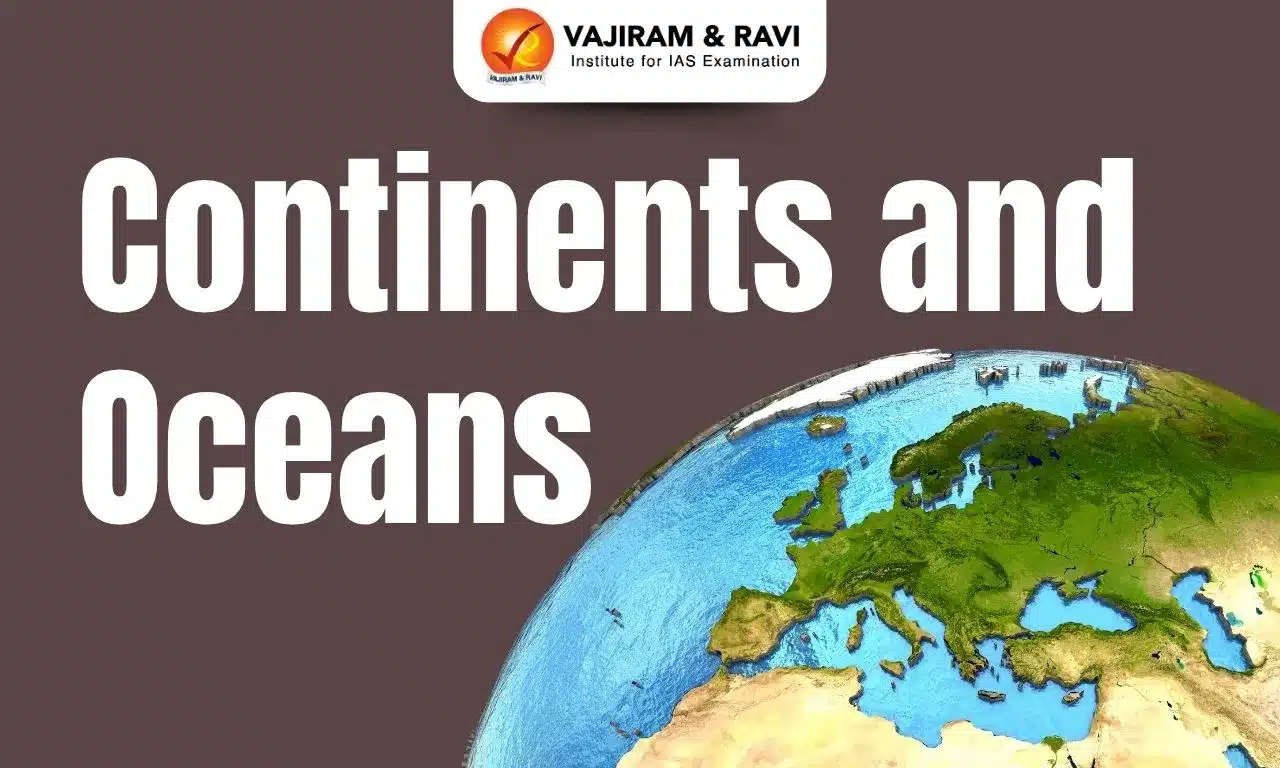
Earth stands as the only known planet in the universe with a distinct combination of land and water. In the late Paleozoic and early Mesozoic eras, the supercontinent Pangea existed, surrounded by the ocean Panthalassa. Over time, Pangea began to break apart due to the movement of tectonic plates which led to the formation of the continents and made up about 29% of the Earth's surface. The vast oceans, which cover approximately 71% of the Earth's surface, are the world's largest water bodies. This article will explore the facts about the 7 Continents and 5 Oceans that make up our planet.

7 Continents and 5 Oceans

The Earth consists of 7 Continents and 5 Oceans. The continents include Asia, Africa, North America, South America, Antarctica, Europe, and Australia. Meanwhile, the oceans cover the globe with the Pacific, Atlantic, Indian, Southern (also known as Antarctic), and Arctic. Each of these landmasses and bodies of water is crucial in influencing the planet's physical features, weather patterns, and ecological systems.

List of 7 Continents

According to the Continental Drift Theory, the movement of tectonic plates resulted in the formation of 7 Continents of the world from which Asia being the largest one, in term of area as well as population and Antarctica being the smallest one in terms of population and Oceania/ Australia being the smallest one in terms of area. Check out the List of 7 Continents in the table below and the fantastic facts of each continent further the table.

List of 7 Continents

Name of Continent

Area (Km²)

Population (2022)

Countries

Asia 

44,579,000

4,723,918,410

48

Africa

30,370,000

1,408,085,198

54

Europe

10,180,000

748,593,065

44

North America

24,709,000

373,640,153

23

South America

17,840,000

438,234,538

12

Oceania/ Australia

8,486,460

43,826,590

14

Antarctica

14,200,000

1000-5000 (Seasonal)

0

Asia

Asia is the largest continent by both size and population, covering about 30% of the Earth's land area. It has 48 UN-recognized countries, though other territories and islands are included. Key nations like Russia, the largest by area, China, the most populous, and India, the largest democracy, are found here. Russia spans both Asia and Europe, forming the region known as Eurasia.

Also Read: Asian Countries

Asia

Area (sq km)

44,579,000

Population (approx.)

4.64 billion

Countries

49

Highest Point

Mount Everest (Nepal/China)

Longest River

Yangtze River (6,300 km)

Largest Lake

Caspian Sea

Largest City

Tokyo, Japan

Dominant Language(s)

Mandarin, Hindi, Arabic

Main Biomes

Taiga, Gobi Desert, Himalayas, Rainforests

Economic Activities

Agriculture, manufacturing, technology

Africa

Africa is the second-largest continent by both land area and population. It acquires approximately 20% of the Earth's total landmass, with most of its territory situated in the Eastern Hemisphere. The continent is home to 54 countries, the most of any in the world. The Sahara Desert is the world’s largest desert, and the Nile is the longest river. The continent also hosts some of the hottest regions, including Ethiopia. Due to its location along the Equator, Africa experiences direct sunlight year-round. The largest country in Africa by area is Algeria, while Nigeria holds the title for the most populous country. Seychelles is the smallest country on the continent.

Africa

Area (sq km)

30,370,000

Population (approx.)

1.34 billion

Countries

54

Highest Point

Mount Kilimanjaro (Tanzania)

Longest River

Nile River (6,650 km)

Largest Lake

Lake Victoria

Largest City

Lagos, Nigeria

Dominant Language(s)

Arabic, French, English

Main Biomes

Sahara Desert, Congo Rainforest, Savannah

Economic Activities

Agriculture, mining, tourism, oil and gas

Europe

Europe is the third largest continent in terms of the population and sixth in terms of the land area. It is bordered by the Arctic Ocean, Mediterranean Sea, Asia, and the Atlantic Ocean, with most of its land in the Eastern Hemisphere. Europe has no deserts. Historically, it was the centre of global power and the site of both world wars. Home to 44 countries, primarily Christian, it includes the smallest country, Vatican City. Major cities like London and Paris are renowned worldwide, and 27 nations form the European Union, using the common currency, the Euro.

Also Read: European Countries

Europe

Area (sq km)

10,180,000

Population (approx.)

747 million

Countries

50

Highest Point

Mount Elbrus (Russia)

Longest River

Volga River (3,690 km)

Largest Lake

Lake Ladoga

Largest City

Istanbul, Turkey

Dominant Language(s)

Russian, German, French

Main Biomes

Mediterranean Forests, Taiga, Grasslands

Economic Activities

Manufacturing, tourism, finance, agriculture

Northern America

North America is the third-largest continent by area and ranks fifth in terms of population among the continents. Located primarily in the western hemisphere, it spans across five distinct time zones. The continent is home to 23 countries, with the United States of America (USA) hosting the world's largest economy. One of its natural wonders, Lake Superior, borders both the USA and Canada, making it the largest of the Great Lakes.

Northern America

Area (sq km)

24,709,000

Population (approx.)

597 million

Countries

23

Highest Point

Denali/Mount McKinley (USA)

Longest River

Mississippi River (6,275 km)

Largest Lake

Lake Superior

Largest City

Mexico City, Mexico

Dominant Language(s)

English, Spanish, French

Main Biomes

Temperate Deciduous Forests, Prairie, Tundra

Economic Activities

Agriculture, manufacturing, technology

Southern America

South America holds the fourth position in both size and population among the continents worldwide. Situated in the western hemisphere, it is connected to North America by the narrow Isthmus of Panama. The continent is home to two of the world's tallest volcanoes, Mount Chimborazo and Mount Cotopaxi. Brazil, the largest country in South America by land area, is renowned for its coffee production, leading the globe as the top coffee exporter. In addition to its 12 countries, South America is known for its diverse wildlife, including the massive Anaconda, the world's largest snake species.

Southern America

Area

Approximately 17,840,000 square kilometers

Population

Around 430 million (as of 2022)

Countries

12 sovereign countries including Brazil, Argentina, Peru

Highest Point

Mount Aconcagua in Argentina (6,960 meters above sea level)

Longest River

Amazon River (Approximately 7,062 kilometers)

Largest City

São Paulo, Brazil (Population over 12 million)

Major Landmarks

Machu Picchu (Peru), Christ the Redeemer (Brazil)

Dominant Language

Spanish and Portuguese (with indigenous languages)

Main Biomes

Amazon Rainforest, Andes Mountains, Atacama Desert

Economic Activities

Agriculture, mining, tourism, oil and gas

Australia/ Oceania

Australia is ranked at the sixth position in terms or land area as well as in terms of population, Located primarily in the Eastern Hemisphere, Oceania is often referred to as the "Island Continent" due to many islands, with the Great Barrier Reef being a prominent feature as the largest coral reef system on Earth. According to United Nations data, Oceania is home to approximately 14 sovereign nations, including Australia, New Zealand, and Papua New Guinea. Australia, the largest country in Oceania, is also the world's sixth-largest country by land area. Due to its position in the Southern Hemisphere, Oceania is sometimes called the "Land Down Under."

Australia/ Oceania

Area

Approximately 8.6 million square kilometers

Population

Around 40 million

Countries

Consists of a single country: Australia

Highest Point

Mount Kosciuszko (2,228 meters)

Longest River

Murray-Darling River (2,508 kilometers)

Largest Lake

Lake Eyre (when filled, covering 9,500 square kilometers)

Largest City

Sydney, Australia

Dominant Language(s)

English

Main Biomes

Outback, Rainforests, Great Barrier Reef

Economic Activities

Mining, agriculture, tourism, manufacturing

Antarctica

Antarctica, the fifth-largest continent, is the smallest in population and is located at the Earth's southernmost point, housing the South Pole. It is larger than Oceania and is primarily covered by polar deserts. The continent contains 75% of the world’s freshwater in glaciers. The Antarctic Treaty 1959, signed by 52 nations, ensures peaceful management by banning activities such as nuclear waste disposal, nuclear testing, and mining. These regulations help preserve its unique and delicate environment, making it one of the most protected regions on Earth.

Antarctica

Area (sq km)

14,000,000

Population (approx.)

Minimal (Research)

Countries

None (Treaty System)

Highest Point

Vinson Massif (Antarctica)

Longest River

None (Glacial Ice)

Largest Lake

Lake Vostok

Largest City

McMurdo Station, Antarctica

Dominant Language(s)

Various

Main Biomes

Ice Sheets, Tundra, Mountains

Economic Activities

Research, exploration, fishing

List of 5 Oceans

The total area of 71% of the Earth is covered with water from which 96% is salty and not ideal for drinking. Originally, the Panthalassa covered much of the Earth’s surface. However, after the breakdown of Pangea, the landmasses were separated, causing the formation of this large water body. As of now, Earth is home to five major oceans. The Pacific Ocean holds the title as the largest and deepest of these, while the Arctic Ocean is the smallest and shallowest. Below is a table having the names and key characteristics of the five oceans of the world, along with the fantastic facts about each of the oceans.

List of 5 Oceans

Names of Ocean

Area (Km²)

Share to Earth’s Water Surface Area (In %)

Pacific Ocean

165,200,000

>40%

Atlantic Ocean

106,400,000

>22%

Indian Ocean

73,556,000

20%

Antarctic/ Southern Ocean

20,327,000

15-16%

Arctic Ocean

13,986,000

3-4%

Pacific Ocean

The Pacific Ocean holds the title of being the largest ocean on Earth, surpassing all others in size. Its vast expanse covers more surface area than all the landmasses combined. Stretching from the western shores of the Americas to the eastern coasts of Asia and Oceania, it is bordered by the Arctic Ocean to the north and the Southern Ocean to the south. Interestingly, the Pacific is home to the Mariana Trench, which contains the deepest point on Earth, the Challenger Deep. The name "Pacific" was named upon this great body of water by the Portuguese explorer Ferdinand Magellan, reflecting its calm nature at the time of his discovery.

Pacific Ocean

Characteristic

Description

Area

Approximately 168 million square kilometers

Average Depth

Around 4,280 meters

Deepest Point

Mariana Trench (Challenger Deep), about 10,994 meters

Location

Bounded by Asia and Australia to the west, the Americas to the east, the Arctic Ocean to the north, and the Southern Ocean to the south

Major Currents

North Pacific Gyre, South Pacific Gyre, Kuroshio Current, California Current, Humboldt Current, and the Equatorial Currents

Climate Influence

Significant impact on global climate patterns, including El Niño and La Niña phenomena

Marine Biodiversity

Home to a diverse range of marine life, including coral reefs, fish, mammals, and numerous other species

Atlantic Ocean

The Atlantic Ocean ranks as the second-largest ocean in the world. It spans the distance between the eastern coast of the Americas and the western coast of Europe and Africa. In addition to its main body, it encompasses significant bodies of water such as the Mediterranean Sea, the Gulf of Mexico, and the Caribbean Sea. Like the Pacific, the Atlantic also borders the Arctic and Southern Oceans. Known for its role in global trade, especially the spice trade, the Atlantic was a key route for early European explorers, such as Vasco da Gama, during the Age of Exploration.

Atlantic Ocean

Area

Approximately 85 million square kilometers

Average Depth

Around 3,646 meters

Deepest Point

Puerto Rico Trench (Milwaukee Deep), about 8,376 meters

Location

Bounded by the Americas to the west, Europe and Africa to the east, the Arctic Ocean to the north, and the Southern Ocean to the south

Major Currents

Gulf Stream, North Atlantic Drift, Canary Current, Brazil Current, Benguela Current, and the South Equatorial Current

Climate Influence

Influences weather patterns, including the Atlantic Meridional Overturning Circulation (AMOC) and the North Atlantic Oscillation (NAO)

Marine Biodiversity

Home to diverse marine life including fish, whales, dolphins, and important breeding grounds for many species

Economic Importance

Crucial for international shipping routes, fishing industries, and natural resources such as oil and gas

Islands

Includes islands and archipelagos such as the Caribbean islands, the Azores, Canary Islands, Cape Verde, and the British Isles

Indian Ocean

The Indian Ocean occupies third place in terms of size among the world's oceans. It stretches between the eastern coastline of Africa, the southern tip of the Indian subcontinent, and the western edges of Oceania. This ocean is also significant for including the Middle Eastern coastlines. Rich in biodiversity, it is home to unique species of plants and animals. Under the United Nations Convention on the Law of the Sea (UNCLOS), India has the exclusive rights to explore the polymetallic nodules in its waters.

Indian Ocean

Characteristic

Description

Area

Approximately 70 million square kilometers

Average Depth

Around 3,741 meters

Deepest Point

Java Trench (Sunda Trench), about 7,258 meters

Location

Bounded by Africa to the west, Asia to the north, Australia to the east, and the Southern Ocean to the south

Major Currents

Indian Monsoon Current, Agulhas Current, Somali Current, and the South Equatorial Current

Climate Influence

Influences the monsoon weather patterns, critical for agriculture in surrounding regions

Marine Biodiversity

Rich in marine life including coral reefs, diverse fish species, marine mammals, and unique ecosystems

Economic Importance

Key shipping routes connecting the Middle East, Africa, and East Asia, with significant oil and gas resources and fisheries

Islands

Includes islands and archipelagos such as Madagascar, the Maldives, Seychelles, Sri Lanka, and the Andaman and Nicobar Islands

Antarctic (Southern) Ocean

Known as the Southern Ocean or Antarctic Ocean, this body of water is the fourth largest, and also considered as the second smallest ocean. It surrounds Antarctica and stretches into the Southern Hemisphere, linking with the Atlantic, Indian, and Pacific Oceans. The Southern Ocean was officially recognized in the early 21st century by the International Hydrographic Organization. Characterised by its cold waters and strong easterly currents, it is often regarded as the most frigid of all the oceans.

Antarctic Ocean (Southern Ocean)

Area

Approximately 20 million square kilometers

Average Depth

Around 3,000 to 4,000 meters

Deepest Point

Unknown

Location

Surrounds Antarctica

Major Currents

Antarctic Circumpolar Current

Climate Influence

Plays a significant role in global climate regulation and oceanic circulation

Marine Biodiversity

Supports diverse marine life adapted to extreme cold, including fish, seals, and whales

Arctic Ocean

The Arctic Ocean is the smallest and shallowest of the world's five oceans. Located within the Arctic Circle, it borders the northern parts of Europe, Asia, and North America, including regions like the Bay of Hudson. In the past, explorers have searched for a passage across this ocean to reach trade routes to Asia, seeking goods like spices, silk, and opium. 

Arctic Ocean

Area

Approximately 14 million square kilometers

Average Depth

Around 1,200 meters

Deepest Point

Fram Strait (around 5,450 meters)

Location

Centered around the North Pole

Major Currents

Transpolar Drift, Beaufort Gyre, East Greenland Current

Climate Influence

Plays a crucial role in regulating global climate, especially affecting polar regions

Marine Biodiversity

Supports unique marine life adapted to cold conditions, including polar bears and seals

Continents and Oceans FAQs

Q1: What are the 5 oceans in the world?

Ans: The 5 oceans are the Pacific, Atlantic, Indian, Antarctic/ Southern, Arctic Ocean.

Q2: Which is the largest ocean in the world?

Ans: The largest and deepest ocean in the world is the Pacific Ocean.

Q3: What are the 7 continents in the world?

Ans: The 7 continents in the world are Asia, Africa, Europe, North America, South America, Oceania/ Australia, and Antarctica.

Q4: How many continents were created by the theory of continental drift?

Ans: A total of seven continents were created as per the Continental Drift Theory

International Day for the Elimination of Violence Against Women

International Day for the Elimination of Violence Against Women

The International Day for the Elimination of Violence Against Women, observed on 25 November every year serves as a powerful reminder of the global fight to end gender-based violence. Recognised by the United Nations General Assembly in 2000, the day marks the beginning of the 16 Days of Activism (Nov 25-Dec 10). In 2025, the global theme is “UNiTE to End Digital Violence Against All Women and Girls.” For UPSC aspirants, this topic is important for GS-1 (Society), GS-2 (Governance), GS-3 (Cyber Security), and Essay.

International Day for the Elimination of Violence Against Women

Violence against women remains one of the most pervasive human-rights violations globally. India, with its vast population and diverse socio-cultural landscape, has made continuous efforts to strengthen laws, institutions, and digital safety frameworks. The increasing rise of cyberbullying, deepfakes, doxxing, cyberstalking, and online hate campaigns has broadened the challenge, making the focus on digital safety more urgent. Against this backdrop, the observance of November 25 highlights India’s commitment to creating a safer physical and digital environment for women and girls.

International Day for the Elimination of Violence Against Women Theme

The theme for the International Day for the Elimination of Violence Against Women 2025 is “UNiTE to End Digital Violence Against All Women and Girls.” It highlights the growing threat of online abuse, including cyberstalking, deepfakes, doxxing, and digital harassment. The theme urges governments, tech platforms, and communities to strengthen digital safety, promote accountability, and create secure online spaces for women and girls.

International Day for the Elimination of Violence Against Women History

The International Day for the Elimination of Violence Against Women was officially designated by the United Nations General Assembly in 2000 to raise global awareness about gender-based violence. The date, 25 November, commemorates the assassination of the Mirabal sisters in 1960, who were activists opposing dictatorship in the Dominican Republic.

  • Declared by the UN General Assembly in 2000 through Resolution 54/134.
  • 25 November chosen to honour the Mirabal sisters, symbols of resistance against oppression.
  • Marks the start of the 16 Days of Activism (Nov 25–Dec 10).
  • Aims to mobilise governments, organisations, and citizens to end gender-based violence globally.

India’s Multi-Layered Approach to Ending Violence Against Women

India adopts a multi-layered approach that combines strong legal protections, institutional mechanisms, technology-driven systems, and comprehensive support services for women. This integrated framework focuses on prevention, timely response, survivor support, and long-term empowerment.

  • Robust legal reforms including Bharatiya Nyaya Sanhita 2023, PWDVA 2005, and POSH Act 2013.
  • Institutional mechanisms like NCW, State Commissions for Women, Fast Track Special Courts, and Women Help Desks.
  • Supportive schemes under Mission Shakti, including One Stop Centres, Swadhar Greh, and Women Helpline (181).
  • Technology-driven tools such as SHe-Box, ITSSO, Cri-MAC, NDSO, and Digital Shakti Campaign for safer digital environments.
  • Integrated emergency systems like ERSS (112) and specialised training programs like Stree Manoraksha for psychosocial support.

Legal Framework to Protect Women in India

India has strengthened its legal architecture with comprehensive laws addressing domestic violence, sexual harassment, cyber harms, and crimes against women and children. These reforms ensure speedy justice, survivor-friendly procedures, and stricter punishments. The introduction of the Bharatiya Nyaya Sanhita (BNS), 2023 marks a major shift in criminal law, with enhanced penalties and technology-enabled processes.

National Commission for Women (NCW)

The National Commission for Women, established on 31 January 1992, is the apex statutory body mandated to protect women’s constitutional and legal rights. It monitors safeguards, suggests law reforms, and addresses complaints online and offline. State Commissions for Women perform parallel roles at the local level. NCW also operates helpline 7827170170 providing 24×7 online support through IVR-based systems for psychological counselling, legal support, and emergency assistance.

Bharatiya Nyaya Sanhita, 2023

Effective from 1 July 2024, BNS replaces the Indian Penal Code (IPC) and introduces stronger provisions for crimes against women. It expands definitions of sexual offences, mandates audio-video recording of victim statements, and ensures that cases involving women and children receive priority in trial proceedings.

  • Life imprisonment for rape of minors under 18.
  • Time-bound trials and improved evidence collection.
  • Wider definitions of sexual assault and exploitation.
  • Survivor-friendly procedures including digital recording.

Protection of Women from Domestic Violence Act, 2005 (PWDVA)

PWDVA legally recognises domestic violence in all forms: physical, sexual, emotional, and economic. It defines an aggrieved person as any woman in a domestic relationship and ensures protection orders, residence rights, and compensation. This Act enables women to seek relief even through Protection Officers and service providers, ensuring a comprehensive support ecosystem.

Sexual Harassment of Women at Workplace Act, 2013 (POSH Act)

The POSH Act provides a robust legal framework to protect women across all workplaces: public, private, organised, and unorganised. It mandates the establishment of Internal Committees (ICs) in workplaces with more than 10 employees and Local Committees (LCs) for smaller establishments. The Ministry of Women and Child Development oversees implementation.

  • Mandatory ICs and LCs for grievance redressal
  • Completion of inquiries within 90 days
  • Accountability mechanisms for employers
  • Access to SHe-Box portal for online complaints

Digital Shakti Campaign

The NCW’s Digital Shakti Campaign aims to make women digitally skilled, aware, and empowered to combat online crimes. It trains women across India in identifying and responding to cyber threats, enhancing their ability to report and safeguard themselves online.

  • Cyber safety training
  • Awareness on digital rights
  • Reporting mechanisms for cybercrimes
  • Data privacy and protection awareness

Institutional Mechanisms for Fast and Survivor-Friendly Justice

India has invested in specialised institutions to speed up justice delivery and improve survivor experience.

  1. Fast Track Special Courts (FTSCs): As of August 2025, 773 FTSCs, including 400 e-POCSO courts, are functional. These courts have disposed over 3.34 lakh cases relating to rape and POCSO.
  2. Women Help Desks (WHDs): As of February 2025, 14,658 WHDs operate in police stations, facilitating easier reporting and improving sensitivity in investigations.
  3. SHe-Box Portal: A unified digital platform that routes workplace harassment complaints to relevant Internal/Local Committees. It offers real-time tracking, data monitoring, and improved accountability.

Technology-Driven Reforms for Women’s Safety

The Government has introduced several digital tools to track offenders, strengthen policing, and enhance coordination between states.

  • Investigation Tracking System for Sexual Offences (ITSSO): Monitors progress of investigations to ensure timely completion.
  • National Database on Sexual Offenders (NDSO): Tracks convicted offenders and helps police identify repeat offenders.
  • Crime Multi-Agency Centre (Cri-MAC): Facilitates real-time sharing of information on heinous crimes across states.

International Day for the Elimination of Violence Against Women FAQs

Q1: When is the International Day for the Elimination of Violence Against Women observed?

Ans: It is observed every year on 25 November to raise global awareness about gender-based violence and mobilise action to end it.

Q2: Why is 25 November chosen for the observance?

Ans: The date marks the assassination of the Mirabal sisters in 1960, who became symbols of resistance against violence and dictatorship in the Dominican Republic.

Q3: What is the theme for 2025?

Ans: The 2025 theme is “UNiTE to End Digital Violence Against All Women and Girls”, focusing on rising threats like cyberstalking, deepfakes, doxxing, and online harassment.

Q4: Who established this international day?

Ans: The United Nations General Assembly (UNGA) officially designated the day in 2000 through Resolution 54/134.

Q5: What global campaign begins on this day?

Ans: The observance marks the start of the 16 Days of Activism Against Gender-Based Violence, ending on 10 December (Human Rights Day).

Auramine O

Auramine O

Auramine O Latest News

India continues to face recurring episodes of chemical adulteration in food, particularly through the use of non-permitted synthetic dyes and one of the most persistent among them is auramine O.

About Auramine O

  • It is a synthetic yellow dye produced from compounds such as dimethylaniline and formaldehyde.
  • The dye appears as yellow flakes or powder and dissolves easily when mixed with solvents.
  • It is not approved for use as a food colour in India, the European Union, and the United States.
  • Applications of Auramine O: It is extensively used in industry, including textile and leather processing, printing inks, paper manufacturing, and certain microbiological staining procedures.
  • Impacts on Human Health: It creates health risks like liver and kidney damage, enlargement of the spleen, mutagenic effects that can alter genetic material, and potential carcinogenic outcomes.
  • Global context: Regulators in the U.S., EU, and East Asian nations classify auramine as an industrial dye, and its presence in consumables triggers product recalls and import alerts.
    • The International Agency for Research on Cancer (IARC) classifies auramine as a substance that is possibly carcinogenic to humans.

Source: TH

Auramine O FAQs

Q1: What is the chemical nature of Auramine O?

Ans: It is a synthetic organic compound.

Q2: In which products is Auramine O commonly used?

Ans: Textiles and leather products

Postojna Cave

Postojna Cave

Postojna Cave Latest News

Researchers from Poland, the United States, and Slovenia recently worked out exact equations for stalagmite shapes, then checked them on real cave specimens from Postojna Cave in Slovenia.

About Postojna Cave

  • It is located in western Slovenia.
  • It is a 24 km long cave carved out by the Pivka River over millions of years. 
  • It’s made of limestone, and each 1 cm of growth takes around 100 years.
  • The Pivka River enters the Postojna cavern 18 m below its mouth, runs underground, and reappears as a spring in the Planina Plain.
  • The caves were officially discovered in the 1800s (although graffiti in the caves dates back to as early as the 1200s), and have been open as a tourist attraction since 1819.
  • It is the only karst cave with a railway, which was built more than 140 years ago. 
  • The cave system hosts Proteus anguinus — a blind, colorless, snake-like amphibian about 30 cm long, with both lungs and gills, feeding on snails and worms.

Source: EARTH

Postojna Cave FAQs

Q1: Postojna Cave is located in which country?

Ans: Slovenia

Q2: Which river carved out the Postojna Cave over millions of years?

Ans: Pivka River

Q3: What is the approximate length of the Postojna Cave system?

Ans: 24 km

Q4: Postojna Cave is primarily made of which rock type?

Ans: Limestone

Pazhayar River

Pazhayar River

Pazhayar River Latest News

Rampant discharge of sewage and untreated water into the Pazhayar river at several places in Nagercoil has raised serious concerns among residents about the river’s future and measures being taken to curb the pollution.

About Pazhayar River

  • It is a major river flowing in the Kanniyakumari district of Tamil Nadu.
  • Course:
    • It originates from the slopes of Mahendragiri hills at an altitude of 800 m above M.S.L.
    • It flows towards southwestern direction and joins the Arabian Sea near Manakudi. 
  • The total length of the river is 40 km. 
  • Alathurayar, Poigaiyar, Thadaveyar, Koya odai, and Ulakkaruviyar are the major tributaries of the Pazhayar River.
  • Chattupythur dam, Chettothoppu dam, Cholanmkattu dam, Kutty dam, Kumari dam, Mission dam, Pallikondam dam, Pillaipetha dam, Salari dam, Veerapuli dam, and Veeranarayanamangalam are some of the dams constructed in the Pazhayar River.
  • The Manakudi Estuary at its mouth is ecologically sensitive and rich in mangroves, birds, and marine life.

Source: TH

Pazhayar River FAQs

Q1: Pazhayar River flows through which Indian state?

Ans: Tamil Nadu

Q2: Pazhayar River ultimately drains into which water body?

Ans: Arabian Sea

Q3: The Pazhayar River originates from which hill region?

Ans: Mahendragiri Hills

Q4: What is the approximate length of the Pazhayar River?

Ans: 40 km

HAMMER Weapon System

HAMMER Weapon System

HAMMER Weapon System Latest News

Recently, Bharat Electronics Limited and Safran Electronics and Defence (SED) signed a joint venture cooperation agreement for the production of the HAMMER Weapon System in India.

About HAMMER Weapon System

  • The HAMMER (Highly Agile and Manoeuvrable Munition Extended Range) is an air-to-ground precision-guided weapon system developed by Safran, a French aerospace and defence company.
  • It is also known as a glide bomb.

Features of HAMMER Weapon System

  • Range: HAMMER precision-guided munitions have a range of up to 70 km.
  • It can be fitted to standard bombs of 250kg, 500kg, and 1,000kg weights.
  • It is resistant to jamming, and capable of being launched from low altitudes over rough terrain.
  • It is difficult to intercept and can penetrate fortified structures.
  • Design and Capabilities: It is a precision-guided weapon system known for its high accuracy and modular design, making it adaptable for multiple platforms, including the Rafale and Light Combat Aircraft Tejas.

 What is a Precision-Guided Weapon System?

  • It is a guided weapon intended to destroy a point target and minimize collateral damage.
  • These are also known as "smart bombs,"
  • These systems incorporate a guidance system (typically in the front of the precision munition), a payload, and fins.

Source: IE

HAMMER Weapon System FAQs

Q1: What is the range of HAMMER precision-guided munitions?

Ans: Up to 70 km

Q2: Which company developed the HAMMER weapon system?

Ans: Safran, France

Information Security Education and Awareness Project

Information Security Education and Awareness Project

Information Security Education and Awareness Project Latest News

Recently, the Ministry of Electronics and Information Technology (MeitY) launched the Cyber Security Innovation Challenge (CSIC) 1.0 under the Information Security Education and Awareness (ISEA) Project of MeitY.

About Information Security Education and Awareness Project

  • It is an initiative of the Ministry of Electronics and Information Technology (MeitY), Government of India.
  • It was started in 2005 and currently in its third phase since Oct. 2023 onwards.
  • Purpose: Generating human resources in the area of Information Security and creating general awareness on cyber hygiene/cyber security among the masses.
  • Aim: It is aimed at human resources development for safe, trusted, and secure cyber space.

Implementation of Information Security Education and Awareness Project

  • The project is implemented through select 50 institutions in a hub-n-spoke mode, comprising:
    • Premier Academic Institutions i.e. IITs, NITs, IIITs, etc.
    • Autonomous Organizations of MeitY i.e. C-DAC & NIELIT
    • Technical Universities

Key Facts about Cyber Security Innovation Challenge (CSIC) 1.0

  • It is an initiative of the Ministry of Electronics and Information Technology (MeitY)
  • It was launched for students and researchers to work upon real-world cyber challenges.
  • It is strategically designed to foster indigenous, research-driven cyber security solutions from the academic ecosystem.
  • The Innovation Challenge would focus on problem statements across 10 domains;
    • Computer & Network Security; Mobile Device Security; Systems & Software Security; Hardware Security; Security in Futuristic Technologies; Cryptography; Security in Distributed Wireless Networks; Cyber Forensics; Governance, Operations & Services; and Fintech Security. 

Source: PIB

Information Security Education and Awareness Project FAQs

Q1: Which ministry launched the Information Security Education and Awareness Project?

Ans: Ministry of Electronics and Information Technology

Q2: What is the primary objective of the Information Security Education and Awareness Project?

Ans: To enhance cybersecurity awareness among citizens.

Asian and Pacific Centre for Development of Disaster Information Management

Asian and Pacific Centre for Development of Disaster Information Management

Asian and Pacific Centre for Development of Disaster Information Management Latest News

Recently, the 10th Session of the Asian and Pacific Centre for Development of Disaster Information Management (APDIM) on Inclusive Disaster Risk Data Governance was held in New Delhi.

About Asian and Pacific Centre for Development of Disaster Information Management

  • It is a regional institution of the United Nations Economic and Social Commission for Asia and the Pacific (ESCAP). 
  • Vision: To ensure effective disaster risk information is produced and used for sustainable development in Asia and the Pacific
  • Mandate: To reduce human and material losses due to natural hazards and contribute to the effective design, investment and implementation of disaster risk reduction and resilience policies.
  • Governance: It is governed by a Governing Council consisting of eight ESCAP member countries elected for a period of three years (India is one of the members for a period from 2022 to 2025).
  • Headquarter: Tehran, Iran.

Functions of Asian and Pacific Centre for Development of Disaster Information Management

  • Risk Information and Knowledge Repository: It functions as a regional facility to strengthen the science-policy interface.
  • Information Capacity and Application: It facilitates the exchange of expertise, experiences, and knowledge in disaster information management between and within the countries of the region.
  • Regional Cooperation and Coordination for Disaster Risk Information: It promotes effective regional cooperation, facilitates dialogue, 

Source: PIB

Asian and Pacific Centre for Development of Disaster Information Management FAQs

Q1: What is the primary objective of APDIM?

Ans: To enhance disaster risk reduction and management in the region

Q2: Where is the Asian and Pacific Centre for Development of Disaster Information Management (APDIM) headquartered?

Ans: Tehran, Iran

Hayli Gubbi Volcano

Hayli Gubbi Volcano

Hayli Gubbi Volcano Latest News

Recently, the Hayli Gubbi volcano erupted for the first time after 10,000 years.

About Hayli Gubbi Volcano

  • Location: It is located in Ethiopia’s Afar region about 800km northeast of Addis Ababa near the Eritrean border.
  • It is a shield volcano that sits within Ethiopia’s Danakil Depression, one of the hottest and most remote areas on the planet.
  • It is the southernmost volcano in the Erta Ale range.
    • The Erta Ale range is known for its persistent lava lakes and is primarily made up of shield volcanoes.
  • Hayli Gubbi has no previously recorded eruptions in modern history.

Key Facts about Shield Volcano

  • They are the largest volcanoes on Earth.
  • They are built by repeated eruptions that occurred intermittently over vast periods of time
  • Shield volcanoes contain almost exclusively basalt (a type of lava that is very fluid when erupted).
  • These volcanoes are not steep. They are broad volcanoes with gentle slopes.

What is Ash Cloud?

  • It forms when a volcano erupts and sends volcanic materials into the atmosphere. 
  • It contains fine volcanic ash, sulphur dioxide, and tiny fragments of rock and glass.
  • It has an adverse effect on human health, causing respiratory problems, eye irritation and skin discomfort.

Source: TH

Hayli Gubbi Volcano FAQs

Q1: Where is the Hayli Gubbi Volcano located?

Ans: Ethiopia

Q2: What is the type of Hayli Gubbi Volcano?

Ans: Shield Volcano

Cyclone Senyar, Origin, Naming, Significance, Impact

Cyclone Senyar

Cyclone Senyar is a developing cyclonic system over the Bay of Bengal, closely monitored by the India Meteorological Department due to its potential to intensify into a severe storm. It originated as a low-pressure area over the southern Andaman Sea and the Strait of Malacca, where favorable sea surface temperatures and atmospheric conditions contributed to its formation. 

Once it reaches cyclonic storm strength, it has been named Senyar, meaning “lion,” a name contributed by the United Arab Emirates as part of the North Indian Ocean cyclone naming list.

The cyclone is expected to bring very heavy rainfall, strong winds, and potential flooding, particularly in the Andaman & Nicobar Islands, Tamil Nadu, Kerala, and parts of Andhra Pradesh / Yanam, with low-lying areas vulnerable to inundation and disruptions to transport, fishing, and daily life.

Cyclone Senyar

Cyclone Senyar is a cyclonic system forming over the Bay of Bengal, currently being closely monitored by the India Meteorological Department (IMD). It originated from a low-pressure area over the Strait of Malacca and the southern Andaman Sea. The system is expected to intensify into a cyclonic storm, bringing heavy rainfall, strong winds, and rough seas in the coming days. Authorities are alerting coastal and island regions for preparedness measures.

Cyclone Senyar Origin

The origin of Cyclone Senyar can be traced to a well-marked low-pressure area over the southern Andaman Sea. This circulation is moving west-northwestwards and is expected to strengthen gradually over the Bay of Bengal. An additional upper-air cyclonic circulation near the southern tip of India is influencing its formation. Such post-monsoon cyclonic formations are typical in this region due to favorable sea surface temperatures and atmospheric conditions.

Cyclone Senyar Naming

If the system intensifies into a cyclonic storm, it will be officially named Senyar. The name, meaning “lion,” was contributed by the United Arab Emirates as part of the rotating list of names for cyclones in the North Indian Ocean. Cyclone naming is done when a system reaches wind speeds of 34 knots or more. This practice helps in easy identification and communication of warnings to the public. Naming also aids in international coordination and disaster management efforts in the region.

Also Read: Amphan Cyclone

Areas and States Affected by the Cyclone Senyar

The Andaman & Nicobar Islands are expected to be the first and most affected region, with very heavy rainfall forecasted. Mainland regions likely to be impacted include Tamil Nadu, Kerala, Andhra Pradesh / Yanam, and parts of Lakshadweep. Coastal districts, especially delta regions in Tamil Nadu, are on alert for potential flooding. Authorities are monitoring rainfall and wind intensity to mitigate the impact on vulnerable communities.

  • Andaman & Nicobar Islands: very heavy rainfall expected.
  • Tamil Nadu: delta districts on orange alert for heavy rain.
  • Kerala and Mahe: forecasted heavy rainfall.
  • Andhra Pradesh / Yanam and Lakshadweep: moderate rainfall likely.

Tropical Cyclone Formation

Tropical cyclones form over warm ocean waters near the equator, where sea surface temperatures are above 26-27°C. They develop from low-pressure areas due to intense heat and moisture, which create rising air and strong winds. The Coriolis force causes the system to rotate, while low vertical wind shear allows it to strengthen. These cyclones are most common in the pre-monsoon and post-monsoon seasons in the North Indian Ocean.

  • Require sea surface temperature above 26-27°C.
  • Originate from low-pressure areas over oceans.
  • Coriolis force causes the rotation of the system.
  • Low vertical wind shear allows intensification.
  • Common during pre-monsoon (April-June) and post-monsoon (October-December).

Early Warning Systems and Preparedness Measures

The IMD has issued alerts for heavy to very heavy rainfall in affected regions. Fishermen have been advised against venturing into the Andaman Sea and southwest Bay of Bengal due to rough sea conditions. Local administrations are actively monitoring the situation, advising residents to follow official weather bulletins, and preparing for potential evacuations in low-lying areas. Disaster management authorities are coordinating with state governments for relief measures.

  • Heavy rainfall alerts issued for multiple regions.
  • Fishermen advised to avoid dangerous sea zones.
  • Evacuation preparedness in low-lying coastal areas.
  • Authorities monitoring real-time weather updates.

Cyclone Senyar Significance

Cyclone Senyar is significant as it reflects the recurring pattern of post-monsoon cyclones in the Bay of Bengal. It poses risks to life, property, and livelihoods, especially in island and coastal areas. The system also tests early warning mechanisms, emergency preparedness, and disaster response capacities of states.

  • Represents post-monsoon cyclonic activity in the Bay of Bengal.
  • Highlights risks to life, infrastructure, and livelihoods.
  • Tests disaster response and early warning systems.
  • Indicative of climate change impacts in the region.

Also Read: Cyclone Montha

Cyclone Senyar Impact

Cyclone Senyar is expected to bring heavy rainfall, strong winds, and potential flooding in coastal and island regions. Wind speeds are initially around 35–45 km/h, with gusts up to 55 km/h, and may intensify further. Low-lying areas are vulnerable to flooding, while transport, fishing, and daily life could face disruptions. Precautionary measures, including school closures in affected districts, have already been implemented to ensure safety.

  • Very heavy rainfall expected, especially in Andaman & Nicobar Islands.
  • Winds initially 35-45 km/h, gusting up to 55 km/h.
  • Flooding risk in low-lying coastal areas.
  • Disruptions to transport, fishing, and daily life.
  • Schools closed in vulnerable districts for safety.

Cyclone Senyar FAQs

Q1: When is Cyclone Senyar expected to intensify?

Ans: It may become a depression around November 25 and a cyclonic storm within 48 hours.

Q2: Why is it named “Senyar”?

Ans: The name was contributed by the UAE and means “lion.” It follows international naming conventions for North Indian Ocean cyclones.

Q3: Which areas are most at risk?

Ans: Andaman & Nicobar Islands, Tamil Nadu, Kerala, Andhra Pradesh / Yanam, and Lakshadweep.

Q4: What precautions have been advised?

Ans: Avoid fishing or venturing into rough seas. Follow official IMD updates and local advisories. Evacuations may be conducted in low-lying and flood-prone areas.

Q5: Why is Cyclone Senyar important?

Ans: It highlights the challenges of disaster management, tests preparedness systems, and underscores climate change-related risks.

Bharat NCAP

Bharat NCAP

Bharat NCAP Latest News

The Ministry of Road Transport and Highways (MoRTH) recently released a comprehensive draft for Bharat NCAP 2.0, a significantly expanded version of the country’s crash test rating programme.

About Bharat NCAP

  • The Bharat New Car Assessment Programme (Bharat NCAP) is an indigenous star-rating system for crash testing cars, under which vehicles will be assigned between one to five stars, indicating their safety in a collision. 
  • It is an ambitious joint project between the Government of India (GoI) and Global NCAP, the regulatory body behind the safety crash test ratings.
  • It was launched on 22 August 2023 and commenced on 1 October 2023.
  • Objective: To help consumers make an informed decision before purchasing a car, thereby spurring demand for safer cars.
  • Under the Bharat NCAP, cars voluntarily nominated by automobile manufacturers will be crash tested as per protocols laid down in the Automotive Industry Standard (AIS) 197.
  • Vehicles tested under the Bharat NCAP are evaluated across three critical safety domains: adult occupant protection, child occupant protection, and safety assist technologies.
  • Applicability:
    • Only right-hand drive passenger vehicles on sale in India and weighing less than 3,500 kg are eligible for consideration. 
    • Base variants of cars are to be tested, and ratings will be applicable for four years.
    • Besides internal combustion engine (ICE) models, CNG cars as well as battery-powered electric vehicles are eligible to undergo the safety test.
  • It is a voluntary programme under which the cost of the car for assessment for star rating and the cost of such assessment are borne by the respective vehicle manufacturer or importer.
  • Bharat NCAP is overseen by the Ministry of Road Transport, but is an independent body.
  • The current Bharat NCAP regulations remain valid until September 30, 2027, after which Bharat NCAP 2.0 is expected to be implemented by October 2027.

Bharat NCAP 2.0 Proposed Guidelines

  • It brings in fresh mandatory tests, revised scoring methods, and updated safety verticals. 
  • Notably, for the first time, vehicles will be assessed on vulnerable road user protection.
  • The Bharat NCAP 2.0 proposal introduces a 100-point rating system across five pillars: Crash Protection, Vulnerable Road-User Protection, Safe Driving, Accident Avoidance, and Post-Crash Safety. 
  • The crash test will be expanded from two to five and will now have Male, female, and child dummies for testing. 
  • The cars will go through offset frontal impact, full-width frontal impact, side impact, pole side impact, and rear impact.
  • Electronic stability control (ESC) and curtain airbags will be compulsory for any model seeking a star rating. 
  • Autonomous emergency braking (AEB) remains optional. Models with side-facing seats will not be eligible for a rating.
  • From 2027-29, a 5-star rating will require 70 points, and this would rise to 80 points from 2029-31
  • Minimum scores will also apply across each pillar.

Source: IT

Bharat NCAP FAQs

Q1: What does Bharat NCAP primarily assess?

Ans: Safety rating through crash tests.

Q2: Who bears the cost of the car and assessment under Bharat NCAP?

Ans: Vehicle manufacturer or importer.

Q3: Star ratings under Bharat NCAP are valid for how long?

Ans: What is the maximum star rating a car can receive under Bharat NCAP?

Cyclones, Tropical & Temperate Cyclones, Formation, Nomenclature

Cyclones

Cyclones are dynamic low-pressure systems characterised by the inward spiralling of winds towards a central core. These systems play a critical role in atmospheric heat redistribution, monsoon circulation, and seasonal climatic variations. For India, cyclones greatly influence both the southwest monsoon and the pattern of rainfall over coastal regions, making them essential for understanding weather-related vulnerabilities as well as agricultural outcomes. 

Cyclones rotate anticlockwise in the Northern Hemisphere and clockwise in the Southern Hemisphere due to the Coriolis force. They draw their name from the Greek word ‘Cyclos,’ meaning a coiled snake, which aptly describes the spiral cloud bands observed in satellite imagery. 

In the Indian Ocean region, these cyclones form primarily in the Bay of Bengal and Arabian Sea, where warm ocean waters fuel their development.

Cyclones Classification

Cyclones are broadly classified based on their origin, latitudinal location, and the atmospheric conditions responsible for their formation. This categorization helps differentiate their structure, behavior, and potential impact on different climatic zones.

  • Tropical Cyclones
    • Form over warm tropical oceans between the Tropics of Cancer and Capricorn.
    • Characterized by intense low pressure, strong winds, and heavy rainfall.
    • Common in regions such as the Indian Ocean, Western Pacific, and Atlantic basins.
  • Extratropical Cyclones (Temperate or Mid-Latitude Cyclones)
    • Develop in the mid-latitudes between 35° and 65° in both hemispheres.
    • Form due to interaction of contrasting air masses along the polar front.
    • Move west to east and are dominant during winter seasons in temperate regions.

Anticyclones

Anticyclones are high-pressure weather systems where air subsides and diverges outward from the center, creating calm and stable atmospheric conditions. These systems typically bring clear skies, dry weather, and steady winds that rotate differently in each hemisphere.

Anticyclones Features

  • High-Pressure Center: Air pressure is highest at the center and decreases outward.
  • Subsiding Air: Air sinks from upper layers toward the surface, preventing cloud formation.
  • Wind Direction:
    • Northern Hemisphere: Winds blow outward in a clockwise direction.
    • Southern Hemisphere: Winds blow outward in a counter-clockwise direction.
  • Weather Conditions: Usually bring fair weather, mild temperatures, clear skies, and low precipitation.
  • Large and Slow-Moving: Anticyclones cover large areas and may persist for several days to weeks.
  • Associated Hazards: Can cause cold waves in winter, heatwaves in summer, and fog due to stable air.
Pattern of Wind Direction in Cyclones and Anticyclones

Pressure System

Pressure Condition at the Centre

Pattern of Wind Direction (Northern Hemisphere)

Pattern of Wind Direction (Southern Hemisphere)

Cyclone

Low

Anticlockwise

Clockwise

Anticyclone

High

Clockwise

Anticlockwise

Also Read: Amphan Cyclone

Tropical Cyclones

Tropical cyclones are intense low-pressure systems that form over warm tropical oceans and develop into powerful storms with strong winds, heavy rainfall, and storm surges. Their formation depends on warm sea temperatures, high humidity, and organized wind circulation. These systems can cause large-scale destruction when they move toward coastal regions.

Tropical Cyclones Features

  • Origin: Develop over tropical and subtropical oceans between 5° and 30° latitude.
  • Energy Source: Derive energy from warm ocean surfaces with temperatures above 27°C.
  • Pressure Conditions: Characterized by a sharply defined low-pressure center called the eye.
  • Wind Circulation:
    • Northern Hemisphere: Anticlockwise.
    • Southern Hemisphere: Clockwise.
  • Cloud Structure: Surrounded by dense cumulonimbus cloud bands arranged in a spiral pattern.
  • Movement: Generally move westward and curve poleward due to Coriolis force.
  • Associated Hazards: High-velocity winds, torrential rainfall, and storm surges causing coastal flooding.
  • Seasonality: Most active during pre-monsoon and post-monsoon periods in the Indian Ocean.
  • Naming: Names assigned by WMO’s regional bodies based on predetermined lists.
  • Lifecycle: Undergo stages of formation, maturation, and decay, often weakening rapidly after landfall.

Conditions Favourable for Tropical Cyclone Formation

Tropical cyclones require a combination of warm ocean temperatures, atmospheric instability, and organized wind flow to develop into powerful rotating systems. These conditions allow moisture, heat, and convection to intensify the low-pressure center.

  • Warm Sea Surface Temperature: Ocean temperature above 27°C over a large area to supply heat and moisture.
  • High Humidity: Sufficient moisture in the lower and middle troposphere to fuel continuous convection.
  • Coriolis Force: Adequate Coriolis effect (usually beyond 5° latitude) to initiate and maintain cyclonic rotation.
  • Low Vertical Wind Shear: Minimal variation in wind speed and direction with altitude to allow vertical cloud development.
  • Pre-existing Low-Pressure Area: Presence of a weak low-level disturbance or cyclonic circulation to act as an initial trigger.
  • Upper-Air Divergence: Strong divergence or outflow at the upper troposphere to support rising air and intensification.
  • Unstable Atmosphere: Favourable lapse rate enabling warm, moist air to rise and form deep convective clouds.

Stages in the Formation of Tropical Cyclones

Cyclones evolve through a sequence of well-defined stages depending on atmospheric conditions and ocean heat availability. Each stage contributes to the organisation, intensification, or dissipation of the storm. Understanding these stages is essential for predicting cyclone behaviour.

  1. Formation and Initial Development Stage
    • Begins with the transfer of heat and moisture from warm ocean surfaces through evaporation.
    • Rising air cools and condenses to form cumulonimbus clouds, increasing atmospheric instability.
    • A weak low-pressure area emerges, organizing into a developing cyclonic circulation.
  1. Mature Stage
    • Strong convection produces vigorous thunderstorms and widespread upward motion.
    • Air diverges outward at the tropopause, intensifying the low pressure at the center.
    • A distinct warm “eye” develops, surrounded by dense cloud bands and extremely strong winds.
  1. Modification and Decay Stage
    • Cyclone weakens when cut off from its supply of warm, moist air, typically after landfall or moving over cooler waters.
    • Central pressure rises, wind speeds drop, and cloud systems begin to disintegrate.
    • The storm gradually loses strength and eventually dissipates. Tropical Cyclone Formation

Tropical Cyclones Nomenclature

Tropical cyclones are given human-readable names to facilitate clear communication between meteorological agencies, governments and the public. The WMO/ESCAP Panel on Tropical Cyclones maintains pre-approved lists of names submitted by member countries; each name is used once and then retired.

  • Names are chosen by regional bodies (e.g. WMO/ESCAP panel) from lists submitted by participating countries.
  • Each name is short, easy to pronounce, culturally neutral, and not repeated once used. 
  • In the North Indian Ocean (Bay of Bengal + Arabian Sea), naming began in 2004 and is handled by the RSMC in New Delhi. 
  • From 2020 onwards, a new list of 169 names was adopted by the WMO/ESCAP Panel (including more countries). 
  • Names are used sequentially column-wise from the member-country list; once a column's names are used, they move to the next.
Country Some Recent Names in List

Bangladesh

Nisarga, Biparjoy, Arnab, Upakul, Rajani, Urmi, Meghala

India

Gati, Tej, Murasu, Aag, Vyom, Jhar, Probaho, Neer, Prabhanjan, Ghurni, Ambud, Jaladhi, Vega 

Iran

Nivar, Hamoon, Akvan, Sepand, Booran, Anahita, Azar, Pooyan, Arsham, Hengame, Savas, Tahamtan, Toofan

Maldives

Burevi, Midhili, Kaani, Odi, Guruva, Kurangi, Kuredhi, Horangu, Thundi, Faana 

Myanmar

Kywe, Michaung, Ngamann, Kyarthit, Sapakyee, Yinkaung, Linyone, Kyeekan, Bautphat

Oman

Yaas, Remal, Sail, Naseem, Muzn, Sadeem, Dima, Manjour, Rukam, Watad, Al-jarz, Rabab, Raad

Pakistan

Gulab, Asna, Sahab, Afshan, Manahil, Zannata, Sarsar, Badban, Sarrab, Gulnar, Waseq

Qatar

Shaheen, Dana, Lulu, Mouj, Suhail, Rayhan, Anbar, Oud, Bahar, Seef, Fanar

Saudi Arabia

Jawad, Fengal, Ghazeer, Asif, Sidrah, Kaseer, Nakheel, Haboob, Bareq, Alreem, Wabil 

Sri Lanka

Asani, Shakhti, Gigum, Gagana, Verambha, Ogha, Salitha, Rivi, Rudu

Thailand

Sitrang, Montha, Thianyot, Bulan, Phutala, Kraison, Matcha, Mahingsa, Phraewa, Asuri, Thara

UAE

Mandous, Senyar, Afoor, Nahhaam, Quffal, Gargoor, Khubb, Degl, Athmad, Boom, Saffar

Yemen

Mocha, Ditwah, Diksam, Sira, Bakhur, Balhaf, Brom, Shuqra, Fartak, Darsah, Samhah

Cyclone Levels (Categories 1 to 5)

Cyclones are classified into five levels based on maximum sustained wind speed, with higher categories indicating more destructive potential.

Levels of Cyclones and Their Wind Speed Range

Cyclone Level

Category

Wind Speed Range

Impact Severity

Level 1

Category 1

119–153 km/h

Minor damage; broken tree branches; light structural damage.

Level 2

Category 2

154–177 km/h

Moderate damage; uprooted shallow trees; damage to weak structures.

Level 3

Category 3

178–208 km/h

Major damage; roofs damaged; trees uprooted; power failures.

Level 4

Category 4

209–251 km/h

Severe damage; structural failures; widespread power outages.

Level 5

Category 5

≥ 252 km/h

Catastrophic destruction; total roof failure; large-scale devastation.

Extratropical Cyclones (Temperate Cyclones)

Extratropical cyclones, also known as temperate cyclones or mid-latitude cyclones, form outside the tropics and are driven mainly by temperature contrasts between warm and cold air masses. These cyclones typically develop along the polar front in mid-latitudes between 30°-60°. They bring widespread rainfall, strong winds, and frontal systems affecting large areas.

  • Also called mid-latitude, wave, or temperate cyclones.
  • Associated with frontal systems like warm front and cold front.
  • Influenced by westerlies and jet streams.
  • Move from west to east and cover large spatial areas.
  • Common in North America, Europe, and the North Atlantic.

Extratropical Cyclones Formation

  • Develop along the polar front, where warm tropical air meets cold polar air.
    Initiated by a wave-like disturbance on the front.
  • Cyclogenesis occurs as pressure drops and a low-pressure centre forms.
  • Warm front and cold front develop and begin to rotate around the low.
  • Strengthening aided by upper-air divergence and jet stream support.
    Mature stage shows a comma-shaped cloud pattern with intense rainfall.
  • Dissipation occurs when the cyclone becomes occluded as the cold front overtakes the warm front.

Cyclones in India

Cyclones in India primarily form in the Bay of Bengal and the Arabian Sea due to warm ocean temperatures and favourable monsoon dynamics. The Bay of Bengal witnesses a higher frequency and intensity of storms, impacting eastern coastal states more severely. These cyclones significantly influence India’s climate, disaster patterns, and seasonal rainfall distribution.

  • India is impacted by cyclones from two major basins, the Bay of Bengal (more active) and the Arabian Sea (increasingly intense in recent years).
  • Eastern coastal states like Odisha, West Bengal, Andhra Pradesh, and Tamil Nadu face the maximum risk.
  • Cyclones occur mostly in April-June and October-December, with November being the peak month.
  • Bay of Bengal is more cyclone-prone due to warmer waters, low wind shear, and storm movement from the South China Sea.
  • Cyclones bring heavy rainfall, flooding, storm surges, and strong winds, affecting millions along the coast.
  • IMD acts as the Regional Cyclone Warning Centre, issuing alerts using satellites, radars, and models.
  • India has strengthened evacuation planning, early warning systems, and cyclone shelters, reducing fatalities significantly.
  • Recent years show a rise in rapid intensification and more powerful Arabian Sea cyclones due to climate warming.

Destructive Elements of Cyclones

  • Strong Winds: Cyclones generate extremely powerful winds capable of uprooting trees, damaging buildings, and disrupting essential services. These winds increase rapidly near the eyewall, causing enormous destruction within a short period. Electrical and communication infrastructure is particularly vulnerable.
  • Torrential Rainfall: Heavy rainfall associated with cyclones can cause widespread flooding, landslides, and soil erosion. Large amounts of precipitation accumulate over short intervals, overwhelming drainage systems. Flooding remains a major source of loss of life during cyclonic events.
  • Storm Surge: Storm surges are abnormal rises in seawater levels caused by low pressure and strong onshore winds. These surges inundate coastal areas, contaminating freshwater sources and destroying agricultural land.

Cyclones Management in India

India’s strategy for managing cyclones combines structural infrastructure and advanced early-warning systems, backed by strong institutional coordination under the National Cyclone Risk Mitigation Project (NCRMP). The government has significantly strengthened last-mile alerting, evacuation networks, shelters, and community capacity, reducing cyclone-related casualties.

  • The National Cyclone Risk Mitigation Project (NCRMP) strengthens coastal infrastructure, builds cyclone shelters, and improves communication networks across coastal states.
  • A modern early-warning dissemination system sends alerts through SMS, sirens, radio, television, satellites, and local control rooms for timely action.
  • Thousands of Multi-Purpose Cyclone Shelters (MPCS) have been constructed to house communities safely during cyclone landfalls.
  • Evacuation routes, raised roads, saline embankments, and underground power cabling help minimise structural damage during storms.
  • Community capacity-building programs train volunteers in first aid, search and rescue, shelter management, and disaster preparedness.
  • India uses advanced forecasting tools, numerical weather models, Doppler radars, and satellite monitoring to improve cyclone prediction accuracy.
  • A web-based risk atlas and decision-support system assist planners in assessing cyclone vulnerability and making informed decisions before landfall.
  • Large-scale, well-organized evacuations conducted by state governments significantly reduce loss of life during severe cyclones.
  • The Common Alerting Protocol helps issue location-specific warnings in multiple formats to ensure alerts reach even remote coastal villages.
  • Maintenance of cyclone shelters and disaster infrastructure is now handled by state authorities to ensure long-term readiness.
  • Recent government initiatives focus on climate-resilient development, improved coastal zone management, and strengthening of early-warning technology.

Western Disturbances

Western Disturbances in India are eastward-moving extratropical storms originating in the Mediterranean region that bring significant winter rainfall to northwestern India. They travel across West Asia, picking up moisture and producing cloudiness, rainfall, hailstorms, and snowfall in the Himalayas. These systems play a crucial role in supporting rabi agriculture, especially wheat, in North India.

  • They are mid-latitude cyclonic systems embedded in the westerly jet stream that enter India through Pakistan and Afghanistan.
  • Western Disturbances bring winter rainfall to Punjab, Haryana, Delhi, Rajasthan, and western Uttar Pradesh.
  • They cause snowfall in Jammu & Kashmir, Ladakh, Himachal Pradesh, and Uttarakhand.
  • Associated weather features include cloudy skies, rise in night temperatures, thunderstorms, hailstorms, and sometimes cold waves post-rainfall.
    They contribute 5–10% of India’s annual rainfall, vital for the rabi crop cycle.
  • Interaction with tropical winds sometimes triggers intense rainfall events, leading to flooding or crop damage.
  • Increased frequency and intensity in recent years is linked to climate variability and warmer oceans affecting global circulation patterns.
  • Strong Western Disturbances can also influence heatwave patterns, delaying the onset of summer in north India.
Other Related Posts
Chota Nagpur Plateau Interior of the Earth
Malwa Plateau Continental Drift Theory
Soils of India Paleomagnetism
Largest State in India Convectional Current Theory
Godavari River System Tsunami
Big Bang Theory Western Disturbances in India
Latitude and Longitude The Universe
Asteroid

Cyclones FAQs

Q1: What is the definition of a cyclone?

Ans: A cyclone is a rotating low-pressure system with inward-spiralling winds around its centre.

Q2: What are cyclones also called?

Ans: Cyclones are also called hurricanes, typhoons, willy-willies, and tropical storms depending on the region.

Q3: How do cyclones happen?

Ans: Cyclones form when warm ocean water heats the air, creating a low-pressure system that intensifies with moisture and rotation.

Q4: Which is the longest cyclone?

Ans: Cyclone Freddy (2023) is the longest-lived tropical cyclone ever recorded.

Special Leave Petition

Special Leave Petition

Special Leave Petition Latest News

The Jammu & Kashmir and Ladakh High Court recently observed that dismissal of a Special Leave Petition (SLP), whether by a speaking or non-speaking order, does not lead to merger of the impugned order with the Supreme Court's order.

About Special Leave Petition

  • A SLP is a request made to the Supreme Court of India seeking special permission to appeal against any judgment, order, or decree from any court or tribunal (except military tribunals), even when the law does not provide a statutory right of appeal.
  • In other words, SLP is not a right—it's a privilege granted by the Supreme Court at its discretion.
  • Article 136 states that the Supreme Court may, in its discretion, grant special leave to appeal from any judgment, decree, determination, or order from any court or tribunal in India.
  • It can only be exercised when a substantial question of law or gross injustice has been committed.
  • A judgement, decree, or order need not be final for an SLP. An interim or interlocutory order, decree, or judgement can also be challenged.
  • It is a discretionary/optional power of the SC, and the court can refuse to grant the appeal at its discretion. 
  • The aggrieved party can’t affirm a special leave to offer under Article 136 as a right.
  • SLP can be filed by:
    • Any aggrieved party (individual or business)
    • Government bodies
    • Public sector undertakings
    • NGOs or associations (in relevant cases)
      • The key requirement is that the party must be aggrieved by the impugned judgment or order.
      • An SLP can be filed for any civil or criminal matter, etc.
  • SLP can be filed against judgments from:
    • High Courts
    • Tribunals (except those under armed forces)
    • Quasi-judicial bodies
  • Time limit to file SLP:
    • It can be filed against any judgment of the High Court within 90 days from the date of judgment or
    • It can be filed within 60 days against the order of the High Court refusing to grant the certificate of fitness for appeal to SC.
  • Procedure for a SLP:
    • A SLP must contain all the facts upon which the SC is to decide, which revolve around the grounds on which an SLP can be filed. 
    • The said petition needs to be duly signed by an Advocate-on-Record.
    • The petitioner must include a statement within the SLP stating that no other petition has been filed in a High Court.
    • Once the petition is filed, the SC will hear the aggrieved party and depending upon the merits of the case, will allow the opposite party to state their part in a counter affidavit.
    • After the hearing, if the court deems the case fit for further hearing, it will allow the same; otherwise it will reject the appeal.

Source: LL

Special Leave Petition FAQs

Q1: Special Leave Petition is governed under which Article of the Indian Constitution?

Ans: Article 136

Q2: Within how many days can an Special Leave Petition be filed against a High Court judgment?

Ans: 90 days

Q3: Can Special Leave Petition be filed in both civil and criminal matters?

Ans: Special Leave Petitions can be filed for both civil and criminal matters

Daily Editorial Analysis 25 November 2025

Daily Editorial Analysis

The Amplitude of Gubernatorial Discretion

Context

  • Walter Bagehot’s reminder that the British monarch has no veto and must even sign her own death-warrant underscores the democratic expectation that the nominal head of state functions without independent political will.
  • This principle illuminates the contemporary debate over the role of the Indian Governor under Article 200, where ambiguity about discretion has repeatedly strained Centre–State relations.
  • The Supreme Court’s recent advisory opinion attempts clarification, yet its implications reveal deeper tensions between constitutional design and political practice.

Historical Foundations and Constitutional Intent

  • The Government of India Act, 1935 vested substantial discretionary power in Governors, including the ability to assent, withhold assent, or return Bills.
  • The framers of the Indian Constitution consciously departed from this colonial model.
  • During the evolution of draft Article 175, the Constituent Assembly removed references to discretion, signalling a commitment to a parliamentary system in which the Governor acts on the aid and advice of the Council of Ministers.
  • This intended transformation placed the Governor as a figurehead akin to Bagehot’s constitutional monarch, with no personal political mandate.
  • Yet practice has never fully aligned with this vision.
  • Shifts in political alliances, party discipline, and the potential for partisan interference have kept the question of gubernatorial authority unresolved and often contentious.

Judicial Interpretation and the Expansion of Discretion

  • The Supreme Court recently considered whether the Governor possesses implied discretion under Article 200 and whether timelines can be imposed for decisions on Bills.
  • The Court affirmed that discretion exists in assenting, withholding, or reserving Bills, and concluded that mandatory timelines cannot be judicially prescribed. Judicial review is limited to cases of prolonged, unexplained, or indefinite delay.
  • This stance reintroduces discretionary space that the framers had consciously excluded. The Court argued that the anti-defection law and strict party whips ensure unified legislative action, making it unlikely that a Bill could pass without cabinet support.
  • Therefore, the Governor may need discretion if advice is unconstitutional or contrary to the text.
  • However, this reasoning overlooks politically plausible scenarios where coalitions shift, and a new ministry may legitimately reconsider a Bill passed under a previous alliance.
  • Constitutional advisor N. Rau noted such situations, cautioning against assumptions of stable legislative intent.
  • Moreover, safeguards already exist: a Governor confronted with blatantly unconstitutional advice may act under Article 356 without relying on ministerial recommendation.

Political Realities and Institutional Friction

  • Expansive discretion becomes problematic in a political context where Governors are often perceived as extensions of the Union executive.
  • Soli Sorabjee’s criticism of the office becoming a consolation prize for burnt-out politicians highlights concerns about impartiality.
  • When different parties control the Union and the State, the Governor’s actions, particularly strategic delays or reservations of Bills, can escalate tensions.
  • Historical evidence shows repeated misuse of delays. Former Karnataka Chief Minister Ramakrishna Hegde documented that 74 Bills awaited presidential assent for years, with some pending for six to seven years.
  • Such delays amount to a de facto veto, despite the Constitution providing none.

Risks of Over-Broad Discretion: Toward Gubernatorial Governance?

  • By affirming implied discretion and placing many actions beyond judicial review, the Court’s opinion risks enabling a form of gubernatorial governance where unelected officers influence legislative outcomes.
  • This development contradicts the democratic architecture in which the legislature and its accountable executive should dominate policy-making.
  • Doctrinal uncertainty also emerges. The advisory opinion diverges from reasoning in the earlier Tamil Nadu case, potentially encouraging broader assertions of discretion unless constitutional amendments define tighter boundaries.
  • A system that permits significant delays or unilateral gubernatorial decisions threatens the federal balance and weakens the authority of elected State governments.

A Path Forward: Timelines and Reduced Discretion

  • A stable federal structure requires clearer limits on gubernatorial authority.
  • Introducing constitutional timelines for assent would prevent obstruction through delay and enhance transparency.
  • Reinforcing the principle that discretion exists only in the narrow exceptions envisaged by the framers would restore alignment with parliamentary conventions.
  • Additionally, revisiting the mode of appointment, as recommended by multiple commissions, would mitigate perceptions of partisanship and strengthen institutional legitimacy.

Conclusion

  • The relationship between the legislature and the constitutional head in a parliamentary system demands clarity, restraint, and respect for democratic accountability.
  • Gubernatorial authority under Article 200 remains one of the most significant unresolved constitutional challenges in India.
  • Without reforms, especially defined timelines and narrowed discretion, the risk persists that an office intended to be ceremonial will continue to shape legislation in ways neither envisioned by the framers nor conducive to healthy federalism.

The Amplitude of Gubernatorial Discretion FAQs

 Q1. What constitutional issue arises from Article 200 regarding the Governor’s role?
Ans. The issue arises from the ambiguity over the Governor’s discretionary power in assenting to or delaying Bills passed by the State legislature.

Q2. Why did the framers remove references to discretion from the draft Article 175?
Ans. They removed those references to ensure the Governor functions as a ceremonial head who acts on the aid and advice of the Council of Ministers.

Q3. What concern is raised by prolonged delays in granting assent to Bills?
Ans. Prolonged delays create a de facto veto that undermines democratic decision-making and disrupts State governance.

Q4. How does political partisanship affect the functioning of the Governor’s office?
Ans. Political partisanship affects the office because Governors are often perceived as aligned with the Union, creating friction when the State is ruled by an opposing party.

Q5. What reform is suggested to reduce conflicts between the State and the Governor?
Ans. A reform suggested is the introduction of clear constitutional timelines for the Governor’s actions on Bills.

Source: The Hindu


Bridging India's Numeracy Gap

Context

  • The National Education Policy (NEP) 2020 emphasises Foundational Literacy and Numeracy (FLN) as the basis for all future learning.
  • Through the NIPUN Bharat Mission, this vision has shifted from focusing on inputs to prioritising measurable learning outcomes.
  • As a result, foundational learning — stagnant for years — is now showing notable improvement, as seen in both government and independent assessments.
  • However, a significant challenge remains: numeracy is consistently weaker than literacy. ASER 2024 highlights this gap — while 48.7% of Class 5 students can read fluently, only 30.7% can solve a basic division problem.
  • Importantly, no State in India reports higher numeracy scores than literacy. This persistent disparity makes strengthening numeracy essential for achieving comprehensive foundational learning.

Why Numeracy Lags Behind: The Cumulative Nature of Math

  • Mathematics is hierarchical — each new concept depends on mastering earlier ones.
  • If foundational ideas like place value are not understood in early grades, students struggle later with addition, decimals, and more complex operations.
  • Unlike language, partial understanding doesn’t allow progress in math, so gaps expand over time.
  • Curriculum Progression vs. Learning Levels

    • Traditional syllabus-driven teaching moves ahead regardless of whether students have understood earlier concepts.
    • Evidence from Teaching at the Right Level (Pratham) shows that instruction must match the child’s learning level, not the textbook.
    • Without such alignment, most learners fall behind, widening learning disparities.
  • Real-Life Application Gap

    • Research reveals a disconnect between classroom math and everyday problem-solving.
    • Students who perform well on school math tests struggle with market-based calculations.
    • Children familiar with real-world arithmetic (e.g., shop work) often cannot transfer these skills to classroom-style math problems.
    • This two-way gap underscores the need for integrated, practical learning.

Consequences of Weak Numeracy

  • Poor foundational numeracy leads to difficulties in math and science, both of which have higher failure rates in board exams.
  • Many students drop out in middle or secondary school not due to lack of interest, but because learning gaps make classroom teaching incomprehensible.
  • Fear of math blocks access to higher education for many who cannot clear Class 10 or leave school earlier.

Way Forward

  • Extend Foundational Interventions Beyond Class 3

    • The current FLN focus up to Class 3 is insufficient since 70% of Class 5 and over 50% of Class 8 students still cannot do basic division.
    • Extending interventions up to Class 8 — as successfully demonstrated in Dadra & Nagar Haveli and Daman & Diu — is essential to bridge learning gaps, especially after COVID-19 disruptions.
  • Introduce FLN+ Skills for Higher Grades

    • Beyond foundational numeracy, upper primary children need fractions, decimals, percentages, ratios and integers to succeed in board exams and progress academically.
    • With most Class 5 students unable to do division, they also lack these higher-level skills — making FLN+ indispensable.
  • Reform Pedagogy to Match Learning Levels

    • Teaching must shift from rigid, grade-based syllabi to activity-based, child-friendly methods used in FLN.
    • Instruction should be aligned with students’ learning levels, not just the curriculum, especially at higher grades where gaps widen sharply.
  • Integrate Real-Life Problem-Solving

    • Classrooms should embed numeracy and literacy in real-life contexts.
    • Connecting learning to everyday situations strengthens comprehension, improves transfer of skills, and increases student engagement.

Why This Matters: Urgency for India’s Future

  • The numeracy gap deepens as students advance through school and leads to:
    • poor learning outcomes,
    • high board exam failure rates,
    • rising dropouts, and
    • weakened employability and equity.
  • The NIPUN Bharat Mission has proven that large-scale improvement is possible.
  • The next step is to expand this progress to upper primary classes and FLN+, ensuring continuity of learning and preparing students for future academic and economic opportunities.

Bridging India's Numeracy Gap FAQs

Q1. Why does numeracy lag behind literacy in India?

Ans. Numeracy lags because math is cumulative; missing early concepts like place value blocks progress. Traditional syllabus-based teaching advances too quickly, widening learning gaps over time.

Q2. How does real-life application influence numeracy learning?

Ans. Studies show students often fail to apply school math in real-life situations, while real-world arithmetic skills don’t easily transfer to classroom problems, highlighting a two-way disconnect.

Q3. What are the consequences of weak foundational numeracy?

Ans. Weak numeracy leads to difficulties in math and science, higher board exam failures, rising dropouts, and reduced access to higher education, limiting long-term opportunities.

Q4. Why must foundational interventions extend beyond Class 3?

Ans. Since most Class 5 and half of Class 8 students cannot do basic division, interventions must continue through middle school to close persistent and widening gaps.

Q5. What reforms are essential to strengthen numeracy outcomes?

Ans. India needs FLN+ skills, activity-based teaching aligned to learning levels, and real-life problem-solving integration to improve comprehension and ensure lasting numeracy gains.

Source: TH


Modernising India’s Labour Regulation - Significance of the New Labour Codes

Context

  • India has replaced 29 fragmented labour laws with four consolidated Labour Codes—wages, social security, industrial relations, and occupational safety & health.
  • The reform seeks to reduce regulatory complexity, encourage formalisation, and enhance ease of doing business, forming an institutional pillar for Viksit Bharat 2047.

Background and Rationale for Reform

  • Fragmented regulatory landscape

    • Earlier labour regimes evolved without coordination, resulting in inconsistencies across definitions, thresholds, and state-level rules.
    • This generated ambiguity, compliance burden, and “interpretive fog”.
  • Consolidation into four codes

    • Uniform definitions across states.
    • Written appointment letters mandatory.
    • Clearer rules for timely wage payments.
    • Recognition of gig and platform workers.
    • Updated health, safety, and working conditions.
    • National-level simplified compliance architecture.

Transforming the Business Environment

  • Closing the “Tax on Scale”

    • Ambiguity earlier acted as a disincentive to growth.
    • Firms stayed small to avoid triggering new compliance thresholds, leading to “missing middle” phenomenon.
    • Uniform rules reduce uncertainty, enabling expansion across states.
  • Enhancing ease of doing business

    • Predictability matters more than subsidies.
    • Lower risk of accidental non-compliance will boost investor confidence.
    • Simplified registration, single licence, and unified national returns reduce administrative friction.

Promoting Formalisation and Labour-Market Efficiency

  • Strengthening formal employment

    • Appointment letters and clear wage definitions discourage informal arrangements.
    • Improves worker retention, skill development, and productivity.
    • Better workforce planning for firms.
  • Digital and platform economy inclusion

    • Recognises gig and platform workers for the first time.
    • By opening pathways to social protection, the Codes reduce the disconnect between the structure of work and the structure of regulation.
    • This brings India in line with many OECD economies, better equipped to sustain innovation.
  • Women’s labour-force participation

    • Relaxation of restrictions on night work with safety provisions, expanding economic opportunities and supporting inclusive growth.

Economic Logic - Lowering Transaction Costs

  • High transaction costs previously: Firms avoided hiring, formalisation, and expansion. Compliance complexity was a shadow tax on business.
  • New compliance architecture: Clearer rules, online systems, and uniform standards reduce friction. Encourages formal economic behaviour and sustainable enterprise growth.

Institutional Importance

  • Earlier regime: Fragmented laws resulted in risk-averse, defensive firms.
  • New regime: Coherent, predictable framework will lead to ambitious, growth-oriented behaviour.
  • Institutions shape economic behaviour: Supports a modern, competitive labour market aligned with economic transformation goals.

Challenges Ahead

  • Implementation bottlenecks

    • States must notify rules in harmony with the Centre.
    • Robust digital platforms required for registration and compliance.
    • Inspectorate reforms needed to prevent discretion-based enforcement.
    • Awareness gaps among MSMEs and workers.
  • Transition management

    • Shift from legacy systems to new Codes may initially create confusion. Ensuring social protection coverage for gig/platform workers is a long-term challenge.

Way Forward

  • Strengthen state capacity to implement rules uniformly.
  • Ensure seamless digital integration for registration, licensing, and compliance.
  • Build awareness and training for MSMEs, start-ups, gig workers, and labour officers.
  • Promote social security portability, especially for gig/platform workforce.
  • Continuous feedback loops to refine Codes based on ground realities.
  • Gender-sensitive infrastructure to support increased female labour participation.

Conclusion

  • India’s four Labour Codes mark a historic institutional shift, replacing outdated and fragmented statutes with a coherent, predictable, and modern labour framework.
  • They promote formalisation, reduce compliance uncertainty, support women and gig workers, and strengthen the ease of doing business—key pillars for building a Viksit Bharat 2047.
  • While successful implementation remains critical, the Codes lay a strong foundation for an inclusive, competitive, and resilient labour market that benefits both workers and entrepreneurs.

New Labour Codes FAQs

Q1. How do the new Labour Codes address the “missing middle” problem in India’s industrial structure?

Ans. By providing uniform definitions, predictable rules, and simplified compliance, the Labour Codes remove scale-related regulatory disincentives.

Q2. How the Labour Codes strengthen the ease of doing business in India?

Ans. They reduce regulatory ambiguity through unified registration, single licences, and clear compliance norms.

Q3. What is the significance of recognising gig and platform workers under the new Labour Codes?

Ans. Recognition extends social security pathways to a fast-growing workforce segment, aligning India’s labour regulation with global trends.

Q4. In what way do the Labour Codes support formalisation and labour-market efficiency?

Ans. Mandatory appointment letters, harmonised wage definitions, and uniform categories reduce informal arrangements.

Q5. Why is effective implementation critical for realising the benefits of the new Labour Codes?

Ans. Because uniform state rules, non-discretionary enforcement are essential to ensure that Codes translate into tangible economic and labour-market gains.

Source: IE

Daily Editorial Analysis 25 November 2025 FAQs

Q1: What is editorial analysis?

Ans: Editorial analysis is the critical examination and interpretation of newspaper editorials to extract key insights, arguments, and perspectives relevant to UPSC preparation.

Q2: What is an editorial analyst?

Ans: An editorial analyst is someone who studies and breaks down editorials to highlight their relevance, structure, and usefulness for competitive exams like the UPSC.

Q3: What is an editorial for UPSC?

Ans: For UPSC, an editorial refers to opinion-based articles in reputed newspapers that provide analysis on current affairs, governance, policy, and socio-economic issues.

Q4: What are the sources of UPSC Editorial Analysis?

Ans: Key sources include editorials from The Hindu and Indian Express.

Q5: Can Editorial Analysis help in Mains Answer Writing?

Ans: Yes, editorial analysis enhances content quality, analytical depth, and structure in Mains answer writing.

Supreme Court’s Advisory Opinion on Governor’s Powers

Advisory Opinion

Advisory Opinion Latest News

  • The Supreme Court has issued a significant advisory opinion under Article 143 of the Constitution, responding to a Presidential reference triggered by a two-judge Bench judgment from April 2025 related to delays in assent to State Bills. 

Background to the Presidential Reference

  • The Presidential reference arose due to the Supreme Court’s April 2025 judgment in State of Tamil Nadu vs. Governor of Tamil Nadu, which:
    • Mandated a three-month timeline for Governors and the President to act on Bills,
    • Declared such decisions judicially reviewable,
    • Exercised Article 142 powers to grant “deemed assent” to several pending Tamil Nadu Bills.
  • This ruling generated constitutional uncertainty, prompting the Union government to seek clarification on:
    • Whether courts can prescribe timelines,
    • Whether presidential inaction is justiciable,
    • Whether the Supreme Court’s Article 142 powers can override constitutional provisions. 

Scope of Questions Raised in the Reference

  • The reference placed 14 constitutional questions before a Constitution Bench, primarily relating to:
    • Interpretation of Article 200 and Article 201 regarding assent to State Bills,
    • Whether courts can intervene before a Bill becomes law,
    • The justiciability of delays,
    • The permissible boundaries of Article 142. 
  • These questions went to the heart of India’s federal structure and the functional relationship among State legislatures, Governors, and the Union.

Key Takeaways from the Supreme Court’s Advisory Opinion

  • The five-judge Bench delivered a comprehensive opinion, which reshapes constitutional understanding on several fronts.
  • Governor’s Options Under Article 200
    • The Court clarified that a Governor has three constitutionally recognised choices when presented with a Bill:
      • Assent,
      • Reserve the Bill for Presidential consideration,
      • Withhold assent and return the Bill to the legislature with observations.
        These options are explicitly grounded in the constitutional text. 
  • Discretion of the Governor
    • The Court held that the Governor enjoys discretion in choosing among these options and is not bound by the aid and advice of the Council of Ministers regarding assent-related decisions. 
    • This interpretation marks a significant shift from earlier decisions such as Shamsher Singh (1974) and Nabam Rebia (2016), which emphasised the primacy of ministerial advice. 
  • Limited Justiciability
    • Governor’s actions under Article 200 are generally not justiciable,
    • However, in cases of “glaring prolonged and unexplained inaction”, courts may issue a limited mandamus directing the Governor to act,
    • Courts cannot review the validity of the Governor/President’s decision before a Bill becomes law. 
  • No Judicial Timelines
    • A key reversal of the April 2025 judgment: the Court held that in the absence of constitutional timelines, the judiciary cannot prescribe time limits for Governors or the President to act on Bills. 
  • No ‘Deemed Assent’
    • The Court strongly rejected the concept of “deemed assent,” holding that the judiciary cannot substitute executive authority through Article 142. Assent-related decisions belong exclusively to the Governor or President. 

Issues Arising from the Opinion

  • Potential Undermining of Legislative Intent
    • The Court’s recognition of wide gubernatorial discretion contradicts earlier judicial positions and expert committee recommendations.
    • The Sarkaria Commission (1987) held that reserving Bills for the President should occur rarely, and only in cases of clear unconstitutionality.
    • Earlier Supreme Court cases insisted that Governors act on ministerial advice, not independent discretion.
    • The current opinion risks allowing Governors to delay or derail the legislative agenda of elected State governments. 
  • Concerns Over Lack of Timelines
    • The Punchhi Commission (2010) recommended a six-month limit for gubernatorial decisions.
    • The Supreme Court itself had earlier set non-textual timelines (e.g., in K.M. Singh, three months for Speakers to decide disqualification petitions).
    • Thus, critics argue that judicially crafted timelines can be constitutionally permissible when required to uphold democratic functioning. 
    • The current advisory opinion rejects such purposive interpretation. 

Way Forward

  • While the Governor represents the Union and the ideal of national unity, federalism is a basic structure of the Constitution. Moving forward:
    • Governors must exercise constitutional powers with responsible urgency,
    • The Centre must ensure the office is not used to thwart State governments,
    • Judicial oversight must remain available to prevent constitutional paralysis while respecting the separation of powers. 

Source: TH

Advisory Opinion FAQs

Q1: What triggered the Presidential reference?

Ans: A 2025 judgment prescribing timelines and granting deemed assent to pending Bills.

Q2: What options does a Governor have under Article 200?

Ans: Assent, return the Bill, or reserve it for the President.

Q3: Can courts set timelines for Governors or the President?

Ans: No, the Court held timelines cannot be judicially prescribed.

Q4: Is gubernatorial discretion subject to judicial review?

Ans: Only in extreme cases of prolonged unexplained inaction.

Q5: Can the Supreme Court grant ‘deemed assent’?

Ans: No, Article 142 cannot substitute constitutional powers of Governors/President.

Melghat Malnutrition Crisis: Why Infant Deaths Persist and What Experts Recommend

Melghat Malnutrition Crisis

Melghat Malnutrition Crisis Latest News

  • Recently, the Bombay High Court sharply criticised the Maharashtra and Union governments for their extremely casual handling of the alarming rise in malnutrition-related infant deaths in Melghat, a tribal-dominated region in Amravati district.
  • A petitioner informed the court that 65 infants (0–6 months) had died due to malnutrition between June 2025 and now, and over 220 children were currently classified as Severe Acute Malnutrition (SAM) — with half at risk of dying without immediate intervention.

Melghat’s Persistent Malnutrition Crisis: Current Status

  • For over three decades, Melghat, home to predominantly Korku tribal communities, has struggled with chronic infant and maternal deaths linked to malnutrition and poor healthcare access. 
  • Despite multiple government schemes, malnutrition remains widespread due to:
    • Food insecurity
    • High infection rates
    • Poor access to healthcare
    • Severe anaemia

Infant Deaths: Fluctuating but Persistently High

  • Melghat comprises Dharni and Chikhaldara talukas with 324 villages. Infant deaths remain worryingly high.
  • Officials argue deaths stem not only from malnutrition but also:
    • Anaemia
    • Sickle cell disease
    • Pneumonia
    • Delayed treatment due to poor connectivity
  • However, the petitioner maintains that malnutrition exacerbates these illnesses, making them fatal without timely care.

Alarming Malnutrition Numbers

  • An affidavit submitted to the High Court shows:
    • 10,000 children identified with malnutrition (SAM) in November 2024
      • Dharni: 1,290 children
      • Chikhaldara: 788 children
  • The district administration claims interventions like:
    • Hot cooked food scheme (eggs & bananas 4 times a week)
    • Village Child Development Centres (VCDC)
  • But also acknowledges persistent “peripheral issues” like connectivity and healthcare delays.

Statewide Malnutrition Landscape

  • According to Maharashtra's Women & Child Welfare Minister (Poshan Tracker data, Feb 2025):
    • 1.82 lakh malnourished children in the state
    • 30,800 Severe Acute Malnutrition (SAM)
    • 1,51,643 Moderate Acute Malnutrition (MAM)
  • IIPS Mumbai also reports Maharashtra’s poor nutrition indicators:
    • 35% stunted
    • 35% underweight
    • 26% wasted
  • These figures show systemic shortcomings beyond Melghat.

Persistent Challenges Fueling Melghat’s Malnutrition and Infant Mortality Crisis

  • Melghat faces severe infrastructural deficits that delay urgent medical care:
    • Poor road conditions make reaching hospitals on time difficult.
    • Inadequate electricity supply affects homes and healthcare facilities.
    • Shortage of fully functional PHCs, forcing dependence on distant hospitals.
  • These gaps contribute directly to preventable infant and maternal deaths.

Fragmented Governance and Poor Coordination

  • Experts note that various government departments work in silos, leading to:
    • Irregular supply of nutrition supplements
    • Weak monitoring of malnutrition cases
    • Poor coordination in implementing policies
  • This fragmentation undermines even well-designed interventions.

Severe Shortage of Doctors and High Absconding Rates

  • Melghat continues to struggle with recruiting and retaining medical professionals - High absenteeism among doctors.
  • Despite improved salaries and incentives, difficult working conditions deter medical staff.

Cultural Preference for Traditional Healing

  • A large section of the tribal community still depends on bhoomkas (traditional healers).
  • Methods like damma (burning skin with hot iron tongs) delay scientific treatment and worsen conditions, particularly in sick infants.

Intergenerational Malnutrition Cycle

  • Health challenges often begin before birth:
    • Many tribal women enter pregnancy underweight and anaemic
    • They give birth to low-birth-weight babies with weak immunity
    • Limited healthcare access means infections go untreated, raising mortality risks
  • This perpetuates a cycle of malnutrition across generations.

Expert-Backed Solutions to Tackle Malnutrition in Melghat

  • Experts emphasise that eliminating malnutrition requires far more than food distribution. It demands a holistic, coordinated, and systems-based approach.
  • Strengthen the Healthcare Ecosystem
    • Build a robust maternal and child healthcare system.
    • Ensure timely care for infections, anaemia, and other co-morbidities.
    • Upgrade civic and health infrastructure across Melghat.
  • Empower ASHA Workers with Strong Training
    • Create a well-trained cadre of ASHA workers skilled in early identification of malnutrition.
    • Equip them to initiate timely referrals and follow-up interventions.
  • Integrate Health and Nutrition Interventions
    • Combine nutrition support with treatment of associated illnesses.
    • Implement coordinated health–nutrition programmes rather than isolated initiatives.
  • Promote Community-Centred Behaviour Change
    • Engage communities to shift harmful practices and strengthen trust in modern healthcare.
    • Encourage awareness on maternal health, child feeding, and hygiene.
  • Ensure Interdepartmental Convergence
    • Experts stress that lasting solutions require all departments to work together:
    • Health, Women & Child Development, Rural Development, Tribal Welfare, Social Welfare, PWD
    • Coordinated action prevents gaps and improves service delivery.
  • Fix Doctor Recruitment and Retention
    • Enforce due diligence during appointments.
    • Ensure doctors serve full tenures, backed by improved working conditions and monitoring.

Conclusion

  • Melghat’s crisis is not just about food scarcity but a complex mix of poor infrastructure, healthcare gaps, cultural practices, and administrative weaknesses. 
  • Without systemic, coordinated reforms, infant deaths and malnutrition will persist.
  • Ending malnutrition in Melghat requires a synchronised, multi-sector effort — strong healthcare systems, empowered frontline workers, integrated programmes, community engagement, and strict accountability in staffing.

Source: TH | HT

Melghat Malnutrition Crisis FAQs

Q1: Why is Melghat witnessing persistent infant deaths?

Ans: Melghat faces chronic malnutrition, weak healthcare access, infections, anaemia, and delays in treatment due to poor roads and inadequate medical infrastructure.

Q2: What did the Bombay High Court observe about Melghat’s situation?

Ans: The court criticised the Maharashtra and Union governments for a casual approach and demanded detailed action-taken reports on rising infant deaths and SAM cases.

Q3: What systemic challenges worsen Melghat’s malnutrition crisis?

Ans: Poor roads, weak electricity supply, shortage of doctors, fragmented departmental coordination, and continued reliance on traditional healers worsen the crisis.

Q4: How widespread is malnutrition in Maharashtra according to Poshan Tracker?

Ans: Maharashtra has over 1.82 lakh malnourished children, including 30,800 SAM and 1.5 lakh MAM cases, indicating deep structural nutrition issues beyond Melghat.

Q5: What expert-backed solutions can help reduce infant deaths in Melghat?

Ans: Experts recommend strengthening healthcare, training ASHA workers, integrating health-nutrition interventions, improving infrastructure, and ensuring interdepartmental convergence.

Red Fort Blast Explained: How IEDs Work and Why India Needs a Counter-IED Policy

IED

IED Latest News

  • A deadly blast near the Red Fort Metro Station in Delhi on November 10 killed 13 people and injured several others, likely caused by an improvised explosive device (IED). 
  • While official details are still emerging, experts explain that IEDs are dangerous, easily assembled weapons capable of causing mass harm. 
  • They emphasise that IEDs reflect the darkest impulses of human intent and highlight the urgent need for a comprehensive national counter-IED strategy to prevent future attacks.

Why Terrorists Rely on IEDs

  • IEDs remain the preferred weapon for terrorists because they are low-risk, high-impact, and easy to assemble using widely available materials. 
  • An IED typically consists of a container, battery, detonator, switch, and explosives, with added fragments like ball bearings or nails to increase lethality. 
  • Except for the detonator, most components can be improvised from everyday items. 
  • While most groups use commercially made detonators for reliability, some extremists have experimented with unstable homemade versions. 
  • Overall, the ease of fabrication and devastating potential make IEDs a go-to tool for terror attacks.

How IEDs Reveal the ‘Signature’ of the Terror Group

  • IED components often carry identifiable patterns that help investigators trace the group behind an attack. 
  • The type of explosive used — military-grade like RDX/TNT, commercial explosives, or homemade mixtures such as ANFO (Ammonium Nitrate Fuel Oil) — offers key clues, since terror groups usually stick to familiar materials and methods.
  • The triggering mechanism also narrows down suspects. Whether the device is command-operated, timer-based, or victim-operated (like suitcase or transistor bombs) reflects the group’s typical modus operandi. 
  • Additionally, the method of placement — vehicle-borne, suicide-borne, or person-borne — further refines the analysis.
  • Together, these elements form a distinct “bomb signature,” enabling agencies to link an attack to likely perpetrators. 
  • The National Bomb Data Centre of the NSG maintains detailed blast records and provides expert assessments to support such investigations.

Declining Patterns in IED Attacks Across Conflict Zones

  • IED attacks in India have shown a steady decline across major conflict areas, including Jammu & Kashmir, Naxal-affected regions, and the hinterland. 
  • In J&K, recent blasts have often used a mix of military-grade, commercial, and homemade explosives — as seen in the 2019 Pulwama attack, which combined RDX from Pakistan with locally sourced commercial explosives and fertiliser-based materials. 
  • Drone-dropped magnetic IEDs from Pakistan, once a concern in J&K and Punjab, have also reduced significantly.
  • In Naxal-affected regions, IED incidents have sharply fallen, with most devices relying on commercially available explosives. 
  • In the rest of the country, only a few significant incidents have occurred, such as the 2024 Bengaluru Rameshwaram Café blast using low-grade explosives. 
  • Overall, jihadi groups now increasingly mix different explosive types to assemble devices, even as the overall frequency of attacks declines.

Sources of Explosives: A Persistent Cat-and-Mouse Battle

  • Military-grade materials largely enter India through Pakistan-backed channels — via drones or human couriers. 
  • Despite stronger border surveillance, agencies must intercept every attempt, while handlers need only one success. 
  • This creates an unending cat-and-mouse dynamic requiring continuous technological upgrades and vigilance.

Commercial Explosives: Pilferage from Licensed Supply Chains

  • Commercial explosives and detonators used in mining, construction and road projects are regulated by the Petroleum and Explosives Safety Organization (PESO).
  • Although PESO enforces strong safety standards, its limited manpower leads to gaps at the last-mile. 
  • In insurgency-prone zones, pilferage occurs through coercion or collusion with end-users, making enforcement a challenge.

Homemade Explosives: Misuse of Precursor Chemicals

  • Terrorists often extract explosive material from precursor chemicals and commonly available substances such as fertilisers.
  • While Indian fertilisers include safeguards that make “cooking” difficult, the threat persists due to the wide availability of precursor items. 
  • Experts recommend identifying such chemicals clearly and mandating vendors to report bulk purchases to local police.
  • This layered sourcing — border smuggling, local pilferage, and chemical extraction — underscores the need for tighter monitoring, inter-agency coordination, and proactive regulation.

Toward a National Counter-IED Policy Framework

  • A comprehensive National Counter-IED Policy is urgently needed to unify strategy, clarify responsibilities, and strengthen coordination among all stakeholders involved in preventing and responding to explosive threats.
  • The Red Fort blast appears to involve a nitrate-based mix, but speculating further is premature. 
  • The Nowgam police station explosion highlights critical gaps in safe handling
    • Such blasts can occur either due to an embedded detonator accidentally triggering upon friction or because contaminated, confined ammonium nitrate detonates when exposed to sustained heat.
  • The key lesson is clear: all recovered explosives, blast remnants, and devices must be “rendered safe” exclusively by trained Bomb Detection and Disposal Squads before any evidence collection begins.
  • The account also underscores the exemplary actions of the Srinagar doctor-cop whose meticulous investigation dismantled a new terror module — a reminder of the critical role of skilled, alert personnel in counter-terror operations.

Source: IE | BS

IED FAQs

Q1: What caused the Red Fort blast according to initial assessments?

Ans: The Red Fort blast was likely triggered by a nitrate-based improvised explosive device (IED), though full details are still under investigation by security agencies.

Q2: Why are IEDs popular among terrorist groups?

Ans: IEDs are cheap, easy to assemble from common materials, involve low risk for attackers, and can create large-scale destruction, making them ideal weapons.

Q3: How do investigators identify the terror group behind an IED blast?

Ans: Investigators analyse the explosive type, triggering mechanism, and placement method to determine a group’s unique “bomb signature” and trace likely perpetrators.

Q4: What are the key trends in IED attacks in India?

Ans: IED attacks have declined across J&K, Naxal regions, and the hinterland, but groups now commonly use mixed explosive materials, including military, commercial, and homemade components.

Q5: Why does India need a national counter-IED policy?

Ans: A unified policy would streamline responsibilities, improve coordination, strengthen explosive monitoring, and ensure safe handling of recovered devices to prevent accidental detonations.

Enquire Now