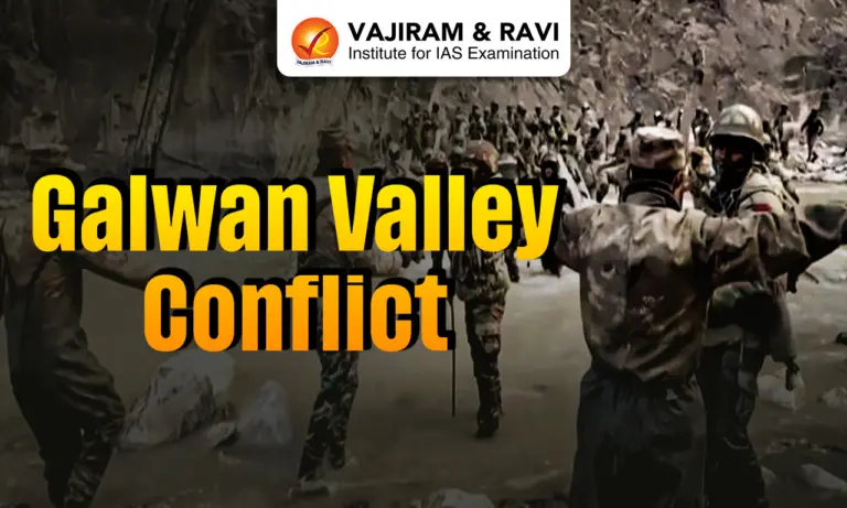
The Galwan Valley Conflict was a serious clash between India and China in 2020 along a disputed border in Ladakh. It highlighted long-standing tensions and disagreements over the boundary between the two countries. The incident showed how quickly border situations can escalate even without firearms. It also stressed the need for peaceful dialogue and better coordination. The Galwan Valley Conflict reflects the long-standing and evolving nature of India-China relations over the years.
About Galwan Valley
- The Galwan Valley is located in the northeastern part of Ladakh, in India.
- It lies close to the Line of Actual Control (LAC), which is the disputed border between India and China.
- The valley is situated west of Aksai Chin, a region that is currently under Chinese control but claimed by India.
- It is a high-altitude region, located at more than 14,000 feet above sea level, making it cold and difficult to access.
- The Galwan River flows through this valley, giving the region its name.
- This river originates in Aksai Chin (on the Chinese side) and flows westward into Ladakh (Indian side).
- The Galwan River eventually joins the Shyok River on the Indian side of the LAC.
- The valley consists of narrow land between steep mountains, which makes movement and military operations challenging.
- At the western end, the valley is near the Shyok River and the important Darbuk-Shyok-DBO (DSDBO) Road, which is strategically important for India.
- At the eastern side, it is close to China’s important G219 Highway, which connects Xinjiang and Tibet.
- Due to its location near key roads and the LAC, the Galwan Valley holds high strategic and military importance for both India and China.
Galwan Valley Conflict Causes & Developments
- The Galwan Valley conflict is part of the long-standing border dispute between India and China along the Line of Actual Control (LAC), which is not clearly defined and has different interpretations on both sides.
- The roots of the issue go back to the 1962 India-China war, after which China retained control over areas like Aksai Chin, and both countries developed conflicting views about the border.
- Over the years, India and China signed agreements (such as 1993 and 1996) to maintain peace and avoid the use of firearms, which helped keep the border relatively stable for decades.
- However, tensions started rising in recent years due to infrastructure development on both sides, especially India improving roads, bridges, and connectivity in border areas.
- A major point of dispute was India’s construction of the Darbuk-Shyok-Daulat Beg Oldie (DSDBO) road, which enhanced India’s military access to remote regions. China objected to this, seeing it as a threat to its position near Aksai Chin.
- The Galwan Valley is located in a strategically sensitive area near Aksai Chin, making it important for both countries from a military and geographical perspective.
- Tensions increased further as Indian and Chinese troops came face-to-face in multiple areas of eastern Ladakh, including Pangong Tso, Galwan Valley, Demchok, and Daulat Beg Oldie.
- In several instances, Chinese troops reportedly crossed into areas claimed by India, especially around Pangong Tso, which increased mistrust between the two sides.
- The situation at Pangong Tso was not just about land but also about control over the lake, which holds strategic and resource importance.
- The Galwan region has also been historically sensitive, as it was a flashpoint during the 1962 war, showing that tensions in this area are not new.
- The situation escalated when Chinese troops reportedly moved into disputed areas, set up temporary structures, and brought equipment, leading to an initial standoff.
- Both sides then deployed large numbers of troops and military resources near the LAC, increasing the risk of conflict.
- The conflict turned violent, involving hand-to-hand combat using stones and clubs, as firearms were not used due to earlier agreements.
- One important factor behind the clash is often described as China’s “nibble and negotiate” strategy, where it gradually tries to change ground realities and then negotiate from a stronger position.
- Another key reason was China’s effort to stop India from strengthening its border infrastructure, which could improve India’s defence and troop movement.
- The conflict is also linked to long-standing territorial disputes, especially over Aksai Chin and parts of Ladakh.


Galwan Valley Conflict Timeline & Key Events
- June 2020 – Galwan Valley Clash:
- A violent clash took place between Indian and Chinese soldiers in the Galwan Valley in eastern Ladakh. The troops engaged in hand-to-hand combat due to restrictions on the use of firearms. This incident led to casualties on both sides and marked the first deadly confrontation between the two countries in over four decades, significantly increasing tensions.
- January 2021 – Sikkim (Naku La) Clash:
- Indian and Chinese troops came face-to-face near the Naku La pass in Sikkim. The situation led to a physical confrontation, causing injuries to soldiers from both sides. However, the clash was quickly controlled, and it did not escalate into a larger conflict.
- September 2021 – Pangong Tso Incident:
- Tensions rose again near Pangong Lake in Ladakh, where both sides accused each other of violating border agreements. There were reports of warning shots being fired, which was unusual because earlier agreements prohibited the use of firearms along the border. This incident showed the fragile nature of peace in the region.
- December 2022 – Tawang Clash (Arunachal Pradesh):
- A clash occurred between Indian and Chinese troops in the Tawang sector of Arunachal Pradesh. Soldiers from both sides were involved in a physical confrontation, leading to minor injuries. The situation was later brought under control through local military talks.
India-China Border Dispute (LAC Issues)
- The Line of Actual Control (LAC) is the de facto boundary in India-China relations that separates Indian-controlled and Chinese-controlled territories, but it is not clearly defined or officially demarcated.
- The total length of the border is about 3,488 km as per India, while China considers it to be around 2,000 km, reflecting differing perceptions.
- These different interpretations of the LAC often lead to face-offs, tensions, and occasional clashes between the two sides.
- The present situation largely stems from the 1962 India-China war, after which China retained control over areas like Aksai Chin.
- The boundary is divided into three sectors:
- Western Sector (Ladakh) – most disputed, includes Aksai Chin
- Middle Sector (Himachal Pradesh & Uttarakhand) – relatively peaceful
- Eastern Sector (Arunachal Pradesh & Sikkim) – dispute over the McMahon Line
- Since 1988, both countries have engaged in dialogue and signed agreements to maintain peace along the border.
- Important agreements include:
- 1993 Border Peace and Tranquillity Agreement (BPTA) – focuses on peace and non-use of force
- 1996 Agreement – introduces limits on military activities near the LAC
- Efforts to clearly define and map the LAC (2000-2005) failed due to strong and conflicting territorial claims.
- As a result, both countries continue to patrol up to their own perceived boundaries, increasing the risk of confrontation.
- Growing infrastructure development and strategic competition on both sides have further intensified tensions.
- Incidents such as the Galwan Valley clash (2020) highlight that the dispute remains unresolved.
- The Galwan Valley falls under Sub-Sector North (SSN), located east of the Siachen Glacier, and is strategically important as it provides direct access towards Aksai Chin.
- Overall, the LAC issue persists due to unclear boundaries, historical disputes, mutual mistrust, and strategic concerns between India and China.
Strategic Importance of Galwan Valley
- Location & Connectivity: The Galwan Valley lies near the LAC in Eastern Ladakh and is close to the important DSDBO road, which connects remote border areas and supports troop movement.
- Link to Daulat Beg Oldie (DBO): It is strategically important as it helps secure access to DBO, home to one of the world’s highest airstrips, crucial for India’s military logistics.
- Gateway to Aksai Chin: The valley acts as a key route providing direct access towards Aksai Chin, increasing its importance in the territorial dispute.
- Surveillance Advantage: The high-altitude terrain and river junctions provide a natural vantage point, helping in monitoring enemy movement and activities.
- Countering China’s Activities: Control over this region allows India to keep a check on China’s infrastructure and military build-up in nearby areas.
- Defensive Buffer Zone: The valley acts as a protective barrier, preventing further movement of Chinese troops towards the Shyok River and deeper into Indian territory.
- Strategic Sensitivity: The 2020 clash highlighted how sensitive this region is, where even small changes can lead to major tensions.
Agreements and Disengagement Efforts
- Disengagement Status: India and China have successfully disengaged from several friction points, including after mutual agreement and verification.
- Restoration of Patrolling Rights
- Both sides agreed to resume patrolling in Depsang Plains and Demchok, which were long-pending issues even before 2020.
- Indian troops can now patrol up to Patrolling Points (PP) 10-13 in Depsang and Charding Nullah in Demchok.
- Patrolling Rules and Coordination
- Patrols will be carried out up to earlier traditional points along the LAC.
- Indian patrols are expected to happen twice a month, with each patrol limited to 14-15 soldiers to avoid confrontation.
- Both sides will coordinate patrol schedules and adjust timings if needed to prevent face-offs.
- Other Friction Points
- Areas like Galwan Valley and Pangong Tso remain sensitive, though disengagement has already taken place there.
- Discussions are still ongoing in the eastern sector (especially Arunachal Pradesh).
- Confidence-Building Measures
- The agreement includes regular commander-level meetings and dialogue mechanisms to improve communication.
- Both countries aim to gradually reduce troop deployment along the LAC, especially during harsh winter conditions.
Challenges in Border Management
The Challenges in Border Management in India has been discussed below:
- Lack of Infrastructure: India still faces shortages in border infrastructure like roads and connectivity. In many areas, roads end 60-80 km before the LAC, making troop movement slow, while China can move forces quickly.
- Slow Progress in Projects: Many important border road projects have been delayed or not completed on time, affecting overall preparedness.
- Manpower Shortage: There is a significant shortage of personnel in forces like CAPFs and Assam Rifles, which weakens border security.
- Coordination Problems: Multiple forces (Army, ITBP, etc.) operate on the Indian side, leading to coordination and command issues, unlike China where control is more unified.
- Logistics and Mobility Issues: Difficult terrain and limited infrastructure make it hard to supply troops and move equipment in border areas.
- Technological Gaps: India still faces some gaps in advanced surveillance systems (like drones and sensors) compared to China.
Measures in Border Management
- Better Coordination Among Agencies: All agencies like the Army, border forces, intelligence, customs, and immigration should work together with a common plan to manage borders more effectively.
- Use of Modern Technology: Borders should be managed using advanced technology, such as:
- Biometric systems for identity checks
- Smart scanners and detectors to find weapons, drugs, or illegal items
- Drones (UAVs) for regular monitoring and surveillance
- Capacity Building of Forces: Border forces should be given better training, especially in using new technology and understanding local conditions and culture.
- Community Participation: People living near border areas should be encouraged to support security forces by sharing information and acting as the “eyes and ears” of the system.
- Improving Relations with Neighbours: India should cooperate more closely with neighbouring countries to tackle cross-border issues like terrorism and smuggling, and support joint efforts when needed.
![]() Last updated on July, 2026
Last updated on July, 2026
→ UPSC Mains 2026 will be conducted on 21st, 22nd, 23rd, 29th and 30th August 2026.
→ UPSC Mains Admit Card 2026 is expected to be released in early August at upsc.gov.in or upsconline.nic.in
→ Enroll in Vajiram & Ravi’s UPSC Mains Test Series 2026 for structured answer writing practice, expert evaluation, and exam-oriented feedback.
→ Go through the UPSC Mains Previous Year Papers to enhance your preparation.
→ Download UPSC Mains Essay Paper 2025, UPSC Mains GS Paper-I 2025, UPSC Mains GS Paper-II 2025, UPSC Mains GS Paper-III 2025, UPSC Mains GS Paper-IV 2025, UPSC Mains English (Compulsory) Paper 2025, UPSC Mains Hindi (Qualifying) Paper 2025 here.
→ UPSC has released UPSC Toppers List 2025 with the Civil Services final result on its official website.
→ UPSC Calendar 2027 has been released.
→ Also check Best UPSC Coaching in India
Galwan Valley Conflict FAQs
Q1. What was the Galwan Valley Conflict?+
Q2. Where is the Galwan Valley located?+
Q3. What caused the Galwan Valley Conflict?+
Q4. Why is the Galwan Valley important?+
Q5. What is the Line of Actual Control (LAC)?+
Tags: galwan valley conflict international relations international relations notes