Naxal-Free India, India’s Journey Towards Ending Left-Wing Extremism

Naxal-Free India

India’s emergence as a Naxal-free nation on 31 March 2026 marks a significant milestone in its internal security journey. It reflects the success of a comprehensive approach that combined effective security operations with development, better governance, tribal welfare and rehabilitation, helping transform regions once affected by Left-Wing Extremism (LWE) into active participants in India’s growth and development.

About Naxalism

Naxalism, officially referred to as Left-Wing Extremism (LWE), is an armed insurgency inspired by Maoist ideology that seeks to overthrow the Indian State through violent revolution. It originated from the Naxalbari uprising in West Bengal in 1967 and gradually spread across the tribal and forested regions of central and eastern India, popularly known as the Red Corridor, emerging as one of India’s most serious internal security challenges.

Naxalism Reasons 

The spread of Naxalism or Left-Wing Extremism was driven by a combination of governance deficits, socio-economic deprivation and geographical isolation.

  • Historical Underdevelopment: Tribal and remote regions remained deprived of quality education, healthcare, roads and other essential public services for decades.
  • Economic Deprivation: Persistent poverty, unemployment and limited livelihood opportunities created fertile ground for extremist recruitment.
  • Alienation of Tribal Communities: Inadequate protection of land and forest rights, displacement and weak participation in governance generated resentment among tribal populations.
  • Weak State Presence: Difficult terrain and limited administrative reach enabled extremist groups to establish parallel influence in several regions.
  • Poor Infrastructure and Connectivity: Lack of roads, banking facilities, telecommunications and digital connectivity isolated communities from mainstream development.
  • Ideological Radicalisation: Maoist groups exploited local grievances and propagated armed struggle as an alternative to democratic institutions.
  • Governance Deficit: Weak implementation of welfare schemes and delayed access to justice reduced public confidence in the State.

Naxal-Free India

India became effectively Naxal-free on 31 March 2026 after nearly six decades of Left-Wing Extremism. It signifies that Naxal violence has been reduced to a negligible level, with the State regaining control and governance restored across almost all previously affected regions.

  • Sharp Decline in Affected Districts: The number of LWE-affected districts declined from 126 in 2014 to just 0 in 2026, while the number of most-affected districts fell from 35 to zero.
  • Major Reduction in Violence: Naxal-related incidents decreased from 870 in 2014 to 234 in 2025, indicating a significant weakening of extremist activities.
  • Decline in Fatalities: Fatalities reduced from 310 in 2014 to 100 in 2025, compared to the peak of 1,005 deaths in 2010.
  • Weakened Maoist Networks: Intelligence-led operations, stronger security coordination and rehabilitation policies considerably reduced the operational strength of Maoist groups.
  • Improved Governance and Connectivity: Expansion of roads, mobile connectivity, banking and public services restored the State’s presence in previously affected regions.
  • Greater Peace and Development: Improved law and order enabled better implementation of welfare programmes and accelerated socio-economic development in former Naxal-affected areas.

The Three Pillars of Naxal-Free India

Over the last twelve years, India’s strategy to eliminate Left-Wing Extremism was built on three interconnected pillars - Vishwaas, Nirman and Jan Kalyan. Together, these pillars combined security, development and welfare to address both the violence and the underlying causes of Naxalism.

Vishwaas (Restoring Faith in the State)

Vishwaas focused on restoring public confidence through stronger security, effective governance and community participation.

  • National Policy and Action Plan (2015): Introduced a whole-of-government approach based on Dialogue, Security and Coordination, replacing the earlier fragmented response.
  • Strengthened Security Grid: Constructed 597 fortified police stations, established 408 CAPF camps, built 68 night-landing helipads, and deployed 400 bullet-proof vehicles and five hospitals for security personnel.
  • Specialised Security Forces: Integrated CoBRA, CRPF, District Reserve Guard (DRG), Special Task Forces (STF), Greyhounds and other elite units through joint operations and training.
  • Technology-Based Operations: Used UAVs, drones, satellite imagery, AI-based intelligence, mobile-data analytics and social-media monitoring to improve surveillance and operational efficiency.
  • Trace, Target, Neutralise Doctrine: Adopted an intelligence-led strategy to trace Maoist movements, target their strongholds and neutralise their operational networks through operations such as Operation Black Forest, Operation Double Bull, Operation Octopus, Operation Thunderstorm, Operation Bhimbarg and Operation Chakrabandha.
  • Disrupting Financial Networks: Established a dedicated National Investigation Agency (NIA) vertical to target Naxal financing, supported by action from the Enforcement Directorate and State agencies.
    • As of December 2025, the NIA had seized assets worth over ₹40 crore. The Enforcement Directorate (ED) attached assets worth ₹12 crore.
  • Red Carpet for Surrender: Encouraged Naxal cadres to surrender by providing financial assistance (₹5 lakh for higher-ranked cadres and ₹2.5 lakh for others), a ₹10,000 monthly stipend for 36 months, incentives for depositing weapons, and rehabilitation and livelihood support to facilitate their reintegration into mainstream society.

Nirman (Building Infrastructure and Connectivity)

Nirman focused on improving connectivity, expanding governance and creating economic opportunities in formerly affected regions.

  • Road Connectivity: Constructed over 12,249 km of roads and approved projects covering 17,319 km under LWE-specific connectivity schemes.
  • Digital Connectivity: Installed more than 9,600 mobile towers, extending mobile coverage to 96% of villages in the most affected areas.
  • Financial Inclusion: Expanded banking infrastructure through 1,804 bank branches, 1,321 ATMs, 74,720 banking correspondents and 6,025 post offices.
  • Education Infrastructure: Sanctioned 259 Eklavya Model Residential Schools, with 179 schools developed, to improve educational access for tribal children.
  • Skill Development: Established 46 Industrial Training Institutes (ITIs) and 49 Skill Development Centres, providing training to over 90,000 youth and women.
  • Community Outreach: Implemented Civic Action Programmes, Tribal Youth Exchange Programmes and the Media Plan Scheme to strengthen engagement between communities and the State.

Jan Kalyan (People’s Welfare and Dignity)

Jan Kalyan ensured that peace was sustained through inclusive welfare, tribal empowerment and long-term socio-economic development.

  • Rehabilitation of Surrendered Cadres: Supported reintegration through skill development, livelihood assistance, self-employment support and housing under Pradhan Mantri Awas Yojana (PMAY), while providing free education up to Class XII for their children.
  • Special Central Assistance (SCA): Funded critical infrastructure and development projects in the most affected districts.
  • Aspirational Districts Programme: Improved outcomes in health, education, financial inclusion, infrastructure and governance through convergence of welfare schemes.
  • PM-JANMAN: Enhanced access to housing, drinking water, healthcare, education and connectivity for Particularly Vulnerable Tribal Groups (PVTGs).
  • Dharti Aaba Janjatiya Gram Utkarsh Abhiyan: Reduced infrastructure gaps and expanded development opportunities in tribal villages through coordinated interventions across multiple ministries.
  • Strengthening Tribal Livelihoods: Improved access to education, healthcare, housing, livelihoods and democratic institutions, helping integrate tribal communities into the mainstream development process.

Case Study: Bastar’s Transformation

Bastar in Chhattisgarh was once one of India’s most Naxal-affected regions because of poor connectivity, weak governance and difficult terrain. Over the last twelve years, it has witnessed significant transformation through a strategy combining security, development and tribal participation. 

  • The Bastariya Battalion (2017), comprising many local tribal youth, improved security and strengthened trust between communities and the administration. 
  • More than 3,240 km of roads and 889 mobile towers connected remote villages with schools, healthcare, markets and government services. 
  • Around 3,000 surrendered Naxalites were supported through rehabilitation, skill development and livelihood programmes. 
  • In 2026, the Shaheed Veer Gunda Dhur Seva Dera initiative began converting around 70 CAPF camps into centres providing healthcare, banking, agricultural support and welfare services. 
  • Cultural initiatives such as Bastar Pandum and the Bastar Olympics also promoted tribal identity and community participation. 

Bastar’s experience shows that security combined with development, welfare and community empowerment can successfully transform conflict-affected regions.

Naxal-Free India Significance 

The elimination of Left-Wing Extremism represents not only a major internal security achievement but also a significant milestone in India’s democratic and developmental journey.

  • Strengthens Internal Security: Eliminates one of India’s longest-running internal security challenges and enhances national stability.
  • Deepens Democratic Governance: Restores the authority of constitutional institutions and expands the reach of democratic governance.
  • Promotes Inclusive Development: Enables infrastructure, welfare programmes and public services to reach previously inaccessible tribal regions.
  • Empowers Tribal Communities: Improves education, healthcare, livelihoods and financial inclusion while strengthening tribal participation in governance.
  • Boosts Economic Growth: Better connectivity encourages investment, agriculture, mining, tourism and local entrepreneurship.
  • Strengthens Cooperative Federalism: Demonstrates the effectiveness of coordinated action between the Union Government and State Governments.
  • Advances National Integration: Integrates remote regions mor closely into India’s social, economic and political mainstream.

Naxal Free India Challenges

Despite major progress, sustaining a Naxal-Free India requires addressing the underlying socio-economic issues in vulnerable regions.

  • Preventing Revival: Residual extremist elements and sleeper networks may attempt to regain influence in isolated areas.
  • Sustaining Development: Continued delivery of infrastructure, livelihoods and public services is necessary to prevent the re-emergence of grievances.
  • Tribal Rights Protection: Effective implementation of land, forest and rehabilitation policies remains essential for maintaining public trust.
  • Administrative Capacity: Strengthening governance and ensuring regular service delivery in remote areas continues to be a challenge.
  • Rehabilitation of Former Cadres: Long-term livelihood opportunities and social reintegration are required for surrendered extremists.

Way Forward

The long-term success of Naxal-Free India depends on consolidating security gains with inclusive and sustainable development.

  • Strengthen the Vishwaas-Nirman-Jan Kalyan approach through continued coordination between security, development and welfare initiatives.
  • Expand livelihood and skill-development opportunities for tribal youth to reduce the risk of extremist recruitment.
  • Ensure effective implementation of tribal welfare and forest rights programmes to strengthen confidence in democratic institutions.
  • Improve last-mile governance through better healthcare, education, banking, digital connectivity and public service delivery.
  • Sustain intelligence-led security operations while promoting community participation and rehabilitation to prevent the resurgence of Left-Wing Extremism.

India’s journey to becoming Naxal-free demonstrates that lasting internal security is achieved not merely through force, but by combining effective policing with development, good governance, rehabilitation and the empowerment of local communities.

Naxal-Free India FAQs

Q1: What is Naxal-Free India?

Ans: Naxal-Free India refers to the successful elimination of organised Left-Wing Extremism (LWE) through a coordinated strategy of security, development, rehabilitation and good governance.

Q2: What is Left-Wing Extremism (LWE)?

Ans: Left-Wing Extremism (LWE) is a Maoist-inspired armed insurgency that aims to overthrow the Indian State through violence and originated from the Naxalbari movement in 1967.

Q3: How was Naxal-Free India achieved?

Ans: Naxal-Free India was achieved through a three-pillar strategy - Vishwaas, Nirman and Jan Kalyan that combined security operations, intelligence-based policing, infrastructure development, tribal welfare and rehabilitation of surrendered cadres to address both violence and its root causes.

Q4: Why is Naxal-Free India significant for India?

Ans: Naxal-Free India strengthens internal security, expands democratic governance, promotes tribal development and supports inclusive economic growth.

Q5: What are the key challenges after achieving Naxal-Free India?

Ans: The key challenge after Naxal-Free India is to sustain peace through continued development, protection of tribal rights, employment generation and vigilant security to prevent the resurgence of extremism.

Umling La Pass, Location, Height, Connectivity, Road, Significance

Umling La Pass

Umling La Pass is a high mountain pass in the Ladakh region in India. It is known for its extreme altitude, strategic location and remarkable road engineering. The pass gained global recognition after the Border Roads Organisation (BRO) built a motorable road across it under Project HIMANK. Although Mig La became the highest motorable road in 2025, Umling La remains one of the world's most significant high altitude mountain passes because of its border connectivity, engineering achievement, tourism value and strategic importance.

Umling La Pass

A mountain pass is a natural route through a mountain range that allows movement between valleys or regions. Such passes have historically supported travel, trade, defence and communication. Umling La Pass is situated in the Changthang area of Ladakh near Demchok. It stands among the world's highest mountain passes connected by a motorable road and remains an important example of high altitude infrastructure in India.

Umling La Pass Features

Umling La Pass is among the world's highest mountain passes accessible by road. It lies close to the India-China border in eastern Ladakh.

  • Location: Umling La is situated in the Changthang region of Ladakh near Demchok village. It lies on the ridge separating the Koyul Lungpa valley from the Indus River basin, making it geographically important.
  • Altitude: The pass stands at about 5,799 metres (19,024 feet) above sea level. Some BRO construction references mention road sections reaching nearly 19,300 feet, reflecting the extreme elevation achieved during road construction.
  • Mountain Range: Umling La forms part of the high altitude Himalayan Region landscape in the Changthang plateau. 
  • Drainage: It forms the source of the Umlung stream flowing towards the Indus River, while another stream drains into the Kiungdul River through Koyul Lungpa.
  • Border Location: The pass lies close to the Indo-China border near Demchok. Its location makes it strategically significant while also remaining one of the most remote and sparsely inhabited regions of Ladakh.
  • Connectivity: Umling La connects Chisumle and Demchok villages through a high altitude road. The complete route strengthens accessibility in the Chumar sector and provides an important land connection.
  • Distance: The Chisumle-Umling La-Demchok route extends roughly 52 to 54 km, while several references mention connectivity over nearly 86 km between the linked villages.
  • Route from Leh: Travellers generally follow the route Leh → Upshi → Chumathang → Mahe → Nyoma → Hanle → Photi La → Umling La. The distance from Leh is approximately 230 to 250 km, requiring about 8 to 10 hours depending on road conditions.
  • Climate: Winter temperatures can fall to -40°C, while oxygen levels remain nearly 50% lower than normal. These harsh conditions make travel and construction exceptionally challenging throughout the year.
  • World Recognition: From 2017 to 2025, the Chisumle-Umling La-Demchok Road held the title of the world's highest motorable road, surpassing Bolivia's Uturuncu Volcano Road at 18,953 feet before Mig La overtook the record in 2025.
  • Expedition Activities: Umling La attracts motorcyclists, cyclists and overland travellers. In 2022, international teams from Canada and Switzerland drove auto rickshaws to Umling La at 5,799 metres, setting the highest altitude auto rickshaw driving world record. In addition, the first ever solo woman motorcycle expedition to Umling La by Ms Kanchan Ugursandi was also officially flagged off.

Umling La Road

The Umling La Road represents one of India's greatest high altitude infrastructure achievements and has greatly improved connectivity in eastern Ladakh.

  • Construction Agency: The road was constructed by the Border Roads Organisation (BRO) under Project HIMANK, which develops strategic roads across Ladakh. The project required nearly six years to complete.
  • Guinness World Record: In 2021, the BRO received the Guinness World Record after constructing the world's highest motorable road through Umling La, showcasing India's capability in high altitude infrastructure development.
  • Black-Top Road: BRO successfully black-topped the entire road despite extreme weather and difficult terrain. The project demonstrated India's engineering capability in building durable roads at very high elevations.
  • Strategic Connectivity: The road links Chisumle and Demchok while improving access to important areas in the Chumar sector. It also provides an alternate direct route connecting Leh with remote border settlements.
  • Engineering Challenges: Construction teams worked under severe conditions where oxygen remained nearly 50% below normal and temperatures regularly reached -40°C. Such conditions made labour availability and road construction extremely difficult.
  • Project HIMANK: Project HIMANK has also developed strategic roads through Tanglang La, Khardung La and Chang La, built the world's highest Bailey Bridge at Khardung La and constructed the Srinagar-Leh Road, which supported Operation Vijay during the Kargil War.
  • Recent Developments: In 2025, BRO's Project HIMANK set another engineering milestone by constructing the Mig La Road at 19,400 feet, surpassing Umling La and establishing a new world record for the highest motorable road.

Umling La Pass Significance

Umling La has major strategic, economic, engineering and tourism importance because of its location, infrastructure and contribution to border development.

  • Strategic Importance: Its proximity to the India-China border strengthens road connectivity in sensitive frontier areas and improves movement to remote villages and strategic locations in eastern Ladakh.
  • Engineering Excellence: Successful construction at nearly 19,000 feet demonstrates India's expertise in high altitude road building despite severe weather, frozen terrain and extremely low oxygen availability.
  • Regional Development: Improved connectivity has enhanced access for residents of Chisumle, Demchok and nearby settlements. Better transport supports local services, economic activities and emergency response.
  • Tourism Growth: The road has made one of the world's highest mountain passes accessible to visitors, encouraging adventure tourism, road expeditions and motorcycle travel while showcasing the unique landscape of Ladakh.
  • National Infrastructure: Umling La Road reflects the long term role of BRO in developing border infrastructure. Its success has strengthened India's transport network in remote Himalayan regions and supported future high altitude engineering projects.

Umling La Pass FAQs

Q1: Where is Umling La Pass located?

Ans: Umling La Pass is located in the Changthang region of Ladakh, India, near Demchok village close to the India-China border in eastern Ladakh.

Q2: What is the height of Umling La Pass?

Ans: Umling La Pass is situated at an elevation of 5,799 metres (19,024 feet) above sea level, making it one of the highest motorable mountain passes in the world.

Q3: Who built the Umling La Road?

Ans: The Umling La Road was constructed by the Border Roads Organisation (BRO) under Project HIMANK. The project took nearly six years to complete in extremely difficult high altitude conditions.

Q4: Why is Umling La Pass important for India?

Ans: Umling La Pass is important for its strategic location near the India-China border, improved connectivity to remote villages, engineering achievement and growing adventure tourism in Ladakh.

Q5: Is Umling La the world's highest motorable road?

Ans: No. Umling La held the record as the world's highest motorable road from 2017 to 2025. In 2025, the Mig La Road in Ladakh surpassed it by reaching an altitude of 19,400 feet.

UPSC Daily Quiz 4 August 2026

UPSC Daily Quiz

[WpProQuiz 223]

UPSC Daily Quiz FAQs

Q1: What is the Daily UPSC Quiz?

Ans: The Daily UPSC Quiz is a set of practice questions based on current affairs, static subjects, and PYQs that help aspirants enhance retention and test conceptual clarity regularly.

Q2: How is the Daily Quiz useful for UPSC preparation?

Ans: Daily quizzes support learning, help in revision, improve time management, and boost accuracy for both UPSC Prelims and Mains through consistent practice.

Q3: Are the quiz questions based on the UPSC syllabus?

Ans: Yes, all questions are aligned with the UPSC Syllabus 2025, covering key areas like Polity, Economy, Environment, History, Geography, and Current Affairs.

Q4: Are solutions and explanations provided with the quiz?

Ans: Yes, each quiz includes detailed explanations and source references to enhance conceptual understanding and enable self-assessment.

Q5: Is the Daily UPSC Quiz suitable for both Prelims and Mains?

Ans: Primarily focused on Prelims (MCQ format), but it also indirectly helps in Mains by strengthening subject knowledge and factual clarity.

Chief Secretary in India, Role, Appointment, Functions

Chief Secretary in India

The Chief Secretary is the senior-most civil servant in a State Government and serves as the administrative head of the state bureaucracy. Usually selected from the Indian Administrative Service (IAS), the Chief Secretary acts as the principal advisor to the Chief Minister and coordinates the functioning of all government departments. As the head of the state civil services, the Chief Secretary ensures effective implementation of government policies, maintains coordination among departments, and oversees the overall administration of the state.

Chief Secretary in India

The Chief Secretary is the top administrative officer of a State Government and serves as the principal link between the political executive and the state bureaucracy. As the head of the State Secretariat, the Chief Secretary ensures smooth coordination among departments, oversees the implementation of government decisions, and promotes efficient and accountable governance across the state.

Chief Secretary in India Role and Responsibilities

The Chief Secretary is responsible for ensuring the smooth functioning of the State Government by coordinating departments, advising the Chief Minister, and supervising the implementation of government policies.

  • Acts as the principal advisor to the Chief Minister on administrative and policy matters.
  • Coordinates the work of all State Government departments and ministries.
  • Heads the State Secretariat and supervises senior government officials.
  • Ensures effective implementation of government policies, schemes, and programmes.
  • Maintains coordination between the State Government and the Central Government.
  • Reviews the performance of departments and monitors administrative efficiency.
  • Leads disaster management and coordinates emergency response during crises.
  • Promotes administrative reforms to improve governance, transparency, and public service delivery.
  • Chairs high-level committees constituted by the State Government.
  • Ensures law and order coordination by working with the Home Department and district administration.

Appointment of the Chief Secretary

The Chief Secretary is appointed by the State Government, usually from among the senior-most IAS officers of the state cadre. The appointment is generally made on the recommendation of the Chief Minister based on seniority, administrative experience, leadership ability, and merit. The selected officer serves as the highest-ranking civil servant in the state and heads the State Secretariat.

Position of the Chief Secretary in the State Administration

The Chief Secretary occupies the highest administrative position in the State Government and serves as the head of the State Secretariat. As the senior-most IAS officer in the state, the Chief Secretary ensures coordination among departments, advises the Chief Minister, and oversees the implementation of government policies and administrative decisions.

  • Highest-ranking civil servant in the State Government.
  • Administrative head of the State Secretariat.
  • Principal advisor to the Chief Minister on governance and policy matters.
  • Coordinates the functioning of all government departments and senior officials.
  • Acts as the link between the State Government, Central Government, and district administration.
  • Supervises senior IAS officers and departmental secretaries to ensure effective governance.

Difference Between the Chief Secretary and Cabinet Secretary

The Chief Secretary and the Cabinet Secretary are senior administrative officers, but they differ in their level of governance, appointment, reporting authority, and administrative responsibilities.

Basis

Chief Secretary

Cabinet Secretary

Level of Government

State Government

Union (Central) Government

Position

Highest-ranking civil servant in a state

Highest-ranking civil servant in India

Reports To

Chief Minister

Prime Minister

Administrative Head

State Administration

Cabinet Secretariat and Central Civil Services

Appointment

Appointed by the State Government

Appointed by the Appointments Committee of the Cabinet (ACC)

Service

Indian Administrative Service (IAS)

Indian Administrative Service (IAS)

Jurisdiction

Entire State

Entire Country

Primary Role

Coordinates state departments and advises the Chief Minister

Coordinates Central Ministries and advises the Prime Minister and the Cabinet

Office

State Secretariat

Cabinet Secretariat, New Delhi

Importance of the Chief Secretary in State Governance

The Chief Secretary plays a vital role in ensuring efficient administration, policy implementation, and coordination among various departments, making the state governance system effective and accountable.

  • Provides administrative leadership to the entire State Government machinery.
  • Ensures effective implementation of government policies, schemes, and programmes.
  • Coordinates the functioning of all departments for smooth governance.
  • Advises the Chief Minister on key administrative and policy matters.
  • Acts as a link between the State Government, Central Government, and district administration.
  • Promotes transparency, accountability, and good governance in public administration.
  • Strengthens crisis and disaster management through effective inter-departmental coordination.
  • Supports administrative reforms to improve efficiency and public service delivery.

Chief Secretary in India FAQs

Q1: What is the Chief Secretary in India?

Ans: The Chief Secretary is the highest-ranking civil servant in a State Government and serves as the administrative head of the state bureaucracy. Each state has its own Chief Secretary.

Q2: Who appoints the Chief Secretary?

Ans: The State Government appoints the Chief Secretary, usually from among the senior-most IAS officers of the state cadre.

Q3: Is the Chief Secretary mentioned in the Constitution of India?

Ans: No. The post of Chief Secretary is not specifically mentioned in the Constitution of India. It is an executive position governed by administrative conventions and service rules.

Q4: What are the main responsibilities of the Chief Secretary?

Ans: The Chief Secretary advises the Chief Minister, coordinates all state departments, supervises the State Secretariat, and ensures effective implementation of government policies and programmes.

Q5: What is the difference between the Chief Secretary and the Cabinet Secretary?

Ans: The Chief Secretary is the administrative head of a State Government, whereas the Cabinet Secretary is the highest-ranking civil servant in the Union Government and heads the Cabinet Secretariat.

Sela Pass, Location, Height, Connectivity, Tunnel, Significance

Sela Pass

Sela Pass is one of India's most important high altitude mountain passes. It combines geographical, strategic, cultural and transport significance in the eastern Himalayas. It is located in Arunachal Pradesh and serves as the main road link between Tawang and the rest of India. The pass is also known for its glacial landscapes, sacred lakes, military importance and year round connectivity maintained by the Border Roads Organisation (BRO).

Sela Pass

A Mountain Pass is a natural route through a mountain range that allows movement of people, vehicles and goods between regions. Sela Pass is a high altitude mountain pass in the eastern Himalayas located between the Tawang and West Kameng districts of Arunachal Pradesh. It forms the primary road connection to Tawang and carries National Highway 13, making it one of India's most significant border transport corridors.

Sela Pass Features

Sela Pass is a strategically important Himalayan pass with unique geographical, ecological, transport and cultural features that make it one of India's most significant mountain crossings.

  • Location: Sela Pass lies on the boundary of Tawang and West Kameng districts in Arunachal Pradesh. It separates Tawang from the rest of India and serves as the main land route connecting the border district with Assam.
  • Height: The pass stands at about 4,170 metres (13,700 feet) above sea level, making it one of the highest motorable mountain passes in India and among the highest motorable passes in the world.
  • Mountain Range: Sela Pass crosses a sub range of the eastern Himalayas. The surrounding region consists of snow covered mountains, deep valleys, glacial landforms and alpine landscapes with very limited vegetation because of harsh climatic conditions.
  • Connectivity: National Highway 13, earlier known as NH 229, passes through Sela Pass. It connects Tawang with Dirang, Tezpur, Guwahati and the rest of India, making it the district's most important transport corridor.
  • Distance: The pass is located about 78 km from Tawang and nearly 340 km from Guwahati. These connections make it the principal approach route for civilian travel, trade, tourism and defence logistics.
  • Access: The Border Roads Organisation (BRO) maintains the pass throughout the year. Although heavy snowfall and landslides may occasionally force temporary closures, it generally remains open despite severe weather conditions.
  • Climate: Sela Pass experiences long winters with frequent snowfall. Winter temperatures can fall to around -10°C, while summers remain cool because of its high elevation and mountainous environment.
  • Sela Lake: Sela Lake is a high altitude Glacial Lake situated on the northern side of the pass at an elevation of over 13,000 feet. It is formed from glacial meltwater and is one of the major natural landmarks of the region.
  • Drainage: Water from Sela Lake flows into the Nuranang River, which is a tributary of the Tawang River. 
  • Ecology: Sparse alpine vegetation surrounds the lake and nearby grasslands are used as summer grazing grounds for yaks.

Sela Tunnel

The Sela Tunnel has transformed connectivity across the eastern Himalayas by providing reliable year round transport while strengthening defence logistics and regional development.

  • Location: The Sela Tunnel is located in West Kameng district of Arunachal Pradesh below Sela Pass. 
  • Project: It is built by the Border Roads Organisation (BRO) under Project Vartak, it provides uninterrupted all weather connectivity to Tawang.
  • Engineering Achievement: It is recognised as the world's longest bi lane road tunnel above 13,000 feet. The tunnel is constructed about 400 metres below Sela Pass, ensuring travel even during severe snowfall.
  • Project Components: The project consists of a 980 metre single tube tunnel, a 1,555 metre twin tube tunnel and a 1,200 metre link road. The twin tube system includes a traffic tunnel and a separate emergency services tunnel.
  • Connectivity: The tunnel connects Tezpur in Assam with Tawang in Arunachal Pradesh through NH 13. It reduces the distance between Dirang and Tawang by about 10 km and cuts travel time by more than one hour.
  • Need: The Balipara-Chariduar-Tawang Road frequently remained blocked because of heavy snowfall and rain induced landslides. The tunnel ensures uninterrupted transport throughout the year by bypassing weather related disruptions.
  • Strategic Significance: Located close to the Line of Actual Control (LAC) with China, the tunnel enables quicker deployment of soldiers, weapons, equipment and military supplies to forward areas, strengthening border preparedness.
  • Technology: The tunnel was built using the New Austrian Tunnelling Method (NATM) with advanced safety features. 
  • Inauguration: It was dedicated to the nation by Prime Minister of India Narendra Modi on 9 March 2024 at a total cost of ₹825 crore.

Sela Pass Significance

Sela Pass remains one of India's most valuable mountain corridors because of its combined geographical, strategic, cultural, transport and regional development importance.

  • Strategic Importance: Located near the Line of Actual Control (LAC), Sela Pass serves as a critical military logistics corridor for troop movement, defence supplies and operational readiness along India's eastern frontier.
  • Historical Importance: Sela Pass witnessed major military action during the 1962 Sino-Indian War. Maha Vir Chakra awardee Jaswant Singh Rawat fought at the pass for nearly 72 hours before attaining martyrdom, becoming a symbol of exceptional courage.
  • Jaswant Singh War Memorial: The nearby Jaswant Singh War Memorial (Jaswant Garh) honours the soldiers who sacrificed their lives during the 1962 conflict and remains an important military memorial in Arunachal Pradesh.
  • Transport importance: As the principal gateway to Tawang, the pass ensures uninterrupted movement of people, goods, government services, tourism and essential supplies between Arunachal Pradesh and the plains of Assam.
  • Cultural Importance: The sacred lakes surrounding the pass, especially Sela Lake,, also called Paradise Lake, is among nearly 101 sacred lakes of Tibetan Buddhism and hold deep spiritual value for the Monpa community living in the region.
  • Ecological Importance: The region supports fragile Himalayan ecosystems, high altitude glacial lakes, alpine vegetation, yak grazing grounds and freshwater systems that contribute to the Nuranang and Tawang river basins.
  • Regional Development: The Sela Tunnel has strengthened economic activity, tourism, emergency services and border infrastructure while improving year round accessibility for remote communities across western Arunachal Pradesh.

Sela Pass FAQs

Q1: Where is Sela Pass located?

Ans: Sela Pass is located between the Tawang and West Kameng districts of Arunachal Pradesh in the eastern Himalayas. It connects Tawang with the rest of India through National Highway 13.

Q2: What is the height of Sela Pass?

Ans: Sela Pass is situated at an elevation of about 4,170 metres (13,700 feet) above sea level. It is one of the highest motorable mountain passes in India.

Q3: Why is Sela Pass strategically important?

Ans: Sela Pass is located near the Line of Actual Control (LAC) with China. It is an important route for military logistics, troop movement and transportation of defence equipment.

Q4: What is the significance of the Sela Tunnel?

Ans: The Sela Tunnel provides all weather connectivity between Tezpur and Tawang. It reduces travel time, improves transport during winter and strengthens connectivity in the border region.

Q5: Why is Sela Lake famous?

Ans: Sela Lake is a high altitude glacial lake near Sela Pass. It is known for its scenic beauty, religious importance in Tibetan Buddhism and its role as the source of water for the Nuranang River.

Magnetorheological Fluid

Magnetorheological Fluid

Magnetorheological Fluid Latest News

Recently, scientists at the Indian Institute of Technology (IIT) Patna have developed an innovative hybrid magneto-rheometer that promises to advance research and applications of magnetorheological (MR) fluids. 

About Magnetorheological Fluid

  • It is a fluid that has good magnetic properties.
  • MR fluid responds to the magnetic field and changes its properties when a magnetic field is presented.
  • Property: These fluids can rapidly change their mechanical properties when exposed to a magnetic field, increasing in apparent viscosity, to the point of becoming a viscoelastic solid.  
  • Composition: These fluids contain magnetic micro-sized iron particles, non-magnetic-based fluid, and some additives in order to mitigate sedimentation and agglomeration.
  • Carrier fluids: The various carrier fluids used in the preparation of MR fluids are mineral oil, silicon oil, castor oil, soybean oil, kerosene, synthetic oils, honge oil, organic oil, water-based oils, etc.
    • However, for obtaining better vibration control, silicone oil is the most preferred one due to its higher viscosity index, lower friction characteristics, higher flash point, and higher shear strength. 
  • The fluid can transmit force which can be controlled with an electromagnet, giving rise to its many possible control-based applications.
  • Potential Applications: It is ideal for adaptive technologies such as brakes, clutches, shock absorbers, vibration control systems, dampers, actuators, and medical devices.

Source: PIB

Magnetorheological Fluid FAQs

Q1: What is the main advantage of Magnetorheological Fluid (MR) fluid over Electrorheological (ER) fluid?

Ans: Requires lower energy and gives higher force

Q2: What are the carrier fluid used in MR fluid?

Ans: Mineral oil, Silicon oil, Castor oil, Soybean oil, kerosene etc.

Vikram Sarabhai Medal

Vikram Sarabhai Medal

Vikram Sarabhai Medal Latest News

Recently, astrophysicist Annapurni Subramaniam has been awarded the COSPAR Vikram Sarabhai Medal – 2026. 

About Vikram Sarabhai Medal

  • It was constituted in 1990 in the honour of Vikram Sarabhai.
  • It is an international medal awarded to scientists from developing countries for their outstanding contributions to the field of space research.
  • It is awarded jointly by the Committee on Space Research (COSPAR) and the Indian Space Research Organization (ISRO).
  • Eligibility: For a candidate to be eligible for this award, her or his relevant work must have been carried out mainly in the five year period ending one year before the COSPAR Scientific Assembly at which the medal is to be presented. 
    • Annapurni Subramaniam is the only fourth Indian to receive this medal, in addition to being the first Indian woman scientist and only the third female recipient of this honour.
    • Other Indian recipients: Anil Bharadwaj (2024), Gurbax Singh Lakhina (2014) and UR Rao, (1996).

Key Facts about Committee on Space Research

  • It was established in 1958.
  • It is an international body affiliated to the International Science Council and United Nations (through UN-COPUS).
  • COSPAR is one of the largest forums for space scientists and holds its scientific assembly biennially. 

Source: IE

Vikram Sarabhai Medal FAQs

Q1: The Vikram Sarabhai Medal is awarded by whom?

Ans: It is awarded jointly by the Committee on Space Research (COSPAR) and the Indian Space Research Organization (ISRO).

Q2: The medal is named after Vikram Sarabhai who is known as?

Ans: Father of Indian Space Programme

Glaw Lake

Glaw Lake

Glaw Lake Latest News

Glaw Lake in Arunachal Pradesh's Lohit district has been designated as India's 101st Ramsar Site under the Ramsar Convention on Wetlands, making it the first Ramsar Site in Arunachal Pradesh. The announcement was made by Union Environment Minister Bhupender Yadav on 3 August 2026, marking a significant milestone in India's efforts to strengthen wetland conservation, biodiversity protection, climate resilience, and sustainable management of freshwater ecosystems.

About Glaw Lake

  • Location: It is located in the state of Arunachal Pradesh.
  • It is Arunachal Pradesh’s first designated Ramsar Site.
  • It is a freshwater lake in the Eastern Himalayas is a biodiversity hotspot, nestled within the Kamlang Tiger Reserve and Wildlife Sanctuary.
  • It is located at an elevation of 1,168 meters.
  • Water Source: The Lake is fed by perennial mountain streams and is surrounded by lush vegetation, supporting rich floral diversity.
  • Biodiversity: The wetland has over 150 tree species and 49 orchid species recorded within the site and its catchment, underscoring the ecological significance of Glaw Lake and its surrounding landscape.
    • It supports high-altitude aquatic biodiversity, including endangered species such as the White-Bellied Heron and Clouded Leopard.

Key Facts about Ramsar Convention

  • It is an intergovernmental treaty that sets the framework for both national action and international cooperation to conserve and ensure the wise use of wetlands and their resources.
  • It was adopted in 1971 in the city of Ramsar in Iran and came into force in 1975.
  • It was the first intergovernmental agreement focused exclusively on a specific ecosystem, i.e. wetlands.
  • The convention rests on the three main pillars
    • Conservation of wetlands of international importance,
    • Promotion of the wise use of all wetlands within a country’s territory
    • International co-operation on shared wetland systems and migratory species

Source: PIB

Glaw Lake FAQs

Q1: Glow Lake is located in which state?

Ans: Arunachal Pradesh

Q2: Glow Lake is situated inside which Tiger Reserve?

Ans: Kamlang Tiger Reserve

Q3: What is a Ramsar Site?

Ans: A Ramsar Site is a wetland recognized as a Wetland of International Importance under the Ramsar Convention, an international treaty adopted in 1971 for the conservation and sustainable use of wetlands.

Q4: How many Ramsar Sites are there in India as of August 2026?

Ans: As of August 2026, India has 101 Ramsar Sites, following the inclusion of Glaw Lake as the country's latest Wetland of International Importance.

Q5: Which is the first Ramsar Site in Arunachal Pradesh?

Ans: Glaw Lake is the first Ramsar Site in Arunachal Pradesh, receiving international recognition for its ecological significance and role in conserving freshwater biodiversity.

Karivalamvanthanallur Excavation, Revealing Tamil Nadu’s Ancient Past

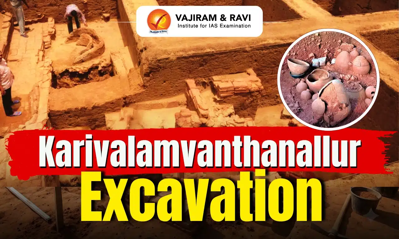
Karivalamvanthanallur Excavation

The ongoing excavation at Karivalamvanthanallur in Tamil Nadu’s Tenkasi district has uncovered important archaeological evidence that sheds light on ancient Tamil society, including its settlement patterns, technology, craft production, burial practices and trade activities.

About Karivalamvanthanallur Excavation

Karivalamvanthanallur is an important archaeological site that helps understand the cultural development of southern Tamil Nadu from prehistoric times to the historic period.

  • The site is located at Malayadipatti near Karivalamvanthanallur in Tenkasi district, Tamil Nadu, on the banks of the Vaippar River. 
  • The excavation is being conducted by the Tamil Nadu State Department of Archaeology (TNSDA) as part of the state’s broader archaeological exploration programme, which also includes sites such as Keeladi. 
  • The historical importance of the region was recognised nearly a century ago after reports of Roman coins, glass beads and burial urns were found in the area, indicating ancient trade and cultural activity. 

Karivalamvanthanallur Excavation Major Archaeological Findings

The artefacts discovered from Karivalamvanthanallur provide valuable insights into the technological advancement, economic activities, cultural practices and social life of ancient communities.

  • Microlithic Tools: The discovery of small stone tools (microliths) provides evidence of early human activity at the site and indicates the presence of prehistoric communities in the region.
  • Evidence of Iron Technology: The discovery of hematite (used for iron extraction) and iron implements indicates knowledge of iron-working and metal production during the historic period.
  • Sangam-Era Brick Structure: A large brick structure measuring around 8.7 metres × 4.2 metres with descending steps has been unearthed. It may have functioned as an underground granary or a rainwater harvesting structure, reflecting advanced construction techniques and water management practices.
  • Craft Production Activities: The presence of glass beads, shell bangles and terracotta spindle whorls indicates specialised activities such as bead-making, ornament production and weaving. These findings suggest that Karivalamvanthanallur developed as a centre of organised production during the Sangam Age.
  • Pottery and Daily Life: The discovery of Black-and-Red Ware pottery, graffiti-marked pottery, black-painted vessels, perforated bowls, terracotta figurines and gaming pieces provides insights into the lifestyle, artistic skills and cultural practices of ancient communities.
  • Burial Practices and Cultural Traditions: A burial urn decorated with painted peacock motifs, along with human teeth remains and associated pottery, provides evidence of ancient burial practices. The peacock motif also finds resonance with Sangam literature, particularly Akananuru, where peacock feathers are associated with memorial traditions.
  • Evidence of Trade and Economic Activity: The combination of habitation remains, craft production and diverse artefacts suggests that Karivalamvanthanallur was not merely a residential settlement but also a centre of manufacturing and exchange. Its location along ancient routes connecting the eastern and western coasts may have supported regional trade networks.
  • Evidence of an Organised Settlement and Economy: The findings indicate that Karivalamvanthanallur was a well-developed settlement with both residential and economic activities, as evidence of iron-working, bead-making, shell bangle production and weaving suggests the presence of specialised workshops, while its location near ancient trade routes may have facilitated exchange and interaction with other regions.

Karivalamvanthanallur Excavation Significance

Karivalamvanthanallur excavation adds important evidence to the understanding of early South Indian history and the development of Tamil civilization.

  • It strengthens the understanding of the cultural continuity of Tamil Nadu from prehistoric times to the Sangam Age.
  • It provides evidence of ancient achievements in iron technology, craft production, water management and trade.
  • It challenges the perception that early settlements were only agricultural communities by highlighting specialised manufacturing activities.
  • Along with Keeladi, Adichanallur and Sivagalai, it contributes to the reconstruction of early historic urban and cultural developments in South India.

Karivalamvanthanallur Excavation FAQs

Q1: Where is the Karivalamvanthanallur excavation site located?

Ans: Karivalamvanthanallur excavation site is located at Malayadipatti near Karivalamvanthanallur in Tenkasi district of Tamil Nadu, on the banks of the Vaippar River.

Q2: Which period of human history is represented by the archaeological findings at Karivalamvanthanallur?

Ans: The findings indicate a cultural sequence from the Microlithic period to the Iron Age, Early Historic period and Historic period.

Q3: Which organisation is conducting the Karivalamvanthanallur excavation?

Ans: The Tamil Nadu State Department of Archaeology (TNSDA) is conducting the Karivalamvanthanallur excavation as part of Tamil Nadu’s wider archaeological exploration programme.

Q4: What are the major findings of the Karivalamvanthanallur excavation?

Ans: The major findings include microlithic tools, iron artefacts, hematite, Sangam-era brick structures, glass beads, shell bangles, terracotta spindle whorls, pottery, burial urns and evidence of craft production, revealing technological and economic development in ancient Tamil society.

Q5: What is the historical significance of the Karivalamvanthanallur excavation?

Ans: The Karivalamvanthanallur excavation provides evidence of continuous human activity from the Microlithic period to the Iron Age, Early Historic and Historic periods, helping understand the cultural evolution of ancient Tamil society.

UNCLOS Maritime Zones, EEZ, Rights, Conferences, Significance

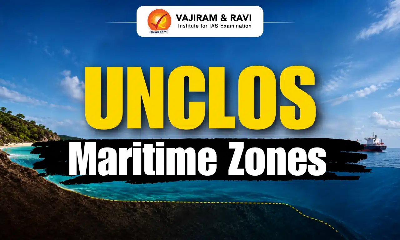
UNCLOS Maritime Zones

The United Nations Convention on the Law of the Sea (UNCLOS) acts as a global rulebook for oceans, guiding how countries use and manage marine spaces. It divides the seas into different maritime zones, each with specific rights and responsibilities for coastal states. These zones help nations utilize marine resources, ensure environmental protection, and maintain maritime security. UNCLOS Maritime Zones are discussed in detail in this article.

UNCLOS Maritime Zones

  • The United Nations Convention on the Law of the Sea (UNCLOS), 1982, often called the “Law of the Sea”, is an international treaty that provides a comprehensive legal framework for the use and governance of the world’s oceans.
  • It divides marine areas into distinct maritime zones such as Internal Waters, Territorial Sea, Contiguous Zone, Exclusive Economic Zone (EEZ), and High Seas, each having a different legal status.
  • UNCLOS is the only global convention that clearly defines state jurisdiction in maritime spaces, balancing the interests of coastal states and the international community.
  • It forms the backbone of offshore governance, regulating activities like navigation, resource exploitation, environmental protection, and maritime security.
  • The convention also outlines the rights and responsibilities of states across these five concentric zones, ensuring peaceful and sustainable use of oceans.

Baseline (Starting Point of Maritime Zones)

  • The baseline is the low-water line along the coast as officially recognized by a coastal state.
  • It serves as the reference line from which all maritime zones like the Territorial Sea, EEZ, and Contiguous Zone are measured.
  • Two main types: Normal Baseline (Article 5) and Straight Baseline (Article 7 of UNCLOS).

Internal Waters

  • Internal Waters lie on the landward side of the baseline and include areas like bays, ports, rivers, inlets, and coastal lakes connected to the sea.
  • The coastal state exercises full sovereignty, similar to its land territory.
  • Foreign vessels do not have the right of innocent passage unless specifically permitted.
  • The state can regulate entry, navigation, and security, including Port State Control measures.

Territorial Sea (Up to 12 Nautical Miles)

  • Extends up to 12 nautical miles (nm) from the baseline (Article 3 of UNCLOS).
  • A nautical mile = 1.85 km, based on the Earth’s latitude measurement.
  • Coastal states enjoy complete sovereignty over:
    • Water surface
    • Seabed and subsoil
    • Airspace above
  • However, this sovereignty is subject to the Right of Innocent Passage, meaning:
    • Foreign ships can pass through as long as it is not harmful to peace, security, or order.
    • Coastal states can temporarily suspend this right for security reasons.

Contiguous Zone (Up to 24 Nautical Miles)

  • Extends up to 24 nautical miles from the baseline.
  • Acts as a buffer or intermediary zone between the Territorial Sea and High Seas.
  • Coastal states do not have full sovereignty but have limited enforcement powers to:
    • Prevent violations of customs, fiscal, immigration, and sanitary laws.
    • Punish offences committed within their territory or territorial waters.
  • Jurisdiction is limited mainly to the surface and seabed, not full control over airspace.

Exclusive Economic Zone (EEZ) (Up to 200 Nautical Miles)

  • Extends up to 200 nautical miles from the baseline.
  • Coastal states have sovereign rights (not full sovereignty) for:
    • Exploration and exploitation of natural resources (living and non-living).
    • Conservation and management of marine resources.
    • Activities like energy generation from water, currents, and wind.
  • Important limitation:
    • Other states retain freedom of navigation and overflight.
  • Thus, EEZ represents a balance between resource rights of coastal states and global maritime freedoms.

Continental Shelf

  • Continental Shelf Refers to the seabed and subsoil beyond the Territorial Sea, forming the natural extension of the landmass.
  • Coastal states have exclusive sovereign rights to explore and exploit mineral and non-living resources.
  • It does not include water column rights, unlike EEZ.
  • Can extend beyond 200 nm in certain geological conditions.

High Seas

  • The High Seas lie beyond the EEZ and are outside national jurisdiction.
  • Considered the “common heritage of mankind”.
  • All states enjoy freedoms such as:
    • Navigation
    • Overflight
    • Fishing (subject to regulations)
    • Marine scientific research
  • Activities must be used only for peaceful purposes under international law.

UNCLOS Conferences

  • The United Nations Convention on the Law of the Sea (UNCLOS) developed over time through three major international conferences.
  • These conferences were organized to create a common legal framework for oceans, as countries had conflicting claims over maritime boundaries and resources.
  • The journey from UNCLOS I to UNCLOS III shows how global consensus gradually evolved to form the present Law of the Sea system.

UNCLOS I (1958)

  • The first United Nations Conference on the Law of the Sea (UNCLOS I) was held in Geneva, Switzerland, with discussions beginning in 1956 and final agreements adopted in 1958, marking the first global effort to codify international maritime law.
  • It resulted in the adoption of four major conventions dealing with the Territorial Sea and Contiguous Zone, High Seas, Continental Shelf, and Fishing & Conservation of Living Resources, thereby laying the initial legal foundation for ocean governance.
  • Despite this progress, the conference failed to reach agreement on the standard width of the Territorial Sea, reflecting differences between countries and leaving the framework incomplete and limited in scope.

UNCLOS II (1960)

  • The second conference (UNCLOS II) was again held in Geneva in 1960 as a short follow-up meeting to address unresolved issues from UNCLOS I, especially regarding territorial sea limits and fishing rights.
  • The conference aimed to create a clear and universally accepted rule on maritime boundaries, but it ultimately failed to produce any new agreements or treaties.
  • The failure occurred by a very narrow margin (one vote short of the required majority), highlighting the continued disagreements between coastal states seeking greater control and maritime powers supporting freedom of navigation.

UNCLOS III (1973-1982)

  • The third and most significant conference (UNCLOS III) was held from 1973 to 1982 in New York and Geneva, driven by increasing global conflicts over ocean resources, maritime boundaries, and strategic interests.
  • This conference successfully produced the comprehensive UNCLOS (1982) treaty, which clearly defined maritime zones such as Territorial Sea, Exclusive Economic Zone (EEZ), and High Seas, and established a complete legal framework for ocean governance.
  • It introduced key provisions related to navigation rights, deep seabed mining, marine scientific research, environmental protection, and dispute settlement mechanisms, making it a holistic and modern law of the sea.
  • The convention came into force on 16 November 1994, after sufficient ratifications, and also led to the creation of institutions like the International Tribunal for the Law of the Sea (ITLOS), strengthening global maritime dispute resolution.

Significance of UNCLOS Maritime Zones

  • The United Nations Convention on the Law of the Sea (UNCLOS) establishes a uniform and comprehensive legal framework for oceans, bringing clarity to maritime boundaries and significantly reducing conflicts between states over sea areas and resources.
  • It ensures a balanced and equitable sharing of marine resources by recognizing the rights of coastal states over nearby waters while also protecting the collective interests of the international community, especially in areas beyond national jurisdiction.
  • UNCLOS plays a vital role in supporting global trade and navigation, as it guarantees freedom of navigation and overflight, which is essential for international shipping routes that carry the majority of the world’s trade.
  • The convention promotes marine environmental protection by setting rules to prevent pollution, overfishing, and habitat destruction, thereby encouraging the sustainable use of ocean resources for future generations.
  • It provides an effective system for peaceful dispute resolution through legal mechanisms and institutions, helping countries settle maritime disagreements such as those in the South China Sea and East China Sea without resorting to conflict.
  • UNCLOS also supports marine scientific research and technological development, enabling countries to explore and study ocean resources while maintaining international cooperation and data sharing.

UNCLOS Maritime Zones FAQs

Q1: What is UNCLOS?

Ans: The United Nations Convention on the Law of the Sea (UNCLOS) is an international treaty that provides a legal framework for managing oceans, including maritime boundaries, navigation, and resource use.

Q2: Why is UNCLOS important?

Ans: UNCLOS is important because it ensures peaceful use of oceans, reduces disputes, promotes global trade, and protects marine environments.

Q3: What are maritime zones under UNCLOS?

Ans: UNCLOS divides oceans into Internal Waters, Territorial Sea, Contiguous Zone, Exclusive Economic Zone (EEZ), and High Seas, each with different legal rights.

Q4: What is a baseline in UNCLOS?

Ans: A baseline is the starting point along a country’s coast from which all maritime zones are measured.

Q5: What are Internal Waters?

Ans: Internal Waters are areas like ports, bays, and rivers where the state has complete sovereignty, just like land territory.

Madura Island

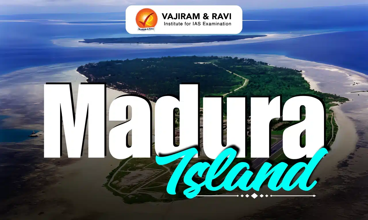
Madura Island

Madura Island Latest News

At least five people were killed and 41 remain missing after a ferry carrying 271 passengers and crew caught fire off Indonesia's Madura Island recently.

About Madura Island

  • It is an Indonesian island located off the northeast coast of Java
  • It's separated from Java by the narrow Madura Strait.  
  • It is known as "The Salt Island" because it produces a lot of salt. 
  • The island covers an area of 5,290 sq.km.
  • Madura Island has a mostly flat landscape. There are no big mountains or huge changes in height.  
  • Most of these people are Madurese. About 3.6 million to 4 million Madurese live on the island.  
  • The Madura people are the third largest people group in Indonesia.  
  • The main language spoken here is Madurese
  • It is famous for its bull races held each year after the harvest. 
  • The main towns on the island include Bangkalan in the west, followed by Sampang, Pamekasan, and Sumenep further east. 
  • Economy
    • The principal industries are cattle raising and salt panning, the latter a government monopoly. 
    • Kapok, copra, and coconut oil are important products, as is teak from forests in the northwest.

News: NDTV

Madura Island FAQs

Q1: Where is Madura Island located?

Ans: Off the northeast coast of Java, Indonesia.

Q2: Which strait separates Madura Island from Java?

Ans: The Madura Strait.

Q3: Why is Madura Island known as the "Salt Island"?

Ans: Because it produces a large quantity of salt.

Q4: What type of landscape does Madura Island have?

Ans: A mostly flat landscape with no major mountains.

TRAI MyCall

TRAI MyCall

TRAI MyCall Latest News

The Telecom Regulatory Authority of India (TRAI) recently launched a revamped version of "TRAI MyCall', a mobile application that enables telecom consumers to directly assess and report the voice-calling experience.

About TRAI MyCall

  • It is a mobile application launched by the Telecom Regulatory Authority of India (TRAI).
  • It is a citizen-centric digital platform that empowers telecom consumers to share real-time feedback on their voice-calling experience, along with relevant network parameters.  
  • The feedback provided by consumers is visible to Telecom Service Providers (TSPs) as well as TRAI in an anonymised form. 
  • This feedback provides valuable insights to TSPs, helping them identify areas where network performance needs improvement and take targeted corrective measures. 
  • This consumer-driven approach is expected to enhance the overall Quality of Service (QoS). 
  • The platform also strengthens evidence-based regulatory oversight by enabling TRAI to assess the Quality of Experience (QoE) across telecom networks based on real consumer feedback. 
  • While network performance is evaluated using technical Quality of Service (QoS) parameters, the QoE perceived by consumers also provides an important perspective on service performance. 
  • The revamped TRAI MyCall application offers several consumer-friendly features, including:
    • Instant rating of voice calls through a simple 1-5 star feedback system.
    • Reporting of specific issues such as call drops, echo during calls, audio delay, cross connection, voice breaking, one party unable to hear the other, and calls taking too long to connect, which shall be available to the respective service provider for corrective action.
    • Automatic post-call feedback prompts for seamless participation.
    • Rating and feedback history on interactive map.
    • Coverage Test feature to assess signal strength.
    • Multilingual support with Bhashini.  

Key Facts about Telecom Regulatory Authority of India

  • It is a regulatory body responsible for overseeing the telecommunications industry in India. 
  • It was established under the Telecom Regulatory Authority of India Act, 1997, passed by Parliament.
  • Objectives:
    • To stimulate the growth and development of the telecommunication sector by creating favorable conditions. 
    • To provide a fair and transparent environment for telcos.
    • To come up with different regulatory directions/mandates on tariffs, DTH, portability of mobile numbers, and so on.
  • Roles and Functions:
    • It sets fair pricing standards for telecom services, such as calls, SMS, and data, to make sure they are affordable to the consumers.
    • TRAI monitors the telcos and makes sure they provide high-quality services when it comes to network coverage, stability, and customer satisfaction/support.
    • It recommends guidelines pertaining to licenses and permissions for new services providers as well as existing ones.
    • TRAI addresses complaints and ensures the companies abide by the consumer protection laws. 
    • It ensures that the businesses providing telecommunication services do not engage in deceptive practices, such as false advertising and hidden charges.
    • Also, it oversees that its regulations are implemented by telcos and enforces penalties on them in case of violation of regulations.
    • TRAI fixes and regulates tariffs provided by telcos, which were earlier vested in the Central Government. 
  • Composition:
    • It consists of a Chairperson, a maximum of two full-time members, and two part-time members.
    • Tenure: Members serve for three years or until the age of 65 years, whichever is earlier.
    • Appointments are made by the Central Government.
  • Telecom Disputes Settlement And Appellate Tribunal (TDSAT):
    • The TRAI Act was amended, establishing a TDSAT to take over the adjudicatory and dispute functions from TRAI. 
    • TDSAT was set up to adjudicate any dispute between a licensor and a licensee, between two or more service providers, between a service provider and a group of consumers, and to hear and dispose of appeals against any direction, decision, or order of TRAI. 

News: PIB

TRAI MyCall FAQs

Q1: What is TRAI MyCall?

Ans: A mobile application launched by the Telecom Regulatory Authority of India (TRAI).

Q2: What is the primary purpose of the TRAI MyCall app?

Ans: To enable telecom consumers to provide real-time feedback on their voice-calling experience.

Q3: Who can view the feedback submitted through the TRAI MyCall app?

Ans: Telecom Service Providers (TSPs) and TRAI in anonymised form.

Q4: How does the feedback collected through TRAI MyCall help Telecom Service Providers?

Ans: It helps them identify network issues and take corrective measures.

Banderol Missile

Banderol Missile

Banderol Missile Latest News

Russia’s new low-cost S8000 Banderol cruise missile is quietly changing the air war over Ukraine’s Black Sea coast.

About Banderol Missile

The S8000 Banderol, which translates to "package" or "small parcel," is a cruise missile developed by Russia.

Banderol Missile Launch Platforms

  • It is primarily an air-launched munition, with the Orion unmanned aerial vehicle (UAV) serving as its primary launch platform. 
  • The missile is also integrated for use with the Mi-28 Havoc helicopter. 
  • However, reports indicate that Russian has developed a compact ground launcher for the S8000 Banderol, moving beyond its previous airborne carriers. 

Banderol Missile Features

  • The missile's design prioritizes low production costs and simplified manufacturing, incorporating imported foreign components for key systems.
  • It is approximately 5 m long, with a wingspan of 2.2 m and a body diameter of 30 cm.  
  • Powered by a small, commercially available Chinese turbojet engine, it can travel up to 500 km.  
  • Its maximum speed is 620–650 km/h, and its cruising speed is 520–560 km/h.
  • It carries a relatively small high-explosive fragmentation warhead that includes about 50 kilograms of explosives. 
  • The missile navigates using inertial and satellite guidance.

News: HT

Banderol Missile FAQs

Q1: What is the S8000 Banderol?

Ans: A cruise missile developed by Russia.

Q2: What is the primary launch platform of the S8000 Banderol missile?

Ans: The Orion unmanned aerial vehicle (UAV).

Q3: What type of engine powers the S8000 Banderol missile?

Ans: A commercially available Chinese turbojet engine.

Q4: What is the maximum range of the S8000 Banderol missile?

Ans: Up to 500 kilometres.

Right to Health in India, Article, Provision, Case Laws, Global Context

Right to Health

The Right to Health means that every person has the right to attain the highest possible standard of physical, mental and social well being. It is a fundamental human right closely linked with dignity, equality and development. Although the Constitution of India does not explicitly mention it as a Fundamental Right. However Judicial Interpretation, Directive Principles of State Policy (DPSPs) and International Commitments have gradually strengthened its legal and policy framework in India.

Right to Health in India 2026

The Right to Health ensures access to healthcare services, medicines, sanitation, safe drinking water, health information and preventive and emergency medical care without discrimination. It also includes equal opportunities to achieve the highest attainable standard of health.

  • Human Dignity: Health is considered an essential part of the right to live with dignity. Governments have the responsibility to provide accessible, affordable and quality healthcare irrespective of gender, religion, race, ethnicity, or economic status.
  • Rajasthan Right to Health Act: Rajasthan became the first Indian state to enact a Right to Health law. It provides every resident free consultation, medicines, diagnostics, emergency transport, procedures and emergency treatment in all public health institutions and selected private hospitals as prescribed under rules.

Right to Health Constitutional and Legal Provisions

The constitutional framework and judicial interpretation together provide a strong legal basis for recognising healthcare as an essential right in India.

  • Article 21: The Supreme Court has interpreted Article 21, which guarantees the Right to Life and Personal Liberty, to include the Right to Health because a life with dignity cannot exist without adequate healthcare.
  • Directive Principles of State Policy: Articles 38, 39, 42, 43 and 47 under the Part 4 of Indian Constitution require the State to promote social justice, improve nutrition, raise the standard of living, ensure humane working conditions and improve public health.
  • Universal Declaration of Human Rights: India is a signatory to Article 25 of the Universal Declaration of Human Rights (1948), which recognises every person's right to an adequate standard of living, including food, housing, clothing, medical care and essential social services.

Right to Health Case Laws

Indian courts have significantly expanded the scope of the Right to Health through landmark judgments that established healthcare as a constitutional obligation.

  • Parmanand Katara vs Union of India (1989): The Supreme Court ruled that every doctor, whether working in a government or private hospital, has a professional duty to provide immediate medical assistance to save human life without delay.
  • Paschim Banga Khet Mazdoor Samity vs State of West Bengal (1996): The Supreme Court held that providing adequate medical facilities is a constitutional responsibility of a welfare state and governments cannot deny timely medical treatment because of administrative shortcomings.
  • Menstrual Hygiene Judgment: The Supreme Court held that menstrual hygiene forms an integral part of Article 21. It directed all States, Union Territories and both government and private schools to provide free biodegradable sanitary napkins, hygienic separate toilets and implement the National Menstrual Hygiene Policy for schoolgirls from Classes VI to XII.

Right to Health International Recognition

The Right to Health is recognised globally through international human rights instruments that promote universal and equitable healthcare.

  • WHO Recognition: The concept gained international recognition in 1946 with the establishment of the World Health Organization (WHO), which recognised health as a basic human right and promoted universal access to healthcare.
  • Universal Declaration of Human Rights (1948): Article 25 recognises the right to an adequate standard of living, including medical care, nutrition, housing, clothing and social security necessary for health and well being.
  • International Covenant on Economic, Social and Cultural Rights: Article 12 recognises the right of every individual to enjoy the highest attainable standard of physical and mental health and encourages governments to strengthen public health systems.
  • Global Human Rights Framework: Regional human rights instruments, including the African Charter on Human and Peoples' Rights and the American Convention on Human Rights, also recognise healthcare as a fundamental human right.

Right to Health Challenges

Despite policy improvements, several structural and financial barriers continue to limit universal access to quality healthcare across India.

  • Weak Healthcare Infrastructure: India has only 1.4 hospital beds per 1,000 people, one doctor for every 811 people and 1.7 nurses per 1,000 people. More than 75% of healthcare infrastructure is located in metro cities, while 73% of the population lives outside them.
  • High Disease Burden: India faces both communicable and non communicable diseases, including tuberculosis, HIV/ AIDS, malaria and diabetes. According to Frontiers in Public Health, over 33% of the ailing population still suffers from infectious diseases.
  • High Out of Pocket Expenditure: Per capita out of pocket expenditure on infectious diseases is ₹7.28 for inpatient care and ₹29.38 for outpatient care, increasing the financial burden on households and raising the risk of poverty.
  • Gender Inequality: The World Economic Forum 2021 placed India among the five lowest ranked countries for female health and survival. Between 2017 and 2019, women from poor households recorded more than 2,25,000 fewer hospital visits than men for nephrology, cardiology and oncology services.
  • Low Public Health Financing: The allocation under Union Budget on healthcare was only 0.26% of GDP in FY26, significantly below the average of around 1.8 to 1.9% of GDP public spending, limiting investments in infrastructure and healthcare personnel.

Right to Health Significance

The Right to Health strengthens inclusive development by ensuring healthcare becomes an enforceable public responsibility rather than merely a welfare service.

  • Rights Based Healthcare: A legal right creates accountability and compels governments to ensure accessible, affordable and quality healthcare for every citizen instead of relying only on welfare schemes.
  • Universal Access: It promotes equal availability of consultation, medicines, diagnostics, emergency services, sanitation and preventive healthcare, reducing disparities between different regions and social groups.
  • Financial Protection: Expanding free and affordable healthcare reduces out of pocket expenditure, prevents medical poverty and improves financial security for economically weaker households.
  • Better Public Health Outcomes: Improved healthcare access supports disease prevention, early diagnosis, timely treatment, lower mortality, stronger workforce productivity and sustainable social and economic development.
  • Greater Transparency and Accountability: Legal recognition of health rights improves patient awareness, strengthens institutional responsibility, enhances transparency in treatment and encourages responsive healthcare governance.

Right to Health FAQs

Q1: What is the Right to Health?

Ans: The Right to Health means every person has the right to access quality healthcare and attain the highest possible standard of physical and mental well being without discrimination.

Q2: Is the Right to Health a Fundamental Right in India?

Ans: The Constitution does not explicitly mention it as a Fundamental Right, but the Supreme Court has interpreted Article 21 to include the Right to Health.

Q3: Which state became the first to pass a Right to Health law?

Ans: Rajasthan became the first Indian state to enact a Right to Health law, providing free healthcare services at public health institutions and specified private hospitals.

Q4: Which constitutional provisions support the Right to Health in India?

Ans: Article 21 and the Directive Principles of State Policy under Articles 38, 39, 42, 43 and 47 together provide the constitutional foundation for the Right to Health.

Q5: What are the major challenges to ensuring the Right to Health in India?

Ans: Key challenges include inadequate healthcare infrastructure, low public health spending, high disease burden, gender disparities and significant out of pocket healthcare expenditure.

Modified Interest Subvention Scheme

Modified Interest Subvention Scheme

Modified Interest Subvention Scheme Latest News

A third-party assessment by the Institute for Social and Economic Change (ISEC), Bengaluru said that every ₹1 invested under Kisan Credit Card– Modified Interest Subvention Scheme (KCC-MISS) contributes ₹2.30 to net value addition in the agriculture & allied sector. 

About Modified Interest Subvention Scheme

  • It is a Central Sector Scheme launched in 2006–07 by the Government of India.
  • Aim: It is aimed at ensuring the availability of short-term credit to farmers at an affordable interest rate through Kisan Credit card (KCC).
  • Under the Scheme: 
    • Farmers received short-term loans of up to Rs.3 lakh through Kisan Credit Cards (KCC) at a subsidized interest rate of 7%, with 1.5% interest subvention provided to eligible lending institutions.
    • Additionally, farmers repaying loans promptly are eligible for an incentive of up to 3% as Prompt Repayment Incentive (PRI) effectively reducing their interest rate on KCC loans to 4%.
    • For loans taken exclusively for animal husbandry or fisheries, the interest benefit is applicable up to Rs.2 lakh.
  • It is implemented by the Reserve Bank of India (RBI) and the National Bank for Agriculture and Rural Development (NABARD).
  • It is operated through Public Sector Banks, Regional Rural Banks (RRBs), Cooperative Banks and Private Sector Banks operating in rural and semi urban areas.

Source: PIB

Modified Interest Subvention Scheme FAQ's

Q1: What is the objective of Modified Interest Subvention Scheme?

Ans: Ensure affordable credit to farmers

Q2: What is the rate of interest subvention provided to lending institutions under MISS?

Ans: 1.5%

Ethiopia

Ethiopia

Ethiopia Latest News

Recently, a landslide triggered by heavy rainfall in Ethiopia's Amhara region killed 14 people and injured several others. 

About Ethiopia

  • Location: It is a landlocked country in the Horn of Africa.
  • It lies entirely within tropical latitudes.
  • Bordering Countries: It is bordered by six countries namely Eritrea (North), Djibouti (Northeast), Somalia (East), Kenya (South), South Sudan and Sudan (West).
  • Capital City: Addis Ababa

Geographical Features of Ethiopia

  • Topography: The five major topographic features of the country are the Rift Valley, Western and Eastern Highlands, and Western and Eastern Lowlands.
    • The Denakil Plain, in which a depression known as the Kobar Sink drops as low as 380 feet (116 metres) below sea level, is found here  in its rift valley. 
  • Climate: Most of Ethiopia has a tropical climate.
  • Highest Point: Mount Ras Dejen which is 4,533 m high
  • Major Rivers: It has three main rivers in Ethiopia are the Blue Nile, the Omo River, and the Awash River. 
  • Lakes: Lake Tana which is located in the northwest of the Ethiopian Highlands.
  • Natural Resources: It has reserves of precious metals and other natural resources such as gold, potash, natural gas, copper, and platinum.

Source: TH

Ethiopia FAQs

Q1: What is the capital of Ethiopia ?

Ans: Addis Ababa

Q2: Which crop is Ethiopia famous for and is a major export?

Ans: Coffee

Baba Baidyanath Dham Temple

Baba Baidyanath Dham Temple

Baba Baidyanath Dham Temple Latest News

A large number of devotees thronged the Baba Baidyanath Dham temple in Jharkhand’s Deoghar on the first Monday of the holy month of Shravan.

About Baba Baidyanath Dham Temple

  • It is a Hindu temple dedicated to Lord Shiva located in Deoghar, Jharkhand
  • It is one of the 12 Jyotirlingas in India.
  • This ancient temple has been mentioned in several ancient scriptures, such as Puranas, Vedas, Mahabharata, Ramayana, etc.

Baba Baidyanath Dham Temple History

  • The mythological origin of Baidyanath Dham is tied to the legend of King Demon Ravana, who was granted a boon by Lord Shiva to take a sacred Jyotirlinga to his palace in Lanka. 
  • But he placed it on the ground in Deoghar, where the Lingam permanently resides. 
  • Historical records suggest the temple's original construction in the 8th century by Puran Mal, an ancestor of the Nagavanshi dynasty. 
  • Over the centuries, the temple has seen numerous renovations and expansions, reflecting various architectural styles and cultural influences. 
  • The current structure is attributed to Raja Man Singh in the 16th century.
  • The temple hosts the famous Shravani Mela, one of the largest annual religious gatherings in India.

Baba Baidyanath Dham Temple Architecture

  • The temple showcases the classic Nagara style of North Indian architecture.  
  • The temple complex is spread over an area of 12 acres and consists of 22 temples dedicated to various deities. 
  • The main temple is the Baidyanath Jyotirlinga Temple, which houses the lingam of Shiva. 
  • The temple is built of stone and has a pyramidal tower that rises to a height of 72 feet. 
  • The temple has a simple and elegant design, with a spacious hall, a sanctum, and a vestibule. 

News: DD

Baba Baidyanath Dham Temple FAQs

Q1: Where is Baba Baidyanath Dham Temple located?

Ans: Deoghar, Jharkhand.

Q2: To which deity is Baba Baidyanath Dham Temple dedicated?

Ans: Lord Shiva.

Q3: Who is believed to have originally constructed Baba Baidyanath Dham Temple?

Ans: Puran Mal, an ancestor of the Nagavanshi dynasty.

Q4: Which style of architecture is seen in Baba Baidyanath Dham Temple?

Ans: Nagara style of North Indian architecture.

Q5: Why is Baba Baidyanath Dham considered one of India's most important pilgrimage sites?

Ans: Because it is one of the 12 Jyotirlingas dedicated to Lord Shiva and hosts the annual Shravani Mela.

Dikhow River

Dikhow River

Dikhow River Latest News

Flash floods from the Dikhow River recently submerged Assam's Nepali Khuti, a self-reliant Gorkha dairy village, within two hours, destroying homes, livestock, and livelihoods completely.

About Dikhow River

  • It is an important south bank tributary of the Brahmaputra River.
  • Course
    • It originates in the Zunheboto district of Nagaland and enters into the Assam plain through Naginimara of the Sivsagar district of Assam.
    • It flows through the Sivsagar district only to join with the river Brahmaputra at Dikhowmukh on its southern bank within the district. 
  • The total length of the river is 236 km.
  • The river basin is surrounded by the Brahmaputra River in the north, the Buridihing basin in the east, the Jhanji basin in the west, and the Naga Hills in the south.
  • The river leaves more than fifteen abandoned channels at different places in the Assam plain mostly in the form of Ox-bow Lakes.

News: RED

Dikhow River FAQs

Q1: Of which major river is the Dikhow River a tributary?

Ans: The Brahmaputra River.

Q2: Where does the Dikhow River originate?

Ans: Zunheboto district of Nagaland.

Q3: Through which district of Assam does the Dikhow River enter the Assam plain?

Ans: Sivasagar district (through Naginimara).

Q4: What is the total length of the Dikhow River?

Ans: 236 km.

Electronic Voting Machine (EVM), Voting Process in India, Model

Electronic Voting Machine

Electronic Voting Machine (EVM) is a device used to record votes during elections. India first used EVMs in the Paravur Assembly Constituency of Kerala in 1982. The Election Commission of India gradually expanded their use from 1998. All state elections and by-elections used EVMs in 2003. Since the 2004 Lok Sabha elections, EVMs have been the standard voting system across the country. The system aims to improve accuracy, speed, transparency and efficiency in the electoral process.

What is an EVM (Electronic Voting Machine)?

An Electronic Voting Machine (EVM) is a portable microcontroller based voting system developed by the Technical Experts Committee of the Election Commission of India with BEL and ECIL. It consists of a Control Unit and a Ballot Unit connected by a cable. The polling officer operates the Control Unit, while the voter presses the blue button on the Ballot Unit against the preferred candidate and symbol to record the vote electronically.

Electronic Voting Machine Features

The major features of the Electronic Voting Machine (EVM) has been listed below:

  • Development: EVMs were designed by the Technical Experts Committee (TEC) with Bharat Electronics Limited under the Ministry of Defence and Electronics Corporation of India Limited under the Department of Atomic Energy.
  • Model: Presently, the M3 Model consists of a Ballot Unit (BU), Control Unit (CU) and Voter Verifiable Paper Audit Trail (VVPAT).
  • Voting Process: The polling officer activates the ballot from the Control Unit. The voter presses the blue button beside the candidate's name and symbol on the Ballot Unit to cast the vote.
  • Stand alone architecture: EVMs are not connected to any network and do not use an operating system. This design prevents remote access or external communication.
  • Programming: The machines use one time programmable or masked microchips that cannot be read, rewritten, or reprogrammed after manufacturing.
  • Voting Capacity: One EVM can record up to 2,000 votes. Generally, around 1,500 votes are recorded during actual polling for operational efficiency.
  • Candidate Capacity: Each Ballot Unit supports 16 candidates including NOTA. Up to 24 Ballot Units can be linked, allowing a maximum of 384 candidates including NOTA in the M3 model.
  • Counting and Control Features: Pressing the "TOTAL" button displays total votes polled without revealing candidate wise results. After the "CLOSE" button is pressed, no further voting is possible.

Voter Verifiable Paper Audit Trail (VVPAT)

Voter Verifiable Paper Audit Trail (VVPAT) is an independent verification system attached to the Electronic Voting Machine (EVM). It enables voters to confirm that their vote has been correctly recorded.

  • Introduction: VVPAT was first used in the 2013 bye-election of Noksen Assembly Constituency in Nagaland. It was deployed in all constituencies during the 2019 Lok Sabha elections.
  • Working Mechanism: After voting, a paper slip displaying the serial number, candidate name and symbol remains visible through a transparent window for 7 seconds before automatically dropping into a sealed box.
  • Access and security: Only authorised polling officials can access the VVPAT unit. The printed slips remain sealed and are preserved for verification whenever legally required.

Electronic Voting Machine Significance

The key highlighting importance and advantages of the Electronic Voting Machine has been listed below:

  • Battery operated machine: EVMs do not require electricity. They run on independent battery power, making them suitable for remote and electricity deficient polling stations.
  • Anti booth capturing safeguard: EVMs permit a maximum of four votes per minute, reducing the possibility of large scale bogus voting through booth capturing.
  • Faster election results: Electronic counting significantly reduces counting time. Results can generally be declared within a few hours instead of taking several days.
  • Cost savings: EVMs reduce expenditure on paper, printing, transportation, storage and distribution because millions of ballot papers are no longer required for every election.
  • Enhanced transparency: VVPAT enables voters to verify their vote immediately. Under Rule 56D of the Conduct of Elections Rules, 1961, VVPAT slips can be counted in specified situations and VVPAT count prevails in case of any discrepancy.

Electronic Voting Machine Challenges

Despite multiple safeguards, Electronic Voting Machines continue to face public debate regarding transparency and reliability in the electoral process as highlighted below:

  • Transparency: Critics argue that the internal functioning of EVMs is not fully visible to the public, leading to demands for greater verification and independent scrutiny.
  • Reliability: Concerns are occasionally raised regarding hardware failure or technical malfunction, although failed machines are replaced and examined under established procedures.
  • Trust deficit: Some political parties and voters continue to seek additional safeguards, including wider VVPAT verification, despite existing technical and administrative protections.
  • ADR petition: In 2023, the Association for Democratic Reforms requested a return to paper ballots, voter handling of VVPAT slips and 100% VVPAT counting. In 2024, the Supreme Court rejected these requests while introducing measures to strengthen confidence through stricter verification.

Electronic Voting Machine FAQs

Q1: What is an Electronic Voting Machine (EVM)?

Ans: An Electronic Voting Machine (EVM) is a device used by the Election Commission of India to electronically record and count votes during elections.

Q2: What is the purpose of VVPAT with an EVM?

Ans: VVPAT allows voters to verify their vote by displaying the candidate's name and symbol on a paper slip for 7 seconds before storing it securely.

Q3: When were EVMs first used in India?

Ans: EVMs were first used in the Paravur Assembly Constituency of Kerala in 1982 and became the standard voting system for Lok Sabha elections in 2004.

Q4: Can an EVM work without electricity?

Ans: Yes. EVMs operate on independent batteries and do not require an external electricity supply, making them suitable for remote polling stations.

Q5: How many votes can an EVM record?

Ans: An Election Commission of India EVM can record a maximum of 2,000 votes and supports up to 384 candidates, including NOTA, in the M3 model.

Illegal Geotagging: Why Kerala Wants Sensitive Forest Spots Off Online Maps

Illegal Geotagging

Illegal Geotagging Latest News

  • The Kerala Forest Department has decided to identify and remove illegally geotagged locations within the state's forests from online mapping platforms, citing risks to human lives, wildlife, and ecologically fragile zones.

Geotagging

  • Geotagging is the process of attaching geographical information (such as latitude, longitude, altitude, date, and time) to digital content like photographs, videos, social media posts, or documents. 
  • It enables the precise location where the content was created or shared to be identified.

Uses of Geotagging

  • Navigation and location-based services. 
  • Disaster management and emergency response. 
  • Environmental monitoring and scientific research. 
  • Land records, urban planning, and infrastructure management. 
  • Tourism, logistics, and asset tracking. 
  • Social media location sharing.

Concerns

  • Violation of personal privacy by revealing a person's location.
  • Increased risk of stalking, theft, or cybercrime.
  • Exposure of sensitive military or strategic locations.
  • Misuse by criminals or hostile actors for surveillance.

What Is Illegal Geotagging?

  • Illegal geotagging refers to the unauthorized capture, sharing, or publication of location-specific information that is prohibited by law or poses a threat to national security, public safety, or individual privacy.

Examples

  • When sensitive ecological locations within protected forest areas are publicly marked without approval.
    • Notably, even trekking routes used by forest department personnel inside protected areas — including parts of Silent Valley — had appeared on online maps.
  • Geotagging and uploading photographs of military installations, air bases, naval facilities, or strategic infrastructure.
  • Publishing the precise location of individuals without their consent, violating privacy laws.
  • Geotagging critical infrastructure such as nuclear plants, ammunition depots, or communication facilities where disclosure is restricted.

Legal Perspective in India

  • There is no standalone law that bans geotagging. 
  • However, geotagging becomes illegal when it violates provisions under laws such as the Official Secrets Act, 1923, the Bharatiya Nyaya Sanhita (BNS), 2023 (where applicable), the Digital Personal Data Protection Act, 2023, or other security-related regulations.
  • Government agencies may also impose restrictions on photographing or mapping specific sensitive locations.

What Prompted the Move

  • The Kerala govt said geotagged locations inside protected forest areas were directing visitors toward places where entry could be dangerous, while also disturbing the surrounding ecosystem.
  • The decision follows growing concerns among forest officials over the rising number of sensitive locations appearing on digital maps.
  • Kozhikode Divisional Forest Officer had earlier sought removal of Google Maps listings within reserve forests in his district, noting they encouraged unauthorised entry.

The Process: Identification and Removal

  • The department's IT wing has been tasked with identifying illegally tagged locations and preparing a list for the Forest Management Wing.
  • A final list will be submitted to online map platforms, requesting removal of the tags.
  • The department also plans to identify individuals who uploaded such geotags within reserve and protected forest areas and pursue legal action where required.

Why This Is a Concern

  • Disaster Risk
    • Many illegally tagged locations lie in mountainous regions vulnerable to landslides and other natural hazards, particularly during the monsoon season.
    • Tourists seeking to witness the Kerala monsoon are increasingly stepping into these dangerous zones.
  • Wildlife and Ecological Risk
    • Exposing wildlife corridors increases the risk of human-animal conflict, especially in areas inhabited by elephants, big cats, and bison, which require controlled access.
    • Officials stressed that the "sanctity" of such areas must be preserved, and unauthorised tourism entry cannot be permitted.

Additional Measures Planned

  • Forest teams have been instructed to engage with human habitations near sensitive zones.
  • The department is working with local bodies to establish a regulatory mechanism preventing illegal entry and future unauthorised tagging.
  • Environmental organisations in Kerala have also flagged concerns over unregulated access to protected forests, urging authorities to curb illegal geotagging of ecologically sensitive areas.

Conclusion

  • Kerala's initiative to remove sensitive forest locations from digital maps highlights an emerging governance challenge at the intersection of technology and conservation — where unchecked digital visibility of fragile ecosystems can directly endanger both human lives and wildlife. 
  • By combining platform-level removal requests, legal action against violators, and local regulatory coordination, the state is attempting a comprehensive response, one that may serve as a model for other ecologically sensitive regions across India.

Source: IE | OL

Illegal Geotagging FAQs

Q1: What is Illegal Geotagging and why is Kerala removing forest locations from online maps?

Ans: Illegal Geotagging refers to the unauthorised sharing of sensitive locations. Kerala is removing such forest geotags to prevent illegal entry, protect wildlife, and improve visitor safety.

Q2: How is Illegal Geotagging defined in India?

Ans: Illegal Geotagging is the unauthorised publication of location-specific information that threatens ecological security, public safety, privacy, or national security, violating applicable Indian laws.

Q3: Which laws regulate Illegal Geotagging in India?

Ans: Illegal Geotagging may violate the Official Secrets Act, 1923, the Digital Personal Data Protection Act, 2023, the Bharatiya Nyaya Sanhita, 2023, and other security-related regulations.

Q4: Why is Illegal Geotagging a major concern for forests and wildlife?

Ans: Illegal Geotagging exposes ecologically sensitive locations, encourages unauthorised tourism, increases human-wildlife conflict, and threatens conservation efforts in protected forests.

Q5: How can Illegal Geotagging be prevented in protected forest areas?

Ans: Illegal Geotagging can be tackled by identifying and removing sensitive geotags, taking legal action against violators, coordinating with mapping platforms, and strengthening local monitoring mechanisms.

Europe’s Wildfires: Why They’re Growing Bigger, Hotter and Harder to Control Explained

Europe's Wildfires

Europe's Wildfires Latest News

  • Wildfires raging across Europe have reached alarming intensity, with Greece witnessing some of its most severe fires yet. 
  • France saw its largest peace-time evacuation, Spain lost 172,000 hectares, and major blazes have hit Portugal, Italy, Cyprus, and Croatia — producing apocalyptic scenes of ash-covered forests, orange skies, and smoke plumes visible from space.

Climate Whiplash: The Wet-Then-Dry Trigger

  • Climate whiplash refers to rapid swings between weather extremes.
  • In western Europe, an unusually wet period earlier this year spurred explosive growth of grasses, shrubs, and undergrowth.
  • This vegetation then dried out under successive heatwaves and drought, creating abundant fuel awaiting a spark.
  • Researchers note this wet-then-dry sequence is becoming more common as climate change intensifies both ends of the weather spectrum — the same pattern that fuelled last year's California wildfires.

Fire Clouds: Why Some Blazes Become Unstoppable

  • A striking feature of this year's fires is the emergence of pyrocumulonimbus clouds (pyroCb), or "fire clouds.

How They Form and Why are They Dangerous 

  • Large wildfires release intense heat; hot air, smoke, ash, and moisture rise rapidly, cool, and condense around smoke particles to form towering clouds.
  • These clouds can grow into full thunderstorms reaching 10-15 km into the atmosphere, even penetrating the stratosphere.
  • Collisions between ice crystals, water droplets, and ash inside these clouds generate lightning, which can ignite new fires kilometres from the original blaze. 
  • The storms also create powerful, erratic winds that can suddenly shift a fire's direction or speed — trapping firefighters and residents.
  • In extreme cases, a wildfire effectively creates its own weather system.
  • Experts warn that intensifying heatwaves and droughts are enabling "sixth-generation wildfires" — extremely intense events that destroy biodiversity and release massive carbon dioxide, further fuelling global warming.

Beyond Climate Change: The Land-Use Factor

  • Decades of rural-to-urban migration across Europe have led to abandoned farms and declining livestock grazing.
  • Areas once kept open through agriculture are now covered with dense shrubs, young trees, and dry vegetation, creating a continuous layer of combustible fuel that lets fires spread faster and farther.
  • A 2023 OECD report notes that land abandonment in the Mediterranean has caused significant fuel buildup, contributing to rising wildfire risk over the past century.

Economic and Environmental Consequences

  • As per the UNECE (July 30 report): wildfires threaten lives, destroy homes and infrastructure, and force community evacuations.
  • Wildfires cost the European Union around EUR 2.5 billion annually through infrastructure damage, lost tourism revenue, and disrupted economic activity.
  • Long-term costs include ecosystem degradation, biodiversity loss, reduced agricultural productivity, and public health impacts.

The Way Ahead: Shifting Emergency Management Strategy

  • Experts note that while the overall number of fires has declined due to improved suppression capabilities, fires that escape initial control now develop with unprecedented intensity and speed.
  • This calls for a fundamental shift: protecting people, not just suppressing fires, must become the central objective — with greater focus on risk communication, public preparedness, and timely evacuation.
  • Long-term resilience requires actively managing agroforestry landscapes, addressing rural abandonment, and building diverse, resilient ecosystems — not just firefighting.

Wildfires in India

  • India also faces a growing wildfire risk, with the Forest Survey of India detecting thousands of fire incidents annually.
  • Highest fire-prone regions: parts of the Northeast, pockets of Odisha, Chhattisgarh, and central/southern India; Himalayan states like Uttarakhand and Himachal Pradesh battle severe summer fires.
  • Top 5 states by forest fire detections (2025-26): Maharashtra, Madhya Pradesh, Chhattisgarh, Andhra Pradesh, and Odisha.
  • Key distinction: Unlike Europe's frequently lightning-triggered fires, most Indian forest fires are linked to human activity — agricultural burning, forest produce collection, or accidental ignition.

Conclusion

  • Europe's wildfires are no longer just a weather phenomenon — they represent the convergence of climate change-driven weather extremes, self-sustaining fire cloud dynamics, and decades of land-use change from rural abandonment. 
  • As fires grow increasingly unpredictable and destructive, experts stress a shift from pure suppression toward comprehensive risk management, landscape stewardship, and public preparedness — lessons equally relevant for fire-prone regions in India.

Source: IE | N18

Europe's Wildfires FAQs

Q1: Why are Europe's Wildfires becoming bigger, hotter, and harder to control?

Ans: Europe's Wildfires are intensifying because climate whiplash, prolonged heatwaves, droughts, and accumulated vegetation create conditions for larger and more destructive fires.

Q2: What are fire clouds discussed in Europe's Wildfires?

Ans: Europe's Wildfires explains that pyrocumulonimbus or fire clouds generate lightning and powerful winds, creating self-sustaining fires that spread rapidly and become difficult to control.

Q3: How does land-use change contribute to Europe's Wildfires?

Ans: Europe's Wildfires highlights that rural abandonment, declining grazing, and unmanaged vegetation have increased combustible fuel, enabling wildfires to spread faster across landscapes.

Q4: What are the economic and environmental impacts of Europe's Wildfires?

Ans: Europe's Wildfires cause loss of life, biodiversity decline, infrastructure damage, reduced tourism, agricultural losses, and annual economic costs running into billions of euros.

Q5: What lessons does Europe's Wildfires offer for India?

Ans: Europe's Wildfires emphasises better landscape management, wildfire preparedness, public awareness, timely evacuation, and long-term ecosystem resilience to reduce growing wildfire risks in India.

Taxation and Other Laws (Amendment) Bill, 2026 – Explained

Taxation

Taxation Latest News

  • The Government has proposed several tax reforms through the Taxation and Other Laws (Amendment) Bill, 2026, including relaxation of tax rules for offshore funds, extension of tax incentives for electronics contract manufacturing, and new exemptions for data centres and foreign investors.

Background

  • In recent years, India has introduced a series of tax reforms to attract global investments, strengthen domestic manufacturing, and position itself as a preferred destination for international fund management. 
  • However, industry stakeholders have argued that certain provisions under the Income-tax Act imposed restrictive conditions on offshore investment funds and created uncertainty for multinational companies operating in sectors such as electronics manufacturing and data centres.
  • Following representations from industry and in view of evolving global economic conditions, the Government has proposed amendments through the Taxation and Other Laws (Amendment) Bill, 2026
  • The proposed changes aim to simplify the tax framework, improve ease of doing business, enhance India's competitiveness, and support key sectors such as electronics, financial services, mining, and digital infrastructure.

Key Highlights of the Proposed Tax Reforms

  • Relaxation of Tax Conditions for Offshore Funds
    • The Bill proposes significant changes to the taxation framework governing Eligible Investment Funds (EIFs) or offshore funds managed from India.
    • At present, offshore funds are required to satisfy 13 conditions to ensure that their fund management activities in India do not constitute a taxable business presence.
    • The proposed amendments remove 8 out of these 13 conditions, thereby substantially easing compliance requirements.
  • Conditions Proposed to be Removed
    • Minimum 25 investors in the fund. 
    • Maximum 10% participation interest by a single investor. 
    • Restriction on investing more than 25% of the corpus in a single entity.
    • Restriction on investments in associate entities.
    • Minimum monthly average corpus requirement of ₹100 crore.
    • Other structural conditions which are considered inconsistent with global fund management practices.
    • Experts have observed that these provisions were not aligned with international fund structures and often discouraged offshore funds from locating their fund management operations in India.
  • After the proposed amendments, offshore funds will primarily be required to satisfy only five key conditions:
    • The fund should not be a resident of India. 
    • The fund should not directly or indirectly control or manage any business in India.
    • Investment by Indian residents should not exceed 5% of the corpus as on 1 April and 1 October of the relevant financial year.
    • The revised framework is also expected to create greater uniformity between offshore funds operating in India and those located in the International Financial Services Centre (IFSC).

Extension of Tax Incentives for Electronics Contract Manufacturing

  • The Bill proposes to extend the tax exemption available to foreign companies supplying capital goods, machinery, equipment, or tooling to Indian electronics contract manufacturers.
  • The tax exemption, which was earlier available until 2030-31, is proposed to be extended by ten years, up to 2040-41.
  • The proposal is expected to benefit global electronics companies, particularly those adopting the contract manufacturing model in India, by providing long-term tax certainty and encouraging greater investment in domestic manufacturing.
  • The Bill also introduces a new tax exemption for foreign companies involved in:
    • Storage of electronic components in customs-bonded warehouses.
    • Sale of such components to Indian contract electronics manufacturers.
    • The measure seeks to strengthen India's electronics manufacturing ecosystem by facilitating smoother supply chains and reducing tax-related uncertainties for multinational firms.
  • Tax Relief for Data Centres
    • Recognising the rapid expansion of India's digital economy, the Bill proposes several measures to promote investment in data centre infrastructure.
    • The proposed amendments include:
      • Expanding the definition of an eligible data centre to include facilities operated through both ownership and leasing
      • Removing the requirement for a separate Central Government notification for foreign companies procuring data centre services from specified facilities in India. 
      • These measures are expected to reduce procedural hurdles and align the tax framework with prevailing commercial practices in the sector.
  • Tax Holiday for Diamond Trading Entities
    • To strengthen India's position in the global diamond trade, the Bill proposes a 15-year tax holiday, extending up to 31 March 2041, for specified foreign companies operating in notified special zones.
    • The proposed exemption will apply to entities engaged as:
      • Mining companies 
      • Sightholders 
      • Brokers 
      • Aggregators 
      • Tender or auction entities 
    • The exemption covers income earned from the sale of rough diamonds within the notified special zone.

Replacement of the Income-tax (Amendment) Ordinance, 2026

  • The Bill also seeks to replace the Income-tax (Amendment) Ordinance, 2026, which was promulgated on 5 June 2026.
  • The Ordinance had provided tax relief to Foreign Portfolio Investors (FPIs) by exempting:
    • Capital gains on investments in Government securities. 
    • Withholding tax on such investments. 
  • According to the Government, the Ordinance was introduced to:
    • Mitigate the impact of external economic shocks.
    • Support domestic economic stability. 
    • Encourage foreign capital inflows. 
  • The proposed Bill seeks to incorporate these provisions into permanent legislation while introducing additional tax measures based on stakeholder feedback received after the enactment of the Finance Act, 2026.

Significance of the Proposed Reforms

  • The proposed amendments are expected to:
    • Position India as a more attractive destination for global fund management.
    • Enhance the competitiveness of the IFSC
    • Provide long-term policy certainty to electronics manufacturers. 
    • Promote investment in data centres and digital infrastructure. 
    • Encourage foreign investment in Government securities. 
    • Strengthen India's role in global value chains. 
  • Collectively, these measures align with broader government initiatives such as Make in India, Digital India, and efforts to improve the country's ease of doing business.

Source: TH | IE

Taxation FAQs

Q1: What is the objective of the Taxation and Other Laws (Amendment) Bill, 2026?

Ans: It aims to simplify tax provisions, promote investment, improve ease of doing business, and provide tax certainty across key sectors.

Q2: How many conditions for Eligible Investment Funds are proposed to be removed?

Ans: The Bill proposes to remove 8 out of the existing 13 conditions.

Q3: Till when is the tax exemption for electronics contract manufacturing proposed to be extended?

Ans: The exemption is proposed to be extended until 31 March 2041.

Q4: Which investors benefited from the Income-tax (Amendment) Ordinance, 2026?

Ans: Foreign Portfolio Investors (FPIs) investing in Government securities were granted exemptions from capital gains tax and withholding tax.

Q5: How will the proposed reforms benefit India's data centre sector?

Ans: The reforms expand the definition of eligible data centres, recognise leased facilities, and reduce procedural requirements, thereby encouraging investment in digital infrastructure.

NOTTO’s National Organ Transplant Portal

NOTTO

NOTTO Latest News

  • The National Organ and Tissue Transplant Organisation (NOTTO) has launched a dynamic real-time national portal and mobile application to digitise India's organ transplantation ecosystem. 
  • The platform aims to establish a unified nationwide waiting list, enable transparent organ allocation, facilitate national-level donor matching, and improve transplant outcome monitoring.
  • This will help in strengthening equity, efficiency, and accountability in organ transplantation.

Why the Portal is Significant

  • The portal represents a major reform in India's organ transplantation framework by -
    • Reduce delays in transplantation by creating a real-time national waiting list for organ recipients.
    • Enabling transparent and traceable organ allocation across hospitals and states.
    • Increase utilisation of donated organs by facilitating nationwide matching of swap donors.
    • Recording post-transplant health outcomes through follow-up data.
    • Strengthening cooperative federalism through better Centre-State coordination.
    • Improving coordination among hospitals, State Organ and Tissue Transplant Organisations (SOTTOs), Regional Organ and Tissue Transplant Organisations (ROTTOs), and NOTTO.
    • Promoting organ donation through Aadhaar-linked organ donation pledges.
    • Generating evidence-based data for future healthcare planning, and improving public trust in the transplantation system.
  • The initiative aligns with the broader goals of Digital Health, Good Governance, and Universal Health Coverage.

Key Features of the Portal

  • Unified national waiting list:
    • Hospitals directly upload patient details onto the portal.
    • The system automatically generates hospital-level waiting lists, state-level waiting list, regional waiting list, and national waiting list.
    • This replaces fragmented hospital-based record systems and enhances transparency.
  • Real-time organ allocation:
    • The portal digitally manages inter-hospital allocation, intra-state transfers, inter-state organ movement, and national-level allocation where required.
    • Every transaction is digitally recorded, improving accountability and reducing delays.
  • National swap donor matching:
    • The portal expands the pool for paired kidney exchange (swap transplantation).
    • Earlier, hospitals searched only within their own donor pool.
    • Now, matching can occur across the country, significantly increasing the probability of compatible donor-recipient pairs among nearly one lakh patients awaiting transplantation.
  • National transplant outcome registry: For the first time, hospitals will upload follow-up health data of transplant recipients, creating a national database on transplant outcomes, useful for - 
    • Policy formulation
    • Clinical research
    • Quality assessment
    • Performance monitoring
  • Digital alerts and Aadhaar-linked organ pledges: The portal enables -
    • Automated alerts replacing manual coordination through calls and messages.
    • Aadhaar-linked organ donation pledges, ensuring clarity regarding donor consent when required.
  • Regulatory functions: The platform also supports registration and renewal of transplant centres, online processing by State Appropriate Authorities, and formation and monitoring of statutory committees.

How Organ Allocation will Work

  • The portal follows existing allocation principles: 
    • The donor hospital gets the first opportunity to allocate organs to its registered patients.
    • If no suitable recipient is available - organ moves to the State Pool, then to the Regional Pool, and finally to the National Pool.
  • Kidney allocation: Since kidneys constitute the largest share of transplants -
    • One kidney generally remains with the donor hospital.
    • The second is allocated to the nearest government hospital with a matching recipient.
    • If unmatched, it progresses through the state, regional, and national pools.
  • Current status of organ transplantation in India:
  • Delhi recorded the highest overall transplants of 4,564.
  • Tamil Nadu performed the highest number of deceased donor transplants (266).

Major Challenges

  • Diverse state allocation policies:
    • Uniform allocation remains difficult because states follow different criteria.
  • For example,
    • Telangana, Maharashtra and Gujarat follow Score-based allocation.
    • West Bengal, Karnataka, Rajasthan and Kerala follow priority based on earlier registration.
    • Tamil Nadu follows a regional zonal allocation system.
    • Madhya Pradesh and Chhattisgarh give preference to patients lacking suitable living donors.
  • Consequently, although the portal generates a consolidated national waiting list, allocation priorities continue to follow existing state guidelines.
  • Need for policy harmonisation: NOTTO is consulting states to evolve uniform allocation standards, but healthcare being primarily a State Subject, consensus remains essential.
  • Phased rollout: While the portal has been launched, all operational modules are expected to become fully functional within the next two months, after testing system performance and traffic.

Conclusion

  • The NOTTO portal marks a transformative step towards creating a transparent, technology-driven and equitable organ transplantation ecosystem in India. 
  • Its long-term success, however, will depend on uniform national allocation guidelines, effective Centre-State coordination, robust data governance, and greater public awareness to boost organ donation rates.

Source: IE

NOTTO FAQs

Q1: How will the NOTTO National Organ Transplant Portal improve organ allocation in India?

Ans: It enables a real-time national waiting list, transparent organ allocation, nationwide donor matching, etc.

Q2: What is the significance of nationwide swap donor matching under the NOTTO portal?

Ans: It expands the donor pool across India, increasing the chances of finding compatible donor-recipient pairs.

Q3: What is the major challenge in implementing a unified national organ allocation system in India?

Ans: Diverse organ allocation criteria followed by different states hinder the adoption of a uniform national allocation framework.

Q4: What is the role of digital governance in strengthening India's organ transplantation ecosystem?

Ans: Digital governance enhances transparency, accountability, coordination, regulatory oversight, etc.

Q5: Why is the creation of a National Transplant Outcome Registry important?

Ans: It provides evidence-based data for policy formulation, clinical research, quality assessment, etc.

Reservation in India, Category Wise, Percentage, Provisions, Case Laws

Reservation in India

The Reservation in India was created to provide equal opportunity to marginalised communities such as Scheduled Castes (SC), Scheduled Tribes (ST), and other backward classes. The aim was to eliminate social inequality, discrimination injustices being done to the marginalized community. The Reservation System in India helped disadvantaged groups to hold a place in the education system, the government jobs and legislation. In this article, we will discuss the reservation policy, structure and its impact. 

Why in News?

The Reservation Hatao Andolan (RHA) has gained significant attention after emerging as a viral youth-led campaign. The movement advocates for the abolition of caste-based reservations in education and government jobs, calling for a merit-based selection system and reservations based on economic criteria, sparking widespread public and political debate on India's reservation policy.

What is Reservation System in India?

The Reservation System in India was introduced for the purpose of ensuring justice and inclusive development. The goal of the Caste Reservation in India was to work towards the upliftment of communities that were having historical disadvantages of caste-hierarchy and systematic exclusion. The need of introducing Reservation in India was: 

  • Social Equality: Ensure that oppressed communities like SCs, STs, OBCs receive equal access to education, employment and upward mobility. 
  • Reduce Economic Gaps: The reserved seats at educational institutes and offices ensures that the marginalised group receive economic empowerment and stability. 
  • Overcome historical injustice: Compensates for the years of injustice, discrimination, exclusion and denial of basic rights to SCs, STs and OBC groups. 
  • Inclusive Representation: Provide diversity across public services as well as academia. 
  • Strengthen democratic participation: enables marginalised communities to participate in governance and policymaking, providing a stronger voice in shaping the nation. 

Reservation in India History

The Reservation in India was created to address social inequalities and fair representation. The journey of caste-based reservation can be traced back to the colonial era: 

  • 1882- Early Foundation: Reformers like William Hunter and Jyotirao Phule are remembered as the very initial people who initiated the need of caste-based reservations to uplift the marginalised groups and ensure social justice is served. 
  • 1933- The Communal Awards: Communal Awards were introduced by British Prime Minister Ramsay Macdonald. Under this, it was proposed that electorates be separated for communities including Muslims, Sikhs, Indian Christians, Anglo-Indians, Dalits and Europeans.
  • 1932- The Poona Pact: Mahatma Gandhi and Dr. B.R Ambedkar negotiated the separate electorates for dalits under the Poona Pact. The pact was concluded with the decision of establishing a common Hindu electorate having reserved seats for dalits in legislatures. 
  • Post- Independence Constitutional Provisions: Dr. Ambedkar and the constituent assembly introduced reservations for SCs and STs in education, employment and legislatures. Initially it was set up for 10 years, but kept on extending due to social disparities. 
  • 1991- Inclusion of OBCs: The Mandal Commission was established for the purpose of submitting a report about the OBCs. Based on this report, the Indian government provided reservation benefits of Other Backward Classes in order to address their historical socio-economic disadvantages. 

Mandal Commission for Reservation in India

The Mandal Commission was a major backward class commission that shaped India's OBC Reservation in India policy and affirmative action framework.

  • The Mandal Commission was established in December 1978 under Article 340 and formally set up on 1 January 1979 by the Morarji Desai government.
  • It was chaired by B.P. Mandal (a Member of Parliament) and was tasked with identifying socially and educationally backward classes across India.
  • The Commission developed 11 indicators covering social, educational and economic factors to determine backwardness and identify eligible communities.
  • Its report, submitted to the President in December 1980, estimated that Other Backward Classes (OBCs) constituted about 52% of India's population.
  • Based on this estimate, the Commission recommended 27% reservation in central government jobs for OBCs to improve representation and social justice.
  • The Commission prepared an all India list of over 3,000 OBC castes, covering both Hindu and non Hindu communities, including Muslims, Sikhs, Christians and Buddhists.
  • It also identified over 2,000 highly disadvantaged groups under a separate "depressed backward classes" category for targeted welfare measures.
  • In 1990, Prime Minister V.P. Singh announced implementation of its recommendations and in 1992 the Supreme Court upheld the 27% OBC reservation with certain conditions.

Reservation System in India Constitutional Provisions

The Reservation in India underwent a number of constitutional provisions and amendments: 

  • Articles 15(4) & 16(4):  The state provides reservation in education and public employment for SCs, STs, and other backward classes.
  • Article 16(4A) (77th Amendment, 1995): Reservation in promotions for SCs and STs.
  • Article 16(4B) (81st Amendment, 2000): Allows the carrying forward of unfilled SC/ST vacancies beyond the 50% limit.
  • Article 335: Balances the claims of SCs/STs in public employment with administrative efficiency.
  • Articles 330 & 332: Provide reservation in Parliament and State Assemblies for SCs and STs.
  • Articles 243D & 243T: Mandate reservations in Panchayats and Municipalities respectively.
  • Article 15(6) & 16(6) (103rd Amendment, 2019): Introduce 10% reservation for Economically Weaker Sections (EWS) in the general category, in addition to the existing 50% cap for SCs, STs, and OBCs.

Reservation Percentage in India for SC/ ST/ OBC

The current Reservation Quota in India are based on caste and other social categories. The percentage of Reservation in India has been tabulated below:

Reservation Percentage in India
Category Reservation Percentage
Scheduled Castes (SC) 15%
Scheduled Tribes (ST) 7.5%
Other Backward Classes (OBC) 27%
Economically Weaker Sections (EWS) 10%
Persons with Benchmark Disabilities 4%

Caste Reservation in India

In India, both government and select private educational institutions as well as Government Jobs implement reservation policies to promote equitable access to higher education for historically marginalized communities.

  • Seats are reserved for Scheduled Castes (SC), Scheduled Tribes (ST), and Other Backward Classes (OBC) to bridge educational disparities and ensure representation.
  • In several states, private colleges, especially those receiving government aid, are also mandated to follow reservation norms for SC, ST, and OBC students.
  • Even premier institutions like IITs, NITs, and top medical colleges adhere to reservation policies, fostering diversity and inclusion at the highest levels of academia.
  • Around 60% of government job vacancies are reserved for SC, ST, OBC, and EWS categories, while 3% horizontal reservation is provided for persons with disabilities across all categories.

Reservation in India Landmark Cases

Reservation in India has been shaped by landmark Supreme Court judgments that defined reservation limits, promotions, creamy layer rules and constitutional amendments. These judgments have played a defining role in balancing affirmative action with constitutional principles of equality. India’s reservation framework has evolved through several critical Supreme Court rulings:

  • State of Madras v. Champakam Dorairajan (1951): The Supreme Court struck down castebased admission quotas under Article 15. This led to the First Constitutional Amendment and insertion of Article 15(4) for backward classes, SCs and STs.
  • M.R. Balaji v. State of Mysore (1963): The Court ruled that reservations in educational institutions should generally not exceed 50%, establishing a principle that continues to guide reservation policies across India.
  • Indra Sawhney v. Union of India (1992): The Court upheld 27% OBC reservation, introduced the creamy layer concept, restricted reservations in promotions and reaffirmed the 50% reservation ceiling.
  • Constitutional Changes after Indra Sawhney: Parliament enacted the 77th Constitutional Amendment, inserting Article 16(4A), which empowers states to provide reservation in promotions for SCs and STs.
  • M. Nagaraj v. Union of India (2006): The Supreme Court upheld promotion reservations for SCs and STs but required proof of inadequate representation and protection of administrative efficiency.
  • Jarnail Singh and Recent Judgements (2018-2024): The Court extended creamy layer exclusion to SC/ST promotions, allowed sub classification within reserved groups and reaffirmed constitutional equality principles in reservation policies.
  • 103rd Constitutional Amendment (2019): The amendment introduced 10% EWS reservation in education and government jobs for economically weaker sections, beyond the existing 50% reservation cap.
  • Janhit Abhiyan v. Union of India (2022): The Supreme Court upheld the validity of the 103rd Constitutional Amendment Act, 2019, which introduced a 10% reservation for Economically Weaker Sections (EWS), even if it breached the 50% ceiling.

Also Check: Difference Between Creamy Layer and Non Creamy Layer of OBC

Reservation in India FAQs

Q1: What is the Reservation Percentage in India?

Ans: The total reservation in India is currently around 59.5%, including SC (15%), ST (7.5%), OBC (27%), and EWS (10%).

Q2: What is the 33% Reservation in India?

Ans: It refers to the proposed reservation of 33% of seats for women in the Lok Sabha and State Legislative Assemblies under the Women's Reservation Bill.

Q3: What is the Reservation of SC, ST, and OBC in India?

Ans: SCs have 15%, STs 7.5%, and OBCs 27% reservation in education and government jobs.

Q4: Why was Mandal Commission setup?

Ans: The Mandal Commission was set up in 1979 to identify socially and educationally backward classes and recommend measures for their advancement, including reservations.

Q5: What are Communal Awards?

Ans: The Communal Award of 1932 by the British government provided separate electorates for different religious and social communities in India, including Dalits.

Daily Editorial Analysis 4 August 2026

Daily-Editorial-Analysis

AI and Cyber, The Double Helix of Today’s Security Threats

Context

  • Artificial Intelligence (AI), cyber capabilities, autonomous systems and data increasingly shape economic and military power.
  • The convergence of AI and cyber threats is particularly dangerous because attacks can become faster, adaptive, scalable and autonomous.
  • AI has evolved from an efficiency-enhancing tool into critical infrastructure for defence, intelligence, business and governance.
  • AI-powered malware, autonomous agents and automated vulnerability discovery are challenging conventional cybersecurity systems and raising fundamental questions about human control and accountability.

A New and Disruptive Technological Era

  • Large Language Models (LLMs) are expanding beyond information processing, while Agentic AI is increasingly capable of planning and executing tasks autonomously.
  • Traditional cybersecurity relies heavily on predefined rules and predictable attack patterns. AI-powered malware can potentially analyse its environment, alter its behaviour and exploit emerging vulnerabilities.
  • Advanced AI capable of identifying zero-day vulnerabilities can strengthen cyber defence but can equally be weaponised for offensive operations.
  • The traditional Zero Trust security model may therefore require continuous adaptation as autonomous systems become capable of imitating legitimate behaviour and exploiting vulnerabilities faster than humans can respond.

AI and the Transformation of Warfare

  • The Russia-Ukraine conflict and West Asian conflicts demonstrate AI’s growing military importance.
  • AI-enabled systems can process satellite imagery, radio communications, electromagnetic signals and visual data to generate actionable intelligence.
  • AI can improve target detection, missile tracking, battlefield intelligence, surveillance, reconnaissance and precision targeting.
  • Autonomous weapons capable of identifying and engaging targets with limited human intervention could significantly alter military calculations.
  • However, algorithms may recognise patterns without understanding their human, political and strategic context.
  • Excessive dependence on automated assessments could therefore produce miscalculation and dangerous escalation.

The AI Power Shift

  • AI is increasingly becoming a source of military, economic and technological power.
  • States possessing superior computing capacity, data, semiconductors and advanced models could gain disproportionate strategic influence.
  • The U.S.-China technological competition illustrates this emerging power struggle.
  • The concentration of advanced AI capabilities within a few states and corporations creates risks of technological inequality and strategic dependence.
  • At the same time, capabilities once restricted to nation states could become accessible to criminal networks or extremist organisations, potentially democratising offensive capabilities.

Cybersecurity in the Age of Agentic AI

  • The transition from Generative AI to Agentic AI could dramatically transform cyber conflict. Autonomous systems may plan operations, interact with digital environments and adapt their behaviour.
  • Attackers could use AI to discover vulnerabilities, generate malicious code and evade detection, while defenders deploy AI for continuous monitoring and automated response.
  • This could create an AI-driven cyber arms race in which machine-to-machine confrontation occurs faster than humans can understand or control.

The Problem of AI Reliability

  • AI’s growing capabilities do not eliminate hallucinations, algorithmic bias, erroneous reasoning and distorted outputs.
  • These weaknesses become particularly dangerous in national security and military decision-making.
  • An inaccurate AI-generated warning during a crisis could trigger escalation.
  • AI can also contribute to algorithmic radicalisation, misinformation, deep fakes and political polarisation.
  • A machine may identify a possible threat without possessing the contextual wisdom necessary to understand its significance.

Concentration of Technological Power

  • The growing influence of major technology companies raises concerns over who controls frontier AI, determines acceptable uses and bears responsibility for harm.
  • The U.S.-China AI rivalry demonstrates how technological development is increasingly connected with geopolitical competition.
  • The race for supremacy could encourage states and corporations to prioritise speed and strategic advantage over safety.

The Need for Global AI Governance

  • Human-in-the-Loop Decision-Making

    • AI should assist rather than independently determine decisions involving lethal force and strategic escalation. Meaningful human control must remain essential.
  • International Norms

    • Major powers should establish common rules governing autonomous weapons, AI-enabled cyberattacks and strategic AI systems.
  • AI Safety and Testing

    • Frontier models require rigorous testing for cyber vulnerabilities, manipulation, bias and unintended autonomous behaviour before deployment.
  • Strengthening Cyber Resilience

    • Governments should modernise cybersecurity infrastructure, improve incident response and develop adaptive AI-based defence mechanisms.
  • Transparency and Accountability

    • Clear responsibility must exist for decisions influenced by AI. Strategic technologies cannot operate without accountability and oversight.
  • International Cooperation

    • AI governance must not become another arena of great-power rivalry. Cooperation among governments, technology companies, researchers and international organisations is essential.

India’s Strategic Imperative

  • For India, AI-cyber convergence affects national security, critical infrastructure, defence modernisation and strategic autonomy.
  • India should strengthen indigenous AI, semiconductor capabilities, cybersecurity research, defence applications and skilled manpower.
  • India should promote an international framework based on responsible AI, human control, transparency and equitable access, while avoiding both technological complacency and excessive pessimism.

Conclusion

  • AI can strengthen defence and resilience but can also enable autonomous attacks, cyber warfare, misinformation and destabilising military decisions.
  • The objective should not be blind technological adoption or rejection.
  • It should be cautious experimentation, strong safeguards, meaningful human control and continuous risk assessment.
  • As AI increasingly determines the future of warfare and economic power, governance, wisdom and oversight must advance alongside technological innovation.

AI and Cyber, The Double Helix of Today’s Security Threats FAQs

Q1. What is the major security concern arising from AI?
Ans. AI can make cyberattacks faster, adaptive, autonomous and harder to detect.

Q2. How is AI transforming modern warfare?
Ans. AI is improving intelligence, surveillance, target detection and precision strikes.

Q3. What is the danger of Agentic AI?
Ans. Agentic AI can autonomously plan and execute cyber operations with limited human intervention.

Q4. Why is human oversight essential in AI systems?
Ans. Human oversight is essential because AI can produce biased, inaccurate or misleading decisions.

Q5. What should global AI governance prioritise?
Ans. Global AI governance should prioritise human control, accountability, safety, transparency and international cooperation.

Source: The Hindu


Critical Minerals, The Foundation of Strategic Power

Context

  • The global energy and technological transition is transforming the geopolitics of natural resources.
  • Critical minerals such as lithium, cobalt, nickel, graphite, copper and rare earth elements are essential for electric vehicles, batteries, renewable energy, semiconductors, defence and advanced manufacturing.
  • As decarbonisation and digitalisation accelerate, mineral security is acquiring strategic importance comparable to oil.
  • For India, securing these resources is crucial for energy security, technological sovereignty and national security.

The Geopolitics of Critical Minerals

  • Critical-mineral supply chains are highly concentrated. The top three refining countries accounted for 86% of refining capacity for major critical minerals in 2024, up from around 82% in 2020.
  • China dominates the refining of most strategic minerals, while Indonesia is a major supplier of nickel.
  • This concentration creates geopolitical vulnerabilities. China’s rare-earth export controls in 2025 raised concerns across automotive, defence, aerospace, AI, semiconductors and clean energy.
  • Consequently, the European Union and the United States are pursuing supply-chain diversification through domestic production, processing, recycling and international partnerships.

Rising Demand and Supply Vulnerabilities

  • The clean-energy transition will substantially increase mineral demand.
  • The existing copper project pipeline could result in a 30% supply shortfall by 2035, while rising lithium demand may push the market into deficit during the 2030s.
  • Rare-earth demand is also expected to grow rapidly with wind power, electronics and advanced magnets.
  • India faces particular pressure because its net-zero ambitions and manufacturing expansion are mineral-intensive.
  • Under a net-zero pathway, cumulative demand for critical energy-transition minerals could reach around 169 million tonnes by 2070, significantly exceeding demand under current policies.

India’s Reserve-to-Refining Gap

  • India possesses substantial resources of cobalt, copper, graphite and nickel, besides monazite deposits containing rare-earth oxides.
  • Recycling could eventually meet a significant share of copper and graphite demand.
  • However, geological reserves do not automatically ensure supply security.
  • India remains import-dependent for lithium, cobalt and nickel, while China's dominance in graphite and rare-earth processing creates additional risks.
  • The critical weakness is the midstream processing and refining capacity.
  • China accounts for more than 90% of rare-earth and graphite processing, nearly 75% of cobalt processing and around 70% of lithium-chemical production.
  • India must therefore move beyond bulk-mineral extraction towards high-purity processing and value-added manufacturing.

Structural Constraints

  • India's progress is constrained by limited exploration, inadequate geological data, lengthy regulatory clearances and restricted private participation.
  • Remote-region projects also face high infrastructure and logistical costs.
  • Processing is an even greater bottleneck. India lacks adequate facilities for certain high-purity inputs, while copper and graphite face technological, purification and scale constraints.
  • Recycling cannot immediately replace primary supply because collection networks, feedstock and technologies remain limited.

India’s Policy Response

  • Since 2023, India has increasingly treated critical minerals as a strategic priority.
  • The identification of 30 critical minerals and launch of the National Critical Mineral Mission represent an important policy shift.
  • The mission targets 1,200 exploration projects by 2030-31, production of at least 15 critical minerals and overseas acquisition of 50 mining assets.
  • Khanij Bidesh India Limited (KABIL) has secured 15,703 hectares in Argentina’s Catamarca province for lithium exploration.
  • Proposed rare-earth corridors across Odisha, Kerala, Andhra Pradesh and Tamil Nadu can strengthen domestic processing.
  • International cooperation is also important. The India-U.S. critical minerals and rare-earths framework provides opportunities for supply diversification, technology cooperation and strategic partnerships.

The Way Forward: From Mission to Execution

  • The immediate priority is effective implementation. Processing and refining must become national industrial priorities through targeted incentives, infrastructure and technological partnerships.
  • Better geological information, predictable approvals and risk-sharing mechanisms can attract private investment.
  • India should develop strategic mineral stockpiles, strengthen industry-linked R&D, expand recycling and diversify overseas mineral assets through trusted partners.
  • Mineral-specific risk assessments should determine where domestic production, diversified imports, strategic reserves or recycling are most appropriate.
  • A coordinated institutional framework should establish measurable milestones across exploration, mining, refining, recycling and overseas acquisition.
  • This would integrate mineral security with India's broader industrial and strategic objectives.

Conclusion

  • Critical minerals are strategic foundations of the clean-energy economy, digital transformation and national security.
  • India's geological potential provides a strong base, but reserves alone cannot ensure resilience.
  • The priority must be to build capabilities across the entire value chain.
  • India must move from resource potential to processing capability, import dependence to diversified supply, and fragmented initiatives to coordinated execution.
  • Sustained investment in exploration, refining, recycling, R&D, strategic reserves and international partnerships can reduce vulnerability and strengthen India's position in the emerging global mineral order.

Critical Minerals, The Foundation of Strategic Power FAQs

Q1. Why are critical minerals strategically important?
Ans. Critical minerals are essential for clean energy, advanced technology, defence and manufacturing.

Q2. Which country dominates critical-mineral processing?
Ans. China dominates the processing and refining of most major critical minerals.

Q3. What is India’s major critical-mineral weakness?
Ans. India’s major weakness is inadequate processing and refining capacity.

Q4. What is the National Critical Mineral Mission?
Ans. The mission aims to strengthen domestic exploration, production and overseas acquisition of critical minerals.

Q5. How can India achieve mineral security?
Ans. India can achieve mineral security through domestic refining, recycling, strategic stockpiles, R&D and diversified international partnerships.

Source: The Hindu

Daily Editorial Analysis 2026 FAQs

Q1: What is editorial analysis?

Ans: Editorial analysis is the critical examination and interpretation of newspaper editorials to extract key insights, arguments, and perspectives relevant to UPSC preparation.

Q2: What is an editorial analyst?

Ans: An editorial analyst is someone who studies and breaks down editorials to highlight their relevance, structure, and usefulness for competitive exams like the UPSC.

Q3: What is an editorial for UPSC?

Ans: For UPSC, an editorial refers to opinion-based articles in reputed newspapers that provide analysis on current affairs, governance, policy, and socio-economic issues.

Q4: What are the sources of UPSC Editorial Analysis?

Ans: Key sources include editorials from The Hindu and Indian Express.

Q5: Can Editorial Analysis help in Mains Answer Writing?

Ans: Yes, editorial analysis enhances content quality, analytical depth, and structure in Mains answer writing.

Enquire Now