Black Hole Tragedy, Governor, Reason, Response, Holwell’s Narrative

Black Hole Tragedy

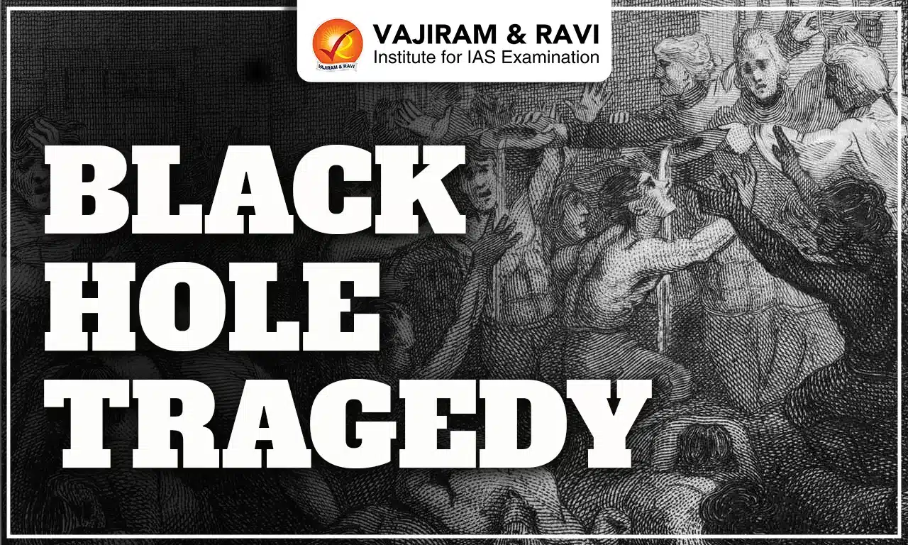
The Black Hole Tragedy is remembered as one of the most controversial and emotionally charged events of eighteenth-century India. It took place after the capture of Fort William in Calcutta on the night of 20 June 1756, when British prisoners were allegedly confined in a very small guardroom. The event became deeply influential because it shaped British attitudes, justified military retaliation, and played a major role in later political changes in Bengal.

Black Hole Tragedy

The Black Hole Tragedy refers to the reported confinement of British soldiers and civilians by the forces of Siraj ud-Daulah, the Nawab of Bengal, after the fall of Fort William. According to John Zephaniah Holwell, a British survivor, 146 prisoners were forced into a room measuring 18 × 14 feet, and only 23 survived by morning. Although many historians doubt the numbers, Holwell’s version became influential in British writings and was used to justify their later political actions.

Black Hole of Calcutta

The Black Hole of Calcutta refers to a confined prison room in the old Fort William complex, remembered for the tragic night when several captives reportedly died due to overcrowding. The chamber was originally built as a small guard cell and not intended to hold large groups. Over time, the incident became a symbol of colonial memory, shaping British interpretations of early conflict in Bengal and influencing later administrative and military decisions in the region. Later, Holwell built a Memorial to honor the victims who died in this incident.

Black Hole Tragedy of Calcutta Monument

Black Hole Tragedy Location

The Black Hole was originally a small guardroom inside the old Fort William, used by sentries and never designed to hold prisoners. After the incident, the old fort was demolished and replaced by the new Fort William, which still stands in the Maidan area of Kolkata. The exact location of the Black Hole cell is now identified in an alley between the General Post Office (GPO) and the adjacent northern building, situated in the north-west corner of B.B.D. Bagh. The memorial tablet once placed on that wall is currently kept in the Postal Museum nearby.

Black Hole Tragedy Historical Background

Understanding the Black Hole Tragedy requires studying the political and economic conditions of Bengal before 1756. The event did not occur suddenly but was the outcome of rising tensions between the Nawab of Bengal and the East India Company.

  • Weakening Mughal Empire: After Aurangzeb’s death in 1707, Mughal authority declined, and provincial rulers gained more independence. Bengal became a rich but politically sensitive region.
  • Rise of Siraj ud-Daulah: Siraj ud-Daulah became Nawab in April 1756. Young and determined, he aimed to control foreign trading companies and prevent them from expanding their political influence.
  • British Fortification: The East India Company strengthened the fortifications of Fort William without seeking the Nawab’s permission. This act was viewed as a direct challenge to his authority.
  • Political Refuge Issue: The Company provided shelter to Krishna Das, whose father was accused of misusing state revenue. This angered Siraj, who believed the British were interfering in Bengal’s internal matters.
  • Capture of Fort William: Siraj ud-Daulah attacked Calcutta in June 1756. Most British soldiers fled to ships, leaving a small group inside the fort. These were the people taken prisoner, leading to the Black Hole Tragedy.

Black Hole Tragedy Reasons

The Black Hole Tragedy occurred due to a combination of administrative failures, military misjudgment, and chaotic prison management after the fall of Fort William. The primary reason was the sudden collapse of British leadership, which left captured individuals without proper oversight. Siraj ud-Daulah’s soldiers likely underestimated the number of prisoners and placed them in a small guardroom meant for only a few detainees. The overcrowding, intense heat, locked doors, and lack of ventilation created deadly conditions. Miscommunication among the Nawab’s troops and the absence of clear orders on handling prisoners further intensified the tragedy, resulting in high casualties overnight.

Black Hole Tragedy of Bengal

The Black Hole Tragedy took place on the night of 20 June 1756, after Siraj ud-Daulah captured Fort William in Calcutta. During the surrender, many British soldiers, civilians, and Anglo-Indian workers were taken prisoner. Because senior officers had fled, the remaining captives were gathered by the Nawab’s troops. They were pushed into a small guardroom measuring 18×14 feet, with only two barred windows. Throughout the night, prisoners struggled for air and water. Many collapsed due to suffocation, heat, and dehydration. By morning, only a small number survived. The incident became one of the most controversial events in colonial history.

Black Hole Tragedy Holwell’s Narrative

John Zephaniah Holwell’s report, although debated, became the standard British version. Holwell described the events after Fort William’s fall, explaining how prisoners were confined overnight in a tiny guardroom later called the “Black Hole.”

  • Holwell met Siraj-ud-Daulah, who assured him no harm would occur, but prisoners were later locked in a 18 × 14 ft room.
  • Jailers stripped the prisoners and confined them at 8 p.m.; by 6 a.m., only about 23 survived.
  • Holwell claimed lower-rank Jemadars acted out of revenge, not on Siraj’s orders.
  • Historians differ: Wolpert estimated 64 imprisoned, 21 survived; Prior noted 43 missing or dead from various causes.
  • The room had two blocked windows, iron bars, and poor ventilation, worsened by fires in the fort.
  • Prisoners offered guards bribes of 1,000-2,000 rupees to shift them, but no permission was granted.
  • Crowding caused panic: people fought for air and water, many collapsing from heat, thirst, or trampling.
  • By night’s end, bodies were removed and survivors revived; Siraj showed little reaction but was believed unaware of the confinement.
  • Corpses were dumped into a ditch, while Holwell and a few others were later taken as prisoners to Murshidabad.

Siraj ud-Daulah’s Role in Black Hole Tragedy

Siraj ud-Daulah did not personally order the Black Hole confinement, according to most historians. His role was indirect and resulted from the battlefield situation after capturing Fort William. Siraj was angry at the British for illegal fortifications and giving shelter to political enemies. After the fort fell, his soldiers handled the prisoners without guidance or proper planning. Many scholars believe the tragedy occurred due to miscommunication and lack of supervision, not deliberate cruelty. Siraj was not present at the site that night. However, British writers portrayed him as responsible, helping justify the campaign that later removed him from power.

Black Hole Tragedy Casualties

According to Holwell’s detailed list, 123 people were reported dead from suffocation, excluding sixty-nine names he did not know, including Dutch and British soldiers, corporals, sergeants, militia members, whites, topazes, and Portuguese. The victims included senior Company officials, civilians, and military personnel. Holwell recorded the deaths of counsellors like E. Eyre and Wm. Baillie, service gentlemen such as Jenks, Revely, and Valicourt, military captains like Clayton and Buchanan, several lieutenants and ensigns, sergeants, and many sea captains. Only a small group survived, including Holwell himself, Ensign Walcott, Mrs. Carey, Captain Mills, Captain Dickson, and a few militia members.

Black Hole Tragedy Governor

During the Black Hole Tragedy, the acting Governor of Fort William was Roger Drake, whose weak leadership played a major role in the fall of Calcutta. When Siraj ud-Daulah advanced toward the fort in June 1756, Drake failed to organize proper defence arrangements or maintain discipline among the Company troops. As pressure increased, he abandoned the fort along with several senior officers, leaving the remaining soldiers and civilians without coordinated command. This vacuum of leadership contributed to confusion during the surrender, allowing the prisoners to be gathered by the Nawab’s forces and later confined in the room known as the “Black Hole.”

British Response to Black Hole Tragedy

The British response was swift and politically charged. The East India Company immediately blamed Siraj ud-Daulah for the tragedy and portrayed it as intentional cruelty. This helped mobilize military and financial support for an expedition to Bengal. Robert Clive led the counterattack, recapturing Calcutta in January 1757. The British rebuilt Fort William and strengthened defences. The tragedy also influenced public opinion in England, increasing support for aggressive imperial policy. Holwell’s narrative was printed widely, turning the event into a symbol of “Indian barbarity.” Ultimately, the response paved the way for the Battle of Plassey and British rule in Bengal.

Black Hole Tragedy Aftermath

The aftermath of the Black Hole Tragedy had long-lasting political consequences. When news reached British authorities in Madras and London, it created widespread anger and strengthened demands for strong retaliation against Siraj ud-Daulah. This led to Robert Clive’s return to Bengal with a military force. The event was used as a moral justification for British expansion. In 1757, Clive defeated Siraj ud-Daulah at the Battle of Plassey, establishing British dominance in Bengal. Holwell later built a Black Hole Monument in Calcutta, reinforcing the narrative. Over time, historians questioned the accuracy of the account, leading to major debates.

Black Hole Tragedy Debates

Many Historiographical Debates related to Black Hole Tragedy were carried out by several historians considering the following aspects:

  • Holwell’s Narrative Questioned
    • Holwell's numbers were likely exaggerated.
    • The room may not have held as many people as he described.
    • British failure in defending the fort was ignored in early narratives.
  • Indian Sources Missing
    • Contemporary Bengali sources do not describe the incident in the same way.
    • This suggests that the tragedy gained importance mainly in British records.
  • Colonial Propaganda
    • Several scholars believe the event was used to justify expansion and portray the British as victims before Plassey.
  • Archaeological Evidence
    • The exact location of the “Black Hole” room is disputed, However the most accepted location is near the General Post Office.
    • Historical maps show several guardrooms, but none perfectly match Holwell’s description.

Black Hole Tragedy Significance

The Black Hole Tragedy of Bengal has been crucial event of that time highlighting the emergence of various events as below:

  • A Turning Point in British Rule: The Black Hole Tragedy became a major justification for British revenge and further military action in Bengal.
  • Led to the Battle of Plassey (1757): The story helped Robert Clive gain support in England for a campaign against Siraj ud-Daulah.
  • Political Propaganda: Holwell’s version was repeatedly used in speeches and writings to portray Indians as cruel and justify British dominance.
  • Creation of a Memorial: A memorial was built by Holwell to honor those who died. It became a symbol of British suffering.
  • Influence on Colonial Policy: The tragedy was used to defend the expansion of Company rule in Bengal after Plassey.

Black Hole Tragedy Impact

The Black Hole Tragedy had wide impacts on political decisions, military strategies, and historical memory in colonial India. Overall, the incident transformed from a local tragedy to a powerful tool of colonial expansion. 

  • Political: Strengthened British justification for war, leading to Plassey.
  • Administrative: Increased British focus on fortification, discipline, and troop management.
  • Economic: British control over Bengal’s revenue and trade after Plassey grew stronger.
  • Psychological: Deepened racial mistrust between British rulers and Indians.
  • Historical: Became a key narrative in colonial writings, often used to show alleged “Indian brutality.”
  • Memorial: Holwell built a monument, later rebuilt by Curzon.

Black Hole Tragedy UPSC

The Black Hole Tragedy remains an important but heavily debated event in Indian history. While there is no doubt that prisoners were confined in a small cell after the fall of Fort William, the scale and details of the incident remain uncertain. The tragedy played a major role in shaping British perceptions, influencing political decisions, and contributing to the defeat of Siraj ud-Daulah at Plassey. Studying the Black Hole Tragedy highlights how historical narratives can be shaped by personal accounts, propaganda, and political motives.

Other Related Posts
Battle of Plassey Robert Clive
Battle of Buxar Anglo Mysore Wars
Dual Government in Bengal Tipu Sultan
Anglo Maratha Wars Maratha Empire
Third Battle of Panipat Chhatrapati Shivaji Maharaj
Battel of Bhima Koregaon Anglo Burmese War
Maharaja Ranjit Singh Anglo Nepal War

Black Hole Tragedy FAQs

Q1: What was the Black Hole Tragedy?

Ans: It was the alleged confinement of British prisoners in a small guardroom after the fall of Fort William in 1756.

Q2: Who recorded the Black Hole Tragedy?

Ans: John Zephaniah Holwell, a British survivor, wrote the main account widely used in later British writings.

Q3: How many people died in the Black Hole Tragedy?

Ans: Holwell claimed 123 deaths, but modern historians believe the number was likely between 20 and 40.

Q4: What caused the Black Hole Tragedy?

Ans: It happened due to confusion after the capture of Fort William and the forced confinement of many prisoners in a tiny room.

Q5: The Black Hole Tragedy is related to which Battle?

Ans: The Black Hole Tragedy influenced British public opinion, justified military action in Bengal, and contributed to the ‘Battle of Plassey’.

UPSC Daily Quiz 18 November 2025

UPSC Daily Quiz

The Daily UPSC Quiz by Vajiram & Ravi is a thoughtfully curated initiative designed to support UPSC aspirants in strengthening their current affairs knowledge and core conceptual understanding. Aligned with the UPSC Syllabus 2025, this daily quiz serves as a revision resource, helping candidates assess their preparation, revise key topics, and stay updated with relevant issues. Whether you are preparing for Prelims or sharpening your revision for Mains, consistent practice with these Daily UPSC Quiz can significantly enhance accuracy, speed, and confidence in solving exam-level questions.

[WpProQuiz 25]

UPSC Daily Quiz FAQs

Q1: What is the Daily UPSC Quiz?

Ans: The Daily UPSC Quiz is a set of practice questions based on current affairs, static subjects, and PYQs that help aspirants enhance retention and test conceptual clarity regularly.

Q2: How is the Daily Quiz useful for UPSC preparation?

Ans: Daily quizzes support learning, help in revision, improve time management, and boost accuracy for both UPSC Prelims and Mains through consistent practice.

Q3: Are the quiz questions based on the UPSC syllabus?

Ans: Yes, all questions are aligned with the UPSC Syllabus 2025, covering key areas like Polity, Economy, Environment, History, Geography, and Current Affairs.

Q4: Are solutions and explanations provided with the quiz?

Ans: Yes, each quiz includes detailed explanations and source references to enhance conceptual understanding and enable self-assessment.

Q5: Is the Daily UPSC Quiz suitable for both Prelims and Mains?

Ans: Primarily focused on Prelims (MCQ format), but it also indirectly helps in Mains by strengthening subject knowledge and factual clarity.

Gross Value Added (GVA), Meaning, Formula, Example, Importance

Gross Value Added

Gross Value Added (GVA) is one of the most crucial indicators used to measure the economic performance of a nation. It reflects how much value different producers, industries, or sectors add to the economy by generating goods and services. Unlike measures that focus on expenditure or taxes, GVA captures the pure productive contribution of the economy’s supply side.

In 2015, India revamped its national accounts system to align with the United Nations System of National Accounts (SNA), 2008, ensuring that its economic measurement practices matched global standards. This reform not only updated the methodology but also shifted the base year and refined how GVA and related indicators are calculated.

What is Gross Value Added (GVA)?

Gross Value Added (GVA) represents the value of output minus the value of intermediate consumption. It tells us how much new value is created in the production process after deducting the value of inputs used in production.

GVA highlights the contribution of each sector, whether agriculture, manufacturing, or services, to the economy’s overall output.

It forms the supply-side measure in national accounts and is a key entry on the income side of the country’s economic balance sheet.

Formula: GVA=GDP−Taxes on Products+Subsidies on Products

How is Gross Value Added (GVA) Calculated?

Gross Value Added (GVA) is calculated to measure the actual value created during the production of goods and services. It captures how much a sector or industry contributes to the economy after subtracting the cost of inputs used in production.

    • The basic formula for calculating GVA is: GVA = Output Value - Intermediate Consumption.
  • Formula: GVA=GDP−Taxes on Products+Subsidies on Products
  • GVA is also used to derive GDP using the formula: GDP = GVA + (Taxes on Products – Subsidies on Products).

Why India Adopted SNA 2008 Framework

To improve the quality of its economic statistics, India aligned its accounting system with United Nations System of National Accounts (SNA), 2008. This global standard ensures consistency, comparability, and uniformity in national income computation across countries. It also makes Indian data more reliable for international investors and economic bodies.

  • Ensures India follows global best practices.
  • Provides integrated and consistent macroeconomic accounts.
  • Enhances credibility of national income estimates.
  • Enables better policy decisions through improved data quality.

Evolution of GVA Measurement in India

Before 2015, India used GVA at “factor cost,” which excluded all taxes and subsidies. After the methodological revision, GVA at “basic prices” became the primary measure, making the data more reflective of production realities. This shift also accompanied a change in the base year from 2004-05 to 2011-12 for better accuracy.

GVA at Basic Prices vs Factor Cost
Aspect GVA at Basic Prices GVA at Factor Cost

Includes

Production taxes

None

Excludes

Production subsidies

All subsidies

Reflects

Output valued at actual producer prices

Output valued without taxes/subsidies

Used Today

Yes

No

Sectoral Classification of Gross Value Added (GVA) in India

The National Statistical Office (NSO) computes Gross Value Added (GVA) at both quarterly and annual intervals. For accuracy and clarity, the Indian economy is divided into eight major sectors. Each sector’s performance helps understand growth patterns and identify areas that require policy intervention.

Sector Nature of Activities

Agriculture, Forestry & Fishing

Farming, livestock, forestry, fishing

Mining & Quarrying

Extraction of minerals, ores

Manufacturing

Industrial production & processing

Electricity, Gas, Water Supply & Utilities

Power generation & distribution

Construction

Infrastructure, real estate development

Trade, Hotels, Transport & Communication

Retail, logistics, tourism, telecom

Financial, Real Estate & Professional Services

Banking, insurance, real estate

Public Administration, Defence & Other Services

Government & social services

Difference between GDP and GVA

Although both GDP and GVA measure economic activity, their perspectives differ. GDP reflects demand-side expenditure, while GVA highlights supply-side production. The inclusion of taxes and exclusion of subsidies in GDP makes it a less precise measure of actual productive contribution compared to GVA.

  • GDP may rise due to higher taxes even when production stagnates.
  • GVA provides a clearer picture of real output.
  • GVA is preferred for analyzing sectoral dynamics.
Difference between GDP and GVA
Aspect GDP GVA

Focus

Demand-side measurement

Supply-side measurement

Includes

Taxes on products

Does NOT include taxes

Excludes

Subsidies

Subsidies are ADDED

Utility

Best for global comparison

Best for domestic policy decisions

Formula

C + I + G + (X − M)

GDP − Taxes + Subsidies

Gross Value Added (GVA) Importance

Gross Value Added (GVA) is important because it offers a clear and accurate picture of the real production happening in an economy. By excluding the impact of taxes and subsidies, it reflects the actual value created by different sectors.

  • GVA provides a precise measure of sector-wise production by focusing purely on value creation rather than tax-driven distortions.
  • It gives a detailed breakdown of how each major sector, such as agriculture, industry, and services, contributes to overall economic growth.
  • Policymakers rely on GVA data to design targeted schemes, allocate resources effectively, and support sectors that require urgent intervention.
  • It helps track short-term and long-term economic trends, showing which sectors are rising, slowing, or undergoing structural changes.
  • Since it measures value added at each stage of production, it becomes a key tool for assessing productivity levels across industries.
  • By removing the influence of taxes and subsidies, GVA presents a clearer and more unbiased picture of the economy’s real performance.
  • It highlights sectoral imbalances, making it easier for the government to promote balanced and inclusive growth across regions and industries.
  • GVA aligns with global SNA 2008 standards, ensuring that India’s economic data is comparable with international norms.

Gross Value Added (GVA) Issues

Gross Value Added (GVA) faces several issues that can affect the accuracy and reliability of economic estimates. Since GVA depends heavily on the quality of data collected from various sectors, any gaps or errors can distort the overall picture of production.

  • GVA estimates rely on multiple data sources, and any inaccuracies in surveys, reporting, or sectoral data can lead to misleading results.
  • The informal sector, which forms a large part of India's economy, is difficult to measure accurately, creating gaps in GVA calculations.
  • Differences in data collection methods, outdated sampling frames, or flawed estimation techniques can weaken the reliability of GVA figures.
  • GVA does not reflect non-market activities like household work, which can be significant in developing economies.
  • It does not capture inter-sectoral linkages, meaning that value added in one sector may depend heavily on another but remains unreported in the final figure.
  • Sudden policy changes, technological shifts, or global disruptions may influence sectoral GVA unevenly, making comparisons over time challenging.

Role of GVA in Economic Policy and Planning

Gross Value Added (GVA) plays a crucial role in shaping national economic policies by providing a clear understanding of sector-wise productivity. It helps policymakers identify strengths, weaknesses, and priority areas for targeted intervention.

  • It assists the government in designing sector-specific policies by showing which industries contribute the most to economic growth.
  • It helps in evaluating the impact of fiscal measures like subsidies, tax changes, and investment incentives on sector performance.
  • It guides planning bodies in resource allocation by highlighting high-performing and underperforming sectors.
  • It supports the formulation of employment strategies by identifying labor-intensive and productivity-driven sectors.
  • It aids in regional planning by showing GVA distribution across states and helping bridge inter-state economic disparities.
  • It helps monitor the real-time health of the economy, allowing timely corrective actions during slowdown phases.
Other Related Posts
New Economic Policy 1991 Green GDP
Care Economy Securities and Exchange Board of India
National Income Foreign Portfolio Investment
Gross Domestic Product (GDP) Foreign Direct Investment
GDP Deflator

Gross Value Added (GVA) FAQs

Q1: What is Gross Value Added (GVA)?

Ans: GVA is the measure of the value of goods and services produced in an economy after deducting the cost of inputs. It reflects the contribution of individual sectors to overall economic output.

Q2: How is GVA calculated?

Ans: GVA = Output Value – Intermediate Consumption. This helps determine the net value created during the production process.

Q3: How is GVA different from GDP?

Ans: GVA shows the value added by each sector, while GDP is GVA plus taxes and minus subsidies on products.

Q4: Why is GVA important?

Ans: It helps assess sector-wise performance, productivity levels, and economic health, making it crucial for policy planning and analysis.

Q5: Who releases GVA data in India?

Ans: The National Statistical Office (NSO) under the Ministry of Statistics and Programme Implementation (MoSPI) releases GVA estimates.

Brahmaputra River System, Origin, Length, Tributaries

brahmaputra river system

The Brahmaputra River System is one of Asia's largest and most significant river systems. It originates from the Chemayungdung Glacier, near Mount Kailash, in the Angsi Glacier region in southwestern Tibet. It then passes through Assam and Bangladesh, eventually merging with the Bay of Bengal. 

The river spans across the Indian states of Assam and Arunachal Pradesh and plays a crucial role in the northeastern region of India. The Brahmaputra River rises in the eastern Tibetan Plateau course through India and Bangladesh. The river supports a diverse ecosystem, serving as shelter to a wide range of flora and fauna, including rare and endangered species.

Brahmaputra River System

The Brahmaputra River System is surrounded by the Himalayas to the north, the Patkai Hills to the east, the Assam Hills to the south, and the Himalayas again to the west. The Himalayan regions of Sikkim and Arunachal Pradesh, which form part of the Brahmaputra Basin, experience heavy snowfall. These regions also account for 55.48% of India’s total forest cover, making them some of the greenest areas in the country.

One of the most remarkable features of the Brahmaputra River System is Majuli, an island in Assam, which holds the distinction of being the world’s largest and oldest inhabited river island, recognized by UNESCO. The river system also has a significant hydropower potential of 66,065 MW, making it a crucial resource for renewable energy development.

As the Brahmaputra River flows from Kobo to Dhubri in Assam, it accumulates a large amount of sediment from its 20 tributaries on the north bank and 13 on the south bank. The region receives the majority of its annual rainfall during the South-West monsoon season, with 85% of the total precipitation occurring between May and September.

Brahmaputra River System Origin

The Brahmaputra, meaning "Son of Brahma," originates from the Chemayungdung glacier in southwestern Tibet. Its source lies in proximity to the origins of the Indus and Sutlej rivers. Despite its location at a remarkably high altitude, the Tsangpo River maintains a gentle gradient. It flows at a slow pace, forming a broad river channel that stretches for nearly 640 kilometers.

Brahmaputra River System Map

The Brahmaputra River has its origin in the Chemayungdung Glacier in southwestern Tibet. From there, it flows eastward across the Tibetan Plateau as the Yarlung Tsangpo River. This majestic river later enters India through Arunachal Pradesh, marking the beginning of its long journey across Northeast India. The Brahmaputra River System Map has been shared below.

Brahmaputra River System

Brahmaputra River System Tributaries

The Brahmaputra River System Tributaries play a significant role in shaping its flow and water volume. The rivers in the Himalayan region are primarily glacier-fed, experiencing a rise in water levels during the monsoon season. Heavy rainfall, occurring between May and September due to the southwest monsoon, often leads to flooding in these rivers, impacting the Brahmaputra’s overall flow. The tributaries of the Brahmaputra are classified into two categories: northern (left-bank) tributaries and southern (right-bank) tributaries. These rivers contribute significantly to the river’s strength, often causing seasonal flooding.

Brahmaputra River System Tributaries

Northern (Left-bank) Tributaries

Southern (Right-bank) Tributaries

Lhasa River

Kameng River

Nyang River

Manas River

Parlung Zangbo River

Beki River

Lohit River

Raidak River

Dhanashri River

Jaldhaka River

Kolong River

Teesta River


Subansiri River

Brahmaputra River System Left Tributaries

The Brahmaputra River is fed by several significant tributaries that originate across Tibet, Arunachal Pradesh, and the Northeast Indian region. These rivers not only enrich the water volume of the Brahmaputra but also support hydropower generation, agriculture, flood regulation, and ecological balance. Below is a detailed table including the Brahmaputra River System Left Tributaries, their origins, the states or regions they pass through, and their key contributions to the river system and surrounding ecosystems.

Brahmaputra River System Left Tributaries

Tributary Name

Origin

States/Regions Covered

Key Significance

Lhasa River

Tibet (Lhasa Plateau)

Tibet

Major tributary of Yarlung Tsangpo; contributes to Brahmaputra's upper flow

Nyang River

Nyangtri Prefecture, Tibet

Tibet

Enhances flow in Tibet; important for hydro development

Parlung Zangbo River

Tibet

Tibet

One of the easternmost contributors to the Tsangpo system

Subansiri River

Tibet

Arunachal Pradesh, Assam

Largest tributary; site of major hydropower projects

Kameng River

Tawang, Arunachal Pradesh

Arunachal Pradesh, Assam

Supports agriculture and biodiversity in West Kameng

Lohit River

Eastern Tibet

Arunachal Pradesh, Assam

Joins Siang & Dibang to form Brahmaputra; prone to floods

Dhanashri (Dhansiri)

Laisang Peak, Nagaland

Nagaland, Assam

Important for irrigation; passes through ecologically sensitive zones

Kolong River

Distributary of Brahmaputra

Assam

Supports inland navigation and local livelihoods

Brahmaputra River System Right Tributaries

The Brahmaputra River System is enriched by various tributaries that originate in the Eastern Himalayas and the hills of Northeast India. These tributaries, flowing through diverse terrains and states like Assam, Meghalaya, Sikkim, and even Bhutan and Bangladesh, play an important role in shaping the region’s ecology, economy, and culture. Each river contributes uniquely, be it through hydroelectric potential, biodiversity support, irrigation, or transboundary cooperation. The following table highlights the Brahmaputra River System Right Tributaries detailing their origin, the regions they flow in, and their key significance.

Brahmaputra River System Right Tributaries

Tributary Name

Origin

States/Regions Covered

Key Significance

Manas River

Bhutan Himalayas

Bhutan, Assam

A UNESCO World Heritage Site; supports rich biodiversity and wildlife sanctuaries.

Beki River

Himalayas in Bhutan

Assam

Important for fisheries, floodplain cultivation, and a tributary of the Manas River.

Raidak River

Northern Bhutan

Bhutan, West Bengal, Assam

Supports irrigation and hydropower; merges with the Brahmaputra near Dhubri.

Jaldhaka River

Bitang Lake (Sikkim-Bhutan border)

Sikkim, West Bengal, Bangladesh

Transboundary river; key for farming, hydroelectricity, and cross-border cooperation.

Teesta River

Pauhunri Glacier, Eastern Himalayas

Sikkim, West Bengal, Bangladesh

Major eastern Himalayan river; vital for hydro projects and Indo-Bangladesh water sharing.

Kopili River

Meghalaya Hills (Sapong Reserve)

Meghalaya, Assam

Major source for power and irrigation; joins Brahmaputra near Nagaon.

Kulsi River

Khasi Hills, Meghalaya

Meghalaya, Assam

Seasonal river; known for river dolphins; prone to flooding during monsoon.

Dhansiri (South)

Patkai Hills, Eastern Himalayas

Arunachal Pradesh, Assam

Important for floodplain agriculture and biodiversity; passes through Golaghat.

Krishnai River

West Garo Hills, Meghalaya

Assam

Seasonal river supporting agriculture; joins with Dudhnoi before meeting Brahmaputra.

Dudhnoi River

East Garo Hills, Meghalaya

Assam

Converges with Krishnai River; crucial for local irrigation systems.

Jinjiram River

East Garo Hills, Meghalaya

Meghalaya, Assam

Seasonal waterway; significant for flood management in the Goalpara district.

Sonkosh (Sankosh)

Bhutan

Bhutan, Assam

Borders Assam and West Bengal; joins Brahmaputra near Srirampur; irrigation support.

States Through Which the Brahmaputra River Flows

The majestic Brahmaputra River, one of the longest and most important rivers in India, flows through several northeastern states before entering Bangladesh. In India, the Brahmaputra River passes through the states of Arunachal Pradesh, Assam, Meghalaya, Nagaland, West Bengal, and Sikkim. Originating from the Angsi Glacier in Tibet (where it is known as the Yarlung Tsangpo), the river enters India through Arunachal Pradesh as the Siang or Dihang River, flows majestically across Assam, and finally travels toward West Bengal before entering Bangladesh as the Jamuna River.

Cities Located on the Brahmaputra River

The Brahmaputra River flows through several important cities that play a key role in the cultural, economic, and geographical landscape of Northeast India. Major cities situated along the banks of the Brahmaputra River include Pasighat, Dibrugarh, Tezpur, Guwahati, and Goalpara.

  • Pasighat (Arunachal Pradesh): One of the oldest towns in Arunachal Pradesh, Pasighat lies near the entry point of the Brahmaputra into India and is known for its scenic beauty.
  • Dibrugarh (Assam): Often called the "Tea City of India," Dibrugarh is a major commercial hub located on the banks of the Brahmaputra.
  • Tezpur (Assam): A historical and cultural city, Tezpur sits gracefully along the river, surrounded by lush landscapes.
  • Guwahati (Assam): The largest city in Assam, Guwahati is an important river port and urban center along the Brahmaputra.
  • Goalpara (Assam): Located in Lower Assam, Goalpara is another significant town positioned along the river’s fertile plains.

Brahmaputra River System List of Dams and Hydro Projects

Brahmaputra River System has its vast network of tributaries, it sustains diverse ecosystems and human settlements, contributing significantly to agriculture, culture, and the economy. Below in the table includes the Brahmaputra River System List of Dams and Hydro Projects:

Brahmaputra River System List of Dams and Hydro Projects

Dam

Location

Status

Zangmu Dam

Tibet, China

Operational

Jiacha Dam

Tibet, China

Under construction

Dagu Dam

Tibet, China

Proposed

Jiexu Dam

Tibet, China

Proposed

Upper Subansiri Hydroelectric Project

India

Under construction

Lower Subansiri Hydroelectric Project

India

Under construction

Teesta-V (NHPC) Dam

India

Completed

Teesta-III Dam

India

Under construction

Rangit Dam

India

Completed

Jaldhaka Hydroelectric Project

India and Bhutan

Operational

Kurichu Hydroelectric Project

Bhutan

Operational

Chukha Hydroelectric Project

Bhutan

Operational

Tala Hydroelectric Project

Bhutan

Operational

Daguchu Hydroelectric Project

Bhutan

Operational

Different Names of Brahmaputra River

The Brahmaputra River is known by different names across its journey through various regions, reflecting diverse linguistic and cultural identities. Originating from Tibet, where it is revered as Tsangpo meaning "The Purifier," the river flows through China, India, and Bangladesh. In each of these regions, it adopts unique names.

Different Names of Brahmaputra River

Region

Name

Tibet

Tsangpo (meaning ‘The Purifier’)

China

Yarlung Zangbo, Jiangin

Assam Valley

Dihang or Siang, South of Sadiya: Brahmaputra

Bangladesh

Jamuna River

Padma River: Combined Waters of Ganga and Brahmaputra

Meghana: From the confluence of Padma and Meghna 

Brahmaputra River System FAQs

Q1: What is the river system of Brahmaputra?

Ans: The river originates from the Kailash ranges of Himalayas at an elevation of 5300 M.

Q2: What are the four names of Brahmaputra River?

Ans: Brahmaputra or Luit in Assamese, Yarlung Tsangpo in Tibetan, the Siang/Dihang River in Arunachali, and Jamuna River in Bengali.

Q3: Which glacier is the origin of the Brahmaputra River?

Ans: The Brahmaputra River originates from the Chemayungdung Glacier.

Q4: What is Brahmaputra called in China?

Ans: Tsangpo, the Brahmaputra is also known by its Chinese name.

Q5: Why is Brahmaputra called the red river?

Ans: The soil of this region is naturally rich in iron content, bringing the colour red to the river with a high concentration of red and yellow soil sediments.

Indo-Gangetic Plains, Feature, Location, Formation, Significance

Indo-Gangetic Plains

The Indo-Gangetic Plain, spanning India, Bangladesh, and Nepal, faces recurrent floods due to heavy monsoon rains, glacial melt, deforestation, and urbanization. These floods damage lives, agriculture, and infrastructure. Effective management demands an integrated approach combining sustainable land use, afforestation, advanced forecasting technologies, and active community participation. Building resilience through coordinated planning and environmental conservation is essential to reduce flood impacts and safeguard livelihoods in this densely populated region.

Indo-Gangetic Plains

The Indo-Gangetic Plains, or Indo-Gangetic-Brahmaputra Plains, are vast aggradational plains formed by alluvial deposits from the Indus, Ganga, Brahmaputra, and their tributaries. The Northern Plains of India are one of the five physiographic divisions of India and represent its youngest landform. Spanning a massive area, they hold the title of the world’s largest alluvial plain, supporting dense populations, fertile agriculture, and a rich cultural history shaped by these mighty river systems.

Indo-Gangetic Plains Features

The Indo-Gangetic Plains has some unique geographical, climatic, and socio-economic characteristics. The table below includes the Indo-Gangetic Plains Features for better understanding:

Indo-Gangetic Plains Features

North-South Extension

They extend from the south of the Himalayas upto the edge of the Peninsular Plateau.

East-West Extension

They extend from the mouth of the Indus in the west to the mouth of the Ganga in the east.

Boundaries

They are bounded by the Shiwalik range to the north, the Desert to the west, the Peninsular Plateau to the south, and the Puruvachal Hills to the east.

Length

The total length of this tract is 3200 km, of which around 2400 km lies in India and the rest lies in Bangladesh.

Width

The average width of the Great Northern Plains is 150-300 km. They are widest in the west where their width goes up to 500 km, and narrow down towards the east where their width shrinks down to 60-100 km.

Area

They occupy an area of around 7.8 lakh sq. km, making it the largest alluvial plain in the world.

States Covered

The Great Northern Plains of India spread over the states – Punjab, Haryana, Delhi, Uttar Pradesh, Bihar, parts of Jharkhand and West Bengal, and Assam.

Extreme Horizontality

Extreme horizontality is an important feature of this plain. With an average elevation of around 200 m and the highest elevation of about 291 m above the mean sea level, its average gradient range is just 15-20 cm.

Soil Cover

The rivers coming from the northern mountain carry a huge load of sediments which get deposited over these plains. Thus, these plains have a rich and fertile soil cover.

Indo-Gangetic Plains Formation

The Indo-Gangetic Plains were formed by the deposition of sediments from the Indus, Ganga, and Brahmaputra river systems, which filled a vast depression between the Peninsular Plateau and the Himalayas. During the Tertiary Period, the collision of the Indo-Australian and Eurasian plates created the Himalayas and a large syncline to the south. Over time, rivers from the Himalayas deposited immense alluvial material into this depression, giving rise to the Northern Plains of India.

Indo-Gangetic Plains Regional Division

Regionally, the Indo-Gangetic Plains are divided into four major sections:

  1. Rajasthan Plain - Occupies the arid western part, largely desert with some fertile tracts along river channels.
  2. Punjab-Haryana Plain - Known for extensive alluvial deposits and intensive agriculture, supported by canal irrigation.
  3. Ganga Plain - The largest and most fertile stretch, spanning several states from Uttarakhand to West Bengal.
  4. Brahmaputra Plain - A flood-prone yet highly fertile region in Assam, shaped by the Brahmaputra River and its tributaries.

Rajasthan Plain

Forming the western edge of the Indo-Gangetic Plains, this region includes the Thar or Great Indian Desert, extending across western Rajasthan and into Pakistan. It has two main parts:

Marusthali 

The true desert area in the east, covering much of the Marwar plain. While it appears as an aggradational plain, geologically it belongs to the Peninsular Plateau, evident from scattered outcrops of gneiss, schist, and granite. Its eastern side is rocky; the west is dominated by shifting sand dunes called Dhrian.

Rajasthan Bagar

A semi-arid tract between the Thar desert and the Aravalli Range. Seasonal streams from the Aravallis create fertile patches called Rohi. The Luni River, flowing southwest into the Rann of Kutch, is the main watercourse. North of the Luni lies the sandy plain called Thali. The region also has saline lakes such as Sambhar, Didwana, and Khatu.

Punjab-Haryana Plain

Located east and northeast of the Rajasthan Plain, this region stretches about 640 km from northwest to southeast, with an average width of 300 km. It slopes gently southwest, so rivers follow the same direction. The soil is mainly silty and porous.

Key subdivisions and features:

  • Bet - Floodplain areas near riverbanks formed by new alluvium.
  • Bhabar Plain - Foothill zone with boulders, gravel, sand, and clay that cannot retain water.
  • Punjab Plain - Formed by the alluvium of the Satluj, Beas, Ravi, Chenab, and Jhelum; hence called the Land of Five Rivers. Divided into five Doabs:
    1. Bist-Jalandhar Doab - Between Beas and Satluj
    2. Bari Doab - Between Beas and Ravi
    3. Rachna Doab - Between Ravi and Chenab
    4. Chaj Doab - Between Chenab and Jhelum
    5. Sind Sagar Doab - Between Jhelum-Chenab and the Indus

Other notable features:

  • Bet Lands - Khadar-rich fertile floodplains replenished annually.
  • Dhayas - Broad Khadar floodplains bordered by bluffs.
  • Chos - Eroded tracts in the north near the Shiwalik Hills caused by seasonal streams.

Ganga Plain

The largest unit of the Indo-Gangetic Plains, covering about 3.75 lakh sq. km, formed by the alluvium of the Ganga and its Himalayan and Peninsular tributaries. It stretches from Delhi to Kolkata across Uttar Pradesh, Bihar, and West Bengal, sloping east and southeast.

Upper Ganga Plain

  • Location: Westernmost part, bounded by the Shiwaliks (north), Peninsular boundary (south), Yamuna River (west). Eastern limit unclear.
  • Gradient: ~25 cm/km; sluggish rivers.
  • Features: River bluffs, meanders, oxbow lakes, levees, abandoned channels, sandy bhurs.
  • Major Units: Ganga-Yamuna Doab, Rohilkhand Plains, Avadh Plains.

Middle Ganga Plain

  • Location: East of the Upper Ganga Plain; covers eastern Uttar Pradesh and Bihar.
  • Boundaries: Himalayas (north), Peninsular edge (south).
  • Features: Levees, bluffs, oxbow lakes, marshes, tals, ravines; highly flood-prone due to shifting river courses—Kosi, the “Sorrow of Bihar,” is most notorious.
  • Major Units: Ganga-Ghaghara Doab, Ghaghara-Gandak Doab, Gandak-Kosi Doab (Mithila Plain).

Lower Ganga Plain

  • Location: Eastern Bihar, West Bengal, most of Bangladesh.
  • Boundaries: Darjeeling Himalaya (north), Bay of Bengal (south), Chotanagpur Highlands (west), Bangladesh (east).
  • Features: Dominated by deltaic landforms. The Ganga-Brahmaputra Delta, the world’s largest is rich in mangroves and home to the Royal Bengal Tiger.

Brahmaputra Plain

  • Location & Names: Northeastern India; also called Brahmaputra Valley or Assam Valley.
  • Boundaries: Eastern Himalayas of Arunachal Pradesh (north), Patkai Bum & Naga Hills (east), Garo-Khasi-Jaintia & Mikir Hills (south), Indo-Bangladesh border and lower Ganga Plain (west).
  • Formation: An aggradational plain formed by the depositional work of the Brahmaputra and its tributaries.
  • Riverine Features: Alluvial fans, sandbars, meanders, oxbow lakes formed as northern tributaries enter the valley abruptly.
  • Notable Facts: Majuli Island, the world’s largest riverine island, lies here. The valley is also famous for its tea plantations.

Indo-Gangetic Plains Geomorphology

The table of the distinctive geomorphological features of the Indo-Gangetic Plains is shared below:

Indo-Gangetic Plains Geomorphology
Feature Location & Extent Composition Key Characteristics Fertility / Use

Bhabar

8–16 km belt along Shiwalik foothills (Indus to Tista)

Unassorted gravel and pebbles

Streams disappear underground due to porous sediments

Poor for cultivation

Tarai

South of Bhabar; 15-30 km wide

Finer alluvium

Marshy, waterlogged; streams re-emerge

Fertile; much converted to farmland

Khadar

Along river floodplains

New alluvium

Renewed annually; no calcareous deposits

Very fertile; intensively cultivated

Bhangar

Terraces above floodplains

Older alluvium with kankar

Not renewed frequently; higher than Khadar

Less fertile

Reh / Kallar

Dry tracts of UP and Haryana

Saline/alkaline efflorescence

Generally barren

Unfit for cultivation

Bhur

Elevated sandy ridges along Ganga

Wind-blown sand

Formed in hot, dry months

Limited agricultural use

Indo-Gangetic Plains Significance

  • Although the Northern Plains of India cover less than one-third of India’s total area, they support over 40% of the country’s population.
  • Fertile alluvial soils, flat terrain, slow-moving perennial rivers, and a favorable climate enable intensive agriculture, earning the northern plains the title of Granary of India.
  • The flat relief supports a dense network of roads and railways, promoting rapid urbanization and industrial growth.
  • The banks of rivers like the Ganga and Yamuna host numerous pilgrimage sites, adding deep cultural and spiritual significance to the region.

Indo-Gangetic Plains FAQs

Q1: What are the Indo-Gangetic Plains?

Ans: The Indo-Gangetic Plains are a vast, fertile lowland region stretching across northern India, Pakistan, and Bangladesh, formed by the Indus, Ganga, and Brahmaputra rivers.

Q2: Where are the Indo-Gangetic Plains located?

Ans: They extend from Punjab in the west to Assam in the east, covering major states like Punjab, Haryana, Uttar Pradesh, Bihar, and West Bengal.

Q3: How were the Indo-Gangetic Plains formed?

Ans: They were formed by alluvial deposits brought by rivers from the Himalayas over millions of years, creating fertile soil ideal for agriculture.

Q4: Why are the Indo-Gangetic Plains important?

Ans: They are India’s agricultural heartland, supporting dense populations, rich biodiversity, and major cultural and historical centers.

Q5: What type of soil is found in the Indo-Gangetic Plains?

Ans: Primarily alluvial soil, which is highly fertile and suitable for crops like wheat, rice, sugarcane, and pulses.

Integrated Forum on Climate Change and Trade

Integrated Forum on Climate Change and Trade

Integrated Forum on Climate Change and Trade Latest News

Recently, the 30th Conference of the Parties (COP30) to the United Nations Framework Convention on Climate Change formally launched an integrated forum on Climate Change and Trade (IFCCT).

About Integrated Forum on Climate Change and Trade

  • It is a politically supported forum where countries can address the increasingly contentious intersection between trade policies and climate action.
  • Launched at: It was launched at COP30,  Belém (Brazil), on 15 November 2025.
  • It bridges divides between climate ambition and trade policy and help developing countries gain a stronger voice in shaping emerging trade rules. 
  • It will be co-chaired by Brazil and a developed country partner, and open to all Parties to the UNFCCC.
  • The IFCCT will be institutionally independent of both the WTO and the UNFCCC.
  • The Forum will not negotiate binding outcomes or interpret existing agreements or adjudicate disputes or evaluate specific national measures

Key Features of Integrated Forum on Climate Change and Trade

  • It will begin with an open-ended consultation process extending into 2026 to define topics to be discussed and the forum's jurisdiction.
  • It creates an opportunity of interoperability rather than fragmentation related to climate negotiations.
  • It will bring together civil society organisations, business associations, and international initiatives.

Source: DTE

Integrated Forum on Climate Change and Trade FAQs

Q1: Where was the IFCCT launched?

Ans: It was launched during COP30, Belém, Brazil.

Q2: What is the principle of IFCCT?

Ans: Trade can be a key lever for turning climate ambition into action.

Adam Chini Rice

Adam Chini Rice

Adam Chini Rice Latest News

Agricultural scientists at Banaras Hindu University (BHU), have recently achieved significant breakthroughs in improving the Adam Chini Rice variety’s resilience and productivity by using  mutagenesis.

About Adam Chini Rice

  • It is an aromatic black rice variety known for its pleasant aroma and superior cooking qualities.
  • It is mainly grown in the Eastern Uttar Pradesh region including Chandauli, Varanasi and Vindhya region.
  • It received Geographical Indication (GI) in 2023.

Characteristics of Adam Chini Rice

  • It is known for its sugar-crystal-like grains, drought tolerance, and disease resistance qualities.
  • It reaches height up to 165 cm and its grains are short-bold, scented with intermediate alkali digestion value
  • It has long maturity period (155 days) and low yields (20-23 quintals per hectare)
  • It is renowned for its excellence in flavor and aroma.
  • It has intermediate amylose content which helps rice to remain fluffy and remains soft on cooling.

Improved Features of Adam Chini Rice

  • Reduced height (105 cm for mutant-14),
  • Early maturity (120 days for mutant-19),
  • Higher yields (30-35 quintals per hectare for mutants 14, 15, 19, and 20).
  • Now it is more suitable for mass production while retaining its coveted fragrance.

Source: NIE

Adam Chini Rice FAQs

Q1: Where is Adam Chini Rice primarily grown?

Ans: Eastern Uttar Pradesh

Q2: What is a distinctive feature of Adam Chini Rice?

Ans: It has sugar-crystal-like grains.

Exercise AJEYA WARRIOR

Exercise AJEYA WARRIOR

Exercise AJEYA WARRIOR Latest News

Recently, the eighth edition of the Exercise “AJEYA WARRIOR-25” commenced at the Foreign Training Node, Mahajan Field Firing Ranges, Rajasthan.   

About Exercise AJEYA WARRIOR

  • It is a bilateral military exercise conducted between India-UK.
  • It is held biennially since 2011, AJEYA WARRIOR has evolved into a flagship engagement between the Indian Army and the British Army.

Key Features of Exercise AJEYA WARRIOR 25

  • The Indian Army is being represented by troops of the Sikh Regiment.
  • The objective of the exercise is to facilitate the exchange of best combat skills and experiences between the two armies and to enhance their ability to operate together in complex situations.
  • It is conducted under a United Nations mandate, the exercise focuses on counter-terrorism operations in semi-urban environments.
  • It includes joint mission planning at Brigade level, integrated tactical drills, simulation-based scenarios and company-level field training exercises replicating real-life counter-terror contingencies.
  • The exercise also aims to share best practices, enhance tactical proficiency and develop coordinated responses for managing complex operations in challenging environments.
  • Significance: The 2025 edition further reinforces shared values of professionalism, cooperation and commitment to regional stability and global peace.

Source: PIB

Exercise AJEYA WARRIOR FAQs

Q1: What is Exercise Ajeya Warrior?

Ans: A biennial military training event between India and the UK.

Q2: Where is the 8th edition of Exercise Ajeya Warrior being held?

Ans: Mahajan Field Firing Ranges, Rajasthan, India

Sentinel-6B Satellite

Sentinel-6B Satellite

Sentinel-6B Satellite Latest News

Recently, the Sentinel-6B was launched from the Vandenberg Space Force Base in California. 

About Sentinel-6B Satellite

  • It is a joint mission between the United States’ NASA and NOAA, and the European Space Agency.
  • Objective: It is an ocean-tracking satellite which will measure the rising sea levels and its impacts on the planet. 
  • Sentinel-6B is set to carry forward the legacy of Sentinel -6 Michael Freilich, launched in November 2020.
  • It will orbit Earth at a speed of 7.2 km per second, completing one revolution every 112 minutes.
  • Sentinel-6B will provide primary sea level measurements down to approximately an inch from over 90% of all the oceans.

Components of Sentinel-6B Satellite

  • It consists of six onboard science instruments.
  • The satellite has two fixed solar arrays, plus two deployable solar panels, and will travel in a longitude direction around Earth in a non-Sun-synchronous orbit.
  • It is expected to spend the next 5.5 years in orbit.

Significance of Sentinel-6B Satellite

  • It observes Earth's ocean, measuring sea levels to improve weather forecasts and flood predictions.
  • It safeguards public safety, benefits commercial industry, and protects coastal infrastructure.

Source: IE

Sentinel-6B Satellite FAQs

Q1: What is the expected lifespan of the Sentinel-6B satellite?

Ans: 5.5 years

Q2: What is the primary objective of the Sentinel-6B satellite?

Ans: To measure sea surface topography

Lycodon Irwini

Lycodon irwini

Lycodon Irwini Latest News

Researchers recently confirmed the discovery of Lycodon irwini, a glossy black wolf snake, on Great Nicobar Island.

About Lycodon Irwini

  • It is a new species of snake.
  • It was discovered on the remote Great Nicobar Island at the southern tip of the Nicobar Islands.
  • The snake, which is a member of the Lycodon subcinctus group, was named in honour of the late Australian conservationist and television personality, Stephen Robert Irwin. 
  • It is a striking glossy-black wolf snake that had remained unidentified for years because it closely resembles another widespread species. 
  • The new research finally confirms that the Great Nicobar population represents a distinct species currently known only from the island.
  • One of the most notable features of Lycodon irwini is its uniform glossy black colour, unlike close relatives that typically have white bands or patches. 
  • The snake is slender, nocturnal, and can grow close to 1.2 metres in length. 
  • The researchers also documented a higher number of belly and tail scales compared to similar species.

Source: RM

Lycodon irwini FAQs

Q1: What is Lycodon irwini?

Ans: It is a new species of snake.

Q2: Where was Lycodon irwini discovered?

Ans: It was discovered on the remote Great Nicobar Island at the southern tip of the Nicobar Islands.

Q3: What is a distinguishing feature of Lycodon irwini?

Ans: Uniform glossy black colour

Kwar Hydroelectric Project

Kwar Hydroelectric Project

Kwar Hydroelectric Project Latest News

Several labourers were rescued safely after a truck caught fire inside a tunnel at the Kwar hydroelectric power project on the Chenab river in the mountainous Kishtwar district of the Jammu region recently.

About Kwar Hydroelectric Project

  • It is a 540 MW run-of-river hydropower project.
  • It is located on the Chenab River in the Kishtwar district of Jammu and Kashmir.
  • The project is being developed by Chenab Valley Power Projects Private Ltd (CVPPL). 
    • CVPPL is a joint venture company between NHPC Ltd and Jammu & Kashmir State Power Development Corporation (JKSPDC) with equity contributions of 51 percent and 49 percent, respectively.
  • The project shall generate 1,975.54 million units in a 90 percent dependable year.
  • The Government of India is extending a grant of Rs. 69.80 crore towards the cost of enabling Infrastructure and also supporting the Union Territory of Jammu & Kashmir by providing a grant of Rs. 655.08 crore for the equity contribution of JKSPDC (49%) in M/s. CVPPPL.

Source: TI

Kwar Hydroelectric Project FAQs

Q1: The Kwar Hydroelectric Project is located on which river?

Ans: Chenab River

Q2: Where is the Kwar Hydroelectric Project situated?

Ans: Kishtwar district of Jammu and Kashmir

Q3: What is the total installed capacity of the Kwar Hydroelectric Project?

Ans: 540 MW

Q4: Which company is developing the Kwar Hydroelectric Project?

Ans: The project is being developed by Chenab Valley Power Projects Private Ltd (CVPPL).

Dariya Bahadur Island

Dariya Bahadur Island

Dariya Bahadur Island Latest News

Udupi police recently registered a case against eight individuals who allegedly entered the restricted Dariya Bahadur, or Bhadragada Island, also known as Lighthouse Island, within Malpe police station limits.

About Dariya Bahadur Island

  • It is located in the Udupi district, Karnataka.
  • It is among the four islands near Malpe Beach.
  • It is also known as Bhadragada Island, or Lighthouse Island.
  • The island’s breadth is just approximately 1.6 square kilometres, and its area is estimated to be less than 250 yards.
  • It is well renowned for being a rocky island and esteemed for the elegance of its buildings.
  • This island is where the famous Daira Bahadurgarh fort is located. 
    • It was constructed by Basavappa Naik of Bidanur. 
    • There is also a mystery associated with the island fort, as the treasure of the king was buried somewhere to escape from the invasion of Haider Ali during the mid-18th century.
    • Surrounding the fort premises, there is an old tile factory and also a few temples.

Source: TOI

Dariya Bahadur Island FAQs

Q1: Dariya Bahadur Island is located in which Indian state?

Ans: Karnataka

Q2: Dariya Bahadur Island is situated near which popular beach?

Ans: Malpe Beach

Q3: What is another name for Dariya Bahadur Island?

Ans: It is also known as Bhadragada Island, or Lighthouse Island.

Q4: Which historic structure is located on Dariya Bahadur Island?

Ans: Daira Bahadurgarh Fort

United Nations Convention Against Cybercrime

United Nations Convention Against Cybercrime

United Nations Convention Against Cybercrime Latest News

Recently, the Supreme Court asked the Centre to take a call on ratifying the United Nations Convention against Cybercrime.

About United Nations Convention Against Cybercrime

  • It was adopted by member states of the UN General Assembly (UNGA) in December 2024 to strengthen global cooperation in combating cybercrime.
  • Purpose: To promote international cooperation, strengthen measures to prevent and combat cybercrime, and support capacity-building, particularly for developing countries.
  • It will enter into force 90 days after the 40th State deposits its ratification.
  • India has not signed this treaty yet.
  • It is the first universal legally binding instrument to strengthen collective defences against cybercrime. 
  • The convention was developed by the UN Office on Drugs and Crime (UNODC).

Key Provisions of United Nations Convention Against Cybercrime

  • It sets legal standards for addressing offenses such as illegal access, cyber fraud, and online child exploitation, while ensuring human rights and data privacy.
  • It provides States with a range of measures to be undertaken to prevent and combat cybercrime.
  • It facilitates the sharing of electronic evidence across borders and establishes a 24/7 cooperation network among States.
  • It recognises the non-consensual dissemination of intimate images as an offence.
  • It covers crimes such as hacking, ransomware, online financial fraud, illegal interception, money laundering,
  • It applies not only to cyber offences but also to the collection and sharing of electronic evidence in serious crimes.

Source: IE

United Nations Convention Against Cybercrime FAQs

Q1: When was the United Nations Convention Against Cybercrime adopted?

Ans: December 2024

Q2: Has India signed the United Nations Convention Against Cybercrime?

Ans: No. India has not signed yet.

National Gopal Ratna Award

National Gopal Ratna Award

National Gopal Ratna Awards Latest News

The Department of Animal Husbandry and Dairying recently announced the winners of the National Gopal Ratna Awards (NGRA) 2025.

About National Gopal Ratna Awards

  • NGRA are the country’s highest honours in the livestock and dairy sector.
  • It was constituted by the Department of Animal Husbandry, and Dairying under the Ministry of Fisheries, Animal Husbandry and Dairying.
  • It was launched under the Rashtriya Gokul Mission in 2021.
  • Objective: It aims to encourage excellence among milk-producing farmers, dairy cooperatives, Milk Producer Companies (MPCs), Dairy Farmer Producer Organizations (FPOs), and Artificial Insemination Technicians (AITs).
  • The NGRA will be conferred in the following categories:
    • Best Dairy farmer rearing indigenous cattle/buffalo breeds (list of registered breeds Annexed).
    • Best Dairy Cooperative Society (DCS)/ Milk Producer Company (MPC)/Dairy Farmer Producer Organization (FPO).
    • Best Artificial Insemination Technician (AIT).
  • There is also a provision of Special award for the North Eastern Region (NER) and Himalayan States so as to encourage and boost the dairy development activities in these States/UTs.
  • The Award consists of a cash prize of Rs. 5 lakh for 1st rank, Rs. 3 lakh for 2nd rank, Rs. 2 lakh for 3rd rank and Rs. 2 lakh for Special Award for North Eastern Region, along with a Certificate of merit and a memento in the first two categories i.e Best Dairy Farmer and Best DCS/FPO/MPCs.  
  • In the Best Artificial Insemination Technician (AIT) category, NGA will consist of a Certificate of merit and a memento.

Source: DDN

National Gopal Ratna Awards FAQs

Q1: The National Gopal Ratna Awards (NGRA) are the highest honours in India for which sector?

Ans: Livestock and dairy sector

Q2: Which ministry oversees the National Gopal Ratna Awards?

Ans: Ministry of Fisheries, Animal Husbandry and Dairying

Q3: The National Gopal Ratna Awards were launched in 2021 under which scheme?

Ans: Rashtriya Gokul Mission

Q4: What is the primary objective of the NGRA?

Ans: To encourage excellence in dairy and livestock activities.

Vitamin K

Vitamin K

Vitamin K Latest News

Vitamin K, often overlooked, is vital for blood clotting, bone strength, and heart health.

About Vitamin K

  • It is a fat-soluble vitamin that comes in two forms. 
    • The main type is called phylloquinone (Vitamin K1), found in green leafy vegetables like collard greens, kale, and spinach. 
    • The other type, menaquinones (Vitamin K2), are found in some animal foods and fermented foods. 
    • Menaquinones can also be produced by bacteria in the human body.
  • Vitamin K helps to make various proteins that are needed for blood clotting and the building of bones. 
    • Prothrombin is a vitamin K-dependent protein directly involved with blood clotting. 
    • Osteocalcin is another protein that requires vitamin K to produce healthy bone tissue.
  • Vitamin K is found throughout the body, including the liver, brain, heart, pancreas, and bone
  • It is broken down very quickly and excreted in urine or stool. 
  • Because of this, it rarely reaches toxic levels in the body even with high intakes, as may sometimes occur with other fat-soluble vitamins.

Why Do Modern Diets Often Cause Vitamin K Deficiency?

  • Many people fall short of Vitamin K not because food is scarce but because daily diets lack greens and fermented foods. 
  • Over-frying or overcooking vegetables also destroys much of the vitamin.
  • Long-term antibiotic use, liver disease, or fat-absorption disorders can further lower Vitamin K levels since it is fat-soluble and requires dietary fat for absorption. 
  • Vitamin K deficiency can contribute to significant bleeding, poor bone development, osteoporosis, and increased cardiovascular disease.

Source: ET

Vitamin K FAQs

Q1: Vitamin K is primarily classified as which type of vitamin?

Ans: It is a fat-soluble vitamin.

Q2: What is the main form of Vitamin K found in green leafy vegetables?

Ans: Phylloquinone (Vitamin K1)

Q3: Which Vitamin K–dependent protein is directly involved in blood clotting?

Ans: Prothrombin

Q4: Why does Vitamin K rarely reach toxic levels in the body?

Ans: It is broken down quickly and excreted.

Supreme Court Restricts Tiger Safari to Non-Forest Land

Tiger Safari

Tiger Safari Latest News

  • In a landmark ruling aimed at preserving India’s tiger habitats, the Supreme Court has issued sweeping directions to curb ecological damage in tiger reserves.

Background of the Case

  • The ruling stems from a suo motu intervention by the Supreme Court after reports of unauthorised tree felling, illegal construction, and misuse of funds surfaced within the Jim Corbett Tiger Reserve
  • An expert committee appointed by the Court investigated the violations and proposed detailed recommendations for ecological restoration.
  • Accepting the committee’s findings, the Court noted that tiger tourism, while valuable for public awareness, has often devolved into “mass commercial tourism” detrimental to wildlife and forest ecosystems. 
  • The judgment seeks to strike a balance between ecotourism, local livelihoods, and biodiversity protection.

Key Directives of the Supreme Court

  • Tiger Safaris Only in Non-Forest Areas
    • The Court categorically prohibited tiger safaris inside core or critical tiger habitats, directing that they may only be established on non-forest or degraded forest land within buffer zones.
    • Further, such safaris must operate in association with a fully functional rescue and rehabilitation centre for tigers, catering to conflict animals, injured, or abandoned wildlife.
  • Complete Ban on Night Tourism and Mobile Use
    • Recognising the disturbance caused by human activity and noise pollution, the Court imposed a complete ban on night tourism within tiger reserves.
    • In areas where roads pass through core tiger habitats, the Court ordered strict night-time regulation, prohibiting vehicular movement from dusk to dawn, except for emergency or ambulance services.
    • Additionally, it directed that the use of mobile phones within tourism zones of core habitats be strictly prohibited to minimise noise and human interference.
  • Eco-Sensitive Zone Norms for Tiger Reserves
    • The Court directed that Eco-Sensitive Zones (ESZs) around tiger reserves must conform to the Ministry of Environment, Forest and Climate Change (MoEF&CC) norms.
    • Under this, the minimum ESZ area shall be equivalent to the buffer or fringe area of the tiger reserve. States were instructed to notify ESZ boundaries within one year, ensuring uniform protection standards nationwide.
  • Regulation of Tourism Infrastructure in Buffer Zones
    • The judgment mandates that all tourism infrastructure development in buffer areas comply with ESZ notifications under the Environment (Protection) Act, 1986.
    • While eco-friendly resorts may be allowed in buffer areas, the Court emphasised that no such establishment shall be permitted in tiger corridors. It further recommended promoting community-managed homestays and village-based ecotourism, thereby ensuring that conservation efforts benefit local populations.
  • Ban on Commercial and Industrial Activities
    • The Court imposed a comprehensive ban on ecologically harmful activities in buffer and fringe areas, including:
      • Commercial mining and polluting industries,
      • Sawmills and hydroelectric projects,
      • Firewood extraction and tree felling without authorisation,
      • Waste discharge into natural ecosystems,
      • Use of low-flying aircraft or tourism flights, and
      • Introduction of exotic species.
    • These restrictions align with the Wildlife (Protection) Act, 1972 and India’s commitments under the Convention on Biological Diversity (CBD).

Directions to States and Tiger Conservation Authorities

  • The Court instructed all State Governments to:
    • Prepare or revise the Tiger Conservation Plans within three months.
    • Notify core and buffer areas within six months.
    • Establish effective monitoring systems to ensure compliance with the ruling.
  • It also directed the National Tiger Conservation Authority (NTCA) to serve as the nodal agency for enforcing these directions and conducting annual ecological audits of tiger reserves.
  • The NTCA and MoEF&CC were further asked to submit a joint compliance report within one year, detailing progress in implementing the Court’s directives.

Significance of the Judgment

  • This verdict reinforces the principle of “ecocentric jurisprudence”, which prioritises the intrinsic value of nature over anthropocentric interests. 
  • By imposing strict limits on tourism and infrastructure expansion, the Court has sought to reverse the trend of ecological degradation within protected areas.
  • It also aligns with India’s broader conservation goals under Project Tiger (1973), which has helped increase the national tiger population to 3,682 as per the 2024 census, a global success story.
  • Moreover, by encouraging community-based tourism and homestays, the judgment ensures that local economies remain linked to conservation rather than exploitation.

Source: TH | IE

Tiger Safari FAQs

Q1: What did the Supreme Court rule regarding tiger safaris?

Ans: The Court held that tiger safaris can only be conducted on non-forest or degraded forest land within buffer areas, not in core habitats.

Q2: What restrictions did the Court impose on tourism?

Ans: It banned night tourism and the use of mobile phones in core tiger reserve areas.

Q3: What are Eco-Sensitive Zones (ESZs) in tiger reserves?

Ans: ESZs are protective buffer zones surrounding tiger reserves, where tourism and development activities are regulated under MoEF&CC guidelines.

Q4: What activities are prohibited in tiger reserve buffer areas?

Ans: Mining, sawmills, polluting industries, hydroelectric projects, waste discharge, and tree felling without permission are banned.

Q5: What directives were given to state governments?

Ans: States must revise Tiger Conservation Plans within three months and notify core and buffer areas within six months.

How China Reduced Air Pollution: Key Lessons India Can Learn

Air Pollution

Air Pollution Latest News

  • Each winter, North India faces severe smog, worsened by low temperatures, stagnant winds, stubble burning, and firecrackers. 
  • Pollution remains high year-round due to industry and vehicle emissions, even in coastal cities like Mumbai.
  • China, which once grappled with similar pollution crises, is often cited as a model. Its recent success in dramatically improving air quality has drawn attention, with Chinese officials expressing willingness to share their strategies.
  • This raises key questions: What challenges did China face, how effectively did it tackle them, and which of its solutions could realistically work in India?

China’s ‘Airpocalypse’: How Rapid Growth Triggered a Pollution Crisis

  • India’s current pollution levels mirror China’s late-2000s phase, when rapid industrialisation and urbanisation sharply increased particulate pollution and its health impacts. 
  • After China opened its economy in 1978, carbon emissions soared, leading to smog-filled skies, contaminated rivers, and rising public discontent.
  • The situation gained global attention during the 2008 Beijing Olympics, pushing the government to act. 
  • China’s main pollutant was PM2.5, emitted from heavy industries, coal-based heating, power plants, vehicles, and crop burning. These particles penetrate deep into the lungs and bloodstream, causing severe health risks.
  • Recognising the urgency, China launched aggressive measures from 2013 onward, resulting in air quality improvements across nearly 80% of the country.

China’s Policy Push: Strong Top-Down Governance

  • By the late 2000s, air pollution became a major government priority. China’s 11th Five-Year Plan integrated environmental goals into the cadre evaluation system, where bureaucrats’ promotions depended on meeting pollution-control targets. 
  • This created strong top-down pressure for compliance across provinces and cities.

Industrial Shutdowns and Cleaner Technologies

  • China invested heavily in pollution-control technologies and shut down thousands of outdated, highly polluting industrial units—including smelters, chemical factories, power plants, and paper mills. 
  • Simultaneously, the government pushed aggressively for Electric Vehicles (EVs), recognising their lower lifecycle emissions compared to traditional combustion engines.

Mass Electrification of Transport

  • Cities like Shenzhen led the world by fully electrifying their massive bus fleets. 
  • By 2017, all 16,000+ buses in the city were electric, a move replicated by other cities such as Shanghai. 
  • These transitions greatly cut urban tailpipe emissions.

Key Measures That Improved Air Quality (2013–2017)

  • Studies from Tsinghua University show that China’s biggest gains came from:
    • Restrictions on coal boilers,
    • Cleaner residential heating,
    • Shutting local polluting industries, and
    • Vehicle emission controls.

Caveats and Ongoing Challenges

  • China’s model has pitfalls. Strict targets sometimes lead to fudged data or illegal reopening of factories. 
  • Recent commitments to increase coal capacity have raised concerns about reversing progress. 
  • Additionally, China’s air-quality standards remain less stringent than Western norms, leaving room for improvement.

India and China: Similar Laws, Different Outcomes

  • Both countries introduced environmental laws in the 1980s and air-quality programmes in the 2010s, yet China’s results have been far more effective. 
  • China followed continuous, long-term action, while India relies on reactive mechanisms like GRAP, triggered only after pollution crosses dangerous thresholds and limited mainly to the NCR.

Key Determinants of Success: Political Will and Accountability

  • A 2023 comparative study highlighted two crucial factors:
    • Strong political will and financial capacity to prioritise clean air.
    • Clear accountability systems linking national standards to facility-level pollution control.
  • China had both; India struggles with fragmented governance and inconsistent enforcement.

Structural Differences: Energy Access and Household Emissions

  • India faces unique challenges such as biomass burning in rural households, unlike China. 
  • While LPG subsidies have helped, affordable clean fuel access remains limited. 
  • China also tackled pollution after achieving near-universal electricity access, allowing it to close polluting plants without jeopardising basic needs.

Governance Constraints in India

  • China’s unitary political structure enables swift, top-down implementation. 
  • India’s overlapping jurisdictions dilute responsibility and slow enforcement, though judicial interventions through PILs have helped fill gaps.

What India Can Learn

  • Experts note India can adapt key Chinese strategies:
    • Stricter industrial and vehicular emission norms
    • Wider adoption of clean fuels
    • Stronger public transport systems
    • Robust environmental monitoring and scientific research
  • While India cannot copy China’s model exactly, China’s experience demonstrates that comprehensive, science-based, and accountable action can significantly improve air quality.

Source: IE | TH

Air Pollution FAQs

Q1: Why is China seen as a model for air pollution control?

Ans: China dramatically reduced PM2.5 levels through strict enforcement, shutting polluting industries, expanding clean energy, and electrifying transport, offering valuable lessons for India’s persistent smog crisis.

Q2: What triggered China’s air pollution crisis in the 2000s?

Ans: Rapid industrialisation, coal dependence, urbanisation, and rising vehicle emissions created China’s “airpocalypse,” prompting public anger and international scrutiny, especially before the 2008 Beijing Olympics.

Q3: What were China’s most effective pollution-control measures?

Ans: Key actions included closing outdated factories, restricting coal boilers, cleaner heating, nationwide EV adoption, stricter emission norms, and linking bureaucrats’ promotions to air-quality targets.

Q4: Why has India struggled compared to China?

Ans: India relies on reactive measures like GRAP, faces biomass burning, uneven clean fuel access, and fragmented governance, unlike China’s unified, well-funded, long-term implementation.

Q5: What can India realistically adopt from China’s strategy?

Ans: India can tighten industrial and vehicular norms, expand public transport, boost clean fuels, strengthen monitoring, and implement accountability-linked pollution control while tailoring solutions to local realities.

Supreme Court Warns on Digital Arrest Scams, Urges Action on UN Cybercrime Treaty

Digital Arrest Scam

Digital Arrest Scam Latest News

  • Highlighting the need for global collaboration to tackle cybercrime, the Supreme Court asked the Centre to clarify whether India has ratified the UN Convention against Cybercrime
  • During a hearing on a suo motu case related to a ‘digital arrest’ scam, Justice Joymalya Bagchi questioned Solicitor General Tushar Mehta on India’s status regarding the treaty, stressing its importance in addressing rising online frauds.

Digital Arrest Scam

  • A digital arrest scam is a sophisticated cyber fraud in which criminals impersonate law enforcement agencies to intimidate victims into believing they are under “virtual arrest”. 
  • Scammers typically pose as officers from the police, CBI, ED, or even courts, using forged documents, spoofed phone numbers, or video calls to create a sense of urgency and fear.
  • Victims are falsely accused of crimes such as money laundering, violating cyber laws, or involvement in illegal parcels. 
  • They are then coerced into staying on video call “under surveillance” and pressured to transfer money to supposedly secure or investigative accounts. 
  • Elderly individuals and professionals are frequent targets.

United Nations Convention against Cybercrime

  • Adopted by the UN General Assembly in December 2024, the Convention is the world’s first comprehensive global treaty on cybercrime. 
  • It establishes a unified framework for countries to prevent, investigate, and combat a wide range of cyber offences. 
  • It recognises that criminals exploit ICT systems across borders—hacking networks, stealing data, committing financial fraud, and engaging in online child exploitation—while law enforcement remains limited by jurisdictional boundaries.
  • A key objective of the treaty is to enhance international cooperation, especially in the sharing of electronic evidence across borders for cybercrimes and other serious offences.

The Treaty Structure

  • It consists of a Preamble and nine chapters, covering General Provisions, Criminalization, Jurisdiction, Procedural Measures, International Cooperation, Preventive Measures, Technical Assistance, Implementation, and Final Provisions.

Major Provisions

  • The Convention requires states to criminalise core cyber offences—illegal access, data interference, system interference, online fraud, forgery, child sexual abuse material, grooming, and non-consensual intimate image sharing. 
  • It obligates countries to align domestic laws and cooperate through extradition, mutual legal assistance, and 24/7 contact points for quick evidence preservation. 
  • It also empowers authorities to secure electronic evidence through expedited preservation, search and seizure, production orders, and interception, while respecting human rights.

Implementation

  • A Conference of States Parties will monitor compliance, review progress, and adopt future protocols. 
  • The treaty was opened for signature in October 2025 and will become binding once 40 states ratify it.
  • The United Nations Office on Drugs and Crime serves as the secretariat to the Ad Hoc Committee and to the future Conference of the States Parties.

SC on Digital Arrest Scams

  • Emphasising global cooperation in fighting cybercrime, the Supreme Court asked the Centre to consider ratifying the UN Convention against Cybercrime
  • SC Judge noted that without worldwide coordination, India cannot effectively trace money trails in cyber frauds. 
  • The Solicitor General informed the Court that India has not yet ratified the treaty.

Bench Passes Extraordinary Order in Digital Arrest Case

  • In a rare move, the Court directed that the accused in a ‘digital arrest’ fraud—where a 72-year-old lawyer lost ₹3.29 crore—must not be granted bail until the investigation is completed. 
  • The order came after concerns that the accused might be released as the 90-day chargesheet deadline nears. 
  • Justice Kant remarked that the situation may require unusual orders.

Court Takes Suo Motu Cognisance of Growing Digital Arrest Scams

  • Acting on a complaint from an elderly couple in Ambala who were defrauded of ₹1.05 crore, the SC had earlier sought responses from the MHA and CBI. 
  • The scammers allegedly used forged orders of the SC, Bombay HC, and ED to intimidate victims.

Proposal to Transfer All Digital Arrest Cases to CBI

  • Concerned by the sharp rise in cyber fraud, the Supreme Court proposed moving all digital arrest cases nationwide to the CBI, asking states to submit case details. 
  • The Supreme Court Advocate-on-Record Association (SCAORA) has also sought to join proceedings to assist the court.

Source: IE | TH | UNODC

Digital Arrest Scam FAQs

Q1: What is a digital arrest scam?

Ans: A scam where fraudsters impersonate police, CBI, ED or courts, falsely accuse victims, keep them on video calls, and coerce them into transferring large amounts of money.

Q2: Why did the Supreme Court mention the UN Cybercrime Convention?

Ans: The SC stressed that without global cooperation and cross-border evidence sharing under the UN treaty, India cannot effectively investigate or trace money trails in rising cyber fraud cases.

Q3: What extraordinary order did the SC issue?

Ans: The Court directed that accused in a major digital arrest scam must not be released on bail until the investigation concludes, citing the need for “unusual orders.”

Q4: Why did the SC take suo motu cognisance?

Ans: It acted after an elderly couple reported losing ₹1.05 crore to scammers using forged court orders, reflecting the sharp nationwide rise in digital arrest fraud.

Q5: What steps has the SC proposed to curb these scams?

Ans: The Court suggested transferring all digital arrest cases to the CBI, sought data from states, and allowed SCAORA to assist, aiming for coordinated national action.

Daily Editorial Analysis 18 November 2025

Daily Editorial Analysis

The Lower Judiciary, Litigation, Pendency, Stagnation

Context

  • India’s justice delivery system faces an enduring crisis marked by enormous case pendency, procedural delays, and structural weaknesses in the subordinate judiciary.
  • With 4.69 crore cases pending in district courts, the burden falls heavily on lower courts, which form the backbone of the judicial hierarchy.
  • Recent Supreme Court observations highlight a sense of stagnation in this tier, aggravated by judges lacking basic training and experience.
  • Addressing this crisis requires targeted structural reforms, improved training frameworks, and modernisation of procedural laws.

Obstacles to Efficiency in Subordinate Courts

  • Clerical Burdens and Structural Inefficiencies

    • A major obstacle to efficiency in subordinate courts is the excessive clerical workload imposed on judges.
    • Under the Code of Civil Procedure (CPC) and the Civil Rules of Practice, judges must call every suit, issue summons, receive vakalathnamas, and handle routine filings.
    • These tasks occupy crucial morning hours, often from 10:30 a.m. to noon, leaving judges minimal time for hearing cases or writing judgments.
    • This misallocation of judicial time contributes directly to pendency.
    • A practical solution is the appointment of a dedicated judicial officer at the lowest rank in each district to perform ministerial functions for all courts of a particular cadre.
    • Such a system would free subordinate judges from clerical tasks and substantially improve productivity and case disposal.
  • Judicial Competence and Training

    • Another systemic challenge is the decline in the experience and preparedness of newly appointed judges.
    • Traditionally, district munsifs and magistrates were selected from lawyers with a decade or more of practice under senior advocates, ensuring familiarity with courtroom dynamics and legal reasoning.
    • Today, many judges enter directly from law school with little exposure to real litigation, making it difficult to handle complex matters or pass reasoned orders.
    • To remedy this, there is a need for mandatory training for new judges at High Court benches, where they can observe proceedings, understand judicial conduct, and study how orders are drafted.
    • This work culture through observation would significantly strengthen the subordinate judiciary’s competence and improve the quality of decision-making.

Problematic Legislation and Procedural Complications

  • Mandatory Pre-Suit Mediation in Commercial Courts

    • Section 12A of the Commercial Courts Act, interpreted as mandatory in Patil Automation v. Rakheja Engineers, requires pre-suit mediation.
    • However, commercial parties usually exchange notices before approaching court, making mandatory mediation unnecessary and adding an extra procedural layer that delays access to justice.
  • Cooling-Off Period in Mutual Consent Divorce

    • The six-month cooling-off period often works against couples seeking prompt resolution.
    • Inconsistent application across courts leads to avoidable proceedings and even incentivises false declarations about separation duration.
  • Ambiguities in the New Rent Act

    • Confusion over whether a registered lease is required for rent court jurisdiction results in forum-shopping and contradictory rulings.
    • For small residential tenancies, where parties rely on oral agreements to avoid registration fees, this statutory uncertainty increases litigation and delays.

Archaic Procedural Law as a Tool for Delay

  • Partition Suits: Two-Step Decree Process

    • Requiring both a preliminary decree and a final decree in partition suits creates unnecessary delays, especially since final decree proceedings do not commence automatically.
    • A single decree or automatic continuation would streamline these cases.
  • Execution Proceedings under Order XXI

    • Order XXI contains 106 rules, many of which are hyper-technical and enable judgment debtors to stall execution.
    • The prolonged difficulty in enforcing decrees undermines public confidence and forces litigants into years of post-decree litigation.
  • Time Limits for Written Statements

    • The 90-day limit for filing written statements under Order VIII Rule 1 has not accelerated
    • While suitable for money suits, strict timelines in title disputes often compromise the quality of pleadings without improving disposal rates.

The Role of the Higher Judiciary and the Path Forward

  • Reducing pendency is not solely the responsibility of subordinate courts. Higher courts must also ensure timely disposal of appeals and revisions.
  • The objective should be reasonable termination of proceedings rather than hastening the commencement of new ones.
  • Reform requires a combination of measures:
    • Modernising procedural law to eliminate outdated steps.
    • Improving recruitment standards by selecting experienced lawyers as judges.
    • Strengthening judicial training, especially at the entry level.
    • Reassigning ministerial functions to dedicated officers to free judges for core adjudication.
    • Simplifying execution mechanisms to ensure decrees have real enforceability.
  • Without these interventions, pendency will continue to rise and public confidence in the justice system will erode further.

Conclusion

  • India’s judicial backlog stems from structural inefficiencies, outdated procedures, and inadequate training within the subordinate judiciary.
  • Clerical burdens, flawed statutory mechanisms, and archaic provisions of the CPC continue to obstruct timely justice.
  • Comprehensive reform, combining modern procedural frameworks, experienced judicial appointments, and smarter administrative design is, essential.
  • Only by enabling subordinate judges to focus on their core judicial functions can India deliver timely, accessible, and effective justice.

The Lower Judiciary, Litigation, Pendency, Stagnation FAQs

Q1. Why is the subordinate judiciary struggling with case pendency?

Ans. The subordinate judiciary is struggling with case pendency because judges spend too much time on clerical work and lack the capacity to focus on substantive case disposal.

Q2. What solution is proposed to reduce judges’ clerical workload?

Ans. The proposed solution is to appoint a dedicated lower-rank judicial officer to handle ministerial tasks such as summons, filings, and case-calling.

Q3. Why is judicial training considered necessary for new judges?

Ans. Judicial training is necessary because many new judges lack practical experience and need to observe High Court functioning to develop proper judicial skills.

Q4. How do certain statutes unintentionally increase delays?

Ans. Certain statutes increase delays by adding unnecessary procedural steps, such as mandatory pre-suit mediation or cooling-off periods that prolong litigation.

Q5. Why are execution proceedings often prolonged in civil cases?

Ans. Execution proceedings are often prolonged because Order XXI of the CPC contains numerous technical rules that allow judgment debtors to delay enforcement.

Source: The Hindu


India Needs to ‘Connect, Build and Revive’ with Africa

Context

  • A decade has passed since New Delhi hosted the third India–Africa Forum Summit (IAFS-III), a landmark event that symbolised a transformative shift in India’s diplomatic vision.
  • By welcoming representatives from all 54 African nations, India signalled its ambition to elevate the relationship into a continent-wide, strategic partnership.
  • The years since have seen rising trade, new missions, expanding educational networks, and greater political alignment, yet they have also revealed persistent challenges that demand new solutions.
  • As India rises as a global economic heavyweight and Africa becomes the demographic centre of the world, both regions stand on the threshold of a shared future that requires coordinated, co-created action.

Features of Indo-Africa Ties

  • The Promise and Complexity of a Growing Partnership

    • The strategic logic of India–Africa ties has strengthened considerably since 2015.
    • India’s establishment of 17 new diplomatic missions and trade surpassing $100 billion reflect a broadening engagement.
    • These advances underscore India’s recognition of Africa’s increasing global importance, especially as one in four people on Earth will be African by 2050, and India is set to become the world’s third-largest economy.
    • India has emerged as one of Africa’s top five investors, with $75 billion in cumulative investment.
    • More importantly, the model of engagement is shifting from traditional infrastructure projects to co-creation in high-impact sectors such as vaccine production, digital tools, and renewable technologies. The new message is clear: Build together.
  • Expanding Security and Development Cooperation

    • Security cooperation has become a defining feature of this partnership.
    • The inaugural Africa-India Key Maritime Engagement (AIKEYME) in April 2025—featuring navies from nine African countries, marks the beginning of a shared maritime security architecture in the Indian Ocean.
    • On the development front, India’s Exim Bank extending a $40-million credit line to the ECOWAS Bank for Investment and Development signals support for African-led development priorities.
    • Education, one of the relationship’s strongest pillars, is highlighted by the opening of the IIT Madras campus in Zanzibar, supported by decades of collaboration through the Pan-African e-Network and the ITEC programme.
  • Competing in a Changing Global Landscape

    • Despite progress, India faces significant challenges. China remains ahead in trade and investment volumes.
    • Indian companies are often hindered by limited financial scale and bureaucratic delays, creating pressure to scale back engagement, an approach that would be strategically misguided.
    • Instead, India must move up the value chain. Future-facing sectors such as green hydrogen, electric mobility, and digital infrastructure offer the opportunity for joint innovation and leapfrogging.
    • Africa’s own transformation is accelerating through the African Continental Free Trade Area (AfCFTA), which aims to create a single continental market.
    • India’s UPI and digital stack can complement Africa’s ambitions, but tools alone are not strategy.
    • With vibrant innovation hubs emerging in Kigali, Nairobi and Lagos, Africa is not just a recipient of technology but a producer of innovation. India must adapt to this evolving ecosystem.

Human Connections: The Partnership’s Most Enduring Strength

  • The most profound dimension of the India–Africa relationship is its human link.
  • Nearly 40,000 Africans trained in India under programmes such as ITEC, ICCR scholarships, and the Pan-African e-Network now serve as policymakers, innovators and professionals across the continent. These individuals form living bridges of trust.
  • The exchange flows both ways. African athletes, students and entrepreneurs have made their mark in India, from Nigerian footballers who became household names to South African coaches shaping Indian cricket.
  • African students and researchers enrich India’s universities, laboratories and cultural spaces. The partnership is not merely strategic; it is lived and human.

Charting the Next Chapter: Strategic Priorities

  • Connect finance to real outcomes

    • Lines of credit should yield visible, high-impact results, with public finance serving to de-risk private capital.
  • Build an India–Africa digital corridor

    • Collaboration must extend beyond UPI to integrate Africa’s digital strengths, enabling co-developed platforms for health, education and payments across the Global South.
  • Revive the India–Africa Forum Summit (IAFS)

    • The absence of the summit since 2015 has left a strategic vacuum. Its revival would restore structure, visibility and coordinated direction.

Conclusion

  • The foundations built since 2015 show that the India-Africa relationship is evolving from one of exchange to one of co-creation.
  • As both regions experience unprecedented transformation, India as an economic powerhouse and Africa as the world’s demographic engine, their futures are becoming deeply intertwined.
  • Where merchants once crossed the Indian Ocean in search of spices and gold, India and Africa now traverse those waters exchanging ideas, innovation and confidence.
  • The next chapter must be one of shared ambition, anchored not in India extending a hand to Africa but in India and Africa joining hands to build the future together.

India Needs to ‘Connect, Build and Revive’ with Africa FAQs

Q1. What made the 2015 India–Africa Forum Summit significant?

Ans. The 2015 summit was significant because it brought together representatives from all 54 African nations and marked a major expansion of India’s diplomatic ambition.

Q2. Why is Africa becoming increasingly important in global affairs?

Ans. Africa is becoming more important because by 2050 one in four people in the world will be African, making it a major demographic and economic force.

Q3. How has India strengthened educational ties with Africa?

Ans. India has strengthened educational ties by training thousands of African students through programmes like ITEC and by opening the IIT Madras campus in Zanzibar.

Q4. What sectors should India and Africa co-invest in for the future?

Ans. India and Africa should co-invest in green hydrogen, electric mobility and digital infrastructure to build future-focused growth.

Q5. Why is reviving the India–Africa Forum Summit important?

Ans. Reviving the summit is important because it would restore structure, coordination and momentum to the India–Africa partnership.

Source: The Hindu

Daily Editorial Analysis 18 November 2025 FAQs

Q1: What is editorial analysis?

Ans: Editorial analysis is the critical examination and interpretation of newspaper editorials to extract key insights, arguments, and perspectives relevant to UPSC preparation.

Q2: What is an editorial analyst?

Ans: An editorial analyst is someone who studies and breaks down editorials to highlight their relevance, structure, and usefulness for competitive exams like the UPSC.

Q3: What is an editorial for UPSC?

Ans: For UPSC, an editorial refers to opinion-based articles in reputed newspapers that provide analysis on current affairs, governance, policy, and socio-economic issues.

Q4: What are the sources of UPSC Editorial Analysis?

Ans: Key sources include editorials from The Hindu and Indian Express.

Q5: Can Editorial Analysis help in Mains Answer Writing?

Ans: Yes, editorial analysis enhances content quality, analytical depth, and structure in Mains answer writing.

Enquire Now