Difference between Democracy and Monarchy, Definitions, Examples

Difference between Democracy and Monarchy

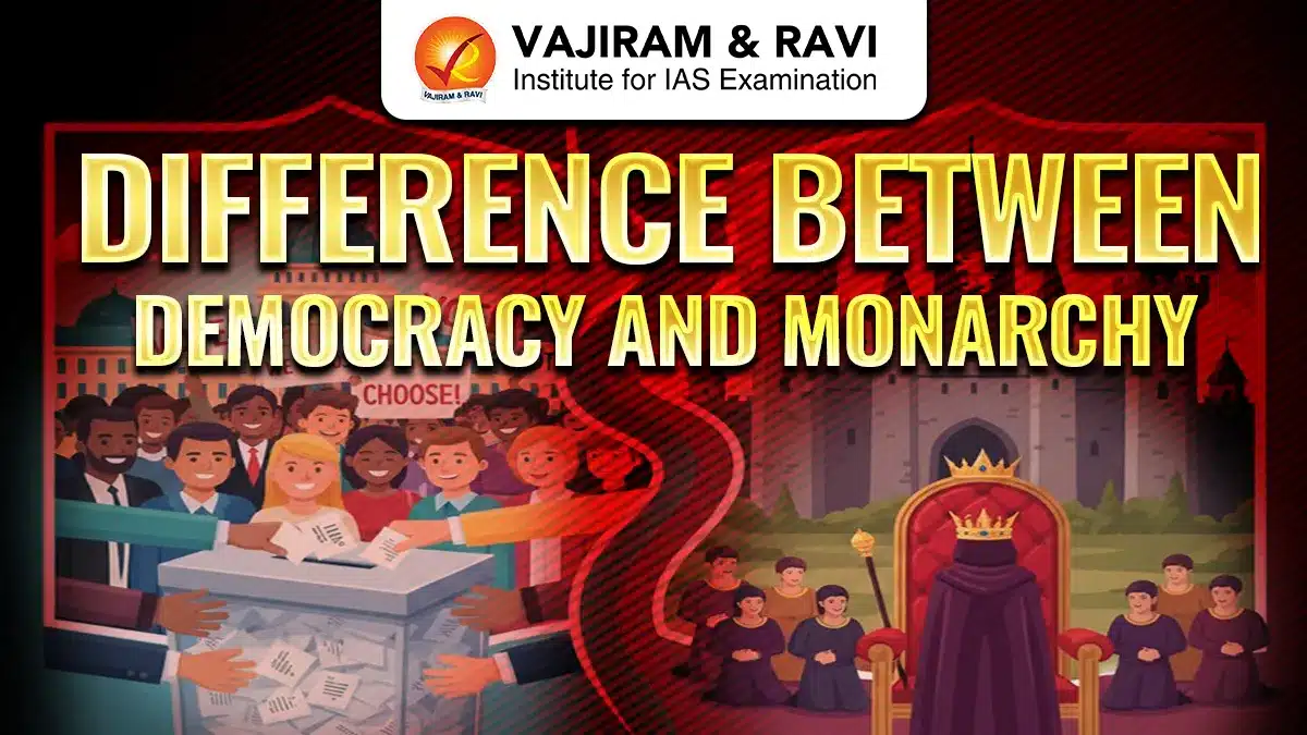
The Difference between Democracy and Monarchy lies in who holds power and how it is exercised. In a democracy, power rests with the people, and leaders are elected through free and fair elections. In a monarchy, authority is vested in a king, queen, or monarch, usually inherited through a royal family.

The detailed difference, along with their definitions, has been discussed below in the article.

What is Democracy?

Democracy is a form of government in which power rests with the people, who exercise it directly or through elected representatives. Citizens have the right to vote, participate in decision-making, and hold leaders accountable. Democracies are guided by the rule of law, equality, and protection of civil liberties, ensuring that governance reflects the will of the people.

What is Monarchy?

Monarchy is a form of government where a single person, usually a king or queen, serves as the head of state, and the position is generally hereditary. Monarchs may exercise absolute power (absolute monarchy) or have a ceremonial role under a constitution (constitutional monarchy). 

Other types include semi-constitutional monarchy, subnational monarchy, and commonwealth realms, depending on the distribution of power between the monarch and elected bodies.

Difference between Democracy and Monarchy

The key Difference Between Democracy and Monarchy have been tabulated below.

Difference between Democracy and Monarchy
Basis of Comparison Democracy Monarchy

Definition

A system of government where power rests with the people, exercised directly or through elected representatives.

A system of government where power rests with a king, queen, or emperor, usually inherited through a royal family.

Source of Power

Derived from the people through elections.

Derived from hereditary succession within a royal family.

Leadership Selection

Leaders are elected by citizens through free and fair elections.

Monarchs inherit their position; selection is based on birthright.

Law-Making

Elected representatives formulate laws, rules, and policies for public welfare.

Monarchs or royal councils create laws; citizens have little or no say.

Accountability

Leaders are accountable to the people; can lose power in elections if public expectations are not met.

Monarchs generally have limited accountability; citizens cannot remove them if dissatisfied.

Citizen Participation

Citizens can vote, criticize policies, and influence governance.

Citizens usually have no role in decision-making.

Rights and Freedoms

Promotes civil liberties, political rights, and equality among citizens.

Rights and freedoms vary; in absolute monarchies, citizens may face limited freedoms and oppression.

Equality

All citizens are considered equal before the law.

Hierarchical society; citizens may not be considered equal, especially under absolute monarchies.

Rule of Law

Constitution and laws apply to everyone, including leaders.

Monarch may be above law in absolute monarchies; in constitutional monarchies, bound by law.

Origin

Concept originated in Greece; Athenian Democracy is the earliest known form.

Originated in ancient and medieval times; still exists in some countries today.

Types

Direct democracy, representative democracy, parliamentary democracy, presidential democracy.

Absolute monarchy, constitutional monarchy, semi-constitutional monarchy, subnational monarchy, commonwealth realms.

Examples

India, USA, France, Germany, Japan.

United Arab Emirates (UAE), Saudi Arabia, United Kingdom (constitutional monarchy), Denmark (constitutional monarchy).

Also Check Related Articles
Difference between NITI Aayog and Inter-State Council Difference Between Economic Survey and Union Budget
Difference Between Tropical Evergreen and Tropical Deciduous Forests Difference Between Ordinary Bill and Money Bill
Difference Between Legislative and Executive Difference between Himalayan and Peninsular Plateau
Difference Between Vedas and Upanishads Difference Between Scheduled and Non-Scheduled Banks
Difference Between Written and Unwritten Constitution Difference between NITI Aayog and Planning Commission
Difference between Colonialism and Imperialism Difference between Fundamental Rights and Directive Principles of State Policy
Difference between Procedure Established by Law and Due Process of Law Difference Between Democracy and Republic
Difference between Creamy Layer and Non-Creamy Layer of OBC Difference between Rajya Sabha and Vidhan Sabha
Difference Between Western Ghats and Eastern Ghats

Difference between Democracy and Monarchy FAQs

Q1: What is the main difference between democracy and monarchy?

Ans: Democracy vests power in the people through elections, while monarchy grants authority to a hereditary king, queen, or monarch.

Q2: Can a monarchy exist within a democratic system?

Ans: Yes, in constitutional monarchies, monarchs are ceremonial heads while governance is carried out by elected representatives, balancing tradition with democratic principles.

Q3: Which system provides more citizen participation?

Ans: Democracy allows citizens to vote, influence policies, and hold leaders accountable; monarchy usually limits citizen participation except in constitutional frameworks.

Q4: Are all monarchies undemocratic?

Ans: No, absolute monarchies are centralized and autocratic, while constitutional monarchies function democratically, limiting monarch powers and respecting citizen rights.

Q5: Which system ensures greater accountability of leaders?

Ans: Democracy ensures accountability through elections, rule of law, and citizen oversight; monarchs in absolute monarchies may remain unaccountable.

UPSC Daily Quiz 18 December 2025

UPSC Daily Quiz

[WpProQuiz 49]

UPSC Daily Quiz FAQs

Q1: What is the Daily UPSC Quiz?

Ans: The Daily UPSC Quiz is a set of practice questions based on current affairs, static subjects, and PYQs that help aspirants enhance retention and test conceptual clarity regularly.

Q2: How is the Daily Quiz useful for UPSC preparation?

Ans: Daily quizzes support learning, help in revision, improve time management, and boost accuracy for both UPSC Prelims and Mains through consistent practice.

Q3: Are the quiz questions based on the UPSC syllabus?

Ans: Yes, all questions are aligned with the UPSC Syllabus 2025, covering key areas like Polity, Economy, Environment, History, Geography, and Current Affairs.

Q4: Are solutions and explanations provided with the quiz?

Ans: Yes, each quiz includes detailed explanations and source references to enhance conceptual understanding and enable self-assessment.

Q5: Is the Daily UPSC Quiz suitable for both Prelims and Mains?

Ans: Primarily focused on Prelims (MCQ format), but it also indirectly helps in Mains by strengthening subject knowledge and factual clarity.

National Parks in Assam, Tiger Reserves, Wildlife Sanctuaries

National Parks in Assam

National Parks in Assam and other protected areas are legally notified regions created to conserve wildlife, forests, wetlands, and natural ecosystems. They restrict human activities like hunting, logging, and settlement. The biodiversity is protected through National Parks in India, Wildlife Sanctuaries, Tiger Reserves, Biosphere Reserves, Ramsar wetlands, and Elephant Reserves, ensuring habitat security, ecological balance, climate regulation, and long-term survival of endangered flora and fauna.

Protected Areas in Assam

The Protected Areas in Assam safeguards ecosystems across forests, wetlands, and floodplains. These include:

  1. National Parks: 8 legally notified parks protect core ecosystems.
  2. Wildlife Sanctuaries: 20 sanctuaries including proposed areas.
  3. Tiger Reserves: 3 reserves under Project Tiger.
  4. Biosphere Reserves: Manas and Dibru-Saikhowa designated.
  5. World Heritage Sites: Kaziranga and Manas recognised globally.
  6. Ramsar Site: Deepor Beel listed for wetland conservation.
  7. Important Bird Areas: 46 Important Bird Areas identified.
  8. Elephant Reserves: 5 notified elephant landscapes.

National Parks in Assam

Assam is one of India’s richest biodiversity states, located in the Eastern Himalayas and Brahmaputra floodplains. It hosts grasslands, wetlands, tropical forests, and river ecosystems. Assam has eight National Parks, two Biosphere Reserves, three Tiger Reserves, one Ramsar Site, and forty six Important Bird Areas, making it a global conservation hotspot.

Kaziranga National Park

Kaziranga represents the Brahmaputra floodplain grassland ecosystem and supports the world’s largest population of one-horned rhinoceros.

  1. Location and Landscape: Situated across Nagaon, Golaghat, and Sonitpur districts along Brahmaputra floodplains.
  2. Global Significance: Holds over seventy percent of the world’s one-horned rhinoceros population.
  3. Tiger Prey Base: Highest prey biomass density supporting strong tiger populations in India.
  4. Big Five Census: Recorded rhino 1855, wild buffalo 1431, elephant 1246, tiger 85.
  5. Unique Mammals: Eastern swamp deer survives only here within India.
  6. Bird Diversity: Home to 480 recorded bird species including 25 globally threatened.
  7. Aquatic Systems: Contains over 150 perennial water bodies supporting fish breeding.
  8. Floral Diversity: Supports more than 32 aquatic plant species.
  9. Reptile Presence: Hosts seven turtle and tortoise species.
  10. Tourism Value: Elephant and jeep safaris enable close wildlife observation.

Manas National Park

Manas lies in Himalayan foothills and showcases exceptional natural beauty with high biodiversity richness.

  1. Geographical Setting: Located in western Assam’s bhabar foothill zone along Bhutan border.
  2. Protected Status: Declared Tiger Reserve, National Park, Biosphere Reserve, World Heritage Site.
  3. Area Coverage: National Park covers 500 square kilometres.
  4. Species Protection: Hosts over twenty-two Schedule I endangered species.
  5. UNESCO Value: Recognised for outstanding natural beauty and ecological processes.
  6. Mammal Diversity: Nearly sixty mammal species recorded.
  7. Bird Richness: Over five hundred bird species documented.
  8. Floral Composition: Contains eighty-nine tree species and forty-nine shrubs.
  9. Butterfly Diversity: Supports more than two hundred butterfly species.
  10. Aquatic Fauna: Records seventy-nine fish species including rare turtles.

Dibru-Saikhowa National Park

Dibru-Saikhowa is a riverine biosphere reserve shaped by Brahmaputra dynamics.

  1. Area and Status: Covers 340 square kilometres as National Park and Biosphere Reserve.
  2. Unique Habitat: Formed after the 1950 Assam earthquake.
  3. Mammal Records: Thirty-six mammal species including feral horses.
  4. Aquatic Mammals: Supports Gangetic river dolphins.
  5. Bird Importance: Recognised Important Bird Area with 382 bird species.
  6. Migratory Birds: Major wintering site for long-distance migratory birds.
  7. Wetland Ecology: Extensive river islands and marsh ecosystems.
  8. Vegetation Feature: Noted for natural regeneration of Salix trees.
  9. Reptile Presence: Hosts turtles and diverse wetland reptiles.
  10. Conservation Role: Protects floodplain biodiversity under dynamic river systems.

Nameri National Park

Nameri protects riverine forests along Assam-Arunachal border.

  1. Location: Situated in Sonitpur district adjoining Arunachal Pradesh.
  2. Area: National Park covers 200 square kilometres.
  3. Tiger Reserve Core: Forms core zone of Nameri Tiger Reserve.
  4. River System: Jia Bhoroli river defines southwestern boundary.
  5. Mammal Diversity: Supports tiger, elephant, gaur, and dhole.
  6. Rare Species: Habitat for hispid hare and slow loris.
  7. Bird Significance: Known for white-winged wood duck.
  8. Raptors Presence: Records fish eagles and vultures.
  9. Reptile Diversity: Includes king cobra and softshell turtles.
  10. Eco-tourism: Popular for regulated river rafting activities.

Orang National Park

Orang represents floodplain grassland biodiversity on Brahmaputra’s northern bank.

  1. Historical Status: Oldest declared game reserve in Assam.
  2. Area: Covers 78.80 square kilometres.
  3. Breeding Ground: Important fish breeding habitat.
  4. Key Mammals: Supports rhinoceros and tiger populations.
  5. Elephant Groups: Known for male elephant bachelor herds.
  6. Bird Diversity: Records 222 bird species.
  7. Florican Habitat: Second-highest Bengal florican concentration.
  8. Reptiles: Hosts python and king cobra.
  9. Turtles: Supports seven turtle and tortoise species.
  10. Riverine Ecology: Maintains Brahmaputra floodplain ecosystem integrity.

Dehing Patkai National Park

Dehing Patkai protects Assam Valley tropical wet evergreen forests.

  1. Area: Covers 111.19 square kilometres.
  2. Location: Spread across Dibrugarh and Tinsukia districts.
  3. Forest Type: Known for dense wet evergreen forests.
  4. Elephant Reserve: Part of Dehing-Patkai Elephant Reserve.
  5. Rare Mammals: Habitat for Chinese pangolin and clouded leopard.
  6. Primate Diversity: Supports hoolock gibbon and macaques.
  7. Bird Species: Hosts hornbills and rare forest birds.
  8. Reptile Presence: Includes king cobra and monitor lizard.
  9. Historic Landmarks: Near Stillwell Road and Digboi refinery.
  10. Conservation Value: Protects eastern Himalayan forest biodiversity.

Raimona National Park

Raimona forms a transboundary forest landscape in Bodoland.

  1. Geographical Spread: Located along Indo-Bhutan international boundary.
  2. Connectivity: Links Bhutan and West Bengal protected areas.
  3. Vegetation: Moist deciduous and semi-evergreen forests dominate.
  4. Flagship Species: Asian elephant and Bengal tiger present.
  5. Golden Langur: Endemic endangered primate and Bodoland mascot.
  6. Avifauna: Supports white-bellied heron and Bengal florican.
  7. River Boundaries: Defined by Sankosh and Saralbhanga rivers.
  8. Landscape Role: Acts as ecological corridor.
  9. Forest Integrity: Maintains Himalayan foothill ecosystems.
  10. Biodiversity Value: Protects rare fauna across political borders.

Sikhna Jwhwlao National Park

Sikhna Jwhwlao strengthens Bodoland’s conservation network.

  1. Notification Year: Declared National Park in 2025.
  2. Area Coverage: Encompasses 316.29 square kilometres.
  3. Regional Importance: Third National Park in Bodoland.
  4. Biosphere Link: Part of Manas Biosphere Reserve.
  5. Ecological Corridor: Connects four protected forest landscapes.
  6. Butterfly Diversity: Records over 460 butterfly species.
  7. Flagship Mammals: Supports tiger, rhinoceros, elephant.
  8. Primate Species: Habitat for golden langur.
  9. Border Location: Lies along Indo-Bhutan boundary.
  10. Conservation Status: Enhances protected area coverage in Assam.

Tiger Reserves in Assam

Assam hosts three tiger reserves protecting grassland and forest tigers. Assam has three Tiger Reserves: Kaziranga, Manas and Nameri, protecting floodplain grasslands, riverine forests, and Himalayan foothills. These reserves conserve high tiger prey density, transboundary habitats, elephants, and rich biodiversity under Project Tiger, strengthening long-term wildlife protection.

  1. Manas Tiger Reserve
  2. Nameri Tiger Reserve
  3. Kaziranga Tiger Reserve

Manas Tiger Reserve

Manas Tiger Reserve protects transboundary tiger populations.

  1. Established: 1973; covering 2837.12 square kilometres.
  2. Landscape: Himalayan foothill forests and grasslands.
  3. Tiger Count: Thirty-one tigers recorded in 2016-17.
  4. Elephant Presence: Over one thousand elephants documented.

Nameri Tiger Reserve

Nameri secures riverine forest tigers.

  1. Declared: 2000; spanning 344 square kilometres.
  2. Core Area: National Park forms reserve core.
  3. Habitat Type: Riverine forests and grasslands.
  4. Species Protection: Supports tiger prey species.

Kaziranga Tiger Reserve

Kaziranga safeguards floodplain tigers.

  1. Notified: 2006; covering 858.98 square kilometres.
  2. High Prey Density: Supports India’s richest tiger prey base.
  3. Landscape: Grassland and wetland mosaic.
  4. Tiger Security: Ensures long-term tiger viability.

Wildlife Sanctuaries in Assam

Wildlife Sanctuaries complement National Parks by protecting specific habitats and species. Assam’s sanctuaries cover grasslands, wetlands, hill forests, and floodplains. They conserve endangered mammals, migratory birds, orchids, primates, reptiles, amphibians, and fishes. Many sanctuaries act as ecological corridors supporting seasonal wildlife movement during floods, particularly between Kaziranga, Karbi Anglong, and riverine landscapes.

Wildlife Sanctuaries in Assam List

The wildlife sanctuaries of Assam conserve diverse ecosystems and species. There are total 20 sanctuaries in Assam, as listed below:

  • Garampani Wildlife Sanctuary: Hot springs and orchids support elephant, tiger, and  hornbills.
  • Laokhowa Wildlife Sanctuary: Floodplain grasslands support rhinoceros and wild buffalo populations.
  • Bornadi Wildlife Sanctuary: Created for pygmy hog and hispid hare conservation.
  • Chakrasila Wildlife Sanctuary: Second natural habitat of golden langur.
  • Burachapori Wildlife Sanctuary: Grassland mosaic supports Bengal florican.
  • Panidehing Wildlife Sanctuary: Wetland attracts migratory waterfowl concentrations.
  • Hollongapar Gibbon Sanctuary: Protects India’s only ape species.
  • Pabitora Wildlife Sanctuary: World’s highest rhino density recorded.
  • Sonai Rupai Wildlife Sanctuary: Himalayan foothill forests with elephants.
  • Bherjan-Borajan-Padumoni Sanctuary: Primate-rich fragmented forest blocks.
  • East Karbi Anglong Sanctuary: Kaziranga landscape connectivity zone.
  • Nambor Wildlife Sanctuary: Orchid-rich tropical forests.
  • Marat Longri Sanctuary: Elephant reserve component.
  • Nambor-Doigrung Sanctuary: Hot springs and gaur habitat.
  • Amchang Wildlife Sanctuary: Urban fringe forest near Guwahati.
  • Dehing Patkai Sanctuary: Wet evergreen forest biodiversity.
  • Borail Wildlife Sanctuary: Moist evergreen hill forests.
  • Deepor Beel Sanctuary: Wetland bird habitat near Guwahati.
  • Bordoibam Bilmukh Sanctuary: Proposed bird breeding sanctuary.
  • North Karbi Anglong Sanctuary: Flood refuge for Kaziranga wildlife.

Ramsar Sites in Assam

Assam has one internationally recognised Ramsar wetland at Deepor Beel declared in 2002 and covering 4.1 square kilometres of area. Its features are:

  1. Wetland Type: Permanent freshwater lake of Brahmaputra paleo-channel.
  2. Bird Richness: Records over 219 bird species.
  3. Migratory Birds: Hosts Siberian crane and waterfowl.
  4. Fish Diversity: Over fifty commercially viable fish species.
  5. Floral Diversity: Supports giant water lily and hydrophytes.
  6. Conservation Value: Important Bird Area of global priority.

National Parks in Assam FAQs

Q1: How many National Parks are there in Assam?

Ans: Assam has eight National Parks protecting floodplains, wetlands, grasslands, and forest ecosystems.

Q2: Which is the most famous National Park in Assam?

Ans: Kaziranga National Park is the most famous for one-horned rhinoceros and high tiger density.

Q3: Which National Parks in Assam are UNESCO World Heritage Sites?

Ans: Kaziranga National Park and Manas National Park are UNESCO World Heritage Sites.

Q4: Which National Park in Assam has the highest bird diversity?

Ans: Manas National Park records over 500 bird species, making it the richest in avifauna.

Q5: Which is the latest National Park in Assam?

Ans: Sikhna Jwhwlao National Park is the latest recognised National Park in Assam notified in 2025.

National Parks in Uttarakhand, Tiger Reserves, Wildlife Sanctuaries

National Parks in Uttarakhand

National Parks are legally protected natural areas notified under the Wildlife Protection Act 1972, to conserve ecosystems, wildlife, and biodiversity without human exploitation. Other protected areas include Wildlife Sanctuaries, Biosphere Reserves, Tiger Reserves, Conservation Reserves, and Ramsar Wetlands, each serving specific conservation goals. The National Parks in India as well as other protected areas protect endangered species, maintain ecological balance, conserve water sources, preserve genetic diversity, and support climate stability. Human activities like hunting, mining, and deforestation are strictly regulated or prohibited within such notified regions.

Protected Areas in Uttarakhand

The Protected Areas in Uttarakhand conserve Himalayan biodiversity through legally notified parks, sanctuaries, reserves, and wetlands.

  1. National Parks: Six parks protecting alpine, forest, and river ecosystems.
  2. Wildlife Sanctuaries: Safeguard endangered mammals, birds, and flora.
  3. Tiger Reserves: Maintain breeding populations and dispersal corridors.
  4. Ramsar Wetlands: Protect migratory bird habitats and aquatic biodiversity.

National Parks in Uttarakhand

Uttarakhand hosts six notified National Parks located across the Himalayas and Terai regions, representing alpine, sub-alpine, temperate, and tropical ecosystems. These parks conserve glaciers, rivers, forests, grasslands, and high-altitude meadows. They protect globally important species such as Bengal tiger, snow leopard, Asian elephant, musk deer, and endemic alpine flora. Many parks are part of UNESCO-recognized landscapes and transboundary ecological corridors, playing a critical role in Himalayan biodiversity conservation.

Jim Corbett National Park

India’s first National Park, established in 1936, Jim Corbett National Park lies in Nainital district and forms the core of Corbett Tiger Reserve, protecting rich Terai ecosystems and high tiger densities.

  1. Establishment Purpose: Created to protect Bengal tigers under early wildlife conservation efforts.
  2. Rivers System: Ramganga, Sonanadi, and Kosi rivers sustain wetlands and grasslands.
  3. Vegetation Type: Moist deciduous forests, grasslands, chaurs, and riverine habitats.
  4. Key Fauna: Bengal tiger, Asian elephant, leopard, goral, sloth bear, gharial.
  5. Conservation Role: Part of WWF-supported Terai Arc Landscape ecological corridor.
  6. Special Success: Captive breeding revived gharial and mugger crocodile populations.

Nanda Devi National Park

Located in Chamoli district, Nanda Devi National Park surrounds the 7,816-meter Nanda Devi peak and forms the core of the Nanda Devi Biosphere Reserve.

  1. Global Status: UNESCO World Heritage Site under Man and Biosphere Programme.
  2. Landscape Feature: Glacial basin encircled by high Himalayan peaks.
  3. Flora Diversity: Fir, birch, juniper, rhododendron dominate alpine forests.
  4. Key Fauna: Musk deer, Himalayan tahr, serow, black bear.
  5. Ecological Value: Preserves fragile alpine ecosystems with minimal human access.

Rajaji National Park

Rajaji National Park spans Haridwar, Dehradun, and Pauri Garhwal districts, covering Shivalik hills and Indo-Gangetic plains with diverse forest types.

  1. Formation Year: Created in 1983 by merging three wildlife sanctuaries.
  2. River System: Ganga and Song rivers traverse the park.
  3. Habitat Range: Semi-evergreen, deciduous forests, grasslands, and riverine belts.
  4. Key Species: Asian elephant, Bengal tiger, sloth bear, porcupine.
  5. Human Interface: Seasonal habitat of nomadic Van Gujjar community.

Gangotri National Park

Gangotri National Park lies in Uttarkashi district, covering the upper catchment of the Bhagirathi River and India-China international boundary.

  1. Glacial Source: Gaumukh glacier marks origin of the River Ganga.
  2. Mountain Peaks: Chaukhamba I-III, Satopanth, Kedarnath dominate terrain.
  3. Vegetation Zones: Conifer forests, alpine meadows, and glacial zones.
  4. Key Fauna: Snow leopard, brown bear, blue sheep, Himalayan tahr.
  5. Ecological Link: Forms continuity with Govind National Park and Kedarnath Sanctuary.

Govind National Park

Govind Pashu Vihar National Park is located in Uttarkashi district and named after freedom fighter Govind Ballabh Pant.

  1. Conservation Focus: Managed under India’s Snow Leopard Project.
  2. Forest Types: Broadleaf forests, conifers, alpine meadows, shrubs.
  3. Floral Richness: Oak, maple, walnut, rhododendron, cedar species.
  4. Major Fauna: Snow leopard, musk deer, Himalayan tahr, bearded vulture.
  5. Altitude Range: Supports diverse species across steep elevational gradients.

Valley of Flowers National Park

Valley of Flowers National Park is a high-altitude alpine valley in Chamoli district, globally famous for endemic flowering plants.

  1. UNESCO Status: Declared World Heritage Site in 2005.
  2. Ecological Zone: Transition region between Zanskar and Greater Himalayas.
  3. Floral Diversity: Orchids, poppies, marigolds, daisies, rhododendrons.
  4. Faunal Presence: Snow leopard, brown bear, musk deer, red fox.
  5. Biosphere Role: Forms core of Nanda Devi Biosphere Reserve.

Tiger Reserves in Uttarakhand

Uttarakhand has two designated Tiger Reserves supporting India’s highest-quality tiger habitats. These reserves play a significant role in protecting high-density tiger habitats, maintaining Terai-Shivalik wildlife corridors, and supporting elephant movement, biodiversity conservation, and long-term ecological stability. The two tiger reserves are:

  1. Corbett Tiger Reserve: India’s oldest and most tiger-dense reserve.
  2. Rajaji Tiger Reserve: Northwestern limit of tiger and elephant distribution.

Corbett Tiger Reserve

It is located in Himalayan foothills and spans Terai and Shivalik regions across three districts. Jim Corbett National Park is the core of the Corbett Tiger Reserve with the launch of Project Tiger in 1973.

  1. Total Area: 1,288.31 square kilometers including core and buffer.
  2. Tiger Status: Highest tiger density nationally with rising population trend.
  3. Habitat Type: Sal forests, chaurs, grasslands, riverine belts.
  4. Monitoring Tools: M-STrIPES, camera traps, electronic surveillance systems.

Rajaji Tiger Reserve

It was declared India’s 48th Tiger Reserve in 2015, Rajaji Tiger Reserve lies along Shivalik foothills.

  1. Forest Types: Sal-dominated deciduous, grasslands, pine forests.
  2. Faunal Diversity: Over 50 mammal species including elephants and tigers.
  3. River Network: Ganga and Song rivers enhance habitat productivity.
  4. Conservation Issue: Infrastructure pressures in buffer zones monitored legally.

Wildlife Sanctuaries in Uttarakhand

Wildlife Sanctuaries in Uttarakhand protect species-rich habitats across Kumaon, Garhwal, Terai, and Shivalik landscapes. These sanctuaries conserve musk deer, elephants, snow leopards, migratory birds, and endemic flora. They safeguard river catchments, alpine meadows, temperate forests, and wildlife corridors connecting India and Nepal. Many sanctuaries support threatened species listed as Endangered, Vulnerable, or Critically Endangered, playing a vital role in national biodiversity conservation strategies.

Wildlife Sanctuaries in Uttarakhand List

Uttarakhand hosts several ecologically important wildlife sanctuaries spread across diverse Himalayan landscapes. There are 6 officially recognised Wildlife Sanctuaries in Uttarakhand as mentioned below:

  1. Askot Wildlife Sanctuary: Located in Pithoragarh district, this sanctuary conserves endangered musk deer within western Kumaon Himalayas, features alpine forests, river valleys, rich birdlife, and is notified as an Eco-Sensitive Zone for ecological protection.
  2. Kedarnath Wildlife Sanctuary: Spread across Rudraprayag and Chamoli districts, it protects musk deer habitats from Gaurikund to Kedarnath, covering Mandakini river catchment, alpine meadows, glaciers, and high Himalayan peaks like Chaukhamba and Kedarnath.
  3. Nandhaur Wildlife Sanctuary: Situated in Terai Arc Landscape, it forms part of Shivalik Elephant Reserve, linking Corbett and Nepal forests, supporting elephants, tigers, leopards, and serving as a crucial transboundary wildlife corridor.
  4. Sonanadi Wildlife Sanctuary: Located in Nainital district, this sanctuary acts as buffer to Jim Corbett Tiger Reserve, supporting tiger dispersal, riverine forests, grasslands, and maintaining habitat continuity within the Terai ecosystem.
  5. Binsar Wildlife Sanctuary: Located in Kumaon region, this sanctuary protects oak-rhododendron forests, Himalayan bird species, and historic landscapes, once serving as summer capital of Chand rulers, offering panoramic views of Himalayan peaks.
  6. Mussoorie Wildlife Sanctuary: Also known as Benog Wildlife Sanctuary, it lies near Mussoorie town, forms part of Rajaji landscape, supports diverse birds, mammals, and riverine ecology of Aglar river, a Yamuna tributary.
  7. Govind Pashu Vihar Wildlife Sanctuary: It is located in Uttarkashi protects alpine forests and meadows, supports snow leopard conservation under national projects, and preserves rich Himalayan flora, raptors, and high-altitude wildlife habitats.

Ramsar Sites in Uttarakhand

As of now, Uttarakhand has only one Ramsar Site. Asan Conservation Reserve is Uttarakhand’s first Ramsar site, formed by Asan Barrage in Dehradun district. The key features of this region are:

  1. Wetland Type: Reservoir at Asan-Yamuna river confluence.
  2. Bird Diversity: Supports over 330 bird species annually.
  3. Threatened Avifauna: Hosts critically endangered vultures and Baer’s pochard.
  4. Flyway Importance: Strategic wintering site under Central Asian Flyway.
  5. Ecological Role: Fish spawning, migration, feeding ground supporting wetland biodiversity.

National Parks in Uttarakhand FAQs

Q1: How many National Parks are there in Uttarakhand?

Ans: Uttarakhand has six national parks protecting Himalayan, Terai, alpine, forest, and river ecosystems.

Q2: Which is the oldest National Park in Uttarakhand?

Ans: Jim Corbett National Park is the oldest, established in 1936 as India’s first national park.

Q3: Which National Parks in Uttarakhand are UNESCO World Heritage Sites?

Ans: Nanda Devi National Park and Valley of Flowers National Park are UNESCO World Heritage Sites.

Q4: Which National Parks in Uttarakhand is the source of the River Ganga?

Ans: Gangotri National Park contains the Gaumukh Glacier, the origin of the River Ganga.

Q5: Which major animals are protected in Uttarakhand’s National Parks?

Ans: Key species include Bengal tiger, snow leopard, Asian elephant, musk deer, and Himalayan black bear.

Rashtriya Krishi Vikas Yojana, Objectives, Features, Funding Pattern

Rashtriya Krishi Vikas Yojana

The Pradhan Mantri Rashtriya Krishi Vikas Yojana (PM-RKVY) is a major centrally sponsored scheme of the Government of India aimed at accelerating agricultural growth and improving farmers’ income. The scheme focuses on strengthening agriculture and allied sectors through increased public investment, infrastructure creation, innovation, and state-specific planning. 

By adopting a decentralised and flexible approach, PM-RKVY plays an important role in ensuring food security, rural development, and sustainable agriculture in India.

Rashtriya Krishi Vikas Yojana Objectives

The objectives of PM-RKVY focus on inclusive, sustainable, and income-oriented agricultural development:

  • To encourage states to increase public investment in agriculture and allied sectors.
  • To enhance agricultural productivity and overall farm growth.
  • To strengthen agricultural and post-harvest infrastructure and reduce losses.
  • To promote diversification into high-value crops, horticulture, livestock, and fisheries.
  • To encourage adoption of modern, innovative, and climate-resilient farming practices.
  • To ensure efficient and sustainable use of natural resources such as soil and water.
  • To reduce regional disparities in agricultural development.
  • To enhance farmers’ income and improve rural livelihoods.
  • To promote agribusiness, food processing, and value-chain development.

Also Read: PM VIKAS Scheme

Pradhan Mantri Rashtriya Krishi Vikas Yojana Features

The Pradhan Mantri Rashtriya Krishi Vikas Yojana has several important features that make it a comprehensive agricultural development programme:

  • State-Led and Decentralized Approach: States have the flexibility to plan and implement agricultural projects according to local priorities.
  • Growth-Oriented Scheme: The scheme aims to achieve a sustained annual growth rate of around 4 percent in agriculture and allied sectors.
  • Wide Sectoral Coverage: It supports crop production, horticulture, livestock, fisheries, organic farming, agricultural research, and marketing infrastructure.
  • Incentive-Based Funding: States receive financial assistance based on their commitment to increasing public investment in agriculture.
  • Infrastructure Development: Support is provided for irrigation facilities, warehouses, cold storage, soil testing laboratories, rural markets, and farm mechanization.
  • Promotion of Innovation: Encourages adoption of modern technologies such as precision farming, climate-resilient agriculture, and digital advisory services.
  • Farmer Welfare and Capacity Building: Includes training programmes, extension services, and skill development initiatives for farmers.
  • Support for Value Addition: Emphasis on food processing, agribusiness development, Farmer Producer Organizations (FPOs), and supply chain strengthening.

Also Read: Pradhan Mantri Schools for Rising India (PM-SHRI) Scheme

Rashtriya Krishi Vikas Yojana Funding Pattern

PM-RKVY is a centrally sponsored scheme with a shared funding pattern:

  • General States: 60 percent Centre and 40 percent State
  • North-Eastern and Hilly States: 90 percent Centre and 10 percent State
  • Union Territories: 100 percent central funding

Sub-Schemes under Rashtriya Krishi Vikas Yojana

The PM-RKVY comprises of the following schemes:

Sub-Schemes under Rashtriya Krishi Vikas Yojana
Sub-Scheme Objectives Benefits

Soil Health Management

Improve soil fertility and productivity

Soil testing, soil health cards, nutrient management, and farmer training

Rainfed Area Development

Enhance productivity in rainfed regions

Water conservation, drought-resistant crops, watershed management, and improved farming practices

Agroforestry

Promote tree-based farming systems

Integration of trees with crops, sustainable land use, and additional income sources for farmers

Paramparagat Krishi Vikas Yojana (PKVY)

Encourage organic farming

Support for certified organic crops, training, and market linkages for organic produce

Agricultural Mechanization including Crop Residue Management

Increase farm efficiency and sustainability

Farm machinery, mechanized harvesting, crop residue management to reduce stubble burning

Per Drop More Crop (Micro Irrigation)

Improve water use efficiency

Drip and sprinkler irrigation, water-saving technologies, and higher crop productivity

Crop Diversification Programme

Encourage cultivation of high-value crops

Promotion of horticulture, medicinal plants, pulses, oilseeds, and other remunerative crops

RKVY DPR Component

Support state-specific agriculture projects

Funding for district/state-level projects based on Annual Action Plans (AAPs) and local needs

Accelerator Fund for Agri Startups

Promote agripreneurship

Seed funding, incubation support, start-ups in agri-processing, technology, and allied sectors

Rashtriya Krishi Vikas Yojana FAQs

Q1: What is Rashtriya Krishi Vikas Yojana (RKVY)?

Ans: RKVY, launched in 2007, is a centrally sponsored scheme incentivising states to invest in agriculture and allied sectors, promoting growth and farmer welfare.

Q2: What are the main objectives of RKVY?

Ans: Objectives include promoting agricultural growth, increasing farmers’ income, supporting infrastructure, encouraging innovation, strengthening value chains, ensuring sustainability, and enhancing rural livelihoods.

Q3: Who implements RKVY?

Ans: RKVY is implemented by state governments, guided and funded by the central government, with states preparing Annual Action Plans aligned to local priorities.

Q4: What is the funding pattern under RKVY?

Ans: Funding: General states 60:40, North-Eastern/hilly states 90:10, Union Territories 100% central funding, ensuring financial support while promoting state participation in agriculture.

Q5: Which sectors are covered under RKVY?

Ans: RKVY covers crops, horticulture, livestock, fisheries, organic farming, soil health management, post-harvest infrastructure, marketing, and allied sectors to boost productivity and income.

National Parks in Bihar, Tiger Reserve, Wildlife Sanctuaries

National Parks in Bihar

National Parks and other protected areas are legally designated regions created to conserve wildlife, forests, wetlands, rivers and unique ecosystems. In India, these areas are notified under the Wildlife Protection Act 1972, to ensure long term protection of biodiversity. National Parks receive the highest level of protection with strict limits on human activity, while Wildlife Sanctuaries, Tiger Reserves and Ramsar wetlands allow regulated conservation based use. These protected areas help maintain ecological balance, protect endangered species, conserve genetic diversity and support climate resilience through forests and wetlands.

Protected Areas of Bihar

Bihar’s protected areas include national parks, wildlife sanctuaries, tiger reserves, bird sanctuaries and riverine conservation zones, covering forests, wetlands and rivers.

  • National Park: Valmiki National Park is the only national park in the state.
  • Tiger Reserves: Valmiki Tiger Reserve is currently  identified for tiger conservation with the proposal of a new Kaimur Reserve.
  • Wildlife Sanctuaries: Large forest and wetland sanctuaries across plains and plateaus.
  • Bird Sanctuaries: Oxbow lakes, dams and wetlands protecting migratory birds.
  • River Sanctuaries: Ganga stretch conserved for Gangetic dolphins and aquatic fauna.

National Parks in Bihar

Bihar has only one National Park- Valmiki National Park, located in the northernmost part of the state along the Indo Nepal border. Despite limited forest cover compared to central India, Bihar’s protected areas are ecologically significant due to their location in the Gangetic Plains, Himalayan foothills and Vindhyan landscapes. Valmiki National Park forms the core of Bihar’s tiger conservation efforts and connects with forest landscapes of Nepal. The state also supports wildlife through sanctuaries, tiger reserves, bird habitats and riverine protected zones.

Valmiki National Park

Valmiki National Park is Bihar’s only National Park in India, located in West Champaran district along the Indo Nepal border.

  1. Geographical Location: Situated in Shivalik foothills, bordered by Nepal and Gandak River.
  2. Area Coverage: Forms core zone of Valmiki Tiger Reserve spread over nearly 900 sq km.
  3. River Systems: Harha and Masan rivers originate here, forming Burhi Gandak downstream.
  4. Vegetation Types: Moist deciduous forests, semi evergreen patches, grasslands and wetlands.
  5. Major Mammals: Bengal tiger, leopard, sloth bear, black bear, Indian gaur and rhinoceros.
  6. Deer Species: Spotted deer, sambar, barking deer and hog deer widely distributed.
  7. Tribal Presence: Tharu tribe is the dominant indigenous community around the park.
  8. Bird Diversity: Himalayan terai birds, migratory waterfowl and forest species recorded.

Tiger Reserves in Bihar

Bihar has important tiger landscapes supporting conservation of big cats and forest corridors. Currently Bihar has only one recognised Tiger Reserve at Valmiki National Park with confirmed Breeding of Tigers. Although the state is set to get the second Tiger reserve within the Kaimur Wildlife Sanctuary which has received the permit from the Government and remains for the NTCA approval.

Valmiki Tiger Reserve

Valmiki Tiger Reserve is Bihar’s flagship conservation area and the 18th tiger reserve of India.

  1. Location: Situated in West Champaran along Nepal border in Shivalik foothills.
  2. Total Area: About 899 sq km including core and buffer zones.
  3. Core Habitat: Nearly 598 sq km notified as critical tiger habitat.
  4. Forest Types: Sal forests, mixed deciduous forests, swamps and grasslands.
  5. River Network: Gandak, Pandai, Manor, Harha and Masan rivers flow through reserve.
  6. Tiger Population: Tiger numbers increased from single digits to over 20 recently.
  7. Mammal Diversity: Over 50 mammal species recorded by Zoological Survey of India.
  8. Reptiles and Amphibians: Crocodiles, gharials, pythons, king cobra and hill turtles present.
  9. Bird Species: More than 240 bird species including vultures and Himalayan terai birds.

Wildlife Sanctuaries in Bihar

Bihar has a diverse network of wildlife sanctuaries protecting forests, wetlands, rivers and bird habitats. These sanctuaries are spread across Gangetic plains, Chota Nagpur plateau edges and Vindhyan ranges. They support mammals, birds, reptiles and aquatic species, many of which are endangered. Wetland sanctuaries like Kanwar Jheel are internationally important, while river sanctuaries protect India’s national aquatic animal. Forest sanctuaries such as Bhimbandh and Kaimur maintain ecological stability and act as wildlife corridors in eastern India.

Wildlife Sanctuaries in Bihar List

Bihar’s major sanctuaries conserve unique ecosystems ranging from forests to oxbow lakes and rivers. The list of major wildlife sanctuaries in Bihar has been given below:

  • Bhimbandh Wildlife Sanctuary: Large forest sanctuary south of Ganges with geothermal hot springs.
  • Gautam Buddha Wildlife Sanctuary: Cross state sanctuary with sal forests and large carnivores.
  • Kaimur Wildlife Sanctuary: Bihar’s largest sanctuary and important tiger corridor.
  • Kanwar Jheel Wildlife Sanctuary: Asia’s largest freshwater oxbow lake and Ramsar site.
  • Udaipur Wildlife Sanctuary: Wetland sanctuary on Gandaki floodplain supporting migratory birds.
  • Vikramshila Gangetic Dolphin Sanctuary: 60 km Ganga stretch protecting endangered dolphins.
  • Pant Rajgir Wildlife Sanctuary: Hill forest sanctuary around ancient Rajgir landscape.
  • Nagi Nakti Bird Sanctuaries: Important bird area supporting thousands of migratory birds.

Ramsar Sites in Bihar

Bihar’s Ramsar wetlands are internationally important oxbow lakes and bird sanctuaries that support migratory birds, endangered species, flood regulation and local livelihoods across the Gangetic plains. There are total 6 Ramsar Sites in Bihar including recently recognised areas:

  1. Kanwar Taal (Begusarai): Asia’s largest freshwater oxbow lake supporting critically endangered vultures and waterbirds.
  2. Nagi Bird Sanctuary (Jamui): Man made wetland hosting large congregations of bar headed geese.
  3. Nakti Bird Sanctuary (Jamui): Dam reservoir evolved into a major habitat for migratory ducks.
  4. Gokul Jalashay (Bhagalpur): Oxbow lake along Ganga supporting birds and local fisheries.
  5. Udaipur Jheel (Bhagalpur): Wetland within wildlife sanctuary aiding groundwater recharge.

Gogabeel Lake (Katihar): Floodplain wetland important for local biodiversity and fisheries.

National Parks of Bihar FAQs

Q1: How many National Parks are there in Bihar?

Ans: Bihar has only one National Park, Valmiki National Park, located in West Champaran district.

Q2: Why is Valmiki National Park important?

Ans: It is Bihar’s only National Park and a major habitat for Bengal tigers and rich forest biodiversity.

Q3: Is Valmiki National Park also a Tiger Reserve?

Ans: Yes, Valmiki National Park forms the core area of the Valmiki Tiger Reserve.

Q4: Where is Valmiki National Park situated?

Ans: It is located along the Indo Nepal border in the Shivalik foothills of northern Bihar.

Q5: What type of wildlife is found in Valmiki National Park?

Ans: The park hosts tigers, leopards, bears, deer species, reptiles and over 240 bird species.

National Parks in Uttar Pradesh, Tiger Reserves, Wildlife Sanctuaries

National Parks in Uttar Pradesh

National Parks in Uttar Pradesh and other protected areas are legally notified regions meant for long term conservation of wildlife, forests, wetlands, and ecological balance. National Parks offer the highest protection, prohibiting human activities like grazing and resource extraction, while Wildlife Sanctuaries allow limited human use under regulation. Biosphere reserves, tiger reserves, and conservation reserves together protect habitats, migration corridors, river systems, and endangered species. In Uttar Pradesh, these protected areas safeguard grasslands, wetlands, forests, and dry deciduous ecosystems, supporting biodiversity and ecological security.

Protected Areas of Uttar Pradesh

Uttar Pradesh has an extensive protected area network covering forests, wetlands, rivers, and grasslands.

  1. National Parks: Only one National Park exists within state boundaries.
  2. Wildlife Sanctuaries: The state has 25 notified wildlife sanctuaries.
  3. Tiger Reserves: Six tiger reserves notified under Project Tiger framework.
  4. Safari Parks: In Uttar Pradesh Etawah Safari Park is one of the major areas.
  5. Wetland Protection: Multiple Ramsar sites protect migratory bird habitats.
  6. River Conservation: Chambal, Ganga, Yamuna wetlands safeguard aquatic fauna.
  7. Corridor Importance: Several sanctuaries act as tiger and elephant corridors.

National Parks in Uttar Pradesh

There is only one notified National Parks in Uttar Pradesh which makes it unique among large Indian states. Despite limited National Parks, the state compensates through an extensive network of wildlife sanctuaries, tiger reserves, bird sanctuaries, and Ramsar wetlands. These areas collectively protect Terai forests, riverine ecosystems of Ganga and Chambal, Vindhyan hills, and Indo-Nepal border forests. Uttar Pradesh plays a strategic role in tiger corridors, wetland bird conservation, gharial protection, and Central Asian Flyway migratory routes.

Dudhwa National Park

Dudhwa National Park is Uttar Pradesh’s only National Park in India, protecting Terai forests and grasslands along the Indo-Nepal border.

  1. Location: Situated in Lakhimpur Kheri district near Nepal border Terai belt.
  2. Ecosystem: Comprises sal forests, grasslands, swamps, and seasonal floodplains.
  3. Hydrology: Influenced by rivers like Suheli and Mohana causing periodic flooding.
  4. Flagship Species: Supports Bengal tiger, swamp deer, one-horned rhinoceros rehabilitation.
  5. Connectivity: Linked ecologically with Kishanpur and Katerniaghat sanctuaries.

Tiger Reserves in Uttar Pradesh List

Tiger Reserves in Uttar Pradesh strengthen conservation of tigers and forest corridors. The list of major Tiger Reserves located in UP has been given below:

  1. Dudhwa Tiger Reserve
  2. Pilibhit Tiger Reserve
  3. Amangarh Tiger Reserve
  4. Ranipur Tiger Reserve 

Dudhwa Tiger Reserve

Dudhwa Tiger Reserve integrates forests, wetlands, and grasslands forming a critical tiger stronghold. It is the largest tiger landscape in Terai region of Uttar Pradesh.

  1. Components: Includes Dudhwa National Park, Kishanpur and Katerniaghat sanctuaries.
  2. River System: Ghaghara separates Dudhwa National Park from Katerniaghat Sanctuary.
  3. Faunal Diversity: Hosts tiger, gharial, marsh crocodile, swamp deer species.
  4. Grassland Species: Known for swamp deer and Bengal florican presence.
  5. Transboundary Link: Connects with Nepal’s Bardia National Park.
  6. Conservation Value: Maintains genetic flow between Indian and Nepalese tiger populations.

Amangarh Tiger Reserve

Amangarh Tiger Reserve protects western Terai forests linked with Corbett landscape. It is the buffer extension of the Corbett Tiger Reserve ecosystem of Uttarakhand.

  1. Location: Situated in Bijnor district along Uttarakhand border region.
  2. Ecological Role: Acts as buffer and corridor of Corbett Tiger Reserve.
  3. Forest Type: Dominated by sal forests and riverine vegetation.
  4. Wildlife Presence: Frequented by tigers, elephants, deer, and leopards.
  5. Connectivity: Ensures movement between Corbett and western UP forests.
  6. Management Focus: Emphasizes corridor conservation and habitat restoration.

Pilibhit Tiger Reserve

Pilibhit Tiger Reserve is a globally recognized success story in tiger conservation. Terai grassland reserve along the Indo-Nepal border region.

  1. Location: Spread across Pilibhit, Lakhimpur Kheri, Shahjahanpur districts.
  2. Eco-Zone: Lies in Terai belt along Indo-Nepal Himalayan foothills.
  3. Legal Status: Declared Tiger Reserve in 2014 under Project Tiger.
  4. Hydrology: Bounded by Sharda Sagar Dam and Sharda River system.
  5. Vegetation: Features sal forests, tall grasslands, floodplain swamps.
  6. Major Fauna: Tiger, leopard, swamp deer, hog deer, gharial species.
  7. TX2 Award: Won TX2 Award 2020 for doubling tiger numbers.
  8. Global Recognition: Appreciated by UNDP and WWF for conservation practices.
  9. Community Model: Known for low conflict and strong local participation.

Ranipur Tiger Reserve

Ranipur Tiger Reserve strengthens Bundelkhand’s forest connectivity with central India. It is Bundelkhand’s first tiger reserve and corridor zone.

  1. Location: Situated in Chitrakoot district within Bundelkhand region.
  2. Landscape: Lies in northern Vindhya mountain range ecosystem.
  3. Status: Approved as Uttar Pradesh’s fourth tiger reserve.
  4. National Rank: Recognized as India’s 53rd tiger reserve.
  5. Forest Type: Comprises tropical dry deciduous forests.
  6. Faunal Movement: Tigers migrate from nearby Panna Tiger Reserve.
  7. Corridor Role: Acts as a vital corridor between Vindhyan tiger habitats.

Wildlife Sanctuaries in Uttar Pradesh

Wildlife sanctuaries form the backbone of biodiversity conservation in Uttar Pradesh. It protects wetlands, forests, grasslands, rivers, hill ranges. Several sanctuaries support migratory bird populations, gharials and river dolphins. These are mainly located across Terai, Gangetic plains, Vindhyas, Bundelkhand. Multiple wetlands designated internationally significant through declaration of Ramsar Sites. These sanctuaries coexist with traditional settlements.

Wildlife Sanctuaries in Uttar Pradesh List

Uttar Pradesh hosts diverse Wildlife Sanctuaries with unique ecological significance. The List of major Wildlife Sanctuaries in Uttar Pradesh has been given below:

  1. Bakhira Sanctuary: Eastern UP’s largest wetland, Ramsar site, migratory birds hub.
  2. Chandraprabha Sanctuary: Kaimur hills forest with waterfalls and rivers.
  3. Hastinapur Sanctuary: Established for swamp deer, along Ganga floodplains.
  4. Kaimur Sanctuary: Tiger and elephant corridor across Vindhyan range.
  5. Katerniaghat Sanctuary: Gharial habitat linking Dudhwa with Nepal forests.
  6. Kishanpur Sanctuary: Grassland ecosystem supporting swamp deer and floricans.
  7. National Chambal Sanctuary: Clean river habitat for gharials and dolphins.
  8. Okhla Bird Sanctuary: Yamuna wetland with over 300 bird species.
  9. Saman Bird Sanctuary: Ramsar site conserving sarus cranes.
  10. Sur Sarovar Sanctuary: Ramsar wetland hosting 30,000 migratory waterbirds annually.
  11. Suhelwa Sanctuary: Large Terai forest strip along Indo-Nepal border.

Other Wildlife Sanctuaries in Uttar Pradesh include:

  • Sarsai Nawar Wetland
  • Kachhua Sanctuary
  • Lakh Bahosi Sanctuary
  • Mahavir Swami Sanctuary
  • Nawabganj Bird Sanctuary
  • Parvati Arga Bird Sanctuary
  • Patna Bird Sanctuary
  • Ranipur Sanctuary
  • Samaspur Sanctuary
  • Sandi Bird Sanctuary
  • Sohagi Barwa Sanctuary
  • Suraha Tal Sanctuary
  • Vijai Sagar Sanctuary

Safari Parks in Uttar Pradesh

Safari Parks in Uttar Pradesh promote conservation education and wildlife tourism. There is one Safari Park in UP- Etawah Safari Park. It is a drive-through safari park spread over 350 hectares. It was inaugurated and opened to the public in November 2019. It includes lion, deer, antelope, bear, leopard safaris. It is home to Asiatic lion breeding centres with multiple dens. It has around 260 animals recorded by March 2023. There are several facilities for visitors including: Multimedia museum, 4D education theatre, interpretation centre which enhances wildlife awareness and eco-tourism in central UP.

Ramsar Sites in Uttar Pradesh

Uttar Pradesh has diverse Ramsar sites including river stretches, oxbow lakes and bird sanctuaries that conserve wetlands, sustain migratory birds and maintain ecological balance across the Ganga basin. There are total 10 recognised Ramsar Sites in Uttar Pradesh:

  • Upper Ganga River: River stretch conserving dolphins, fish diversity and floodplain ecology.
  • Haiderpur Wetland: Ganga linked wetland supporting migratory waterbirds and marsh species.
  • Bakhira Wildlife Sanctuary: Largest natural floodplain wetland in eastern Uttar Pradesh.
  • Sur Sarovar: Lake near Agra known for winter migratory birds.
  • Samaspur Bird Sanctuary: Perennial wetland hosting thousands of migratory birds annually.
  • Saman Bird Sanctuary: Seasonal oxbow lake supporting breeding and wintering birds.
  • Sandi Bird Sanctuary: Freshwater wetland providing habitat to rare waterfowl.
  • Nawabganj Bird Sanctuary: Managed wetland near Lucknow supporting diverse birdlife.
  • Parvati Arga Bird Sanctuary: Twin oxbow lakes crucial for migratory bird conservation.
  • Sarsai Nawar Jheel: Shallow wetland important for sarus crane habitat.

National Parks in Uttar Pradesh FAQs

Q1: How many National Parks are there in Uttar Pradesh?

Ans: There is only one National Park in Uttar Pradesh, known as Dudhwa National Park.

Q2: Where is Dudhwa National Park located?

Ans: Dudhwa National Park is located in Lakhimpur Kheri district near the Indo-Nepal border of Uttar Pradesh.

Q3: What is the need for National Parks in Uttar Pradesh?

Ans: National Parks are significant as they protect forests and grasslands and support tigers, swamp deer and rich biodiversity.

Q4: Is Dudhwa National Park part of a Tiger Reserve?

Ans: Yes, it forms the core area of the Dudhwa Tiger Reserve.

Q5: Does Uttar Pradesh have other protected wildlife areas besides National Parks?

Ans: Yes, the state has 25 wildlife sanctuaries, multiple tiger reserves, and several Ramsar wetlands.

Albedo, Meaning, Types, Role, Importance, Key Details

Albedo

Albedo refers to the ability of a surface to reflect sunlight back into space. It is measured on a scale from 0 to 1 or expressed as a percentage. A higher albedo means more reflection, while a lower albedo means more absorption of solar energy.

Bright surfaces like snow and ice have high albedo because they reflect most sunlight. Dark surfaces like oceans, forests, and roads have low albedo as they absorb more heat. Albedo plays a key role in controlling Earth’s temperature and climate system.

Types of Albedo

Albedo can be broadly classified into the following types:

1. Terrestrial Albedo

Terrestrial albedo refers to the measurement of Earth’s reflectivity. It indicates how much of the incoming solar radiation is reflected back into space by the Earth’s surface and atmosphere.

  • The average terrestrial albedo of Earth is about 0.31.
  • This means around 31% of incoming solar radiation is reflected, while the remaining is absorbed.
  • Terrestrial albedo depends on several factors such as:
    • Oceans
    • Forests
    • Clouds
    • Ice and snow
    • Deserts and land surfaces

2. Astronomical Albedo

Astronomical albedo measures the reflectivity of celestial bodies other than Earth, such as planets, moons, asteroids, and comets.

  • It helps scientists understand the surface composition and atmospheric features of these bodies.
  • A high astronomical albedo usually indicates a bright or icy surface.
  • A low astronomical albedo suggests dark, rocky, or dusty surfaces.

Factors Affecting Albedo

Albedo is influenced by natural conditions and human activities that determine how much sunlight a surface reflects or absorbs. Changes in surface characteristics or atmospheric conditions can increase or decrease albedo, directly affecting temperature and climate.

  • Surface Colour: Light-coloured surfaces reflect more sunlight, while dark surfaces absorb more heat.
  • Surface Type: Snow, ice, sand, forests, and water bodies have different reflectivity levels.
  • Cloud Cover: Thick and bright clouds increase albedo by reflecting solar radiation.
  • Snow and Ice Cover: Presence of snow greatly increases albedo, especially in polar regions.
  • Vegetation Cover: Dense forests lower albedo, whereas grasslands and croplands reflect more.
  • Human Activities: Urbanisation, deforestation, and land-use changes modify natural reflectivity.

Albedo of Different Earth Surfaces

Albedo of different Earth surfaces varies based on colour, texture, and material, which determines how much sunlight is reflected or absorbed. Bright surfaces like snow reflect most solar radiation, while dark surfaces such as oceans and forests absorb more heat, influencing regional and global climate patterns.

Albedo of Different Earth Surfaces
Surface Type Typical Albedo Range (Reflectivity) Notes

Fresh Snow

0.80 - 0.95

Very high reflectivity; reflects most sunlight.

Old/Melting Snow

0.40 - 0.70

Lower than fresh snow as impurities and melting reduce reflectivity.

Sea Ice

0.50 - 0.70

High reflectivity but lower than fresh snow.

Desert Sand

0.30 - 0.45

Moderately high reflectivity due to light colour.

Grasslands

0.18 - 0.30

Moderate reflectivity; varies with vegetation type.

Bare Soil

0.10 - 0.20

Depends on moisture and colour of the soil.

Forests

0.06 - 0.20

Low reflectivity because dense vegetation absorbs more sunlight. 

Open Ocean (Water)

0.06 - 0.10

Very low reflectivity; most sunlight is absorbed.

Urban Areas / Asphalt

0.04 - 0.18

Low reflectivity due to dark surfaces like roads and roofs.

Whole Earth Average (Planetary Albedo)

0.30 - 0.31

Earth reflects about ~30% of incoming sunlight overall.

Role of Albedo in Climate and Weather

  • Controls Earth’s energy balance by deciding how much solar radiation is reflected or absorbed.
  • High albedo surfaces keep regions cooler, while low albedo surfaces cause warming.
  • Creates temperature differences between land, sea, and ice-covered areas.
  • Influences wind circulation and pressure systems due to uneven heating of Earth’s surface.
  • Affects rainfall and weather patterns by altering surface heating.
  • Plays a key role in the ice-albedo feedback, where melting ice leads to more warming.
  • Impacts seasonal climate variations, especially in polar and temperate regions.

Albedo and Global Warming

Albedo has a direct connection with global warming because it determines how much solar energy is absorbed by the Earth. A decrease in albedo leads to higher heat absorption, which accelerates the warming of the planet.

  • Melting glaciers and polar ice reduce Earth’s reflectivity.
  • Darker surfaces absorb more heat, increasing surface temperatures.
  • Deforestation lowers albedo by replacing bright surfaces with darker vegetation.
  • Urbanisation increases heat absorption due to concrete and asphalt.
  • Reduced albedo creates a positive feedback loop, intensifying global warming.

Importance of Albedo for Climate Change Mitigation

  • Plays a crucial role in maintaining Earth’s energy balance by reflecting a significant portion of incoming solar radiation back into space.
  • Helps in slowing global warming by reducing heat absorption, especially in polar and high-altitude regions.
  • Improves the accuracy of climate models and projections, which are essential for long-term climate planning.
  • Supports urban climate mitigation through the use of high-albedo materials such as cool roofs, reflective roads, and lighter building surfaces.
  • Reduces the urban heat island effect, lowering energy demand for cooling in cities.
  • Encourages protection of ice sheets, glaciers, and snow cover, preventing rapid temperature rise due to ice–albedo feedback.
  • Promotes sustainable land-use practices, including afforestation and climate-sensitive agriculture.
  • Assists governments and planners in designing effective climate policies and adaptation strategies.

Albedo FAQs

Q1: What is albedo?

Ans: Albedo is the measure of how much sunlight a surface reflects back into space.

Q2: In what form is albedo expressed?

Ans: Albedo is expressed as a value between 0 and 1 or as a percentage.

Q3: Which surface has the highest albedo on Earth?

Ans: Fresh snow has the highest albedo as it reflects most of the incoming solar radiation.

Q4: What is the average albedo of the Earth?

Ans: The average terrestrial (planetary) albedo of Earth is about 0.31.

Q5: How does albedo affect climate?

Ans: Higher albedo leads to cooling by reflecting sunlight, while lower albedo causes warming by absorbing heat.

Doctrine of Pith and Substance, Evolution, Landmark Case Laws

Doctrine of Pith and Substance

The Doctrine of Pith and Substance is a judicial principle used to determine the true nature of a law when its constitutional validity is challenged. If a law’s main purpose falls within the legislative competence of the body that enacted it, the law remains valid even if it incidentally overlaps with matters outside its jurisdiction.

This doctrine ensures that laws are judged based on their dominant objective (pith) rather than minor incidental effects (substance). It helps maintain a balance between Union and State powers under India’s federal system.

Doctrine of Pith and Substance Evolution

The Doctrine of Pith and Substance originally developed in Canada under disputes between federal and provincial laws. It was later adopted in India to resolve conflicts between Union and State legislative powers.

In India, after the Constitution of India, 1950, courts used this principle to interpret Articles 245 and 246 along with the Seventh Schedule. The doctrine has evolved to ensure that minor overlaps in legislative powers do not invalidate important laws, supporting smooth governance within India’s quasi-federal system.

Doctrine of Pith and Substance vs Doctrine of Colourable Legislation

The Doctrine of Pith and Substance focuses on the true nature and dominant purpose of a law to uphold its validity despite incidental overlaps. In contrast, the Doctrine of Colourable Legislation examines whether a legislature has disguised its lack of power to bypass constitutional limits.

Feature Doctrine of Pith and Substance Doctrine of Colourable Legislation

Focus

True nature and main purpose of the law

Legislative intent and misuse of power

Test

Substance over form

Indirect use of power to bypass limits

Effect

Law is upheld if main subject is valid

Law is struck down if power is abused

Purpose

Maintains federal balance

Prevents legislature from acting beyond competence

Key Question

What is the dominant subject of the law?

Is the legislature acting fraudulently or indirectly?

Constitutional Basis of the Doctrine in India

The Doctrine of Pith and Substance is not explicitly mentioned in the Constitution, but it has a strong constitutional foundation derived from several provisions:

  • Article 245 - Defines the extent of laws made by Parliament and State Legislatures, giving them the power to make laws within their territory.
  • Article 246 - Deals with the distribution of legislative powers between the Union and the States through the Union List, State List, and Concurrent List.
  • Seventh Schedule - Specifies subjects under Union, State, and Concurrent jurisdiction, allowing for minor overlaps.

Landmark Case Laws on Doctrine of Pith and Substance

  1. State of Bombay v. F.N. Balsara (1951)

The Bombay Prohibition Act was challenged for encroaching upon trade and commerce, a Union List matter. The Supreme Court held that its dominant purpose was public health, a State List subject, and upheld the law.

  1. A.S. Krishna v. State of Madras (1957)

The Court clarified that incidental encroachment on Union powers does not invalidate a State law if its pith and substance is within the State’s legislative competence.

  1. Kartar Singh v. State of Punjab (1994)

The TADA Act was scrutinized for overlapping Union and State powers. The Supreme Court upheld it, noting that the law’s main objective was national security and public order, validating it under the doctrine.

  1. ITC Ltd. v. Agricultural Produce Market Committee (2002)

The Supreme Court reaffirmed that legislative competence must be judged by the true nature of the law, not incidental effects. The case emphasized substance over form in determining constitutionality.

  1. Rajasthan v. Union of India (1977)

The Court reiterated that minor encroachments on another list are permissible, as long as the law’s main purpose aligns with the legislature’s power.

Limitations and Criticisms of the Doctrine

  • Blurs Federal Division of Powers: It can weaken the clear demarcation between Union and State legislative powers.
  • Subjective Interpretation: Determining the “dominant purpose” of a law is often subjective, leading to inconsistent judicial decisions.
  • Favoring Centralization: The doctrine may indirectly empower the Union at the expense of States in sensitive areas like trade or security.
  • Potential Misuse by Legislature: Minor encroachments might be justified under the doctrine, sometimes undermining States’ authority.
  • Judicial Discretion: Courts have wide discretion in deciding the dominant purpose, which can lead to varied outcomes in similar cases.
  • Incidental Encroachments Accepted: Laws may still overlap with restricted areas, which critics argue can dilute the federal framework.

Doctrine of Pith and Substance FAQs

Q1: What is the Doctrine of Pith and Substance?

Ans: It is a judicial principle used to determine the true nature and main purpose of a law. A law remains valid if its dominant objective falls within the legislature’s competence, even if it incidentally encroaches on another subject.

Q2: Is the Doctrine of Pith and Substance mentioned in the Constitution?

Ans: No, it is judicially evolved from constitutional provisions such as Articles 245, 246, and the Seventh Schedule.

Q3: Why is the doctrine important in India?

Ans: It resolves disputes between Union and State legislative powers, ensuring that minor overlaps do not invalidate laws.

Q4: Does incidental encroachment make a law invalid?

Ans: No, only substantial encroachment outside the legislature’s power can render a law unconstitutional.

Q5: Which country first introduced this doctrine?

Ans: The doctrine originated in Canada and was later adopted in India during judicial interpretation.

Carbon-based Filter for PFAS Removal from Groundwater

Carbon-based Filter for PFAS Removal from Groundwater

Carbon-based Filter for PFAS Removal from Groundwater Latest News

A recent field-based study demonstrates that a specially engineered carbon material can be injected underground to trap and remove PFAS (Per- and Polyfluoroalkyl Substances) from contaminated groundwater, offering a cost-effective, long-term remediation solution for polluted sites.

What are Per- and Polyfluoroalkyl Substances (PFAS)?

  • Per- and Polyfluoroalkyl Substances (PFAS) are a large family of over 4,700 synthetic chemicals, widely known as “Forever Chemicals” due to their extreme environmental persistence.
  • PFAS have been mass-produced since the 1950s and are extensively used in non-stick cookware, water-resistant clothing, food packaging, cosmetics, firefighting foams, metal coatings, and industrial lubricants.
  • The carbon–fluorine (C–F) bond, one of the strongest covalent bonds in chemistry, makes PFAS highly resistant to degradation, leading to widespread groundwater contamination, especially near military, industrial, and municipal sites.

What is Carbon-Based PFAS Remediation?

  • Carbon-based PFAS remediation is a novel in-situ groundwater treatment approach demonstrated in a 2025 field study published in the Journal of Hazardous Materials.
  • The study evaluated a specially engineered ultra-fine carbon material, known as Colloidal Carbon Product (CCP), designed to adsorb and immobilise PFAS in groundwater.
  • The technology uses a “push–pull” testing method, where CCP is injected underground to form an in-situ permeable treatment zone, and groundwater is later extracted to measure PFAS reduction.
  • Unlike surface treatment methods, this approach is non-invasive, subsurface-based, and suitable for long-term remediation.
  • Field trials at a S. Navy training site showed PFAS levels dropped by up to four orders of magnitude, from over 50,000 ng/L to below detection limits within 10 months, including effective removal of both long-chain and short-chain PFAS.

Source: PHY

Carbon-based Filter for PFAS Removal from Groundwater FAQs

Q1: Why are PFAS called “Forever Chemicals”?

Ans: PFAS are called Forever Chemicals because their carbon–fluorine bonds resist natural chemical, biological, and photolytic degradation, allowing them to persist in the environment for decades.

Q2: How are humans commonly exposed to PFAS?

Ans: Humans are primarily exposed through consumption of PFAS-contaminated drinking water or food, use of PFAS-containing consumer products, and inhalation of contaminated air, especially near industrial sites.

Q3: What are the major health impacts of PFAS exposure?

Ans: PFAS exposure is associated with hormonal disruption, reduced fertility, developmental problems in children, elevated cholesterol levels, and an increased risk of certain cancers.

Altermagnetism in RuO₂

Altermagnetism in RuO₂

Altermagnetism in RuO₂ Latest News

Recently, the Japanese researchers have experimentally confirmed ruthenium dioxide as an altermagnet, a third fundamental magnetic class distinct from ferromagnets and antiferromagnets.

About Altermagnetism and RuO₂ Discovery

  • Altermagnetism is now recognised as the third fundamental class of magnetism, distinct from ferromagnetism and antiferromagnetism.
  • In altermagnetic materials, magnetic moments alternate, but their arrangement follows complex symmetry operations such as rotation and reflection, rather than simple up–down cancellation.
  • This leads to a net-zero external magnetic field, similar to antiferromagnets, but with internal electronic spin splitting comparable to ferromagnets.
  • Ruthenium dioxide (RuO₂) thin films have been experimentally demonstrated to exhibit true altermagnetism, resolving long-standing global inconsistencies.
  • The discovery was made by a joint research team from National Institute for Materials Science (Japan), University of Tokyo, Kyoto Institute of Technology, and Tohoku University, and published in Nature Communications.
  • The team fabricated single-orientation (single-variant) RuO₂ thin films on sapphire substrates, ensuring uniform crystallographic orientation, which was crucial for conclusive verification.
  • Using X-ray Magnetic Linear Dichroism (XMLD), researchers confirmed spin arrangements where net magnetisation cancels (no N–S poles).
  • The study also observed spin-split magnetoresistance, electrically verifying the spin-splitting electronic structure, a key signature of altermagnetism.
  • The experimental results were found to be consistent with first-principles calculations of magneto-crystalline anisotropy, strengthening theoretical validation.

Source: PHY

Altermagnetism in RuO₂ FAQs

Q1: Why is altermagnetism called the third class of magnetism?

Ans: Because it combines zero net magnetization with spin-split electronic behavior, unlike ferromagnets or antiferromagnets alone.

Q2: Why is RuO₂ important for memory technologies?

Ans: RuO₂ thin films enable error-resistant, dense, and fast memory devices with electrical readout capability.

Q3: What experimental technique confirmed altermagnetism in RuO₂?

Ans: X-ray magnetic linear dichroism, supported by first-principles calculations.

Exercise “Desert Cyclone II”

Exercise “Desert Cyclone II”

Exercise “Desert Cyclone II” Latest News

The Ministry of Defence informed that an Indian Army contingent has departed for the United Arab Emirates (U.A.E.) to participate in the second edition of the Joint Military Exercise Desert Cyclone II, scheduled to be conducted at Abu Dhabi from 18–30 December 2025.

About Exercise Desert Cyclone II

  • Desert Cyclone II is the second edition of the India–U.A.E. Joint Military Exercise, following the inaugural edition held in 2024.
  • The Indian contingent comprises 45 personnel, primarily drawn from a Mechanised Infantry Regiment battalion of the Indian Army.
  • The A.E. Land Forces are represented by a contingent of similar strength from the 53 Mechanised Infantry Battalion.
  • The core objective of the exercise is to enhance interoperability and strengthen defence cooperation between the Indian Army and the U.A.E. Land Forces.
  • The exercise focuses on sub-conventional operations in urban environments under a United Nations mandate, preparing forces for peacekeeping, counter-terrorism, and stability operations.
  • Joint training includes fighting in built-up areas, heliborne operations, and detailed joint mission planning.
  • A key feature is the integration of Unmanned Aerial Systems (UAS) and counter-UAS techniques for conducting urban military operations.
  • The conduct of Desert Cyclone II reflects deepening military diplomacy, shared strategic interests, and growing operational synergy between India and the U.A.E.

Key Facts about India–U.A.E. Defence Relations

  • India and the U.A.E. established diplomatic relations in 1972.
  • The A.E. opened its Embassy in New Delhi in 1972, while India opened its Embassy in Abu Dhabi in 1973.
  • The first-ever India–U.A.E. Joint Air Forces exercise was conducted in September 2008 at the Al-Dhafra Air Base, Abu Dhabi.
  • India has been a regular participant in the biennial International Defence Exhibition (IDEX) held in Abu Dhabi.
  • In 2025, Indian Navy ships INS Visakhapatnam and INS Trikand participated in the bilateral naval exercise “Zayed Talwar”, aimed at enhancing naval interoperability and synergy.

Source: TH

Exercise Desert Cyclone II FAQs

Q1: When was Desert Cyclone II conducted?

Ans: It was conducted in Abu Dhabi from 18 to 30 December 2025.

Q2: Which units participated in the exercise?

Ans: The exercise involved Indian Army Mechanised Infantry and the 53 Mechanised Infantry Battalion of the U.A.E. Land Forces.

Q3: What type of operations were emphasised?

Ans: The focus was on sub-conventional operations, urban warfare, and UN-mandated peacekeeping scenarios.

Drought, Definition, Types, Causes, Drought Prone Areas, Impact

Drought

Drought is a prolonged period when rainfall is significantly below normal, leading to water shortage, crop failure, and stress on livelihoods. In India, nearly 51% of agricultural land depends on rainfall, making the country highly vulnerable. Unlike sudden disasters, drought develops slowly but affects large populations, disrupting food security, rural incomes, and the overall economy. Its effects can last for months or even years, depending on severity.

Drought Definition

The India Meteorological Department (IMD) defines meteorological drought as a situation when seasonal rainfall is less than 75% of the long-term average, indicating a significant shortage of moisture. 

The severity is classified into moderate drought (25-50% rainfall deficit) and severe drought (over 50% deficit). Such droughts have serious impacts on agriculture, water availability, and society.

Types of Drought

Drought can be classified based on its impact on rainfall, agriculture, water resources, and society. Each type develops differently and affects communities in various ways.

  • Meteorological Drought: Occurs when rainfall is 25% or more below normal, signaling a potential drought.
  • Agricultural Drought: Happens when soil moisture is insufficient for crops, reducing yields even if the rainfall deficit is moderate.
  • Hydrological Drought: Results from lower water levels in rivers, reservoirs, and groundwater due to prolonged dry conditions.
  • Socio-economic Drought: Arises when water scarcity starts affecting livelihoods, food supply, employment, and income.

Causes of Drought in India

Drought in India results from a combination of climatic, environmental, and human-induced factors.

1. Climatic Factors

These are natural causes related to weather and rainfall patterns:

  • Erratic Monsoon: About 75% of India’s annual rainfall comes from the southwest monsoon; delays or uneven distribution cause drought.
  • Low Rainfall Years: Periods with below-normal precipitation lead to water scarcity in agriculture and reservoirs.
  • High Temperature and Evaporation: Rising temperatures increase evaporation from soil and water bodies, reducing available moisture.
  • Extreme Weather Events: Heatwaves and prolonged dry spells exacerbate drought conditions.

2. Environmental Factors

These relate to natural land and ecosystem changes that reduce water availability:

  • Deforestation: Loss of forest cover reduces soil moisture retention and affects local rainfall patterns.
  • Land Degradation: Soil erosion, overgrazing, and poor land management decrease the soil’s water-holding capacity.
  • Reduced Groundwater Recharge: Changes in natural watercourses, siltation of rivers, and loss of wetlands reduce natural water storage.
  • Arid and Semi-Arid Geography: Regions like western Rajasthan and parts of Gujarat naturally receive low rainfall, making them prone to drought.

3. Human-Induced Factors

These are caused by human activity that worsens drought impacts:

  • Overexploitation of Groundwater: India extracts over 250 billion cubic meters of groundwater annually, leaving insufficient water during dry periods.
  • Poor Irrigation and Water Management: Inefficient flood irrigation and lack of water storage infrastructure increase water stress.
  • Urbanization and Industrialization: Cities and industries consume large amounts of water and prevent natural groundwater recharge.
  • Unsustainable Agriculture: Mono-cropping, water-intensive crops like sugarcane and rice, and overuse of chemical fertilizers deplete soil moisture.

Drought-Prone Areas of India

Some regions in India face drought more frequently due to climate, geography, and water resource limitations. Overall, about 68% of India’s net sown area is considered drought-prone, affecting millions of farmers.

  • Western India: Rajasthan and Gujarat experience frequent droughts due to arid climate.
  • Central India: Maharashtra and Madhya Pradesh face irregular rainfall and groundwater depletion.
  • Southern India: Karnataka, Telangana, Andhra Pradesh, and Tamil Nadu often suffer from monsoon failures.
  • Eastern Plateau: Jharkhand and parts of Odisha are vulnerable due to poor water retention.

Impact of Drought on Agriculture and Food Security

  • Crop Losses: Prolonged water scarcity reduces yields of major crops like rice, wheat, pulses, and oilseeds. Severe droughts can cause 10-40% reduction in crop production, affecting both domestic supply and exports.
  • Livestock Stress: Shortages of fodder and drinking water reduce livestock health and milk production, impacting rural income. For example, in 2016-17, drought in Maharashtra led to loss of 3.6 million livestock units.
  • Food Price Inflation: Lower crop production increases food prices, making staples like wheat, rice, and pulses less affordable for the poor.
  • Nutrition and Health Risks: Reduced food availability and income loss lead to malnutrition, especially among children and women. Surveys show malnutrition rates rise in drought-affected districts by 10-15%.
  • Seed and Input Scarcity: Farmers often struggle to access quality seeds, fertilizers, and irrigation inputs during droughts, reducing the capacity for recovery in the next season.

Economic and Social Impacts of Drought

Drought affects not only agriculture but also the broader economy and society, creating long-term challenges for communities. Severe drought years can even reduce India’s GDP growth by 0.5-1%, showing the economic scale of this problem.

  • Loss of Rural Employment - Reduced farm activity and crop failure lead to unemployment and distress migration.
  • Increased Poverty - Small and marginal farmers face income loss and rising debt, worsening poverty levels.
  • Decline in Livelihoods - Livestock rearing, dairying, and seasonal labor are affected due to water and fodder shortages.
  • Food Insecurity - Lower crop production and higher prices make food less affordable, impacting nutrition.
  • Health Risks - Water scarcity causes poor sanitation, malnutrition, and higher incidence of waterborne diseases.
  • Social Stress and Conflicts - Competition over scarce water resources increases tensions in affected communities.

NDMA Guidelines on Drought Management

The NDMA Guidelines (2010) provide a comprehensive framework to prepare for, mitigate, and manage drought in India, focusing on early warning, water conservation, agriculture, and community resilience.

  • Drought Monitoring - Set up state and district Drought Monitoring Cells, automatic weather stations, and soil moisture sensors for real-time assessment.
  • Early Warning Systems - Integrate ground-based and satellite data, and maintain ICT dashboards and web portals for timely alerts.
  • Water Management - Promote rainwater harvesting, watershed development, and micro-irrigation to conserve water.
  • Agricultural Support - Encourage drought-resistant crops, crop diversification, credit, insurance, and market support for farmers.
  • Community Awareness & Capacity Building - Train officials, local bodies, NGOs, and include drought mitigation in school and college curricula.
  • Livestock & Environmental Measures - Provide fodder, water for animals, promote afforestation and biodiesel plantations.
  • Integrated Planning & Implementation - Prepare drought management plans at all levels, allocate funds, and involve development programs and CSR initiatives.

Challenges in Drought Management

Drought management in India faces multiple structural and operational challenges that limit effective preparedness and response.

  • Fragmented Water Governance - Overlapping responsibilities among central, state, and local agencies create coordination gaps.
  • Delayed Relief Measures - Slow disbursement of aid and employment schemes reduces effectiveness and increases farmer distress.
  • Low Irrigation Coverage - Only about 52% of farmland is irrigated, making rain-fed regions highly vulnerable.
  • Limited Real-Time Data - Lack of localized, accurate information on rainfall, soil moisture, and crop conditions hampers early action.
  • Climate Uncertainty - Increasing variability of monsoon and extreme weather events makes drought prediction difficult.
  • Resource Constraints - Inadequate financial, technical, and human resources at state and district levels affect implementation of mitigation measures.

Way Forward

Effective drought management requires proactive, long-term, and sustainable strategies to reduce vulnerability and enhance resilience.

  • Promote Climate-Resilient Agriculture - Encourage drought-tolerant and less water-intensive crops.
  • Expand Efficient Irrigation - Increase use of micro-irrigation, drip, and sprinkler systems to save water.
  • Strengthen Groundwater Management - Recharge aquifers and regulate over-extraction.
  • Leverage Technology - Use satellites, GIS, weather forecasting, and mobile alerts for early warning and planning.
  • Community Participation - Involve local communities, Panchayati Raj Institutions, and NGOs in water conservation and drought preparedness.
  • Integrate Drought in Development Planning - Include drought risk mitigation in state and central developmental programs, budget allocations, and CSR initiatives.

Drought FAQs

Q1: What is drought?

Ans: Drought is a prolonged period of low rainfall that leads to water scarcity, crop failure, and livelihood stress.

Q2: Which regions in India are most drought-prone?

Ans: Rajasthan, Maharashtra, Karnataka, Telangana, Gujarat, and parts of central and eastern India are highly vulnerable.

Q3: How does drought affect food security?

Ans: It reduces crop output, raises food prices, and increases the risk of malnutrition.

Q4: Can droughts be predicted in advance?

Ans: Yes, to some extent, using satellite data, weather models, and early warning systems.

Q5: What is the most effective long-term solution to drought?

Ans: Sustainable water management, climate-resilient agriculture, technology use, and community involvement are key solutions.

Dams in India, State Wise List, Longest & Highest Dams in India

Dams in India

India, often referred to as the land of rivers, surrounded the Himalayas in the north, the plateaus in central India, and the Western and Eastern Ghats in the south along the oceanic boundaries. These varied terrains provide an ideal setting for dam construction. With approximately 4,300 large dams already built and several more under development, India continues to expand its water management infrastructure through projects aimed at irrigation, hydroelectric power generation, and flood control.

List of Dams in India

Below in the table is the List of Dams in India as they play a crucial role in water conservation, irrigation, hydroelectric power generation, and flood control. 

List of Dams in India
Name of Dam State Name River Name

Nizam Sagar Dam

Telangana

Manjira River

Somasila Dam

Andhra Pradesh

Pennar River

Srisailam Dam

Andhra Pradesh

Krishna River

Singur dam

Telangana

Manjira River

Ukai Dam

Gujarat

Tapti River

Dharoi Dam

Gujarat

Sabarmati River

Kadana dam

Gujarat

Mahi River

Dantiwada Dam

Gujarat

Banas River

Pandoh Dam

Himachal Pradesh

Beas River

Bhakra Nangal Dam

Himachal Pradesh and Punjab Border

Sutlej River

Nathpa Jhakri Dam

Himachal Pradesh

Satluj River

Chamera Dam

Himachal Pradesh

Ravi River

Baglihar Dam

Jammu and Kashmir

Chenab River

Dumkhar Hydroelectric Dam

Jammu and Kashmir

Indus River

Uri Hydroelectric Dam

Jammu and Kashmir

Jhelum River

Maithon Dam

Jharkhand

Barakar River

Chandil Dam

Jharkhand

Swarnarekha River

Panchet Dam

Jharkhand

Damodar River

Tunga Bhadra Dam

Karnataka

Tungabhadra River

Linganamakki dam

Karnataka

Sharavathi River

Kadra Dam

Karnataka

Kalinadi River

Alamatti Dam

Karnataka

Krishna River

Supa Dam

Karnataka

Kalinadi or Kali river

Krishna Raja Sagara Dam

Karnataka

Kaveri River

Harangi Dam

Karnataka

Harangi River

Narayanpur Dam

Karnataka

Krishna River

Kodasalli Dam

Karnataka

Kali River

Malampuzha Dam

Kerala

Malampuzha River

Peechi Dam

Kerala

Manali River

Idukki Dam

Kerala

Periyar River

Kundala Dam

Kerala

Kundala Lake

Parambikulam Dam

Kerala

Parambikulam River

Walayar Dam

Kerala

Walayar River

Mullaperiyar Dam

Kerala

Periyar River

Neyyar Dam

Kerala

Neyyar River

Rajghat Dam

Uttar Pradesh and Madhya Pradesh Border

Betwa River

Barna Dam

Madhya Pradesh

Barna River

Bargi Dam

Madhya Pradesh

Narmada River

Bansagar Dam

Madhya Pradesh

Sone River

Gandhi Sagar Dam

Madhya Pradesh

Chambal River

Yeldari Dam

Maharashtra

Purna river

Ujani Dam

Maharashtra

Bhima River

Pawna Dam

Maharashtra

Maval River

Mulshi Dam

Maharashtra

Mula River

Koyna Dam

Maharashtra

Koyna River

Jayakwadi Dam

Maharashtra

Godavari River

Bhatsa Dam

Maharashtra

Bhatsa river

Wilson Dam

Maharashtra

Pravara River

Tansa Dam

Maharashtra

Tansa river

Panshet Dam

Maharashtra

Ambi River

Mula Dam

Maharashtra

Mula river

Kolkewadi Dam

Maharashtra

Vashishti River

Girna Dam

Maharashtra

Girana river

Vaitarna Dam

Maharashtra

Vaitarna river

Radhanagari Dam

Telangana

Bhogawati River

Lower Manair Dam

Telangana

Manair River

Mid Manair Dam

Telangana

Manair River and SRSP Flood Flow Canal

Upper Manair Dam

Telangana

Manair River and Kudlair River

Khadakwasla Dam

Maharashtra

Mutha River

Gangapur Dam

Maharashtra

Godavari river

Jalaput Dam

Andhra Pradesh and Odisha Border

Machkund River

Indravati Dam

Odisha

Indravati River

Hirakud Dam

Odisha

Mahanadi River

Vaigai Dam

Tamil Nadu

Vaigai River

Perunchani Dam

Tamil Nadu

Paralayar River

Mettur Dam

Tamil Nadu

Kaveri River

Govind Ballabh Pant Sagar Dam / Rihand dam

Uttar Pradesh

Rihand River

Tehri Dam

Uttarakhand

Bhagirathi River

Dhauli Ganga Dam

Uttarakhand

Dhauli Ganga River

Longest Dam in India

Hirakud Dam, the longest dam in India, stretches over 25.79 km across the Mahanadi River in Sambalpur district, Odisha. Completed in 1953, this composite dam serves multiple purposes, including flood control, irrigation, and hydroelectric power generation. It has a total reservoir capacity of 47,79,965 acre-feet, making it one of the most significant water infrastructure projects in India.

Highest Dam in India

Tehri Dam, standing at 260.5 meters, is the tallest dam in India and ranks 12th among the tallest dams in the world. Constructed on the Bhagirathi River in New Tehri, Tehri Garhwal district, Uttarakhand, this massive structure plays a crucial role in hydroelectric power generation, irrigation, and water supply. The dam has a length of 575 meters, and its first phase was completed in 2006. It operates under THDC India Ltd. and is a key component of the Tehri Hydroelectric Complex.

Oldest Dam in India

The Kallanai Dam, built on the Kaveri River, is the oldest dam in India and one of the oldest water-regulation structures in the world still in use. Located in the Thanjavur district of Tamil Nadu, it was originally constructed between 100 BC and 100 AD by the Chola king Karikalan. The dam continues to serve as a crucial irrigation structure, benefiting agriculture in the region. Today, it is operated by the Government of Tamil Nadu and remains a remarkable testament to ancient Indian engineering expertise.

Uses of Dams in India

  • Water Supply for Domestic and Urban Use – Dams help in storing and supplying water for households, cities, and industries, ensuring a consistent and reliable source of clean water.
  • Irrigation Support – They provide essential water resources for agriculture, helping farmers sustain crop production even in drought-prone areas.
  • Industrial Utility – Many industries rely on a steady water supply from dams for manufacturing, processing, and cooling purposes.
  • Hydroelectric Power Generation – Dams facilitate renewable energy production by controlling the power of flowing water, contributing to sustainable electricity generation.
  • River Navigation – Dams regulate river flow, making inland water transport more feasible and economical, which is the cheapest mode of transportation.
  • Livelihood and Recreation – Reservoirs created by dams support fishing, boating, and tourism, providing employment opportunities to local communities.
  • Flood Control – By regulating river flow, dams help in preventing floods and mitigating damage to life and property.
Also Check Other Posts
Biosphere Reserves in India National Parks in India
Waterfalls in India Highest Peak in India
Ramsar Sites in India Wildlife Sanctuaries in India
Dams in India Tiger Reserves in India
Mountain Passes in India Longest Bridge in India

Dams in India FAQs

Q1: Which is the 5 biggest dam in India?

Ans: Sardar Sarovar Dam, Hirakud Dam, Nagarjuna Sagar Dam, ndira Sagar Dam, Koyna Dam.

Q2: How many dams are there in India?

Ans: India has 5334 dams with 447 being very important.

Q3: Which is the smallest dam in India?

Ans: The smallest dam is Cheruthoni Dam, constructed upon the Periyar River, which is only 138.2 metres tall.

Q4: What is the 7th largest dam?

Ans: Longtan Dam is the 7th largest dam.

Q5: Which is the oldest dam in India?

Ans: Kallanai Dam built across the Kaveri river of Tamil Nadu is the oldest dam (first dam) in India.

Battle of Adwa

Battle of Adwa

Battle of Adwa Latest News

The Indian Prime Minister recently laid a wreath at the Adwa Victory Monument in Addis Ababa, paying tribute to Ethiopia’s historic victory in the 1896 Battle of Adwa.

About Battle of Adwa

  • It was fought by the Ethiopian Empire, which was then known as Abyssinia, and Italy on March 1, 1896, near Adwa, Ethiopia, as the concluding battle of the First Italo-Ethiopian War (1895–1896).
  • The conflict stemmed from Italy's ambitions to establish an empire in Africa, which was part of the broader "scramble for Africa" among European powers.
  • This battle saw the Ethiopian Empire, led by Emperor Menelik II, successfully defeat an invading Italian force. 
  • The Ethiopian army, numbering around 100,000, faced off against approximately 17,000 Italian troops, resulting in a decisive victory for the Ethiopians and securing their sovereignty. 
  • The victory had further significance for being the first crushing defeat of a European power by African forces during the colonial era.
  • Ethiopian victory secured independence until Italian dictator Benito Mussolini again attempted to conquer the nation when he invaded it in 1935, initiating what would be known as the Second Italo-Ethiopian War.
    • Ethiopia initially resisted the Italians alone except with the help of anti-fascist volunteers from the United States and other nations. 
    • By 1940, however, when Italy declared war on Great Britain, its forces joined the Ethiopians in forcing them out of Ethiopia in 1941.

Source: DDN

Battle of Adwa FAQs

Q1: The Battle of Adwa was fought in which year?

Ans: 1896

Q2: The Battle of Adwa marked the conclusion of which war?

Ans: First Italo-Ethiopian War.

Q3: Which empire successfully defeated Italy at the Battle of Adwa?

Ans: Ethiopian Empire (Abyssinia)

Q4: Who was the Ethiopian ruler that led the forces during the Battle of Adwa?

Ans: Emperor Menelik II

Q5: Why was Battle of Adwa historically significant?

Ans: It marked the first major defeat of a European power by African forces in the colonial era.

India Coast Guard Ship (ICGS) Sarthak

India Coast Guard Ship (ICGS) Sarthak

ICGS Sarthak Latest News

The Indian Coast Guard (ICG) Ship Sarthak, an Offshore Patrol Vessel, recently made a port call at Chabahar, Iran.

About ICGS Sarthak

  • It is the fourth in the series of five Offshore Patrol Vessels (OPVs) being built by Goa Shipyard for the Indian Coast Guard (ICG).
    • These OPVs are multi-mission platforms capable of undertaking concurrent operations. 
  • ICGS Sarthak was commissioned on October 28, 2021.
  • The 105-meter-long ship displacing 2450 tons is propelled by two 9100-kilowatt diesel engines designed to attain a maximum speed of 26 knots. 
  • The ship is fitted with state-of-the-art equipment machinery, sensors, and weapons and has an Integrated Bridge System, and Integrated Machinery Control System.
    • That enables it to function as a command platform and undertake mandated Coast Guard charter of duties, including search and rescue, combating maritime crimes, and preserving and protecting the marine environment.
  • It will be based at Porbandar, Gujrat, and operate on India’s western seaboard under the operational and administrative control of the commander, Coast Guard Region. 
  • It has a complement of 11 officers and 110 men.

Source: NOA

India Coast Guard Ship (ICGS) Sarthak FAQs

Q1: ICGS Sarthak belongs to which category of vessels of the Indian Coast Guard?

Ans: Offshore Patrol Vessel (OPV)

Q2: Which shipyard constructed ICGS Sarthak?

Ans: Goa Shipyard Limited

Q3: When was ICGS Sarthak commissioned into the Indian Coast Guard?

Ans: October 28, 2021

Q4: ICGS Sarthak will be based at which port?

Ans: It will be based at Porbandar, Gujrat.

Annatto

Annatto

Annatto Latest News

As informed by the Council of Scientific and Industrial Research (CSIR), the CSIR–Central Food Technological Research Institute (CSIR–CFTRI), Mysuru had undertaken four Grant-in-Aid projects related to the study and development of annatto.

About Annatto

  • It is a natural food colouring and flavoring agent obtained from the seeds of the achiote tree (Bixa orellana), native to the tropical regions of the Americas.
  • About 70% of natural food colors come from annatto. 
  • It adds a yellow-orange color to foods like cheese, butter, yogurt, sausage, smoked fish, ice cream, and baked goods.
    • The bold color comes from carotenoids, which are plant pigments that are found in the coating of the seed.
  • It is most often ground up into a powder or paste form for use. 
  • Its color can also be extracted from the seed and then added to foods as a dye.
  • Some also use annatto to boost the flavor of certain dishes. 
  • It has a mild, peppery flavor when used in large amounts as well as a nutty and floral scent.
  • It is safe for most people when used in normal food amounts. However, it might cause allergic reactions in some sensitive people.

Annatto Benefits

  • It has been linked to various benefits, including reduced inflammation, improved eye and heart health, and anticancer properties.
  • It is rich in several key antimicrobial compounds, which can limit the growth of bacteria, fungi, and parasites.
  • It is rich in antioxidants, or compounds that help neutralize the effects of harmful free radicals that can build up and cause damage to cells.
  • It is high in tocotrienol, a form of vitamin E that some studies show could help with keeping bones strong and healthy.
  • Annatto seeds are sometimes also ground up and applied topically to help enhance the health of your skin.

Source: PIB

Annatto FAQs

Q1: What is Annatto?

Ans: Annatto is a natural food colouring and flavouring agent.

Q2: From which plant is Annatto derived?

Ans: It is obtained from the seeds of the achiote tree (Bixa orellana), native to the tropical regions of the Americas.

Q3: Which pigments are responsible for the colour of Annatto?

Ans: The color comes from carotenoids, which are plant pigments that are found in the coating of the seed.

Q4: What health benefits are associated with Annatto?

Ans: Annatto is linked to antioxidant, antimicrobial, anti-inflammatory properties and may support eye, heart, bone, and skin health.

List of Anglo-Sikh Wars, History, Series of Event, Aftermath

Anglo-Sikh Wars

The Anglo-Sikh Wars were two significant battles fought between the Sikh Empire and the British East India Company in the mid-19th century. These wars led to the fall of the Sikh Empire and British control over Punjab. The First Anglo-Sikh War happened in 1845 whereas the Second Anglo-Sikh War in 1848. The fall of the Sikh Empire marked the end of one of the last major independent Indian states before the Revolt of 1857.

Anglo-Sikh Wars

In the early 19th century, the British East India Company aimed to extend its dominance over Punjab, a region governed by the Sikh Empire under Maharaja Ranjit Singh. However, after Ranjit Singh’s death in 1839, internal conflicts and political instability weakened the empire. Utilising this opportunity, the Britishers increased their influence, escalating tensions that eventually led to open conflict. The Anglo-Sikh Wars, fought between 1845-1849, resulted in British control over the Sikh Empire, reshaping the political landscape of the region.

First Anglo-Sikh War

In the between 1845-1846, Maharaja Ranjit Singh expanded and consolidated the Sikh kingdom of Punjab, creating a powerful buffer state as British-controlled territories steadily advanced toward Punjab’s frontiers. To maintain balance, he pursued a cautious alliance with the British, even ceding territories south of the Sutlej River.

Ranjit Singh modernized his army by including Hindu and Muslim contingents and employing European and American officers to train Sikh forces on modern lines. While the British viewed this with suspicion, the deeper causes of conflict were more complex.

First Anglo-Sikh War Course

The British began with around 20,000-30,000 soldiers, while the Sikh army, under Lal Singh and Teja Singh, fielded nearly 50,000 troops. Despite their numerical advantage, the treachery of Lal Singh and Teja Singh weakened Sikh resistance. Major Battles includes:

  1. Battle of Mudki (18 December 1845): The British won despite strong Sikh resistance.
  2. Battle of Ferozeshah (21-22 December 1845): A battle where the British barely managed to secure victory.
  3. Battle of Baddowal ( 21 January 1846):Ranjodh Singh Majithia led the battle and burned a portion of British cantonment. 
  4. Battle of Aliwal (28 January 1846): The British gained the upper hand by defeating the Sikh army.
  5. Battle of Sobraon (10 February 1846): This decisive battle led to the end of the First Anglo-Sikh War.

First Anglo-Sikh War Treaty

  • Treaty of Lahore (8 March 1846): The First Anglo-Sikh War concluded with the Treaty of Lahore, which imposed humiliating terms on the Sikhs. The strength of the Sikh army was reduced, and political control shifted to the British. Maharaja Duleep Singh was proclaimed ruler, with Rani Jindan as regent and Lal Singh as wazir. Since the Sikhs could not pay the full war indemnity, Kashmir (including Jammu) was transferred to Gulab Singh, who agreed to pay the Company ₹75 lakhs.
  • Treaty of Amritsar (16 March 1846): A follow-up treaty formally ceded Kashmir to Gulab Singh, establishing him as the independent ruler of Jammu and Kashmir.
  • Treaty of Bhairowal (December 1846): Dissatisfaction over the Kashmir settlement led to Sikh unrest. The Treaty of Bhairowal removed Rani Jindan from the regency. A Council of Regency, composed of eight Sikh sardars, was set up to govern Punjab under the supervision of Henry Lawrence, the British Resident

Second Anglo-Sikh War

Rising tensions between the British and the Sikhs following the Treaty of Lahore led to the Second Anglo-Sikh War in 1848. The treaty had significantly weakened the Sikh Empire by territorial losses and a weakened Sikh military. This led to uprisings in regions like Multan and Hazara, where the killing of two British officers escalated tensions into a full-scale conflict.

Second Anglo-Sikh War Course

Lord Dalhousie personally supervised the campaign in Punjab. The war was marked by three major battles that decided the fate of the Sikh kingdom:

  • Battle of Ramnagar (22 November 1848): The first clash took place at Ramnagar under Sir Hugh Gough, the British commander-in-chief. The battle ended inconclusively, with neither side gaining a decisive advantage.
  • Battle of Chillianwala (13 January 1849): The second major engagement occurred at Chillianwala. It was one of the bloodiest encounters of the Anglo-Sikh wars, with heavy losses on both sides. Although the British claimed success, the outcome was far from clear, and the Sikhs fought with great determination.
  • Battle of Gujarat (21 February 1849): The battle was fought near Gujarat, close to the Chenab River. The Sikh army suffered a crushing defeat. Their Afghan allies were expelled from India, and the Sikh resistance collapsed soon after.

Meanwhile, at Multan, the British secured victory after a long siege. Mulraj surrendered in January 1849, marking the end of his rebellion. Following the defeat at Gujarat, Sikh commanders like Sher Singh and Chattar Singh surrendered in March 1849.

Second Anglo-Sikh War Impact

The annexation of Punjab was formally completed in March 1849, following the conclusion of the Second Anglo-Sikh War. Under the terms imposed by Lord Dalhousie, the young Maharaja Duleep Singh, only eleven years old at the time, was deposed and later sent to England on a pension. His mother, Rani Jindan (Jind Kaur), was forcibly separated from him, confined at Firozpur, and stripped of her wealth and allowances.

To administer the newly acquired province, Sir John Lawrence was appointed as the first Chief Commissioner of Punjab. His tenure laid the foundation of British rule in the region, combining military control with administrative reorganisation. In recognition of his role in the conquest, Dalhousie was elevated to the rank of Marquis.

One of the most symbolic spoils of conquest was the Koh-i-Noor diamond, which the British appropriated. Originally part of the Sikh royal treasury, Maharaja Ranjit Singh had expressed in his will that the gem should be donated to the Jagannath Temple in Puri, Odisha. The British ignored this wish and instead claimed the diamond under the Treaty of Lahore (1849), transferring it to the British Crown.

Anglo-Sikh Wars Impact

The Anglo-Sikh Wars significantly shaped India’s history, leaving lasting political and social effects.

  1. The wars led to the downfall of the Sikh Empire, bringing Punjab under British control.
  2. The annexation of Punjab further strengthened British dominance in India.
  3. The British administration introduced new policies, impacting governance, military structure, and society in Punjab.
  4. The conflicts played a key role in shaping Sikh consciousness and promoting a spirit of resistance.
  5. The Sikh defeat served as a reminder of colonial oppression, inspiring future uprisings against British rule.

Anglo-Sikh Wars FAQs

Q1: How many Anglo-Sikh wars are there?

Ans: There were two Anglo-Sikh Wars: the First (1845–1846) and the Second (1848–1849), both leading to the British annexation of Punjab and the fall of the Sikh Empire.

Q2: Who won the 2nd Anglo-Sikh war?

Ans: The British East India Company won the Second Anglo-Sikh War (1848–1849), defeating the Sikh forces and annexing Punjab, marking the complete end of Sikh sovereignty in India.

Q3: Who was the bravest Sikh warrior?

Ans: Hari Singh Nalwa (1791–1837), chief commander of the Sikh Khalsa Fauj, is renowned for leading conquests in Kasur, Sialkot, Attock, Multan, Kashmir, Peshawar, and Jamrud.

Q4: Who led First Anglo-Sikh War?

Ans: The First Anglo-Sikh War (1845–1846) was led by Governor-General Sir Henry Hardinge and Sir Hugh Gough for the British, while Lal Singh and Tej Singh led the Sikhs.

Q5: Which Treaty ended the First Anglo-Sikh War?

Ans: The First Anglo-Sikh War concluded with the Treaty of Lahore, signed on March 9, 1846.

Wildlife Sanctuaries of India, List, Map, Area, Importance

Wildlife Sanctuaries of India

Wildlife Sanctuaries of India are special places where animals can live safely without human interference. These protected areas are designed to keep the natural habitats of animals safe, where activities like hunting, poaching, and trapping are strictly forbidden. India is home to a wide variety of these protected spaces, from lush forests and dense jungles to riverbanks and majestic mountains. Each sanctuary reflects the country’s commitment to preserving its incredible wildlife and diverse landscapes.

Wildlife Sanctuaries of India

Wildlife Sanctuaries of India is a specially protected area dedicated to the preservation of both flora and fauna. These sanctuaries are established as natural habitats where tourism is typically restricted, focusing on undisturbed conservation. The inception of these protected zones began with the Wildlife Protection Act of 1947, with further reinforcements introduced through the Wildlife (Protection) Act of 1972, which empowered state governments to officially designate ecologically significant regions as sanctuaries.

India now boasts approximately 553 wildlife sanctuaries that collectively cover around 119,776 square kilometers. Among these, 51 are designated as tiger reserves, primarily serving as safe place for Bengal tigers. Classified under IUCN Category IV, these sanctuaries aim to safeguard ecosystems with high ecological, geomorphologic, and natural significance, reinforcing India's commitment to wildlife preservation.

Wildlife Sanctuaries of India Provisions

  • Wildlife Sanctuaries are notified by State Governments under the Wildlife (Protection) Act, 1972 to conserve wild animals, habitats, and biodiversity.
  • Constitutional backing is provided through Article 48A and Article 51A(g), making wildlife protection a State duty and citizen responsibility.
  • Entry, hunting, exploitation of wildlife, forest produce removal, and setting fires are strictly regulated or prohibited.
  • Certain traditional rights of local communities may continue, and relocation is not compulsory.
  • Sanctuaries are managed by State Forest Departments under the Chief Wildlife Warden.
  • Eco-Sensitive Zones may be declared around sanctuaries to control developmental activities.
  • Violations attract penalties including imprisonment and fines, with stricter punishment for offences involving endangered species.

List of Wildlife Sanctuaries of India

The following table provides an updated List of Wildlife Sanctuaries of India, specifying their respective states and union territories along with the area they cover.

List of Wildlife Sanctuaries of India

S.No.

State & UT

State Area (km²)

No. of Wildlife Sanctuary

Area (km²)

% of State Area

1.

Andhra Pradesh

160229

13

6771.40

4.23

2.

Arunachal Pradesh

83743

13

7614.56

9.09

3.

Assam

78438

17

1728.95

2.20

4.

Bihar

94163

12

2851.67

3.03

5.

Chhattisgarh

135191

11

3760.28

2.78

6.

Goa

3702

6

647.91

17.50

7.

Gujarat

196022

23

16618.42

8.48

8.

Haryana

44212

7

118.21

0.27

9.

Himachal Pradesh

55673

28

6115.97

10.99

10.

Jharkhand

79714

11

1955.82

2.45

11.

Karnataka

191791

38

8216.69

4.28

12.

Kerala

38863

18

2156.21

5.55

13.

Madhya Pradesh

308245

24

7046.19

2.29

14.

Maharashtra

307713

49

7861.70

2.55

15.

Manipur

22327

7

708.14

3.17

16.

Meghalaya

22429

4

94.11

0.42

17.

Mizoram

21081

9

1359.75

6.45

18.

Nagaland

16579

4

43.91

0.26

19.

Odisha

155707

19

7094.65

4.56

20.

Punjab

50362

13

326.60

0.65

21.

Rajasthan

342239

25

5592.38

1.63

22.

Sikkim

7096

7

399.10

5.62

23.

Tamil Nadu

130058

33

7096.54

5.46

24.

Telangana

114840

9

5672.70

4.94

25.

Tripura

10486

4

603.64

5.76

26.

Uttar Pradesh

240928

26

5822.20

2.42

27.

Uttarakhand

53483

7

2690.12

5.03

28.

West Bengal

88752

16

1440.18

1.62

29.

Andaman & Nicobar

8249

97

395.60

4.80

30.

Chandigarh

114

2

26.01

22.82

31.

Dadra & Nagar Haveli

491

1

92.17

18.77

32.

Daman & Diu

112

1

2.19

1.96

33.

Delhi

1483

1

19.61

1.32

34.

Jammu & Kashmir

163090

14

1815.04

1.11

35.

Ladakh

59146

2

9000.00

15.22

36.

Lakshadweep

32

1

0.01

0.03

37.

Puducherry

480

1

3.90

0.81


TOTAL

3287263

573

123762.56

3.76

Wildlife Sanctuaries of India Map

The Wildlife Sanctuaries of India Map highlights the locations of over 570 Wildlife Sanctuaries across India including deserts and wetlands to forests and mangroves. Major clusters are visible in states like Andhra Pradesh, Assam, Gujarat, Kerala, and Madhya Pradesh, as well as the Andaman & Nicobar Islands.

Wildlife Sanctuaries of India Map

10 Largest Wildlife Sanctuaries in India

The 10 Largest Wildlife Sanctuaries in India cover vast and diverse ecosystems, ranging from arid deserts to dense forests and mangrove wetlands. These sanctuaries play a crucial role in conserving endangered species, maintaining ecological balance, and protecting India’s rich biodiversity.

Rank Wildlife Sanctuary Area (km²) Location
1 Kutch Desert Wildlife Sanctuary 7,506.22 Gujarat
2 Indian Wild Ass Sanctuary 4,954 Gujarat
3 Desert National Park 3,162 Rajasthan
4 Great Indian Bustard Sanctuary 1,222 Maharashtra
5 Achanakmar Wildlife Sanctuary 914.02 Chhattisgarh
6 Manas Wildlife Sanctuary 950 Assam
7 Koyna Wildlife Sanctuary 423.55 Maharashtra
8 Bhadra Wildlife Sanctuary 492.46 Karnataka
9 Nagarjunsagar–Srisailam Wildlife Sanctuary 3,568 Andhra Pradesh
10 Sundarbans Wildlife Sanctuary 362.4 West Bengal

10 Smallest Wildlife Sanctuaries in India

The 10 Smallest Wildlife Sanctuaries in India occupy limited geographical areas but play a vital role in protecting region-specific flora and fauna. Despite their small size, they significantly contribute to biodiversity conservation, bird protection, and local ecological balance.

Rank Wildlife Sanctuary Area (km²) Location
1 Mayureshwar Wildlife Sanctuary 5.14 Maharashtra
2 Bor Wildlife Sanctuary 61.1 Maharashtra
3 Chilika Wildlife Sanctuary 15.53 Odisha
4 Bondla Wildlife Sanctuary 7.98 Goa
5 Mahavir Swami Wildlife Sanctuary 5.4 Uttar Pradesh
6 Kinnerasani Wildlife Sanctuary 635.4 Telangana
7 Pobitora Wildlife Sanctuary 38.8 Assam
8 Kutch Bustard Sanctuary 2 Gujarat
9 Nangal Wildlife Sanctuary 3 Punjab
10 Thol Wildlife Sanctuary 7 Gujarat

Wildlife Sanctuaries of India State Wise List

Below is the complete List of Wildlife Sanctuaries in India according to the states.

Wildlife Sanctuaries of India State Wise List

S No.

States

Wildlife Sanctuaries

1.

Assam

Nambor Wildlife Sanctuary

Dihing Patkai Wildlife Sanctuary

East Karbi Anglong Wildlife Sanctuary

Chakrashila Wildlife Sanctuary

Amchang Wildlife Sanctuary

2.

Bihar

Kaimur Wildlife Sanctuary

Gautam Budha Wildlife Sanctuary

Pant (Rajgir) Wildlife Sanctuary

Valmiki Wildlife Sanctuary

3.

Chhatisgarh

Bhairamgarh Wildlife Sanctuary

Badalkhol Wildlife Sanctuary

Bhoramdev Wildlife Sanctuary

Udanti Wild Buffalo Wildlife Sanctuary

4.

Goa

Bondla Wildlife Sanctuary

Madei Wildlife Sanctuary

5.

Gujarat

Kutch Desert Wildlife Sanctuary

Porbandar Lake Wildlife Sanctuary

Jambugodha Wildlife Sanctuary

Wild Ass Wildlife Sanctuary

Ratanmahal Wildlife Sanctuary

Thol Lake Wildlife Sanctuary

Sasan Gir Sanctuary

Mitiyala Wildlife Sanctuary

6.

Haryana

Bhindawas Wildlife Sanctuary

N Khaparwas Wildlife Sanctuary

Kalesar Wildlife Sanctuary

7.

Himachal Pradesh

Bandli Wildlife Sanctuary

Daranghati Wildlife Sanctuary

Dhauladhar Wildlife Sanctuary

Talra Wildlife Sanctuary

Pong Dam Lake Wildlife Sanctuary

Nargu Wildlife Sanctuary

9.

Jharkhand

Lawalong Wildlife Sanctuary

Parasnath Wildlife Sanctuary

Palkot Wildlife Sanctuary

10.

Karnataka

Someshwara Wildlife Sanctuary

Bhadra Wildlife Sanctuary

Bhimgad Wildlife Sanctuary

Brahmagiri Wildlife Sanctuary

Cauvery Wildlife Sanctuary

Pushpagiri Wildlife Sanctuary

Sharavathi Valley Wildlife Sanctuary

11.

Kerala

Periyar Wildlife Sanctuary

Chinnar Wildlife Sanctuary

Aralam Wildlife Sanctuary

Chimmony Wildlife Sanctuary

Idukki Wildlife Sanctuary

Malabar Wildlife Sanctuary

12.

Madhya Pradesh

Bori Wildlife Sanctuary

Gandhi Sagar Wildlife Sanctuary

Ken Gharial Wildlife Sanctuary

National Chambal Wildlife Sanctuary

Orcha Wildlife Sanctuary

13.

Maharashtra

Koyana Wildlife Sanctuary

Painganga Wildlife Sanctuary

Bhimashankar Wildlife Sanctuary

Tungareshwar Wildlife Sanctuary

Great Indian Bustard Wildlife Sanctuary

14.

Manipur

Yangoupokpi-Lokchao Wildlife Sanctuary

15.

Meghalaya

16.

Mizoram

Dampa Wildlife Sanctuary (TR)

Ngengpui Wildlife Sanctuary

Baghmara Pitcher Plant Wildlife Sanctuary

17.

Nagaland

Fakim Wildlife Sanctuary

Rangapahar Wildlife Sanctuary

18.

Odisha

Baisipalli Wildlife Sanctuary

Chilika (Nalaban) Wildlife Sanctuary

Hadgarh Wildlife Sanctuary

Satkosia Gorge Wildlife Sanctuary

19.

Punjab

Abohar Wildlife Sanctuary

Harike Lake Wildlife Sanctuary

Jhajjar Bacholi Wildlife Sanctuary

20.

Rajasthan

Keoladeo Bird Sanctuary

Jawahar Sagar Wildlife Sanctuary

Mount Abu Wildlife Sanctuary

Ramsagar Wildlife Sanctuary

Shergarh Wildlife Sanctuary

21.

Sikkim

Fambong Lho Wildlife Sanctuary

Kitam Wildlife Sanctuary (Bird)

Maenam Wildlife Sanctuary

22.

Tamil Nadu

Indira Gandhi (Annamalai) Wildlife Sanctuary

Karaivetti Wildlife Sanctuary

Pulicat Lake Wildlife Sanctuary

Vedanthangal Wildlife Sanctuary

Kalakad Wildlife Sanctuary

23.

Tripura

Gumti Wildlife Sanctuary

Rowa Wildlife Sanctuary

Trishna Wildlife Sanctuary

24.

Uttarakhand

Askot Musk Deer Wildlife Sanctuary

Binsar Wildlife Sanctuary

Govind Pashu Vihar Wildlife Sanctuary

Kedarnath Wildlife Sanctuary

Sonanadi Wildlife Sanctuary

25.

Uttar Pradesh

Hastinapur Wildlife Sanctuary

Ranipur Wildlife Sanctuary

Sohagibarwa Wildlife Sanctuary

Sur Sarovar Wildlife Sanctuary

Chandraprabha Wildlife Sanctuary

National Chambal Wildlife Sanctuary

26.

West Bengal

Sunderbans Wildlife Sanctuary

Chintamani Kar Bird Sanctuary

Haliday Island Wildlife Sanctuary

Ballavpur Wildlife Sanctuary

Lothian Island Wildlife Sanctuary

Mahananda Wildlife Sanctuary

Wildlife Sanctuaries of India Union Territory List

Below is the complete List of Wildlife Sanctuaries in India according to the Union Territory.

Wildlife Sanctuaries of India Union Territory List

S No.

UTs

Wildlife Sanctuary

1.

Andaman and Nicobar Islands

Bamboo Island Wildlife Sanctuary

Barren Island Wildlife Sanctuary

Chanel Island Wildlife Sanctuary

Peacock Island Wildlife Sanctuary

Turtle Islands Wildlife Sanctuary

2.

Jammu & Kashmir

Gulmarg Wildlife Sanctuary

Limber Wildlife Sanctuary

Nandini Wildlife Sanctuary

3.

Lakshadweep

Pitti Wildlife Sanctuary (Bird)

4.

Dadra Nagar Haveli and Daman and Diu

Dadra & Nagar Haveli Wildlife Sanctuary

Fudam Wildlife Sanctuary

Wildlife Sanctuaries of India Importance

Wildlife Sanctuaries of India serve as indispensable sanctuaries not only for animals but also for entire ecosystems. Acting as protected areas, these sanctuaries shield endangered species, natural landscapes, and even indigenous cultures from external threats. As vital resources for both nature and humanity, their conservation is crucial.

Protecting Endangered Species

Relocating endangered species is both costly and challenging, which is why preserving them in their natural habitat is essential. Sanctuaries enable these species to survive in an environment free from the risks of poaching and habitat destruction. Here, under the careful watch of sanctuary staff, species can breed, adapt, and grow their populations naturally. For researchers and biologists, sanctuaries provide a unique opportunity to study animal behaviors in a natural setting without disrupting their way of life.

Safeguarding Landscapes and Ecosystems

With urban expansion on the rise, natural forests are increasingly under threat. Wildlife Sanctuaries in India combat this trend by protecting forested areas and allowing natural landscapes to flourish. From dense forests to serene rivers, valleys, and waterfalls, these protected zones maintain essential features of our environment. 

Preserving Indigenous Cultures

For many indigenous tribes, sanctuaries represent both home and heritage. Certain tribes, such as Odisha’s Saara Adivasis, have coexisted with nature for centuries, sustaining forest ecosystems through traditional practices. Sanctuaries not only protect the biodiversity within them but also help preserve these communities' cultures and ways of life. Free from the pressures of urban development, these tribes can continue their customs, which, in turn, support forest conservation.

Conserving Biodiversity

Human activity has posed significant threats to global biodiversity. Sanctuaries offer a haven where ecosystems can exist without interference. Often described as in-situ conservation, sanctuaries maintain the natural balance, supporting ecosystems in their original configuration, thereby aiding species diversity and ecological health.

Promoting Ecotourism

Ecotourism has grown as more people seek meaningful travel experiences that support environmental conservation. Wildlife Sanctuaries in India provide a setting where people can observe animals in their natural, cage-free surroundings, often with their young, unhindered by the limitations of captivity. The revenue generated from ecotourism supports conservation efforts and aids in sanctuary development, creating a cycle where tourism funds the very habitats tourists come to appreciate.

Also Check Other Posts
Biosphere Reserves in India National Parks in India
Waterfalls in India Highest Peak in India
Ramsar Sites in India Wildlife Sanctuaries in India
Dams in India Tiger Reserves in India
Mountain Passes in India Longest Bridge in India

Wildlife Sanctuaries of India FAQs

Q1: How many wildlife sanctuaries are there in India?

Ans: There are 573 existing wildlife sanctuaries in India covering an area of 123,762.56 km2, which is 3.76% of the geographical area of the country (National Wildlife Database Centre, Nov. 2023).

Q2: Which is the 1st wildlife sanctuary in India?

Ans: The first wildlife sanctuary established in India is Manas National Park, also known as Manas Wildlife Sanctuary.

Q3: Which is the largest wildlife sanctuary of India?

Ans: The Ranthambore National Park, located in the state of Rajasthan, is the largest wildlife sanctuary in India. It serves as a national reserve for the tigers.

Q4: Which is the famous wildlife sanctuary in India?

Ans: Corbett National Park, located in Uttarakhand, is widely regarded as the oldest wildlife sanctuary in India, established in 1936. It's famous for its Bengal tiger population and was named after Jim Corbett.

Q5: Which is the largest wildlife sanctuary in the world?

Ans: Northeast Greenland National Park is the largest terrestrial protected area in the world, encompassing a massive 972,000 sq.km. (375,000 sq mi) in eastern Greenland.

BharatNet Project

BharatNet Project

BharatNet Project Latest News

The Minister of State for Communications and Rural Development, in a written reply to a question in the Lok Sabha recently, said that BharatNet is being implemented in a phased manner to provide broadband connectivity to all Gram Panchayats (GPs).

About BharatNet Project

  • It is an ambitious project of the Government of India aimed at providing broadband connectivity to all Gram Panchayats (GPs) in the country. 
  • The project was approved in 2011
  • It is one of the biggest rural telecom projects in the world.
  • The primary objective is to provide unrestricted access to broadband connectivity to all the telecom service providers. 
    • This enables access providers like mobile operators, Internet Service Providers (ISPs), Cable TV operators, and content providers to launch various services such as e-health, e-education, and e-governance in rural and remote India. 
  • The project initially aimed to connect approximately 2.5 lakh Gram Panchayats across the country.
  • The project is being executed by a Special Purpose Vehicle (SPV), namely Bharat Broadband Network Limited (BBNL), which was incorporated in 2012 under Indian Companies Act 1956. 
  • In 2016, the Telecom Commission approved implementing the project in three phases.
    • Phase I: 
      • Focused on laying optical fibre cables to connect 1 lakh Gram Panchayats by utilising existing infrastructure. 
      • This phase was completed in December 2017.
    • Phase II (ongoing): 
      • Expanded coverage to an additional 1.5 lakh Gram Panchayats using optical fibre, radio, and satellite technologies
      • This phase incorporated collaborative efforts with state governments and private entities.
    • Phase III (ongoing): 
      • Aims at future-proofing the network by integrating 5G technologies, increasing bandwidth capacity, and ensuring robust last-mile connectivity. 
      • The Amended BharatNet Program (ABP) approved in August 2023 can be considered part of this evolution.

What is the Amended BharatNet Program (ABP)?

  • Approved in August 2023, the ABP is a design improvement aiming for 
    • Optical Fibre (OF) connectivity to 2.64 lakh GPs in ring topology (a network design where connected devices form a circular data channel) 
    • OF connectivity to the remaining non-GP villages on demand. 
  • It includes features like IP-MPLS (Internet Protocol Multi-Protocol Label Switching) network with routers at Blocks and GPs, operation and maintenance for 10 years, power backup, and Remote Fibre Monitoring System (RFMS).

Source: PIB

BharatNet Project FAQs

Q1: What is the BharatNet Project?

Ans: It is a Government of India initiative to provide broadband connectivity to all Gram Panchayats.

Q2: When was the BharatNet Project approved?

Ans: The project was approved in 2011.

Q3: Which government body executes the BharatNet Project?

Ans: It is executed by Bharat Broadband Network Limited (BBNL).

Q4: What is the main objective of BharatNet?

Ans: To provide unrestricted broadband access to telecom service providers.

Daily Editorial Analysis 18 December 2025

Daily Editorial Analysis

The Story of ‘We, the Moving People’

Context

  • Modern citizenship has traditionally been tied to territorial residence, with political rights anchored to stable habitation within defined borders.
  • However, large-scale migration, both international and internal, is disrupting this foundational assumption.
  • As populations move with increasing frequency, governments face growing challenges in regulating political membership, electoral participation, and demographic change.
  • This tension has produced public anxiety, nativist politics, and administrative interventions that are reshaping democratic systems.

Citizenship, Migration, and Electoral Anxiety

  • The overlap between citizenship and territory weakens when people migrate.
  • Electoral systems that depend on fixed residence become sites of political contestation, as questions arise over who is entitled to vote and where.
  • In India, the Special Intensive Revision (SIR) of electoral rolls is justified as a response to duplicate registrations caused by migration.
  • Yet such exercises raise fears of disenfranchisement of mobile and vulnerable populations.
  • Similar anxieties are visible in the United States, where demands for access to voter databases and documentary proof of citizenship have been framed as election-integrity measures.
  • Critics argue that these moves risk restricting voter access and undermining federal autonomy.
  • In both countries, the fear of alien voters has become a powerful political narrative, often outweighing empirical evidence.

Global Migration and the Rise of Nativism

  • Although migrants form only a slightly higher share of the global population than in the past, their absolute numbers have nearly doubled since 1990, exceeding 300 million by 2024.
  • This demographic reality has intensified political reactions, particularly in developed democracies.
  • Immigration ranks among the top electoral concerns in countries such as the United States, the United Kingdom, Canada, and Australia, where the proportion of foreign-born residents has risen sharply.
  • This has fuelled nativist populism, even as these economies rely heavily on migrant labour.
  • The contradiction between economic dependence and political exclusion lies at the heart of contemporary migration politics.

Labour Without Citizenship

  • A defining feature of current migration regimes is the growth of temporary labour systems.
  • Wealthy countries increasingly seek migrant workers who contribute economically but do not settle permanently or claim political rights.
  • Examples include H-1B workers in the United States and migrant labour systems in the Gulf Cooperation Council countries and Singapore.
  • These arrangements produce a large class of workers without political identity, essential to economic growth yet excluded from democratic participation.
  • Migration thus creates mobility without belonging, redefining the relationship between labour and citizenship.

Internal Migration and Democratic Representation in India

  • Migration within national borders has equally profound political consequences.
  • In India, rural-to-urban and inter-State migration has reshaped demographics, electoral outcomes, and party strategies.
  • Voting rights remain tied to place of residence, making electoral roll revisions decisive not only in determining who can vote, but where that vote is counted.
  • This has major implications for federal politics. Migrant-receiving States gain political weight, while migrant-sending States risk losing influence.
  • With delimitation approaching after decades, internal migration is set to significantly redistribute political representation.

Cultural Transformation and Historical Continuity

  • Migration is not only a political force but also a cultural one. Migrating populations carry languages, beliefs, and social practices, reshaping societies over time.
  • Historically, migration enabled the spread and transformation of religious traditions, languages, and cultural identities.
  • Contemporary examples, such as the celebration of Deepavali at the White House, highlight migration’s role in expanding cultural universes rather than eroding them.
  • Languages themselves bear the imprint of past migrations, reflecting gendered and social patterns of movement.

The Retreat from Birthright Citizenship

  • One of the most consequential shifts concerns birthright citizenship, long considered a settled principle in liberal democracies.
  • In the United States, long-standing interpretations of constitutional citizenship are being challenged amid fears of demographic change.
  • India has similarly restricted citizenship by birth for children of undocumented migrants.
  • These developments signal a global move away from inclusive citizenship toward conditional belonging, driven by migration-related anxieties.

Conclusion

  • Migration is moving more than people; it is moving the foundations of political life.
  • By destabilising the link between territory, citizenship, and representation, it compels democracies to confront fundamental questions of belonging and participation.
  • Administrative processes such as censuses, electoral roll revisions, and delimitation are not neutral exercises, but arenas where the future of democracy is negotiated.
  • As populations continue to move, the central challenge will be adapting political institutions without sacrificing inclusion, representation, and democratic legitimacy.

The Story of ‘We, the Moving People’ FAQs

Q1. How does migration challenge traditional ideas of citizenship?
Ans. Migration disrupts the assumption that citizenship is tied to fixed residence within a specific territory.

Q2. Why do electoral roll revisions become politically sensitive in migrant societies?
Ans. Electoral roll revisions determine who can vote and where, raising concerns about exclusion and disenfranchisement of mobile populations.

Q3. What contradiction lies at the heart of contemporary migration policies in wealthy countries?
Ans. Wealthy countries depend on migrant labour while restricting migrants’ political rights and pathways to citizenship.

Q4. How does internal migration affect federal politics in India?
Ans. Internal migration shifts political representation by increasing the influence of migrant-receiving States and reducing that of migrant-sending States.

Q5. Why is birthright citizenship being reconsidered in some democracies?
Ans. Birthright citizenship is being reconsidered due to anxieties over migration, demographic change, and national identity.

Source: The Hindu


India's Overseas Bill Betrays Migrant Workers

Context

  • As India’s economy rises, millions from States like Uttar Pradesh, Bihar, and Kerala migrate abroad for work, sustaining families and contributing significantly to national income.
  • However, the Overseas Mobility (Facilitation and Welfare) Bill, 2025—meant to replace the 1983 Emigration Act—risks weakening protections for these vulnerable workers.
  • Marketed as a modern, efficient reform, the Bill prioritises ease of movement and deregulation over worker safety and welfare.
  • Critics argue it could intensify exploitation rather than provide meaningful safeguards, turning a promised shield into a system that accelerates migrant workers’ insecurity.
  • This article highlights how India’s Overseas Mobility (Facilitation and Welfare) Bill, 2025, risks undermining the rights and safety of millions of migrant workers by prioritising deregulation and administrative ease over protection, accountability, and welfare.

Overseas Mobility Bill, 2025: Core Concerns

  • Dilution of Migrant Workers’ Legal Rights
    • The Bill removes provisions that earlier allowed migrant workers to directly pursue legal action against exploiters.
    • Unlike the 2021 draft, it weakens enforceable rights and shifts responsibility to an overstretched state apparatus.
  • Weakening Protections for Women and Vulnerable Migrants
    • Labour migration is deeply gendered, yet the Bill dilutes specific safeguards for women and children.
    • Stronger penalties proposed earlier are replaced with vague references to “vulnerable classes,” risking poor enforcement.
  • Silence on Human Trafficking
    • The Bill fails to explicitly address human trafficking, despite migrants operating in high-risk corridors.
    • This omission undermines protection against coercion, forced labour, and modern forms of slavery.
  • Deregulation of Recruitment Agencies
    • Key anti-exploitation measures are rolled back.
    • Mandatory disclosure of recruitment fees is dropped, increasing risks of debt bondage, contract substitution, and fraud by unregulated agents.
  • Risky Accreditation and Digital-Only Oversight
    • Replacing Emigration Check Posts with digital clearances may streamline procedures but removes critical on-ground safeguards.
    • The accreditation model risks legitimising unscrupulous recruiters.
  • Reduced Accountability Abroad
    • Earlier provisions holding recruitment agencies responsible for reception, dispute resolution, and document renewal overseas are diluted.
    • These duties are shifted to government bodies with limited capacity.
  • Surveillance Without Safeguards
    • The Integrated Information System expands data collection without clear consent or protection norms, raising concerns about surveillance rather than worker welfare.
    • Online recruitment fraud remains unaddressed.
  • Inadequate Reintegration Support
    • Reintegration measures are weak.
    • The Bill offers limited support for skill training or trauma care and excludes migrants deported within 182 days from rehabilitation benefits.
  • Excessive Centralisation
    • Decision-making is concentrated at the Centre, sidelining States with high migration experience like Kerala and Uttar Pradesh.
    • Trade unions and civil society groups are excluded from governance structures.
  • Weak Penalties and Enforcement Gaps
    • Penalties target recruitment violations but fail to address traffickers or abusive overseas employers, leaving the most powerful actors beyond the law’s reach.

A Call to Strengthen Protections for India’s Migrant Workers

  • India’s labour migrants are vital contributors to the economy, not expendable exports.
  • The Overseas Mobility Bill, 2025 risks deepening inequities by weakening safeguards and accountability.
  • Parliament must act to restore workers’ self-advocacy rights, enforce transparent recruitment fees, ensure post-arrival protections, and involve States and civil society in governance.
  • Stronger anti-trafficking provisions, expanded definitions of work, meaningful penalties with compensation, and well-funded reintegration support are essential.
  • What migrants need is not facilitation alone, but firm legal and institutional protection.

Conclusion

  • Unless substantially amended, the Overseas Mobility Bill will deepen migrant vulnerability; India must replace facilitation-driven reform with a rights-based, federal, and worker-centric protection framework.

India's Overseas Bill Betrays Migrant Workers FAQs

Q1. Why is the Overseas Mobility Bill, 2025 controversial?

Ans. The Bill dilutes enforceable rights, weakens safeguards against exploitation, and prioritises deregulation, raising fears of increased abuse and insecurity for Indian migrant workers.

Q2. How does the Bill affect migrant workers’ legal remedies?

Ans. It removes provisions allowing migrants to directly seek legal redress, shifting responsibility to overburdened state mechanisms and reducing workers’ ability to challenge exploitation.

Q3. What are the concerns regarding women migrant workers?

Ans. The Bill replaces strong gender-specific protections with vague references to “vulnerable classes,” risking weak enforcement against trafficking, abuse, and sexual violence.

Q4. Why is deregulation of recruitment agencies problematic?

Ans. Dropping fee transparency and on-ground checks increases risks of debt bondage, contract substitution, fraud, and exploitation by unregulated or unscrupulous agents.

Q5. What reforms do critics demand to protect migrants?

Ans. They seek restored self-advocacy rights, explicit anti-trafficking provisions, transparent recruitment rules, stronger penalties with compensation, federal participation, and robust reintegration support.

Source: TH

Daily Editorial Analysis 18 December 2025 FAQs

Q1: What is editorial analysis?

Ans: Editorial analysis is the critical examination and interpretation of newspaper editorials to extract key insights, arguments, and perspectives relevant to UPSC preparation.

Q2: What is an editorial analyst?

Ans: An editorial analyst is someone who studies and breaks down editorials to highlight their relevance, structure, and usefulness for competitive exams like the UPSC.

Q3: What is an editorial for UPSC?

Ans: For UPSC, an editorial refers to opinion-based articles in reputed newspapers that provide analysis on current affairs, governance, policy, and socio-economic issues.

Q4: What are the sources of UPSC Editorial Analysis?

Ans: Key sources include editorials from The Hindu and Indian Express.

Q5: Can Editorial Analysis help in Mains Answer Writing?

Ans: Yes, editorial analysis enhances content quality, analytical depth, and structure in Mains answer writing.

Foreign Ministers of India, List from 1946 to 2025, Tenure

Foreign Ministers of India

The Ministry of External Affairs (MEA) is headed by the Minister of External Affairs, who is also a member of the Union Cabinet. While the minister sets the direction, the day-to-day administration is overseen by the Foreign Secretary, a senior officer from the Indian Foreign Service. The MEA manages India’s representation in the United Nations and other international bodies, oversees embassies and commissions around the world, and advises other ministries and state governments on matters related to foreign affairs.

Foreign Ministers of India

The Foreign Minister of India holds one of the most important portfolios in the Union Cabinet. This role is central to shaping India’s foreign policy and maintaining diplomatic relations with the rest of the world. The position is usually allocated to a senior or highly experienced member of the cabinet.

The Foreign Minister represents India on the global stage, attending international summits, negotiating treaties, and fostering bilateral ties. So far, 29 individuals have held this post. Notably, Indira Gandhi was the First Woman Foreign Minister of India, from 6 September 1967 to 13 February 1969.

Foreign Ministers of India History

The Ministry of External Affairs (MEA) was originally known as the Ministry of External Affairs and Commonwealth Relations when it was established in 1948. First Prime Minister of India, Jawaharlal Nehru, personally handled this portfolio until his death in 1964.

Over time, the Ministry’s responsibilities expanded beyond diplomatic relations. It took charge of the Protection of Pilgrims Act, 1887, the Indian Pilgrim Shipping Rules 1933, and the Mohammedan Pilgrims Act, 1896. It was also responsible for the administration of Naga Hill’s Tuensang Area.

Today, the Ministry of External Affairs remains the central authority for managing India’s foreign relations and diplomatic missions worldwide.

List of Foreign Ministers of India

Here’s the List of Foreign Ministers of India from 1964 to the present.

List of Foreign Minister of India
Foreign Minister Tenure Prime Minister

1. Jawahar Lal Nehru

2 Sept. 1946 to 27 May 1964

Himself

2. Gulzarilal Nanda

27 May 1964 to 9 June 1964

Himself (acting)

3. Lal Bahadur Shastri

9 June 1964 to 17 July 1964

Himself

4. Swaran Singh

18 July 1964 to 14 Nov. 1966

Lal Bahadur Shastri, Indira Gandhi

5. M. C. Chagla

14 Nov. 1966 to 5 Sept. 1967

Indira Gandhi

6. Indira Gandhi

6 Sept. 1967 to 13 Feb. 1969

Indira Gandhi

7. Dinesh Singh

14 Feb. 1969 to 27 June 1970

Indira Gandhi

Swaran Singh  (reappointed)

27 June 1970 to 10 Oct. 1974

Indira Gandhi

8. Yashwantrao Chavan

10 Oct. 1974 to 24 March 1977

Indira Gandhi

9.Atal Bihari Vajpayee  (Janata Party )

26 March 1977 28 to July 1979

Morarji Desai

10. Shyam Nandan Prasad Mishra (Janata Party (Secular))

28 July 1979 to 13 January 1980


Charan Singh

11. P. V. Narasimha Rao

14 Jan. 1980 to 19 July 1984

Indira Gandhi

Indira Gandhi (reappointed)

19 July 1984 to 31 Oct. 1984

Herself

12. Rajiv Gandhi

31 Oct. 1984 to 24 Sept. 1985

Himself

13. Bali Ram Bhagat

25 Sept. 1985 to 12 May 1986

Rajiv Gandhi

14. P. Shiv Shankar

12 May 1986 to 22 Oct. 1986

Rajiv Gandhi

15.N. D. Tiwari

22 Oct. 1986 to 25 July 1987

Rajiv Gandhi

Rajiv Gandhi (Repeated)

25 July 1987 to 25 June 1988

Himself

P. V. Narasimha Rao (reappointed)

25 June 1988 to 2 Dec. 1989

Rajiv Gandhi

16. V. P. Singh (Janta Dal)

2 Dec. 1989 to 5 Dec. 1989

Himself

17. I. K. Gujral  (Janata Dal (National Front))

5 Dec. 1989 to 10 Nov. 1990

V. P. Singh

18. Vidya Charan Shukla (Samajwadi Janata Party)

21 Nov. 1990 to 20 Feb. 1991

Chandra Shekhar


19. Madhavsinh Solanki

21 June 1991 to 31 March 1992

P. V. Narasimha Rao

P. V. Narasimha Rao (reappointed))

31 March 1992 to 18 January 1993

Himself

Dinesh Singh (reappointed)

18 January 1993 to 10 February 1995

P. V. Narasimha Rao

20. Pranab Mukherjee

10 February 1995 to 16 May 1996

P. V. Narasimha Rao

21. Sikander Bakht

21 May 1996 to 1 June 1996

Atal Bihari Vajpayee

I. K. Gujral (Janata Dal )

1 June 1996 to 18 March 1998

H. D. Deve Gowda & I. K. Gujral

Atal Bihari Vajpayee (reappointed)

19 March 1998 to 5 December 1998

Atal Bihari Vajpayee

22. Jaswant Singh

5 Dec. 1998 to 23 June 2002

Atal Bihari Vajpayee

23.Yashwant Sinha

1 July 2002 to 22 May 2004

Atal Bihari Vajpayee

24. Natwar Singh

22 May 2004 TO 6 Nov. 2005

Manmohan Singh

25. Manmohan Singh

6 Nov. 2005 to 24 Oct. 2006

himself

Pranab Mukherjee (reappointed)

24 Oct. 2006 to 22 May 2009

Manmohan Singh

26. S. M. Krishna

22 May 2009 to 26 Oct. 2012

Manmohan Singh

27. Salman Khurshid

28 Oct. 2012 to 26 May 2014

Manmohan Singh

28. Sushma Swaraj

26 May 2014 to 30 May 2019

Narendra Modi

29. Subrahmanyam Jaishankar

30 May 2019 -- Incumbent

Narendra Modi

Longest Serving External Affairs Minister of India

Jawaharlal Nehru, India’s first Prime Minister, also served as the External Affairs Minister (earlier known as the External & Commonwealth Affairs portfolio). He held this charge continuously from 1946–47 until his death in 1964, alongside the prime ministership. This made him the longest-serving External Affairs Minister in India’s history.

First Foreign Minister of India

  • Jawaharlal Nehru served as First Foreign Minister of India from 1947 to 1964, while also being the First Prime Minister of India.
  • He was a central figure in India’s independence movement and deeply committed to non-alignment and peaceful diplomacy.
  • Born in 1889 in Allahabad, he studied in England at Harrow and Trinity College, Cambridge, before returning to India in 1912.
  • Nehru joined the Indian National Congress and quickly rose to prominence, facing multiple imprisonments during the struggle for freedom.
  • After independence, he led the formation of modern India's foreign policy and laid the foundation for its global diplomatic presence.
Also Check Related Post
Vice Presidents of India Education Ministers of India
Foreign Ministers of India Finance Ministers of India
Cabinet Ministers of India Prime Ministers of India
Deputy Prime Minister of India Presidents of India
Ministry of External Affairs

Foreign Ministers of India FAQs

Q1: Who is the current Foreign Minister of India (2025)?

Ans: Dr. Subrahmanyam Jaishankar is the Current External Affairs Minister of India, serving since May 2019.

Q2: Who was the first Foreign Minister of India?

Ans: Jawaharlal Nehru was the first Foreign Minister of India, holding the position from 1947 to 1964.

Q3: Who was the first woman Foreign Minister of India?

Ans: Indira Gandhi became the first woman to hold the post in 1967, while serving as Prime Minister.

Q4: Who served the longest tenure as Foreign Minister of India?

Ans: Jawaharlal Nehru served the longest, from 1947 until his death in 1964.

Q5: Has any Prime Minister served as Foreign Minister?

Ans: Yes, several Prime Ministers including Nehru and Indira Gandhi also held the Foreign Ministry portfolio.

Ganga River System, Tributaries, Origin, Map, Length

Ganga River System

The Ganga River System is also known as the Ganges River System, an extensive and intricate network of rivers, tributaries, distributaries, and wetlands covering multiple states in northern India and parts of Bangladesh. The Ganga River is already considered sacred in Hinduism and holds immense religious importance. It is one of the most significant river systems in the world, supporting a vast population and influencing the cultural, religious, and economic landscape of the region. The Ganga originates in the Himalayas and flows through the fertile Indo-Gangetic Plain. It eventually drains into the Bay of Bengal, forming the Ganges-Brahmaputra Delta, one of the largest river deltas in the world.

Ganga River System

The Ganga River is one of the major rivers of the Himalayan drainage system and the most sacred river in India. Flowing through northern and eastern India, it forms the largest river basin of the country, supporting diverse flora, fauna, and human settlements.
Key facts include:

  • It stretches over 2,500 km, making it one of Asia’s longest rivers.
  • It forms a complex network of Himalayan and Peninsular tributaries.
  • It sustains numerous cities, farmlands, and industries across its basin.
  • It holds immense spiritual significance in Hindu traditions, rituals, and pilgrimages.

Ganga River System Origin

The Ganga originates as the Bhagirathi River from the Gangotri Glacier at Gaumukh in Uttarakhand at an elevation of 3,892 m. After merging with the Alaknanda River at Devprayag, the stream is officially named Ganga.

Flowing for nearly 2,525 km, the Ganga passes through the states of Uttarakhand, Uttar Pradesh, Bihar, Jharkhand, and West Bengal, touching the lives of millions. It forms one of the world's most densely populated basins, accounting for 26.4% of India’s geographical area and supporting nearly 50% of India’s population.

  • Origin: Gaumukh (Gangotri Glacier), Uttarakhand
  • Source Stream: Bhagirathi
  • Total Length: ~2,525 km
  • Major States: Uttarakhand → UP → Bihar → Jharkhand → West Bengal
  • Final Drainage: Bay of Bengal

Ganga River System Map

The Ganga River System is the largest and most sacred river network in India, playing a central role in the country's cultural, spiritual, and ecological landscape. A Ganga River System Map illustrates the origin, major tributaries, and extensive drainage basin of the Ganga River, which spans multiple states across northern and eastern India before emptying into the Bay of Bengal.

[my_image src="https://vajiramandravi.com/current-affairs/wp-content/uploads/2025/11/ganga-river-system-map.webp" size="full" align="center" width="auto" height="299px" alt="ganga-river-system-map" title="ganga-river-system-map"]

Course of the Ganga River System

The course of Ganga can be divided into three major sections: Upper Course, Middle Course, and Lower Course, shaped by Himalayan terrain, alluvial plains, and deltaic regions.

Upper Course (Himalayan Region)

This part features steep gradients, rapids, and narrow gorges.

  • Bhagirathi meets Alaknanda at Devprayag → River named Ganga
  • Enters plains at Haridwar
  • Barrages at Haridwar, Bijnor, and Narora divert water to Upper, Madhya, and Lower Ganga Canals

Middle Course (Indo-Gangetic Plains)

From Haridwar to Bihar, the river becomes wider and supports dense agricultural activity.

  • Joined by major tributaries: Ramganga, Yamuna, Gomti, Ghaghara, Gandak, Kosi
  • Plains provide extremely fertile alluvial soil
  • River meanders widely due to low gradient

Lower Course (Bengal Region)

The river slows down and splits into distributaries forming the world's largest delta.

  • Farakka Barrage regulates flow
  • Ganga splits into Bhagirathi-Hooghly (right) and Padma (left)
  • Padma enters Bangladesh and joins Brahmaputra & Meghna
  • Dense mangrove forests (Sundarbans) formed by tidal influence

Ganga River System Tributaries

The Ganga River System is fed by various tributaries and sub-tributaries, which are categorized into right-bank and left-bank tributaries depending on their position relative to the main source (the Ganga).

Ganga River System Right Bank Tributaries

The Ganga River System is one of the most extensive and sacred river systems in India. It originates from the Gangotri Glacier in Uttarakhand and flows through the northern plains, nourishing millions of lives. The river receives several right bank tributaries, mainly from the southern side of its flow. The major right-bank tributaries joining the Ganga River include:

  • Yamuna River
  • Tons (Tamsa) River
  • Son (Sone) River
  • Punpun River
  • Chandan River
  • Phalgu (Niranjana) River
  • Kiul River
  • Karamnasa River

1. Yamuna River

The Yamuna is the largest and most important right-bank tributary of the Ganga. It originates from the Yamunotri Glacier in Uttarakhand and flows through major urban and agricultural centers.

  • Originates at 6,387 meters in the Himalayas.
  • Passes through Haryana, Delhi, and Uttar Pradesh.
  • Major tributaries: Chambal, Betwa, Ken, Hindon.
  • Joins the Ganga at Allahabad (Prayagraj) at the Triveni Sangam.

Importance

  • Essential for irrigation in the Yamuna–Ganga Doab.
  • Provides water to Delhi and surrounding regions.
  • Associated with ancient Indian civilization and heritage.

2. Tons (Tamsa) River

The Tons River is an important right-bank tributary flowing through central India.

  • Originates in the Kaimur Range, Madhya Pradesh.
  • Known for waterfalls like the Chachai Falls.
  • Flows through Madhya Pradesh and Uttar Pradesh.

Importance

  • Supports local irrigation and agriculture.
  • Carries seasonal monsoon flows essential for eastern UP plains.

3. Son (Sone) River

The Son River is a major right-bank tributary with a large basin area.

  • Originates from the Amarkantak Plateau, Madhya Pradesh.
  • Longest right-bank tributary after the Yamuna.
  • Flows through MP, UP, Jharkhand, Bihar.
  • Known for the Indrapuri Barrage in Bihar.

Importance

  • Major irrigation projects for Bihar and UP.
  • Alluvial plains formed by the river are agriculturally fertile.

4. Punpun River

The Punpun River flows parallel to the Ganga and drains eastern Bihar.

  • Originates in Palamu Hills of Jharkhand.
  • Flows through Gaya, Patna.
  • Joins the Ganga near Fatuha in Bihar.

Importance

  • Crucial for local farming in Bihar’s plains.
  • Religious mention in the Puranas as a sacred river.

5. Chandan River

A small right-bank tributary located in Bihar and Jharkhand.

  • Originates in Jharkhand’s hills.
  • Flows into Bihar’s plains and merges with the Ganga.

Importance

  • Supports agriculture and groundwater recharge.
  • Plays a role in small-scale irrigation.

6. Phalgu (Niranjana) River

The Phalgu River is historically significant due to its association with Bodh Gaya.

  • Formed by the merging of Niranjana and Mohana rivers.
  • Flows through Gaya in Bihar.
  • Eventually drains into the Punpun River.

Importance

  • Considered sacred by Hindus and Buddhists.
  • Important for religious rituals in Gaya (Pind Daan).

Ganga River System Left Bank Tributaries

The Ganga River System, one of the largest in the world, receives numerous tributaries that join it from the northern Himalayan side. These are known as the left-bank tributaries. They originate mainly in the Himalayas, making them perennial rivers with high discharge, rich sediments, and strong ecological influence. The major left-bank tributaries of the Ganga include:

  • Ramganga River
  • Gomti River
  • Ghaghara (Karnali) River
  • Gandak River
  • Kosi River
  • Mahananda River

1. Ramganga River

The Ramganga River originates in the Doodhatoli Range of Uttarakhand and flows through the Jim Corbett National Park before entering the plains. It contributes significantly to irrigation and water supply in western Uttar Pradesh. The river joins the Ganga near Kannauj, increasing its discharge.

  • Origin: Doodhatoli Hills, Uttarakhand
  • Passes through Corbett National Park
  • Joins Ganga near Kannauj

2. Gomti River

The Gomti River originates from Gomat Taal in Pilibhit and flows entirely through the plains of Uttar Pradesh. It passes through major cities like Lucknow and Sultanpur, serving as an important water source. The river meets the Ganga at Ghazipur.

  • Origin: Gomat Taal, Pilibhit (UP)
  • Major cities: Lucknow, Sultanpur, Jaunpur
  • Joins Ganga at Ghazipur

3. Ghaghara (Karnali) River

The Ghaghara River rises in the Tibetan Plateau near Lake Mansarovar and flows through Nepal before entering India. It is one of the largest and most powerful tributaries, bringing heavy sediments and causing floods. The river joins the Ganga at Chhapra in Bihar.

  • Origin: Mapchachungo Glacier, Tibet
  • Known as Karnali in Nepal
  • Joins Ganga at Chhapra (Bihar)

4. Gandak River

The Gandak River originates in the Himalayas of Nepal from the Nhubine Himal Glacier. It flows southward through deep valleys and brings nutrient-rich alluvium to Bihar. The river meets the Ganga near Patna.

  • Origin: Nhubine Himal Glacier (Nepal)
  • Known as Kali Gandaki/Narayani in Nepal
  • Joins Ganga near Patna

5. Kosi River

The Kosi River originates in Tibet and enters India after flowing through eastern Nepal. Known as the “Sorrow of Bihar,” it frequently shifts its course due to heavy sediment load. The river merges with the Ganga at Kursela in Bihar.

  • Origin: Tibet (Saptakoshi system)
  • Causes widespread floods in Bihar
  • Joins Ganga at Kursela

6. Mahananda River

The Mahananda River rises in the Darjeeling Hills and flows through Bihar and West Bengal before entering Bangladesh. It is the easternmost major tributary of the Ganga and influences the hydrology of North Bengal. The river finally joins the Ganga near Godagari.

  • Origin: Darjeeling Hills (WB)
  • Flows through Bihar & North Bengal
  • Joins Ganga near Godagari (Bangladesh)

Ganga River System Cities

The Ganga River flows through several historically, culturally, and economically significant cities in India. These cities have flourished along the river due to fertile lands, trade routes, and religious importance. Many of them, like Haridwar, Varanasi, and Kolkata, serve as major pilgrimage destinations and urban centers. Here is the list of Major Cities located on the bank of Ganga River.

  • Srinagar (Uttarakhand) – Known for its ancient temples and scenic Himalayan surroundings.
  • Rishikesh (Uttarakhand) – Global hub of yoga and spirituality; gateway to the Himalayas.
  • Haridwar (Uttarakhand) – One of the holiest Hindu cities; site of Kumbh Mela and ritual bathing ghats.
  • Roorkee (Uttarakhand) – Known for IIT Roorkee and colonial-era canal systems.
  • Bijnor (Uttar Pradesh) – A significant agricultural and sugarcane belt along the Ganga.
  • Narora (Uttar Pradesh) – Home to Narora Atomic Power Station and Ganga barrage.
  • Kannauj (Uttar Pradesh) – Famous for attar (perfume), ancient trade center on Ganga bank.
  • Kanpur (Uttar Pradesh) – Major industrial city known for leather, textiles, and IIT Kanpur.
  • Prayagraj (Uttar Pradesh) – Site of the Triveni Sangam; hosts the world-famous Kumbh Mela.
  • Varanasi (Uttar Pradesh) – One of the world’s oldest cities; a major cultural, spiritual, and educational hub.
  • Mirzapur (Uttar Pradesh) – Known for carpets, handicrafts, and its scenic ghats.
  • Patna (Bihar) – One of India’s oldest continuously inhabited cities; political and cultural hub.
  • Bhagalpur (Bihar) – Known for silk production and Vikramshila ruins.
  • Behrampore (West Bengal) – Important town in Murshidabad district along the river.
  • Serampore (West Bengal) – Known for colonial heritage and educational institutions.
  • Howrah (West Bengal) – Industrial hub; connected to Kolkata by the iconic Howrah Bridge.
  • Kolkata (West Bengal) – Major metropolitan city; cultural capital of India and major port city on the Hooghly (Ganga distributary).

Dams on the Ganga River System

The Ganga River System contains several major dams and barrages that play a vital role in hydropower generation, irrigation, flood control, and water management across northern India. These structures support agriculture, drinking water supply, and regional development in Uttarakhand, Uttar Pradesh, Bihar, West Bengal, and adjoining states.

Dam / Project River Location State Purpose / Key Features
Tehri Dam Bhagirathi (Ganga headstream) Tehri Uttarakhand 2,400 MW hydropower; irrigation, drinking water; one of the world’s tallest dams
Koteshwar Dam Bhagirathi Koteshwar Uttarakhand Acts as balancing reservoir for Tehri Dam; hydropower
Maneri Bhali I & II Bhagirathi Uttarkashi Uttarakhand Hydroelectric generation: 90 MW (Stage I) + 304 MW (Stage II)
Ramganga Dam (Kalagarh Dam) Ramganga Kalagarh Uttarakhand Multipurpose: irrigation, hydropower, flood control; located near Corbett NP
Narora Barrage Ganga Bulandshahr Uttar Pradesh Supplies water for irrigation; regulates flow near Narora Atomic Power Station
Kanpur Barrage Ganga Kanpur Uttar Pradesh Ensures urban water supply & irrigation regulation
Farakka Barrage Ganga Murshidabad West Bengal 2304 m long; diverts water into Hooghly River to maintain Kolkata Port
Gandak Barrage / Project Gandak Valmikinagar Bihar Indo–Nepal project for irrigation, flood control & hydropower
Kosi Project (Kosi Barrage) Kosi Birpur Bihar Major flood control & irrigation system; Indo–Nepal collaboration
Rihand Dam Rihand (tributary of Son) Pipri, Sonebhadra Uttar Pradesh India’s largest reservoir (Govind Ballabh Pant Sagar); hydropower + irrigation
Bansagar Dam Son Shahdol Madhya Pradesh Joint MP–UP–Bihar irrigation project; hydropower generation
Matatila Dam Betwa (Yamuna tributary) Lalitpur Uttar Pradesh Hydropower, irrigation, regional water supply
Chambal Project (Gandhi Sagar, Rana Pratap Sagar & Jawahar Sagar Dams) Chambal (Yamuna tributary) MP–Rajasthan Multipurpose hydropower & irrigation system across three major dams  
Damodar Valley Project Damodar Jharkhand & West Bengal Flood control, hydropower, irrigation; India’s first multipurpose river valley project  
Durgawati Dam Durgawati (Karmanasa tributary) Kaimur Bihar Under construction; drinking water + irrigation supply

Ganga-Brahmaputra Delta

Before merging into the Bay of Bengal, the Ganga and Brahmaputra together form the world's largest delta, situated between the Bhagirathi-Hooghly and the Padma-Meghna rivers. The coastline of this delta features a highly indented and complex landscape. Comprising a network of distributaries and islands, the region is covered by dense mangrove forests. A significant portion of the Ganga-Brahmaputra Delta consists of low-lying swamps that frequently cause flooding by seawater during high tides.

Government Initiatives for Cleaning the Ganga River

The Ganga River is not only vital for India’s ecology and economy but also holds immense cultural and spiritual significance. Over the years, pollution from industrial, domestic, and agricultural sources has severely impacted its water quality. To restore and maintain the health of the river, the Government of India has launched several initiatives aimed at cleaning, conserving, and rejuvenating the Ganga River and its tributaries.

1. Namami Gange Programme (2014)

  • Launched in 2014 by the Ministry of Jal Shakti.
  • Objectives: Sewage treatment, riverfront development, industrial effluent control, afforestation along riverbanks.
  • Integrated mission with a budget of over ₹20,000 crore for cleaning the Ganga and its tributaries.

2. Ganga Action Plan (GAP I & II)

  • GAP-I (1986–2000): First major effort to control pollution in major cities along the Ganga.
  • GAP-II (1993–2000): Focused on additional towns and river stretches.
  • Key measures included sewage treatment plants (STPs), public awareness campaigns, and industrial waste control.

3. National Ganga River Basin Authority (NGRBA)

  • Established in 2009 under the Ministry of Environment & Forests.
  • Objective: Coordinated management and pollution control of the Ganga basin.
  • Responsible for implementing policies and monitoring water quality across multiple states.

4. River Surface Cleaning Initiatives

  • Deployment of floating trash skimmers and manual cleaning drives.
  • Focus on plastic, industrial debris, and solid waste removal from riverbanks and ghats.

5. Afforestation and Biodiversity Programs

  • Plantation of trees along riverbanks to reduce soil erosion.
  • Protection of aquatic species like the Ganges river dolphin and Gharial.

Economic Importance of the Ganga River System

The Ganga River is one of India’s most economically significant rivers, supporting agriculture, industry, fisheries, tourism, and inland navigation. Its fertile plains, abundant water supply, and navigable stretches make it a backbone for regional livelihoods and contribute substantially to the national economy.

  • The Ganga River supports irrigation across Uttar Pradesh, Bihar, Jharkhand, and West Bengal, enabling cultivation of rice, wheat, sugarcane, and other crops.
  • Its fertile alluvial plains contribute to high agricultural productivity and food security in northern India.
  • The river provides habitat for freshwater fish and supports livelihoods of fishermen along its banks.
  • It supplies water for industries in cities like Kanpur, Varanasi, and Kolkata, including textiles, leather, paper, and chemical sectors.
  • Navigable stretches of the Ganga form part of National Waterway-1, facilitating transport of goods like coal, cement, and food grains.
  • Pilgrimage and tourism along the river, including sites like Haridwar, Varanasi, and Prayagraj, contribute significantly to local and regional economies.
  • Hydropower projects like Tehri Dam and Maneri Bhali generate electricity, support irrigation, and control floods in multiple states.
  • Sand, silt, and gravel extracted from the Ganga are used in construction, supporting local economies.
Also Check Other River System
Godavari River System Tapti River System
Kaveri River System Mahanadi River System
Ganga River System Narmada River System
Yamuna River System Krishna River System
Indus River System
Brahmaputra River System

Ganga River System FAQs

Q1: What is the system of the Ganga River?

Ans: The Ganga drainage system, also known as the Ganga river basin, is a large river system that includes the Ganga river and its tributaries.

Q2: What are the 7 streams of Ganga?

Ans: The seven streams of Ganga are Bhagirathi, Janhvi, Bhilangana, Mandakini, Rishiganga, Saraswati and Alaknanda which merge into Ganga at Devprayag.

Q3: What is the flow of the Ganges River system?

Ans: The Ganga River System flows from northwest to southeast.

Q4: What are the 3 parts of Ganga?

Ans: The important among these are Alaknanda, Dhauliganga, Pindar, Mandakini and Bhilangana.

Q5: Who is the father of Ganga?

Ans: The father of Ganga was Himavan.

MH-60R Seahawk Helicopters: How the New Squadron Boosts Indian Navy Power

MH-60R Seahawk

MH-60R Seahawk Latest News

  • The Indian Navy has commissioned its second MH-60R Seahawk helicopter squadron, INAS 335, at INS Hansa in Goa. 
  • Nicknamed the “Ospreys,” the squadron operates US-origin MH-60R helicopters, the maritime variant of the Black Hawk. 
  • These helicopters will significantly enhance the Navy’s anti-submarine warfare, maritime surveillance, and blue-water operational capabilities, strengthening India’s overall naval defence posture.

MH-60R Seahawks Fully Integrated into Naval Operations

  • With the induction of INAS 335, the Indian Navy has now fully operationalised its MH-60R Seahawk fleet. 
  • The first squadron, INAS 334, was commissioned at INS Garuda, Kochi, in March 2024, enabling seamless integration across the Navy’s air and sea-based platforms.
  • The MH-60R helicopters can operate from shore bases, aircraft carriers, and major warships.
  • These are designed for diverse roles including anti-submarine warfare (ASW), anti-surface warfare (ASuW), surveillance, search and rescue (SAR), medical evacuation (MEDEVAC), and vertical replenishment (VERTREP).
  • Rigorously tested under Indian Reference Atmosphere (IRA) conditions, the 24 US-acquired helicopters are replacing the ageing Sea King fleet
  • Their induction in 2025 also marks 75 years since the approval of the Indian Navy’s Fleet Air Arm, underscoring a major milestone in naval aviation capability.

Key Features of the MH-60R Seahawk Helicopter

  • The MH-60R Seahawk is a highly advanced maritime helicopter developed by Sikorsky, a Lockheed Martin company, to US Navy specifications. 
  • A variant of the Black Hawk platform, it has also been used in high-profile missions such as Operation Neptune Spear in 2011.
  • Equipped with a state-of-the-art digital sensor suite, the MH-60R features multi-mode radar, electronic support measures, infrared cameras, advanced datalinks, aircraft survivability systems, and dipping sonars. 
  • Its onboard mission system integrates sensor data to generate a comprehensive picture of surface and sub-surface threats.
  • This enhanced situational awareness allows precise detection, tracking, and targeting of enemy ships and submarines. 
  • The helicopter can be armed with torpedoes, air-to-ground missiles, rockets, and onboard guns, making it a powerful platform for anti-submarine and anti-surface warfare.

MH-60R: Strengthening India’s Response to Conventional and Asymmetric Maritime Threats

  • The Indian Navy has described the MH-60R Seahawk as a highly agile and versatile platform capable of addressing both traditional and non-conventional maritime threats.
  • On the conventional front, its core role is anti-submarine warfare, using dipping sonar, sonobuoys and torpedoes to detect, track and neutralise hostile submarines. 
  • It can also engage enemy surface ships, conduct mine-related reconnaissance, support sea-denial missions and extend the strike range of warships during blue-water operations in the deep sea.
  • Equally significant is its role in countering asymmetric threats such as maritime terrorism, piracy, smuggling, sea-borne infiltration, sabotage of ports and offshore infrastructure, and disruptions by non-state actors. 
  • The helicopter is also suited to detecting unmanned threats like drones and hostile activity concealed within civilian or fishing vessels.
  • As Navy Chief Admiral Dinesh Tripathi has noted, modern maritime power is increasingly shaped by asymmetric capabilities deployed by both state and non-state actors. 
  • In this evolving security environment, the induction of the MH-60R substantially enhances India’s maritime surveillance, deterrence and response capabilities.

Five-Year Sustainment Support to Boost MH-60R Operational Readiness

  • The Ministry of Defence has signed agreements with the United States to provide five years of sustainment support for the Indian Navy’s MH-60R Seahawk fleet.
  • This comprehensive package includes spare parts, support equipment, training, technical assistance, repair and replenishment of components, and the establishment of intermediate-level repair and periodic maintenance facilities in India.
  • According to the MoD, the support will significantly improve the helicopters’ operational availability and maintainability, enabling all-weather operations from ships and dispersed locations, and ensuring optimal performance across their full range of missions.

Source: IE

MH-60R Seahawk FAQs

Q1: What are MH-60R Seahawk helicopters?

Ans: MH-60R Seahawk helicopters are advanced maritime helicopters designed for anti-submarine warfare, surveillance, and multi-role naval operations.

Q2: Why is the second MH-60R squadron important for the Indian Navy?

Ans: The second squadron enables full fleet integration, improving persistent anti-submarine coverage, maritime surveillance, and operational readiness across India’s naval platforms.

Q3: What missions can MH-60R Seahawk helicopters perform?

Ans: MH-60R Seahawk helicopters can conduct ASW, ASuW, SAR, MEDEVAC, VERTREP, mine reconnaissance, and blue-water strike support missions.

Q4: How do MH-60R helicopters counter asymmetric maritime threats?

Ans: They detect piracy, maritime terrorism, smuggling, sea-borne infiltration, drones, and hostile activity disguised within civilian or fishing vessels.

Q5: What sustainment support has India secured for MH-60R helicopters?

Ans: India has signed a five-year sustainment package covering spares, training, repairs, and maintenance facilities to ensure high operational availability.

China Wireless Freight Trains: How Virtual Coupling Boosts Rail Capacity

Wireless Freight Trains

Wireless Freight Trains Latest News

  • China recently demonstrated a major advance in rail technology by successfully operating seven fully loaded freight trains as a single coordinated unit without physical coupling. 
  • Using a wireless control system, each train—carrying about 5,000 tonnes—ran at much closer intervals than normally possible. 
  • This innovation allows for safer, synchronised movement, effectively increasing freight capacity and efficiency. 
  • The technology could significantly strengthen China’s already dominant rail freight network by enabling faster transport of larger cargo volumes without expanding physical infrastructure.

Wireless Control System Behind China’s Multi-Train Run

  • China’s seven-train freight operation was enabled by a wireless control system deployed on the Baoshen Railway in Inner Mongolia. 
  • Instead of using traditional mechanical couplings, the trains were synchronised through a wireless network that coordinated their movement as a single unit. 
  • The system was developed by China Shenhua Energy, a subsidiary of the state-owned CHN Energy group, overcoming the key challenge of linking multiple heavy freight trains without physically joining them.

Technology Behind China’s Wireless Train Convoy

  • China’s wireless freight convoy is powered by a “two-dimensional control mode” developed by China Shenhua Energy and domestic partners. 
  • The system combines relative speed control with absolute distance monitoring, using continuous communication between trains and ground systems. 
  • This virtual coupling allows trains to adjust dynamically to speed changes, shorten braking distances, and safely operate at closer intervals without physical connections.

Safe Spacing Through Wireless Synchronisation

  • Despite operating closely on the same track, the seven freight trains maintained safe distances during the trial. 
  • CHN Energy said each train ran about 1,091 metres apart at a speed of 60 kmph. 
  • Using wireless communication and precise control, the system synchronised acceleration and braking across all trains without mechanical couplers
  • According to China Central Television (CCTV) report, the operation was completed without any collision or separation, demonstrating that wireless coordination can ensure both safety and efficiency in multi-train freight movement.

Implications for China’s Rail Freight Capacity

  • The successful wireless multi-train operation could significantly boost China’s freight capacity—by up to 50%—without requiring new rail infrastructure. 
  • The breakthrough aligns with China’s strategy of using advanced technology to increase loading efficiency. 
  • CHN Energy noted that since 2022, the project has been tested across multiple heavy-haul scenarios, offering a scalable model for rail systems worldwide.

Why Wireless Multi-Train Control Matters for China

  • China’s rail freight volumes continue to surge, with over 3 billion tonnes moved in the first nine months of the year. 
  • Expanding capacity by building new lines is expensive, making efficiency-enhancing technologies more attractive. Wireless group train control allows longer trains, shorter intervals, and denser convoys without new infrastructure. 
  • The system can also raise station “throat capacity,” enabling more trains to enter and exit efficiently. 
  • As China expands international services like China Railway Express across Europe and Asia, mastering such technology strengthens its freight competitiveness and positions it as a global leader in heavy-haul rail operations.

Source: IE | BS

Wireless Freight Trains FAQs

Q1: What are China wireless freight trains?

Ans: China wireless freight trains are multiple heavy trains digitally synchronised through wireless control, allowing them to operate as a single convoy without physical coupling.

Q2: How does virtual coupling work in China’s rail system?

Ans: Virtual coupling uses wireless communication, relative-speed control and absolute-distance monitoring to synchronise braking and acceleration among trains running close together.

Q3: How was safety ensured during the wireless train trial?

Ans: The trains maintained about 1,091 metres distance at 60 kmph, with fully synchronised acceleration and braking, ensuring no collision or separation occurred.

Q4: Why is this technology important for China’s rail freight capacity?

Ans: China wireless freight trains can raise cargo capacity by up to 50% without building new tracks, making freight expansion cheaper and faster.

Q5: What global significance does this railway technology hold?

Ans: The system offers a scalable model for heavy-haul railways worldwide, especially where infrastructure expansion is costly or geographically constrained.

Protecting the Aravalli Range – Explained

Aravalli Range

Aravalli Range Latest News

  • The Supreme Court has settled a uniform definition of the Aravalli hills and ranges and paused fresh mining leases across Delhi, Haryana, Rajasthan, and Gujarat, while issuing directions for sustainable mining and ecological restoration of the region.

Aravalli Mountain Range: Geographic and Ecological Significance

  • The Aravalli Mountain Range is one of the oldest mountain systems in the world, estimated to be nearly two billion years old. 
  • Stretching over 650 km from Delhi to Gujarat, the range passes through Haryana, Rajasthan, and Gujarat, forming a critical ecological spine in north-western India.
  • Ecologically, the Aravalli’s act as a natural barrier against desertification, preventing the eastward expansion of the Thar Desert into the fertile Indo-Gangetic plains. 
  • They play a vital role in climate regulation, groundwater recharge, and biodiversity conservation. 
  • Several important rivers, such as the Chambal, Sabarmati, and Luni, originate from or are supported by the Aravalli system.
  • The region is rich in minerals like limestone, marble, sandstone, copper, zinc, and tungsten, which have historically made it a mining hub. 
  • However, excessive quarrying over recent decades has severely degraded forests, reduced groundwater levels, and worsened air quality, especially in the National Capital Region (NCR).

Mining and Environmental Degradation

  • Since the early 1990s, the Environment Ministry has issued regulations restricting mining to sanctioned projects. 
  • Despite this, widespread illegal and unregulated mining continued, particularly in parts of Haryana and Rajasthan.
  • In 2009, the Supreme Court imposed a blanket ban on mining in Faridabad, Gurugram, and Mewat districts of Haryana. However, enforcement challenges persisted. 
  • Recognising the long-term ecological risks and India’s commitments under the UN Convention to Combat Desertification, the Court revisited the issue in recent years to adopt a more comprehensive and sustainable approach.

Supreme Court Intervention and Uniform Definition

  • A major issue in protecting the Aravalli’s was the absence of a uniform definition. 
  • Different States and agencies used inconsistent criteria to identify Aravalli formations, leading to regulatory loopholes.
  • To address this, the Supreme Court constituted a committee comprising representatives from the Environment Ministry, Forest Survey of India (FSI), Geological Survey of India, State Forest Departments, and the Central Empowered Committee (CEC). 
  • In 2025, the Court accepted the committee’s recommendation that hills above 100 metres in height would be considered part of the Aravalli range.
  • While concerns were raised that this definition might exclude smaller formations, the Court held that it was more inclusive and workable than earlier slope-based or buffer-based definitions, which risked excluding large areas altogether.

Central Empowered Committee Recommendations

  • The Central Empowered Committee proposed a science-based, multi-layered strategy for protecting the Aravalli’s. Key recommendations included:
    • Comprehensive scientific mapping of the Aravalli range across all States
    • Macro-level environmental impact assessment of mining activities
    • Strict prohibition of mining in ecologically sensitive zones such as wildlife corridors, aquifer recharge areas, water bodies, and protected habitats
    • No new mining leases or renewals until proper mapping and assessments are completed
    • Tight regulation of stone-crushing units contributing to air pollution
  • These recommendations were accepted by the Supreme Court in its November 2025 order.

Sustainable Mining and the Green Wall Initiative

  • Instead of imposing a complete ban, the Supreme Court adopted a calibrated approach. 
  • It allowed existing legal mining to continue under strict regulation while pausing fresh approvals. The Court noted that total bans often fuel illegal mining mafias and unregulated extraction.
  • Complementing judicial action, the Centre launched the Aravalli Green Wall Project in June 2025. 
  • The initiative aims to increase green cover in a five-kilometre buffer zone across 29 districts in Gujarat, Rajasthan, Haryana, and Delhi. 
  • The project targets the restoration of 26 million hectares of degraded land by 2030, strengthening India’s land degradation neutrality goals.

Source: TH | IE

Aravalli Range FAQs

Q1: Why is the Aravalli range ecologically important?

Ans: It prevents desertification, supports groundwater recharge, and regulates climate in north-western India.

Q2: Why did the Supreme Court define the Aravalli hills uniformly?

Ans: To prevent regulatory loopholes caused by inconsistent definitions across States.

Q3: Has mining been completely banned in the Aravallis?

Ans: No, fresh mining is paused, while existing legal mining continues under strict regulation.

Q4: What is the Aravalli Green Wall Project?

Ans: A government initiative to expand green cover in a five-km buffer around the Aravallis.

Q5: How does the Aravalli issue relate to India’s global commitments?

Ans: India is obligated under the UN Convention to Combat Desertification to protect vulnerable ecosystems like the Aravallis.

INS Hansa

INS Hansa

INS Hansa Latest News

Recently, the Indian Navy commissioned its second MH-60R helicopter squadron, INAS 335, also known as the ‘Ospreys’, at INS Hansa, Vasco da Gama, Goa.

About INS Hansa

  • INS Hansa is an Indian Naval Air Station located near Dabolim, Goa.
  • It is the largest naval airbase in India and houses some of the Indian Navy’s premier air squadrons.
  • The base includes a civil enclave, which functions as Dabolim Airport, handling domestic and international flights round-the-clock.
  • The station was originally commissioned on 5 September 1961 at Sulur near Coimbatore, Tamil Nadu, and was initially co-located with the Indian Air Force’s Sulur Air Force Station.
  • Following the liberation of Goa, the Navy took over Dabolim airfield in April 1962, and INS Hansa was relocated to Dabolim in June 1964.
  • INS Hansa has earlier witnessed key capability additions, including the commissioning of the second P-8I maritime patrol aircraft squadron in 2022, strengthening shore-based fixed-wing naval operations.
  • The Navy is also progressing the acquisition of 15 MQ-9B Sea Guardian remotely piloted aircraft, which will enable persistent maritime surveillance and enhanced Maritime Domain Awareness (MDA).
  • Although formally commissioned at Goa, the MH-60R helicopters have already demonstrated operational effectiveness in Operation Sindoor, TROPEX-25, and the Tri-Services Exercise 2025.

About MH-60R Seahawk Helicopter

  • INAS 335 is the second Indian Naval Air Squadron to operate the MH-60R Seahawk helicopters, following the commissioning of the first squadron at Kochi, Kerala, in March 2024.
  • The MH-60R is an all-weather, day-and-night capable, multi-role helicopter designed to operate from ships and shore bases.
  • It is optimised for Anti-Submarine Warfare (ASW), enabling detection, tracking, and engagement of enemy submarines.
  • The helicopter performs Anti-Surface Warfare (ASuW) roles against enemy surface vessels.
  • It is equipped for Search and Rescue (SAR) and Medical Evacuation (MEDEVAC) missions during peacetime and combat operations.
  • The platform supports Vertical Replenishment (VERTREP), improving logistics sustainment of naval task forces at sea.
  • The induction of INAS 335 substantially augments integral naval aviation capability on the western seaboard, a region of high strategic and commercial importance.

Source: TH

INS Hansa FAQs

Q1: What is INAS 335 and why is it important?

Ans: INAS 335, also known as the Ospreys, is the second Indian Naval Air Squadron equipped with MH-60R helicopters, and it significantly enhances India’s maritime combat, surveillance, and rescue capabilities.

Q2: What roles can the MH-60R helicopter perform?

Ans: The MH-60R can conduct ASW, ASuW, SAR, MEDEVAC, and VERTREP operations, making it a versatile multi-mission platform.

Q3: Why is INS Hansa strategically significant?

Ans: INS Hansa is India’s largest naval airbase, strategically located on the western coast, enabling rapid air-sea integration and power projection in the Indian Ocean Region.

Kavach System

Kavach System

Kavach System Latest News

Recently, the Union Railway Minister, in a written reply during the Winter Session of Parliament, informed the Lok Sabha that the indigenously developed Kavach system has been fully commissioned on over 2,000 km of the Indian Rail network, with the rollout progressing at a very fast pace.

About Kavach System

  • Kavach is an indigenously developed Automatic Train Protection (ATP) system designed to enhance railway operational safety.
  • It has been developed by the Research Design and Standards Organisation (RDSO) under Indian Railways (IR) in collaboration with Medha Servo Drives Pvt Ltd, HBL Power Systems Ltd, and Kernex Microsystems.
  • Kavach is a highly complex digital safety ecosystem consisting of five major integrated components, including continuous Optical Fibre Cable (OFC) laid along tracks and telecom towers for uninterrupted communication.
  • The system uses a combination of electronic devices and Radio Frequency Identification (RFID) installed in locomotives, signalling systems, and railway tracks, which communicate using ultra-high radio frequencies.
  • Based on pre-programmed safety logic, Kavach can alert loco pilots, automatically apply brakes, and prevent unsafe train movements.
  • Field trials have been ongoing since 2016 on passenger trains before large-scale deployment.
  • As of December 2025, Indian Railways has:
    • Laid 7,129 km of Optical Fibre Cable (OFC)
    • Installed 860 telecom towers
    • Connected 767 railway stations to data centres
      Deployed trackside equipment along 3,413 km
    • Equipped 4,154 locomotives with Kavach
    • Around 40,000 technicians and operators have been trained, highlighting the technological sophistication of the system.
    • Consequential railway accidents have reduced by nearly 90%, declining from 135 incidents in 2014 to about 11 currently, indicating tangible safety outcomes.

Source: TH

Kavach System FAQs

Q1: Is Kavach an indigenous system?

Ans: Yes, it is a fully indigenous ATP system developed by RDSO and Indian industry partners.

Q2: Which safety risks does Kavach primarily address?

Ans: It targets SPAD, overspeeding, collisions, and human error.

Q3: Does Kavach replace the loco pilot?

Ans: No, it assists the loco pilot and intervenes only when safety is compromised.

Q4: Is Kavach operational nationwide?

Ans: No, it is being phased and prioritised on high-density and high-risk routes, with over 2,000 km commissioned so far.

Minorities Rights Day in India 2025, Theme, History, Significance

Minorities Rights Day 2025 is observed on 18th December every year in India to spread awareness about the need of protecting the rights of the minority communities. The day encourages people to learn more about the issues faced by minorities in India and ways and methods to ensure their safety.

Minorities Rights Day in India 2025

India is a secular nation and the constitution of India provides equal rights to all its citizens. In the same spirit of equality, our constitution also provided measures that safeguard the rights of minorities through ensuring specific laws for them are made. These laws take care of people who are economically and socially disadvantaged irrespective of their caste, culture, and community including the people of scheduled tribes and scheduled castes.

Minorities Rights Day 2025 Theme

The theme for Minorities Rights Day 2025 focuses on Protecting Constitutional Rights, Empowerment via Schemes, Social Inclusion, & Ensuring Safety/Equality.  This theme emphasizes the importance of recognizing and celebrating cultural, linguistic, religious, and social diversity while ensuring that the rights of minority communities are safeguarded.

Minorities Rights Day 2025 History 

Minorities Rights Day in India is observed by the National Commission for Minorities, emphasizing the importance of religious harmony, mutual respect, and fostering a deeper understanding of all minority communities.

The United Nations, on 18th December 1992, adopted and proclaimed the Declaration on the Rights of Persons Belonging to National or Ethnic, Religious, and Linguistic Minorities. This declaration underscores the need to respect, preserve, and protect the cultural, religious, linguistic, and national identities of minority groups, both at the state and individual levels.

It also places a responsibility on state governments to enhance the living conditions of minorities and actively promote awareness about their unique identities, ensuring their rights are safeguarded and valued.

Ministry of Minority Affairs in India

On 29th January 2006, the Ministry of Minority Affairs was established, separating it from the Ministry of Social Justice and Environment to adopt a more focused approach to addressing issues concerning notified minority communities, namely Muslims, Christians, Buddhists, Sikhs, Parsis, and Jains.

The ministry is tasked with formulating comprehensive policies, planning, coordination, evaluation, and reviewing developmental programs and regulatory frameworks to promote the welfare and empowerment of these communities.

National Commission of Minorities

The Union Government established the National Commission for Minorities under the National Commission for Minorities Act, 1992, to protect the interests of minority communities. Initially, five religious communities, Muslims, Christians, Sikhs, Buddhists, and Zoroastrians (Parsis) were notified as minorities. Later, on 27th January 2014, the Jains were also recognised as a minority community.

Several states, including Andhra Pradesh, Assam, Bihar, Chhattisgarh, Delhi, Jharkhand, Karnataka, Maharashtra, Madhya Pradesh, Manipur, Rajasthan, Tamil Nadu, Uttarakhand, Uttar Pradesh, and West Bengal, have established State Minorities Commissions, with offices located in their respective state capitals.

These State Commissions are responsible for safeguarding and protecting the constitutional and legal rights of minority communities. Members of minority communities can approach their State Minorities Commissions for redressal of grievances. 

Minorities Rights Day in India 2025 FAQs

Q1: What is the theme of Minority Rights Day?

Ans: The theme for Minority Rights Day 2025 focuses on Protecting Constitutional Rights, Empowerment via Schemes, Social Inclusion, & Ensuring Safety/Equality

Q2: Which is the first minority group in India?

Ans: Muslims were the first officially recognized minority group in India.

Q3: What are minority rights in India?

Ans: Minority rights in India include protection of cultural, educational, religious, and linguistic identities under Articles 29 and 30 of the Constitution.

Q4: On which of the following day is World Minority Day celebrated?

Ans: World Minority Rights Day is celebrated on 18th December.

Q5: Who are minorities in India?

Ans: In India, minorities are notified religious communities, including Muslims, Christians, Sikhs, Buddhists, Zoroastrians (Parsis), and Jains.

Animal Husbandry Infrastructure Development Fund

Animal Husbandry Infrastructure Development Fund

Animal Husbandry Infrastructure Development Fund (AHIDF) Latest News

In response to a question asked in the Rajya Sabha, the Minister of Fisheries, Animal Husbandry, and Dairying responded that the amount of loan sanctioned under the Animal Husbandry Infrastructure Development Fund (AHIDF) is ₹ 10,320 Crores.

About Animal Husbandry Infrastructure Development Fund (AHIDF)

  • It is a ₹15,000 crores central sector scheme under the prime minister’s “Atma Nirbhar Bharat Abhiyan” stimulus package.
  • It is aimed at boosting investments in animal husbandry infrastructure.
  • Implementing Agency: Department of Animal Husbandry and Dairying, Ministry of Fisheries, Animal Husbandry, and Dairying.
  • Objectives: 
    • To expand milk and meat processing capacity and help small rural producers connect with organised markets. 
    • To ensure that livestock farmers get better prices for their milk, meat, and other animal products. 
    • To make good-quality milk and meat products that can be easily available for people across the country. 
    • To meet the growing demand for protein-rich food and help reduce malnutrition, especially among children. 
    • To encourage entrepreneurship and create more job opportunities in the livestock sector. 
    • To promote exports and increase the export contribution in the milk and meat sector.
    • To make available quality concentrated animals feed.
  • The scheme will incentivize investments for 
    • Dairy processing and value addition infrastructure.
    • Meat processing and value addition infrastructure.
    • Animal Feed Plant.
    • Breed multiplication farm.
    • Animal Waste to Wealth Management (Agri-waste management).
    • Veterinary vaccine and drug production facilities.
  • The eligible beneficiaries under the Scheme would be:
    • Farmer Producer Organization (FPO)
    • Private companies
    • Individual entrepreneurs
    • Section 8 companies
    • Micro, Small, and Medium Enterprises (MSMEs)

Animal Husbandry Infrastructure Development Fund (AHIDF) Benefits

  • The beneficiaries are to contribute a minimum of 10% margin money as investment. The balance 90% would be the loan component to be made available by scheduled banks.
  • The Government of India will provide 3% interest subvention to eligible beneficiaries.
  • Repayment Period: Maximum of 8 years, including a moratorium period of 2 years.
  • From the Credit Guarantee Fund, Credit guarantee would be provided to those sanctioned projects which are covered under MSME-defined ceilings. Guarantee coverage would be up to 25% of the credit facility of the borrower. 
    • Credit Guarantee Fund: Set up and managed by NABARD, the limit of the fund is Rs.750 crore.

Source: PIB

Animal Husbandry Infrastructure Development Fund (AHIDF) FAQs

Q1: What is the Animal Husbandry Infrastructure Development Fund (AHIDF)?

Ans: A ₹15,000 crore central sector scheme to boost investment in animal husbandry infrastructure.

Q2: What is the primary objective of Animal Husbandry Infrastructure Development Fund (AHIDF)?

Ans: To expand milk and meat processing capacity and connect rural producers with organised markets.

Q3: Which types of infrastructure are eligible for incentives under Animal Husbandry Infrastructure Development Fund (AHIDF)?

Ans: Dairy processing, meat processing, animal feed plants, breed multiplication farms, animal waste management, and veterinary vaccine/drug facilities.

Q4: Who are the eligible beneficiaries under Animal Husbandry Infrastructure Development Fund (AHIDF)?

Ans: FPOs, private companies, individual entrepreneurs, MSMEs, and Section 8 companies.

Q5: What percentage of the project cost is provided as a bank loan under AHIDF?

Ans: Up to 90%.

Enquire Now