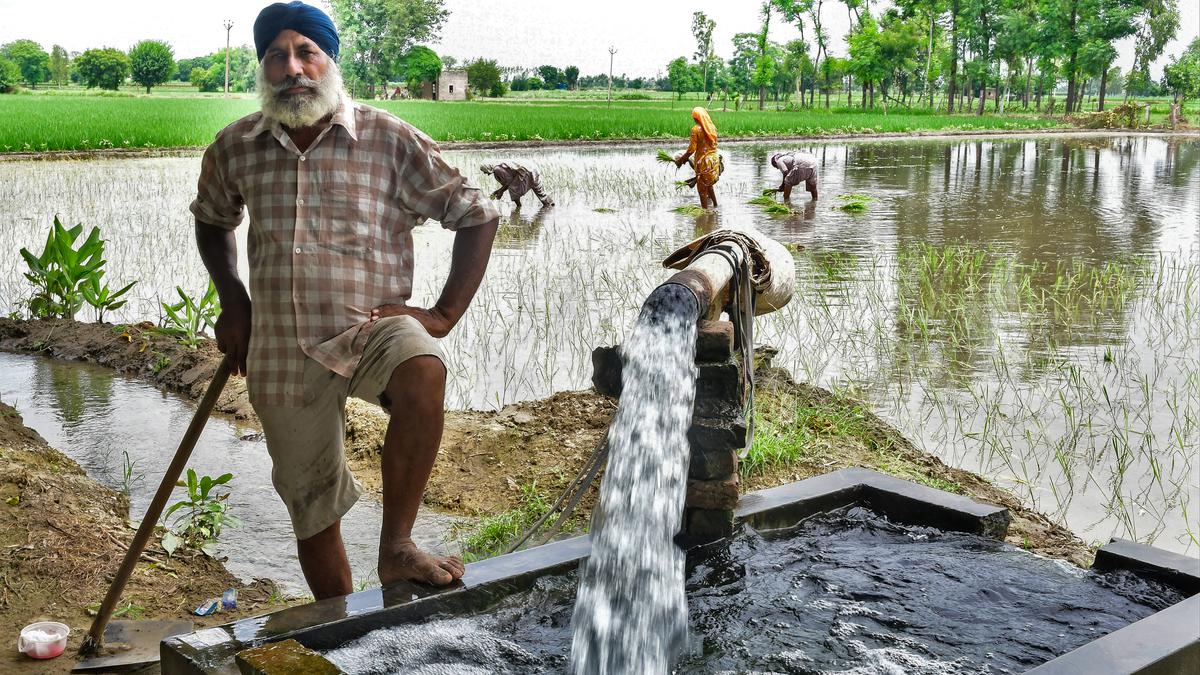
Sustainable Agriculture, Practice, Significance, Government Initiatives

Sustainable Agriculture

Sustainable Agriculture refers to farming systems that meet present food and fiber needs without reducing the ability of future generations to meet their own needs. The concept gained global recognition after the Brundtland Report of 1987 and focuses on conserving soil, water, biodiversity and ecosystem services. Agriculture contributes nearly one third of global anthropogenic greenhouse gas emissions and is a major driver of land degradation, water pollution and biodiversity loss. Sustainable Farming promotes environment friendly practices such as crop rotation, agroforestry, mixed farming and reduced chemical use to balance productivity, environmental protection and farmer livelihoods under changing climatic conditions.

Sustainable Agriculture in India

Sustainable Agriculture in India has emerged as a response to soil degradation, groundwater depletion, climate variability and rising input costs caused by intensive farming practices. Indian agriculture supports nearly 42% of the workforce and depends heavily on natural resources, making sustainability critical for food security. Overuse of chemical fertilizers, HYV seeds and irrigation has degraded soil health and reduced resilience. Sustainable approaches like Organic Farming, Zero Budget Natural Farming, Agroforestry and System of Rice Intensification aim to improve soil fertility, conserve water and stabilize farmer incomes while ensuring long term productivity and ecological balance.

Sustainable Agriculture Practice

Sustainable Agriculture Methods include diverse farming techniques that conserve resources, reduce environmental harm and maintain productivity over time.

  • Crop Rotation: Systematic cultivation of different crops in succession maintains soil nutrients, reduces pest cycles, lowers disease incidence and minimizes fertilizer dependence, especially when legumes are included to biologically fix atmospheric nitrogen.
  • Organic Farming: Organic farming avoids synthetic fertilizers and pesticides, relying on crop residues, animal manure, compost and biological pest control to enhance soil health and reduce chemical pollution.
  • Agroforestry: Integration of trees with crops or livestock improves carbon sequestration, enhances biodiversity, reduces soil erosion and provides additional income through timber, fruits and fodder.
  • Zero Budget Natural Farming: Promoted initially in Andhra Pradesh, this approach uses natural inputs like cow based formulations, eliminating purchased chemicals and credit dependence while improving soil microbial activity.
  • System of Rice Intensification: SRI increases rice yields using younger seedlings, wider spacing and less water, reducing irrigation demand while improving root growth and soil aeration.
  • Integrated Pest Management: IPM emphasizes pest prevention through crop rotation, biological control agents and natural predators, reducing reliance on chemical pesticides and lowering production costs.
  • Conservation Agriculture: This method minimizes tillage, maintains permanent soil cover and promotes crop diversification to reduce erosion, improve soil moisture retention and enhance long term productivity.

Sustainable Agriculture Significance

Sustainable Agriculture plays a vital role in balancing food production with environmental protection and social equity.

  • Environmental Conservation: Sustainable practices reduce soil erosion, conserve groundwater, prevent water pollution and protect biodiversity while maintaining ecosystem services critical for long term agricultural productivity.
  • Climate Change Mitigation: Sustainable food systems lower greenhouse gas emissions, enhance carbon sequestration through soil and trees and improve resilience to climate variability and extreme weather events.
  • Food Security: By improving soil health and water efficiency, Sustainable Agriculture supports stable crop yields and nutritional security for a growing population under changing environmental conditions.
  • Economic Viability: Reduced dependence on costly chemical inputs lowers production expenses, stabilizes farmer incomes and improves long term profitability, especially for small and marginal farmers.
  • Social Equity: Sustainable Agriculture promotes fair wages, safer working conditions, community participation and equitable access to nutritious food while strengthening rural livelihoods.

Sustainable Agriculture Government Initiatives

India has implemented several policy measures and programs to promote Sustainable Farming Practices nationwide.  The list of major government initiatives has been given below:

  • Paramparagat Krishi Vikas Yojana: PKVY promotes certified organic farming through cluster based approaches, reducing chemical use and encouraging traditional sustainable practices among farmer groups.
  • National Mission on Sustainable Agriculture: Launched under the National Action Plan on Climate Change, this mission focuses on rainfed area development, soil health management, water use efficiency, climate resilient farming and integrated farming systems.
  • Sub Mission on Agroforestry: SMAF supports integration of trees with crops and livestock, enhancing carbon sequestration, farm diversification, biodiversity conservation and additional income through timber and non timber forest products.
  • Rashtriya Krishi Vikas Yojana: RKVY provides flexible financial assistance to states for Sustainable Agriculture projects, innovation, infrastructure development and adoption of modern eco friendly farming practices.
  • Mission Organic Value Chain Development for North Eastern Region: MOVCDNER focuses on organic production, certification, processing and marketing in the North Eastern states to strengthen sustainable value chains.
  • Network Project on Organic Farming: Implemented by ICAR, this project evaluates performance of organic versus conventionalSustainable Sugarcane Initiative farming systems and develops location specific organic production technologies.
  • System of Rice Intensification: SRI promotes higher rice productivity using less water, younger seedlings and improved soil management, enhancing resource efficiency and climate resilience.
  • Sustainable Sugarcane Initiative: This initiative encourages use of less water, fewer seeds and efficient nutrient management to improve sugarcane yields while reducing environmental stress.
  • Zero Budget Natural Farming Promotion: Supported by several state governments, this approach reduces farmer dependence on external inputs by using natural formulations and locally available resources.

Sustainable Agriculture Challenges

Despite its benefits, Sustainable Agriculture faces multiple economic, technical and structural challenges.

  • High Labor Requirement: Practices like organic farming and intercropping require more manual labor, increasing production costs and reducing short term profitability for resource constrained farmers.
  • Lower Initial Yields: Transitioning from conventional to sustainable farming often leads to short term yield reductions, raising concerns about food security and farmer income stability.
  • Capital Constraints: High initial investment in irrigation systems, organic inputs and infrastructure limits adoption among small and marginal farmers lacking access to credit.
  • Market and Storage Issues: Sustainable produce faces marketing challenges due to inadequate certification, price realization issues and higher post harvest losses without proper infrastructure.
  • Policy and Awareness Gaps: Limited extension services, weak incentives and lack of awareness hinder widespread adoption of sustainable agricultural practices.

Way Forward:

Addressing existing barriers is essential to scale Sustainable Agriculture effectively across regions.

  • Financial Incentives: Direct subsidies, crop insurance and input support can reduce transition risks and encourage farmers to adopt sustainable practices.
  • Research and Innovation: Investment in location specific technologies, climate resilient crops and low cost sustainable inputs can improve productivity and adoption rates.
  • Extension Services: Strengthening farmer training, digital advisory platforms and field demonstrations can bridge knowledge gaps and improve implementation.
  • Market Access: Developing storage facilities, certification systems and consumer awareness can enhance demand and price realization for sustainably produced food.
  • Inclusive Policies: Empowering women farmers, promoting land consolidation and enforcing environmental regulations can ensure long term economic, social and ecological sustainability.

Sustainable Agriculture FAQs

Q1: What is Sustainable Agriculture?

Ans: Sustainable Agriculture is a farming approach that meets present food needs while conserving soil, water, biodiversity, and resources for future generations.

Q2: Why is Sustainable Agriculture important for India?

Ans: It helps address soil degradation, water scarcity, climate risks, and farmer income instability while ensuring long term food security.

Q3: Which farming methods are part of Sustainable Agriculture?

Ans: Crop rotation, organic farming, agroforestry, Zero Budget Natural Farming, integrated pest management, and conservation agriculture are key methods.

Q4: How does Sustainable Agriculture help climate change mitigation?

Ans: It reduces greenhouse gas emissions, improves carbon sequestration, enhances soil health, and builds resilience against extreme climate events.

Q5: What are major challenges in adopting Sustainable Agriculture?

Ans: High initial costs, lower short term yields, labor intensity, limited market access, and lack of awareness restrict widespread adoption.

Battle of Hydaspes, Causes, Outcomes, Reasons for Porus’ Defeat

Battle of Hydaspes

The Battle of Hydaspes, fought in May 326 BCE on the banks of the Hydaspes River (present day Jhelum in Pakistan) was one of the most challenging and significant military engagements of Alexander. It stands out as Alexander’s toughest battlefield victory and the first major encounter between Greek and Indian military systems with Hydaspes marking the easternmost reach of his conquests. The battle is remembered for its complex river-crossing strategy, large-scale use of war elephants, and its long-term political and cultural impact on the Indian subcontinent.

Battle of Hydaspes

The Battle of Hydaspes was fought between the Macedonian Empire under Alexander and the Paurava forces led by King Porus. Despite being outnumbered and facing formidable war elephants, the Macedonian army achieved a decisive victory through superior tactics, discipline and leadership. The battle resulted in the annexation of large parts of Punjab into Alexander’s empire. Unlike many defeated rulers, Porus was spared, reinstated as a Satrap, and allowed to govern his territory under Macedonian overlordship.

Also Read: Battle of Wandiwash

Battle of Hydaspes Causes

The Battle of Hydaspes occurred due to Alexander’s eastward expansion and Porus’ refusal to submit to Macedonian authority.

  • Indian campaign objective: Alexander aimed to extend his empire beyond Persia into the Indian subcontinent.
  • Strategic location: Porus ruled the region between the Hydaspes and Acesines rivers, blocking Alexander’s advance.
  • Refusal to surrender: Porus rejected Alexander’s demand for submission, choosing armed resistance.
  • Alliance politics: Alexander allied with Taxiles of Taxila against his rival Porus.
  • Imperial credibility: Leaving Porus undefeated would have threatened Alexander’s control over subdued Indian rulers.

Battle of Hydaspes Course

The Battle of Hydaspes unfolded through careful planning, deception and a decisive combined-arms assault by Alexander.

  • Initial deployment: Porus stationed his army on the south bank of the Hydaspes during the monsoon, using the swollen river as defense.
  • Strategic deception: Alexander used repeated feints and night movements to confuse Porus about the crossing point.
  • River crossing: Around 27 km upstream, Alexander crossed the river at night using boats and skin floats during a storm.
  • First engagement: Porus’ son led cavalry and chariots to block the crossing but was defeated and killed.
  • Battle formation: Porus deployed infantry supported by 85-200 war elephants, with cavalry on flanks.
  • Cavalry attacks: Macedonian cavalry under Alexander and Coenus broke the Indian cavalry through flanking maneuvers.
  • Elephant phase: War elephants inflicted heavy casualties but were neutralized by Macedonian infantry attacks on mahouts.
  • Final rout: A hammer-and-anvil tactic by infantry and cavalry shattered Porus’ army.

Also Read: Battle of Plassey

Battle of Hydaspes Outcomes

The victory at the Battle of Hydaspes strengthened Alexander’s control in northwest India but marked the limits of his eastward expansion.

  • Territorial gains: Macedon annexed territories from the Hydaspes to the Hyphasis (Beas) River.
  • Capture of Porus: King Porus was captured but treated with honor and reinstated as ruler.
  • Status of Porus: Porus was restored as king and appointed Macedonian satrap.
  • Foundation of cities: Alexander founded Nikaia to commemorate victory and Bucephala in memory of his horse Bucephalus.
  • Military exhaustion: Macedonian casualties were higher than previous battles, weakening troop morale.
  • Advance halted: At the Hyphasis River, troops refused to march further east, forcing Alexander to turn back.
  • Indirect rule model: Alexander adopted governance through local rulers instead of direct annexation.
  • Strategic impact: This arrangement stabilized Macedonian control in Punjab without prolonged resistance.
  • Alexander’s Death: Although Alexander died in Babylon (in present-day Iraq) in June 323 during his return journey from India to Greece.

Why was Porus Defeated at the Battle of Hydaspes?

The result of the defeat of Porus in the Battle of Hydaspes was due to tactical disadvantages and following reasons:

  • Superior Macedonian tactics: Alexander’s flanking cavalry maneuvers outmatched Porus’ static formation.
  • River-crossing mastery: Successful monsoon crossing nullified Porus’ defensive advantage.
  • Elephant limitations: War elephants caused disorder within Porus’ own ranks when wounded.
  • Inferior equipment: Indian infantry lacked armor and long spears like the Macedonian sarissa.
  • Chariot failure: Muddy terrain rendered Indian chariots ineffective.
  • Command coordination: Macedonian units operated with higher discipline and battlefield coordination.
Related Articles
Important Battles in Indian History Important Battles of Mughal Empire
Battle of Kannauj Battle of Khanwa
Battle of Purandar Battle of Longewala
Battle of Hydapses Battle of Wandiwash
Battle of Tarain Battle of Chengam
Battle of Porto Novo Battle of Pollilur
Battle of Salher Battle of Pavankhind
Battle of Kolhapur Battle of Bhupalgarh
Battle of Sinhagad Battle of Surat
Battle of Walong Battle of Saragarhi
Battle of Rezang La Maratha Wars List

Battle of Hydaspes FAQs

Q1: When and where was the Battle of Hydaspes fought?

Ans: The Battle of Hydaspes was fought in May 326 BCE on the banks of the Hydaspes River, modern Jhelum, in present-day Pakistan.

Q2: Who fought the Battle of Hydaspes?

Ans: The battle was fought between Alexander the Great of the Macedonian Empire and King Porus of the Paurava kingdom.

Q3: Why is the Battle of Hydaspes historically important?

Ans: It marked Alexander’s most difficult victory and led to Greek political and cultural influence reaching the Indian subcontinent.

Q4: What role did war elephants play in the Battle of Hydaspes?

Ans: Porus used 85-200 war elephants, which caused heavy Macedonian casualties but were eventually neutralized by disciplined infantry tactics.

Q5: What happened to King Porus after the Battle of Hydaspes?

Ans: Porus was captured but reinstated as ruler and appointed a satrap by Alexander, retaining control over his kingdom.

Battle of Khanwa, History, Course of Battle, Outcomes, Aftermath

Battle of Khanwa

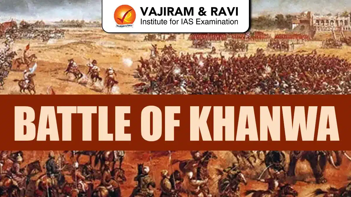
The Battle of Khanwa was a decisive military confrontation fought on 16 March 1527 near Khanwa, close to present day Fatehpur Sikri in Rajasthan. It marked a critical phase in medieval Indian history as it firmly established Mughal authority in northern India. The battle was fought between the Mughal forces led by Babur and a powerful Rajput confederacy under Rana Sanga of Mewar. This conflict was not merely a clash of two armies but a struggle for political supremacy over North India. It was among the earliest battles in the region where gunpowder weapons were used on a large scale, resulting in heavy casualties on both sides.

Battle of Khanwa

The Battle of Khanwa was fought between the Mughal Empire led by Babur and the Kingdom of Mewar led by Rana Sanga for dominance over northern India. The encounter followed Babur’s victory at the First Battle of Panipat in 1526 and represented a direct challenge to Mughal expansion. Rana Sanga had united several Rajput chiefs and Afghan nobles to expel Babur from India. The battle ended in a decisive Mughal victory, largely due to Babur’s superior military tactics and effective use of artillery and firearms. This victory ensured Mughal control over the Delhi-Agra region and weakened Rajput resistance significantly.

Battle of Khanwa Reasons

The Battle of Khanwa was fought due to a direct struggle for political supremacy in northern India after the decline of the Lodi Sultanate. Babur’s victory at the First Battle of Panipat in 1526 alarmed Rana Sanga, who had emerged as the most powerful Rajput ruler and aimed to expand his influence over the Delhi-Agra region. Rana Sanga formed a strong Rajput-Afghan confederacy to expel Babur from India. Disputes over an alleged alliance, Babur’s decision to permanently settle in India, and fear of Mughal expansion finally made armed conflict unavoidable.

Battle of Khanwa Historical Background

The historical background of the Battle of Khanwa reflects political instability in North India and competing ambitions of Babur and Rana Sanga.

  • Decline of the Lodi Dynasty: The Delhi Sultanate under Ibrahim Lodi was weakened by rebellions, defections, and administrative failures, creating conditions for foreign intervention and regional power struggles.
  • Babur’s Early Indian Campaigns: Babur had conducted multiple raids into Punjab between 1504 and 1519, gradually familiarizing himself with Indian politics and geography before launching a full-scale invasion.
  • Conquest of Punjab Region: Between 1520 and 1521, Babur captured Bhira, Sialkot, and Lahore, gaining control over the strategic gateways to Hindustan and weakening Afghan resistance.
  • Role of Lodi Rebels: Afghan nobles like Daulat Khan Lodi and Alam Khan Lodi invited Babur to invade India, hoping to overthrow Ibrahim Lodi and gain political advantage.
  • First Battle of Panipat 1526: Babur defeated Ibrahim Lodi at Panipat, killing the Sultan and founding the Mughal Empire in India, which altered the balance of power in North India.
  • Rana Sanga’s Rising Power: Rana Sanga had transformed Mewar into the strongest Rajput state, extending influence over eastern Malwa, Chanderi, and areas close to Agra.
  • Disputed Alliance Claims: Babur accused Rana Sanga of breaking an alleged agreement to jointly fight the Lodis, while Rajput sources claim Babur himself sought Sanga’s support.
  • Formation of Rajput Confederacy: Realizing Babur intended to stay in India, Rana Sanga organized a grand coalition of Rajput chiefs and Afghan allies to confront Mughal authority.

Battle of Khanwa Leaders

The major leaders involved in the Battle of Khanwa were:

  1. Rana Sanga: Ruler of Mewar and leader of the Rajput confederacy, he commanded the anti-Mughal alliance aiming to expel Babur from India.
  2. Babur: Founder of the Mughal Empire, he led the Mughal forces using artillery, firearms, and defensive tactics to secure victory.
  3. Mahmud Lodi: Younger son of Sikandar Lodi, he joined Rana Sanga with Afghan troops to restore Lodi rule in Delhi.
  4. Hasan Khan Mewati: Ruler of Mewat, he supported Rana Sanga and contributed men and resources to the Rajput-Afghan alliance.

Battle of Khanwa Course

The course of the Battle of Khanwa shows contrasting military strategies, intense fighting, and decisive moments that shaped the outcome.

  • Initial Mughal Concerns: Babur identified Rana Sanga and eastern Afghan rulers as major threats, initially sending Humayun east before recalling him due to Sanga’s rapid advance.
  • Strength of Opposing Armies: Estimates suggest Rana Sanga commanded over 110,000 soldiers, including 10,000 Afghan troops, while Babur’s army was likely around 80,000 men.
  • Early Rajput Successes: Mughal detachments sent to Dholpur, Gwalior, and Bayana were defeated, especially at the Battle of Bayana, boosting Rajput morale.
  • Impact on Mughal Morale: Continuous defeats caused fear among Babur’s troops, leading to desertions by Afghans and dissatisfaction among Turkish soldiers unwilling to fight in India.
  • Babur’s Religious Appeal: To raise morale, Babur renounced wine, destroyed his drinking vessels, and declared the campaign a religious struggle, strengthening unity within his army.
  • Strategic Positioning at Khanwa: Babur selected Khanwa carefully and fortified his camp using carts chained with iron, trenches on flanks, and defensive barriers.
  • Use of Firearms and Artillery: Mughal musketeers, falconets, and mortars were placed behind defensive carts, allowing sustained fire against advancing Rajput forces.
  • Rajput Battle Tactics: Rana Sanga relied on traditional cavalry charges, believing Rajput horsemen could overwhelm Mughal ranks through direct and sustained assaults.
  • Psychological Effect of Gunfire: Loud musket fire frightened Rajput horses and elephants, causing confusion and trampling within their own ranks.
  • Flank Battles: Rajput forces attacked Mughal flanks for nearly three hours, but Mughal firepower prevented them from breaking through defensive positions.
  • Failed Taulqama Maneuvers: Babur attempted flanking movements twice, but fierce Rajput resistance forced Mughal units to withdraw temporarily.
  • Silhadi’s Alleged Defection: Silhadi of Raisen reportedly joined Babur during the battle, though some historians believe this was a later Mughal narrative.
  • Rana Sanga Wounded: Rana Sanga was struck by a bullet and lost consciousness, creating confusion and temporary leadership vacuum within the Rajput army.
  • Role of Jhala Ajja: Jhala Ajja impersonated Rana Sanga to maintain morale and command, continuing Rajput attacks despite heavy losses.
  • Collapse of Rajput Centre: Continuous artillery fire decimated Rajput central formations, preventing close combat and causing severe casualties.
  • Mughal Counteroffensive: Babur ordered a general advance when Rajput strength weakened, pushing their forces back and killing many commanders.
  • Final Rajput Charge: Rajputs launched desperate attacks on Mughal flanks, but superior Mughal firepower ensured their defeat.
  • End of the Battle: Exhausted Mughal troops did not pursue fleeing Rajputs, marking the battle’s end with heavy casualties scattered across Bayana, Alwar, and Mewat.

Battle of Khanwa Outcomes

The outcomes of the Battle of Khanwa reshaped political power in North India and confirmed Mughal military superiority.

  • Decisive Mughal Victory: Babur’s victory eliminated the strongest immediate threat to Mughal rule in North India after Panipat.
  • Heavy Casualties: Both Mughal and Rajput forces suffered severe losses, reflecting the battle’s intensity and scale.
  • Use of Gunpowder Warfare: Khanwa highlighted the effectiveness of firearms and artillery against traditional cavalry-based armies.
  • Decline of Rajput Confederacy: The defeat weakened Rajput unity and ended Rana Sanga’s bid for northern supremacy.
  • Psychological Impact: Babur’s victory established Mughal invincibility, discouraging further large-scale resistance.
  • Construction of Skull Towers: Babur ordered towers of enemy skulls, following Timurid tradition, to intimidate future opponents.
  • End of Afghan Hopes: Afghan nobles supporting Mahmud Lodi lost their last major chance to revive Lodi authority.
  • Territorial Consolidation: Mughal control over Agra, Delhi, and surrounding regions was secured after the battle.

Also Read: Important Battles in Indian History

Battle of Khanwa Aftermath and Impact

The aftermath of the Battle of Khanwa had long-term military, political, and historical consequences for India.

  • Rana Sanga’s Retreat: Rana Sanga was carried unconscious from the battlefield by Prithviraj Kachwaha and Maldev Rathore of Marwar.
  • Oath of Revenge: After regaining consciousness, Rana Sanga vowed not to return to Chittor until Babur was defeated and expelled from India.
  • Death of Rana Sanga: In January 1528, Rana Sanga died at Kalpi, reportedly poisoned by his own nobles fearing further conflict with Babur.
  • Shift in Warfare Methods: Indian armies increasingly adopted artillery and firearms, abandoning older battlefield strategies.
  • Babur’s Strategic Advantage: Superior tactics and cannons proved decisive, as noted by historians like Pradeep Barua.
  • Subsequent Campaigns: Babur went on to fight the Battle of Chanderi in 1528 and the Battle of Ghagra in 1529.
  • Continuation of Rajput Power: Rajput resistance did not end permanently, as Rao Maldeo Rathore later emerged as a strong Rajput leader.
  • Foundation of Mughal Rule: Khanwa confirmed Babur’s intention to stay in India and laid the groundwork for a lasting Mughal Empire.
Related Articles
Important Battles in Indian History Important Battles of Mughal Empire
Battle of Kannauj Battle of Khanwa
Battle of Purandar Battle of Longewala
Battle of Hydapses Battle of Wandiwash
Battle of Tarain Battle of Chengam
Battle of Porto Novo Battle of Pollilur
Battle of Salher Battle of Pavankhind
Battle of Kolhapur Battle of Bhupalgarh
Battle of Sinhagad Battle of Surat
Battle of Walong Battle of Saragarhi
Battle of Rezang La Maratha Wars List

Battle of Khanwa FAQs

Q1: When was the Battle of Khanwa fought?

Ans: The Battle of Khanwa was fought on 16 March 1527 near Khanwa in present-day Rajasthan.

Q2: Who fought in the Battle of Khanwa?

Ans: The battle was fought between Mughal Emperor Babur and Rana Sanga of Mewar leading a Rajput confederacy.

Q3: Why was the Battle of Khanwa important?

Ans: It firmly established Mughal supremacy in North India after Panipat and weakened Rajput resistance significantly.

Q4: What military innovation decided the Battle of Khanwa?

Ans: Babur’s effective use of artillery, muskets, and defensive tactics proved decisive against traditional cavalry warfare.

Q5: What happened to Rana Sanga after the Battle of Khanwa?

Ans: Rana Sanga was wounded, retreated from the battlefield, and died in January 1528 before launching another campaign.

Battle of Wandiwash 1760, Causes, Outcomes, Reasons for French Defeat

Battle of Wandiwash

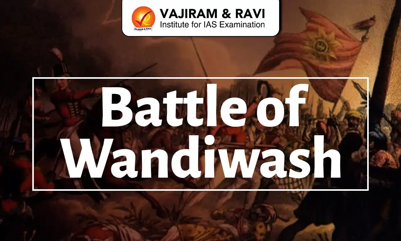
The Battle of Wandiwash, fought on 22 January 1760, was a decisive military engagement in South India that permanently altered the balance of European power in the subcontinent. It occurred during the Third Carnatic War, which itself was part of the global Seven Years’ War. The battle marked the final collapse of French political and military ambitions in India and paved the way for British supremacy through the East India Company.

Battle of Wandiwash

The Battle of Wandiwash was fought between the British East India Company forces under Sir Eyre Coote and the French army led by Count Thomas Arthur de Lally. It took place near the fortified town of Vandavasi (Anglicised as Wandiwash), strategically located inland from the Coromandel Coast. Despite having comparable troop strength, the French army suffered a decisive defeat. The British victory eliminated the last serious European rival in India. Notably, Indian sepoys fought on both sides, highlighting how European dominance was built using local manpower. Wandiwash thus stands as a critical milestone that enabled the British East India Company to move from a trading entity to a territorial power ruling India.

Battle of Wandiwash Causes

The Battle of Wandiwash resulted from escalating Anglo-French rivalry in India during the Seven Years’ War and the struggle for political dominance in the Carnatic region.

  • Seven Years’ War impact (1756-1763): European conflict between Britain and France expanded to India, making Carnatic a major theatre.
  • Third Carnatic War (1758-1763): Continued struggle between British and French East India Companies for supremacy in South India.
  • French offensive under Count de Lally (1758): Capture of Fort St. David and attacks on Madras intensified hostilities.
  • British recovery strategy: Sir Eyre Coote reorganised British forces after losses and planned decisive engagement.
  • Strategic importance of Wandiwash: Control of Vandavasi secured inland communication lines to Pondicherry.
  • Declining French resources: Weak naval support under Admiral d’Aché and shortage of funds forced risky French campaigns.

Battle of Wandiwash Course

The Battle of Wandiwash on 22 January 1760 unfolded through a well-planned British counterattack against a resource-strained French force attempting to capture Vandavasi.

  • French objective: Count de Lally advanced to recapture the fort of Wandiwash to restore French strategic control in Carnatic.
  • British response: Sir Eyre Coote marched rapidly from Arcot to intercept French forces before fort consolidation.
  • Troop deployment: British fielded about 1,900 European infantry, 2,100 sepoys, 330 cavalry and 26 guns.
  • French strength: French forces comprised nearly 2,250 European infantry, 1,300 sepoys, 300 cavalry and 16 guns.
  • Artillery dominance: Superior British artillery fire disrupted French formations early in the engagement.
  • Cavalry failure: French cavalry charges collapsed due to poor coordination and terrain constraints.
  • Decisive outcome: The French line broke, leading to rout, heavy losses and capture of Marquis de Bussy.

Battle of Wandiwash Outcomes

The British victory at the Battle of Wandiwash dismantled French military power in South India and reshaped colonial politics permanently.

  • The British captured key French-held territories: Chetpattu, Tiruvannamalai, Tindivanam and Perumukkal during 1760.
  • Marquis de Bussy’s forces withdrew, restricting French presence to Pondicherry alone.
  • Pondicherry surrendered to the British on 16 January 1761 after an eight-month siege.
  • The French lost strategic centres including Gingee, Mahe and Karaikal soon after.
  • The defeat compelled France to accept the Treaty of Paris in 1763.
  • France retained Pondicherry and Chandannagar only for trade, without fortifications or troops.
  • The British East India Company emerged as the supreme European power in India.

Battle of Wandiwash Reason for French Defeat

The French defeat was not merely tactical but structural, reflecting deeper administrative, naval and financial weaknesses.

  • Inferior naval support: British naval dominance cut French sea links with France, disrupting reinforcements and supplies after 1758.
  • Financial weakness: French focus on territorial control weakened their commercial revenue base.
  • State-controlled company: The French East India Company suffered from bureaucratic delays and rigid control due to direct state control from Paris.
  • Leadership limitations: Apart from Lally and Dupleix, France lacked strong military leadership in India.
  • Artillery disadvantage: French deployed only 16 guns compared to the British 26 guns during the battle, although similar deployment of troops.
  • British command superiority: Leaders like Eyre Coote and Stringer Lawrence ensured better coordination.
  • Strategic depth disadvantage: British control of Madras, Bombay and Calcutta gave logistical superiority as the French hold only Pondicherry.

Battle of Wandiwash Treaty

The Treaty of Paris (1763) formally ended the War and confirmed British political supremacy in India. Although, it was not directly signed after the Battle of Wandiwash, but after the resulting victory in the Third Carnatic War.

  • Treaty date: Signed in February 1763, concluding the global Seven Years’ War (1756-1763).
  • Territories restored: France regained Pondicherry and Chandannagar, along with Mahe, Karaikal and Yanam for trade purposes.
  • Military restrictions: France was prohibited from fortifying settlements or maintaining troops in India.
  • Political impact: French East India Company lost all political and military authority in the subcontinent.
  • British advantage: British East India Company emerged as the sole dominant European power in India.
Related Articles
Important Battles in Indian History Important Battles of Mughal Empire
Battle of Kannauj Battle of Khanwa
Battle of Purandar Battle of Longewala
Battle of Hydapses Battle of Wandiwash
Battle of Tarain Battle of Chengam
Battle of Porto Novo Battle of Pollilur
Battle of Salher Battle of Pavankhind
Battle of Kolhapur Battle of Bhupalgarh
Battle of Sinhagad Battle of Surat
Battle of Walong Battle of Saragarhi
Battle of Rezang La Maratha Wars List

Battle of Wandiwash FAQs

Q1: When and where was the Battle of Wandiwash fought?

Ans: The Battle of Wandiwash was fought on 22 January 1760 at Vandavasi, present-day Tamil Nadu, during the Third Carnatic War.

Q2: Who led the British and French forces in the Battle of Wandiwash?

Ans: The British forces were commanded by Sir Eyre Coote, while the French army was led by Count Thomas Arthur de Lally.

Q3: Why is the Battle of Wandiwash historically important?

Ans: It ended French political and military ambitions in India and established the British East India Company as the dominant European power.

Q4: Which war was the Battle of Wandiwash a part of?

Ans: The battle was part of the Third Carnatic War, which was the Indian theatre of the global Seven Years’ War.

Q5: What was the main outcome of the Battle of Wandiwash?

Ans: The British victory led to the fall of Pondicherry and confined the French in India to limited trading activities only.

Animal Husbandry in India, Dairy, Poultry, Livestock

Animal Husbandry

Animal Husbandry in India is one of the most important pillars of the agricultural economy. It includes the scientific breeding, feeding, healthcare, and management of livestock such as cattle, buffaloes, goats, sheep, pigs, and poultry. The sector provides milk, meat, eggs, wool, hides, manure, and draft power, supporting rural livelihoods and national food security.

Animal husbandry is a crucial pillar of the Indian economy, contributing nearly 5.5% to the country’s total Gross Value Added (GVA) and accounting for more than 30% of the GVA within the agriculture and allied sectors during 2022-23.

Dairy Sector In India

The dairy sector is one of the most important components of Animal Husbandry in India. India is the largest milk-producing country in the world, with steady growth in production over the last decade. The Dairy Sector In India provides daily income to millions of rural households and plays a key role in nutritional security and women empowerment.

  • Contribution to Economy: The dairy sector contributes a significant share to agricultural GVA and supports more than 80 million rural households directly or indirectly.
  • Per Capita Availability: Per capita milk availability in India has increased to around 470-500 grams per day, improving protein intake and nutritional standards.
  • White Revolution: The success of the dairy sector is largely credited to Operation Flood, implemented by the National Dairy Development Board, which expanded cooperative dairy networks across the country.
  • Major Milk Producing States: Uttar Pradesh, Rajasthan, Madhya Pradesh, Gujarat, and Maharashtra are among the top milk-producing states in India.
  • Role of Cooperatives: Dairy cooperatives collect milk from farmers, ensure fair pricing, and provide veterinary and feed support services. Example Amul.
  • Employment Generation: Dairy farming creates year-round employment, especially for women and small farmers.
  • Value-Added Dairy Products: Growth in processing industries has increased production of cheese, butter, paneer, yogurt, and other dairy products.
  • Government Support: Schemes like Dairy Processing and Infrastructure Development Fund help modernize dairy infrastructure and increase milk processing capacity.

Poultry Sector in India

The Poultry Sector in India is one of the fastest-growing segments of animal husbandry and plays a crucial role in meeting the country’s protein demand. It includes both egg production (layer farming) and meat production (broiler farming).

  • Rapid Growth Rate: The poultry sector has been growing at an average annual rate of around 8-10%, making it one of the most dynamic livestock industries in India.
  • Egg Production: India produces more than 140 billion eggs annually, ranking among the top egg-producing countries in the world. Per capita egg availability has crossed 100 eggs per person per year.
  • Meat Production: Poultry contributes the largest share to India’s total meat production, which is around 9–10 million tonnes annually. Broiler farming has expanded significantly due to rising demand for affordable protein.
  • Poultry Population: As per livestock census data, India has over 850 million poultry birds, including both backyard and commercial farms.
  • Major Poultry Producing States: Andhra Pradesh, Tamil Nadu, Telangana, West Bengal, and Maharashtra are among the leading egg and poultry meat producing states.
  • Employment Generation: The poultry industry provides direct and indirect employment to millions of farmers, traders, feed manufacturers, and transport workers.
  • Low Investment, Quick Returns: Poultry farming requires relatively lower initial investment compared to dairy and offers faster returns due to a short production cycle.
  • Technological Advancements: Modern poultry farms use automated feeding systems, climate-controlled sheds, vaccination schedules, and scientific breeding techniques to improve productivity.
  • Government Support: The government promotes poultry farming under schemes like the National Livestock Mission, which supports entrepreneurship and infrastructure development in the livestock sector.

Also Read: Pink Revolution

Livestock in India

Livestock in India refers to domesticated animals raised for economic purposes such as milk, meat, eggs, wool, hides, and draft power. India has one of the largest livestock populations in the world, making it a global leader in dairy and a major contributor to meat and poultry production. Livestock forms the backbone of rural livelihoods and supports millions of small and marginal farmers across the country.

1. Total Livestock Population

  • India has over 535 million livestock as per the latest livestock census.
  • It has the largest cattle population in the world.
  • Poultry population exceeds 850 million birds.
  • Livestock numbers have steadily increased over the years.

2. Major Types of Livestock

  • Cattle – Primarily used for milk production and agricultural draft power.
  • Buffaloes – Major contributors to India’s total milk production and buffalo meat exports.
  • Goats – Known as the “poor man’s cow” and widely reared for meat and milk.
  • Sheep – Raised for wool and mutton, especially in Rajasthan and Telangana.
  • Pigs – Important in northeastern states for meat consumption.
  • Poultry – Includes layers (egg production) and broilers (meat production).

3. Economic Importance

  • Livestock contributes more than 30% of agricultural Gross Value Added (GVA).
  • It provides employment to over 80 million rural households.
  • Offers regular income unlike seasonal crop farming.

4. Nutritional Contribution

  • Supplies protein-rich foods such as milk, eggs, and meat.
  • Improves food security and dietary diversity in rural and urban areas.

5. Regional Distribution

  • Cattle and buffaloes are widely distributed across northern and western India.
  • Sheep are concentrated in Rajasthan, Jammu & Kashmir, and Telangana.
  • Goats are common in Uttar Pradesh, Bihar, and West Bengal.
  • Poultry farming is highly developed in Andhra Pradesh, Tamil Nadu, and Telangana.

6. Indigenous Breeds

India is home to several famous indigenous breeds such as:

  • Gir cattle
  • Sahiwal cattle
  • Murrah buffalo

Major Government Schemes for Animal Husbandry

The Government of India has launched several schemes and programs to promote livestock development, improve breed quality, increase productivity, and enhance farmers’ income. These schemes are mainly implemented by the Department of Animal Husbandry and Dairying under the Ministry of Fisheries, Animal Husbandry and Dairying.

1. Rashtriya Gokul Mission

  • Launched to conserve and develop indigenous cattle and buffalo breeds.
  • Promotes artificial insemination and genetic improvement.
  • Establishment of Gokul Grams for scientific breeding.
  • Aims to enhance milk productivity and preserve native breeds like Gir and Sahiwal.

2. National Livestock Mission

  • Focuses on overall development of livestock sector excluding dairy.
  • Encourages entrepreneurship in sheep, goat, pig, and poultry farming.
  • Supports feed and fodder development programs.
  • Provides financial assistance for setting up livestock units.

3. Dairy Processing and Infrastructure Development Fund

  • Aims to modernize dairy processing plants.
  • Expands milk chilling and storage capacity.
  • Strengthens dairy cooperatives and producer companies.
  • Enhances value addition in dairy products.

Also Read: India’s Dairy Model

4. Livestock Health and Disease Control Programme

  • Focuses on vaccination against major animal diseases like Foot and Mouth Disease (FMD) and Brucellosis.
  • Improves veterinary infrastructure and diagnostic labs.
  • Reduces livestock mortality and economic losses.

5. Animal Husbandry Infrastructure Development Fund

  • Encourages private sector investment in dairy and meat processing.
  • Supports cold chain and value-added product units.
  • Provides interest subvention and credit guarantee support.

6. National Animal Disease Control Programme

  • Aims to control and eradicate Foot and Mouth Disease (FMD) and Brucellosis.
  • Conducts mass vaccination drives across the country.
  • Strengthens disease surveillance and monitoring systems.

7. Kisan Credit Card

  • Provides affordable credit to livestock farmers.
  • Covers dairy, poultry, and fisheries farmers.
  • Ensures easy access to working capital.

Role of Women in Animal Husbandry

Women make up nearly 70% of the workforce in India’s animal husbandry sector and are central to its growth and sustainability. They handle essential daily activities such as feeding animals, collecting fodder, providing water, cleaning sheds, and milking, thereby strengthening food security and the rural economy. Women are also actively involved in rearing small livestock like goats and poultry and in processing dairy products at the household level.

Animal Husbandry in India Challenges

  • Genetic Improvement of Breeds: Promote artificial insemination, embryo transfer technology, and conservation of high-yielding indigenous breeds to increase productivity per animal.
  • Strengthening Fodder Security: Expand fodder cultivation, promote silage making, and encourage use of balanced cattle feed to address feed shortages.
  • Improved Veterinary Infrastructure: Establish more veterinary hospitals, mobile clinics, and diagnostic labs in rural areas for timely disease control.
  • Mass Vaccination and Disease Surveillance: Strengthen nationwide vaccination drives and digital disease monitoring systems to reduce livestock mortality.
  • Promotion of Modern Technology: Encourage use of automated milking machines, climate-controlled poultry sheds, and digital livestock tracking systems.
  • Enhancing Credit and Insurance Coverage: Provide easy access to institutional credit, expand livestock insurance schemes, and simplify loan procedures for small farmers.

Way Forward

  • Boost Breed Productivity: Expand artificial insemination coverage, strengthen indigenous breed improvement, and promote scientific selection to raise milk and meat yields.
  • Ensure Fodder & Feed Security: Increase fodder cultivation, support silage and hay-making, and promote balanced feed and mineral supplementation.
  • Upgrade Veterinary Services: Add rural veterinary clinics, mobile units, tele-veterinary services, and modern diagnostic labs for timely disease control.
  • Scale Up Vaccination & Surveillance: Intensify mass vaccination against FMD and Brucellosis and use digital disease tracking to prevent outbreaks.
  • Invest in Infrastructure: Build milk chilling centers, cold chains, meat processing units, and quality testing labs to reduce post-harvest losses.
  • Improve Access to Credit & Insurance: Expand affordable loans, interest subvention, and livestock insurance coverage for small and marginal farmers.
  • Promote Technology Adoption: Encourage automated milking, climate-controlled poultry sheds, RFID tagging, and data-driven farm management.
  • Strengthen Market Linkages: Develop farmer producer organizations (FPOs), e-market platforms, and direct procurement models to improve price realization.

Animal Husbandry FAQs

Q1: What is Animal Husbandry?

Ans: Animal husbandry is the branch of agriculture that deals with the breeding, feeding, care, and management of livestock such as cattle, buffaloes, goats, sheep, pigs, and poultry for products like milk, meat, eggs, and wool.

Q2: Why is Animal Husbandry important in India?

Ans: It supports rural livelihoods, provides regular income to farmers, contributes over 30% to agricultural GVA, and ensures nutritional security through milk, eggs, and meat production.

Q3: Which ministry looks after Animal Husbandry in India?

Ans: The sector is managed by the Department of Animal Husbandry and Dairying under the Ministry of Fisheries, Animal Husbandry and Dairying.

Q4: What is the contribution of Animal Husbandry to India’s economy?

Ans: Animal husbandry contributes around 5-6% to India’s total Gross Value Added (GVA) and plays a major role in the agriculture and allied sectors.

Q5: Which country is the largest milk producer in the world?

Ans: India is the largest milk-producing country globally.

Battle of Chanderi, Causes, Winner, Outcome, Significance

Battle of Chanderi

The Battle of Chanderi, fought in January 1528, was a decisive battle between the Mughal emperor Babur and the Rajput ruler Medini Rai. It was fought after the Battle of Khanwa (1527) and formed an important part of Babur’s campaign to strengthen Mughal rule in India. The victory at Chanderi weakened Rajput resistance and expanded Mughal control into Central India.

The Baburnama, the autobiography of Babur, is the principal contemporary source for the Battle of Chanderi and provides a detailed account of the siege and its outcome.

Date

January 1528

Location

Chanderi Fort, Madhya Pradesh

Between

Babur and Medini Rai

Outcome

Mughal Victory

Importance

Strengthened Mughal rule after Khanwa

Battle of Chanderi Background

The Battle of Chanderi was closely linked to the Battle of Khanwa. Although Babur had defeated Rana Sanga in 1527, many Rajput chiefs continued to resist Mughal rule. Among them, Medini Rai, the ruler of Chanderi and a close ally of Rana Sanga, remained the most powerful.

Medini Rai had earlier served in the Malwa Sultanate and later became its most influential noble. After the defeat at Khanwa, he returned to the strong fort of Chanderi and prepared to continue the struggle against Babur.

Babur realised that lasting peace could not be achieved until the remaining Rajput strongholds were defeated. Therefore, he decided to capture Chanderi before another Rajput alliance could emerge.

Battle of Chanderi Causes 

Babur’s decision to attack Chanderi was driven by military, political and strategic considerations.

  • To strengthen Mughal rule: Babur wanted to remove the remaining centres of resistance after Khanwa.
  • To defeat Rana Sanga’s allies: Medini Rai was one of Rana Sanga’s strongest supporters. His defeat would weaken the Rajput Confederacy.
  • Strategic importance of Chanderi: The fort controlled important routes between Malwa and Bundelkhand, making it valuable for both trade and military movement.
  • Failure of peace talks: Babur offered to exchange Shamsabad Fort for Chanderi, but Medini Rai refused, leading to war.

Course of the Battle of Chanderi 

Babur reached Chanderi in January 1528 and first tried to settle the dispute peacefully. When Medini Rai rejected his proposal, Babur laid siege to the fort.

Since Chanderi was built on a hill, attacking it was difficult. Babur used gunpowder artillery and ordered raised platforms to improve the range of his cannons. After heavy fighting, the Mughal army captured the lower fort and soon occupied the upper fort.

When defeat became certain, the Rajput women performed Jauhar (a mass self-immolation to avoid capture, enslavement, and dishonour by the victorious army) while the warriors carried out Saka (donning saffron robes and charging into battle with the resolve to fight to the death)l Medini Rai was killed defending the fort.

After the victory, Babur ordered a tower of skulls to be built, following the Timurid tradition of celebrating military victories.

Outcome of the Battle of Chanderi 

The Battle of Chanderi resulted in a decisive Mughal victory.

  • Medini Rai was killed defending the fort.
  • Chanderi was annexed into the Mughal Empire.
  • The Rajput Confederacy suffered another major setback.
  • Mughal influence expanded into Malwa and Bundelkhand.
  • Babur emerged as the undisputed power in northern India before the Battle of Ghaghra.

Significance of the Battle of Chanderi 

The Battle of Chanderi was a turning point in early Mughal history, as it strengthened Babur’s empire, weakened Rajput resistance, and reshaped the political and military landscape of northern India.

  • Completed Mughal Consolidation: Together, Panipat, Khanwa and Chanderi transformed Babur from an invader into the ruler of a stable empire.
  • Decline of Rajput Resistance: The fall of Chanderi deprived Rana Sanga of one of his strongest allies and effectively ended the first phase of organised Rajput resistance against the Mughals.
  • Rise of Gunpowder Warfare: The siege demonstrated the superiority of artillery, firearms and organised siege tactics over traditional fort defences.
  • Political Transformation of Malwa: The death of Medini Rai accelerated the decline of the Malwa Sultanate and altered the balance of power in Central India.
  • Foundation for Mughal Expansion: The victory secured Babur’s position, enabling later Mughal rulers to expand deeper into the Indian subcontinent.

Battle of Chanderi FAQs

Q1: Why was the Battle of Chanderi fought?

Ans: The Battle of Chanderi was fought because Babur wanted to eliminate Medini Rai, a close ally of Rana Sanga, consolidate Mughal rule after the Battle of Khanwa, and capture the strategically important fort of Chanderi.

Q2: Who fought the Battle of Chanderi and what was its outcome?

Ans: The Battle of Chanderi was fought between Mughal emperor Babur and Rajput ruler Medini Rai in January 1528. It ended in a Mughal victory, with Chanderi being annexed to the Mughal Empire and Medini Rai killed in battle.

Q3: Why was the Battle of Chanderi significant in Indian history?

Ans: The Battle of Chanderi strengthened Mughal authority, weakened the Rajput Confederacy, demonstrated the superiority of gunpowder artillery, and laid the foundation for further Mughal expansion in India.

Q4: What was the role of Medini Rai in the Battle of Chanderi?

Ans: Medini Rai was the Rajput ruler of Chanderi and a trusted ally of Rana Sanga. He refused Babur’s peace offer, defended the fort with great courage, and died fighting during the siege.

Q5: Which historical source provides the main account of the Battle of Chanderi?

Ans: The Baburnama, the autobiography of Babur, is the principal contemporary source for the Battle of Chanderi and provides a detailed account of the siege and its outcome.

Maratha Wars List, Timeline, Battles, Combatants

Maratha Wars

The list of Maratha Wars includes some of the most prominent demonstrations of power that shaped the expansion, rise and finally the decline of the kingdom. The study of these wars helps us in understanding about the political culture of that era and the power struggle between different forces and the Maratha Legacy. The Marathas faced many challenges both within and outside the empire. In this article, we are going to learn about the important maratha wars that were fought during the period.

Maratha Wars List

The Maratha Empire witnessed a number of wars that also became a part of defining their power, economic, cultural and political. These wars are what eventually led to the downfall of the Maratha Kingdom. Major decisive wars fought by Marathas with other contemporary rulers in India include wars with Mughal, British, Nizams, etc. These wars and conflicts are detailed here in this article. 

Maratha - Mughal Conflict

The war between the Maratha and the Mughal started in the 17th century and continued till early 18th century. These conflicts became a major reason for reducing mughal control in India and strengthening the hold of Maratha Empire. Some of the key battles fought include: 

Battle

Year

Combatants

Result

Battle of Pratapgarh

1659

Marathas vs. Bijapur Sultanate

Victory

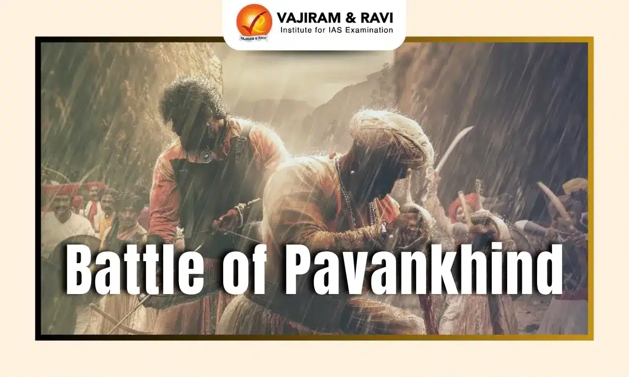
Battle of Pavan Khind

1660

Marathas vs. Bijapur Sultanate

Inconclusive

Battle of Panhala

1660

Marathas vs. Bijapur Sultanate

Defeat

Battle of Chakan

1660

Marathas vs. Mughal Empire

Defeat

Battle of Umberkhind

1661

Marathas vs. Mughal Empire

Victory

Battle of Surat

1664

Marathas vs. Mughal Empire

Victory

Battle of Purandar

1665

Marathas vs. Mughal Empire

Defeat

Battle of Sinhagad

1670

Marathas vs. Mughal Empire

Victory

Battle of Salher

1672

Marathas vs. Mughal Empire

Victory

Battle of Bhupalgarh

1679

Maratha Kingdom vs. Mughal Empire

Defeat

Battle of Kalyan

1682-1684

Maratha Kingdom vs. Mughal Empire

Victory

Battle of Ramsej

1682-1688

Maratha Kingdom vs. Mughal Empire

Defeat

Battle of Wai

1687

Maratha Kingdom vs. Mughal Empire

Victory

Maratha-Nizam Wars

The war between the Maratha and the Nizam’s began in the 18th century. The first war took place between the Marathas and the Nizam of Hyderabad. The main reasons for these wars were territorial disputes and the ambition of the Marathas to establish their dominance over the Deccan Region.

Battle

Year

Combatants

Outcome

Battle of Palkhed

1728

Maratha Confederacy vs. Hyderabad Deccan

Victory

Battle of Uruli

1762

Maratha Confederacy vs. Hyderabad Deccan

Victory

Battle of Rakshasbhuvan

1763

Maratha Confederacy vs. Hyderabad Deccan

Victory

Battle of Kharda

1795

Maratha Confederacy vs. Hyderabad Deccan

Victory

Maratha-Rajput Wars

The Maratha-Rajput wars took place in the 18th century in between the Maratha Empire and many Rajput kingdoms. These wars showcased the attempts of maratha’s to expand their power and influence in the Rajputana region, eventually leading to alliances and military confrontations.

Battle

Year

Combatants

Outcome

Battle of Pilsud

1715

Maratha Confederacy vs. Kingdom of Amber

Defeat

Battle of Mandsaur

1732

Maratha Confederacy vs. Kingdom of Amber

Victory

Battle of Kakkor

1759

Maratha Confederacy vs. Kingdom of Amber

Defeat

Maratha-Mysore Wars

The Maratha-Mysore wars took place in the 18th century in between the Kingdom of Mysore and the Marathas. These wars included tiff over problems like territorial disputes in the southern region of India and witnessed many shifting alliances and battles. 

War

Battle

Year

Outcome

First Maratha-Mysore War

Battle of Rattihalli

1764

Victory

Battle of Jadi Hanwati

1764

Victory

Battle of Sira

1767

Victory

Battle of Moti Talab

1771

Victory

Second Maratha-Mysore War

Battle of Saunshi

1777

Defeat

First Battle of Nargund

1778

Defeat

Second Battle of Nargund

1785

Defeat

Battle of Adoni

1786

Defeat

Battle of Savanur

1786

Defeat

Anglo-Maratha Wars

The Anglo-Maratha Wars were a series of three conflicts between the British East India Company and the Maratha Empire, ultimately leading to the decline of the Marathas and the rise of British rule in India.

War

Duration

Key Events & Outcome

First Anglo-Maratha War

1775-1782

Triggered by the Treaty of Surat; ended with the Treaty of Salbai, maintaining the status quo.

Second Anglo-Maratha War

1803-1805

British gained control over Delhi and several Maratha territories.

Third Anglo-Maratha War

1817-1819

Final defeat of the Maratha Confederacy; British supremacy established in India.

Battles Fought by Chhatrapati Shivaji Maharaj List

Chhatrapati Shivaji Maharaj is remembered as the founder of the Maratha Empire, who fought many battles during his period of ruling and defended his kingdom. The battles fought by him include: 

Battle

Year

Outcome

Battle of Torna

1646

Shivaji captured Torna Fort from the Bijapur Sultanate

Battle of Raigad

1656

Shivaji defeated the Adil Shahi forces and captured Raigad Fort, which later became his capital.

Battle of Pratapgad

November 10, 1659

Shivaji defeated Afzal Khan, a commander of the Bijapur Sultanate.

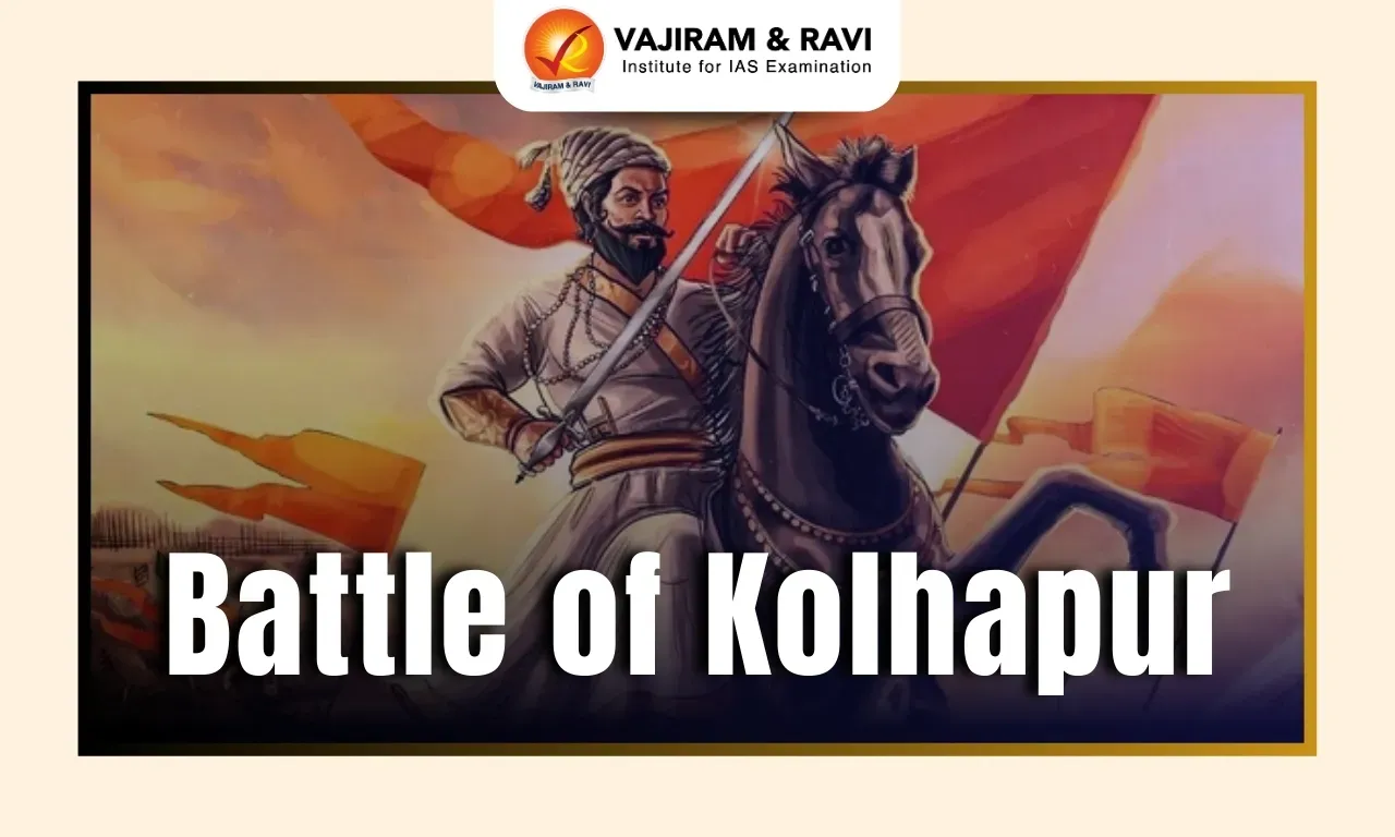
Battle of Kolhapur

December 28, 1659

Shivaji defeated the Adilshahi forces, expanding his control.

Battle of Chakan

1660

Shivaji faced defeat against the Mughal Empire.

Battle of Umberkhind

February 2, 1661

Shivaji defeated the Mughal general Kartalab Khan.

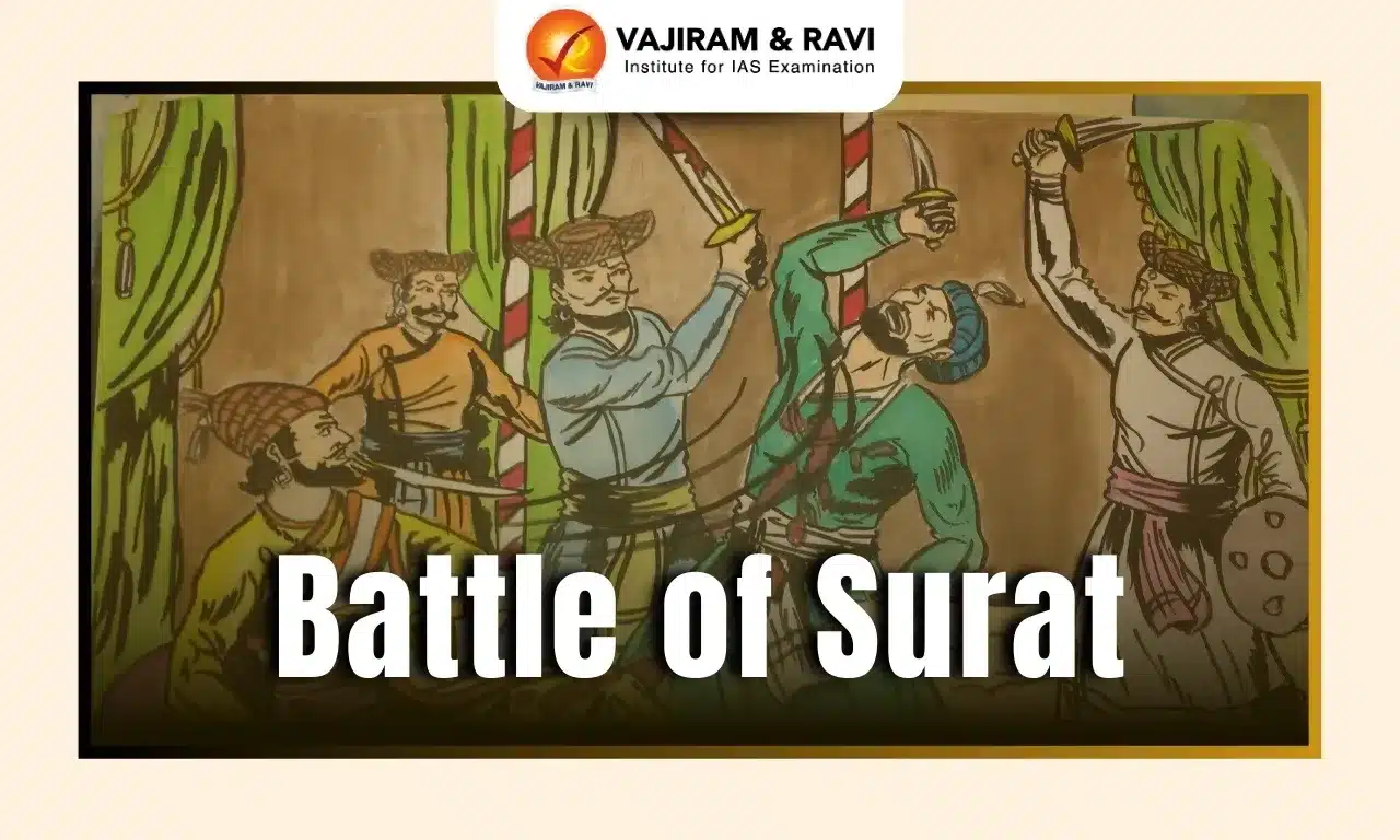
Sacking of Surat

January 5, 1664

Shivaji raided Surat, defeating the Mughal captain Inayat Khan.

Battle of Purandar

1665

Shivaji strategically defended his territories against the Mughal Empire.

Battle of Sinhagad

February 4, 1670

Tanaji Malusare led the Marathas to victory against the Mughal forces.

Battle of Wadgaon

1670

Shivaji's forces defeated the Adil Shahi Sultanate, strengthening control over the western Deccan.

Battle of Toppur

1678

Shivaji defeated the Bijapur Sultanate, gaining control over Toppur Fort.

Battle of Sangamner

1679

This was Shivaji's last battle against the Mughal Empire, resulting in defeat.

Battle of Vani-Dindori

1679

Shivaji's forces defeated the Mughals, capturing important territories.

Related Articles
Important Battles in Indian History Important Battles of Mughal Empire
Battle of Kannauj Battle of Khanwa
Battle of Purandar Battle of Longewala
Battle of Rezang La Battle of Wandiwash
Battle of Tarain Battle of Chengam
Battle of Porto Novo Battle of Pollilur
Battle of Salher Battle of Pavankhind
Battle of Kolhapur Battle of Bhupalgarh
Battle of Sinhagad Battle of Surat
Battle of Walong Battle of Saragarhi


List of Maratha Wars FAQs

Q1: How many Maratha Wars were there?

Ans: There were three Anglo-Maratha Wars.

Q2: Who defeated the Marathas?

Ans: The British East India Company defeated the Marathas.

Q3: Who won the 3rd Anglo-Maratha War?

Ans: The British East India Company won the 3rd Anglo-Maratha War.

Q4: Who won the 4th Anglo-Maratha War?

Ans: There was no 4th Anglo-Maratha War.

Q5: Who fought the 2nd Anglo-Maratha War?

Ans: The British East India Company and the Maratha Empire fought the 2nd Anglo-Maratha War.

Battle of Longewala 1971, Background, Significance, Impact

Battle of Longewala

The Battle of Longewala is one of the most iconic battles of the 1971 India-Pakistan War, symbolizing valor, determination, and the strategic brilliance of the Indian armed forces. Fought in the Thar Desert of Rajasthan, this battle is renowned for the courage displayed by a small contingent of Indian soldiers who held off a much larger Pakistani force. Despite being heavily outnumbered, the defenders leveraged terrain, intelligence, and air support to turn the tide decisively in India’s favor.

Battle of Longewala 1971 Historical Background

The 1971 India-Pakistan War had its roots in the Bangladesh Liberation movement, with India intervening to support the Mukti Bahini against Pakistani oppression in East Pakistan.

While the eastern front witnessed a massive Indian advance leading to the eventual liberation of Bangladesh, Pakistan aimed to open a western front to divert Indian attention.

    • Location: Longewala is a remote border post near Jaisalmer, Rajasthan, in the western Thar Desert.
    • Strategic Importance: Longewala was a key entry point for Pakistani forces to advance into Indian territory. Capturing it would have allowed Pakistan to threaten major towns and create a diversion.
  • Indian Forces:
      • 23rd Battalion, Punjab Regiment – around 120 soldiers.
      • Led by Captain Bhagwan Singh, a young but determined officer.
  • Pakistani Forces:
    • Approximately 2,000 soldiers with 40–50 tanks from the 22nd Cavalry.
    • Equipped for a swift armored thrust into India.

Course of the Battle

The Battle of Longewala began on the night of December 4-5, 1971, when Pakistani forces launched a major attack on the post.

  • Pakistani forces advanced with tanks and infantry under cover of darkness.
  • Indian soldiers defended with machine guns and mortars, using the desert terrain effectively.
  • Many Pakistani tanks got stuck in the soft sand, slowing their progress.
  • Indian Air Force launched airstrikes at dawn, destroying Pakistani armor.
  • Pakistani attack was repelled, resulting in heavy casualties and retreat.

Role of the Indian Army and Air Force

The victory at Longewala was a combined effort of both the Indian Army and Indian Air Force, demonstrating the importance of inter-service cooperation:

  • Indian Army Contributions:
    • Courageous Defense: Soldiers held their ground despite being heavily outnumbered.
    • Tactical Use of Weapons: Mortars, recoilless rifles, and machine guns were used effectively to damage tanks and slow the enemy.
    • Morale and Leadership: Captain Bhagwan Singh’s leadership inspired his men to resist fiercely.
  • Indian Air Force Contributions:
    • Timely Intervention: Air support arrived at dawn, attacking the immobilized Pakistani tanks.
    • Precision Strikes: Fighter-bombers targeted enemy armor and supply lines.
    • Psychological Impact: The airstrikes demoralized Pakistani troops, causing chaos and retreat.

Also Read: Important Battles in Indian History

Battle of Longewala Significance

The Battle of Longewala is celebrated for its strategic, tactical, and symbolic importance:

  • Symbol of Heroism: Demonstrated extraordinary courage and resilience against overwhelming odds.
  • Tactical Masterclass: Showcased effective defensive positioning, use of terrain, and timely reinforcements.
  • Strategic Victory: Prevented Pakistani forces from advancing further into Rajasthan.
  • Boost to Morale: Became a source of national pride and inspiration for Indian forces.
  • Military Lessons: Highlighted the importance of combined arms operations, intelligence, and quick decision-making.

Impact on the 1971 India-Pakistan War

The Battle of Longewala had significant strategic, psychological, and operational effects on the overall 1971 conflict. Key impacts include:

  • Halted Pakistani Advance in the West: The successful defense prevented Pakistani forces from advancing into Rajasthan, protecting key Indian territories like Jaisalmer.
  • Diversion of Pakistani Resources: After the defeat, Pakistan had to divert troops and armor to regroup, weakening their operations on both western and eastern fronts.
  • Facilitated Eastern Front Operations: With reduced pressure in the west, India could focus more resources on the eastern sector, hastening the liberation of East Pakistan (Bangladesh).
  • Boosted Indian Morale: The victory at Longewala became a symbol of bravery and determination, significantly boosting the morale of Indian troops and civilians alike.
  • Weakened Pakistani Morale: The heavy losses and failure of a well-planned offensive demoralized Pakistani soldiers and commanders, affecting their overall war strategy.
  • Demonstrated Effective Use of Air-Ground Coordination: The battle highlighted the importance of close cooperation between the Indian Army and Air Force, setting a precedent for modern warfare strategy.
  • Global Recognition of Indian Military Capability: The battle showcased India’s military efficiency on an international stage, gaining recognition for strategic planning and operational excellence.
  • Strategic Psychological Advantage: It created a perception that India could effectively defend and counter even when outnumbered, influencing Pakistani decision-making for the remainder of the war.
Related Articles
Important Battles in Indian History Important Battles of Mughal Empire
Battle of Kannauj Battle of Khanwa
Battle of Purandar Battle of Longewala
Battle of Hydapses Battle of Wandiwash
Battle of Tarain Battle of Chengam
Battle of Porto Novo Battle of Pollilur
Battle of Salher Battle of Pavankhind
Battle of Kolhapur Battle of Bhupalgarh
Battle of Sinhagad Battle of Surat
Battle of Walong Battle of Saragarhi
Battle of Rezang La Maratha Wars List

Battle of Longewala FAQs

Q1: When did the Battle of Longewala occur?

Ans: On the night of December 4-5, 1971.

Q2: Who led the Indian forces?

Ans: Captain Bhagwan Singh commanded the 23rd Battalion, Punjab Regiment.

Q3: How many soldiers defended Longewala?

Ans: Approximately 120 Indian soldiers defended against 2,000 Pakistani troops.

Q4: How did the terrain influence the battle?

Ans: The soft desert sand caused many Pakistani tanks to get stuck, slowing their advance and making them easy targets for Indian forces.

Q5: What role did the Indian Air Force play?

Ans: The IAF conducted dawn airstrikes, destroying Pakistani tanks and preventing further advancement.

Murlen National Park, Location, Flora, Fauna, Significance

Murlen National Park

Murlen National Park is a protected forest located in the Champhai district of Mizoram, near the India–Myanmar border. Spread over approximately 200 square kilometres, it forms part of the globally important Indo-Burma Biodiversity Hotspot. The park is famous for its dense evergreen forests, where in some areas only about 1% of sunlight reaches the forest floor. Rich in rare wildlife, medicinal plants, and bird species, Murlen National Park is one of Northeast India's most significant biodiversity conservation areas.

Murlen National Park

Murlen National Park is situated in the Champhai district of eastern Mizoram, sharing an international border with Myanmar. It lies within the Mizo Hills, which form a part of the Patkai Hill Range, and is close to the Chin Hills of Myanmar. The park's strategic location makes it an important ecological corridor connecting the forests of India and Southeast Asia.

Murlen National Park Flora

Murlen National Park is covered with dense sub-tropical evergreen and montane forests, making it one of the richest floral regions in Northeast India. Its humid climate, heavy rainfall, and thick forest canopy support an exceptional diversity of trees, medicinal plants, orchids, bamboo, and epiphytes.

  • Sub-tropical Evergreen Forests: The park is dominated by dense evergreen forests with multi-layered vegetation and a closed canopy.
  • Oak (Quercus spp.): Common in the montane forests, oaks play an important role in maintaining soil fertility and supporting wildlife.
  • Michelia (Magnolia champaca): A valuable evergreen tree known for its fragrant flowers and high-quality timber.
  • Castanopsis Species: These evergreen trees are among the dominant canopy species and provide food for birds and mammals.
  • Bamboo (Melocanna baccifera and other species): Bamboo grows abundantly and serves as a vital food source and shelter for many animals.
  • Cane (Rattan Palms): Found throughout the forest, rattan is ecologically important and widely used by local communities for handicrafts.
  • Wild Bananas (Musa spp.): Naturally occurring banana species provide food for primates, birds, and other wildlife.
  • Medicinal Plants: The park contains over 400 medicinal plant species, many of which are used in traditional Mizo herbal medicine.
  • Wild Orchids: Numerous orchid species flourish in the humid environment, making the park a hotspot for orchid diversity.
  • Ferns, Mosses, and Lichens: These moisture-loving plants thrive under the dense canopy, contributing to the forest's rich biodiversity.
  • Epiphytes: Orchids, mosses, and other epiphytic plants grow on tree trunks and branches without harming their host trees.
  • Dense Forest Canopy: In some areas, the canopy is so thick that only about 1% of sunlight reaches the forest floor, creating a cool, humid microclimate that supports shade-loving plant species.

Murlen National Park Fauna

Murlen National Park is one of the most important wildlife habitats in Northeast India, supporting a rich diversity of mammals, birds, reptiles, and amphibians.

  • Hoolock Gibbon: India's only ape and an endangered primate, the Hoolock Gibbon is one of the park's flagship species and depends on continuous forest canopies for movement.
  • Bengal Tiger: The park provides suitable habitat for the Bengal Tiger, an apex predator that helps maintain ecological balance.
  • Leopard: A stealthy carnivore commonly found in the park's dense forests and hilly terrain.
  • Himalayan Black Bear: This vulnerable bear species inhabits the higher forested areas and feeds on fruits, insects, and small animals.
  • Serow: A rare mountain-dwelling ungulate found on rocky slopes and forested hills, considered an important conservation species.
  • Malayan Giant Squirrel: One of the world's largest tree squirrels, easily recognized by its striking coloration and arboreal lifestyle.
  • Clouded Leopard: An elusive and vulnerable wild cat that thrives in the park's dense evergreen forests.
  • Barking Deer (Indian Muntjac): A small deer species known for its distinctive barking alarm call.
  • Wild Boar: A common omnivore that plays a significant role in seed dispersal and forest regeneration.
  • Civets: Several civet species inhabit the park and contribute to maintaining forest ecosystems through seed dispersal.
  • Porcupines: Nocturnal rodents that feed on roots, tubers, and fallen fruits.
  • Asian Black Giant Flying Squirrel: A nocturnal gliding mammal that inhabits mature forest canopies.

Murlen National Park Significance

Murlen National Park is one of India's most ecologically important protected areas due to its exceptional biodiversity, dense evergreen forests, and strategic location along the India–Myanmar border.

  • Part of the Indo-Burma Biodiversity Hotspot: The park lies within one of the world's 36 biodiversity hotspots, known for its rich species diversity and high level of endemism.
  • Habitat for Endangered Wildlife: It provides a safe refuge for threatened species such as the Hoolock Gibbon, Clouded Leopard, Bengal Tiger, Himalayan Black Bear, and Serow.
  • Exceptional Floral Diversity: The park protects dense subtropical and montane forests containing over 400 medicinal plant species, rare orchids, bamboo, and numerous epiphytes.
  • Unique Forest Canopy: Murlen is famous for its exceptionally dense forest canopy, where in some areas only about 1% of sunlight reaches the forest floor, creating a rare and unique forest ecosystem.
  • Important Bird Conservation Area: It supports several rare bird species, including Mrs. Hume's Pheasant (Mizoram's state bird), Blyth's Tragopan, hornbills, and other forest birds.
  • Transboundary Ecological Corridor: Located near the India–Myanmar border, the park facilitates wildlife movement between the forests of the Mizo Hills and Chin Hills, strengthening regional biodiversity conservation.
  • Climate and Watershed Protection: Its forests help regulate the local climate, prevent soil erosion, protect river catchments, and sustain the flow of rivers such as the Tiau and Tuivai.

Murlen National Park FAQs

Q1: Where is Murlen National Park located?

Ans: Murlen National Park is located in the Champhai district of Mizoram, along the India–Myanmar border. It lies in the Mizo Hills, which are part of the Patkai hill range.

Q2: Why is Murlen National Park famous?

Ans: The park is famous for its dense evergreen forests, where in some areas only about 1% of sunlight reaches the forest floor. It is also known for its rich biodiversity and status as part of the Indo-Burma Biodiversity Hotspot.

Q3: What is the area of Murlen National Park?

Ans: Murlen National Park covers an area of approximately 200 square kilometres, making it one of the important protected areas in Northeast India.

Q4: Which biodiversity hotspot does Murlen National Park belong to?

Ans: Murlen National Park is part of the Indo-Burma Biodiversity Hotspot, one of the world's most biologically diverse and ecologically significant regions.

Q5: Which are the major animals found in Murlen National Park?

Ans: The park is home to several important wildlife species, including the Hoolock Gibbon, Bengal Tiger, Leopard, Clouded Leopard, Himalayan Black Bear, Serow, Malayan Giant Squirrel, and Barking Deer.

Battle of Kannauj, Background, Winner, Battle Leader

Battle of Kannauj

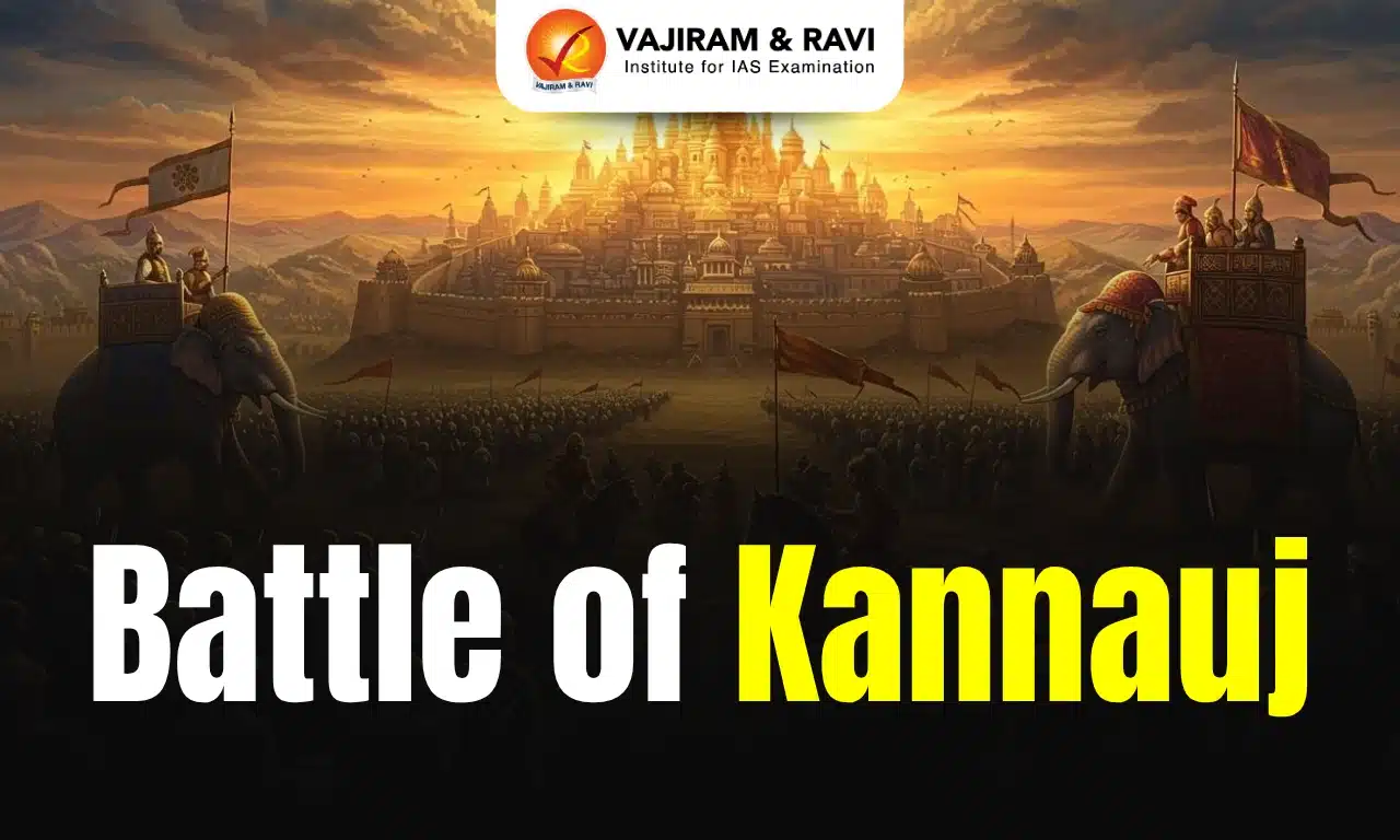
The Battle of Kannauj of 1540 is also known as the Battle of Bilgram which was fought between the Mughal Emperor Humayun and Afghan Warlord Sher Shah Suri, the mughals were defeated which led to the establishment of the Sur Empire in India and shift in power dynamics of the region.

Battle of Kannauj Background

The Battle of Kannauj Background was initiated during the disintegration of the Gupta Empire which led to power shift in North India. Other regional powers such as Pratiharas, Rashtrakutas, and Palas each of these dynasties sought to control Kannauj. Kannauj was strategically important due to its location and economic significance.

Battle of Kannauj Course

The Battle of Kannauj stretched over several decades. It saw the rise and fall of multiple dynasties. The conflict involved fierce clashes between the Pratiharas, Rashtrakutas, Palas, and other regional powers. Each group aimed to assert dominance over the strategic region.

The Battle of Kannauj was defined by shifting alliances and frequent military campaigns. Political navigation played a key role throughout the battle. Together, these events helped shape the political map of medieval India. In a separate historical event, two armies stood face to face for nearly a month without engaging.

Eventually, heavy rains flooded Humayun’s camp. The downpour destroyed their weapons and ammunition. Sher Shah had been waiting for such an opportunity. On May 17, 1540, when he saw the Mughal forces trying to relocate, he attacked. The sudden strike threw the Mughal army into chaos. Many were killed in the confusion. Humayun fought bravely but ultimately lost. He was forced to flee the battlefield.

Battle of Kannauj Aftermath

After losing at Bilgram, Humayun was basically on the run. He reached Agra, but Sher Shah was right behind him with a large army. Before he could make any real plans, news came that both Delhi and Agra had already fallen. He barely made it to Lahore.

In Lahore, he met his brothers but instead of coming together, they each had their own plans. Hindal wanted control over Sindh. Kamran was more interested in protecting his hold over Punjab and Afghanistan. Neither was willing to back Humayun.

When Humayun tried heading toward Kashmir, Kamran blocked the route. With no support and nowhere else to go, he moved through Lahore into Sindh. Eventually, he had to leave India and seek help from the Shah of Persia.

Battle of Kannauj Cause of Failure

  • For ten years (1530–1540), Humayun was caught up in battles and barely paid attention to administration. With no meaningful reforms or welfare measures, his treasury was drained, and public support eroded. 
  • Humayun misread both the strength of the Afghan tribes and Sher Shah’s strategy. He didn’t realize that Sher Shah wasn’t just a military commander, he was a smart tactician with deep knowledge of local politics and warfare.
  • Afghan chieftains across northern India, long hostile to Mughal rule, rallied under Sher Shah’s leadership. Their unity, something Humayun lacked within his own camp, gave Sher Shah a major edge.
  • Humayun had no backing from local zamindars or nobles. Internal feuds, especially with his own brothers, further weakened his hold. Political instability within the Mughal court made things worse.
  • Humayun’s ill-timed and poorly thought-out Bengal campaign drained resources and delayed his response to Sher Shah’s rise. He failed to grasp how serious the threat really was.
  • After losing the Battle of Chausa in 1539, Humayun didn’t act aggressively to retake lost territory. Instead, he stayed on the defensive, which only helped Sher Shah consolidate power and reputation.
Related Articles
Important Battles in Indian History Important Battles of Mughal Empire
Battle of Kannauj Battle of Khanwa
Battle of Purandar Battle of Longewala
Battle of Hydapses Battle of Wandiwash
Battle of Tarain Battle of Chengam
Battle of Porto Novo Battle of Pollilur
Battle of Salher Battle of Pavankhind
Battle of Kolhapur Battle of Bhupalgarh
Battle of Sinhagad Battle of Surat
Battle of Walong Battle of Saragarhi
Battle of Rezang La Maratha Wars List

Battle of Kannauj FAQs

Q1: What was the Battle of Kannauj?

Ans: A decisive battle was fought in 1540 between Mughal emperor Humayun and Afghan ruler Sher Shah Suri.

Q2: When was the Battle of Kannauj fought?

Ans: It took place on 17 May 1540.

Q3: Where is Kannauj located?

Ans: Kannauj is in present-day Uttar Pradesh, India, historically a significant political and cultural center.

Q4: Who won the Battle of Kannauj?

Ans: Sher Shah Suri defeated Humayun, leading to the Mughal emperor’s temporary exile.

Q5: Why is the Battle of Kannauj important?

Ans: It marked the end of Humayun’s rule in India and the beginning of the Sur Empire.

Mudumalai National Park, Location, History, Area, Rivers, Biodiversity

Mudumalai National Park

Mudumalai National Park is a well-known wildlife sanctuary located in the state of Tamil Nadu, India. It is surrounded by forests and hills and forms part of a larger network of protected areas in South India. The park provides a safe habitat for a wide variety of plants and animals, including many important and endangered species. Known for its natural beauty and rich biodiversity, Mudumalai attracts nature lovers, wildlife enthusiasts, and tourists who visit to experience its peaceful environment and diverse wildlife. 

Mudumalai National Park

  • Mudumalai National Park is one of the most famous wildlife destinations in southern India. Located in the beautiful Nilgiri Hills of Tamil Nadu, the park is known for its rich biodiversity, scenic landscapes, and thriving wildlife.
  • The name Mudumalai comes from a Tamil word meaning "ancient hill range." True to its name, the park is home to ancient forests, rolling hills, grasslands, rivers, and a remarkable variety of plants and animals.
  • It is one of the most important protected areas in the Western Ghats, a global biodiversity hotspot. 

Mudumalai National Park Location

  • Mudumalai National Park is located in the Nilgiris District of Tamil Nadu and lies at the meeting point of three states - Tamil Nadu, Kerala, and Karnataka. This strategic location makes it an important ecological zone in southern India.
  • The park shares its boundaries with Bandipur Tiger Reserve in Karnataka and Wayanad Wildlife Sanctuary in Kerala. Together, these protected areas form one of the largest continuous wildlife habitats in India.
  • Mudumalai is a part of the Nilgiri Biosphere Reserve, India's first biosphere reserve, which is known for its exceptional biodiversity and conservation value.
  • The nearest major city is Coimbatore, located about 120-127 km away. Coimbatore serves as the nearest airport and railway hub for visitors travelling to the park.

Mudumalai National Park History

  • The forests of Mudumalai have been important for centuries and were traditionally inhabited by indigenous tribal communities who lived in close harmony with nature.
  • During British rule, parts of the forest were used for timber extraction. Recognizing the ecological importance of the region, the government declared about 60 sq. km of forest as a wildlife sanctuary in 1940, making it the first wildlife sanctuary in South India.
  • In 1986, Mudumalai became part of the Nilgiri Biosphere Reserve, which was India's first biosphere reserve established to protect the unique ecosystems of the Western Ghats.
  • In 1990, the sanctuary was upgraded to Mudumalai National Park, providing stronger legal protection to its wildlife and habitats.
  • In 2007, the area was declared a Tiger Reserve under Project Tiger, further strengthening conservation efforts for tigers and other wildlife.

Mudumalai National Park Area

  • Mudumalai National Park covers an area of approximately 321 square kilometres, while the core national park area extends over about 103 square kilometres.
  • The park forms part of a much larger interconnected forest landscape that includes Bandipur, Wayanad, Nagarhole, Mukurthi, and Silent Valley National Parks.
  • Together, these forests create a vast wildlife habitat spread across nearly 3,300 square kilometres, allowing animals to move freely between different protected areas.
  • The varied terrain includes forests, grasslands, rivers, wetlands, and rocky hills, making it suitable for a wide range of wildlife species.

Mudumalai National Park Rivers

  • The Moyar River is the most important river flowing through Mudumalai National Park. It serves as a major water source for wildlife and plays a crucial role in maintaining the park's ecosystem.
  • The river forms a natural boundary between Mudumalai National Park and Bandipur Tiger Reserve, while also marking part of the border between Tamil Nadu and Karnataka.
  • Numerous smaller streams and seasonal water bodies connected to the Moyar River provide drinking water for animals throughout the year.
  • These water resources are especially important during the dry season when wildlife gathers near rivers and wetlands.

Mudumalai National Park Tribal Communities

  • Several indigenous tribal communities have lived in and around Mudumalai for generations. Their traditional knowledge of forests, wildlife, and medicinal plants has contributed significantly to the region's cultural heritage.
  • The Toda tribe is one of the most well-known communities of the Nilgiri Hills. They are famous for their unique culture, traditional lifestyle, and distinctive circular huts.
  • The Kurumba tribe has traditionally depended on forest resources and is known for its deep understanding of wildlife and medicinal plants.
  • The Irula tribe is another important indigenous community in the region. Traditionally involved in agriculture and forest-related activities, they possess extensive ecological knowledge of the area.
  • Today, many conservation programmes involve local tribal communities, recognizing their role in protecting forests and biodiversity.

Mudumalai National Park Flora (Vegetation)

  • Mudumalai National Park supports a rich variety of vegetation because of differences in rainfall, altitude, and soil conditions across the region.
  • The park contains tropical moist deciduous forests, dry deciduous forests, semi-evergreen forests, thorn forests, grasslands, and wetland ecosystems, creating a highly diverse natural environment.
  • Important tree species found here include teak, rosewood, sandalwood, Indian laurel, terminalia, and several species of acacia.
  • The reserve is also famous for its tall "Elephant Grass", which provides food and shelter to herbivorous animals such as elephants, deer, and gaur.
  • Extensive bamboo groves are found throughout the park and play an important role in supporting wildlife populations.
  • Wetland areas, locally known as vayals, support aquatic plants and provide habitats for birds, amphibians, and other water-dependent species.

Mudumalai National Park Fauna (Wildlife)

  • Mudumalai National Park is renowned for its incredible wildlife diversity and is one of the most important wildlife habitats in India.
  • The park supports more than 55 species of mammals, over 260 species of birds, around 50 species of fish, 21 species of amphibians, and 34 species of reptiles.
  • The two flagship species of the park are the Bengal Tiger and the Asian Elephant, both of which are protected under various conservation programmes.
  • Other important mammals include the Indian Gaur, Leopard, Sloth Bear, Wild Dog (Dhole), Spotted Deer, Sambar Deer, Indian Pangolin, Jungle Cat, Golden Jackal, Malabar Giant Squirrel, and Bonnet Macaque.
  • The park is particularly important for elephant conservation and forms part of a major elephant migration corridor in southern India.
  • Birdlife is exceptionally rich, with species such as the Malabar Grey Hornbill, Indian Peafowl, Black Eagle, Bonelli's Eagle, White-bellied Woodpecker, and Spot-bellied Eagle Owl frequently seen in the area.
  • Several endangered vulture species, including the White-rumped Vulture and Long-billed Vulture, are also found here, making the park important for bird conservation.
  • Reptiles found in the park include the Indian Rock Python, Mugger Crocodile, Indian Star Tortoise, Flying Snake, and various species of lizards and geckos.

Significance of Mudumalai National Park

  • Mudumalai is one of the most important wildlife conservation areas in southern India and serves as a crucial link between several protected forests of the Western Ghats.
  • As part of the Nilgiri Biosphere Reserve, it helps maintain ecological connectivity between Tamil Nadu, Kerala, and Karnataka, allowing wildlife to move safely across large forest landscapes.
  • The park plays a major role in the conservation of endangered species such as tigers, elephants, leopards, and vultures.
  • It is recognized as one of India's most important wildlife corridors, helping maintain genetic diversity among animal populations.
  • The park also contributes to water conservation, climate regulation, scientific research, environmental education, and sustainable eco-tourism.

Mudumalai National Park Conservation Efforts

  • Mudumalai was declared a Tiger Reserve in 2007 under Project Tiger, strengthening protection measures for tigers and their habitats.
  • Forest officials conduct regular anti-poaching patrols, wildlife monitoring, habitat restoration, and fire management activities to protect biodiversity.
  • Special programmes are carried out to remove invasive plant species such as Lantana camara, Parthenium, and Senna spectabilis, which threaten native vegetation.
  • Wildlife corridors connecting Mudumalai with Bandipur, Wayanad, and Nagarhole are protected to ensure safe movement of elephants, tigers, and other animals.
  • Community-based conservation programmes encourage local tribal communities and villagers to participate in forest protection and sustainable development activities.
  • Measures such as restrictions on night traffic through forest roads have been introduced to reduce wildlife accidents and minimize disturbance to animals.
  • Continuous research, camera-trap monitoring, and ecological studies help conservation authorities make informed decisions for long-term wildlife protection.

Mudumalai National Park Challenges and Threats

  • The increase in traffic on roads passing through the park disrupts wildlife movement and often leads to animal-vehicle collisions, putting many animals at risk.
  • The spread of invasive plant species in different parts of the forest is reducing the growth of native plants, which affects the food supply for herbivores and disturbs the natural balance of the ecosystem.
  • Human-wildlife conflict is a major concern in nearby villages. This happens when elephants enter farmlands or when predators attack livestock, causing loss for local communities.
  • During the dry season, forest fires become a serious danger, damaging both vegetation and wildlife. These risks may increase further due to climate change, making the situation more challenging.
  • To protect this rich ecosystem, strong conservation efforts and active community participation are very important for ensuring its safety for future generations.

Mudumalai National Park FAQs

Q1: Where is Mudumalai National Park located?

Ans: Mudumalai National Park is located in the Nilgiris district of Tamil Nadu at the tri-junction of Tamil Nadu, Kerala, and Karnataka, forming a key ecological zone in South India.

Q2: What is Mudumalai National Park famous for?

Ans: The park is famous for its rich biodiversity, scenic landscapes, and as a habitat for endangered species like the Bengal Tiger and Asian Elephant.

Q3: What is the total area of Mudumalai National Park?

Ans: Mudumalai National Park covers about 321 sq. km, with a core area of around 103 sq. km.

Q4: Which river flows through Mudumalai National Park?

Ans: The Moyar River is the main river flowing through the park, supporting wildlife and maintaining ecological balance.

Q5: When was Mudumalai National Park established?

Ans: It was declared a wildlife sanctuary in 1940, became part of the Nilgiri Biosphere Reserve in 1986, and was upgraded to a national park in 1990.

Millets in India, Types, Map, Production, Distribution, Benefits

Millets in India

Millets in India are small-grained, hardy cereals that grow well in warm climates and are especially suited to regions with poor soil fertility and low rainfall. Known for their resilience, these crops require minimal external inputs, making them essential for dry-land farming systems in India. Beyond their adaptability, millets are highly valued for their nutritional richness, offering a sustainable alternative to staple grains like rice and wheat.

This article discusses the major Types of Millets cultivated in India, such as Jowar (Sorghum), Bajra (Pearl Millet), Ragi (Finger Millet), and Barley. It examines their growth requirements, patterns of production, and distribution across the country, highlighting their significance in food security and agricultural sustainability.

Millets in India

Millets are short-duration cereals, typically maturing within 3-4 months, and belong to the grass family. These small-grained crops thrive in warm climates and are highly resilient, making them suitable for cultivation in less fertile soils and drought-prone regions. With minimal or no requirement for purchased inputs, Millets form the backbone of dry-land agriculture.

Nutritionally, millets are rich in fibre, protein, and essential minerals, while being non-acid-forming and easy to digest. Their nutraceutical properties contribute to better health outcomes, particularly in preventing lifestyle-related diseases. Owing to their affordability and resilience, millets play a crucial role in ensuring food and nutritional security, especially for economically weaker sections of society.

Types of Millets in India

Millets in India are known for their short growing season, resilience to drought, and high nutritional value; they are often called “nutri-cereals.” Millets not only provide food security to millions in arid and semi-arid regions but also offer health benefits like better digestion, improved bone strength, and diabetes management. Below is a table outlining the major Types of Millets in India, their nutritional highlights, and regions of production.

Types of Millets in India

Millet

Nutritional Highlights

Major Producing States in India

Pearl Millet (Bajra)

Rich in iron, fibre, protein; highly energy-giving

Rajasthan, Maharashtra, Gujarat, Haryana, Uttar Pradesh

Finger Millet (Ragi)

High calcium, amino acids; supports bone health, diabetes management

Karnataka, Tamil Nadu, Uttarakhand, Andhra Pradesh, Maharashtra

Sorghum (Jowar)

Gluten-free, rich in antioxidants, protein, fibre

Maharashtra, Karnataka, Telangana, Madhya Pradesh

Foxtail Millet (Kangni/Rala)

High fibre, iron, magnesium; aids in digestion, controls blood sugar

Andhra Pradesh, Karnataka, Tamil Nadu, Telangana

Little Millet (Kutki)

Easily digestible, rich in B-vitamins and iron

Madhya Pradesh, Chhattisgarh, Tamil Nadu, Odisha

Barnyard Millet (Sanwa)

Rich in fibre, calcium, phosphorus; light on stomach, fasting food

Uttarakhand, Madhya Pradesh, Uttar Pradesh, Tamil Nadu

Kodo Millet (Kodo)

High protein, fibre, minerals; useful for weight and diabetes management

Madhya Pradesh, Chhattisgarh, Tamil Nadu, Karnataka

Proso Millet (Cheena)

Quick-growing, rich in protein, essential fatty acids

Madhya Pradesh, Uttar Pradesh, Bihar, Andhra Pradesh

Jowar (Sorghum)

Jowar is a highly nutritious millet, rich in protein, fibre, thiamine, riboflavin, folic acid, and carotene. Unlike other cereals, the proteins in sorghum are less digestible after cooking, which in some cases can be beneficial for people requiring slower digestion, such as diabetics. Because of its nutrient profile, Jowar is considered an important food grain for maintaining energy and overall health.

Conditions for Growth

Jowar is primarily a rainfed crop suited to dry farming regions. It is cultivated both as a Kharif crop (during the monsoon) and as a Rabi crop (during the winter). The crop does not thrive in areas receiving more than 100 cm of rainfall. Ideal soils for Jowar cultivation are clayey deep regur (black cotton soils) and alluvial soils. It can also be grown on gentle slopes up to an altitude of about 1,200 meters, making it a versatile crop in semi-arid regions.

Production and Distribution

India is one of the leading producers of Jowar. Maharashtra contributes about 38% of the country’s total production, followed by Karnataka with 20%. Other important states cultivating Jowar include Tamil Nadu, Rajasthan, Andhra Pradesh, and Uttar Pradesh.

Bajra (Bull Rush Millet)

Bajra is the second most important Millet in India and has been cultivated since prehistoric times in Africa and the Indian subcontinent. It is valued for its ability to grow under harsh conditions and is a staple in semi-arid regions. Bajra is rich in iron, fibre, protein, and essential amino acids, making it a vital food grain for combating malnutrition. Apart from human consumption, it also serves as an important fodder crop in drought-prone areas.

Conditions for Growth

Bajra is primarily a rainfed Kharif crop, suited to dry and warm climates. It grows well in regions with an annual rainfall of 40-50 cm, with an upper tolerance limit of around 100 cm. The crop thrives in poor, light sandy soils as well as in black and red soils. Bajra is often sown either as a pure crop or as a mixed crop along with cotton, jowar, and ragi. Its resilience to drought, low soil fertility, high temperatures, and even saline or low pH soils makes it highly adaptable.

Production and Distribution

India is one of the world’s leading producers of Bajra. The major producing states are:

  • Rajasthan (largest producer, contributing about 45.22% of India’s total output)
  • Uttar Pradesh (2nd)
  • Haryana (3rd)
  • Gujarat (4th)

These states dominate Bajra cultivation due to their arid to semi-arid conditions, where other cereals struggle to grow.

Ragi (Finger Millet)

Ragi, or finger millet, is one of the most nutrient-rich cereals cultivated in India. It is especially known as the richest natural source of calcium (300-350 mg per 100 grams), making it highly beneficial for bone health and preventing malnutrition. Apart from calcium, it also contains iron, dietary fibre, and essential amino acids. Its slow-digesting starch helps in controlling diabetes, and it is widely used in preparing traditional food items such as ragi mudde, dosa, porridge, and malted drinks.

Conditions for Growth

Ragi is a rainfed Kharif crop, sown between May and August and harvested between September and January. It thrives in warm climates and requires 50-100 cm of rainfall, making it highly suited to semi-arid and drier regions. The crop can be cultivated in a range of soils, including red soils, light black soils, sandy soils, and well-drained alluvial loams. It is particularly well adapted to areas where conditions are neither too wet nor too dry, and it avoids waterlogging.

Production and Distribution

Ragi is widely cultivated across Southern and Central India. The major producing states include:

  • Karnataka (largest producer, particularly in its drier regions)
  • Maharashtra
  • Uttarakhand
  • Tamil Nadu
  • Andhra Pradesh
  • Jharkhand
  • Odisha
  • Chhattisgarh
  • Gujarat

Barley

Barley is one of the world’s oldest cultivated grains, domesticated nearly 10,000 years ago and grown extensively across Eurasia. In India, it holds importance as both a food and industrial crop.

Barley is used as animal fodder, in the preparation of health foods, and as a raw material in breweries for making beer and whisky. Its high fibre content also makes it beneficial for digestion and overall health, and barley-based products are increasingly included in dietary supplements and wellness foods.

Conditions for Growth

Barley is largely a rabi crop in India, cultivated in the cooler seasons. It grows best in temperate climates, as it does not tolerate high heat or humidity. The crop requires 75-100 cm of rainfall and thrives in the Great Plains and valleys of the western Himalayas, where winters are suitable for its growth. Barley can also be cultivated at altitudes of up to 1,300 meters, particularly in states such as Uttarakhand.

Production and Distribution

Barley production in India has seen a gradual decline over time, much like other traditional cereals. However, it remains an important crop in several states. The leading barley-producing regions are:

  • Uttar Pradesh
  • Rajasthan
  • Punjab
  • Madhya Pradesh
  • Haryana
  • Bihar
  • Himachal Pradesh
  • West Bengal
  • Jammu and Kashmir

Millets in India Map

Millets are cultivated across diverse regions of India, with each type concentrated in specific states depending on climate and soil conditions. Maharashtra and Karnataka dominate in jowar production, Rajasthan leads in bajra, while Karnataka and Tamil Nadu are major ragi growers. A Millets in India Map highlights these regional patterns, showcasing how different states contribute to the overall millet production.

Millets in India Production

Millets are cultivated extensively across the world, with major production concentrated in India, China, and several African countries. Millets in India are primarily grown in states such as Karnataka, Rajasthan, Maharashtra, and Tamil Nadu, where climatic conditions favor their growth. Their ability to thrive with minimal water and withstand poor soils makes them a vital crop for food security, especially in drought-prone and semi-arid regions.

Millets in India Benefits

  • Nutrient-Dense - Millets are packed with essential vitamins, minerals, protein, and dietary fibre, making them an excellent choice for balanced nutrition and overall health.
  • Drought-Resilient - These crops thrive in arid and semi-arid regions, requiring far less water than rice or wheat, which makes them vital for sustainable farming and climate-resilient agriculture.
  • Low Glycemic Index - Millets release sugar slowly into the bloodstream, helping regulate blood sugar levels. This makes them particularly beneficial for people with diabetes or those managing weight.
  • Culinary Versatility - From traditional porridges and rotis to modern snacks and health foods, millets can be adapted into a wide range of dishes, enriching diets with both taste and nutrition.
Also Check Other Posts
Soils of India Forests in India
Dams in India Major Ports in India
Coastal States of India Natural Vegetation of India

Millets in India FAQs

Q1: Which millet is grown most in India?

Ans: Pearl millet (Bajra) is the most widely grown millet in India, especially in Rajasthan, Maharashtra, Gujarat, and Uttar Pradesh.

Q2: Which is the king of millets?

Ans: Pearl millet, commonly called Bajra, is known as the "King of Millets" because of its high cultivation, nutritional value, and adaptability to dry regions.

Q3: Which is the best millet to eat in India?

Ans: Foxtail millet is considered the best for health due to its high fiber, protein, and low glycemic index, supporting weight loss and diabetes management.

Q4: What are the 7 types of millets?

Ans: The 7 types are pearl millet, finger millet, foxtail millet, proso millet, barnyard millet, little millet, and kodo millet.

Q5: Which crop is Queen of Millets?

Ans: Finger millet, known as Ragi, is called the "Queen of Millets" due to its rich calcium, iron content, and wide health benefits.

Battle of Sinhagad, History, Events, Challenges, Aftermath

Battle of Sinhagad

The Battle of Sinhagad took place on the night of February 4, 1670, within the walls of the Sinhagad Fort, located near Pune, Maharashtra. This battle was fought between Tanaji Malusare, a commander of the Maratha ruler Chhatrapati Shivaji Maharaj, and Udaybhan Rathod, the Sinhagad Fort keeper serving under Jai Singh I. Tanaji Malusare and his troops claimed their victory and reclaiming the fortress for the Marathas. The battle resulted in approximately 300 casualties on the Mughal side and 50 on the Maratha side, while nearly 4,000 Mughal troops were captured by just 500 Maratha warriors.

Battle of Sinhagad

In 1670, the Battle of Sinhagad occurred in the fort of Sinhagad near Pune. The Maratha War took place between Tanaji Malusare, a Koli commander of Maratha ruler Shivaji Maharaj and Udaybhan Rathod. In this Battle of Sinhagad, Tanaji Malusare died and Shivaji renamed the fort of Kondhana as Sinhagad Fort (Lion’s Fort) in his remembrance.

Battle of Sinhagad History

Sinhagad Fort was previously known as Kondhana, the fort was under the control of Mirza Raja Jai Singh and held strategic significance due to its location among other forts like Rajgad, Purandar, and Torna. The Mughals had stationed weapons to nearly 5,000 soldiers, led by Udaybhan Rathod, a subordinate of Jai Singh. Tanaji Malusare managed to invade the fort and conduct a reconnaissance mission. During his observation, he discovered that a celebration was scheduled for the night of the attack, meaning the Mughal soldiers would be less focused. Seizing this opportunity, Tanaji, along with his brother Suryaji and 300 Mavalas began warriors from the Maval region, prepared for the daring assault.

Battle of Sinhagad Overview

Below in the table we have discussed the Battle of Sinhagad Overview:

Battle of Sinhagad Overview

Event

Battle of Sinhagad

Date

4 February 1670

Location

Sinhagad Fort, Pune

Forces Involved

Forces of Maratha Empire and Mughal Empire 

Result

Victory of Maratha Empire

Battle of Sinhagad Series of Events

Shivaji gave instruction to begin the battle and achieved significant success, reclaiming several forts that had been ceded under the Treaty of Purandar.

  • The first victory was on 4th February 1670, when Fort Kondana was seized from Udai Bhan, a Rajput commander. 
  • Leading this daring assault, Tanaji Malusare, along with 300 Mavle warriors, scaled the hillside near the Kalyan Gate using rope ladders. 
  • With the guidance of local Koli (fishermen) who were well-known with the terrain, they swiftly eliminated the guards and advanced into the fort.

Attack on the Garrison

Tanaji Malusare and his warriors got involved in the night assault on Sinhagad Fort, scaling its steep cliffs with the aid of rope ladders and a monitor lizard named Yashwanti.

Seizing the element of surprise, the Marathas launched their attack when the Mughal forces were least prepared. They successfully breached the fort’s defenses, catching the enemy off guard. In the battle that followed, Udaybhan Singh Rathore was murdered, and the Mughal garrison had no choice but to surrender.

Who was Tanaji Malusare?

Tanaji Malusare was a well known general in Chhatrapati Shivaji’s army and one of his most trusted companions. He is best known for his heroic role in the Battle of Sinhagad 1670, where he led the Marathas against Udaybhan Singh Rathore, a fierce Rajput warrior and Mughal fort keeper. His bravery and sacrifice played a crucial role in securing a Maratha victory.

Battle of Sinhagad Challenges

  • The Marathas recognized that direct assault was impossible, and the only way to capture Sinhagad was by scaling its steep, nearly walls.
  • To maintain the element of surprise, the assault was launched at night. The warriors used rope ladders to climb the sheer cliffs, making their way up under extreme difficulty.
  • Once inside, the Marathas engaged in fierce close battle with the Mughal defenders, leading to intense and brutal fighting within the fort’s premises.
  • The Marathas moved strategically, sneaking in and eliminating looks before reaching and unlocking the fort’s main gate.
  • Once the gate was opened, more Maratha troops entered, overwhelming the remaining Mughal forces and securing control of the fort.
  • The fort’s steep cliffs and rugged terrain made it nearly unaffected by cannon fire, as there were no suitable positions for artillery to be placed.
  • Sinhagad Fort had only a few narrow pathways leading to the main gate, making it difficult for large enemy forces to approach or lay siege effectively.

Battle of Sinhagad Aftermath

Purandar Fort served as a crucial refuge for the Peshwas whenever they could not remain safely in their capital, especially after they had taken control from Shivaji’s successors in Poona.

In 1818, a British force under General Pritzker captured Purandhar. The attack began with a mortar battery assault on March 14, followed by the British takeover of Wazirgarh on March 15. Although Purandhar was under Wazirgarh’s jurisdiction, its commandant was compelled to accept the surrender terms, leading to the British flag being raised over the fort on March 16, 1818.

Strategically positioned, the fort oversees the Purandhar Ghat, an important passage through the Western Ghats. In 1776, the British government and the Maratha states signed a treaty regarding the fort. However, the agreement was invalidated by the Treaty of Salbai, signed in 1782 at the end of the First Anglo-Maratha War between the Bombay government and Raghunath Rao.

Related Articles
Important Battles in Indian History Important Battles of Mughal Empire
Battle of Kannauj Battle of Khanwa
Battle of Purandar Battle of Longewala
Battle of Hydapses Battle of Wandiwash
Battle of Tarain Battle of Chengam
Battle of Porto Novo Battle of Pollilur
Battle of Salher Battle of Pavankhind
Battle of Kolhapur Battle of Bhupalgarh
Battle of Sinhagad Battle of Surat
Battle of Walong Battle of Saragarhi
Battle of Rezang La Maratha Wars List

Battle of Sinhagad FAQs

Q1: Who won the Battle of Sinhagad?

Ans: The Battle of Sinhagad (1670) was won by the Marathas under the leadership of Tanaji Malusare, a trusted commander of Chhatrapati Shivaji Maharaj.

Q2: Who killed Udaybhan in real?

Ans: In reality, there is no definitive historical record confirming exactly who killed Udaybhan Rathod during the Battle of Sinhagad (1670). However, according to folklore and popular accounts, he was slain by Shelar Mama, a senior Maratha warrior who fought alongside Tanaji Malusare.

Q3: Did Tanaji survive the battle?

Ans: No, Tanaji Malusare did not survive the Battle of Sinhagad (1670).

Q4: Did Udaybhan cut Tanhaji's hand?

Ans: There is no concrete historical evidence confirming that Udaybhan Rathod cut off Tanaji Malusare's hand during the Battle of Sinhagad (1670).

Q5: Who defeated Shivaji?

Ans: Chhatrapati Shivaji Maharaj was a brilliant strategist and warrior who successfully resisted the Mughals, Adilshahi, and other rivals for most of his life.

Battle of Bhupalgarh, History, Events, Challenges, Aftermath

Battle of Bhupalgarh

The Battle of Bhupalgarh (also known as Bhupalgad) took place in 1679 between the Mughal Empire and the Marathas near present-day Khanapur. This conflict was part of the events leading up to the larger Deccan wars. The Maratha forces were commanded by Shivaji, the founder and first ruler of the Maratha Empire. The battle ended with the Mughals, led by General Diler Khan, demolishing the Bhupalgarh fort and securing a significant victory. Shivaji’s son, Sambhaji, who later became the second ruler of the Maratha Empire, fought alongside the Mughals after defecting from his father.

Battle of Bhupalgarh

The Maratha War, Battle of Bhupalgarh was fought in 1679 between the Mughal Empire and the Maratha under Shivaji, was a significant conflict that lasted over 55 days. The fort of Bhupalgarh was ultimately captured by the Mughals, led by General Diler Khan. Following intense battle, the Mughal forces seized the fortress, took control of its supplies, and captured the defending troops. Diler Khan repelled Maratha reinforcements and ordered the complete destruction of the fort. The battle resulted in a decisive Mughal victory, with Shivaji facing defeat. The fort of Bhupalgarh was demolished by the Mughals, marking a crucial setback for the Marathas.

Battle of Bhupalgarh History

During Aurangzeb’s reign (1658–1707), the Mughal Empire expanded rapidly, leading to frequent conflicts with Shivaji’s growing Maratha power. In 1678, Shivaji divided his empire, assigning Maharashtra to his younger son, Rajaram, while Sambhaji was given the unstable Karnataka region. Feeling sidelined, Sambhaji was approached by Mughal general Diler Khan, who offered to help him reclaim Maharashtra in exchange for an alliance. Sambhaji, however, did not consider himself a Mughal subordinate but an independent ruler. Historical records, including English factory letters and Persian sources, suggest that he opposed Diler Khan’s actions, especially the mistreatment of Hindu civilians in Athni and Tikota.

Battle of Bhupalgarh Series of Events

The Mughals began the Battle of Bhupalgarh with heavy artillery fire, targeting the fort’s walls and towers. The following day, they launched a full-scale assault that continued until noon, resulting in the fort’s capture after heavy casualties on both sides. Meanwhile, Shivaji’s cavalry reinforcements, numbering 16,000, arrived late but were intercepted 12 miles away by Ikhlas Khan’s force of 1,500. Despite being surrounded, Ikhlas Khan’s troops held their ground, killing a thousand Maratha soldiers. When Diler Khan’s reinforcements arrived, the Maratha forces were overwhelmed and had no choice but to retreat from the battlefield.

Battle of Bhupalgarh Aftermath

After capturing Bhupalgarh, Diler Khan took large stocks of grain and captured many people, some of whom were sold into slavery. In a brutal act, he released 700 captives but only after cutting off one of their arms. He then ordered the fort to be completely destroyed.

Historian Pandit Shankar Joshi criticizes Sambhaji for joining the Mughals, stating that his actions during the attack on Bhupalgarh showed an unstable character. A month later, with Mughal support, Sambhaji surrounded the Panhala. However, after Shivaji’s death in 1680, he became king and once again turned against the Mughals, leading to the Deccan Wars.

Related Articles
Important Battles in Indian History Important Battles of Mughal Empire
Battle of Kannauj Battle of Khanwa
Battle of Purandar Battle of Longewala
Battle of Hydapses Battle of Wandiwash
Battle of Tarain Battle of Chengam
Battle of Porto Novo Battle of Pollilur
Battle of Salher Battle of Pavankhind
Battle of Kolhapur Battle of Bhupalgarh
Battle of Sinhagad Battle of Surat
Battle of Walong Battle of Saragarhi
Battle of Rezang La Maratha Wars List

Battle of Bhupalgarh FAQs

Q1: Who won the Battle of Bhupalgarh?

Ans: The Mughal forces, led by General Diler Khan, won the Battle of Bhupalgarh in 1679

Q2: Did Shivaji Maharaj lose any battle?

Ans: While Shivaji Maharaj was a brilliant military leader, he did lose two major battles: the Battle of Kolhapur (1660) and the Battle of Purandar (1665).

Q3: Did Sambhaji Maharaj lose any battle?

Ans: While Chhatrapati Sambhaji Maharaj was a valiant warrior, he was eventually captured and executed by Mughal forces in 1689, not due to losing a battle, but rather a skirmish at Sangameshwar.

Q4: What was the biggest fight of Shivaji Maharaj?

Ans: One of the biggest and most significant battles fought by Chhatrapati Shivaji Maharaj was the Battle of Pavan Khind (1660).

Q5: What Battle did Akbar defeat?

Ans: Mughal Emperor Akbar achieved a major victory in the Second Battle of Panipat (1556), where he defeated Hemu, securing Mughal rule in India.

Battle of Kolhapur 1659, History, Series of Events, Outcome

Battle of Kolhapur

The Battle of Kolhapur took place in Kolhapur city, Maharashtra on 28 December 1659. Fought in between the Maratha Empire and Adilshahi forces, led by Rustam Zaman. The war is remembered due to its masterful strategy adopted by Shivaji which was similar to Babur’s strategy against Rana Sanga. The Battle of Kolhapur is the second most important war after the Battle of Pratapgarh. In this article, we are going to cover the history of the battle of Kolhapur, the clashes in between the Adilshah and Maratha forces and other important facts related to the exam. 

Battle of Kolhapur History 

The Battle of Kolhapur, fought on December 28, 1659, was a war that took place in between the Maratha empire and the Adil Shahi Dynasty of Bijapur. This war was fought after the completion of the war of Pratapgarh in which Shivaji won and shattered the morale of the Bijapur army. Based on this win, Shivaji launched another campaign, capturing a hilly territory stretching upto 200 km. By December 1659, Shivaji had advanced close to Panhala Fort, a crucial military stronghold, while Rustam Zaman, a seasoned general of the Bijapur army, was dispatched in his direction. On December 27, 1659, Rustam Zaman, along with his troops, arrived near Kolhapur, close to Miraj, setting the stage for a decisive confrontation.

The Siege of Panhala, 1660

The Panhala Fort, constructed between 1178 ans 1209 AD by Bhoja II of Shilhara Dynasty. Associated with Raja Bhoj, the fort was also known as Gangu Teli. Over time, it changed hands multiple times, with Singhana of the Yadava dynasty of Devagiri taking control after overthrowing Bhoja Raja. In 1589, the Adil Shahi dynasty fortified Panhala, turning it into a major military stronghold.

Adilshah vs. Marathas Forces

The Bijapur forces were led by Rustam Zaman, supported by experienced commanders such as Fazal Khan, Malik Itbar, Sadat Khan, Yakub Khan, Aankush Khan, Hasan Khan, Mulla Yahya, and Santaji Ghatage. The army primarily consisted of elite cavalry units and war elephants as the first line of defense. Rustam Zaman commanded the center, Fazal Khan led the left flank, and Malik Itbar managed the right flank. Mullah Yahya and Fateh Khan controlled the rear guard, while the total strength of the Bijapur cavalry was around 10,000 troops.

In Maratha War the forces were personally led by Chhatrapati Shivaji, supported by skilled cavalry commanders such as Netaji Palkar, Sardar Godaji Jagtap, Hiroji Ingale, Bhimaji Wagh, Sidhoji Pawar Jadhavrao, Hanmantrao Kharate, Pandhare, Siddi Hilal, and Mahadik. Shivaji himself took charge of the center, Jadhavrao and Siddi Hilal led the left flank, and Ingale and Sidhoji Pawar managed the right flank. Mahadik and Wagh commanded the rear guard, while Netaji Palkar handled an off-center position. The Maratha cavalry numbered only 3,500, significantly fewer than the 10,000-strong Adilshahi army.

Battle of Kolhapur Series of Events

  1. After the Battle of Pratapgarh, Rustam Zaman and Fazal Khan retreated, reorganizing their forces for another attack.
  2. Ali Adil Shah of Bijapur decided to personally lead a campaign against Shivaji, mobilizing a larger army.
  3. Siddi Jauhar, a prominent African military commander in Bijapur, declared his intent to attack Shivaji at Panhala Fort.
  4. Upon hearing of Siddi Jauhar's advance, Shivaji immediately reinforced Panhala Fort to prepare for an upcoming siege.
  5. The Bijapur forces encircled Shivaji’s fort, attempting to cut off supply lines.
  6. The Marathas, faced with a multi-pronged attack, needed a robust defensive strategy.

Challenges Faced by the Maratha Army

  • Siddi Jauhar’s army established communication with the Mughals, who had also besieged Bijapur.
  • Fateh Khan was ordered to attack from Janjira and reclaim Konkan.
  • Sawants of Sawantwadi were instructed to raid Shivaji’s southern and western borders.

Strategic Countermeasures by the Marathas

  • Raghunathpant Korde defended Konkan against Fateh Khan.
  • Abaji Sondev secured Kalyan and Bhiwandi.
  • Baji Pasalkar led a counter-attack against the Sawants.
  • Moropant Pingle managed Sahyadri’s strategic forts, including Purandhar, Sinhagad, and Pratapgad.

Battle of Kolhapur Outcome

On the morning of December 28, 1659, Rustam Zaman’s forces moved toward Panhala Fort, unaware that Shivaji had anticipated their movements. With 3,500 cavalrymen, Shivaji launched a rapid and decisive attack. Using superior battlefield tactics, he divided and weakened the Bijapur army. The Marathas flanked the enemy from both sides, killing 2,000 enemy troops. Rustam Zaman’s forces, disoriented by the surprise attacks, began to disintegrate. Within hours, Shivaji had routed the Bijapur army, forcing Rustam Zaman and Fazal Khan to flee.

The Marathas captured 2,000 horses and 12 elephants from the Bijapur army. This victory significantly expanded Shivaji’s influence in the Deccan and bolstered his territorial acquisitions. The Marathas also renamed the Khelna Fort to Vishalgad after capturing it through a clever infiltration tactic.

Battle of Kolhapur Casualties and Aftermath

The Battle of Kolhapur resulted in approximately 7,000 casualties on the Adilshahi side and 2,000 on the Maratha side. This battle, along with the Battle of Pratapgarh, solidified Shivaji’s reputation as a brilliant military strategist. On September 22, 1660, following a temporary truce between Shivaji and Ali Adil Shah, Panhala and Pawangad forts were surrendered to Bijapur, though Rangna and Vishalgad remained under Shivaji’s control.

The victory at Kolhapur further strengthened Shivaji’s hold over Maharashtra, paving the way for his continued expansion and the eventual establishment of the Maratha Empire as a dominant power in Indian history.

Related Articles
Important Battles in Indian History Important Battles of Mughal Empire
Battle of Kannauj Battle of Khanwa
Battle of Purandar Battle of Longewala
Battle of Hydapses Battle of Wandiwash
Battle of Tarain Battle of Chengam
Battle of Porto Novo Battle of Pollilur
Battle of Salher Battle of Pavankhind
Battle of Kolhapur Battle of Bhupalgarh
Battle of Sinhagad Battle of Surat
Battle of Walong Battle of Saragarhi
Battle of Rezang La Maratha Wars List

Battle of Kolhapur FAQs

Q1: Who won the Battle of Kolhapur?

Ans: Chhatrapati Shivaji Maharaj won the Battle of Kolhapur.

Q2: Who was Rustam E. Zama?

Ans: Rustam Zaman was a general of the Adil Shahi dynasty of Bijapur who fought against Shivaji Maharaj in the Battle of Kolhapur.

Q3: Which battle was won by Sambhaji Maharaj?

Ans: Sambhaji Maharaj won the Battle of Wai (1687) against the Mughal forces.

Q4: Which is the biggest battle of Shivaji Maharaj?

Ans: The Battle of Pratapgarh (1659) is considered one of the most significant battles of Shivaji Maharaj.

Q5: Which Maratha never lost a battle?

Ans: Bajirao I, the Peshwa of the Maratha Empire, never lost a battle in his lifetime.

Battle of Pavankhind, History, Composition, Events

Battle of Pavankhind

The Battle of Pavankhind was fought between the Maratha warriors Baji Prabhu Deshpande and Sambu Singh Jadhav against Siddi Masud of Bijapur Sultanate. The war was fought on 13 July 1660, at a mountain pass in the vicinity of Vishalgad fort, near the city of Kolhapur. The war ended with the Maratha forces losing against the Bijapur state. In this article, we are going to cover about the history of Pavankhind battle, battles between Maratha forces and Adilshah. 

Battle of Pavankhind History 

The Chhatrapati Shivaji Maharaj forces defeated the Adilshahi generals and as a rebellion, Adilshah sent Siddi Jauhar to fight against the Marathas. At the same time, Adilshah also took the assistance from Mughals leading to Shaista Khan, attacking from north towards Pune. At the same time, Siddi Jauhar attacked the Panhala Fort but failed to enter it. Instead of fighting back, Shivaji Maharaj planned a safer escape to reach Fort Vishalgad to continue the battle from there. 

Adilshahi Forces Composition 

Siddi Jauhar led the Adilshahi forces, supported by Siddi Masud and Fazal Khan. Meanwhile, Jasvantrao Dalvi of Palavani and Survey of Shringarpur besieged Vishalgad.

Composition of Maratha Forces

Shivaji Maharaj commanded the Maratha army with the support of leaders like Bandal, Jadhavrao, and his trusted Sardar, Bajiprabhu Deshpande. Despite being vastly outnumbered, the Marathas had around 600 skilled light infantry soldiers—experienced mountaineers from the naval zone who had never been conquered before.

Battle of Pavan Khind Events Serial Wise

In the Maratha War the Panhala Fort was tightly surrounded by the Siddi Jauhar army, making it difficult for anyone to escape. In order to create a diversion, Shivaji Maharaj sent his messenger to pretend to be negotiating a peace treaty. Siddi Jauhar got distracted by this negotiation and let his guard down. 

Shivaji Maharaj saw this as an opportunity and along with his army of 600 warriors, headed by Bajiprabhu Deshpande, headed towards Vishalgad. The Adilshahi forces believed one of them to be Shivaji and quickly captured him, only to find out he was a soldier named Shiva Kashid. As the enemy moved forward, Siddi Masood, Jauhar’s son-in-law led the attack. While all this happened, Shivaji reached Ghod Khind, while Bajiprabhu Desh fought the war with only 300 soldiers, while Shivaji raced to Vishalgad.

Battle of Pavan Khind Aftermath

After the end of war, Ghod Khind was renamed as Pavan Khind. The armies of both Adilshahi and Maratha fought their final war here in Pavan Khind where the Marathas won and gained the title of autonomous power. The war proved a sacrifice of BajiPrabhu Deshpande and Shiva Kashid. 

Battle of Pavan Khind: Important Facts 

The table below shows the important facts about the Battle of Pavan Khind.

Events

Battle of Pavan Khind

Date

13 July 1660

Location

Pavan Khind, Vishalgad, Maharashtra, India

Forces Involved

Maratha Empire and Bijapur Sultanate Forces

Result

The Adilshahi forces were strong against the Maratha army.

Related Articles
Important Battles in Indian History Important Battles of Mughal Empire
Battle of Kannauj Battle of Khanwa
Battle of Purandar Battle of Longewala
Battle of Hydapses Battle of Wandiwash
Battle of Tarain Battle of Chengam
Battle of Porto Novo Battle of Pollilur
Battle of Salher Battle of Pavankhind
Battle of Kolhapur Battle of Bhupalgarh
Battle of Sinhagad Battle of Surat
Battle of Walong Battle of Saragarhi
Battle of Rezang La Maratha Wars List

Battle of Pavankhind FAQs

Q1: Who won the Battle of Pavan Khind?

Ans: The Marathas, led by Bajiprabhu Deshpande, secured Shivaji Maharaj’s safe escape, making it a strategic victory.

Q2: How many Marathas fought in Pavan Khind?

Ans: Around 300 Maratha warriors fought under Bajiprabhu Deshpande to defend the pass.

Q3: Was Baji Prabhu Deshpande against Shivaji?

Ans: No, Bajiprabhu Deshpande was a loyal commander and sacrificed his life for Shivaji Maharaj.

Q4: Is Pavan Khind a true story?

Ans: Yes, the Battle of Pavan Khind is a historical event showcasing Maratha bravery.

Q5: How many hours did Baji Prabhu Deshpande fight?

Ans: He fought relentlessly for about five to six hours to delay the enemy.

Battle of Salher, History, Events, Challenges, Aftermath

Battle of Salher

In 1671, Chhatrapati Shivaji launched an initiative to end Mughal rule from the Baglan region, leading to the capture of key forts. Aurangzeb, who was in rage, sent Diler Khan, while Bahadur Khan laid siege to Salher. Shivaji assigned the task to Moropant Pingle and Prataprao Gujar to counter the Mughals. The Marathas, initially retreating, later regrouped and decisively defeated Ikhlas Khan. The victory forced Bahadur Khan to abandon Salher. Sabhasad Bakhar records 10,000 casualties and significant loot.

Battle of Salher

The Battle of Salher (1672) was a significant military engagement between the Marathas and the Mughals, fought near the Salher Fort in present-day Maharashtra. It was a decisive victory for the Marathas under Chhatrapati Shivaji, marking one of their most significant victories over the Mughal Empire.

Battle of Salher History

The Treaty of Purandar (1665) forced Chhatrapati Shivaji to surrender 23 forts, including strategic ones like Sinhagad, Purandar, and Lohagad, to the Mughals. At the time the Maratha Empire in Nashik region, including Salher and Mulher, was under Mughal control. Following Shivaji’s escape from Agra in 1666, tensions remained until Aurangzeb’s renewed anti-Hindu policies gaslighting conflict. Between 1670-1672, Shivaji’s forces reclaimed several forts, raided Baglan, Khandesh, and Surat, and ultimately secured a decisive victory over a 40,000-strong Mughal army near Salher, marking a significant expansion of his power and territorial control.

Battle of Salher Series of Events

In January 1671, Sardar Moropant Pingle led the Maratha War of 15,000 soldiers to capture Mughal forts, including Aundha, Patta, Trimbak, and later launched a battle on Salher and Mulher. In response, Aurangzeb sent generals Ikhlas Khan and Bahlol Khan with 12,000 troops to reclaim Salher. By October 1671, the Mughals had laid siege to the fort, prompting Shivaji to positioned Moropant Pingle and Prataprao Gujar to counter them.

Approaching from different directions, Prataprao launched the first attack but was temporarily forced to withdraw. However, Moropant’s soldiers soon joined him on an open battlefield near Salher. Despite being nearly 2:1, the Marathas defeated the Mughal forces, leading to an intense day-long battle.

The battle resulted in around 10,000 casualties on both sides. The Marathas’ swift cavalry proved superior to the Mughals' heavily equipped military. The Mughal army was completely routed, suffering a humiliating defeat. The victorious Marathas seized 6,000 horses, an equal number of camels, 125 elephants, and an entire Mughal supply train, along with vast treasures, gold, jewels, and luxurious goods.

Battle of Salher Aftermath

In January 1671, Sardar Moropant Pingle led 15,000 Maratha troops to capture Mughal forts, including Aundha, Patta, and Trimbak, before advancing toward Salher and Mulher. In response, Aurangzeb sent Ikhlas Khan and Bahlol Khan with 12,000 cavalry to reclaim Salher. By October, the Mughals laid siege to the fort, prompting Shivaji to send Moropant Pingle and Prataprao Gujar to counter them.

Prataprao attacked first but had to retreat. Moropant’s forces soon reinforced him, and together they launched a counter offensive on the open plains near Salher. The battle lasted an entire day, with over 10,000 casualties. Despite being outnumbered, the Marathas secured a decisive victory.

The Marathas seized 6,000 horses, camels, elephants, and Mughal treasures. Sabhasad Bakhar describes the battlefield as soaked in blood. This victory cemented Shivaji’s military prowess and strengthened the foundation of Hindavi Swaraj.

Battle of Salher Consequences

Historians regard the Battle of Salher as a significant milestone in medieval Indian history, marking the first major victory of a Hindu army over Muslim invaders since the First Battle of Tarain (1191). Unlike Shivaji’s previous successes, which largely relied on guerrilla tactics, this battle demonstrated the effectiveness of the Marathas’ light cavalry against the numerically superior Mughal forces in open warfare.

The triumph was so remarkable that Saint Ramdas addressed Shivaji as Gajpati (Lord of Elephants), Haypati (Lord of Cavalry), Gadpati (Lord of Forts), and Jalpati (Master of the High Seas) in a famous letter. While not a direct outcome of this battle, Shivaji’s growing power and influence eventually led to his coronation as Chhatrapati in 1674, formally establishing him as an emperor and reinforcing the Maratha vision of Hindavi Swaraj.

Related Articles
Important Battles in Indian History Important Battles of Mughal Empire
Battle of Kannauj Battle of Khanwa
Battle of Purandar Battle of Longewala
Battle of Hydapses Battle of Wandiwash
Battle of Tarain Battle of Chengam
Battle of Porto Novo Battle of Pollilur
Battle of Salher Battle of Pavankhind
Battle of Kolhapur Battle of Bhupalgarh
Battle of Sinhagad Battle of Surat
Battle of Walong Battle of Saragarhi
Battle of Rezang La Maratha Wars List

Battle of Salher FAQs

Q1: In which battle did Shivaji defeat Mughals?

Ans: The Battle of Salher was a battle fought between the Maratha Empire and the Mughal Empire in February 1672 CE.

Q2: Who won battle of basra?

Ans: The Battle of Basra (1986) was fought between Iran and Iraq during the Iran-Iraq War (1980–1988). It was part of Operation Karbala-5, one of the largest and bloodiest offensives launched by Iran to capture the strategic city of Basra in southern Iraq.

Q3: Who won the Battle of Purandar?

Ans: The Mughal forces, led by Jai Singh, won the Battle of Purandar in 1665, forcing Shivaji to sign the Treaty of Purandar, which resulted in the Marathas surrendering 23 forts.

Q4: Who had defeated the Mughal army in Salwar?

Ans: Battle of Salher (1672), the Marathas under Chhatrapati Shivaji decisively defeated the Mughal army in an open-field battle.

Q5: Who defeated Mughals 17 times?

Ans: The Ahoms of Assam defeated the Mughals 17 times in various battles between the early 17th and 18th centuries.

Battle of Surat 1664, History, Series of Events, Aftermath

Battle of Surat

The Battle of Surat fought on January 5, 1664 in between the Maratha and the mughal empire, was led by Shivaji Maharaj. Surat, an important port city and trade center of Mughals, was attacked by the Marathas. Prince Muazzam (Emperor Aurangzeb) the governor in chief of Gujarat fought against the marathas. Eventually the Marathas won the war and the Surat city was ransacked for six days. In this article, we are going to cover the Battle of Surat History, the components of the war and significant consequences. 

Battle of Surat History 

The Battle of Surat was an important event that happened on 5 February 1664. At this time, the Mughal Empire was at its highest power , while the Maratha Empire was an emerging regional force. Shivaji launched this battle to increase his territory and challenge mughal authority. 

At the same time, Shaista Khan, the mughal governor, engaged in a war against the Marathas in the Deccan. This war weakened the financial condition of the Maratha kingdom. In order to revive the treasury, Shivaji created a plan to attack Surat, a wealthy Mughal stronghold and thriving port city. The goal was to conquer and plunder the riches and transfer the wealth to Raigad Fort, the primary residence. 

Mughal Forces at Surat

The city's defenses were weak, and Inayat Khan, the local Mughal Subedar, could only deploy 1,000 armed men for protection. However, this proved insufficient against the swift and strategic attack launched by Shivaji. As the battle unfolded, the Mughal garrison was overwhelmed, and Shivaji’s forces set the regional shipping sector ablaze, dealing a severe blow to Mughal trade and influence.

Maratha Forces at Surat

Shivaji led a well-organized force of over 8,000 cavalrymen, accompanied by his trusted commanders. The Marathas’ mobility and guerrilla tactics allowed them to swiftly overrun the city, ensuring a decisive victory.

Battle of Surat Course

The Maratha War of Battle of Surat was a struggle between the Marathas and the Mughal Empire. Daud Khan and Shaista Khan had attacked the Pune-Supa region, setting the entire village on fire. Shaista Khan continued to seize control of Lal Mahal in Pune, looting the wealth and enforcing the mughal dominance in the Deccan. Aurangzeb with an aim to consolidate his rule, targeted the vulnerable people of Pune and Supa. In response, Chhatrapati Shivaji devised a bold strategy to attack Surat- the wealthiest trade hub. The decision followed the night raid on Shaista Khan during which he amputated the thumb of Mughal general. Instead of launching a direct assault on the Surat Fort, Shivaji initially demanded tribute from the city's wealthy merchants. However, upon their refusal, he launched a full-fledged attack on the city.

The element of surprise played a crucial role, leaving the Mughal chieftains unprepared. Rather than facing Shivaji’s forces head-on, they sought refuge inside the Fort of Surat. Over the course of three days, the Marathas plundered the city, targeting the riches of traders and merchants from Mughal Gujarat Subah, Portuguese settlements, and other commercial hubs. The residences of prominent traders like Virji Vora, Haji Zahid Beg, and Haji Kasim were raided, yielding gold, silver, pearls, diamonds, rubies, and emeralds.

Notably, Shivaji refrained from looting the homes of foreign missionaries, demonstrating his strategic and principled approach to warfare. The Battle of Surat not only boosted Maratha finances but also sent a strong message to the Mughal Empire, proving that Shivaji was a formidable force against their expansionist ambitions.

Chhatrapati Shivaji in Battle of Surat

The first is of Father Ambrose, a Catholic monk. Shivaji was informed that this person’s home was deserving of looting. Father Ambrose was a devout man, and Chhatrapati Shivaji was aware of this and refrained from looting his home. His home remained unharmed during the battle of Surat. The second businessman was Mohandas Parekh. He was also one of Surat’s wealthiest businessmen. It so happened that Parekh had passed away a few months earlier and that his wife was now his sole heir. The merchant has also been a big humanitarian throughout his life. Shivaji immediately outlawed the robbing of his home or of his valuables and, in fact, stationed guards to ensure that this would not occur.

Battle of Surat Aftermath

In this Maratha War, before the Mughal Empire in Delhi was informed of the battle of Surat, all of this loot had already been transferred to the Deccan. Later, the Maratha state was built up and strengthened with this wealth. The Mughal Emperor Aurangzeb was angered by this occurrence. After Shivaji’s invasion of the Port of Surat, trade did not thrive as much, which resulted in a decrease in the Mughal Empire’s revenue. The battle of Surat resulted in the victory of the Maratha Empire against Mughal forces.

The second sacking of Surat occurred in 1670. This time, Shivaji was directly engaged in battle with Mughal forces deployed throughout the Sahyadris. He was also squaring off against Janjira Siddi. The Mughal boats from Surat attacked the back of his soldiers when they were fighting the Siddi. Shivaji responded by attacking Surat. This time, Lohagad, which is close to Pune, received the loot.

Related Articles
Important Battles in Indian History Important Battles of Mughal Empire
Battle of Kannauj Battle of Khanwa
Battle of Purandar Battle of Longewala
Battle of Hydapses Battle of Wandiwash
Battle of Tarain Battle of Chengam
Battle of Porto Novo Battle of Pollilur
Battle of Salher Battle of Pavankhind
Battle of Kolhapur Battle of Bhupalgarh
Battle of Sinhagad Battle of Surat
Battle of Walong Battle of Saragarhi
Battle of Rezang La Maratha Wars List


Battle of Surat FAQs

Q1: Why did Shivaji sack Surat?

Ans: Shivaji sacked Surat in 1664 to weaken the Mughal Empire financially and replenish the Maratha treasury.

Q2: How did Surat get its name?

Ans: Surat derives its name from the Gujarati word Suraj, meaning "good land" or "beautiful place."

Q3: How many times did Shivaji loot Surat?

Ans: Shivaji looted Surat twice, first in 1664 and again in 1670.

Q4: When did the British capture Surat?

Ans: The British captured Surat in 1759 after defeating the Dutch forces.

Q5: Why is Surat called the Diamond City?

Ans: Surat is called the Diamond City because it is a global hub for diamond cutting and polishing, handling over 90% of the world's diamonds.

Famous Temples in India 2026, State Wise List, Map, Pictures

Famous Temples in India

India is known for the world's oldest civilizations and a land rich in history, diverse traditions, and deep-rooted religious beliefs. As the birthplace of major religions like Hinduism, Jainism, Buddhism, and Sikhism, India is known for its cultural heritage and religious harmony. The country embraces a secular position in the world, where people of various faiths coexist in unity.

Famous Temples in India

Famous Temples in India serve as more than just places of worship, they are architectural and historical landmarks that reflect the country’s rich heritage. Since different historical eras, these temples provide insights into religious traditions, societal values, and artistic styles, depicting the evolution of faith and craftsmanship over centuries.

List of Famous Temples in India 2026

Below is a List of Famous Temples in India, showcasing their historical and spiritual significance. These temples, spread across various states, were built during different eras by ancient dynasties, rulers, and devotees, reflecting the rich cultural and architectural heritage of India. The following table provides details about these renowned temples, including their location.

List of Famous Temples in India
Temple Name Location

Kedarnath Temple

Rudraprayag, Uttarakhand

Somnath Temple

Somnath Gujarat

Vaishno Devi Temple

Katra, Jammu and Kashmir

Ramanathaswamy Temple

Rameshwaram, Tamil Nadu

Kashi Vishwanath Temple

Varanasi, Uttar Pradesh

Konarak Sun Temple

Konark, Odisha

Shri Jagannath Temple

Puri, Odisha

Yamunotri Temple

Uttarkashi, Uttarakhand

Meenakshi Temple

Madurai, Tamil Nadu

Amarnath Cave Temple

Jammu and Kashmir

Lingaraja Temple

Bhubaneswar, Odisha

Tirupati Balaji Temple

Tirumala, Andhra Pradesh

Kanchipuram Temples

Kanchipuram, Tamil Nadu

Ranakpur Temple

Pali, Rajasthan

Shirdi Sai Baba Temple

Shirdi, Maharashtra

Shri Padmanabhaswamy Temple

Trivandrum, Kerala

Dwarkadhish Temple

Dwarka, Gujarat

Laxminarayan Temple

Delhi

Siddhivinayak Temple

Mumbai, Maharashtra

Gangotri Temple

Uttarkashi, Uttarakhand

Iskcon Temple

Vrindavan, Uttar Pradesh

Mahabodhi Temple

Gaya, Bihar

Kamakhya Temple

Guwahati, Assam

Khajuraho Temple

Khajuraho, Madhya Pradesh

Virupaksha Temple

Hampi, Karnataka

Akshardham Temple

Delhi

Shri Digambar Jain Lal Mandir

Delhi

Sanchi Stupa

Sanchi, Madhya Pradesh

Golden Temple

Amritsar, Punjab

Top 20 Famous Temples in India 2026

India, known as the "Land of Temples," is home to some of the most sacred temples in the world. These Famous Temples in India are not just places of worship but also hold historical significance reflecting India’s rich heritage. The list of top 20 Famous Temples in India to visit 2026 has been provided below:

1. Khajuraho Temple, Madhya Pradesh

  • Built between the 9th and 12th centuries by the Chandela dynasty.
  • Famous for erotic sculptures and intricate carvings, depicting human emotions and celestial beings.
  • Originally, 85 temples existed, but only 25 remain today, classified into Hindu and Jain temples.
  • Recognized as a UNESCO World Heritage Site.

2. Siddhivinayak Temple, Maharashtra

  • Dedicated to Lord Ganesha, Siddhivinayak Temple was built in 1801 by Laxman Vithu and Dubai Patil.
  • One of the richest Temples in India, receiving donations from Bollywood celebrities and business tycoons.
  • The idol of Lord Ganesha is self-manifested (Swayambhu).

3. Lord Venkateswara Temple, Andhra Pradesh

  • Lord Venkateswara Temple is located in Tirumala Hills, also called Tirupati Balaji Temple.
  • One of the most visited pilgrimage sites in the world, attracting 50,000+ devotees daily.
  • Features Dravidian architecture with intricately carved gopurams (tower gateways).
  • The temple receives donations worth millions daily.

4. Kashi Vishwanath Temple, Uttar Pradesh

  • Kashi Vishwanath Temple is located in Varanasi and is dedicated to Lord Shiva.
  • One of the 12 Jyotirlingas, considered the most sacred Shiva shrines.
  • Originally built in ancient times, rebuilt in 1780 by Ahilyabai Holkar after being destroyed multiple times.
  • A golden dome donated by Maharaja Ranjit Singh covers the temple's sanctum.

Also Read: Holkar Dynasty

5. Mahabodhi Temple, Bihar

  • A UNESCO World Heritage Site, marking the spot where Gautama Buddha attained enlightenment.
  • One of the oldest brick structures in the world, built in the 3rd century BCE by Emperor Ashoka.
  • Mahabodhi Temple features a 50-meter-tall tower and a sacred Bodhi tree under which Buddha meditated.

6. Konark Sun Temple, Odisha

  • Konark Sun Temple was built in the 13th century by King Narasimhadeva I.
  • Shaped like a gigantic chariot of Lord Surya (Sun God), featuring 12 wheels and 7 horses.
  • Known for its Kalinga-style architecture and detailed stone carvings.

Also Read: Eastern Ganga Dynasty

7. Jagannath Temple, Odisha

  • Jagannath Temple is located in Puri, one of the Char Dham pilgrimage sites.
  • Famous for the Rath Yatra (Chariot Festival), where massive chariots carry deities namely Jagannath, Balabhadra, and Subhadra.
  • The idols of Lord Jagannath, Balabhadra, and Subhadra are made of wood and replaced every 12 years.

8. Padmanabhaswamy Temple, Kerala

  • One of the wealthiest temples in the world, holding a treasure worth over $22 billion.
  • Built in the Dravidian and Chera architectural style.
  • The main deity, Lord Padmanabhaswamy, is depicted in a reclining position on the serpent Ananta.

9. Vaishno Devi Temple, Jammu & Kashmir

  • A cave temple, situated at an altitude of 5200 feet in the Trikuta Hills.
  • Dedicated to Mata Vaishno Devi, an embodiment of Goddess Durga.
  • Devotees undertake a 13 km trek to reach the Vaishno Devi Temple.

10. Amarnath Temple, Jammu & Kashmir

  • Amarnath Temple is located at 3,888 meters above sea level, dedicated to Lord Shiva.
  • Home to the naturally occurring ice Shiva Lingam, which grows and shrinks according to the lunar cycle.
  • Amarnath Temple trek is open only during July-August which requires a challenging pilgrimage trek.

11. Ramanathaswamy Temple, Tamil Nadu

  • Ramanathaswamy Temple is one of the 12 Jyotirlinga shrines which features the longest corridor among Hindu temples, stretching 1,200 meters.

12. Brihadeeswara Temple, Tamil Nadu

  • Brihadeeswara Temple was built in 1010 AD by Raja Raja Chola I which was made entirely of granite, featuring a 216-feet-tall vimana (tower).
  • It is also recognised as a UNESCO World Heritage Site.

13. Meenakshi Temple, Tamil Nadu

  • Meenakshi Temple is dedicated to Goddess Meenakshi (Parvati) and Lord Sundareswarar (Shiva), featuring 985 intricately carved pillars in the Hall of Thousand Pillars.

14. Ranganathaswamy Temple, Tamil Nadu

  • Ranganathaswamy Temple is one of the largest functioning Hindu temples, covering 156 acres and serving as a home to Asia’s largest Gopuram (temple tower).

15. Somnath Temple, Gujarat

  • Somnath Temple is one of the 12 Jyotirlingas which was rebuilt multiple times due to invasions, last restored by Sardar Vallabhbhai Patel in 1951.

16. Dwarkadhish Temple, Gujarat

  • Dwarkadhish Temple is located in Dwarka, one of the Char Dham pilgrimage sites which is dedicated to Lord Krishna, featuring five-storied architecture.

17. Virupaksha Temple, Karnataka

  • The Virupaksha Temple is located in Hampi, Karnataka, is one of the oldest and most significant Hindu temples in India. 
  • Dedicated to Lord Shiva, it is a part of the Group of Monuments at Hampi, which has been designated as a UNESCO World Heritage Site. 
  • The temple was originally built in the 7th century, but it gained prominence under the Vijayanagara Empire, especially during the reign of Deva Raya II, when Lakkana Dandesha, a chieftain, after expansion.

18. Gomateshwara Temple, Karnataka

  • The Gomateshwara Temple, also known as the Bahubali Temple, is a renowned Jain pilgrimage site located in Shravanabelagola, Karnataka. 
  • The temple is most famous for its 57-foot-tall monolithic statue of Lord Bahubali (Gomateshwara), which is considered one of the largest free-standing statues in the world. 
  • The Bahubali statue represents the profound meditation of Lord Bahubali, the son of the first Jain Tirthankara, Rishabhanatha (Adinatha).

19. Badrinath Temple, Uttarakhand

  • The Badrinath Temple is dedicated to Lord Vishnu, situated on the banks of the Alaknanda River at an altitude of 3,133 meters
  • It is one of the Char Dham pilgrimage sites in India. 
  • The temple, believed to have been established by Adi Shankaracharya in the 8th century.
  • The idol of Badrinarayan, made of black stone, is worshipped in a meditative posture.
  • Open only for six months due to heavy winters, it attracts millions of devotees seeking moksha (liberation). 
  • The temple is deeply linked to Hindu mythology, including Vishnu’s meditation, Goddess Lakshmi’s Badri tree, and the Pandavas’ journey to heaven.

20. Kamakhya Temple

  • The Kamakhya Temple is located on Nilachal Hills in Guwahati, Assam, is one of the oldest and most revered centers of Tantric practices in India. 
  • Dedicated to Goddess Kamakhya, a form of Shakti, the temple symbolizes female power and fertility. 
  • According to legend, it marks the spot where Sati’s yoni (womb) fell after Lord Shiva’s tandava (dance of destruction). 
  • The temple is famous for the Ambubachi Mela, an annual festival celebrating the goddess's menstruation cycle, drawing thousands of devotees and Tantric practitioners.

Famous Temples in India FAQs

Q1: What are the four main temples of India?

Ans: Jagannath Temple, Golden Temple, Ramanathaswamy Temple are the main temples of India.

Q2: What is the biggest temple in India?

Ans: Thiru Ranganathaswamy Temple is the biggest temple in India.

Q3: Which is the richest temple in India?

Ans: Padmanabhaswamy Temple is widely considered the world's richest temple.

Q4: Which is the oldest temple of India?

Ans: Mundeshwari Temple is the oldest temple of India.

Q5: Which is the 1st tallest temple in India?

Ans: Ranganathaswamy Temple, Raja Gopuram is the 1st tallest temple in India.

UPSC Daily Quiz 8 July 2026

UPSC Daily Quiz

[WpProQuiz 204]

UPSC Daily Quiz FAQs

Q1: What is the Daily UPSC Quiz?

Ans: The Daily UPSC Quiz is a set of practice questions based on current affairs, static subjects, and PYQs that help aspirants enhance retention and test conceptual clarity regularly.

Q2: How is the Daily Quiz useful for UPSC preparation?

Ans: Daily quizzes support learning, help in revision, improve time management, and boost accuracy for both UPSC Prelims and Mains through consistent practice.

Q3: Are the quiz questions based on the UPSC syllabus?

Ans: Yes, all questions are aligned with the UPSC Syllabus 2025, covering key areas like Polity, Economy, Environment, History, Geography, and Current Affairs.

Q4: Are solutions and explanations provided with the quiz?

Ans: Yes, each quiz includes detailed explanations and source references to enhance conceptual understanding and enable self-assessment.

Q5: Is the Daily UPSC Quiz suitable for both Prelims and Mains?

Ans: Primarily focused on Prelims (MCQ format), but it also indirectly helps in Mains by strengthening subject knowledge and factual clarity.

Battle of Chausa, Causes, Winner, Outcome, Significance

Battle of Chausa

The Battle of Chausa, fought on 26 June 1539, was a decisive battle between the Mughal emperor Humayun and the Afghan ruler Sher Shah Suri near Chausa (present-day Buxar district, Bihar). It was Humayun’s first major military defeat after Babur had established the Mughal Empire in India. The battle greatly weakened Mughal authority, strengthened Sher Shah’s position, and paved the way for the rise of the Sur Empire.

Battle of Chausa Background

The Battle of Chausa was the result of the growing struggle between the Mughals and the Afghans for control over North India after the death of Babur.

When Humayun became emperor in 1530, the Mughal Empire was still new and not fully secure. Although Babur had defeated the Lodis and Rajputs, Mughal control remained weak in Bihar and Bengal, where many Afghan chiefs still held power.

Among them, Farid Khan, later known as Sher Shah Suri, emerged as the strongest leader. Through military ability, diplomacy and efficient administration, he established his control over Bihar and gradually expanded into Bengal.

By March 1538, Sher Shah had already secured the strategic Rohtasgarh Fort, where he kept his family and treasury safe. Later, in September 1538, Humayun captured Gaur, the capital of Bengal. However, instead of immediately pursuing Sher Shah, he stayed in Bengal for several months.

Sher Shah used this time wisely. He united the Afghan chiefs, strengthened his army, cut the Mughal supply routes between Agra and Bengal, and surrounded Humayun strategically. By the time Humayun started his return journey, Sher Shah held the advantage.

Causes of the Battle of Chausa 

  • Afghan Challenge to Mughal Rule: Sher Shah had become the most powerful Afghan leader and posed the biggest challenge to Mughal rule in eastern India.
  • Humayun’s Strategic Mistakes: Humayun remained in Bengal for several months, giving Sher Shah enough time to prepare for war and strengthen his position.
  • Control over Bihar and Bengal: Bihar and Bengal were rich provinces with fertile land, large revenues and important trade routes. Both sides wanted to control these regions.
  • Disruption of Mughal Supply Lines: Sher Shah occupied the areas between Agra and Bengal, cutting off Humayun’s communication and supply routes.
  • Struggle for Supremacy: The battle was ultimately a contest between the expanding Mughal Empire and the resurgent Afghan power under Sher Shah Suri.

Course of the Battle of Chausa 

In early 1539, Humayun began his return journey from Bengal towards Agra. Sher Shah advanced quickly and blocked the Mughal army near Chausa, on the banks of the Ganga River.

For nearly three months, both armies remained camped opposite each other without fighting a major battle. Humayun hoped for negotiations, while Sher Shah patiently waited for the right opportunity to attack.

On the night of 25-26 June 1539, heavy monsoon rains flooded the Mughal camp and created confusion among the soldiers. Before dawn, Sher Shah launched a carefully planned surprise attack.

The Mughal army was completely unprepared. Afghan cavalry attacked from different directions, while the flooded ground prevented the Mughals from organising an effective defence. Many Mughal soldiers were killed, and many others drowned while trying to cross the swollen Ganga River.

Humayun narrowly escaped with the help of Nizam, a Bhisti (water carrier), who helped him cross the river. The Mughal army suffered a crushing defeat.

Outcome of the Battle of Chausa 

The Battle of Chausa completely changed the political situation in North India.

  • Humayun suffered his first major military defeat.
  • The Mughal army lost thousands of soldiers, along with artillery and military supplies.
  • Sher Shah emerged as the most powerful ruler in North India.
  • The victory paved the way for the establishment of the Sur Empire, which was firmly consolidated after the Battle of Kannauj (1540).
  • Mughal authority weakened significantly, forcing Humayun onto the defensive.

Significance of the Battle of Chausa 

The Battle of Chausa was one of the turning points in medieval Indian history. It showed that better planning, leadership and military strategy could defeat a larger imperial army.

  • Rise of the Sur Empire: The victory transformed Sher Shah Suri from a powerful Afghan chief into the dominant ruler of North India and paved the way for the establishment of the Sur Empire.
  • Temporary Decline of Mughal Power: The battle exposed Humayun’s weak leadership and temporarily displaced Mughal authority from North India until his restoration in 1555.
  • Superior Military Strategy: Sher Shah’s careful planning, strong intelligence network and surprise attack proved more effective than the Mughal army’s numerical strength.
  • Beginning of Major Administrative Reforms: After his victories, Sher Shah introduced important reforms in land revenue, currency, roads, postal communication and governance, many of which were later adopted and improved by Akbar.
  • Road to the Battle of Kannauj: The victory at Chausa prepared the ground for the Battle of Kannauj (1540), where Humayun was decisively defeated and forced into exile.

Battle of Chausa FAQs

Q1: Who fought the Battle of Chausa and when was it fought?

Ans: The Battle of Chausa was fought on 26 June 1539 between the Mughal emperor Humayun and the Afghan ruler Sher Shah Suri near Chausa in present-day Buxar district, Bihar.

Q2: What was the outcome of the Battle of Chausa?

Ans: The battle ended in a decisive victory for Sher Shah Suri, significantly weakening Mughal authority and paving the way for the establishment of the Sur Empire after the Battle of Kannauj (1540).

Q3: Why did Humayun lose the Battle of Chausa?

Ans: Humayun was defeated due to strategic miscalculations, prolonged stay in Bengal, disrupted communication lines, poor military preparedness during the monsoon, and Sher Shah Suri’s superior leadership and surprise attack.

Q4: Why is the Battle of Chausa considered a turning point in medieval Indian history?

Ans: It marked the temporary eclipse of Mughal power, strengthened Afghan supremacy under Sher Shah Suri, and created the conditions for major administrative reforms that later influenced the Mughal Empire.

Q5: Which important battle followed the Battle of Chausa?

Ans: The Battle of Kannauj (Bilgram), fought in 1540, followed the Battle of Chausa and resulted in Humayun’s complete defeat, forcing him into exile and enabling Sher Shah Suri to firmly establish the Sur Empire.

Battle of Chengam, Cause, Winners, Other Details

Battle of Chengam

The Battle of Chengum was fought on 3rd September 1767 and is remembered as an important event of History of India. The battle took place between forces of Hyder Ali of Mysore and the Nizam of Hyderabad vs. the British East India Company at Chengum ( Tiruvannamalai district of Tamil Nadu). The British East India Company won the battle. In this article, we are going to cover all about the Battle of Chengum.  

Battle of Chengum 

The battle of Chengum is remembered as an important event due to the following reasons: 

  • The battle of Chengum is also remembered as the Battle of Changama. This war was a part of the first Anglo-Mysore War. 
  • Colonel Joseph Smith, an English Army Officer discovered in May 1767, that Hyder Ali and Nizam of Hyderabad, Asaf Jah II were forming an alliance. Under this alliance, Hyder Ali agreed to pay Rs.18 lakhs to the Nizam, who would bribe the Marathas to halt the southern incursions. In return, the Nizam would acknowledge Tipu Sultan, Hyder Ali’s son as the Nawab of Carnatic after its conquest. 
  • However, after the agreement there were differences between Mysore and Hyderabad. 
  • On August 25, 1767, British forces stationed at Kaveripattinam were attacked by the combined Mysore-Hyderabad troops, who took over the town by August 28. As Colonel Smith’s forces advanced towards Tiruvannamalai, they were ambushed on September 3, 1767, during the Battle of Chengam. 
  • Despite being heavily outnumbered (Indian forces ~70,000 vs. British ~7,000), the Indian side suffered a major setback, losing nearly 2,000 men compared to 170 British casualties.
  • The British regrouped and on September 26, 1767, defeated Hyder Ali again in the Battle of Tiruvannamalai. Continued failures, along with the Nizam’s secret communications with the British, eventually led to the breakdown of the Mysore-Hyderabad alliance.
  • In 1768, the Nizam formally allied with the British through a treaty. The First Anglo-Mysore War ultimately ended with the Treaty of Madras.
Related Articles
Important Battles in Indian History Important Battles of Mughal Empire
Battle of Kannauj Battle of Khanwa
Battle of Purandar Battle of Longewala
Battle of Hydapses Battle of Wandiwash
Battle of Tarain Battle of Chengam
Battle of Porto Novo Battle of Pollilur
Battle of Salher Battle of Pavankhind
Battle of Kolhapur Battle of Bhupalgarh
Battle of Sinhagad Battle of Surat
Battle of Walong Battle of Saragarhi
Battle of Rezang La Maratha Wars List

Battle of Chengam FAQs

Q1: Who won the 1st Anglo-Mysore War?

Ans: Hyder Ali of Mysore emerged victorious in the First Anglo-Mysore War.

Q2: What is the Battle of Bedara also known as?

Ans: The Battle of Bedara is also known as the Battle of Biderra.

Q3: Who won the Battle of Porto Novo?

Ans: The British East India Company, led by Sir Eyre Coote, won the Battle of Porto Novo.

Q4: Why was the Battle of Chengam fought?

Ans: The Battle of Chengam was fought during the First Anglo-Mysore War as Hyder Ali and the Nizam attempted to stop British advances in the Carnatic region.

Q5: Who fought the Battle of Chengam?

Ans: The Battle of Chengam was fought between the combined forces of Hyder Ali and the Nizam of Hyderabad against the British East India Company.

Horticulture Sector in India, Segments, State-wise Distribution

Horticulture Sector in India

The horticulture sector in India is one of the fastest-growing segments of agriculture. It includes the cultivation of fruits, vegetables, flowers, spices, plantation crops, and medicinal plants. Over the years, horticulture has become a key driver of agricultural diversification, income generation, and nutritional security in the country.

What is Horticulture?

Horticulture refers to the science and practice of growing fruits, vegetables, flowers, and other crops for human consumption and commercial use. It is more intensive, high-value, and profit-oriented compared to traditional farming.

Horticulture Sector in India Features

The horticulture sector in India is a high-value and rapidly growing segment of agriculture that focuses on fruits, vegetables, flowers, and other crops. It plays a key role in increasing farmers’ income, improving nutrition, and supporting economic development.

  • High-Value Crops: Horticulture focuses on crops like fruits, vegetables, and flowers that provide higher returns compared to traditional food grains.
  • Crop Diversification: It encourages farmers to shift from cereals to a variety of crops, reducing risk and improving farm sustainability.
  • Intensive Farming Practice: Requires careful management, better inputs, and scientific techniques to achieve higher productivity from limited land.
  • Year-Round Production: Different crops are grown in different seasons, ensuring continuous production and stable income for farmers.
  • Employment Generation
    Creates large employment opportunities in cultivation, harvesting, processing, packaging, and marketing activities.
  • Nutritional Security: Provides essential vitamins, minerals, and fiber through fruits and vegetables, improving public health.
  • Export Potential: India exports many horticulture products like spices, fruits, and flowers, contributing to foreign exchange earnings.
  • Support to Food Processing Industry: Supplies raw materials for industries producing juices, jams, pickles, and other processed foods.
  • Suitable for Small Farmers: Even small and marginal farmers can earn good income due to high productivity and profitability.
  • Use of Modern Technology: Adoption of drip irrigation, greenhouse farming, and improved seeds enhances efficiency and output.
  • Regional Specialization: Different regions grow specific crops based on climate and soil conditions, increasing productivity and quality.
  • Perishable Nature: Most horticulture produce is perishable, requiring proper storage, cold chains, and transportation facilities.
  • Contribution to Agricultural Growth: The sector contributes significantly to agricultural GDP and has surpassed foodgrain production in volume.

Major Segments of Horticulture in India

Horticulture in India is broadly divided into several major segments based on the type of crops cultivated. These segments together contribute over 370 million tonnes of production annually, with fruits and vegetables dominating the sector.

1. Fruits

Fruits are one of the most important segments of horticulture, contributing significantly to nutrition and exports. India is the second-largest producer of fruits in the world.

  • Total fruit production: 114.51 million tonnes (2024-25)
  • Major fruits: mango, banana, apple, citrus, grapes, guava
  • India is the largest producer of banana, mango, and papaya globally
  • Key producing states: Andhra Pradesh, Maharashtra, Uttar Pradesh, Gujarat

2. Vegetables

Vegetables form the largest share of horticulture production in India and are the backbone of the sector.

  • Total production: 219.67 million tonnes (2024-25)
  • Share: Vegetables dominate overall horticulture output (largest segment)
  • Major vegetables: potato, onion, tomato, cabbage, cauliflower
  • India ranks 2nd globally in vegetable production
  • Leading states: Uttar Pradesh, West Bengal, Madhya Pradesh, Bihar

3. Plantation Crops

These are long-duration commercial crops grown mainly in tropical regions and are important for export earnings.

  • Major crops: tea, coffee, rubber, coconut, arecanut
  • India ranks 1st in coconut and arecanut production globally
  • Key regions: Kerala, Karnataka, Tamil Nadu, Assam

4. Spices

India is known as the “Spice Bowl of the World” and is a global leader in spice production, consumption, and export.

  • Major spices: turmeric, pepper, cardamom, ginger, cumin
  • India is the largest producer, consumer, and exporter of spices
  • Contributes significantly to agricultural exports

5. Floriculture (Flowers)

Floriculture includes the cultivation of flowers for decorative, cultural, and export purposes.

  • Major flowers: rose, marigold, jasmine, orchid
  • Demand driven by festivals, weddings, and export markets
  • Rapid growth due to urbanization and lifestyle changes 

6. Medicinal and Aromatic Plants

This segment includes plants used in pharmaceuticals, cosmetics, and traditional medicine systems like Ayurveda.

  • Examples: tulsi, aloe vera, ashwagandha, lemongrass
  • Growing demand due to herbal and organic product trends
  • Increasing importance in export and health industries

7. Nuts and Dry Fruits

Though smaller in share, this segment is gaining importance due to rising demand.

  • Major crops: cashew, almond, walnut
  • India is a major producer and exporter of cashew
  • Key regions: Kerala, Goa, Maharashtra, Jammu & Kashmir

State-wise Contribution

Horticulture production in India is unevenly distributed, with states like Uttar Pradesh, Maharashtra, and West Bengal contributing the highest shares. Different crops are grown in specific regions based on climate, soil, and agro-ecological suitability.

1. Mango (Fruit Crop)

Mango (Fruit Crop)

Aspect

Details

Top Producing States

Uttar Pradesh, Andhra Pradesh, Karnataka, Bihar, Gujarat

Production Facts

India is the largest producer globally, contributing ~40–50% of world production (~20–22 million tonnes annually)

Major Varieties

Alphonso (Maharashtra), Dasheri (UP), Banganapalli (AP), Kesar (Gujarat)

Climate Required

Tropical & sub-tropical climate; temperature 24–30°C, rainfall 75–250 cm, dry weather during flowering

Soil Type

Well-drained loamy/alluvial soil (pH 5.5–7.5)

Special Note

Cannot tolerate frost; requires dry season for good fruiting

2. Banana (Fruit Crop)

Banana (Fruit Crop)

Aspect

Details

Top Producing States

Andhra Pradesh, Tamil Nadu, Maharashtra, Gujarat, Karnataka

Production Facts

India is the largest producer of banana in the world

Climate Required

Tropical climate; temperature 25–35°C, high humidity

Soil Type

Deep, fertile, well-drained loamy soil

Special Note

Requires continuous water supply and is highly sensitive to frost and drought

3. Apple (Temperate Fruit)

Apple (Temperate Fruit)

Aspect

Details

Top Producing States

Jammu & Kashmir, Himachal Pradesh, Uttarakhand

Production Facts

India is a major apple producer in Asia (mainly hill regions)

Climate Required

Temperate climate with chilling requirement (1000–1500 hours)

Soil Type

Well-drained loamy soil

Special Note

Requires cold winters and mild summers

4. Potato (Vegetable Crop)

Potato (Vegetable Crop)

Aspect

Details

Top Producing States

Uttar Pradesh, West Bengal, Bihar, Gujarat

Production Facts

One of the largest vegetable crops in India

Climate Required

Cool climate; temperature 15–20°C

Soil Type

Sandy loam soil with good drainage

Special Note

Sensitive to high temperature and waterlogging

5. Onion (Vegetable Crop)

Onion (Vegetable Crop)

Aspect

Details

Top Producing States

Maharashtra, Madhya Pradesh, Karnataka, Gujarat

Production Facts

India is the second-largest producer of onion globally

Climate Required

Mild climate; temperature 13–25°C

Soil Type

Well-drained loamy soil

Special Note

Requires dry weather during harvesting

6. Coconut (Plantation Crop)

Coconut (Plantation Crop)

Aspect

Details

Top Producing States

Kerala, Tamil Nadu, Karnataka, Andhra Pradesh

Production Facts

India is one of the largest producers of coconut

Climate Required

Tropical climate; temperature 27°C, high humidity

Soil Type

Coastal sandy and alluvial soil

Special Note

Requires high rainfall and coastal conditions

7. Tea (Plantation Crop)

Tea (Plantation Crop)

Aspect

Details

Top Producing States

Assam, West Bengal (Darjeeling), Tamil Nadu

Production Facts

India is among the largest tea producers and exporters

Climate Required

Warm, humid climate with heavy rainfall (150–300 cm)

Soil Type

Acidic soil (pH 4.5–5.5)

Special Note

Grows well in hilly slopes and high humidity areas

8. Turmeric (Spice Crop)

Turmeric (Spice Crop)

Aspect

Details

Top Producing States

Telangana, Andhra Pradesh, Maharashtra, Tamil Nadu

Production Facts

India is the largest producer and exporter of turmeric

Climate Required

Warm and humid climate

Soil Type

Well-drained sandy loam soil

Special Note

Requires good rainfall and irrigation

Government Initiatives for Horticulture Development

The Government of India has launched several schemes and missions to promote the growth of the horticulture sector through better infrastructure, technology, and financial support.

1. Mission for Integrated Development of Horticulture (MIDH)

  • Centrally sponsored umbrella scheme covering fruits, vegetables, spices, flowers, and plantation crops
  • Focuses on holistic development from production to post-harvest management
  • Provides financial assistance for nurseries, irrigation, and protected cultivation
  • Promotes organic farming and integrated pest management
  • Sub-schemes include NHM, HMNEH, and NBM

2. National Horticulture Mission (NHM)

  • Launched to promote area expansion and productivity improvement
  • Supports plantation of new orchards and rejuvenation of old ones
  • Encourages use of high-quality planting material
  • Provides assistance for infrastructure like storage and marketing
  • Focuses on states with high horticulture potential

3. Horticulture Mission for North East & Himalayan States (HMNEH)

  • Special scheme for North Eastern and Himalayan regions
  • Promotes region-specific crops like spices, fruits, and flowers
  • Supports organic horticulture and export-oriented production
  • Focuses on infrastructure development and market access
  • Encourages sustainable and eco-friendly farming

4. National Horticulture Board (NHB)

  • Provides financial assistance for commercial horticulture projects
  • Supports cold storage, warehouses, and post-harvest infrastructure
  • Promotes hi-tech horticulture and modern practices
  • Offers credit-linked subsidies to farmers and entrepreneurs
  • Helps in improving market linkages and value chains

5. PM Formalization of Micro Food Processing Enterprises (PMFME)

  • Aims to promote food processing and value addition
  • Supports small units with credit, training, and branding assistance
  • Encourages “One District One Product (ODOP)” approach
  • Helps reduce wastage of horticulture produce
  • Strengthens local supply chains and rural economy

6. Pradhan Mantri Krishi Sinchai Yojana (PMKSY) – Micro Irrigation

  • Promotes efficient water use through drip and sprinkler irrigation
  • Per Drop More Crop” component focuses on horticulture crops
  • Reduces water wastage and improves crop productivity
  • Provides subsidies for installation of irrigation systems
  • Especially useful for water-intensive crops like fruits and vegetables

7. Operation Greens

  • Initially launched for TOP crops (Tomato, Onion, Potato)
  • Expanded to include more fruits and vegetables
  • Aims to stabilize prices and reduce volatility
  • Supports storage, transportation, and processing facilities
  • Helps farmers get better prices and reduces consumer price fluctuations

8. Agricultural and Processed Food Products Export Development Authority (APEDA)

  • Promotes export of horticulture products
  • Provides assistance for quality certification and packaging
  • Supports development of export infrastructure
  • Helps farmers connect with international markets
  • Encourages branding of Indian horticulture produce

9. National Bamboo Mission (NBM)

  • Focuses on development of the bamboo sector
  • Promotes cultivation, processing, and marketing of bamboo
  • Provides support for plantation and value addition
  • Enhances income of farmers in forest and tribal areas
  • Boosts eco-friendly and sustainable resources

10. Sub-Mission on Seeds and Planting Material (SMSP)

  • Ensures availability of quality seeds and planting materials
  • Supports development of nurseries and seed infrastructure
  • Promotes use of certified and disease-free plants
  • Improves productivity and crop quality
  • Strengthens the foundation of horticulture production 

Challenges in Horticulture Sector

 The horticulture sector in India has achieved significant growth, but it continues to face several serious challenges related to infrastructure, markets, and climate.

  • India loses about 15–30% of horticulture produce annually, which is nearly 15 million tonnes, due to poor post-harvest management and lack of storage facilities.
  • The country has around 8,000–9,000 cold storage units with ~40 million tonnes capacity, which is insufficient and unevenly distributed, especially lacking in rural areas.
  • Price fluctuations are very common, with examples like tomato prices falling to ₹2–₹6 per kg, causing heavy losses to farmers during surplus production.
  • Only about 10% of fruits and vegetables are processed in India, which is very low compared to developed countries, leading to limited value addition.
  • More than 85% of farmers are small and marginal, making it difficult to adopt modern technologies and achieve large-scale production.
  • Horticulture crops are highly sensitive to climate change, and events like heatwaves, unseasonal rains, and droughts frequently damage crops and reduce yields.
  • Pest and disease attacks are more common in horticulture crops, leading to reduced quality and increased cost of cultivation.
  • Farmers often receive a lower share of the final price due to multiple intermediaries and weak market linkages.
  • Poor transportation and lack of cold chain logistics cause spoilage during transit, especially for perishable fruits and vegetables.
  • Storage losses in crops like onion can reach up to 30-40% due to spoilage and improper storage conditions.
  • Export potential is limited due to issues like lack of quality standards, certification, and proper packaging infrastructure.
  • Inefficient irrigation practices lead to water wastage, affecting productivity, especially in water-scarce regions.

Way Forward

  • Strengthen cold storage and supply chain infrastructure to reduce post-harvest losses, which currently range between 15–30% of total produce.
  • Promote food processing and value addition to increase the processing level beyond the current ~10%, creating better income opportunities.
  • Encourage formation of Farmer Producer Organizations (FPOs) to help small farmers achieve economies of scale and improve bargaining power.
  • Improve market linkages and direct marketing platforms like e-NAM to reduce dependence on middlemen and ensure better price realization.
  • Expand micro-irrigation techniques such as drip and sprinkler systems under “Per Drop More Crop” to improve water use efficiency.
  • Promote protected cultivation (greenhouses, polyhouses) to protect crops from climate risks and increase productivity.
  • Invest in research and development (R&D) for high-yielding, disease-resistant, and climate-resilient crop varieties.
  • Strengthen extension services and farmer training to increase awareness about modern horticulture practices and technologies.
  • Develop export infrastructure and quality certification systems to boost India’s share in global horticulture markets.

Horticulture Sector in India FAQs

Q1: What is the horticulture sector in India?

Ans: The horticulture sector in India includes the cultivation of fruits, vegetables, flowers, spices, plantation crops, and medicinal plants. It focuses on high-value crops that provide better income compared to traditional farming.

Q2: Why is the horticulture sector important in India?

Ans: It is important because it increases farmers’ income, provides nutritious food, generates employment, and contributes significantly to agricultural growth and exports.

Q3: What is the current production of horticulture crops in India?

Ans: India produces more than 370 million tonnes of horticulture crops annually, making it one of the largest producers in the world.

Q4: Which are the major horticulture crops grown in India?

Ans: Major crops include fruits (mango, banana), vegetables (potato, tomato), spices (turmeric, pepper), plantation crops (tea, coffee), and flowers (rose, marigold).

Q5: Which state is the largest producer of horticulture crops in India?

Ans: Uttar Pradesh is one of the largest producers, followed by states like Maharashtra, West Bengal, and Andhra Pradesh.

Battle of Porto Novo, Year, Battle Leaders, Key Details

Battle of Porto Novo

The Battle of Porto Novo took place on 1 July 1781 during the Second Anglo-Mysore War. It was fought between the British East India Company and the Kingdom of Mysore at Porto Novo (present-day Parangipettai). Despite being heavily outnumbered, with just over 8,000 troops, the British forces under Sir Eyre Coote defeated Hyder Ali’s much larger army of around 40,000 soldiers. This victory marked a turning point for the British in southern India.

Battle of Porto Novo Chronology

  • The Second Anglo-Mysore War began in 1780 when Hyder Ali declared war against the British. This move was a response to the British attack on Mahe, a French possession under Hyder Ali's control.
  • In July 1780, Hyder Ali invaded the Carnatic region, where the British faced a severe defeat. Following this, Hyder Ali renewed the siege of Arcot.
  • The British, alarmed by his success, strengthened their defences in South India and sent reinforcements under Sir Eyre Coote to Madras.
  • Initially, Coote was pushed back by Hyder Ali, but he later secured key victories.
  • The turning point came at the Battle of Porto Novo (now Parangipettai in Tamil Nadu) in July 1781. In this battle, Coote led a British force of just over 8,000 men against Hyder Ali’s 40,000-strong army.
  • Despite being outnumbered, Coote defeated Hyder Ali. This victory is considered significant in Hyder Ali’s expansionist ambitions.
  • The war ended with the Treaty of Mangalore, signed on 11 March 1784 between Tipu Sultan and the British East India Company.
  • According to the treaty, both sides agreed to restore captured territories and release prisoners.
  • By that time, Hyder Ali had died in 1782 and his son Tipu Sultan had taken over.
  • Two more Anglo-Mysore wars followed, ending with the Siege of Seringapatam in 1799.
  • Tipu Sultan was killed in that final battle, marking the end of Mysore’s resistance against British rule.
Related Articles
Important Battles in Indian History Important Battles of Mughal Empire
Battle of Kannauj Battle of Khanwa
Battle of Purandar Battle of Longewala
Battle of Hydapses Battle of Wandiwash
Battle of Tarain Battle of Chengam
Battle of Porto Novo Battle of Pollilur
Battle of Salher Battle of Pavankhind
Battle of Kolhapur Battle of Bhupalgarh
Battle of Sinhagad Battle of Surat
Battle of Walong Battle of Saragarhi
Battle of Rezang La Maratha Wars List

Battle of Porto Novo FAQs

Q1: What was the Battle of Porto Novo?

Ans: A major battle fought on 1 July 1781 between British East India Company forces and Hyder Ali’s Mysore army.

Q2: Where did the Battle of Porto Novo take place?

Ans: It occurred near Porto Novo (now Parangipettai) in present-day Tamil Nadu, India.

Q3: Who led the British forces in the battle?

Ans: Sir Eyre Coote led the British East India Company troops during the battle.

Q4: Who commanded Mysore’s army in the battle?

Ans: Hyder Ali, the Sultan of Mysore, led the Mysorean forces.

Q5: What was the result of the Battle of Porto Novo?

Ans: The British defeated Hyder Ali's much larger army despite being heavily outnumbered.

Battle of Ghaghra, Causes, Winner, Outcome, Significance

Battle of Ghaghra

The Battle of Ghaghra, fought on 6 May 1529, was the last major battle fought by Babur in India. It was fought between Babur and the Afghan Confederacy led by Mahmud Lodi, with support from Sultan Nusrat Shah of Bengal, on the banks of the Ghaghra River in present-day Bihar. The battle ended organised Afghan resistance against the Mughals and completed Babur’s conquest of North India.

Baburnama, Babur’s autobiography, is the principal contemporary source for the Battle of Ghaghra. It describes Babur’s eastern campaign, his military strategy, and the peace settlement with Bengal.

Date

6 May 1529

Location

Ghaghra (Gogra) River near its confluence with the Ganga, Bihar

Between

Babur vs. Mahmud Lodi and Afghan Confederacy supported by Bengal

Outcome

Mughal Victory

Importance

Last major battle of Babur; completed Mughal consolidation

Battle of Ghaghra Background

Babur defeated Ibrahim Lodi at the First Battle of Panipat (1526) and established Mughal rule in Delhi. However, many Afghan nobles refused to accept his authority. They rallied behind Mahmud Lodi, brother of Ibrahim Lodi, who continued to claim the throne of Delhi.

After the Mughal victories in the Battle of Khanwa (1527) against Rana Sanga and Battle of Chanderi (1528) against Medini Rai, Babur had largely overcome Rajput resistance. But eastern India, particularly Bihar and Jaunpur, became the new centre of Afghan resistance.

Mahmud Lodi gathered Afghan chiefs under his leadership and occupied much of Bihar. He also received support from Nusrat Shah, the Sultan of Bengal, who wanted to prevent Mughal expansion towards Bengal.

Realising that Mughal rule would remain insecure as long as the Afghans controlled eastern India, Babur decided to launch a final campaign against them.

Causes of the Battle of Ghaghra 

Babur attacked Ghaghra for several reasons.

  • To eliminate Afghan resistance: Even after Panipat, the Afghans continued to challenge Mughal authority under Mahmud Lodi.
  • To secure Bihar and eastern Uttar Pradesh: These regions had become strongholds of Afghan power and posed a threat to Mughal rule.
  • To counter Bengal’s support
  • Nusrat Shah allowed Afghan chiefs to operate from his territory, strengthening the anti-Mughal alliance.
  • To complete Mughal conquest: Babur wanted to remove the last major obstacle before establishing complete control over North India.

Course of the Battle of Ghaghra 

Babur marched from Agra towards Bihar in early 1529. His army crossed the Yamuna and advanced through Allahabad, Chunar and Varanasi before reaching the banks of the Ghaghra River.

The Afghan army was positioned on one side of the river, while the Bengal army supported it from nearby positions. Since the battle was fought around rivers, Babur had to combine land operations with river-based warfare.

Babur divided his army into different groups. His son Askari Mirza crossed the Ghaghra with one division, while Babur led another attack from the opposite side. Mughal artillery and cavalry worked together to break the Afghan positions.

The disciplined Mughal army gradually gained the upper hand. Several Afghan chiefs deserted Mahmud Lodi during the battle, weakening the confederacy. Unable to resist the Mughal assault, the Afghan-Bengal alliance was defeated.

Outcome of the Battle of Ghaghra 

The Battle of Ghaghra ended in a decisive Mughal victory.

  • Mahmud Lodi was defeated, ending his claim to the Delhi throne.
  • The Afghan Confederacy was dispersed, bringing organised Afghan resistance to an end.
  • Nusrat Shah signed a peace treaty with Babur and agreed not to support Afghan rebels.
  • Babur recognised the independence of Bengal, avoiding further conflict in the east.
  • Mughal authority was firmly established from Delhi to Bihar.

Significance of the Battle of Ghaghra 

The Battle of Ghaghra completed Babur’s conquest of North India and secured the future of the Mughal Empire.

  • Completed Mughal Consolidation: The victories at Panipat, Khanwa, Chanderi and Ghaghra together transformed Babur from a conqueror into the ruler of a stable empire.
  • Ended Afghan Resistance: The defeat of Mahmud Lodi brought an end to the Lodi dynasty’s attempts to regain power during Babur’s reign.
  • Established Mughal Supremacy in North India: After Ghaghra, no major military power remained capable of challenging Babur in northern India.
  • Beginning of Mughal–Bengal Relations: Instead of annexing Bengal, Babur adopted a diplomatic approach by recognising Nusrat Shah’s rule. This ensured peace on the eastern frontier for the time being.
  • Demonstrated Military Superiority: The battle showcased Babur’s effective use of artillery, cavalry and river transport, highlighting the growing importance of gunpowder and combined military operations.
  • Prepared the Ground for Future Expansion: By securing North India, Babur laid the foundation on which Humayun and especially Akbar later built a vast Mughal Empire.

Chronology of Babur’s Campaigns

Battle Year Significance

First Battle of Panipat

1526

Defeat of Ibrahim Lodi; foundation of Mughal rule

Battle of Khanwa

1527

Defeat of Rana Sanga; Mughal military supremacy

Battle of Chanderi

1528

Ended major Rajput resistance in Central India

Battle of Ghaghra

1529

Ended organised Afghan resistance and completed Mughal consolidation

Battle of Ghaghra FAQs

Q1: Who fought the Battle of Ghaghra and what was its outcome?

Ans: The Battle of Ghaghra was fought on 6 May 1529 between Babur and the Afghan Confederacy led by Mahmud Lodi, supported by the Bengal Sultanate under Nusrat Shah. It ended in a decisive Mughal victory, followed by a peace treaty with Bengal.

Q2: Why was the Battle of Ghaghra fought?

Ans: The Battle of Ghaghra was fought because Mahmud Lodi, supported by Afghan chiefs and Sultan Nusrat Shah of Bengal, challenged Babur’s authority. Babur launched the campaign to eliminate the last organised Afghan resistance and secure Mughal rule over North India.

Q3: Which historical source provides the most authentic account of the Battle of Ghaghra?

Ans: Baburnama, Babur’s autobiography, is the principal contemporary source describing the campaign, the battle, and the peace settlement with Bengal.

Q4: What was the significance of the Battle of Ghaghra?

Ans: The battle ended organised Afghan resistance, strengthened Mughal authority in North India, secured the eastern frontier, and completed the first phase of Mughal consolidation begun at Panipat.

Q5: How did the Battle of Ghaghra contribute to Mughal consolidation?

Ans: Together with the victories at Panipat (1526), Khanwa (1527), and Chanderi (1528), the Battle of Ghaghra transformed Babur’s military victories into a stable Mughal Empire extending from Kabul to Bihar.

Battle of Tukaroi, Causes, Timeline, Winner, Outcome, Significance

Battle of Tukaroi

The Battle of Tukaroi, fought on 3 March 1575, was a decisive battle between the Mughal Empire under Akbar and the Karrani Sultanate of Bengal under Daud Khan Karrani. Although Akbar did not personally command the army, the Mughal forces led by Munim Khan and Raja Todar Mal defeated the Afghans, leading to the Treaty of Katak (Cuttack). The battle marked the beginning of Mughal control over Bengal and Bihar and paved the way for the final defeat of the Karrani dynasty at the Battle of Rajmahal (1576).

Date

3 March 1575

Location

Tukaroi (near present-day Balasore, Odisha; some sources place it in present-day West Bengal)

Between

Mughal Empire vs Karrani Sultanate of Bengal

Commanders

Munim Khan & Raja Todar Mal vs Daud Khan Karrani

Outcome

Mughal Victory

Battle of Tukaroi Background

The Battle of Tukaroi was the outcome of Akbar’s policy of extending Mughal authority over eastern India.

After overthrowing the Sur Empire and consolidating control over North India, Akbar turned his attention towards Bihar and Bengal, two of the richest provinces in the subcontinent. At that time, Bengal was ruled by the Karrani dynasty, founded by Taj Khan Karrani and later strengthened by Sulaiman Khan Karrani. After Sulaiman’s death, his son Daud Khan Karrani became the ruler of Bengal. Unlike his father, Daud refused to accept Mughal suzerainty and pursued an independent policy.

In 1574, Akbar personally led the initial campaign into Bihar, capturing Hajipur and Patna. Thereafter, he returned to Fatehpur Sikri, entrusting the eastern campaign to his experienced generals Munim Khan, Raja Todar Mal, and Shaham Khan.

The Mughal army advanced towards Bengal and occupied Tanda, the Bengal capital, forcing Daud Khan to retreat towards Odisha. Determined to recover his kingdom, Daud reorganised the Afghan forces and confronted the Mughal army near Tukaroi.

Causes of the Battle of Tukaroi

  • Challenge to Mughal Supremacy: Daud Khan refused to accept Mughal overlordship and attempted to preserve Bengal as an independent Afghan kingdom.
  • Strategic Importance of Bengal: Bengal and Bihar were among the wealthiest regions of India, known for fertile agriculture, flourishing ports and extensive trade. Their control was essential for Akbar’s imperial expansion.
  • Capture of Mughal Territory: Daud Khan seized the Mughal frontier fort of Zamania, providing Akbar with an immediate reason to launch military action.
  • Consolidation of Eastern India: Akbar aimed to eliminate the last major Afghan power in eastern India and integrate Bengal into the Mughal Empire.

Course of the Battle of Tukaroi

The two armies met near Tukaroi on 3 March 1575. The Mughal army was commanded by Munim Khan, assisted by Raja Todar Mal, while Daud Khan Karrani personally led the Afghan forces.

The battle began with a fierce Afghan attack. During the initial phase, Munim Khan was seriously wounded, and for a time the Afghan army appeared to gain the upper hand.

However, the Mughal commanders maintained discipline and reorganised their forces. Raja Todar Mal coordinated the Mughal cavalry, which launched a powerful flanking attack on the Afghan army. This manoeuvre disrupted the Afghan formations and gradually shifted the momentum in favour of the Mughals.

A major turning point came when Gujar Khan, Daud Khan’s most trusted commander, was killed during the fighting. His death weakened Afghan morale and created confusion within their ranks.

Unable to withstand the sustained Mughal assault, Daud Khan fled towards Cuttack (Katak) in Odisha with the remaining troops. The Mughal army secured a decisive victory, effectively breaking Afghan resistance in Bengal.

Outcome of the Battle of Tukaroi

The Battle of Tukaroi significantly strengthened Mughal authority in eastern India.

  • The Mughal Empire secured a decisive victory over the Karrani Sultanate.
  • Daud Khan retreated to Odisha after suffering heavy losses.
  • The Treaty of Katak (12 April 1575) was concluded between Daud Khan and Munim Khan.
  • Under the treaty of katak , Bengal and Bihar were ceded to the Mughal Empire, while Daud retained Odisha as a Mughal vassal.
  • The treaty provided only temporary peace, as Daud soon violated its terms and resumed resistance.
  • The conflict finally ended with Daud’s defeat and execution at the Battle of Rajmahal (1576).

Significance of the Battle of Tukaroi

The Battle of Tukaroi was not the final conquest of Bengal but the decisive turning point in Akbar’s eastern campaign. Together with the Treaty of Katak (1575) and the Battle of Rajmahal (1576), it ended the rule of the Karrani dynasty and firmly integrated Bengal into the Mughal Empire. This greatly enhanced Mughal political authority, administrative reach and economic strength in eastern India.

  • Beginning of Mughal Rule in Bengal: The victory brought Bengal and Bihar under effective Mughal control and marked the decline of independent Afghan rule in eastern India.
  • Decline of the Karrani Dynasty: Although Daud Khan temporarily retained Odisha under the Treaty of Katak, the battle irreversibly weakened the Karrani Sultanate and prepared the way for its final defeat at Rajmahal.
  • Consolidation of Akbar’s Empire: The conquest secured the eastern frontier of the Mughal Empire and integrated one of India’s richest regions into the imperial administration.
  • Expansion of Mughal Administration: Following the conquest, Bengal was organised as a Mughal Subah, enabling efficient revenue collection and strengthening imperial governance.
  • Strengthening the Mughal Economy: Control over Bengal’s fertile agricultural lands, textile production, river routes and maritime trade substantially increased Mughal revenues and supported further imperial expansion.
  • Demonstration of Mughal Military Superiority: The battle highlighted the effectiveness of disciplined cavalry, coordinated command and superior battlefield organisation in overcoming the Afghan forces.

Battle of Tukaroi FAQs

Q1: When and between whom was the Battle of Tukaroi fought?

Ans: The Battle of Tukaroi was fought on 3 March 1575 between the Mughal Empire, led by Munim Khan and Raja Todar Mal, and the Karrani Sultanate of Bengal under Daud Khan Karrani.

Q2: Why was the Battle of Tukaroi fought?

Ans: The battle was fought because Daud Khan Karrani refused to acknowledge Mughal suzerainty and sought to preserve the independence of Bengal, prompting Akbar’s campaign to annex Bengal and Bihar.

Q3: What was the immediate outcome of the Battle of Tukaroi?

Ans: The battle ended in a decisive Mughal victory, followed by the Treaty of Katak (1575), under which Daud Khan ceded Bengal and Bihar to the Mughals while retaining Odisha as a Mughal vassal.

Q4: Which battle finally ended the Karrani dynasty after the Battle of Tukaroi?

Ans: The Battle of Rajmahal (1576) finally defeated and executed Daud Khan Karrani, bringing the Karrani dynasty to an end and completing the Mughal conquest of Bengal.

Q5: Why is the Battle of Tukaroi considered a turning point in Mughal history?

Ans: It marked the beginning of Mughal dominance in Bengal, significantly weakened Afghan resistance, and paved the way for the complete annexation of Bengal.

Battle of Pollilur, History, Winner, About Tipu Sultan

Battle of Pollilur

The Battle of Pollilur, part of the Second Anglo-Mysore War, was fought between the British East India Company and the Kingdom of Mysore, led by Hyder Ali and his son Tipu Sultan. The clash occurred near Kanchipuram in present-day Tamil Nadu. General Sir Eyre Coote commanded the British forces, known for his earlier success at the Battle of Wandiwash. The 

Battle of Pollilur was not the first conflict at Pollilur, Hyder Ali had previously defeated the British there in September 1780. However, in the encounter of 1781, Coote’s forces managed to push back Mysorean troops, though the British themselves called it a “dubious victory.” The British lines were split, fighting both Hyder and Tipu separately. 

Battle of Pollilur

On 10th September 1780, Battle of Pollilur which was a part of Second Anglo-Mysore War took place near Kanchipuram which is now a part of Tamil Nadu, India. The Battle was between the Kingdom of Mysore which was led by Tipu Sultan and the forces of British East India Company which was led by William Baillie. The Mysore army won the Battle of Pollilur over the British East India Company.

Also Check:

Battle of Pollilur History

Tipu Sultan aimed to prevent the British forces from joining together. William Baillie's detachment was moving to link up with another British force under Hector Munro at Conjeevaram. Meanwhile, Hyder Ali, Tipu’s father, was engaged in attacking Arcot. Tipu’s strategy was to isolate Baillie’s troops and make them easier to defeat.

Tipu Sultan About

The Kingdom of Mysore was ruled by Tipu Sultan, the son of Haidar Ali and a formidable warrior famously known as the Tiger of Mysore. Born in November 1750, Tipu was a diplomat and a strong admirer of democratic ideals. He supported French soldiers in setting up a Jacobin Club at Seringapatam in 1797 and even planted the Tree of Liberty there.

He modernised his army on the European model, using Persian commands and recognising the importance of naval power. Tipu was eventually defeated and killed in the Fourth Anglo-Mysore War on May 4, 1799, at Srirangapatna in present-day Mandya district, Karnataka.

Related Articles
Important Battles in Indian History Important Battles of Mughal Empire
Battle of Kannauj Battle of Khanwa
Battle of Purandar Battle of Longewala
Battle of Hydapses Battle of Wandiwash
Battle of Tarain Battle of Chengam
Battle of Porto Novo Battle of Pollilur
Battle of Salher Battle of Pavankhind
Battle of Kolhapur Battle of Bhupalgarh
Battle of Sinhagad Battle of Surat
Battle of Walong Battle of Saragarhi
Battle of Rezang La Maratha Wars List

Battle of Pollilur FAQs

Q1: What was the Battle of Pollilur?

Ans: The Battle of Pollilur (1780) was a major conflict between the Kingdom of Mysore and the British East India Company.

Q2: Who fought in the Battle of Pollilur?

Ans: It was fought between Tipu Sultan and his father Hyder Ali against British forces led by Colonel William Baillie.

Q3: When did the Battle of Pollilur take place?

Ans: The battle occurred on 10 September 1780 during the Second Anglo-Mysore War.

Q4: Where was the Battle of Pollilur fought?

Ans: It took place near the town of Pollilur (modern-day Kanchipuram district) in Tamil Nadu, India.

Q5: What was the outcome of the Battle of Pollilur?

Ans: Tipu Sultan decisively defeated the British, capturing almost the entire detachment led by Colonel Baillie.

Twin Tornadoes, Formation, Causes, Types, Global Distribution & India

Twin Tornadoes

Twin Tornadoes refer to two tornadoes that occur simultaneously in close proximity, often developing from the same supercell thunderstorm. They may rotate around a common center or form independently within the same storm system. Although relatively rare, twin tornadoes are highly destructive and demonstrate the complexity of atmospheric dynamics

Twin Tornadoes

  • Twin Tornadoes refer to the occurrence of two separate tornadoes forming simultaneously within the same supercell thunderstorm or a cluster of severe thunderstorms. 
  • Although they originate from the same weather system, each tornado develops its own rotating column of air and may follow a different path.
  • In some situations, the two tornadoes appear to rotate around one another, while in others they move independently across nearby areas. 
  • This behaviour depends on the internal circulation of the parent thunderstorm and the surrounding atmospheric conditions.
  • Twin tornadoes are different from multiple-vortex tornadoes. In a multiple-vortex tornado, several smaller vortices rotate inside a single large tornado, whereas twin tornadoes involve two separate tornadoes existing at the same time.
  • Because two tornadoes strike nearby locations simultaneously, they can affect a much larger geographical area, increasing the scale of destruction and making rescue operations more difficult than during a normal tornado event.
  • The formation of twin tornadoes requires an unusual combination of strong atmospheric instability, high moisture content, powerful wind shear, and a persistent rotating supercell, making them one of the rarest forms of severe weather.

Tornado

  • A tornado is a rapidly rotating column of air that extends from the base of a cumulonimbus cloud to the Earth's surface. It is among the most violent and destructive weather phenomena found on Earth.
  • Tornadoes are commonly known as twisters, whirlwinds, or sometimes simply funnels because of their characteristic funnel-shaped appearance.
  • They are formed during severe thunderstorms, where rapidly rising warm air and strong atmospheric rotation combine to create an intense spinning column of air.
  • Tornadoes usually occur together with heavy rainfall, lightning, thunder, hailstorms, and strong gusty winds, making them part of a broader severe weather system.
  • Although most tornadoes travel along a relatively narrow path, the destruction within that path can be catastrophic. 
  • Buildings may collapse, vehicles may be lifted or overturned, trees may be uprooted, and flying debris becomes one of the leading causes of injuries and fatalities.
  • The strongest tornadoes can produce wind speeds exceeding 500 km/h, making them capable of causing devastation within just a few minutes.

Why are Twin Tornadoes So Rare?

  • Rare Atmospheric Conditions: Twin tornadoes are extremely rare because they require a unique combination of atmospheric conditions that rarely occur together. While many severe thunderstorms produce a single tornado, the formation of two separate tornadoes at the same time is highly uncommon.
  • Formation from the Same Storm: Twin tornadoes develop when two independent tornadoes form simultaneously from the same supercell thunderstorm. Although they originate from one parent storm, each tornado has its own rotating circulation (mesocyclone) and follows a separate path.
  • Movement Pattern: The two tornadoes may travel side by side, move in different directions, or briefly appear to rotate around one another before separating. Their movement depends on the internal circulation of the parent storm.
  • Specific Weather Requirements: Their formation requires very high atmospheric instability, a large supply of warm and moist air, strong vertical wind shear, and a long-lasting rotating supercell. Since all these conditions must occur simultaneously, twin tornadoes are rarely observed.
  • Energy Distribution: In most cases, a powerful thunderstorm concentrates its energy into producing one large and intense tornado. It is uncommon for the storm to generate enough energy to sustain two separate tornadoes at the same time.
  • Occlusion (Hand-Off) Process: Twin tornadoes usually form during the occlusion or hand-off stage of a supercell. As the first tornado begins to weaken due to the inflow of cooler air, the storm may simultaneously generate a second rotating circulation, allowing both tornadoes to exist together for a short time.
  • Overlap Window: There is usually only a brief overlap period during which both tornadoes remain on the ground together. This short-lived stage requires an exceptionally energetic atmosphere, making true twin tornadoes even rarer.
  • Fujiwhara Effect: After both tornadoes form, they may interact through the Fujiwhara Effect, where two nearby rotating tornadoes orbit around a common centre. In many cases, the stronger tornado weakens or absorbs the smaller one.
  • Short Duration: True twin tornadoes usually remain active together for only a few minutes, making them extremely rare and difficult to observe, forecast, and study.
  • Twin Tornadoes vs Multiple-Vortex Tornadoes: Twin tornadoes consist of two separate tornadoes developing from the same storm, whereas a multiple-vortex tornado is one large tornado containing several smaller rotating vortices within it.

Formation of Twin Tornadoes

The formation of Twin Tornadoes is a rare and complex process that occurs within a powerful supercell thunderstorm. Unlike ordinary tornadoes, twin tornadoes develop when the parent storm is able to produce two separate rotating circulations (mesocyclones) at nearly the same time.

  • Formation of a Supercell Thunderstorm
    • The process begins with the formation of a supercell thunderstorm, which develops when warm, moist air near the Earth's surface rises rapidly and meets cold, dry air at higher altitudes. This creates strong atmospheric instability, providing the energy needed for severe storms.
  • Development of Strong Wind Shear
    • Wind shear, which is the change in wind speed and direction with height, causes the rising air to rotate. Strong updrafts inside the thunderstorm tilt this horizontal rotation into a vertical rotating column, forming a mesocyclone, the rotating core of a supercell.
  • Formation of the First Tornado
    • As the mesocyclone strengthens, a funnel cloud develops beneath the storm. When this rotating funnel extends from the cloud to the ground, it becomes the first tornado.
  • Development of a Second Mesocyclone
    • During the occlusion (hand-off) stage, the first tornado gradually weakens as cooler air wraps around it. If the atmosphere remains highly unstable, the supercell may generate a second mesocyclone while the first tornado is still active.
  • Formation of Twin Tornadoes
    • The newly formed second mesocyclone produces another tornado before the first one disappears. As a result, two separate tornadoes exist on the ground simultaneously, creating a Twin Tornado event.
  • Interaction Between the Two Tornadoes
    • The two tornadoes may move side by side, travel independently, or briefly rotate around one another due to the Fujiwhara Effect. Eventually, one tornado usually weakens, merges with the other, or dissipates as the storm continues its life cycle.
  • Dissipation
    • Twin tornadoes usually remain active together for only a short period because maintaining two separate tornadoes requires an extremely energetic atmosphere. Once the storm loses energy, both tornadoes gradually weaken and disappear.

Conditions Necessary for Tornado Formation

  • The formation of tornadoes depends on the interaction of several atmospheric conditions rather than a single weather factor. All these conditions must occur together for a tornado to develop.
  • Warm and moist air near the ground acts as the primary energy source, while cold and dry air at higher levels creates the instability needed for powerful thunderstorm development.
  • Strong wind shear helps generate atmospheric rotation, while powerful updrafts strengthen that rotation and convert it into a vertically rotating column.
  • Most destructive tornadoes develop from supercell thunderstorms, which are highly organised rotating thunderstorms capable of sustaining intense atmospheric circulation for long periods.

Characteristics of Tornadoes

  • Tornadoes usually appear as a funnel-shaped cloud, although sometimes only rotating dust and debris are visible when condensation is limited.
  • Their colour depends on the surrounding environment and the amount of dust, soil, moisture, and debris they pick up. They may appear white, grey, brown, black, or even reddish.
  • The width of a tornado can range from only a few metres to more than 3 kilometres, while their path length may extend for several kilometres.
  • Most tornadoes survive for less than 10 minutes, but stronger tornadoes can remain active for over an hour and travel much longer distances.
  • In the Northern Hemisphere, tornadoes usually rotate counter-clockwise, whereas in the Southern Hemisphere, they generally rotate clockwise due to the influence of large-scale atmospheric circulation.
  • Most fatalities occur because of high-speed flying debris, collapsing buildings, and overturned vehicles rather than direct contact with the tornado itself.

Types of Tornadoes

  • Supercell Tornadoes
    • Supercell tornadoes are the strongest, largest, and most destructive type of tornadoes. They develop from supercell thunderstorms, which contain a rotating updraft called a mesocyclone. Most of the world's violent tornadoes belong to this category.
  • Landspouts
    • Landspouts are relatively weak tornadoes that form without a mesocyclone. They usually develop during the early stages of thunderstorm formation and are generally short-lived, causing comparatively less damage.
  • Waterspouts
    • Waterspouts are tornado-like rotating columns of air that develop over oceans, seas, lakes, or rivers. Some waterspouts move onto land and transform into ordinary tornadoes capable of causing damage.
  • Multiple-Vortex Tornadoes
    • Multiple-vortex tornadoes contain two or more smaller rotating vortices inside one larger tornado. These smaller vortices rotate around the main circulation and often produce highly uneven but extremely severe damage along the tornado's path.

Global Distribution of Tornadoes

  • Twisters (tornadoes) are not evenly distributed across the world. They occur more frequently in regions where warm, moist air meets cold, dry air, creating strong atmospheric instability, wind shear, and powerful thunderstorms.
  • The United States records the highest number of tornadoes in the world due to the frequent collision of different air masses. It experiences more than a thousand tornadoes every year, making it the global hotspot for tornado activity.
  • The Central Plains of the United States, popularly known as "Tornado Alley", is the most tornado-prone region. States such as Texas, Oklahoma, Kansas, Nebraska, and South Dakota frequently witness powerful tornadoes formed by severe supercell thunderstorms.
  • In recent years, the Southeastern United States, known as "Dixie Alley", has also become a major tornado-prone region. States like Alabama, Mississippi, Louisiana, Tennessee, and Georgia experience frequent and often deadly tornadoes, many of which occur at night.
  • Bangladesh is considered the most tornado-prone country in the Indian subcontinent. Its hot, humid climate and frequent severe thunderstorms make it highly vulnerable to destructive tornadoes, especially during the pre-monsoon season.
  • Argentina, particularly the Pampas region, is another important tornado-prone area. Here, the interaction between warm tropical air and cold polar air frequently produces severe thunderstorms capable of generating tornadoes.
  • Canada experiences the second-highest number of tornadoes in the world after the United States. Most tornadoes occur in the southern provinces during the warmer months when atmospheric conditions become favourable.
  • Australia, South Africa, and several parts of Europe also experience tornadoes occasionally. Although less frequent and generally weaker than those in the United States, these tornadoes can still cause considerable damage.
  • Tornadoes have been reported on every continent except Antarctica. The extremely cold climate of Antarctica does not provide the warm, moist air required for the formation of severe thunderstorms and tornadoes.

Tornadoes in India

  • Twisters (tornadoes) are rare in India compared to countries like the United States, but they occur under favourable weather conditions and can cause significant damage.
  • Most tornadoes in India are associated with pre-monsoon thunderstorms, locally known as Nor'westers (Kal-Baishakhi), which mainly occur during April and May.
  • The most vulnerable regions are West Bengal, Odisha, Bihar, Jharkhand, Assam, and other Northeastern states, where warm, moist air from the Bay of Bengal interacts with hot continental air.
  • Indian tornadoes are generally short-lived and smaller than those in the United States, but they can still produce strong winds capable of damaging houses, crops, trees, and infrastructure.
  • Due to their sudden formation and limited early warning systems, tornadoes can cause considerable loss of life and property, especially in rural areas.
  • India has witnessed several notable tornadoes, including the 2010 Bihar Tornado, along with major events in West Bengal and Odisha.
  • Waterspouts are also occasionally observed over rivers, lakes, and coastal waters, particularly along the eastern coast.
  • Although India is not a major tornado-prone country, its eastern and northeastern regions remain vulnerable during the pre-monsoon season, highlighting the need for better forecasting and disaster preparedness.

Twin Tornadoes FAQs

Q1: What are Twin Tornadoes?

Ans: Twin tornadoes are two separate tornadoes that form at the same time from the same supercell thunderstorm or severe storm system. They may travel side by side or move independently, making them one of the rarest weather phenomena.

Q2: How are Twin Tornadoes different from Multiple-Vortex Tornadoes?

Ans: Twin tornadoes are two separate tornadoes with independent rotating columns of air, whereas a multiple-vortex tornado is a single tornado that contains several smaller rotating vortices within it.

Q3: Why are Twin Tornadoes so rare?

Ans: Twin tornadoes require a rare combination of high atmospheric instability, warm and moist air, strong vertical wind shear, and a long-lasting supercell thunderstorm. Since these conditions rarely occur together, true twin tornadoes are extremely uncommon.

Q4: How do Twin Tornadoes form?

Ans: Twin tornadoes usually form when a supercell thunderstorm generates two separate rotating circulations (mesocyclones) during its lifecycle. For a brief period, both tornadoes remain on the ground simultaneously before weakening or separating.

Q5: What causes a Tornado to form?

Ans: Tornadoes form when warm, moist air collides with cold, dry air, creating atmospheric instability. Combined with wind shear and powerful thunderstorm updrafts, this produces a rapidly rotating column of air that reaches the ground.

Battle of Purandar, Overview, History, Series of Events, Aftermath

Battle of Purandar

The Maratha Empire was unbeatable under Shivaji Maharaj during the mid 17th century in the Deccan region. Shivaji had launched several successful raids against Mughal territories, including the famous attack on Shaista Khan's camp in Pune (1663) and the Sack of Surat (1664), where he looted the Mughal port city. In response to this invasion, Aurangzeb decided to take action against Shivaji. Instead of direct confrontation, he hired Raja Jai Singh I of Amber, to lead Mughal troops against Marathas. Jai Singh was given a force of approximately 40,000 soldiers, including Rajputs, Mughal cavalry, artillery, and support troops.

Battle of Purandar

The Maratha War, Battle of Purandar was between the Mughal Empire and the Maratha forces in 1665. Mughal Emperor Aurangzeb assigned Jai Singh to lead a military campaign against Chhatrapati Shivaji. Jai Singh was supported by several Mughal commanders, including Dilir Khan, Rai Singh, Sujan Singh, and Daud Khan. Under Jai Singh’s leadership, the Mughal forces successfully seized control of the Purandar Fort. The battle concluded by the signing of the Treaty of Purandar between Shivaji and Jai Singh. However, there seems to be a historical mix-up in the last part, as the Treaty of Purandar (1776) was later signed between the Peshwa of the Marathas and the British East India Company in Calcutta.

Battle of Purandar History

The Battle of Purandar was fought in 1665 between the Maratha Empire, led by Chhatrapati Shivaji Maharaj, and the Mughal Empire, under Raja Jai Singh I of Amber. The battle was part of the larger conflict between the Mughals and the Marathas over control of the Deccan region. 

During the mid-17th century, the Maratha Empire emerged as a major force in the Deccan under Shivaji Maharaj. Shivaji had successfully expanded his territories, capturing several forts and challenging the supremacy of the Adil Shahi Sultanate of Bijapur and the Mughal Empire. Some of the notable battles fought between Maratha and Mughal, before the Battle of Purandar are discussed below:

  1. 1659: Shivaji defeated Afzal Khan, a general of Bijapur, and expanded his control over the Deccan.
  2. 1663: Shivaji conducted a daring raid on Shaista Khan's camp in Pune, dealing a humiliating blow to the Mughals.
  3. 1664: Shivaji launched the Sack of Surat, looting one of the richest Mughal trading cities.

Battle of Purandar Overview

Below in the table we have discussed the Battle of Purandar Overview:

Battle of Purandar Overview

Events

Battle of Purandar

Date

31 March 1665 – 12 June 1665

Location

Purandar, Maharashtra, India

Forces Involved

Maratha Empire led by Chhatrapati Shivaji and Mughal Forces led by Jai Singh.

Result

Victory of Mughal Empire

Battle of Purandar Series of Events

  • In 1665, an army of 14,000 soldiers, armed with gunpowder and weapons, set out to invade Shivaji’s Swarajya. 
  • Instead of attacking Shivaji head-on, Mirza Jaisingh and Diler Khan chose a different strategy. They focused on capturing smaller forts first, where the defenses were weaker, with only 500 to 1,000 soldiers guarding them.
  • As they moved forward, their strength kept growing. By the time they reached Purandar, their army had nearly doubled to 30,000, reinforced by troops from the territories they had already conquered.
  • On the way, they stopped at a village called Saswad. Diler Khan decided to camp there for the night before pushing forward with his cannons and men. 
  • However, the Marathas saw an opportunity. Under the cover of darkness, a small group launched a sudden attack, striking the Mughals with full force. 
  • After causing chaos in their ranks, they swiftly withdrew, leaving the enemy unsettled

Siege of Vajragarh Fort

The late-night attack had a clear objective, to weaken the Mughal army’s military strength, and it proved highly successful. Despite their inventory of ammunition and cannons, the Mughals struggled to breach the walls of Purandar Fort. Even after days of attempts, they failed to break through its defenses.

Realizing direct assault wasn’t working, Diler Khan shifted his strategy. He began capturing smaller forts around Purandar, each manned by just 300 to 400 soldiers. One such fort was Vajragarh, located near Purandar. Historians believe that controlling Vajragarh made it easier to target Purandar.

Murarbaji Deshpande, the fort’s killedaar (commander), was renowned for his exceptional bravery. As the cannon fire weakened the fort’s walls, he knew he had to act. One evening, he led a small group of warriors on a daring mission into the Mughal camp. They first sabotaged the enemy’s artillery, then launched a surprise attack, killing around 200–300 Mughal soldiers before retreating to the fort.

The following morning, when the Mughals attempted to fire their cannons, many of them exploded due to the damage inflicted by Murarbaji’s men. However, the Mughal weapons were soon reinforced under the command of Niccolao Manucci, who managed to breach Purandar’s walls. Despite the defenses, Murarbaji and his men refused to surrender.

Siege by Murarbaji Deshpande

Diler Khan attempted to win him over after getting iImpressed by Murarbaji’s exceptional bravery . He offered a treaty, a high-ranking position in the Mughal army, a generous salary, and even a jagir (land grant).

However, Murarbaji was deeply committed to the cause of Hindavi Swarajya and rejected the offer outright. The very idea of serving the enemy enraged him. In a fearless act of defence, he charged straight into the heart of the Mughal forces, cutting down enemy soldiers one after another.

According to historical accounts, Murarbaji alone killed nearly 100 Mughal soldiers. Unable to contain his fury, Diler Khan broke the traditional code of battle. As Murarbaji engaged in combat with multiple warriors, Diler Khan shot an arrow at him from a distance, killing the Maratha warrior in the middle of the battle.

Battle of Purandar Aftermath

During the Battle of Purandar, Chhatrapati Shivaji realized that sustaining the Maratha troops against the massive Mughal forces led by Mirza Raja Jai Singh was becoming increasingly difficult. Following the Mughal victory in June 1665 and the fall of Purandar Fort, Shivaji made a strategic decision. Instead of prolonging the conflict, he chose to negotiate with Jai Singh and propose new terms for peace.

Before proceeding, Shivaji ensured his safety by securing a formal guarantee that he would be allowed to meet Jai Singh and return unharmed, regardless of the outcome. This agreement, which marked a significant turning point, came to be known as the Treaty of Purandar.

Treaty of Purandar 1665

The Treaty of Purandar was signed between Chhatrapati Shivaji Maharaj and Rajput ruler Jai Singh I, who was leading the Mughal forces on behalf of Emperor Aurangzeb. As per the Treaty of Purandar 1665 was surrendered to the Mughals, along with several other key territories. The terms of the agreement included the following:

  1. Shivaji gave 23 out of his 35 forts to the Mughals, which had a combined annual revenue of 40 lakh huns (a currency of that time).
  2. He was allowed to retain control over the remaining 12 forts, provided he remained loyal to the Mughal Empire.
  3. On the advice of Jai Singh, Shivaji agreed to send his eight-year-old son, Shambhaji, to the Mughal court. In return, Shambhaji was granted a mansab (military rank) of 500 and an honorable position.
  4. Shivaji pledged to join the Mughal army when required and act in accordance with imperial commands.
  5. The Mughals approved Shivaji’s request to govern the Bijapur-controlled provinces of Konkan and Balaghat. These regions generated an annual revenue of 4 lakh huns and 5 lakh huns, respectively.
  6. Shivaji agreed to pay the Mughal emperor a total sum of 40 lakh huns in 13 installments, ensuring his continued control over these newly acquired provinces despite the ongoing Mughal expansion.
  7. This treaty marked a significant moment in Shivaji’s strategic diplomacy, allowing him to regroup and later challenge Mughal dominance more effectively.
Related Articles
Important Battles in Indian History Important Battles of Mughal Empire
Battle of Kannauj Battle of Khanwa
Battle of Purandar Battle of Longewala
Battle of Hydapses Battle of Wandiwash
Battle of Tarain Battle of Chengam
Battle of Porto Novo Battle of Pollilur
Battle of Salher Battle of Pavankhind
Battle of Kolhapur Battle of Bhupalgarh
Battle of Sinhagad Battle of Surat
Battle of Walong Battle of Saragarhi
Battle of Rezang La Maratha Wars List

Battle of Purandar FAQs

Q1: Who won the Battle of Purandar?

Ans: Mughal Empire won the Battle of Purandar.

Q2: Who died while defending Purandar?

Ans: Murarbaji Deshpande died while defending Purandar.

Q3: Which is the biggest battle of Shivaji Maharaj?

Ans: The Battle of Pratapgad was fought between Chhatrapati Shivaji Maharaj and Afzal Khan is the biggest battle of Shivaji Maharaj.

Q4: What was the purpose of the Battle of Purandar?

Ans: The agenda of the battle was to capture the fort of Purandar which had been the then abode of the Marathas in the southwestern part of India located near to Pune.

Q5: Did Jai Singh defeat Shivaji?

Ans: Jai Singh did not defeat Shivaji in the conventional sense of a decisive battlefield victory. Instead, he used a combination of military pressure and diplomacy to force Shivaji into signing the Treaty of Purandar in 1665.

Indira Gandhi National Park, Location, History, Geography, Biodiversity

Indira Gandhi National Park

Indira Gandhi National Park is a well-known protected area located in the state of Tamil Nadu, India. Surrounded by hills, forests, and rich natural landscapes, it provides a safe habitat for a wide variety of plants and animals. The park is known for its diverse wildlife and scenic beauty, making it an important site for conservation and nature study. It attracts nature lovers, researchers, and tourists who come to experience its peaceful environment and explore its rich biodiversity. 

Indira Gandhi National Park Location

  • Indira Gandhi National Park is situated in the Coimbatore and Tiruppur districts of Tamil Nadu. Indira Gandhi National Park, also known as Anamalai National Park, is one of the most important protected areas in southern India.
  •  It is located in the Anamalai Hills of the Western Ghats in Tamil Nadu, a region famous for its exceptional biodiversity and scenic beauty.
  • The park is located in the southern section of the Nilgiri Biosphere Reserve, making it an important link between several protected forests in Tamil Nadu, Kerala, and Karnataka.
  • The park was renamed in honor of former Prime Minister Indira Gandhi for her efforts towards wildlife conservation and environmental protection. It is also a part of the Nilgiri Biosphere Reserve, which has been recognized by UNESCO as a World Heritage Site due to its rich ecological importance.
  • The park plays a vital role in protecting endangered wildlife, especially the Bengal Tiger, while also conserving forests, rivers, and the unique ecosystem of the Western Ghats.

Also Read : Anamalai Tiger Reserve

Indira Gandhi National Park History

  • The area was first declared as the Anamalai Wildlife Sanctuary in 1976 to conserve the rich biodiversity of the Western Ghats and protect its forests and wildlife.
  • In 1987, the sanctuary was renamed Indira Gandhi Wildlife Sanctuary and National Park as a tribute to former Prime Minister Indira Gandhi, recognizing her commitment to nature conservation.
  • In 2007, the protected area became part of Project Tiger, one of India's major wildlife conservation programmes. This gave additional protection to the Bengal tiger and strengthened conservation efforts within the park.
  • Today, the park is considered one of the most important tiger habitats in southern India and continues to play a key role in wildlife research, habitat conservation, and eco-tourism.

Indira Gandhi National Park Area

  • Indira Gandhi National Park covers an area of about 958 square kilometres, making it one of the largest protected forests in Tamil Nadu.
  • Out of the total area, around 387 square kilometres fall within Tiruppur district, while the remaining portion lies in Coimbatore district.
  • The park contains a variety of landscapes, including dense evergreen forests, deciduous forests, rolling grasslands, rocky hills, valleys, rivers, and reservoirs. This diverse terrain supports a large number of plant and animal species.
  • Since it forms part of the much larger Nilgiri Biosphere Reserve, the park contributes significantly to maintaining ecological balance in the Western Ghats.

Indira Gandhi National Park Hills

  • The park is located in the Anamalai Hills, also known as the Elephant Hills, one of the major hill ranges of the Western Ghats.
  • These hills extend along the border of Tamil Nadu and Kerala and are known for their breathtaking landscapes, dense forests, waterfalls, and rich wildlife.
  • The rugged hills create different climatic conditions, allowing many rare and endemic species of plants and animals to survive.
  • The nearby Anamudi Peak, standing at about 2,695 metres, is the highest peak in South India and adds to the geographical importance of the region.

Indira Gandhi National Park Rivers

  • Several rivers and streams flow through or around the park, providing a continuous supply of water for wildlife and maintaining the health of the forest ecosystem.
  • Aliyar River is one of the major rivers in the region. It originates in the Anamalai Hills and flows through the tiger reserve before reaching the picturesque Aliyar Dam, which also serves as an important water source.
  • The Chinnar River, flowing through the nearby Chinnar Wildlife Sanctuary, supports diverse vegetation and provides water to many wild animals.
  • The Thirumoorthy River flows through the Thirumoorthy Dam, creating a peaceful natural environment surrounded by forests and hills.
  • Although located slightly outside the park, the Amaravathi River and Amaravathi Dam are ecologically important as they support nearby forests and wildlife habitats.

Indira Gandhi National Park Tribal Communities

  • Several indigenous tribal communities have lived in and around the Anamalai Hills for generations. They possess valuable traditional knowledge about forests, medicinal plants, and wildlife.
  • The Kadar tribe is well known for its deep understanding of forest resources and medicinal plants. Traditionally, they depended on hunting and gathering for their livelihood.
  • The Malasar (Malai Malasar) community has a close relationship with the forests and is known for its traditional farming methods and knowledge of local biodiversity.
  • Other important tribes living in the region include the Pulaiyar, Mudugar (Mudugars), and Eravalar (Eravallan) communities. They continue to preserve their unique customs, traditions, handicrafts, and sustainable ways of living.
  • Today, many conservation programmes involve these tribal communities, recognizing their important role in protecting the forests and wildlife.

Indira Gandhi National Park Flora (Vegetation)

  • Indira Gandhi National Park has an exceptionally rich variety of plant life because of its varied climate and altitude. It contains tropical evergreen forests, moist deciduous forests, grasslands, and shola forests.
  • The evergreen forests are dense and receive heavy rainfall throughout the year. Important tree species found here include rosewood, ebony, teak, vengai, and magnolia.
  • The moist deciduous forests contain species such as bamboo, Terminalia, Indian laurel, and banyan, which shed their leaves during the dry season.
  • Open grasslands within the park provide grazing grounds for herbivores such as deer, gaur, and elephants, helping maintain the ecological balance.
  • The park is also rich in medicinal plants, many of which have been traditionally used by local tribal communities for healthcare.
  • Numerous species of orchids, ferns, mosses, and lichens grow throughout the forests, adding to the park's botanical diversity.

Indira Gandhi National Park Fauna (Wildlife)

  • Indira Gandhi National Park is one of the richest wildlife habitats in the Western Ghats and supports a remarkable diversity of mammals, birds, reptiles, amphibians, and insects.
  • The park is especially famous for the Bengal Tiger, which is the flagship species of the reserve. Other important mammals include the Asian Elephant, Leopard, Sloth Bear, Wild Boar, Indian Pangolin, Sambar Deer, Spotted Deer, Mouse Deer, and Barking Deer.
  • It is also home to several rare and endemic species such as the Lion-tailed Macaque, Nilgiri Langur, Nilgiri Tahr, Malabar Giant Squirrel, and Grizzled Giant Squirrel, which are found mainly in the Western Ghats.
  • More than 250 species of birds have been recorded in the park. Some of the notable birds include the Malabar Pied Hornbill, Black Eagle, Paradise Flycatcher, Emerald Dove, Fairy Bluebird, Green Pigeon, and Racket-tailed Drongo.
  • The park also supports many reptiles such as the King Cobra, Indian Rock Python, and Indian Monitor Lizard, along with numerous species of frogs, butterflies, and insects.
  • Because of its rich biodiversity and healthy ecosystem, Indira Gandhi National Park is regarded as one of India's most significant conservation areas and remains an important centre for wildlife protection, scientific research, and eco-tourism.

Significance of Indira Gandhi National Park

  • Major Biodiversity Hotspot: The park is one of the richest biodiversity regions in India, located in the Western Ghats, and supports a wide variety of plants, animals, birds, reptiles, and insects, including many rare and endangered species
  • Key Tiger and Elephant Habitat: It provides a safe habitat for Bengal tigers and Asian elephants, playing a vital role in maintaining their population and ensuring long-term survival
  • Part of Nilgiri Biosphere Reserve: The park is an important part of the Nilgiri Biosphere Reserve, forming ecological connections with forests across Tamil Nadu, Kerala, and Karnataka for smooth wildlife movement
  • Maintains Ecological Balance: Its forests help in climate regulation, soil conservation, and water protection, while rivers from the park support nearby villages and agriculture
  • Home to Endemic Species: It protects unique and region-specific species like the Lion-tailed Macaque, Nilgiri Tahr, and Nilgiri Langur, preserving the natural heritage of the Western Ghats
  • Centre for Research and Education: The park serves as a hub for scientific research and environmental studies, helping improve conservation strategies and ecological understanding
  • Supports Eco-tourism and Livelihoods: Responsible eco-tourism creates awareness and provides employment opportunities for local communities through guiding and nature-based activities

Conservation Efforts

  • Project Tiger Initiative: Indira Gandhi National Park was included under Project Tiger in 2007, which strengthened the protection of Bengal tigers through regular monitoring, habitat management, and anti-poaching efforts
  • Strict Wildlife Protection: The Forest Department conducts regular patrols to prevent poaching, illegal logging, forest fires, and encroachment, using tools like camera traps and GPS-based monitoring systems
  • Habitat Restoration: Efforts are made to restore degraded forest areas by planting native species, removing invasive plants, improving grasslands, and conserving water sources to support wildlife
  • Wildlife Corridors Protection: The park is connected to nearby forests through wildlife corridors, allowing animals like elephants and tigers to move safely and maintain genetic diversity
  • Community Participation: Local communities are involved in eco-development and conservation programmes, helping reduce pressure on forest resources while supporting sustainable livelihoods
  • Research and Monitoring: Continuous scientific research and wildlife monitoring help track animal populations, forest health, and environmental changes for better management decisions
  • Awareness and Education: Awareness programmes, nature camps, and educational activities are organized to promote environmental responsibility and conservation awareness
  • Sustainable Eco-tourism: Tourism is regulated through controlled visitor access and managed safari routes, ensuring minimal disturbance to wildlife and natural habitats
  • Conservation of Endemic Species: Special attention is given to protecting endemic and endangered species like the Lion-tailed Macaque, Nilgiri Tahr, and Nilgiri Langur
  • Long-term Ecosystem Conservation: Focus is on protecting the entire ecosystem, including forests, rivers, and grasslands, to maintain ecological balance in the Western Ghats.

Indira Gandhi National Park FAQs

Q1: Where is Indira Gandhi National Park located?

Ans: Indira Gandhi National Park is located in Tamil Nadu, mainly in the Coimbatore and Tiruppur districts, within the Anamalai Hills of the Western Ghats.

Q2: Why is Indira Gandhi National Park important?

Ans: It is important for its rich biodiversity, tiger conservation, and role in maintaining ecological balance in the Western Ghats.

Q3: What is another name of Indira Gandhi National Park?

Ans: It is also known as Anamalai National Park, named after the Anamalai Hills where it is located.

Q4: What is the total area of Indira Gandhi National Park?

Ans: The park covers an area of about 958 square kilometres, making it one of the largest protected areas in Tamil Nadu.

Q5: When did Indira Gandhi National Park become part of Project Tiger?

Ans: It became part of Project Tiger in 2007, which strengthened the protection of Bengal tigers.

Sariska National Park, Location, History, Flora, Fauna, Tiger Revival

Sariska National Park

Sariska National Park is a well-known wildlife sanctuary located in the state of Rajasthan, India. Surrounded by hills and forests, it offers a peaceful natural environment and is home to a variety of plants and animals. The park is especially known for its efforts to protect wildlife and maintain ecological balance. It attracts nature lovers, tourists, and wildlife enthusiasts who come to experience its scenic beauty and rich biodiversity

Sariska National Park

  • Sariska National Park is a major wildlife reserve located in Alwar district of Rajasthan, close to the national capital region, which makes it one of the most accessible protected areas in India
  • It lies around 107 km from Jaipur and forms an important part of the Aravalli landscape, supporting a wide range of ecosystems and wildlife species
  • The park spreads over about 881.11 square kilometres, including core and buffer areas, which together help in long term conservation of biodiversity
  • It is managed by the Rajasthan Forest Department and is also designated as a Tiger Reserve under Project Tiger, highlighting its national importance in wildlife conservation
  • Sariska is known not only for its wildlife but also for its natural beauty, historical structures, and cultural significance, making it a unique combination of nature and heritage

Also Read : National Parks in Rajasthan

Sariska National Park Physiography and Landscape

  • The park is situated in the Aravalli hill range, one of the oldest mountain systems in the world, which gives the region a rugged topography with hills, ridges, and valleys
  • The terrain includes rocky outcrops, plateaus, narrow valleys, and open grasslands, which together create a variety of habitats for different species
  • The altitude ranges between 300 metres to around 700 metres above sea level, influencing climate and vegetation patterns
  • Seasonal streams and water bodies such as Siliserh Lake and other small reservoirs play a crucial role in sustaining wildlife, especially during dry periods
  • The region experiences a semi arid climate with hot summers, mild winters, and monsoon rainfall, which shapes the overall ecology of the park

Sariska National Park Climate and Vegetation Type

  • Sariska receives an average annual rainfall of around 600 to 700 mm, most of which occurs during the southwest monsoon season
  • The dominant vegetation type is tropical dry deciduous forest, along with patches of tropical thorn forest, both adapted to low moisture conditions
  • During summer, many trees shed their leaves to conserve water, giving the forest a dry and open appearance, while in monsoon it becomes greener and more vibrant
  • The vegetation plays a key role in preventing soil erosion, maintaining groundwater, and providing habitat and food for wildlife

Sariska National Park Historical Development and Legal Status

  • The Sariska region was first declared a Wildlife Reserve in 1955, marking the beginning of formal conservation efforts in the area
  • In 1958, it was upgraded to a Wildlife Sanctuary, which provided stronger protection to flora and fauna
  • In 1978, Sariska became the 11th Tiger Reserve under Project Tiger, a major step towards conserving India’s tiger population
  • In 1982, it was officially notified as a National Park, giving it the highest level of protection under Indian law
  • Over time, the park has expanded to include surrounding forest areas, improving habitat connectivity and conservation outcomes

Also Read : Wildlife Sanctuaries of India

Sariska National Park Historical and Cultural Significance

  • Sariska has strong links with Indian mythology and history, making it important beyond ecological value
  • It is believed that the Pandavas spent part of their exile here during the Mahabharata period, and the region still holds cultural relevance
  • The Pandupol Hanuman Temple, located inside the reserve, is a major religious site visited by thousands of devotees, especially on auspicious days
  • The Kankwari Fort, built in the 17th century by Maharaja Jai Singh II, stands within the park and is historically important
  • The fort is associated with Mughal history as Dara Shikoh was imprisoned here by Aurangzeb, adding to its historical importance
  • The ruins of the Garh Rajor temples from the 11th century showcase ancient Indian architecture and highlight the long human association with this region

Tiger Extinction and Revival Programme

  • In 2005, Sariska faced a major ecological crisis when all tigers in the reserve became extinct due to poaching, which raised serious concerns about wildlife protection
  • To address this, a scientific and carefully planned tiger relocation programme was developed by the Rajasthan Forest Department in collaboration with the National Tiger Conservation Authority
  • In 2008, two male tigers were translocated from Ranthambore National Park using helicopters, marking the first such attempt in India
  • In 2009, a female tiger was added to ensure breeding and population growth
  • All relocated tigers were fitted with radio collars and monitored using VHF tracking and triangulation techniques, allowing continuous observation of their movement and health
  • In 2012, the birth of tiger cubs marked a successful revival of the population, proving that relocation can work if managed properly
  • Over the years, the tiger population has gradually increased, making Sariska a successful example of species reintroduction and conservation management.

Also Read : Sariska Tiger Reserve

Flora of Sariska National Park

  • The forest is largely dominated by Dhok trees, which account for a major portion of the vegetation and are well suited to dry and rocky conditions
  • Other important species include Salar, Khair, Ber, and Bamboo, which grow in different parts of the park depending on soil and moisture conditions
  • In valleys and areas with better water availability, trees like Arjun, Jamun, Bahera, and Mango grow to larger sizes
  • The vegetation supports a wide range of herbivores and also provides shelter and breeding grounds for many animal species
  • Forest cover plays an important role in maintaining ecological balance, carbon storage, and microclimatic conditions

Fauna of Sariska National Park

  • Sariska supports a rich variety of wildlife, making it an important biodiversity hotspot in Rajasthan and the Aravalli region
  • The Bengal tiger is the flagship species and the main focus of conservation efforts in the reserve
  • Other carnivores include leopards, caracals, striped hyenas, jackals, and wild dogs, which occupy different ecological niches
  • Herbivores such as Sambar, Chital, Nilgai, Chinkara, and Wild Boar form the prey base for predators and are commonly seen in the park
  • The park is also home to primates like Hanuman langurs and rhesus monkeys, which are widely distributed across the forest
  • Reptiles such as cobras, pythons, and monitor lizards are found in the region, along with numerous amphibians
  • Sariska also supports a rich diversity of bird species including vultures, eagles, peafowl, and other migratory and resident birds, making it important for bird conservation

Conservation Importance and Ecological Role

  • Sariska plays a crucial role in protecting biodiversity in the Aravalli ecosystem, which is under pressure due to human activities
  • It helps conserve endangered and rare species such as the tiger and caracal, ensuring their survival in the wild
  • The park contributes to climate regulation, groundwater recharge, and soil conservation, which are essential ecosystem services
  • It also acts as an important site for scientific research, wildlife monitoring, and conservation studies
  • Eco tourism in Sariska supports the local economy and creates awareness about wildlife conservation among visitors
  • Overall, Sariska stands as a strong example of how effective management, scientific intervention, and community support can restore degraded ecosystems

Sariska National Park FAQs

Q1: Where is Sariska National Park located?

Ans: Sariska National Park is located in the Alwar district of Rajasthan, about 107 km from Jaipur, in the Aravalli hills.

Q2: Why is Sariska National Park famous?

Ans: It is famous for its Bengal tigers, rich biodiversity, and as one of the few reserves where tigers were successfully reintroduced.

Q3: What is the total area of Sariska Tiger Reserve?

Ans: The reserve covers approximately 881.11 square kilometres, including both core and buffer zones.

Q4: When was Sariska declared a Tiger Reserve?

Ans: Sariska was declared the 11th Tiger Reserve in India in 1978 under Project Tiger.

Q5: What happened to tigers in Sariska in 2005?

Ans: In 2005, tigers became locally extinct due to poaching, which led to a major conservation crisis.

National Food Security Mission, Significance, Objectives, Initiatives

National Food Security Mission

The National Food Security Mission (NFSM) was launched in 2007-08 aiming to increase the production of rice, wheat, and pulses by expanding the cultivation area, enhancing productivity, restoring soil fertility, creating employment opportunities, and improving the farm-level economy. This initiative was renamed as National Food Security and Nutrition Mission (NFSNM) in 2024. Keep reading the article to know how the National Food Security Mission continues to play a major role in ensuring food security and strengthening India’s agricultural sector.

National Food Security Mission Overview

The National Food Security Mission (NFSM) is a significant initiative by the central government to increase food production and ensure food security for the growing population. The mission focuses on increasing the production of essential crops like pulses, nutri cereals, rice, wheat, and cereals. Check out the table below to get the National Food Security Mission Overview:

National Food Security Mission Overview

Launch Year

2007

Renamed

National Food Security & Nutrition Mission (NFSNM)

Ministry

Ministry Of Agriculture and Farmers Welfare

Objective

To increase the production of rice, wheat, and pulses, ensuring food security in India.

Target 

Production Increase: Rice (10 million tonnes), Wheat (8 million tonnes), Pulses (2 million tonnes by the end of the Eleventh Plan), Additional target of 25 million tonnes during the Twelfth Plan.

Funding

Centrally Sponsored Scheme 

Thrust Areas of Scheme

  • Increase in the production of targeted crops (through area expansion and productivity enhancement).
  • Restoration of soil fertility and productivity 
  • Rise in farm level net income.

Implementation 

Currently implemented across 638 districts in India.

National Food Security Mission Objectives

The NFSM is introduced to promote the sustainable agricultural practices and enhance the productivity through the below mentioned National Food Security Mission Objectives:

  1. Increase the production of rice, wheat, pulses, and coarse cereals to meet the growing food demand of the country.
  2. Reduce reliance on imports and support farmers in improving their yields. 
  3. Provide farmers with high-quality seeds, fertilizers, and irrigation support to improve crop yields.
  4. Implement measures to restore soil health and maintain productivity at the farm level for sustainable agriculture.
  5. Encourage the adoption of eco-friendly farming practices to conserve natural resources and ensure environmental balance.
  6. Contribute to the nation’s food security by making more food grains available.
  7. Create rural employment opportunities by promoting agricultural activities and interventions.

National Food Security Mission Scheme Details

The National Food Security Mission (NFSM) is implemented by the Ministry of Agriculture and Farmers' Welfare through the Department of Agriculture and Farmers Welfare (DA&FW). It offers both financial and technical support to farmers to increase the production of crops and new cultivation measures:

The mission primarily focuses on key food crops and operates in close partnership with state governments to ensure effective implementation and maximize its impact at the ground level. Target Crops includes Rice, wheat, pulses, coarse cereals, nutri cereals, and commercial crops.

NFSM Beneficiary

Under the National Food Security Mission (NFSM), farmers of all categories are eligible to receive the scheme's benefits. This approach ensures that small, marginal, and large-scale farmers can access financial assistance, technical support, and other resources to improve their crop production and agricultural productivity.

NFSM Components

  • NFSM-Rice
  • NFSM-Wheat
  • NFSM-Pulses
  • NFSM-Coarse Cereals
  • NFSM-NFSM-Nutri-Cereals
  • NFSM-Commercial Crops

Initiatives under NFSM

Under the National Food Security Mission (NFSM), farmers receive incentives through their respective States/UTs to enhance agricultural productivity. The support includes:

  1. Promoting advanced techniques for better crop management and protection.
  2. Conducting on-field demonstrations to showcase effective farming practices.
  3. Encouraging the use of newly released varieties and hybrids by providing access to certified seeds.
  4. Supporting sustainable farming through balanced fertilization and pest control methods.
  5. Offering training programs during the cropping season to equip farmers with the latest agricultural knowledge and skills.

National Food Security Mission Application Process

Farmers can easily apply for support under the National Food Security Mission (NFSM) by approaching their local Rural Agricultural Extension Officers and submitting the required documents. Other than this, they can register on the e-Krishi Yantra Grant Portal to access assistance and avail various benefits under the scheme.

National Food Security Act

The National Food Security Act (NFSA), 2013 is a legal framework designed to provide subsidised food grains to eligible households, aiming to eliminate hunger and malnutrition in India. Key highlights of the NFSA include:

  1. It covers around 75% of the rural population and 50% of the urban population under the Antyodaya Anna Yojana (AAY) and priority households categories.
  2. Each eligible person is entitled to 5 kg of wheat, rice, or grains per month at subsidised prices.
  3. Food grains are distributed through an extensive network of ration shops.
  4. Pregnant women are provided with nutritional support and financial assistance to ensure maternal and child health.
  5. The oldest woman in the household is recognized as the head for ration card issuance, promoting gender equality.

National Food Security Mission FAQs

Q1: What is the National Food Security Mission?

Ans: The National Food Security Mission (NFSM) is a government initiative launched in 2007 to increase the production of rice, wheat, pulses, and coarse cereals.

Q2: Who launched the NFSM scheme?

Ans: The National Food Security Mission (NFSM) was launched by the Government of India under the Ministry of Agriculture and Farmers' Welfare in 2007.

Q3: During which five year plan was NFSM launched?

Ans: The National Food Security Mission (NFSM) was launched during the 11th Five Year Plan (2007-2012) to increase the production of rice, wheat, and pulses.

Q4: Who is eligible for NFSM scheme?

Ans: Under the National Food Security Mission (NFSM), eligibility includes farmers, Self-Help Groups (SHGs), Farmer Producer Organizations (FPOs), and State Agriculture Departments for financial and technical support.

Q5: Who is eligible for National Food Security Act?

Ans: Under the National Food Security Act (NFSA), eligible beneficiaries include priority households and Antyodaya Anna Yojana (AAY) families, covering about 67% of India's population.

Niti Aayog’s Strategic Roadmap for Making Ayurveda Global

Niti Aayog’s Strategic Roadmap for Making Ayurveda Global

NITI Aayog, in collaboration with PricewaterhouseCoopers (PwC), has released the Strategic Roadmap for Making Ayurveda Global (2026) to position Ayurveda as a globally recognised, evidence-based healthcare system by 2047. 

Why is Globalisation of Ayurveda Important?

The report highlights that Ayurveda is not merely a traditional healing system but a strategic national asset capable of contributing to healthcare, economic development and India’s global influence.

  • India has over 3.55 lakh trained Ayurveda practitioners, making it the world’s largest Ayurveda ecosystem.
  • Nearly 95% of qualified Ayurveda professionals are based in India, indicating significant scope for global expansion.
  • Ayurveda products are exported to around 150 countries.
  • Exports have increased from USD 1.09 billion in 2014 to USD 2.16 billion in 2023, reflecting rising international demand.
  • Globalisation of Ayurveda can generate employment, strengthen exports, expand wellness services and promote medical value travel.
  • Ayurveda strengthens India’s cultural diplomacy and promotes India’s traditional knowledge systems globally.

Core Challenges to Global Expansion of Ayurveda 

The report identifies several barriers that continue to limit Ayurveda’s global expansion.

  • Limited International Recognition: Most countries do not officially recognise Ayurveda as an independent healthcare system, limiting the professional mobility of practitioners.
  • Inadequate Scientific Evidence: Although Ayurveda has a long history of clinical practice, more internationally accepted research and clinical trials are required to improve global confidence.
  • Regulatory Differences: Different countries follow different regulatory standards for medicines, making approval and market access difficult for Ayurvedic products.
  • Quality Standardisation: Variations in manufacturing practices, product quality and certification reduce consumer confidence in international markets.
  • Limited Insurance Coverage: Very few countries include Ayurveda under public or private health insurance, reducing its accessibility.
  • Weak Global Branding: Unlike Traditional Chinese Medicine (TCM), Ayurveda lacks a coordinated international branding and promotional strategy.

Niti Aayog’s Strategic Roadmap for Making Ayurveda Global

To make Ayurveda a globally recognised healthcare system, NITI Aayog has recommended a roadmap focusing on global recognition, scientific validation, quality assurance and international expansion.

Three-Pillar Framework

It identifies the three key areas that must be strengthened to successfully globalise Ayurveda.

  • Availability: Expand trained practitioners, manufacturing, exports, research, and standardised education.
  • Acceptability: Strengthen regulatory recognition, insurance coverage, international partnerships, and integration into healthcare systems.
  • Propagation: Promote global branding, Medical Value Travel, cultural diplomacy, and international outreach.

Key Recommendations of the Strategic Roadmap

To achieve its vision of making Ayurveda a globally recognised healthcare system, the roadmap recommends the following strategic interventions:

Improve Global Recognition

  • Create a Global Ayurveda Register (GAR) to maintain a verified database of qualified Ayurveda practitioners worldwide.
  • Sign Mutual Recognition Agreements (MRAs) so that Ayurveda qualifications are accepted in more countries.
  • Establish a World Federation of Ayurveda and Yoga to strengthen global cooperation and professional exchange.

Strengthen Quality Standards

  • Publish an Ayurvedic Pharmacopoeia – Export Edition based on international regulatory standards.
  • Upgrade manufacturing and quality certification to improve global confidence in Ayurvedic medicines.
  • Ensure uniform standards for the safety, quality and efficacy of Ayurveda products.

Promote Scientific Research

  • Increase clinical research and scientific studies to generate stronger evidence for Ayurveda.
  • Encourage collaboration between industry, universities and research institutions for innovation.
  • Use modern technologies such as Artificial Intelligence (AI) to improve research and quality control.

Expand Global Markets

  • Develop a Real-Time Ayurveda Trade Dashboard to monitor exports and identify new market opportunities.
  • Increase exports of value-added Ayurvedic medicines instead of mainly exporting raw medicinal plants.
  • Promote Medical Value Travel (Heal in India) by integrating Ayurveda with healthcare and wellness tourism.

Develop Human Resources

  • Establish International Ayurveda Centres of Excellence for education, research and clinical practice.
  • Expand Ayurveda education through international partnerships, Ayush Chairs and scholarships.
  • Build a globally competent workforce of Ayurveda practitioners and researchers.

Strengthen Global Outreach

  • Develop a unified global branding strategy to improve the international image of Ayurveda.
  • Work with WHO and other international organisations for wider global acceptance.
  • Position Ayurveda as an evidence-based, preventive and holistic healthcare system while strengthening India’s health diplomacy and soft power.

Phased Implementation

The roadmap proposes a phased strategy extending up to 2047.

Phase I (Up to 2029): Building the Foundation

  • Focus on creating the institutional, regulatory and quality framework required for the global expansion of Ayurveda.

Phase II (2030–2035): Expanding Global Presence

  • Focus on increasing international acceptance, strengthening partnerships, improving market access and expanding Ayurveda’s presence across major global regions.

Phase III (2036–2047): Achieving Global Integration

  • Focus on integrating Ayurveda into national healthcare systems, strengthening evidence-based practice, expanding insurance coverage and establishing India as a global leader in traditional medicine.

Governance and Institutional Mechanism

To ensure coordinated and effective implementation of the roadmap, the report proposes a dedicated governance structure involving multiple stakeholders.

  • Mission Steering Group (MSG): Establish a high-level body chaired by the Union Minister of Ayush to provide strategic direction, oversee implementation, and monitor progress.
  • Global Ayurveda Forum: Create a dedicated platform to coordinate efforts among government ministries, industry, academia, research institutions, and international partners.
  • Milestone-based implementation: Execute the roadmap through time-bound milestones, clearly defined responsibilities, and outcome-based monitoring.
  • Inter-agency coordination: Strengthen collaboration among the Ministry of Ayush, Ministry of External Affairs, Ministry of Commerce, research institutions, and regulatory bodies to ensure policy convergence.
  • Monitoring and evaluation: Develop transparent progress dashboards and periodic review mechanisms to track implementation and improve accountability.

Niti Aayog’s Strategic Roadmap for Making Ayurveda Global FAQs

Q1: Why has NITI Aayog proposed a Strategic Roadmap for Making Ayurveda Global by 2047?

Ans: To position Ayurveda as a globally recognised, evidence-based healthcare system while promoting healthcare, exports, employment, medical value travel, and India’s soft power.

Q2: What are the major challenges preventing the globalisation of Ayurveda?

Ans: Limited international recognition, inadequate scientific evidence, regulatory differences, lack of quality standardisation, limited insurance coverage, and weak global branding.

Q3: What are the key recommendations of NITI Aayog’s Strategic Roadmap for Making Ayurveda Global?

Ans: Global recognition (GAR, MRAs), scientific research, quality standardisation, global market expansion, human resource development, and international outreach through WHO and global partnerships.

Q4: How will the roadmap be implemented up to 2047?

Ans: The roadmap will be implemented in three phases. Phase I (up to 2029) focuses on building institutional, regulatory and quality frameworks. Phase II (2030-2035) aims to expand global recognition, partnerships and market access. Phase III (2036-2047) seeks to integrate Ayurveda into healthcare systems worldwide and establish India as a global leader in traditional medicine.

Q5: What governance mechanism has been proposed for implementing the roadmap?

Ans: A Mission Steering Group under the Ministry of AYUSH, a Global Ayurveda Forum, and digital monitoring systems to ensure coordinated, transparent, and accountable implementation.

Himalayan Pangolin

Himalayan Pangolin

Himalayan Pangolin Latest News

Researchers have revalidated and concluded that the Himalayan pangolin (Manis aurita) is a distinct extant species, separate from the Chinese pangolin (Manis pentadactyla). 

About Himalayan Pangolin

  • Scientific name: Its scientific name is Manis aurita
  • It went through a demographic contraction around the 14th century, coinciding with the onset of the Little Ice Age in the Himalayan region.
  • Features
    • It is significantly larger in body size and skull.
    • It paradoxically has markedly smaller ears. It also has a shorter and broader nasal bone.
    • It has enlarged olfactory bulb and turbinals, using smell to forage for ants and termites. 
  • Distribution: Its distribution is restricted to the southern Himalayan foothills, with confirmed populations in Nepal, South Tibet, and Northeast India, including the state of Assam.
  • Threats
    • It is facing illegal wildlife trade.
    • The products from this species have infiltrated regulated traditional medicine markets.
    • It is also facing an internal threat of inbreeding. 

Source: DTE

Himalayan Pangolin FAQs

Q1: What are the Major threats to Himalayan Pangolin?

Ans: Habitat degradation, illegal wildlife trade; most trafficked mammal globally for scales, skin, meat

Q2: What is the scientific name of Himalayan Pangolin?

Ans: Manis aurita

Leucine

Leucine

Leucine Latest News

Researchers said that branched chain amino acids leucine acts like a protective shield and inhibits the premature degradation of outer mitochondrial membrane proteins.  

About Leucine

  • Leucine is an essential amino acid.
  • It belongs to the family of branched chain amino acids (BCAA) such as isoleucine and valine.
  • These are needed for the growth and functioning of organs such as muscles, nervous system, the heart, and the brain.
  • BCAAs are not made in the body and need to be supplied from our diet. Without them, the outer membrane of the mitochondrion cannot be properly constructed or maintained. 
  • Functions
    • It is involved in muscle growth, tissue repair, and energy production
    • It acts like a protective shield and inhibits the premature degradation of outer mitochondrial membrane proteins.
    • This is done by leucine interacting with a protein called SEL1L, which has a role in recognising and pulling out damaged or misfolded proteins.

What are Amino Acids?

  • Amino acids are molecules that combine to form proteins.
  • Amino acids and proteins are the building blocks of life.
  • There are 20 different amino acids.
  • A protein consists of one or more chains of amino acids (called polypeptides) whose sequence is encoded in a gene.
  • Some amino acids can be synthesized in the body, but others (essential amino acids) cannot and must be obtained from a person’s diet.
  • The nine essential amino acids are: histidine, isoleucine, leucine, lysine, methionine, phenylalanine, threonine, tryptophan, and valine.

Source: TH

Leucine FAQs

Q1: What is Leucine?

Ans: Leucine is an essential amino acid and a branched-chain amino acid (BCAA)

Q2: Why is Leucine called a BCAA?

Ans: Due to its branched side chain; other 2 BCAAs are Isoleucine & Valine

Norwegian Sea

Norwegian Sea

Norwegian Sea Latest News

Recently, UK fighter jets intercepted a Russian maritime patrol aircraft after it "repeatedly approached" a carrier strike group in the Norwegian Sea.

About Norwegian Sea

  • It is a marginal sea of the Arctic Ocean, bordered by Norway to the northwest, Greenland to the southeast, and Iceland to the east.
  • Borders: The Barents Sea (northeast), separated from the Atlantic Ocean in the southwest by a submarine ridge that spans from Iceland to the Faroe Islands. 
  • In the north, the Norwegian Sea is separated from the Greenland Sea by the Jan Mayen Ridge.
  • It was formed when the Eurasian Plate and the North American Plate began to separate approximately 250 million years ago. 
  • Currents
    • The warm North Atlantic current pushes the warm waters through the Norwegian Sea into the Barents Sea.
    • The cold East Iceland Current transfers the cold water from the Norwegian Sea towards Iceland.
    • This thermal mixing of the warm and cold currents creates excellent fishing grounds in the Norwegian Sea.
    • It acts as a transition zone between boreal and Arctic climatic conditions and therefore its habitat shares the characteristics from both these climates.

Source: BBC

Norwegian Sea FAQs

Q1: How was Norwegian Sea formed?

Ans: Formed when Eurasian Plate & North American Plate separated ∼250 million years ago

Q2: What is the Norwegian Sea?

Ans: A marginal sea of the North Atlantic Ocean / Arctic Ocean, located northwest of Norway.

Bintang Adipurna

Bintang Adipurna

Bintang Adipurna Latest News

Prime Minister Narendra Modi was recently conferred with Indonesia's highest honour 'Bintang Adipurna of the Republic of Indonesia' medal for his role in strengthening the ties between both the countries. 

About Bintang Adipurna

  • The Bintang Adipurna (First Class of the Star of the Republic of Indonesia) is Indonesia's highest civilian honor conferred by the President of the Republic of Indonesia.
  • It is awarded to individuals who have rendered exceptional service to the unity, continuity, and prosperity of the Republic of Indonesia
  • Foreign officials receiving such an award are recognized by the Republic of Indonesia as contributors to establishing a relationship based on friendship and mutual respect between the two nations.
  • The insignia has very distinctive characteristics.
    • The decoration consists of a shining gold star with several rays that stand for excellence, honour and distinguished service.
    • In the middle of it there is the symbol of Indonesia—the Garuda Pancasila, which stands for the sovereignty of the nation and the five principles of the state.
    • It is worn along with a ceremonial sash, the colors of which are red and white – the national colors of Indonesia.
    • There is also a star badge that is put on in state ceremonies.

News: TH

Bintang Adipurna FAQs

Q1: What is the Bintang Adipurna?

Ans: It is Indonesia's highest civilian honor.

Q2: For what purpose is the Bintang Adipurna awarded?

Ans: For rendering exceptional service to the unity, continuity, and prosperity of the Republic of Indonesia.

Q3: Why are foreign dignitaries awarded the Bintang Adipurna?

Ans: For contributing to friendship and mutual respect between Indonesia and their respective countries.

Q4: What does the gold star in the Bintang Adipurna insignia symbolize?

Ans: Excellence, honour, and distinguished service.

Guwahati Declaration

Guwahati Declaration

Guwahati Declaration Latest News

The BRICS nations recently adopted the Guwahati Declaration, reaffirming their commitment to strengthen cooperation to prevent and combat illicit drug trafficking and related organised transnational crime.

About Guwahati Declaration

  • It was adopted by the BRICS nations to strengthen cooperation against illicit drug trafficking and related transnational organized crime.  
  • The declaration was adopted at the conclusion of the two-day BRICS Heads of Anti-Drug Agencies Meeting held in Guwahati, Assam. 
  • It was held under India's 2026 BRICS chairship, themed "Building for Resilience, Innovation, Cooperation and Sustainability,".
  • The meeting brought together representatives from Brazil, China, Ethiopia, India, Indonesia, Iran, Russia and the United Arab Emirates to discuss coordinated strategies against global drug trafficking. 
  • The joint declaration calls for greater cooperation through the timely exchange of information, intelligence and best practices, in line with national laws and international obligations. 
  • It also highlights the importance of using innovative technologies, digital tools and data-driven approaches to improve law enforcement and regulatory measures against drug trafficking. 
  • The declaration also stresses the need to strengthen efforts to reduce drug demand, promote healthy lifestyles and protect vulnerable groups, especially children and young people, through evidence-based and people-centred strategies. 

Key Facts about BRICS

  • It is an intergovernmental organization of major emerging economies that aims to create greater economic and geopolitical integration and coordination among member states. 
  • BRICS, originally coined by Goldman Sachs economist Jim O'Neill in 2001, started as the BRIC countries (Brazil, Russia, India, and China), with South Africa joining later in 2010 to form BRICS.  
  • It was expanded in 2024 to include Egypt, Ethiopia, Iran, Saudi Arabia and the UAE, with Indonesia joining in 2025. 
  • The grouping has emerged as an influential bloc, bringing together 11 major emerging economies that account for around 49.5 percent of the world's population, about 40 percent of global GDP and nearly 26 percent of global trade.
  • In addition to the 11 member nations, 10 partner countries joined BRICS in 2025 -- Belarus, Bolivia, Cuba, Kazakhstan, Malaysia, Nigeria, Thailand, Uganda, Uzbekistan and Vietnam. 

News: TH

Guwahati Declaration FAQs

Q1: What is the Guwahati Declaration?

Ans: A declaration adopted by BRICS nations to strengthen cooperation against illicit drug trafficking and related transnational organized crime.

Q2: At which meeting was the Guwahati Declaration adopted?

Ans: The declaration was adopted at the conclusion of the two-day BRICS Heads of Anti-Drug Agencies Meeting held in Guwahati, Assam.

Q3: What does the Guwahati Declaration call for among BRICS nations?

Ans: Timely exchange of information, intelligence and best practices.

Q4: Under whose chairship was the Guwahati Declaration adopted?

Ans: India's 2026 BRICS Chairship.

Egyptian Vulture

Egyptian Vulture

Egyptian Vulture Latest News

Recently, it was observed that once familiar in villages, temple towns, grazing lands and rocky cliffs across Southern India, the Egyptian Vulture (Neophron percnopterus) has almost disappeared from much of its range. 

About Egyptian Vulture

  • It is one of the world’s smallest vultures.
  • Distribution: It is distributed across southern Europe, northern and central Africa, the Middle East, Central Asia and the Indian subcontinent.
  • Habitat: It inhabits open, arid areas near humans, with plenty of food options. 
  • Characteristics: These are monogamous, migrating between breeding seasons as a pair. They build a large nest and will constantly replenish it during the breeding season.
  • Diet: Diverse feeding habit, from carrion to insects, small reptiles and amphibians and mammal faeces
  • Threats: The loss of habitat, decrease in food supply, collisions with electricity infrastructure and poisoning from the use of agricultural chemicals.
  • Conservation status
    • IUCN: Endangered
  • Ecological Role: It played a vital ecological role by removing animal carcasses from the landscape and helping maintain healthy ecosystems.

Source: TH

Egyptian Vulture FAQs

Q1: What are the major threats to Egyptian Vulture?

Ans: Illegal poisoning, accidental poisoning, collision with power line

Q2: What is the Habitat of Egyptian Vulture?

Ans: It inhabits open, arid areas near humans.

Vihar Lake

Vihar Lake

Vihar Lake Latest News

The Vihar lake, one of the seven reservoirs supplying drinking water to Mumbai, started overflowing following heavy rainfall. 

About Vihar Lake

  • It is a man-made reservoir located near Vihar village on the Mithi River within the grounds of the Borivali National Park in North Mumbai, Maharashtra.
  • The lake was built from 1856 to 1860 by the British government to overcome the drinking water woes of the people of southern Mumbai.
  • It gets its water from the Powai-Kanheri hill ranges in the catchment area.
  • It is the largest lake in Mumbai in the Salsette group of islands.
  • It is bordered between the Tulsi Lake and the Powai Lake.
  • It partly meets the drinking water needs of the South Mumbai region. 
  • It supplies 3% of the Mumbai city’s water requirement, after filtration at Bhandup, where the large water filtration plant is located.

Source: TP

Vihar Lake FAQs

Q1: Where is Vihar Lake located?

Ans: North Mumbai, Maharashtra

Q2: When was Vihar Lake built and by whom?

Ans: Built 1856-1860 by British government to solve Mumbai’s drinking water shortage; completed in 1860

School Dropout Rate Falls, Teacher Strength Crosses 1 Crore – Explained

School Dropout Rate

School Dropout Rate Latest News

  • The Union Ministry of Education has released two key reports on school education, the UDISE+ 2025-26 report and the Performance Grading Index (PGI) 2.0 for 2025-26, showing a decline in dropout rates, improved teacher strength, and continued challenges in learning retention.

About UDISE+ and PGI

  • The Unified District Information System for Education Plus (UDISE+) is the government of India's official digital database for the education sector. 
  • Maintained by the Ministry of Education, it collates real-time statistics on:
    • School infrastructure
    • Student enrolment
    • Teacher metrics
    • Facilities and amenities
    • Learning environment
  • The database is populated through voluntary uploading of data by schools with active UDISE+ codes.
  • The Performance Grading Index (PGI) 2.0 assesses states and Union Territories across six domains:
    • Learning Outcomes
    • Access
    • Infrastructure and Facilities
    • Equity
    • Governance Process
    • Teacher Education and Training
  • The PGI uses a 10-tier ranking system to grade states based on their performance in these domains.

Key Findings from UDISE+ 2025-26

  • Decline in Dropout Rates
    • The academic year 2025-26 witnessed a notable reduction in dropout rates across preparatory and secondary levels compared to previous years:
    • Preparatory level: Dropout rate declined from 2.3% in 2024-25 to 1.8% in 2025-26.
    • Secondary level: Dropout rate declined from 8.2% in 2024-25 to 7.0% in 2025-26.
    • However, the highest dropout rates at the secondary level were recorded in Ladakh, Gujarat, Chhattisgarh, and Karnataka.
    • The report attributes the improvement to:
      • An increased number of schools offering secondary education
      • Enhanced accessibility
      • Targeted interventions
      • More supportive and responsive school environments
  • Improvement in Student Retention
    • Student retention has shown a positive trend at higher levels:
    • Middle level: Retention increased from 82.8% (2024-25) to 83.7% (2025-26).
    • Secondary level: Retention increased significantly from 47.2% (2024-25) to 51.9% (2025-26).
    • However, a marginal decline was observed at the foundational and preparatory levels in 2025-26, following three consecutive years of improvement.
  • Concerning Retention Reality
    • Despite improvements, only about half of Class I students make it to Class XII, highlighting the persistent challenge of student attrition at higher levels of schooling.
  • Gross Enrolment Ratio (GER)
    • The GER at the secondary level improved considerably:
    • From 68.5% in 2024-25 to 71.7% in 2025-26.
    • This reflects greater accessibility and continued enrolment at higher levels.
  • Teacher Strength Crosses One Crore
    • For the first time in any academic year, the total number of school teachers crossed 1.02 crore during 2025-26, an increase of 8.3% compared to 2022-23.
    • Women continue to account for the majority of the workforce at 54.9%.
    • Rising teacher numbers are seen as critical for improving student-teacher ratios and ensuring quality education.
  • Pupil-Teacher Ratios (PTR)
    • PTRs have continued to improve, comfortably surpassing the NEP target of 30:1:
    • Foundational stage: 10
    • Preparatory: 12
    • Middle: 17
    • Secondary: 21
  • School Rationalisation
    • Zero-enrolment schools fell by 29% to 5,663.
    • Single-teacher schools declined by 3% to 100,843.
  • Girls' Enrolment
    • Girls accounted for 48.4% of total enrolment in 2025-26, marginally up from 48.3% in the previous year.
  • Digital Access and Infrastructure
    • Significant improvements were reported in digital access:
    • Computer access in schools increased from 64.7% to 69.9%.
    • Internet connectivity improved from 63.5% to 67.4%.
    • Basic amenities showed near-universal availability:
    • Safe drinking water: 99.5%
    • Girls' toilets: 98.5%
    • Boys' toilets: 97.2%
    • Grid electricity: 95%
    • However, playground availability declined from 83% to 81.9%.
  • Inclusion
    • Schools with disability-accessible ramps and handrails increased from 54.9% to 58.2%.
  • Enrolment Composition
    • Minority communities account for over 20% of total enrolment.
    • Among minority students: Muslims 79.4%, Christians 10.1%, Sikhs 7.1%, Buddhists 2.0%, Jains 1.3%, Parsis 0.1%.
    • Social category breakdown: OBC 44.9%, General 27.5%, SC 17.7%, ST 10%.

Performance Grading Index 2.0 Findings

  • State-Wise Performance
    • The PGI 2025-26 revealed that no state or Union Territory achieved any of the top three grades (71%-100%) in the 10-tier ranking system.
  • Top Performers
    • Chandigarh: The only UT to reach the fourth-highest grade, 'Uttam-3'.
    • 'Prachesta-1' category (51%-60%): Delhi, Dadra & Nagar Haveli and Daman & Diu, Kerala, and Punjab.
  • Middle Performers
    • 'Prachesta-2' category (41%-50%): Himachal Pradesh, Goa, Maharashtra, Odisha, and Lakshadweep.
    • 'Prachesta-3' (31%-40%) and 'Akanshi-1' (21%-30%): Most states fall in these categories, with 13 states in each grade.
  • Aspirational Category
    • The 'Akanshi' category (lower end of rankings) includes:
    • Uttar Pradesh, Bihar, West Bengal, Madhya Pradesh, Jharkhand, Jammu & Kashmir
    • Northeastern states: Nagaland, Arunachal Pradesh, Manipur, Mizoram, Meghalaya
  • Domain-Wise Leaders
    • Learning Outcomes: Punjab tops, followed by Kerala.
    • Access: Kerala leads along with Puducherry.
    • Teacher Education & Training: Kerala and Lakshadweep share the top position.
    • Equity: Tamil Nadu leads.
  • Decliners
    • States showing a decline in PGI scores compared with 2024-25:
    • Madhya Pradesh, Manipur, Odisha, and Uttarakhand
  • Inter-State Gaps
    • Highest score: Chandigarh at 766.0
    • Lowest score: Meghalaya at 525.7
    • Gap: 31.4% between the top and bottom performers
    • Encouragingly, the gap has narrowed from 51% in 2017-18, indicating some progress in reducing inter-state disparities in school education quality.

Significance and Concerns

  • Positive Trends
    • Falling dropout rates signal improved retention and school responsiveness.
    • Rising teacher strength and improving PTR indicate better educational conditions.
    • Digital access improvements reflect the growing integration of technology in schools.
    • Near-universal basic amenities show progress in school infrastructure.
  • Persisting Challenges
    • Only half of Class I students reach Class XII, reflecting continued attrition at higher levels.
    • No state has achieved the top three PGI grades, indicating significant room for improvement.
    • Marginal decline in retention at foundational and preparatory levels needs attention.
    • Wide inter-state disparities in performance, especially in aspirational states.
    • Aspirational category states, particularly in the northeast and Hindi-belt, require focused intervention.
  • Structural Concerns
    • Playground availability declining raises concerns about physical education.
    • Learning outcomes remain a challenge, especially in aspirational states.
    • Gender parity improvements remain marginal.
    • Regional disparities in teacher availability and school infrastructure persist.

Source: ET | Print

Sudan

Sudan

Sudan Latest News

Recently, UNICEF reported that over 300 children were killed or wounded in Sudan's civil war over six months. 

About Sudan

  • Location: It is a Northeast African country.
  • Bordering Countries: It shares its border with Egypt (north), Eritrea, and Ethiopia (east), Central African Republic and Chad (west), Libya (northwest) and South Sudan (south),
  • Maritime Border: It shares its border with the Red Sea.
  • Capital City: Khartoum

Geographical Features of Sudan

  • Terrain: It is mainly composed of vast plains and plateaus that are drained by the Nile River and its tributaries.
  • Climate: The climate of Sudan varies from north to south.
  • The northern part of Sudan is a desert climate, receiving little rainfall, shifting to semi-arid and the tropical savannah towards the South.
  • Highest point: Jabal Marrah 
  • Major River: The Nile River system is the dominant geographical feature, running from south to north across the country and draining all streams and rivers of Sudan.
  • Natural Resources: Petroleum; small reserves of iron ore, copper, chromium ore, zinc, tungsten, mica, silver, gold; hydropower.

Source: NDTV

Sudan FAQs

Q1: Where is Sudan located?

Ans: Northeast Africa and shares 7 land borders: Egypt, Libya, Chad, CAR, South Sudan, Ethiopia, Eritrea

Q2: What is the Capital city of Sudan?

Ans: Khartoum

Char Kaman Restoration: Reviving Hyderabad’s Historic Qutb Shahi Gateways

Char Kaman Restoration

Char Kaman Restoration Latest News

  • The Telangana government has announced that the Char Kaman — four ornamental gateways near Hyderabad's Charminar — will soon undergo restoration. 
  • The project has received a major boost, with administrative sanction granted to invite tenders and appoint a consultant for the work.

What Is the Char Kaman

  • While Hyderabad's Charminar is widely known as a symbol of the Qutb Shahi dynasty's architectural legacy, fewer people are aware of the four ornamental gateways surrounding it, collectively called the Char Kaman. 
  • These arches once marked the entrances to the old city of Hyderabad.
  • Basically, the Char Kaman public square enclosed by four large archways was built as a garden at the entry to the Qutb Shahi Palace complex to the north of the Charminar area with Dad Mahal inside the enclosure.
  • The Char-Su-Ka-Houz (tank of four directions) or Gulzar Houz was the freshwater fountain in the centre of this square. 
  • The four Kamans are namely Kali Kaman to the east, Sher-e-Batil ki Kaman to the west, Machili Kaman to the north and Charminar Kaman to the south of Gulzar Houz. 
  • There are three floors on each end of the arch, originally constructed as chambers for royal guards.

Historical Background

  • The Charminar was built between 1589 and 1591 by Muhammad Quli Qutb Shah, the fifth ruler of the Qutb Shahi dynasty
  • According to Hyderabad historian Mohammed Safiullah, the Char Kaman were likely constructed a few years later, around 1594.
  • Historian Syed Ali Asghar Bilgrami, in his 1927 book Landmarks of Deccan, notes that after completing the Charminar, Shah commissioned these four surrounding arches.

Original Names and Their Meanings

  • The four gateways originally had different names from what they're known by today:
    • West ArchDaulat Khanae Ali: Meant "the gate of the royal residence."
    • East ArchNaqqar Khana: Meant "gate of the palace where drums are beaten."
    • The central area enclosed by all four arches was called Jilau Khana, or the royal vestibule.

How the Present Names Came About

  • North Arch — Machli Kaman (Fish Arch): This arch was tall enough for "a huge elephant with a canopied litter" to pass through. It got its name because a large bamboo-and-paper fish, resembling a miniature aeroplane, was suspended at its centre every lunar new year.
  • South Arch — Charminar Kaman
  • East Arch — Kali Kaman (or Kaman of Shambhoo Pershad): Meaning the "black arch."
  • West Arch — Kaman Sher Dil (or Sihr Batil): Meaning "gateway for the lion-hearted" or "magic breaker."
  • These names continue to be used in Hyderabad today. Historians also note that the Qutb Shahi palaces were originally located near the western arch, though these structures have since been lost to time.

Historical Role of the Gateways

  • During the Qutb Shahi period, the Char Kaman witnessed heavy traffic and served an important administrative function. 
  • Nearby outhouses served as sitting areas for nobles and officials. Each morning, noblemen would arrive with their retinue and attendants. 
  • Upon reaching the royal vestibule at the centre of the four arches, they would leave their attendants behind and proceed alone for an audience with the king.

What Does the Restoration Plan Involve

  • The restoration work will primarily focus on:
    • Structural repairs
    • Conservation of heritage features
  • The broader goal is to improve the overall physical condition of the monuments while carefully preserving their historical character. 
  • Heritage conservationists have long advocated for this restoration, citing damage caused over the years by growing urbanisation and the resulting pollution in the area.

Source: IE | TH

Char Kaman Restoration FAQs

Q1: Why is the Char Kaman Restoration project significant?

Ans: The Char Kaman Restoration project seeks to preserve four historic Qutb Shahi gateways, protecting Hyderabad's architectural heritage and improving their structural condition for future generations.

Q2: What are the four gateways covered under the Char Kaman Restoration?

Ans: The Char Kaman Restoration includes Machli Kaman, Kali Kaman, Sher-e-Batil Kaman and Charminar Kaman, which surround the historic Gulzar Houz near Charminar.

Q3: What historical role did the monuments play before the Char Kaman Restoration?

Ans: Before the Char Kaman Restoration, the gateways served as ceremonial entrances to the Qutb Shahi palace complex and important administrative spaces for royal officials.

Q4: What activities are planned under the Char Kaman Restoration project?

Ans: The Char Kaman Restoration project focuses on structural repairs, conservation of heritage features and preservation of the monuments' original architectural character.

Q5: Why is the Char Kaman Restoration important for heritage conservation?

Ans: The Char Kaman Restoration protects an important cultural landmark from pollution, urbanisation and structural deterioration while preserving Hyderabad's historical identity.

Wayanad Landslide, Causes, Impact, Environmental Consequences

Wayanad Landslide

The Wayanad landslide is once again in the spotlight after a fresh landslide struck an under-construction tunnel road in Kerala's Wayanad district on July 7, 2026. The Wayanad landslide claimed at least three lives, left several people missing, and prompted large-scale rescue operations, with nine people rescued.

Following the Wayanad landslide, the state government evacuated nearby residents, suspended traffic on the Meenakshi Bridge, and ordered a structural safety inspection to prevent further risks.

What Caused the Wayanad Landslide?

The Wayanad landslide was caused by a combination of natural factors and human activities that destabilized the fragile hill slopes of the Western Ghats.

  • Extremely Heavy Rainfall: Continuous monsoon rains saturated the soil, triggering slope failure and debris flow.
  • Fragile Geology: The Western Ghats consist of weathered rocks, steep slopes, and loose soil that are naturally prone to landslides.
  • Steep Terrain: Wayanad's rugged topography increases the risk of soil and rock movement during intense rainfall.
  • Deforestation: Removal of forests weakened soil binding, making slopes more vulnerable to collapse.
  • Unplanned Development: Road construction, quarrying, hill cutting, and expanding infrastructure disturbed the natural stability of slopes.
  • Climate Change: Rising temperatures have increased the frequency of extreme rainfall events, leading to more frequent landslides.
  • Poor Drainage: Inadequate drainage systems allowed rainwater to accumulate, increasing soil pressure and slope instability.
  • Encroachment in Vulnerable Areas: Construction and settlements in landslide-prone zones exposed more people and infrastructure to disaster risks.

Major Impacts of the Wayanad Landslide

The Wayanad landslide caused widespread loss of life, severe environmental damage, and major disruptions to infrastructure and livelihoods across the affected region.

  • Loss of Lives: The landslide resulted in significant casualties, with many people killed, injured, and reported missing.
  • Displacement of Residents: Thousands of people were evacuated and shifted to relief camps after homes were destroyed or declared unsafe.
  • Infrastructure Damage: Roads, bridges, houses, schools, electricity lines, and water supply systems suffered extensive damage.
  • Agricultural Losses: Coffee, tea, pepper, cardamom, banana, and other plantations were buried under mud and debris, affecting farmers' incomes.
  • Environmental Degradation: The disaster caused soil erosion, destruction of forests, river siltation, and loss of biodiversity in the Western Ghats.
  • Economic Impact: Tourism, agriculture, transport, and local businesses faced heavy financial losses due to the destruction.
  • Disruption of Connectivity: Several villages were cut off as roads and bridges collapsed, delaying rescue and relief operations.
  • Psychological and Social Impact: The disaster left survivors traumatized and disrupted the lives of affected families and communities.

Seismic Zone of Wayanad

Wayanad district falls under Seismic Zone III of the Bureau of Indian Standards (BIS) seismic zoning map, which is classified as a moderate earthquake risk zone. Although earthquakes are not the primary cause of landslides in the region, seismic activity combined with heavy rainfall and steep slopes can increase the risk of slope failure. Therefore, earthquake-resistant construction and proper land-use planning are important in Wayanad.

Gadgil Committee (Western Ghats Ecology Expert Panel)

The Gadgil Committee was constituted in 2010 to recommend measures for the conservation and sustainable development of the Western Ghats.

  • Chairperson: Dr. Madhav Gadgil
  • Constituted By: Ministry of Environment and Forests (MoEF)
  • Report Submitted: 2011
  • Objective: Protect the ecology and biodiversity of the Western Ghats.
  • Recommended Three Ecologically Sensitive Zones (ESZ-I, ESZ-II, and ESZ-III) based on environmental sensitivity.
  • Proposed Strict Restrictions on mining, quarrying, and large-scale construction in ecologically fragile areas.
  • Discouraged New Dams and other major development projects in highly sensitive regions.
  • Promoted Decentralized Governance by giving local bodies a greater role in environmental decision-making.
  • Emphasized Sustainable Development while balancing ecological conservation with local livelihoods.

Kasturirangan Committee

The Kasturirangan Committee was constituted in 2012 to review the recommendations of the Gadgil Committee and suggest a balanced approach to conserving the Western Ghats while allowing sustainable development.

  • Chairperson: Dr. K. Kasturirangan
  • Constituted By: Ministry of Environment and Forests (MoEF)
  • Report Submitted: 2013
  • Recommended Declaring 37% of the Western Ghats (about 59,940 sq. km.) as Ecologically Sensitive Area (ESA).
  • Used Satellite and Remote Sensing Data to identify ecologically sensitive regions.
  • Prohibited Mining, Quarrying, and Sand Mining in Ecologically Sensitive Areas.
  • Restricted Highly Polluting Industries such as Red Category industries and thermal power plants within ESAs.
  • Allowed Sustainable Agriculture and Plantations, including tea, coffee, rubber, and spice plantations, to continue.
  • Balanced Conservation and Development by permitting regulated economic activities in non-sensitive areas.
  • Focused on Protecting Biodiversity while minimizing the impact on local livelihoods and development projects.

Lessons from the Wayanad Landslide

The Wayanad landslide highlights the urgent need to balance development with environmental conservation and strengthen disaster preparedness in ecologically fragile regions.

  • Strengthen Early Warning Systems to provide timely alerts before landslides occur.
  • Promote Scientific Land-Use Planning by avoiding construction in landslide-prone areas.
  • Protect Forest Cover to improve slope stability and reduce soil erosion.
  • Regulate Quarrying and Hill Cutting in ecologically sensitive regions.
  • Implement Committee Recommendations such as those of the Gadgil and Kasturirangan Committees for sustainable development.
  • Improve Drainage Infrastructure to prevent water accumulation on hill slopes.
  • Adopt Disaster-Resilient Construction techniques for roads, bridges, and buildings in hilly areas.
  • Strengthen Climate Adaptation Measures to address the growing risk of extreme rainfall events.
  • Enhance Community Awareness and Preparedness through regular training, mock drills, and public education.
  • Ensure Strict Environmental Impact Assessments (EIA) before approving major infrastructure projects in fragile ecosystems.

Wayanad Landslide FAQs

Q1: What is the Wayanad Landslide?

Ans: The Wayanad Landslide is a major natural disaster in Kerala's Wayanad district, where heavy rainfall triggered massive landslides, causing loss of life, property, and infrastructure.

Q2: What caused the Wayanad Landslide?

Ans: The main causes include extreme rainfall, fragile geology, steep slopes, deforestation, unplanned development, and the increasing impact of climate change.

Q3: Which areas were affected by the Wayanad Landslide?

Ans: Major affected areas include Mundakkai, Chooralmala, Meppadi, and nearby villages in Wayanad district.

Q4: Which seismic zone does Wayanad fall under?

Ans: Wayanad falls under Seismic Zone III, which is classified as a moderate earthquake risk zone by the Bureau of Indian Standards (BIS).

Q5: What is the Kasturirangan Committee?

Ans: The Kasturirangan Committee recommended declaring around 37% of the Western Ghats as an Ecologically Sensitive Area (ESA) while balancing environmental conservation with sustainable development.

Ram Temple Trust Governance: Why the Trust Is Appointing Its First CEO

Ram Temple Trust Governance

Ram Temple Trust Governance Latest News

  • The Ram Temple Trust has accepted the resignations of its two most influential office-bearers — General Secretary Champat Rai and trustee Anil Mishra. 
  • Along with this, the Trust has announced it will appoint a Chief Executive Officer (CEO) for the first time. 
  • This marks the biggest administrative overhaul of the body since it was set up in 2020. The move comes in the wake of a donation-theft controversy that exposed serious gaps in the temple's management system.

How Did the Trust Come Into Being

  • The Shri Ram Janmabhoomi Teerth Kshetra Trust owes its existence to the Supreme Court's November 2019 Ayodhya judgment. 
    • The Court had directed the government to formulate a scheme within three months to set up a trust and transfer the disputed land to it.
    • The Central government constituted the Trust on February 5, 2020, and transferred the acquired land to it through a Gazette notification.
  • Unlike major temples such as Tirupati, Jagannath, Vaishno Devi, or Kashi Vishwanath, the Ram Temple is not governed by a dedicated state legislation
  • Instead, its legal foundation rests on a combination of four things: the Supreme Court's 2019 judgment, the 1993 Ayodhya Acquisition Act, the Central government's scheme and notification, and the Trust's own deed.
  • This makes the Ram Temple Trust legally unique — it is neither a conventional private religious trust nor a statutory temple board created through legislation. 
  • Instead, it is a public religious trust brought into existence through executive action, in implementation of a judicial mandate.

Who Runs the Trust

  • The Trust has 15 members and functions as the temple's highest decision-making body. It is chaired by Mahant Nritya Gopal Das. 
  • However, due to his age and health issues, day-to-day leadership had gradually shifted to General Secretary Champat Rai, who became the institution's public face.
  • The Trust deed provides for a mix of permanent members, nominated members, and ex-officio representatives. This ensures representation from the religious community, as well as from the Central and Uttar Pradesh governments. 
  • Temple construction was supervised by a separate committee headed by Nripendra Mishra, former Principal Secretary to the Prime Minister, as an ex-officio member.

How Is the Ram Temple Different From Other Major Temples

  • A useful comparison emerges when we look at how India's other major temples are governed:
  • This comparison shows a key structural gap: unlike these other temples, which are run by government-appointed executive officers under statutory frameworks, the Ram Temple has so far been managed directly by its trustees and office-bearers themselves.

How Was the Temple Managed Day-to-Day

  • Unlike Tirupati or Vaishno Devi, the Ram Temple did not have a professional chief executive until now. 
  • Instead, administrative responsibilities were informally divided among individual office-bearers
  • This "founder-led" model worked reasonably well during the temple's construction phase. 
  • However, it came under severe strain once the temple became one of India's busiest pilgrimage sites, receiving around one lakh devotees daily.

What Went Wrong: The Donation Controversy

  • Investigations into a donation-theft case exposed serious governance weaknesses. Many temple staff had been engaged for daily work in an ad hoc manner, with appointment letters missing for several employees. 
  • Notably, six outsourced counting agents — officially hired by the State Bank of India for counting donations — had actually been recommended by Trust office-bearers themselves. 
  • While a Standard Operating Procedure (SOP) for temple operations had been drafted, its actual implementation was found lacking. 
  • Notably, a private internal audit conducted back in 2020 had already flagged the temple's management as "highly unprofessional," citing the absence of SOPs, systematic financial records, defined reporting hierarchies, HR processes, and maker-checker controls.

Why Appoint a CEO Now

  • The decision to appoint a CEO represents the Trust's biggest administrative restructuring since its formation. 
  • Under this new arrangement, the CEO will handle day-to-day administration, allowing the Trust and its members to focus primarily on policy decisions.
  • This move brings the Ram Temple's governance model closer to that of other major Indian temples — where professional executive officers or chief administrators handle operations, separate from the trustee body. 

Why Does the Trust's Rulebook Remain Largely Unknown

  • Unlike most major Indian temple institutions, much of the Ram Temple Trust's internal rulebook remains outside the public domain. 
  • While the Centre notified the Trust's creation in February 2020, the detailed government scheme and Trust Deed under which it operates have never been made public.
    • When an RTI applicant sought these documents, the Ministry of Home Affairs told the Central Information Commission (CIC) that they formed part of a "confidential file" due to the sensitivity of the matter. 
    • The CIC further ruled that the Trust does not qualify as a "public authority" under the RTI Act.
  • This stands in sharp contrast to institutions like Tirupati, Jagannath, Vaishno Devi, and Kashi Vishwanath, whose governing Acts and administrative structures are all publicly available.

Source: IE | TI

Ram Temple Trust Governance FAQs

Q1: Why is Ram Temple Trust Governance being restructured?

Ans: Ram Temple Trust Governance is being restructured following a donation-related controversy that exposed administrative weaknesses and highlighted the need for professional management.

Q2: How is Ram Temple Trust Governance different from other major temple administrations?

Ans: Ram Temple Trust Governance is based on a trust framework rather than a dedicated statutory law, unlike many major temples governed by specific legislative Acts.

Q3: What role will the CEO play in Ram Temple Trust Governance?

Ans: Under the new Ram Temple Trust Governance framework, the CEO will oversee day-to-day administration while trustees focus on policy and strategic decisions.

Q4: Why has transparency become an issue in Ram Temple Trust Governance?

Ans: Ram Temple Trust Governance has faced scrutiny because its governing documents remain largely unavailable in the public domain and the Trust is outside the RTI framework.

Q5: What is the significance of the CEO appointment in Ram Temple Trust Governance?

Ans: The CEO appointment marks a shift towards professional administration, improved accountability and stronger institutional systems within Ram Temple Trust Governance.

Performance Grading Index

Performance Grading Index

Performance Grading Index Latest News

Recently, the Union Ministry of Education released the Report on Performance Grading Index 2.0 for States/UTs (PGI-S) and Performance Grading Index for Districts (PGI-D) for 2025-26. 

About Performance Grading Index

  • It is an index that measures the performance of states in school education undertaken by the Department of School Education &Literacy (DoSEL).
  • PGI strives to evaluate the relative performance of all the State/UTs and districts respectively in a uniform scale to encourage them to perform better.
  • The PGI 2.0 is constructed based on 73 indicators from 2 Categories containing 6 Domains.

Performance Grading Index (PGI ) – States/UTs

  • It is devised by the Department of School Education & Literacy, Union Ministry of Education.
  • It evaluates the performance of States and Union Territories by categorizing them into different grades or levels.
  • Total weightage: The PGI- States/UTs structure comprises total weightage of 1000 points across 70 indicators.
  • It consists of 2 Categories: Outcome and Governance & Management; comprising six domains:
    • Learning Outcomes and Quality
    • Access
    • Infrastructure & Facilities
    • Equity
    • Governance Processes
    • Teachers Education & Training
  • The framework is fully aligned with data from the Unified District Information System for Education Plus (UDISE+), PARAKH Rashtriya Sarvekshan 2024, PM POSHAN Portal, PRABAND Portal, and Vidyanjali Portal.

Performance Grading Index (PGI ) – Districts

  • Objective: Assessing districts on a common parameter with attention now shifting towards outcome measurement of educational policies.
  • Total weightage: It comprises a total weightage of 600 points across 70 indicators, which are grouped under 6 categories viz., Outcomes, Effective Classroom Transaction, Infrastructure Facilities & Student Entitlements, School Safety & Child Protection, Digital Learning and Governance Process.
  • These categories are further divided into 11 domains
    • Learning Outcomes and Quality (LOQ), Access Outcomes (AO), Teacher Availability and Professional Development Outcomes (TAPDO), Learning Management (LM), Learning Enrichment Activities (LEA), Infrastructure, Facilities, Student Entitlements (IF&SE), School Safety and Child Protection (SS&CP), Digital Learning (DL), Funds Convergence and Utilisation (FCU), Attendance Monitoring Systems (AMS) and School Leadership Development (SLD).
  • Data Source: It is drawn from several sources, viz., Unified District Information System for Education Plus (UDISE +), PARAKH Rashtriya Sarvekshan 2024 (PRS 2024) and the PRABANDH Portal.

Source: PIB

Performance Grading Index FAQs

Q1: PGI is aligned with which education policy?

Ans: National Education Policy 2020 – focuses on learning outcomes and quality of education

Q2: What is PGI-D and its total weightage?

Ans: Performance Grading Index for Districts; 600 points across 70 indicators with 6 Categories & 11 Domains

Kasturirangan Committee 2012, Background, Recommendations

Kasturirangan Committee

The Kasturirangan Committee is officially known as the High Level Working Group (HLWG). It was constituted in 2012 to review the earlier Western Ghats Ecology Expert Panel report and propose a balanced framework for conservation and development of Western Ghats. The committee, under the chairmanship of K. Kasturirangan, focused on protecting ecologically sensitive regions of the Western Ghats while accommodating livelihood and developmental needs. Its report highlighted the urgency of conserving biodiversity rich landscapes through a calibrated regulatory approach.

Kasturirangan Committee Background

The Kasturirangan Committee was formed to address conflicts between environmental protection and development needs in the Western Ghats region.

  • Need for Review of Gadgil Report: The earlier report recommended 64% of Western Ghats as ecologically sensitive, which faced strong opposition from states due to strict restrictions affecting development, agriculture and infrastructure activities.
  • Formation of HLWG Committee: A 10 member High Level Working Group chaired by K. Kasturirangan was constituted in 2012 to examine the Gadgil Committee recommendations and provide a more accurate and implementable framework.
  • Focus on Balanced Approach: The committee aimed to reconcile environmental conservation with economic development by reducing regulatory burden while ensuring protection of the most fragile ecosystems across six states.
  • Western Ghats Significance: The region spans multiple states and is a globally recognized biodiversity hotspot, hosting endangered species, major river systems and ecologically sensitive forest landscapes requiring urgent conservation.
  • Concept of Eco Sensitive Areas (ESA): ESAs are areas within 10 km of protected regions, notified under the Environment Protection Act, 1986 to regulate activities and minimize environmental degradation.

Kasturirangan Committee Recommendations

The Kasturirangan Committee proposed specific measures to identify and regulate ecologically sensitive areas while allowing sustainable development.

  • Eco Sensitive Areas Coverage: The report proposed 37% of the Western Ghats, around 60,000 sq km, as Eco Sensitive Area, significantly lower than the 64% suggested earlier, ensuring a balanced conservation approach.
  • State wise Distribution: Out of total ESA, about 20,668 sq km falls in Karnataka covering 1,576 villages which highlights the significant impact on specific regions and local populations.
  • Prohibition of Activities: A complete ban was recommended on mining, quarrying, thermal power plants and red category industries due to their high environmental impact and irreversible ecological damage.
  • Regulation of Infrastructure: The committee emphasized that infrastructure projects should undergo detailed environmental impact assessment to evaluate effects on forests, wildlife and overall ecosystem before approval.
  • UNESCO Recognition: It highlighted 39 Components of Protected Areas as national parks, wildlife sanctuaries and reserved forests across Western Ghats in Kerala, Karnataka, Tamil Nadu and Maharashtra as an opportunity to enhance conservation awareness.
  • Landscape Classification: The report distinguished between natural landscapes and cultural landscapes, excluding inhabited regions and plantations to protect livelihoods while focusing conservation on ecologically rich areas.
  • Mining Phase Out Plan: Existing mining activities in ESA were to be phased out within five years or upon lease expiry, ensuring gradual transition without sudden economic disruption.
  • Role of State Governments: States were advised to develop strategies for conservation, sustainable use of resources and long term ecological management aligned with regional development priorities.

Kasturirangan Committee Criticism

The Kasturirangan Committee report faced criticism from states, environmentalists and local communities for various reasons.

  • Opposition from Karnataka Government: The state government opposed ESA declaration, arguing it would adversely affect livelihoods, halt developmental activities and impact agriculture and local economic systems.
  • Satellite Based Demarcation Issues: The use of remote sensing and aerial surveys led to criticism that ground realities were ignored, resulting in inclusion of non forest areas and exclusion of ecologically sensitive zones.
  • Impact on Livelihoods: Farmers and local communities feared displacement, restrictions on farming and reduced economic opportunities due to limitations on development and industrial activities.
  • Environmental Concerns: Some experts, including members of the earlier panel, termed the report as anti environmental, arguing it diluted protections by reducing ESA coverage from 64% to 37%.
  • Governance Concerns: Critics highlighted that decision making power remained with bureaucratic authorities rather than local bodies, reducing community participation in environmental governance.
  • Inclusion Errors: Several villages with plantations or non forest land were included under ESA, creating confusion and opposition among residents who depended on these lands for livelihood.

Kasturirangan Committee Significance

The Kasturirangan Committee report remains a key policy framework in balancing conservation with development in ecologically sensitive regions.

  • Balanced Development Model: It attempted to harmonize environmental protection with economic growth by reducing ESA coverage while ensuring protection of critical biodiversity rich zones.
  • Climate Change Relevance: The report emphasized the need for preventive conservation to reduce long term economic costs associated with environmental degradation, disasters and climate induced risks.
  • Sustainable Livelihood Approach: It recognized that conservation should not eliminate livelihood options but promote environmentally sustainable practices such as eco friendly agriculture and resource management.
  • Policy Framework for ESA: It provided a structured approach for identifying and managing Eco Sensitive Areas under the Environment Protection Act 1986, strengthening environmental governance.
  • Urgency of Implementation: The report highlighted that delays in implementation would accelerate ecological degradation, making restoration more costly and difficult in the future.
  • Stakeholder Engagement Need: It stressed the importance of scientific analysis, stakeholder consultation and consensus building to ensure effective and inclusive environmental decision making.
  • Long Term Ecological Security: By focusing on conservation of biodiversity hotspots, the report contributes to preserving water resources, forest cover and ecological stability crucial for sustainable development. 

Kasturirangan Committee FAQs

Q1: What is the Kasturirangan Committee?

Ans: It is a High Level Working Group formed in 2012 to review the Western Ghats ecology report and suggest a balanced approach for conservation and development.

Q2: How much area was proposed by the Kasturirangan Committee as an Eco Sensitive Area (ESA)?

Ans: The committee proposed 37% of the Western Ghats, approximately 60,000 sq km, to be declared as an Eco Sensitive Area.

Q3: Which activities are banned in Eco Sensitive Areas (ESA) regions?

Ans: Mining, quarrying, thermal power plants and red category industries are completely banned due to their high environmental impact.

Q4: Why did the Karnataka Government oppose the Kasturirangan Committee report?

Ans: Karnataka opposed it due to concerns over livelihood loss, restrictions on development and inclusion of many villages under ESA.

Q5: What is the main objective of the Kasturirangan Committee report?

Ans: The main objective is to balance environmental conservation with sustainable development while protecting biodiversity in the Western Ghats.

Kwar Hydroelectric Project

Kwar Hydroelectric Project

Kwar Hydroelectric Project Latest News

The heavy rainfall triggered a major landslide near the under-construction 540 MW Kwar Hydroelectric Power Project in the Kishtwar district of Jammu and Kashmir recently.

About Kwar Hydroelectric Project

  • It is a 540 MW hydropower project located on the Chenab River in the Kishtwar district of Jammu and Kashmir.
  • The project is envisaged as a Run of River Scheme.
  • The project envisages the construction of a 109 m high dam, an underground power house with 4 units of 135 MW each. 
  • It is expected to generate 1,975 million units (MU) of electricity annually. 
  • The project is being developed by Chenab Valley Power Projects Private Ltd. (CVPPL). 
    • CVPPL is a joint venture company between NHPC Ltd and Jammu & Kashmir State Power Development Corporation (JKSPDC) with equity contributions of 51 percent and 49 percent, respectively.

News: NIE

Kwar Hydroelectric Project FAQ's

Q1: What is the installed capacity of the Kwar Hydroelectric Project?

Ans: 540 MW.

Q2: On which river is the Kwar Hydroelectric Project being developed?

Ans: Chenab River.

Q3: Where is the Kwar Hydroelectric Project located?

Ans: Kishtwar district, Jammu and Kashmir.

Q4: Who is developing the Kwar Hydroelectric Project?

Ans: Chenab Valley Power Projects Private Limited (CVPPL).

Daily Editorial Analysis 8 July 2026

Daily-Editorial-Analysis

India’s Economic Prospects After the West Asian Crisis’

Context

  • India enters 2026–27 with strong economic momentum but faces significant external and domestic challenges.
  • The preliminary Memorandum of Understanding (MoU) between the United States and Iran, leading to the reopening of the Strait of Hormuz, is expected to stabilise global crude oil supplies and lower prices.
  • This provides India with an opportunity to strengthen economic growth while addressing structural concerns such as energy dependence, agricultural vulnerability, and geopolitical uncertainty.

2026–27 Growth Prospects and Challenges

  • Strong Economic Performance

    • India recorded GDP growth of 7% in 2025–26, following robust growth in the previous two years.
    • Gross Value Added (GVA) expanded even faster, driven by manufacturing, trade, transport, and financial services.
    • A low Implicit Price Deflator (IPD) reflected moderate inflation and balanced economic expansion.
  • Challenges to Growth

    • Growth in 2026–27 may slow due to higher crude oil prices during the first quarter and the expected El Niño-induced rainfall deficiency.
    • Weak monsoon conditions threaten both kharif and rabi crops, increasing the risk of lower agricultural output and higher food inflation.
    • Potential fertiliser shortages may further reduce farm productivity.
  • Policy Priorities

    • To minimise these risks, India should build adequate fertilizer reserves, review crop-specific trade policies, and strengthen agricultural preparedness.
    • The Reserve Bank of India (RBI) projects real GDP growth of 6%, indicating continued resilience despite global and climatic challenges.

Fiscal Prospects, Petroleum Economy

  • Fiscal Outlook

    • Higher inflation is expected to increase nominal GDP growth to about 4%, resulting in stronger tax revenues.
    • The substantial RBI dividend strengthens government finances, making it likely that the fiscal deficit target of 3% of GDP will be achieved or only marginally exceeded.
    • Although subsidy expenditure may rise, stronger revenues are expected to offset much of the additional burden.
  • India's Petroleum Economy

    • India's dependence on imported crude oil has increased to over 90%, while domestic crude production has steadily declined.
    • Rising demand for petroleum products reflects rapid industrialisation, urbanisation, and economic growth.
  • Long-Term Energy Strategy

    • India has developed significant refining capacity, reducing refining costs and supporting energy security.
    • Improvements in energy efficiency have lowered the energy intensity of economic growth.
    • However, long-term sustainability requires expanding domestic oil exploration, promoting renewable energy, investing in nuclear power, and reducing excessive dependence on imported crude.

The Way Forward

  • Strategic Commodity Reserves

    • Lower global oil prices provide an opportunity to expand strategic reserves of crude oil, fertilizers, and other essential commodities.
    • Strengthening storage infrastructure will enhance preparedness against future supply disruptions.
  • Diversification of Energy Sources

    • India should diversify crude import sources and reduce reliance on the Strait of Hormuz to improve supply security and minimise geopolitical risks.

Conclusion

  • India's economic outlook for 2026–27 remains favourable due to stabilising oil markets, strong macroeconomic fundamentals, and prudent fiscal management.
  • Nevertheless, climate variability, dependence on imported energy, and geopolitical uncertainty continue to pose significant risks.
  • Strengthening strategic reserves, expanding domestic energy production, accelerating the transition to clean energy, improving agricultural resilience, maintaining fiscal stability, and diversifying energy imports will enhance India's long-term resilience and support sustainable, high-quality economic growth.

India’s Economic Prospects After the West Asian Crisis’ FAQs

Q1. Why is the reopening of the Strait of Hormuz important for India?

Ans. The reopening of the Strait of Hormuz is expected to stabilise global crude oil supplies, reduce oil prices, and improve India's energy security.

Q2. What are the major risks to India's growth in 2026–27?

Ans. The major risks include El Niño-induced rainfall deficiency, fertilizer shortages, and geopolitical uncertainty affecting energy supplies.

Q3. How can lower crude oil prices benefit India's economy?

Ans. Lower crude oil prices can reduce inflation, improve fiscal and current account balances, and support higher economic growth.

Q4. Why should India build strategic reserves?

Ans. India should build strategic reserves of crude oil and fertilizers to protect the economy from future supply disruptions and price shocks.

Q5. What long-term measures can strengthen India's energy security?

Ans. India can strengthen its energy security by increasing domestic oil production, diversifying crude imports, and expanding renewable energy and nuclear power.

Source: The Hindu


Childcare as Critical Public Infrastructure - Building a Safe and Accountable Care Ecosystem

Context

  • The alleged abuse of toddlers at Capgemini's on-campus daycare centre in Bengaluru has highlighted serious gaps in India's childcare ecosystem.
  • The incident underscores the need to treat childcare as an essential component of social and economic infrastructure rather than merely a workplace welfare measure.

Why Childcare Matters

  • A robust childcare system delivers multiple social and economic benefits:
    • Ensures children's physical safety, nutrition, emotional well-being, and early learning.
    • Supports women's participation and retention in the workforce.
    • Recognises childcare as skilled, professional work deserving training, standards, and fair wages.
    • Promotes inclusive economic growth and gender equality.
  • India still has nearly 86 million children below six years without access to quality early childhood care, despite the fact that nearly 85% of brain development occurs during these formative years.

The Development Challenge

  • India's low female labour force participation, particularly in urban areas, is closely linked to inadequate childcare support.
  • Many women are compelled to leave employment due to caregiving responsibilities, leading to:
    • Loss of household income.
    • Reduced labour productivity.
    • Slower economic growth.
    • Persistent gender inequality.
  • Thus, childcare is both a social necessity and an economic imperative.

Global Best Practices

  • Countries such as Singapore have integrated childcare into national development strategies by:
    • Expanding preschool and childcare capacity.
    • Providing subsidies to childcare centres.
    • Enforcing strict safety and quality standards.
    • Improving wages and professional standards for childcare workers.
  • These measures have strengthened workforce participation while supporting child development.

India's Existing Legal Framework

  • India already possesses a policy framework for workplace childcare. For example, the Maternity Benefit (Amendment) Act, 2017 mandates crèche facilities in establishments meeting prescribed criteria -
    • Any establishment with 50 or more employees to provide crèche facilities.
    • Employers must permit mothers -
      • Up to four visits to the crèche daily, including standard rest intervals.
      • To visit a nearby approved location if an on-site facility isn't available.
    • Crèche guidelines prescribe standards relating to staffing, safety, monitoring, training, and infrastructure.
    • However, weak implementation, poor monitoring, and inadequate enforcement have limited their effectiveness, particularly for women employed in the informal sector.

Challenges in India's Childcare Ecosystem

  • Several structural issues continue to undermine childcare services.
  • For example,
    • Poor regulation and weak accountability.
    • Inadequate enforcement of existing norms.
    • Childcare is viewed as low-status, unpaid domestic work.
    • Low wages and limited skill development for caregivers.
    • Lack of family-friendly workplace policies.
    • Insufficient childcare services for both formal and informal sector workers.

Way Forward

  • The triple dividend of investing in childcare:

    • Expanding childcare services can generate a triple dividend by -
      • Enhancing child health, learning, and long-term human capital.
      • Increasing women's labour force participation and economic empowerment.
      • Creating skilled employment opportunities within the care economy.
  • Features of a quality childcare:

    • A crèche should not function merely as a supervision centre.
    • Quality childcare must integrate safe and secure environments, adequate nutrition, health and hygiene, early childhood education, and emotional care and cognitive stimulation.
    • Children require responsive, trained caregivers rather than passive supervision.
  • Need of the hour:

    • To build a trustworthy childcare ecosystem, India should -
      • Treat childcare as essential public infrastructure under the vision of Viksit Bharat.
      • Shift from voluntary compliance to strict regulatory enforcement.
      • Strengthen Crèche Monitoring Committees with active parent participation.
      • Conduct regular inspections and surprise audits.
      • Hold employers accountable for maintaining quality childcare facilities.
      • Professionalise the childcare workforce through standardised certification; training in child development, nutrition, hygiene, behavioural care, and emergency response; fair wages; and career progression opportunities.
      • Expand maternity, parental leave, crèche facilities, and family-friendly workplace policies to reduce women's unpaid care burden.

Conclusion

  • The Bengaluru daycare incident should become a catalyst for systemic reform rather than a temporary controversy.
  • A safe, accessible, and accountable childcare ecosystem is indispensable for child development, women's empowerment, and inclusive economic growth.
  • Recognising childcare as public infrastructure—not merely a private family responsibility—is essential for achieving the goals of Viksit Bharat, gender equality, and sustainable human capital development.

Childcare as Critical Public Infrastructure FAQs

Q1. Why should quality childcare be treated as essential public infrastructure?

Ans. It promotes early childhood development, women's labour force participation, and inclusive economic growth.

Q2. What are the major shortcomings of India's childcare ecosystem?

Ans. Weak regulation, poor enforcement of crèche norms, inadequate skilling of caregivers, low wages, etc.

Q3. What is the "triple dividend" of investing in childcare?

Ans. Child development, women's economic empowerment, and skilled employment in the care economy.

Q4. How can India strengthen workplace childcare services?

Ans. By enforcing crèche regulations, conducting regular audits, ensuring employer accountability, etc.

Q5. What is the significance of quality early childhood care for India's demographic and economic development?

Ans. Builds human capital during critical brain development years while enabling greater workforce participation and long-term productivity gains.

Source: IE


Beyond Three Cs, The New Lexicon of India-Australia Ties

Context

  • In May 2023, when the India-Australia Comprehensive Strategic Partnership was nearly three years old, PM Modi described the relationship as having entered "T-20 mode."
  • He noted that the ties had moved beyond the traditional three Cs — Commonwealth, Cricket, and Curry — and even beyond the later three Ds — Democracy, Diaspora, and Dosti.
  • As PM Modi undertakes his third visit to Australia, the relationship has expanded into new areas, adding fresh dimensions like Development, Defence, Energy, and Education to this evolving partnership.

Growing Trade and Investment Ties

  • Bilateral economic cooperation has delivered strong results for both nations. Under the Economic Cooperation and Trade Agreement (ECTA), all Indian exports to Australia now enjoy duty-free access.
  • This benefits key Indian sectors like textiles, pharmaceuticals, chemicals, engineering goods, and gems and jewellery.
  • In return, Australia gets preferential access to 90% of its trade value with India, helping it export critical minerals, resources, wool, avocados, and macadamia to India.
  • Both countries now share an ambitious target: raising bilateral trade from $33 billion in 2025 to $100 billion by 2030.
  • On the investment front, cumulative two-way investment is approaching $50 billion.
    • Australia's AirTrunk has announced plans to invest $30 billion by 2030 in India's digital infrastructure and AI-ready data centres.
    • At the same time, India is investing in Australia too — notably, Perdaman Chemicals & Fertilizers, founded by an Indian entrepreneur, is building Australia's largest urea plant in Western Australia with a $4.5 billion investment.
    • Interestingly, over 98% of this plant's modules are being manufactured in India itself, creating substantial employment back home.

Defence: The Fastest-Growing Pillar

  • Defence cooperation is currently the fastest-growing area of this partnership. Australia's Deputy Prime Minister and Defence Minister Richard Marles chose India for his first foreign visit in both his terms under the Albanese government — a clear signal of India's importance as a reliable partner.
  • Last year, Marles hosted Indian Defence Minister Rajnath Singh in Australia — the first visit by an Indian Defence Minister to Australia in 12 years.
  • Regular exchanges between military leadership, along with participation in joint military exercises like AUSINDEX, Malabar, and Talisman Sabre, are strengthening operational coordination, particularly in the maritime domain.
  • New opportunities are also emerging in defence industry cooperation, covering cyber security, AI, drones, and shipbuilding.

The Energy Partnership

  • Beyond trade and defence, energy cooperation is deepening too.
  • The India-Australia Renewable Energy Partnership operates through a dedicated Solar Taskforce and a Green Hydrogen Task Force, both guided at the ministerial level.
  • India's ambitious renewable energy targets offer huge potential for collaboration — spanning critical minerals, manufacturing, research, and solar rooftop deployment.
  • Notably, arrangements for future Australian uranium exports to India may be finalised soon.
  • This could significantly boost India's civil nuclear programme, while also benefiting Australia's uranium export industry.

Education and Skills Cooperation

  • The education and skills partnership between the two countries is building a strong foundation for future-ready youth and innovators.
  • Currently, over one lakh Indian students are enrolled in Australian institutions. At the same time, Australian universities are setting up campuses in India, making world-class education more accessible and affordable at home.
  • Joint research collaboration in priority areas like advanced computing, energy, healthcare, space, and defence is helping create valuable intellectual assets and professional networks.
  • Special visa programmes have also opened new employment pathways for skilled Indian youth in Australia.
  • Australia's global expertise in vocational training is being tapped in India too, particularly in solar rooftop installation and mining skills, in states like Gujarat, Uttar Pradesh, and Odisha — helping address Australia's workforce shortages while boosting skill development in India.

Sport as a New Frontier

  • Sport has emerged as a new area of cooperation.
  • Both countries can collaborate on sports education, training, medicine, equipment, and infrastructure, especially with major upcoming events like the 2030 Commonwealth Games and the 2032 Brisbane Olympics on the horizon.
  • With the Indian diaspora in Australia now exceeding ten lakh people — rightly called a "living bridge" between the two nations — traditional Indian sports like kabaddi and kho kho are gaining popularity even beyond the diaspora community.

Building Multilateral Partnerships

  • The strength of this bilateral relationship is increasingly extending into multilateral formats too.
  • India and Australia now cooperate through trilateral partnerships like India-Indonesia-Australia and India-France-Australia.
  • Other notable initiatives include the Australia-Canada-India Technology and Innovation Partnership (launched November 2025) and the India-Japan-Australia Supply Chain Resilience Initiative.
  • A possible new grouping with the United Arab Emirates could also help counter disruptions and dominance in critical areas like rare earths, semiconductors, and emerging technologies.
  • Both countries share a common vision for a free, open, safe, peaceful, and prosperous Indo-Pacific region.
  • This vision plays out through platforms like the Quad and the Indian Ocean Rim Association (IORA).
  • Their combined engagement with Pacific Island countries also creates opportunities for cooperation in education, health, technology, fintech, capacity building, and disaster relief.

Conclusion

  • From Commonwealth and cricket to critical minerals and cutting-edge technology, India-Australia ties have matured into a genuinely multidimensional partnership.
  • Anchored in mutual trust and shared Indo-Pacific vision, this relationship exemplifies how historical goodwill can evolve into strategic depth across trade, defence, energy, and education.

Beyond Three Cs, The New Lexicon of India-Australia Ties FAQs

Q1. How have India-Australia relations evolved beyond the traditional "Three Cs"?

Ans: The partnership now spans trade, defence, clean energy, education, technology, critical minerals and Indo-Pacific cooperation, reflecting a comprehensive strategic relationship.

Q2. Why is the Economic Cooperation and Trade Agreement (ECTA) significant?

Ans: ECTA provides duty-free access for Indian exports, expands Australian market access and aims to increase bilateral trade to 100 billion dollars by 2030.

Q3. Why has defence become a key pillar of India-Australia relations?

Ans: Regular military exercises, maritime cooperation, defence technology partnerships and shared Indo-Pacific security interests have significantly strengthened bilateral defence engagement.

Q4. How does energy cooperation strengthen India-Australia ties?

Ans: Collaboration in renewable energy, green hydrogen, critical minerals and potential uranium exports supports India's energy transition and Australia's resource-based economy.

Q5. What role do multilateral platforms play in India-Australia relations?

Ans: Platforms such as the Quad, IORA and supply chain initiatives enhance regional security, technological cooperation and resilience across the Indo-Pacific region.

Source: TH

Daily Editorial Analysis 2026 FAQs

Q1: What is editorial analysis?

Ans: Editorial analysis is the critical examination and interpretation of newspaper editorials to extract key insights, arguments, and perspectives relevant to UPSC preparation.

Q2: What is an editorial analyst?

Ans: An editorial analyst is someone who studies and breaks down editorials to highlight their relevance, structure, and usefulness for competitive exams like the UPSC.

Q3: What is an editorial for UPSC?

Ans: For UPSC, an editorial refers to opinion-based articles in reputed newspapers that provide analysis on current affairs, governance, policy, and socio-economic issues.

Q4: What are the sources of UPSC Editorial Analysis?

Ans: Key sources include editorials from The Hindu and Indian Express.

Q5: Can Editorial Analysis help in Mains Answer Writing?

Ans: Yes, editorial analysis enhances content quality, analytical depth, and structure in Mains answer writing.


Minor Irrigation Census (MIC): Three-fourths of India’s irrigation sources run on electricity

Minor Irrigation Census (MIC): Three-fourths of India’s irrigation sources run on electricity

What’s in Today’s Article?

  • Why in News?
  • What are the Minor Irrigation Schemes?
  • About the Minor Irrigation Census (MIC)
  • Findings of the Sixth MIC


Why in News?

  • The latest/sixth edition of the Minor Irrigation Census (MIC) finds that electricity is the dominant source (3/4th) of power to extract water, over diesel, windmills, and solar pumps.

  • The MIC is a compendium of borewells, tubewells, and other privately owned irrigation sources by farmers.


What are the Minor Irrigation Schemes?

  • Non-irrigated (rain-fed) agriculture depends entirely on rainfall, stored in the soil profile.
  • Irrigation provides a powerful management tool against the vagaries of rainfall (which is not uniform across the country) and makes it economically attractive -
    • To grow high yield seed varieties and
    • To apply adequate plant nutrition as well as pest control and other inputs, thus giving room for a boost in yields.
  • Minor Irrigation schemes contribute a major share in the growing irrigation across the country.
    • Irrigation schemes using either groundwater or surface water and having a Culturable Command Area up to 2000 hectares individually are categorized as Minor Irrigation Schemes.
    • Minor Irrigation plays an important role in the development of agriculture and livelihoods particularly in drought prone areas and areas outside command of Major and Medium projects.
  • The schemes have been categorised broadly into 6 major types:
    • Dugwell (can draw water from a maximum depth of 15 metres),
    • Shallow tubewell (capable of drawing water from up to 35 metres),
    • Medium Tubewell (up to 70 metres),
    • Deep tubewell (beyond 70 metres),
    • Surface flow schemes and
    • Surface lift schemes.


About the Minor Irrigation Census (MIC):

  • The need for conducting the census of Minor Irrigation arose as it was felt that a database of these schemes will serve the planning, development and management needs of these schemes which contribute to agriculture in a big way.
  • The First Census of Minor Irrigation schemes was conducted with reference year 1986-87.
  • This is the Sixth MIC, which has been conducted with reference year 2017-18 in all States and UTs except Delhi, Daman & Diu, Dadra and Nagar Haveli and Lakshadweep.
    • This means the MIC reports aren’t a reflection of the present state of use.
    • Because data collection requires collecting granular data down to the block level, it takes a few years to compile and make the data public.
  • The First census of water bodies has also been taken up in convergence with the sixth MIC.


Findings of the Sixth MIC:

  • The number of MI schemes:
    • Overall, 23.14 million MI schemes were reported in the country from 695 districts, which shows an increase of about 1.42 million between the fifth and sixth editions.
    • Most of the schemes (96.6%) were privately owned and small and marginal farmers, having less than two hectares of land, owned the majority of MI schemes.
    • Out of all MI schemes, 21.93 million (94.8%) were for groundwater (GW) and 1.21 million (5.2%) for surface-water (SW) extraction.
    • UP had the largest number of MI schemes in the country (17.2%) followed by Maharashtra (15.4%) and MP (9.9%).
    • Leading States in GW schemes are UP, Maharashtra, MP; whereas Maharashtra, Karnataka, Telangana, Odisha and Jharkhand have the highest share in SW schemes.
  • The use of electricity: While it showed a quantum jump from powering only 56% of sources in 2011 to 70% in 2017, the latest report shows electricity as powering 76% of sources - a slower growth rate.
    • This electrification of groundwater withdrawal corresponds to a rise in the use of tube wells and borewells that are capable of extracting water at greater depths.
  • Dominant source of groundwater:
    • While ‘dug-wells’ or ponds remain the dominant source of groundwater, their number has declined from 87 lakh to 82 lakh between the 5th and 6th editions.
    • ‘Shallow’ tube wells have declined from 59 lakh to 55 lakh.
    • However, ‘medium-sized’ wells grew from 31 lakh to 43 lakh and ‘deep’ wells rose from 26 lakh to 37 lakh.
  • Causes for the increase of more powerful and deep-reaching tubewells:
    • While excessive groundwater withdrawal has been a matter of long-standing concern, the report doesn’t discuss the causes for such increase.
    • State governments announce schemes where farmers are incentivised or get access to loans to buy such tubewells, could be an explanation.
    • However, the lower growth in electrification is also likely to be a result of greater emphasis on energy efficient water extraction.


 Q1) What exactly is Mission Kakatiya?

Mission Kakatiya is a flagship program of the Telangana government that intends to revitalise water tanks and other water storage structures in order to support and help the state's small and marginal farmers.


Q2) What is the Per Drop More Crop scheme?

The Per Drop More Crop scheme was launched by the government of India in 2015-16 to increase water use efficiency at the farm level through Micro Irrigation technologies like drip and sprinkler irrigation systems.


Source: Three-fourths of India’s irrigation sources run on electricity: study | MICENSUS

Enquire Now