UPSC Daily Quiz 13 July 2026

UPSC Daily Quiz

[WpProQuiz 208]

UPSC Daily Quiz FAQs

Q1: What is the Daily UPSC Quiz?

Ans: The Daily UPSC Quiz is a set of practice questions based on current affairs, static subjects, and PYQs that help aspirants enhance retention and test conceptual clarity regularly.

Q2: How is the Daily Quiz useful for UPSC preparation?

Ans: Daily quizzes support learning, help in revision, improve time management, and boost accuracy for both UPSC Prelims and Mains through consistent practice.

Q3: Are the quiz questions based on the UPSC syllabus?

Ans: Yes, all questions are aligned with the UPSC Syllabus 2025, covering key areas like Polity, Economy, Environment, History, Geography, and Current Affairs.

Q4: Are solutions and explanations provided with the quiz?

Ans: Yes, each quiz includes detailed explanations and source references to enhance conceptual understanding and enable self-assessment.

Q5: Is the Daily UPSC Quiz suitable for both Prelims and Mains?

Ans: Primarily focused on Prelims (MCQ format), but it also indirectly helps in Mains by strengthening subject knowledge and factual clarity.

Sports Cups and Trophies, Starting Year, Organising Body, First Winner

Sports Cups and Trophies

Sports trophies represent the history, legacy, traditions, and achievements of various sporting disciplines. They honour outstanding performances, preserve the heritage of games, and reflect the evolution of sports across nations. India has a rich sporting tradition with numerous prestigious domestic and international trophies associated with cricket, hockey, football, tennis, badminton, golf, and other sports.

Major International Cricket Trophies

Cricket has some of the most prestigious sporting trophies in the world. International cricket tournaments are mainly organised by the International Cricket Council (ICC), while bilateral trophies are organised by respective cricket boards.

Trophy / Cup

Starting Year

Organising Body

First Winner

Important Facts

ICC Cricket World Cup

1975

International Cricket Council (ICC)

West Indies (1975)

Premier international One Day International (ODI) cricket tournament. India won the World Cup in 1983 and 2011.

ICC Men’s T20 World Cup

2007

ICC

India (2007)

Global championship for Twenty20 cricket. India defeated Pakistan in the final of the inaugural edition held in South Africa. 

ICC Champions Trophy

1998

ICC

South Africa (1998)

Originally known as ICC KnockOut Tournament. It features top-ranked cricket nations competing in ODI format.

ICC World Test Championship Mace

2019 (inaugural cycle)

ICC

New Zealand (2021)

Championship for Test-playing nations. The winner receives the ICC Test Championship Mace.

The Ashes

1882–83

England and Australia Cricket Boards

Australia (1882–83)

Historic Test rivalry between England and Australia. The name originated after Australia defeated England at The Oval in 1882.

Border–Gavaskar Trophy

1996–97

BCCI and Cricket Australia

India (1996–97)

Test series between India and Australia. Named after Allan Border and Sunil Gavaskar.

Pataudi Trophy

2007

England and Wales Cricket Board (ECB)

India (2007)

Awarded during India’s Test tour of England. Named after Mansoor Ali Khan Pataudi and the Pataudi cricketing family. India won the inaugural series 1–0 under Rahul Dravid.

Important Indian Domestic Cricket Trophies

Domestic cricket tournaments in India are organised mainly by the Board of Control for Cricket in India (BCCI). These competitions help identify and develop cricket talent.

Trophy

Starting Year

Format

Important Facts

Ranji Trophy

1934-35

First-Class Cricket

India’s premier domestic first-class cricket tournament. Named after Kumar Shri Ranjitsinhji. First winner: Bombay.

Duleep Trophy

1961-62

First-Class Cricket

Named after Kumar Shri Duleepsinhji. Initially played between geographical zones.

Irani Cup

1959-60

First-Class Cricket

Played between Ranji Trophy champions and Rest of India. Named after Z. R. Irani.

Vijay Hazare Trophy

2002-03

List A (50-over) Cricket

Named after Vijay Hazare, one of India’s greatest batsmen.

Deodhar Trophy

1973-74

List A Cricket

Named after Prof. D. B. Deodhar, known as the “Grand Old Man of Indian Cricket”.

Syed Mushtaq Ali Trophy

2006-07

T20 Cricket

India’s premier domestic T20 tournament. Named after Syed Mushtaq Ali, the first Indian batsman to score a Test century overseas.

Indian Premier League (IPL)

2008

T20 Cricket

The IPL is India’s premier professional Twenty20 league featuring city-based franchise teams with both Indian and overseas players. It is organised by the Board of Control for Cricket in India (BCCI) and provides a platform for domestic and international cricketers to compete together. The inaugural season was won by Rajasthan Royals under the captaincy of Shane Warne.

Major Hockey Trophies

Hockey has a special place in Indian sporting history because India dominated international hockey for several decades.

Trophy / Cup

Starting Year

Organising Body

First Winner

Important Facts

Hockey World Cup

1971

International Hockey Federation (FIH)

Pakistan (1971)

Premier international hockey tournament. 

Sultan Azlan Shah Cup

1983

Malaysian Hockey Confederation

Australia (1983)

Annual international men’s hockey tournament held in Malaysia. Pakistan was the runner-up in the inaugural edition.

Champions Trophy (Hockey)

1978

FIH

Pakistan (1978)

Featured the world’s top hockey teams.

Beighton Cup

1895

Indian Hockey Federation / Hockey Bengal

Calcutta Naval Volunteers AC

One of the oldest hockey tournaments in the world. Started in Kolkata.

Aga Khan Cup

1896

Hockey tournament in India

Bombay Gymkhana 

One of India’s earliest premier hockey tournaments, originated in Mumbai.

Major Football Trophies

Football has several prestigious international and Indian tournaments. Many Indian football trophies have historical links with colonial-era sporting traditions.

Trophy / Cup

Starting Year

Organising Body

First Winner

Important Facts

FIFA World Cup

1930

FIFA

Uruguay (1930)

The most prestigious international football tournament. Held every four years.

FIFA Club World Cup

2000

FIFA

Corinthians (Brazil), 2000

Championship among top club teams from different continents.

UEFA Champions League Trophy

1955

UEFA

Real Madrid (1956)

Europe’s premier club football competition.

Durand Cup

1888

Durand Football Tournament Society / Indian Armed Forces

Royal Scots Fusiliers

India’s oldest football tournament and recognised as the third-oldest existing football tournament in the world after the FA Cup and Scottish Cup.

Santosh Trophy

1941

All India Football Federation (AIFF)

Bengal (1941)

India’s national football championship for states. Named after Maharaja Sir Manmatha Nath Roy Chowdhary of Santosh.

Rovers Cup

1891

Bombay Presidency


Historically India’s second-oldest football tournament after Durand Cup; now discontinued.

Major Badminton Trophies

Badminton tournaments are governed globally by the Badminton World Federation (BWF).

Trophy

Starting Year

Organising Body

Important Facts

Thomas Cup

1949

BWF

World men’s team badminton championship. India won its first Thomas Cup in 2022 by defeating Indonesia 3-0.

Uber Cup

1957

BWF

World women’s team badminton championship. Named after former English badminton player Betty Uber.

Sudirman Cup

1989

BWF

World mixed team badminton championship. Named after Indonesian badminton legend Dick Sudirman.


Tennis Grand Slam Trophies

The four Grand Slam tournaments are the most prestigious competitions in tennis. They are organised by their respective national tennis bodies.

Grand Slam

Starting Year

Organising Body

Important Trophy Facts

Australian Open

1905

Tennis Australia

Men’s trophy: Norman Brookes Challenge Cup. Women’s trophy: Daphne Akhurst Memorial Cup.

French Open (Roland Garros)

1891

French Tennis Federation

Men’s trophy: Coupe des Mousquetaires. 

Women’s trophy: Coupe Suzanne Lenglen.

Wimbledon

1877

All England Lawn Tennis Club

Men’s trophy: Gentlemen’s Singles Trophy. 

Women’s trophy: Venus Rosewater Dish.

US Open

1881

United States Tennis Association

One of the four Grand Slam tournaments.

Other important tennis team competitions:

Trophy

Starting Year

Important Facts

Davis Cup

1900

Men’s international team tennis championship.

Billie Jean King Cup

1963

Women’s international team tennis championship. Earlier known as Fed Cup; renamed in 2020.

Hopman Cup

1989

Mixed team tennis tournament named after Australian player Harry Hopman.

Major Golf Trophies

Golf has several prestigious international trophies that represent team spirit, sportsmanship, and competitive excellence. The most important golf trophies are associated with historic team competitions involving professional and amateur golfers from different countries.

Trophy

Starting Year

Important Facts

Ryder Cup

1927

Biennial golf competition between Europe and the United States.

Walker Cup

1922

Amateur golf competition between teams from the USA and Great Britain and Ireland.

Major Polo Trophy

Polo has a long sporting tradition, and several historic trophies represent the legacy and global popularity of the game. Among them, the Ezra Cup holds special significance as one of the oldest continuously played polo trophies in the world.

Trophy

Starting Year

Important Facts

Ezra Cup

1880

Considered the oldest continuing polo trophy in the world. Started in Kolkata.

Sports Cups and Trophies FAQs

Q1: Which country won the first ICC Cricket World Cup in 1975?

Ans: West Indies won the inaugural ICC Cricket World Cup held in England in 1975.

Q2: The Thomas Cup is associated with which sport?

Ans: The Thomas Cup is associated with badminton and is the world men’s team badminton championship organised by the Badminton World Federation (BWF).

Q3: The Durand Cup is related to which sport and why is it significant?

Ans: The Durand Cup is associated with football. Started in 1888, it is India’s oldest football tournament and one of the oldest existing football tournaments in the world.

Q4: The Santosh Trophy is related to which sport?

Ans: The Santosh Trophy is related to football. It is India’s national football championship for state teams and is named after Maharaja Sir Manmatha Nath Roy Chowdhary of Santosh.

Q5: The Ranji Trophy is related to which sport and is named after whom?

Ans: The Ranji Trophy is related to cricket. It is India’s premier domestic first-class cricket tournament and is named after Kumar Shri Ranjitsinhji

Important Tunnels in India 2026, List, Location, Length, Famous

Important Tunnels in India

India’s challenging terrains, especially in the Himalayas and the Western Ghats, have necessitated the construction of tunnels for road, rail, and metro connectivity. These tunnels not only reduce travel time but also enhance strategic and economic connectivity. Here’s a detailed guide to the most Important Tunnels in India 2026.

Important Tunnels in India 2026

India has developed an extensive network of tunnels across its challenging terrains to ensure all-weather connectivity, reduced travel time, and strategic mobility. These tunnels exemplify India’s engineering excellence, strategic foresight, and commitment to boosting regional development and national connectivity. The Famous Tunnels of India 2026 have been discussed below in detail.

1. Atal Tunnel (Rohtang Tunnel), Himachal Pradesh

  • Location: Rohtang Pass, Lahaul-Spiti Valley, Himachal Pradesh.
  • Length: 9.02 km – the world’s longest high-altitude tunnel above 3,000 meters.
  • Purpose: Provides year-round connectivity between Manali and Lahaul-Spiti, bypassing snow-blocked routes and reducing travel distance by 46 km.
  • Importance: Enhances strategic military mobility by allowing rapid troop and equipment movement in a sensitive Himalayan region. It also supports tourism and local trade, improving the regional economy.
  • Significance: An engineering marvel due to construction at extreme altitude, in avalanche-prone terrain, with advanced ventilation, lighting, fire safety, and surveillance systems. It was named after former Prime Minister Atal Bihari Vajpayee, reflecting India’s commitment to Himalayan infrastructure development.

2. Pir Panjal Railway Tunnel, Jammu & Kashmir

  • Location: Pir Panjal Range, between Banihal and Qazigund, Jammu & Kashmir.
  • Length: 11.215 km – one of India’s longest railway tunnels.
  • Purpose: Provides all-weather rail connectivity to the Kashmir Valley, reducing travel time in snow-bound Himalayan regions.
  • Importance: Plays a critical role in strategic defense logistics, enabling rapid troop and equipment movement, while also facilitating smooth passenger and freight transport.
  • Significance: An engineering marvel of Himalayan rail infrastructure, constructed using modern tunneling techniques. It is part of the Jammu–Baramulla rail link, ensuring safe and reliable train operations throughout the year, even during extreme winter conditions.

3. Jawahar Tunnel, Jammu & Kashmir

Location: Banihal Pass, Jammu & Kashmir, on NH-44.

  • Length: 2.85 km – one of the earliest highway tunnels in India.
  • Purpose: Provides year-round road connectivity between Jammu and Srinagar, bypassing heavy snowfall zones in the Himalayas.
  • Importance: Ensures continuous transport for civilians, trade, and strategic movement in winter months when snow blocks mountain passes.
  • Significance: Constructed in 1956, it is a historic tunnel in India’s Himalayan infrastructure, modernized with improved lighting, ventilation, and safety systems, demonstrating early engineering ingenuity in high-altitude tunneling.

4. Dr. Syama Prasad Mookerjee Tunnel (Chenani-Nashri), J&K

  • Location: Between Chenani and Nashri, Jammu & Kashmir, on NH-44.
  • Length: 9.28 km – currently India’s longest road tunnel.
  • Purpose: Reduces the distance between Chenani and Nashri by 30 km, saving nearly 2 hours of travel time and bypassing landslide-prone mountainous stretches.
  • Importance: Enhances all-weather connectivity, supports regional trade, tourism, and ensures strategic troop and supply movement in sensitive Himalayan areas.
  • Significance: Inaugurated in 2017, the tunnel features modern tunnel control systems, advanced ventilation, fire safety, and emergency management. It is considered a benchmark for road tunnel safety and engineering in India.

5. Z-Morh Tunnel, Jammu & Kashmir

  • Location: Near Sonamarg, Jammu & Kashmir, on the Srinagar-Leh highway.
  • Length: 6.5 km – a significant all-weather road tunnel in the Himalayas.
  • Purpose: Provides year-round connectivity between Srinagar and Kargil by bypassing avalanche-prone stretches that are often blocked in winter.
  • Importance: Ensures uninterrupted civilian travel, trade, and tourism while also supporting strategic military logistics in this sensitive Himalayan region.

6. Zoji La Tunnel, Ladakh

  • Location: Between Sonamarg (Jammu & Kashmir) and Drass (Ladakh) on the Srinagar-Leh highway.
  • Length: 14.2 km – set to be Asia’s longest bi-directional road tunnel.
  • Purpose: Provides year-round, weather-proof connectivity on a highway that is often blocked by snow and avalanches, reducing travel time between Srinagar and Leh.
  • Importance: Enhances strategic defense mobility, allowing rapid troop and equipment movement in the border-sensitive Ladakh region, while also supporting tourism and trade.

7. Sangaldan Railway Tunnel, Jammu & Kashmir

  • Location: Katra–Banihal section, Jammu & Kashmir, part of the Jammu–Baramulla rail link.
  • Length: 7.1 km – one of the longest railway tunnels in India.
  • Purpose: Provides all-weather railway connectivity through the snow-laden Himalayan terrain, ensuring safe and fast train movement between Katra and Banihal.
  • Importance: Plays a vital role in strategic logistics, allowing rapid movement of troops and military equipment to sensitive border regions, while also supporting passenger and freight transport in the Kashmir Valley.

8. Andhra Pradesh Electrified Rail Tunnel

  • Location: Cherlopalli–Rapuru section, Andhra Pradesh.
  • Length: 6.6 km – India’s longest electrified railway tunnel.
  • Purpose: Supports freight and passenger train movement, particularly enabling efficient transport of goods to Krishnapatnam Port.
  • Importance: Enhances logistics and regional economic connectivity, reducing transit times for freight and strengthening trade routes along the southeastern coast.

9. Sela Tunnel, Arunachal Pradesh

  • Location: Sela Pass, Arunachal Pradesh, connecting Dirang and Tawang.
  • Length: 1.79 km + 475 m (twin-section tunnel).
  • Purpose: Provides all-weather road connectivity to Tawang, bypassing snow and landslide-prone stretches that often block the highway in winter.
  • Importance: Enhances strategic defense mobility in the sensitive Northeast region, ensures smooth transport for civilians, and supports tourism and local trade.

10. Chamba Tunnel, Uttarakhand

  • Location: Chamba, Uttarakhand, on NH 94 as part of the Chardham Highway project.
  • Length: 440 meters.
  • Purpose: Ensures safer and faster road travel through hilly regions prone to landslides and heavy rainfall.
  • Importance: Facilitates religious tourism, local trade, and transportation, connecting key destinations in Uttarakhand’s Himalayan region.

11. Nechiphu Tunnel, Arunachal Pradesh

  • Location: Arunachal Pradesh, part of strategic road networks in the Eastern Himalayas.
  • Length: 450 meters.
  • Purpose: Provides continuous road connectivity by bypassing steep and dangerous mountain stretches.
  • Importance: Enhances strategic military movement, local transportation, and accessibility for remote communities in Arunachal Pradesh.

12. Karbude Railway Tunnel, Maharashtra

  • Location: Western Ghats, Konkan Railway, Maharashtra.
  • Length: 6.5 km (approx.) – the longest tunnel on the Konkan Railway route.
  • Purpose: Enables smooth passenger and freight train movement through the rugged Western Ghats.
  • Importance: Supports coastal logistics and economic connectivity between Mumbai and Mangalore, aiding port transport and trade.
  • Significance: A critical engineering achievement in Western Ghats railway infrastructure, overcoming steep gradients and difficult terrain to maintain efficient rail operations.
Also Check Other Posts
Biosphere Reserves in India National Parks in India
Waterfalls in India Highest Peak in India
Ramsar Sites in India Wildlife Sanctuaries in India
Dams in India Tiger Reserves in India
Mountain Passes in India Longest Bridge in India

Important Tunnels in India 2026 FAQs

Q1: What is the longest tunnel in India 2026?

Ans: The USBRL Tunnel 50 (Udhampur–Srinagar–Baramulla Rail Link) in Jammu & Kashmir is the longest tunnel in India, measuring 12.775 km.

Q2: Which is the world’s longest high-altitude tunnel in India 2026?

Ans: The Atal Tunnel (Rohtang Tunnel) in Himachal Pradesh is the world’s longest high-altitude tunnel above 3,000 meters, spanning 9.02 km.

Q3: Which tunnel connects Banihal and Qazigund?

Ans: The Pir Panjal Railway Tunnel, 11.215 km long, connects Banihal and Qazigund and provides all-weather railway connectivity to the Kashmir Valley.

Q4: What is the significance of Zoji La Tunnel?

Ans: The Zoji La Tunnel (14.2 km, under construction) will provide year-round, weather-proof connectivity between Sonamarg and Drass in Ladakh.

Q5: Which tunnels improve strategic defense mobility in the Himalayas?

Ans: Tunnels like Atal Tunnel, Zoji La Tunnel, Chenani–Nashri Tunnel, Z-Morh Tunnel, and Sela Tunnel are crucial for rapid troop movement and supply logistics in sensitive border regions.

Highest Mountain Peak in the World 2026, Top 10 List, Height, Range

Highest Mountain Peak in the World

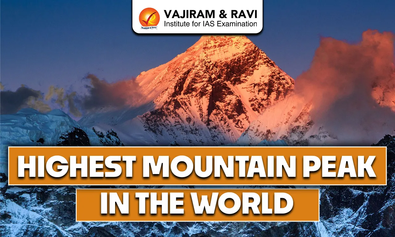
The Highest Mountain Peak in the World 2026 is the tallest natural point on Earth measured above sea level. It is formed due to the movement and collision of tectonic plates over millions of years. Such high peaks influence climate patterns, support glaciers and give rise to major rivers. They are important in the study of physical geography and environmental processes.

Highest Mountain Peak in the World 2026

Around the world, more than one hundred mountain peaks rise above 7,200 metres above sea level. Most of these extremely high mountains are concentrated in Asia, particularly along the zone where the Indian Plate is pushing against the Eurasian Plate. This tectonic collision has created some of the tallest and youngest fold mountains on Earth, making the region highly significant in physical geography.

List of Highest Mountain Peaks in the World 2026

The highest mountain peaks in the world are briefly discussed below in order of their height above sea level. These peaks are mainly located in Asia and are significant for their geographical features, formation processes and global importance.

List of Highest Mountain Peaks in the World 2026
S No. Mountain Metres Feet Range Location

1.

Mount Everest

8,848

29,029

Himalayas

Nepal/China(Tibet)

2.

K2

8,611

28,251

Karakoram

India

3.

Kangchenjunga

8,586

28,169

Himalayas

Nepal/India

4.

Lhotse

8,516

27,940

Himalayas

Nepal/China -Climbers ascend Lhotse Face in climbing Everest

5.

Makalu

8,485

27,838

Himalayas

Nepal/China

6.

Cho Oyu

8,201

26,906

Himalayas

Nepal/China-Considered “easiest” eight-thousander

7.

Dhaulagiri

8,167

26,795

Himalayas

Nepal – Presumed world’s highest from 1808-1838

8.

Manaslu

8,163

26,781

Himalayas

Nepal

9.

Nanga Parbat

8,126

26,660

Himalayas

India

10.

Annapurna I

8,091

26,545

Himalayas

Nepal – First eight-thousander to be climbed (1950)

11.

Gasherbrum I (Hidden peak; K5)

8,080

26,509

Karakoram

India (currently under the illegal occupation of Pakistan)

12.

Broad Peak

8,051

26,414

Karakoram

India (currently under the illegal occupation of Pakistan)

13.

Gasherbrum II (K4)

8,035

26,362

Karakoram

India (currently under the illegal occupation of Pakistan)/China Border

14.

Shishapangma

8,027

26,335

Himalayas

China

Top 10 Highest Mountain Peaks in the World 2026

1. Mount Everest

  • Mount Everest is the tallest mountain in the world with a height of 8,848.86 metres above sea level.
  • It has the highest topographic prominence, which means it rises higher than any other peak on Earth. There is no taller mountain nearby.
  • It is situated in the Himalayas on the border of Nepal and China (Tibet). It lies within Sagarmatha National Park and Qomolangma National Nature Preserve.
  • The mountain was accurately measured in 1856 during the Great Trigonometrical Survey of India and was officially named in 1865 after Sir George Everest.
  • It is called Sagarmatha in Nepal and Chomolungma in Tibet, reflecting its cultural importance in both regions.


2. K2

  • K2 is the second-highest mountain in the world, with a height of 8,611 metres above sea level. It is also called Mount Godwin Austen.
  • It is popularly known as “The Savage Mountain”.
  • It is situated in the Karakoram Range along the border between India and China. Karakoram is known for its rugged and high-altitude terrain.
  • K2 has a prominence of about 4,020 metres, which means it rises sharply above the surrounding landscape. 
  • The mountain is famous for its extremely steep slopes and harsh weather conditions. Due to its difficult climbing routes, it is considered one of the toughest and most dangerous peaks in the world.
  • Compared to Mount Everest, K2 has a higher death rate among climbers and fewer mountaineers have successfully reached its summit.

3. Kangchenjunga

  • Kangchenjunga is the third-highest mountain in the world, with a height of 8,586 metres above sea level.
  • It is located in the Himalayas on the border between Nepal and the Indian state of Sikkim.
  • It is known for its remote location, heavy snowfall, and difficult climbing conditions, making it one of the more dangerous high peaks.
  • The first successful ascent was made in 1955 by a British team. It is one of the 14 “eight-thousanders,” meaning peaks in the world that are higher than 8,000 metres.

4. Lhotse

  • Lhotse is the fourth-highest mountain in the world, with a height of 8,516 metres above sea level.
  • It is situated in the Himalayas on the Nepal-China (Tibet) border.
  • Lhotse lies very close (around 2.66 km) to Mount Everest.
  • It has two main summits-Lhotse Main and Lhotse Middle.
  • The first successful ascent was made in 1956 by a Swiss team, and it is often climbed along with Mount Everest.

5. Makalu

  • Makalu is the fifth-highest mountain in the world, with a height of 8,485 metres above sea level.
  • It is located on the border of Nepal and Tibet in the Mahalangur range of the Himalayas.
  • The mountain is famous for its sharp ridges and pyramid-like shape, which makes climbing very difficult and risky.
  • The surrounding region is rich in biodiversity and is home to endangered animals like the red panda and snow leopard.
  • Local communities such as the Sherpa, Rai and Limbu live in this area and consider the mountain spiritually important.

6. Cho Oyu

  • Cho Oyu is the sixth-highest mountain in the world, with a height of 8,201 metres above sea level.
  • It lies in the Himalayas on the border of Nepal and China and falls under the Khumbu region of Nepal.
  • It was first successfully climbed in 1954 by a Swiss expedition team.
  • Among the fourteen peaks above 8,000 metres, Cho Oyu is considered comparatively less difficult to climb, though it still requires high-altitude experience.

7. Dhaulagiri

  • Dhaulagiri is the seventh-highest mountain in the world, rising to 8,167 metres above sea level.
  • It is situated in Nepal.
  • It was first successfully climbed in 1960 by a Swiss expedition.
  • Dhaulagiri is regarded as one of the more difficult peaks among the fourteen mountains above 8,000 metres due to its steep slopes and harsh weather conditions.

8. Manaslu

  • Manaslu is the eighth-highest mountain in the world, with a height of 8,163 metres above sea level.
  • It is located in Nepal in the Himalayas and lies within the Manaslu Conservation Area.
  • It was first climbed successfully in 1956 by a Japanese expedition team.
  • Manaslu is one of the fourteen peaks above 8,000 metres and is considered challenging due to difficult weather and terrain conditions.

9. Nanga Parbat

  • Nanga Parbat is the ninth-highest mountain in the world, with a height of 8,126 metres above sea level.
  • It is located in the western Himalayas in the Gilgit-Baltistan region of Kashmir, near a sharp bend of the Indus River. It is considered the westernmost major peak of the Himalayan range.
  • Nanga Parbat is famous for its steep faces, technical climbing routes and frequent avalanches, making it one of the more dangerous peaks above 8,000 metres.
  • The first successful ascent was made in 1953 by an Austrian expedition team.

10. Annapurna I

  • Annapurna I is the tenth-highest mountain in the world, rising to 8,091 metres above sea level.
  • It is situated in Nepal in the Himalayas and lies within the Annapurna Conservation Area.
  • Annapurna was first successfully climbed in 1950 by a French expedition, becoming one of the earliest 8,000-metre peaks to be summited.
  • It is regarded as one of the most dangerous “eight-thousanders” because of its steep slopes and high risk of avalanches.
Also Check Other Posts
Biosphere Reserves in India National Parks in India
Waterfalls in India Highest Peak in India
Ramsar Sites in India Wildlife Sanctuaries in India
Dams in India Tiger Reserves in India
Mountain Passes in India Longest Bridge in India

Highest Mountain Peak in the World 2026 FAQs

Q1: What is the highest mountain peak in the world 2026?

Ans: Mount Everest is the highest mountain peak in the world, with a height of 8,848.86 metres above sea level.

Q2: Where are most of the world’s highest mountain peaks located?

Ans: Most peaks above 8,000 metres are located in Asia formed due to the collision of the Indian and Eurasian Plates.

Q3: Which mountain is known as “The Savage Mountain”?

Ans: K2 is popularly known as “The Savage Mountain” because of its extremely difficult and dangerous climbing conditions.

Q4: What are “Eight-thousanders”?

Ans: Eight-thousanders are the 14 mountain peaks in the world that rise above 8,000 metres above sea level.

Q5: Which mountain is considered the most dangerous among the top peaks?

Ans: Annapurna I is considered one of the most dangerous eight-thousanders due to its steep slopes and high avalanche risk.

Major Rivers of the World 2026, List, Length, Origin, Tributaries

Major Rivers of the World

Major Rivers of the world is an important theme in the UPSC Prelims Exam. UPSC frequently tests candidates on river origins, courses, tributaries, drainage basins, and mouths, as well as rivers crossing important latitudes like the Equator, Tropic of Cancer, or Tropic of Capricorn.

Major Rivers of the World 2026

The list of Major Rivers of the World 2026 has been tabulated below along with their origin, tributaries, country, location, features and other details: 

Major Rivers of the World 2026
  Name of the River Characteristics

Major Rivers of North America 

Mississippi - Missouri River system 

  • Mississippi - Missouri River system is the longest River System in North America.
  • Known for Bird’s Foot Delta. 
  • Mississippi River rises in the Lake Itasca, USA
  • The Missouri River rises in the Rocky Mountains, USA.
  • The Missouri River is the longest river in North America. 
  • Missouri River is the tributary of the Mississippi River. It joins Mississippi near St.Louis.
  • Drains into the Gulf of Mexico.

Rio Grande River 

  • It rises in the San Juan Mountains in the United States (Colorado).
  • It forms the border between the USA and Mexico.
  • Drains into the Gulf of Mexico.

Colorado River

  • It rises in the Rocky Mountains, in Colorado, USA.
  • Hoover dam is located on the Colorado river.
  • It form the Grand Canyon. 

St Lawrence River

  • It rises in Lake Ontario.
  • Connects the Great Lakes to the Atlantic Ocean. 
  • It forms the border between Canada and the USA.
  • It drains into the Atlantic Ocean

Major Rivers of South America 

Amazon River

  • It is the largest river in the world by volume.
  • It is the second longest river in the world after the Nile.
  • It has the largest drainage basin. It flows through Brazil, Peru, Ecuador, Colombia, Venezuela, and Bolivia.
  • It flows through the Amazon Rainforest. 
  • It rises in the Andes Mountains of Peru.
  • Major tributaries include Rio Negro, Madeira, and Xingu.
  • Drains into the Atlantic Ocean on the northeastern coast of Brazil. 

Ornicco River 

  • It rises in the Guiana Highlands near the Brazil-Venezuela border.
  • It flows in a giant arc.
  • It flows through Venezuela and Colombia.
  • Drains into the Atlantic ocean.

Prana River 

  • Rises in Southern Brazil, formed by the confluence of the Paranaiba and Grande rivers in Brazil.
  • It flows through Brazil, Paraguay, Argentina.
  • Itaipu Dam is located on the Prana River.

Major Rivers of Europe 

Volga River 

  • It is the longest river in Europe (3530 Km) 
  • It rises in the Valdai Hills in western Russia.
  • It drains into the Caspian Sea. 

Danube 

  • It is the second longest river in Europe.
  • Originates in the Black Forest Mountains in Southwestern Germany.
  • It is the only major European river to flow from the west to the east.
  • It flows through Germany, Austria, Slovakia, Hungary, Croatia, Serbia, Bulgaria, Romania, Moldova, and Ukraine.
  • Major Cities Along the Danube: Vienna, Budapest, Belgrade etc 
  • It drains into Black Sea.

Rhine River

  • It rises in the Swiss Alps.
  • It flows through Switzerland, Liechtenstein, Austria, Germany, France, and the Netherlands
  • It drains into the North Sea.

Rhone River

  • It rises in the Swiss Alps.
  • It drains into the Mediterranean Sea. 

Ural River 

  • It rises in the Ural Mountains, Southern Russia.
  • It flows mainly through Russia and Kazakhstan.
  • It makes a natural boundary between Europe and Asia.
  • Drains into the Caspian Sea. 

Dnieper River 

  • It rises in the Valdai Hills, Western Russia.
  • It flows mainly through Russia, Ukraine, Belarus.
  • Drains into Black Sea. 

Major Rivers of Africa

Nile River

  • The Nile River is the longest river in the world, measuring roughly 6,650 kilometres in length.
  • It flows from south to north through northeastern Africa and drains into the Mediterranean Sea near Alexandria.
  • It is formed by the confluence of two major river systems, namely the White Nile and the Blue Nile.
  • The Nile Basin spans 11 countries: Burundi, Rwanda, Tanzania, Uganda, Kenya, Democratic Republic of the Congo, South Sudan, Sudan, Ethiopia, Eritrea, and Egypt.
  • It has historically been called the “lifeline of Egypt”.

Congo River

  • It originates as the Chambeshi River in the highlands of northeastern Zambia, near Lake Tanganyika.
  • It flows primarily through the Democratic Republic of the Congo (DRC) and forms the border with the Republic of the Congo.
  • With a length of 2,900 miles (4,700 km), it is the second longest river in Africa.
  • It is also the world's deepest recorded river.
  • It is the only major river to cross the equator twice.
  • It drains into the Atlantic Ocean. 

Niger River 

  • Niger river is the third longest river in Africa after the Nile and Congo river. 
  • It originates in the Guinea highlands.
  • It flows in crescent shape through Mali, Niger, and Benin before creating a major delta in Nigeria.
  • It is also called the “Oil River” as it was the major centre of palm oil during the colonial period. 

Zambezi River

  • The Zambezi River is Africa's fourth-longest river and the longest east-flowing river.
  • It originates in the Mwinilunga District of Northwestern Zambia. 
  • It flows through six countries - Angola, Zambia, Namibia, Botswana, Zimbabwe, and Mozambique.
  • It is famous for Victoria Falls, Kariba Dam, and Cahora Bassa Dam. 
  • It drains into Indian Ocean

Major Rivers of Asia

Ganga River

  • Ganga river is the longest river in India (2525 Km).
  • It is the largest river system in India in terms of basin area and population supported. 
  • It is formed by the confluence of Bhagirathi River and Alaknanda River at Devprayag.
  • It enters the plains at Haridwar.
  • Major Left Bank Tributaries: Ramganga, Gomti, Ghaggar, Gandak, Kosi, Mahananda 
  • Major Right Bank Tributaries: Yamuna, Son, Damodar. 

Brahmaputra River 

  • It originates in Chemayungdung glacier of Kailash range near Mansarovar lake.
  • It enters India in Arunachal as Dihang through Namcha Barwa 
  • It is known for floods, shifting channels and bank erosion
  • Major Left bank tributaries: Burhi, Dihing, Dhansari, Dibang, Lohit, etc 
  • Major Right bank tributaries: Subansiri, Kameng, Manas, Sankosh, Teesta 
  • It is known as Tsangpo in Tibet and Jamuna in Bangladesh. 

Indus River

  • Origin: Indus originates from glaciers of the Kailash range near Mansarovar Rakas Lake region.
  • Tributaries: Zaskar, Shyok, Gilgit, Drass, Hunza, Kabul are its important tributaries in the higher ranges of Himalayas.
  • Rivers of Punjab - Jhelum, Chenab, Ravi, Beas, Satluj are left bank tributaries. 

Mekong River

  • It originates in the Lasagongma Spring on the Tibetan Plateau, China.
  • It flows through China, Myanmar, Laos, Thailand, Cambodia, and Vietnam.
  • It borders Myanmar and Laos and Laos and Thailand.
  • It forms the fertile Mekong Delta in Vietnam, one of the world’s major rice-producing regions.
  • Drains into South China Sea. 

Yellow River 

  • It is the second longest river in China. 
  • It rises in the Tibetan Plateau. 
  • It is called the Yellow river because it carries huge amounts of yellow loess, fine silt coming from Loess Plateau. 
  • Infamous as China's Sorrow" due to massive destruction caused by floods. 
  • It is known as the “Cradle of Chinese Civilization.” as early Chinese settlements and agriculture developed along its banks

Yangtze River 

  • Yangtze river is the longest river in Asia.
  • Length: 6300 km
  • The Three Gorges Dam, the world's largest hydroelectric power station, is located on the river.
  • Drains into East China Sea 

Ob River 

  • Originates at the confluence of the Biya and Katun rivers in the Altai Mountains. 
  • It flows mainly through Russia.
  • It drains into the Arctic Ocean. 

Lena River

  • It originates in the Baikal Mountains near Lake Baikal.
  • It is the longest river in Russia.
  • It flows entirely in Russia.
  • known for the Lena Pillars, which are towering limestone rock formations.
  • Drains into the Arctic Ocean.

Major Rivers of Australia 

Murray River

  • Rises in the Australian Alps in the Great Dividing Range.
  • It is the longest river in Australia (2508km) 
  • Drains into the Southern Ocean near Lake Alexandrina.

Darling River

  • Rises in the Great Dividing Range.
  • It is the third longest river in Australia 
  • Part of the Murray-Darling River system, the largest river system in Australia.
  • It joins the Murray river at Wentworth.
Also Check Other Posts
Biosphere Reserves in India National Parks in India
Waterfalls in India Highest Peak in India
Ramsar Sites in India Wildlife Sanctuaries in India
Dams in India Tiger Reserves in India
Mountain Passes in India Longest Bridge in India

Major Rivers of the World 2026 FAQs

Q1: Which river crosses the Equator twice?

Ans: The Congo river crosses the Equator twice.

Q2: Which river is famous for the Bird’s Foot Delta?

Ans: The Mississippi River is famous for the Bird’s Foot Delta.

Q3: Which river makes border between USA and Mexico?

Ans: The Rio Grande River makes border between USA and Mexico.

Q4: Which is the longest river in the world?

Ans: Nile river is the longest river in the world.

Q5: The Mekong River drains into which sea?

Ans: The Mekong river drains into South-China Sea.

Sundarban Biosphere Reserve, Location, Flora & Fauna, Geography

Sundarban Biosphere Reserve

Sundarban Biosphere Reserve is a unique natural region located in the delta of the Ganga, Brahmaputra, and Meghna rivers in West Bengal. It is famous for having the largest mangrove forest in the world, with a network of rivers, creeks, and islands. The area is well known as the habitat of the Royal Bengal Tiger, along with many other species of plants and animals. It is an important biodiversity hotspot and supports a rich ecosystem of land and water. The reserve also plays a key role in protecting coastal areas from cyclones and maintaining ecological balance. Overall, it shows how nature and human life coexist in a fragile environment. 

Sundarban Biosphere Reserve

  • The Sundarban Biosphere Reserve is a vast and ecologically important region located in West Bengal, forming part of the Ganga-Brahmaputra-Meghna delta, which is the largest delta in the world.
  • It is widely known for having the largest mangrove forest on Earth, spread across India and Bangladesh, creating a unique mix of land, rivers, and tidal ecosystems.
  • The reserve was officially declared in 1989 under India’s National MAB Programme, inspired by UNESCO’s Man and Biosphere (MAB) Programme (1970) to promote harmony between humans and nature.
  • It was included in the Global Network of Biosphere Reserves in 2001, highlighting its international ecological importance.
  • The region is also globally recognised as a UNESCO World Heritage Site, making it one of the most important biodiversity areas in the world.

Sundarban Biosphere Reserve Location and Extent

  • The Sundarban region covers around 10,200 sq km of mangrove forests, with about 4,200 sq km in India and the rest in Bangladesh.
  • The Indian part of the Sundarban is located in West Bengal, covering the districts of South 24 Parganas and North 24 Parganas, and extends southwards up to the Bay of Bengal
  • In India, the total Sundarban region (including inhabited areas) is about 9,600 sq km, forming the Biosphere Reserve.
  • It is bounded by river Muriganga in the west and Harinbhanga and Raimangal rivers in the east, with major rivers like Matla, Thakuran, Saptamukhi, and Gosaba flowing through it.
  • The area consists of a complex network of rivers, creeks, mudflats, and islands, creating a dynamic and ever-changing landscape.

Also Read : Biosphere Reserves in India

Uniqueness of Sundarban

  • Sundarban is the only mangrove forest in the world where tigers are found naturally, making it extremely unique.
  • It is the largest continuous habitat of the Royal Bengal Tiger, with a specially adapted population that can survive in saline and swampy conditions.
  • The region shows a rare combination of terrestrial, aquatic, and coastal ecosystems, leading to high biodiversity and ecological productivity.
  • It is also recognised under multiple conservation frameworks such as Project Tiger (1973) and proposed as a Ramsar Site (wetland of international importance).

Importance of Sundarban Ecosystem

  • The Sundarban ecosystem supports a rich diversity of flora and fauna, making it a major biodiversity hotspot.
  • It acts as a natural fish nursery, supporting fisheries that are important for both ecology and local economy.
  • The dense mangrove forests help in reducing the impact of cyclones, protecting coastal areas from storms and tidal waves.
  • It also prevents soil erosion and stabilizes the coastline through its complex root systems.
  • Millions of people depend on this ecosystem for their livelihood, including fishing, honey collection, and forest-based resources.

Sundarban Biosphere Reserve Topography

  • Geologically, Sundarban is a prograding delta, formed by the continuous deposition of sediments brought by rivers like Ganga, Matla, and Bidyadhari.
  • The region is mainly composed of quaternary sediments, making the soil soft, fertile, and constantly changing due to tidal action.
  • The land is mostly low-lying and waterlogged, which supports mangrove vegetation adapted to saline conditions.

Sundarban Biosphere Reserve Climate and Rainfall

  • The region has a tropical monsoon climate, influenced by its proximity to the Bay of Bengal.
  • The average maximum temperature is around 35°C, while the climate remains humid throughout the year.
  • The area receives about 1920 mm of annual rainfall, mainly during the monsoon season.
  • The average humidity is around 82%, creating favorable conditions for mangrove growth.

Sundarban Biosphere Reserve Flora (Plant Life)

  • The Sundarban is dominated by mangrove vegetation, including important species like Sundari, Passur, and Nypa palm.
  • Forest types include tidal swamp forests, saline mixed forests, and brackish water forests, all adapted to saline and waterlogged conditions.
  • The region has about 81 mangrove plant species, showing the highest mangal (mangrove) diversity in the world.
  • These plants play a crucial role in coastal protection, nutrient cycling, and habitat formation.

Sundarban Biosphere Reserve Fauna (Animal Life)

  • Sundarban is the largest habitat of the Royal Bengal Tiger, which is specially adapted to this ecosystem.
  • It supports over 50 species of mammals, including spotted deer, wild boar, and rhesus macaque.
  • The region is rich in reptiles such as estuarine crocodile, water monitor lizard, and king cobra.
  • It is home to aquatic species like the Gangetic dolphin and snubfin dolphin, along with several marine turtles such as Olive Ridley Turtle and Green Sea Turtle.
  • More than 150 bird species and a wide variety of fish, crabs, and molluscs are found here, making it highly diverse.

Protected Areas within Sundarban Biosphere Reserve

  • The Biosphere Reserve includes several protected areas such as:
    • Sundarban National Park (core area)
    • Sundarban Tiger Reserve
    • Sajnekhali Wildlife Sanctuary
    • Lothian Island Wildlife Sanctuary
    • Halliday Island Wildlife Sanctuary
  • These areas together ensure the conservation of wildlife and habitats at different levels.

Sundarban Biosphere Reserve Socio-Economic Importance

  • The Sundarban region supports a large population of around 4.5 million people, many of whom depend directly on forest resources.
  • Due to saline soil and limited agriculture, people rely on fishing, honey collection, fuelwood, and handicrafts.
  • Eco-development programmes focus on sustainable livelihood options, such as aquaculture, animal husbandry, and alternative energy use.
  • Community participation plays a key role in ensuring balanced development and conservation.

Why is the Sundarban Biosphere Reserve Important?

  • It is a globally significant ecosystem due to its unique mangrove biodiversity and role in climate resilience.
  • The region acts as a natural barrier against cyclones and sea-level rise, especially important for coastal protection.
  • It provides habitat to many endangered and rare species, making it crucial for conservation.
  • At the same time, it supports human livelihoods, showing a balance between nature and development.
  • Sundarban is a perfect example of how ecological sustainability and human survival are interconnected.

Sundarban Biosphere Reserve FAQs

Q1: What is Sundarban Biosphere Reserve famous for?

Ans: Sundarban Biosphere Reserve is famous for the largest mangrove forest in the world and as the natural habitat of the Royal Bengal Tiger.

Q2: Where is Sundarban Biosphere Reserve located?

Ans: It is located in West Bengal, in the delta of the Ganga, Brahmaputra, and Meghna rivers, near the Bay of Bengal.

Q3: Why is Sundarban considered unique?

Ans: It is the only mangrove forest in the world with a natural tiger population and has a mix of terrestrial, aquatic, and coastal ecosystems.

Q4: When was Sundarban Biosphere Reserve established?

Ans: It was declared a Biosphere Reserve in 1989 and included in the UNESCO Global Network of Biosphere Reserves in 2001.

Q5: What type of ecosystem is found in Sundarban?

Ans: Sundarban has a mangrove ecosystem with tidal forests, rivers, creeks, and mudflats, supporting both land and aquatic life.

Important Battles in Indian History, List, Year, Outcomes

Important Battles in Indian History

The Important Battles in Indian History cover all the major events and battles that took place during ancient, medieval and modern history. Given the long history of conquering and invasion, India has witnessed a huge number of wars which were fought for the quest of power, religious domination and territorial control. In this article, we are going to look into these wars and their important dates and significance. 

Important Battles in Indian History

The Important Battles in Indian History are the ones that have left a lasting impact on the topography, culture and political environment of India. The battles in Indian history can be divided into three periods: 

  • Ancient period 
  • Medieval period 
  • Modern period 

Important Battles in Ancient India History

Ancient Indian History has witnessed some important battles that reflect on the culture, philosophies and flourishing economy of that period. Once known as the “sone ki chidiya”, India was invaded by some powerful dynasties, with the intention of expansion and power control. 

Important Battles in Ancient Indian History

Battle Name

Year

Between

Outcome

Battle of the Ten Kings

14th century BCE

King of Bharatas vs. a confederation of ten tribes

Bharatas emerged victorious, leading to the establishment of the Kuru Kingdom.

Battle of Hydaspes

326 BCE

Alexander the Great vs. King Porus

Alexander won but respected Porus, allowing him to retain his kingdom.

Seleucid–Mauryan War

305–303 BCE

Chandragupta Maurya vs. Seleucus I Nicator

Chandragupta secured territories and a marriage alliance with Seleucus.

Kalinga War

261 BCE

Ashoka vs. Raja Anantha Padmanabha

Ashoka won but adopted Buddhism due to the war's brutality.

Battle of Pullalur

618–619 CE

Chalukya King Pulakesin II vs. Pallava King Mahendravarman I

Pulakesin II defeated the Pallavas.

Important Battles in Medieval Indian History

Medieval India saw the invasion of the Mughal Empire and the Delhi Sultanate both constituting powerful empires. Both being powerful kingdoms, this period saw a rise in political struggles for supremacy in India and military conflicts. List of important battles in Medieval Indian History include: 

Important Battles in Medieval Indian History

Battle

Year

Between

Outcome

First Battle of Tarain

1191 CE

Prithviraj Chauhan vs. Muhammad Ghori

Prithviraj defeated Muhammad Ghori, showcasing Rajput strength.

Second Battle of Tarain

1192 CE

Muhammad Ghori vs. Prithviraj Chauhan

Muhammad Ghori defeated Prithviraj, marking the start of Muslim rule in North India.

Battle of Chandawar

1194 CE

Muhammad Ghori vs. Jaichandra

Muhammad Ghori defeated Jaichandra, consolidating his power in northern India.

Battle of Kili

1299 CE

Mongols (Chagatai Khanate) vs. Delhi Sultanate

Delhi Sultanate, under Alauddin Khilji, successfully repelled the Mongol invasion.

Battle of Delhi

1398 CE

Timur (Timurids) vs. Tughlaq Dynasty

Timur sacked Delhi, causing widespread destruction and weakening the Tughlaq dynasty.

First Battle of Panipat

1526 CE

Babur vs. Ibrahim Lodi

Babur's victory established the Mughal Empire in India.

Battle of Khanwa

1527 CE

Babur vs. Rana Sanga

Babur defeated Rana Sanga, solidifying Mughal control over northern India.

Battle of Chanderi

1528 CE

Babur vs. Medini Rai

Babur captured Chanderi, further consolidating Mughal power in central India.

Second Battle of Panipat

1556 CE

Akbar (Mughals) vs. Hemu

Akbar's forces defeated Hemu, ensuring Mughal dominance in northern India.

Battle of Haldighati

1576 CE

Maharana Pratap of Mewar vs. Mughal forces (led by Man Singh I)

Mughals emerged victorious, Maharana Pratap's guerrilla warfare tactics continued.

List of Important Battles in Modern Indian History

Modern History of India constitutes a major power supremacy of the British and their ruling. The wars fought during this period shaped the political landscape of India and also acknowledged the wars fought by Indians against the British to get freedom from colonial rule. Important battles in Modern Indian History include: 

Important Battles in Modern Indian History

Battle Name

Year

Between

Outcome

Battle of Plassey

1757 CE

British East India Company vs. Siraj-ud-Daulah

Marked the beginning of British political dominance in India.

Battle of Buxar

1764 CE

British East India Company vs. Mir Qasim, Shuja-ud-Daula, and Shah Alam II

Consolidated British control over Bengal and established the Company's dominance in India.

Third Battle of Panipat

1761 CE

Marathas vs. Ahmad Shah Abdali

Decisive defeat of the Marathas, leading to a decline in their power.

Battle of Wandiwash

1760 CE

British vs. French

Ended French ambitions in India during the Carnatic Wars.

Anglo-Mysore Wars

1767–1799 CE

British East India Company vs. Mysore (Hyder Ali and Tipu Sultan)

Series of wars that led to the fall of Mysore and strengthened British control.

Anglo-Maratha Wars

1775–1818 CE

British East India Company vs. Maratha Empire

Led to the dissolution of the Maratha Empire and British supremacy.

Revolt of 1857 (First War of Independence)

1857 CE

Indian rebels vs. British East India Company

Marked the end of Company rule and the beginning of direct British Crown rule.

Top 10 Battles in Indian History 2026

Here is a list of the top 10 most important battles in Indian history, based on their historical impact and legacy:

  1. Battle of Kurukshetra (Mahabharata) 
    • Date: Legendary (circa 3000 BCE)
    • Significance: Fought between the Pandavas and Kauravas, the battle of Kurukshetra is a mythological battle which shaped the narrative in Indian culture about the Mahabharata and its philosophy. 
  2. Battle of Hydaspes 
    • Date: 326 BCE
    • Combatants: Alexander the Great vs. King Porus of Paurava
    • Significance: fought on the banks of Jhelum River, the Battle of Hydaspes was one of the biggest victories of Alexander. However, while King Porus was defeated, his efforts to resist were appreciated by Alexander. 
  3. Kalinga War
    • Date: 261 BCE
    • Combatants: Emperor Ashoka and the kingdom of Kalinga.
    • Significance: Ashoka is remembered to play an important role in preaching and promoting Buddhism in India as well in other nations. After the casualties that occured in the Kalinga War, Ashoka gave up on violence and decided to follow a non-violence life and embrace buddhism. 
  4. Battle of Panipat 
    • Date: April 21, 1526
    • Combatants: Babur vs. Ibrahim Lodi
    • Significance: The beginning of Mughal Empire in India witnessed the first battle of Panipat that was fought in between Babur and Ibrahim Lodi. This war played a significant role in shaping Indian history by marking the start of Mughal Rule in India. 
  5. Battle of Talikota
    • Date: January 26, 1565
    • Combatants: Deccan Sultanates vs. Vijayanagara Empire
    • Significance: Battle of Talikota marked the collapse of Vijayanagara empire by a combined effort of the Deccan sultanate to fight against the power in south India. 
  6. Battle of Plassey
    • Date: June 23, 1757
    • Combatants: British East India Company vs. Nawab of Bengal, Siraj-ud-Daula
    • Significance: 
    • This battle marked the beginning of British rule in India. The British victory, largely due to treachery within the Nawab’s ranks, led to British domination of Bengal and, eventually, most of India.
  7. Battle of Buxar
    • Date: October 22, 1764
    • Combatants: British East India Company vs. Shuja-ud-Daula, Mir Qasim, and the Nawab of Oudh
    • Significance: This war increased the influence of British over India and led to the expansion of British Colonial power, strengthening the control of British East India Company over Bengal territory.
  8. Battle of Kolhapur 
    • Year: 1779
    • Combatants: Marathas vs. British East India Company
    • Significance: Showed the resilience of Maratha Empire through the key battle of maratha-british conflict. After this war, the Marathas emerged as a powerful empire in Indian politics.
  9. First Battle of Indian Independence
    • Year: 1857
    • Combatants: Indian rebels (Sepoys) vs. British East India Company
    • Significance: The Revolt against British Rule was the first war of Indian Independence. All the wars after this event were inspired from this war of 1857.
  10. Battle of Kohima
    • Date: April 4 to June 22, 1944
    • Combatants: British-Indian forces vs. Imperial Japanese Army
    • Significance: A turning point in World War II where British-Indian troops halted Japan’s advance into India, shifting momentum in favor of the Allies in Southeast Asia.

All Battles fought in the past have played an important role in impacting the cultural and political history of India, whether it involved struggle of independence, spread of religious changes, and territorial dominance.

Related Articles
Important Battles in Indian History Important Battles of Mughal Empire
Battle of Kannauj Battle of Khanwa
Battle of Purandar Battle of Longewala
Battle of Hydapses Battle of Wandiwash
Battle of Tarain Battle of Chengam
Battle of Porto Novo Battle of Pollilur
Battle of Salher Battle of Pavankhind
Battle of Kolhapur Battle of Bhupalgarh
Battle of Sinhagad Battle of Surat
Battle of Walong Battle of Saragarhi
Battle of Rezang La Maratha Wars List


Important Battles of Indian History FAQs

Q1: What was the greatest battle in Indian history?

Ans: The Battle of Panipat (1526, 1556, 1761) had a massive impact on Indian history, shaping empires and dynasties.

Q2: Which part of history is most important for UPSC Mains?

Ans: Modern Indian History (1757–1947), especially British rule, freedom struggle, and post-independence developments.

Q3: What was the most famous battle in history?

Ans: The Battle of Kurukshetra (from Mahabharata) is legendary, while the Battle of Panipat (1761) is historically significant.

Q4: When and between whom did the major wars of Indian history take place?

Ans: Major battles like Panipat (1526, 1556, 1761), Buxar (1764), Plassey (1757), and 1857 Revolt were fought between Indian rulers and foreign powers like the Mughals, Marathas, British, and Afghans.

Q5: What was India called 1000 years ago?

Ans: India was known as "Bharat", "Aryavarta", and "Jambudweep" in ancient texts.

Longest Bridge in India, List of Longest Bridges in India

Longest Bridge in India

Bridges are among the most important infrastructure assets of a country, improving connectivity, supporting economic growth, and linking geographically separated regions. India has developed several major bridges across rivers, seas, lakes, and difficult terrains to strengthen road and rail networks. 

The longest bridge in India is the Atal Setu (Mumbai Trans Harbour Link), which is 21.8 km long and located in Maharashtra. It is also the longest sea bridge in India, connecting Sewri in Mumbai with Nhava Sheva in Navi Mumbai across Thane Creek and the Arabian Sea region. It was inaugurated in January 2024.

Top 10 Longest Bridges in India Complete List

The top 10 longest bridges in India are as follows: 

Rank Bridge Name Length Location Water Body / Feature Year of Opening

1

Atal Setu (Mumbai Trans Harbour Link)

21.8 km

Maharashtra

Thane Creek / Arabian Sea

2024

2

Kacchi Dargah–Bidupur Bridge

9.76 km (main bridge)

Bihar

Ganga River

Under completion (target 2026)

3

Dr. Bhupen Hazarika Setu (Dhola–Sadiya Bridge)

9.15 km

Assam

Lohit River

2017

4

Dibang River Bridge

6.20 km

Arunachal Pradesh

Dibang River

2018

5

Mahatma Gandhi Setu

5.75 km

Bihar

Ganga River

1982

6

Bandra–Worli Sea Link

5.60 km

Maharashtra

Mahim Bay

2009

7

Bogibeel Bridge

4.94 km

Assam

Brahmaputra River

2018

8

Vikramshila Setu

4.70 km

Bihar

Ganga River

2001

9

Vembanad Rail Bridge

4.62 km

Kerala

Vembanad Lake

2011

10

Digha-Sonpur Bridge (J.P. Setu)

4.55 km

Bihar

Ganga River

2016

Important Bridges in India

India has built several landmark bridges across rivers, seas, and lakes to improve connectivity, trade, and strategic mobility. Some of the longest and most important bridges in India are listed below.

Atal Setu (Mumbai Trans Harbour Link)

  • Atal Setu, officially known as the Atal Bihari Vajpayee Sewri-Nhava Sheva Atal Setu, is the longest bridge in India with a length of 21.8 km.  
  • It connects Sewri in Mumbai with Nhava Sheva in Navi Mumbai and significantly reduces travel time between the two regions.  
  • The bridge has approximately a 16.5 km section over the sea and around 5.5 km approach viaducts on land.  
  • It is a six-lane road bridge constructed by the Mumbai Metropolitan Region Development Authority (MMRDA).  
  • It is an important infrastructure project aimed at improving connectivity between Mumbai, Navi Mumbai International Airport, and Jawaharlal Nehru Port.

Kacchi Dargah-Bidupur Bridge

  • The Kacchi Dargah-Bidupur Bridge is a major six-lane bridge project over the Ganga River in Bihar.
  • The main bridge section over the river is approximately 9.76 km long, making it one of India’s longest river bridges after completion.
  • The complete project alignment, including approach roads and connecting structures, extends to nearly 19.76 km.
  • The project connects Patna district with Vaishali district and aims to improve connectivity between northern and southern Bihar.

Dr. Bhupen Hazarika Setu (Dhola-Sadiya Bridge)

  • The Dr. Bhupen Hazarika Setu is India’s longest operational river bridge before the completion of newer mega projects.
  • It is 9.15 km long and built over the Lohit River, a tributary of the Brahmaputra.
  • It connects Dhola and Sadiya in Assam and improves connectivity with Arunachal Pradesh.
  • It was inaugurated in 2017 and was named after legendary Assamese singer Dr. Bhupen Hazarika.

Dibang River Bridge

  • The Dibang River Bridge is located in Arunachal Pradesh and has a length of approximately 6.20 km.
  • It is constructed over the Dibang River and provides strategic connectivity in India’s northeastern border region.
  • The bridge improves movement between Assam and remote areas of Arunachal Pradesh.
  • It was opened in 2018.

Mahatma Gandhi Setu

  • The Mahatma Gandhi Setu is a major road bridge over the Ganga River in Bihar.
  • It connects Patna with Hajipur and plays a vital role in Bihar’s transport network.
  • Opened in 1982, it was once the longest river bridge in India.
  • The bridge is approximately 5.75 km long.

Bandra-Worli Sea Link

  • The Bandra-Worli Sea Link, officially called the Rajiv Gandhi Sea Link, is located in Mumbai, Maharashtra.
  • It connects Bandra with Worli across Mahim Bay.
  • It is approximately 5.6 km long and was opened in 2009.
  • It was India’s first major cable-stayed bridge built over the open sea.

Bogibeel Bridge

  • Bogibeel Bridge is India’s longest rail-cum-road bridge.
  • It is built over the Brahmaputra River in Assam and has a length of approximately 4.94 km.
  • The bridge connects Dibrugarh and Dhemaji districts.
  • It was inaugurated in 2018 and has strategic importance because of its proximity to the India-China border region.

Vikramshila Setu

  • Vikramshila Setu is a road bridge over the Ganga River near Bhagalpur, Bihar.
  • It was opened in 2001 and has a length of approximately 4.70 km.
  • The bridge connects Bhagalpur with Naugachhia and northern Bihar regions.
  • The bridge suffered a partial structural collapse in May 2026. 

Vembanad Rail Bridge

  • The Vembanad Rail Bridge is located in Kerala and crosses Vembanad Lake.
  • It has a length of approximately 4.62 km.
  • It is one of India’s longest railway bridges and forms an important part of the railway connectivity in the Kochi region.
  • It was opened in 2011.

Digha-Sonpur Bridge (J.P. Setu)

  • The Digha-Sonpur Bridge, also known as Jai Prakash Setu, is a rail-cum-road bridge over the Ganga River in Bihar.
  • It connects Digha Ghat in Patna with Sonpur in Saran district.
  • The bridge is approximately 4.55 km long.
  • It was opened in 2016 and improved connectivity between northern and southern Bihar.
Also Check Other Posts
Biosphere Reserves in India National Parks in India
Waterfalls in India Highest Peak in India
Ramsar Sites in India Wildlife Sanctuaries in India
Dams in India Tiger Reserves in India
Mountain Passes in India Longest Bridge in India


Longest Bridge in India FAQs

Q1: Which is the longest bridge in India?

Ans: The Atal Setu (Mumbai Trans Harbour Link) is the longest bridge in India. It is 21.8 km long, located in Maharashtra, and was inaugurated in January 2024. It connects Sewri in Mumbai with Nhava Sheva in Navi Mumbai across Thane Creek.

Q2: Which is the longest river bridge in India?

Ans: The Kacchi Dargah-Bidupur Bridge over the Ganga River in Bihar is the longest river bridge in India after completion. Its main bridge section over the river is approximately 9.76 km long.

Q3: Which is the longest rail-cum-road bridge in India?

Ans: The Bogibeel Bridge in Assam is India’s longest rail-cum-road bridge. It is built over the Brahmaputra River and was inaugurated in 2018.

Q4: Which is the longest sea bridge in India?

Ans: The Atal Setu (Mumbai Trans Harbour Link) is the longest sea bridge in India, with a total length of 21.8 km. It connects Mumbai and Navi Mumbai across Thane Creek.

Q5: Which bridge is known as India’s first major cable-stayed sea bridge?

Ans: The Bandra-Worli Sea Link (Rajiv Gandhi Sea Link) in Mumbai is India’s first major cable-stayed sea bridge. It was opened in 2009 and connects Bandra with Worli across Mahim Bay.

Monsoon in India 2026, Types, Map, Impacts, Prediction 2026

Monsoon in India

The Monsoon in India is one of the most defining climatic phenomena of the subcontinent. It shapes not only the weather patterns but also the socio-economic fabric of the country. Bringing life-giving rainfall, the monsoon is important for agriculture, water resources, and daily life. Understanding the monsoon's origins, mechanisms, variations, and impacts is important for appreciating how this seasonal wind system influences India’s environment, economy, and society. In this article, we are going to cover about the Indian Monsoon, its characteristics, types, driving forces, regional variations, historical importance, impacts, challenges and measures taken to manage it effectively. 

What is Monsoon?

The term monsoon is derived from the Arabic word mausim, meaning "season." In meteorological terms, a monsoon is a seasonal reversal of wind direction accompanied by significant changes in precipitation. It is not just a period of heavy rain but a complex climatic phenomenon involving interactions between land, ocean, and atmosphere. Monsoon systems exist in many parts of the world, including Southeast Asia, West Africa, and Australia, but the Indian monsoon is particularly significant due to its scale and socio-economic impact.

In India, the monsoon represents a lifeline that sustains the agricultural economy and replenishes rivers, lakes, and groundwater reserves. The monsoon is closely tied to the livelihoods of millions of people, as around 60% of India’s population depends on agriculture, much of which is rain-fed. Additionally, the monsoon influences hydroelectric power generation, industrial production, and food security.

Monsoon in India 2026

The Indian monsoon is characterized by seasonal wind reversals that bring heavy rainfall to different parts of the subcontinent. Broadly, Monsoon in India is divided into two major systems: Southwest Monsoon (June to September), this phase brings moisture-laden winds from the Indian Ocean to the Indian mainland, marking the onset of the primary rainy season. Northeast Monsoon (October to December) which is also known as the retreating monsoon, it mainly affects southeastern India, bringing rainfall to regions like Tamil Nadu, Andhra Pradesh, and parts of Kerala.

The monsoon is important not only for agriculture but also for maintaining water resources, influencing rural and urban livelihoods, and impacting economic growth. In years of deficient monsoon, India has historically experienced droughts, famine-like situations, and economic setbacks, whereas a good monsoon leads to record harvests, stable food prices, and improved rural incomes.

Features of Monsoon in India

The major important Features of Monsoon in India include: 

  • Seasonal Rainfall: Heavy rainfall occurs predominantly from June to September during the southwest monsoon.
  • Two Distinct Phases: Southwest and Northeast monsoons mark the two major phases, with differing wind patterns, rainfall intensity, and regional impacts.
  • Geographical Influence: The Himalayas, the Thar Desert, the Indian Ocean, and the Western Ghats influence rainfall distribution and wind directions.
  • Rainfall Diversity: Coastal regions and the Western Ghats receive extremely high rainfall, while arid and semi-arid regions such as Rajasthan receive sparse rain.
  • Wind Reversal: The hallmark of the monsoon is the seasonal reversal of wind direction, bringing moisture-laden winds during the wet season and dry winds during the retreating phase.
  • Sudden Onset and Withdrawal: The southwest monsoon typically arrives in Kerala by early June and withdraws from northern India by late September. The retreating monsoon in the south is comparatively gradual. 

Monsoon in India Map

Here is a geographical representation of Monsoon in India: 

Types of Monsoon in India

India experiences two types of monsoon:

  • Southwest Monsoon
  • Northeast Monsoon

Southwest Monsoon in India

  • The Southwest Monsoon in India occurs from June to mid-September. During the summer months, the northern and central parts of India, particularly the Thar Desert region, heat up rapidly. This heating creates a low-pressure zone over the northern Indian subcontinent. 
  • At the same time, the relatively cooler Indian Ocean maintains high-pressure conditions. The pressure difference causes winds to blow from the ocean towards the land.
  • This monsoon onset is often sudden, leading to a rapid fall in temperature and a sharp rise in humidity. It marks the hot-wet season in India, supporting extensive agricultural activities.
  • Rainfall is particularly heavy along the western coast and the Western Ghats due to orographic lifting, while the northeastern states experience intense rainfall due to their proximity to the Bay of Bengal.
  • The southwest monsoon accounts for nearly 80% of India’s annual rainfall, making it the primary driver of the country’s agricultural calendar. Crops like rice, sugarcane, maize, pulses, and millets depend heavily on the monsoon. 
  • The variability in monsoon onset, duration, and intensity directly affects food production, water availability, and rural income.

Northeast Monsoon in India

  • The Northeast Monsoon in India occurs from October to December. As the sun moves southwards, the monsoon troughs shift toward the southern hemisphere. 
  • The withdrawal of southwest monsoon winds creates a high-pressure system over northern India. Cold, dry winds from the Himalayas and the Indo-Gangetic plains blow toward the Indian Ocean, while moisture-laden winds bring rainfall to southeastern India, particularly Tamil Nadu and Andhra Pradesh.
  • Although the northeast monsoon contributes only about 10-15% of India’s annual rainfall, it is crucial for regions like Tamil Nadu, which receives scant rainfall during the southwest monsoon. Farmers in these regions rely on this rain for paddy cultivation and other crops. 
  • The retreating monsoon also replenishes groundwater reserves in southern India.

Factors Affecting Monsoon in India

The Monsoon in India is driven by complex interactions between atmospheric pressure systems, jet streams, and ocean currents. Major factors include:

  • Inter-Tropical Convergence Zone (ITCZ): The ITCZ shifts northward during summer, moving over India as far as 30°N. This shift is intensified by the rapid heating of the Indian landmass. The resulting low-pressure zone draws moist air from the Indian Ocean, which is deflected by the Coriolis force, causing heavy rainfall over India. During winter, the ITCZ shifts southward, bringing dry conditions to the subcontinent.
  • Tibetan Plateau: The Tibetan Plateau acts as a heat source, heating the air above it and creating a tropical easterly jet that aids monsoon circulation. As a mechanical barrier, it forces the subtropical westerly jet to bifurcate, which affects the timing and distribution of rainfall over India.
  • Jet Streams: Jet streams are fast-flowing air currents in the upper atmosphere, which can influence monsoon onset and withdrawal. The subtropical westerly jet moves south in summer, facilitating the southwest monsoon, while its northward retreat in winter supports the northeast monsoon.
  • Somali Jet: The Somali Jet is a low-level wind current originating near Somalia and the Arabian Sea. It reverses its direction with seasonal changes, bringing moisture-laden winds from the Indian Ocean towards India, accelerating the arrival of the southwest monsoon.
  • El Niño and La Niña Phenomena: The warming or cooling of the Pacific Ocean can significantly influence monsoon rainfall in India, causing floods or droughts.
  • Indian Ocean Dipole (IOD): The variation in sea surface temperatures in the western and eastern Indian Ocean can amplify or weaken monsoon rains.

Monsoon in India Regional Variations

The Indian monsoon witnesses many important regional variations due to topography and proximity to water bodies:

  • Western Ghats and Coastal Areas: Receive heavy rainfall due to orographic lift. Some regions, like Mawsynram and Cherrapunji in Meghalaya, are among the wettest places on Earth, receiving more than 11,000 mm of rain annually.
  • Northern Plains: Moderate to heavy rainfall influenced by monsoon progression from the southwest. States like Uttar Pradesh, Bihar, and Punjab benefit from monsoon-fed rivers like the Ganges and Yamuna.
  • Northeast India: Extremely high rainfall due to Bay of Bengal proximity and Himalayan foothills, supporting lush forests and fertile soils.
  • Deccan Plateau: Receives lower rainfall as monsoon winds weaken while crossing the plateau. Regions like Telangana and Karnataka experience moderate rainfall suitable for crops like millets and pulses.
  • Arid and Semi-Arid Regions: Rajasthan and parts of Gujarat receive minimal and erratic rainfall, making them highly dependent on water conservation and irrigation practices.

Monsoon in India Impacts

Monsoon in India has the following impact on different sectors like agriculture, economy, health and infrastructure: 

  • Agriculture: The monsoon is critical for agriculture, influencing crop selection, sowing, and irrigation. A good monsoon ensures abundant harvests of staples such as rice, wheat, and pulses, while a poor monsoon can lead to drought, crop failures, and food insecurity.
  • Water Resources: Monsoon rains replenish rivers, lakes, reservoirs, and groundwater, essential for irrigation, drinking water, and hydroelectric power generation.
  • Economy: Agriculture-dependent rural areas are particularly sensitive to monsoon performance. A robust monsoon can boost rural incomes, food supply, and overall GDP growth, whereas deficient rainfall may negatively affect economic stability and inflation.
  • Health: Monsoon brings both benefits and risks to public health. While rainfall is essential for water supply and sanitation, stagnant water can lead to outbreaks of waterborne diseases like cholera, dengue, and malaria. Proper sanitation and public health measures are crucial.
  • Infrastructure: Excessive rainfall can damage roads, bridges, and urban infrastructure, highlighting the importance of effective drainage systems and resilient planning.
  • Environment: Monsoon sustains ecological balance, replenishing soil moisture, supporting flora and fauna, and maintaining wetland ecosystems. However, extreme rainfall events can lead to soil erosion, landslides, and habitat loss.

Prediction of Monsoon in India 2026

Advanced weather forecasting systems help improve monsoon prediction, rainfall monitoring, flood preparedness, agricultural planning, and disaster management across India during 2026.

  • According to the India Meteorological Department (IMD), the Southwest Monsoon reached Kerala in May 2026, earlier than normal, and covered the entire country by June 2026.
  • During July 2026, the monsoon remained active over most parts of the country. The monsoon trough persisted near its normal position, while multiple upper-air cyclonic circulations and western disturbances continued to strengthen rainfall activity across northern, eastern and northeastern India.
  • Rainfall distribution during July 2026 remained uneven across the country. East and Northeast India recorded about 330.9 mm rainfall against the normal 513.2 mm, while India as a whole received around 222.4 mm compared with the normal 275.7 mm, showing nearly 19% below normal rainfall.
  • The active monsoon phase brought heavy to very heavy rainfall over Assam, Meghalaya, Bihar, Odisha, Jharkhand, West Bengal, Sub-Himalayan West Bengal and Sikkim.
  • The IMD also highlighted the possibility of extremely heavy rainfall at isolated locations, especially across Bihar, Odisha, Assam and Meghalaya, increasing the risk of flooding, waterlogging and disruption of transport and agricultural operations in vulnerable areas.
  • Despite the active monsoon, heat and humid weather conditions continued over isolated parts of Odisha, Rayalaseema, Tamil Nadu and Puducherry, reflecting the seasonal transition where monsoon rainfall and high humidity occurred simultaneously across different regions.
  • Strong thunderstorms accompanied by lightning and gusty winds reaching 30-40 kmph remained likely over parts of Bihar, Jharkhand, Gangetic West Bengal and Northeast India, while squally winds over the Arabian Sea and Bay of Bengal continued to influence maritime weather conditions.
  • The July 2026 monsoon pattern remained significant for kharif crop sowing, reservoir replenishment, groundwater recharge and water resource management, while highlighting the importance of continuous weather monitoring, flood preparedness and climate-resilient agricultural planning across India.

Monsoon in India FAQs

Q1: What is the duration of Southwest Monsoon in India?

Ans: The Southwest Monsoon lasts from June to September.

Q2: What is the duration of Northeast Monsoon in India?

Ans: The Northeast Monsoon occurs from October to December.

Q3: What is Somali Jet?

Ans: The Somali Jet is a seasonal, strong wind that reverses direction from south to north during the summer monsoon, aiding rainfall in India.

Q4: What are jet streams?

Ans: Jet streams are narrow, fast-flowing air currents in the upper atmosphere that influence weather and monsoon patterns.

Q5: What is El Nino Effect?

Ans: El-Nino Effect is a periodic warming of the central and eastern Pacific Ocean that disrupts global weather, often reducing monsoon rainfall in India.

Agasthyamalai Biosphere Reserve, Location, Flora & Fauna, Geography

Agasthyamalai Biosphere Reserve

Agasthyamalai Biosphere Reserve is a beautiful and ecologically rich region located in the southern part of the Western Ghats, covering areas of Kerala and Tamil Nadu. It is known for its dense forests, hills, and rich biodiversity, with many species of plants and animals found only in this region. The area is important for maintaining ecological balance and supporting water sources for nearby regions. It is also home to several protected areas and tribal communities who depend on the forest for their livelihood.

Agasthyamalai Biosphere Reserve

  • Agasthyamala Biosphere Reserve is a beautiful and ecologically rich region located in the southern part of the Western Ghats in India, spreading across Kerala and Tamil Nadu.
  • It is known for its lush forests, rich biodiversity, and cultural importance, making it one of the most important natural regions in peninsular India.
  • The reserve was established in 2001 and later included in the UNESCO World Network of Biosphere Reserves in 2016, which highlights its global importance.
  • With mountain peaks rising up to 1,868 metres, the area offers a mix of forests, rivers, and wildlife habitats, creating a unique natural environment.
  • The Biosphere reserve is split into three major zones viz. Core Zone, Buffer Zone and Transition Zone.

Agasthyamalai Biosphere Reserve Location & Geography

  • The biosphere reserve is situated at the southernmost end of the Western Ghats, covering districts like Thiruvananthapuram and Kollam in Kerala and Tirunelveli and Kanniyakumari in Tamil Nadu.
  • It covers a large geographical area of about 3,500 square kilometres, consisting of mountains, valleys, forests, and river systems that together form a complex and diverse landscape.
  • Important rivers such as Thamirabarani, Neyyar, and Karamana originate from this region, making it crucial for water supply, agriculture, and human settlements in nearby areas.
  • The region experiences a tropical monsoon climate with heavy rainfall, especially on the western side, which supports thick vegetation and rich biodiversity throughout the year.

Agasthyamalai Biosphere Reserve Biodiversity and Fauna

  • Agasthyamala is recognized as a biodiversity hotspot, meaning it supports a very high number of plant and animal species, many of which are endemic (found only in this region).
  • It is home to around 2,254 species of plants, including nearly 400 endemic species, along with a wide variety of rare and medicinal plants used in Ayurveda and traditional medicine.
  • The reserve supports 79 species of mammals (20 endemic), 337 species of birds, 88 reptiles, 45 amphibians, and several fish species, showing its exceptional wildlife diversity.
  • Important animals found here include the Bengal tiger, Asian elephant, Nilgiri tahr, lion-tailed macaque, Nilgiri marten, and sloth bear, while birds like the Great Indian hornbill add to its ecological richness.
  • The presence of such a wide range of species makes the region extremely important for wildlife conservation and ecological research.

Agasthyamalai Biosphere Reserve Vegetation (Flora)

  • The reserve has a wide variety of vegetation types such as tropical evergreen forests, semi-evergreen forests, moist deciduous forests, montaneAgasthyamalai B rainforests, and shola-grassland ecosystems, each supporting different species.
  • Due to its favourable climate and rainfall, the forests remain green and dense throughout the year, providing ideal conditions for plant growth.
  • It is considered a “genetic reservoir” because it preserves valuable plant species like cardamom, pepper, nutmeg, jamun, and plantain, which are important both economically and ecologically.
  • The region is also famous for medicinal plants like Arogyapacha, often called the “plant of eternal health”, which has attracted scientific research and pharmaceutical interest.
  • Another unique feature is the Neelakurinji flower, which blooms once every 12 years, transforming the landscape into a beautiful purple carpet and attracting tourists and researchers alike.

Protected Areas within the Agasthyamalai Biosphere Reserve

Tribal Communities and Socio-Economic Aspects

  • The reserve is inhabited by the Kani tribe, one of the oldest indigenous communities, who have deep knowledge of forest resources, medicinal plants, and sustainable living practices.
  • Their lifestyle is closely connected with nature, and they traditionally depend on forests for food, medicine, and livelihood, while generally avoiding large-scale commercial exploitation.
  • Apart from tribal populations, there are also non-tribal communities living in tea plantations within the reserve.
  • In recent years, efforts have been made to promote sustainable development, alternative livelihoods, and reduce pressure on forest resources, ensuring both conservation and human welfare.

Agasthyamalai Biosphere Reserve Cultural and Historical Significance

  • The name Agasthyamala is derived from Sage Agastya, a revered figure in Indian mythology and one of the Saptarishis (seven sages).
  • The region is considered a sacred pilgrimage site, with a temple dedicated to the sage located at the mountain peak, attracting devotees from different parts of the country.
  • It is also associated with the Ramayana and is believed to be a centre for the development of Ayurveda and Siddha medicine systems.
  • This strong connection between nature, spirituality, and traditional knowledge makes the region culturally unique and significant.

Agasthyamalai Biosphere Reserve Importance and Recent Developments

  • Agasthyamala plays a crucial role in maintaining ecological balance, conserving rare species, and protecting water resources, which are essential for human survival.
  • It is also important for climate regulation, carbon storage, and preservation of traditional medicinal knowledge.
  • Recently, the Supreme Court has taken steps to remove illegal encroachments and protect the fragile ecosystem of the region.
  • The area is also under consideration for UNESCO World Heritage Site status, which could further strengthen conservation efforts and global recognition.
  • Agasthyamala Biosphere Reserve is a perfect example of the harmonious relationship between nature and humans, combining biodiversity, culture, and sustainability.
  • Its protection is essential not only for preserving wildlife and forests but also for supporting local communities, traditional knowledge systems, and future environmental security.
  • Conserving such regions will ensure that future generations continue to benefit from nature’s richness and ecological balance.

Agasthyamalai Biosphere Reserve FAQs

Q1: Where is Agasthyamalai Biosphere Reserve located?

Ans: It is located in the southern part of the Western Ghats, spread across Kerala and Tamil Nadu in India.

Q2: Why is Agasthyamalai considered a biodiversity hotspot?

Ans: It is called a biodiversity hotspot because it has thousands of species of plants and animals, many of which are rare and found only in this area.

Q3: When was Agasthyamalai Biosphere Reserve established?

Ans: The reserve was established in 2001 and later included in the UNESCO World Network of Biosphere Reserves in 2016.

Q4: Which rivers originate from Agasthyamalai Biosphere Reserve?

Ans: Important rivers like Thamirabarani, Neyyar, and Karamana originate from this region, supporting water needs of nearby areas.

Q5: What are the major protected areas in Agasthyamalai?

Ans: The reserve includes Shendurney Wildlife Sanctuary, Peppara Wildlife Sanctuary, Neyyar Wildlife Sanctuary, and Kalakkad–Mundanthurai Tiger Reserve.

Mineral Resources, Definition, Characteristics, Distribution in India and World

Mineral Resources

Mineral resources are naturally occurring substances found in the earth’s crust that have economic value. These include metals like iron, copper, and gold, as well as non-metals like mica and limestone. They are essential for industrial development, infrastructure, and daily human activities. Minerals are exhaustible resources, meaning they take millions of years to form and cannot be replaced quickly once used.

Types of Minerals

Minerals are broadly classified based on their properties and usage:

1. Metallic Minerals

Metallic minerals are those minerals that contain metals in their raw form. These metals can be extracted through mining and processing and are widely used in industries like construction, transport, and manufacturing.

Types of Metallic Minerals

1. Ferrous Minerals

  • These minerals contain iron as the main element.
  • They are mainly used in the production of steel and alloys, which are essential for infrastructure and heavy industries.
  • Examples: Iron ore, manganese, chromite

2. Non-Ferrous Minerals

  • These minerals do not contain iron.
  • They are important for industries like electronics, aerospace, electrical, and construction because they are lightweight and resistant to corrosion.
  • Examples: Copper, bauxite (aluminium), lead, zinc, gold, silver

2. Non-Metallic Minerals

Non-metallic minerals do not contain metals but are equally important for various industries like construction, chemicals, and manufacturing.

Types of Non-Metallic Minerals

1. Industrial Minerals

    • Used directly in industries without converting into metals.
  • Examples: Limestone, mica, graphite

2. Building Materials

    • Used in construction and infrastructure development.
  • Examples: Sand, clay, gypsum, marble

3. Gemstones and Precious Stones

    • Used in jewellery and decorative items.
  • Examples: Diamond, ruby, emerald

Characteristics of Minerals

Minerals have distinct physical and chemical properties that help in their identification, classification, and use in various industries. These characteristics are formed due to their internal structure, composition, and geological processes.

  • Natural Occurrence: Minerals are naturally occurring inorganic substances formed over millions of years through geological processes like heat, pressure, and chemical reactions.
  • Occurrence in Deposits: Minerals are found in rocks, veins, and beds, and when present in large quantities, they form economically valuable deposits.
  • Definite Chemical Composition: Each mineral has a fixed or limited chemical formula that determines its properties and behavior.
  • Crystal Structure: Minerals have an orderly internal arrangement of atoms, which gives them a definite shape and crystal system such as cubic or hexagonal.
  • Hardness: It is the resistance of a mineral to scratching, measured on the Mohs scale from 1 (softest) to 10 (hardest).
  • Cleavage: The property of a mineral to break along smooth and flat surfaces due to its internal structure.
  • Fracture: The irregular breaking pattern of a mineral when cleavage is absent, often producing rough or curved surfaces.
  • Toughness: The ability of a mineral to resist breaking, bending, or deforming under stress.
  • Brittleness: The tendency of a mineral to break or shatter easily when force is applied.
  • Color: The visible appearance of a mineral, which may vary due to impurities and is not always reliable for identification.
  • Streak: The color of a mineral in powdered form, which is more reliable than its surface color.
  • Luster: The way a mineral reflects light, which can be metallic or non-metallic such as glassy or dull.
  • Transparency (Diaphaneity): The ability of a mineral to allow light to pass through it, classified as transparent, translucent, or opaque.

Distribution of Mineral Resources in India

The distribution of minerals in India is highly uneven and closely linked to the country’s geological structure. Most minerals are concentrated in the Peninsular Plateau region, especially in areas formed by ancient crystalline rocks. States like Odisha, Jharkhand, Chhattisgarh, Karnataka, and Rajasthan are rich in mineral resources, while the Northern Plains have very limited deposits.

Major Mineral Belts in India

India’s mineral wealth is concentrated in a few important belts, each known for specific types of minerals:

  • North-Eastern Plateau Belt: Covers Jharkhand, Odisha, West Bengal, and parts of Chhattisgarh. It is the richest mineral belt in India with large deposits of iron ore, coal, manganese, and mica. The Chota Nagpur Plateau lies in this region and is often called the “storehouse of minerals.”
  • Central Belt: Extends across Madhya Pradesh and Chhattisgarh. This belt is known for coal, bauxite, limestone, and diamonds. The region supports cement and power industries.
  • Southern Belt: Includes Karnataka, Andhra Pradesh, and Tamil Nadu. It is rich in iron ore, gold, bauxite, and mica. The Dharwar region in Karnataka is famous for gold deposits.
  • Western Belt: Covers Rajasthan and Gujarat. It is known for copper, zinc, lead, gypsum, and petroleum. Rajasthan is particularly important for non-ferrous minerals.
  • North-Western Himalayan Belt: Includes Jammu & Kashmir ansd Himachal Pradesh. This belt has deposits of copper, lead, zinc, and limestone, though mining is limited due to difficult terrain.

State-wise Distribution of Major Mineral Resources 

State-wise Distribution of Major Minerals has been highlighted below, along with major mines and their significance.

State-wise Distribution of Major Mineral Resources 

Mineral

Top Producing States

Major Mines / Areas

Significance / Uses

Iron Ore

Odisha, Chhattisgarh, Jharkhand, Karnataka, Goa

Barbil-Joda (Odisha), Bailadila (Chhattisgarh), Noamundi (Jharkhand), Bellary (Karnataka)

Backbone of steel industry, infrastructure, railways

Coal

Jharkhand, Chhattisgarh, Odisha, West Bengal, MP

Jharia, Raniganj, Bokaro, Talcher, Korba

Thermal power generation, major energy source

Bauxite

Odisha, Gujarat, Maharashtra, Jharkhand, MP

Panchpatmali, Koraput, Amarkantak

Raw material for aluminium production

Aluminium

Odisha, Chhattisgarh, Jharkhand

Angul, Korba

Used in aircraft, transport, packaging, electrical

Copper

Rajasthan, MP, Jharkhand

Khetri, Malanjkhand, Singhbhum

Electrical wires, electronics, alloys

Zinc

Rajasthan (dominant), Gujarat

Rampura Agucha, Zawar

Galvanization, corrosion protection

Lead

Rajasthan

Zawar, Rajpura-Dariba

Batteries, chemicals, radiation shielding

Gold

Karnataka, Andhra Pradesh

Kolar Gold Fields, Hutti, Ramagiri

Jewellery, electronics, financial reserves

Silver

Rajasthan, Gujarat

By-product of zinc mines (Udaipur belt)

Jewellery, solar panels, electronics

Nickel

Odisha

Sukinda Valley

Stainless steel, batteries, alloys

Manganese

Odisha, Maharashtra, MP, Karnataka

Nagpur, Balaghat, Keonjhar

Steel making, alloy production

Chromite

Odisha (largest), Karnataka

Sukinda Valley

Stainless steel, refractory material

Limestone

MP, Rajasthan, Andhra Pradesh, Gujarat, Chhattisgarh

Satna, Jaisalmer, Kadapa

Cement industry, construction

Dolomite

Chhattisgarh, Odisha, MP

Bilaspur, Durg

Flux in iron & steel industry

Gypsum

Rajasthan (largest), J&K

Bikaner, Barmer

Fertilizers, cement, plaster

Mica

Jharkhand, Bihar, Andhra Pradesh, Rajasthan

Koderma, Gaya belt, Nellore

Electrical insulation, cosmetics

Graphite

Jharkhand, Odisha, Tamil Nadu, Kerala

Palamu, Koraput

Lubricants, batteries, pencils

Diamond

MP, Andhra Pradesh, Chhattisgarh

Panna, Krishna River basin

Jewellery, cutting tools

Petroleum (Oil)

Assam, Gujarat, Maharashtra (offshore), Rajasthan

Digboi, Ankleshwar, Mumbai High, Barmer

Fuel, petrochemicals, transport

Natural Gas

Assam, Tripura, Gujarat, Maharashtra

Krishna-Godavari Basin, Hazira

Power generation, fertilizer industry

Uranium

Jharkhand, Andhra Pradesh, Telangana

Jaduguda, Tummalapalle

Nuclear energy production

Thorium

Kerala, Tamil Nadu, Odisha

Monazite sands (coastal)

Future nuclear fuel

Salt

Gujarat (largest), Rajasthan, Tamil Nadu

Rann of Kutch, Sambhar Lake

Food, chemicals, preservation

Mineral Distribution in World

The global distribution of minerals is uneven and depends on geological history, with major concentrations found in regions rich in ancient rocks, tectonic activity, and sedimentary basins.

Distribution of Minerals in the World

Mineral

Major Producing Countries

Key Regions / Mines

Significance / Uses

Iron Ore

Australia, Brazil, China, India, Russia

Pilbara (Australia), Carajás (Brazil)

Steel production, infrastructure

Coal

China, India, USA, Australia, Indonesia

Shanxi (China), Jharia (India), Appalachia (USA)

Power generation, fuel

Bauxite

Australia, Guinea, China, Brazil, India

Weipa (Australia), Boké (Guinea)

Aluminium production

Copper

Chile, Peru, China, USA, DR Congo

Chuquicamata (Chile), Escondida (Chile)

Electrical industry, wiring

Gold

China, Australia, Russia, USA, Canada

Witwatersrand (South Africa), Nevada (USA)

Jewellery, finance

Silver

Mexico, China, Peru, Australia, Russia

Zacatecas (Mexico), Andes (Peru)

Jewellery, electronics

Zinc

China, Peru, Australia, India, Mexico

Mount Isa (Australia), Rampura Agucha (India)

Galvanization, alloys

Nickel

Indonesia, Philippines, Russia, Canada, Australia

Sudbury (Canada), Norilsk (Russia)

Stainless steel, batteries

Manganese

South Africa, Australia, Gabon, Brazil, India

Kalahari (South Africa)

Steel making

Chromium (Chromite)

South Africa, Kazakhstan, India, Turkey

Bushveld Complex (South Africa)

Stainless steel

Petroleum (Oil)

USA, Saudi Arabia, Russia, Canada, Iraq

Middle East, Texas, Siberia

Fuel, petrochemicals

Natural Gas

USA, Russia, Iran, Qatar, China

Siberia, Persian Gulf

Energy, fertilizers

Uranium

Kazakhstan, Canada, Australia, Namibia, Niger

Athabasca Basin (Canada)

Nuclear energy

Diamond

Russia, Botswana, Canada, DR Congo, Australia

Yakutia (Russia), Kimberley (South Africa)

Jewellery, cutting tools

Limestone

China, USA, India, Russia

Widely distributed

Cement industry

Phosphate

Morocco, China, USA, Russia, Jordan

Western Sahara (Morocco)

Fertilizers

Gypsum

China, USA, Iran, Spain, Thailand

Global deposits

Cement, plaster

Tin

China, Indonesia, Myanmar, Peru, Bolivia

Southeast Asia belt

Electronics, alloys

Mineral Resources Significance

Mineral resources are essential for economic development as they provide raw materials for industries, support infrastructure growth, and contribute to energy and technological advancement.

  • Industrial Development: Provide basic raw materials for industries like iron & steel, cement, and manufacturing.
  • Economic Growth: Contribute significantly to GDP, exports, and government revenue.
  • Employment Generation: Create jobs in mining, processing, and related sectors.
  • Infrastructure Development: Used in construction of roads, buildings, railways, and urban development.
  • Energy Security: Minerals like coal, petroleum, and uranium are key sources of energy.
  • Technological Advancement: Essential for electronics, communication, and modern technologies.
  • Strategic Importance: Critical minerals are vital for defense, aerospace, and national security.
  • Regional Development: Promotes development of mineral-rich but backward areas.
  • Foreign Exchange Earnings: Export of minerals adds to national income.
  • Support to Agriculture: Minerals like gypsum and phosphate are used in fertilizers.

Mineral Resources FAQs

Q1: What are mineral resources?

Ans: Mineral resources are naturally occurring substances found in the Earth’s crust that have economic value and are used in industries, construction, and daily life.

Q2: Are mineral resources renewable or non-renewable?

Ans: Most mineral resources are non-renewable because they take millions of years to form and cannot be replenished quickly.

Q3: What are the main types of minerals?

Ans: Minerals are mainly classified into metallic minerals (ferrous and non-ferrous) and non-metallic minerals, along with energy minerals like coal and petroleum.

Q4: Why are minerals unevenly distributed in India?

Ans: Minerals are unevenly distributed due to differences in geological structure, rock formation, and tectonic history of different regions.

Q5: Which region in India is richest in minerals?

Ans: The Chota Nagpur Plateau (Jharkhand, Odisha, Chhattisgarh) is the richest mineral region in India.

Education Ministers of India (1947–2026), List, First & Current Minister

Education Ministers of India

The Education Minister of India is a member of the Union Cabinet who heads the Ministry of Education. The ministry is responsible for formulating national education policies, improving school and higher education, promoting research and innovation, strengthening teacher training, and expanding access to quality education across India.

Education Ministers of India Complete List (1947– Present)

Since India’s independence in 1947, several distinguished leaders have served as the Education Minister. Each has contributed to strengthening the country’s education system through new policies, institutions, and reforms. 

Complete List of Education Ministers of India
Education Minister Tenure

Maulana Abul Kalam Azad

15 August 1947 – 2 February 1958

Dr. K. L. Shrimali

22 February 1958 – 31 August 1963

Humayun Kabir

1 September 1963 – 21 November 1963

M. C. Chagla

21 November 1963 – 13 November 1966

Fakhruddin Ali Ahmed

14 November 1966 – 13 March 1967

Dr. Triguna Sen

16 March 1967 – 14 February 1969

Dr. V. K. R. V. Rao

14 February 1969 – 18 March 1971

Siddhartha Shankar Ray

18 March 1971 – 20 March 1972

S. Nurul Hasan

24 March 1972 – 24 March 1977

Pratap Chandra Chunder

26 March 1977 – 28 July 1979

Dr. Karan Singh

30 July 1979 – 14 January 1980

B. Shankaranand

14 January 1980 – 17 October 1980

S. B. Chavan

17 October 1980 – 8 August 1981

Sheila Kaul

8 August 1981 – 31 December 1984

K. C. Pant

31 December 1984 – 25 September 1985

P. V. Narasimha Rao

25 September 1985 – 25 June 1988

P. Shiv Shankar

25 June 1988 – 2 December 1989

V. P. Singh (Additional Charge)

2 December 1989 – 10 November 1990

Rajmangal Pandey

21 November 1990 – 21 June 1991

Arjun Singh

23 June 1991 – 24 December 1994

P. V. Narasimha Rao

24 December 1994 – 9 February 1995

Madhavrao Scindia

9 February 1995 – 17 January 1996

P. V. Narasimha Rao

17 January 1996 – 16 May 1996

Murli Manohar Joshi

16 May 1996 – 1 June 1996

S. R. Bommai

5 June 1996 – 19 March 1998

Murli Manohar Joshi

19 March 1998 – 22 May 2004

Arjun Singh

23 May 2004 – 22 May 2009

Kapil Sibal

28 May 2009 – 28 October 2012

M. M. Pallam Raju

28 October 2012 – 26 May 2014

Smriti Irani

26 May 2014 – 5 July 2016

Prakash Javadekar

5 July 2016 – 30 May 2019

Ramesh Pokhriyal ‘Nishank’

30 May 2019 – 7 July 2021

Dharmendra Pradhan

7 July 2021 – Present

First Education Minister of India

Maulana Abul Kalam Azad was the first Education Minister of independent India. A freedom fighter, scholar, journalist, and senior leader of the Indian National Congress, he played a crucial role in building the foundation of India’s modern education system.

Major Contributions of Maulana Abul Kalam Azad: 

  • Laid the foundation of India’s modern education system.
  • Played an important role in establishing the University Grants Commission (UGC) in 1956.
  • Supported the development of the Indian Institutes of Technology (IITs).
  • Promoted universal primary education and adult literacy.
  • Encouraged scientific research, technical education, and women’s education.
  • Supported major cultural institutions including the Indian Council for Cultural Relations (ICCR), Sahitya Akademi, Sangeet Natak Akademi, and Lalit Kala Akademi.

Because of his remarkable contribution to education, 11 November, his birth anniversary, is celebrated as National Education Day in India.

Current Education Minister of India

Dharmendra Pradhan is the current Union Education Minister of India. He assumed office on 7 July 2021.

Key Initiatives Under Dharmendra Pradhan: 

Major Educational Reforms and Contributions of Education Ministers of India

Since independence, India’s Education Ministers have played a significant role in shaping the country’s education system through institution building, policy reforms, expansion of educational opportunities, and promotion of research and innovation. Their contributions have influenced school education, higher education, technical learning, literacy programmes, and digital transformation.

  • Maulana Abul Kalam Azad (1947-1958): Laid the foundation of India’s modern education system after independence. He promoted universal primary education, adult literacy, women’s education, and scientific research. He played a key role in strengthening higher education through institutions like the University Grants Commission (UGC) and supported the development of the Indian Institutes of Technology (IITs). He also encouraged the growth of cultural and literary institutions to preserve India’s heritage.
  • Dr. K. L. Shrimali (1958-1963): Focused on expanding access to education at school and university levels. He strengthened teacher training programmes, promoted educational planning, and worked towards improving rural education facilities.
  • Humayun Kabir (1963): During his brief tenure, he encouraged curriculum development, supported higher education expansion, and promoted cultural and academic activities within the education system.
  • M. C. Chagla (1963-1966): Worked towards modernising education by promoting science education, technical learning, and improvements in secondary and higher education. He emphasised education as an important tool for national development.
  • Fakhruddin Ali Ahmed (1966-1967): Focused on educational planning, literacy improvement, and expansion of educational opportunities, particularly in rural areas.
  • Dr. Triguna Sen (1967-1969): Strengthened technical and engineering education and supported improvements in higher education institutions. His tenure was influenced by the recommendations of the Kothari Commission, which contributed to the National Policy on Education, 1968.
  • Dr. V. K. R. V. Rao (1969-1971): Promoted educational planning, academic research, and expansion of higher education institutions. He encouraged the development of education policies based on research and social needs.
  • S. Nurul Hasan (1972-1977): Continued major education reforms and strengthened academic and research institutions. He played an important role in promoting historical and social science research through institutions such as the Indian Council of Historical Research (ICHR) and supported the development of higher education.
  • Pratap Chandra Chunder (1977-1979): Focused on improving educational administration, curriculum development, value-based education, and ensuring equal educational opportunities for different sections of society.
  • Dr. Karan Singh (1979-1980): Promoted cultural education, heritage studies, and academic research. He emphasised the importance of Indian culture within the education system.
  • B. Shankaranand (1980): Worked towards expanding educational opportunities and supported initiatives aimed at improving access to education, especially in rural areas.
  • S. B. Chavan (1980-1981): Focused on literacy programmes, educational planning, and strengthening the school education system.
  • Sheila Kaul (1981-1984): Promoted girls’ education, expansion of primary education, and welfare-oriented educational programmes to improve access for disadvantaged groups.
  • K. C. Pant (1984-1985): Encouraged modernisation of education, strengthened science education, and supported reforms in higher education policies.
  • P. V. Narasimha Rao (1985-1988): Introduced the landmark National Policy on Education (NPE), 1986, which focused on universal elementary education, teacher training, adult literacy, women’s education, and vocational education. Major initiatives such as Jawahar Navodaya Vidyalayas, Operation Blackboard, and District Institutes of Education and Training (DIETs) were introduced during this period.
  • P. Shiv Shankar (1988-1989): Continued the implementation of the National Policy on Education, 1986, and worked towards strengthening educational administration and policy execution.
  • V. P. Singh (1989-1990): Held additional charge of the Education portfolio as Prime Minister and continued existing educational policies and programmes.
  • Rajmangal Pandey (1990-1991): Focused on literacy programmes, educational equality, and strengthening school education initiatives.
  • Arjun Singh (1991-1994; 2004-2009): Played an important role in expanding higher education institutions, including Central Universities, IITs, IIMs, and IISERs. During his second tenure, major developments took place regarding the Right of Children to Free and Compulsory Education Act, 2009, and policies promoting inclusion in higher education.
  • Madhavrao Scindia (1995-1996): Focused on improving the quality of higher education, modernising institutions, and promoting academic excellence.
  • S. R. Bommai (1996-1998): Strengthened educational administration and continued policy implementation during the United Front government period.
  • Murli Manohar Joshi (1998-2004): Expanded the Sarva Shiksha Abhiyan (SSA), promoted science and technology education, and introduced curriculum reforms through the National Curriculum Framework (NCF), 2000.
  • Kapil Sibal (2009-2012): Played a key role in implementing the Right to Education (RTE) Act, 2009. He introduced the Continuous and Comprehensive Evaluation (CCE) system along with the CGPA-based grading system for CBSE Class 10 examinations, promoted technology-based learning, and encouraged reforms in higher education.
  • M. M. Pallam Raju (2012-2014): Focused on improving teacher education, expanding higher education opportunities, promoting skill development, and enhancing the quality of educational institutions.
  • Smriti Irani (2014-2016): Promoted digital education initiatives, improved school education programmes, encouraged innovation, and focused on strengthening educational quality.
  • Prakash Javadekar (2016-2019): Expanded technology-based education through initiatives such as DIKSHA, encouraged digital classrooms, promoted research and innovation, and strengthened learning outcomes in schools.
  • Ramesh Pokhriyal ‘Nishank’ (2019-2021): Oversaw the approval and early implementation process of the National Education Policy (NEP) 2020, one of India’s biggest education reforms. During his tenure, the Ministry of Human Resource Development was renamed the Ministry of Education.
  • Dharmendra Pradhan (2021-Present): Leading the implementation of NEP 2020 with a focus on multidisciplinary education, skill development, digital learning, multilingual education, research, and innovation. His tenure has included initiatives such as PM SHRI Schools, the National Curriculum Framework, Academic Bank of Credits, National Credit Framework, and strengthening research through the Anusandhan National Research Foundation (ANRF).

History of the Ministry of Education in India

The Ministry of Education was established on 15 August 1947 after India gained independence.

  • Initially focused on expanding literacy, school education, and higher education institutions.
  • During the 1980s, the ministry was renamed the Ministry of Human Resource Development (MHRD) in 1985.
  • The ministry was renamed back to the Ministry of Education on 29 July 2020 with the announcement of the National Education Policy (NEP) 2020.

The Ministry of Education currently functions through two major departments:

  • Department of School Education and Literacy.
  • Department of Higher Education.

Education Ministers of India FAQs

Q1: Who was the first Education Minister of India?

Ans: Maulana Abul Kalam Azad was the first Education Minister of independent India. He served from 1947 to 1958.

Q2: Who is the current Education Minister of India?

Ans: Dharmendra Pradhan is the current Union Education Minister of India. He has been serving since 7 July 2021.

Q3: When was the Ministry of Education established?

Ans: The Ministry of Education was established on 15 August 1947.

Q4: When was the Ministry of Human Resource Development created?

Ans: The ministry was renamed as the Ministry of Human Resource Development in 1985.

Q5: When was the ministry renamed back to the Ministry of Education?

Ans: The ministry was renamed back to the Ministry of Education on 29 July 2020.

Mountain Ranges in India 2026, List, Map, States Covered, Peaks

Mountain Ranges in India

India is home to some of the most magnificent and ancient mountain ranges in the world. These Mountain Ranges in India define the country's geography, influence its climate, shape its river systems, and play a key role in cultural and spiritual traditions. From the towering Himalayas in the north to the scenic Nilgiris in the south, each range tells a story of geological evolution and natural beauty.

In this detailed guide, we will understand the major Mountain Ranges in India, their location, formation, highest peaks, and unique geographical features.

Mountain Ranges in India 2026

India is a land of many beautiful mountain ranges that cover almost every part of the country. From the high Himalayas in the north to the green hills of the Western and Eastern Ghats in the south, these ranges add to India’s natural beauty. They also play an important role in climate, rivers, and rich wildlife. The details of all the important Mountain Ranges in India has been shared below. 

1. The Himalayas

The Himalayas are among the most prominent and youngest fold mountain ranges in the world, formed by the collision of the Indian Plate with the Eurasian Plate millions of years ago. Stretching over 2,500 km from west to east, they form a natural barrier between the Indian subcontinent and the Tibetan Plateau.

  • Length: ~2,500 km
  • Width: 160-400 km
  • Highest Peak: Mount Everest (8,848.86 meters)
  • Spread Across: India, Nepal, Bhutan, China, and Pakistan
  • Borders: Karakoram & Hindu Kush (NW), Tibetan Plateau (N), Indo-Gangetic Plain (S)

The Himalayas are divided into three main parallel ranges (from north to south):

  1. Greater Himalayas (Himadri)
  2. Lesser Himalayas (Himachal)
  3. Outer Himalayas (Shivalik)

I. The Greater Himalayas (Himadri)

The Greater Himalayas, also known as Himadri or the Inner Himalayas, form the northernmost and highest range of the Himalayan system. This range has an average elevation of around 6,000 meters, containing many of the world’s tallest peaks such as Mount Everest (8,849 m), Kanchenjunga (8,598 m), and Nanga Parbat. It is the permanent snow-covered zone and the origin of major glaciers like Gangotri and Satopanth, which give rise to sacred rivers such as the Ganga and Yamuna.

II. Lesser Himalayas (Himachal)

The Lesser Himalayas, also known as the Himachal Range or Middle Himalayas, lie to the south of the Himadri. They have an average elevation ranging from 3,700 to 4,500 meters and consist of rugged terrain with deep valleys and forested slopes. Major mountain ranges like the Pir Panjal, Dhauladhar, and Nag Tibba belong to this region. It is home to several popular hill stations such as Shimla, Mussoorie, Nainital, and Dharamshala, making it a prominent zone for tourism and habitation.

III. Outer Himalayas (Shivalik)

The Outer Himalayas, also known as the Shivalik Hills, form the southernmost and youngest range of the Himalayan system. They stretch for about 2,400 km from the Indus Gorge in the northwest to the Brahmaputra valley in the east, with an average height of 1,500-2,000 meters. The range is composed mainly of loose sediments and gravel, making it prone to erosion. It features fertile Doon and Duar valleys (like Dehradun), and is known by local names such as Dafla Hills, Dundwa Range, and Churia Hills in different regions.

2. The Karakoram Range

The Karakoram Range, located in the northern region of India (Ladakh and Jammu & Kashmir), is one of the most rugged and high-altitude mountain systems in the world. Stretching across India, Pakistan, and China, it features some of the highest peaks on Earth, including K2 (8,611 meters), the second-highest peak in the world. The range is also home to vast glaciers like the Siachen Glacier, which is the longest glacier outside the polar regions.

  • Location: Northern India (Ladakh & J&K), extending into Pakistan and China
  • Highest Peak: K2 (8,611 m), world’s second-highest mountain
  • Major Glaciers: Siachen, Baltoro, Biafo, and Hispar
  • Importance: Acts as a natural barrier and holds great strategic and defense significance for India

3. The Purvanchal Range

The Purvanchal Range, also known as the Eastern Hills, is an extension of the Himalayas located in northeastern India, curving southward beyond the Dihang River. It runs along the borders of Nagaland, Manipur, Mizoram, Tripura, and Assam, forming a scenic landscape of lush hills and dense forests. The region is known for its rich biodiversity, humid climate, and tribal culture, making it an ecological hotspot. These ranges also play a key role in preventing soil erosion and maintaining the stability of the northeastern terrain.

  • Location: Northeastern India (Assam, Manipur, Nagaland, Mizoram, Tripura)
  • Highest Peak: Dapha Bum (4,570 m)
  • Major Hills: Patkai, Naga, Mizo, and Manipur Hills
  • Significance: Rich in biodiversity, cultural diversity, and ecological importance

4. The Aravalli Range

The Aravalli Range, one of the oldest fold mountain ranges in the world, stretches for about 700 km from Delhi and Haryana through Rajasthan to Gujarat. Formed during the Precambrian era, it is a residual mountain range that has been heavily eroded over millions of years. Despite its age, the Aravallis play a vital role in blocking the expansion of the Thar Desert, supporting biodiversity, and maintaining ecological balance in northwestern India. The famous Mount Abu hill station and Guru Shikhar (1,722 m), its highest peak, lie within this range.

  • Location: Extends across Delhi, Haryana, Rajasthan, and Gujarat
  • Highest Peak: Guru Shikhar (1,722 m) in Mount Abu, Rajasthan
  • Type: Ancient fold (residual) mountains
  • Significance: Prevents desert spread, rich in minerals, and hosts historical sites

5. The Western Ghats

The Western Ghats, also known as the Sahyadri Hills, run parallel to the western coast of India for about 1,600 km from Gujarat to Kerala. This mountain range is one of the eight biodiversity hotspots in the world and a UNESCO World Heritage Site. It plays a major role in influencing the Indian monsoon, maintaining ecological balance, and supporting diverse flora and fauna. The region is home to scenic hill stations like Munnar, Wayanad, and Mahabaleshwar, as well as Anamudi (2,695 m), the highest peak in South India.

  • Location: Extends through Gujarat, Maharashtra, Goa, Karnataka, Kerala, and Tamil Nadu
  • Highest Peak: Anamudi (2,695 m), Kerala
  • Local Names: Sahyadri (Maharashtra), Nilgiri, Anaimalai, and Cardamom Hills (South)
  • Significance: Regulates monsoon, rich biodiversity, UNESCO World Heritage Site

6. The Eastern Ghats

The Eastern Ghats are a discontinuous and eroded mountain range running along the eastern coast of India from Odisha to Tamil Nadu. Unlike the Western Ghats, they are not continuous and are intersected by major east-flowing rivers like the Mahanadi, Godavari, Krishna, and Kaveri. These ancient hills are rich in minerals, forests, and biodiversity, playing a crucial role in the ecology and agriculture of eastern India. The Jindhagada Peak (1,690 m) in Andhra Pradesh is the highest point in the Eastern Ghats.

  • Location: Extends through Odisha, Andhra Pradesh, Telangana, Karnataka, and Tamil Nadu
  • Highest Peak: Jindhagada Peak or Arma Konda or Sitamma Konda(1,690 m), Andhra Pradesh
  • Major Hills: Javadi, Nallamala, Palkonda, Seshachalam, and Shevaroy Hills
  • Significance: Source of east-flowing rivers, rich in minerals and forest resources

7. The Vindhya Range

The Vindhya Range is a discontinuous chain of hills and plateaus located in central India, extending across Madhya Pradesh, Uttar Pradesh, and parts of Bihar and Chhattisgarh. It runs almost parallel to the Narmada River and forms a natural boundary between North and South India. The range holds great mythological and cultural significance, being mentioned in many ancient Hindu scriptures as the southern limit of the Aryavarta region. Its terrain consists of rocky ridges and forested plateaus, rich in minerals and wildlife.

  • Location: Central India - Madhya Pradesh, Uttar Pradesh, Bihar, and Chhattisgarh
  • Highest Peak: Sad-Bhawna Shikhar (752 m)
  • Type: Discontinuous and ancient mountain range
  • Significance: Marks the boundary between North and South India; rich in mineral and cultural heritage

8. The Satpura Range

The Satpura Range lies to the south of the Vindhya Range and extends through Madhya Pradesh, Maharashtra, and Chhattisgarh. It consists of a series of flat-topped plateaus and rugged hills, with an average elevation of 600-900 meters. The range is known for its dense forests, rich biodiversity, and significant role in separating the Narmada and Tapi river valleys. Its highest peak, Dhupgarh (1,350 m) near Pachmarhi in Madhya Pradesh, is also the highest point in Central India.

  • Location: Extends through Madhya Pradesh, Maharashtra, and Chhattisgarh
  • Highest Peak: Dhupgarh (1,350 m), near Pachmarhi
  • Type: Relict (eroded) mountain range formed by plateaus
  • Significance: Source of major rivers, rich in forests and wildlife sanctuaries like Pachmarhi Biosphere Reserve

9. The Nilgiri Hills

The Nilgiri Hills, meaning “Blue Mountains,” are located at the junction of Tamil Nadu, Kerala, and Karnataka, forming part of the Western Ghats. These hills are known for their rolling tea gardens, pleasant climate, and rich biodiversity. The Doddabetta Peak (2,637 m) is the highest point in the Nilgiri range and one of the highest in South India. The Nilgiris also serve as a meeting point of the Eastern and Western Ghats, making them a vital ecological and geographical link in southern India.

  • Location: Junction of Tamil Nadu, Kerala, and Karnataka
  • Highest Peak: Doddabetta (2,637 m), Tamil Nadu
  • Known For: Tea plantations, scenic beauty, and biodiversity
  • Significance: Connects Eastern and Western Ghats; major hill stations like Ooty and Coonoor

Mountain Ranges in India Map

The Mountain Ranges in India Map clearly shows how these ranges are spread across the country, shaping its geography and climate. In the north, the Himalayas and Karakoram dominate, while the Aravalli, Vindhya, and Satpura ranges define central India’s terrain. The Western and Eastern Ghats run along the peninsular coasts, and the Purvanchal hills mark the country’s eastern frontier. Together, these ranges form the backbone of India’s physical landscape.

List of Mountain Ranges in India 2026

India has many famous mountain ranges that make the country rich in natural beauty. From the great Himalayas in the north to the green Ghats in the south, each range is special in its own way. They are home to rivers, forests, and many beautiful places to visit. All the Important mountain ranges of India have been shared below.

Mountain Ranges in North India (North to South)

The Mountain Ranges in North India are dominated by some of the world’s highest and most majestic mountain ranges, including the Himalayas and the Karakoram. Stretching from Ladakh to Arunachal Pradesh, these ranges form a natural barrier against cold winds from Central Asia and play a vital role in shaping India’s climate, rivers, and biodiversity.

Mountain Ranges in North India (North to South)

Mountain Range

Location/State

Saltoro Mountains

Ladakh

Karakoram Range

Ladakh

Deosai Mountain

Jammu & Kashmir

Ladakh Range

Ladakh

Zanskar Range

Jammu & Kashmir

Pir Panjal Range

Jammu & Kashmir

Zabarwan Range

Jammu & Kashmir

Dhauladhar Range

Himachal Pradesh

Kishtwar Himalaya

Jammu & Kashmir

Garhwal Himalaya

Uttarakhand

Dundwa Range

Northern Uttar Pradesh

Mountain Ranges in Central India (West to East)

The Mountain Ranges in Central India are mostly folded and eroded hills, rich in minerals and dense forests. Stretching from Rajasthan in the west to Jharkhand in the east, they play a key role in influencing local climate, drainage patterns, and biodiversity.

Mountain Ranges in Central India (West to East)

Mountain Range

Location/State

Aravalli Range

Rajasthan to Haryana

Vindhya Range

Madhya Pradesh to Uttar Pradesh

Satpura Range

Madhya Pradesh to Maharashtra

Maikal Range

Madhya Pradesh to Chhattisgarh

Rajmahal Hills

Jharkhand

Mountain Ranges in North East India (North to South)

The Mountain Ranges in North East India are part of the Eastern Himalayas and Patkai hills, forming a natural boundary with Myanmar and China. These ranges are rich in biodiversity, covered with dense forests, and home to many tribal communities. The region includes significant ranges like Patkai, Naga, Mizo, Garo, Khasi, and Jaintia Hills, known for their scenic beauty and cultural diversity.

Mountain Ranges in Central India (West to East)

Mountain Range

Location (State/Region)

Highest Peak

Approx. Height (m)

Patkai Range

Arunachal Pradesh, Nagaland

Mount Saramati

3,841 m

Naga Hills

Nagaland

Mount Saramati

3,841 m

Khasi Hills

Meghalaya

Lum Shyllong

1,965 m

Jaintia Hills

Meghalaya

Smit Peak

1,700 m

Garo Hills

Meghalaya

Nokrek Peak

1,412 m

Mizo Hills (Lushai Hills)

Mizoram

Blue Mountain (Phawngpui)

2,157 m

Western Ghats Mountains (North to South)

The Western Ghats, also known as the Sahyadri Range, run parallel to India’s western coast from Gujarat to Kerala. These mountains form one of the world’s eight biodiversity hotspots, known for their lush forests, waterfalls, and diverse wildlife. Here is the list of Western Ghats Mountains (North to South).

Western Ghats Mountains (North to South)

Mountain Range

States

Satmala Hills

Maharashtra

Ajanta Hills

Maharashtra

Harishchandra Range

Maharashtra

Balaghat Range

Maharashtra

Kudremukh

Karnataka

Baba Budan Hills

Karnataka

Nilgiri Mountains

Tamil Nadu

Akamala Machad Hills

Kerala

Anaimalai Hills

Tamil Nadu, Kerala

Palani Hills

Tamil Nadu, Kerala

Cardamom Hills

Tamil Nadu, Kerala

Varushnad Hills

Tamil Nadu

Eastern Ghats Mountains (North to South)

The Eastern Ghats run parallel to India’s eastern coast, extending from Odisha in the north to Tamil Nadu in the south. These discontinuous and ancient hill ranges are lower than the Western Ghats and are rich in minerals, forests, and scenic river valleys like those of the Godavari and Krishna.

Eastern Ghats Mountains (North to South)

Mountain Range

States

Nayagarh Hills

Odisha

Bastar Plateau

Chhattisgarh

Nallamala Hills

Andhra Pradesh, Telangana

Erramala Hills

Andhra Pradesh

Velikonda Range

Andhra Pradesh

Palkonda Range

Andhra Pradesh

Seshachalam Hills

Andhra Pradesh

Nagari Hills

Andhra Pradesh

Javedi Hills

Tamil Nadu

Melagiri Range

Tamil Nadu

Shevaroy Hills

Tamil Nadu

Pachaimalai Hills

Tamil Nadu

Sirumalai Hills

Tamil Nadu

Also Check Other Posts
Biosphere Reserves in India National Parks in India
Waterfalls in India Highest Peak in India
Ramsar Sites in India Wildlife Sanctuaries in India
Dams in India Tiger Reserves in India
Mountain Passes in India Longest Bridge in India

Mountain Peaks in India FAQs

Q1: Which is the oldest mountain range in India?

Ans: The Aravalli Range is the oldest mountain range in India and one of the oldest geological formations in the world, dating back to around 2.5 billion years.

Q2: Which is the highest mountain range in India?

Ans: The Greater Himalayas (Himadri) is the highest mountain range in India, containing peaks like Mount Everest (on the border) and Kanchenjunga (within India).

Q3: Which mountain range separates Northern and Southern India?

Ans: The Vindhya Range acts as a natural divide between North and South India, influencing both geography and climate.

Q4: What are the 7 major mountain ranges of India?

Ans: The 7 major mountain ranges in India are the Himalayas, Karakoram, Aravalli, Western Ghats, Eastern Ghats, Vindhya, and Satpura ranges.

Q5: Which is the 2nd highest peak in India?

Ans: Nanda Devi is the second-highest peak in India at 7,816 meters.

National Parks in India 2026, State Wise List, Latest Map

National Parks in India

National Parks in India 2026 are government-protected areas established to conserve wildlife, natural habitats, and ecological diversity. As of 2026, India currently has 107 National Parks and 573 Wildlife Sanctuaries. These protected areas serve as important centers for biodiversity conservation and wildlife protection. Madhya Pradesh and the Andaman & Nicobar Islands have the highest number of National Parks in India, with nine parks each.

National Parks in India 2026

National Parks in India play a vital role in protecting wildlife and their natural habitats. These areas have strict rules that ban hunting, poaching, industrial activities, and farming to keep the environment undisturbed. With secure boundaries, no outside activities are allowed near or within these parks. The main purpose of National Parks in India is to conserve India’s diverse wildlife. Below is a List of National Parks in India 2026, which is useful for competitive exams and general knowledge.

What is a National Park?

A National Park is a protected area established by the government under the Wildlife Protection Act 1972 to conserve wildlife, flora, and natural ecosystems. These parks aim to safeguard biodiversity and provide a secure habitat for endangered species. Human activities like hunting, poaching, and commercial use of resources are strictly prohibited within their boundaries. National Parks also promote eco-tourism, environmental education, and scientific research to maintain ecological balance and awareness.

List of National Parks in India 2026 State Wise

India proudly hosts around 107 national parks, each dedicated to preserving its remarkable biodiversity and distinctive landscapes. Here’s a List of National Parks in India 2026 State wise with Declaration/ Establishment Year and Famous Animals:

List of National Parks in India 2026 State wise

State/Union Territory

Total National Parks

National Parks Name

Declaration/ Establishment Year

Famous Animal

Andaman & Nicobar Islands

9

Campbell Bay National Park

1992

Nicobar Megapode, Giant Robber Crab

Galathea Bay National Park

1992

Giant Leatherback Turtle

Mahatama Gandhi Marine (Wandoor) National Park

1982

Dugong

Middle Button Island National Park

1987

Dugong

Mount Harriett National Park

1987

Andaman wild pig

North Button Island National Park

1987

Dugong, Dolphins

Rani Jhansi Marine National Park

1996

Dugong

Saddle Peak National Park

1987

Andaman wild pig, water monitor lizard, Andaman hill myna, Andaman imperial pigeon

South Button Island National Park

1987

Dugongs, sea turtles, blue whales, dolphins

Andhra Pradesh

3

Papikonda National Park

2008

Bengal Tiger

Rajiv Gandhi (Rameswaram) National Park

2005

Spotted deer (chital), Black-naped hare

Sri Venkateswara National Park

1989

Sloth Bear, Slender Loris, Indian Golden Gecko, Red Sanders 

Arunachal Pradesh

2

Mouling National Park

1986

Red Panda, Himalayan Takin

Namdapha National Park

1983

Namdapha Flying Squirrel, Hoolock Gibbon, Red Panda

Assam

8

Dibru-Saikhowa National Park

1999

White-winged Wood Duck, feral horses, Gangetic River Dolphin

Kaziranga National Park

1974

Great Indian One-Horned Rhinoceros

Manas National Park

1990

Bengal Tiger, Pygmy Hog

Nameri National Park

1998

Royal Bengal Tiger, Asian Elephant, White-winged Wood Duck

Rajiv Gandhi Orang National Park

1999

Great Indian One-Horned Rhinoceros, Royal Bengal Tiger, Wild Water Buffalo, Asian Elephant

Dehing Patkai National Park

2021

Royal Bengal Tiger, Indian Leopard, Hoolock Gibbon, White-Winged Wood Duck, Grey Peacock-Pheasant

Raimona National Park

2021

Gee's Golden Langur

Sikhna Jwhwlao National Park

2025

Gee's Golden Langur

Bihar

1

Valmiki National Park

1989

Royal Bengal Tiger

Chhattisgarh

3

Guru Ghasidas (Sanjay) National Park

1981

Royal Bengal Tiger

Indravati (Kutru) National Park

1982

Wild Water Buffalo

Kanger Valley National Park

1982

Bastar Hill Myna

Goa

1

Mollem National Park

1992

Bengal Tiger, Gaur

Gujarat

4

Vansda National Park

1979

Indian Leopard, Four-horned Antelope (Chausinga), Indian Giant Squirrel,

Blackbuck (Velavadar) National Park

1976

Indian blackbuck

Gir National Park

1975

Asiatic Lion

Marine (Gulf of Kachchh) National Park

1982

Dugong

Haryana

2

Kalesar National Park

2003

Indian Leopard

Sultanpur National Park

1989

Siberian Crane, Greater Flamingo, Bar-headed Goose

Himachal Pradesh

5

Great Himalayan National Park

1984

Snow Leopard

Inderkilla National Park

2010

Snow Leopard

Khirganga National Park

2010

Snow Leopard

Pin Valley National Park

1987

Snow Leopard

Simbalbara National Park

2010

Goral, Sambhar, Chittal

Jammu and Kashmir

4

City Forest (Salim Ali) National Park

1992

Hangul

Dachigam National Park

1981

Hangul

Kishtwar National Park

1981

Snow Leopard

Jharkhand

1

Betla National Park

1986

Bison, Elephant, Tiger, Leopard, and Axis-axis (Spotted Deer

Karnataka

5

Anshi National Park

1987

Black Panther

Bandipur National Park

1974

Bengal Tiger, Asian Elephant

Bannerghatta National Park

1974

Asian Elephant

Kudremukh National Park

1987

Lion-tailed Macaque

Nagarhole National Park

1988

Bengal tigers

Kerala

6

Anamudi Shola National Park

2003

Nilgiri Tahr, Asian Elephant

Eravikulam National Park

1978

Nilgiri Tahr

Mathikettan Shola National Park

2003

Asian Elephant

Pambadum Shola National Park

2003

Nilgiri marten

Periyar National Park

1982

Asian Elephant, Bengal Tiger 

Silent Valley National Park

1984

Lion-tailed Macaque

Madhya Pradesh

9

Bandhavgarh National Park

1968

Royal Bengal Tiger

Fossil National Park

1983

prehistoric plant and mollusk fossils

Pench National Park

1975

Royal Bengal Tiger

Kanha National Park

1955

Hard Ground Barasingha, Royal Bengal Tiger

Madhav National Park

1959

Royal Bengal Tiger

Panna National Park

1981

Royal Bengal Tiger

Sanjay National Park

1981

Royal Bengal Tiger

Satpura National Park

1981

Indian Giant Squirrel

Van Vihar National Park

1979

White tigers, Hard Ground Barasingha, Royal Bengal Tiger

Dinosaur Fossils National Park

2011

Sauropods, Abelisaurids, fossilized herbivorous dinosaur eggs

Kuno National Park

2018

Cheetah

Maharashtra

6

Chandoli National Park

2004

Bengal tiger

Gugamal National Park

1975

Bengal tiger

Nawegaon National Park

1975

Indian leopard, Bengal tiger 

Pench (Jawaharlal Nehru) National Park

1975

Bengal tiger 

Sanjay Gandhi (Borivali) National Park

1983

Leopard

Tadoba Andhari National Park

1955

Bengal tiger 

Manipur

1

Keibul-Lamjao National Park

1977

Sangai

Meghalaya

2

Balphakram National Park

1985

Asian elephant

Nokrek Ridge National Park

1986

Red Panda

Mizoram

2

Murlen National Park

1991

Hoolock Gibbon

Phawngpui Blue Mountain National Park

1992

Hoolock Gibbon

Nagaland

1

Intanki National Park

1993

Hoolock Gibbon

Odisha

2

Bhitarkanika National Park

1988

Saltwater Crocodile

Similipal National Park

2025

Royal Bengal Tiger, black tigers

Rajasthan

5

Mukundra Hills National Park

2006

Royal Bengal Tiger

Desert National Park

1992

Great Indian Bustard

Keoladeo Ghana National Park

1981

Siberian Crane

Ranthambhore National Park

1980

Royal Bengal Tiger

Sariska National Park

1992

Royal Bengal Tiger

Sikkim

1

Khangchendzonga National Park

1977

Snow Leopard

Tamil Nadu

5

Guindy National Park

1976

Blackbuck

Gulf of Mannar Marine National Park

1980

Dugong

Indira Gandhi (Annamalai) National Park

1989

Asian Elephant

Mudumalai National Park

1990

Bengal Tiger

Mukurthi National Park

1990

Nilgiri Tahr

Ladakh

1

Hemis National Park

1981

Snow Leopard

Telangana

3

Kasu Brahmananda Reddy National Park

1994

Indian Peafowl

Mahaveer Harina Vanasthali National Park

1994

Blackbuck

Mrugavani National Park

1994

Spotted Deer

Tripura

2

Clouded Leopard National Park

2007

Clouded Leopard

Bison (Rajbari) National Park

2007

Indian Gaur

Uttar Pradesh

1

Dudhwa National Park

1977

Swamp Deer (Barasingha)

Uttarakhand

6

Corbett National Park

1936

Royal Bengal Tiger

Gangotri National Park

1989

Snow Leopard

Govind National Park

1990

Snow Leopard

Nanda Devi National Park

1982

Snow Leopard, Bharal 

Rajaji National Park

1983

Asian Elephant

Valley of Flowers National Park

1982

Snow Leopard, Himalayan Musk Deer, Asiatic Black Bear

West Bengal

6

Buxa National Park

1992

Royal Bengal Tiger

Gorumara National Park

1992

Great Indian One-Horned Rhinoceros

Jaldapara National Park

2012

Great Indian One-Horned Rhinoceros

Neora Valley National Park

1986

Red Panda

Singalila National Park

1986

Red Panda

Sunderban National Park

1984

Royal Bengal Tiger

Total 107

How Many National Parks in India 2026?

With the addition of Sikhna Jwhwlao National Park and Similipal National Park in 2025, there are 107 Total National Parks in India as of 2026. 

National Parks in India 2026 Map

There are 107 National Parks in India as of 2026 covering around 44,403 km2 covering the diverse including the Himalayas to coastal regions. The First National Park in India is Jim Corbett National Park which was initially known as Hailey National Park established in 1936 in Uttarakhand where as South Button Island NP in the Andaman & Nicobar Islands, which is referred as the Smallest National Park in India about 5 km². 

National Park in India Features

  • Legal Protection: National Parks are legally protected; activities like hunting, grazing, and forestry are prohibited.
  • Wildlife Conservation: They serve as safe habitats for endangered and native species of animals and birds.
  • Ecological Balance: Helps in preserving ecosystems, biodiversity, and natural landscapes.
  • Public Access: Generally open to visitors for education and eco-tourism under strict rules.
  • Scientific Research: Provide opportunities for research, wildlife monitoring, and conservation studies.

Latest National Parks in India 2026

Similipal National Park is the Newest National Parks in India, established in 2025. The Top 3 Recently Added National Parks in India 2026 are:

Newest National Parks in India 2026
Rank National Parks  Location Year

1

Similipal National Park

Odisha

2025

2

Sikhna Jwhwlao National Park

Assam

2025

3

Dihing Patkai National Park

Assam

2021

4

Raimona National Park

Assam

2021

Oldest National Parks in India 2026

Corbett National Park, established in 1936, is the Oldest National Parks in India. Located in the Himalayas in Uttarakhand, it was initially named Hailey National Park. Renowned for its rich biodiversity, the park is especially famous for being the first area to come under the Project Tiger initiative in 1973. Jim Corbett Tiger Reserve is home to Bengal tigers, elephants, leopards, and hundreds of bird species, making it one of the most prominent wildlife sanctuaries in India.

Oldest National Parks in India 2026

S.No

National Parks in India

Location

Year

1

Corbett National Park

Uttrakhand

1936

2

Kanha National Park

Madhya Pradesh

1955

3

Tadoba National Park

Maharashtra

1955

Top 30 Largest National Parks in India 2026

Hemis National Park is the Largest National Parks in India in India by area. It is located in the eastern part of Ladakh (previously part of Jammu and Kashmir) in northern India and spans an area of approximately 4,400 square kilometers. Nestled in the trans-Himalayan region, this park is renowned for being the highest altitude national park in the country and serves as a vital sanctuary for the elusive snow leopard, along with other rare wildlife like the Tibetan wolf, red fox, and bharal (blue sheep).

Largest National Parks in India 2026

Rank

National Park

Location (State/UT)

Area (km²)

1

Hemis National Park

Ladakh

3,350

2

Desert National Park

Rajasthan

3,162

3

Gangotri National Park

Uttarakhand

2,390

4

Namdapha National Park

Arunachal Pradesh

1,808

5

Khangchendzonga National Park

Sikkim

1,784

6

Guru Ghasidas (Sanjay) National Park

Chhattisgarh

1,441

7

Sundarbans National Park

West Bengal

1,330

8

Indravati (Kutru) National Park

Chhattisgarh

1,258

9

Papikonda National Park

Andhra Pradesh

1,013

10

Kanha National Park

Madhya Pradesh

940

11

Bandipur National Park

Karnataka

874

12

Kaziranga National Park

Assam

859

13

Simlipal National Park

Odisha

846

14

Rajaji National Park

Uttarakhand

820

15

Great Himalayan National Park

Himachal Pradesh

754

16

Khirganga National Park

Himachal Pradesh

710

17

Pin Valley National Park

Himachal Pradesh

675

18

Nagarahole National Park

Karnataka

643

19

Nanda Devi National Park

Uttarakhand

625

20

Kudremukh National Park

Karnataka

600

21

Satpura National Park

Madhya Pradesh

585

22

Panna National Park

Madhya Pradesh

543

23

Corbett National Park

Uttarakhand

521

24

Manas National Park

Assam

500

25

Dudhwa National Park

Uttar Pradesh

490

26

Mouling National Park

Arunachal Pradesh

483

27

Govind National Park

Uttarakhand

472

28

Sanjay National Park

Madhya Pradesh

467

29

Bandhavgarh National Park

Madhya Pradesh

449

30

Campbell Bay National Park

Andaman & Nicobar Islands

426

Smallest National Parks in India 2026

South Button Island National Park is the Smallest National Parks in India covering an area of just 5 sq.km. It is located in the Andaman and Nicobar Islands, off the southeastern coast of the Indian mainland. Despite its small size, the park is rich in marine biodiversity, offering vibrant coral reefs, sea turtles, and exotic fish species. It forms part of the Rani Jhansi Marine National Park and is a popular site for scuba diving.

Smallest National Parks in India 2026

Rank

National Park

Location

Area (km^2)

1

South Button Island NP

Andaman and Nicobar Islands

0.03

2

Fossil National Park

Madhya Pradesh

0.3

4

North Button Island National Park

Andaman and Nicobar Islands

0.4

5

Middle Button Island National Park

Andaman and Nicobar Islands

0.9

7

Dinosaur Fossils National Park

Madhya Pradesh

1.4

8

Pambadum Shola National Park

Tamil Nadu

1.4

National Parks in India 2026 Facts

  • Hemis National Park (Jammu & Kashmir): The largest national park in India, famous for its snow leopard population.
  • South Button Island National Park (Andaman & Nicobar Islands): The smallest national park in India, known for its coral reefs and marine life.
  • Rann of Kutch (Gujarat): The largest wildlife sanctuary in India, home to the Indian wild ass and migratory birds.
  • Bor Tiger Reserve (Maharashtra): The smallest wildlife sanctuary in India, critical for tiger conservation.

Biodiversity Conservation in India 2026

India has established several constitutional, legal, and policy measures to protect its rich flora and fauna. These provisions aim to conserve biodiversity, protect endangered species, prevent illegal wildlife trade, and ensure sustainable management of natural resources.

Constitutional Provisions

  • Article 48A – Directs the State to protect and improve the environment and safeguard forests and wildlife.
  • Article 51A(g) – Makes it a Fundamental Duty of every citizen to protect and improve the natural environment, including forests, lakes, rivers, and wildlife.
  • Forests and Wildlife were transferred to the Concurrent List through the 42nd Constitutional Amendment Act, 1976, allowing both the Centre and States to make laws on these subjects.

Major Laws for Flora & Fauna Conservation

  • Wild Life (Protection) Act, 1972
    • Provides legal protection to wild animals, birds, and plants.
    • Regulates hunting and wildlife trade.
    • Establishes National Parks, Wildlife Sanctuaries, and Conservation Reserves.
    • Creates schedules for different levels of species protection.
  • Forest (Conservation) Act, 1980
    • Restricts the diversion of forest land for non-forest purposes without Central Government approval.
    • Helps prevent deforestation and habitat destruction.
  • Environment (Protection) Act, 1986
    • Provides a comprehensive framework for environmental protection.
    • Empowers the Central Government to take measures for protecting ecosystems and biodiversity.
  • Biological Diversity Act, 2002
    • Conserves biological diversity and promotes sustainable use of biological resources.
    • Ensures fair and equitable sharing of benefits arising from biological resources.
    • Established the National Biodiversity Authority (NBA).
  • Indian Forest Act, 1927
    • Regulates forest management and protection.
    • Controls forest produce and forest-related activities.

International Conventions Supported by India

  • Convention on Biological Diversity (CBD)
  • Convention on International Trade in Endangered Species of Wild Fauna and Flora (CITES)
  • Ramsar Convention
  • Convention on Migratory Species

Important Conservation Initiatives

  • Project Tiger (1973)
  • Project Elephant (1992)
  • Integrated Development of Wildlife Habitats
  • National Biodiversity Action Plan
  • Green India Mission

National Parks in India Importance

National Parks in India play a vital role in wildlife conservation, biodiversity protection, and the preservation of natural ecosystems. They help protect endangered species, maintain ecological balance, and ensure sustainable use of natural resources for future generations.

  • Conservation of Wildlife: National Parks provide a safe and protected habitat for various wildlife species, including endangered animals such as the Bengal Tiger, Asiatic Lion, and One-Horned Rhinoceros.
  • Protection of Biodiversity: These parks preserve a wide variety of flora and fauna, ensuring the survival of numerous plant, bird, reptile, and mammal species.
  • Maintenance of Ecological Balance: National Parks help maintain healthy ecosystems by protecting forests, grasslands, wetlands, and other natural habitats that support life.
  • Preservation of Natural Habitats: They prevent habitat destruction caused by deforestation, urbanization, and human encroachment, allowing wildlife to thrive in their natural environment.
  • Climate Change Mitigation: Forests within National Parks act as carbon sinks, absorbing carbon dioxide and helping reduce the effects of global warming and climate change.
  • Protection of Water Resources: Many National Parks safeguard rivers, lakes, wetlands, and watersheds, ensuring a continuous supply of clean water and supporting groundwater recharge.
  • Scientific Research and Conservation Studies: National Parks serve as important centers for wildlife research, ecological studies, and biodiversity monitoring, helping scientists understand environmental changes.
  • Promotion of Eco-Tourism: Parks attract millions of tourists every year, promoting sustainable tourism while creating awareness about wildlife conservation and environmental protection.
  • Environmental Education and Awareness: They provide opportunities for students, researchers, and visitors to learn about ecosystems, wildlife, and conservation practices.
  • Protection of Endangered Species: Several conservation programs are implemented within National Parks to protect species facing the risk of extinction and to increase their population.
  • Support for Ecosystem Services: National Parks contribute to essential ecosystem services such as pollination, soil conservation, water purification, and nutrient cycling.
  • Preservation of Genetic Diversity: They protect the genetic resources of plants and animals, which are important for future scientific research and species adaptation.
  • Control of Soil Erosion: Forest vegetation and natural landscapes in National Parks help prevent soil erosion and land degradation.
  • Boost to Local Economy: Eco-tourism and conservation-related activities generate employment opportunities for local communities, guides, forest staff, and tourism operators.
  • Protection of India's Natural Heritage: National Parks preserve India's unique wildlife and natural landscapes, ensuring that future generations can experience and benefit from this rich ecological heritage.
  • Support for National Conservation Programs: Many National Parks are part of initiatives such as Project Tiger and Project Elephant, which focus on protecting key wildlife species and their habitats.
  • Disaster Risk Reduction: Healthy ecosystems within National Parks help reduce the impact of floods, droughts, landslides, and other natural disasters by stabilizing the environment.
  • Contribution to Sustainable Development: National Parks support the goals of sustainable development by balancing environmental conservation with economic and social benefits.
  • Conservation of Rare and Medicinal Plants: Many National Parks protect valuable medicinal and endemic plant species that are important for healthcare, research, and biodiversity conservation.
Also Check Other Posts
Biosphere Reserves in India National Parks in India
Waterfalls in India Highest Peak in India
Ramsar Sites in India Wildlife Sanctuaries in India
Dams in India Tiger Reserves in India
Mountain Passes in India Longest Bridge in India


National Parks in India FAQs

Q1: How many National Parks are there in India?

Ans: There are a total of 107 National Parks in India.

Q2: Which is the largest national park in India?

Ans: Hemis National Park, situated in the Leh district of Jammu and Kashmir, holds the distinction of being India's largest national park, covering an expansive area of approximately 4,400 square kilometers.

Q3: Which state has the maximum number of national parks?

Ans: Madhya Pradesh and Andaman and Nicobar Islands are the leaders in India when it comes to the number of National Parks, each boasting a total of nine parks.

Q4: Which is the first national park in India?

Ans: India's inaugural national park was Hailey National Park, established in 1936. It is currently known as Jim Corbett National Park.

Australian Grass Owl

Australian Grass Owl

Australian Grass Owl Latest News

A rare sighting of an Australian Grass Owl at Maguri Motapung Beel in Assam's Tinsukia district has excited birdwatchers and wildlife enthusiasts  recently.

About Australian Grass Owl

  • Australian grass owl, also known as the Eastern grass owl, is an elusive species of owl in the family Tytonidae. 
  • Scientific Name: Tyto longimembris 

Australian Grass Owl Habitat and Distribution

  • It lives in eastern, southern and southeast Asia, parts of New Guinea, Australia (mainly in Queensland) and the western Pacific. 
  • It has also been found in the coastal islands.  
  • It prefers grassland habitat, including savanna, floodplains and agricultural fields.  
  • One of the most remarkable aspects of this species is its preference for roosting and nesting on the ground, a behavior uncommon among owls. 
  • The owl constructs its nest amidst tall grass, meticulously hidden from view.  

Australian Grass Owl Features

  • It is a medium-sized, rather slim owl with long slender legs that are sparsely feathered. 
  • Adult males measure from 32 to 38 cm (13 to 15 in) in length, while the larger females can measure from 35 to 42 cm (14 to 17 in).  
  • The wingspan is from 100 to 116 cm (39 to 46 in).  
  • The heart-shaped facial disc is white in the male and pale orange buff with dark speckles in the female. It is outlined by a narrow pale ruff with dark edging at the bottom.  
  • The eyes are relatively small (for an owl) and have buff and black 'tear' marks below them. 
  • The upper parts of the owl are chocolate and buff while the underparts are pale, flushed orange-buff and highly spotted. 

Australian Grass Owl Conservation Status

It is classified as 'Least Concern' under the IUCN Red List.

Key Facts about Maguri Motapung Beel

  • It is a large freshwater wetland located near the Motapung village of Assam’s Tinsukia district.
  • It is located in the south bank of the Dibru River, which is a channel of the mighty Brahmaputra River.
  • The Beel is connected to the Dibru River by a system of channels and is very rich in aquatic life. 
  • The wetland, spread over an area of 9.6 sq.km. was declared an Important Bird and Biodiversity Area (IBA) in 1996.  
  • The lake supports approximately 110 species of birds and a large human population, most of whom depend on fishing for a livelihood. 
  • It is a major stopover for wintering migratory birds.  It hosts species like the Greater Adjutant Stork, Spot-billed Pelican, and various migratory waterfowls during winter months. 

News: IT

Australian Grass Owl FAQs

Q1: What is another name for the Australian Grass Owl?

Ans: It is also known as the Eastern Grass Owl.

Q2: In which regions is the Australian Grass Owl naturally found?

Ans: It is found in eastern, southern and southeast Asia, parts of New Guinea, Australia (mainly Queensland), and the western Pacific.

Q3: What is the preferred habitat of the Australian Grass Owl?

Ans: It prefers grasslands, including savannas, floodplains, and agricultural fields.

Q4: What is the IUCN Red List status of the Australian Grass Owl?

Ans: Least Concern.

Hyperkeratosis

Hyperkeratosis

Hyperkeratosis Latest News

Experts say feeding sweets to monkeys at Jaipur's Galtaji temple is causing hyperkeratosis among them.

About Hyperkeratosis

  • Hyperkeratosis is a condition that causes your skin to thicken in certain places. 
  • The thickening occurs when your body produces too much keratin, a protein found in your skin’s outer layer. 
  • Keratin helps to protect the body against infiltration by water and other chemical and biological agents with which it comes in contact every day. 
  • Hyperkeratosis can affect any area of your body, including your hands, feet, mouth, nose and nails. 
  • Anyone can get hyperkeratosis. Some people have it at birth. Other people develop this condition as children or adults.
  • There are two main types of hyperkeratosis:
    • Non-pressure-related hyperkeratosis: Thickening of your skin due to genetics.
    • Pressure-related hyperkeratosis: Thickening of your skin due to inflammation, irritation, or pressure.
  • Several factors may cause hyperkeratosis, including:
    • Allergies.
    • Autoimmune diseases.
    • Chronic inflammation of the skin (dermatitis).
    • Infections of the skin, including HPV (human papillomavirus).
    • Genetics.
    • Medications, including chemotherapy.
    • Pressure or rubbing of your skin.
    • Psoriatic arthritis.
    • Reactions to chemicals, including tattoo ink.
    • Skin infections.
    • Sun exposure.
    • Vitamin A deficiency.
  • Forms of hyperkeratosis include:
    • actinic keratosis, which causes rough, sandpaper-like patches of skin to develop as a result of excess skin exposure
    • calluses
    • corns
    • eczema
    • epidermolytic hyperkeratosis, an inherited skin disorder present at birth
    • lichen planus, a condition that causes white patches to grow on the inside of the mouth
    • plantar warts
    • psoriasis
    • Warts
  • Symptoms:
    • The symptoms of hyperkeratosis can vary depending on the underlying cause and the area of the body affected. 
    • Common symptoms include:
      • Thickened Skin: Areas of skin may appear rough and thickened.
      • Dryness and Scaling: The affected skin may be dry and flaky.
      • Color Changes: The skin may appear darker or discolored in the affected areas.
      • Itching or Pain: Some individuals may experience discomfort or itching in the affected areas.
  • Treatment depends on the type of hyperkeratosis you have.

News: IT

Hyperkeratosis FAQs

Q1: What is hyperkeratosis?

Ans: Hyperkeratosis is a condition that causes the skin to thicken due to excessive production of keratin.

Q2: What causes the thickening of the skin in hyperkeratosis?

Ans: The body produces too much keratin.

Q3: What is keratin?

Ans: Keratin is a protein found in the outer layer of the skin that protects the body from water and other chemical and biological agents.

Q4: What are the two main types of hyperkeratosis?

Ans: Non-pressure-related hyperkeratosis and pressure-related hyperkeratosis.

Q5: What causes non-pressure-related hyperkeratosis?

Ans: It is mainly caused by genetics.

Pampadum Shola National Park, Location, Wildlife, Ecosystem

Pampadum Shola National Park

Pampadum Shola National Park is a small but important protected area located in Kerala. It is known for its dense greenery, peaceful environment, and unique shola forest ecosystem. It supports a variety of plants, animals, and bird species. Despite its small size, the park plays a key role in biodiversity conservation and protecting rare species. It represents how smaller parks can help maintain ecological balance and preserve fragile natural habitats. 

Pampadum Shola National Park 

  • Pampadum Shola National Park is a small yet highly significant protected area located in the Idukki district of Kerala, within the Southern Western Ghats, one of the most important biodiversity regions in the world. It is widely known for its unique shola-grassland ecosystem, which combines patches of dense forest with open grasslands.
  • Despite covering only about 12 sq. km, making it the smallest national park in Kerala, it holds immense ecological value due to its rich biodiversity, presence of endemic species, and fragile mountain ecosystem.
  • The name “Pampadum Shola”, meaning “the forest where the snake dances”, reflects both the natural richness and cultural significance of the region. 
  • The park remains relatively less explored, adding to its charm as a quiet and pristine natural habitat.

Pampadum Shola National Park Location and Geographical Features

  • The park is situated in the eastern part of the Southern Western Ghats, close to the Kerala-Tamil Nadu border, and lies near well-known places like Munnar, Marayoor, and Vattavada, making it accessible yet relatively undisturbed.
  • It forms a part of the Palani Hills, extending up to the Vandaravu Peak, which is one of the highest points in the region. The park also serves as an important ecological corridor, connecting Eravikulam National Park with the Palani Hills, allowing wildlife movement across regions.
  • The altitude ranges from 1600 meters to 2400 meters, resulting in a cool, misty, and humid climate, which is ideal for the growth of montane forests. 
  • The terrain is undulating and hilly, with slopes, valleys, and dense forest patches that make the landscape both scenic and ecologically complex.

Pampadum Shola National Park Climate

  • Pampadum Shola experiences a moderate and cool climate throughout the year, with temperatures ranging from about 6°C in winter to around 30°C in summer, depending on altitude and season.
  • The park receives rainfall from both the South-West Monsoon and the North-East Monsoon, which ensures a high level of moisture and supports dense vegetation growth.
  • The weather is generally misty and cloudy, creating a typical mountain forest environment.

River System and Hydrological Importance

  • The park plays a crucial role as a watershed region, giving rise to important rivers such as the Pambar River and the Vaigai River, which are vital for water supply in nearby regions, especially in Tamil Nadu.
  • The shola forests and grasslands function like natural water reservoirs, absorbing rainfall during monsoon seasons and slowly releasing it, thus maintaining perennial streams and river flow throughout the year.
  • This hydrological function makes Pampadum Shola extremely important not just ecologically but also for regional water security and agriculture.

Pampadum Shola National Park Vegetation and Flora

  • The vegetation is characterized by the shola-grassland ecosystem, which includes tropical montane evergreen forests interspersed with grasslands, a rare and unique ecological formation found mainly in the Western Ghats.
  • The park supports a wide range of plant life, including medicinal plants, orchids, ferns, shrubs, and climbers, making it botanically rich despite its small size.
  • Forest types include evergreen forests, moist deciduous forests, and semi-evergreen patches, creating multiple habitats within a small area.
  • A major recent development is the removal of invasive Australian wattle (Acacia mearnsii), which had earlier spread widely and disrupted native vegetation. Restoration efforts are now helping in the revival of native grasslands, streams, and plant species.

Pampadum Shola National Park Wildlife and Biodiversity

  • Pampadum Shola is considered a biodiversity hotspot, with a high concentration of endemic, rare, and threatened species, even within its limited area.
  • Important mammals found here include Nilgiri Marten (a rare and endangered carnivore), Nilgiri Tahr, elephants, gaur, leopard, wild boar, sambar, and common langur, showing a mix of forest and grassland species.
  • The park also supports arboreal animals, such as giant squirrels and flying squirrels, due to the dense canopy structure.
  • Its biodiversity is significant because many species found here are restricted to the Western Ghats region, making conservation efforts highly important.

Pampadum Shola National Park Bird and Insect Diversity

  • The park is rich in bird species, including Kerala Laughing Thrush, Black-and-Orange Flycatcher, Nilgiri Wood Pigeon, and several other endemic birds.
  • It also has a remarkable diversity of insects, with around 100 species of butterflies and more than 90 species of moths, many of which are rare or region-specific.
  • A notable butterfly species is Parantica nilgiriensis (Nilgiri Tiger), which is considered threatened, highlighting the ecological importance of the park.
  • The presence of diverse bird and insect species plays a vital role in pollination, seed dispersal, and maintaining ecological balance.

Historical Background and Legal Status

  • The area was initially declared a Reserved Forest in 1897 by the Travancore Government, recognizing its ecological importance even during early times.
  • Later, to ensure better protection of its fragile ecosystem, it was declared a National Park.
  • Today, it forms part of the broader Western Ghats landscape, which is recognized globally for its biodiversity and ecological value, and is linked to UNESCO World Heritage regions.

Pampadum Shola National Park Tribal Communities

  • The region is home to indigenous communities such as the Muthuvan Tribe and Hill Pulaya Tribe, who have traditionally lived in harmony with nature.
  • Local communities are actively involved in conservation through Eco-Development Committees (EDCs), which help in both livelihood support and environmental protection.
  • The park offers controlled eco-tourism activities to protect and maintain ecological balance.

Pampadum Shola National Park Significance

  • Pampadum Shola National Park, though small in size, plays a crucial role in protecting the unique shola-grassland ecosystem, which is limited to certain parts of the Western Ghats.
  • It contributes significantly to biodiversity conservation, water resource management, and climate regulation in the region.
  • The park also demonstrates how scientific management, community participation, and restoration efforts can help maintain and revive fragile ecosystems.
  • Overall, it stands as an important example of how even a small protected area can have immense ecological, environmental, and conservation value.

Pampadum Shola National Park FAQs

Q1: Where is Pampadum Shola National Park located?

Ans: Pampadum Shola National Park is located in the Idukki district of Kerala, in the Southern Western Ghats near the Kerala-Tamil Nadu border. It lies close to popular hill stations like Munnar and forms part of the Palani Hills.

Q2: Why is Pampadum Shola National Park important?

Ans: The park is important for its unique shola-grassland ecosystem, rich biodiversity, and presence of endemic and endangered species. It also plays a key role in water conservation and ecological balance.

Q3: What is the size of Pampadum Shola National Park?

Ans: It covers an area of about 12 square kilometers, making it the smallest national park in Kerala, yet highly significant ecologically.

Q4: What type of ecosystem is found in Pampadum Shola National Park?

Ans: The park features a shola-grassland ecosystem, which includes tropical montane evergreen forests mixed with grasslands, a rare ecological formation found in the Western Ghats.

Q5: Which rivers originate from Pampadum Shola National Park?

Ans: Important rivers like the Pambar River and Vaigai River originate from this region, making it a crucial watershed area for nearby regions.

Eärendil-1

Eärendil-1

Eärendil-1 Latest News

Recently, the U.S.Federal Communications Commission (FCC) authorized a company named Reflect Orbital to launch and operate a test satellite Eärendil-1 designed to deploy a large mirror in orbit around the earth. 

About Eärendil-1

  • It is the first satellite planned by US startup Reflect Orbital. 
  • Purpose: Its purpose is to reflect sunlight towards specific spots on the earth at nighttime.
  • Working
    • It is a single satellite in a non-geostationary orbit fit with a “deployable, highly specular thin-film reflector”.
    • The reflector will be motorised and can be steered to different orientations.
    • It is intended to use this technology to extend the usable hours for solar panels and provide light during “critical operations” like emergency or humanitarian missions.
    • Orbital Profile: The satellite will operate at a LEO altitude between 600 kilometers and 650 kilometers.
  • Significance: It makes clean, abundant energy available on demand and that its technology can help alleviate energy concerns, aid with disaster responses, fulfill industrial needs and boost agriculture.

Source: TH

Eärendil-1 FAQs

Q1: Eärendil-1 is a demonstration satellite developed by which company?

Ans: Reflect Orbital, a US-based private space company

Q2: What is the main objective of Eärendil-1 satellite ?

Ans: To test deployable large-scale heliostat technology to reflect sunlight to Earth

Convention on International Trade in Endangered Species of Wild Fauna and Flora

Convention on International Trade in Endangered Species of Wild Fauna and Flora

Convention on International Trade in Endangered Species of Wild Fauna and Flora Latest News

Wildlife experts from around the world are meeting in Geneva, Switzerland for the 34th meeting of the Animals Committee of the Convention on International Trade in Endangered Species of Wild Fauna and Flora (CITES). 

About Convention on International Trade in Endangered Species of Wild Fauna and Flora

  • CITES was adopted in 1973 and entered into force in 1975.
  • CITES is a global agreement between 185 Parties (184 countries and the European Union) that regulates international trade in wild animals and plants.
  • It aims to ensure that international trade in wild animals and plants is legal, sustainable and traceable, and does not threaten the survival of the species in the wild.
  • Functions
    • CITES regulates international trade in specimens of species of wild animals and plants based on a system of permits and certificates issued under certain conditions.
    • It covers export, re-export, import and landing from the high seas of live and dead animals and plants and their parts and derivatives, including any processed products. 
    • Although CITES is legally binding on the Parties – in other words, they have to implement the Convention–it does not take the place of national laws.
  • CITES Secretariat: Geneva, Switzerland (administered by the United Nations Environment Programme )
  • Representatives of CITES nations meet every two to three years at a Conference of the Parties (or COP) to review progress and adjust the lists of protected species, which are grouped into three categories with different levels of protection
  • Appendix I
    • It includes species threatened with extinction and provides the greatest level of protection, including a prohibition on commercial trade.
  • Appendix II
    • It includes species that are not currently threatened with extinction but may become so without trade controls. 
    • Regulated trade is allowed if the exporting country issues a permit based on findings that the specimens were legally acquired and the trade will not be detrimental to the survival of the species or its role in the ecosystem.
  • Appendix III
    • It includes species for which a country has asked other CITES parties to help control international trade. 
    • Trade in Appendix III species is regulated using CITES export permits (issued by the country that listed the species in Appendix III) and certificates of origin (issued by all other countries).
    • Countries may list species for which they have domestic regulations in Appendix III at any time.

Source: DTE

Convention on International Trade in Endangered Species of Wild Fauna and Flora FAQs

Q1: CITES is also known as?

Ans: Washington Convention

Q2: Where is the Headquarters of CITES Secretariat is located?

Ans: Geneva, Switzerland

New Species of Jumping Spiders

New Species of Jumping Spiders

New Species of Jumping Spiders Latest News

Three new species of rare jumping spiders, genus Onomastus, have been discovered by a team of researchers from India and Sri Lanka.

About New Species of Jumping Spiders

  • All three species of jumping spiders belong to the genus Onomastus. 
  • The new species are:
    • Onomastus brahmagiri: It was discovered in the Brahmagiri Hills of the Western Ghats in India.
    • Onomastus silentvalley: It was discovered in the shola forests of Silent Valley National Park, Kerala.
    • Onomastus wijesinghei: It was discovered in the montane forests of Sri Lanka.  
  • Onomastus belongs to one of the oldest lineages of jumping spiders and is restricted to the Oriental region. 
  • The newly described species are known only from isolated montane forests and are believed to have limited dispersal ability. 
  • The findings support the “sky island” concept, in which isolated montane habitats act as natural islands, promoting long-term geographic isolation, speciation, and high levels of endemism

News: TH

New Species of Jumping Spiders FAQs

Q1: Where was Onomastus brahmagiri discovered?

Ans: It was discovered in the Brahmagiri Hills of the Western Ghats, India.

Q2: Where was Onomastus silentvalley discovered?

Ans: It was discovered in the shola forests of Silent Valley National Park, Kerala.

Q3: Where was Onomastus wijesinghei discovered?

Ans: It was discovered in the montane forests of Sri Lanka.

Q4: What is significant about the evolutionary history of the genus Onomastus?

Ans: It belongs to one of the oldest lineages of jumping spiders.

Negotiated Dealing System-Order Matching

Negotiated Dealing System-Order Matching

Negotiated Dealing System-Order Matching Latest News

Bloomberg has introduced the first electronic trade in Indian government bonds (IGBs) through its terminal by directly connecting to the Negotiated Dealing System-Order Matching (NDS-OM). 

About Negotiated Dealing System-Order Matching

  • It was launched in 2005 by the Reserve Bank of India.
  • It is a screen based electronic anonymous order matching system for secondary market trading in Government securities owned by RBI.
  • Presently the membership of the system is open to entities like Banks, Primary Dealers, Insurance Companies, Mutual Funds etc.
  • All central government securities, state government securities and treasury bills are tradable on the NDS-OM Web Module.
  • Additionally, it allows members to negotiate bilaterally through the “Request for Quote” segment.
  • The system is designed to bring transparency to secondary market transactions while enabling members to place bids and offers directly on the NDS-OM screen.
  • There are two types of NDS-OM members, including
    • Direct Members: Direct members have current accounts with the RBI and can directly settle trades on NDS-OM.
    • Indirect Members: Indirect members do not have current accounts with the RBI and must settle through NDS-OM members that have direct accounts.
  • Most foreign institutional investors have indirect access, while resident entities may have direct access.
  • Trade Settlement: Under this trades are settled at T+1 and guaranteed by Clearing Corporation of India Limited (CCIL).
  • Benefits
    • Wider market access; level playing field for all.
    • Immediate dissemination of market info
    • Lower transaction cost.

Source: BS

Negotiated Dealing System-Order Matching FAQs

Q1: NDS-OM is an electronic platform for trading of which securities?

Ans: Government Securities - G-Secs

Q2: Who are the direct participants in NDS-OM?

Ans: Banks, PDs, Insurance Companies, Mutual Funds

List of Prime Ministers of India from 1947-2026, Tenure, Party

Prime Ministers of India

List of Prime Ministers of India 2026: The Prime Minister of India is the head of the government and plays a crucial role in shaping the nation’s policies, governance, and international relations. They lead the Council of Ministers, make key decisions, and ensure the smooth functioning of the administration. Narendra Modi is the current Prime Minister of India, serving since 2014. He took the oath for his third term on June 9, 2024, making him the second longest-serving Prime Minister after Jawaharlal Nehru. This article provides a List of Prime Ministers of India from 1947-2026 highlighting their contributions and leadership.

Prime Ministers of India 2026

India has seen 15 Prime Ministers since independence, each shaping the nation’s progress. Narendra Modi, currently serving his third term in 2024, began his leadership in 2014 and has introduced transformative reforms like GST, Make in India, and Swachh Bharat Abhiyan. His tenure also witnessed major decisions, including the revocation of Article 370, digital advancements, and a push for self-reliance (Atmanirbhar Bharat).

List of Prime Ministers of India from 1947-2026

Jawaharlal Nehru, India’s first Prime Minister, took office on 15th August 1947. Currently, Narendra Modi serves as India’s 15th Prime Minister. Below is a detailed List of Prime Ministers of India from 1947-2026 along with their tenure and political parties.

List of Prime Ministers of India from 1947-2026
No. Name Start of Term End of Term Duration in years and days Party

1

Jawaharlal Nehru (1889–1964)

15 August 1947 

27 May 1964

16 years, 286 days

Indian National Congress

2

Gulzarilal Nanda (1898–1998)

27 May 1964 

9 June 1964

13 days

3

Lal Bahadur Shastri (1904–1966)

9 June 1964

11 January 1966

1 year, 216 days

4

Indira Gandhi (1917–1984)

24 January 1966

24 March 1977

11 years, 59 days

Indian National Congress (R)

5

Morarji Desai (1896–1995)

24 March 1977

28 July 1979

2 years, 126 days

Janata Party

6

Charan Singh (1902–1987)

28 July 1979 

14 January 1980

170 days

Janata Party (Secular)

7

Indira Gandhi (1917–1984)

14 January 1980

31 October 1984

4 years, 291 days

Indian National Congress (I)

8

Rajiv Gandhi (1944–1991)

31 October 1984

2 December 1989

5 years, 32 days

Indian National Congress

9

Vishwanath Pratap Singh (1931–2008)

2 December 1989

10 November 1990

343 days

Janata Dal

10

Chandra Shekhar (1927–2007)

10 November 1990 

21 June 1991

223 days

Samajwadi Janata Party (Rashtriya)

11

P. V. Narasimha Rao (1921–2004)

21 June 1991

16 May 1996

4 years, 330 days

Indian National Congress (I)

12

Atal Bihari Vajpayee (1924–2018)

16 May 1996

1 June 1996

16 days

Bharatiya Janata Party

13

H. D. Deve Gowda (born 1933)

1 June 1996 

21 April 1997

324 days

Janata Dal

14

Inder Kumar Gujral (1919–2012)

21 April 1997 

19 March 1998

332 days

15

Atal Bihari Vajpayee (1924–2018)

19 March 1998 

22 May 2004

6 years, 64 days

Bharatiya Janata Party (NDA)

16

Manmohan Singh (1932-2024)

22 May 2004

26 May 2014

10 years, 4 days

Indian National Congress (UPA)

17

Narendra Modi (born 1950)

26 May 2014

May 30, 2019

10 years, 192 days

Bharatiya Janata Party (NDA)

May 30, 2019

June 9, 2024

June 9, 2024

Incumbent

Prime Ministers of India Contributions

From Jawaharlal Nehru’s vision for a modern India to Narendra Modi’s digital and economic transformation, each leader has played a significant role in nation-building. Check out the contribution of each leader in shaping the independent India. The detailed list of Prime Minister of India in chronological order with their contributions, tenure and party has been provided here:

Narendra Modi (2014 - Present)

Narendra Modi became India’s 14th Prime Minister in 2014 and has served three consecutive terms. His tenure has been marked by bold economic and policy reforms such as GST (Goods and Services Tax), Digital India, Make in India, and Swachh Bharat Abhiyan. He also played a crucial role in revoking Article 370 in Jammu & Kashmir, the implementation of the CAA.

Dr. Manmohan Singh (2004-2014)

Dr. Manmohan Singh served as India’s 13th Prime Minister and was a respected economist. He is known for introducing economic liberalization in 1991 as Finance Minister. As Prime Minister, he launched schemes like MNREGA, Right to Information (RTI), and the Indo-US Nuclear Deal. His tenure saw significant economic growth, but it was also affected by corruption scandals such as 2G, Commonwealth Games, and Coalgate.

Atal Bihari Vajpayee (1996, 1998-99, 1999-2004)

Atal Bihari Vajpayee was the 10th Prime Minister of India and served three terms. He is remembered for Pokhran-II nuclear tests (1998), the Kargil War (1999), and the Golden Quadrilateral highway project. His tenure strengthened India's defense and infrastructure. In 2014, he was honored with the Bharat Ratna, India’s highest civilian award.

Inder Kumar Gujral (1997-1998)

Inder Kumar Gujral, the 12th Prime Minister of India, is best known for his Gujral Doctrine, which promoted good relations with India's neighbors. His tenure was short-lived, but his diplomatic initiatives aimed at improving relations with Pakistan, Nepal, and Bangladesh had a long-term impact.

H.D. Deve Gowda (1996-1997)

H.D. Deve Gowda served as India’s 11th Prime Minister and was a leader from Karnataka. He focused on agriculture and irrigation projects, benefiting farmers across the country. His tenure was part of a coalition government formed by the United Front.

P.V. Narasimha Rao (1991-1996)

P.V. Narasimha Rao was the 10th Prime Minister of India and is regarded as the architect of India’s economic liberalization. His government introduced Liberalization, Privatization, and Globalization (LPG) reforms, which transformed India into a free-market economy. His leadership helped India recover from an economic crisis and improved foreign relations.

Chandra Shekhar (1990-1991)

Chandra Shekhar served as the 8th Prime Minister of India for a brief period. His government struggled with a weak coalition, leading to political instability. His tenure was marked by the 1991 economic crisis and the assassination of Rajiv Gandhi.

V.P. Singh (1989-1990)

V.P. Singh was the 7th Prime Minister of India and is most remembered for implementing the Mandal Commission Report, which introduced reservations for OBCs in government jobs and educational institutions. His tenure also saw political turbulence due to caste-based reservations and protests.

Rajiv Gandhi (1984-1989)

Rajiv Gandhi, the 6th Prime Minister of India, was the youngest to hold office at 40 years old. His tenure focused on modernizing India’s technology and telecom sector. He introduced computerization, reduced the voting age to 18, and initiated the Panchayati Raj system. However, his term was marred by the Bofors scandal, Shah Bano case, and Bhopal Gas Tragedy. He was assassinated by an LTTE suicide bomber in 1991.

Chaudhary Charan Singh (1979-1980)

Chaudhary Charan Singh served as the 5th Prime Minister of India. Coming from a farmer’s background, he championed agricultural and land reforms. His tenure was short-lived due to lack of parliamentary support.

Morarji Desai (1977-1979)

Morarji Desai, the 4th Prime Minister of India, was the first non-Congress Prime Minister. He led the Janata Party government after Indira Gandhi’s Emergency. He worked on dismantling the Emergency laws and improving India’s foreign relations, including with Pakistan and China.

Indira Gandhi (1966-1977, 1980-1984)

Indira Gandhi was India’s 3rd and first woman Prime Minister. She is best known for leading India during the 1971 Bangladesh Liberation War and implementing the Green Revolution to achieve self-sufficiency in food production. However, her decision to impose Emergency (1975-1977) remains controversial. She was assassinated in 1984 following Operation Blue Star.

Gulzarilal Nanda (1964, 1966 - Interim PM)

Gulzarilal Nanda served as interim Prime Minister twice (1964, 1966) after the deaths of Jawaharlal Nehru and Lal Bahadur Shastri. His tenure lasted only 13 days each time, but he played a role in ensuring political stability.

Lal Bahadur Shastri (1964-1966)

Lal Bahadur Shastri was the 2nd Prime Minister of India. He is famous for the slogan "Jai Jawan, Jai Kisan", which honored soldiers and farmers. He led India during the 1965 Indo-Pakistan War. His tenure ended abruptly due to his mysterious death in Tashkent after signing a peace agreement.

Jawaharlal Nehru (1947-1964)

Jawaharlal Nehru was India’s first and longest-serving Prime Minister. A key figure in the Indian independence movement, he played a major role in shaping modern India. His contributions include establishing IITs, AIIMS, the Planning Commission, and a non-aligned foreign policy. He was popularly called "Chacha Nehru" for his love for children.

Current Prime Minister of India 2026

The current Prime Minister of India is Shri Narendra Modi, serving his third consecutive term after winning the 2024 general elections. He first took office on May 26, 2014, and has continued to lead the nation with a focus on development, digital transformation, and global diplomacy. His leadership marks one of the longest continuous tenures in independent India’s history.

First Prime Minister of India

Pandit Jawaharlal Nehru was the first Prime Minister of India, serving from 1947 to 1964. He played a pivotal role in shaping modern India through his vision of democracy, secularism, and industrial development. Under his leadership, India laid the foundation for progress in science, education, and international diplomacy.

Second Prime Minister of India

Shri Gulzarilal Nanda served as the Second Prime Minister of India, holding office for two brief terms. He played a key role in the establishment and organization of the Indian National Trade Union Congress (INTUC). In recognition of his remarkable contributions to the nation, he was honoured with the Bharat Ratna, India’s highest civilian award, in 1997.

Prime Ministers of India Important Facts

  • Jawaharlal Nehru is recognized as the architect of modern India and holds the longest tenure as Prime Minister, serving 16 years and 286 days.
  • Indira Gandhi was India’s first and only female Prime Minister, holding office for 15 years and 350 days across two terms.
  • Rajiv Gandhi became India’s youngest Prime Minister at age 40, assuming office on October 31, 1984.
  • Morarji Desai was India’s first non-Congress Prime Minister, serving from March 24, 1977, to July 28, 1979.
  • Atal Bihari Vajpayee had the shortest tenure of 16 days during his first term in 1996.
  • Manmohan Singh was India’s first Sikh Prime Minister, serving from May 22, 2004, to May 26, 2014.
  • P. V. Narasimha Rao was the first Prime Minister from South India, serving from June 21, 1991, to May 16, 1996.
  • Gulzarilal Nanda served as acting Prime Minister twice, each time for just 13 days.
  • Narendra Modi has been in office since May 26, 2014, and is currently serving his third consecutive term after being re-elected in June 2024.

Who is the Prime Minister of India 2026?

The Prime Minister of India is the head of the Government and the chief executive authority responsible for leading the Union Council of Ministers and administering the country.

  • Constitutional Basis: The office of the Prime Minister is provided under Articles 74 and 75 of the Constitution of India.
  • Appointment: Appointed by the President of India, usually the leader of the majority party or coalition in the Lok Sabha.
  • Qualifications: Must be a citizen of India and a member of either the Lok Sabha or Rajya Sabha, or become a member within six months of appointment.
  • Council of Ministers: Heads and leads the Council of Ministers and allocates portfolios among ministers.
  • Chief Advisor to the President: Acts as the principal advisor to the President on governmental matters.
  • Parliamentary Leader: Leads the majority party or coalition and guides legislative business in Parliament.
  • Policy Formulation: Plays a central role in framing and implementing national policies and development programs.
  • Administrative Functions: Coordinates the work of various ministries and ensures smooth functioning of the government.
  • Emergency Role: Provides leadership and coordination during national emergencies and crises.
  • Foreign Affairs: Represents India in international forums and oversees major foreign policy decisions.
  • Collective Responsibility: Ensures that the Council of Ministers remains collectively responsible to the Lok Sabha.
  • Tenure: Holds office as long as they enjoy the confidence of the majority in the Lok Sabha.
  • Removal: Can resign voluntarily or cease to hold office if they lose the confidence of the Lok Sabha.

Prime Minister Constitutional Provisions

Important Constitutional Provisions Related to the Prime Minister has been provided below:

  • Article 74: Provides for a Council of Ministers with the Prime Minister as its head to aid and advise the President.
  • Article 75: Deals with the appointment, tenure, salaries, and collective responsibility of ministers.
  • Article 78: Specifies the duties of the Prime Minister in communicating decisions of the Council of Ministers to the President.
  • Article 88: Grants ministers, including the Prime Minister, the right to participate in parliamentary proceedings.
Also Check Related Post
Vice Presidents of India Education Ministers of India
Foreign Ministers of India Finance Ministers of India
Cabinet Ministers of India Prime Ministers of India
Deputy Prime Minister of India Presidents of India
Ministry of External Affairs

List of Prime Ministers of India 2026 FAQs

Q1: Who is the Prime Minister 2026 in India?

Ans: Narendra Modi, currently serving his third term in 2026.

Q2: Who was the first CM of India?

Ans: The first chief minister in India was Pandit Govind Ballabh Pant.

Q3: Who is the longest serving PM?

Ans: The longest-serving prime minister was Jawaharlal Nehru, also the first prime minister, whose tenure lasted 16 years and 286 days.

Q4: Who is the first lady Prime Minister of India?

Ans: Indira Gandhi was the first woman Prime Minister of India and served the nation for two terms.

Q5: Who is the 12th Prime Minister of India?

Ans: Shri Inder Kumar Gujral was sworn in as the 12th Prime Minister of India on 21st April, 1997.

Five Year Plans in India, History, Objectives, Achievements, Failures

Five Year Plan in India

The Five Year Plan in India was a systematic approach to economic development introduced after Independence to ensure planned use of resources and balanced growth. India implemented twelve Five Year Plans between 1951 and 2017, covering agriculture, industry, infrastructure, education, and welfare sectors. The planning system was discontinued after the Twelfth Five-Year Plan, and a more flexible policy framework under NITI Aayog replaced it, as discussed in detail in the article below.

What is Five Year Plan in India?

The Five Year Plans in India was a centralized economic planning mechanism under which the government set specific economic, social, and developmental targets to be achieved over a period of five years.

The planning process was formulated and implemented by the Planning Commission of India, which was established in 1950. Each plan outlined sector-wise priorities such as agriculture, industry, education, health, infrastructure, and social justice, keeping in view the country’s developmental needs.

Five Year Plans in India Origin

The concept of Five Year Plans in India was inspired by the centralized planning model adopted by the Soviet Union. After gaining independence in 1947, India faced challenges such as poverty, unemployment, low agricultural productivity, and inadequate industrial development. To address these issues through systematic economic planning, the Government of India adopted the Five Year Plan model.

Five Year Plans in India History

India adopted the Five Year Plans model in 1951 to achieve planned economic development after Independence, inspired by the Soviet Union’s centralized planning system. The plans aimed to address poverty, low industrial base, and uneven development through systematic resource allocation.

  • Planning Commission was established in 1950 under the chairmanship of the Prime Minister
  • First Five Year Plan (1951-56) focused mainly on agriculture and irrigation
  • Early plans emphasized state-led industrialization and public sector growth
  • Plan Holiday (1966-69) occurred due to wars, droughts, and economic instability
  • Economic reforms in 1991 changed the planning approach toward liberalization
  • Twelfth Five Year Plan (2012-17) was the last plan before discontinuation
  • Planning Commission was replaced by NITI Aayog in 2015
  • Five Year Plans ended in 2017 to adopt a flexible and cooperative federal framework

Five Year Plans in India Objectives and Goals

The major objectives of the Five Year Plans in India were:

  • Economic Growth: Achieving rapid and sustained economic development by increasing national income and productivity.
  • Self-Reliance: Reducing dependence on imports and promoting domestic production, especially in key industries.
  • Social Justice: Reducing inequalities of income, wealth, and opportunities across regions and communities.
  • Poverty Alleviation: Addressing unemployment, poverty, and underdevelopment through targeted programs.
  • Balanced Regional Development: Ensuring equitable growth across states and backward regions.
  • Modernization: Promoting technological advancement, industrial diversification, and human capital development.

List of Five Year Plans in India

India implemented Twelve Five Year Plans between 1951 and 2017 to guide economic and social development in a planned manner. These plans were formulated by the Planning Commission and focused on areas such as agriculture, industrialisation, poverty reduction, and inclusive growth. The Twelfth Five-Year Plan (2012-17) was the last plan, after which the Planning Commission was replaced by NITI Aayog and the planning system was discontinued. 

The complete list of All Five Year Plans in India has been provided below:

First Five Year Plan (1951-56)

  • Marked the beginning of planned economic development in independent India, aiming to stabilise the economy after Partition.
  • Presented to Parliament by Jawaharlal Nehru, reflecting a mixed economy approach with state intervention.
  • K. N. Raj advocated a cautious growth path, arguing that India should “hasten slowly” to avoid inflation and instability.
  • Priority was given to agriculture, irrigation, and food security, as nearly 70% of the population depended on agriculture.
  • Large-scale investments were made in multipurpose river valley projects like Bhakra Nangal, Damodar Valley, and Hirakud.
  • Based on the Harrod-Domar Model, stressing capital formation through higher savings and investment.
  • Strengthened institutional framework by establishing five IITs to build technical manpower.
  • Target growth rate: 2.1% | Achieved growth rate: 3.6%, indicating strong early success.

Second Five Year Plan (1956-61)

  • Shifted focus from agriculture to rapid industrialisation, especially heavy and capital goods industries.
  • Planned under P. C. Mahalanobis, whose model prioritised long-term industrial capacity over short-term consumption.
  • Emphasised development of public sector enterprises in steel, power, and machine tools.
  • Established major steel plants at Bhilai, Rourkela, and Durgapur, laying the foundation of industrial India.
  • Introduced import substitution by imposing high tariffs to protect domestic industries.
  • Faced challenges of inflation, balance of payments pressure, and limited foreign exchange.
  • Target growth rate: 4.5% | Actual growth rate: 4.27%.

Third Five Year Plan (1961-66)

  • Aimed to make India a self-reliant economy with balanced growth of agriculture and industry.
  • Focused on wheat production, fertilisers, and agricultural expansion to reduce food imports.
  • Greater decentralisation, assigning states more responsibility for education and development.
  • Introduction of Panchayat elections strengthened democratic governance at the grassroots.
  • External shocks such as the 1962 China war, 1965 Pakistan war, and consecutive droughts disrupted the plan.
  • Severe fiscal stress and inflation led to poor outcomes.
  • Target growth rate: 5.6% | Actual growth rate: 2.4%, resulting in plan failure.

Plan Holidays (1966-69)

  • Implemented due to economic crisis following the failure of the Third Plan.
  • Consisted of three Annual Plans focusing on short-term stabilization.
  • Priority given to controlling inflation, food security, and restoring economic balance.

Fourth Five Year Plan (1969-74)

  • Introduced under Indira Gandhi with an emphasis on correcting earlier distortions.
  • Based on the Gadgil Formula, ensuring balanced regional development.
  • Core objectives were growth with stability and self-reliance.
  • Nationalisation of 14 banks expanded institutional credit to agriculture and small industries.
  • Green Revolution significantly increased food grain production, especially wheat.
  • Launch of Drought Prone Area Programme (DPAP) to address regional vulnerabilities.
  • Target growth rate: 5.6% | Actual growth rate: 3.3%.

Fifth Five Year Plan (1974-78)

  • Strongly focused on poverty alleviation and employment generation under the slogan Garibi Hatao.
  • Emphasised redistribution of income and reduction of inequalities.
  • Minimum Needs Programme (MNP) aimed at providing basic services like health, education, housing, and water.
  • Expansion of power sector after amendment of the Electricity Supply Act, 1975.
  • Development of the National Highway System to improve connectivity.
  • Target growth rate: 4.4% | Actual growth rate: 4.8%.
  • Discontinued in 1978 due to political change.

Rolling Plan (1978-80)

  • Introduced by the Janata Party government to ensure flexibility in planning.
  • Plans were revised annually based on performance evaluation.
  • Allowed adjustments in targets and resource allocation each year.
  • Abandoned after political transition in 1980.

Sixth Five Year Plan (1980-1985)

  • Marked a major shift in India’s economic strategy, moving gradually from strict state control toward economic liberalisation.
  • Considered the end of Nehruvian Socialism, as price controls, licensing, and excessive regulation were reduced.
  • Focused on modernisation of industries, efficiency improvement, and technological upgradation.
  • Introduced family planning and population control measures to address demographic pressure on resources.
  • Strengthened rural and agricultural credit by establishing the National Bank for Agriculture and Rural Development (NABARD) in 1982, based on the Shivaraman Committee’s recommendations.
  • Prioritised development of energy, transport, and communication infrastructure to support industrial growth.
  • Encouraged greater participation of the private sector while retaining a strong public sector presence.
  • Target growth rate: 5.2%
  • Actual growth rate: 5.7%, making it one of the more successful Five Year Plans.

Seventh Five Year Plan (1985-1990)

  • Implemented under the leadership of Prime Minister Rajiv Gandhi, focusing on technology-driven economic growth.
  • Emphasised modernisation of industries through the adoption of computers, electronics, and telecommunications.
  • Aimed to improve industrial productivity and efficiency, reducing reliance on outdated production methods.
  • Strengthened anti-poverty initiatives and welfare schemes to promote social justice.
  • Encouraged self-sustained economic growth, reducing long-term dependence on external assistance.
  • Laid emphasis on food grain production to ensure food security and price stability.
  • Promoted a shift towards a knowledge-based economy, laying groundwork for future IT sector growth.
  • Aimed to achieve the prerequisites for self-reliant growth by the year 2000.
  • Target growth rate: 5.0%
  • Actual growth rate: 6.01%, indicating robust economic performance.

Annual Plans (1990-1992)

  • The regular Five Year Plan framework was suspended due to political instability and severe economic crisis.
  • India faced an acute balance of payments and foreign exchange crisis, with reserves barely sufficient for a few weeks of imports.
  • High fiscal deficit, rising inflation, and declining industrial growth worsened economic conditions.
  • These years acted as a transition phase before comprehensive structural reforms.
  • Under Prime Minister P. V. Narasimha Rao, India initiated Liberalisation, Privatisation, and Globalisation (LPG) reforms.
  • Major measures included industrial delicensing, reduction in import tariffs, and encouragement of foreign investment.
  • The role of the private sector was expanded, while government control over the economy was reduced.

Eighth Five Year Plan (1992-1997)

  • The first Five Year Plan implemented after the 1991 economic reforms.
  • Marked a decisive shift from centralised planning to a market-driven growth strategy.
  • Focused on modernisation of industries, improving efficiency, and global competitiveness.
  • Emphasised human resource development, especially in education, health, and skill formation.
  • Aimed to control population growth, reduce poverty, and generate employment opportunities.
  • Gave high priority to the development of infrastructure sectors such as power, roads, and telecommunications.
  • Encouraged private sector participation and foreign direct investment (FDI).
  • India became a member of the World Trade Organisation (WTO) in 1995, integrating with the global economy.
  • Target growth rate: 5.6%
  • Actual growth rate: 6.8%, reflecting strong economic performance.

Ninth Five Year Plan (1997-2002)

  • Implemented during the period marking 50 years of Indian Independence.
  • Led under the Prime Ministership of Atal Bihari Vajpayee.
  • Theme of the plan was “Growth with Social Justice.”
  • Sought to balance rapid economic growth with improvement in quality of life.
  • Emphasised poverty eradication, human development, and social sector expansion.
  • Focused on empowering socially and economically backward classes.
  • Aimed to ensure universal access to primary education and improve health outcomes.
  • Encouraged public-private partnership (PPP) to accelerate economic development.
  • Target growth rate: 7.1%
  • Actual growth rate: 6.8%, slightly below expectations.

Tenth Five Year Plan (2002-2007)

  • The Tenth Plan marked a clear shift towards inclusive and equitable economic growth.
  • Aimed at achieving an average annual GDP growth of 8%, focusing on both growth and distribution.
  • One of its key objectives was to reduce poverty by half during the plan period.
  • Targeted creation of 80 million employment opportunities, especially in agriculture, manufacturing, and services.
  • Emphasised reduction of regional disparities by promoting balanced development across states.
  • Focused on strengthening education, health, and skill development to improve human capital.
  • Sought to reduce gender inequality, particularly in education and wage employment.
  • Target growth rate: 8.1%
  • Actual growth rate: 7.6%, slightly below the target but considered relatively strong.

Eleventh Five Year Plan (2007-2012)

  • The theme of the Eleventh Five Year Plan was “Faster and More Inclusive Growth.”
  • Placed strong emphasis on social sector development, especially education, health, and skill formation.
  • Aimed to expand access to higher education, including universities, distance learning, and IT institutes.
  • The Right to Education Act (2009) was enacted, making free and compulsory education for children aged 6-14 years.
  • Focused on employment generation, particularly for youth, through skill development initiatives.
  • Sought to reduce poverty, gender inequality, and regional imbalances.
  • Emphasised environmental sustainability and sustainable use of natural resources.
  • Prepared under the leadership of C. Rangarajan.
  • Targeted provision of safe and clean drinking water for all.
  • Target growth rate: 9%
  • Actual growth rate: 8%, affected partly by the global financial crisis (2008).

Twelfth Five Year Plan (2012-2017)

  • The Twelfth Plan was the last five-year plan implemented in India.
  • Its theme was “Faster, More Inclusive and Sustainable Growth.”
  • Focused on strengthening infrastructure, including power, roads, railways, and urban development.
  • Aimed to ensure electricity access to all villages and improve energy efficiency.
  • Emphasised reducing social and gender gaps in school and higher education enrolment.
  • Promoted skill development and employment generation, especially in non-farm sectors.
  • Stressed environmental sustainability, with a target to increase green cover by 1 million hectares annually.
  • Encouraged innovation, improved governance, and better delivery of public services.
  • Initially targeted 9% growth, later revised to 8% by the National Development Council.

Five Year Plans in India Achievements and Failures

The Five Year Plans played a crucial role in shaping India's economic development after independence. Introduced in 1951, these plans aimed to promote balanced growth, reduce poverty, strengthen infrastructure, and achieve self-reliance. Over six decades, the planning process has significantly influenced various sectors of the Indian economy.

Growth of Agriculture

  • The First Five Year Plan focused heavily on agricultural development and irrigation projects.
  • Initiatives such as the Green Revolution helped India achieve food security.
  • Agricultural productivity increased, reducing dependence on food imports.

Expansion of Industrial Base

  • The Second Five Year Plan emphasized rapid industrialization through the Mahalanobis Model.
  • Development of heavy industries, steel plants, and manufacturing units strengthened the industrial sector.
  • Public sector enterprises played a key role in economic growth.

Development of Infrastructure

  • Massive investments were made in roads, railways, power generation, dams, and communication networks.
  • Major multipurpose river valley projects such as Bhakra Nangal Dam and Hirakud Dam contributed to irrigation and electricity generation.
  • Improved infrastructure facilitated trade and industrial expansion.

Reduction in Poverty and Unemployment

  • Several plans introduced poverty alleviation and employment generation programmes.
  • Schemes targeting rural development improved living standards in many regions.
  • Employment opportunities increased through industrial and infrastructure projects.

Promotion of Self-Reliance

  • Five Year Plans encouraged domestic production and import substitution.
  • India developed capabilities in sectors such as steel, machinery, agriculture, and energy.
  • Dependence on foreign goods gradually declined in strategic sectors.

Growth of Education and Healthcare

  • Increased public expenditure on education, healthcare, and social welfare improved human development indicators.
  • Literacy rates and life expectancy witnessed substantial growth.
  • Expansion of schools, colleges, hospitals, and primary health centres benefited millions.

Balanced Regional Development

  • Special efforts were made to reduce disparities between developed and backward regions.
  • Investments in rural infrastructure and development projects helped integrate remote areas into the national economy.
  • Though regional inequalities persisted, significant progress was achieved in many states.

Increase in National Income

  • India's GDP and per capita income grew steadily over successive plans.
  • Economic planning laid the foundation for long-term development and modernization.
  • The economy transformed from a primarily agrarian system to a diversified one with strong industrial and service sectors.

Five Year Plans in India Failures and Challenges

  • Several plans failed to achieve their growth targets due to wars, droughts, political instability, and resource constraints.
  • Excessive government control sometimes reduced efficiency and competitiveness.
  • Poverty, unemployment, and regional disparities remained major challenges despite planning efforts.

Overall Impact

The Five Year Plans laid the foundation for India's economic transformation by promoting agriculture, industry, infrastructure, and social development. While the planning model faced limitations, it played a vital role in building a self-reliant economy and preparing India for the liberalization era that began in 1991.

Also Read: NITI Aayog

Five Year Plans in India FAQs

Q1: Who introduced the Five Year Plans in India?

Ans: The Five Year Plans were introduced by the Government of India with the establishment of the Planning Commission in 1950.

Q2: Which was the first Five Year Plan in India?

Ans: The First Five Year Plan was launched in 1951 under the leadership of Jawaharlal Nehru.

Q3: How many Five Year Plans were implemented in India?

Ans: India implemented 12 Five Year Plans between 1951 and 2017.

Q4: Why were Five Year Plans discontinued in India?

Ans: They were discontinued to adopt a more flexible, decentralized, and market-driven planning approach through NITI Aayog.

Q5: What replaced the Five Year Plans in India?

Ans: The NITI Aayog replaced the Planning Commission and introduced long-term vision documents and action agendas.

Thamirabarani River

Thamirabarani River

Thamirabarani River Latest News

Nobody has the right to pollute a water body in the name of religion, the Madras High Court recently said while flagging the large-scale dumping of clothes and other articles in the Thamirabarani river during rituals for the dead.

About Thamirabarani River

  • The Thamirabarani River – also known as the Tamraparni River or Porunai River, a rare perennial river in southern India flowing entirely through the Tamil Nadu state.  
  • The river contains a small amount of copper, which gives the river water a distinct reddish tinge. 
  • In Tamil, copper is called Thamiram and hence the river is named Thamirabarani.  
  • Porunai is its classical name in Sangam literature, where it has extensive literary references.
  • Course:
    • It originates from the Agastyarkoodam peak of the Pothigai hills of the Western Ghats.
    • It flows entirely within Tamil Nadu before meeting the Gulf of Mannar near Tuticorin. 
  • Total Length: Approx. 128 km
  • Major Tributaries: Gadananathi River, the Manimuthar River, and the Pachaiyar River.  
  • Prominent dams include:
    • Papanasam Dam
    • Karaiyar Dam
    • Manimuthar Dam
    • Servalar Dam
    • Gadananathi Dam
  • Major Waterfalls:
    • Banatheertham Falls (132 ft, near Kariyar reservoir)
    • Agasthiyar Falls
    • Kalyana Theertham
  • Temples like Papanasam Temple and Agasthiyar Temple are located along its banks.
  • Biodiversity:
    • It is one of the richest rivers in the world with fish and is dominated by more than 16 species of native snakehead fish. 
    • It is estimated that nearly 669 fish species are found in the river. 
    • All the three species of otters in India, the Eurasian otter, the smooth-coated otter, and the Asian small-clawed otter, inhabit the Thamirabarani River.

News: BB

Thamirabarani River FAQs

Q1: In which state does the Thamirabarani River flow?

Ans: It flows entirely through Tamil Nadu.

Q2: Where does the Thamirabarani River originate?

Ans: It originates from Agastyarkoodam Peak in the Pothigai Hills of the Western Ghats.

Q3: Into which water body does the Thamirabarani River drain?

Ans: It drains into the Gulf of Mannar near Tuticorin (Thoothukudi).

Q4: What is the approximate length of the Thamirabarani River?

Ans: Approximately 128 kilometres.

World Youth Skills Day 2026, Theme, Year, Significance

World Youth Skills Day 2026

World Youth Skills Day 2026 will be observed on 15 July 2026, with the global theme "Skills for a Shared Future." The day emphasizes the importance of equipping young people with the skills needed to succeed in a rapidly evolving world shaped by digital transformation, artificial intelligence, climate change, and changing employment trends. It also highlights the role of education, vocational training, and lifelong learning in creating inclusive and sustainable societies.

World Youth Skills Day 2026 Overview

The overview of World Youth Skills Day 2026 has been tabulated below. 

World Youth Skills Day 2026 Overview

Particular

Details

Event Name

World Youth Skills Day 2026

Date

15 July 2026 (Wednesday)

Theme

Skills for a Shared Future

Observed By

United Nations and member countries

Objective

To promote youth skills development, vocational education, and employment opportunities

Focus Areas

Technical skills, Digital skills, AI literacy, Green skills, Social-emotional skills

Significance

Empowering youth to meet future workforce demands and contribute to sustainable development

World Youth Skills Day 2026 Theme

The World Youth Skills Day 2026 theme, "Skills for a Shared Future," highlights the need to prepare young people with a balanced mix of competencies that support economic growth, innovation, and sustainable development.

UNESCO-UNEVOC Initiatives for World Youth Skills Day 2026

UNESCO-UNEVOC is playing a leading role in World Youth Skills Day 2026 by promoting innovative approaches to Technical and Vocational Education and Training (TVET). Its initiatives aim to equip young people with future-ready skills while encouraging collaboration among educators, policymakers, industries, and youth organizations.

  • Organizes a Global Webinar on 15 July 2026, bringing together policymakers, educators, TVET experts, and youth representatives to discuss resilient and future-ready vocational education systems.
  • Promotes Future-Ready TVET by encouraging education systems to integrate digital, AI, green, and entrepreneurial skills into vocational training.
  • Launches the WYSD 2026 Storytelling Initiative, providing young people with a platform to share their ideas, experiences, and innovative projects.
  • Encourages International Collaboration among governments, educational institutions, industries, and training providers to strengthen skills development.
  • Supports Innovation in Skills Training by showcasing best practices and successful vocational education models from around the world.
  • Advocates Inclusive Skill Development to ensure equal access to quality technical and vocational education for all youth.
  • Highlights Sustainable Development by promoting green skills and preparing learners for environmentally responsible careers.
  • Raises Global Awareness about the importance of lifelong learning and continuous upskilling to meet the demands of an evolving labour market.

Also Read:- Important Days in July 2026

World Youth Skills Day 2026 Significance

World Youth Skills Day 2026 highlights the importance of preparing young people with future-ready skills that improve employability, encourage innovation, and support sustainable development. It also promotes collaboration among governments, educators, industries, and youth to build an inclusive and resilient global workforce.

  • Promotes Youth Empowerment by encouraging young people to develop skills for employment and entrepreneurship.
  • Strengthens Employability through technical, vocational, and industry-relevant training.
  • Encourages Digital & AI Skills to help youth adapt to technology-driven workplaces.
  • Supports Green Skills Development for careers in sustainable and environmentally responsible industries.
  • Bridges the Skills Gap between education systems and evolving labour market demands.
  • Fosters Innovation and Entrepreneurship by enabling youth to create solutions for social and economic challenges.
  • Builds Social-Emotional Skills such as communication, teamwork, adaptability, and leadership.
  • Advances Sustainable Development Goals (SDGs) by promoting inclusive education, decent work, and economic growth.
  • Creates a Future-Ready Workforce capable of addressing global challenges through continuous learning and lifelong skill development.

World Youth Skills Day 2026 FAQs

Q1: When is World Youth Skills Day 2026 observed?

Ans: World Youth Skills Day 2026 will be observed on 15 July 2026 to promote skill development and improve employment opportunities for young people worldwide.

Q2: What is the theme of World Youth Skills Day 2026?

Ans: The World Youth Skills Day 2026 theme is "Skills for a Shared Future," emphasizing technical, digital, AI, green, and social-emotional skills for an evolving global workforce.

Q3: Why is World Youth Skills Day celebrated?

Ans: World Youth Skills Day is celebrated to raise awareness about the importance of technical and vocational education, lifelong learning, and skills development in empowering youth and preparing them for future careers.

Q4: Who organizes World Youth Skills Day?

Ans: World Youth Skills Day is led by the United Nations in collaboration with UNESCO-UNEVOC, governments, educational institutions, industries, and youth organizations worldwide.

Q5: What are the key events planned for World Youth Skills Day 2026?

Ans: Major events include the UNESCO-UNEVOC Global Webinar, United Nations discussions at its Headquarters in New York, and global skill showcases, storytelling campaigns, workshops, and youth innovation initiatives.

Special Assistance to States for Capital Investment Scheme

SASCI Scheme

Special Assistance to States for Capital Investment Scheme Latest News

Recently, the Centre has approved all 28 major projects proposed by the Delhi government under the Special Assistance to States for Capital Investment (SASCI) scheme. 

About Special Assistance to States for Capital Investment Scheme

  • It is an important scheme of the Central government under which states and Union Territories receive interest-free financial aid for infrastructure projects.
  • It is managed by the Ministry of Finance.
  • SASCI was launched in 2020-21 amid the financial stress caused by the Covid-19 pandemic.
  • Salient features of SASCI Scheme
    • Under this, the Centre provides long-term, 50-year interest-free loans to states and union territories to boost capital spending.
    • It also provides incentives tied to reforms and capital investment by states.
    • It has an endeavor of developing end to end tourist experience, funding support to the shortlisted proposals, strengthening all points of the tourist value chain, harnessing quality expertise for design and development, sustainable operations and maintenance etc.
    • Under this scheme projects have been identified based on the project proposals submitted by the concerned State Governments.

Source: TH

Special Assistance to States for Capital Investment Scheme FAQs

Q1: Special Assistance to States for Capital Investment Scheme was launched by which ministry?

Ans: Ministry of Finance

Q2: SASCI scheme provides funds to states in the form of?

Ans: 50-year interest free loan

Maori

Maori

Maori Latest News

Addressing the Indian community in Auckland, Prime Minister recently invoked the Maori concept of 'waka' to describe India-New Zealand ties.

About Maori

  • The Maori Tribe is an indigenous tribe who have inhabited New Zealand for centuries.
    • New Zealand consists of two islands, the North Island and the South Island.  
    • The South Island is larger and more mountainous than the North Island. 
    • The vast majority (86%) of present-day Maori live on the North Island.  
  • They first arrived on the islands in the early 13th century.  
  • Today Māori make up about a sixth of New Zealand’s population. 
  • Culturally, they are Polynesians, most closely related to eastern Polynesians. 
  • Maori culture has endured centuries of torture and struggle, first in the hands of the ‘Crown’, and later others who wished to claim a spot on their land.
  • Language: 
    • Maori is classified as part of the Polynesian group of the Eastern Oceanic Branch of the Austronesian languages.
    • Approximately one-third of the Maori still speak their ancestral language, with the vast majority fluent in English as well.
    • The Māori language is an official language of New Zealand. 
  • At the center of Māori tradition is the marae—a sacred, communal meeting ground. 
    • The marae usually consists of buildings and an open space.  
    • It is used within the community for important meetings, communal meals, arts and crafts, and cultural shows. 
  • A famous aspect of Maori culture is the Haka, a powerful war dance known for its intensity, facial expressions, and rhythm.
  • Their distinctive costumes serve as a visual expression of their heritage, reflecting their deep connection to the land and ancestral spirits.
  • Another very prominent identity of the Maori people are their tattoos, which can be seen on their faces.
  • These tattoos are called ‘ta moko’ which is a traditional Maori art form, deeply symbolic and respected.
  • Ta moko designs are unique to each person and are a depiction of their social status, their genealogy, what they have done for society, and more.
  • In recent decades, there has been a resurgence of Māori culture and activism, particularly following the civil rights movements in the 1960s and the establishment of the Treaty of Waitangi Act in 1975, which allowed for claims regarding historical grievances.  

What is Waka?

  • Waka means a canoe or vessel. 
  • However, in Maori culture, the meaning of waka goes far beyond that of a boat. It symbolises a shared journey, unity, and cooperation. 

Maori FAQs

Q1: Who are the Māori?

Ans: The Māori are the indigenous people of New Zealand.

Q2: When did the Māori first arrive in New Zealand?

Ans: In the early 13th century.

Q3: To which cultural group do the Māori belong?

Ans: They belong to the Polynesian cultural group.

Q4: What is the Haka?

Ans: It is a traditional Māori war dance known for its intensity, facial expressions, and rhythm.

Q5: What are traditional Māori facial tattoos called?

Ans: Ta moko.

Indus River System, Origin, Map, Major Tributaries, Length

Indus River System

The Indus River System is one of the three major Himalayan river basins and world’s largest and most ancient river basins. With its vast network of tributaries, it sustains diverse ecosystems and human settlements, contributing significantly to agriculture, culture, and the economy of both the countries it is flowing into that is India and Pakistan. This article provides an in-depth study of the Indus River System, covering its origin, course, major tributaries, and significance.

Indus River System

The Indus River System is among the largest and oldest river basins in the world. Originating in the Himalayas, it covers India and Pakistan, nourishing fertile lands and supporting diverse ecosystems. The system includes six major rivers, Indus, Jhelum, Chenab, Ravi, Beas, and Satluj which have played a crucial role in shaping South Asian history and culture. The Indus Waters Treaty (1960) governs water distribution between India and Pakistan. Under this agreement, Pakistan controls the Indus, Jhelum, and Chenab, while India manages Ravi, Beas, and Satluj.

Indus River System Origin

The Indus River originates from a glacier near Bokhar Chu in the Tibetan region, within the Kailash Mountain Range, close to Mansarovar Lake. The river flows northwest and enters India’s Ladakh region at Demchok. Within India, it flows between the Karakoram and Ladakh ranges, shaping the region’s unique topography. In Tibet, the Indus River is revered and known as ‘Singi Khamban’, meaning ‘Lion’s Mouth’ due to its flow.

Indus River System Left and Right Bank Tributaries

The Indus River System Left and Right Bank Tributaries include major rivers such as Jhelum, Chenab, Shyok, etc. These rivers has been detailed below category wise based on left and right bank locations:

Indus River System Left Bank Tributaries

The left bank tributaries of the Indus River System include the Zanskar, Suru, Soan, Jhelum, Chenab, Ravi, Beas, Sutlej, and Panjnad rivers. These tributaries rise from the Himalayas, Zaskar Range, Pir Panjal, and the Kailash region, contributing major volumes of snowmelt and perennial flow to the Indus.

1. Zanskar River

The Zanskar River is an important left-bank tributary of the Indus, flowing through the cold desert region of Ladakh. It originates in the Zanskar Range and cuts through some of the deepest gorges of the Himalayas. Due to harsh climate and terrain, human settlements are very limited along its course.

  • Originates from the Zanskar Range in Ladakh
  • Joins the Indus at Nimmu (near Leh)
  • Known for deep gorges and rugged terrain
  • Famous for the winter Chadar Trek on its frozen surface

2. Suru River

The Suru River originates from the Panzella Glacier in the Ladakh region and flows through the fertile Suru Valley near Kargil. It provides essential water for agriculture in an otherwise cold and arid environment. The river’s course supports barley and apricot cultivation and sustains several villages in the valley.

  • Originates from the Panzella Glacier in Ladakh
  • Flows through the Suru Valley and supports local agriculture
  • Major source of irrigation for Kargil region
  • Drains into the Indus River downstream

3. Indus River

The Indus River, the primary watercourse of the Indus River System, originates from glaciers in the Kailash Range, near Mansarovar Lake in Tibet. It flows for approximately 2,880 kilometers, of which 710 kilometers pass through the Indian Union Territory of Ladakh, before continuing its course through Pakistan and Tibet. The river’s journey is shaped by diverse landscapes, including:

  • The Himalayan Mountains,
  • The Hindu Kush,
  • The Karakoram Range,
  • The semi-arid plains of Pakistan.

4. Jhelum River

  • Tributary of the Indus River System; known as Vitusta (Rigveda), Hydaspes (Greek), and Veth (Kashmir).
  • Originates from Chashma Verinag Glacier, Pir Panjal Range, Jammu & Kashmir.
  • It flows through Srinagar and Wular Lake (one of India's largest freshwater lakes).
  • Jhelum River travels 720 km; enters Pakistan via Baramulla and Muzaffarabad.
  • Merges with the Chenab River in Pakistan.

5. Chenab River

  • Chenab River is also known as Asskini Chandrabhaga in ancient texts.
  • Formed by the confluence of Chandra and Bhaga rivers near Keylong, Himachal Pradesh.
  • The River originates from glacial meltwater at Baralacha La Pass.
  • Largest tributary of the Indus River System.
  • Flows through India and Pakistan, where it merges with the Indus River.

6. Ravi River

  • Ravi River is known as Iravati (ancient) and “The River of Lahore.”
  • It originates near Rohtang Pass in Chamba district, Himachal Pradesh.
  • Ravi River flows 720 km before merging with the Chenab in Pakistan.
  • Passes through Shahdara Bagh, site of Mughal tombs (Jahangir and Noor Jahan).
  • Supports agriculture between Pir Panjal and Dhauladhar Ranges.

7. Beas River

  • Beas River originates from Beas Kund near Rohtang La Pass in Himachal Pradesh.
  • The River travels 470 km through Himachal Pradesh and Punjab.
  • It merges with the Satluj River in Punjab.
  • Crucial for irrigation, hydroelectric power, and sustaining biodiversity.

8. Satluj River

  • Satluj River is the longest tributary of the Indus River System.
  • It Originates from Lake Rakshastal near Mansarovar, Tibet.
  • Enters India through Shipki La Pass, Himachal Pradesh.
  • Flows 1,450 km (1,050 km in India) through Himachal and Punjab.
  • Enters Pakistan and joins the Indus River near Mithankot.

Indus River System Right Bank Tributaries

The right bank tributaries of the Indus River System include the Shyok, Gilgit, Hunza, Swat, Kunnar, Kurram, Gomal, Tochi, and Kabul rivers. These rivers rise mainly from the Karakoram, Hindu Kush, and western Himalayan ranges, bringing snowmelt and seasonal flows from Ladakh, Afghanistan, and northwest Pakistan.

1. Shyok River

The Shyok River originates from the Rimo Glacier in the Karakoram Range and flows through northern Ladakh. It widens at the confluence with the Nubra River and forms a unique V-shaped bend around the Karakoram. Its course is highly braided and dynamic due to glacial melt.

  • Origin: Rimo Glacier, Karakoram Range
  • Meets Nubra River in Ladakh
  • Forms a distinct V-shaped bend
  • Major right-bank tributary of the Indus

2. Nubra River

The Nubra River rises from the Nubra Glacier and flows through the cold desert region of the Nubra Valley. It meanders southeast and joins the Shyok River at the base of the Ladakh Range. The river supports limited agriculture and settlements in the valley.

  • Origin: Nubra Glacier
  • Flows through Nubra Valley
  • Joins Shyok River downstream
  • Supports local agriculture in Ladakh

3. Gilgit River

The Gilgit River originates from the Shandur region and flows through the Gilgit Valley in northern Pakistan. It receives water from several glaciers before meeting the Indus near Juglot. The river sustains agriculture and settlements across Gilgit-Baltistan.

  • Origin: Shandur region
  • Flows through Gilgit Valley
  • Joins Indus near Juglot
  • Supplies irrigation to mountain settlements

4. Hunza River

The Hunza River is formed by the Hispar and Batura glaciers in the Karakoram Range. Flowing through the picturesque Hunza Valley, it merges with the Gilgit River. Its waters are crucial for irrigation and glacial runoff management.

  • Origin: Hispar & Batura Glaciers
  • Drains the Hunza Valley
  • Merges with Gilgit River
  • Important for irrigation in Karakoram region

Indus River System States Covered

The Indus River originates in Tibet (China) near Lake Mansarovar and flows northwest into Ladakh (India) before entering Pakistan. In Pakistan, it passes through Gilgit–Baltistan, Khyber Pakhtunkhwa, Punjab, and Sindh, serving as the major freshwater source. Along its course, it forms fertile plains and supports extensive irrigation networks. Finally, it drains into the Arabian Sea near Karachi after traversing diverse terrains and climates.

Indus River System Features

The key highlighting features of the Indus River System has been listed below: 

  • The Indus River is about 3,180 km long. Its drainage basin covers approximately 1.16 million square kilometers, spanning Tibet (China), India, and Pakistan.
  • Originates from Bokhar Chu Glacier, near Mansarovar Lake in Tibet. Flows through Ladakh (India), Punjab (Pakistan), and merges into the Arabian Sea near Karachi.
  • Right Bank Tributaries include Shyok, Gilgit, Kabul, Gomal and Left Bank Tributaries include Jhelum, Chenab, Ravi, Beas, Satluj.
  • Forms fertile alluvial plains in Punjab and Sindh regions. Creates deep gorges in Ladakh and Gilgit-Baltistan.
  • The Indus River System supports agriculture in India and Pakistan.
  • Several dams and hydroelectric projects use Indus River System water.
  • Indus Water Treaty (1960) was signed to govern water-sharing between India and Pakistan.

Indus River System Map

The Indus River System is one of the largest and major river systems in the Indian subcontinent, spanning India, Pakistan, and parts of Tibet. A map of this system illustrates the course of the Indus River from its origin in the Tibetan Plateau to its delta in the Arabian Sea. It also displays the network of its major tributaries including the Jhelum, Chenab, Ravi, Beas, and Satluj rivers.

Dams Built on Indus River System 2026

The several dams and projects has been developed on the tributaries of Indus River. The most important and famous Dams on Indus River System has been detailed below:

  • Bhakra Nangal Dam: The dam is built on the Sutlej River which is the left bank tributary of the Indus River. It is the Highest Gravity Dam of the World.
  • Kol Dam:  The Kol Dam is also built on the Sutlej River of Indus River System. It is one of the major hydroelectric project dam.
  • Ranjit Sagar Dam:  The dam is the major multipurpose project. It is built on the Ravi River tributary of Indus.

Indus Water Treaty 1960

The Indus Water Treaty of 1960 is a historic agreement between India and Pakistan, mediated by the World Bank, to regulate the distribution of the Indus River System's waters. 

  • Under the treaty, India was allocated control over the three eastern rivers: Ravi, Beas, and Sutlej, while Pakistan was granted rights over the three western rivers: Indus, Jhelum, and Chenab. 
  • This agreement is widely regarded as one of the most successful water-sharing treaties, offering a structured framework for cooperation and conflict resolution between the two nations despite ongoing geopolitical tensions. 
  • The treaty permits India to utilize the western rivers for non-consumptive purposes, including hydropower generation, navigation, and irrigation, while ensuring an uninterrupted downstream flow to Pakistan, thereby maintaining a balance of water rights and usage.
Also Check Other River System
Godavari River System Tapti River System
Kaveri River System Mahanadi River System
Ganga River System Narmada River System
Yamuna River System Krishna River System
Indus River System
Brahmaputra River System


Indus River System FAQs

Q1: Where do 5 rivers meet Indus?

Ans: Jhelum and Ravi join Chenab, Beas joins Sutlej, and then Sutlej and Chenab join to form Panjnad, 10 miles north of Uch Sharif in Muzaffar Garh district.

Q2: What are the Indus water systems?

Ans: The Indus River system comprises six rivers: Indus, Jhelum, Chenab, Ravi, Beas, and Sutlej.

Q3: Which river is called the father of rivers?

Ans: Indus River, great trans-Himalayan river of South Asia.

Q4: What are the 5 tributaries of the Indus River?

Ans: Jhelum, Chenab, Ravi, Beas, and Satluj, from the Panchnad.

Q5: What is the other name of Indus River system?

Ans: The river Indus is also known as Sindhu.

European Countries, Name List 2026, Capital, Area, Flags

European Countries

Europe consists of 51 countries, although only 44 of them have their capital cities located on the European continent. The largest European Country is Russia, followed by Ukraine and France in terms of land area. On the other end of the scale, the smallest country in Europe is Vatican City, covering an area of just 0.44 square kilometres (0.17 square miles).

European Countries

Europe is the second-smallest continent among the seven continents, covering approximately 10.18 million km² (3.93 million sq mi), which is about 2% of Earth's surface. The continent comprises 50 European Countries and, as of 2021, had a population of around 745 million people, making up nearly 10% of the global population. Europe has played a major role in shaping Western civilization, with its cultural and historical influence since many centuries.

What are the 51 Countries in Europe 2026?

There are 44 officially UN recognised Countries in Europe however the broader list is considered to be of 51 as several other countries are debated due to their transcontinental existence, geographic location in Asia but political engagement in Europe, etc. These debated European Countries include:

  • Armenia: Located West Asia but a member in European organizations.
  • Azerbaijan: Extends Eastern Europe and Western Asia.
  • Cyprus: Located in the Eastern Mediterranean but politically and culturally part of Europe.
  • Georgia: Extends Eastern Europe and Western Asia.
  • Kazakhstan: Most of the part is located in Central Asia but the westernmost tip spans into Europe.
  • Russia: Spans Eastern Europe and Northern Asia.
  • Turkey: A part of its landmass is located in Southeast Europe.

Also Read: NATO Countries

European Countries List 2026

According to the United Nations, Europe consists of 44 recognized countries. Below is a List of European Countries along with their capitals and flags:

List of European Countries 2026
European Countries Capital Flag

Denmark 

Copenhagen

Flag of Denmark | Meaning, Colors & History | Britannica

Sweden 

Stockholm

Flag of Sweden | Colors, Meaning & History | Britannica

Finland 

Helsinki

Flag of Finland | Meaning, Colors & History | Britannica

Norway 

Oslo

Flag of Norway | Colors, Meaning & History | Britannica

Iceland 

Reykjavik

Flag of Iceland | Meaning, Colors & History | Britannica

Kosovo 

Pristina

Flag of Kosovo | Colors, Meaning & History | Britannica

Slovenia 

Ljubljana

Flag of Slovenia | Meaning, Colors & Design | Britannica

Albania

Tirana

Flag of Albania | Meaning, Emblem & History | Britannica

Croatia

Zagreb

Flag of Croatia | History, Meaning, & Coat of Arms | Britannica

North Macedonia 

Skopje

Flag of North Macedonia | Meaning, Colors & Design | Britannica

Bulgaria 

Sofia

Flag of Bulgaria | Meaning, Colors & Design | Britannica

Bosnia and Herzegovina 

Sarajevo

Flag of Bosnia and Herzegovina | Symbolism, Colors, Design | Britannica

Montenegro 

Podgorica

Flag of Montenegro | Meaning, Symbol & Colors | Britannica

Serbia

Belgrade

Flag of Serbia | History, Meaning & Design | Britannica

Andorra 

Andorra la Vella

Flag of Andorra | Meaning, Colors & History | Britannica

Austria 

Vienna

Flag of Austria - Wikipedia

Germany 

Berlin

Flag of Germany | History, Meaning, WW1, & WW2 | Britannica

Belgium 

Brussels

Flag of Belgium | History, Colors & Design | Britannica

France 

Paris

Flag of France | History & Meaning | Britannica

Italy 

Rome

Flag of Italy | History, Colors & Symbolism | Britannica

Greece 

Athens

Flag of Greece | Meaning, Colors & History | Britannica

Ireland 

Dublin

Flag of Ireland | History, Symbolism, Design | Britannica

Malta 

Valletta

Flag of Malta | Meaning, Colors & Symbol | Britannica

Liechtenstein 

Vaduz

Flag of Liechtenstein | Symbolism, Design, Colors | Britannica

Luxembourg 

Luxembourg

Flag of Luxembourg | Meaning, Colors & History | Britannica

Portugal 

Lisbon

Flag of Portugal | History, Colors, Symbols | Britannica

Monaco

No official capital

Monaco summary | Britannica

Netherlands 

Amsterdam

Flag of the Netherlands | Colors, Meaning & History | Britannica

Switzerland

Bern

Flag of Switzerland | History, Design & Symbolism | Britannica

San Marino 

San Marino

San Marino | Population, Italy, Flag, Map, Capital, & Government | Britannica

Spain 

Madrid

Flag of Spain | History, Meaning & Design | Britannica

United Kingdom

London

Flag of the United Kingdom | History, Meaning, Colors & Design | Britannica

Turkey 

Ankara

Flag of Turkey | Colors, History & Symbolism | Britannica

Azerbaijan 

Baku

Flag of Azerbaijan | Colors, Meaning & History | Britannica

Belarus 

Minsk

Flag of Belarus | Symbols, Colors, History | Britannica

Serbia 

Belgrade

Flag of Serbia | History, Meaning & Design | Britannica

Slovakia 

Bratislava

Flag of Slovakia | Symbols, Colors, Design | Britannica

Ukraine

Kiev

Flag of Ukraine | Colors, Meaning & History | Britannica

Poland 

Warsaw

Flag of Poland | History, Colors & Symbolism | Britannica

Republic of Moldova 

Chișinău

Flag of Moldova | History, Design & Meaning | Britannica

Russia 

Moscow

Flag of Russia | History, Design, Symbolism | Britannica

Czech Republic 

Prague

Flag of the Czech Republic | Colors, Meaning & History | Britannica

Estonia

Tallinn

Flag of Estonia | Meaning, Colors & History | Britannica

Georgia 

Tbilisi

Flag of Georgia (country) | History, Meaning & Design | Britannica

Hungary 

Budapest

Flag of Hungary | Colors, History & Meaning | Britannica

Latvia 

Riga

Flag of Latvia | History, Design & Meaning | Britannica

Lithuania

Vilnius

Flag of Lithuania | History, Colors, Symbols | Britannica

Armenia 

Yerevan

Flag of Armenia | History, Meaning & Symbolism | Britannica

Top 10 European Countries by Area 2026

Covering a total area of 10,186,000 km², it is one of the most densely populated regions and consists of around 50 countries, along with several dependent territories. Below is a List of Top 10 European Countries by Area.

List of Top 10 European Countries by Area 2026
European Countries Area Covered

Russia

17,098,246 km² 

Ukraine 

603,500 km²

France 

543,940 km² 

Spain 

505,992 km² 

Sweden 

450,295 km²

Germany 

357,114 km²

Finland 

338,425 km²

Norway

323,802 km² 

Poland

312,696 km² 

Italy

301,339 km² 

Top 10 European Countries by Population 2026

Below mention is the List of Top 10 European Countries by Population as of 2026, along with their estimated populations:

List of Top 10 European Countries by Population 2026
European Countries Population

Russia 

144,373,540

Germany 

83,132,800

France  

67,059,890

United Kingdom 

66,834,400

Italy 

60,297,400

Spain 

47,076,780

Ukraine 

44,385,150

Poland 

37,970,870

Romania  

19,356,540

The Netherlands 

17,332,850

European Countries Interesting Facts

  • Europe is the second smallest continent after Australia.
  • Vatican City, the world’s smallest country, is located in Europe.
  • The continent comprises 50 countries.
  • Russia has the largest population among European nations.
  • St. Peter’s Basilica in Vatican City is the world’s largest church.
  • Christianity is the most widely practiced religion in Europe.

Also Read: Asian Countries 

European Countries FAQs

Q1: What is the 44 country in Europe?

Ans: Holy See is the 44th country of Europe.

Q2: How many countries are in Europe 2026?

Ans: The continent comprises 44 UN recognised countries.

Q3: Are there 55 countries in Europe?

Ans: This list of European countries by population comprises the 51 countries and 5 territories.

Q4: Are the USA bigger than Europe?

Ans: Europe is only slightly larger than the United States.

Q5: Which country has 48 countries?

Ans: Asia is an incredibly diverse continent of 48 countries.

Integrated Rural Development Programme, Objectives, Significance

Integrated Rural Development Programme

The Integrated Rural Development Programme was launched in 1978, is a government scheme to reduce rural poverty by providing assets, skills and financial support to poor families, helping them become self-reliant and improve their livelihoods.

About Integrated Rural Development Programme

  • The Integrated Rural Development Programme (IRDP) was started by the Government of India in 1978 and put into action in 1980. It ran until 1999, after which it was merged with five other schemes and re-launched as the Swarnjayanti Gram Swarozgar Yojana (SGSY). The main aim of IRDP was to help the rural poor become self-reliant through self-employment.
  • IRDP was created by combining earlier rural schemes like the Community Area Development Programme (CADP), Drought Prone Area Programme (DPAP), Small Farmer Development Agency (SFDA), and Marginal Farmers and Agricultural Labourers Agency (MFALA). This merger allowed the government to provide a more coordinated effort to fight poverty and support rural development.
  • The scheme focused on reducing poverty, hunger and unemployment in villages. At the beginning, it was implemented in 2,000 out of the 5,004 development blocks in India. The National Common Minimum Programme (NCMP) of the central government also highlights that villages are essential for the country’s overall development and emphasizes the need to improve rural communities

Read about: United Nations Development Programme

Integrated Rural Development Programme Objectives

  • Main Goal: Help poor rural families earn extra income so they can rise above the poverty line.
  • Coverage: Around 55 million poor people benefited under the scheme at a cost of ₹13,700 per person to the government.
  • Target Groups: Sharecroppers, marginal and small farmers, laborers, artisans, Scheduled Castes (SCs), Scheduled Tribes (STs) and other rural poor.
  • Support Provided: Financial assistance, subsidies, loans, or credit to buy productive assets like tools, livestock or equipment.
  • Self-Employment: Focuses on creating opportunities for rural people to earn their own livelihood.
  • Partner Programs: Some associated schemes include:
    • Development of Women and Children in Rural Areas (DWCRA)
    • Ganga Kalyan Yojana (GKY)
    • Million Wells Scheme (MWS)
    • Supply of Improved Toolkits to Rural Artisans (SITRA)
    • Training of Rural Youth for Self-Employment (TRYSEM)
  • Sectoral Support: Promotes fisheries, livestock, poultry, social forestry and cottage industries in villages.
  • Income and Living Standards: Aims to increase income and improve the overall living conditions of poor rural families.
  • Empowerment: Helps disadvantaged people become self-reliant by giving them assets, skills and financial support.

Integrated Rural Development Programme (IRDP) Key Aspects

  • Cumulative Sectoral Development
    • Focuses on imp
    • sectors grow together for balanced rural progress.
  • Spatial Integration
    • Look at the connection between resources (like raw materials) and where production or activities happen.
    • Identifies areas that need extra attention to make development more effective.
  • Individual and Group Development
    • Ensures that development benefits reach not just a few, but the majority of rural people.
    • Promotes fair distribution of funds and opportunities so everyone can improve their living standards.
  • Socio-Economic and Environmental Balance
    • Focuses on providing essentials like food, shelter, education and health to reduce poverty.
    • Ensures that while using resources for development, the environment is protected for future generations.

Integrated Rural Development Programme (IRDP) Sixth Five-Year Plan Period

  • The Integrated Rural Development Programme (IRDP) was mainly launched to fight poverty in villages.
  • It aimed to help the poorest families get productive assets, skills, and knowledge so they could earn a stable income.
  • These families also needed basic social services like housing, healthcare, and education to improve their living standards.
  • Other important programs under this initiative included the National Rural Development Programme (NRDP) and the Minimum Needs Programme (MNP).
  • The Panchayat Samitis were responsible for implementing these programs at the local level.

Integrated Rural Development Programme (IRDP) Beneficiaries

The IRDP is meant to help people in rural areas who are poor or struggling. The main beneficiaries are:

  • Rural artisans - people in villages who make handicrafts or do traditional work.
  • Laborers - those who work as daily wage workers or farm helpers.
  • Small and marginal farmers - farmers who have very little land and income.
  • Scheduled Castes (SCs) and Scheduled Tribes (STs) - groups officially recognized by the government for special support.
  • Economically weaker people - anyone earning less than Rs. 11,000 per year.

Subsidies Provided Under Integrated Rural Development Programme (IRDP)

  • Small farmers get 25% subsidy.
  • Agricultural laborers and marginal farmers get 33.33% subsidy.
  • SC/ST families, children and persons with disabilities get 50% subsidy.
  • Maximum subsidy for SC/ST households and differently-abled persons: Rs 6,000 in general areas, Rs 5,000 in DPAP/DDP areas, Rs 4,000 in non-DPAP/non-DDP areas.
  • Women and differently-abled individuals among SC/ST candidates are given extra preference.
  • First preference is given to those with ceiling surplus land and green card holders under bonded labor or family welfare schemes.
  • The program helps rural poor, marginalized farmers and disadvantaged groups improve their income and livelihood.

Integrated Rural Development Programme (IRDP) Implementation

The Integrated Rural Development Program (IRDP) is carried out by different organizations at different levels:

  • Block-level staff: Work at the village and local level to implement the program on the ground.
  • District Rural Development Agencies (DRDAs): Coordinate and manage the program at the district level.
  • State Level Coordination Committee (SLCC): Oversees the program in each state.
  • Ministry of Rural Areas and Employment: Provides funds, makes policies, monitors progress, evaluates the program and gives guidance.

Integrated Rural Development Programme (IRDP) Funding

  • The Integrated Rural Development Program (IRDP) is a centrally sponsored scheme. The cost is shared equally between the Union Government and the States (50:50).
  • The program has been running in all blocks across the country since 1980.
  • Central funds are given to states based on how many rural poor they have compared to the total rural poor in India.
  • Financial help is also provided by banks, cooperatives and regional rural banks in the form of subsidies and loans.

Integrated Rural Development Programme (IRDP) Targeted Areas

  • Tribal areas: Madhya Pradesh and Odisha
  • Agriculturally developed areas: Punjab, Haryana, Andhra Pradesh
  • Agriculturally underdeveloped areas: Eastern Uttar Pradesh and Maharashtra
  • Hilly regions: Jammu & Kashmir, West Bengal, Tamil Nadu
  • Desert areas: Rajasthan
  • Other states: Gujarat, Kerala, Karnataka have well-managed administration, while Bihar, Himachal Pradesh, and Madhya Pradesh have weaker administration

Integrated Rural Development Programme (IRDP) Significance

The Integrated Rural Development Program (IRDP) has been helping rural India for over 44 years, benefiting more than 6 lakh families, with 60% of them from Scheduled Castes (SCs) and Scheduled Tribes (STs). Its main aim is to reduce poverty and promote equality by giving disadvantaged groups a chance to improve their income and living standards. The government has implemented the program in different stages to reach more people and make it more effective. While there have been challenges in proper execution at the local level, the program has still been largely successful in providing support to the rural poor. Overall, IRDP has played an important role in helping marginalized communities become self-reliant and in promoting social and economic inclusion across rural India.

Integrated Rural Development Programme (IRDP) FAQs

Q1: What is the Integrated Rural Development Programme (IRDP)?

Ans: IRDP is a government scheme to reduce rural poverty by providing assets, skills and financial support to poor families to make them self-reliant.

Q2: Who were the main beneficiaries of the Integrated Rural Development Programme (IRDP)?

Ans: Rural artisans, laborers, small and marginal farmers, SCs/STs, and economically weaker people earning less than Rs 11,000/year.

Q3: What kind of support does the Integrated Rural Development Programme (IRDP) provide?

Ans: Financial assistance, subsidies, loans, and credit to buy productive assets like tools, livestock, or equipment. Focus on self-employment and improving income and living standards.

Q4: How were subsidies under the Integrated Rural Development Programme (IRDP) provided?

Ans: IRDP subsidies: small farmers 25%, laborers/marginal farmers 33.33%, SC/ST, children, differently-abled 50%; max Rs 6,000 (general), Rs 5,000 (DPAP/DDP), Rs 4,000 (non-DPAP/DDP), with special preference for women, differently-abled, and disadvantaged groups.

Q5: How was the Integrated Rural Development Programme (IRDP) implemented?

Ans: IRDP was implemented through block-level staff, coordinated by DRDAs at the district level, overseen by SLCC at the state level and guided by the Ministry of Rural Areas and Employment for funds, policy and monitoring.

Dudhwa Tiger Reserve

Dudhwa Tiger Reserve

Dudhwa Tiger Reserve Latest News

According to the fourth rhino census the rhino population in the Dudhwa Tiger Reserve (DTR) has increased to 53.

About Dudhwa Tiger Reserve

  • Location: It is located on the Indo-Nepal border in the district of Lakhimpur-Kheri in Uttar Pradesh.
    • It includes the Dudhwa National Park and two nearby sanctuaries, viz. Kishanpur and Katerniaghat.
  • Topography: It is a typical Tarai-Bhabar habitat of the upper Gangetic plains biogeographic province.
  • Rivers: The Sharda River flows by the Kishanpur WL Sanctuary, the Geruwa River flows through the Katerniaghat WL Sanctuary, and the Suheli and Mohana streams flow in the Dudhwa National Park, all of which are tributaries of the mighty Ghagra River.
  • Vegetation: The vegetation is of the North Indian Moist Deciduous type, containing some of the finest examples of Sal forests in India.
  • Flora: It mainly consists of Sal Forest along with its associate tree species like Terminalia alata (Asna), Lagerstroemia parviflora (Asidha), Adina cordifolia (Haldu), etc.
  • Fauna: Tiger, leopard, Swamp deer, Rhinoceros, chital, hog deer, barking deer, Sambhar, wild boar, and Ratel.
  • There are about 400 species of birds in the park, such as the Florican and black-necked storks.

Source: TOI

Dudhwa Tiger Reserve FAQs

Q1: Which river flows through Dudhwa Tiger Reserve?

Ans: Suheli and Mohana rivers -

Q2: Dudhwa Tiger Reserve is located in which state?

Ans: Uttar Pradesh

ECINET Form 6: New Voter Registration Requirement Raises Procedural Questions

ECINET Form 6

ECINET Form 6 Latest News

  • The Election Commission of India's (ECI) online voter registration portal, ECINET, now requires new applicants to furnish details of their parents' status in the last Special Intensive Revision (SIR) of electoral rolls, down to the polling booth number and serial number. 
  • This change has been introduced even though Form 6, the statutory enrolment form, has not been formally amended through the procedure established by law, raising questions about due process.

What Is the New Procedure?

  • The ECINET portal allows users to submit forms for new electoral registrations, changes to existing rolls, and deletions. 
  • Form 6, the electors' enrolment form under the Representation of the People Act, 1950, and the Registration of Electors Rules, 1960, now includes a new section online called the "declaration form."
  • Applicants must state whether their parents were included in the last SIR:
    • If yes: They must provide the Assembly constituency number, polling booth (part) number, and the serial number at which their father or mother was registered.
    • If no: They must select that option and provide their parents' names and Electors Photo Identity Card (EPIC) numbers, if available.
  • This requirement applies in all states where the SIR has been completed or is underway, except Bihar.

Status of the SIR Exercise

  • The EC has completed the SIR in 13 states/UTs since June 2025, using the early 2000s intensive revision as the reference point ("last SIR").
  • The exercise is currently underway in 19 other states/UTs.
    • The EC has yet to announce the SIR for Himachal Pradesh, Ladakh, and Jammu and Kashmir.
    • In Assam, the SIR has been deferred until the National Register of Citizens (NRC) exercise is completed.
  • So far, the SIR has led to the deletion of 5.58 crore names nationally, mostly due to electors being found deceased, shifted, absent, or enrolled at multiple places.
  • In West Bengal alone, 27 lakh electors who had submitted documents were deleted through a judicial adjudication process, with appeals now pending before appellate tribunals.

The Legal Question: Was Due Process Followed?

  • Article 326 of the Constitution guarantees the right to enrol as an elector to all adult citizens ordinarily resident in a constituency, unless disqualified by law.
  • The Representation of the People Act, 1950 empowers the Union government to frame election and registration rules.
  • Section 28 (RPA) requires the Central Government, after consulting the EC, to notify rules in the Official Gazette, which must then be laid before Parliament.
  • Since Form 6 is part of the Registration of Electors Rules, 1960, any change to it requires formal amendment and gazette notification by the Law and Justice Ministry.
  • However, no such amendment has been notified. E-Gazette records from June 2025 (when the SIR was announced) show no change to Form 6. 
  • Notably, the downloadable/printable version of Form 6 on ECINET does not even contain the new SIR declaration section, confirming that the form has not been formally amended. 

Implications for New Electors

  • New applicants, largely those who have recently turned 18, must now trace themselves or their parents to the last SIR record.
  • Since the EC has not clarified this change, it remains unclear whether applicants unable to provide such details will face additional scrutiny.
  • This assumes greater significance because the ongoing SIR is unprecedented: rolls are being prepared afresh rather than revised annually, and for the first time, electors must submit documents to prove eligibility, including citizenship.
  • The impact of this declaration requirement on the enrolment of children of those already deleted from rolls (as in West Bengal) remains unknown.

Conclusion

  • The ECINET's new declaration requirement highlights a troubling gap between administrative practice and legal procedure. 
  • Without formal gazette notification, the change lacks statutory backing, raising concerns about transparency, accountability, and the potential exclusion of genuine electors from India's democratic process.

Source: IE

ECINET Form 6 FAQs

Q1: What is the new requirement introduced in ECINET Form 6?

Ans: The ECINET Form 6 portal now requires applicants to provide details of their parents' electoral status in the last Special Intensive Revision, including polling booth and serial numbers.

Q2: Why has the ECINET Form 6 requirement generated legal concerns?

Ans: The ECINET Form 6 requirement was introduced without a formal amendment to the Registration of Electors Rules, raising questions about statutory procedure and legal validity.

Q3: How does the ECINET Form 6 requirement relate to Article 326?

Ans: The ECINET Form 6 requirement has sparked debate because Article 326 guarantees adult citizens the right to enrol as electors, subject only to legal disqualifications.

Q4: Who could be affected by the ECINET Form 6 requirement?

Ans: The ECINET Form 6 requirement may particularly affect first-time voters and applicants unable to trace their parents' electoral records from the last Special Intensive Revision.

Q5: Why is the ECINET Form 6 issue significant for electoral governance?

Ans: The ECINET Form 6 controversy highlights the importance of transparency, due process and statutory compliance in protecting citizens' electoral rights and democratic participation.

AI in the Judiciary: Supreme Court’s Draft Framework for Responsible AI Governance

AI in the Judiciary

AI in the Judiciary Latest News

  • The Supreme Court, in June 2026, released the draft Regulations for Use of Artificial Intelligence (AI) in Courts, 2026, aimed at creating a governance framework for AI adoption in the judiciary. 
  • It prescribes general principles for AI's use and establishes an institutional framework to oversee it.

Applicability: Is It Binding?

  • The Draft Regulations are not automatically or uniformly binding. 
  • They will come into force for the Supreme Court on a date notified by the Chief Justice of India, and separately for each High Court (and courts/tribunals under its jurisdiction) on dates notified by that High Court's Chief Justice. 
  • Different provisions can also be implemented on different dates, allowing phased AI adoption suited to each court's needs.

What Role Has Been Carved Out for AI?

  • Courts are required to "actively seek opportunities" to deploy AI systems that demonstrably improve access to justice, reduce delays, or enhance administrative efficiency
  • AI use is explicitly permitted for administrative and assistive functions such as case management, transcription, translation, legal research, document summarisation, accessibility, and court administration. 
  • All such use requires written approval from the SC's Apex Body or the concerned High Court/tribunal's AI Committee, along with supervision by nominated court officers.

Can AI Decide a Case?

  • No. The Draft Regulations categorically state that no judicial outcome can be reached through algorithmic decision-making alone or solely on AI-generated information. 
  • Human judicial authority remains determinative in all adjudicative decisions; AI's role in decision-making, if any, is purely advisory and subject to independent human evaluation.

What Is Absolutely Barred?

  • Certain uses are prohibited in "absolute and non-derogable" terms, meaning no authority can permit them under any circumstances:
    • Risk scoring to assess flight risk;
    • Predicting recidivism (the process of using historical, behavioral, and demographic data to estimate the likelihood that a previously convicted individual will commit a new crime or return to prison); 
    • Evaluating bail eligibility;
    • Determining witness credibility;
    • Predicting, profiling, or inferring future conduct of parties, accused persons, witnesses, or legal representatives;
    • Submitting AI-generated output as independent evidence without full disclosure of its AI origin;
    • Using "black-box" (unexplainable) AI systems in matters affecting personal liberty.

Transparency for Litigants

  • If a court uses AI that "materially assists" it in case management, document analysis, or judicial administration, it must inform the parties involved in a timely, accessible manner. 
  • However, litigants will only be notified when AI has provided material assistance, not for every instance of AI use.

Institutional and Regulatory Architecture

  • An "Apex Body" at the Supreme Court, comprising sitting SC and High Court judges, a MeitY official, and finance/cybersecurity experts, will set minimum mandatory standards and issue implementation guidelines.
  • This body will operate through five specialised committees, while the SC and each High Court will form their own AI Committees, backed by an AI Secretariat.
  • A separate research body, the Centre of Research and Excellence on Artificial Intelligence (CoRE-AI), will evaluate tools and track developments to support the Apex Body.

Role of Private Vendors

  • Private companies can be involved only with written approval from the relevant court authority and must comply with mandatory contract terms covering:
    • Ownership of and access rights to court data and AI outputs;
    • A bar on using sensitive judicial data;
    • A prohibition on retaining or fine-tuning models using court data without AI Committee approval;
    • No exclusive IP claims over tools built substantially on judicial data or public resources.

Safety Measures: A Lifecycle Approach

  • The Regulations mandate safety checks before, during, and after AI deployment:
    • A Technical and Ethical Impact Assessment covering system architecture, training data, bias, hallucination risks, and cybersecurity
    • Some systems may require "Controlled Environment Testing" in isolation before deployment
    • Post-deployment, systems face technical, legal, ethical, and cybersecurity audits conducted in-house (source code and training data cannot be shared with third parties)
    • Each court must maintain an AI Register of approved systems and audit outcomes
    • Each AI Secretariat must maintain an AI Incident Database, with mandatory 24-hour notification if a tool fails or is suspended
    • High Courts must have an emergency fall-back protocol to run processes manually if systems fail

Grievance Redressal for Litigants

  • Where harm results from a prohibited use of AI, an affected party can file an application with the court where the AI system was used. 
  • The court must provide a hearing and pass appropriate orders. 
  • High Courts may design simplified procedures and complaint formats for accessibility, and this remedy exists alongside other legal remedies already available under ordinary law.

Conclusion

  • The SC's draft regulations strike a calibrated balance, embracing AI for efficiency and access to justice while firmly safeguarding judicial independence, personal liberty, and due process. 
  • By barring algorithmic decision-making in sensitive matters and ensuring layered oversight, India moves toward responsible, human-centric AI governance in courts.

Source: IE | TLL

AI in the Judiciary FAQs

Q1: What is the objective of the Supreme Court's draft framework on AI in the Judiciary?

Ans: The AI in the Judiciary framework seeks to improve efficiency, accessibility and court administration while ensuring that judicial decision-making remains firmly under human control.

Q2: Can AI decide cases under the proposed AI in the Judiciary framework?

Ans: No. The AI in the Judiciary framework expressly prohibits algorithmic decision-making, making human judges solely responsible for all judicial outcomes.

Q3: What functions can AI perform under the AI in the Judiciary framework?

Ans: The AI in the Judiciary framework permits AI for transcription, translation, legal research, case management, document summarisation and administrative support under judicial supervision.

Q4: What safeguards are included in the AI in the Judiciary framework?

Ans: The AI in the Judiciary framework mandates ethical impact assessments, cybersecurity audits, transparency measures, AI registers and continuous oversight throughout an AI system's lifecycle.

Q5: Why is the AI in the Judiciary framework important for India's justice system?

Ans: The AI in the Judiciary framework promotes responsible innovation by balancing technological efficiency with judicial independence, due process, transparency and protection of fundamental rights.

India-US Extradition Law and Its Implications

India-US Extradition Law

India-US Extradition Law Latest News

  • The US Department of Justice (DoJ) has indicted jailed gangster Lawrence Bishnoi, Punjab Police SHO Gurinderjit Singh Nagra, and others for racketeering conspiracy, murder, extortion, and transnational organised crime spanning India, Canada, and the US. 
  • If the US formally seeks their extradition, the process will be governed by the India-US Extradition Treaty (1997) and India's Extradition Act, 1962.
  • The case reflects the growing challenge of transnational organised crime and the importance of balancing sovereignty, criminal justice, and international obligations.

Legal Framework Governing Extradition

  • India-US Extradition Treaty (1997):
    • The treaty regulates extradition between the two countries and is founded on the principle of dual criminality.
    • Under dual criminality, an offence is extraditable only if it is punishable by more than one year of imprisonment in both jurisdictions.
  • Key provisions:
    • Dual criminality: The underlying conduct, not the exact legal terminology, must constitute a serious offence in both countries.
    • Political offence exception: Political offences are exempt, but murder, terrorism, hostage-taking, drug trafficking, etc., are specifically excluded from this protection.
    • Nationality not a bar: Indian citizenship alone cannot prevent extradition.
    • Rule of speciality: An extradited person can ordinarily be tried only for the offences for which extradition was granted.

Do the Charges Quality for Extradition?

  • The allegations against Bishnoi and Nagra broadly satisfy treaty requirements because the offences involved are recognised under Indian law.
  • This includes murder, criminal conspiracy, extortion, drug trafficking, and firearms-related offences.
  • Although the US indictment invokes the Racketeer Influenced and Corrupt Organizations (RICO) Act, identical legal provisions are not required under the treaty.
  • Therefore, what matters is that the underlying criminal conduct is punishable in both countries.
  • Judicial precedent - Tahawwur Rana case:
    • Demonstrated the application of the dual criminality principle.
    • Some charges were excluded as they lacked corresponding Indian offences, but extradition proceeded on offences satisfying dual criminality.

Extradition Procedure in India

(If the US submits a formal extradition request)

  • Executive process:
    • The US Department of Justice forwards the request through the US State Department to India's Ministry of External Affairs (MEA).
    • MEA, in consultation with the Ministry of Home Affairs (MHA) and agencies such as the CBI, examines compliance with the treaty and the Extradition Act.
  • Judicial scrutiny:
    • If accepted for consideration, an Indian court examines whether treaty conditions are fulfilled, and the evidence would justify prosecution if the offence had occurred in India.
    • If satisfied, the court certifies the person as extraditable.
  • Final executive decision:
    • The Union Government has the final authority to approve or refuse surrender.
    • It may impose conditions, seek diplomatic assurances, and delay extradition where legally justified.
    • Orders are subject to judicial review before the High Court and the Supreme Court, making extradition proceedings time-consuming.

Can India Refuse or Delay Extradition?

  • Extradition is not automatic, even if treaty requirements are fulfilled.
  • Case of Lawrence Bishnoi:
    • He is already in judicial custody with numerous criminal cases pending in India.
    • Section 31 of the Extradition Act, 1962 allows India to postpone surrender while domestic criminal proceedings are pending.
    • Article 14 of the Treaty permits temporary surrender but leaves discretion to the requested State.
    • Hence, India may legally require Bishnoi to face domestic trials first, and serve any sentence before extradition.
  • Case of Gurinderjit Singh Nagra:
    • Not facing comparable prosecutions in India.
    • However, Section 34 treats certain offences committed abroad as if committed in India.
    • Section 34A empowers the Centre to prosecute an accused domestically instead of extraditing him.

Relevant Precedents

  • Tahawwur Rana: India's 2019 extradition request underwent multiple judicial stages in the US, including appeals up to the US Supreme Court, illustrating the lengthy nature of extradition proceedings.
  • Vikash Yadav Case:
    • Following a US indictment over an alleged assassination plot, Indian authorities registered an FIR and initiated domestic proceedings.
    • Demonstrates that India may prioritise prosecution within its own jurisdiction before considering extradition.

India-US Extradition Record

  • Despite strong strategic relations, extradition remains relatively limited.
  • India to the US:
    • Slightly over a dozen fugitives have been extradited since 1997.
    • First: Yogesh Ratilal Shah (2002) – bank fraud.
    • Latest: Ganesh Shenoy (2025) – fatal car crash case.
  • US to India:
    • 11 fugitives extradited between 2002 and 2018.
    • Around 60 Indian extradition requests reportedly remained pending during that period.
  • Notable refusals:
    • David Coleman Headley: Extradition denied due to a plea agreement with US authorities.
    • Warren Anderson: Extradition rejected citing insufficient evidence.

Source: IE

India-US Extradition Law

Q1: What is the principle of dual criminality under the India–US Extradition Treaty?

Ans: It requires that the alleged offence be punishable with imprisonment of more than one year under the laws of both India and the US.

Q2: Can India refuse or postpone extradition even if treaty conditions are satisfied?

Ans: Yes, under Section 31 of the Extradition Act, 1962, India may postpone extradition until sentences are completed.

Q3: What is the significance of the rule of speciality in extradition law?

Ans: It ensures that an extradited person is tried only for the offences for which extradition was granted.

Q4: How does the Tahawwur Rana case illustrate the extradition process?

Ans: It demonstrates that extradition involves prolonged judicial scrutiny and appeals, even in high-priority national security cases.

Q5: How do Sections 34 and 34A of the Extradition Act, 1962 strengthen India's legal options?

Ans: They enable India to prosecute extraditable offences committed abroad domestically when extradition is not feasible or is deferred.

China Bans Helium Exports – Why This Strategic Resource Matters

Helium Exports

Helium Exports Latest News

  • China has temporarily but immediately banned helium exports, raising concerns about global supply chains for semiconductors, healthcare, and other critical industries dependent on this strategic resource.

About Helium and Its Importance

  • Helium is the second-lightest chemical element after hydrogen and is a noble gas with unique properties that make it indispensable for several high-technology applications. 
  • It has an extremely low boiling point of -269°C and does not participate easily in chemical reactions, making it an ideal coolant and inert medium.

How Helium Is Obtained

  • Helium is a non-renewable resource generated deep in the Earth's crust through the radioactive decay of uranium and thorium atoms, which emit alpha particles that capture electrons to form helium atoms over millions of years.
  • Helium migrates into natural gas reservoirs and is extracted alongside natural gas.
  • Natural gas is processed to isolate helium only when helium constitutes at least 0.3% by volume of the gas.
  • Isolation uses the differing boiling points of helium and other gases.
  • Commercial helium is usually at least 99.997% pure.
  • Some operators recover helium from LNG plants and from the air, but these quantities are too small to significantly impact global demand.

Global Helium Production

  • The world's major helium producers are:
    • USA: 43% of the total global supply, the largest producer.
    • Qatar: 33% of the total supply, especially serving Asia.
    • Russia: With export restrictions requiring the Prime Minister’s sign-off through 2027.
    • Canada and Algeria: Smaller but notable producers.
  • China, in contrast:
    • Produces only about 1.6% of the world's helium.
    • Imports more than 80% of its helium requirements.

Uses of Helium

  • Cooling Applications
    • MRI machines: Cooling superconducting magnets to enable medical imaging.
    • Semiconductor fabrication: Removing heat from silicon wafers during chip manufacturing.
    • Quantum computers: Cooling devices to near absolute zero temperatures.
  • Aerospace and Fuel Systems
    • Rocket fuel tanks: Used by organisations like ISRO, NASA, and SpaceX to pressurise fuel tanks.
    • Aerospace applications: Critical for space missions and high-altitude operations.
  • Manufacturing
    • Optical fibre production: Rapidly and uniformly cools molten glass and prevents bubble formation.
    • Semiconductor industry: Critical coolant and controlled atmosphere agent.
    • Leak detection: Small atomic size makes helium ideal for detecting even microscopic leaks.
  • Other Uses
    • Balloons and airships: Used as a lifting gas.
    • Laboratory research: Various scientific applications.
    • Controlled atmospheres: For sensitive manufacturing processes.

News Summary

  • Recently, China's Ministry of Commerce and General Administration of Customs temporarily but immediately banned helium exports from the country. 
  • As of the report's release, Beijing had not published detailed information about the scope or reasons for the ban.

Context and Timing

  • The export ban comes amid an extended period of strained global helium supply:
    • Russia's export restrictions require the Prime Minister to sign off on shipments through 2027.
    • Heightened tensions in West Asia, particularly around the Strait of Hormuz, have created supply risks.
  • As noted by industry observers, following the escalation of the Iran conflict, "one-third of global helium production is now literally bottled up behind the Strait of Hormuz", a much higher proportion than global oil production affected by the conflict.

The US Factor

  • In 2024, the US privatised its Federal Helium Reserve, selling its assets to the Messer Group.
  • This eliminated the buffer that had historically cushioned shocks like those from the US-Iran conflict.
  • Subsequently, the US House Committee on Oversight and Government Reform launched an investigation into Messer's Chinese interests.
  • This has stoked the risk of tit-for-tat trade measures, of which China's latest export ban could be part.

Cost and Supply Chain Challenges

  • Helium prices have surged significantly:
    • June 2026 spot price for high-purity helium in Northeast Asia: $150-205 per thousand cubic feet.
    • This is almost double the price in late 2025.
  • Complex Supply Chain
    • The helium supply chain is cost-intensive and technically sophisticated.
  • Purification and Liquefaction
    • Mid- to large-scale facilities require more than $100 million in investment.
    • Smaller facilities cost around $10 million.
    • Requires corrosion-resistant alloys capable of withstanding ultra-low temperatures.
  • Storage
    • Underground salt caverns: Reduce leaks significantly, but are rare; new development can cost more than $200 million.
    • Compressed gas storage: Typically costs up to $10 million to build.
    • Bulk cryogenic liquid storage: Costs between $0.5 million and $20 million, depending on capacity.
  • Transportation
    • Helium can only be transported in vacuum-jacketed stainless steel vessels.
    • These are manufactured by only a few companies worldwide, including several Chinese firms, adding another layer to China's leverage.
    • Contractors must ensure delivery before the holding time expires, after which helium will start boiling off into the atmosphere.

Implications of the Ban

  • For Global Semiconductor Industry
    • Semiconductor fabrication depends heavily on helium as a coolant.
    • Any supply disruption could delay chip production globally.
    • Countries reliant on Asian semiconductor manufacturing may face indirect impacts.
  • For Healthcare
    • MRI machines worldwide depend on liquid helium for cooling.
    • Supply shortages could disrupt medical imaging services.
  • For Aerospace and High-Tech Industries
    • Space programmes may face supply challenges.
    • Quantum computing research could be affected.
    • Advanced manufacturing sectors may need to seek alternatives.
  • For Global Trade Dynamics
    • Reinforces the trend of weaponizing critical resources in geopolitical disputes.
    • Increases pressure on countries to develop strategic reserves.
    • Highlights the importance of supply chain diversification.

Implications for India

  • Vulnerability Areas
    • Semiconductor manufacturing ambitions under the India Semiconductor Mission may face input constraints.
    • ISRO's space programmes rely on helium for rocket fuel pressurisation.
    • Medical imaging services could face supply disruptions.
    • High-tech research and manufacturing sectors may see rising costs.
  • Strategic Considerations
    • Need to diversify import sources beyond traditional suppliers.
    • Consider building strategic reserves of critical materials.
    • Invest in domestic helium exploration in natural gas fields.
    • Develop alternative technologies where possible.

Source: TH

Helium Exports FAQs

Q1: Who are the major producers of helium globally?

Ans: The United States (43%), Qatar (33%), Russia, Canada, and Algeria are the major global producers of helium.

Q2: Why is helium considered a strategic resource?

Ans: Helium is critical for semiconductor manufacturing, MRI machines, aerospace, quantum computing, and other high-technology applications, with no easy substitutes.

Q3: How is helium extracted?

Ans: Helium is extracted from natural gas reservoirs where it accumulates as a byproduct of the radioactive decay of uranium and thorium in the earth's crust.

Q4: Why has China banned helium exports?

Ans: The ban likely aims to preserve domestic supply for semiconductor and medical industries and may also be a geopolitical response to US actions on Chinese interests.

Q5: What is the current price of helium in Northeast Asia?

Ans: The spot price for high-purity helium in Northeast Asia has surged to $150-205 per thousand cubic feet in June 2026, nearly double the price in late 2025.

Silent Valley National Park, Location, Biodiversity, History

Silent Valley National Park

Silent Valley National Park is a beautiful and untouched natural area located in the Western Ghats of Kerala, known for its rich biodiversity and dense evergreen forests. It is often seen as a symbol of environmental conservation, as it has remained largely protected from human interference, preserving its unique wildlife, rare plants, and peaceful natural ecosystem.

Silent Valley National Park

  • Silent Valley National Park is one of the last remaining tropical rainforests of Kerala, known for its untouched and rich natural environment. It is also a classic example of a successful people’s movement that helped protect the forest from destruction.
  • It was declared a National Park in 1984 and officially inaugurated in 1985, with an initial core area of 89.52 sq. km. Later in 2007, an additional 148 sq. km. was added as a buffer zone to strengthen conservation efforts.
  • Historically, the area was declared a Reserved Forest in 1914, and its administration shifted over time before finally becoming a protected national park.

Historical Background

  • The region started gaining attention as early as 1847 due to its water resources, and later forest operations (1927-1976) raised concerns about ecological damage.
  • A major issue arose when a 120 MW Hydroelectric Project was proposed, which threatened the fragile ecosystem of the valley.
  • Scientific bodies like National Committee on Environmental Planning and Coordination (NCEPC) suggested safeguards, while the Kerala Forest Research Institute (1977) recommended declaring it a Biosphere Reserve.
  • Environmentalists such as Dr. Salim Ali and Dr. M.S. Swaminathan strongly opposed the project and emphasized conservation.
  • Public protests, scientific reports, and legal actions turned this into a major environmental movement in India.
  • The M.G.K. Menon Committee studied the issue, and based on its report, the project was finally abandoned.
  • The area was declared a National Park on 15 November 1984, later included in the Nilgiri Biosphere Reserve (1986), and expanded with a buffer zone in 2007.

Ecological Landscape

  • Located in the Western Ghats (a global biodiversity hotspot), the park acts as an “ecological island” where natural conditions remain largely undisturbed.
  • It has high species diversity and endemism, especially in evergreen and semi-evergreen forests, making it ecologically very important.
  • The park supports a wide range of biodiversity.
  • The Lion-tailed macaque is the flagship and endangered species, highlighting the park’s conservation value.
  • Tribal communities like Irulas, Kurumbas, Mudugas, and Kattunaikkars live around the park and their traditional culture is well preserved.

Geography and River System

  • The park lies in the south-western Nilgiri Hills and forms a plateau surrounded by high ridges, helping maintain its isolation.
  • The terrain is undulating with steep slopes and valleys, and the altitude ranges from 900 m to 2383 m, with Anginda Peak as the highest point.
  • The Kunthipuzha River, a perennial river, flows through the park and divides it into two parts before joining the Bharathapuzha River.
  • Important tributaries like Kunthancholapuzha, Karingathodu, and Madrimaranthode originate within the forest.
  • The Bhavani River, a tributary of the Cauvery river, also flows nearby and contributes to the region’s hydrology.

Climatic Features

  • The park shows climatic variation due to altitude, where plains are hot and humid, while hills are cooler.
  • Rainfall mainly comes from the South-West Monsoon (June-September) and also from the North-East Monsoon.
  • The region receives very heavy rainfall (up to 6500 mm) in higher areas, making it highly suitable for rainforest vegetation.
  • Temperature generally ranges between 8°C and 29°C, supporting diverse flora and fauna.

Biodiversity

  • Studies by the Zoological Survey of India recorded about 315 species, including many endemic and newly recorded species.
  • Mammals include Elephant, Tiger, Leopard, Sloth Bear, Gaur, Nilgiri Langur, and Lion-tailed Macaque, showing rich wildlife diversity.
  • The park is rich in arboreal animals, due to dense forest cover.
  • Bird diversity is high with 211 species, including rare and endemic birds, and it is a breeding ground for species like Tiger Bittern.
  • Reptiles include King Cobra (largest venomous snake) and rare species like Beddome’s keelback and Travancore tortoise.
  • The flora includes around 1000 flowering plants, 107 orchids, 100 ferns, and many medicinal plants, along with important trees like Cullenia.

Tribal Communities

  • Tribes such as Kurumba, Muduga, Irula, and Kattu Naiken depend on agriculture and forest resources.
  • They practice shifting cultivation (Panchakkad) and grow crops like ragi, maize, banana, ginger, and pepper.
  • They collect Non-Timber Forest Produce (NTFP) like honey and medicinal plants, though it is restricted in the core zone.
  • Eco-Development Committees (EDCs) help in community welfare and conservation participation, making locals active stakeholders.

Socio-Cultural Significance

  • Indigenous communities such as Irulas, Kurumbas, Mudugas, and Kattunaikkars live around the park and maintain a close relationship with nature, practicing sustainable lifestyles.
  • Their traditional knowledge of forests and biodiversity plays an important role in conservation and ecological understanding.
  • The establishment of Eco-Development Committees (EDCs) has helped integrate local communities into conservation efforts, ensuring both livelihood security and environmental protection.
  • Silent Valley stands as a symbol of successful environmental conservation in India, showing how public awareness and scientific intervention can prevent ecological destruction.
  • It plays a vital role in biodiversity conservation, climate regulation, water security, and ecological research, making it important not only for India but for the entire world.
  • The park also highlights the importance of sustainable development, where economic activities must be balanced with environmental protection to ensure long-term ecological balance.

Silent Valley National Park FAQs

Q1: What is Silent Valley National Park famous for?

Ans: Silent Valley National Park is famous for being one of the last undisturbed tropical rainforests in India and for protecting the endangered Lion-tailed macaque, along with its rich biodiversity.

Q2: Where is Silent Valley National Park located?

Ans: It is located in the Western Ghats of Kerala, in the south-western part of the Nilgiri Hills, making it part of a global biodiversity hotspot.

Q3: Why is Silent Valley called a symbol of environmental conservation?

Ans: It is considered a symbol of conservation because a major people’s movement successfully stopped a hydroelectric project, helping preserve the forest ecosystem.

Q4: When was Silent Valley National Park established?

Ans: The park was declared a National Park in 1984 and officially inaugurated in 1985, later expanded with a buffer zone in 2007.

Q5: What is the ecological importance of Silent Valley National Park?

Ans: The park acts as an ecological island, supports high endemism, regulates climate, and protects important watersheds like the Kunthipuzha River.

Special Intensive Revision (SIR) by Election Commission, Significance, Challenges

Special Intensive Revision (SIR)

The Special Intensive Revision (SIR) of electoral rolls is a comprehensive voter verification exercise conducted by the Election Commission of India (ECI) to update and authenticate electoral records. Unlike the routine annual revision of voter lists, SIR involves an extensive, time-bound door-to-door verification process to identify and correct inaccuracies in the electoral roll. The exercise aims to ensure that all eligible citizens are enrolled as voters while removing duplicate, deceased, shifted, or otherwise ineligible entries, thereby enhancing the accuracy, inclusiveness, and integrity of the electoral process.

Special Intensive Revision (SIR)

SIR refers to a large-scale, intensive revision of electoral rolls by the Election Commission of India under its constitutional and statutory powers. Usually triggered in anticipation of high-stakes elections or when the rolls have remained largely unchanged for years, the SIR involves steps such as fresh enumeration forms, house-to-house verification by Booth Level Officers (BLOs), document verification of voters, deletion of ineligible entries, and inclusion of those omitted. The SIR 2025 in Bihar, where more than 8 crore voters were to be re-verified, is the latest example. Key facts:

  • The legal basis lies in Article 324 of the Constitution (superintendence, direction and control of elections) and Section 21(3) of the Representation of the People Act, 1950, which allows the Commission to carry out “special revision of the electoral roll.”
  • The objective is to include every eligible citizen (18+ years) and to remove duplicates, deceased persons, ineligible entries and correct errors like wrong names or addresses.
  • It is not simply a summary revision but combines features of a full enumeration (intensive revision) and summary updates, hence the nomenclature “Special Intensive”.

Special Intensive Revision Significance

The SIR exercise offers multiple benefits for democracy and electoral integrity:

  • Reduces ghost voters and multiple registrations: By removing duplicate entries, the fairness of elections improves.
  • Reflects demographic changes: Large-scale migration, new elector entrants, and urbanization distort old rolls; SIR addresses this.
  • Improves inclusion of marginalised groups: Young voters, internal migrants, disabled voters get properly registered.
  • Strengthens transparency and trust: When voters feel the list is updated and inclusive, public confidence in the system increases.
  • Facilitates efficient polling logistics: Clean rolls help better planning: fewer spoiled ballots, accurate polling station allocation (as seen in Jaipur creation of new booths).

Special Intensive Revision Objectives

The major objectives of conducting a Special Intensive Revision are:

  • Accuracy: To update and correct the electoral roll so that duplicate names, deceased voters, and ineligible persons are removed.
  • Inclusion: To ensure that all eligible citizens, including first-time voters, migrants, and those omitted earlier, are included in the voter list.
  • Legitimacy: To strengthen public trust in elections by cleansing rolls and thereby reinforcing the “one person, one vote” principle.
  • Demographic adjustment: With increasing migration (rural→urban), changing residencies, newly eligible voters (18+), SIR helps the roll reflect ground realities.
  • Pre-election readiness: Especially before major Assembly or Lok Sabha elections, a clean roll reduces litigations and helps smooth polling operations.

Special Intensive Revision Legal Framework

The legal and constitutional basis for SIR is critical for understanding its authority and challenges:

  • Article 324 (1): Grants the ECI superintendence, direction and control of elections to Parliament and State Legislatures.
  • Article 326: Guarantees adult suffrage to all citizens aged 18+ for elections to Lok Sabha and State Assemblies.
  • Representation of the People Act, 1950, Section 16 and 19: Sets out criteria for voter eligibility (citizen, 18+, ordinary resident). Section 21(3) empowers the ECI to order special roll revision.
  • Registration of Electors Rules, 1960: Specifies procedures for enrolment, revision, etc. Some legal commentators note that the term “Special Intensive Revision” itself is not explicitly present in the Rulebook, raising questions of nomenclature and procedural clarity.

Special Intensive Revision Process

The SIR process involves several distinct phases and features which differentiate it from routine roll updates:

  1. Notification & Planning: The ECI issues notification specifying qualifying date (e.g., July 1, 2025 in Bihar).
  2. House-to-House Enumeration: BLOs visit every house in assigned polling booth area and distribute pre-filled “Enumeration Forms” to existing electors and new eligible persons.
  3. Submission of Documents: For voters enrolled after a certain past date (e.g., Jan 2003 in Bihar SIR) proof of date/place of birth and parentage is required. This is stricter than earlier frameworks.
  4. Verification & Deletions/ Additions: EROs scrutinise the submissions, identify deaths, duplicates, migration, ineligible voters and remove them; simultaneously new inclusions are processed. For example in Jaipur, 741 new polling booths were to be created under SIR to accommodate changes.
  5. Draft Publication & Objections: A draft roll is published, objections entertained, grievance redressal mechanism applied. The Supreme Court directed ECI to publish details of deleted names in the Bihar SIR litigation.
  6. Final Roll & Freeze: The final roll is constituted and frozen for ensuing election. Additions/deletions after that are restricted to special cases.

Special Intensive Revision Features

The key features of the Special Intensive Revision (SIR) has been listed below:

  • Focus on every household rather than selective updates.
  • Time-bound completion preceding major elections.
  • Special emphasis on migrants, youth, and excluded electorates.
  • Integration of digital tools, SMS alerts, online enumeration portals.
  • Stronger document verification for entries added post last intensive revision.

Bihar SIR 2025

The SIR exercise launched in Bihar in mid-2025 offers concrete insights and lessons. This case underlines both the scale and complexity of SIR. It also highlights the balancing act between thoroughness of revision and inclusivity of electoral participation.

  • The ECI notified SIR with the qualifying date 1 July 2025, marking all citizens turning 18 by 1 October 2025 as eligible for inclusion.
  • More than 8 crore voters were subject to enumeration; BLOs and 4 lakh volunteers were mobilised.
  • The process required voters registered after Jan 2003 to provide proof of their name, birth date and parent’s details. This was stricter than past editions of intensive revision.
  • The Supreme Court directed the ECI to publish details of deletions and make it widely known via websites and media.
  • As part of booth rationalisation, districts such as Jaipur created hundreds of new polling stations under SIR to avoid over-crowding.

Uttar Pradesh SIR 2026

The Election Commission of India (ECI) has published the draft electoral roll for Uttar Pradesh following the recently completed Special Intensive Revision (SIR) 2026, marking one of the most extensive voter list overhauls in the state ahead of upcoming elections. Out of the total 15.44 crore registered voters in Uttar Pradesh, the names of 12.55 crore voters have been retained in the draft electoral roll after the completion of the Special Intensive Revision (SIR).

The reasons for this Uttar Pradesh Special Intensive Revision (SIR) 2026 have been listed below.

  • Death of the voter as verified through field checks and official records
  • Permanent migration of voters to other states or constituencies
  • Duplicate or multiple entries detected in the electoral roll
  • Voters found to be untraceable or not residing at the given address during verification
  • Ineligible entries due to age-related discrepancies or incorrect details
  • Failure to submit required documents or verification forms during the SIR process

Special Intensive Revision Challenges

While SIR is conceptually sound, its implementation has raised serious concerns:

  • Risk of disenfranchisement: The demand for additional documents (especially for post-2003 entries) may exclude legitimate voters lacking birth or parentage proof. Critics argue that this risks excluding the poor, migrants and marginalised groups.
  • Timing before elections: Conducting a full-scale revision just before a major election may create confusion, logistic issues, and allegations of bias. For example, state parties asked for clarity that SIR is not a citizenship verification exercise.
  • Terminology & procedural clarity: The term “Special Intensive Revision” is not explicitly mentioned in existing rules, leading to questions about legal basis and consistency.
  • Resource and staffing constraints: House-to-house enumeration at scale demands huge human and technological resources, field officials have flagged shortages.
  • Digital divide and accessibility: Rural, remote, migrant or low-literate citizens may be disadvantaged in online enumeration or document submission.
  • Political objections and litigations: Some opposition parties allege SIR may be used to manipulate voter lists for favourable outcomes. For example, the Supreme Court is hearing a PIL (Association for Democratic Reforms vs ECI) challenging the 2025 Bihar SIR.

Way Forward:

Given the importance and complexity of SIR, a set of reforms can help strengthen its outcomes:

  • Define clear legal guidelines: While Section 21(3) of RP Act provides power, transparent guidelines on document requirements, timeline and inclusion criteria can reduce disputes and litigations.
  • Ensure minimal documentation barrier: Maintain presumption of validity for earlier registered voters; avoid blanket demands of new proof unless probable cause exists.
  • Use technology to streamline the process: Mobile apps for enumeration, GIS mapping of premises, online grievance portals for exclusion/delayed enrolment can enhance efficiency and reduce errors.
  • Inclusion focus: Special camps for migrants, disabled, first-time voters; mass awareness campaigns in multiple languages; mobile verification vehicles in remote areas.
  • Stakeholder consultation: Political parties, civil society organisations, tribal and migrant groups must be consulted to detect potential exclusion and build confidence in the exercise.
  • Real-time monitoring & public disclosure: Publishing lists of deleted/included names, reasons for deletion, leveraging transparency to reduce fear of disenfranchisement.
  • Post-roll audit & feedback mechanism: Conduct sample audits after the roll is finalised to verify inclusion of marginalised groups, and correct omissions before polling.
  • Synchronise with delimitation and polling station rationalisation: Changes in constituency boundaries, migration flows, and new polling station creation (as seen in Jaipur) must be integrated into SIR design.

SIR Election Commission

The Election Commission of India (ECI) plays a central role in planning and executing the Special Intensive Revision (SIR). It issues formal notifications specifying the schedule, qualifying date, and procedures for enumeration. The ECI also supervises the house-to-house verification, document scrutiny, and final roll publication. Through its constitutional authority under Article 324, the Commission ensures that every eligible citizen is included and every error or duplicate is eliminated from the voter roll.

Chief Electoral Officer

The Chief Electoral Officer (CEO) of each state or union territory is responsible for implementing SIR on the ground. Acting under the guidance of the Election Commission, the CEO coordinates with District Election Officers, Electoral Registration Officers, and Booth Level Officers. The CEO ensures timely data collection, field verification, training of staff, public awareness drives, and transparent grievance redressal during the revision. Their reports form the basis for ECI’s final electoral roll approval.

Special Intensive Revision (SIR) FAQs

Q1: What is Special Intensive Revision (SIR)?

Ans: SIR is a large-scale voter roll verification process conducted by the Election Commission to update and correct the electoral list.

Q2: Why is Special Intensive Revision important before elections?

Ans: It ensures fair and accurate elections by removing duplicate or ineligible entries and adding newly eligible voters to the list.

Q3: Who conducts Special Intensive Revision in each state?

Ans: The Chief Electoral Officer and local election officers conduct SIR under the supervision of the Election Commission of India.

Q4: What documents are required for SIR verification?

Ans: Voters may need to provide proof of age, address, and parentage, especially for registrations after 2003.

Q5: What are the major challenges in Special Intensive Revision?

Ans: Challenges include risk of voter exclusion, documentation barriers, limited staff, and digital accessibility issues in remote areas.

Daily Editorial Analysis 13 July 2026

Daily-Editorial-Analysis

Five Crore Indians Wait When the Courts Take a Break

Context

  • The Indian judiciary is the guardian of the Constitution, rule of law, and fundamental rights.
  • Yet, it faces a severe judicial backlog, with over 39 crore pending cases and millions of under trial prisoners awaiting justice.
  • While judges deserve adequate rest due to their demanding workload, prolonged court vacations reduce judicial capacity when timely justice is most needed.
  • Ensuring continuous court functioning is essential for strengthening public trust and improving access to justice.

The Challenge of Judicial Delays

  • Human Cost of Delayed Justice
    • The impact of delayed justice extends beyond statistics. Many under trial prisoners spend years in jail despite the presumption of innocence, often remaining incarcerated longer than the punishment they might have received after conviction.
    • Such delays undermine individual liberty and weaken public faith in the justice system.
  • Growing Case Backlog
    • India's courts continue to struggle with an enormous backlog that could take centuries to clear at the present disposal rate.
    • Every pending case represents uncertainty for individuals, businesses, and society.
    • The growing pendency has transformed judicial delay into both a legal and socio-economic challenge.

Court Vacations: Balancing Rest and Responsibility

  • Need for Judicial Rest
    • Indian judges are among the most overworked in the world, managing heavy daily workloads while using vacation periods to write judgments and prepare pending matters.
    • Adequate rest is therefore necessary to maintain judicial quality and independence.
  • Institutional Continuity
    • The concern lies not with judicial leave but with the simultaneous reduction in court functioning.
    • Essential public services such as hospitals, police stations, and government offices continue operating through rotational staffing.
    • Similarly, courts can ensure uninterrupted justice through staggered vacations, allowing judges to rest without significantly reducing judicial capacity.

Structural Reforms for an Efficient Judiciary

  • Ending the Colonial Legacy
    • Long court vacations are a colonial legacy, originally designed for British judges working in India's climate.
    • Although circumstances have changed, the practice largely continues.
    • Merely renaming vacations as partial court working days without increasing effective sitting days does little to reduce pendency.
  • Filling Judicial Vacancies
    • A large number of judicial vacancies, particularly in the High Courts, further increases delays. Filling these positions would strengthen judicial capacity and improve case disposal.
    • While appointments require coordination between the judiciary and the executive, improving the court calendar remains an immediate administrative reform.

Beyond Courts: Alternative Solutions

  • Strengthening Alternative Dispute Resolution
    • Reducing the burden on courts requires greater use of Alternative Dispute Resolution (ADR) mechanisms such as Lok Adalats, mediation, and arbitration.
    • These methods provide quicker, cost-effective, and less adversarial resolution of disputes, allowing courts to focus on complex constitutional and criminal matters.
  • Leveraging the Expertise of Retired Judges
    • The experience of retired judges remains a valuable national resource.
    • Their expertise can support case management, identify procedural bottlenecks, monitor institutional reforms, and improve disposal rates without requiring them to resume regular judicial duties.

Conclusion

  • An effective judiciary depends on both judicial independence and institutional efficiency.
  • The objective is not to eliminate judicial vacations but to ensure uninterrupted access to justice through staggered leave, filling judicial vacancies, expanding ADR mechanisms, improving case management, and utilising the expertise of retired judges.
  • These reforms can reduce delays, strengthen public confidence, and uphold the constitutional promise of timely justice.
  • In a constitutional democracy, justice must remain continuously accessible because justice delayed is justice denied.

Five Crore Indians Wait When the Courts Take a Break FAQs

Q1. What is the main challenge facing the Indian judiciary?

Ans. The Indian judiciary faces a massive judicial backlog and delays in delivering justice.

Q2. Why are long court vacations criticised?
Ans. They reduce court functioning and slow the disposal of pending cases.

Q3. What is meant by staggered vacations?
Ans. Staggered vacations allow judges to take leave in turns while courts continue functioning.

Q4. How can Alternative Dispute Resolution (ADR) help the judiciary?
Ans. ADR resolves disputes outside courts, reducing the burden on judges and speeding up justice.

Q5. Why should retired judges be involved in judicial reforms?
Ans. Retired judges can use their experience to improve case management and reduce delays.

Source: The Hindu


Judging Graduates, Not Entrance Scores

Context

  • The IITs remain among India's most sought-after institutions, and admission through JEE ranks and GATE scores has long been seen as a mark of a student's ability.
  • Recruiters, too, have traditionally treated these entrance credentials as proxies for competence.
  • Recently, however, the All IITs Placement Committee decided to exclude JEE ranks, GATE scores, and percentiles from standard placement resumes, a move that experts argue deserves wide support.

Why Entrance Rank Is Not Enough

  • An entrance exam captures performance on a single day, while a degree reflects years of learning, growth, and experience.
  • Between JEE and placement lie classrooms, laboratories, projects, internships, teamwork, failures, and personal development.
  • Continuing to privilege entrance rank at recruitment reduces the entire IIT experience to a mere interlude between JEE and employment, an unfair simplification for both student and institution.
  • A meaningful assessment should instead examine whether a student has solved real problems, built prototypes, written code, contributed to research, and demonstrated workplace maturity.

Alignment with NEP 2020

  • The Committee's decision aligns with the National Education Policy 2020, which calls for moving beyond an examination-dominated system toward developing critical thinking, creativity, ethical judgment, and holistic growth.
  • If institutions are expected to build these capabilities, placement systems should recognise them too, rather than reverting to a single entrance score.

The Bias Concern

  • Entrance ranks can inadvertently reveal a student's social category or admission route, since programme-level opening and closing ranks are often compared.
  • Such inference, even if unintentional, can shape recruiter perception. The focus should shift to what a student can do now, not how they entered the institution.

Better Tools Already Exist

  • Removing entrance ranks does not leave recruiters without filters.
  • Employers already use more relevant instruments: CGPA/CPI thresholds, technical interviews, coding tests, case discussions, design tasks, project reviews, research contributions, and behavioural assessments.
  • It has long been recognised that JEE or GATE scores fail to reliably capture these workplace-relevant skills.

Protecting Student Well-Being

  • Many IIT students are first-generation learners, from rural, non-English-medium, or economically disadvantaged backgrounds, who may need time to adjust but grow significantly over their years at the institution.
  • When entrance ranks become embedded in recruitment hierarchies, they create anxiety and constant comparison among students.
  • A fair placement process should let students showcase what they achieved years after their entrance score, not be defined by it.

Distinguishing Admission from Recruitment

  • Admission and recruitment serve different purposes: one decides entry into a programme, the other assesses current professional readiness.
  • Conflating the two weakens both processes and unfairly extends the shadow of a single exam over a student's entire career trajectory.

Rethinking Salary Metrics

  • The Committee's related move away from publicising only the highest salary packages is also significant.
  • Headline-grabbing top packages create a misleading impression, since they are often outliers.
  • Median salary offers a more accurate picture of how the broader graduating cohort has fared, encouraging a healthier, more mature public conversation on campus placements.

Conclusion

  • This reform signals institutional maturity, judging students by what they became, not how they entered.
  • A fair placement process values present competence over past rank, easing student anxiety while encouraging genuine growth.
  • Other institutions should adopt this humane, evidence-based approach to campus recruitment.

Judging Graduates, Not Entrance Scores FAQs

Q1. Why have the IITs decided to remove JEE and GATE scores from placement resumes?

Ans: The decision ensures recruiters evaluate students on their current skills, academic achievements, projects and professional readiness rather than historical entrance examination performance.

Q2. How does this reform align with the National Education Policy (NEP) 2020?

Ans: It supports NEP 2020's emphasis on holistic development, critical thinking, creativity and competency-based assessment instead of relying solely on examination scores.

Q3. Why can entrance ranks create bias during recruitment?

Ans: Entrance ranks may indirectly reveal social category or admission route, influencing recruiter perceptions instead of objectively evaluating a candidate's present capabilities.

Q4. What alternatives can employers use to assess IIT graduates?

Ans: Employers can rely on CGPA, technical interviews, coding assessments, project portfolios, research work, internships, case discussions and behavioural evaluations to judge professional competence.

Q5. Why is reporting median salary considered a better practice than highlighting the highest package?

Ans: Median salary reflects the placement outcomes of the broader graduating cohort, providing a more balanced and realistic picture than exceptional high-value offers.

Source: TH

Daily Editorial Analysis 2026 FAQs

Q1: What is editorial analysis?

Ans: Editorial analysis is the critical examination and interpretation of newspaper editorials to extract key insights, arguments, and perspectives relevant to UPSC preparation.

Q2: What is an editorial analyst?

Ans: An editorial analyst is someone who studies and breaks down editorials to highlight their relevance, structure, and usefulness for competitive exams like the UPSC.

Q3: What is an editorial for UPSC?

Ans: For UPSC, an editorial refers to opinion-based articles in reputed newspapers that provide analysis on current affairs, governance, policy, and socio-economic issues.

Q4: What are the sources of UPSC Editorial Analysis?

Ans: Key sources include editorials from The Hindu and Indian Express.

Q5: Can Editorial Analysis help in Mains Answer Writing?

Ans: Yes, editorial analysis enhances content quality, analytical depth, and structure in Mains answer writing.


Enquire Now