Difference between Geosynchronous and Geostationary Orbit

Difference between Geosynchronous and Geostationary Orbit

Satellites play a crucial role in modern technology, including communication, weather forecasting, navigation, and scientific research. Many satellites are placed in special orbits around Earth so they can operate efficiently. A geostationary orbit is actually a special type of geosynchronous orbit with specific conditions. Understanding the difference between Geosynchronous and Geostationary Orbit is important to get an overview of both of these orbits.

What is Geosynchronous Orbit?

A Geosynchronous Orbit is a type of Earth orbit in which a satellite takes 24 hours to complete one revolution around the Earth, matching the rotation period of our planet. Because of this synchronization, the satellite returns to the same position in the sky at the same time each day. However, it may still appear to move slightly north or south relative to a fixed point on Earth. These orbits are commonly used for communication, weather, and observation satellites.

What is Geostationary Orbit?

A Geostationary Orbit is a special type of Geosynchronous Orbit in which a satellite moves around the Earth with the same rotational speed as the planet. The satellite orbits directly above the Earth’s equator at an altitude of about 35,786 km and completes one revolution in 24 hours. Because of these conditions, the satellite appears completely stationary over one fixed point on Earth. This orbit is widely used for communication, television broadcasting, and weather satellites.

Also Read: Types of Satellites

Difference between Geosynchronous and Geostationary Orbit

Both Geosynchronous Orbit and Geostationary Orbit are important satellite orbits used for communication, weather monitoring, and scientific observation. The Difference between Geosynchronous and Geostationary Orbit has been highlighted below.

Difference between Geosynchronous and Geostationary Orbit

Basis of Difference

Geosynchronous Orbit

Geostationary Orbit

Definition

An orbit in which a satellite takes the same time as Earth (24 hours) to complete one revolution

A special type of geosynchronous orbit where the satellite remains fixed over one point on Earth

Relation Between Them

General category of orbit

Subset of geosynchronous orbit

Orbital Period

24 hours (same as Earth's rotation)

24 hours

Satellite Motion from Earth

Appears to move in the sky

Appears completely stationary

Orbit Shape

Can be circular or elliptical

Always circular

Orbital Inclination

Can have any inclination relative to the equator

Must have zero inclination (0°)

Location of Orbit

May orbit above different latitudes

Must orbit directly above the equator

Ground Track

Forms a figure-eight pattern (analemma) when viewed from Earth

Appears as a single fixed point

Satellite Position

Changes position over Earth during the day

Remains above the same longitude

Altitude

Usually around 35,786 km but may vary slightly

About 35,786 km above the equator

Coverage Area

Covers different regions during orbit

Continuous coverage of the same region

Ground Antenna Requirement

Ground stations must track satellite movement

Ground antennas remain fixed

Communication Stability

Slight signal variation due to satellite movement

Stable communication because satellite is fixed

Applications

Scientific observation, communication satellites

Television broadcasting, weather satellites, telecommunications

Examples

Some research and communication satellites

Weather and communication satellites like INSAT satellites

Visibility from Earth

Appears to move north–south during the day

Always visible at the same position in the sky

Polar Coverage

Can observe wider latitudes depending on inclination

Poor coverage of polar regions

Complexity of Operation

Requires tracking systems for antennas

Easier operation due to fixed satellite position

Difference between Geosynchronous and Geostationary Orbit FAQs

Q1: What is the difference between Geosynchronous Orbit and Geostationary Orbit?

Ans: The main difference is that satellites in a Geosynchronous Orbit complete one revolution around Earth in 24 hours but may appear to move in the sky, while satellites in a Geostationary Orbit remain fixed over one point on the equator and appear stationary from Earth.

Q2: Is a Geostationary Orbit a type of Geosynchronous Orbit?

Ans: Yes, a Geostationary Orbit is a special type of Geosynchronous Orbit that has a circular orbit and zero inclination above the equator.

Q3: What is the altitude of a Geostationary Orbit?

Ans: Satellites in a Geostationary Orbit operate at an altitude of approximately 35,786 km above the Earth's equator.

Q4: Why are Geostationary satellites important?

Ans: Satellites in Geostationary Orbit are important because they remain fixed relative to Earth, making them ideal for communication, television broadcasting, and weather monitoring.

Q5: Do Geosynchronous satellites remain stationary in the sky?

Ans: No, satellites in a Geosynchronous Orbit may appear to move in a figure-eight pattern when observed from Earth.

Mahatma Gandhi (1869-1948), Biography, Death, Contributions

Mahatma Gandhi

Mahatma Gandhi was born on 2nd October 1869 in Porbandar, Gujarat. When born he was named Mohandas Karamchand Gandhi. Also known as the Father of the Nation, his life was based on the ideals of truth, nonviolence and self-reliance. Mahatma Gandhi’s leadership not only shaped India’s freedom struggle but also inspired global movements for justice, equality and peace. His principles continue to guide humanity in addressing conflict and oppression through moral courage rather than violence. In this article, we are going to cover all about Mahatma Gandhi, his life, education, philosophy and his teachings. 

Mahatma Gandhi Biography

Mahatma Gandhi was born in a Hindu family and grew up with deeply rooted values of morality, discipline and compassion. His background of growing up in a simple, truthful and empathetic family. He pursued his early education in Porbandar and later in Rajkot and left for London at the age of 18 to study law at University College London and the Inner Temple. During his stay in England, he adopted vegetarianism, studied world religions and refined his moral outlook, laying the groundwork for his future philosophy.  

Mahatma Gandhi in South Africa

Mahatma Gandhi came back to India in 1891 and struggled to establish a legal practice. He moved to South Africa on a legal assignment and encountered the harsh realities of racial discrimination. Gandhiji faced humiliation when he was thrown out of the train at Pietermaritzburg for refusing to leave the “whites only” compartment despite having a valid ticket. These experiences of alienation awakened in him a spirit of resistance. In South Africa, Mahatma Gandhi practiced Satyagraha, a method of non violent resistance against injustice. For over two decades, he held campaigns for the rights of Indian immigrants against discriminatory laws, laid the foundation for his leadership style based on civil disobedience and moral strength. 

Mahatma Gandhi Return to India

Mahatma Gandhi returned to India in 1915 and was welcomed by Gopal Krishna Gokhale, his political mentor. As soon as he entered India, Gandhi started working on grassroot levels and transformed India’s national struggle into a mass movement of the people. Some of these movements included: 

  • Champaran Satyagraha (1917): Mahatma Gandhi’s first Satyagrapha movement took place in India where he fought for the rights of indigo farmers in Bihar who were being exploited by European planters. The success of this movement gave Gandhiji the status of a national leader. 
  • Non- Cooperation Movement (1920-22): Gandhi motivated Indians to boycott British goods, schools, courts and titles. This marked the first nationwide participation of masses in the freedom struggle. 
  • Salt March/ Dandi March: A 240 mile march from Sabarmati Ashram to Dandi took place with the goal of breaking the salt law imposed by the British. This symbolised mass defiance of colonial authority and caught global attention. 
  • Quit India Movement: The Quit India Movement was launched during the time of World War II and demanded the immediate withdrawal of the British from India. While the whole movement was met with brutal repression, it galvanized with the slogan- “Do or Die”. 

Mahatma Gandhi Teachings and Gandhian Philosophy

Gandhi’s ideology was rooted in ancient Indian values and universal human ethics. His major principles, teachings and Gandhian Philosophy include:

  • Ahimsa (Nonviolence): Belief in non-harming as the most powerful weapon.
  • Satyagraha: Resistance based on truth, courage, and moral force rather than violence.
  • Sarvodaya: Welfare of all, especially the weakest sections of society.
  • Swadeshi and Self-Reliance: Promoted indigenous industries like khadi to empower rural India and reduce dependency on foreign goods.
  • Communal Harmony: Advocated religious tolerance and social unity, fighting against caste-based discrimination.

Mahatma Gandhi’s Influence on the World 

Mahatma Gandhi’s fight for India’s independence came to fruition with India getting finally independent on 15 August, 1947. His teachings and influence is still remembered all over the world as an eternal force. 

  • In India: Gandhi remains the Father of the Nation. His birthday, October 2, is celebrated as Gandhi Jayanti and also observed globally as the International Day of Nonviolence. His emphasis on decentralization, village economy, and self-reliance continue to influence policies.
  • Globally: Leaders such as Martin Luther King Jr., Nelson Mandela, and Dalai Lama drew inspiration from Gandhi’s nonviolent struggles. His methods have shaped civil rights and liberation movements across continents.

Mahatma Gandhi Literary Contributions

Gandhi was a prolific writer. His major literary works include:

  • “Hind Swaraj” (1909): A critique of modern civilization and vision of self-rule.
  • Autobiography – “The Story of My Experiments with Truth.”
  • Edited journals such as Young India, Harijan, Indian Opinion, and Navajivan.These writings remain key sources of his philosophy and political thought.

Mahatma Gandhi Awards and Achievements

Mahatma Gandhi was nominated five times for the Nobel Peace Prize but never received one. However his contributions were globally recognised and he was also declared the “Man of the Year” (1930) by the Times Magazine. In 2011, he was listed among the Top 25 Political Icons of all time. 

Mahatma Gandhi Timeline

The time line for the major events happened during the life of Mahatma Gandhi has been tabulated below in chronological order: 

Mahatma Gandhi Timeline
Year Event Significance

1869

Birth of Mohandas Karamchand Gandhi on 2 October at Porbandar, Gujarat

Beginning of the life of India’s “Father of the Nation.”

1883

Married Kasturba Gandhi at age 13

Early marriage, common in that era.

1888

Left for London to study law at Inner Temple

Exposure to Western education and values.

1891

Returned to India after completing law studies

Began legal practice in Rajkot and Bombay.

1893

Went to South Africa for legal work

Faced racial discrimination; foundation of Satyagraha laid.

1894

Founded the Natal Indian Congress in South Africa

Organized Indians against racial discrimination.

1906

First Satyagraha launched in South Africa

Experimented with nonviolent resistance.

1915

Returned to India

Joined Indian freedom struggle; established Sabarmati Ashram.

1917

Champaran Satyagraha

First successful Satyagraha in India, for indigo farmers.

1919

Jallianwala Bagh massacre

Intensified Gandhi’s opposition to British rule.

1920

Launched the Non-Cooperation Movement

First mass movement under Gandhi’s leadership.

1930

Dandi March (Salt March)

Symbolic protest against salt tax; part of Civil Disobedience Movement.

1931

Attended Second Round Table Conference in London

Represented Indian National Congress.

1942

Launched Quit India Movement

Mass movement demanding immediate British withdrawal.

1947

India achieved Independence on 15 August

Culmination of Gandhi’s lifelong struggle.

1948

Assassinated on 30 January by Nathuram Godse in New Delhi

End of an era; Gandhi remembered as apostle of peace and nonviolence.

Mahatma Gandhi Death and Assassination

Mahatma Gandhi was assassinated on 30 January 1948 after an evening prayer meeting at Birla House, New Delhi. He was 78 years old when Nathuram Vinayak Godse shot him at close range. Gandhi had dedicated his life to truth, non violence (Ahimsa) and Satyagraha and was actively working to promote peace during the communal tensions that followed the Partition of India. His death deeply shocked the nation and the world.

Also Read: Sardar Vallabhai Patel

Mahatma Gandhi FAQs

Q1: Who is Mahatma Gandhi in history?

Ans: Mahatma Gandhi was the leader of India’s freedom struggle against British rule, known for his philosophy of nonviolence and truth.

Q2: What was the name of the book written by Mahatma Gandhi?

Ans: His famous book is The Story of My Experiments with Truth, an autobiography.

Q3: How did Mahatma Gandhi change the world?

Ans: Gandhi inspired global movements for civil rights and freedom through nonviolence and peaceful resistance.

Q4: What was the civil disobedience movement?

Ans: The Civil Disobedience Movement (1930) was Gandhi’s campaign of mass nonviolent resistance against unjust British laws, notably marked by the Salt March.

Q5: Which round table conference did Gandhiji attend?

Ans: Mahatma Gandhi attended the Second Round Table Conference in 1931 as the sole representative of the Indian National Congress.

Krishi Vigyan Kendra, Features, Objectives, Importance

Krishi Vigyan Kendra

Krishi Vigyan Kendras are important institutions connecting agricultural research with on-ground application. Through the use of innovation, region-specific technologies and capacity building initiatives and eco-friendly practices, Krishi Vigyan Kendras strengthen farmers, boost productivity and promote rural transformation, thereby securing sustainable food systems and driving agricultural progress across India. In this article, we are going to cover Krishi Vigyan Kendras, its features, objectives and importance. 

Krishi Vigyan Kendras

Krishi Vigyan Kendras are district-level agricultural extension centers established in 1974 under the Indian Council of Agricultural Research. Their primary goal is to serve as a bridge between agricultural research and the farming community, ensuring that scientific knowledge is translated into practical outcomes. KVKs are designed to introduce innovative technologies, enhance farm productivity, and promote sustainable practices tailored to local agro-climatic conditions. They focus on training, demonstrations, and advisory services covering multiple domains such as crop production, horticulture, livestock, fisheries, and agroforestry. Each KVK functions as a knowledge hub that supports farmers with real-time solutions on soil health, pest management, water conservation, and post-harvest management. With more than 700 centers spread across India, KVKs are important in achieving national food security and strengthening rural livelihoods.

Krishi Vigyan Kendra Features

The KVK model is unique in its farm-centric approach to technology dissemination. Each KVK acts as a Farm Science Centre, targeting the district’s specific agricultural challenges and opportunities. Krishi Vigyan Kendras have the following features: 

  • Through on-farm testing and frontline demonstrations, farmers are directly exposed to new crop varieties, innovative techniques, and improved farming tools, ensuring hands-on experience.
  • Capacity-building initiatives include training programs for farmers, rural youth, women, and extension workers, focusing on modern farming skills and entrepreneurship. 
  • KVKs also function as resource hubs, providing soil and water testing facilities, seed production units, and farm mechanization guidance. 
  • Their methods integrate crop cultivation, horticulture, fisheries, animal husbandry, and agroforestry, enabling a holistic model of rural development. 
  • By promoting organic farming, integrated pest management, and climate-resilient practices, KVKs also play a major role in environmental sustainability. 
  • Additionally, they provide entrepreneurship by supporting farmers in value addition, agri-marketing, and small-scale enterprises, thereby strengthening the rural economy.

Krishi Vigyan Kendra Objectives

The Krishi Vigyan Kendras aim to translate agricultural research into field-level solutions with a focus on technology transfer, skill development, and sustainable farming. Their objectives include:

  • Technology Assessment & Demonstration: Checking and refining agricultural technologies to suit diverse agro-climatic zones through field trials.
  • Skill Development: Conducting vocational training for farmers, women, and rural youth to enhance employment opportunities and modernize traditional practices.
  • On-Farm Testing (OFT): Addressing real-world farming problems by testing technologies under farmers’ conditions for better adaptability.
  • Frontline Demonstrations (FLD): Showcasing advanced crop varieties, livestock practices, and soil conservation methods to encourage adoption.
  • Knowledge Dissemination: Offering advisory services in soil health, pest and disease management, irrigation practices, and climate adaptation.
  • Promoting Sustainability: Encouraging eco-friendly practices, organic farming, and conservation of natural resources.
  • Diversification: Strengthening allied activities such as fisheries, dairy, horticulture, and agroforestry to increase rural income sources.

Krishi Vigyan Kendra Importance

The importance of Krishi Vigyan Kendras lies in their grassroots-level impact on agricultural growth and rural development. 

  • They are instrumental in bridging the research farmer gap, ensuring that innovations from agricultural universities and research institutes reach farmers effectively. 
  • By conducting need-based training programs, KVKs empower farmers with scientific knowledge, enabling them to adopt cost-effective, productive, and climate-resilient techniques. 
  • Their on-field demonstrations provide practical exposure, while advisory services offer real-time solutions to crop and livestock issues. 
  • KVKs also promote integrated farming systems and organic practices, ensuring both ecological balance and economic sustainability. 
  • By encouraging entrepreneurship and skill-based employment, KVKs enhance rural income and resilience. 
  • Their localized, participatory approach makes them vital for food security, poverty reduction, and rural empowerment in India.

Krishi Vigyan Kendra Challenges

Despite their contribution, KVKs face many structural and operational challenges. 

  • Resource constraints such as limited funds, outdated infrastructure, and inadequate equipment hinder efficiency. 
  • Many centers suffer from a shortage of trained professionals, especially in advanced areas like digital agriculture, precision farming, and climate adaptation. 
  • Outdated technology dissemination and weak research-extension linkages often leave farmers dependent on old practices. 
  • Awareness levels among small and marginal farmers remain low, reducing the outreach of KVK programs. In several regions, coordination gaps between KVKs, local administrations, and agricultural universities lead to duplication of efforts. 
  • Additionally, monitoring mechanisms are weak, with limited evaluation of the long-term impact of programs. 
  • Connectivity issues in remote areas further reduce access to KVK services. Addressing these problems through enhanced funding, skill enhancement, and stronger integration with digital platforms is essential for KVKs to realize their transformative potential.
Also Check Other Posts
Contract Farming National Horticulture Mission
Kharif and Rabi Crops Organic Farming

Krishi Vigyan Kendra FAQs

Q1: How many Krishi Vigyan Kendra are there?

Ans: There are more than 700 Krishi Vigyan Kendras functioning across India.

Q2: What is the Krishi Vigyan Kendras scheme?

Ans: It is an ICAR initiative launched in 1974 to provide district-level agricultural extension, training, and technology dissemination.

Q3: Which is the first Krishi Vigyan Kendra?

Ans: The first KVK was established in 1974 at Puducherry (then Pondicherry).

Q4: What is the concept of Krishi Vigyan Kendra?

Ans: The concept of KVK is to serve as a district-level Farm Science Centre to bridge the gap between agricultural research and farmers.

Q5: What are the roles and functions of KVK?

Ans: KVKs conduct on-farm testing, frontline demonstrations, farmer training, skill development, and advisory services to improve agriculture and rural livelihoods.

PM Matsya Sampada Yojana, Objectives, Features, Contributions

PM Matsya Sampada Yojana

The Pradhan Mantri Matsya Sampada Yojana (PMMSY) is the flagship scheme of the Government of India launched in September 2020 to bring a blue revolution in the fisheries and aquaculture sector. It aims to modernise fisheries infrastructure, enhance fish production, increase fishermen’s income, and ensure sustainable utilization of aquatic resources.

The scheme is implemented by the Department of Fisheries, Ministry of Fisheries, Animal Husbandry and Dairying, and is considered one of the most comprehensive fisheries development programs in India.

Read about: Pradhan Mantri Garib Kalyan Rojgar Yojana Scheme

PM Matsya Sampada Yojana Objectives

The key objectives of Pradhan Mantri Matsya Sampada Yojana (PMMSY) focus on economic growth, employment generation, sustainability, and fishers’ welfare.

  • To enhance fish production from 137 lakh tonnes (2019-20) to 220 lakh tonnes by 2024–25
  • To increase fisheries sector contribution to GVA from 1.24% to nearly 1.5%
  • To double the income of fishers and fish farmers
  • To generate over 55 lakh direct and indirect employment opportunities
  • To modernize fisheries value chain including harvesting, processing, storage, and marketing
  • To promote sustainable, responsible, and inclusive fisheries development
  • To strengthen inland fisheries, marine fisheries, and aquaculture infrastructure

PM Matsya Sampada Yojana Features

The features of Pradhan Mantri Matsya Sampada Yojana are shared below.

  • PMMSY is a centrally sponsored scheme with a total investment of ₹20,050 crore for the period 2020-21 to 2024-25.
  • PM Matsya Sampada Yojana is a centrally sponsored flagship scheme launched in 2020 to bring comprehensive development in India’s fisheries sector.
  • The scheme covers the entire fisheries value chain, including fish seed production, aquaculture, harvesting, processing, storage, transportation, and marketing.
  • It aims to promote sustainable and responsible fisheries while ensuring long-term conservation of aquatic resources.
  • The scheme focuses on both marine and inland fisheries, including brackish water and freshwater aquaculture.
  • It supports modernisation of fisheries through the adoption of advanced technologies such as biofloc farming, cage culture, recirculatory aquaculture systems, mariculture, and seaweed cultivation.
  • PMMSY provides financial assistance for the development of fish ponds, hatcheries, fishing vessels, cold storage units, ice plants, and processing facilities.
  • The funding pattern under the scheme is 60:40 for general states, 90:10 for northeastern and Himalayan states, and 100% central assistance for Union Territories.
  • It aims to enhance fish production to around 220 lakh tonnes and improve the contribution of fisheries to the agricultural GDP.

PM Matsya Sampada Yojana Beneficiaries

The Pradhan Mantri Matsya Sampada Yojana is aimed at benefiting fishers, fish farmers, fish workers, and stakeholders associated with the fisheries sector.

  • Fishers
  • Fish farmers
  • Fish workers and Fish vendors
  • Fisheries Development corporations
  • Self Help Groups (SHGs)/Joint Liability Groups (JLGs) in fisheries sector
  • Fisheries cooperatives
  • Fisheries Federations
  • Entrepreneurs and private firms
  • Fish Farmers Producer Organizations/Companies (FFPOs/Cs)
  • SCs/STs/Women/Differently abled persons
  • State Governments/UTs and their entities
  • State Fisheries Development Boards (SFDB)
  • Central Government and its entities

Read about: PM SVANidhi Scheme

Contribution of Fisheries Sector in Indian Economy

  • The fisheries sector supports around 30 million people, with a significant portion coming from marginalized and vulnerable communities.
  • India produced 175.45 lakh tonnes of fish in FY 2022-23, making it the third-largest fish-producing country in the world.
  • The fisheries sector contributes approximately 1.09% to India’s Gross Value Added (GVA) and over 6.724% to the agricultural GVA.
  • To promote development and transformation in fisheries, several schemes and initiatives have been implemented:
    • Fisheries and Aquaculture Infrastructure Development Fund (FIDF): Launched in 2018-19 with a total fund size of ₹7,522.48 crore, this scheme provides interest subvention up to 3% per annum for a repayment period of 12 years, including a 2-year moratorium on principal repayment.
    • Kisan Credit Card (KCC) for Fishers and Fish Farmers: Introduced from FY 2018-19, the scheme enables fishers and fish farmers to access short-term credit and working capital for aquaculture, fisheries operations, and allied activities.

PM Matsya Sampada Yojana Challenges

The challenges of Pradhan Mantri Matsya Sampada Yojana are:

  • Many small and marginal fish farmers, especially in remote areas, are unaware of the scheme, its benefits, or the process for availing financial and technical support, which reduces effective participation.
  • Fishers and entrepreneurs often face challenges in obtaining institutional loans or subsidies, and the high cost of modern fishing equipment, vessels, hatcheries, and advanced aquaculture technologies prevents widespread adoption.
  • Lack of sufficient cold storage, ice plants, refrigerated transport, and modern fish markets in many regions results in high post-harvest losses and limits income from fish sales.
  • Unsustainable fishing practices, overexploitation of fish stocks, and poor regulation of inland and marine resources threaten long-term production and ecological balance.
  • Rising sea and water temperatures, floods, cyclones, and erratic rainfall patterns adversely affect fish breeding, aquaculture, and overall production, making the sector highly vulnerable.
  • Many fish farmers and fishers continue traditional methods due to a lack of training, awareness, or technical knowledge, resulting in lower productivity and income potential.

Way Forward

  • Strengthen awareness campaigns so all 30 million fishers, especially marginalised communities, benefit from schemes.
  • Improve access to credit and Kisan Credit Card facilities for fishers and fish farmers to adopt modern technologies.
  • Expand cold chains, ice plants, and refrigerated transport to reduce 20–25% post-harvest losses.
  • Promote sustainable fishing practices to prevent overfishing and conserve biodiversity.
  • Implement climate-resilient aquaculture techniques to mitigate floods, cyclones, and rising sea temperatures.
  • Enhance skill development and capacity building, targeting 5 lakh fishers annually, including digital marketing and value addition.
  • Encourage women’s participation, as they make up 70% of inland fish processing and marketing workers.
  • Develop fisheries clusters, integrated aquaculture parks, and export-oriented units to increase production and global competitiveness.

PM Matsya Sampada Yojana FAQs

Q1: What is PM Matsya Sampada Yojana?

Ans: PMMSY is a central government scheme launched in 2020 to promote sustainable development of fisheries and aquaculture in India.

Q2: Which ministry implements PMMSY?

Ans: It is implemented by the Department of Fisheries, Ministry of Fisheries, Animal Husbandry and Dairying.

Q3: What is the total outlay of PMMSY?

Ans: The total outlay is ₹20,050 crore for the period 2020–2025.

Q4: What is the main objective of PMMSY?

Ans: The main objective is to increase fish production, double fishermen’s income, and modernize the fisheries sector.

Q5: Who are the beneficiaries of PMMSY?

Ans: Fish farmers, fishermen, fish vendors, SHGs, FPOs, and fisheries entrepreneurs.

Battle of Jajau, Background, Causes, Outcome, Significance

Battle of Jajau

The Battle of Jajau, fought in 1707, was one of the most significant succession battles in Mughal history. It took place near Jajau, close to Agra in present-day Uttar Pradesh, following the death of Emperor Aurangzeb. The battle was fought primarily between Prince Muazzam (later Bahadur Shah I) and Prince Azam Shah, both of whom claimed the Mughal throne. Muazzam's victory settled the succession dispute and marked the beginning of a gradual decline in the political authority of the Mughal Empire.

Battle of Jajau Background

The Battle of Jajau emerged from the Mughal succession crisis that followed Emperor Aurangzeb's death in March 1707, leading to a struggle for the imperial throne among his sons.

  • His long reign had left the empire administratively exhausted due to continuous wars and regional unrest.
  • Prince Muazzam, the eldest son, was serving as the Governor of Kabul and Lahore and enjoyed the support of several senior Mughal nobles.
  • Prince Azam Shah, Aurangzeb's favourite son, governed the Deccan and controlled the imperial treasury at Ahmadnagar, giving him strong military and financial resources.
  • Prince Kam Bakhsh ruled in the southern Deccan but did not initially participate in the main succession conflict.
  • Despite Aurangzeb's reported advice to avoid a civil war, rivalry among the princes led to the Battle of Jajau on 20 June 1707.

Also Read : Aurangzeb and Fall of Mughals

Battle of Jajau Causes

The Battle of Jajau was primarily caused by the Mughal succession dispute that arose after the death of Emperor Aurangzeb in 1707.

  • Death of Aurangzeb in March 1707 created a power vacuum with no officially designated successor.
  • Rival claims to the throne by Prince Muazzam and Prince Azam Shah triggered the succession conflict.
  • Control over provincial armies and resources enabled both princes to mobilise large military forces.
  • Support from influential Mughal nobles divided the imperial court into competing factions.
  • Azam Shah's access to the imperial treasury at Ahmadnagar strengthened his military preparations.
  • Ambition to secure the Mughal Empire before rival claimants could consolidate power made armed conflict inevitable.

Battle of Jajau Outcome

The Battle of Jajau ended with a decisive victory for Prince Muazzam, who secured the Mughal throne and brought the immediate succession struggle to an end.

  • Prince Muazzam defeated Prince Azam Shah in the battle fought on 20 June 1707.
  • Prince Azam Shah and his son Bidar Bakht were killed during the conflict.
  • Muazzam was crowned Emperor Bahadur Shah I, becoming the eighth Mughal emperor.
  • The battle resolved the immediate Mughal succession crisis after Aurangzeb's death.
  • Kam Bakhsh remained a rival until his defeat by Bahadur Shah I in 1709.
  • The conflict weakened the Mughal Empire and marked the beginning of its gradual political decline.

Battle of Jajau Significance

The Battle of Jajau was a landmark event in Mughal history, as it determined the empire's next ruler and marked the beginning of a gradual decline in Mughal political authority.

  • Resolved the Mughal succession dispute following the death of Emperor Aurangzeb.
  • Established Bahadur Shah I as the new Mughal emperor after his victory over Azam Shah.
  • Preserved the temporary unity of the Mughal Empire under a single ruler.
  • Exposed the growing factionalism and internal rivalries within the Mughal nobility.
  • Highlighted the weakening administrative and military structure of the empire after Aurangzeb's reign.
  • Marked the beginning of the gradual decline of Mughal political power during the eighteenth century.
  • Influenced the future rise of regional powers such as the Marathas, Sikhs, and Rajputs as Mughal authority weakened.

Battle of Jajau FAQs

Q1: When was the Battle of Jajau fought?

Ans: The Battle of Jajau was fought on 20 June 1707, shortly after the death of Mughal Emperor Aurangzeb.

Q2: Who fought the Battle of Jajau?

Ans: The battle was fought between Prince Muazzam (later Bahadur Shah I) and Prince Azam Shah, the sons of Aurangzeb, for the Mughal throne.

Q3: Who won the Battle of Jajau?

Ans: Prince Muazzam emerged victorious, defeated Azam Shah, and became the Mughal Emperor Bahadur Shah I.

Q4: Where did the Battle of Jajau take place?

Ans: The battle took place at Jajau, near Agra in present-day Uttar Pradesh.

Q5: Why is the Battle of Jajau important?

Ans: The Battle of Jajau resolved the Mughal succession crisis after Aurangzeb's death and marked the beginning of the gradual decline of the Mughal Empire's political power.

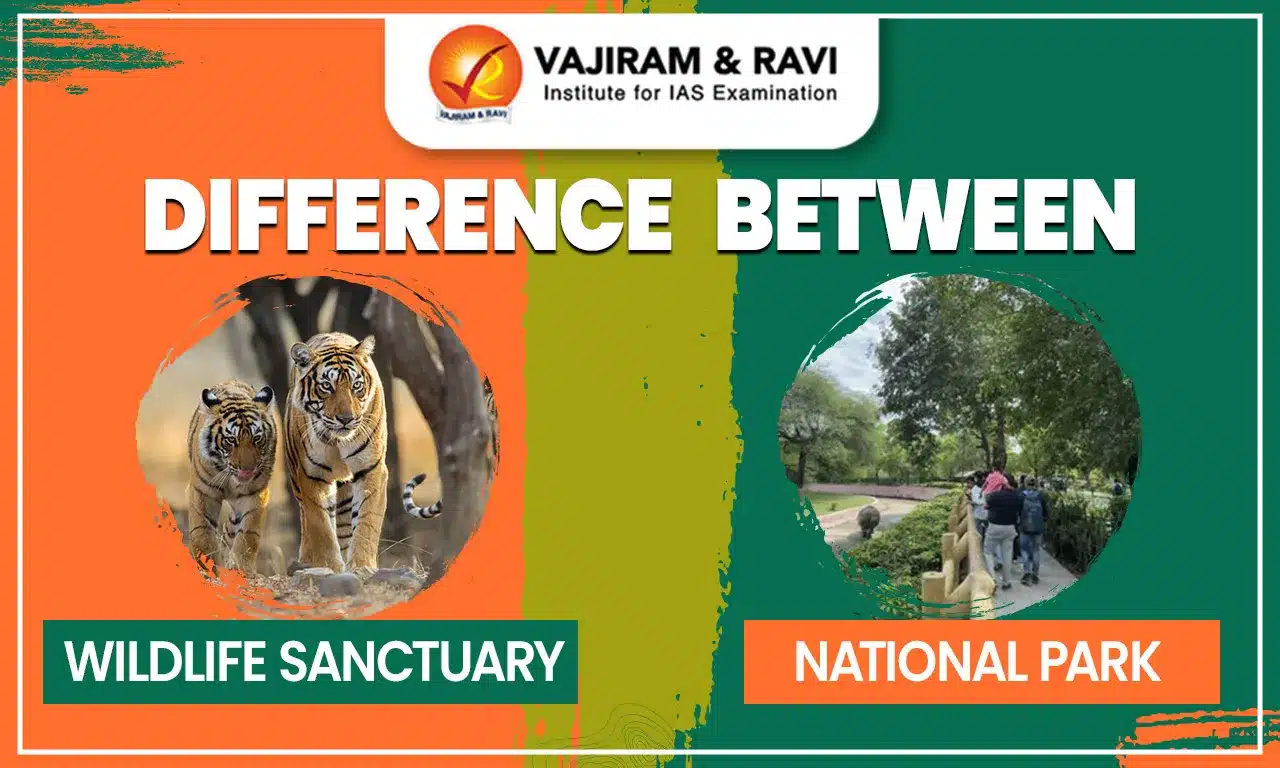
Difference Between Wildlife Sanctuary and National Park

Difference Between Wildlife Sanctuary and National Park (1)

Wildlife Sanctuary and National Park are major components of India’s protected area network. Both aim to conserve flora, fauna, and natural habitats, but they differ in their level of protection, permissible human activities, and management objectives. While Wildlife Sanctuary allows some degree of human interaction, National Parks offer stricter regulations to preserve ecosystems in their clean form. This article delves into the major Difference Between Wildlife Sanctuary and National Park.

Difference Between Wildlife Sanctuary and National Park

A Wildlife Sanctuary is primarily focused on conserving particular species of animals and birds in their natural habitat with minimal human interference. In contrast, a National Park has broader objectives, protecting entire ecosystems, offering recreational opportunities, and preserving landscapes. National Parks enforce stricter rules and usually cover a larger area than Wildlife Sanctuaries, making them more ecologically comprehensive. Wildlife Sanctuaries and National Parks are both crucial for protecting the natural heritage of a country. While both aim to conserve biodiversity and provide safe habitats for flora and fauna, they differ in purpose, management, and the level of human interference allowed.

Wildlife Sanctuary vs National Park

Both Wildlife Sanctuaries and National Parks serve crucial yet distinct roles. Wildlife Sanctuaries are primarily established to protect specific species, with controlled human activity to minimize disturbance to their natural habitat. On the other hand, National Parks aim for a more holistic approach, conserving entire ecosystems, promoting ecological research, protecting natural landscapes, and allowing regulated tourism. The complete Difference Between Wildlife Sanctuary and National Park is presented below:

Difference Between Wildlife Sanctuary and National Park
Aspect Wildlife Sanctuary National Park

Main Purpose

Protection of specific species and their natural habitats

Broader conservation of entire ecosystems and landscapes

Human Activities

Limited and regulated to avoid disturbance

Heavily restricted; some eco-tourism allowed under strict rules

Ownership/Control

Often government-owned or supported by research institutions

Completely under government protection and control

Size & Coverage

Varies in size; often smaller and species-specific

Usually larger, covering a variety of terrain and biodiversity

Legal Status

Less stringent protection under the Wildlife Protection Act

Stricter legal protection and management policies

Also Read: Elephant Reserves in India

What is a Wildlife Sanctuary?

A Wildlife Sanctuary in India is a protected area designated to provide a safe haven for wild animals, birds, and other organisms in their natural habitats. These sanctuaries aim to prevent illegal activities like poaching, hunting, and trafficking. Although they are government-regulated, some are privately maintained by research institutions and environmental organizations.

Key Features and Importance:

  • Wildlife sanctuaries play a vital role in protecting endangered species, allowing them to breed and thrive without human threats.
  • These areas offer undisturbed landscapes for wild species to flourish naturally, free from urban or industrial encroachment.
  • By restricting human interference, sanctuaries help maintain ecological balance and preserve the diversity of life.
  • These zones are important for ecological research and studies related to flora, fauna, and environmental patterns.
  • Wildlife Sanctuaries encourage regulated ecotourism, providing educational opportunities for visitors while promoting wildlife conservation awareness.
  • As of now, India has over 543 wildlife sanctuaries covering approximately 118,918 square kilometers.

Also Read: Elephant Corridors in India

What is a National Park?

A National Park in India is a government-notified area dedicated to the conservation of biodiversity, ecosystems, and historical heritage. Unlike sanctuaries, national parks offer stricter protection, no human activity, such as grazing or logging, is allowed within their boundaries. The focus is on preserving entire ecosystems and promoting scientific research. Key Features and Importance:

  • National Parks conserve a wide variety of plant and animal species, helping prevent extinction.
  • These areas are critical for the survival and recovery of species at risk of extinction.
  • National Parks protect complete ecosystems, ensuring minimal human-induced damage to natural habitats.
  • They act as centers for environmental education and also preserve historical and cultural artifacts.
  • National Parks attract tourists from around the world, supporting local economies through sustainable ecotourism.

Also Read: Tiger Reserves in India

Wildlife Sanctuary and National Park Facts

  • Hemis National Park in Ladakh is Largest National Park in India home to the elusive Snow Leopard.
  • Northeast Greenland National Park is the world's largest, spanning 972,000 sq. km.
  • Some sanctuaries serve as gene pools, preserving genetic diversity.
  • Sanctuaries allow activities like regulated tourism; parks are more restrictive.
  • India's first national park was Jim Corbett National Park, established in 1936 in Uttarakhand.
Also Check
Kaziranga National Park Dudhwa National Park
Nagarhole National Park Tadoba Andhari National Park
Kanha National Park Manas National Park
Bandipur National Park Sundarbans National Park
Pench National Park Bandhavgarh National Park


Difference Between Wildlife Sanctuary and National Park FAQs

Q1: What is the main difference between a wildlife sanctuary and a national park?

Ans: National Parks aim to preserve entire ecosystems and prohibit all human activities, while Wildlife Sanctuaries allow limited activities and focus on specific species.

Q2: Can humans live in or use resources from wildlife sanctuaries?

Ans: Yes, in some cases, regulated activities like grazing or collection of forest products may be permitted.

Q3: Are both governed under the same law?

Ans: Yes, both are governed under the Wildlife Protection Act, 1972, but national parks are more stringently protected.

Q4: Which is more extensive in area, sanctuaries or parks?

Ans: Generally, national parks cover a larger area than wildlife sanctuaries.

Q5: How many national parks are there in India as of 2025?

Ans: India has over 107 national parks, with many new areas being notified as protected zones every year.

Battle of Samugarh, Causes, Outcome, and Historical Significance

Battle of Samugarh

The Battle of Samugarh was an important event in Indian history that took place during the Mughal period. It was fought between the sons of Emperor Shah Jahan, who were competing for power and the throne. This battle was part of a larger struggle for succession within the royal family. It played a major role in deciding who would become the next ruler of the Mughal Empire and had a lasting impact on its future. The conflict shows how internal rivalry and ambition could shape the course of history. 

When and Where Was the Battle of Samugarh Fought?

  • The Battle of Samugarh was one of the most decisive battles of the Mughal War of Succession, fought after Emperor Shah Jahan fell seriously ill in 1657.
  • It took place on 29 May 1658 near Agra, at a place called Samugarh, between Dara Shikoh and Aurangzeb.
  • The battle ended in a decisive victory for Aurangzeb, which paved the way for his accession to the Mughal throne.

What Were the Causes of the Battle of Samugarh? 

  • The Mughal Empire did not follow primogeniture (fixed rule of succession), which meant all sons could claim the throne, leading to intense rivalry.
  • After Shah Jahan’s illness, rumours of his death created urgency among his four sons  - Dara Shikoh, Shuja, Murad Baksh, and Aurangzeb, to capture power.
  • Dara Shikoh, being the eldest son and his father’s favourite, was already handling administration at Agra and was seen as the natural successor.
  • Dara was known for his liberal outlook, interest in Sufism, and promotion of Hindu-Muslim intellectual exchange, which gained him both support and opposition.
  • Aurangzeb, in contrast, believed in military discipline, political authority, and religious orthodoxy, and viewed Dara as unfit to rule a vast empire.
  • Aurangzeb formed an alliance with Murad Baksh and advanced from the Deccan, while Shuja declared himself emperor in Bengal but was defeated earlier.
  • The final and most decisive struggle for power took place at Samugarh between Dara Shikoh and Aurangzeb.

Battle of Samugarh Was Fought Between? 

  • Dara Shikoh commanded a large imperial army, supported by Mughal nobles, strong artillery, and Rajput allies, especially Raja Jaswant Singh of Jodhpur.
  • His army relied more on loyalty and numbers rather than strict military discipline and battlefield experience.
  • Aurangzeb and Murad Baksh led a combined force of battle-hardened Deccan troops, known for their experience and discipline.
  • Aurangzeb’s army was well-organised, strategically positioned, and guided by careful planning and leadership.
  • Both sides had armies of over 50,000 soldiers, including cavalry, infantry, and artillery units.

What Happened in the Battle of Samugarh? 

  • The armies met at Samugarh, about 10 km from Agra, after several days of skirmishes and positioning.
  • Dara Shikoh placed his artillery at the centre, with himself on an elephant, and Rajput forces on the flanks.
  • Aurangzeb positioned himself at the centre, Murad Baksh on the right, and Mir Jumla on the left wing.
  • In the early phase, Dara’s artillery gave him an advantage and pushed Aurangzeb’s troops slightly backward.
  • However, Dara made a major tactical mistake by leaving his defensive position and advancing into open combat.
  • His movement created confusion among his troops, who mistakenly thought he was retreating from the battlefield.
  • Aurangzeb quickly used this opportunity and launched a decisive cavalry charge, turning the situation in his favour.
  • Murad’s forces attacked aggressively, while the Rajput contingents were outflanked and weakened.
  • Dara’s army soon lost coordination, many nobles deserted, and soldiers began to flee the battlefield.
  • Realising defeat, Dara Shikoh escaped toward Delhi, and the battle ended in a complete victory for Aurangzeb.

Battle of Samugarh Was Won by Whom?

  • The defeat completely destroyed Dara Shikoh’s chances of becoming emperor, and he fled north but was later captured and executed in 1659.
  • Aurangzeb entered Agra and placed Shah Jahan under house arrest in Agra Fort, effectively taking control of the empire.
  • In July 1658, Aurangzeb crowned himself as emperor with the title “Alamgir”.
  • He later defeated Shuja and executed Murad Baksh, thereby ending the War of Succession.
  • The victory at Samugarh firmly established Aurangzeb as the supreme ruler of the Mughal Empire.

Why Did Aurangzeb Win the Battle of Samugarh?

  • Superior military strategy and planning allowed Aurangzeb to control the battlefield effectively.
  • Dara Shikoh’s tactical errors, especially leaving a secure position, led to confusion and defeat.
  • Aurangzeb’s army was more disciplined, experienced, and battle-ready, unlike Dara’s relatively less organised forces.
  • Aurangzeb gained support from orthodox and conservative sections, strengthening his political legitimacy.

What Was the Significance of the Battle of Samugarh?

  • The battle represented not just a political struggle but a clash of ideologies within the Mughal Empire.
  • Dara Shikoh symbolised tolerance, pluralism, and cultural synthesis, while Aurangzeb represented orthodoxy and centralised authority.
  • Aurangzeb’s victory marked a shift towards religious conservatism and stronger imperial control.
  • His reign (1658-1707) became one of the longest in Mughal history, marked by territorial expansion.
  • However, his policies also led to administrative rigidity and social tensions, which later contributed to the decline of the Mughal Empire.

Battle of Samugarh FAQs

Q1: When was the Battle of Samugarh fought?

Ans: The Battle of Samugarh was fought on 29 May 1658 during the Mughal War of Succession after Emperor Shah Jahan fell ill.

Q2: Where did the Battle of Samugarh take place?

Ans: It took place near Agra, at a place called Samugarh, located about 10 km from the city.

Q3: Who fought in the Battle of Samugarh?

Ans: The battle was fought between Dara Shikoh and Aurangzeb, the sons of Emperor Shah Jahan.

Q4: Who won the Battle of Samugarh?

Ans: Aurangzeb won the battle decisively, which helped him secure the Mughal throne.

Q5: Why was the Battle of Samugarh fought?

Ans: It was fought due to a succession dispute, as there was no fixed rule like primogeniture in the Mughal Empire.

Public Distribution System (PDS), Objective, Evolution, Issues, Reforms

Public Distribution System

Public Distribution System (PDS) in India has evolved into a nationwide, rights-based food security network ensuring affordable access to essential food grains for vulnerable households. As of 2025, it caters to around 80.56 crore bevneficiaries under the National Food Security Act, making it one of the largest food distribution systems in the world. Over the years, PDS has expanded from a welfare-based setup to a more targeted and technology-driven system. It performs key functions such as procurement, storage, transportation, and subsidised distribution through a network of fair price shops. 

Public Distribution System (PDS) Objectives

The Public Distribution System (PDS) aims to ensure food security by providing essential commodities like rice, wheat, and coarse grains to vulnerable households at subsidised rates. It seeks to stabilise food prices, reduce hunger, and support the nutritional needs of economically weaker sections across the country.

  • Ensure Food Security: Provide essential food grains at subsidised prices to protect vulnerable households from hunger and malnutrition.
  • Price Stabilisation: Regulate market prices of essential commodities and shield poor families from inflation and volatility.
  • Nutritional Support: Supply adequate and nutritious food, especially to children, pregnant women, and economically weaker sections.
  • Buffer Stock Management: Maintain national food reserves to ensure the continuous availability of food grains during emergencies, droughts, and production shortfalls.
  • Equitable Distribution: Transfer food grains from surplus states to deficit regions to promote balanced access across the country.
  • Support to Farmers: Procure food grains at Minimum Support Prices (MSP) to provide remunerative prices and encourage stable agricultural production.

Public Distribution System (PDS) Evolution

Public Distribution System (PDS) Evolution has transitioned from a wartime rationing mechanism during the 1940s to a nationwide welfare-oriented food security system. Over time, it has undergone major reforms, shifting from a universal model to a targeted and digitalised system aimed at improving efficiency and transparency.

Origins of PDS (World War II Phase)

  • PDS began during World War II as a wartime rationing system to manage food scarcity.
  • Before the 1960s, the system depended heavily on imported food grains to meet distribution needs.

Expansion During Food Shortages (1960s)

  • PDS expanded significantly in the 1960s due to severe food shortages and rising population
  • needs.
  • The government established the Agriculture Prices Commission (now CACP) to ensure fair price policies for farmers.
  • The Food Corporation of India (FCI) was created to strengthen procurement, storage, and movement of food grains for PDS.

Universal PDS Phase (1970s-1992)

  • By the 1970s, PDS evolved into a universal system, offering subsidised food to all households, irrespective of income.
  • Until 1992, PDS remained a general entitlement scheme with no targeting of beneficiaries.

Revamped Public Distribution System - RPDS (1992)

  • Launched in June 1992 to improve reach in remote, hilly, tribal, and inaccessible regions.
  • Aimed to strengthen infrastructure, reduce shortages, and ensure regular supply in disadvantaged areas.
  • Focused on addressing the needs of underprivileged populations in difficult terrains.

Targeted Public Distribution System - TPDS (1997)

  • Introduced in June 1997 to direct subsidies towards the poor instead of universal coverage.
  • Beneficiaries classified into Below Poverty Line (BPL) and Above Poverty Line (APL) households.
  • Marked the shift from a universal to a targeted welfare approach to reduce fiscal burden and improve efficiency.

Antyodaya Anna Yojana - AAY (2000)

  • Launched in December 2000 for the poorest among BPL families, identified through NSS data showing 5% of people sleeping hungry.
  • One crore of the poorest households were initially targeted, later expanded in phases.
  • AAY provided highly subsidised grains: 35 kg per family per month, at very low issue prices.

National Food Security Act - NFSA (2013)

  • Enacted in September 2013, making food security a legal right for eligible households.
  • Built on the TPDS framework to provide subsidised food grains to 67% of the population.
  • Introduced legally enforceable entitlements and grievance redressal mechanisms.
  • Transformed access to food from a welfare provision into a justiciable right under law.

Overall Transformation of PDS

  • Evolved from colonial rationing → universal welfare scheme → targeted system → legal right under NFSA.
  • Gradual reforms aimed at improving coverage, efficiency, targeting, and food security outcomes, particularly for the most vulnerable.

Public Distribution System (PDS) Functions

The Public Distribution System (PDS) functions as India’s largest food security network, ensuring the procurement, storage, and distribution of essential food grains at subsidised rates to vulnerable households. The detailed functions of PDS have been listed below.

  • MSP Procurement: Procures food grains from farmers at Minimum Support Price to ensure stable and assured income for agricultural producers.
  • Buffer Stock Maintenance: Maintains national-level buffer stocks to manage emergencies like droughts, floods, and supply disruptions.
  • Storage Management: Stores food grains in FCI warehouses and state depots to ensure continuous, year-round availability.
  • Transportation & Movement: Transports grains from procurement states to deficit regions, reducing regional imbalance in food availability.
  • Subsidised Distribution: Provides essential commodities such as rice and wheat at subsidised rates through Fair Price Shops to eligible households.
  • Price Stabilisation: Helps control inflation by reducing pressure on open-market demand
  • through distribution of subsidised grains.
  • Food Security Assurance: Ensures food access for vulnerable groups under BPL, APL, AAY, and NFSA by providing legal food entitlements.
  • Support to Welfare Schemes: Supplies food grains to schemes like Mid-Day Meal, ICDS, and PM-POSHAN for children, lactating mothers, and poor families.
  • Hunger & Malnutrition Reduction: Ensures affordable access to cereals, reducing hunger, food deprivation, and undernutrition among poor households.
  • Social Equity Promotion: Provides equal access to subsidised grains, supporting weaker and marginalised communities across regions.
  • Crisis & Disaster Support: Acts as a safety net during natural disasters, pandemics, and economic crises by ensuring uninterrupted food supply.
  • Quality Control: Ensures quality checks, inspection, and maintenance standards for food grains before distribution to beneficiaries.
  • Transparency & Grievance Redressal: Provides accountability through NFSA grievance mechanisms, vigilance committees, and social audits.

Public Distribution System (PDS) Issues

The Public Distribution System (PDS), despite being one of the largest food security networks in the world, faces several systemic challenges that reduce its effectiveness and create significant financial and administrative burdens. These issues weaken the intended impact of welfare schemes, reduce access for genuine beneficiaries, and inflate government expenditure.

  1. Leakages and Diversions
    • Around 28% leakage in PDS results in an estimated ₹69,108 crore annual loss, reflecting major inefficiencies.
    • Grains are often diverted during transportation or sold illegally in the open market.
    • Example: Nearly one-third of grains lifted from FCI fail to reach Fair Price Shops, reducing actual availability for poor households.
  1. Targeting Errors
    • TPDS suffers from both inclusion and exclusion errors, limiting its effectiveness.
    • Non-poor households often obtain ration cards, while deserving poor households are left out.
    • Example: Many migrant labourers and informal workers struggle to get ration cards, whereas some urban middle-income families access subsidised food grains.
  1. Supply Chain Inefficiencies
    • Problems in storage, transportation, and inter-agency coordination cause delays and wastage.
    • Inadequate warehouse capacity leads to spoilage of food grains.
    • Example: Remote and hilly regions frequently receive delayed deliveries, creating periodic shortages at ration shops.
  1. Monocropping and Reduced Crop Diversity
    • MSP-driven procurement focuses heavily on rice and wheat, discouraging crop diversification.
    • Long-term nutritional outcomes and soil health are affected.
    • Example: Punjab and Haryana shifted to water-intensive rice cultivation, reducing production of millets and coarse grains.
  1. Rising Subsidy Burden
    • Food subsidy increased from ₹21,200 crore in 2002-03 to nearly ₹2 lakh crore in 2024-25.
    • High subsidy levels stress the Union Budget and burden FCI finances.
    • Example: Subsidy dues to FCI often accumulate due to the large fiscal requirement for maintaining PDS operations.
  1. Urban Bias
    • PDS works more efficiently in urban areas due to better infrastructure and monitoring.
    • Rural, tribal, and remote regions face irregular supply and weaker administrative oversight.
    • Example: Urban ration shops in Delhi or Mumbai receive regular stock, while tribal districts in Odisha and Jharkhand face stock-outs due to transport bottlenecks.

Public Distribution System (PDS) Reforms

  • Aadhaar Seeding of Beneficiaries: Ensures proper identification, removes duplicate/ghost ration cards, and reduces inclusion–exclusion errors in TPDS.
  • Digitisation of Ration Cards: Allows online verification of beneficiary data, tracking of monthly quotas, and real-time monitoring of entitlements.
  • End-to-End Computerisation of Supply Chain: Tracks food grains digitally from FCI procurement centres to state depots and finally to FPS, reducing diversion and leakage.
  • GPS Tracking of Food Grain Transport Vehicles: Monitors truck movement to prevent route diversion, delay, or pilferage during transportation.
  • Automation with e-PoS Machines: FPS shops use biometric Point of Sale devices to authenticate beneficiaries and record transactions, improving transparency.
  • Smart Ration Cards: Introduced as secure electronic cards storing beneficiary details and biometrics, preventing counterfeiting and fake entries.
  • SMS-Based Monitoring System: Beneficiaries receive SMS alerts when grain is dispatched or arrives at FPS, promoting public oversight and reducing corruption.
  • Online Grievance Redressal Mechanisms: State portals and toll-free helplines allow beneficiaries to lodge complaints and track resolutions, improving accountability.
  • Strengthening Transparency through Social Audits: Local communities, SHGs, and NGOs participate in monitoring FPS functioning and reporting irregularities.
  • Expansion of Food Basket: Some states distribute pulses, edible oils, iodised salt, and fortified foods through PDS to enhance nutritional security.
  • Universal PDS Models in Select States: States like Tamil Nadu and Kerala provide subsidised food grains to all households to minimise targeting errors.
  • Direct Benefit Transfer (DBT) Pilots: Cash transfer of the food subsidy directly to beneficiary bank accounts, reducing storage and transport-related leakages (implemented cautiously).

Public Distribution System (PDS) Way Forward

The Public Distribution System can be strengthened by enhancing transparency, reducing leakages, and ensuring better targeting through technology-driven reforms. Improving storage, transport, and procurement mechanisms will make food distribution more efficient and sustainable.

  • End-to-End Digitalisation: Complete computerisation, GPS tracking, and e-POS-based beneficiary authentication to minimise leakages.
  • Diversified Food Basket: Include millets, pulses, and fortified foods in PDS to improve nutrition and reduce dependence on rice and wheat.
  • Strengthening Storage & Logistics: Modernise warehouses, expand scientific silos, and improve last-mile delivery in remote regions.
  • Better Targeting & Inclusion: Regularly update beneficiary lists, integrate Aadhaar effectively, and ensure migrant portability through ONORC.

Public Distribution System (PDS) FAQs

Q1: What is the Public Distribution System (PDS)?

Ans: PDS is a government-run food security network that provides essential food grains like rice and wheat to eligible households at subsidised prices through Fair Price Shops (FPS).

Q2: Which ministry administers the PDS?

Ans: PDS is administered by the Ministry of Consumer Affairs, Food and Public Distribution.

Q3: What commodities are distributed under PDS?

Ans: Wheat, rice, sugar, and kerosene are the primary items. Some states also distribute pulses, edible oils, iodised salt, and fortified foods.

Q4: What is Targeted Public Distribution System (TPDS)?

Ans: Launched in 1997, TPDS divides beneficiaries into BPL and APL categories to ensure subsidies reach the poorest households more effectively.

Q5: What is Antyodaya Anna Yojana (AAY)?

Ans: AAY targets the poorest among BPL families. Each eligible household receives highly subsidised food grains (35 kg per month).

Bison National Park, Location, History, Geography, Biodiversity

Bison National Park

Bison National Park is a beautiful and peaceful wildlife area located in the state of Tripura, India. It is known for its rich natural greenery and diverse animal life. Surrounded by forests, hills, and grasslands, the park provides a safe habitat for many species, especially the Indian bison (gaur), from which it gets its name. The park also plays an important role in wildlife conservation and maintaining ecological balance.

Bison National Park is Located in Which State?

  • Bison National Park, also known as Rajbari National Park, is an important wildlife reserve located in the South Tripura district of India, and it lies within the larger Trishna Wildlife Sanctuary, which is well known for conserving biodiversity.
  • The park is especially recognized for protecting the Indian Gaur (Bison), a large and powerful wild animal that is considered vulnerable, and this makes the park ecologically significant.
  • Surrounded by dense forests, grasslands, and water sources, the park offers a peaceful natural environment.

Bison National Park History & Area

  • The Trishna Wildlife Sanctuary was established in 1988 with the main objective of restoring and protecting the natural habitat of the Indian Bison (Gaur), which was facing threats due to habitat loss.
  • Later, in 2007, a part of this sanctuary was declared as Bison National Park to provide stronger protection and focused conservation efforts for the gaur and other wildlife species.
  • Rajbari National Park covers an area of around 31.63 square kilometres, making it a relatively small but ecologically rich protected area.
  • It is part of the larger Trishna Wildlife Sanctuary, which spreads across approximately 163 square kilometres, creating a wider habitat for wildlife movement and survival.

Bison National Park River System

  • The Gumti River flows through the park and acts as a major source of water for animals and plants, supporting the overall ecosystem.
  • This river also plays a geographical role by separating the Sipahijola Wildlife Sanctuary from the Trishna Wildlife Sanctuary, thus marking natural boundaries.
  • Along with the river, smaller streams and water channels help maintain moist conditions and biodiversity, especially during dry periods.

Bison National Park Vegetation (Flora)

  • The park supports a wide variety of vegetation types, which contribute to its rich biodiversity and provide food and shelter to wildlife.
  • It includes tropical semi-evergreen forests, where both evergreen and deciduous trees grow together, along with moist deciduous forests that shed leaves seasonally.
  • Savannah-type grasslands are also present, which are particularly suitable for grazing animals like bison, along with patches of Eastern Himalayan vegetation.
  • The region has a large presence of bamboo forests, which serve as an important food source for herbivores and play a key role in maintaining the habitat.
  • Additionally, the park is home to several medicinal plants such as tulsi, kalmegh, and rudraksh, which are valued for their traditional uses.

Bison National Park Wildlife (Fauna)

  • The park is most famous for the Indian Gaur (Bison), which is one of the largest species of wild cattle and is the main focus of conservation in the area.
  • Other mammals found in the park include leopards, civets, wild boars, porcupines, flying squirrels, gibbons, and different species of langurs, showing the park’s rich faunal diversity.
  • The park also supports a wide variety of bird species such as hornbills, pheasants, kingfishers, drongos, and tailorbirds, making it an attractive place for bird watchers.
  • Reptiles like the Indian python, king cobra, and monitor lizard are also found here, contributing to the ecological balance of the region.

Significance of Indian Gaur

  • The Indian Gaur is a large and strong animal with a muscular body and dark-colored coat, commonly found in forested and hilly regions.
  • It is a herbivorous animal that feeds on grasses, leaves, and shrubs, and usually lives in groups or herds led by a dominant male.
  • Due to threats like habitat destruction and hunting, its population has declined, which is why protected areas like Rajbari National Park are crucial for its survival.

Bison National Park Importance

  • The park plays a vital role in the conservation of the Indian Gaur as well as other wildlife species, helping protect biodiversity in the region.
  • It contributes to maintaining ecological balance by supporting forests, water systems, and wildlife habitats.
  • With its scenic beauty and diverse wildlife, the park also promotes eco-tourism, environmental awareness, and sustainable conservation practices.

Bison National Park FAQs

Q1: Where is Bison National Park located?

Ans: Bison National Park is located in the South Tripura district of Tripura, India, within the Trishna Wildlife Sanctuary.

Q2: What is another name for Bison National Park?

Ans: Bison National Park is also known as Rajbari National Park.

Q3: Why is Bison National Park important?

Ans: It is important for conserving the Indian Gaur (Bison) and maintaining ecological balance in the region.

Q4: What is the total area of Bison National Park?

Ans: The park covers an area of approximately 31.63 square kilometres.

Q5: Which river flows through Bison National Park?

Ans: The Gumti River flows through the park and serves as a major water source for wildlife.

Irrigation Systems, Types, Government Initiatives, Indian Context

Irrigation Systems

Irrigation is the artificial and controlled application of water to agricultural fields to support crop growth when rainfall is insufficient or irregular. Irrigation Systems include various methods and structures used to deliver water efficiently to crops. Since ancient times, irrigation has played a vital role in increasing agricultural productivity, reducing drought risks, and ensuring stable food production across regions.

Irrigation Systems Types

Irrigation Systems include multiple methods designed to deliver water efficiently to crops depending on soil, climate, and crop requirements.

  • Surface Irrigation: Water is spread over fields by gravity through flooding, basin, border, or furrow methods. It is simple and widely used but causes high water loss through evaporation and runoff, reducing overall efficiency in large agricultural fields.
  • Sprinkler Irrigation: Water is sprayed into the air through nozzles, resembling rainfall. It is suitable for uneven lands and shallow soils, and supports crops like vegetables, tea, and coffee, but requires high energy and infrastructure investment.
  • Drip Irrigation: Water is delivered directly to plant roots using emitters at a low rate of 2-20 liters per hour. It minimizes water loss, reduces weed growth, and increases efficiency, especially in orchards, vegetables, and plantation crops.
  • Sub surface Irrigation: Water is supplied below the soil surface through pipes or porous tubes, allowing roots to absorb moisture directly. It reduces evaporation losses and helps prevent waterlogging and salinity in high water table regions.
  • Center Pivot Irrigation: A rotating sprinkler system distributes water in circular patterns over large fields. It is efficient for crops like wheat and corn but requires high capital investment and continuous energy supply.
  • Well and Tube Well Irrigation: Groundwater is extracted through shallow or deep wells. Tube wells can irrigate up to 400 hectares and are widely used in states like Uttar Pradesh, Punjab, and Haryana due to reliable year round supply.
  • Canal Irrigation: Water is transported from rivers through canals. Perennial canals provide continuous irrigation using barrages, while inundation canals operate during floods. This system is prominent in northern plains with fertile soils.
  • Tank Irrigation: Water is stored in tanks formed by constructing bunds across streams. It is common in Karnataka, Maharashtra, and Rajasthan, but tanks often dry during dry seasons, limiting their reliability.

Irrigation Systems Features

The major features of the Irrigation System has been highlighted below:

  • Need: Irrigation is required due to uneven and uncertain rainfall distribution, seasonal monsoon concentration (75% rainfall in 3-4 months), limited rainfall coverage (only 30% adequate), and torrential nature of rains causing runoff, making water supply essential for crop survival and growth.
  • Purpose: The main purpose of irrigation is to provide controlled and timely water supply to crops, maintain optimum soil moisture, support use of HYV seeds and fertilizers, and enable multiple cropping cycles across different seasons.
  • Significance: Irrigation ensures higher agricultural productivity, stable crop production, improved food security, and increased farmer income by enabling cultivation of water intensive crops and protecting crops from droughts and rainfall variability.
  • Factors Influencing Irrigation: Key factors include soil type (water retention capacity), crop water requirements, rainfall variability, groundwater availability, and regional climatic conditions which determine the type and efficiency of irrigation systems used.
  • Economic Importance: Irrigation supports rural employment, increases agricultural output, strengthens agro-based industries, and contributes significantly to overall economic growth by stabilizing farm income and reducing risks.
  • Environmental Role: Proper irrigation helps in maintaining soil moisture balance, prevents desertification, supports vegetation growth, and improves climate resilience, but requires careful management to avoid waterlogging and salinity.
  • Agricultural Transformation: Irrigation has enabled the Green Revolution by supporting high yielding varieties and intensive farming, reducing monoculture practices, and promoting diversification into high value crops and commercial agriculture.

Irrigation Systems in India

Irrigation Systems in India are extensive and diverse, playing a central role in agriculture with large scale infrastructure and varied water sources.

  • India has around 68 million hectares of gross irrigated area as of 2025, making it one of the largest irrigated regions globally.
  • About 48% of India’s net sown area is irrigated, while the remaining 52% still depends on rainfall, highlighting partial irrigation coverage.
  • Groundwater contributes nearly 63% of irrigation, making India the largest user globally, but raising sustainability concerns due to excessive extraction.
  • Canals account for about 24% of irrigation, mainly concentrated in northern plains due to favorable terrain and perennial rivers.
  • Crops like wheat and sugarcane have more than 90% irrigation coverage, while pulses and oilseeds remain largely rainfed, affecting productivity differences.
  • Northern and western regions have better irrigation facilities, whereas eastern and northeastern regions remain dependent on rainfall.
  • Over 50 lakh tube wells operate across India, significantly contributing to irrigation, especially in states like Uttar Pradesh and Punjab.
  • Tank irrigation is significant in peninsular regions like Karnataka and Tamil Nadu, where natural depressions and streams support water storage systems.

Irrigation Systems Challenges

Irrigation Systems face multiple structural, environmental, and socio-economic challenges affecting sustainability and efficiency.

  • Groundwater Overexploitation: Excessive use of groundwater, accounting for 63% irrigation, has led to declining water tables in Punjab, Haryana, Rajasthan, and Uttar Pradesh, threatening long term water availability.
  • Water Use Inefficiency: Surface irrigation methods result in significant water loss through seepage and evaporation, reducing water availability for crops, especially at canal tail ends.
  • Soil Degradation: Over irrigation causes waterlogging and salinity, which deteriorates soil fertility and reduces agricultural productivity over time.
  • Water Pollution: Runoff from irrigated fields carries fertilizers and pesticides into nearby water bodies, leading to ecological damage and contamination.
  • Biodiversity Impact: Alteration of natural water flow disrupts ecosystems, affecting wetlands and reducing biodiversity in irrigated regions.
  • Regional Inequality: Irrigation development is uneven, with better facilities in western and southern regions compared to eastern and northeastern areas.
  • Socio-economic Disparity: Farmers with irrigation access benefit more, while small and marginal farmers without irrigation face lower productivity and income instability.
  • Infrastructure Limitations: Poor maintenance of canals and traditional systems leads to inefficiencies, water losses, and unequal distribution across agricultural fields.

Way Forward

  • Promoting drip and sprinkler systems can significantly improve water efficiency and reduce wastage.
  • Monitoring and controlling groundwater extraction.
  • Upgrading canal infrastructure with lining and automation can reduce seepage losses and improve water distribution efficiency.
  • Expanding irrigation facilities in eastern and northeastern regions can reduce disparities and improve agricultural productivity.
  • Encouraging drought resistant crops and efficient irrigation scheduling helps farmers adapt to climate variability and water scarcity.
  • Promoting water storage structures like tanks and reservoirs.
  • Solar powered pumps reduce dependency on conventional energy and provide cost effective irrigation solutions.

Irrigation Systems Government Initiatives

The government has launched several schemes and projects to improve Irrigation Systems coverage, efficiency, and sustainability across India.

  • Pradhan Mantri Krishi Sinchai Yojana: Focuses on “Har Khet Ko Pani” and “Per Drop More Crop,” promoting micro irrigation and improving water use efficiency through integrated water management.
  • Micro Irrigation Fund: Established with ₹5,000 crore under NABARD to promote drip and sprinkler irrigation and support states in expanding micro irrigation coverage.
  • Atal Bhujal Yojana: Focuses on sustainable groundwater management in water stressed regions through community participation and demand side management.
  • PM KUSUM Scheme: Promotes solar powered irrigation pumps, enabling farmers to reduce energy costs and even sell surplus electricity to the grid.
  • Indira Gandhi Canal Project: A 600+ km canal in Rajasthan irrigating over 1.8 million hectares, transforming desert areas into productive agricultural land.
  • Narmada Valley Project: Provides irrigation to over 1.7 million hectares across Gujarat, Madhya Pradesh, and Maharashtra through dams and canals.
  • Sardar Sarovar Project: Irrigates more than 1.8 million hectares and supplies drinking water and hydroelectric power in Gujarat and surrounding regions.
  • Krishna Godavari Basin Project: Covers over 5 million hectares in Andhra Pradesh, supporting irrigation, drinking water, and power generation through a network of dams and canals.

Irrigation Systems FAQs

Q1: What is an Irrigation System?

Ans: An Irrigation System is a method of supplying water artificially to crops to support their growth when rainfall is insufficient or irregular.

Q2: Which is the most efficient Irrigation Method?

Ans: Drip irrigation is the most efficient method as it delivers water directly to plant roots, reducing wastage and improving water use efficiency.

Q3: What is the main source of Irrigation in India?

Ans: Groundwater is the main source, contributing about 63% of total irrigation, mainly through wells and tube wells.

Q4: Why is Irrigation important in India?

Ans: Irrigation is important due to uneven and seasonal rainfall, helping ensure stable crop production, food security, and higher agricultural productivity.

Q5: Name one major Irrigation scheme in India.

Ans: Pradhan Mantri Krishi Sinchai Yojana (PMKSY) is a major scheme aimed at expanding irrigation coverage and promoting efficient water use.

Major Military Exercises of India, List, Army, Navy, Air Force

Major Military Exercises of India

Major military exercises of India are joint training activities conducted by the Indian Armed Forces with other countries or within the country. These exercises help improve coordination, strengthen defence capabilities, and prepare forces for different security challenges. They also play an important role in building strategic partnerships and ensuring national security.

Major Military Exercises of India Need

  • Joint military exercises are important activities under defence cooperation that highlight the professionalism and preparedness of the Indian Army. They provide a platform for troops from different countries to train together and exchange knowledge about modern military practices.
  • These exercises are designed to be practical and cover a wide range of situations. They include operations such as counter-terrorism, humanitarian assistance and disaster relief (HADR), United Nations peacekeeping missions, and combat training in different terrains like high-altitude areas, deserts, urban regions, and jungles.
  • In recent times, the nature of these exercises has become more advanced. They now incorporate emerging aspects of warfare such as drone operations and grey zone conflicts, making the training more realistic and relevant to current security challenges.

Major Military Exercises conducted by Indian Army

Major military exercises conducted by the Indian Army are an important part of India’s defence cooperation with other countries. These exercises help in improving coordination, operational skills, and mutual understanding between participating forces. The Major Military Exercises conducted by the Indian Army are discussed below.

Major Military Exercises conducted by Indian Army

Country

Joint Exercise

Australia

Exercise AUSTRA HIND

Bangladesh

Exercise SAMPRITI

China

Exercise HAND IN HAND

France

Exercise SHAKTI

Indonesia

Exercise GARUDA SHAKTI

Kazakhstan

Exercise PRABAL DOSTYK

Kyrgyzstan

Exercise KHANJAR

Maldives

Exercise EKUVERIN

Mongolia

Exercise NOMADIC ELEPHANT

Myanmar

IMBEX

Nepal

Exercise SURYA KIRAN

Oman

Exercise AL NAGAH

Russia

Exercise INDRA

Seychelles

Exercise LAMITIYE

Sri Lanka

Exercise MITRA SHAKTI

Thailand

Exercise MAITREE

UK

Exercise AJEYA WARRIOR

USA

Exercise YUDH ABHYAS

USA

Exercise VAJRA PRAHAR

Major Military Exercises conducted by Navy

Major military exercises conducted by the Indian Navy play a key role in strengthening maritime security and cooperation with other countries. The Major Military Exercises conducted by the Indian Navy are discussed below.

Major Military Exercises conducted by Navy

Exercise

Participating Countries

MALABAR

India, USA, Japan, Australia

VARUNA

India, France

LA PEROUSE

India, Australia, USA, France, Japan, UK

SEA DRAGON

India, USA, Japan, Canada, South Korea

KONKAN

India, UK

AIME & IMDEX

India, ASEAN Countries

BRIGHT STAR

India, 34 Countries

RIMPAC

India, USA (Multilateral)

SLINEX

India, Sri Lanka

SAMUDRA SHAKTI

India, Indonesia

AL-MOHED AL-HINDI

India, Saudi Arabia

INDIA–FRANCE–UAE Trilateral Exercise

India, France, UAE

KOMODO

India, Multiple (36 Countries)

AUSINDEX

India, Australia

SIMBEX

India, Singapore

IN-BN CORPAT

India, Bangladesh

IBSAMAR

India, Brazil & South Africa

IN-MN Table Top Ex

India, Malaysia

IMCOR, IN-MN BILAT

India, Myanmar

Naseem-al Bahr

India, Oman

INDRA NAVY

India, Russia

INDO-THAI CORPAT

India, Thailand

Major Military Exercises conducted by Air Force

Major military exercises conducted by the Indian Air Force are crucial for enhancing air combat capabilities and operational readiness. These exercises involve coordination with friendly foreign air forces and help in mastering advanced technologies and tactics. The Major Military Exercises conducted by the Indian Air Force are discussed below.

Major Military Exercises conducted by Air Force

Exercise Name

Description

Exercise Veer Guardian

India, Japan

Exercise PASSEX (France)

India, France

Exercise Desert Flag-8

First participation of Tejas in an international exercise (multilateral air exercise)

Exercise Cobra Warrior

Multinational air exercise

Exercise Cope India

Joint exercise with USAF; Japan as observer

Exercise Orion

Multinational air exercise

Exercise INIOCHOS

First air exercise between India and Greece

Exercise Bright Star

Joint exercise with Egypt

Humanitarian Assistance and Disaster Relief (HADR) & Search and Rescue (SAR) Operations

Humanitarian Assistance and Disaster Relief (HADR) and Search and Rescue (SAR) operations involve the Indian Armed Forces responding to disasters and emergencies. These operations focus on rescue, relief, and evacuation of affected people. They are discussed below in the table.

Humanitarian Assistance and Disaster Relief (HADR) & Search and Rescue (SAR) Operations

Operation Name

Year

Objective

Operation Seawave

2004

Tsunami relief and rescue in Andaman & Nicobar Islands

Operation Castor

2004

Humanitarian assistance to Maldives after tsunami

Operation Rainbow

2004

Relief and rescue support to Sri Lanka after tsunami

Operation Rahat

2013

Rescue and evacuation during Uttarakhand floods

Operation Surya Hope

2013

Army-led rescue and relief in Uttarakhand disaster

Operation Megh Rahat

2014

Rescue and relief during Jammu & Kashmir floods

Operation Maitri

2015

Earthquake relief and assistance to Nepal

Kerala Flood Relief Ops

2018

Rescue, evacuation, and relief during Kerala floods

Cyclone Fani Relief Ops

2019

Disaster response and evacuation along Odisha coast

Operation Samudra Setu

2020

Evacuation of Indian citizens during COVID-19

Mission SAGAR

2020-2022

Humanitarian aid and medical support to Indian Ocean countries

Cyclone Amphan Relief Ops

2020

Disaster preparedness and relief in eastern India

Operation Devi Shakti

2021

Evacuation from Afghanistan

Operation Ganga

2022

Evacuation of Indians from Ukraine conflict

Operation Dost

2023

Earthquake relief in Türkiye and Syria

Operation Kaveri

2023

Evacuation of Indians from Sudan

Operation HIMRAHAT

2023

Rescue during Sikkim Glacial Lake Outburst Flood

Tunnel Rescue (Silkyara)

2023

Rescue of trapped workers in Uttarakhand tunnel collapse

Cyclone Michaung Relief Ops

2023

Flood rescue and relief in Chennai

Operation Brahma

2025

Earthquake relief and humanitarian aid to Myanmar

Operation Sagar Bandhu

2025

Cyclone relief and assistance to Sri Lanka

Nationwide Flood Relief Ops

2024-2025

Rescue, medical aid, and relief across multiple Indian states

Integrated Exercises With Sister Services

Integrated exercises with sister services involve joint training conducted by the Army, Navy, and Air Force. These exercises aim to improve coordination, joint planning, and effective use of resources across services. They enhance overall combat readiness and promote integrated operations.

Integrated Exercises With Sister Services

Exercise Name

Description

Ex Kranti Mahotsav

Multi-Role Helicopter (MLH) operations

Ex Chakra Drishti

Use of fighter aircraft, RPA, and AEW&C systems

Western Command Theatre Exercise

Involves helicopters, transport aircraft, RPA, and fighter aircraft

Long-Range Maritime Strike

Operations using fighters, transport aircraft, and AWACS

MiG-29K Detachment at AFS Naliya

Joint detachment with Indian Navy’s MiG-29K fighter aircraft

Major Military Exercises Advantages

  • Better Coordination (Interoperability): Joint exercises help armed forces of different countries work smoothly together. Soldiers learn common procedures, communication methods, and teamwork, which is important during joint operations.
  • Sharing of Knowledge and Best Practices: These exercises provide a platform to exchange ideas, strategies, and modern techniques. Countries learn from each other’s strengths, which improves overall military efficiency and innovation.
  • Strengthening Diplomatic Relations: Military exercises act as a tool of defence diplomacy. They build trust, improve mutual understanding, and strengthen political and strategic partnerships between nations. Example: The Malabar Exercise enhances cooperation among like-minded countries.
  • Assessment of Military Capability: Exercises help identify strengths and weaknesses in planning, coordination, and technology. Based on these observations, countries can improve their defence systems and strategies.
  • Deterrence and Strategic Signalling: Conducting joint exercises sends a strong message of preparedness and unity to potential adversaries. It acts as a deterrent by showcasing military strength and readiness.
  • Preparedness for Humanitarian Assistance (HADR): Many exercises include disaster relief scenarios such as earthquakes, floods, and evacuations. This improves coordination between military forces and civilian agencies during real emergencies.
  • Adaptation to Modern Warfare: Exercises now include new dimensions like cyber warfare, drone operations, and grey zone conflicts. This helps forces stay updated with evolving security challenges.
  • Operational Readiness in Diverse Terrains: Training in deserts, mountains, jungles, and maritime environments improves the ability of forces to operate effectively in different geographical conditions.
  • Confidence Building Measures (CBMs): Regular interaction reduces misunderstandings and builds confidence among participating countries, especially in sensitive regions.
  • Support to Global Peace and Security: Through joint training for UN peacekeeping and crisis response, military exercises contribute to maintaining international peace and stability.

Major Military Exercises FAQs

Q1: What are Major Military Exercises of India?

Ans: They are training activities conducted by the Indian Armed Forces with other countries or domestically to improve combat skills and coordination.

Q2: Why are military exercises important for India?

Ans: They enhance defence preparedness, improve coordination, and help tackle various security and disaster-related challenges.

Q3: What types of military exercises does India conduct?

Ans: India conducts bilateral, multilateral, and tri-service exercises, along with disaster relief and peacekeeping training.

Q4: What are some major Army, Navy, and Air Force exercises of India?

Ans: Some of the major exercises include Yudh Abhyas (Army), Malabar (Navy), and Cope India (Air Force).

Q5: What is the role of military exercises in diplomacy?

Ans: They strengthen strategic partnerships, build trust among nations, and promote regional stability.

Largest Lakes in the World, Top 10 List, Location, Area

Largest Lakes in the World

Largest Lakes in the World: Lakes are the natural source of water and enhance the beauty of Earth’s landscapes. Found in mountains, valleys, and plains. From the vast Caspian Sea, which shares the boundaries with various countries, to iconic freshwater lakes like Superior, Victoria, and Baikal, each lake has unique geographical features. These bodies of water provide vital habitats for wildlife and contribute to local economies through fishing, tourism, and agriculture. Lakes not only add to the scenic beauty of the planet but are also essential for maintaining ecological balance, making them irreplaceable components of Earth's natural heritage. The article provides the list of Largest Lakes in the World by area and volume.

Largest Lakes in the World

The Caspian Sea is recognized as the top rank among the Largest Lakes in the World which is located between Europe and Asia and covers a vast area 389,000 square kilometres (150,000 square miles). The length of the Caspian Sea is approximately 1119 kilometres (745 miles) and reaches depths of up to 1,025 metres (3,365 feet). It has a volume of 78,200 cubic kilometres (18,800 cubic miles). This lake shares the boundaries with Eastern Europe, West Asia, and Central Asia, the Caspian Sea making an impression of lake as well as the sea.

List of Largest Lakes in the World Ranked

Lakes act as the reservoirs of freshwater used for various purposes such as irrigation, agriculture, for drinking purposes, industrial purposes and many more. Below in the table we have shared the List of Top 10 Largest Lakes in World in Order:

List of Largest Lakes in the World 2026
Rank Lake Name Lake Type Area (km²) Countries with Shoreline

1

Caspian Sea

Saline water

389,000

Kazakhstan, Turkmenistan, Azerbaijan, Russia, Iran

2

Superior Lake

Freshwater

82,100

Canada, United States

3

Victoria Lake

Freshwater

59,940

Tanzania, Uganda, Kenya

4

Huron Lake

Freshwater

59,590

Canada, United States

5

Michigan Lake

Freshwater

58,030

United States

6

Tanganyika Lake

Freshwater

32,900

Tanzania, Democratic Republic of the Congo, Burundi, Zambia

7

Baikal Lake

Freshwater

31,722

Russia

8

Great Bear Lake

Freshwater

31,153

Canada

9

Malawi Lake

Freshwater

29,600

Malawi, Mozambique, Tanzania

10

Great Slave Lake

Freshwater

27,200

Canada

Top 10 Largest Lakes in World

We have shared a brief description of the Largest Lakes in the World, including some important facts along:

1. Caspian Sea

The Caspian Sea, though referred to as a “sea,” is actually geologically more like a small ocean than a lake. Enclosed entirely by land, it holds the title of the Largest Lakes in the World by Area. Bordering five countries, it contains a huge volume of saltwater, surpassing that of all the freshwater lakes on Earth combined. This immense body of water is a key geographical feature in the surrounding region. Its length stretches to 1,199 km, with a maximum depth of 1,025 metres and a total volume of 78,200 km³.

2. Superior Lake

Lake Superior, the Largest Freshwater Lakes in the World by surface area, lies on the border between Canada and the United States and is a key part of the Great Lakes system. Renowned for its cold, crystal-clear waters and historical shipwrecks, it attracts both tourists and historians. The lake is surrounded by a stunning landscape that includes rugged coastlines, dense forests, and charming cities. Spanning a length of 616 kilometres, Lake Superior reaches a maximum depth of 406 metres and has a volume of 12,070 cubic kilometres.

3. Victoria Lake

Lake Victoria holds the title of Africa’s Largest Lake by area and ranks as the second Largest Freshwater Lakes in the World. Spanning the borders of multiple countries, it plays a crucial role in feeding the Nile River and is renowned for its rich biodiversity. With numerous islands scattered across its surface, Lake Victoria is not only a vital natural resource but also a breathtaking view of nature. It stretches 322 km in length, reaches a maximum depth of 81 metres, and has a volume of 2,420 km³.

4. Huron Lake

Lake Huron, one of the finest lakes in North America, shares the borders of both Canada and the United States. It forms part of the world’s largest freshwater lake system, sharing this distinction with Lake Michigan. Notable for its fast-flowing streams and the beautiful Georgian Bay, Lake Huron possesses unique natural features. The lake, named after the indigenous Huron tribe, carries a rich historical legacy while also serving as a vital source of freshwater. It stretches 332 kilometres in length, reaches a maximum depth of 229 metres, and holds a volume of 3,520 cubic kilometres.

5. Michigan Lake

Lake Michigan, one of the Great Lakes, stands out among its remarkable neighbours. It stretches along the border of the United States and shares water connections with Lake Huron, forming part of the world's largest freshwater lake system. Known for its stunning beaches and diverse ecosystems, Lake Michigan plays a vital role as a freshwater source for the surrounding region. The iconic Mackinac Bridge serves as a geographic landmark, separating Lake Michigan from Lake Huron, though not affecting their hydrological connection. With a length of 494 km, a maximum depth of 282 m, and a volume of 4,930 km³, Lake Michigan is both expansive and deep.

6. Tanganyika Lake

Lake Tanganyika is considered the second oldest freshwater lake in the world and ranks as the second deepest, following Lake Baikal. Spanning four countries: Tanzania, the Democratic Republic of the Congo, Burundi, and Zambia, it stretches an impressive 676 km in length. With a maximum depth of 1,470 metres, it holds a vast volume of 18,750 km³ of water. The Tanganyika Lake not only serves as a vital water source for the surrounding regions but is also home to a variety of unique fish species, making it a remarkable natural landmark.

7. Baikal Lake

Lake Baikal is the world's deepest freshwater lake, reaching a maximum depth of 1,642 metres. It is also the oldest freshwater lake, believed to be millions of years old. This vast lake holds a significant portion of the planet’s freshwater supply, with an estimated volume of 23,610 cubic kilometres. Baikal Lake, a UNESCO World Heritage Site, is renowned for its exceptional biodiversity, hosting numerous unique aquatic ecosystems that cannot be found anywhere else. With a length of 636 kilometres, it stands as one of the most remarkable natural landmarks on Earth.

8. Great Bear Lake

Great Bear Lake, located in the Northwest Territories of Canada, is a stunning natural wonder despite its cold and remote setting. As the fourth-largest freshwater lake in the world, it holds an impressive volume of water. The lake is surrounded by vast tundra and boreal forests, offering a glimpse into an ancient landscape. Fishing is a popular pastime in the area, which is an essential part of the local ecosystem. Great Bear Lake is truly a breathtaking and significant feature of Canada's natural beauty. It spans 373 kilometres in length, reaches a maximum depth of 446 metres, and holds a volume of 2,234 cubic kilometres of water.

9. Malawi Lake

Lake Malawi, often referred to as the “Lake of the Stars,” is located in East Africa, holding the border between Malawi and Mozambique. As the third-largest freshwater lake in Africa and the ninth-largest in the world, it is renowned for its exceptional biodiversity. The lake is particularly famous for its vibrant cichlid fish population, and holding a variety of aquatic ecosystems. The surrounding landscapes are equally breathtaking, featuring beautiful beaches, towering mountains, and national parks. The lake stretches 579 kilometres in length, reaches a maximum depth of 706 metres, and holds a volume of 8,640 km³ of water.

Also Read: National Parks in India

10. Great Slave Lake

Great Slave Lake, the second-largest freshwater lake in Canada after Great Bear Lake, is situated in the North-Western Region and is characterised by its harsh, subtropical climate with long, cold winters. This vast body of water serves as a crucial habitat for migratory birds and sustains local fishing communities, providing them with a vital source of livelihood. The lake also holds historical significance, with archaeological findings indicating the presence of indigenous settlements dating back thousands of years. During the winter months, the lake’s beauty is particularly breathtaking. Great Slave Lake stretches 480 km in length, has a maximum depth of 614 metres, and holds a volume of 1,115 km³.

Largest Freshwater Lake in the World

The Lake Superior is considered as the Largest Freshwater Lake in World by Area. It's surface area is estimated to be 82,103 km² spanning across United States and Canada. On the other hand, Lake Baikal is the Largest Freshwater Lake in the World by Volume. The estimated volume of the lake is 23,615 km³. It is located in Russia and constitutes over 20% of unfrozen surface freshwater on the Earth.

Largest Saltwater Lake in the World

Caspian Sea is the Largest Salt Water Lake in the World in terms of both Area and Volume. Its surface area spans about 371000 km² and its volume estimates about 782000 km³. It is located in the Eurasian region covering both Asia and Europe Continents. It is a massive saline inland lake.

What is the Difference Between a Lake and a Sea?

Difference Between a Lake and a Sea is essential in geography as both are large water bodies but vary significantly in terms of size, formation, and ecological impact. While lakes are generally enclosed freshwater bodies found inland, seas are large saltwater expanses connected to oceans. The table below highlights the key distinctions between a lake and a sea across various parameters.

Difference Between a Lake and a Sea
Feature Lake Sea

Location

Inland, surrounded by land

Partially enclosed by land, connected to an ocean

Water Type

Mostly freshwater (some saline)

Saltwater

Size

Generally smaller

Larger in area and depth

Connection

Not connected to oceans

Connected to oceans

Tides & Currents

No tides, minimal water movement

Affected by tides and ocean currents

Formation

Formed by glaciers, tectonic shifts, or dams

Formed by tectonic activity and part of ocean basins

Examples

Lake Victoria, Lake Superior, Dead Sea (salt lake)

Arabian Sea, South China Sea, Mediterranean Sea

Also Read
Glacial Retreat Mountain Ranges in the World
Continents and Oceans Lakes in India

Largest Lakes in the World FAQs

Q1: Which is the Largest Lakes in the World?

Ans: The Caspian Sea is the largest lake in the world which covers an area of 389,000 km².

Q2: Which lake holds the title of Largest Lakes in the World by volume?

Ans: Baikal Lake holds the title of largest lake by volume (23,610 km³) and it is also the world's deepest lake (1,642 m).

Q3: Why is the Caspian Sea is ranked among Largest Lakes in the World?

Ans: The Caspian Sea does not feed into an ocean, but it has the size and depth of a sea. This distinction is not merely semantic. However, it has economic, military, and political implications.

Q4: How many countries border the Caspian Sea?

Ans: The Caspian Sea is bordered by five countries: Russia to the northwest, Kazakhstan to the northeast, Turkmenistan to the southeast, Iran to the south, and Azerbaijan to the west.

Q5: What country has 7000 lakes?

Ans: Switzerland is the country holding more than 7000 lakes.

UPSC Daily Quiz 9 July 2026

UPSC Daily Quiz

[WpProQuiz 205]

UPSC Daily Quiz FAQs

Q1: What is the Daily UPSC Quiz?

Ans: The Daily UPSC Quiz is a set of practice questions based on current affairs, static subjects, and PYQs that help aspirants enhance retention and test conceptual clarity regularly.

Q2: How is the Daily Quiz useful for UPSC preparation?

Ans: Daily quizzes support learning, help in revision, improve time management, and boost accuracy for both UPSC Prelims and Mains through consistent practice.

Q3: Are the quiz questions based on the UPSC syllabus?

Ans: Yes, all questions are aligned with the UPSC Syllabus 2025, covering key areas like Polity, Economy, Environment, History, Geography, and Current Affairs.

Q4: Are solutions and explanations provided with the quiz?

Ans: Yes, each quiz includes detailed explanations and source references to enhance conceptual understanding and enable self-assessment.

Q5: Is the Daily UPSC Quiz suitable for both Prelims and Mains?

Ans: Primarily focused on Prelims (MCQ format), but it also indirectly helps in Mains by strengthening subject knowledge and factual clarity.

Sukhoi Su-35, History, Features, Advantages, Limitations, Significance

Sukhoi Su-35

The Sukhoi Su-35 is an advanced multirole fighter aircraft developed by Russia. It is an upgraded version of the Su-27 and is designed for air superiority as well as ground attack missions. It is known for its high speed, strong maneuverability, and modern technology.

Sukhoi Su-35 Development and History

  • The Su-35 was originally developed in the Soviet Union based on the Su-27 design. Its first flight took place in June 1988. After the breakup of the Soviet Union, the aircraft was further improved to make it suitable for export. It was showcased internationally in the 1990s, including air shows in Dubai, Berlin, and Paris.
  • A modern variant, the Su-35S, was later developed and inducted into service. It saw combat use during Russia’s involvement in the Syrian Civil War in 2016, where it provided air cover and support for military operations.

Sukhoi Su-35 Design and Features

  • The Su-35 has a sleek aerodynamic design with advanced engines that include thrust-vectoring technology. This allows the aircraft to perform sharp turns and complex aerial maneuvers. It is a single-seat aircraft with a strong airframe and high payload capacity.
  • The aircraft is equipped with advanced countermeasures such as radar warning systems, missile approach warning systems, and chaff and flare dispensers, which improve its survivability in combat.

Sukhoi Su-35 Technical Specifications

  • The Su-35 has a length of about 21.9 meters and a wingspan of 15.3 meters. It is powered by two powerful turbofan engines. The aircraft can reach a maximum speed of around 2,390 km/h and operate at an altitude of up to 18,000 meters.
  • It has a large fuel capacity, allowing long-range missions, and can carry up to 8,000 kg of weapons. Its maximum take-off weight is about 34,500 kg, making it a heavy and powerful fighter jet.

Comparison with Other Fighter Jets

In the following section, we will compare the Su-35 with other prominent fighter jets to see how it performs in terms of speed, combat ability, technology, and overall effectiveness.

Parameter

Rafale

Sukhoi Su-35

Origin

France

Russia

Role

Multirole fighter

Multirole / Air superiority

Maneuverability

High but less than Su-35

Extremely high (thrust vectoring)

Maximum Speed

~Mach 1.8

~Mach 2.2

Weight (Empty)

~10 tonnes

~18,400 kg

Maximum Take-off Weight

~24.5 tonnes

~34,500 kg

Weapons

Air-to-air & air-to-ground

Air-to-air, air-to-ground, anti-ship, anti-radiation

Technology

Advanced avionics, precision strike

Strong engines, high agility

Combat Strength

Balanced multirole

Superior in aerial combat

Sukhoi Su-35 Advantages

  • One major advantage is its high maneuverability. With thrust-vectoring engines, it can perform complex aerial movements, giving it an edge in dogfights.
  • Another advantage is its high speed and long range. It can fly at very high speeds and cover large distances without needing frequent refueling, making it suitable for long missions.
  • The aircraft also has advanced radar and avionics systems, which help it detect and track multiple targets from long distances, improving combat efficiency.
  • Its multirole capability is another key strength. It can carry a wide range of weapons and perform different missions like air combat, ground attacks, and anti-ship operations.
  • The Su-35 also has a large payload capacity, allowing it to carry more weapons compared to many other fighter jets.
  • Finally, it is known for being relatively cost-effective compared to some fifth-generation fighters, while still offering very high performance, making it attractive for many countries.

Sukhoi Su-35 Limitations

  • One major limitation is the lack of full stealth technology. Unlike fifth-generation aircraft, it is more visible to modern radar systems, which can reduce its effectiveness in highly contested airspace.
  • Another issue is its large size and radar signature, making it easier to detect compared to smaller or stealth aircraft.
  • The aircraft is also expensive to operate and maintain, especially due to its powerful engines and advanced systems.
  • Its performance depends heavily on pilot skill and training, as handling such a highly maneuverable aircraft requires great expertise.
  • Additionally, in modern warfare, there is increasing reliance on network-centric and stealth-based operations, where newer fifth-generation jets may have an advantage over the Su-35.

Sukhoi Su-35 Significance

  • The Sukhoi Su-35 is important because it is a very advanced fighter jet with modern technology. It has high speed, powerful engines, and can perform complex movements in the air, which makes it very effective during combat.
  • It plays a major role in controlling the skies, as it can track and attack enemy aircraft from long distances. This helps countries protect their airspace and strengthen their defence system.
  • Another important feature of the Su-35 is its versatility. It is not limited to one type of mission; it can fight enemy aircraft, attack ground targets, and even target ships. This makes it useful in different types of military operations.
  • The aircraft is also significant because it increases a country’s military strength and acts as a strong deterrent against threats. Its presence can discourage potential enemies from taking aggressive actions.

Sukhoi Su-35 FAQs

Q1: What is the Sukhoi Su-35?

Ans: It is an advanced multirole fighter jet developed by Russia, mainly used for air superiority and ground attack missions.

Q2: When did the Sukhoi Su-35 first fly?

Ans: The Su-35 made its first flight in June 1988 as an upgraded version of the Su-27.

Q3: What are the key features of the Su-35?

Ans: It has high speed, strong maneuverability with thrust-vectoring engines, advanced radar systems, and the ability to carry a large range of weapons.

Q4: What is the maximum speed and range of the Su-35?

Ans: It can reach a maximum speed of about Mach 2.2 (around 2,390 km/h) and has a long operational range due to its large fuel capacity.

Q5: How is the Su-35 different from the Dassault Rafale?

Ans: The Su-35 is more maneuverable and faster, while the Rafale is more balanced with advanced avionics and precision strike capabilities.

Asian Countries, Name List, Capitals, Area, Population, Flags, Map

Asia is the largest and most populous continent on Earth, known for its remarkable geographical, cultural, and economic diversity. Comprising 48 sovereign countries, Asia accounts for nearly 30% of the world's land area and is home to around 60% of the global population. The continent includes some of the world's oldest civilizations, fastest-growing economies, and most influential nations. This article provides a comprehensive List of Asian Countries, along with their capitals, regional classifications, currencies, and other important facts.

Asian Countries

Asia, the world’s largest continent, spans 44.58 million square kilometres, covering 30% of Earth’s land area and hosting 60% of its population. Located in the northern and eastern hemispheres, it is bordered by the Pacific Ocean (east), Indian Ocean (south), and Arctic Ocean (north). It connects to Europe through the Ural Mountains and links to Africa via the Isthmus of Suez. Its immense diversity and strategic location make it a vital region in understanding global development, both historically and in contemporary times.

The Regional Divisions of the Countries in Asia has been tabulated below:

Asian Countries Divisions
Divisions Countries

Central Asia

Kazakhstan, Kyrgyzstan, Tajikistan, Turkmenistan, Uzbekistan

Eastern Asia

China, Hong Kong, Japan, North Korea, South Korea, Macau, Mongolia, Taiwan

Northern Asia

Russia

South-eastern Asia

Brunei, Myanmar, Cambodia, Indonesia, Laos, Malaysia, Philippines, Singapore, Thailand, Timor-Leste, Vietnam.

Southern Asia

Afghanistan, Bangladesh, Bhutan, India, Maldives, Nepal, Pakistan, Sri Lanka.

Western Asia

Armenia, Azerbaijan, Bahrain, Cyprus, Georgia, Iran, Iraq, Israel, Jordan, Kuwait, Lebanon, Oman, State of Palestine, Qatar, Saudi Arabia, Syria, Turkey, United Arab Emirates, and Yemen.

What are 48 Countries in Asia?

Asia, the Largest Continent in the World, is home to 48 countries, as recognized by the United Nations. Spanning a massive land area of over 44.58 million km², the continent showcases diverse geographical, cultural, and political characteristics. Among these nations, Russia holds the title of the largest Asian country by area, covering approximately 13 million km², which accounts for 77% of Asia's landmass. Next in line is China, having an area of 9.6 million km². On the other hand, the smallest Asian nation is the island country of Maldives, which spans just 298 km².

The List of 48 Countries in Asia with their Capital, Region and Currency has been tabulated below:

List of 48 Countries in Asia with Capital, Region and Currency
Country Capital Region Currency

Afghanistan

Kabul

South Asia

Afghan Afghani (AFN)

Armenia

Yerevan

West Asia

Armenian Dram (AMD)

Azerbaijan

Baku

West Asia

Azerbaijani Manat (AZN)

Bahrain

Manama

West Asia

Bahraini Dinar (BHD)

Bangladesh

Dhaka

South Asia

Bangladeshi Taka (BDT)

Bhutan

Thimphu

South Asia

Bhutanese Ngultrum (BTN)

Brunei

Bandar Seri Begawan

Southeast Asia

Brunei Dollar (BND)

Cambodia

Phnom Penh

Southeast Asia

Cambodian Riel (KHR)

China

Beijing

East Asia

Chinese Yuan (CNY)

Cyprus

Nicosia

West Asia

Euro (EUR)

Georgia

Tbilisi

West Asia

Georgian Lari (GEL)

India

New Delhi

South Asia

Indian Rupee (INR)

Indonesia

Jakarta

Southeast Asia

Indonesian Rupiah (IDR)

Iran

Tehran

West Asia

Iranian Rial (IRR)

Iraq

Baghdad

West Asia

Iraqi Dinar (IQD)

Israel

Jerusalem

West Asia

Israeli New Shekel (ILS)

Japan

Tokyo

East Asia

Japanese Yen (JPY)

Jordan

Amman

West Asia

Jordanian Dinar (JOD)

Kazakhstan

Astana

Central Asia

Kazakhstani Tenge (KZT)

Kuwait

Kuwait City

West Asia

Kuwaiti Dinar (KWD)

Kyrgyzstan

Bishkek

Central Asia

Kyrgyzstani Som (KGS)

Laos

Vientiane

Southeast Asia

Lao Kip (LAK)

Lebanon

Beirut

West Asia

Lebanese Pound (LBP)

Malaysia

Kuala Lumpur

Southeast Asia

Malaysian Ringgit (MYR)

Maldives

Malé

South Asia

Maldivian Rufiyaa (MVR)

Mongolia

Ulaanbaatar

East Asia

Mongolian Tugrik (MNT)

Myanmar

Naypyidaw

Southeast Asia

Burmese Kyat (MMK)

Nepal

Kathmandu

South Asia

Nepalese Rupee (NPR)

North Korea

Pyongyang

East Asia

North Korean Won (KPW)

Oman

Muscat

West Asia

Omani Rial (OMR)

Pakistan

Islamabad

South Asia

Pakistani Rupee (PKR)

Palestine

Ramallah

West Asia

Israeli New Shekel (ILS)

Philippines

Manila

Southeast Asia

Philippine Peso (PHP)

Qatar

Doha

West Asia

Qatari Riyal (QAR)

Russia*

Moscow

Eurasia

Russian Ruble (RUB)

Saudi Arabia

Riyadh

West Asia

Saudi Riyal (SAR)

Singapore

Singapore

Southeast Asia

Singapore Dollar (SGD)

South Korea

Seoul

East Asia

South Korean Won (KRW)

Sri Lanka

Sri Jayawardenepura Kotte

South Asia

Sri Lankan Rupee (LKR)

Syria

Damascus

West Asia

Syrian Pound (SYP)

Taiwan

Taipei

East Asia

New Taiwan Dollar (TWD)

Tajikistan

Dushanbe

Central Asia

Tajikistani Somoni (TJS)

Thailand

Bangkok

Southeast Asia

Thai Baht (THB)

Timor-Leste

Dili

Southeast Asia

US Dollar (USD)

Turkey*

Ankara

Eurasia

Turkish Lira (TRY)

Turkmenistan

Ashgabat

Central Asia

Turkmenistan Manat (TMT)

United Arab Emirates

Abu Dhabi

West Asia

UAE Dirham (AED)

Uzbekistan

Tashkent

Central Asia

Uzbekistani Som (UZS)

Vietnam

Hanoi

Southeast Asia

Vietnamese Dong (VND)

Yemen

Sana’a

West Asia

Yemeni Rial (YER)

Top 10 Largest Countries in Asia by Area

Water covers about 71% of the Earth's surface, while landmass occupies the remaining 29%. Russia is the Largest Country in Asia by Area spanning an impressive 17,125,000 square kilometres. The following are the Top 10 Asian Countries (Area-wise):

Top 10 Asian Countries Area Wise
Asian Countries Area covered

Russia

17,125,000 ²km

Canada

9,984,670 ²km

China

9,572,900 ²km

United States of America

9,525,067 ²km

Brazil

8,515,767 ²km

Australia

7,692,202 ²km

India

3,166,391 ²km

Argentina

2,780,400 ²km

Kazakhstan

2,724,900 ²km

Algeria

2,381,741 ²km

Top 10 Most Populated Country in Asia

Asia contributes the most when it comes to the global population, accounting for approximately 60%. Among its vast nations, China and India stand out as the most populous. India is the Largest Country in Asia by Population estimated about 1.476 million as of 2026. The following are the Top 10 Asian Countries Population Wise 2026:

Top 10 Asian Countries Population Wise 2026
Asian Countries Population

India

1,476,625,576

China

1,412,914,089

Indonesia

287,886,782

Pakistan

259,299,791

Bangladesh

177,818,044

Russia

143,394,458

Japan 

122,427,731

The Philippines

117,724,471

Vietnam

102,177,431

Iran

93,168,497

Asian Countries Flag

Asia, the largest and most populous continent on Earth, is divided into six distinct geographical regions based on physiographic features. Each of these regions encompasses a variety of countries with diverse landscapes, cultures, and populations. Below is a List of Asian Countries along with their official flags:

Asian Countries Flags
Regions Asian Countries Flags
Northeast Asia Russia Flag of Russia - Wikipedia
Western Asia Armenia Flag of Armenia | History, Meaning & Symbolism | Britannica
Azerbaijan Flag of Azerbaijan - Wikipedia
Bahrain Flag of Bahrain | Meaning, History & Design | Britannica
Cyprus Flag of Cyprus - Wikipedia
Georgia Flag of Georgia (country) - Wikipedia
Iran Social media platform X replaces Iran flag emoji with Lion-and-Sun symbol amid widening protests - India Today
Iraq Flag of Iraq | History, Meaning & Design | Britannica
Israel Flag of Israel - Wikipedia
Jordan Flag of Jordan - Wikipedia
Kuwait Flag of Kuwait | Meaning, Colors & Redesign | Britannica
Lebanon Flag of Lebanon - Wikipedia
Oman Flag of Oman - Wikipedia
Qatar Flag of Qatar - Wikipedia
Saudi Arabia Flag of Saudi Arabia - Wikipedia
State of Palestine Flag of Palestine - Wikipedia
Syria Flag of Syria | History, Design, Colors | Britannica
Turkey Flag of Turkey - Wikipedia
United Arab Emirates Flag of the United Arab Emirates - Wikipedia

Yemen

Flag of Yemen - Wikipedia

Central Asia

Kazakhstan Flag of Kazakhstan - Wikipedia
Kyrgyzstan Flag of Kyrgyzstan - Wikipedia
Tajikistan Flag of Tajikistan | Meaning, Colors & Symbol | Britannica
Turkmenistan Flag of Turkmenistan | Meaning, Colors & History | Britannica
Uzbekistan Flag of Uzbekistan - Wikipedia

East Asia

China File:Flag of the People's Republic of China.svg - Wikimedia Commons
China, Hong Kong SAR Flag of Hong Kong - Wikipedia
China, Macao SAR Flag of Macau - Wikipedia
Japan Flag of Japan - Wikipedia
North Korea Flag of North Korea - Wikipedia
South Korea South Korea at the 2026 Winter Olympics - Wikipedia
Mongolia Flag of Mongolia - Wikipedia
Taiwan Flag of Taiwan | History, Design, Symbolism | Britannica

South Asia

Afghanistan Islamic Republic of Afghanistan - Wikipedia
Bangladesh Flag of Bangladesh - Wikipedia
Bhutan Flag of Bhutan - Wikipedia
India Flag of India - Wikipedia
Maldives Flag of the Maldives | Meaning, Colors & History | Britannica
Nepal Flag of Nepal | Meaning, Colors & Facts | Britannica
Pakistan Flag of Pakistan - Wikipedia
Sri Lanka Flag of Sri Lanka - Wikipedia

Southeast Asia

Brunei Darussalam Flag of Brunei - Wikipedia
Cambodia Flag of Cambodia - Wikipedia
Indonesia Flag of Indonesia - Wikipedia
Lao PDR Flag of Laos - Wikipedia
Malaysia Flag of Malaysia - Wikipedia
Myanmar (Burma) Flag of Myanmar | History, Meaning & Design | Britannica
Philippines Flag of the Philippines - Wikipedia
Singapore Flag of Singapore - Wikipedia
Thailand Flag of Thailand - Wikipedia
Timor-Leste (East Timor) Flag of East Timor | Meaning, Colors & History | Britannica
Vietnam Flag of Vietnam | History, Meaning, Symbolism | Britannica

Asian Countries Map

This Asian Countries Map depicts a political division of Asia, showcasing all countries with clear boundaries and capitals. Asia, covering around 49.7 million km² (≈30 % of Earth's land area), is bordered by the Arctic Ocean in the north, the Pacific Ocean to the east, Indian Ocean to the south, and connects with Europe via the Ural Mountains and Caucasus. Asia’s landmass features transcontinental nations such as Russia, Turkey, Kazakhstan, Azerbaijan, and Georgia, which straddle both Europe and Asia {Eurasian Economic Union (EAEU)}.

Asian Countries Features

  • Diverse Economies: Asia has economic powerhouses like China, Japan, and India, alongside emerging markets such as Vietnam and Bangladesh that are rapidly industrializing.
  • Cultural Richness: Home to ancient civilizations and spiritual traditions, Asia features deep cultural roots in countries like China, India, Thailand, and Indonesia.
  • Population Giants: China and India together make up more than one-third of the world’s population, with each exceeding one billion people.
  • Economic and Cultural Diversity: The continent includes advanced economies like Japan, Singapore, and South Korea, alongside rapidly developing countries striving for growth. Culturally, Asia showcases a rich variety of languages, religions, traditions, and social norms, highlighting its vast historical and societal depth across regions.

Also Read: European Countries

Asian Countries FAQs

Q1: How many countries in Asia?

Ans: Currently, there are 48 countries in the Asian continent according to the United Nations.

Q2: List the top 3 countries in terms of area globally?

Ans: The top 3 countries in terms of area are- Russia, Canada and China.

Q3: List the top 3 countries in terms of population globally?

Ans: The top 3 countries in terms of population are- China, India and Indonesia.

Q4: What are the subregions of Asian Countries?

Ans: The six geographical regions of Asian countries are, namely, Northern Asia, Western Asia, Central Asia, Eastern Asia, Southern Asia, and Southeast Asia.

Q5: Which countries are covered in Southern Asian Countries?

Ans: The countries covered under southern Asian countries are- Afghanistan, Bangladesh, Bhutan, India, Maldives, Nepal, Pakistan, Sri Lanka.

Sultanpur National Park, Climate, Flora, Fauna, Significance

Sultanpur National Park

Sultanpur National Park is a renowned wetland national park located in Gurugram district of Haryana, famous for its rich birdlife and biodiversity. The park features a subtropical climate with marshy vegetation that supports a variety of flora and fauna throughout the year. It is home to numerous resident and migratory birds, along with mammals such as Nilgai, Blackbuck, and Sambar. Owing to its ecological importance, Sultanpur National Park plays a significant role in wetland conservation, bird protection, and eco-tourism in northern India.

Sultanpur National Park

Sultanpur National Park is a renowned wetland national park located in Gurugram district of Haryana, known for its rich bird diversity and thriving wetland ecosystem. It serves as an important habitat for migratory birds, attracting thousands of visitors and birdwatchers every year.

Sultanpur National Park History

Sultanpur National Park has evolved from a protected wetland into one of Haryana's most important bird conservation areas, safeguarding migratory and resident bird species.

  • Sultanpur Jheel (covering about 1.21 sq. km) was declared a Bird Sanctuary in April 1971 under the Punjab Wildlife Preservation Act, 1959.
  • The sanctuary was established to protect its rich wetland ecosystem and diverse birdlife.
  • In July 1991, it was upgraded to Sultanpur National Park under the Wildlife (Protection) Act, 1972.
  • The park has since become an important wintering ground for migratory birds arriving from Central Asia and Europe.
  • Today, it is recognized as one of the premier birdwatching destinations in northern India and an important wetland conservation site.

Sultanpur National Park Climate & Vegetation

Sultanpur National Park has a subtropical climate with distinct summer, monsoon, and winter seasons. Its wetland ecosystem, grasslands, and marshes create a suitable habitat for a wide variety of wildlife, particularly migratory birds.

  • Climate: The park experiences hot summers (April-June), monsoon rains (July-September), and cool winters (October-March).
  • Winter Season: Pleasant weather and stable water levels make winter the peak season for migratory birds and wildlife observation.
  • Monsoon Influence: Seasonal rainfall replenishes the wetlands, maintaining water availability and supporting the park's ecological balance.
  • Wetland Ecosystem: The landscape is dominated by shallow lakes, marshes, and waterlogged areas that are essential for feeding, nesting, and breeding activities.
  • Grassland Habitat: Open grasslands surrounding the wetlands provide shelter and foraging grounds for birds and mammals.
  • Vegetation Pattern: The Sultanpur National Park consists of marsh vegetation, native grasses, shrubs, and scattered tree cover that help prevent soil erosion and maintain habitat diversity.

Sultanpur National Park Flora

The flora of Sultanpur National Park consists of wetland vegetation, grasslands, shrubs, and native trees, which support the park's rich biodiversity and provide food, shelter, and nesting habitats for wildlife.

  • Dominant tree species include Babul (Acacia nilotica), Neem (Azadirachta indica), Ber (Ziziphus mauritiana), Banyan (Ficus benghalensis), Peepal (Ficus religiosa), and Kikar (Vachellia nilotica).
  • Grasslands are covered with native grasses that provide grazing grounds for herbivores and habitat for ground-nesting birds.
  • Marsh vegetation and reeds flourish around the wetlands, offering ideal nesting and breeding sites for waterbirds.
  • Aquatic plants such as Typha (Cattail), Phragmites (Common Reed), Hydrilla, Vallisneria, and Water Lily (Nymphaea spp.) help maintain the wetland ecosystem.
  • Shrubs and bushes growing around the water bodies provide shelter and protection for small mammals, reptiles, and birds.
  • Seasonal monsoon rainfall promotes lush vegetation growth, enhancing the park's ecological productivity.
  • The diverse plant communities help in soil conservation, water purification, nutrient cycling, and maintaining the ecological balance of the wetland ecosystem.

Sultanpur National Park Fauna

Sultanpur National Park supports a rich diversity of wildlife, with its wetlands serving as an important habitat for both resident and migratory species.

  • The park is home to over 250 species of resident and migratory birds, making it one of India's renowned birdwatching destinations.
  • Important bird species include Greater Flamingo, Demoiselle Crane, Bar-headed Goose, Greylag Goose, Painted Stork, Black-necked Stork, Eurasian Spoonbill, Northern Pintail, Common Teal, Purple Heron, Grey Heron, Little Cormorant, White-throated Kingfisher, and Siberian Crane (historically recorded).
  • Mammals found in the park include Blackbuck, Nilgai (Blue Bull), Hog Deer, Sambar Deer, Jackal, Indian Hare, Small Indian Mongoose, and Leopard (occasionally reported).
  • The wetlands also support freshwater turtles, monitor lizards, rat snakes, Indian cobras, frogs, and toads.
  • Every winter, thousands of migratory birds arrive from Central Asia, Europe, and Siberia, using the park as a resting and feeding ground.
  • The park's wetlands, grasslands, and woodland patches provide ideal habitats for feeding, breeding, nesting, and sheltering a wide range of wildlife.

Sultanpur National Park Significance

Sultanpur National Park is one of northern India's most important wetland ecosystems, playing a crucial role in bird conservation, biodiversity protection, and environmental education.

  • Serves as a vital wintering and stopover habitat for thousands of migratory birds arriving from Central Asia, Europe, and Siberia.
  • Conserves a unique wetland ecosystem that supports a rich diversity of birds, mammals, reptiles, amphibians, and aquatic life.
  • Helps maintain the ecological balance of the region through water conservation, nutrient cycling, and habitat protection.
  • Acts as an important site for the conservation of resident and migratory bird species in Haryana.
  • Promotes eco-tourism, birdwatching, wildlife photography, and nature-based recreation, attracting visitors from across India.
  • Provides opportunities for environmental education, biodiversity research, and wildlife monitoring.
  • Contributes to the protection of natural wetlands near the National Capital Region (NCR), enhancing regional environmental sustainability.


Sultanpur National Park FAQs

Q1: Why is Sultanpur National Park famous?

Ans: Sultanpur National Park is famous for its rich bird diversity, especially its migratory and resident birds. Every winter, thousands of birds from Central Asia, Europe, and Siberia visit the park, making it one of the most popular birdwatching destinations near Delhi.

Q2: Is Sultanpur National Park a Ramsar Site?

Ans: Yes, Sultanpur National Park is a designated Ramsar site. Located in the Gurugram district of Haryana, it was officially recognized as a Wetland of International Importance under the Ramsar Convention in 2021.

Q3: Which is the 2nd largest National Park in India?

Ans: Indravati National Park in Chhattisgarh is widely recognized as the second-largest national park in India, covering an area of approximately 1,258 sq. km.

Q4: Which is the 2nd largest Ramsar Site in India?

Ans: The second largest Ramsar site in India is the Vembanad Kol Wetland in Kerala.

Q5: What is India's smallest national park?

Ans: South Button National Park in the Andaman and Nicobar Islands is the smallest national park in India, covering an area of only 0.03 sq. km. It is renowned for its rich marine biodiversity and coral reef ecosystem.

Rice Cultivation in India, History, Map, Area, Producing States

Rice Cultivation in India

Rice is an integral component of India’s dietary and agricultural identity. As the staple food for the majority of the Indian population, it occupies a central position not only in daily consumption but also in the nation’s agricultural economy. India stands as the second-largest producer of rice in the world, after China, and simultaneously holds the position of being the largest exporter of rice globally. In this article, we are going to cover Rice Cultivation in India, its types, growth seasons, climate conditions, production and productivity as well as the trade and export of rice.

Rice Cultivation in India

Rice cultivation in India is not just an agricultural activity. It is a cultural, economic, and ecological cornerstone. The country’s consistent position as a leading producer and exporter demonstrates its agricultural strength and global significance. However, challenges like water scarcity, soil degradation, declining productivity, and climatic variability demand innovative and sustainable interventions. Practices like SRI and DSR, coupled with improved irrigation efficiency, organic inputs, and technology-driven farming, hold the key to a resilient future for India’s rice sector.

Read About: Silver Production in India

What is Rice?

Rice forms the dietary backbone of India. A significant proportion of the population, especially in eastern, southern, and north-eastern regions, depends on rice as their staple food. The crop is deeply interwoven with India’s socio-economic structure, rural livelihoods, and cultural traditions.

Being a Kharif crop, rice requires high temperatures (above 25°C), high humidity, and annual rainfall exceeding 100 cm for optimum growth. However, with irrigation facilities, it can also thrive in areas with lower rainfall. It is most commonly cultivated in states such as West Bengal, Uttar Pradesh, Punjab, Andhra Pradesh, Tamil Nadu, Bihar, Odisha, and Assam.

Unpolished rice has a higher nutritional value, being rich in Vitamins A, B, and calcium, whereas polished rice loses much of these essential nutrients during milling. Besides its nutritional importance, rice cultivation also supports mixed farming systems, integrating crops and livestock to enhance sustainability and income.

Types of Rice

  • Rice varieties are diverse, catering to different tastes, climates, and culinary preferences. Broadly, rice can be classified into three major categories based on grain size:
    • Long-grain rice: Varieties like Basmati and Jasmine rice fall under this category. They are slender, aromatic, and become fluffy when cooked.
    • Medium-grain rice: Examples include Arborio and Calrose rice. These grains are shorter and have a tender, moist texture.
    • Short-grain rice: Varieties like Japanese sushi rice and glutinous rice are plump and sticky.
  • In addition to these, there are specialty varieties:
    • Brown rice, which retains its bran layer, making it more nutritious and fiber-rich.
    • Black rice, known for its high antioxidant content and striking color.
    • Wild rice, technically a grass seed, with a nutty flavor and chewy texture.
  • Each type contributes uniquely to culinary traditions worldwide, reinforcing rice’s versatility and global importance.
  • Agro-Biodiversity Strength: India possesses around 60,000 identified rice varieties out of nearly 1,23,000 varieties recorded globally, reflecting exceptional genetic diversity and agricultural heritage.
  • Important Varieties: Popular varieties include Basmati, Gobindobhog of West Bengal, Joha Rice of Assam, and Navara Rice of Kerala. Climate-resilient varieties include Kamala and Pusa DST Rice-1.

Rice Cultivation in India History

Rice Cultivation in India has a long history that reflects the country’s agricultural evolution and rich biodiversity.

  • Archaeological findings indicate that rice was domesticated in the Indian subcontinent during the Indus Valley Civilisation, making India one of the earliest centres of rice cultivation.
  • Earlier assumptions that rice cultivation originated only in China have been challenged by evidence showing parallel domestication processes in different regions, including the Indian subcontinent.
  • Unlike China’s predominantly winter rice cultivation, the Indus Valley practised both summer and winter cultivation, contributing to the emergence of Oryza sativa indica.
  • Agricultural policies after the Green Revolution increasingly promoted a limited number of high-yielding varieties, reducing the cultivation of many traditional rice varieties.

Rice Cultivation in India Seasons

Rice is primarily a Kharif crop, grown during the southwest monsoon season (June to October). However, due to India’s diverse agro-climatic conditions, it can also be cultivated in Rabi and Summer seasons under assured irrigation.

  • Kharif Season: The main rice-growing period, where sowing begins with the onset of the monsoon (June-July) and harvesting takes place between October and December.
  • Rabi Season: In well-irrigated areas, particularly in southern and eastern India, rice is cultivated during the Rabi season (November–April).
  • Summer Crop: Found mainly in deltaic regions such as West Bengal and the Krishna-Godavari delta, where water availability throughout the year permits multiple cropping cycles.

Thus, India’s rice cultivation calendar allows for two to three crops per year in regions with abundant water, supporting high agricultural productivity and rural employment.

Rice Cultivation in India Climatic Conditions

Rice is primarily a Kharif crop sown during June-July and harvested between November and December. In southern and eastern India, it is also cultivated during Rabi and Zaid seasons.

  • Rice is a tropical crop that thrives under hot and humid conditions. The ideal temperature range for rice cultivation is between 25°C and 35°C, along with annual rainfall exceeding 150 cm. Hot and humid conditions support healthy crop growth and grain formation.
  • In eastern and southern India, where humidity and warmth prevail for much of the year, farmers can cultivate rice two or even three times annually. In contrast, northern and hilly regions can only support one crop per year due to the onset of cold winters.
  • A defining feature of rice cultivation is its semi-aquatic nature. The crop requires standing water (10-12 cm deep) during most of its growing season. The waterlogged condition helps control weeds and ensures nutrient availability.
  • Rice can be categorized based on topography and water availability:
    • Wet or Lowland Rice: Grown in flooded plains with ample rainfall or irrigation (e.g., Indo-Gangetic plains, coastal deltas).
    • Dry or Upland Rice:  Cultivated in areas with less rainfall or on terraced slopes (e.g., north-eastern hills).
    • Below-Sea-Level Cultivation: Unique to the Kuttanad region of Kerala, where rice is grown on reclaimed land below sea level using special bunds.
  • The 100 cm isohyet marks the natural limit for rainfed rice cultivation. However, irrigation advancements have enabled cultivation even in regions like Punjab, Haryana, and Western Uttar Pradesh, where rainfall is relatively scarce.

Requirements for Rice Cultivation in India

The requirement for the Rice Cultivation in India include:

Rice Cultivation in India Soil Requirements:

Rice cultivation is best suited to clayey or loamy soils found in river valleys, floodplains, deltas, and coastal regions, where water stagnation is possible.

  • Clayey soils possess excellent water-holding capacity, making them ideal for lowland rice in areas such as coastal Tamil Nadu, Karnataka, and Telangana.
  • Loamy soils, found in the Punjab, Haryana, and North Indian plains, require more frequent irrigation due to lower water retention.
    Rice can tolerate a wide pH range, growing in both acidic and alkaline soils, which broadens its geographical adaptability.

Rice Cultivation Water Requirement:

Rice is a highly water-intensive crop requiring approximately 3,000 to 4,000 litres of water for producing one kilogram of rice, making irrigation management extremely important.

Rice Cultivation Labour Requirement:

Rice remains a labour-intensive crop, particularly in traditional cultivation methods. From nursery preparation and transplanting to weeding and harvesting, each stage demands substantial manual labour. Hence, rice cultivation is concentrated in densely populated areas where human labour is readily available. In mechanized regions like Punjab and Haryana, the labour demand is met through migrant workers from Bihar and eastern Uttar Pradesh, ensuring timely sowing and harvesting.

Methods of Rice Cultivation in India

India has remarkable diversity in its rice cultivation techniques, adapted to varying topographies, climates, and resource availability. Farmers mainly use transplantation, broadcasting, and drilling techniques. Modern methods such as Direct Seeded Rice (DSR) and Alternate Wetting and Drying (AWD) are increasingly promoted for water conservation.

  • Broadcasting Method: Seeds are sown by hand directly over dry soil. This method is simple and suitable for areas with low fertility or labour shortages, but yields are relatively low.
  • Drilling Method: Involves ploughing and simultaneous sowing of seeds. Practised mainly in dry regions of peninsular India, this technique provides better soil contact than broadcasting but remains less productive.
  • Transplantation Method: The most widely used and effective method in India. Seeds are first raised in nurseries, and the seedlings (about 25–30 days old) are transplanted to the main field. Though labour-intensive, it ensures better plant spacing, weed control, and high yields.
  • Japanese Method: A mechanised and scientific technique involving the use of machines for transplanting, fertilising, and weeding. Heavy doses of fertilisers are used, achieving very high productivity. While common in developed countries, it is limited in India due to small farm sizes.
  • System of Rice Intensification (SRI): A modern innovation promoting sustainable rice farming. In SRI, young seedlings are planted singly at wider spacing, soil is kept moist but not flooded, and organic manure is used instead of chemical fertilisers. The method enhances root growth, reduces water use, and increases yield. SRI is not a fixed technique but a flexible approach that optimizes land, water, and labour efficiency.
  • Direct Seeding of Rice (DSR): An emerging technique where seeds are directly sown in the field using drills, eliminating the need for transplanting. DSR reduces labour and water usage and shortens the crop cycle, making it suitable for water-scarce regions like Punjab and Haryana.

Rice Production in India

India has emerged as the world's largest rice producer and exporter, contributing significantly to global food supplies and agricultural trade.

  • Production Status: India produced a record 150.18 million tonnes of rice during 2024-25, accounting for more than 28% of global rice production and strengthening its leadership in international rice markets.
  • Area Under Cultivation: Rice occupies approximately 51-52 million hectares, making it the largest cropped area in India and demonstrating its importance in the national agricultural landscape.
  • India contributes about 20% of global rice production, showing its important role in ensuring both domestic and international food security.

Largest Rice Producer in India State Wise

The state wise analysis of Rice Cultivation in India has been provided below:

  • Highest Rice Producer State in India: West Bengal contributes nearly 15% of India's total rice production, benefiting from fertile alluvial soils, abundant rainfall, and extensive river basin cultivation.
  • Second Highest Rice Producer State in India: Uttar Pradesh accounts for around 12% of national rice production, supported by the fertile Ganga basin and extensive cultivation across eastern and central districts.
  • Third Largest Rice Producer State in India: Punjab contributes nearly 10% of India's rice output and records the highest yield levels because of complete irrigation coverage, advanced mechanisation, and improved farming practices.
  • High-Yield States: After Punjab, Tamil Nadu and Telangana rank among the highest-yielding rice-producing states due to efficient irrigation systems and adoption of modern cultivation technologies.
  • Regional Distribution: Major rice-producing belts include the Brahmaputra basin, Ganga basin, Mahanadi basin, and the Godavari, Krishna, and Cauvery delta regions across eastern, northeastern, and southern India.
Rice Production in India
State Rank Positive Factors Challenges

West Bengal

1st

Fertile alluvial plains, ample rainfall, large cultivation area.

Moderate yield due to traditional practices.

Uttar Pradesh

2nd

Extensive alluvial deposits in Ganga-Yamuna plains.

Dependence on monsoon; moderate yield.

Punjab

4th

High irrigation coverage, HYV seeds, fertilisers, mechanisation.

Groundwater depletion, salinity, land degradation.

Rice Cultivation in India Map

Here is a geographical representation of Rice Cultivation in India: 

[my_image src="https://vajiramias.sgp1.cdn.digitaloceanspaces.com/wp/current-affairs/2025/10/top-10-rice-producing-states-of-india.webp?v=2" size="full" align="center" alt="Rice Cultivation in India Map" title="top-10-rice-producing-states-of-india" width="auto" height="auto"]

Rice Trade and Export in India

India holds the top position in global rice exports, surpassing Thailand since 2011–12. The country exports both basmati and non-basmati rice, catering to diverse global markets. Basmati rice, known for its aroma and long grain, is primarily cultivated in Punjab, Haryana, and western Uttar Pradesh. Major importing nations include Saudi Arabia, Iran, Iraq, and Yemen. India’s competitive advantage lies in its vast production base, cost-effective labour, and diversified rice varieties that meet global demand preferences.

  • Export Leadership: India accounts for nearly 40% of global rice exports. Basmati rice is mainly exported to West Asia, Europe, and the United States, while non-basmati rice reaches Africa and Southeast Asia.
  • Importing Countries: Benin, Côte d’Ivoire, Guinea, Cameroon, Kenya, Nepal, Bangladesh, and Sri Lanka import substantial quantities of Indian non-basmati rice, supporting food security in these regions.
  • Export Composition: During 2024-25, non-basmati rice formed nearly 70% of export volume but generated about 48% of export earnings because of its lower market price compared to premium basmati rice.

Challenges Associated with Rice Cultivation in India

Despite record production levels, Rice Cultivation in India faces multiple environmental, economic, and productivity related challenges.

  • Groundwater Depletion: Excessive irrigation and water-intensive cultivation practices have severely depleted groundwater resources, particularly in Punjab, Haryana, and other major rice-growing regions.
  • Ecological Stress: Expansion of rice cultivation into water-stressed areas has increased pressure on natural ecosystems, threatening long-term agricultural sustainability.
  • Low Productivity: India’s average rice yield remains around 2,929 kg per hectare, significantly lower than China’s nearly 7,100 kg per hectare, indicating substantial productivity gaps.
  • Small Landholdings: Nearly 90% of agricultural land is owned by marginal, small, and medium farmers, limiting mechanisation, investment capacity, and adoption of advanced technologies.
  • Monoculture Risks: Excessive dependence on rice and wheat cultivation increases vulnerability to ecological degradation, pest outbreaks, and reduced agricultural diversity.
  • Stubble Burning: The Preservation of Subsoil Water Act 2009 shortened the interval between paddy harvesting and wheat sowing, contributing to widespread crop residue burning and seasonal air pollution.
  • Rising Input Costs: Increasing expenditure on fertilisers, pesticides, diesel, and labour has reduced profitability for many rice farmers across different states.
  • Climate Change Risks: Erratic monsoons, extreme weather events, floods, and droughts threaten rice production stability and can disrupt both domestic supply and global trade.
  • Nutritional Concerns: Although rice ensures calorie security, it does not sufficiently address micronutrient deficiencies, creating challenges for improving nutritional outcomes.

Rice Cultivation in India Government Initiatives

India has introduced several policy measures to improve productivity and sustainability of Rice Cultivation in India.

  • National Food Security Act 2013: The NFSA legally guarantees subsidised foodgrains to about 81.35 crore beneficiaries, covering 75% of the rural population and 50% of the urban population.
  • Rice in Food Security: During 2025-26, rice accounted for approximately 40.6 million tonnes, representing over 65% of total foodgrains distributed through government welfare programmes.
  • Buffer Stock Management: As of 1 January 2026, rice stocks in the central pool stood at 63.06 million metric tonnes, far exceeding the prescribed buffer norm of 7.61 million metric tonnes.
  • Rice Fortification Programme: Nationwide Rice Fortification with iron, folic acid, and vitamin B12 was approved in 2022 to address anaemia and micronutrient deficiencies among beneficiaries.
  • National Food Security and Nutrition Mission: NFSNM focuses on improving rice productivity in low-yield districts through better seeds, technologies, and scientific cultivation practices.
  • Rashtriya Krishi Vikas Yojana: RKVY enables states to implement region-specific rice development projects, including irrigation facilities, infrastructure creation, and processing support.
  • PM Dhan-Dhaanya Krishi Yojana: Introduced for 2025-26, PMDDKY targets 100 low-productivity districts through improved irrigation, agricultural credit access, and post-harvest infrastructure development.
  • Crop Diversification Efforts: Punjab launched a 2025 pilot scheme providing ₹17,500 per hectare for shifting from paddy to maize cultivation across six districts covering 12,000 hectares.
  • Sustainable Technologies: Direct Seeded Rice, Alternate Wetting and Drying, climate-resilient varieties, and methane-reducing cultivation practices are being promoted to reduce environmental stress.
  • Digital and Carbon Initiatives: Depot Darpan, Digital Agri-Stack, Unified Farmer Service Platform, and Carbon Credit Trading Scheme support transparent procurement, monitoring, and sustainable rice cultivation practices.
Also Check Other Posts
Geomorphology Major Dams in India
Composition and Structure of Atmosphere Major Ports in India
Types of Forests in India Coastal States of India
Ocean Acidification Migration in India
Deep Ocean Mission Natural Vegetation of India


Rice Cultivation in India FAQs

Q1: Which state is the largest producer of rice in India?

Ans: West Bengal is the largest producer of rice in India.

Q2: Where is rice mostly cultivated in India?

Ans: Rice is mostly cultivated in eastern, southern, and north-eastern states such as West Bengal, Uttar Pradesh, Andhra Pradesh, Tamil Nadu, Bihar, Odisha, and Assam.

Q3: Where is 90% of rice grown?

Ans: About 90% of the world’s rice is grown in Asian countries, primarily in regions with hot and humid tropical climates.

Q4: What are the ideal climatic conditions for rice?

Ans: Rice requires a warm and humid climate with temperatures above 25°C, high humidity, and annual rainfall of over 100 cm.

Q5: What are the types of rice grown in India?

Ans: The main types of rice grown in India include long-grain rice (Basmati), medium-grain rice, short-grain rice, and specialty varieties such as brown rice and black rice.

e-NAM Completes 10 Years, Features, Benefits, Achievements, Role

e-NAM Completes 10 Years

The National Agriculture Market (e-NAM), a pan-India electronic trading platform that connects APMC mandis across the country, completes ten years in April 2026. It has played an important role in improving agricultural marketing by bringing transparency, better price discovery, and wider market access for farmers.

About e-NAM

The National Agriculture Market (e-NAM) is a pan-India electronic trading platform launched in April 2016.

  • It connects APMC mandis across the country and creates a unified national market for agricultural commodities. 
  • It is not a separate market, but a digital system built over existing mandis, allowing farmers and traders to buy and sell produce online while the physical trade continues in mandis. 
  • The platform is implemented by the Small Farmers’ Agribusiness Consortium (SFAC) under the Ministry of Agriculture.

e-NAM Need

Before the introduction of e-NAM, agricultural markets in India were fragmented and largely confined within state boundaries under the APMC system. Farmers had limited access to buyers and often depended on local traders, which affected price realisation. There was also a lack of transparency in price discovery and inefficiencies in the marketing process. e-NAM was introduced to address these issues by integrating markets, improving competition, and ensuring better returns to farmers.

e-NAM Features

e-NAM is designed as a comprehensive digital platform that integrates physical markets with online trading, ensuring efficiency, transparency, and wider participation.

  • Entry through Mandis and Recognised Storage Centres: Farmers bring their produce to APMC mandis, FPO collection centres, or government-recognised warehouses such as those registered with the Warehousing Development and Regulatory Authority (WDRA), which serve as the starting point for listing produce on the e-NAM platform.
  • Digital Entry of Produce: The produce is recorded through gate entry and converted into tradable lots on the e-NAM platform.
  • Lot Creation with Unique ID: Each lot is given a unique identification number, enabling tracking throughout the trading process.
  • Quality Testing and Certification: The produce is tested in mandi labs, and a quality report is uploaded online for buyers to see.
  • Online Platform Integration: The lot details (quantity, quality, location) are displayed on the e-NAM portal for nationwide visibility.
  • Pan-India Bidding: Traders from across India can participate in online bidding without being physically present in the mandi.
  • Competitive Price Discovery: The price is determined through transparent online bidding, and the farmer can sell to the highest bidder.
  • Inter-State Trade: Buyers from other states can purchase produce, breaking local market barriers.
  • Direct Digital Payment: Once the trade is finalized, payment is made directly to the farmer’s bank account.
  • Post-Payment Delivery System: After payment, the trader lifts the produce from the mandi, and transportation is arranged by the buyer.
  • Integration with Warehousing (e-NWR): Farmers can store their produce in WDRA-accredited warehouses and receive an electronic warehouse receipt (e-NWR), which acts as proof of ownership and allows them to sell the produce on e-NAM without physically bringing it to the mandi.
  • Logistics and Value Chain Services: The platform connects farmers and traders with services such as transportation of produce, grading and packaging facilities, insurance coverage, and access to trade finance.
  • Single Digital Platform: All activities - entry, quality testing, bidding, and payment are managed through one online system

Key Achievements of e-NAM

Over the past decade, e-NAM has demonstrated significant expansion and impact:

  • Expansion of Unified Market Network: e-NAM has expanded from 1,389 mandis in 2024 to 1,656 mandis by March 2026, covering 23 States and 4 Union Territories, strengthening national market integration.
  • Large-Scale Trade Facilitation: Since its launch in 2016, e-NAM has facilitated trade of about 13.25 crore metric tonnes of agricultural commodities.
  • High Trade Value Generation: The platform has enabled total trade worth approximately ₹4.84 lakh crore, reflecting its growing scale and economic impact.
  • Increasing Stakeholder Participation: As of March 2026, e-NAM has registered over 1.80 crore farmers, 2.73 lakh traders, and 4,724 Farmer Producer Organizations (FPOs), indicating wide outreach.
  • Improved Price Discovery: Online competitive bidding and real-time price dashboards have enhanced transparency and helped farmers secure better prices.
  • Promotion of Digital Payments: Integration of multiple payment modes like NEFT, RTGS, internet banking, and UPI has ensured faster, transparent, and secure transactions.
  • Mobile-Based Accessibility: The e-NAM mobile app provides free price information for 247 commodities, enabling farmers to make informed decisions anytime.
  • Integration of Value Chain Services (PoP): The Platform of Platforms launched in 2022 integrates services like logistics, warehousing, grading, financial services, and advisory support.
  • Support for Infrastructure Development: The government provides financial assistance of up to ₹75 lakh per mandi to strengthen infrastructure and digital integration.
  • Integration with e-NWR System: Linking with electronic warehouse receipts allows farmers to store produce, avoid distress sales, and sell without physical movement.
  • Strengthening Transparency and Monitoring: Real-time dashboards provide data on trade volumes, prices, and market trends, improving decision-making and accountability.
  • Improved Financial Inclusion: Direct payments and digital records have helped farmers access formal credit and financial services more easily.

e-NAM Completes 10 Years FAQs

Q1: What is e-NAM?

Ans: e-NAM, launched in 2016, is a national online platform linking APMC mandis to enable transparent trading of agricultural produce across India.

Q2: Why was e-NAM introduced?

Ans: e-NAM was introduced to remove market fragmentation, improve price discovery, and give farmers access to more buyers.

Q3: How does e-NAM work?

Ans: e-NAM allows farmers’ produce to be listed online, traders bid from anywhere, and payments are made directly to farmers.

Q4: Who manages and implements e-NAM?

Ans: e-NAM is implemented and managed by the Small Farmers’ Agribusiness Consortium under the Ministry of Agriculture.

Q5: What is the impact of e-NAM?

Ans: e-NAM has improved transparency, increased market access, and supported better price realisation for farmers.

Orang National Park, Location, History, Flora, Fauna, Climate

Orang National Park

Orang National Park is one of Assam's most important protected areas, known for its rich biodiversity and successful conservation of the one-horned rhinoceros. Located on the northern bank of the Brahmaputra River, the park is often called the "Mini Kaziranga" because of its landscape and wildlife, which closely resemble those of Kaziranga National Park. Orang is home to several endangered species, making it an important destination for wildlife conservation and ecological research.

Orang National Park

Orang National Park is situated in the Darrang and Sonitpur districts of Assam. It covers an area of approximately 79.28 sq. km and is characterized by alluvial floodplains, grasslands, wetlands, and riverine forests. The park forms part of the Indo-Burma Biodiversity Hotspot, one of the world's richest biodiversity regions.

Orang National Park History

Orang has a fascinating conservation history that reflects India's efforts to protect endangered wildlife and fragile ecosystems.

  • Originally inhabited by local tribal communities before being abandoned due to disease outbreaks and socio-economic reasons.
  • Declared the Orang Wildlife Sanctuary in 1985 to conserve its unique biodiversity.
  • Upgraded to National Park status in 1999 after recognizing its ecological importance.
  • Declared the 49th Tiger Reserve of India in 2016 under Project Tiger.
  • Conservation measures have significantly increased the population of the Indian one-horned rhinoceros.
  • Today, Orang is considered one of Assam's most successful wildlife conservation landscapes.

Orang National Park Flora

The flora of Orang National Park is dominated by alluvial grasslands, riverine forests, and wetlands, creating an ideal habitat for a wide variety of wildlife.

  • Tall Elephant Grass: Dominates the park and provides shelter for one-horned rhinoceroses, tigers, and deer.
  • Riverine Forests: Found along the Brahmaputra River, comprising species such as Arjun, Sissoo, and Khair.
  • Moist Deciduous Trees: Includes Simul (Silk Cotton), Jamun, and Indian Rosewood, supporting diverse fauna.
  • Alluvial Grasslands: Regularly replenished by seasonal floods, making them highly fertile and productive.
  • Wetland Vegetation: Aquatic plants and reeds flourish in marshes, providing habitat for fish, amphibians, and waterbirds.
  • Bamboo and Shrubs: Scattered bamboo clumps and dense shrubs offer food and nesting sites for birds and small mammals.
  • Ecological Importance: The park's vegetation helps prevent soil erosion, maintain ecological balance, and support biodiversity.

Orang National Park Fauna

Orang National Park is renowned for its rich fauna, supporting several endangered mammals, birds, reptiles, and aquatic species within its grasslands, wetlands, and riverine forests.

  • Greater One-Horned Rhinoceros: The park is one of India's most important habitats for the Indian one-horned rhinoceros.
  • Royal Bengal Tiger: Declared a Tiger Reserve in 2016, Orang provides a suitable habitat for the Royal Bengal Tiger.
  • Asian Elephant: Herds of Asian elephants frequently move through the park's forests and grasslands.
  • Wild Water Buffalo: Orang supports a healthy population of the endangered wild water buffalo.
  • Deer Species: Herbivores such as the Hog Deer and Swamp Deer are commonly found in the park.
  • Primates: The park is home to Rhesus Macaques, Capped Langurs, and other monkey species.
  • Bird Diversity: Over 220 species of birds, including the Bengal Florican, Lesser Adjutant Stork, Great Hornbill, Spot-billed Pelican, and various migratory waterbirds, have been recorded.
  • Reptiles: Important reptile species include the Indian Python, King Cobra, Indian Cobra, Monitor Lizard, and several freshwater turtles.
  • Aquatic Life: The wetlands and water bodies support numerous fish, amphibians, and other aquatic organisms, contributing to the park's ecological balance.
  • Conservation Significance: The diverse fauna makes Orang National Park a key biodiversity hotspot and an important protected area for wildlife conservation in Northeast India.

Orang National Park Climate and Vegetation

Orang National Park experiences a tropical monsoon climate and is characterized by alluvial grasslands, riverine forests, and wetlands, which together support its rich biodiversity.

Climate

  • Tropical Monsoon Climate: The park has warm temperatures and high humidity throughout the year.
  • Summer Season: Temperatures range between 25°C and 37°C, with hot and humid conditions.
  • Monsoon Season: Receives heavy rainfall from June to September, leading to seasonal flooding by the Brahmaputra River.
  • Winter Season: Winters are cool and pleasant, with temperatures ranging from 8°C to 25°C, making it the best time for wildlife viewing.
  • Annual Rainfall: The park receives over 2,000 mm of rainfall annually, sustaining its forests and wetlands.

Vegetation

  • Alluvial Grasslands: Extensive grasslands dominate the landscape and provide ideal grazing grounds for herbivores like the one-horned rhinoceros and hog deer.
  • Riverine Forests: Dense forests along riverbanks consist of species such as Arjun, Khair, Sissoo, and Simul.
  • Wetlands and Marshes: Numerous wetlands support aquatic plants, migratory birds, reptiles, and fish.
  • Moist Deciduous Forests: These forests provide habitat for tigers, elephants, and various primates.
  • Seasonal Floodplains: Annual floods replenish soil nutrients, helping maintain the park's fertile grasslands and diverse plant communities.
  • Ecological Importance: The varied vegetation plays a vital role in preventing soil erosion, maintaining ecological balance, and supporting Orang National Park's rich wildlife.

Why is Orang National Park Called the "Mini Kaziranga"?

Orang National Park is popularly known as the "Mini Kaziranga" because it has ecological features similar to Kaziranga National Park, including vast alluvial grasslands, wetlands, and a thriving population of the Greater One-Horned Rhinoceros. It also supports species such as the Royal Bengal Tiger, Asian Elephant, and Wild Water Buffalo, making it an important wildlife habitat in Assam.

Orang National Park Conservation Initiatives

Several conservation initiatives have been implemented to protect Orang National Park's biodiversity, endangered species, and fragile floodplain ecosystem.

  • Project Tiger: Orang was declared a Tiger Reserve in 2016, strengthening tiger conservation and habitat management.
  • Rhino Conservation: Continuous efforts are made to protect the Greater One-Horned Rhinoceros through habitat improvement and population monitoring.
  • Anti-Poaching Measures: Regular forest patrols, surveillance, and intelligence networks help prevent illegal hunting and wildlife crimes.
  • Habitat Management: Grassland restoration, wetland conservation, and invasive species control improve wildlife habitats.
  • Wildlife Monitoring: Camera traps, scientific surveys, and periodic wildlife censuses are conducted to monitor animal populations.
  • Community Participation: Local communities are encouraged to support conservation through awareness programmes and eco-development initiatives.
  • Human-Wildlife Conflict Mitigation: Measures such as rapid response teams and awareness campaigns help reduce conflicts between wildlife and nearby villages.
  • Flood Management and Rescue Operations: Forest authorities carry out wildlife rescue and rehabilitation during seasonal floods caused by the Brahmaputra River.
  • Eco-tourism Promotion: Sustainable tourism practices are promoted to support conservation while generating livelihoods for local communities.

Orang National Park Threats and Conservation Challenges

Orang National Park faces several natural and human-induced threats that affect its wildlife, habitats, and long-term ecological sustainability.

  • Poaching: Illegal hunting, particularly of the Greater One-Horned Rhinoceros for its horn, remains a major conservation concern.
  • Seasonal Flooding: Annual floods from the Brahmaputra River can displace wildlife and damage habitats, although they also help maintain the park's ecosystem.
  • Habitat Degradation: Encroachment, invasive plant species, and changes in land use can degrade grasslands and wetlands.
  • Human-Wildlife Conflict: Animals such as elephants and tigers sometimes stray into nearby villages, leading to conflicts with local communities.
  • Climate Change: Changing rainfall patterns and extreme weather events may alter the park's floodplain ecosystem and biodiversity.
  • Illegal Grazing: Livestock grazing in buffer areas can reduce the availability of natural forage for wild herbivores.
  • Invasive Species: The spread of invasive plants threatens native vegetation and reduces habitat quality.
  • Pollution: Agricultural runoff and waste from nearby settlements can impact wetlands and aquatic ecosystems.
  • Tourism Pressure: Unregulated tourism may disturb wildlife and damage sensitive habitats if not managed sustainably.
  • Need for Stronger Conservation: Continued anti-poaching efforts, habitat restoration, community participation, and scientific monitoring are essential to ensure the long-term protection of Orang National Park.

Orang National Park FAQs

Q1: Is Orang the smallest Tiger Reserve in India?

Ans: No. Orang Tiger Reserve is one of the smaller tiger reserves in India, but it is not the smallest.

Q2: What is the other name of Orang National Park?

Ans: Orang National Park is popularly known as the "Mini Kaziranga" because its floodplain grasslands, wetlands, and wildlife closely resemble those of Kaziranga National Park.

Q3: Which river flows near Orang National Park?

Ans: The Brahmaputra River flows along the southern boundary of Orang National Park. Its annual floods help maintain the park's fertile grasslands, wetlands, and rich biodiversity.

Q4: When was Orang National Park established?

Ans: Orang was declared a Wildlife Sanctuary in 1985 and was upgraded to the status of a National Park in 1999 due to its ecological significance and rich wildlife.

Q5: Which animals are famous in Orang National Park?

Ans: Orang National Park is best known for the Greater One-Horned Rhinoceros. It is also home to the Royal Bengal Tiger, Asian Elephant, Wild Water Buffalo, Hog Deer, Swamp Deer, and more than 220 species of birds.

Indravati National Park, Location, Climate, Flora, Fauna

Indravati National Park

Indravati National Park is one of Chhattisgarh's most important protected areas and a renowned tiger reserve in central India. It is located in the Bijapur district, the park is famous for its rich biodiversity, dense deciduous forests, and one of the last surviving populations of the endangered wild water buffalo. Besides its ecological significance, the park has also been in the spotlight due to anti-Naxal operations conducted in the surrounding Bastar region.

Indravati National Park Location

Indravati National Park is situated in the Bijapur district of Chhattisgarh, within the Bastar region. The park derives its name from the Indravati River, which flows from east to west and forms its northern boundary with Maharashtra. The reserve is part of the Central Indian Highlands, an ecologically significant landscape supporting diverse wildlife. 

Indravati National Park Climate & Vegetation

Indravati National Park experiences a tropical monsoon climate, characterized by hot summers, heavy monsoon rainfall, and mild winters. The favorable climate supports dense tropical deciduous forests, making the park an important habitat for diverse flora and fauna.

  • Climate: Tropical monsoon with hot summers (March-June), heavy rainfall during the southwest monsoon (June-September), and pleasant winters (November-February).
  • Rainfall: Receives an average annual rainfall of 1,200–1,500 mm, mainly during the monsoon season.
  • Moist Mixed Deciduous Forest with Teak: Dominated by teak, along with species like haldu, arjun, and shisham.
  • Moist Mixed Deciduous Forest without Teak: Supports trees such as achar, karra, kullu, jamun, and bel, along with dense undergrowth.
  • Southern Dry Mixed Deciduous Forest: Found in relatively drier areas and consists of hardwood species, bamboo, shrubs, and grasses.
  • Riverine Vegetation: The Indravati River and seasonal streams support lush vegetation, bamboo patches, and grasslands that provide food and shelter for herbivores and other wildlife.

Indravati National Park Flora

Indravati National Park is covered by rich tropical deciduous forests, supporting a wide variety of timber, medicinal, and fruit-bearing plant species that sustain its diverse wildlife.

  • Teak is the dominant tree species and forms extensive forest cover across the park.
  • Achar (Char), Karra, and Kullu are common deciduous trees found throughout the reserve.
  • Shisham, Haldu, Arjun, Semal, Bel, and Jamun contribute to the park's rich floral diversity.
  • Bamboo grows abundantly in many parts of the park, providing habitat and food for several animal species.
  • Grasses, shrubs, climbers, and medicinal plants flourish in forest clearings and riverine areas, supporting herbivores and maintaining ecological balance.

Indravati National Park Fauna

Indravati National Park is one of Central India's richest wildlife habitats, renowned for its Tiger Reserve status and one of the last surviving populations of the endangered Wild Water Buffalo.

  • Mammals: Bengal Tiger, Leopard, Wild Water Buffalo, Gaur (Indian Bison), Sloth Bear, Dhole (Indian Wild Dog), Sambar, Chital, Nilgai, Blackbuck, Wild Boar, and Barking Deer.
  • Birds: Home to Peafowl, Hornbills, Eagles, Kingfishers, Woodpeckers, Parakeets, and numerous resident and migratory bird species.
  • Reptiles: Includes Marsh Crocodile (Mugger), Indian Rock Python, Monitor Lizard, Cobra, and other snake species.
  • Aquatic Life: The Indravati River and its tributaries support a variety of freshwater fish, turtles, and amphibians.
  • Flagship Species: The park is internationally recognized for conserving the endangered Wild Water Buffalo and the Royal Bengal Tiger.
  • The diverse fauna reflects the park's healthy tropical deciduous ecosystem, making it a vital biodiversity hotspot in the Central Indian landscape.

Anti-Naxal Operations Around Indravati National Park

The forests surrounding Indravati National Park lie within the Bastar region of Chhattisgarh, a long-affected area of Left Wing Extremism (LWE). To restore security and governance, the government has intensified coordinated anti-Naxal operations involving central and state security forces.

  • Operation Green Hunt, Operation Kagar, and Operation Black Forest are among the major campaigns launched to dismantle Maoist networks.
  • Central Armed Police Forces (CAPFs), Chhattisgarh Police, and elite units such as the Commando Battalion for Resolute Action (CoBRA) and Greyhounds conduct joint counter-insurgency operations.
  • Security forces have increased the establishment of forward operating bases (FOBs) and strengthened surveillance in remote forest areas.
  • The operations aim to eliminate Maoist presence, improve law and order, and facilitate development, infrastructure, and conservation activities in the region.
  • Recent operations have resulted in a significant decline in Maoist activities, particularly in the Bastar division, which includes areas surrounding the national park.

Indravati National Park Significance

Indravati National Park is one of India's most important protected areas, known for its rich biodiversity, tiger conservation, and ecological importance in the Central Indian landscape.

  • Tiger Reserve: Declared a Tiger Reserve in 1983 under Project Tiger, it plays a vital role in conserving the Royal Bengal Tiger.
  • Wild Water Buffalo Conservation: Protects one of the last remaining populations of the endangered Wild Water Buffalo, the state animal of Chhattisgarh.
  • Biodiversity Hotspot: Supports diverse mammals, birds, reptiles, and plant species, contributing to ecological balance and genetic diversity.
  • Watershed Protection: The Indravati River sustains the park's ecosystems and provides water for wildlife and surrounding habitats.
  • Climate and Environmental Benefits: Dense forests help in carbon sequestration, soil conservation, groundwater recharge, and climate regulation.

Indravati National Park FAQs

Q1: Which is the 2nd largest national park in India?

Ans: Indravati National Park is the second-largest national park in Chhattisgarh after Guru Ghasidas National Park. However, it is not the second-largest national park in India. The second-largest national park in India is Desert National Park in Rajasthan.

Q2: Which river flows through Indravati National Park?

Ans: The Indravati River flows along the northern boundary of Indravati National Park from east to west and gives the park its name.

Q3: What is Indravati National Park known for?

Ans: Indravati National Park is known for its Tiger Reserve, rich tropical deciduous forests, and one of the last remaining populations of the endangered Wild Water Buffalo. It is also an important biodiversity hotspot in central India.

Q4: Is Indravati a tiger reserve?

Ans: Yes. Indravati National Park was declared a Tiger Reserve in 1983 under Project Tiger, making it one of India's important tiger conservation areas.

Q5: When was Indravati National Park established?

Ans: Indravati National Park was established as a National Park in 1981 and was later designated as a Tiger Reserve in 1983 under Project Tiger.

National Livestock Mission, Objectives, Portal, Scheme

National Livestock Mission

National Livestock Mission is a scheme that promotes sustainable development, supports rural livelihoods and strengthens India’s agriculture economy. Launched in 2014, the scheme was realigned in the financial year 2021-22 and implemented by the Department of Animal Husbandry and Dairying under the Ministry of Fisheries, Animal Husbandry and Dairying. In this article, we are going to look into the objectives, features and significance of the scheme. 

National Livestock Mission Overview 

National Livestock Mission (NLM) was launched as a centrally sponsored scheme in 2014 by the Government of India. The scheme promotes sustainable and holistic development of the livestock sector and focuses on enhancing productivity and addressing the challenges in feed, breeding and health. 

National Livestock Mission - Overview

Launch Year

2014, re-aligned in 2021-22

Objectives

Improve quantity and quality of livestock production systems

Ministry

Ministry of Fisheries, Animal Husbandry and Dairying

Total Sub-Missions

Three (2021)

Key Activities

  • Breed improvement initiatives
  • Strengthening fodder seed chains
  • Research and development in livestock sectors
  • Livestock insurance promotion
  • Skill development and technology transfer

Institutional Structure

  • Empowered Committee (EC): Oversees the mission's implementation.
  • Project Approval Committee (PAC): Reviews project proposals.
  • State-Level Executive Committee (SLEC) : Implements at the state level

Funding

Financial outlay of ₹2300 crore (re-aligned mission).

Target Beneficiaries

Farmers, entrepreneurs, cooperative societies, and organizations involved in livestock production and related sectors.

National Livestock Mission Objectives 

The National Livestock Mission addresses the challenges existing in the livestock sector and promote rural development by the following Objectives: 

  • Implementing breed improvement programs by improving per-animal productivity. 
  • Improve productivity and sustainability by encouraging research in critical areas like poultry, goats, sheep, feed and fodder. 
  • Provides better support to farmers by strengthening the capacity of state functionaries and livestock owners through improved extension services. 
  • Ensure better livestock health by strengthening disease surveillance and prevention. 
  • Provide skill based training by promoting technologies and reducing production costs and improving efficiency. 
  • Create employment opportunities through livestock-based enterprises in small poultry and fodder sectors. 

National Livestock Mission Portal

The National Livestock Mission Portal, ‘Udyami Mitra’, is an online platform designed to simplify the process of accessing the scheme's benefits. Available at ‘nlm.udyamimitra.in’, it allows beneficiaries to:

  • Submit their applications
  • Undergo screening by State Implementing Agencies (SIAs)
  • Secure loan sanctioning from lenders
  • Receive subsidy approvals from relevant authorities

The portal serves as a comprehensive, one-stop solution for beneficiaries to apply for subsidies, track their applications, and stay updated on their status.

Sub-Missions in the National Livestock Scheme

The National Livestock Mission comprises three sub-missions having 10 activities after realignment to address specific needs within the livestock sector. Each sub-mission has a unique focus and objectives.

  1. Sub-Mission on Breed Improvement of Livestock and Poultry
  2. Sub-Mission of Feed & Fodder
  3. Sub-Mission on Innovation and Extension.

National Livestock Mission Features

The mission includes several key features aimed at achieving its objectives effectively:

  • Increased Production: Focuses on improving animal breeds to boost the production of meat, milk, eggs, and wool.
  • Fodder and Feed Development: Enhances the supply of quality feed by strengthening the fodder seed chain and promoting fodder processing units to meet demand.
  • Risk Management: Supports livestock insurance to protect farmers from unexpected losses.
  • Financial Assistance: Provides subsidies to establish livestock units, benefiting both individual entrepreneurs and groups like Farmer Producer Organizations (FPOs) and Self-Help Groups (SHGs).
  • Centralized Implementation: Operates nationwide with an online application process via platforms like Udyami Mitra, ensuring transparency and efficient project approval and funding.

Additional Activities in National Livestock Mission

The Union Cabinet approved modifications to the National Livestock Mission, adding new initiatives such as:

  • Entrepreneurship for Horse, Donkey, Mule, and Camel: 50% capital subsidy (up to ₹50 lakhs) for individuals, FPOs, SHGs, JLGs, FCOs, and Section 8 companies, including support for breed conservation of horses, donkeys, and camels.
  • Fodder Seed Processing Infrastructure: 50% capital subsidy (up to ₹50 lakhs) for setting up fodder processing units, grading plants, and seed storage godowns.
  • Fodder Cultivation Support: Assistance for expanding fodder cultivation on non-forest, waste, rangeland, non-arable, and degraded forest lands.
  • Livestock Insurance: A simplified insurance program with a reduced beneficiary premium share of 15%, with the Centre and State sharing the premium (60:40, or 90:10 for some states).

In summary, the National Livestock Mission is vital in fostering sustainable growth in the livestock sector by improving productivity, supporting rural employment, and providing essential financial assistance.

National Livestock Mission FAQs

Q1: What is the National Livestock Mission?

Ans: The National Livestock Mission (NLM) aims to improve livestock productivity and promote sustainable development in the livestock sector through various interventions.

Q2: What is the National Livestock Scheme UPSC?

Ans: The National Livestock Scheme under the NLM focuses on enhancing livestock health, improving breeding techniques, and promoting fodder and feed development.

Q3: When was the NLM scheme launched?

Ans: The National Livestock Mission was launched in 2014 by the Ministry of Agriculture & Farmers' Welfare.

Q4: What is the role of livestock in UPSC?

Ans: Livestock plays a crucial role in UPSC preparation as it is often included in the General Studies syllabus under topics related to agriculture, rural development, and sustainable growth.

Q5: What is the 21st Livestock Census?

Ans: The 21st Livestock Census is a nationwide survey conducted to gather detailed data on the livestock population in India, highlighting trends in animal husbandry and livestock-related activities.

Continents and Oceans, List, Names, Map, Area, Differences

7 Continents and 5 Oceans

The origin of Continents and Oceans goes back billions of years as Earth gradually formed and cooled. Earth is the only known planet with a unique combination of land and water that supports life. During the late Paleozoic and early Mesozoic eras, all landmasses were united into a supercontinent called Pangaea, which was surrounded by the vast ocean Panthalassa. Scientists believe the single large landmass slowly broke apart because of the movement of tectonic plates and created the present day 7 Continents. At the same time, water from Earth's interior and the atmosphere collected in huge basins, forming the oceans. This long geological process continues even today, as continents move slowly and ocean floors change over millions of years, constantly reshaping Earth's surface.

Continents and Oceans

Continents and Oceans are the two main natural divisions of Earth that shape its land and water surface. Continents are large, continuous landmasses, while oceans are vast bodies of salt water surrounding and separating them. Together, the 7 Continents and 5 Oceans cover the entire planet, with oceans occupying about 71% of Earth's surface and land making up the remaining 29%. These land and water regions influence climate, weather, ecosystems, trade and human life. Learning about Continents and Oceans helps us understand Earth's geography, natural features and how different parts of the world are connected.

7 Continents and 5 Oceans List

The Earth consists of 7 Continents and 5 Oceans. The continents include:

  1. Asia,
  2. Africa,
  3. North America,
  4. South America,
  5. Antarctica,
  6. Europe, and
  7. Australia.

Meanwhile, the oceans cover the globe are:

  1. Pacific,
  2. Atlantic,
  3. Indian,
  4. Southern (also known as Antarctic), and
  5. Arctic.

Each of these landmasses and bodies of water is crucial in influencing the planet's physical features, weather patterns, and ecological systems.

List of 7 Continents of the World

According to the Continental Drift Theory, the movement of tectonic plates resulted in the formation of 7 Continents of the world from which Asia being the largest one, in term of area as well as population and Antarctica being the smallest one in terms of population and Oceania/ Australia being the smallest one in terms of area. Check out the List of 7 Continents in the table below and the fantastic facts of each continent further the table.

List of 7 Continents

Name of Continent

Area (Km²)

Population (2022)

Countries

Asia 

44,579,000

4,723,918,410

48

Africa

30,370,000

1,408,085,198

54

Europe

10,180,000

748,593,065

44

North America

24,709,000

373,640,153

23

South America

17,840,000

438,234,538

12

Oceania/ Australia

8,486,460

43,826,590

14

Antarctica

14,200,000

1000-5000 (Seasonal)

0

1. Asia

Asia is the largest continent by both size and population, covering about 30% of the Earth's land area. It has 48 UN recognized countries, though other territories and islands are included. Key nations like Russia, the largest by area, China, the most populous, and India, the largest democracy, are found here. Russia spans both Asia and Europe, forming the region known as Eurasia.

Also Read: Asian Countries

Asia

Aspect

Description

Area (sq km)

44,579,000

Population (approx.)

4.64 billion

Countries

49

Highest Point

Mount Everest (Nepal/China)

Longest River

Yangtze River (6,300 km)

Largest Lake

Caspian Sea

Largest City

Tokyo, Japan

Dominant Language(s)

Mandarin, Hindi, Arabic

Main Biomes

Taiga, Gobi Desert, Himalayas, Rainforests

Economic Activities

Agriculture, manufacturing, technology

2. Africa

Africa is the second-largest continent by both land area and population. It acquires approximately 20% of the Earth's total landmass, with most of its territory situated in the Eastern Hemisphere. The continent is home to 54 countries, the most of any in the world. The Sahara Desert is the world’s largest desert, and the Nile is the longest river. The continent also hosts some of the hottest regions, including Ethiopia. Due to its location along the Equator, Africa experiences direct sunlight year-round. The largest country in Africa by area is Algeria, while Nigeria holds the title for the most populous country. Seychelles is the smallest country on the continent.

Africa
Aspect Description

Area (sq km)

30,370,000

Population (approx.)

1.34 billion

Countries

54

Highest Point

Mount Kilimanjaro (Tanzania)

Longest River

Nile River (6,650 km)

Largest Lake

Lake Victoria

Largest City

Lagos, Nigeria

Dominant Language(s)

Arabic, French, English

Main Biomes

Sahara Desert, Congo Rainforest, Savannah

Economic Activities

Agriculture, mining, tourism, oil and gas

3. Europe

Europe is the third largest continent in terms of the population and sixth in terms of the land area. It is bordered by the Arctic Ocean, Mediterranean Sea, Asia, and the Atlantic Ocean, with most of its land in the Eastern Hemisphere. Europe has no deserts. Historically, it was the centre of global power and the site of both world wars. Home to 44 countries, primarily Christian, it includes the smallest country, Vatican City. Major cities like London and Paris are renowned worldwide, and 27 nations form the European Union, using the common currency, the Euro.

Also Read: European Countries

Europe
Aspect Description

Area (sq km)

10,180,000

Population (approx.)

747 million

Countries

50

Highest Point

Mount Elbrus (Russia)

Longest River

Volga River (3,690 km)

Largest Lake

Lake Ladoga

Largest City

Istanbul, Turkey

Dominant Language(s)

Russian, German, French

Main Biomes

Mediterranean Forests, Taiga, Grasslands

Economic Activities

Manufacturing, tourism, finance, agriculture

4. Northern America

North America is the third-largest continent by area and ranks fifth in terms of population among the continents. Located primarily in the western hemisphere, it spans across five distinct time zones. The continent is home to 23 countries, with the United States of America (USA) hosting the world's largest economy. One of its natural wonders, Lake Superior, borders both the USA and Canada, making it the largest of the Great Lakes.

Northern America
Aspect Description

Area (sq km)

24,709,000

Population (approx.)

597 million

Countries

23

Highest Point

Denali/ Mount McKinley (USA)

Longest River

Mississippi River (6,275 km)

Largest Lake

Lake Superior

Largest City

Mexico City, Mexico

Dominant Language(s)

English, Spanish, French

Main Biomes

Temperate Deciduous Forests, Prairie, Tundra

Economic Activities

Agriculture, manufacturing, technology

5. Southern America

South America holds the fourth position in both size and population among the continents worldwide. Situated in the western hemisphere, it is connected to North America by the narrow Isthmus of Panama. The continent is home to two of the world's tallest volcanoes, Mount Chimborazo and Mount Cotopaxi. Brazil, the largest country in South America by land area, is renowned for its coffee production, leading the globe as the top coffee exporter. In addition to its 12 countries, South America is known for its diverse wildlife, including the massive Anaconda, the world's largest snake species.

Southern America
Aspect Description

Area

Approximately 17,840,000 square kilometers

Population

Around 430 million (as of 2022)

Countries

12 sovereign countries including Brazil, Argentina, Peru

Highest Point

Mount Aconcagua in Argentina (6,960 meters above sea level)

Longest River

Amazon River (Approximately 7,062 kilometers)

Largest City

São Paulo, Brazil (Population over 12 million)

Major Landmarks

Machu Picchu (Peru), Christ the Redeemer (Brazil)

Dominant Language

Spanish and Portuguese (with indigenous languages)

Main Biomes

Amazon Rainforest, Andes Mountains, Atacama Desert

Economic Activities

Agriculture, mining, tourism, oil and gas

6. Australia/ Oceania

Australia is ranked at the sixth position in terms or land area as well as in terms of population, Located primarily in the Eastern Hemisphere, Oceania is often referred to as the "Island Continent" due to many islands, with the Great Barrier Reef being a prominent feature as the largest coral reef system on Earth. According to United Nations data, Oceania is home to approximately 14 sovereign nations, including Australia, New Zealand, and Papua New Guinea. Australia, the largest country in Oceania, is also the world's sixth-largest country by land area. Due to its position in the Southern Hemisphere, Oceania is sometimes called the "Land Down Under."

Australia/ Oceania
Aspect Description

Area

Approximately 8.6 million square kilometers

Population

Around 40 million

Countries

Consists of a single country: Australia

Highest Point

Mount Kosciuszko (2,228 meters)

Longest River

Murray-Darling River (2,508 kilometers)

Largest Lake

Lake Eyre (when filled, covering 9,500 square kilometers)

Largest City

Sydney, Australia

Dominant Language(s)

English

Main Biomes

Outback, Rainforests, Great Barrier Reef

Economic Activities

Mining, agriculture, tourism, manufacturing

7. Antarctica

Antarctica, the fifth-largest continent, is the smallest in population and is located at the Earth's southernmost point, housing the South Pole. It is larger than Oceania and is primarily covered by polar deserts. The continent contains 75% of the world’s freshwater in glaciers. The Antarctic Treaty 1959, signed by 52 nations, ensures peaceful management by banning activities such as nuclear waste disposal, nuclear testing, and mining. These regulations help preserve its unique and delicate environment, making it one of the most protected regions on Earth.

Antarctica
Aspect Description

Area (sq km)

14,000,000

Population (approx.)

Minimal (Research)

Countries

None (Treaty System)

Highest Point

Vinson Massif (Antarctica)

Longest River

None (Glacial Ice)

Largest Lake

Lake Vostok

Largest City

McMurdo Station, Antarctica

Dominant Language(s)

Various

Main Biomes

Ice Sheets, Tundra, Mountains

Economic Activities

Research, exploration, fishing

List of 5 Oceans of the World

The total area of 71% of the Earth is covered with water from which 96% is salty and not ideal for drinking. Originally, the Panthalassa covered much of the Earth’s surface. However, after the breakdown of Pangea, the landmasses were separated, causing the formation of this large water body. As of now, Earth is home to five major oceans. The Pacific Ocean holds the title as the largest and deepest of these, while the Arctic Ocean is the smallest and shallowest. Below is a table having the names and key characteristics of the five oceans of the world, along with the fantastic facts about each of the oceans.

List of 5 Oceans

Names of Ocean

Area (Km²)

Share to Earth’s Water Surface Area (In %)

Pacific Ocean

165,200,000

>40%

Atlantic Ocean

106,400,000

>22%

Indian Ocean

73,556,000

20%

Antarctic/ Southern Ocean

20,327,000

15-16%

Arctic Ocean

13,986,000

3-4%

1. Pacific Ocean

The Pacific Ocean holds the title of being the largest ocean on Earth, surpassing all others in size. Its vast expanse covers more surface area than all the landmasses combined. Stretching from the western shores of the Americas to the eastern coasts of Asia and Oceania, it is bordered by the Arctic Ocean to the north and the Southern Ocean to the south. Interestingly, the Pacific is home to the Mariana Trench, which contains the deepest point on Earth, the Challenger Deep. The name "Pacific" was named upon this great body of water by the Portuguese explorer Ferdinand Magellan, reflecting its calm nature at the time of his discovery.

Pacific Ocean
Characteristic Description

Area

Approximately 168 million square kilometers

Average Depth

Around 4,280 meters

Deepest Point

Mariana Trench (Challenger Deep), about 10,994 meters

Location

Bounded by Asia and Australia to the west, the Americas to the east, the Arctic Ocean to the north, and the Southern Ocean to the south

Major Currents

North Pacific Gyre, South Pacific Gyre, Kuroshio Current, California Current, Humboldt Current, and the Equatorial Currents

Climate Influence

Significant impact on global climate patterns, including El Niño and La Niña phenomena

Marine Biodiversity

Home to a diverse range of marine life, including coral reefs, fish, mammals, and numerous other species

2. Atlantic Ocean

The Atlantic Ocean ranks as the second-largest ocean in the world. It spans the distance between the eastern coast of the Americas and the western coast of Europe and Africa. In addition to its main body, it encompasses significant bodies of water such as the Mediterranean Sea, the Gulf of Mexico, and the Caribbean Sea. Like the Pacific, the Atlantic also borders the Arctic and Southern Oceans. Known for its role in global trade, especially the spice trade, the Atlantic was a key route for early European explorers, such as Vasco da Gama, during the Age of Exploration.

Atlantic Ocean
Characteristic Description

Area

Approximately 85 million square kilometers

Average Depth

Around 3,646 meters

Deepest Point

Puerto Rico Trench (Milwaukee Deep), about 8,376 meters

Location

Bounded by the Americas to the west, Europe and Africa to the east, the Arctic Ocean to the north, and the Southern Ocean to the south

Major Currents

Gulf Stream, North Atlantic Drift, Canary Current, Brazil Current, Benguela Current, and the South Equatorial Current

Climate Influence

Influences weather patterns, including the Atlantic Meridional Overturning Circulation (AMOC) and the North Atlantic Oscillation (NAO)

Marine Biodiversity

Home to diverse marine life including fish, whales, dolphins, and important breeding grounds for many species

Economic Importance

Crucial for international shipping routes, fishing industries, and natural resources such as oil and gas

Islands

Includes islands and archipelagos such as the Caribbean islands, the Azores, Canary Islands, Cape Verde, and the British Isles

3. Indian Ocean

The Indian Ocean occupies third place in terms of size among the world's oceans. It stretches between the eastern coastline of Africa, the southern tip of the Indian subcontinent, and the western edges of Oceania. This ocean is also significant for including the Middle Eastern coastlines. Rich in biodiversity, it is home to unique species of plants and animals. Under the United Nations Convention on the Law of the Sea (UNCLOS), India has the exclusive rights to explore the polymetallic nodules in its waters.

Indian Ocean
Characteristic Description

Area

Approximately 70 million square kilometers

Average Depth

Around 3,741 meters

Deepest Point

Java Trench (Sunda Trench), about 7,258 meters

Location

Bounded by Africa to the west, Asia to the north, Australia to the east, and the Southern Ocean to the south

Major Currents

Indian Monsoon Current, Agulhas Current, Somali Current, and the South Equatorial Current

Climate Influence

Influences the monsoon weather patterns, critical for agriculture in surrounding regions

Marine Biodiversity

Rich in marine life including coral reefs, diverse fish species, marine mammals, and unique ecosystems

Economic Importance

Key shipping routes connecting the Middle East, Africa, and East Asia, with significant oil and gas resources and fisheries

Islands

Includes islands and archipelagos such as Madagascar, the Maldives, Seychelles, Sri Lanka, and the Andaman and Nicobar Islands

4. Antarctic (Southern) Ocean

Known as the Southern Ocean or Antarctic Ocean, this body of water is the fourth largest, and also considered as the second smallest ocean. It surrounds Antarctica and stretches into the Southern Hemisphere, linking with the Atlantic, Indian, and Pacific Oceans. The Southern Ocean was officially recognized in the early 21st century by the International Hydrographic Organization. Characterised by its cold waters and strong easterly currents, it is often regarded as the most frigid of all the oceans.

Antarctic Ocean (Southern Ocean)
Characteristic Description

Area

Approximately 20 million square kilometers

Average Depth

Around 3,000 to 4,000 meters

Deepest Point

Unknown

Location

Surrounds Antarctica

Major Currents

Antarctic Circumpolar Current

Climate Influence

Plays a significant role in global climate regulation and oceanic circulation

Marine Biodiversity

Supports diverse marine life adapted to extreme cold, including fish, seals, and whales

5. Arctic Ocean

The Arctic Ocean is the smallest and shallowest of the world's five oceans. Located within the Arctic Circle, it borders the northern parts of Europe, Asia, and North America, including regions like the Bay of Hudson. In the past, explorers have searched for a passage across this ocean to reach trade routes to Asia, seeking goods like spices, silk, and opium. 

Arctic Ocean
Characteristic Description

Area

Approximately 14 million square kilometers

Average Depth

Around 1,200 meters

Deepest Point

Fram Strait (around 5,450 meters)

Location

Centered around the North Pole

Major Currents

Transpolar Drift, Beaufort Gyre, East Greenland Current

Climate Influence

Plays a crucial role in regulating global climate, especially affecting polar regions

Marine Biodiversity

Supports unique marine life adapted to cold conditions, including polar bears and seals

Difference Between Continents and Oceans

The 7 Continents and 5 Oceans are the two major physical features of Earth. The major difference between Continents and Oceans has been provided below:

  • Nature: Continents are large continuous land areas made of rocks and soil. Oceans are huge bodies of salt water that fill deep ocean basins and surround the continents.
  • Earth's Surface Coverage: Continents cover about 29% of Earth's surface. Oceans cover nearly 71% of the planet, making water the dominant feature visible from space.
  • Formation: Continents are formed from ancient continental crust and have evolved over billions of years through tectonic activity. Oceans developed as water collected in large basins formed on Earth's surface.
  • Features: Continents include mountains, plains, plateaus, deserts, forests and rivers. Oceans contain deep trenches, continental shelves, underwater mountains, coral reefs and marine ecosystems.
  • Role in Climate and Life: Continents support human settlements, agriculture and most land based plants and animals. Oceans regulate global climate, drive the water cycle, store heat and support diverse marine life.
  • Resources: Continents provide minerals, forests, fertile land and freshwater resources. Oceans supply fish, salt, offshore minerals, energy resources and important international shipping routes.
Also Read
Bottom Topography of Indian Ocean Bottom Topography of Pacific Ocean
Major Mountain Ranges of the World Lakes in the World

Continents and Oceans FAQs

Q1: What are the 5 oceans in the world?

Ans: The 5 oceans are the Pacific, Atlantic, Indian, Antarctic/ Southern, Arctic Ocean.

Q2: Which is the largest ocean in the world?

Ans: The largest and deepest ocean in the world is the Pacific Ocean.

Q3: What are the 7 continents in the world?

Ans: The 7 continents in the world are Asia, Africa, Europe, North America, South America, Oceania/ Australia, and Antarctica.

Q4: How many continents were created by the theory of continental drift?

Ans: A total of seven continents were created as per the Continental Drift Theory

Q5: Which is the deepest point of Indian Ocean?

Ans: The deepest point of Indian Ocean is Java Trench (Sunda Trench).

Costa Rica

Costa Rica

Costa Rica Latest News

Recently, India and Costa Rica held the first joint economic and trade committee meeting. 

About Costa Rica

  • Location: It is a small country located in Central America.
  • Bordered By: It is bordered by Nicaragua to the north and Panama to the south.
  • Maritime Borders: To the west, it meets the Pacific Ocean, and to the east lies the Caribbean Sea.
  • Capital City: San Jose

Geographical Features of Costa Rica

  • Mountain Ranges: Central Valley has impressive mountain ranges, which include the Cordillera Volcanica to the north and the Cordillera de Talamanca to the south.
  • Volcanoes: Arenal Volcano, the Poás Volcano, and the Irazú Volcano.
  • Highest Point: The country's highest point, Mount Chirripó, lies in the Cordillera de Talamanca and reaches a staggering height of 12,536 feet.
  • Lakes: Lake Arenal, the country's largest lake.
  • Rivers: The Reventazón River (Pours into the Caribbean Sea), Tempisque, the Sierpe, and the San Juan (forms a natural border with Nicaragua).
  • Natural Resources: It consists of copper, manganese, gold, magnetite and bauxite.

Source: PIB

Costa Rica FAQs

Q1: Where is Costa Rica located?

Ans: Central America

Q2: What are the famous geographical features of Costa Rica?

Ans: Highest point: Mount Chirripó – 3,821 m; Cordillera Volcanica & Cordillera de Talamanca

Kamet Peak, Location, Height, Geography, Flora & Fauna

Kamet Peak

Kamet Peak, rising majestically to an elevation of 7,756 meters (25,446 feet), is the second-highest peak in the Garhwal region of Uttarakhand, India. Known for its pyramid-shaped peak and challenging climbing routes, Kamet is part of the Zaskar Range, a subset of the mighty Kumaon Himalayas.

Located near the Tibet border, this peak is a symbol of adventure for mountaineers and a breathtaking sight for trekkers and nature enthusiasts.

Kamet Peak Geography

  • Location: Chamoli District, Uttarakhand, India, near the India-Tibet border.
    Mountain Range: Zaskar Range, part of the Kumaon Himalayas.
  • Elevation: 7,756 meters (25,446 feet) – second-highest peak in the Garhwal region.
  • Nearby Peaks: Abi Gamin (7,355 m) and Mana Peak (7,272 m).
  • Glaciers: East Kamet Glacier and West Kamet Glacier feed tributaries of the Ganges.
  • Terrain: Pyramid-shaped peak with rugged cliffs, snowfields, and steep glacier slopes.
  • Significance: Natural border between India and Tibet; attracts climbers and trekkers from around the world.

Also Read: Fold Mountains

Kamet Peak Flora and Fauna

  • Flora:
    • Alpine shrubs and hardy grasses adapted to high altitudes.
    • Rare high-altitude flowers like Rheum nobile and Meconopsis species.
    • Medicinal herbs used by local communities for traditional remedies.
  • Fauna:
    • Himalayan ibex and tahr grazing on alpine meadows.
    • Snow leopards and Himalayan wolves in remote areas.
    • Migratory birds like the Himalayan snowcock and choughs.
    • Small mammals and insects uniquely adapted to extreme cold.
  • Ecological Importance:
    • Glacial runoff supports rivers like Dhauliganga and Alaknanda.
    • Alpine flora prevents soil erosion and sustains mountain biodiversity.
    • Wildlife thrives in this remote, undisturbed ecosystem.

Also Read: Ural Mountains

Kamet Peak FAQs

Q1: Where is Kamet Peak located?

Ans: Kamet Peak is located in Chamoli District, Uttarakhand, India, near the India-Tibet border in the Zaskar Range of the Himalayas.

Q2: What is the elevation of Kamet Peak?

Ans: Kamet Peak stands at 7,756 meters (25,446 feet), making it the second-highest peak in the Garhwal region of Uttarakhand.

Q3: Who first climbed Kamet Peak?

Ans: The first successful ascent was in 1931 by a British expedition led by Frank Smythe.

Q4: What are the major glaciers around Kamet?

Ans: East Kamet Glacier and West Kamet Glacier are the primary glaciers, feeding rivers like Dhauliganga and Alaknanda.

Q5: What flora and fauna can be seen near Kamet Peak?

Ans: Flora: Alpine shrubs, medicinal herbs, and rare flowers like Rheum nobile. Fauna: Himalayan ibex, snow leopard, Himalayan tahr, and migratory birds.

TribeX Platform

TribeX Platform

TribeX Platform Latest News

Recently, the Ministry of Tribal Affairs launched the TribeX platform.

About TribeX Platform

  • It is a first-of-its-kind digital learning platform dedicated to tribal arts, culture, traditional knowledge and skill development. 
  • Launched by: It was launched by the Ministry of Tribal Affairs.

Features of TribeX Platform

  • Digital Learning Platform: It is conceived as a comprehensive digital learning ecosystem and offers structured learning opportunities through free certificate courses and UGC-recognized Post Graduate diploma programmes in tribal languages, art forms, crafts and traditional knowledge.
  • Digital Repository: It serves as a digital repository for documenting, preserving and promoting tribal languages, oral traditions, performing arts, cultural practices and indigenous knowledge systems for future generations.
  • Courses: It currently hosts 20 free certificate courses across a diverse range of tribal art forms, including paintings, handicrafts, handloom, artefacts and traditional musical instruments.
  • It integrates a robust Learning Management System (LMS), and a Repository Management System providing a secure and seamless digital ecosystem for learning, knowledge management and progress tracking. 
  • It also has a Heritage Archive which hosts more than 5000 multimedia resources, including audio, video and literature documenting tribal festivals, socio-cultural practices and oral traditions from across India.

Source: PIB

TribeX Platform FAQs

Q1: What is the purpose of TribeX Platform ?

Ans: To promote online learning, documentation, preservation & skill development of tribal heritage

Q2: What does the Heritage Archive of TribeX document?

Ans: Tribal languages, oral traditions, festivals, performing arts, socio-cultural practices from across India

Behali Wildlife Sanctuary

Behali Wildlife Sanctuary

Behali Wildlife Sanctuary Latest News

Serious allegations of illegal encroachment, large-scale tree felling, and firing on forest personnel have surfaced recently from the Behali Wildlife Sanctuary in Assam's Sonitpur.

About Behali Wildlife Sanctuary

  • It is located at the foothills of the Eastern Himalaya, in the Biswanath district of Assam.
  • Situated in the north of the Brahmaputra River, Behali is situated at a disputed border between Assam and Arunachal.  
  • With Kaziranga National Park as its close neighbour, it serves as an important elephant corridor.
  • It is part of the Sonitpur Elephant Reserve that was notified in 2003.  
  • Flora
    • The forest is Tropical Wet Evergreen and Semi-evergreen. 
    • Some fine patches of primary rainforest are still to be seen in the area. 
    • The top canopy consists of species such as Tetrameles nudiflora, an emergent deciduous species, which is widely used by hornbills for nesting.   
  • Fauna: 
    • It is home to several threatened wildlife species, including the Asian Elephant, Tiger, Bengal Slow Loris, White-winged Duck, Hog Deer, and Chinese Pangolin, along with critically endangered species such as the Black Softshell Turtle and Red-necked Vulture. 
    • It has also been declared an “Important Bird Area”. Common bird species include the Wreathed Hornbill, Rufous-necked Hornbill, Great Hornbill, Woolly-necked Stork, Lesser Adjutant Stork, etc.

News: ETVB

Behali Wildlife Sanctuary FAQs

Q1: Where is Behali Wildlife Sanctuary located

Ans: In the Biswanath district of Assam.

Q2: At the foothills of which mountain range is Behali Wildlife Sanctuary situated?

Ans: The Eastern Himalaya.

Q3: Which famous national park is a close neighbour of Behali Wildlife Sanctuary?

Ans: Kaziranga National Park.

Q4: What type of forests are found in Behali Wildlife Sanctuary?

Ans: Tropical Wet Evergreen and Semi-evergreen forests.

Hemophagocytic Lymphohistiocytosis (HLH)

Hemophagocytic Lymphohistiocytosis (HLH)

Hemophagocytic Lymphohistiocytosis Latest News

Former Afghanistan fast bowler Shapoor Zadran died at the age of 38 recently after battling Hemophagocytic Lymphohistiocytosis (HLH), a rare immune system disorder.

About Hemophagocytic Lymphohistiocytosis 

  • It is a rare but serious condition in which the body's immune system becomes overactive. 
  • Instead of protecting the body from infections, the immune system starts attacking healthy tissues and organs. 
  • This causes severe inflammation that can affect the liver, spleen, bone marrow, brain, and other parts of the body. 
  • The condition can become life-threatening if left untreated. 
  • HLH can occur for different reasons. It is mainly divided into two types:
  • Primary (Familial) HLH: 
    • This type is caused by genetic changes passed down from parents. 
    • It usually appears during infancy or early childhood, although it can sometimes develop later in life.
    • If both parents are genetic carriers of HLH, a child has a 25% chance of having the disease, a 25% chance of not having the disease, and a 50% chance of being a carrier.  
  • Secondary (Acquired) HLH: 
    • This type develops due to medical conditions that trigger the immune system. 
    • Common triggers include:
      • Viral infections such as Epstein-Barr virus (EBV) or cytomegalovirus (CMV)
      • Certain bacterial, fungal, or parasitic infections
      • Autoimmune diseases like lupus or rheumatoid arthritis
      • Blood cancers such as lymphoma or leukemia
      • A weakened immune system due to certain medications or medical conditions

Common Symptoms Of Hemophagocytic Lymphohistiocytosis

  • The symptoms of HLH often resemble those of severe infections, making it difficult to diagnose in the early stages. 
  • Symptoms may include
  • Persistent high fever
    • Extreme tiredness and weakness
    • Enlarged liver and spleen
    • Swollen lymph nodes
    • Skin rash
    • Easy bruising or bleeding
    • Pale skin due to anemia
    • Low blood cell counts
    • Yellowing of the skin or eyes (jaundice)
    • Confusion, seizures, or other neurological symptoms in severe cases

Hemophagocytic Lymphohistiocytosis Treatment

  • HLH treatment depends on the cause, the patient's age when the disease starts, and how severe the disease is. 
  • Chemotherapy and cancer drugs, immunotherapy, steroids that fight inflammation, antibiotics, and antiviral drugs are all mentioned as part of the treatment protocol.

News: NDTV

Hemophagocytic Lymphohistiocytosis FAQs

Q1: What is Hemophagocytic Lymphohistiocytosis (HLH)?

Ans: A rare but serious condition in which the body's immune system becomes overactive and attacks healthy tissues and organs.

Q2: What causes Primary (Familial) Hemophagocytic Lymphohistiocytosis (HLH)?

Ans: Genetic changes inherited from parents.

Q3: What causes Secondary (Acquired) Hemophagocytic Lymphohistiocytosis (HLH)?

Ans: Medical conditions that trigger an overactive immune response.

Q4: Why is Hemophagocytic Lymphohistiocytosis (HLH) difficult to diagnose in its early stages?

Ans: Because its symptoms resemble those of severe infections.

Astra Mk 1

Astra Mk 1

Astra Mk 1 Latest News

Recently, India and Indonesia reached a significant milestone in their growing strategic cooperation by signing a deal for the supply of the Astra Mk 1 missiles.

About Astra Mk 1

Features of Astra Mk 1

  • Speed and Range: It has a range of 80 to 110 km, an altitude of up to 20 km and a speed of Mach 4.5 (or 4.5 times the speed of sound).
    • Astra Mk 2 has an enhanced range of 200 km.
  • The key features of this missile include inertial guidance, mid-course update and terminal active radar homing.
  • It uses a single-pulse smokeless solid-fuel motor.
  • The missile is being integrated with the IAF’s Sukhoi-30 MKI fleet and is also planned to be integrated with the indigenous Light Combat Aircraft Tejas Mk 1 and the French Rafale jets in future.

Source: IE

Astra Mk 1 FAQs

Q1: What is Astra Mk-1 and who developed it?

Ans: India’s first indigenous Beyond-Visual-Range Air-to-Air Missile (BVRAAM); Designed by DRDO.

Q2: What is the Range, speed & altitude of Astra Mk-1?

Ans: Range: ∼110 km (upgraded to 160 km+); Speed: Mach 4.5; Flight ceiling: 20 km

Battle of Kartarpur, Causes, Events, Outcome & Significance

Battle of Kartarpur

The Battle of Kartarpur was an important conflict in early Indian history that took place during a time of political change and regional struggles for power. It is generally associated with the period of the Mughal Empire and the resistance offered by local rulers and forces. The battle reflects the ongoing attempts of different powers to establish control over strategic regions. It highlights the dynamic nature of warfare and politics in medieval India

Battle of Kartarpur

  • The Battle of Kartarpur (1634-35) was an important event in Sikh history that took place during the time of Guru Hargobind Ji, the sixth Sikh Guru.
  •  It was not just a military fight, but also a symbol of resistance against injustice and oppression.
  • This battle happened during a period when tensions between the Sikh community and the Mughal Empire were increasing. 
  • The growing strength and influence of the Sikhs made the ruling powers uncomfortable, leading to repeated conflicts.
  • The battle reflects how the Sikh community moved from being only spiritual followers to becoming strong defenders of their faith, rights, and identity.

Also Read : Sikhism

Battle of Kartarpur Background

  • The roots of the conflict go back to the martyrdom of Guru Arjan Dev Ji in 1606, after which the Sikh community began facing increasing pressure and hostility from the Mughal authorities.
  • Guru Hargobind Ji understood that spiritual teachings alone would not be enough to protect his followers. As a result, he introduced the concept of Miri-Piri, which combined spiritual authority with political and military strength.
  • Under this idea, Sikhs were encouraged to remain spiritually strong while also being ready to defend themselves. 
  • This marked a major turning point in Sikh history and laid the foundation for future battles like Kartarpur.

Causes of the Battle of Kartarpur

  • The Battle of Kartarpur took place in 1634 during the time of Guru Hargobind Sahib, and its main cause was the betrayal of Painde Khan, a Pathan who was once a close friend, disciple, and trusted associate of the Guru. His shift from loyalty to hostility became the immediate trigger of the conflict.
  • Painde Khan, after turning against the Guru, approached Qutab Khan, the Subedar (governor) of Jalandhar. Together, they went to the Mughal court and complained against the Guru, presenting him as a threat to imperial authority.
  • Influenced by these complaints, the Mughal Emperor decided to act and sent a large and powerful army to suppress Guru Hargobind Sahib. The command of this army was given to Kale Khan, the brother of Mukhlis Khan, who had earlier been defeated by the Guru.
  • Along with Kale Khan, several commanders including Qutab Khan, Painde Khan, Anwar Khan, and Asman Khan were appointed to lead different divisions of the army. The force consisted of nearly 50,000 soldiers, mainly Pathans, showing the seriousness of the Mughal response.

Preparations by the Sikhs

  • As soon as Guru Hargobind Sahib learned about the approaching Mughal army, he began preparing for defense. The Guru’s leadership ensured that the Sikhs remained organized, confident, and spiritually motivated.
  • Prominent Sikh warriors such as Bhai Bidhi Chand, Bhai Jati Mal, Bhai Lakhu, and Bhai Rai Jodh took charge of arranging troops strategically around Kartarpur, guarding all four sides of the city.
  • The Sikh army, though much smaller in number, was highly disciplined and driven by strong faith, courage, and loyalty to their Guru. Their preparation reflected both military skill and spiritual determination.

Also Read : Guru Nanak

Battle of Kartarpur Course

  • When the Mughal forces attacked, a fierce battle began. Despite being outnumbered, the Sikhs fought bravely and managed to overpower the enemy through courage, unity, and strategic fighting.
  • Bhai Bidhi Chand directly confronted Kale Khan, while Baba Gurditta, the eldest son of Guru Hargobind Sahib, engaged Asman Khan in combat, showing remarkable leadership and bravery.
  • A significant moment in the battle was the participation of Tegh Mal, the young son of the Guru, who was only 14 years old. His extraordinary courage and swordsmanship impressed everyone, and he later earned the name Tegh Bahadur, meaning “Brave of the Sword.”

Duel Between Guru Hargobind Sahib and Painde Khan

  • During the battle, Painde Khan came face to face with Guru Hargobind Sahib. Filled with anger, he used harsh and disrespectful words towards the Guru.
  • The Guru calmly responded, showing both courage and compassion. He invited Painde Khan to strike first, saying that a true warrior should fight with dignity rather than words.
  • Painde Khan attacked the Guru multiple times, but each time his blows failed. The Guru skillfully defended himself and allowed him repeated chances, reflecting patience and confidence.
  • Finally, Guru Hargobind Sahib struck a powerful blow that mortally wounded Painde Khan. As he lay dying, Painde Khan realized his mistake and expressed devotion, saying that the Guru’s sword itself was his path to salvation.
  • Even at that moment, the Guru showed kindness and forgiveness. He shaded Painde Khan from the sun with his shield and prayed for his soul, highlighting his compassion, humanity, and spiritual greatness.

Battle of Kartarpur Final Phase

  • After the death of Painde Khan, Kale Khan personally entered the battlefield and challenged the Guru. He fired arrows, one of which slightly injured the Guru’s forehead.
  • The Guru responded with precision, first killing Kale Khan’s horse and then engaging him in a sword fight. The clash was intense, with sparks flying as their swords struck each other.
  • Demonstrating superior skill, Guru Hargobind Sahib eventually delivered a decisive blow that beheaded Kale Khan, bringing the battle close to its end.
  • Seeing their commanders defeated, the Mughal soldiers lost morale and fled the battlefield. Sikh warriors like Bhai Bidhi Chand and Bhai Jati Mal raised victory slogans, marking their triumph.

Battle of Kartarpur Outcome

  • The Battle of Kartarpur ended in a clear victory for the Sikhs, even though they were fewer in number compared to the Mughal army.
  • The battle proved that strong leadership, unity, and courage can overcome even larger and more powerful forces.
  • It is believed that many Mughal soldiers were killed, while the Sikhs also made sacrifices, showing the intensity of the conflict.

Significance of the Battle of Kartarpur

  • The battle is important because it showed the success of the Miri-Piri doctrine, where spiritual strength was combined with the power to defend justice.
  • It marked the transformation of the Sikh community into a group that was not only spiritual but also capable of protecting itself against oppression.
  • The bravery shown by warriors, especially Guru Tegh Bahadur in his youth, became an inspiration for future generations.
  • The Battle of Kartarpur stands as a symbol of courage, resistance, faith, and moral strength, and it continues to hold great importance in Sikh history.

Battle of Kartarpur FAQs

Q1: What was the Battle of Kartarpur?

Ans: The Battle of Kartarpur (1634) was a major conflict between Guru Hargobind Sahib and the Mughal forces, highlighting resistance against imperial authority.

Q2: When did the Battle of Kartarpur take place?

Ans: The battle took place in the year 1634 during the rule of the Mughal Empire.

Q3: Who fought in the Battle of Kartarpur?

Ans: The battle was fought between Guru Hargobind Sahib and Mughal forces led by Kale Khan, along with commanders like Painde Khan and Qutab Khan.

Q4: What was the main cause of the Battle of Kartarpur?

Ans: The main cause was the betrayal of Painde Khan, who turned against Guru Hargobind Sahib and instigated Mughal action.

Q5: Who was Painde Khan and why is he important?

Ans: Painde Khan was once a loyal follower of the Guru but later became his opponent, playing a key role in triggering the battle.

Khadakwasla Dam

Khadakwasla Dam

Khadakwasla Dam Latest News

With heavy rains lashing the catchment areas of Pune’s reservoirs, water is being released from the Khadakwasla Dam into the Mutha River flowing through the city, leading to waterlogging in some low-lying areas.

About Khadakwasla Dam

  • It is a dam on the Mutha River 21 km from the centre of the city of Pune in Maharashtra.
  • It is also known as the Chaskaman Dam or the Peacock Dam because of its shape and the presence of peacocks in the area.  
  • Construction:
    • In 1869, the detailed work on the dam was started by the Captain Fife RE of the British Army as a respite to severe droughts. 
    • The man made lake close to the dam, Khadakwasla Lake is therefore called Lake Fife.
  • The dam is made of stone masonry and concrete and has a length of 1.6 km and a height of 31.8 m.  
  • The dam has 11 radial type sluice gates and six irrigation outlets, flowing into two canals. 
  • The dam also provides water for drinking and industrial purposes to Pune and its neighboring areas..  
  • The dam is also an important source of hydroelectric power generation. 
    • It has two power stations that produce 12 MW and 10 MW of electricity respectively. 

News: TP

Khadakwasla Dam FAQs

Q1: On which river is the Khadakwasla Dam built?

Ans: Mutha River.

Q2: Khadakwasla Dam is located in which state?

Ans: Maharashtra.

Q3: By what other names is the Khadakwasla Dam known?

Ans: It is also known as the Chaskaman Dam or the Peacock Dam because of its shape and the presence of peacocks in the area.

Q4: In which year did the construction work on Khadakwasla Dam begin?

Ans: 1869.

Q5: What materials were used in the construction of the Khadakwasla Dam?

Ans: Stone masonry and concrete.

Hummus Trail

Hummus Trail

Hummus Trail Latest News

The Hind Rajab Foundation (HRF), a Palestinian rights organisation, recently filed a war crimes complaint against Israeli soldier Eitan Gilboa, traced in India's popular 'Hummus Trail' hotspots.

About Hummus Trail

  • It is a term coined to denote the travel route through India most frequented by Israelis, particularly post-military service. 
  • Every year, around 80,000 Israelis visit India, a large number of them young veterans who have been discharged from the mandatory Israeli army service. 
  • This trip, known as the Tiul Gadol, could last up to 6 months or a year and is mainly funded by the bonus they receive after serving in the army.
  • From the north to the south of the country, there are several areas which are frequented by Israelis, and this is colloquially known as the ‘Hummus trail in India’. 
  • The Hummus Trail starts from the Union Territory of Leh and Ladakh, moves further to Kasol (also known as mini-Israel), Bhaghshu, Dharamkot, Tosh, and Kullu in the Parvati valley of Himachal Pradesh. 
  • It also includes remote areas like Kalga, Pulga and Talga, which are known for their ‘Israeli settlements’. 
  • It connects the Hindu religious places of Mathura and Vrindavan and moves towards Pushkar in Rajasthan. 
  • In South India, South Goa and Gokarna are popular for their tropical beaches; the trail also moves to Vattakanal near Kodaikanal in Tamil Nadu.
  • In these places frequented by Israelis, one can observe several changes to the cultural landscape. 
    • It is common to see signs in Hebrew, posters promoting the Israeli Defence Forces, along with cafes, stores and hostels run by Israelis. 
    • According to a 2020 study published, drug abuse and rave parties are common along the Hummus trail, with drug peddling cases on the rise in these regions.
    • The study found that to cope with mental health challenges faced by these veterans during their service in the army, they resort to high drug consumption. 
    • Mental health workers from Israel have also been sent to India to aid these reservists.

News: TH

Hummus Trail FAQs

Q1: What is the Hummus Trail?

Ans: A travel route through India frequently visited by Israeli tourists, especially after military service.

Q2: Who are the majority of Israeli visitors travelling on the Hummus Trail?

Ans: Young veterans discharged from mandatory military service.

Q3: What cultural features are commonly observed along the Hummus Trail?

Ans: Hebrew signboards, Israeli cafés, stores, hostels, and posters promoting the Israeli Defence Forces.

Kanger Valley National Park, Location, Flora, Fauna, Conservation

Kanger Valley National Park

Kanger Valley National Park is one of India's most biologically diverse protected areas, located in the Bastar region of Chhattisgarh. Established in 1982, the park covers approximately 200 square kilometres and is named after the Kanger River, which flows through its dense forests. It is renowned for its rich biodiversity, limestone caves, underground streams, waterfalls, and evergreen forest patches. The park forms part of the Deccan Peninsula Biogeographic Zone and is home to numerous rare plant and animal species, making it an ecologically significant landscape.

Kanger Valley National Park Location

Kanger Valley National Park is situated in the Bastar district of Chhattisgarh, around 27 km southeast of Jagdalpur. Nestled within the Eastern Ghats, the park is characterized by rugged hills, deep valleys, limestone caves, perennial streams, and dense tropical forests.

Kanger Valley National Park Climate & Vegetation

Kanger Valley National Park experiences a tropical monsoon climate and supports dense tropical moist deciduous forests with rare evergreen patches, creating ideal conditions for rich biodiversity.

  • Summer (March-June): Temperatures range from 20°C to 42°C.
  • Monsoon (June-September): Receives heavy rainfall that sustains rivers, caves, and waterfalls.
  • Winter (November-February): Pleasant temperatures between 10°C and 25°C.
  • Dominated by tropical moist deciduous forests with patches of semi-evergreen and evergreen vegetation.
  • Major tree species include Sal, Teak, Saja, Bija, Haldu, and Dhaora.
  • Dense bamboo forests, shrubs, climbers, and grasses cover large areas.
  • The Kanger River and limestone caves create a moist microclimate that supports diverse plant life throughout the year.

Kanger Valley National Park Flora

Kanger Valley National Park is known for its rich floral diversity, with dense tropical moist deciduous forests, bamboo groves, and rare evergreen patches that support a wide variety of wildlife.

  • Dominated by Sal (Shorea robusta), Teak, Saja, Bija, Dhaora, Haldu, Mahua, and Tendu trees.
  • Extensive bamboo forests provide habitat and food for several animal species.
  • Features rare evergreen forest patches, a unique characteristic in central India.
  • Rich in medicinal plants, herbs, shrubs, climbers, and grasses.
  • Moist valleys and riverbanks support diverse moisture-loving vegetation.
  • Seasonal flowering plants attract butterflies, bees, and other pollinators.
  • Forests provide food, shelter, and nesting sites for mammals, birds, reptiles, and insects.
  • The vegetation helps conserve soil, regulate water flow, and maintain ecological balance in the park.

Kanger Valley National Park Fauna

Kanger Valley National Park is home to a diverse range of wildlife, including several endangered mammals, reptiles, birds, and cave-dwelling species, making it one of the richest biodiversity hotspots in central India.

  • Major mammals include Tiger, Leopard, Sloth Bear, Wild Dog (Dhole), Striped Hyena, Jackal, and Indian Wolf.
  • Herbivores found in the park include Sambar, Spotted Deer (Chital), Barking Deer, Mouse Deer, Nilgai, and Wild Boar.
  • Primates such as Hanuman Langur and Rhesus Macaque are commonly seen.
  • The park supports over 200 species of birds, including the Hill Myna (State Bird of Chhattisgarh), Crested Serpent Eagle, Peafowl, Hornbills, and Woodpeckers.
  • Reptiles include the King Cobra, Indian Rock Python, Monitor Lizard, and several other snake species.
  • The limestone caves amdre home to bats, blind cave fish, and other cave-adapted organisms.
  • Rivers and streams support a variety of fish, amphibians, and aquatic reptiles.

Kanger Valley National Park Conservation Efforts

Kanger Valley National Park is protected through habitat conservation, wildlife monitoring, community participation, and sustainable tourism to preserve its unique forests, caves, and rich biodiversity.

  • Strengthens anti-poaching patrols and regular wildlife monitoring across the park.
  • Conserves tropical forests, limestone caves, rivers, and waterfalls that support diverse ecosystems.
  • Protects endangered and vulnerable species such as the Tiger, Leopard, Sloth Bear, and Hill Myna.
  • Promotes habitat restoration through afforestation and forest regeneration programmes.
  • Regulates tourism to minimize disturbance to wildlife and fragile cave ecosystems.
  • Involves local tribal communities in forest protection and biodiversity conservation.
  • Conducts awareness programmes to encourage environmental education and responsible tourism.
  • Supports long-term biodiversity research and ecological monitoring for effective conservation management.

Kanger Valley National Park FAQs

Q1: Where is Kanger Valley National Park located?

Ans: Kanger Valley National Park is located in the Bastar district of Chhattisgarh, about 27 km southeast of Jagdalpur.

Q2: When was Kanger Valley National Park established?

Ans: The park was established in 1982 to conserve the rich forests, wildlife, and unique cave ecosystems of the Bastar region.

Q3: What is Kanger Valley National Park famous for?

Ans: It is famous for its limestone caves (Kutumsar, Kailash, and Dandak Caves), Tirathgarh Waterfall, evergreen forest patches, the Kanger River, and rich biodiversity.

Q4: Which river flows through Kanger Valley National Park?

Ans: The Kanger River flows through the park and gives the national park its name.

Q5: What animals are found in Kanger Valley National Park?

Ans: The park is home to Tigers, Leopards, Sloth Bears, Dholes, Striped Hyenas, Sambar, Spotted Deer, Hill Mynas, King Cobras, Indian Rock Pythons, and many other species.

Battle of Samdhara 1616, Background, Causes, Outcomes

Battle of Samdhara

The Battle of Samdhara 1616 was the first major military victory of the Ahom Kingdom over the Mughal Empire. Fought at the confluence of the Bharali and Brahmaputra rivers in present-day Assam, the battle successfully stopped the early Mughal attempt to expand into Northeast India and strengthened Ahom control over the region.

Battle of Samdhara Background

The Battle of Samdhara emerged from growing political and military tensions between the Ahom Kingdom and the Mughal Empire over trade, territory, and border control in early 17th-century Assam.

  • Rising Tensions: Relations between the Ahoms and Mughals deteriorated due to increasing border disputes.
  • Illegal Trade: In 1615, the Ahoms intercepted and seized illegal Mughal trading vessels carrying contraband.
  • Mughal Response: The incident prompted Bengal Governor Sheikh Qasim Khan to organize a military expedition against the Ahoms.
  • Strategic Objective: The Mughals aimed to expand their influence into Assam and Northeast India.
  • Ahom Preparedness: Under King Pratap Singha, the Ahoms strengthened their defenses to resist the expected invasion.

Battle of Samdhara Causes

The Battle of Samdhara was fought due to growing political, economic, and territorial tensions between the Ahom Kingdom and the Mughal Empire.

  • Illegal Mughal Trade: The Ahoms seized Mughal trading vessels engaged in unauthorized trade and carrying contraband in 1615.
  • Territorial Expansion: The Mughal Empire sought to extend its control over Assam and Northeast India.
  • Border Disputes: Frequent conflicts along the Ahom–Mughal frontier increased hostility between the two kingdoms.
  • Assertion of Authority: The Mughal administration aimed to re-establish its authority after the seizure of its trading vessels.
  • Military Expedition: Bengal Governor Sheikh Qasim Khan dispatched an armed force to invade Ahom territory, triggering the battle.

Battle of Samdhara Outcome

The Battle of Samdhara ended in a decisive victory for the Ahom Kingdom, marking the first successful repulsion of a major Mughal invasion into Assam.

  • Decisive Ahom Victory: The Ahom forces defeated the invading Mughal army.
  • Death of Aba Bakr: Mughal commander Sayyid Aba Bakr was killed during the battle.
  • Thousands Captured: A large number of Mughal soldiers were taken prisoner by the Ahoms.
  • Mughal Advance Halted: The victory stopped the early Mughal expansion into Northeast India.
  • Strengthened Ahom Rule: The success enhanced the military reputation and authority of King Pratap Singha.
  • Foundation for Future Resistance: The battle paved the way for continued Ahom resistance against later Mughal campaigns in Assam.

Samdhara Rampart Inscription (1616)

The Ahom victory at Samdhara is commemorated through the 1616 Samdhara Rampart Inscription. This historical inscription records the triumph of King Pratap Singha and serves as valuable archaeological evidence of the battle and the Ahom Kingdom's successful defence against Mughal aggression.

Battle of Samdhara FAQs

Q1: What was the Battle of Samdhara?

Ans: The Battle of Samdhara was fought in January 1616 between the Ahom Kingdom and the Mughal Empire, ending in a decisive Ahom victory.

Q2: Who ruled the Ahom Kingdom during the Battle of Samdhara?

Ans: The Ahom Kingdom was ruled by King Pratap Singha.

Q3: What caused the Battle of Samdhara?

Ans: The immediate cause was the Ahoms' seizure of illegal Mughal trading vessels and contraband in 1615, which escalated tensions between the two powers.

Q4: Why is the Battle of Samdhara important?

Ans: It marked the first major Ahom victory over the Mughal Empire and successfully halted early Mughal expansion into Northeast India.

Q5: What is the Samdhara Rampart Inscription?

Ans: The 1616 Samdhara Rampart Inscription is an archaeological record that commemorates the Ahom victory under King Pratap Singha at the Battle of Samdhara.

Cropping Pattern in India, Types, Importance, Factors Affecting

Cropping Pattern in India

Cropping Pattern in India refers to the distribution and arrangement of crops in a region, including the sequence in which they are grown and the share of land allotted to each crop during different seasons. The choice of Cropping Pattern in India is largely shaped by factors such as rainfall, temperature, soil characteristics, and overall climatic conditions of the area.

Cropping Pattern in India

Cropping Pattern in India refers to the variety of crops grown in a region at a given time. In India, this pattern is influenced not just by natural factors such as temperature, rainfall, wind, and soil quality, but also by economic aspects like minimum support prices, market demand, crop value, and the availability of labour. 

For example, rice dominates during years of good monsoon rainfall, whereas in years of weak monsoons, farmers often switch to hardier crops like millets. Similarly, certain regions have developed strong associations with particular crops, cotton in Maharashtra, tea in Assam, and jute in West Bengal continue to be the mainstay due to favourable conditions for their cultivation.

Cropping Pattern in India Types

  • Mono-cropping: In this system, the same crop is cultivated on the same piece of land year after year. While simple to manage, it often reduces soil fertility over time.
  • Multiple cropping: This involves growing more than one crop on the same land in a single year. It can be of two types:
    • Intercropping: Different crops are grown together on the same field in a planned row arrangement, helping farmers make better use of space and resources.
    • Sequential cropping: Different crops are cultivated one after another in the same field within a year, ensuring continuous use of the land.
  • Mixed cropping: In this method, farmers grow two or more crops simultaneously on the same land, but without a fixed row pattern. It reduces the risk of complete crop failure, as one crop may survive if another is damaged.
  • Relay cropping: A variation of multiple cropping, relay cropping involves planting the next crop before the first one is fully harvested. This overlapping use of time helps maximize productivity.

Factors Affecting Cropping Pattern in India

The Cropping Pattern in India is a mix of geographical, economic, political, and historical factors which are discussed in brief below:

Geographical Factors

  • Relief: The landscape directly influences what can be grown. For example, rice thrives on irrigated hill terraces, while tea and coffee need well-drained slopes with ample rainfall. In irrigated plains with warm climates, crops like rice and sugarcane dominate, while wheat prefers regions with moderate temperatures and rainfall.
  • Rainfall: The amount and distribution of rain create distinct cropping zones:
    • Heavy rainfall areas (150+ cm annually): East India and the West Coast plains grow rice, tea, coffee, jute, and sugarcane. Livestock is also common due to abundant fodder.
    • Medium rainfall areas (75-150 cm): Eastern UP, Bihar, Odisha, Madhya Pradesh (east), and Vidarbha in Maharashtra support rice (higher rainfall), wheat (lower rainfall), maize, soybeans, and cotton.
    • Low rainfall areas (25-75 cm): Semi-arid stretches cultivate millets, jowar, bajra, ragi, and oilseeds. Wheat is grown in irrigated tracts, and mixed cropping with pulses is common to reduce risk.
  • Soil: Each soil type has its own crop preference. Clayey soils favour rice, loamy soils suit wheat, and black regur soils of the Deccan are perfect for cotton. Coarse grains thrive in lighter soils, while delta soils of Bengal, renewed by annual floods, make jute cultivation ideal. In Darjeeling, the humus-rich soils nurture tea plantations.

Economic Factors

  • Irrigation: Areas with strong irrigation support multiple crops annually—rice in southern belts, wheat in the north, while coarse grains receive less attention.
  • Size of Landholdings: Small farmers often grow subsistence crops like food grains, while larger holdings allow for cash crops and commercial farming. Still, monocultures of rice and wheat dominate many large farms.
  • Risk and Insurance: Access to crop insurance influences patterns. Plantation crops in southern states, for example, expanded because insurance schemes made them less risky.
  • Inputs and Infrastructure: Seeds, fertilisers, water storage, transport, and market access play a big role in deciding what farmers grow.
  • Value and Demand: High-value crops like apples are replacing millets in Himachal and Uttarakhand. Similarly, rice dominates in densely populated regions because of high demand and assured markets.

Political Factors

Government policies often Cropping Patterns in India. Legislation like Food Crops Acts, subsidies, or land reforms can push farmers toward certain crops. The Minimum Support Price (MSP) system has made rice and wheat dominant, leading to monocultures in many regions. In times of drought or inflation, policies shift again, encouraging or discouraging specific crops.

Historical Factors

Tea plantations in Assam and Kangra Valley trace back to British times. Sugarcane expanded in North India because colonial rulers promoted it as a replacement for indigo when artificial dyes killed its market.

Post-Green Revolution, the surplus production of rice and wheat shifted the focus to diversification. Oilseeds and pulses gained more space in fields, marking a new chapter in India’s cropping story.

Cropping Pattern in India FAQs

Q1: What is meant by the cropping pattern?

Ans: Cropping pattern refers to the proportion of land under different crops and the arrangement or sequence of crops cultivated in an area over time.

Q2: What are the major cropping seasons in India?

Ans: India has three main cropping seasons: Kharif (June–October), Rabi (October–March), and Zaid (April–June).

Q3: Which factors influence cropping patterns in India?

Ans: Climate, soil type, rainfall, irrigation, technology, government policies, market demand, and socio-economic conditions affect cropping patterns.

Q4: What is the difference between cropping pattern and cropping system?

Ans: Cropping pattern is the distribution of crops in time and space, while the cropping system includes techniques like intercropping, crop rotation, and mixed farming.

Q5: Which are the main crops grown in India?

Ans: Rice, wheat, maize, millets, pulses, sugarcane, cotton, oilseeds, and plantation crops like tea and coffee dominate Indian agriculture.

Ancient Civilizations of the World, List, Society, Religion

Ancient Civilizations of the World

Ancient civilizations mark the earliest phase of complex human development, when societies transitioned from simple agrarian communities to organized urban cultures. Most historians identify the earliest cradles of civilization in present-day Iraq, Egypt, India, China, Peru and Mexico, emerging between 4000 BCE and 3000 BCE.

These Ancient Civilizations of the World introduced fundamental innovations such as agriculture, writing systems, urban planning, governance and scientific knowledge, many of which continue to shape modern societies. Their legacy forms the foundation of contemporary life from legal systems to technological advancements highlighting the continuity of human progress.

Major Ancient Civilizations of the World

Here we have discussed all the Major Ancient Civilizations of the World below.

Mesopotamian Civilization (c. 3500 BCE - 539 BCE)

Mesopotamian civilization, often regarded as the “cradle of civilization,” emerged in the fertile region between the Tigris and Euphrates rivers in present-day Iraq and parts of Syria and Kuwait. The name Mesopotamia itself means “land between two rivers.” Its strategic location and fertile alluvial soil enabled the rise of the world’s earliest urban societies, making it one of the first centres of complex human development.

Geographical Foundations: 

  • Located in the Fertile Crescent, Mesopotamia benefited from rich soil deposited by river floods.
  • However, unlike the Nile, flooding was irregular and unpredictable, requiring advanced water management.
  • The absence of natural barriers made the region vulnerable to frequent invasions, leading to political instability.

Political Organization: 

  • Mesopotamia was not a unified state but consisted of independent city-states such as Ur, Uruk, Akkad and Babylon.
  • Each city-state was governed by a king (lugal) who exercised both political and military authority.
  • Over time, powerful empires emerged, including the Akkadian, Babylonian and Assyrian empires.
  • Administration relied heavily on scribes and officials, marking the beginning of organized bureaucracy.

Economic Life: 

  • The economy was primarily agriculture-based, supported by extensive irrigation systems such as canals and dikes.

  • Major crops included barley, wheat and dates.
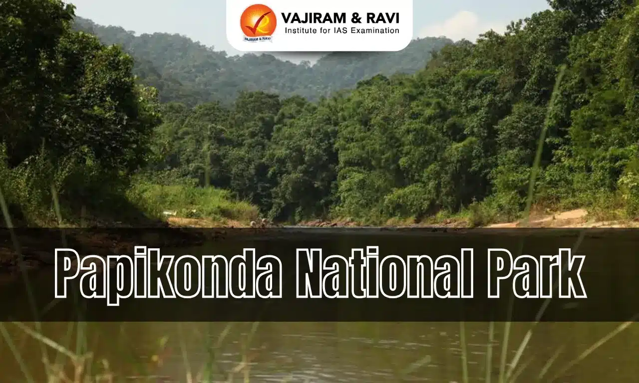
  • Trade networks extended to regions like the Indus Valley and Anatolia, involving metals, textiles and agricultural goods.

  • Temples and palaces played a central role in controlling production and redistribution of resources.

Social Structure: 

Society was hierarchical:

  • Kings and priests at the top
  • Followed by merchants, artisans and scribes
  • Farmers and labourers formed the majority
  • Slaves occupied the lowest position
  • Social roles were well-defined, and inequality was institutionalized.

Cultural and Scientific Contributions: 

  • Writing System: Developed cuneiform script, one of the earliest known writing systems. Initially used for economic records, later expanded to literature, law and administration. Famous literary works include the Epic of Gilgamesh, one of the oldest epics.
  • Law and Governance: The Code of Hammurabi was one of the earliest written legal codes. It introduced the principle of “an eye for an eye”, emphasizing justice and accountability. Laws covered aspects such as trade, property, family and crime.
  • Mathematics and Astronomy:  Introduced the base-60 (sexagesimal) system, which forms the basis of modern time measurement (60 seconds, 60 minutes). Divided the circle into 360 degrees. Made early observations of celestial bodies, contributing to the development of astronomy and calendars.
  • Architecture: Constructed monumental structures called ziggurats, which served as religious temples. Used mud bricks due to lack of stone, developing durable construction techniques. Urban planning included walls, temples and public buildings.

Religion and Beliefs: 

  • Mesopotamians practiced polytheism, worshipping gods associated with natural forces such as water, sky and fertility.
  • Each city-state had its patron deity.
  • Religious institutions, especially temples, were central to economic and social life.
  • People believed in a harsh afterlife, which influenced their rituals and practices.

Military and Conflicts: 

  • Due to lack of natural defenses, Mesopotamia witnessed frequent wars and invasions.
  • City-states often fought for control over fertile land and water resources.
  • Military innovations included the use of chariots and organized armies.

Decline: 

  • Mesopotamia experienced repeated cycles of rise and fall of empires.
  • External invasions, internal conflicts and environmental challenges weakened the region.
  • The civilization came under Persian control when Cyrus the Great conquered Babylon in 539 BCE.

Ancient Egyptian Civilization (c. 3100 BCE - 332 BCE)

Ancient Egyptian civilization developed along the fertile banks of the Nile River. 

Geographical Foundations: 

  • The Nile River was the lifeline of Egyptian civilization, providing water, fertile land, and a natural transportation route.
  • Egypt was geographically protected by deserts on both sides, the Mediterranean Sea to the north, and cataracts (rapids) to the south, which minimized external invasions.
  • The region was broadly divided into Upper Egypt (south) and Lower Egypt (north), unified around 3100 BCE under King Narmer.

Political System and Administration: 

  • Egypt was a centralized monarchy, ruled by the Pharaoh, who was considered a divine representative of gods on Earth.
  • The Pharaoh exercised absolute authority over administration, military, religion, and economy.
  • A well-organized bureaucracy, including viziers, scribes, and officials, managed taxation, agriculture, and public works.
  • Stability was maintained through efficient governance and control over resources.

Economic Life: 

  • The economy was primarily agriculture-based, relying on crops such as wheat and barley.
  • The Nile’s flooding cycle enabled predictable agricultural production, ensuring food security.
  • Trade flourished with regions such as Nubia, Mesopotamia, and the Levant, involving gold, papyrus, linen, and grains.
  • The state controlled surplus production and redistribution, forming a command economy.

Social Structure: Egyptian society was hierarchical:

  • Pharaoh at the top
  • Followed by nobles, priests, and officials
  • Scribes and artisans formed the middle class
  • Farmers and labourers constituted the majority
  • Slaves were at the bottom

Social mobility was limited but possible, especially through administrative roles like scribes.

Religion and Beliefs: 

  • Egyptian religion was polytheistic, with gods associated with natural forces and cosmic order (e.g., Ra, Osiris, Isis).
  • Belief in life after death was central, leading to elaborate burial practices.
  • The concept of Ma’at (truth, order, and justice) guided moral and political life.
  • Mummification was practiced to preserve the body for the afterlife, along with burial goods.

Cultural and Scientific Achievements: 

    • Writing System: Developed hieroglyphics, a pictorial script used for religious texts and inscriptions. Later, simplified scripts like hieratic and demotic were used for administrative purposes. Writing materials included papyrus, one of the earliest forms of paper.
    • Architecture and Engineering: Known for monumental structures such as the pyramids of Giza, temples at Karnak and Luxor, and elaborate tombs in the Valley of the Kings. Mastery in stone construction, geometry, and labour organization enabled large-scale projects.
  • Mathematics and Astronomy: Developed practical mathematics for construction and land measurement. Introduced a 365-day solar calendar, divided into 12 months. Divided the day into 24 hours, influencing modern timekeeping.
  • Medicine: Advanced knowledge of human anatomy, partly derived from mummification practices.Practiced surgeries and used herbal remedies; medical texts like the Ebers Papyrus provide evidence.
  • Art and Culture: Egyptian art was symbolic and highly stylized, often depicting gods, pharaohs, and daily life. Sculpture, painting, and decorative arts reflected religious beliefs and social hierarchy.

Military and Expansion: 

  • Egypt maintained a strong military to defend its territory and expand influence.
  • At its peak, it extended into parts of Syria and Nubia.
  • Military strength also supported trade routes and political dominance.

Decline: 

  • Over time, Egypt faced internal instability, weak rulers, and external invasions (Hyksos, Assyrians, Persians).
  • Ultimately, the civilization ended with the conquest by Alexander the Great in 332 BCE, integrating Egypt into the Hellenistic world.

Indus Valley Civilization (c. 3300–1900 BCE)

The Indus Valley Civilization (IVC), also known as the Harappan Civilization, developed in the northwestern regions of the Indian subcontinent, covering present-day Pakistan and northwest India. It is one of the earliest urban civilizations in the world, known for its well-planned cities, standardized systems and extensive trade networks.

Geographical Foundations:

  • Located along the Indus River and its tributaries, with major sites in regions of Punjab, Sindh and Gujarat.
  • Settlements also extended to areas near the Ghaggar-Hakra river system.
  • Fertile alluvial plains supported agriculture and settlement growth.

Political Organization:

  • No conclusive evidence of kings, monarchy or centralized empire.
  • Uniformity in urban planning suggests the presence of an organized administrative system.
  • Authority may have been exercised by local elites or governing bodies.

Economic Life:

  • Agriculture formed the economic base, with crops such as wheat, barley and evidence of early cotton cultivation.
  • Animal domestication included cattle, sheep and goats.
  • Trade networks extended to regions such as Mesopotamia (referred to as “Meluhha” in Mesopotamian records).
  • Craft specialization included bead-making, pottery, metallurgy and seal production.

Social Structure:

  • Society shows signs of organization but without clear evidence of rigid hierarchy.
  • Variation in house sizes indicates some level of social differentiation.
  • Lack of monumental palaces or royal tombs suggests absence of highly centralized elite dominance.

Cultural and Scientific Contributions:

  • Writing System: Use of a script found on seals and pottery, which remains undeciphered. Likely used for administrative or commercial purposes.
  • Standardization: Uniform system of weights and measures across sites. Standardized brick sizes used in construction.

Science and Technology: 

  • Knowledge of metallurgy, particularly copper and bronze. Advanced techniques in bead-making and craft production. Evidence of measurement precision in urban construction.

Architecture and Urban Planning:

  • Cities such as Harappa, Mohenjo-daro and Dholavira show grid-pattern planning.
  • Sophisticated drainage systems with covered drains and soak pits.
  • Use of baked bricks for durable structures.
  • Public structures include granaries and the Great Bath at Mohenjo-daro.

Religion and Beliefs:

  • Archaeological evidence suggests practices related to fertility and nature worship.
  • Seals depict animal motifs and possible proto-Shiva (Pashupati) figure.
  • The absence of large temples indicates a different religious organization compared to Mesopotamia or Egypt.

Military and Conflicts:

  • Limited evidence of weapons or fortifications designed for large-scale warfare.
  • Suggests that warfare was not a dominant feature of civilization.

Decline:

  • The decline began around 1900 BCE.
  • Factors likely include environmental changes, shifting river systems and decline in long-distance trade.
  • No conclusive evidence of sudden invasion or catastrophic destruction.

Ancient Chinese Civilization (c. 2000 BCE onward)

Ancient Chinese civilization developed along the fertile valleys of the Yellow River (Huang He) and the Yangtze River. It is regarded as one of the world’s oldest continuous civilizations, characterized by strong cultural continuity, dynastic rule and significant contributions to science, philosophy and governance.

Geographical Foundations:

  • Located in the Yellow River basin, known for its fertile loess soil suitable for agriculture.
  • The Yellow River is often called “China’s Sorrow” due to its unpredictable and destructive floods.
  • Natural barriers such as the Himalayas, deserts and seas provided relative isolation and protection.

Political Organization:

  • Governed under a dynastic system beginning with the Xia, followed by Shang and Zhou dynasties.
  • The concept of the Mandate of Heaven legitimized the ruler’s authority and justified the rise and fall of dynasties.
  • Development of centralized administration and an early bureaucratic system.

Economic Life:

  • Agriculture formed the economic base, with millet cultivated in the north and rice in the south.
  • Domestication of animals like pigs and cattle supported agrarian life.
  • Growth of internal trade and early market systems.
  • Silk production became an important economic activity, leading to long-distance trade networks.

Social Structure: Society was hierarchical:

  • Emperor at the top, considered the “Son of Heaven”
  • Nobles and officials
  • Farmers (respected as food producers)
  • Artisans and craftsmen
  • Merchants (often ranked lower despite wealth)

Cultural and Scientific Contributions:

  • Writing System: Development of Chinese script, one of the oldest continuous writing systems still in use.
  • Philosophy and Thought: Emergence of major philosophical traditions such as Confucianism and Taoism, shaping ethics, governance and social relations.

Science and Technology:

  • Major inventions include paper, printing, the compass and gunpowder.
  • Advances in metallurgy, especially bronze casting during the Shang period.
  • Development of irrigation techniques and agricultural tools.

Architecture and Engineering:

  • Construction of palaces, city walls and fortifications.
  • Early forms of the Great Wall were built for defense against invasions.
  • Development of large-scale public works such as canals.

Religion and Beliefs:

  • Practice of ancestor worship and belief in harmony between humans and nature.
  • Influence of philosophical traditions like Confucianism and Taoism on social and moral life.

Military and Conflicts:

  • Frequent conflicts between rival states, especially during the Warring States period.
  • Development of organized armies and use of advanced weapons like crossbows.

Continuity and Legacy:

  • Despite dynastic changes, Chinese civilization maintained strong cultural continuity.
  • Its contributions in governance, philosophy, science and technology have had a lasting global impact.

Maya Civilization (c. 2600 BCE – 900 CE)

The Maya Civilization developed in Mesoamerica, covering present-day southern Mexico, Guatemala, Belize and parts of Honduras and El Salvador. It is recognized for its independently evolved writing system, advanced calendrical knowledge and monumental architecture.

Geographical Foundations:

  • Located in diverse ecological zones, including tropical lowland forests and highland regions.
  • Absence of major perennial rivers in some areas led to reliance on rainwater storage systems such as reservoirs and cenotes.
  • Agricultural adaptations included shifting cultivation and terracing.

Political Organization:

  • Not a unified empire; it consisted of independent city-states such as Tikal, Calakmul, Palenque and Copan.
  • Each city-state was ruled by a hereditary king (k’uhul ajaw) with religious and political authority.
  • Political history marked by alliances, rivalries and warfare.

Economic Life:

  • Agriculture formed the base, with maize (corn) as the staple crop, along with beans and squash.
  • Trade networks exchanged goods such as obsidian, jade, cacao and shells.

  • No use of metal currency; trade was largely barter-based.

Social Structure: Society was hierarchical:

  • Rulers and elite nobles at the top
  • Priests and officials
  • Artisans and traders
  • Farmers and labourers formed the majority

Cultural and Scientific Contributions:

  • Writing System: Developed a fully functional logosyllabic script, one of the most advanced in the ancient world. Used for recording historical events, rituals and dynastic records on monuments and codices.
  • Mathematics and Astronomy: Used a vigesimal (base-20) system and independently developed the concept of zero. Made precise astronomical observations, particularly of the sun, moon and Venus.
  • Calendar System: Developed multiple interrelated calendars, including the Tzolk’in (260-day ritual calendar), Haab (365-day solar calendar) and Long Count calendar for historical dating.

Architecture:

  • Constructed monumental cities with pyramidal temples, palaces, plazas and ball courts.
  • Notable structures include stepped pyramids used for religious ceremonies.
  • Urban centres were often aligned with astronomical features.

Religion and Beliefs:

  • Polytheistic belief system with gods linked to nature and celestial bodies.
  • Ritual practices included offerings and, in some cases, human sacrifice.
  • Priests played a key role in maintaining calendars and conducting rituals.

Military and Conflicts:

  • Frequent warfare among city-states for political dominance and control of resources.
  • Captives were sometimes used in ritual practices.

Decline:

  • Around 800-900 CE, many major southern lowland cities were abandoned.
  • Causes are debated but include prolonged droughts, environmental degradation, warfare and political instability.
  • Northern centres like Chichén Itzá continued for some time after the southern decline.

Persian Civilization (Achaemenid Empire, c. 550 BCE – 330 BCE)

The Persian Civilization, under the Achaemenid Empire, emerged as one of the largest and most powerful empires of the ancient world. At its height, it extended from the Indus Valley in the east to the Balkans (Thrace and Macedonia) in the west, and from the Caucasus Mountains in the north to Egypt in the south. Geographical Foundations:

  • The empire originated in the Iranian Plateau. 
  • The empire's central location allowed it to connect three continents: Asia, Africa and Europe, facilitating trade and cultural exchange.

Foundation and Expansion:

  • The empire was founded by Cyrus the Great, who successfully unified the Persian and Median tribes.
  • He adopted a policy of tolerance toward conquered peoples, allowing them to retain their customs and religions, most famously permitting the Jewish exiles in Babylon to return to Jerusalem. 
  • The empire reached its greatest territorial extent under Darius I (522–486 BCE), who consolidated conquests, suppressed rebellions, and brought administrative stability.

Political Organization:

  • The Persian Empire was divided into approximately 20 administrative provinces known as satrapies, each governed by a satrap (governor) responsible for maintaining law and order, collecting taxes, and ensuring loyalty to the king. 
  • The king exercised strong central authority, supported by a well-organized bureaucracy. 
  • A system of royal inspectors, often called the "Eyes and Ears of the King," traveled unannounced to supervise provincial administration and prevent misuse of power.

Economic Life:

  • The economy was primarily based on agriculture, supported by qanat irrigation techniques that enabled farming in arid regions.
  •  A standardized system of taxation was implemented across the empire, ensuring regular revenue collection from different provinces. 
  • The introduction of a uniform coinage system, especially the gold Daric and silver Siglos, facilitated official trade and tax payments. 
  • Extensive trade networks connected different regions of Asia, Africa and Europe, promoting economic integration.

Social Structure:

  • Persian society was hierarchical. 
  • The king and royal family occupied the highest position, followed by nobles, administrative officials, priests, and military elites. 
  • The majority of the population consisted of farmers, artisans, and traders who contributed to the economic life of the empire. 
  • Slaves existed but were not as central to the economy as in Greece or Rome.

Administration and Governance:

The Persian Empire developed an efficient administrative system that successfully combined strong central control with a degree of local autonomy. 

  • Conquered peoples were generally allowed to retain their own customs, languages, and religious practices, which helped maintain stability and loyalty. This policy of cultural and religious tolerance was a hallmark of Achaemenid rule and contributed to the empire's longevity.

Architecture:

  • The Persians constructed monumental cities such as Persepolis (the ceremonial capital), Susa, and Pasargadae. 
  • Their architecture was characterized by grand palaces, massive stone columns, elaborate stairways, and intricate relief sculptures depicting delegates from across the empire bringing tribute. This artistic style reflected imperial authority and cultural diversity.

Religion and Beliefs:

  • Zoroastrianism, associated with the teachings of the prophet Zoroaster (or Zarathustra), was the dominant religion. It emphasized concepts of truth (asha), righteousness, moral responsibility, and a dualistic struggle between good and evil forces. 
  • Despite this, the empire followed a consistent policy of religious tolerance, allowing diverse beliefs and practices to coexist peacefully.

Military System:

  • The Persian Empire maintained a large and well-organized army composed of soldiers from different regions, including elite units such as the Immortals (a 10,000-strong heavy infantry corps). 
  • The military played a crucial role in the expansion and defense of the empire. However, reliance on diverse contingents with varying loyalties could sometimes be a weakness against a unified enemy.

Decline:

  • The empire gradually weakened due to internal administrative challenges, overextension, and external pressures. A series of weak rulers, court intrigues, and costly wars with Greek city-states drained resources. The empire was ultimately conquered by Alexander the Great, who defeated the last Achaemenid king, Darius III, at the Battle of Gaugamela (331 BCE) and burned Persepolis in 330 BCE, marking the end of Achaemenid rule.

Ancient Greek Civilization (c. 800 BCE – 146 BCE)

Ancient Greek civilization emerged around the Aegean basin, including mainland Greece, the islands and parts of Anatolia. 

Geographical Foundations:

  • Located in a mountainous region with limited fertile land.
  • Mountainous terrain led to the rise of independent city-states (poleis) such as Athens, Sparta and Corinth.
  • Limited arable land encouraged maritime trade, colonization and cultural exchange across the Mediterranean.
  • Natural fragmentation prevented political unity but fostered diversity in political systems.

Political Organization:

  • Greece was not a unified empire but a collection of autonomous city-states.
  • Athens developed direct democracy, where citizens participated in assemblies and decision-making.
  • Sparta followed a militaristic oligarchic system, prioritizing discipline and military training.
  • Political experimentation in Greece laid the groundwork for modern democratic institutions.

Economic Life:

  • Economy based on agriculture (olive, wheat, grapes) and maritime trade.
  • Colonies across the Mediterranean ensured access to raw materials and markets.
  • Trade networks facilitated cultural diffusion and economic prosperity.

Social Structure: Society was hierarchical:

  • Citizens (adult males with political rights)
  • Non-citizens (metics), often traders and artisans
  • Slaves forming a significant part of the labour force

Cultural and Intellectual Contributions:

  • Philosophy: Thinkers like Socrates, Plato and Aristotle developed systematic approaches to ethics, politics and knowledge.Emphasis on rational inquiry and logic became central to Western thought.
  • Science and Mathematics: Contributions in geometry, medicine and natural sciences laid early scientific foundations.
  • Literature and Drama: Development of epic poetry (Homer) and dramatic traditions such as tragedy and comedy.

Architecture:

  • Development of Doric, Ionic and Corinthian architectural styles.
  • Construction of temples and public buildings, notably the Parthenon in Athens.
  • Emphasis on proportion, symmetry and aesthetic balance.

Religion and Beliefs:

  • Polytheistic religion with gods like Zeus, Athena and Apollo.
  • Religious festivals, oracles and rituals played a key role in social life.

Military and Conflicts:

  • Frequent inter-city conflicts, especially the Peloponnesian War between Athens and Sparta.
  • Collective resistance against Persian invasions strengthened Greek identity.

Decline:

  • Internal conflicts weakened the city-states.
  • Eventually brought under the control of Alexander the Great, followed by Roman conquest (146 BCE).

Roman Civilization (c. 753 BCE – 476 CE)

Roman civilization began as a small settlement on the Italian Peninsula and evolved into a vast empire encompassing Europe, North Africa and parts of Asia. It is especially significant for its contributions to law, governance, engineering and administration.

Geographical Foundations:

  • Located in the Italian Peninsula with access to the Mediterranean Sea, facilitating trade and expansion.
  • Fertile plains and river systems supported agriculture and population growth.

Political Organization:

  • Transitioned from monarchy to republic (509 BCE) and later to empire (27 BCE).
  • The Roman Republic developed institutions such as the Senate, assemblies and magistrates.
  • Under the Empire, power became centralized in the emperor, supported by a vast bureaucracy.

Economic Life:

  • Agriculture formed the base, supplemented by trade across the Mediterranean.
  • Use of coinage enabled a monetized economy.
  • Extensive trade networks connected diverse regions of the empire.

Social Structure: Society was hierarchical:

  • Patricians (aristocratic elite)
  • Plebeians (common citizens)
  • Freedmen
  • Slaves forming a major part of the workforce

Cultural and Institutional Contributions:

  • Law and Governance: Development of Roman law, including the Twelve Tables and later legal principles. Concepts such as rule of law, legal rights and citizenship continue to influence modern legal systems.
  • Language and Literature: Latin became the administrative language and influenced many modern European languages.

Engineering and Architecture:

  • Advanced engineering techniques enabled construction of roads, aqueducts, bridges and urban infrastructure.
  • Use of concrete allowed large-scale structures like the Colosseum and public baths.
  • Urban planning included well-organized cities with forums, drainage and public spaces.

Religion and Beliefs:

  • Initially polytheistic, influenced by Greek deities and traditions.
  • Later, Christianity emerged and was institutionalized, particularly under Constantine the Great.

Military and Expansion:

  • Highly disciplined and organized Roman legions enabled territorial expansion and control.
  • Military strength was central to maintaining the empire’s unity.

Decline:

  • Internal political instability, economic challenges and external invasions weakened the empire.
  • The Western Roman Empire fell in 476 CE, marking the end of ancient Roman political dominance in the West.

Ancient Civilizations of the World FAQs

Q1: Which civilization is known as the cradle of civilization?

Ans: Mesopotamian Civilization.

Q2: Which river is associated with Egyptian civilization?

Ans: The Nile River is associated with Egyptian civilization.

Q3: Which civilization is known for planned cities and drainage systems?

Ans: Indus Valley Civilization is known for planned cities and drainage systems.

Q4: Which civilization developed the Twelve Tables?

Ans: Roman Civilization developed the Twelve Tables, an early codification of laws.

Q5: Which civilization is associated with the Great Wall?

Ans: Chinese Civilization is associated with the construction of the Great Wall for defense against invasions.

Dibru Saikhowa National Park, Location, Flora, Fauna, Vegetation

Dibru Saikhowa National Park

Dibru-Saikhowa National Park is located in the Dibrugarh and Tinsukia districts of Assam and is one of India's most important riverine protected areas. Surrounded by the Brahmaputra, Lohit, and Dibru rivers, it is known for its wetlands, swamp forests, and rich biodiversity. The park supports diverse flora, including semi-evergreen forests, grasslands, and the largest Salix swamp forest in Northeast India. It is home to rare fauna such as the White-winged Wood Duck, Royal Bengal Tiger, Wild Water Buffalo, and over 350 bird species.

Dibru Saikhowa National Park

Dibru-Saikhowa National Park is a renowned protected area in Assam, famous for its riverine forests, wetlands, and exceptional wildlife diversity. Established as a National Park in 1999, it also forms the core of the Dibru-Saikhowa Biosphere Reserve. The park is an important habitat for endangered species, migratory birds, and the rare White-winged Wood Duck, making it a biodiversity hotspot in Northeast India.

Dibru Saikhowa National Park History

The history of Dibru-Saikhowa National Park reflects over a century of conservation efforts aimed at protecting Assam's unique riverine forests, wetlands, and endangered wildlife. Over time, the area evolved from reserved forests into a Wildlife Sanctuary, Biosphere Reserve, and finally a National Park.

  • 1890: The area was first declared as the Dibru Reserved Forest.
  • 1920: Additional forest land was added to the Dibru Reserved Forest.
  • 1929: The Saikhowa Reserved Forest was established.
  • 1933: More forest area was incorporated into the Dibru Reserved Forest.
  • 1986: Around 650 sq. km was proposed as a Wildlife Sanctuary.
  • 1995: A 340 sq. km area was officially notified as the Dibru-Saikhowa Wildlife Sanctuary.
  • 1997: It was designated as the Dibru-Saikhowa Biosphere Reserve, covering 765 sq. km with a 340 sq. km core area and a 425 sq. km buffer zone.
  • 1999: The core sanctuary area was declared Dibru-Saikhowa National Park.
  • The park was originally established to conserve the endangered White-winged Wood Duck and its fragile wetland habitat.

Dibru Saikhowa National Park Flora

The flora of Dibru-Saikhowa National Park is highly diverse due to its fertile floodplains, wetlands, and tropical monsoon climate. The park supports a mix of swamp forests, grasslands, riverine vegetation, and semi-evergreen forests, providing vital habitats for a wide range of wildlife.

  • Salix (Willow) Forests: The park contains the largest Salix swamp forest in Northeast India.
  • Moist Semi-evergreen Forests: Dominated by tree species adapted to high rainfall and humid conditions.
  • Moist Deciduous Forests: Home to a variety of broad-leaved trees that shed leaves seasonally.
  • Riverine Forests: Found along the banks of the Brahmaputra, Lohit, and Dibru rivers.
  • Grasslands: Tall elephant grass and reed beds support herbivores and ground-nesting birds.
  • Canebrakes: Dense cane thickets provide shelter for many mammals and birds.
  • Bamboo Groves: Various bamboo species thrive in the park's floodplain ecosystem.
  • Important Tree Species: Hollong, Nahor, Simul, Sissoo, Khair, and Jamun are commonly found.
  • Aquatic Vegetation: Water lilies, lotus, reeds, sedges, and floating aquatic plants flourish in wetlands and marshes.

Dibru Saikhowa National Park Fauna

The fauna of Dibru-Saikhowa National Park is highly diverse, with a rich variety of mammals, birds, reptiles, amphibians, and fish inhabiting its forests, wetlands, and riverine ecosystems. The park is an important refuge for several endangered species and migratory birds.

  • Royal Bengal Tiger is one of the park's top predators and an important flagship species.
  • Asian Elephant, Wild Water Buffalo, Leopard, Clouded Leopard, Fishing Cat, Jungle Cat, Hog Deer, Sambar Deer, and Barking Deer are commonly found.
  • Primates such as the Capped Langur, Slow Loris, and Assamese Macaque inhabit the forested areas.
  • The park is famous for its population of Feral Horses, believed to be descendants of abandoned domestic horses.
  • More than 350 bird species, including the White-winged Wood Duck, Black-breasted Parrotbill, Greater Adjutant, Spot-billed Pelican, Grey-headed Fish Eagle, and several migratory birds, have been recorded.
  • Indian Python, King Cobra, Monitor Lizard, Freshwater Turtles, along with numerous freshwater fish species such as Rohu, Catla, Mrigal, and Mahseer, thrive in the park's rivers and wetlands.

Dibru Saikhowa National Park Climate & Vegetation

The climate and vegetation of Dibru-Saikhowa National Park are shaped by the tropical monsoon climate, heavy rainfall, and the floodplains of the Brahmaputra, Lohit, and Dibru rivers. These conditions support diverse forests, wetlands, and grasslands that sustain the park's rich biodiversity.

  • The park experiences a tropical monsoon climate with hot, humid summers and cool, relatively dry winters.
  • It receives an annual rainfall of about 2,300–3,800 mm, mainly during the southwest monsoon season.
  • Seasonal flooding by the Brahmaputra and its tributaries replenishes nutrients and maintains the park's wetland ecosystem.
  • The vegetation includes moist mixed semi-evergreen forests, moist mixed deciduous forests, riverine forests, grasslands, canebrakes, and marshy wetlands.
  • Dibru-Saikhowa is home to the largest Salix (willow) swamp forest in Northeast India, making it ecologically unique.
  • Extensive elephant grass, bamboo groves, reeds, aquatic plants, and riparian vegetation provide ideal habitats for numerous mammals, birds, reptiles, and aquatic species.

Dibru Saikhowa National Park Conservation Efforts

Dibru-Saikhowa National Park is protected through various conservation initiatives aimed at preserving its unique riverine ecosystem, wetlands, and endangered wildlife. These efforts focus on habitat protection, biodiversity conservation, and sustainable management of natural resources.

  • Protected Area Status: Declared a Wildlife Sanctuary (1995), Biosphere Reserve (1997), and National Park (1999) to ensure long-term conservation.
  • Habitat Conservation: Wetlands, swamp forests, grasslands, and riverine habitats are protected to support diverse plant and animal species.
  • Wildlife Protection: Regular anti-poaching patrols and wildlife monitoring help safeguard endangered species such as the White-winged Wood Duck, Royal Bengal Tiger, and Wild Water Buffalo.
  • Biodiversity Monitoring: Periodic surveys are conducted to monitor populations of birds, mammals, reptiles, and aquatic species.
  • Community Participation: Local communities are encouraged to participate in eco-tourism, conservation awareness, and sustainable livelihood initiatives.
  • Legal Protection: In 2020, the Gauhati High Court stayed permission for hydrocarbon exploration inside the protected area, reinforcing the park's ecological importance and legal safeguards.


Dibru Saikhowa National Park FAQs

Q1: Where is Dibru-Saikhowa National Park located?

Ans: It is located in the Dibrugarh and Tinsukia districts of Assam, about 12 km from Tinsukia town.

Q2: Why is Dibru-Saikhowa National Park famous?

Ans: The park is famous for its White-winged Wood Duck, feral horses, extensive wetlands, swamp forests, rich bird diversity, and riverine ecosystem.

Q3: When was Dibru-Saikhowa declared a National Park?

Ans: It was declared a National Park in 1999.

Q4: What is the area of Dibru-Saikhowa Biosphere Reserve?

Ans: The Biosphere Reserve covers 765 sq. km, including a 340 sq. km core area and a 425 sq. km buffer zone.

Q5: Which rivers surround Dibru-Saikhowa National Park?

Ans: The park is surrounded by the Brahmaputra, Lohit, and Dibru Rivers.

INS Surat

INS Surat

INS Surat Latest News

Warship JS Takanami (DD-110) of the Japan Maritime Self Defence Force (JMSDF) recently conducted joint naval activities with the Indian Navy warship INS Surat.

About INS Surat

  • It is a state-of-the-art stealth guided missile destroyer of the Indian Navy. 
  • It is the fourth and final vessel of the Visakhapatnam-class (Project 15B Guided Missile Destroyer Project) destroyers. 
  • It was designed by the Navy’s Warship Design Bureau and built by Mazagon Dock Shipbuilders, Mumbai. It has 75 percent Indigenous content.
  • It was commissioned into the Indian Navy in January 2025.

INS Surat Features

  • With a displacement of 7,400 tonnes and length of 164m, the INS Surat is among the largest destroyers in the world. 
  • Stealth Design: Reduced radar cross-section with X-band stealth hull; integrated mast for sensors.
  • It is powered by a Combined Gas and Gas (COGAG) propulsion set comprising four gas turbines.
  • It has a top speed of 30 knots (56 km/h) and carries 300 personnel (50 officers and 250 sailors). It has an endurance of 8,500 nautical miles.  
  • It is India’s first artificial intelligence-enabled warship, utilizing indigenously developed AI solutions to enhance operational efficiency. 
  • Armament: 16 BrahMos supersonic cruise missiles (range 290-450 km), 32 Barak-8 MR SAMs (range 70 km), 2 twin torpedo tubes, 76mm SRGM gun, CIWS.
  • Aviation: Hangar for 2 ALH or 1 MH-60R helicopter; enhanced deck for operations.

News: TOI

INS Surat FAQ's

Q1: What is INS Surat?

Ans: It is a state-of-the-art stealth guided missile destroyer of the Indian Navy.

Q2: INS Surat belongs to which class of destroyers?

Ans: Visakhapatnam-class (Project 15B) guided missile destroyers.

Q3: Which shipyard built INS Surat?

Ans: Mazagon Dock Shipbuilders Limited (MDL), Mumbai.

Q4: When was INS Surat commissioned into the Indian Navy?

Ans: January 2025.

Transnational Crime – Diplomatic Reset and Global Crackdown

Transnational Crime

Transnational Crime Latest News

  • Nearly three years after the killing of Khalistani separatist Hardeep Singh Nijjar triggered a major diplomatic crisis between India and Canada, Canadian authorities have stated that no evidence currently links the Indian government to the murder. 
  • Simultaneously, the United States has charged gangster Lawrence Bishnoi and his associate Goldy Brar with orchestrating the assassination under a broader crackdown (Operation Hard Ball) on transnational organised crime.

Transnational Organised Crime 

  • The term "organised crime" refers to illicit operations carried out by networks or groups that collaborate, frequently involving violence, corruption, or related acts in order to get material or financial advantage.
  • When organisations or activities operate across several nations, it is known as transnational organised crime.

Canada’s Revised Position

  • It clarified that investigations have not found evidence implicating Indian government officials in Nijjar’s killing.
  • However, the investigation remains ongoing, and authorities have not closed the case.
  • This marks a significant shift from former Canadian Prime Minister Justin Trudeau’s allegation of a "potential link" between Indian agents and the assassination.
  • India had consistently rejected the allegations as baseless, leading to one of the sharpest downturns in India-Canada diplomatic relations.
  • Bilateral ties have gradually improved since (June) 2025, when both countries agreed to restore diplomatic engagement.

Background - The Hardeep Singh Nijjar Case

  • Who was Nijjar?
    • Hardeep Singh Nijjar was a Canadian resident since 1997.
    • He was the chief of the Khalistan Tiger Force (KTF) - designated by India as a terrorist organisation under the Unlawful Activities (Prevention) Act (UAPA) in 2023.
    • He was also the president of the Guru Nanak Sikh Gurdwara Sahib in Surrey, Canada.
    • Indian authorities accused Nijjar of:
      • Recruiting and financing Khalistani extremist activities.
      • Links to attacks, including the 2021 assault on a Hindu priest in Jalandhar.
      • Supporting activities during the 2020 farm law protests.
  • Diplomatic fallout: Trudeau's allegations in 2023 resulted in mutual expulsion of diplomats, suspension of several bilateral engagements, and significant deterioration in political and strategic relations.

US Charges Against Lawrence Bishnoi and Goldy Brar

  • Federal indictment;
    • A US federal court has charged Lawrence Bishnoi, currently imprisoned in Gujarat; and Goldy Brar (Satinderjeet Singh), believed to be operating from North America.
    • The indictment alleges:
      • Bishnoi directed the murder from prison using smuggled mobile phones.
      • Goldy Brar coordinated operations in North America.
      • Nijjar was shot outside a Sikh temple in British Columbia in June 2023.
  • Operation Hard Ball:
    • The charges form part of a major US-led investigation targeting Indian-origin transnational criminal syndicates involved in racketeering, extortion, kidnapping, drug trafficking, murder, and organised corruption.
    • Key highlights: The FBI has announced a reward of up to $50,000 for information leading to Goldy Brar's arrest.

India-US Security Cooperation

  • Strengthening intelligence sharing:
    • Before Operation Hard Ball, US law enforcement agencies held multiple meetings with Indian agencies through the Ministry of External Affairs (MEA).
    • Information was exchanged regarding Lawrence Bishnoi, Goldy Brar, Rohit Godara, Jaggu Bhagwanpuria, and other associates.
  • India also shared:
    • Evidence against overseas-based gangsters.
    • Details of criminal networks operating from the US, Canada and Europe.
    • Technical surveillance inputs and interrogation-based intelligence.
  • Cooperation intensified after the deportation of Anmol Bishnoi from the US in 2025.

Emerging Dimensions of Transnational Organised Crime

  • Investigations reveal increasing convergence between organised crime and cross-border security threats.
  • For example,
    • Indian-origin gangs maintain links with Pakistan-based narcotics smugglers.
    • Criminal networks finance targeted killings through drug trafficking.
    • Smuggling routes increasingly utilise maritime channels, and drones along the India-Pakistan border.
  • Evading surveillance: Criminal groups employ Virtual Private Networks (VPNs), encrypted messaging platforms., and advanced digital communication technologies.

Broader Implications

  • International relations: India-Canada diplomatic relations. Managing diplomatic disputes through evidence-based investigations. India-US cooperation on law enforcement and intelligence.
  • Internal security: 
    • Cross-border narcotics trafficking, prison-based criminal operations, and cyber-enabled organised crime using encrypted technologies.
    • Expansion into international organised crime following the decline of older criminal syndicates led by Dawood Ibrahim, Chhota Rajan and Ravi Pujari.
  • Governance and legal framework: UAPA, international police cooperation, intelligence sharing for combating organised crime, challenges in extradition and prosecution of overseas fugitives.

International Efforts

  • The United Nations Convention against Transnational Organized Crime (UNTOC) is an international agreement that aims to prevent and combat organized crime across countries.
  • The Guwahati Declaration was adopted by the BRICS nations to strengthen cooperation against illicit drug trafficking and related transnational organized crime.
  • Financial Action Task Force (FATF), Interpol, and the United Nations Office on Drugs and Crime (UNODC) are targeting the massive illicit profits generated by transnational organized crime.

Source: IE | IE

Transnational Crime FAQs

Q1: How does transnational organised crime increasingly threaten India?

Ans: By combining terrorism, narcotics trafficking, etc, these crimes pose both internal security and diplomatic challenges.

Q2: What is the significance of Canada's latest statement on the Hardeep Singh Nijjar case?

Ans: It potentially facilitates the normalisation of India–Canada diplomatic relations while investigations continue.

Q3: What is Operation Hard Ball, and why is it important?

Ans: It is a US-led investigation targeting Indian-origin transnational criminal syndicates through coordinated international law enforcement.

Q4: How has India–US cooperation evolved in combating transnational organised crime?

Ans: India and the US have strengthened intelligence sharing, evidence exchange, and coordination through agencies.

Q5: What challenges do modern organised crime syndicates pose?

Ans: They exploit encrypted communication, making detection, surveillance, and prosecution increasingly difficult.

Election Commission of India (ECI), Structure, Framework, Composition

Election Commission of India

The Election Commission of India (ECI) is an autonomous constitutional authority responsible for administering elections to the Parliament, state legislatures, and the offices of the President and Vice-President of India. Established on 25 January 1950, the Commission ensures that elections are conducted freely, fairly, and transparently across the country. Its work upholds the democratic principle of universal adult suffrage guaranteed by the Constitution under Article 326. The ECI’s independence and credibility are vital to maintaining India’s democratic integrity.

Election Commission of India

The Election Commission of India derives its powers and responsibilities from Article 324 of the Indian Constitution. It is a constitutional body, independent of government influence, tasked with supervising the entire electoral process. Initially a single-member body, it became a multi-member Commission in 1993, consisting of the Chief Election Commissioner (CEC) and two Election Commissioners. The ECI manages over 97 crore registered voters (as per 2024 data) and conducts elections in more than 10 lakh polling stations nationwide.

Election Commission of India Structure

The Election Commission of India (ECI) is a constitutional body established under Article 324 of the Indian Constitution. It is a multi-member commission responsible for supervising elections to Parliament, State Legislatures, and the offices of the President and Vice President. Originally, it had only one Chief Election Commissioner (CEC), but since October 1993, it became a three-member body. The Commission operates as a collegiate body, ensuring collective decision-making. It has a permanent secretariat at Nirvachan Sadan, New Delhi, and functions independently of government control. Its structure ensures autonomy, impartiality, and accountability in the electoral process as mandated by the Constitution.

Election Commission of India Composition

The ECI comprises the Chief Election Commissioner (CEC) and two Election Commissioners (ECs), as provided under Article 324(2) of the Constitution. The President of India determines the number of Commissioners from time to time. All three members enjoy equal powers, salaries, and status, and decisions are taken collectively through majority vote. The Chief Election Commissioner acts as the head of the institution, ensuring smooth coordination. The administrative staff is drawn from central and state government services. This composition aims to maintain checks and balances within the Commission, upholding transparency and non-partisanship in the conduct of elections.

As of 2026 the members of Election Commission of India are:

  • Chief Election Commissioner (CEC): Shri Gyanesh Kumar
  • Election Commissioners: Dr. Sukhbir Singh Sandhu and Dr. Vivek Joshi

Chief Election Commissioner (CEC)

The Chief Election Commissioner is the head of the Election Commission of India and ensures the independence and integrity of the electoral process.

  • The CEC is appointed by the President of India under Article 324(2) of the Constitution.
  • The CEC’s role is crucial in enforcing the Model Code of Conduct (MCC), supervising voter rolls, and ensuring impartial conduct of elections.
  • The Supreme Court in T.N. Seshan vs Union of India (1995) upheld that all Election Commissioners are equal in power and status, ensuring collective functioning.
  • The CEC is considered the guardian of India’s electoral democracy, accountable only to Parliament and the Constitution.

Election Commissioners Appointment

The Chief Election Commissioner and other Election Commissioners are appointed by the President of India under Article 324(2). Though the Constitution does not specify a detailed procedure, the appointment is made on the advice of the Council of Ministers. However, several legal experts and the Supreme Court (in March 2023) have recommended a collegium system involving the Prime Minister, Leader of Opposition, and Chief Justice of India to ensure transparency until Parliament enacts law. Their appointment order is issued by the President, and their terms, conditions, and service benefits are defined under the Election Commission (Conditions of Service) Rules 1992.

Election Commissioners Tenure

Under the Election Commission (Conditions of Service of Election Commissioners and Transaction of Business) Act 1991, each Election Commissioner, including the CEC, holds office for six years or until attaining the age of 65 years, whichever is earlier. This fixed tenure provides functional independence and stability. Their salaries and allowances are equivalent to those of Judges of the Supreme Court, ensuring parity with other high constitutional offices. Article 324(5) protects their tenure by stating that their service cannot be varied to their disadvantage after appointment. Such constitutional safeguards ensure autonomy and prevent arbitrary interference by the executive branch.

Election Commissioners Resignation and Removal

Election Commissioners may resign from office by submitting a written resignation to the President of India. However, the Chief Election Commissioner (CEC) enjoys stronger constitutional protection. Under Article 324(5), the CEC can be removed only in the same manner and on the same grounds as a Judge of the Supreme Court, that is, by a special majority of both Houses of Parliament on proven misbehavior or incapacity. Other Election Commissioners can be removed only on the recommendation of the CEC. This system ensures the Commission’s independence, preventing misuse of executive power and preserving the institution’s credibility and neutrality in elections.

Election Commission of India Powers

The Commission enjoys wide-ranging powers to ensure the integrity, neutrality, and transparency of the electoral process across India.Key Powers:

  • Administrative Powers: Control over election schedules, polling arrangements, and the deployment of polling staff.
  • Advisory Powers: Advises the President and Governors on matters related to disqualification of members.
  • Quasi-Judicial Powers: Decides disputes regarding political party recognition and symbols under the Election Symbols (Reservation and Allotment) Order, 1968.
  • Regulatory Powers: Enforces the Model Code of Conduct (MCC) and monitors election expenditure.
  • Disciplinary Powers: Can direct transfers or suspension of officials for election-related misconduct.

Election Commission of India Functions

The ECI performs multiple functions to ensure free, fair, and periodic elections in accordance with democratic principles. Major Functions:

  • Conduct of Elections: Supervises, directs, and controls elections to Parliament, State Legislatures, and high offices.
  • Delimitation: The Election Commission of India (ECI) does not directly have delimitation powers; instead, it oversees the process, which is conducted by a separate, temporary Delimitation Commission established by the Central Government.
  • Electoral Rolls: Prepares, revises, and updates voter lists through continuous revision and SIR (Special Intensive Revision).
  • Registration of Political Parties: Recognizes parties and allots election symbols.
  • Voter Education: Promotes awareness under the Systematic Voters’ Education and Electoral Participation (SVEEP) program.
  • Monitoring Expenditure: Ensures transparency through election expenditure audits and monitoring teams.

Election Commission of India Constitutional Provisions

The Election Commission of India is established under Article 324 of the Constitution to ensure free and fair elections in India. Key Constitutional Provisions:

  • Article 324(1): Grants the ECI the power to conduct elections to Parliament, State Legislatures, and the offices of President and Vice-President.
  • Article 324(2): Empowers the President to appoint the Chief Election Commissioner and other Election Commissioners.
  • Article 324(5): Provides protection to the tenure and service conditions of the CEC, ensuring independence.
  • These provisions ensure the ECI acts as an autonomous constitutional authority, not subordinate to any executive or legislature.

Election Commission of India Legal Safeguards

The legal framework guarantees the Commission’s independence and shields it from executive or political influence during elections. Major Legal Provisions:

  • Article 324(5): Protects the CEC’s tenure and prevents arbitrary removal.
  • Election Commission (Conditions of Service of Election Commissioners and Transaction of Business) Act, 1991: Defines tenure, salaries, and conditions of service.
  • Representation of the People Acts (1950 & 1951): Provide detailed election procedures, voter eligibility, and dispute resolution.
  • Indian Penal Code & Conduct of Election Rules, 1961: Penalize malpractices like bribery, booth capturing, and false nominations.
  • These legal safeguards collectively ensure institutional autonomy and operational transparency.

Election Commission of India Government Policies

To strengthen electoral integrity, several policy measures and reforms have been introduced by the government in consultation with the ECI. Key Policies and Their Impact:

  • Electoral Bond Scheme (2018): Introduced to improve transparency in political funding, though under judicial scrutiny.
  • One Nation, One Election (Proposal): Aims to synchronize national and state elections, reducing expenditure and administrative burden.
  • Voter ID-Aadhaar Linking Drive (Proposal): Ensures cleaner voter rolls by removing duplicate entries.
  • Remote Voting Prototype (Proposal): Designed to allow migrant workers to vote from other locations.
  • Awareness Campaigns (SVEEP): Promotes voter education and participation, increasing turnout rates to over 67% in 2019 Lok Sabha polls.

Election Commission of India Independence

The independence of the Election Commission is fundamental to Indian democracy. The Constitution grants it autonomy, but its accountability mechanisms ensure transparency.

Accountability Measures:

  • Judicial review of Commission decisions.
  • Parliamentary oversight through questions and debates.
  • Media transparency and publication of detailed election reports.

Measures Ensuring Independence:

  • Fixed Tenure: CEC and ECs hold office for six years or till the age of 65.
  • Security of Tenure: CEC can be removed only by parliamentary impeachment similar to a Supreme Court judge.
  • Equal Status: All commissioners enjoy equal decision-making power.
  • Financial Autonomy: ECI’s budget is charged on the Consolidated Fund of India, ensuring executive non-interference.
  • Neutrality in Appointments: Recent Supreme Court directives advocate a collegium-based selection process for transparency.

Election Commission of India Case Laws

Several judicial decisions have strengthened the constitutional position and functioning of the ECI:

  • S. Subramaniam Balaji v. State of Tamil Nadu (2013): Directed the ECI to enforce the Model Code of Conduct more stringently.
  • Union of India v. Association for Democratic Reforms (2002): Mandated disclosure of candidates’ criminal, educational, and financial backgrounds.
  • PUCL v. Union of India (2003): Recognized the Right to Vote as part of the freedom of expression under Article 19(1)(a).
  • A.C. Jose v. Sivan Pillai (1984): Affirmed that the ECI has plenary powers under Article 324 to ensure free elections.
  • ADR vs. Election Commission (2024): The Supreme Court emphasized transparency in voter list revisions under SIR, ensuring uniform procedures across states.

Election Commission of India Challenges

Despite its achievements, the ECI faces several operational and institutional challenges:

  • Political Pressure and Allegations of Bias: Increasing accusations of partisanship affect its credibility.
  • Voter Exclusion: Issues in electoral roll verification, especially during Special Intensive Revisions (SIR), lead to disenfranchisement.
  • Election Expenditure: Unchecked campaign spending and unaccounted political donations undermine transparency.
  • Fake News and Electoral Manipulation: Social media misinformation impacts voter behavior.
  • Digital Divide: Limited accessibility of digital services in rural areas hinders full participation.

Way Forward:

  • Establish a collegium system for appointment of Election Commissioners.
  • Provide statutory backing for the Model Code of Conduct.
  • Expand voter education programs in marginalized communities.
  • Enhance cyber resilience through AI-based monitoring.
  • Strengthen coordination with social media platforms to curb misinformation.

Election Commission of India Technology Integration

The ECI has significantly integrated technology into election management, ensuring faster, more secure, and transparent processes. Key Digital Initiatives:

  • EVMs and VVPATs: Ensure tamper-proof voting and verifiable paper trails.
  • cVIGIL App: Allows citizens to report Model Code violations in real time.
  • ERONet and NVSP Portal: Facilitate online voter registration and roll management.
  • Suvidha and Samadhan Portals: Streamline candidate permissions and grievance redressal.
  • Garuda App: Enables Booth Level Officers (BLOs) to conduct door-to-door verification digitally.

Election Commission of India Significance

The Election Commission acts as the foundation of India’s democracy, ensuring the people’s mandate is exercised freely, fairly, and periodically.

  • Democratic Legitimacy: Upholds citizens’ right to vote under Article 326, maintaining public confidence in electoral outcomes.
  • Institutional Stability: Ensures smooth transitions of power without conflict, protecting the essence of parliamentary democracy.
  • Inclusivity: Implements initiatives like SVEEP and Accessible Elections Project to include marginalized groups, PwDs, and senior citizens.
  • Technological Reforms: Adoption of EVMs, VVPAT, and digital voter roll systems enhances transparency and reduces human error.
  • Global Recognition: India’s ECI is often cited as a model for electoral management by international organizations like the UNDP and International IDEA.

Election Commission of India Recent Developments

The Election Commission of India (ECI) has announced Phase 2 of its nationwide “Special Intensive Revision” (SIR) of electoral rolls, covering 12 states and Union Territories from November 4, 2025.

  • The exercise will affect around 51 crore electors, aiming for a final roll publication on February 7, 2026.
  • States involved include major poll-bound regions such as Tamil Nadu, Kerala, West Bengal and Puducherry. 
  • The ECI clarified that Aadhaar card and 13 other documents may be used for identity proof, though concerns over potential disenfranchisement have been raised by opposition parties. 
  • The revision follows the earlier SIR pilot in Bihar, where the ECI reported zero appeals or complaints relating to deletions. 
  • Some states have questioned the timeline and scope of the exercise, arguing that it should not proceed in a short span of 2-3 months given migration and administrative challenges.

Election Commission of India FAQs

Q1: What is the Election Commission of India?

Ans: It is a constitutional body established under Article 324 to supervise elections in India.

Q2: Who appoints the Chief Election Commissioner?

Ans: The President of India appoints the Chief Election Commissioner and other Election Commissioners.

Q3: What is the tenure of Election Commissioners?

Ans: They hold office for six years or until the age of 65, whichever is earlier.

Q4: What are the major powers of the Election Commission of India?

Ans: The ECI conducts elections, enforces the Model Code, and regulates political parties and expenditure.

Q5: How does the Election Commission of India ensure free and fair elections?

Ans: Through technology use, strict monitoring, legal powers, and transparent processes under constitutional safeguards.

AISHE Report – Higher Education Enrolment Reaches 4.5 Crore

AISHE Report

AISHE Report Latest News

  • The Union Ministry of Education has released the All India Survey on Higher Education (AISHE) for 2022-23 and 2023-24, showing that total student enrolment in higher education has reached 4.5 crore, with significant gains in women's participation, STEM adoption, and inclusivity.

About the All India Survey on Higher Education (AISHE)

  • The AISHE is a comprehensive annual survey conducted by the Ministry of Education, which tracks key indicators in the higher education sector. It covers:
    • Student enrolment
    • Faculty and teaching staff
    • Infrastructure and facilities
    • Programme and course offerings
    • Gender and social category participation
  • The survey is a critical policy tool that informs decisions related to higher education planning, financial allocations, and reforms under initiatives like the National Education Policy (NEP) 2020
  • Data is submitted voluntarily by registered institutions through a web-based portal and verified using built-in validation checks.
  • The latest AISHE covers 59,533 higher education institutions with an institutional participation rate of over 90%.

News Summary: Key Findings of AISHE 2023-24

  • Total Enrolment Reaches 4.5 Crore
    • Total enrolment in higher education rose to 4.5 crore in 2023-24.
    • This marks a 31.5% increase from 3.42 crore in 2014-15.
    • Reflects growing access and demand for higher education across India.
  • Gross Enrolment Ratio (GER)
    • GER, the proportion of people aged 18-23 enrolled in higher education, has improved significantly:
      • GER in 2023-24: 30
      • GER in 2022-23: 29.5
      • GER in 2014-15: 23.7
    • The rising GER shows that more young people are pursuing college education.
  • Women's Participation Continues to Rise
    • Female enrolment in 2023-24: 2.24 crore
    • Female enrolment in 2022-23: 2.18 crore
    • Female enrolment in 2014-15: 1.57 crore
    • This represents a 42.2% increase since 2014-15.
    • The female GER stood at 31.2 in 2023-24, higher than the national average.
  • Gender Parity Index (GPI)
    • The GPI, which compares female and male participation, stood at 1.08 in 2023-24. 
    • A GPI above 1 indicates that more women than men are enrolled in higher education. The GPI has remained above 1 for seven consecutive years, showing a sustained trend of female participation outpacing male participation.
  • Enrolment Growth Among SC, ST, and OBC Students
    • The report highlights significant increases in participation among students from marginalised communities:
  • Scheduled Castes (SC)
    • Enrolment in 2023-24: 69.72 lakh
    • Increase since 2014-15: 51.4%
    • GER improved from 18.9 (2014-15) to 27.8 (2023-24)
  • Scheduled Tribes (ST)
    • Enrolment in 2023-24: 28.83 lakh
    • Increase since 2014-15: 75.7%
    • GER improved from 13.5 (2014-15) to 22.8 (2023-24)
  • Other Backward Classes (OBC)
    • Enrolment in 2023-24: 1.80 crore
    • Increase since 2014-15: 60.2% (from 1.13 crore)
    • These figures reflect the impact of affirmative action policies, expanded institutional access, and targeted government support for marginalised communities.
  • STEM Education Growth
    • Enrolment Crosses One Crore
        • STEM enrolment in 2023-24: 1.02 crore, the first time it has crossed the one-crore mark.
        • STEM enrolment in 2014-15: 91.5 lakh.
        • Reflects growing interest in Science, Technology, Engineering, and Mathematics disciplines.
    • Rising Women's Share in STEM
        • Women's share in STEM enrolment: 44% in 2023-24
        • Women's share in STEM enrolment in 2014-15: 38.4%
        • This represents a significant improvement in gender inclusivity in STEM fields, though further growth is needed to achieve full parity.
  • Faculty Strength Increases
    • Total faculty in 2023-24: 17.32 lakh
    • Female faculty in 2023-24: 7.78 lakh
    • Female faculty in 2014-15: 5.69 lakh
    • Rising faculty strength is important for maintaining favourable student-teacher ratios and ensuring quality education.

Significance and Implications

  • For Access and Inclusivity
    • The rising GER reflects improved access to higher education across the country.
    • Growth in enrolment among SC, ST, and OBC students demonstrates progress in social justice and equity.
    • Increased women's participation reinforces India's commitment to gender equity in education.
  • For Economic Development
    • STEM growth aligns with India's ambitions in technology, innovation, and industrial development.
    • A more educated workforce supports the country's economic transformation.
    • Higher women's participation in STEM contributes to a diverse talent pool for emerging sectors.
  • For Policy Implementation
    • The findings align with the NEP 2020 targets of achieving a GER of 50% by 2035.
    • Continued growth requires sustained investment in institutions, faculty, and infrastructure.
    • Regional disparities and quality concerns remain areas requiring attention.

Challenges Ahead

  • Quality Concerns
    • Access has grown faster than quality improvements in many institutions.
    • Concerns persist about learning outcomes and the employability of graduates.
    • Faculty shortages and infrastructure gaps in many regions.
  • Regional Disparities
    • Uneven distribution of quality institutions across states.
    • Rural-urban divide in access to premier institutions.
    • Concentration of top institutions in metropolitan areas.
  • NEP 2020 Targets
    • India needs to raise GER to 50% by 2035, requiring sustained expansion.
    • Institutional capacity, particularly in tier-2 and tier-3 cities, needs strengthening.
    • Balancing expansion with quality assurance remains a challenge.
  • Employability
    • Concerns about the skill gap between higher education output and industry needs.
    • Need for industry-academia partnerships to enhance relevance.
    • Vocational and skill-based education requires greater integration.

Source: TH | India Today

AISHE Report FAQs

Q1: What is AISHE?

Ans: AISHE is the All India Survey on Higher Education conducted by the Ministry of Education to track enrolment, faculty, infrastructure, and other indicators across higher education institutions.

Q2: What is India's total higher education enrolment as per AISHE 2023-24?

Ans: Total enrolment in higher education reached 4.5 crore in 2023-24, a 31.5% increase since 2014-15.

Q3: What is the current Gross Enrolment Ratio (GER) in higher education?

Ans: The GER stood at 30 in 2023-24, up from 29.5 in the previous year and 23.7 in 2014-15.

Q4: How has women's participation in higher education changed?

Ans: Female enrolment rose to 2.24 crore in 2023-24 from 1.57 crore in 2014-15 — a 42.2% increase, with the Gender Parity Index at 1.08.

Q5: What is India's STEM enrolment as per AISHE 2023-24?

Ans: STEM enrolment crossed 1.02 crore for the first time, with women accounting for 44% of enrolment, up from 38.4% a decade ago.

Indira Point: Protecting India’s Southernmost Landmark and Developing a Sustainable Tourism Hub

Indira Point

Indira Point Latest News

  • The Union Ministry of Ports, Shipping and Waterways has proposed protection and development works at Indira Point and its famous lighthouse, located in the Andaman and Nicobar Islands. 
  • The Centre, through the Directorate of Lighthouses and Lightships, Sri Vijaya Puram (formerly Port Blair), has sought coastal regulation zone clearance to carry out this proposed work.

Indira Point

  • Indira Point marks India's southernmost tip. It is located on the Great Nicobar Island (GNI) in the Union Territory of Andaman and Nicobar Islands. 
  • It is an important maritime landmark, lying to the south of Galathea Bay — the site where a transshipment port has been proposed under the larger GNI mega infrastructure project.
  • The lighthouse at Indira Point serves as a key landmark on the Singapore-Colombo international maritime route, acting as a navigational aid for mariners. 
  • It also holds growing importance for safe navigation toward Galathea Bay, given the upcoming transshipment port planned there.
  • A Brief History of the Site
    • Indira Point was earlier known as Pygmalion Point
    • It was renamed in 1985 in memory of former Prime Minister Indira Gandhi, following her death. 
    • The lighthouse itself was commissioned in April 1972 and stands 35 metres tall. Its tower is made of cast iron, painted in distinctive red and white bands.

What Is the Protection and Development Proposal?

  • The Ministry of Ports, Shipping and Waterways, through the Directorate General of Lighthouses and Lightships, wants to structurally repair the lighthouse and eventually develop tourism infrastructure and facilities around it.
  • The stated objective is to "preserve and protect the lighthouse for its functional requirement for safety of mariners, rich legacy of region, for historic and cultural significant for future generations."

What Does the Detailed Project Report Propose

  • According to the detailed project report prepared by IIT Madras (IIT-M), the structural work will include:
    • Repair and strengthening of the lighthouse tower's foundation
    • Construction of an all-weather approach road
    • Shore protection works, including breakwaters around the tower
    • Development of a powerhouse, inspection facility, and staff quarters
    • A compound wall and internal pathways
  • Separately, tourism-focused development activities have also been proposed, including eco-tourism initiatives, a convention centre, cafeteria, viewing tower, cycle tracks, an international-standard museum building, and a memorial structure.

Coastal Protection and Regulatory Clearances Needed

  • Since the proposed works fall within sensitive coastal habitats, they are subject to protection under the Island Coastal Regulation Zone (ICRZ) Notification, 2019
  • This means the project requires prior approval from both the Union Territory's Coastal Zone Management Authority and the Union Environment Ministry.
  • The 2019 Notification provides a regulatory framework to protect coastal stretches, marine habitats, and the livelihoods of fishing and other coastal communities across the Andaman and Nicobar Islands.
  • As per coastal zone maps and the project proposal, the works fall in the most sensitive ICRZ-IA areas, along with some portions in ICRZ-IVA:
    • ICRZ-IA areas are considered environmentally the most critical. They include mangrove cover, coral and coral reefs, sand dunes, mudflats, national parks and marine parks, notified forests, salt marshes, and turtle nesting grounds.
    • ICRZ-IVA covers the water area and seabed between the low tide line and up to 12 nautical miles seaward.

Why Does the Site Need Protection Works?

  • The lighthouse structure has weathered significantly over the years, with much of this damage traced back to the December 2004 earthquake and tsunami
    • This natural disaster had a massive impact across the entire Andaman and Nicobar island chain, causing land to rise in some areas and sink in others.
  • The site at Indira Point specifically experienced permanent land subsidence. Originally, the lighthouse and its associated structures stood at a height of 3.5 metres above mean sea level. 
  • When the earthquake and tsunami struck, land sinking combined with seawater ingress engulfed the lighthouse tower and destroyed nearby quarters and huts. 
  • Scientists and authorities estimate that the Nicobar Islands sank by approximately 2.04 metres, submerging the lighthouse's base and foundation in seawater.
  • An assessment by IIT-M found that geological and shoreline changes have continuously exposed the lighthouse foundation to seawater and extreme wave conditions during high tide, ever since 2004. 
  • The lighthouse itself now shows a 3.86° tilt — though this has not been assessed as posing any risk to its structural stability or safety.
  • The lighthouse and its surrounding structures have grown increasingly vulnerable due to ongoing coastal erosion, wave action, and shoreline changes — making structural strengthening necessary.

Conclusion

  • The Indira Point project reflects the government's dual objective of preserving a historically and navigationally significant landmark while promoting tourism at India's southernmost tip. 
  • However, given its location within ecologically fragile ICRZ-IA zones, the project underscores the recurring tension between infrastructure development and coastal ecological protection — a debate that has similarly surrounded the broader Great Nicobar Island infrastructure project.

Source: IE

Indira Point FAQ

Q1: Why is Indira Point strategically important for India?

Ans: Indira Point marks India's southernmost tip and serves as a vital navigational landmark along the Singapore-Colombo shipping route near Great Nicobar Island.

Q2: Why does Indira Point require structural protection?

Ans: Indira Point suffered land subsidence, coastal erosion and structural damage after the 2004 earthquake and tsunami, making restoration and shoreline protection essential.

Q3: What development activities are proposed at Indira Point?

Ans: The Indira Point proposal includes lighthouse restoration, shore protection, an all-weather road, eco-tourism facilities, a museum, viewing tower and visitor amenities.

Q4: Why is environmental clearance necessary for the Indira Point project?

Ans: The Indira Point project falls within ecologically sensitive ICRZ-IA and ICRZ-IVA zones, requiring approvals to protect coastal ecosystems and marine biodiversity.

Q5: What broader policy issue does the Indira Point project highlight?

Ans: The Indira Point project illustrates the challenge of balancing infrastructure development, heritage conservation, maritime interests and ecological protection in fragile island ecosystems.

Hummus Trail: Israeli Tourism, War Crimes Allegations and Legal Accountability in India

Hummus Trail

Hummus Trail Latest News

  • In June 2026, the Hind Rajab Foundation (HRF), a Brussels-based Palestinian rights organisation, filed a complaint with India's Union Ministry of Home Affairs, the Bureau of Immigration, and the police. 
  • The complaint sought the arrest of Eitan Gilboa, an Israeli soldier who was found vacationing in Himachal Pradesh. Gilboa, a member of the 271st Combat Engineering Battalion, was accused of committing war crimes in Gaza in 2024.

What Is Gilboa Accused Of?

  • The HRF alleged that Gilboa participated in the destruction of residential buildings and civilian infrastructure in Khan Yunis and Rafah. 
  • He reportedly filmed himself celebrating these actions, and the videos were later posted on social media by his mother. The HRF submitted geo-located videos, social media evidence, and chain-of-command documentation along with its complaint.
  • By the time the complaint was filed, Gilboa had already fled India. He had been traced by pro-Palestinian activists and the HRF to Old Manali and Gondla Village in Himachal Pradesh.

How Does Indian Law Apply Here?

  • The HRF alleged that Gilboa's actions violated the Fourth Geneva Convention, to which India is a signatory. 
  • Under this convention, any intentional attack known to cause loss of civilian life or injury, along with severe damage to civilian property, is considered a war crime and a "grave breach" of the convention.
  • India does not have a standalone law specifically criminalising war crimes. However, it has enacted the Geneva Conventions Act, 1960. Under this law:
    • Any act constituting a "grave breach" under four sections of the Geneva Convention is criminalised.
    • India can arrest any person, regardless of nationality, found to have committed such an offence — even if the offence occurred outside India's territory.
    • If arrest is not feasible, the Home Ministry and Bureau of Immigration can facilitate deportation of the accused.
  • Despite this legal framework, the Union government did not issue any statement on the HRF's allegations, nor did it initiate a probe into the matter.

About Hummus Trail

  • The "Hummus Trail" refers to a well-known travel circuit across India that is especially popular among Israeli tourists — many of whom are young veterans recently discharged from mandatory Israeli army service.
  • Around 80,000 Israelis visit India every year. Many undertake what is called the Tiul Gadol — an extended trip that can last anywhere from six months to a year, largely funded by the discharge bonus soldiers receive after completing their military service.
  • In February 2026, the Israeli government allocated 4 million NIS (New Israeli Shekel) specifically to boost tourism collaboration with India.

Where Does This Trail Run?

  • The Hummus Trail spans locations across India, from north to south, including:
    • Kasol (often called "mini-Israel")
    • Kodaikanal and Gokarna
    • Goa and Hampi
    • Rishikesh, Varanasi, and Pushkar
    • Almora and Dharamkot
    • More recently, the Andaman and Nicobar Islands
  • In these areas, one can observe visible cultural shifts — Hebrew-language signage, posters promoting the Israeli Defence Forces, and cafes, stores, and hostels run by Israeli nationals. 
  • In 2015, an Israeli-run café in Himachal Pradesh faced backlash for allegedly displaying a "whites only" sign that denied entry to Indians.

Concerns Around the Trail

  • A 2020 study found that drug abuse and rave parties are common along the Hummus Trail, with rising cases of drug peddling in these regions.
  • It noted that many veterans turn to high drug consumption as a coping mechanism for mental health challenges experienced during their army service. 
  • In response, mental health workers from Israel have reportedly been sent to India to support these reservists during their travels.

Why Is This Drawing Global Attention?

  • As per the analysts, India-Israel tourism is not merely about routine holidays or cultural exchange — it forms part of a broader normalisation process aimed at deepening social and economic ties between the two nations. 
  • They noted that Israel has repeatedly thanked India for being among the few countries offering it political and moral support at a time when much of the global community has distanced itself, at least publicly.
  • This issue has gained added significance given the scale of the conflict in Gaza. 
  • Israel has killed over 73,000 Palestinians in the Gaza Strip since the October 7, 2023 Hamas attack, and currently faces a genocide case filed by South Africa at the International Court of Justice (ICJ). 
  • Against this backdrop, the unrestricted entry of Israeli soldiers into India after their service in Gaza has drawn increased scrutiny.

Conclusion

  • The Gilboa case highlights an important gap between India's legal obligations under the Geneva Conventions Act, 1960, and its actual enforcement practice. 
  • It also raises broader questions about how deepening India-Israel tourism ties intersect with India's stated commitments to international humanitarian law, particularly amid an ongoing genocide case at the ICJ.

Source: TH | DC

Hummus Trail FAQs

Q1: Why has the Hummus Trail attracted international attention?

Ans: The Hummus Trail gained attention after allegations against an Israeli soldier vacationing in India raised questions about war crimes, legal accountability and India's treaty obligations.

Q2: How does Indian law apply to allegations linked to the Hummus Trail?

Ans: Under the Geneva Conventions Act, 1960, India can prosecute or act against individuals accused of grave breaches, making the Hummus Trail legally significant.

Q3: What is the Hummus Trail in India?

Ans: The Hummus Trail refers to a popular travel circuit frequented by Israeli tourists across destinations such as Kasol, Goa, Hampi, Pushkar and Rishikesh.

Q4: What concerns have been associated with the Hummus Trail?

Ans: The Hummus Trail has raised concerns over drug abuse, social integration, mental health challenges among former soldiers and legal scrutiny involving international humanitarian law.

Q5: Why is the Hummus Trail important from an international law perspective?

Ans: The Hummus Trail highlights the intersection of tourism, universal jurisdiction, the Geneva Conventions and India's responsibilities under international humanitarian law.

Prambanan Temple

Prambanan Temple

Prambanan Temple Latest News

Recently, the Prime Minister of India visited the UNESCO World Heritage site of Prambanan Temple in Yogyakarta along with the Indonesian President.  

About Prambanan Temple

  • Location: It is the largest Hindu temple complex in Indonesia, located in Sleman, Yogyakarta, Southern Java.
  • It is known locally as the Temple of the Slender Virgin (Roro Jonggrang).
  • Built By: It was built in the 9th century by the Sanjaya dynasty, a Hindu kingdom that ruled over central Java. 
  • Dedicated Deities: It is dedicated to the Hindu Trimurti, the three main gods of Hinduism: Shiva, Vishnu, and Brahma.
  • In 1991, UNESCO designated Prambanan Temple as a World Heritage Site.

Prambanan Temple Architecture

  • The architectural style of Prambanan reflects the influence of both indigenous Javanese traditions and elements borrowed from South India, specifically the Pallava style.
  • The galleries surrounding the temples feature beautifully preserved bas-reliefs (a sculpting technique where the figures or designs project only slightly from a flat background surface) depicting episodes from the Ramayana
  • The main temple complex consists of 240 temples.
  • The highlight is the central compound, where eight main and eight minor temples are assembled on a raised platform. 
  • The three main temples are the Shiva Temple, Brahma Temple, and Vishnu Temple.
  • Shiva’s temple is the biggest and centrally located. It soars to a height of 47 meters, making it one of the tallest temples in Southeast Asia.
  • While the main temple complex is dedicated to Hindu gods, Buddhist temples and shrines surround the area.

Source: News On Air

Prambanan Temple FAQs

Q1: To which deity/deities is Prambanan Temple dedicated?

Ans: It is dedicated to Hindu Trimurti: Shiva, Vishnu & Brahma

Q2: What reliefs are famous on Prambanan Temple walls?

Ans: Stone reliefs illustrating Indonesian version of Ramayana epic

Papikonda National Park, Location, Flora, Fauna, Conservation

Papikonda National Park

Papikonda National Park is a protected wildlife reserve located in the Eastern Ghats of Andhra Pradesh, along the scenic Godavari River. Declared a National Park in 2008, it is renowned for its dense tropical forests, rugged hills, and exceptional biodiversity. The park provides a vital habitat for iconic species such as the Bengal Tiger, Indian Leopard, Sloth Bear, and Malabar Pied Hornbill, while also supporting hundreds of plant species.

Papikonda National Park

Papikonda National Park is one of the largest protected areas in Andhra Pradesh, spread across the forested hills of the Eastern Ghats. The park is known for its rich biodiversity, diverse flora and fauna, and the picturesque Godavari River that flows through its landscape. It plays a crucial role in conserving endangered wildlife, protecting the Eastern Ghats ecosystem, and promoting sustainable eco-tourism.

Papikonda National Park History

Papikonda National Park has evolved from a protected wildlife sanctuary into a nationally significant conservation area, playing a crucial role in preserving the rich biodiversity of the Eastern Ghats.

  • 1978: The area was declared a Wildlife Sanctuary to protect its forests and diverse wildlife.
  • 2008: Papikonda was upgraded to a National Park under the Wildlife (Protection) Act, 1972.
  • The park was established to conserve the unique ecosystems of the Eastern Ghats and the Godavari River basin.
  • It serves as a critical habitat for several endangered and vulnerable species, including the Bengal Tiger and Indian Leopard.
  • Papikonda has been recognized as an Important Bird and Biodiversity Area (IBA) due to its rich avian diversity.
  • Today, it is one of the largest protected forest landscapes in Andhra Pradesh and an important center for wildlife conservation, ecological research, and eco-tourism.

Papikonda National Park Geography

Papikonda National Park is located in the Eastern Ghats of Andhra Pradesh and is known for its rugged hills, dense forests, and the scenic Godavari River, which together create a unique and biodiverse landscape.

  • Located in the Eluru and Alluri Sitharama Raju districts of Andhra Pradesh.
  • Spans an area of approximately 1,012.86 sq. km, making it one of the largest national parks in the state.
  • Lies within the Papikonda Hill Range, a part of the Eastern Ghats.
  • The Godavari River flows through the park, forming picturesque valleys and supporting rich riverine ecosystems.
  • The terrain consists of steep hills, deep valleys, plateaus, and seasonal streams.
  • Elevation varies from around 20 metres to over 850 metres above sea level, creating diverse habitats for flora and fauna.
  • The park is covered with tropical moist deciduous, dry deciduous, and semi-evergreen forests, contributing to its high ecological value.

Papikonda National Park Climate & Vegetation

Papikonda National Park experiences a tropical climate with warm summers, heavy monsoon rainfall, and mild winters. These climatic conditions support lush forests and a wide variety of plant species, making the park one of the richest biodiversity regions in the Eastern Ghats.

  • Experiences a tropical climate with distinct summer, monsoon, and winter seasons.
  • Summers (March-June) are warm and humid, with temperatures often reaching 40°C.
  • Monsoon (June-September) brings moderate to heavy rainfall, replenishing rivers and forests.
  • Winters (October-February) are pleasant, with temperatures ranging between 15°C and 28°C, making it the best time to visit.
  • The park is dominated by tropical moist deciduous forests, interspersed with dry deciduous and semi-evergreen forests.
  • Riverine vegetation thrives along the Godavari River and its tributaries, supporting rich aquatic and terrestrial biodiversity.
  • The forests are home to valuable tree species such as teak, bamboo, Terminalia, Indian kino, Arjun, mahua, and rosewood, which provide habitat and food for diverse wildlife.

Papikonda National Park Flora

Papikonda National Park is home to a rich diversity of plant species, with its tropical forests supporting numerous native, endemic, and medicinal plants that are vital to the Eastern Ghats ecosystem.

  • The park supports over 970 species of flowering plants, making it one of the floristically richest regions in the Eastern Ghats.
  • Dominated by tropical moist deciduous, dry deciduous, and semi-evergreen forests.
  • Teak, Indian Kino (Pterocarpus marsupium), Terminalia, Arjun, and Rosewood are among the major tree species.
  • Other important plants include Mahua, Bamboo, Mango, Sterculia, and Anogeissus.
  • The forests contain several rare, endemic, and medicinal plant species of high ecological and conservation value.
  • Dense vegetation provides food, shelter, and breeding habitats for a wide range of mammals, birds, reptiles, and insects.
  • The rich floral diversity helps maintain the ecological balance, soil conservation, and watershed protection of the Godavari River basin.

Papikonda National Park Fauna

Papikonda National Park is renowned for its rich wildlife, providing a safe habitat for a wide range of mammals, birds, reptiles, amphibians, and butterflies, including several endangered and endemic species.

  • Home to iconic mammals such as the Bengal Tiger, Indian Leopard, Sloth Bear, Gaur (Indian Bison), and Wild Dog (Dhole).
  • Other mammals include the Sambar Deer, Spotted Deer (Chital), Barking Deer, Mouse Deer, Wild Boar, Four-horned Antelope, and Indian Giant Squirrel.
  • Supports primate species like the Bonnet Macaque, Rhesus Macaque, and Hanuman Langur.
  • Rich birdlife includes the Malabar Pied Hornbill, Grey Hornbill, Indian Pitta, Crested Serpent Eagle, Oriental Darter, and several species of kingfishers, woodpeckers, and eagles.
  • Reptiles found in the park include the King Cobra, Indian Python, Monitor Lizard, Indian Golden Gecko, and various freshwater turtles.
  • Numerous frogs, toads, butterflies, and insects contribute to the park's rich biodiversity and ecological balance.
  • The diverse fauna highlights the park's importance as a key wildlife conservation area in the Eastern Ghats and the Godavari River basin.

Papikonda National Park Conservation Challenges

Papikonda National Park faces several environmental and human-induced threats that impact its rich biodiversity and fragile ecosystem, making effective conservation measures essential.

  • Habitat fragmentation due to developmental activities and infrastructure projects threatens wildlife movement.
  • Deforestation and illegal extraction of forest resources put pressure on natural habitats.
  • Human-wildlife conflict has increased in villages located near the park boundaries.
  • Forest fires, especially during the dry season, damage vegetation and wildlife habitats.
  • Poaching and illegal hunting continue to pose risks to several protected animal species.
  • Climate change affects rainfall patterns, water availability, and the distribution of plant and animal species.
  • Unregulated tourism and increasing human activities can disturb wildlife and degrade the park's ecological balance if not managed sustainably.

Papikonda National Park FAQs

Q1: Where is Papikonda National Park located?

Ans: Papikonda National Park is located in the Eastern Ghats of Andhra Pradesh, spanning the Eluru and Alluri Sitharama Raju districts along the Godavari River.

Q2: When was Papikonda National Park established?

Ans: The area was declared a Wildlife Sanctuary in 1978 and was upgraded to a National Park in 2008.

Q3: Why is Papikonda National Park famous?

Ans: The park is famous for its rich biodiversity, Eastern Ghats forests, Godavari River landscape, tiger habitat, and recognition as an Important Bird and Biodiversity Area (IBA).

Q4: Which river flows through Papikonda National Park?

Ans: The Godavari River flows through the heart of Papikonda National Park, supporting its unique riverine ecosystem.

Q5: Which are the major animals found in Papikonda National Park?

Ans: Major wildlife includes the Bengal Tiger, Indian Leopard, Sloth Bear, Gaur, Dhole (Wild Dog), Sambar Deer, Spotted Deer, Mouse Deer, and Four-horned Antelope.

Yak

yak

Yak Latest News

A team of scientists has developed an Internet of Things (IoT)-based smart system to monitor the health of the high-altitude yaks and keep tabs on their movement near the international border in the Himalayas. 

About Yak

  • Yaks belong to the Bovini tribe, which also includes bison, buffaloes, and cattle. 
  • Habitat: Wild yaks inhabit alpine tundra at altitudes of 5000 to 7000 meters. They thrive in environments such as alpine meadows, alpine steppes, and desert steppes.
  • Distribution: Found throughout the Himalayan region, Tibetan plateau, Mongolia, and parts of South-Central Asia.
  • In India, yaks are reared in Arunachal Pradesh, Sikkim, Himachal Pradesh, Uttar Pradesh, and the union territories of Jammu & Kashmir and Ladakh.

Characteristics of Yak

  • This bovine animal has long been recognised for its resilience and adaptability to extreme conditions.
  • It features a thick, shaggy coat. This woolly fur provides insulation against the biting cold of high altitudes. 
  • They have large hearts and lungs, compact bodies, thick outer hair covering, and nonfunctional sweat glands, which help to withstand hypoxia and cold stress. 
  • Diet: Yaks are herbivorous, feeding on grasses and alpine plants.

Conservation Status of Yak

Source: TH

Yak FAQs

Q1: What is the IUCN status of Yak?

Ans: Vulnerable

Q2: What is the distribution of Yak in India?

Ans: Ladakh, J&K have highest population; Also in Arunachal Pradesh, Sikkim, Himachal Pradesh, Uttarakhand, North Bengal

Daily Editorial Analysis 9 July 2026

Daily-Editorial-Analysis

Linking Women’s Incomes and Healthcare 

Context

  • India is experiencing two transformative shifts simultaneously. The first is an economic revolution, reflected in the growing female labour force participation driven by formalisation, digital payments, and supportive government initiatives.
  • The second is an epidemiological transition, where non-communicable diseases such as diabetes, hypertension, cardiovascular diseases, obesity, and mental health disorders have emerged as major public health concerns.
  • These developments are interconnected, as greater women’s economic empowerment can influence household decisions in ways that promote better health outcomes and strengthen public health.

India’s Dual Transformation

  • Economic Revolution

    • The increasing participation of women in the workforce has expanded their economic agency, financial independence, and role in household decision-making.
    • As more women enter formal employment, they gain greater control over income and spending choices.
  • Epidemiological Transition

    • Alongside economic change, India faces a growing burden of chronic illnesses that account for a large share of mortality and healthcare costs.
    • These diseases place significant pressure on households and public finances, highlighting the need for preventive and long-term health strategies.

Looking Beyond Conventional Healthcare

  • Health Beyond Hospitals

    • Health outcomes depend not only on hospitals, doctors, insurance, and healthcare expenditure but also on broader social and economic factors.
    • Programmes such as Ayushman Bharat have improved access to healthcare, yet lasting improvements require investments in nutrition, physical fitness, education, sanitation, and informed household decision-making.
  • The Importance of Preventive Healthcare

    • Investments in prevention reduce the likelihood of illness and lower future medical costs. Consequently, reduced spending on medicines and consultations can sometimes indicate improved health rather than inadequate access to healthcare.
    • This highlights the distinction between purchasing healthcare and creating health through preventive measures.

Evidence from the Employees’ Provident Fund Reform

  • The 2018 EPF Reform

    • A natural experiment emerged from the 2018 Employees’ Provident Fund (EPF) reform.
    • It reduced mandatory provident fund contributions for newly employed women from 12% to 8% during their first three years of formal employment.
    • This policy increased women’s take-home salary without affecting their gross income.
  • Key Findings

    • Research based on nationally representative household data found that female-led households benefiting from the reform reduced healthcare expenditure by approximately 6%.
    • Spending on medicines and doctors’ consultations declined, while expenditure on healthier food, improved nutrition, and physical activity increased.
  • Supporting Evidence

    • Analysis of electronic medical records from a major eye hospital system revealed that lower healthcare expenditure persisted even among women already accessing healthcare services.
    • This suggests that additional income encouraged a shift toward preventive investments rather than reduced healthcare utilisation.

Women’s Financial Decision-Making and Household Welfare

  • Influence of Women’s Income

    • Research by Esther Duflo, Abhijit Banerjee, and Paul Niehaus demonstrates that household spending patterns often depend on who controls the income.
    • Women tend to prioritise education, children’s wellbeing, nutrition, and long-term family welfare.
  • Long-Term Health Investments

    • Greater financial control enables women to invest in disease prevention rather than relying solely on treatment after illness occurs.
    • Such decisions reduce future health risks, lower out-of-pocket expenditure, and improve overall household welfare.
    • This long-term approach contributes to both family well-being and public health improvement.

Policy Implications for India

  • Employment Policy as Health Policy

    • Policies that enhance women’s workforce participation can generate benefits beyond economic growth.
    • By encouraging healthier lifestyles, preventive care, and better nutritional choices, women’s employment can contribute directly to improved public health outcomes.
  • Strengthening India’s Development Strategy

    • Integrating women’s economic empowerment into public health planning supports India’s broader development goals.
    • It can reduce the burden of chronic diseases, ease pressure on healthcare systems, and maximise the benefits of the country’s demographic dividend.

Conclusion

  • Women’s economic empowerment extends beyond income generation and labour market participation.
  • Greater earnings encourage investments in preventive healthcare, healthier lifestyles, improved nutrition, and informed household decision-making.
  • These changes can reduce dependence on costly medical treatment and improve long-term health outcomes.
  • Recognising the link between women’s employment and public health can help India achieve both economic progress and a healthier society, making women’s empowerment a crucial pillar of sustainable development.

Linking Women’s Incomes and Healthcare FAQs

Q1. What are the two major transformations taking place in India?

Ans. India is experiencing an economic revolution through increased women's workforce participation and an epidemiological transition marked by the rise of non-communicable diseases.

Q2. How does women’s economic empowerment influence public health?

Ans. Women’s economic empowerment encourages greater investment in preventive healthcare, nutrition, and healthier lifestyles, leading to improved household health.

Q3. What was the objective of the 2018 Employees’ Provident Fund (EPF) reform?

Ans. The 2018 EPF reform increased the take-home salary of newly employed women by reducing their mandatory provident fund contributions.

Q4. Why is preventive healthcare important?

Ans. Preventive healthcare reduces the risk of illness, lowers future medical expenses, and improves overall health outcomes.

Q5. Why should employment policy be considered a health policy?

Ans. Employment policy should be considered a health policy because increasing women’s income promotes healthier household decisions and strengthens public health.

Source: The Hindu


The Indian Diaspora as Australia's Identity, and Its Future

Context

  • The Indian diaspora has now officially become Australia's largest overseas-born community, overtaking the England-born population for the first time in history.
  • This is a significant shift, since Australia's population has been anchored by a British-derived majority for two centuries.
  • An Indian-origin community now outnumbering it marks a genuine turning point in how Australia understands its own national identity.
  • This development forms the backdrop to PM Modi's third visit to Australia, where the diaspora is expected to be a central focus.

From Three Cs to Four Ds

  • The India-Australia relationship has evolved significantly over the years.
  • It moved from being defined by the simplistic "three Cs" — Cricket, Curry, and Commonwealth — to a more substantive framework of "four Ds": Democracy, Defence, Diaspora, and Dosti.
  • This shift reflects a decade of serious institution-building between the two countries.
  • A key example is India's participation alongside Australia, the United States, and Japan in the Quad — the informal security grouping that now forms the backbone of both countries' Indo-Pacific strategy.
  • During PM Modi's visit, all four pillars will be addressed. However, it is the diaspora-focused event — a large public gathering titled "Melbourne Meets Modi" — that is attracting the most attention, given what this community has come to symbolise for both nations.

A Relatively New Migration Story

  • The settlement pattern of the Indian-Australian community is notably different from Indian communities in the US or the UK.
  • Significant Indian professional migration to Australia only began in the 1960s and 1970s, gaining momentum after the White Australia Policy was dismantled — this had been an explicitly racist immigration regime that excluded non-European migrants.
  • Compared to other diaspora communities worldwide, Australia's Indian community remains relatively young.
  • A large share of recent arrivals left India during the "New India" years since 2014 — a period marked by rapid outward migration, driven by a mix of economic ambition and, for some, disillusionment with domestic democratic institutions.
  • This recent wave of migrants tends to maintain closer and more active ties to India — through family connections, business links, remittances, and a strong sense of nationalist identity.
  • This distinct character, not just its size, is what makes Australia's Indian community stand out.

Rising Political Backlash

  • As anti-immigration sentiment grows globally, in Australia this backlash has increasingly targeted the Indian community specifically.
  • Nationalist street rallies under banners like "March for Australia" have gained momentum over the past year.
  • PM Modi's high-visibility diaspora event takes place within this tense political environment.
  • By showcasing the scale and achievements of the Indian community, the event may inadvertently reinforce a narrative — increasingly used by conservative political movements — that this community has grown "too large, too fast, and too visible."
  • For Australia, the Indian diaspora represents both an economic asset and a strengthening force for its multicultural society.
  • However, given the country's fracturing domestic political landscape, this same asset risks being recast as a political liability in public discourse.

The Need to Move Beyond Numbers

  • For India, the diaspora has traditionally been framed with pride — seen as a cultural and emotional bridge connecting India to its strategic partnership with Australia.
  • However, pride and sentiment alone do not equal genuine understanding.
  • What remains missing on both sides is a serious, evidence-based picture of how this diaspora actually lives, builds trust, and participates in Australian civic life — going beyond routine headline statistics on income, education, and trade that typically dominate government discourse.
  • If both nations genuinely wish to treat the diaspora as a real pillar of their partnership — rather than merely a talking point — this requires dedicated efforts to understand their diverse and varied experiences of settlement, which are far from uniform or monolithic.

A Lasting Demographic Shift

  • Australia's demographic transformation is not a temporary trend — it will permanently reshape the country's national identity, shifting it from a purely antipodean outlook toward one more deeply intertwined with India and the broader Indo-Pacific region.
  • This shift calls for sustained research, stronger engagement with civil society organisations, and policies designed to actively build social cohesion, rather than assuming it will develop on its own.
  • If democracy, defence, diaspora, and dosti are to remain the genuine four pillars of this partnership, the diaspora must be treated not merely as a symbolic talking point, but as a real constituency — one whose experiences and trust genuinely deserve to be understood.

Conclusion

  • Australia's Indian diaspora represents more than demographic milestone — it embodies a strategic partnership's human core.
  • True partnership demands moving beyond statistics toward genuine understanding, ensuring this community's voice shapes policy, not just political optics.

The Indian Diaspora as Australia's Identity, and Its Future FAQs

Q1. Why is the Indian diaspora's emergence as Australia's largest overseas-born community significant?

Ans: It marks a historic demographic shift, reshaping Australia's national identity while strengthening the people-to-people foundation of the India-Australia Comprehensive Strategic Partnership.

Q2. How has the India-Australia relationship evolved beyond the traditional "Three Cs"?

Ans: The partnership now rests on four pillars—Democracy, Defence, Diaspora and Dosti—reflecting deeper cooperation in strategic, economic and people-centric domains.

Q3. Why is the Indian diaspora in Australia considered unique?

Ans: Most migration occurred after the White Australia Policy ended, creating a relatively young, highly skilled community with strong cultural, economic and emotional links to India.

Q4. What challenges does the Indian diaspora currently face in Australia?

Ans: Rising anti-immigration sentiment, political backlash and increasing social polarisation have created new challenges despite the diaspora's significant economic and social contributions.

Q5. What should India and Australia do to strengthen diaspora engagement?

Ans: Both countries should promote evidence-based policymaking, strengthen civil society engagement and foster social cohesion while recognising the diaspora as a strategic stakeholder rather than merely a symbolic asset.

Source: TH

Daily Editorial Analysis 2026 FAQs

Q1: What is editorial analysis?

Ans: Editorial analysis is the critical examination and interpretation of newspaper editorials to extract key insights, arguments, and perspectives relevant to UPSC preparation.

Q2: What is an editorial analyst?

Ans: An editorial analyst is someone who studies and breaks down editorials to highlight their relevance, structure, and usefulness for competitive exams like the UPSC.

Q3: What is an editorial for UPSC?

Ans: For UPSC, an editorial refers to opinion-based articles in reputed newspapers that provide analysis on current affairs, governance, policy, and socio-economic issues.

Q4: What are the sources of UPSC Editorial Analysis?

Ans: Key sources include editorials from The Hindu and Indian Express.

Q5: Can Editorial Analysis help in Mains Answer Writing?

Ans: Yes, editorial analysis enhances content quality, analytical depth, and structure in Mains answer writing.

Enquire Now