Non-Renewable Energy, Sources, Challenges, Government Initiatives

Non-Renewable Energy

Non-Renewable Energy refers to energy resources formed over millions of years from ancient biological remains and geological processes, which cannot be replenished on a human timescale. These include fossil fuels like coal, petroleum, natural gas and nuclear minerals. Their formation began during the Carboniferous period around 275-350 million years ago, making them finite but energy dense resources.

Non-Renewable Energy Sources

Non-Renewable Energy sources originate from ancient organic matter or radioactive minerals and provide large scale energy but exist in limited quantities. The major resources include:

  • Coal: Coal is a carbon rich sedimentary rock formed from plant remains in swamps about 300 million years ago under heat and pressure. It exists in three types- lignite, bituminous and anthracite, with increasing carbon content and energy output.
  • Petroleum (Crude Oil): Petroleum is a thick liquid made of hydrocarbons formed from marine organisms buried under sediments for millions of years. It is refined into products like gasoline, diesel, kerosene and petrochemicals used in plastics and medicines.
  • Natural Gas: Natural gas mainly contains methane (50-90%) along with ethane, propane and butane. It forms similarly to petroleum but results in more volatile hydrocarbons and is widely used as a cleaner burning fossil fuel.
  • Nuclear Energy: Nuclear energy is derived from radioactive minerals like Uranium 235 and Plutonium 239 through nuclear fission. It releases enormous energy by splitting atomic nuclei and is used in controlled reactors to generate electricity.

Non-Renewable Energy Significance

Non-Renewable Energy plays a central role in global development by providing reliable, high density energy essential for industries and infrastructure growth.

  • High Energy Density: Fossil fuels like anthracite coal and petroleum contain high carbon content, producing large amounts of heat energy, making them efficient for electricity generation and industrial use.
  • Industrial Application: Petroleum derivatives such as naphtha and diesel support transport, manufacturing and chemical industries, forming the base for products like plastics, fertilizers and synthetic fibers.
  • Power Supply: Unlike intermittent renewable sources, coal based thermal plants and nuclear reactors provide stable and continuous electricity supply, supporting base load power demands.
  • Wide Availability of Coal: Coal is the most abundant fossil fuel globally and is mined through surface and underground methods, making it a major contributor to global electricity production.
  • Technological Applications: Natural gas is used to produce carbon black, essential for tyre manufacturing, while nuclear energy supports large scale electricity generation using controlled chain reactions.

Non-Renewable Energy Challenges

Despite their importance, Non-Renewable Energy sources pose significant environmental, economic and safety challenges due to extraction, use and limited availability.

  • Resource Exhaustion and Overexploitation: Rapid industrial use is depleting reserves quickly, creating long term energy security concerns and increasing dependency on limited remaining deposits.
  • Environmental Pollution: Burning coal releases sulphur dioxide and other pollutants, making thermal power plants a major source of air pollution and contributing to environmental degradation.
  • Mining Impacts: Surface mining destroys vegetation, alters landscapes and leads to soil erosion and water pollution, while underground mining may cause land subsidence and fires due to coal bed methane.
  • Water Contamination: Extraction processes often release brine, where one barrel of oil can produce up to ten barrels of salt water, potentially contaminating freshwater aquifers if not managed properly.
  • Climate Change Contribution: Methane leakage from natural gas, a potent greenhouse gas, contributes significantly to global warming, increasing atmospheric temperature and climate instability.
  • Nuclear Risks: Nuclear energy faces issues like radioactive waste disposal, long term environmental contamination, high costs and risks of accidents due to human or technical errors.

Non-Renewable Energy Government Initiatives

Governments implement policies to regulate extraction, improve efficiency and reduce dependency while ensuring sustainable use of Non-Renewable Energy resources.

  • Hydrocarbon Exploration and Licensing Policy (HELP): Introduced in 2016, this policy promotes domestic oil and gas production through open acreage licensing, revenue sharing models and marketing freedom to attract investment and technology.
  • National Mineral Policy 2019: This policy focuses on sustainable mining practices, transparent allocation of mineral resources and reducing import dependency while ensuring environmental protection and stakeholder participation.
  • Biofuel Promotion Policy 2018: Aims to reduce crude oil dependency by targeting 20% ethanol blending in petrol and 5% biodiesel blending, along with promoting advanced biofuels and alternative raw materials.
  • Energy Efficiency Measures: Policies encourage replacing old appliances with energy efficient models, conducting energy audits and adopting improved industrial processes to reduce excessive fossil fuel consumption.
  • Transition Support Strategies: Government initiatives also promote gradual shift to alternative energy sources, better transport systems and reduced subsidies on polluting fuels to balance energy security and environmental concerns.

Non-Renewable Energy FAQs

Q1: What is Non-Renewable Energy?

Ans: Non-Renewable Energy comes from resources like coal, oil, gas and uranium that take millions of years to form and cannot be quickly replaced.

Q2: Why are fossil fuels called Non-Renewable Energy?

Ans: Fossil fuels are formed from ancient plants and animals over millions of years, so they cannot be replenished within a human lifetime.

Q3: Which is the most abundant Non-Renewable Energy resource?

Ans: Coal is the most abundant fossil fuel and is widely used for electricity generation across the world.

Q4: What is the main problem with Non-Renewable Energy?

Ans: The biggest issue is pollution and greenhouse gas emissions, which contribute to climate change and environmental damage.

Q5: Is nuclear energy renewable or non-renewable?

Ans: Nuclear energy is considered non-renewable because it uses limited radioactive minerals like uranium for power generation.


Mouling National Park, Location, Flora, Fauna, Significance

Mouling National Park

Mouling National Park is an important protected area located in the state of Arunachal Pradesh. It was established in 1986, the park is known for its rich biodiversity, dense forests, and beautiful Himalayan landscapes. It is situated in the Eastern Himalayas, one of the world's most important biodiversity hotspots. The park provides a safe habitat to many rare and endangered species of plants and animals. Due to its remote location and difficult terrain, much of the park remains untouched, making it an important area for wildlife conservation.

Mouling National Park Location and Geography

Mouling National Park is located in the Upper Siang, East Siang, and West Siang districts of Arunachal Pradesh. It covers an area of about 483 square kilometers and forms part of the larger UNESCO-recognized Dihang-Dibang Biosphere Reserve.

The park is characterized by steep mountains, deep valleys, dense forests, and numerous rivers and streams. The altitude ranges from around 750 meters to more than 4,000 meters above sea level. Because of this wide variation in elevation, different types of ecosystems are found within the park. The Siang River and its tributaries play an important role in shaping the region's landscape and supporting its biodiversity.

Mouling National Park Flora & Fauna

Mouling National Park is known for its rich biodiversity, supporting a wide variety of plant and animal species due to its diverse climatic conditions and altitudinal range.

Flora

  • Dense tropical evergreen forests dominate the lower regions of the park.
  • Subtropical and temperate forests are found at middle elevations.
  • Higher altitudes support alpine vegetation and grasslands.
  • Rich presence of Oak, Pine, Fir, and Rhododendron trees.
  • Home to numerous species of Bamboo and Cane, which are important components of the ecosystem.
  • Contains a variety of Orchids, Ferns, and Mosses.
  • Supports several medicinal and aromatic plants used by local communities.
  • The diverse vegetation helps maintain ecological balance and provides habitat for wildlife.

Fauna

  • Provides habitat to the endangered Red Panda, one of the park's flagship species.
  • Supports large mammals such as Bengal Tiger, Leopard, and Clouded Leopard.
  • Home to Asiatic Black Bear and Himalayan Musk Deer.
  • Other mammals include Goral, Serow, Barking Deer, and Wild Boar.
  • The park shelters the Hoolock Gibbon, India's only ape species.
  • Rich bird diversity includes Great Hornbill, Wreathed Hornbill, Himalayan Monal, and Tragopan.
  • Several species of Eagles, Pheasants, Woodpeckers, and Sunbirds are also found here.
  • The park supports a variety of reptiles, amphibians, snakes, lizards, frogs, and toads.
  • Its diverse wildlife makes it an important conservation area in the Eastern Himalayas.
  • Acts as a safe refuge for many rare, endemic, and threatened species.

Mouling National Park Significance

Mouling National Park is one of the most important protected areas in Arunachal Pradesh and plays a vital role in conserving the rich biodiversity of the Eastern Himalayas. Its diverse ecosystems, rare wildlife species, and dense forests make it an ecologically significant region for wildlife conservation and environmental protection.

  • Protects the unique biodiversity of the Eastern Himalayan hotspot, one of the world's richest ecological regions.
  • Provides a safe habitat for endangered species such as the Red Panda, Clouded Leopard, and Himalayan Musk Deer.
  • Conserves diverse forest ecosystems ranging from tropical evergreen forests to alpine vegetation.
  • Serves as an important part of the Dihang-Dibang Biosphere Reserve, strengthening regional conservation efforts.
  • Maintains ecological balance by supporting a wide variety of plant and animal species.
  • Protects important watersheds and river catchment areas associated with the Siang River system.
  • Helps regulate the local climate and contributes to carbon sequestration through its dense forest cover.
  • Preserves several species of medicinal plants and rare Himalayan flora.
  • Acts as a vital wildlife corridor, allowing the movement and genetic exchange of animal populations.
  • Supports scientific research, biodiversity monitoring, and environmental studies.
  • Promotes eco-tourism and environmental awareness while encouraging sustainable development.
  • Helps preserve the traditional relationship between local tribal communities and forest ecosystems.
  • Contributes significantly to India's efforts in wildlife conservation and ecosystem protection.

Conservation Challenges in Mouling National Park

Despite its protected status, Mouling National Park faces several conservation challenges that threaten its rich biodiversity and fragile ecosystems.

  • Poaching and illegal hunting pose a threat to several rare and endangered wildlife species.
  • Habitat degradation due to human activities in surrounding areas affects wildlife populations.
  • Climate change is altering temperature and rainfall patterns, impacting ecosystems and species distribution.
  • Forest fires, both natural and human-induced, can damage vegetation and wildlife habitats.
  • Human-wildlife conflict occurs when animals move into nearby settlements in search of food or habitat.
  • Encroachment and land-use changes around the park put pressure on forest resources.
  • The park's rugged terrain and remote location make monitoring and patrolling difficult.
  • Limited infrastructure can affect effective wildlife management and conservation activities.
  • Illegal extraction of forest resources, including timber and medicinal plants, can disturb ecological balance.
  • Invasive plant species may compete with native vegetation and reduce biodiversity.
  • Developmental activities in nearby regions can lead to habitat fragmentation and disturbance.
  • Lack of awareness among some local communities regarding wildlife conservation may create additional challenges.

Protection Measures in Mouling National Park

Various conservation and management initiatives have been implemented to protect the rich biodiversity of Mouling National Park. These measures focus on safeguarding wildlife, preserving natural habitats, and ensuring the sustainable management of forest resources.

  • Regular anti-poaching patrols are conducted to prevent illegal hunting and wildlife trafficking.
  • Strict enforcement of wildlife protection laws helps safeguard endangered species and their habitats.
  • Habitat conservation programs are implemented to protect forests, grasslands, and critical wildlife areas.
  • Biodiversity monitoring is carried out to track the population and health of various plant and animal species.
  • Forest restoration and afforestation activities help regenerate degraded areas and improve ecosystem health.
  • Protection of wildlife corridors ensures safe movement of animals between different habitats.
  • Community participation is encouraged to involve local tribal communities in conservation efforts.
  • Awareness and environmental education programs promote wildlife conservation and sustainable resource use.
  • Scientific research and ecological studies support evidence-based conservation planning and management.
  • Control of illegal extraction of forest resources helps maintain ecological balance within the park.
  • Measures are taken to prevent and manage forest fires that may threaten biodiversity.
  • Conservation efforts within the Dihang-Dibang Biosphere Reserve strengthen the protection of the park's ecosystems.

Mouling National Park FAQs

Q1: Where is Mouling National Park located?

Ans: Mouling National Park is located in the Upper Siang, East Siang, and West Siang districts of Arunachal Pradesh.

Q2: When was Mouling National Park established?

Ans: Mouling National Park was established in 1986 to protect the rich biodiversity of the Eastern Himalayan region.

Q3: Why is Mouling National Park famous?

Ans: The park is famous for its rich biodiversity, dense forests, rugged Himalayan landscapes, and rare wildlife species such as the Red Panda and Clouded Leopard.

Q4: Which biosphere reserve includes Mouling National Park?

Ans: Mouling National Park is an important part of the Dihang-Dibang Biosphere Reserve.

Q5: What is the area covered by Mouling National Park?

Ans: The park covers an area of approximately 483 square kilometers.

India Nepal Relations, History, Indo-Nepal Treaty 1950, Challenges

India Nepal Relations

India Nepal Relations represent one of South Asia’s closest and most distinctive bilateral partnerships. The two countries share an open border, deep civilisational links rooted in Hinduism and Buddhism and extensive social and economic interdependence. It was formalised through the Treaty of Peace and Friendship 1950. The treaty enables free movement, trade and employment across borders. India remains Nepal’s largest trade partner, investor and development partner with cooperation in connectivity, hydropower, security and disaster management.

India Nepal Relations Historical Background

The historical foundation of India Nepal Relations has evolved from the ancient time. Major events in the history of India Nepal Cooperation are:

  • Ancient Civilisational Links: India and Nepal share Hindu and Buddhist traditions, with sites like Pashupatinath, Janakpur, Bodhgaya and Lumbini fostering uninterrupted cultural, religious and pilgrimage exchanges since ancient times.
  • Treaty of Sugauli 1816: The treaty between Nepal and British India defined Nepal’s boundaries along the Kali River, laying the groundwork for later territorial interpretations and disputes like Kalapani and Susta.
  • Post Independence Reset 1950: The 1950 Treaty of Peace and Friendship formalised open borders, reciprocal rights and security cooperation, establishing a special relationship after India’s independence and Nepal’s political transition.
  • Cold War Balancing: Nepal gradually diversified foreign relations, engaging China to balance India’s influence, especially after the 1962 Sino-Indian War reshaped Himalayan strategic equations.
  • Economic Blockade 1989-90: Expiry of trade and transit treaties led to severe shortages in Nepal, GDP growth falling from 9.7% in 1988 to 1.5% in 1989, deeply straining bilateral trust.
  • Democratic Transition 1990: Restoration of democracy in Nepal normalised relations, leading to new trade, transit and economic agreements restoring connectivity and cooperation.
  • Maoist Phase and China Factor: Post-2006 politics saw Nepal diversify partnerships, with increased Chinese investments altering traditional India-centric engagement patterns.
  • Post 2014 Engagement: High-level visits since 2014 revitalised ties through credit lines, hydropower cooperation, disaster assistance and cultural diplomacy.
  • Earthquake Diplomacy 2015: India’s Operation Maitri delivered immediate relief after the earthquake, reinforcing humanitarian cooperation despite later political frictions.

Read About: India China Relations

Indo-Nepal Treaty of Peace and Friendship 1950

The Indo-Nepal Treaty of Peace and Friendship 1950 provides the legal and strategic foundation of bilateral relations, governing mobility, trade, security cooperation and economic privileges. The major features of this treaty are:

  • The treaty grants citizens of both countries rights to reside, work, own property and conduct business in each other’s territory without visas or passports.
  • A 1770 km open border enables free movement of people, supporting livelihoods, remittances and cultural exchanges but also creating security management challenges.
  • The treaty obligates both nations to inform each other of external threats, reinforcing mutual security coordination in the sensitive Himalayan region.
  • Indian and Nepali businesses receive national treatment, ensuring imported goods are treated on par with domestic products after entry.

However, Nepal increasingly views the treaty as unequal, prompting the Eminent Persons Group to recommend revisions, though implementation remains pending.

India Nepal Relations Area of Cooperation

India and Nepal partners in trade, connectivity, energy, defence, culture, development assistance, humanitarian support and multilateral engagement. The major areas of cooperation within India Nepal Relations are:

1. Trade and Economy

Economic ties form the backbone of bilateral relations, with India acting as Nepal’s primary trade partner, transit provider and major investment source.

  • Trade Volume: Bilateral trade reached INR 57,858 crore in 2018-19, with India exporting INR 54,300 crore and Nepal exporting INR 3,558 crore, reflecting asymmetrical dependence.
  • Transit Dependency: India provides transit for nearly all of Nepal’s third-country trade, making Indian ports vital for Nepal’s economic stability.
  • Investment Presence: Indian firms operate in banking, insurance, power, manufacturing, tourism and dry ports, contributing significantly to Nepal’s GDP and employment.
  • Energy Trade: Nepal exported electricity worth Rs 10.38 billion to India by mid-2022, marking hydropower as a growing export sector.

2. Connectivity

Connectivity initiatives strengthen economic integration and people-to-people ties between the two countries.

  • Rail Links: The Jayanagar-Kurtha rail line is operational and being extended to Bardibas, enhancing passenger and freight movement.
  • Electric Rail Corridor: India and Nepal signed MoUs for an electric rail link between Kathmandu and Raxaul, improving cross-border mobility.
  • Petroleum Pipeline: The Motihari-Amlekhgunj pipeline, South Asia’s first cross-border pipeline, ensures secure and affordable fuel supply to Nepal.
  • Inland Waterways: India’s Sagarmatha-to-Sagar initiative links Nepal to Indian waterways, expanding access to the Indian Ocean.

3. Energy and Hydropower

Hydropower cooperation is a strategic pillar benefiting both countries’ energy security and climate goals.

  • Arun-3 Project: The 900 MW Arun-3 hydropower project, implemented by SJVN under BOOT mode, involves ₹1,236 crore Indian investment.
  • Arun-4 Agreement: India and Nepal signed an agreement for the 490.2 MW Arun-4 project, strengthening long-term power cooperation.
  • Pancheshwar Project: The Mahakali Treaty’s Pancheshwar Multipurpose Project aims to generate 1,200 MW while supporting irrigation and flood control.
  • Export Commitment: India agreed to import 10,000 MW of electricity from Nepal over a decade, boosting Nepal’s revenue base.

4. Defence Cooperation

Defence ties reinforce mutual trust and regional security.

  • Gorkha Regiments: Around 32,000 Nepali citizens serve in Indian Army Gorkha regiments, symbolising historic military integration.
  • Surya Kiran Exercise: Annual joint military exercise Surya Kiran enhances interoperability, disaster response and counterterrorism coordination.
  • Honorary Ranks: Army chiefs of both nations confer honorary General ranks, reflecting deep institutional respect.

5. Cultural Ties

Cultural diplomacy strengthens grassroots relations beyond formal politics.

  • Sister Cities: India signed Sister-City Agreements linking Kathmandu-Varanasi, Lumbini-Bodhgaya and Janakpur-Ayodhya.
  • Educational Exchanges: India provides over 1,500 scholarships annually to Nepali students across technical and academic disciplines.
  • Religious Tourism: Shared pilgrimage circuits boost tourism and cultural understanding.

6. Humanitarian and Development Assistance

India is Nepal’s largest development and disaster-response partner.

  • Development Aid: India has provided over USD 1.5 billion since 2008 for health, education, infrastructure and rural development.
  • Disaster Relief: Operation Maitri after the 2015 earthquake delivered rapid relief and reconstruction support.
  • Operation Vaccine Maitri: India supplied nearly 9.5 million COVID-19 vaccine doses to Nepal under this operation.
  • Operation Ajay: India helped various Nepalese citizens to evacuate from Israel during Israel-Hamas conflict along with the Indian Citizens.
  • Operation Ganga: During Russia-Ukraine War, India helped Nepal through evacuating citizens from Ukraine and neighbouring nations.

Read About: India Pakistan Relations

India Nepal Relations Challenges

Despite strong ties, bilateral relations face strategic, political, economic and security challenges requiring sustained dialogue and cooperation.

  • Territorial Disputes: Kalapani and Susta disputes intensified after Nepal’s 2019 map claim, complicating diplomatic trust and border management.
  • Treaty Perception Issues: The 1950 treaty is criticised in Nepal as outdated and unequal, affecting public sentiment and political narratives.
  • Trade Imbalance: Nepal imports over 64% from India but exports less than 10%, creating persistent economic asymmetry.
  • China’s Influence: China’s Belt and Road investments in Nepal challenge India’s traditional influence and buffer-state dynamics.
  • Border Security: The open border is exploited for smuggling, fake currency circulation, human trafficking and insurgent movement.
  • Trust Deficit: Delays in project execution and perceptions of political interference fuel anti-India sentiment among sections of Nepali society.

Recent Currency Map Issue: Nepal circulated NPR 100 notes with disputed Kalapani, Lipulekh and Limpiyadhura, symbolically asserting claims, intensifying diplomatic tensions and complicating bilateral trust.

India Nepal Relations FAQs

Q1: What is the basis of India Nepal Relations?

Ans: India Nepal relations are based on shared culture, open borders, economic interdependence and the 1950 Treaty of Peace and Friendship.

Q2: Why is the 1950 India Nepal Treaty controversial?

Ans: Nepal considers the treaty unequal, citing security provisions and economic clauses and has sought its review through diplomatic mechanisms.

Q3: What are the main border disputes between India and Nepal?

Ans: The key disputes involve Kalapani, Lipulekh, Limpiyadhura and Susta regions, arising from differing interpretations of historical boundary agreements.

Q4: How does India support Nepal’s economy?

Ans: India is Nepal’s largest trade partner, transit provider, energy buyer and development assistance contributor across infrastructure and social sectors.

Q5: Why is Nepal strategically important for India?

Ans: Nepal acts as a Himalayan buffer, impacts regional security, controls critical river systems and influences India’s engagement with China in South Asia.

Vansda National Park, Background, Location, Flora, Fauna

Vansda National Park

Vansda National Park is one of Gujarat’s richest biodiversity hotspots and an important protected area representing the northernmost extension of the Western Ghats ecosystem. Although it is one of the smallest national parks in the state, it is renowned for its dense tropical moist deciduous forests, perennial streams, rich floral and faunal diversity, and well-preserved natural habitat.

Vansda National Park Historical Background

The forests of Vansda were once part of the princely State of Vansda and were carefully protected by its rulers, who discouraged commercial felling to preserve valuable timber resources. Owing to its exceptional ecological importance, the Government of Gujarat declared the area a National Park in 1979. Even before its notification, tree felling had largely been prohibited since 1952, helping preserve its old-growth forest ecosystem. Today, the park serves as one of Gujarat’s finest examples of tropical moist deciduous forests.  

Vansda National Park Location and Geographical Features

Vansda National Park is situated in Navsari district of southern Gujarat, close to the Gujarat-Maharashtra border. It covers an area of 23.99 sq km, making it one of the smallest national parks in Gujarat.

  • It lies in the Dang forest region and forms the northern and western limit of the Western Ghats (Sahyadri Range).
  • The Ambika River flows through the park, supporting its rich biodiversity.
  • The terrain consists of gentle hills, valleys, perennial streams and dense forests.
  • The park receives nearly 2,000 mm of annual rainfall, which maintains lush green forests throughout the year.
  • It forms a continuous forest landscape with the forests of the neighbouring Dang district, enhancing wildlife movement and ecological connectivity.  

Vansda National Park Floral Diversity

The flora of Vansda National Park reflects the rich tropical moist deciduous forests of southern Gujarat and provides an ideal habitat for numerous wildlife species.

  • The forest is dominated by Teak (Tectona grandis), along with Bamboo, which together form a dense canopy.
  • Other important tree species include Mahuda, Kusum, Khair, Sadad, Sisam, Timru, Behada, Asan, Amla, Shimlo, Humb and Dudhkod.
  • More than 440 species of flowering plants have been recorded from the park.
  • Colourful orchids are commonly found along the banks of the Ambika River.
  • Dense climbers, shrubs, medicinal plants and giant creepers further enhance the ecological richness of the forest.  

Vansda National Park Faunal Diversity

The dense forests of Vansda National Park provide suitable habitat for a wide range of mammals, reptiles and birds.

  • Leopard is the apex predator and the most important carnivore of the park.
  • The park supports mammals such as Dhole (Indian Wild Dog), Sloth Bear, Four-horned Antelope (Chousingha), Barking Deer, Spotted Deer, Wild Boar, Striped Hyena, Hanuman Langur, Rhesus Macaque, Indian Giant Squirrel, Flying Squirrel, Pangolin, Common Palm Civet, Small Indian Civet, and Jungle Cat.
  • Reptiles include the Indian Rock Python, King Cobra, Russell’s Viper, Krait and other snakes.
  • The park is an important bird habitat with over 150 bird species, including Malabar Trogon, Grey Hornbill, Paradise Flycatcher, Racket-tailed Drongo, Woodpeckers, Emerald Dove, Sunbirds and Peafowl.
  • Rich butterfly diversity further enhances the ecological value of the park.  

Vansda National Park Ecological Significance

Vansda National Park is one of the few remaining patches of dense natural forests in Gujarat and plays a vital role in conserving the state’s moist deciduous ecosystem.

  • Represents the northernmost extension of the Western Ghats biodiversity.
  • Conserves one of Gujarat’s best-preserved tropical moist deciduous forests.
  • It serves as an important watershed for the Ambika River.
  • Maintains ecological connectivity with the forests of the Dang region.
  • Provides habitat for several rare mammals, reptiles, orchids and endemic bird species.
  • Supports eco-tourism and biodiversity research in southern Gujarat.

Vansda National Park FAQs

Q1: Where is Vansda National Park located?

Ans: Vansda National Park is located in Navsari district of Gujarat, near the Gujarat–Maharashtra border. It lies in the Dang forest region and is drained by the Ambika River.

Q2: Which type of forest is found in Vansda National Park?

Ans: Vansda National Park is covered by tropical moist deciduous forests, dominated by teak, bamboo and several other native tree species.

Q3: Which are the important animal species found in Vansda National Park?

Ans: The park is home to leopard, dhole (Indian wild dog), sloth bear, four-horned antelope, barking deer, giant squirrel, pangolin, Indian rock python and more than 150 species of birds.

Q4: Why is Vansda National Park important?

Ans: It protects one of the finest moist deciduous forests in Gujarat and represents the northernmost extension of the Western Ghats ecosystem, making it an important centre of biodiversity.

Q5: Which river flows through Vansda National Park?

Ans: The Ambika River flows through Vansda National Park and supports its rich forests and wildlife. These are concise, factual, and written in the style commonly used for UPSC Prelims revision.

Shifting Cultivation, Definition, Types, Examples in India

Shifting Cultivation

Shifting Cultivation, also referred as slash and burn or swidden farming is one of the oldest agricultural practices followed across the globe, including India. The method is based on a cyclical use of land, where the farmers clear and burn vegetation on small plots, cultivate crops for a limited period and later abandon the land to allow natural regeneration. While this helps sustain communities and shows deep rooted traditions, it also shows concerns about deforestation and soil degradation. In this article, we are going to cover shifting cultivation, its practicing methods, characteristics and types. 

What is Shifting Cultivation?

Shifting Cultivation is an indigenous farming technique in which forest patches are cut and burned to prepare land for cultivation, the nutrient rich ash makes the soil temporarily fertile, but is only able to support crop growth for only a few years. When fertility declines, the farmers move to new plots, leaving the old land barren to regain fertility naturally. This rotational cycle between cultivation and fallow makes it distinct from permanent farming and ties strongly with ecological rhythms. 

Shifting Agriculture Practices 

The Practice of Shifting Cultivation is a sequential process that involves many stages. These stages include: 

  • Farmers clear the land by cutting and burning vegetation, enriching the soil with released nutrients. 
  • Many crops such as cereals, tubers, pulses and vegetables are cultivated on fertile ground. 
  • After the harvest, the soil starts to lose nutrients and once the productivity decreases, the land is left fallow for many years. 
  • During this time, natural vegetation restores the soil fertility making sure it gets reused in the future. This cycle maintains a balance between human needs and ecological renewal. 

Shifting Cultivation Characteristics 

Shifting Cultivation has many unique features that combine sustainability and cultural continuity. It is a form of agriculture that supports biodiversity, uses traditional ecological knowledge and maintains soil fertility. These features include: 

  • Clearing and burning of small forest patches
  • Dependence on fallow periods of soil recovery.
  • Use of mixed cropping to make sure nutritional diversity is maintained. 
  • Rootedness in cultural heritage and community cooperation. 
  • Promotes self-sufficiency, food security and less dependence on external inputs. 
  • Balance between land use and natural regeneration.  

Shifting Cultivation Challenges 

Despite its ecological benefits, shifting cultivation has many challenges as well. 

  • These challenges include problems like soil erosion, fertility loss, nutrient depletion and soil compaction. 
  • On the other hand, climate-related constraints come up from unpredictable rainfall, altered seasons and pest attacks and extreme weather and drought
  • These factors threaten productivity and show the vulnerability of this practice to modern environmental changes. 

Shifting Cultivation Types

The practice of shifting cultivation has different types across the world.. These examples include: 

  • Swidden Cultivation: Classical slash-and-burn farming with fallow regeneration.
  • Milpa Farming: Mesoamerican system of maize, beans, and squash intercropping.
  • Jhum Cultivation: Widely practiced in Northeast India with long fallow cycles.
  • Taungya System: Integrates tree plantation with crop cultivation.
  • Roca Cultivation: Practiced in South America, growing cassava and plantains.
  • Ladang Farming: Southeast Asian rotational farming with diverse crops.
  • Conuco Farming: Caribbean small-scale mixed cropping with biodiversity.
  • Ray Cultivation: Amazonian practice of alternating crops and fallow cycles.
  • Kumara Cultivation: New Zealand tradition of sweet potato farming.
  • Chena Cultivation: Sri Lankan slash-and-burn with extended fallows.

Shifting Agriculture Significance

Shifting cultivation holds immense significance for indigenous communities. It sustains livelihoods while conserving cultural heritage and ecological balance. Its importance can be seen in the following ways:

  • Maintains soil fertility and prevents permanent degradation.
  • Preserves biodiversity and supports local ecosystems.
  • Acts as a cultural identity marker tied to indigenous traditions.
  • Provides food security through diverse and nutritious crops.
  • Helps communities adapt to climate variability with resilience.
  • Encourages local self-reliance and sustains rural economies.
  • Reduces large-scale deforestation by rotating cultivation areas.
  • Enhances soil nutrients through controlled burning.
  • Facilitates intergenerational transfer of ecological knowledge.

Shifting Cultivation Advantages and Disadvantages

Shifting Cultivation has the following advantages and disadvantages: 

Advantages Disadvantages

Promotes biodiversity

Causes deforestation

ensures food security

depletes fertility over time

sustains culture

labor-intensive

enriches soil fertility.

vulnerable to climatic and market fluctuations

Shifting Cultivation Examples in India

Shifting cultivation in India is concentrated in specific tribal and hilly regions. It is widely practiced in the: 

  • Northeast (Assam, Nagaland, Mizoram, Manipur, Meghalaya, Arunachal Pradesh, Tripura), Central India (Jharkhand, Odisha, Chhattisgarh, Madhya Pradesh)
  • Western Ghats (Kerala, Karnataka, Maharashtra)
  • Andaman and Nicobar Islands
  • parts of the Eastern Himalayas (Sikkim, West Bengal) 
  • Tribal areas of Jammu and Kashmir
Other Related Posts
Geomorphology Major Dams in India
Composition and Structure of Atmosphere Major Ports in India
Types of Forests in India Coastal States of India
Ocean Acidification Migration in India
Deep Ocean Mission Natural Vegetation of India

Shifting Cultivation FAQs

Q1: What is shifting cultivation?

Ans: Shifting cultivation is a traditional farming method where forest land is cleared, crops are grown for a few years, and then the land is left fallow for natural regeneration.

Q2: What are the benefits of shifting cultivation?

Ans: It maintains soil fertility, supports biodiversity, ensures food security, and preserves indigenous cultural practices.

Q3: What is Jhum cultivation?

Ans: Jhum cultivation is the local name for shifting cultivation widely practiced in Northeast India.

Q4: What are the different types of cultivation practices?

Ans: The main types include shifting cultivation, subsistence farming, intensive farming, extensive farming, terrace farming, plantation farming, and mixed farming.

Q5: What is mixed cropping?

Ans: Mixed cropping is the practice of growing two or more crops simultaneously on the same land to reduce risk and ensure better utilization of resources.

Centre Amends Drugs Rules 1945, Key Amendments, Significance

Centre Amends Drugs Rules 1945

With rapid advances in biotechnology and precision medicine, new therapies such as stem cell treatments, gene therapy and animal tissue transplants are becoming increasingly important in modern healthcare. Recognising the need for stronger regulation of these advanced technologies, the Central Government has amended the Drugs Rules, 1945 to bring Cell or Stem Cell-derived Products, Gene Therapeutic Products and Xenografts under the Centrally Licence Approving Authority (CLAA) framework. The amendment aims to ensure uniform regulation, improve patient safety and promote responsible innovation in India’s healthcare sector.

About the Drugs Rules, 1945

The Drugs Rules, 1945 were framed under the Drugs and Cosmetics Act, 1940 to regulate the manufacture, import, sale, distribution and licensing of drugs and cosmetics in India.

  • The Rules provide the detailed procedures for implementing the provisions of the Drugs and Cosmetics Act, 1940.
  • They prescribe standards for the manufacture, testing, storage, labelling, licensing and distribution of drugs, biological products and certain medical devices.
  • The Rules aim to ensure that only safe, effective and quality medicines are made available to the public.
  • They specify the roles and responsibilities of the Central and State Licensing Authorities in granting and monitoring licences.

The Rules are amended periodically to accommodate new medical technologies, strengthen regulation and align with evolving national and international standards.

Key Amendments to Drugs Rules, 1945

The amendment to the Drugs Rules, 1945 expands India’s regulatory framework by bringing advanced medical products under stricter and uniform regulatory oversight.

  • Expanded the scope of CLAA: Cell or Stem Cell-derived Products, Gene Therapeutic Products and Xenografts have now been brought under the Centrally Licence Approving Authority (CLAA) framework.
    • Cell or Stem Cell-derived Products: Medicines developed from living cells or stem cells to repair or regenerate damaged tissues, such as stem cell therapy and CAR-T cell therapy.
    • Gene Therapeutic Products: Medicines that treat diseases by repairing, replacing or modifying defective genes, especially for genetic disorders and certain cancers.
    • Xenografts: Animal-derived tissues or organs, such as heart valves, that are transplanted into humans to replace damaged body parts.
    • The Centrally Licence Approving Authority (CLAA) is a regulatory mechanism under the Drugs and Cosmetics Act, 1940 through which the Central and State Licensing Authorities jointly regulate certain critical drugs and biological products.
  • Joint regulation by Centre and States: These products will now be regulated jointly by the Central and State Licensing Authorities, ensuring better coordination in licensing, approval and monitoring across the country.
  • Uniform regulatory standards: The amendment establishes common quality, safety and efficacy standards so that patients receive the same level of protection and treatment quality in every State.
  • Enhanced regulatory scrutiny: Advanced therapies involving living cells, genes and animal tissues will now undergo more rigorous scientific evaluation, manufacturing inspections and safety assessments before approval.
  • Expansion of the existing CLAA framework: Earlier, the CLAA framework covered vaccines, large-volume parenterals (IV fluids above 100 ml) and recombinant DNA (r-DNA) based medicines; the amendment expands this framework to include emerging medical technologies.
    • Recombinant DNA (r-DNA) medicines: Medicines produced using genetic engineering technology, such as insulin and certain monoclonal antibodies.

Why was this Amendment Needed?

The rapid growth of regenerative medicine and gene-based therapies has created new opportunities for treating diseases that were previously considered difficult or impossible to cure. However, these therapies also involve greater scientific complexity and potential risks.

  • Advanced therapies involve living cells and genetic material, making their manufacturing and quality control much more complex than conventional medicines.
  • Cell and gene therapies can produce long-term biological changes in the human body, making safety assessment more challenging.
  • Increasing use of CAR-T cell therapy, stem cell therapy and gene editing has created the need for specialised regulatory mechanisms.
  • Different licensing standards across States could lead to variations in quality and patient safety if a common regulatory framework is not adopted.
  • Global regulatory agencies are strengthening oversight of advanced therapies, making it essential for India to align with international best practices.

Significance of the Amendment

The amendment strengthens India’s regulatory framework for advanced medical technologies while ensuring that innovation is balanced with patient safety and public health.

  • Strengthens patient safety: Rigorous scientific evaluation and licensing will ensure that advanced therapies are safe, effective and of high quality before reaching patients.
  • Ensures uniform regulation across India: Bringing these products under the CLAA framework establishes common licensing, quality and safety standards across all States and Union Territories.
  • Strengthens regulatory oversight: Joint regulation by the Central and State Licensing Authorities improves monitoring, inspection and enforcement for complex biological products.
  • Facilitates faster adoption of advanced therapies: A clear regulatory pathway will enable safe introduction of innovative treatments such as stem cell therapies, gene therapies and xenografts into clinical practice.
  • Promotes innovation and research: A transparent and predictable regulatory environment encourages research institutions, biotechnology companies and pharmaceutical industries to develop advanced therapies.
  • Supports treatment of complex diseases: Improved regulation will facilitate wider availability of cutting-edge therapies for blood cancers, genetic disorders, cardiovascular diseases and orthopaedic conditions.
  • Build Public Confidence: Strong regulatory standards increase trust among patients and healthcare professionals in the safety and reliability of emerging therapies.
  • Aligns India with global best practices: The amendment modernises India’s regulatory framework in line with internationally accepted standards for regulating advanced biological and regenerative medicines.
  • Boosts the biotechnology and life sciences sector: A robust regulatory system enhances India’s competitiveness, attracts investment and supports growth in biotechnology, regenerative medicine and pharmaceutical innovation.
  • Contributes to public health security: Strong regulation ensures that emerging medical technologies are introduced responsibly while safeguarding public health and improving access to advanced healthcare.

Centre Amends Drugs Rules, 1945 FAQs

Q1: Why has the Government amended the Drugs Rules, 1945?

Ans: The amendment aims to strengthen the regulation of advanced therapies such as stem cell products, gene therapies and xenografts to ensure patient safety, uniform standards and responsible innovation.

Q2: Which new medical products have been brought under the CLAA framework?

Ans: The amendment brings Cell or Stem Cell-derived Products, Gene Therapeutic Products and Xenografts under the Centrally Licence Approving Authority (CLAA).

Q3: What is the Centrally Licence Approving Authority (CLAA)?

Ans: CLAA is a regulatory mechanism under the Drugs and Cosmetics Act, 1940, through which the Central and State Governments jointly regulate critical drugs and biological products.

Q4: Why do cell and gene therapies require stricter regulation?

Ans: These therapies use living cells or genes, involve complex technology and can have long-term effects on the human body, making rigorous safety and quality assessment essential.

Q5: How will the amendment benefit India’s healthcare system?

Ans: The amendment will improve patient safety, ensure uniform regulation across the country, encourage innovation and align India’s regulatory framework with global best practices.

Whole-of-Government Approach, Strengthening Institutional Capacity for Viksit Bharat

Whole-of-Government Approach

Achieving the vision of Viksit Bharat by 2047 requires governance that is collaborative, citizen-centric and future-ready. Recognising this, India is increasingly adopting the Whole-of-Government (WoG) Approach, where ministries, departments, institutions and stakeholders work together instead of functioning in isolation. The launch of the third batch of the DAKSH Leadership Programme reflects this shift towards strengthening both individual leadership and institutional capacity.

What is the Whole-of-Government Approach?

The Whole-of-Government (WoG) Approach is a governance model in which different ministries, departments, public institutions and agencies coordinate their efforts, share resources and work towards common national goals instead of functioning independently.

Features of the Whole-of-Government (WoG) Approach

The Whole-of-Government (WoG) Approach is built on a set of guiding principles that promote coordinated, efficient and citizen-centric governance for achieving common national objectives.

  • Institutional convergence: Aligns the strengths of different government institutions to achieve common national objectives.
  • Integrated policymaking: Encourages ministries and departments to jointly formulate and implement policies for better outcomes.
  • Mission-oriented governance: Focuses on achieving time-bound national priorities through coordinated action across institutions.
  • Capacity building: Strengthens both individual competencies and institutional capabilities to create resilient governance systems.
  • Technology-enabled governance: Uses digital platforms, Artificial Intelligence and data-driven systems to improve coordination and decision-making.
  • Adaptive leadership: Promotes continuous learning, innovation and flexibility to respond to emerging governance challenges.
  • Cross-sector collaboration: Encourages partnerships with academia, industry, research institutions and civil society to leverage specialised expertise.
  • Citizen-centric service delivery: Integrates government services to make them more accessible, efficient and responsive to citizens’ needs.
  • Evidence-based decision-making: Promotes the use of data, research and feedback for informed policymaking and effective implementation.
  • Outcome-oriented governance: Measures success through tangible improvements in governance and public service delivery rather than departmental outputs alone.

Why Governance Needs a Whole-of-Government Approach

Modern governance challenges are interconnected and cannot be solved by individual ministries or departments working in isolation. Achieving Viksit Bharat 2047 requires collaborative, technology-driven and mission-oriented governance where institutions combine their expertise and resources to deliver better outcomes.

  • Complex governance challenges require integrated solutions: Issues such as climate change, public health, disaster management and cybersecurity involve multiple sectors and institutions.
    • Example: Pandemic management requires coordination among the Ministries of Health, Home Affairs, Railways and Civil Aviation.
  • Development goals are interlinked: Infrastructure, education, healthcare, skilling and employment must progress together to achieve inclusive development. 
    • Example: PM GatiShakti integrates infrastructure planning across 58 Ministries and Departments.
  • Breaking departmental silos improves governance: Independent functioning often leads to duplication, delays and policy gaps. 
    • Example: Jal Jeevan Mission brings together the Centre, States, Panchayati Raj Institutions and local communities to ensure rural tap water supply.
  • Citizen-centric service delivery requires institutional coordination: Citizens expect seamless public services rather than approaching multiple departments separately. 
    • Example: The JAM Trinity (Jan Dhan-Aadhaar-Mobile) integrates banking, identity and digital technology for efficient Direct Benefit Transfer (DBT).
  • Rapid technological change demands adaptive institutions: Emerging technologies require continuous learning and coordinated governance. 
    • Example: The Capacity Building Commission (CBC) is incorporating Artificial Intelligence and emerging technologies into capacity-building programmes.
  • Future-ready leadership is essential for effective governance: Public leaders must manage complex challenges through collaboration, innovation and strategic thinking. 
    • Example: The DAKSH Leadership Programme prepares senior CPSE executives for Board-level leadership roles.
  • Collaboration improves policy implementation: Joint planning enables institutions to utilise resources efficiently and deliver better developmental outcomes. 
    • Example: Mission Karmayogi promotes competency-based capacity building across the civil services through a common learning framework.
  • Inclusive national development requires shared responsibility: Government, public sector enterprises, academia, industry and citizens must work together to achieve common national goals. 

How is the Government Promoting the Whole-of-Government (WoG) Approach?

The Government is promoting the Whole-of-Government Approach by strengthening institutions, improving coordination among ministries, adopting technology-driven governance and building future-ready leadership to achieve common national goals.

  • Establishing the Capacity Building Commission (CBC): The Capacity Building Commission, created under Mission Karmayogi, serves as the nodal institution for competency-based capacity building. It brings together different categories of public functionaries on common learning platforms and strengthens both individual competencies and institutional capabilities.
  • Implementing Mission Karmayogi: The National Programme for Civil Services Capacity Building (Mission Karmayogi) is transforming civil service training from a rule-based system to a competency-based and citizen-centric approach, encouraging collaboration across ministries instead of isolated departmental functioning.
  • Launching the DAKSH Leadership Programme: The DAKSH (Development of Aspiration, Knowledge, Succession and Harmony) Leadership Programme prepares senior executives of Central Public Sector Enterprises (CPSEs) for Board-level responsibilities through leadership training, strategic thinking, behavioural science and innovation, creating a future-ready leadership pipeline.
  • Promoting inter-institutional collaboration: The Government is encouraging partnerships among ministries, CPSEs, academic institutions, research organisations and the private sector to combine specialised expertise and adopt global best practices. Example: The DAKSH Programme is jointly conducted by the Capacity Building Commission (CBC), Standing Conference of Public Enterprises (SCOPE) and the Indian School of Business (ISB).
  • Encouraging continuous learning: Recognising that technology and governance are changing rapidly, leadership programmes are being redesigned to promote lifelong learning, adaptability and regular upskilling in areas such as Artificial Intelligence (AI) and emerging technologies.
  • Customising capacity-building programmes: Instead of following a uniform training model, the Government is promoting sector-specific and need-based learning so that leaders acquire specialised knowledge relevant to their organisations.
  • Making learning more interactive: Leadership development is shifting from one-way classroom lectures to discussion-based learning, case studies, peer interaction and structured feedback, enabling participants to learn from each other’s experiences.
  • Strengthening integrated planning through PM GatiShakti: The PM GatiShakti National Master Plan integrates planning across 58 Ministries and Departments through a GIS-based platform, improving coordination, reducing duplication and accelerating infrastructure development.
  • Expanding digital and citizen-centric governance: Platforms such as MyGov and the Centralised Public Grievance Redress and Monitoring System (CPGRAMS) improve coordination between institutions while promoting citizen participation, transparency and accountability.
  • Evolving from Whole-of-Government to Whole-of-Nation: The Government is expanding collaboration beyond ministries by involving citizens, academia, industry, public sector enterprises and civil society in national development, ensuring that diverse capabilities contribute to the vision of Viksit Bharat 2047.

Significance of the Whole-of-Government (WoG) Approach

The Whole-of-Government Approach strengthens governance by promoting collaboration, institutional convergence and coordinated action to achieve better development outcomes.

  • Strengthens institutional capacity: Builds capable, resilient and future-ready institutions instead of focusing only on improving individual competencies.
  • Improves policy coordination: Enables ministries and departments to work together, ensuring coherent policymaking and effective implementation.
  • Breaks departmental silos: Reduces duplication of work, improves resource utilisation and accelerates decision-making.
  • Enhances citizen-centric governance: Delivers seamless, transparent and efficient public services by integrating the efforts of multiple institutions.
  • Promotes evidence-based policymaking: Encourages the use of data, technology, research and stakeholder feedback for better governance decisions.
  • Develops future-ready leadership: Creates a strong leadership pipeline equipped with strategic thinking, innovation and adaptability to address emerging challenges.
  • Strengthens public institutions: Improves the governance, efficiency and competitiveness of Central Public Sector Enterprises (CPSEs) and other public institutions.
  • Encourages innovation and continuous learning: Helps institutions adopt Artificial Intelligence (AI), emerging technologies and global best practices.
  • Supports inclusive and sustainable development: Aligns the efforts of government institutions towards common national priorities such as economic growth, social inclusion and environmental sustainability.
  • Accelerates Viksit Bharat 2047: Creates a collaborative governance ecosystem capable of delivering long-term national development goals.

Challenges

Despite its advantages, implementing the Whole-of-Government Approach faces several institutional and operational challenges.

  • Departmental silos: Ministries and departments often continue to function independently, limiting effective coordination.
  • Resistance to organisational change: Traditional administrative practices and hierarchical structures can slow the adoption of collaborative governance.
  • Uneven institutional capacity: Differences in skills, resources and organisational capabilities affect the quality of implementation across institutions.
  • Limited inter-agency coordination: Weak communication and information sharing may lead to delays and policy inconsistencies.
  • Rapid technological change: Keeping public institutions updated with Artificial Intelligence, digital technologies and emerging governance tools remains challenging.
  • Need for continuous capacity building: Public officials require regular upskilling to remain effective in a fast-changing governance environment.
  • Balancing accountability with collaboration: Clearly defining responsibilities becomes difficult when multiple institutions jointly implement programmes.

Way Forward

Strengthening the Whole-of-Government Approach requires sustained institutional reforms, continuous learning and greater collaboration across sectors.

  • Strengthen institutional convergence: Promote regular coordination and joint planning among ministries, departments and public institutions for integrated policymaking.
  • Expand competency-based capacity building: Scale up programmes under Mission Karmayogi, the Capacity Building Commission (CBC) and DAKSH to build future-ready leadership.
  • Leverage technology for governance: Increase the use of Artificial Intelligence (AI), digital platforms, data analytics and integrated information systems for evidence-based decision-making.
  • Promote continuous learning: Encourage lifelong learning, innovation and adaptive leadership to respond effectively to emerging governance challenges.
  • Deepen partnerships with academia and industry: Collaborate with premier educational institutions, research organisations and the private sector to adopt global best practices and specialised knowledge.
  • Strengthen feedback and evaluation mechanisms: Institutionalise regular assessment and participant feedback to continuously improve leadership development and governance outcomes.
  • Expand the Whole-of-Nation approach: Involve citizens, civil society, academia, industry and public sector enterprises as active partners in achieving the vision of Viksit Bharat 2047.

Whole-of-Government Approach FAQs

Q1: What is the Whole-of-Government Approach?

Ans: It is a governance approach where different ministries, departments and institutions work together to achieve common national goals through coordination and collaboration.

Q2: How does the Whole-of-Government Approach improve governance?

Ans: It promotes coordination, reduces departmental silos, improves policy implementation and enables integrated, citizen-centric governance.

Q3: What is the objective of the DAKSH Leadership Programme?

Ans: It aims to prepare senior CPSE executives for future Board-level leadership through structured capacity building and leadership development.

Q4: What is the role of the Capacity Building Commission?

Ans: It strengthens individual competencies and institutional capacity through competency-based training and governance reforms.

Q5: Why is institutional capacity important for Viksit Bharat?

Ans: Strong institutions improve policy implementation, service delivery, innovation and governance efficiency, which are essential for achieving Viksit Bharat by 2047.

European Union (EU), Evolution, Objectives, Powers, Member Countries

European Union

The European Union (EU) is a political and economic union of 27 European countries that function together through common institutions, laws, and policies. It represents one of the most advanced forms of regional integration in the world, combining economic cooperation with political coordination. The headquarters are based in Brussels and Luxembourg.

European Union Background and Evolution

The European Union emerged from the ruins of World War II, when European nations sought lasting peace by replacing rivalry with cooperation. Economic integration was viewed as the most effective way to prevent future conflicts and rebuild devastated economies.

  • Post-World War II Context: Excessive nationalism and repeated wars convinced European leaders that shared institutions were essential for peace and stability.
  • 1946 Vision: The idea of a unified Europe gained momentum with calls for a “United States of Europe.”
  • 1951 - Treaty of Paris: Established the European Coal and Steel Community (ECSC) to place key war industries under joint control.
  • 1957 - Treaty of Rome: Created the European Economic Community (EEC) and Euratom, promoting a common market and nuclear cooperation.
  • 1965 - Merger Treaty: Unified the institutions of ECSC, EEC, and Euratom into a single administrative framework.
  • 1985 - Schengen Agreement: Laid the foundation for passport-free travel among participating states.
  • 1986 - Single European Act: Set a clear roadmap for completing the single market and deepening integration.
  • 1992 - Maastricht Treaty: Formally established the European Union, introduced EU citizenship, and initiated a common foreign and security policy.
  • 1999-2002 - Monetary Union: The euro was introduced, marking a major step toward economic and monetary integration.
  • 2007 - Lisbon Treaty: Strengthened democratic governance, enhanced the role of the Parliament, and improved institutional efficiency.
  • Expansion Phase: Membership grew from six founding states to 27 countries, reflecting the EU’s widening influence and integration.

European Union Objectives

The European Union seeks to create a peaceful, prosperous, and integrated Europe by promoting shared values, economic cooperation, and social justice. Its objectives are rooted in EU treaties and guide all common policies and institutional actions.

  • Promote peace and stability by fostering cooperation among member states and preventing conflict.
  • Uphold common values such as democracy, rule of law, human rights, equality, and freedom.
  • Ensure freedom, security, and justice for citizens through open internal borders and coordinated law enforcement.
  • Develop a single market with free movement of goods, services, capital, and people.
  • Achieve sustainable development based on balanced economic growth, price stability, and environmental protection.
  • Promote full employment and social progress through inclusive economic policies.
  • Combat social exclusion and discrimination and strengthen social protection systems.
  • Encourage scientific research and technological innovation to enhance global competitiveness.
  • Respect cultural and linguistic diversity while fostering a shared European identity.
  • Establish an economic and monetary union, with the euro as a common currency for participating members.

European Union Membership

The European Union consists of 27 member countries that have voluntarily joined the Union by accepting its treaties, laws, and shared values. Membership requires fulfilling strict political and economic criteria, including democracy, rule of law, and a functioning market economy.

European Union Membership
Country Year of Joining

Belgium

1957 (Founding Member)

France

1957 (Founding Member)

Germany

1957 (Founding Member)

Italy

1957 (Founding Member)

Luxembourg

1957 (Founding Member)

Netherlands

1957 (Founding Member)

Denmark

1973

Ireland

1973

United Kingdom

1973 (Left in 2020)

Greece

1981

Spain

1986

Portugal

1986

Austria

1995

Finland

1995

Sweden

1995

Cyprus

2004

Czech Republic

2004

Estonia

2004

Hungary

2004

Latvia

2004

Lithuania

2004

Malta

2004

Poland

2004

Slovakia

2004

Slovenia

2004

Bulgaria

2007

Romania

2007

Croatia

2013

European Union Institutional Structure

The European Union has a well-defined institutional framework designed to ensure democratic representation, effective decision-making, and uniform application of EU laws. Its structure balances supranational authority with intergovernmental cooperation, allowing both EU citizens and member states to participate in governance.

  • European Council: It provides overall political direction and sets long-term priorities of the EU. It consists of heads of state or government of member countries, along with the Presidents of the European Council and the European Commission.
  • European Parliament: It is the only EU institution directly elected by citizens and represents their interests. The Parliament shares legislative and budgetary powers with the Council of the European Union.
  • Council of the European Union: It represents the governments of member states and works jointly with the Parliament to debate, amend, and adopt EU laws. Ministers participate based on policy areas under discussion.
  • European Commission: It acts as the executive body of the EU, proposing legislation, implementing policies, and ensuring compliance with EU treaties. Each member state is represented by one Commissioner.
  • Court of Justice of the European Union (CJEU): It ensures uniform interpretation and application of EU law across all member states and resolves disputes between EU institutions and member governments.
  • European Central Bank (ECB): It manages monetary policy for euro-using countries and works to maintain price stability and financial security within the eurozone.
  • European Court of Auditors: It monitors the proper use of EU funds and ensures financial transparency and accountability.

Powers and Functions of the European Union

The European Union exercises shared and exclusive powers that enable deep economic integration, common policymaking, and coordinated external action among its 27 member states. It functions as a supranational entity while respecting national sovereignty in non-exclusive areas.

  • Economic Integration: Ensures free movement of goods, services, capital, and people through the Single Market and manages the Eurozone for monetary stability.
  • Trade and External Commerce: Negotiates trade agreements and represents member states collectively in global trade forums.
  • Legislative Authority: Formulates and enforces EU laws through regulations and directives applicable across member states.
  • Common Policy Making: Implements joint policies in agriculture, environment, energy, transport, research, and climate action.
  • Freedom, Security, and Justice: Maintains border-free movement under Schengen and coordinates asylum, migration, and criminal justice cooperation.
  • Foreign and Security Policy: Develops unified diplomatic positions, supports peace operations, and provides global humanitarian assistance.
  • Budgetary and Financial Role: Manages the EU budget, cohesion funds, and financial support mechanisms to reduce regional disparities.
  • Protection of Values: Upholds democracy, human rights, rule of law, equality, and anti-discrimination norms.

Strategic and Security Cooperation India-EU

  1. India and the EU maintain a growing strategic partnership focused on peace, stability, and sustainable development.
  2. Cooperation evolved from traditional financial assistance to a partnership based on shared priorities, following India’s rise to a medium-income country.
  3. At the 2017 EU-India Summit, leaders reaffirmed collaboration on the 2030 Agenda for Sustainable Development and continued the EU-India Development Dialogue.
  4. The EU was India’s largest trading partner in goods (2019–20), with total trade close to USD 90 billion, surpassing China and the US.
  5. The Bilateral Trade and Investment Agreement (BTIA, 2007) aims to remove trade barriers, promote investment, and deepen sectoral cooperation.
  6. India and the EU conduct regular negotiations under BTIA to enhance trade, investment, and economic integration between the two partners.
  7. Beyond economics, the partnership includes maritime security, counter-terrorism, climate action, and regional stability, reflecting a shared vision for a rules-based international order.

Challenges Associated with European Union

  • The Russia-Ukraine war, regional instability, and great-power rivalry intensify security threats, energy risks, and test EU unity.
  • Managing US-China tensions, potential US protectionism, and dependence on external powers in energy, defence, and critical technologies remains a major concern.
  • High energy costs, weak productivity growth, rising public debt, and global competition undermine long-term economic resilience.
  • Achieving climate neutrality and digital leadership requires massive investment, innovation, and coordinated policies across member states.
  • An ageing population, shrinking workforce, irregular migration, and integration challenges strain social welfare systems and cohesion.
  • Rising nationalism, Euroscepticism, and cost-of-living pressures weaken public trust and shared EU values.
  • Consensus-based decision-making among 27 members slows responses and complicates policy coherence in foreign policy, defence, and crisis management.

European Union FAQs

Q1: What is the European Union (EU)?

Ans: The EU is a political and economic union of 27 European countries that collaborate on trade, laws, security, and foreign policy while maintaining national sovereignty in non-exclusive areas.

Q2: When was the EU established?

Ans: The EU was formally established by the Maastricht Treaty in 1992, evolving from earlier communities like the ECSC (1951) and EEC (1957).

Q3: Which countries are founding members of the EU?

Ans: The six founding members are Belgium, France, Germany, Italy, Luxembourg, and the Netherlands.

Q4: What is the purpose of the EU?

Ans: Its primary goals are peace, economic integration, free movement, social progress, environmental sustainability, human rights, and global influence.

Q5: What is the EU’s currency?

Ans: The common currency is the euro, used by 19 of the 27 member states, while others like Poland and Sweden retain their national currencies.

Balance of Payments, Meaning, Formula, Components, Deficit, Examples

Balance of Payments

The Balance of Payments (BoP) is an important economic indicator that provides a comprehensive overview of a country’s economic transactions with the rest of the world. It serves as a vital tool for policymakers, economists, and financial analysts to assess the economic health of a nation, shape trade policies, and design strategies for sustainable growth. The BoP encompasses all transactions conducted between residents of a country and non-residents over a specific period, typically a year. These transactions include trade in goods and services, income from investments, transfers such as gifts and remittances, foreign investments, loans, and other financial exchanges. Essentially, the BoP reflects the interactions of a country with the global economy, offering insights into its financial stability, competitiveness, and currency position.

What is Balance of Payments?

The Balance of Payments, also referred to as the Balance of International Payments, is an accounting statement that summarizes all economic transactions between the residents of a country and the rest of the world during a given period. It captures imports and exports of goods and services, capital flows, foreign investments, loans, and transfers. Transactions are recorded from the perspective of the home country, including those undertaken by government bodies, private firms, and individuals. In essence, BoP acts as a mirror reflecting how much a nation owes to or is owed by the rest of the world, and whether it is a net lender or borrower globally.

Balance of Payments Components

The Balance of Payments is broadly divided into three main components: the Current Account, the Capital Account, and errors and omissions. These components collectively provide a holistic picture of a nation’s foreign transactions.

1. Current Account

The Current Account captures the flow of goods, services, income, and transfers between a country and the rest of the world. It reflects how a nation is performing in its international trade and is composed of the following sub-components:

  • Balance of Trade (BoT): This is the net difference between exports and imports of goods. A positive balance (more exports than imports) indicates a trade surplus, while a negative balance indicates a trade deficit.
  • Net Services: It includes services like tourism, banking, transportation, IT services, and royalties earned or paid internationally.
  • Net Primary Income (Factor Income): This represents earnings from foreign investments minus payments made to foreign investors.
  • Net Current Transfers: These are unilateral transfers such as foreign aid, remittances, and gifts received or sent abroad.

The Current Account balance is calculated as:

Current Account = Trade Balance + Net Services + Net Income + Net Transfers

A surplus in the current account indicates that a country is a net lender to the rest of the world, while a deficit indicates that it is a net borrower. Generally, the trade balance is the most influential component of the current account, significantly impacting whether the account records a surplus or deficit.

2. Capital Account

The Capital Account records transactions related to the buying and selling of assets such as stocks, bonds, real estate, and loans between residents and non-residents. It includes:

  • Foreign Direct Investment (FDI): Investments made by foreign entities to acquire ownership or control in domestic firms.
  • Portfolio Investments: Transactions in stocks, bonds, and other financial instruments.
  • Loans and Borrowings: International lending and borrowing activity, including assistance from foreign governments and institutions.

A capital account surplus indicates more money is flowing into the economy than leaving it, while a deficit shows the opposite. These movements often mirror investor confidence and the country’s attractiveness for foreign capital.

3. Errors and Omissions

Despite meticulous accounting, discrepancies can arise in recording all international transactions. These are captured under errors and omissions in the BoP, reflecting unrecorded or misreported transactions.

4. Changes in Foreign Exchange Reserves

Foreign exchange reserves, maintained by the central bank, include foreign currency holdings and Special Drawing Rights (SDRs). Changes in these reserves play a critical role in stabilizing the BoP. For instance, a deficit in the BoP can be corrected through foreign reserve adjustments, while a surplus can lead to accumulation of reserves.

Difference Between Balance of Trade and Balance of Payments 

Balance of Trade and Balance of Payments have the following differences: 

Dimension Balance of Trade (BoT) Balance of Payments (BoP)

Definition

Records exports and imports of goods only.

Records all economic transactions including goods, services, and capital.

Record

Goods transactions only.

Goods, services, income, and capital transactions.

Capital Transfers

Excluded

Included

Economic Status

Partial view of economy

Complete view of economy

Component

Part of Current Account of BoP

Comprises Current and Capital Accounts

Outcome

Favorable, Unfavorable, or Balanced

Both receipts and payments are reconciled

BoP and Foreign Reserves

In accounting terms, the central bank’s foreign reserves are considered part of the BoP’s capital account. Ideally, the BoP should balance to zero when all transactions are accounted for. The term “balance” in BoP thus reflects this theoretical equilibrium.

Disequilibrium in Balance of Payments

A disequilibrium occurs when the sum of the current account and the capital account, excluding central bank reserves, does not balance. For example, excessive imports over exports create a demand for foreign currency exceeding its supply. Such imbalances are counterbalanced by adjusting the country’s foreign exchange reserves. A BoP surplus or deficit thus correlates with accumulation or depletion of foreign reserves.

Causes of Disequilibrium

Disequilibrium in the BoP arises due to multiple factors:

Economic Factors:

  • Structural economic changes affecting exports and imports.
  • Large-scale development expenditure leading to higher imports.
  • High domestic prices reduce export competitiveness.
  • Business cycle fluctuations, inflation, or deflation.

Political Factors:

  • High population growth increasing import requirements.
  • Political instability, wars, and changes in diplomatic policy leading to capital outflows.

Social Factors:

  • Changes in consumer preferences influencing imports and exports.

Types of Disequilibrium

  • Temporary Disequilibrium: Short-term deficits or surpluses caused by factors like seasonal variations, crop failure, or temporary market shocks.
  • Fundamental Disequilibrium: Persistent, long-term deficits or surpluses indicating deep-rooted structural issues.
  • Cyclical Disequilibrium: Arising due to business cycle fluctuations, differing trade patterns, and varying stabilization policies across countries.
  • Structural Disequilibrium: Caused by long-term structural changes such as technological advancements or shifts in consumer preferences.

Measures to Overcome BoP Imbalances

Automatic Correction

Market forces and economic mechanisms adjust imbalances through changes in prices, interest rates, income levels, and capital flows without direct government intervention.

Deliberate Measures

Monetary Measures:

  • Monetary Contraction: Reducing money supply lowers domestic demand, decreases imports, and encourages exports.
  • Devaluation: Reduces the domestic currency’s official value to boost exports and curb imports.
  • Exchange Control: Government regulates the use of foreign currency to control imports and maintain BoP stability.

Trade Measures:

  • Export Promotion: Providing subsidies, incentives, and institutional support to enhance exports.
  • Import Control: Imposing tariffs, quotas, licensing, or restrictions to reduce non-essential imports.

Miscellaneous Measures:

  • Foreign Loans: Borrowing from foreign institutions to cover deficits.
  • Foreign Investments: Attracting FDI and portfolio investments to increase capital inflows.
  • Tourism Development: Enhancing tourism infrastructure to boost foreign exchange earnings.
  • Foreign Remittances: Incentivizing remittances from citizens working abroad.
  • Import Substitution: Encouraging domestic production of goods that were previously imported.

Balance of Payments Crisis

A BoP crisis, also known as a currency crisis, occurs when a country cannot pay for essential imports or service foreign debt. Such crises often follow a period of excessive capital inflows, leading to economic growth followed by sudden withdrawal of foreign investments. This triggers a rapid decline in the currency value, impacting firms reliant on domestic earnings to repay foreign-denominated debts. Governments may respond by increasing interest rates or seeking international assistance.

Role of Global Institutions in Balance of Payments

  • International Monetary Fund (IMF): Provides financial assistance to countries facing BoP deficits, allowing them to implement adjustment policies and reforms while stabilizing the economy.
  • BRICS Contingent Reserve Arrangement (CRA): Offers short-term liquidity support to member countries through currency swaps to mitigate potential BoP crises.

Balance of Payments Significance

The Balance of Payments is significant for several reasons:

  • Economic Health Indicator: It provides an overview of a country’s financial and economic status, indicating whether the economy is growing sustainably.
  • Currency Valuation: BoP data helps determine the direction of a country’s currency whether it is appreciating or depreciating relative to other currencies.
  • Policy Formulation: Governments and central banks use BoP statistics to shape fiscal, trade, and monetary policies, ensuring macroeconomic stability.
  • Investment Decisions: International investors and agencies rely on BoP data to assess the economic environment and investment potential of a country.
  • Understanding Trade Performance: BoP allows policymakers to analyze trade imbalances, capital flows, and international investment patterns.
Also Check Other Posts
Care Economy Mutual Funds
Alternative Investment Funds GDP Deflator

Balance of Payments FAQs

Q1: What do you mean by balance of payments?

Ans: Balance of Payments (BoP) is a statement that tracks a country’s imports, exports, capital flows, and financial transfers with other countries.

Q2: What are the three types of BoP?

Ans: The three types are: Current Account, Capital Account, and Financial Account.

Q3: What are the three components of a BoP?

Ans: The three components are: Current Account, Capital Account, and Errors & Omissions (or Reserve Account adjustments).

Q4: How many types of accounts are there in BoP?

Ans: There are mainly two types: Current Account and Capital & Financial Account.

Q5: What are the three types of payment systems?

Ans: The three types are: Real Time Gross Settlement (RTGS), National Electronic Funds Transfer (NEFT), and Immediate Payment Service (IMPS).

Salim Ali National Park, Location, Geography, Flora, Fauna

Salim Ali National Park

Salim Ali National Park, formerly known as the City Forest National Park, was one of India’s few urban protected areas. Located in Srinagar, Jammu and Kashmir, it was named after the eminent ornithologist Dr. Salim Ali in recognition of his outstanding contribution to bird conservation in India.

Salim Ali National Park Location and Geographical Features

  • Salim Ali National Park is located in Srinagar district of Jammu and Kashmir.
  • It is situated on the foothills of the Zabarwan Range, near the famous Dal Lake.
  • The park forms part of the Jhelum River basin.
  • It originally covered an area of about 9 square kilometres.
  • The landscape comprised temperate forests, marshes, wetlands and riverine habitats, providing favourable conditions for a wide variety of wildlife.

Salim Ali National Park Floral Diversity

The vegetation of the park represents the temperate Himalayan ecosystem.

  • Deodar, Blue Pine (Kail), Chinar, Willow and Poplar.
  • Wetland vegetation included reeds, grasses and other marsh plants.
  • Dense vegetation provided food, shelter and nesting sites for numerous bird species.
  • The rich plant diversity also played an important role in maintaining the ecological balance of the Dal Lake catchment.

Salim Ali National Park Faunal Diversity

Salim Ali National Park supports a rich diversity of wildlife due to its temperate forests and wetland habitats.

  • It provided habitat for the endangered Hangul (Kashmir Stag), along with the Himalayan Black Bear, Leopard, Himalayan Musk Deer, Himalayan Serow and Jungle Cat. 
  • The park was particularly renowned for its avifauna, with over 70 species of resident and migratory birds, including Paradise Flycatcher, Himalayan Monal, Kingfishers, Herons, Egrets, Cormorants and numerous migratory waterfowl from Central Asia. 
  • Several reptiles and amphibians associated with wetland ecosystems were also recorded from the park.

Salim Ali National Park Major Challenges

Salim Ali National Park faces serious conservation challenges due to rapid urbanisation and developmental pressures. A major portion of the notified National Park was converted into the Royal Springs Golf Course between 1998 and 2001, resulting in significant habitat loss and fragmentation. The shrinking forest and wetland ecosystem has adversely affected wildlife, particularly resident and migratory birds. Encroachment, increasing tourism, and infrastructure development around Dal Lake and the Zabarwan Range have further degraded the ecological integrity of the area. 

About Dr. Salim Ali

Dr. Salim Ali (1896-1987), popularly known as the “Birdman of India,” was India’s most distinguished ornithologist and naturalist.

  • He conducted the first systematic bird surveys across India.
  • He played a pioneering role in developing ornithology as a scientific discipline in the country.
  • He was closely associated with the Bombay Natural History Society (BNHS) and made significant contributions to bird conservation.
  • His efforts greatly influenced the protection of several important bird habitats, including Keoladeo National Park in Rajasthan.

Salim Ali National Park FAQs

Q1: Where is Salim Ali National Park located?

Ans: Salim Ali National Park is located in Srinagar district of Jammu and Kashmir, on the foothills of the Zabarwan Range overlooking Dal Lake.

Q2: Why is Salim Ali National Park named after Dr. Salim Ali?

Ans: The park was named in honour of Dr. Salim Ali, popularly known as the “Birdman of India,” for his pioneering contributions to ornithology and bird conservation in India.

Q3: Which is the flagship species associated with Salim Ali National Park?

Ans: The Hangul (Kashmir Stag) is the flagship mammal associated with the park, along with several resident and migratory bird species.

Q4: What is the major conservation challenge faced by Salim Ali National Park?

Ans: A large part of the notified National Park was converted into the Royal Springs Golf Course, resulting in habitat loss, fragmentation and decline in wildlife.

Q5: Which important geographical feature lies adjacent to Salim Ali National Park?

Ans: The park is situated beside Dal Lake and forms part of the Jhelum River basin at the foothills of the Zabarwan Range.

Blackbuck National Park, Location, Background, Geographical Features

Blackbuck National Park

Blackbuck National Park, popularly known as Velavadar Blackbuck National Park, is one of India’s most important grassland protected areas. It is globally recognized for its thriving blackbuck population, significant Indian wolf habitat, and one of the world’s largest roosting sites for migratory harriers. 

Blackbuck National Park Historical Background

The area was originally maintained as a royal grassland reserve by the Maharaja of Bhavnagar, who used it for hunting blackbucks with trained cheetahs. Recognising its ecological value, the government declared it a wildlife sanctuary and later expanded it into a national park in July 1976. Today, it is regarded as one of India’s finest examples of grassland conservation.

Blackbuck National Park Location and Geographical Features

  • Blackbuck National Park is situated at Velavadar in Bhavnagar district of Gujarat, about 45 km from Bhavnagar city. 
  • It lies in the Bhal region of Saurashtra, near the Gulf of Khambhat (Cambay).
  • The seasonal Parvalia and Alang rivers flow through the landscape, with the Alang River forming the southern boundary of the park.
  • It falls within the semi-arid biogeographic zone and represents the Gujarat-Rajwada biotic province. 
  • The northern portion consists of open grasslands, while the southern region contains thorn scrub, saline flats, and tidal mudflats.

Blackbuck National Park Faunal Diversity

National Park is renowned for its rich wildlife diversity and serves as an important refuge for grassland mammals, carnivores, and migratory birds.

  • Blackbuck (Antilope cervicapra): The park supports one of the largest and healthiest blackbuck populations in India; the species can run at speeds of nearly 80 km/h and is protected under Schedule I of the Wildlife (Protection) Act, 1972.
  • Indian Wolf: Velavadar holds one of the most significant wolf populations among Indian protected areas, with the southern thorn-scrub region serving as an important breeding and denning habitat.
  • Lesser Florican: This Critically Endangered grassland bird visits the park during the monsoon breeding season, making Velavadar one of its most important habitats in India.
  • Other Mammals: Nilgai, Striped Hyena, Golden Jackal, Indian Fox, Jungle Cat and Wild Boar are commonly found in the park.
  • Avifauna: Flamingoes, Pelicans, Painted Storks, White Storks and large numbers of migratory Harriers use the park and adjoining wetlands as feeding and roosting grounds.

Blackbuck National Park Floral Diversity

The flora of Blackbuck National Park reflects its unique semi-arid grassland ecosystem and plays a crucial role in sustaining the park’s rich wildlife population.

  • Blackbuck National Park is dominated by tropical grasslands that provide ideal habitat and food for blackbucks and other herbivores. 
  • The vegetation mainly consists of grasses such as Dichanthium annulatum, which forms an important part of the blackbuck’s diet. 
  • Tree species like Babul (Acacia), Karanj, Banyan, and Jambu occur in scattered patches and provide shelter and nesting sites for wildlife. 
  • The southern part of the park contains thorn-scrub vegetation, which serves as an important habitat for Indian wolves and other carnivores. 
  • Due to the saline conditions influenced by the nearby Gulf of Khambhat, salt-tolerant plant species are also found in some areas. 

This unique combination of grasslands, thorn scrub, and saline vegetation makes Velavadar one of India’s finest natural grassland ecosystems.

Blackbuck National Park FAQs

Q1: Where is Blackbuck National Park located and why is it important?

Ans: Blackbuck National Park is located at Velavadar in Bhavnagar district of Gujarat. It is one of India’s most important grassland ecosystems and is globally known for blackbuck conservation, Indian wolf habitat, and migratory harrier roosting sites.

Q2: Which is the flagship species of Blackbuck National Park?

Ans: The flagship species is the Blackbuck (Antilope cervicapra), a Schedule I protected antelope known for its speed of nearly 80 km/h and thriving population in the park.

Q3: Why is Blackbuck National Park called a unique protected area in India?

Ans: Unlike most Indian national parks that protect forests, Velavadar primarily conserves a natural tropical grassland ecosystem, making it a unique model of grassland conservation.

Q4: Which endangered bird species is associated with Blackbuck National Park?

Ans: The Lesser Florican, a Critically Endangered grassland bird, breeds in the park during the monsoon season, making Velavadar one of its most important habitats.

Q5: What makes Blackbuck National Park internationally significant for bird conservation?

Ans: The park is recognised as one of the world’s largest winter roosting grounds for migratory harriers, besides supporting flamingoes, pelicans, painted storks, and several other wetland birds.

Anshi National Park, Location, Biodiversity, Kali Tiger Reserve 

Anshi National Park

Anshi National Park is located in Uttara Kannada district of Karnataka within the Western Ghats biodiversity hotspot. It is spread over about 340 sq km along the Kali River and ranges from 200 to 925 meters elevation. The region receives around 2500 mm rainfall annually and supports dense forests, rare wildlife including black panthers and rich ecological diversity.

Anshi National Park Features

Anshi National Park is known for its rugged terrain, heavy rainfall and connection with Dandeli Wildlife Sanctuary forming a large protected forest system. The key features of this national park has been highlighted below:

  • Location and Extent: Situated on the Karwar-Londa route, the park covers about 340 sq km and forms part of a larger 2200 sq km continuous forest landscape.
  • Altitude: Elevation ranges from 200 to 925 meters, creating varied habitats like valleys, slopes and hill forests supporting diverse species.
  • Climate Conditions: Receives nearly 2500 mm rainfall annually, with temperature varying between 10°C in winter and 40°C in summer seasons.
  • River System: Kali River flows through the park, acting as a major ecological lifeline and supporting aquatic and terrestrial biodiversity.
  • Forest Type: Dominated by moist deciduous and semi evergreen forests with patches of evergreen vegetation in deeper valleys and western regions.
  • Landscape Features: Includes deep valleys, narrow hill slopes, dense forests and riverine ecosystems forming a highly scenic and ecologically important terrain.
  • Formation History: Originated from Dandeli Wildlife Sanctuary in 1987, with final expansion in 2002 adding around 90 sq km area.
  • Protected Status: Became part of a Tiger Reserve in 2007 under Project Tiger, increasing its conservation importance nationally.

Also Read: National Parks in India 2026

Anshi National Park Biodiversity

The Anshi National Park hosts highly diverse flora and fauna due to its Western Ghats location, with many rare and endangered species recorded.

  • Key Flora Species: Includes Calophyllum wightianum, Garcinia morella, bamboo, teak, silver oak, eucalyptus and Artocarpus lacucha found across forest zones.
  • Evergreen Elements: Trees like Knema attenuata, Hopea species and Carallia brachiata dominate semi evergreen and evergreen patches in high rainfall areas.
  • Large Mammals: Important animals include tigers, elephants, Indian bison, sloth bear and wild boar found in dense forest interiors.
  • Rare Species: Black panther (melanistic leopard) is a major highlight and one of the rarest sightings in this region.
  • Other Mammals: Includes pangolin, Malabar civet, jungle cat, leopard cat, flying squirrel and Indian grey mongoose.
  • Deer Species: Common herbivores include sambar, spotted deer, barking deer and mouse deer supporting predator populations.
  • Bird Diversity: Around 200 species such as great hornbill, Malabar pied hornbill, brahminy kite and crested serpent eagle are recorded.
  • Reptile Species: Includes king cobra, spectacled cobra, python, krait, Russell’s viper and bamboo pit viper.

Also Read: Tiger Reserves in India

Kali Tiger Reserve

Kali Tiger Reserve represents the integrated conservation area formed by combining Anshi National Park and Dandeli Wildlife Sanctuary under a unified management system.

  • Formation Timeline: Declared tiger reserve in 2007 as “Anshi-Dandeli Tiger Reserve” under Project Tiger initiative for wildlife protection.
  • Renaming: Renamed as Kali Tiger Reserve in 2015 to highlight the importance of Kali River as the ecological backbone of the region.
  • Total Area Coverage: Includes Anshi National Park (~340 sq km) and Dandeli Wildlife Sanctuary (~475 sq km), forming a vast protected zone.
  • Ecological Connectivity: Creates nearly continuous forest landscape extending over 2200 sq km with adjoining protected regions of Goa and Maharashtra.
  • Administrative Structure: Divided into wildlife divisions and ranges such as Anshi, Phansoli, Kulgi and Castlerock for effective management.
  • Habitat Diversity: Contains moist deciduous, semi evergreen and evergreen forests supporting high biodiversity and ecological stability.

Anshi National Park FAQs

Q1: Where is Anshi National Park located?

Ans: Anshi National Park is located in the Uttara Kannada district of Karnataka in the Western Ghats region.

Q2: Which river flows through Anshi National Park?

Ans: The Kali River flows through the park and supports its rich biodiversity and ecosystem.

Q3: What is Anshi National Park famous for?

Ans: It is famous for its dense forests, rich biodiversity and rare black panther sightings.

Q4: What is the present name of Anshi National Park reserve area?

Ans: It is now part of the Kali Tiger Reserve after being renamed in 2015.

Q5: Which major animals are found in Anshi National Park?

Ans: Major animals include tiger, elephant, Indian bison, sloth bear and black panther.

Simbalbara National Park, Background, Location, Flora, Fauna

Simbalbara National Park

Simbalbara National Park is one of the five national parks of Himachal Pradesh and an important protected area in the Shivalik foothills. Known for its dense Sal forests, perennial streams and rich wildlife, the park forms an ecological link between the forests of Himachal Pradesh and the neighbouring states of Haryana and Uttarakhand.

Simbalbara National Park Historical Background

The forests of Simbalbara were once part of the hunting reserve of the rulers of the former Sirmaur princely state. Recognising their ecological importance, the area was declared Simbalbara Wildlife Sanctuary in 1958 with an area of 19.03 sq km. In 2010, an additional 8.85 sq km was added and the sanctuary was upgraded as Simbalbara National Park, covering a total area of 27.88 sq km. The park is also known as Colonel Sher Jung National Park, in honour of Colonel Sher Jung, a noted conservationist from Himachal Pradesh. 

Simbalbara National Park Location and Geographical Features

Simbalbara National Park is located in the Kiyarda Dun (Paonta Valley) of Sirmaur district, close to the Haryana border.

  • It lies in the Shivalik (Outer Himalayan) Range.
  • The park covers an area of 27.88 sq km.
  • It shares its southern and western boundaries with Kalesar National Park, forming an important wildlife landscape.
  • The terrain consists of low hills, dense forests, grassy glades and perennial streams.
  • The park lies close to the Yamuna River basin and receives moderate to high rainfall, supporting lush vegetation.
  • Geographically, it is situated at the meeting point of the Himalayan, Gangetic Plain and Semi-Arid biogeographic regions, resulting in rich biodiversity. 

Simbalbara National Park Floral Diversity

The flora of Simbalbara National Park is dominated by tropical moist deciduous forests, which are uncommon in Himachal Pradesh.

  • Sal (Shorea robusta) is the dominant tree species and forms the main forest canopy.
  • Other important species include Terminalia elliptica (Sain), Jamun, Khair, Shisham, Bahera, Harad and riverine vegetation.
  • Bamboo, grasses and shrubs occupy the forest floor and grassy glades.
  • The dense forests provide suitable habitat and food for herbivores as well as shelter for carnivores and birds.  

Simbalbara National Park Faunal Diversity

Simbalbara National Park supports diverse mammals, birds, reptiles and insects.

  • Leopard is the apex predator of the park.
  • Herbivores include Sambar, Chital, Barking Deer, Nilgai, Goral, Wild Boar and Indian Porcupine.
  • Primates such as Rhesus Macaque and Hanuman Langur are commonly seen.
  • The park records nearly 140 species of birds, including Hornbills, Kingfishers, Indian Roller, Dollarbird, Crested Serpent Eagle, Brahminy Kite and Long-billed Vulture.
  • Reptiles include Indian Rock Python, Cobra, Monitor Lizard and several snake species.
  • More than 120 species of butterflies have also been reported, reflecting the park’s rich insect diversity.  

Simbalbara National Park Ecological Significance

Simbalbara National Park plays an important role in conserving the biodiversity of the Shivalik landscape.

  • It protects one of the finest Sal forest ecosystems in Himachal Pradesh.
  • It serves as an important ecological corridor connecting the forests of Himachal Pradesh with Kalesar National Park.
  • The park conserves wildlife found at the junction of three major biogeographic regions.
  • Dense forests help conserve soil, regulate water flow and maintain ecological balance.
  • It is an important destination for ecological research, bird watching and nature education.

Simbalbara National Park FAQs

Q1: Where is Simbalbara National Park located?

Ans: Simbalbara National Park is located in Sirmaur district of Himachal Pradesh, in the Shivalik Hills, near the Haryana border.

Q2: When was Simbalbara declared a National Park?

Ans: Simbalbara was declared a Wildlife Sanctuary in 1958 and was upgraded to a National Park in 2010.

Q3: Simbalbara National Park is also known as?

Ans: Simbalbara National Park is also known as Colonel Sher Jung National Park.

Q4: Which type of forest is found in Simbalbara National Park?

Ans: The Simbalbara National Park is mainly covered by tropical moist deciduous forests, with Sal (Shorea robusta) as the dominant tree species.

Q5: Which are the important animal species found in Simbalbara National Park?

Ans: Important wildlife includes Leopard, Goral, Sambar, Chital, Barking Deer, Nilgai, Wild Boar, Indian Rock Python, and about 140 species of birds.

Fiscal Responsibility & Budget Management (FRBM) Act 2003, Objectives

Fiscal Responsibility & Budget Management (FRBM) Act

The Fiscal Responsibility and Budget Management (FRBM) Bill was introduced in 2000 by the Atal Bihari Vajpayee government to give legal shape to the idea of fiscal discipline in India. It aimed to bring accountability and transparency to government finances. The bill became law in 2003, marking a major shift in how public funds were to be managed. The Fiscal Responsibility & Budget Management (FRBM) Act 2003 set specific targets for reducing fiscal deficits, improving financial management, and promoting long-term fiscal stability.

Fiscal Responsibility & Budget Management (FRBM) Act 2003

The Fiscal Responsibility & Budget Management (FRBM) Act 2003, is a law enacted by the Indian Parliament to enforce principles of sound financial management and keep fiscal deficits under control. Its core aim is to ensure a balanced budget and promote fiscal discipline.

The Act initially targeted eliminating the revenue deficit and capping the fiscal deficit at 3% of GDP by March 2008. However, the 2007 global financial crisis forced the government to delay and eventually suspend these targets in 2009. In 2011, as the economy began recovering, the Economic Advisory Council recommended revisiting the FRBM framework. A review committee, chaired by N. K. Singh, set up under the Ministry of Finance, was later tasked with evaluating and updating the Act’s provisions.

Fiscal Responsibility & Budget Management (FRBM) Act 2003 Needs

In May 2016, the government appointed N. K. Singh to head a committee to review the Fiscal Responsibility & Budget Management (FRBM) Act 2003. The committee recommended a phased reduction in the fiscal deficit starting with a target of 3% of GDP by March 2020, then lowering it to 2.8% in 2020-21, and further to 2.5% by 2022-23.

During COVID-19 pandemic, the economic slowdown and increased spending on welfare and healthcare led to a major revenue shortfall. As a result, the government recorded a fiscal deficit of 9.2% of GDP in FY21, slightly better than the revised estimate of 9.5%. For FY22, the deficit target was scaled down to 6.8%, with a longer-term goal of bringing it down to 4.5% by FY26.

The FRBM Act, 2003 is designed not just to limit deficits but also to improve transparency in fiscal management of India. Over the long term, it aims to achieve budgetary stability while giving the Reserve Bank of India (RBI) the space it needs to manage inflation effectively.

Fiscal Responsibility & Budget Management (FRBM) Act Objectives

The Fiscal Responsibility & Budget Management (FRBM) Act, passed by the Indian Parliament in 2003, was a significant step toward institutionalizing financial discipline in the country. Its core objective is to ensure responsible fiscal management by reducing the fiscal deficit and improving the quality of macroeconomic governance. The key goals of the Act can be understood across four broad themes:

  • The FRBM Act mandates specific targets to bring down the fiscal deficit, revenue deficit, and total government debt as a percentage of GDP. 
  • To promote openness in fiscal operations, the FRBM Act requires the government to present documents such as the Medium-Term Fiscal Policy Statement, Fiscal Policy Strategy Statement, and Outcome Budget to Parliament. 
  • The FRBM Act aims to reduce inflationary pressures and maintain a stable macroeconomic environment. 
  • One of the Act’s long-term aims is to prevent the economy from falling into a debt trap by ensuring that debt levels remain within sustainable limits.

Fiscal Responsibility & Budget Management (FRBM) Act Features

To achieve the objectives, Fiscal Responsibility & Budget Management (FRBM) Act Features were incorporated which are mentioned below:

  • The FRBM Act sets limits on fiscal deficit and revenue deficit, expressed as a percentage of GDP. Initially, the Act aimed to reduce the fiscal deficit to 3% of GDP by 2008. These targets are periodically updated based on economic needs and government priorities. 
  • Under the Fiscal Responsibility & Budget Management (FRBM) Act 2003, the central government is mandated to present three critical fiscal documents every financial year: the Medium-Term Fiscal Policy Statement, the Fiscal Policy Strategy Statement, and the Macroeconomic Framework Statement. 
  • Each year, the government outlines specific fiscal goals and performance determiners in line with FRBM principles.
  • The FRBM Act is not static, it includes a built-in review mechanism. This means fiscal targets can be reassessed and modified based on changing economic conditions.

FRBM Act Escape

The Fiscal Responsibility & Budget Management (FRBM) Act 2003 Escape allows the government to exceed the fiscal deficit target in case of extraordinary circumstances which includes war, natural calamity, severe economic downturn or other significant events beyond control. While this provides flexibility and the government is expected to return to the fiscal path once the crisis passes. Even when invoked, the government must justify the deviation and lay out a path to correction.

Fiscal Responsibility & Budget Management (FRBM) Act Advantages

The key highlighting advantages and significance of the Fiscal Responsibility & Budget Management (FRBM) Act 2003 has been listed below:

  • FRBM Act sets legal limits on fiscal and revenue deficits, discouraging excessive borrowing and forcing the government to prioritize essential spending. 
  • Mandates regular reports like the Medium-Term Fiscal Policy and Fiscal Strategy Statements. These documents provide reliable insights into government finances, helping stakeholders plan based on data rather than guesswork.
  • By keeping deficits under control, the Act helps reduce inflationary pressure, stabilizes interest rates, and avoids crowding out private investment which creates a more stable environment for long-term economic growth.
  • Transparent and rule-based fiscal policy enhances the government's credibility. It attracts both domestic and foreign investors, strengthens market confidence, and supports better sovereign credit ratings.

Fiscal Responsibility & Budget Management (FRBM) Act Challenges

Major challenges faced by the Fiscal Responsibility & Budget Management (FRBM) Act 2003 has been discussed below:

  • Though the FRBM Act Escape clause allows deviation from targets during unforeseen circumstances, frequent use undermines the Act’s credibility. It raises doubts about the government’s commitment to long-term fiscal discipline.
  • Strict fiscal targets may limit necessary investments in critical sectors like health, education, and infrastructure. This can hurt long-term growth and weaken efforts to improve social outcomes.
  • The success of the Act relies on strong institutions and political commitment. Inconsistent implementation across different governments and regimes hampers its effectiveness and enforcement.

Fiscal Responsibility & Budget Management (FRBM) Act FAQs

Q1: What is the Fiscal Responsibility & Budget Management (FRBM) Act 2003?

Ans: A law to ensure responsible fiscal management by reducing fiscal deficits and promoting transparency in India's financial operations.

Q2: When was the Fiscal Responsibility & Budget Management (FRBM) Act 2003 passed?

Ans: The FRBM Act was enacted in 2003 by the Indian Parliament.

Q3: What is the main objective of the Fiscal Responsibility & Budget Management (FRBM) Act 2003?

Ans: To reduce fiscal deficit, eliminate revenue deficit, and ensure macroeconomic stability.

Q4: Who implements the Fiscal Responsibility & Budget Management (FRBM) Act 2003?

Ans: The Ministry of Finance, under the Government of India.

Q5: What are fiscal and revenue deficits?

Ans: Fiscal deficit is excess expenditure over income; revenue deficit is excess revenue spending over revenue receipts.

Nameri National Park, Location, Flora & Fauna, Significance

Nameri National Park

Nameri National Park is a famous protected area located in the Sonitpur district of Assam in the foothills of the Eastern Himalayas. Situated along the beautiful Jia Bhoroli River, the park shares its northern boundary with the Pakke Tiger Reserve in Arunachal Pradesh, forming an important wildlife conservation landscape. Known for its rich biodiversity, dense forests, rare bird species, and scenic beauty, Nameri is one of the most significant national parks in Northeast India. It was declared a wildlife sanctuary in 1985 and later upgraded to a national park in 1998.

Nameri National Park Flora & Fauna

Nameri National Park is renowned for its rich biodiversity, supporting a wide variety of plant and animal species due to its dense forests, riverine habitats, grasslands, and favorable climatic conditions in the Eastern Himalayan foothills.

Flora of Nameri National Park

  • Tropical Evergreen Forests: Large portions of the park are covered with evergreen forests that remain green throughout the year and support diverse wildlife.
  • Semi-Evergreen Forests: These forests contain a mix of evergreen and deciduous tree species, creating varied habitats for birds and mammals.
  • Moist Deciduous Forests: Trees shed leaves seasonally and provide important grazing and browsing grounds for herbivores.
  • Riverine Forests: Found along the Jia Bhoroli River and its tributaries, these forests help prevent soil erosion and support aquatic ecosystems.
  • Bamboo and Cane Groves: Extensive bamboo and cane vegetation provide shelter and nesting sites for many animals and birds.
  • Hollong (Dipterocarpus macrocarpus): One of the dominant tree species and the state tree of Assam.
  • Nahor (Mesua ferrea): A valuable timber tree known for its fragrant flowers and ecological importance.
  • Simul (Bombax ceiba): A tall deciduous tree that provides food and nesting opportunities for birds.
  • Gamari (Gmelina arborea): An economically important tree species commonly found in the park.
  • Orchids and Medicinal Plants: The park supports several orchid species and medicinal plants, contributing to its botanical diversity.

Fauna of Nameri National Park

  • Royal Bengal Tiger: The park forms part of the Nameri Tiger Reserve and provides a crucial habitat for tigers.
  • Indian Elephant: Large herds of elephants move through the park, making it an important elephant conservation area.
  • Clouded Leopard: A rare and elusive wild cat found in the dense forests of the park.
  • Leopard: An important predator that helps maintain ecological balance.
  • Himalayan Black Bear: Found in forested areas, particularly near the foothills.
  • Gaur (Indian Bison): The world's largest wild cattle species, commonly seen in grassland habitats.
  • Sambar Deer: One of the major prey species for large carnivores.
  • Barking Deer: A small deer species known for its distinctive barking call.
  • Wild Boar: Widely distributed throughout the park and plays an important role in the ecosystem.
  • Capped Langur and Assamese Macaque: Primates commonly found in the forest canopy.

Avifauna (Bird Species)

  • White-winged Wood Duck: An endangered species and the most iconic bird of Nameri National Park.
  • Great Hornbill: Known for its large casque and role in seed dispersal.
  • Rufous-necked Hornbill: A globally threatened hornbill species found in the Eastern Himalayas.
  • Wreathed Hornbill: Frequently observed in the forested regions of the park.
  • Black Stork: A rare migratory bird recorded in the park.
  • Palla's Fish Eagle: An important raptor associated with riverine habitats.
  • Blue-bearded Bee-eater: A colorful bird species found in forest clearings.
  • Ibisbill: A unique bird species inhabiting riverbanks and gravel beds.
  • Kingfishers and Woodpeckers: Represent the rich bird diversity of the park.
  • More than 300 Bird Species: Making Nameri one of the finest birdwatching destinations in India.

Reptiles and Amphibians

  • King Cobra: One of the world's longest venomous snakes found in the park.
  • Indian Python: A large non-venomous snake inhabiting forested areas.
  • Monitor Lizard: Commonly found near water bodies and forest edges.
  • Cobra and Krait: Important venomous snake species recorded in the park.
  • Turtle Species: Various freshwater turtles inhabit the river systems and wetlands.
  • Frogs and Toads: Numerous amphibian species thrive in the moist forest environment.

Nameri National Park Significance

Nameri National Park is one of the most ecologically important protected areas in Northeast India, known for its rich biodiversity, unique riverine ecosystem, and role in conserving endangered wildlife species.

  • Biodiversity Hotspot: Nameri forms part of the Eastern Himalayan Biodiversity Hotspot, one of the world's richest regions for flora and fauna.
  • Tiger Conservation Area: The park is the core area of the Nameri Tiger Reserve and provides a protected habitat for the Royal Bengal Tiger.
  • Elephant Corridor: It serves as an important elephant migration corridor, facilitating the movement of elephants between Assam and Arunachal Pradesh.
  • Habitat of Rare Species: The park protects several endangered species, including the White-winged Wood Duck, Clouded Leopard, and Himalayan Black Bear.
  • Bird Conservation Centre: With more than 300 bird species, Nameri is recognized as one of India's premier birdwatching destinations and an important avian conservation area.
  • Protection of Riverine Ecosystems: The Jia Bhoroli River and its tributaries support aquatic biodiversity and maintain ecological balance within the park.
  • Wildlife Corridor Function: Nameri provides ecological connectivity with Pakke Tiger Reserve in Arunachal Pradesh, allowing the free movement of wildlife and enhancing genetic diversity.
  • Forest Conservation: The park preserves extensive evergreen, semi-evergreen, and riverine forests that help maintain environmental stability and natural habitats.
  • Climate Regulation: Dense forests act as significant carbon sinks, helping mitigate climate change and regulate local climatic conditions.
  • Watershed Protection: The forests and river systems of the park protect soil resources, prevent erosion, and ensure sustainable water availability.
  • Conservation of Endemic Flora: The park safeguards numerous medicinal plants, orchids, bamboo species, and other valuable plant resources.
  • Scientific Research Importance: Nameri provides opportunities for wildlife research, biodiversity monitoring, and ecological studies in the Eastern Himalayan region.
  • Eco-tourism Development: The park promotes sustainable tourism through birdwatching, nature walks, river rafting, and wildlife observation, generating local employment.
  • Support for Local Livelihoods: Conservation and eco-tourism activities contribute to the socio-economic development of nearby communities.
  • National Conservation Network: Nameri strengthens India's protected area network and plays a vital role in achieving long-term wildlife conservation goals.

Nameri National Park FAQs

Q1: Where is Nameri National Park located?

Ans: Nameri National Park is located in the Sonitpur district of Assam, near the foothills of the Eastern Himalayas and along the banks of the Jia Bhoroli River.

Q2: When was Nameri declared a National Park?

Ans: Nameri was declared a National Park in 1998 after initially being notified as a wildlife sanctuary in 1985.

Q3: What is the total area of Nameri National Park?

Ans: Nameri National Park covers an area of approximately 200 square kilometers.

Q4: Which river flows through Nameri National Park?

Ans: The Jia Bhoroli River flows along the southern boundary of Nameri National Park and is an important part of its ecosystem.

Q5: Why is Nameri National Park famous?

Ans: Nameri is famous for its rich biodiversity, tiger habitat, birdwatching opportunities, river rafting, and the endangered White-winged Wood Duck.

Campbell Bay National Park, Location, Area, Flora, Fauna

Campbell Bay National Park

Campbell Bay National Park, located on Great Nicobar Island, is a protected area of India established in 1992, forming part of the Great Nicobar Biosphere Reserve, and is known for its rich tropical evergreen forests, diverse flora including orchids, and unique fauna such as the Nicobar pigeon, Megapode, and giant robber crab.

About Campbell Bay National Park

  • Campbell Bay National Park is situated on the island of Great Nicobar, the largest of the Nicobar Islands in the eastern Indian Ocean some 190 km to the north of Sumatra. 
  • It was gazetted as a national park of India in 1992.
  • It forms part of the Great Nicobar Biosphere Reserve.
  • The park has an approximate area of some 426 km² and is separated from the smaller Galathea National Park by a 12-km wide forest buffer zone.
  • The Campbell Bay National Park consists of different types of Orchid and flowering plants which attracts different species of birds making it an ideal place for bird watching. 
  • The vegetation of this park includes the tropical evergreen forest, orchids, tree fern.
  • Prominent Animals found in Campbell Bay National Park: Megopode, Nicobar Pigeon, Giant Robber Crab, Crab eating Macaque etc.

Campbell Bay National Park FAQs

Q1: Where is Campbell Bay National Park located?

Ans: Campbell Bay National Park is situated on Great Nicobar Island, the largest of the Nicobar Islands in the eastern Indian Ocean, about 190 km north of Sumatra.

Q2: When was Campbell Bay National Park established?

Ans: It was officially gazetted as a national park in 1992.

Q3: What is the area of Campbell Bay National Park?

Ans: The park covers an approximate area of 426 km² and is separated from the nearby Galathea National Park by a 12-km wide forest buffer zone.

Q4: What types of vegetation are found in Campbell Bay National Park?

Ans: The park is dominated by tropical evergreen forests, orchids, and tree ferns, making it rich in plant diversity.

Q5: Which notable animals inhabit Campbell Bay National Park?

Ans: Prominent fauna include the Nicobar pigeon, Megapode, giant robber crab, and crab-eating macaque, along with other endemic and rare species.

United Nations Development Programme (UNDP), Functions, Structure

United Nations Development Programme

The United Nations Development Programme (UNDP) is the world’s largest development agency within the United Nations system. It works in 177 countries to reduce poverty, strengthen democratic institutions, support crisis recovery, and promote sustainable development. UNDP plays a leading role in helping nations work toward the Sustainable Development Goals (SDGs), while focusing on fairness, human dignity, and long-term growth. Established in 1965, the organisation remains central to global development efforts.

United Nations Development Programme (UNDP)

The United Nations Development Programme (UNDP) was formed on 22 November 1965 and continues to serve as a key international actor in development cooperation. It provides technical expertise, financial assistance, and policy support to developing nations. Its mandate covers poverty reduction, crisis prevention, democratic governance, environmental sustainability, and development financing. UNDP works closely with governments, civil society, international institutions, and private partners to deliver development results. Its programmes ensure that development is inclusive, resilient, and sustainable.

Also Read: United Nations Environment Programme

United Nations Development Programme (UNDP) Historical Background

The United Nations Development Programme (UNDP) emerged from the merger of the Expanded Programme of Technical Assistance (EPTA) and the UN Special Fund.

  • EPTA, formed in 1949, focused on economic assistance and capacity building for developing countries.
  • The Special Fund, created in 1958, aimed to prepare nations for long-term development by supporting large-scale technical projects.
  • The merger was recommended by the United Nations Economic and Social Council (ECOSOC) to reduce duplication of tasks and make development support more systematic.
  • By 1966, the merger was complete, and the UNDP began functioning as the primary global development agency of the UN.

United Nations Development Programme (UNDP) Purpose

UNDP’s core mandate is to help countries eliminate poverty, reduce inequality, and achieve sustainable human development. It also focuses on building local capacity so that nations can eventually manage development independently. UNDP assists countries in planning economic strategies, improving governance systems, and strengthening institutions. It also supports countries during crises such as natural disasters, conflicts, and public health emergencies. UNDP’s work is closely linked with the SDGs and international development frameworks.

United Nations Development Programme (UNDP) Organizational Structure

United Nations Development Programme (UNDP)

United Nations Development Programme (UNDP) is headquartered in New York City and operates through a network of country offices. It is led by an Administrator who holds the rank of Under-Secretary-General of the United Nations. The Administrator oversees a global workforce and supervises regional bureaus that manage development programmes across continents. As of 2025, Haoliang Xu is serving as the Acting Administrator. UNDP employs 7,394 staff worldwide (2022).

United Nations Development Programme (UNDP) Global Presence

UNDP works in 177 countries and territories, making it the largest development assistance agency in the UN system. Country offices collaborate directly with national governments to design policies, prepare development frameworks, and execute long-term programmes.

United Nations Development Programme (UNDP) Budget

UNDP is financed entirely through voluntary contributions from UN member states. It does not receive funding through compulsory UN assessments. Funding includes core contributions and earmarked resources for specific programmes. United Nations Development Programme (UNDP)’s total budget in 2022 was US$6.73 billion. UNDP has been rated highly for financial transparency and ranked first in the Aid Transparency Index (2015, 2016) with a score of 93.3%.

Also Read: International Labour Organisation

United Nations Development Programme (UNDP) Areas of Work

United Nations Development Programme (UNDP) focuses on five main development challenges. These areas guide its country-level and global operations.

  • Democratic Governance: UNDP supports democratic transitions by improving electoral systems, strengthening public institutions, and promoting citizen participation. It offers technical support for elections, public administration reforms, anti-corruption frameworks, and inclusive governance systems. Many countries rely on UNDP for training officials, improving public service delivery, and creating mechanisms for accountability.
  • Poverty Reduction: Poverty reduction is central to UNDP’s mission. It helps countries design policies that widen access to economic opportunities, promote financial inclusion, and strengthen social protection systems. UNDP also assists in reforming trade, promoting debt relief, and attracting investment to boost local economies. A 2013 independent evaluation noted that UNDP effectively supported national poverty programmes but required stronger monitoring mechanisms.
  • Crisis Prevention and Recovery: UNDP’s crisis-related work includes conflict prevention, disaster management, and peacebuilding. It supports countries in early recovery, demobilization of ex-combatants, reintegration of displaced communities, and restoration of essential services. During humanitarian crises, UNDP often works alongside UN agencies to stabilize governance and rebuild infrastructure. After foreign aid to Afghanistan was suspended in 2021, UNDP funded 25,000 health workers to maintain essential health services.
  • Environment and Energy: UNDP addresses climate change, biodiversity loss, land degradation, renewable energy access, and pollution control. It supports countries in transitioning to clean energy, managing natural resources responsibly, and protecting ecosystems. Key environmental programmes include:
    • BIOFIN (Biodiversity Finance Initiative)- works in 30 countries to develop biodiversity financing plans.
    • Equator Prize- recognizes local communities protecting biodiversity.
    • Sustainable land and water management initiatives across Asia, Africa, and Latin America.
  • HIV/ AIDS Response: UNDP works on reducing HIV impact through awareness programmes, policy reforms, and strengthening health systems. The Global Commission on HIV and the Law (2012) is a major initiative supported by UNDP to improve the legal environment for people affected by HIV.

United Nations Development Programme (UNDP) Initiatives

United Nations Development Programme (UNDP) runs several global programmes to drive innovation and collaboration:

  • Human Development Report (since 1991)- Introduced the Human Development Index (HDI) which measures development beyond income.
  • World Alliance of Cities Against Poverty
  • ART Global Initiative
  • Territorial Approach to Climate Change
  • Global Policy Centres in Seoul, Nairobi, Oslo, Singapore, and Istanbul

United Nations Development Programme and SDGs

United Nations Development Programme (UNDP) is the custodian agency for several SDG indicators and plays an integrating role within the UN system to coordinate SDG implementation. It supports countries in preparing SDG frameworks, aligning national budgets, and strengthening data systems. UNDP’s support is essential for countries that struggle with institutional capacity or financial challenges.

United Nations Development Programme and UN Coordination

United Nations Development Programme (UNDP) serves as the Vice-Chair of the UN Sustainable Development Group (UNSDG). It works through the Resident Coordinator (RC) System to ensure all UN agencies collaborate effectively at the country level.

  • Resident Coordinators operate in over 130 countries.
  • They lead joint UN efforts, ensure unified planning, and coordinate humanitarian and development assistance.

United Nations Development Programme (UNDP) Innovations

Launched in 2014, the Innovation Facility supports creative development solutions. It offers seed funding, digital tools, and technical expertise. In 2015, it supported 62 initiatives across 45 countries, contributing to 16 SDGs. Its innovation labs test artificial intelligence, blockchain, and data systems for development challenges.

United Nations Development Programme (UNDP) Controversies

UNDP has faced several allegations over the years. These incidents highlighted internal weaknesses, whistleblower protection issues, and governance challenges. These include:

  • NSA surveillance exposure (2013): Documents revealed UNDP emails were monitored by international intelligence agencies.
  • Gaza Project Allegations (2016) involving claims of resource misuse.
  • North Korea Financial Irregularities reported by former staff.
  • Russia GEF Project Corruption (2010-2014) where misappropriation of funds was alleged.
  • Iraq Stabilization Fund Corruption Scandal (2024) involving 136 reported corruption cases.

United Nations Development Programme (UNDP) Challenges

United Nations Development Programme (UNDP) faces numerous operational, financial, and structural challenges while working globally. The following are the major concerns and recommended solutions:

  1. Dependence on voluntary contributions, leading to unpredictable funding.
  2. Weak accountability mechanisms in crisis-hit and fragile states.
  3. Difficulty in monitoring outcomes in long-term development projects.
  4. Governance and corruption allegations affecting credibility.
  5. Slow bureaucratic procedures delaying implementation.
  6. Challenges in whistleblower protection, as observed in recent scandals.
  7. Climate change complexities making adaptation and mitigation expensive.
  8. Increasing geopolitical tensions affecting development work.

Way Forward:

  • Introduce stronger financial oversight mechanisms, especially in fragile states.
  • Strengthen digital monitoring systems to track project outcomes in real time.
  • Enhance whistleblower protection policies to ensure transparency.
  • Diversify funding sources to reduce reliance on a few donors.
  • Promote climate financing partnerships with private and public actors.
  • Simplify internal procedures for faster project delivery.
  • Expand capacity-building programmes for national institutions.
  • Improve community-level participation to ensure sustainable results.

United Nations Development Programme in India

United Nations Development Programme (UNDP) has operated in India since 1951, working on governance, livelihoods, energy, disaster resilience and inclusion. UNDP-India supports national priorities such as poverty alleviation, climate action, gender equality and strengthening institutions to deliver public services. Recent UNDP-India work includes support for state-level climate planning, social protection design, and data systems that underpin SDG tracking. 

United Nations Development Programme (UNDP) UPSC

UNDP remains one of the most influential actors in global development. For more than six decades, it has supported developing nations through poverty eradication, governance reforms, crisis recovery, and environmental sustainability. While the organisation faces stiff challenges related to funding, corruption allegations, and operational limitations, its global presence and technical expertise continue to make it indispensable. Strengthening internal governance and building more transparent systems will further enhance United Nations Development Programme (UNDP)’s impact in the coming decades.

To deliver on the SDGs and respond to emerging shocks, UNDP’s priorities include: scaling climate-resilient development, deepening impact in fragile contexts, expanding data and digital systems for better policy making, and mobilizing blended finance for SDG investments. Increasing core funding and improving country-level partnerships will be crucial so UNDP can remain agile and catalytic, helping governments secure equitable, resilient development pathways.

United Nations Development Programme FAQs

Q1: What is the United Nations Development Programme (UNDP)?

Ans: UNDP is the United Nations’ global development agency that works in more than 170 countries to reduce poverty, strengthen governance, and promote sustainable development.

Q2: When was United Nations Development Programme established?

Ans: UNDP was created in 1966 through the merger of two UN funds focused on technical assistance and development support.

Q3: What are the main focus areas of United Nations Development Programme?

Ans: UNDP works across three core areas: poverty reduction, democratic governance, and climate and disaster resilience.

Q4: What is the Human Development Report released by United Nations Development Programme?

Ans: The Human Development Report (HDR) is an annual flagship publication of UNDP that presents the Human Development Index (HDI) and analyzes global development trends.

Q5: How does United Nations Development Programme support countries like India?

Ans: UNDP helps India with sustainable development planning, climate action, digital governance, livelihood improvement, and poverty reduction through policy support and on-ground programmes.

Pharmacy Act 1948, Objectives, Features, PCI Functions & Importance

Pharmacy Act 1948

The Pharmacy Act 1948 is a landmark legislation enacted to regulate the pharmacy profession and ensure uniform standards of pharmacy education in India. It provides for the registration of qualified pharmacists and establishes the Pharmacy Council of India (PCI) to oversee pharmacy education and professional practice. The Act aims to protect public health by ensuring that medicines are dispensed only by trained and registered professionals. It continues to serve as the legal framework for maintaining quality, ethics, and accountability in the pharmacy sector.

Pharmacy Act 1948 Objectives

The Pharmacy Act, 1948 aims to regulate the pharmacy profession, standardize pharmacy education, and ensure that only qualified pharmacists provide pharmaceutical services to protect public health.

  • Regulate the Pharmacy Profession: Establish a legal framework for the practice of pharmacy in India.
  • Standardize Pharmacy Education: Prescribe uniform educational standards for pharmacy institutions nationwide.
  • Register Qualified Pharmacists: Ensure only eligible and trained individuals are registered as pharmacists.
  • Maintain State and Central Registers: Provide for the registration and maintenance of records of qualified pharmacists.
  • Promote Safe Dispensing of Medicines: Ensure medicines are dispensed by competent and registered professionals.
  • Improve Public Health: Enhance patient safety through quality pharmaceutical services.
  • Prevent Unqualified Practice: Restrict unauthorized persons from practicing as pharmacists.
  • Ensure Uniform Professional Standards: Promote consistency in pharmacy education and practice across India.
  • Promote Ethical Pharmacy Practice: Encourage pharmacists to follow professional ethics and responsibilities in healthcare.

Pharmacy Act, 1948 Key Features

The Pharmacy Act, 1948 lays down the legal framework for regulating pharmacy education, pharmacist registration, and professional standards to ensure safe and effective pharmaceutical services across India.

  • Legal Recognition of the Pharmacy Profession: Provides a statutory framework for regulating the practice of pharmacy in India.
  • Establishment of the Pharmacy Council of India (PCI): Constitutes the PCI to oversee pharmacy education and professional standards.
  • Formation of State Pharmacy Councils: Provides for State Pharmacy Councils to register pharmacists and implement the Act at the state level.
  • Uniform Pharmacy Education: Prescribes minimum educational standards for pharmacy courses across the country.
  • Approval of Pharmacy Institutions: Requires pharmacy colleges and institutions to obtain PCI approval for recognized courses.
  • Registration of Pharmacists: Mandates that only qualified individuals can be registered and legally practice as pharmacists.
  • Central Register of Pharmacists: Provides for the maintenance of a Central Register containing details of registered pharmacists.
  • Education Regulations: Empowers PCI to frame regulations regarding curriculum, practical training, examinations, faculty, and infrastructure.
  • Inspection of Institutions: Authorizes PCI to inspect pharmacy institutions to ensure compliance with prescribed standards.
  • Recognition of Pharmacy Qualifications: Recognizes approved pharmacy qualifications awarded by institutions meeting statutory requirements.
  • Professional Standards and Ethics: Encourages pharmacists to maintain ethical conduct, competence, and accountability in their professional practice.

Pharmacy Council of India (PCI)

The Pharmacy Council of India (PCI) is a statutory body established under the Pharmacy Act, 1948 to regulate pharmacy education and the pharmacy profession in India. It is responsible for prescribing educational standards, approving pharmacy institutions, recognizing pharmacy qualifications, and ensuring that only qualified pharmacists are registered to practice.

  • Statutory Body: Established under the Pharmacy Act, 1948 to regulate the pharmacy profession in India.
  • Regulates Pharmacy Education: Prescribes minimum educational standards for diploma, degree, and other pharmacy courses.
  • Approves Pharmacy Institutions: Grants approval to pharmacy colleges and institutions that meet prescribed academic and infrastructure standards.
  • Recognizes Pharmacy Qualifications: Recognizes qualifications awarded by approved institutions for pharmacist registration.
  • Frames Education Regulations: Develops regulations relating to curriculum, practical training, examinations, faculty, and infrastructure.
  • Conducts Institutional Inspections: Inspects pharmacy institutions to ensure compliance with PCI norms and standards.
  • Maintains Educational Quality: Promotes uniformity and continuous improvement in pharmacy education across India.
  • Advises Governments: Provides recommendations to the Central and State Governments on matters related to pharmacy education and professional practice.

Functions and Powers of the Pharmacy Council of India

The Pharmacy Council of India (PCI) is entrusted with regulating pharmacy education and ensuring high professional standards in the pharmacy profession. Under the Pharmacy Act, 1948, it exercises various functions and powers to maintain the quality of pharmaceutical education, approve institutions, and safeguard public health.

  • Prescribe Education Standards: Frames minimum educational standards for pharmacy courses across India.
  • Frame Education Regulations: Develops regulations relating to curriculum, practical training, examinations, faculty qualifications, and infrastructure requirements.
  • Approve Pharmacy Institutions: Grants approval to pharmacy colleges and institutions that comply with PCI norms.
  • Recognize Pharmacy Qualifications: Recognizes pharmacy degrees, diplomas, and other qualifications awarded by approved institutions.
  • Inspect Pharmacy Colleges: Conducts inspections and evaluations to ensure institutions maintain prescribed academic and infrastructure standards.
  • Withdraw Approval: Has the authority to withdraw approval from institutions that fail to meet the required standards.
  • Maintain the Central Register of Pharmacists: Compiles and updates the Central Register based on information received from State Pharmacy Councils.
  • Promote Uniform Pharmacy Education: Ensures consistency in pharmacy education and training throughout the country.

Importance of the Pharmacy Act, 1948

The Pharmacy Act, 1948 plays a vital role in regulating the pharmacy profession and ensuring the availability of qualified pharmacists in India's healthcare system.

  • Regulates the Pharmacy Profession: Provides a legal framework for the practice of pharmacy across India.
  • Ensures Qualified Pharmacists: Allows only trained and registered pharmacists to practice and dispense medicines.
  • Standardizes Pharmacy Education: Prescribes uniform educational standards for pharmacy institutions nationwide.
  • Establishes the Pharmacy Council of India (PCI): Creates a statutory body to regulate pharmacy education and professional standards.
  • Protects Public Health: Reduces the risk of medication errors by ensuring medicines are handled by qualified professionals.
  • Promotes Ethical Practice: Encourages pharmacists to follow professional ethics and maintain accountability.
  • Maintains Uniform Registration: Provides for the registration of pharmacists through State Pharmacy Councils and the Central Register.
  • Improves Healthcare Services: Strengthens pharmaceutical care in hospitals, clinics, and community pharmacies.
  • Enhances Quality of Pharmacy Education: Ensures pharmacy institutions maintain prescribed academic and infrastructure standards.

Recent Developments Related to the Pharmacy Act, 1948

The Pharmacy Act, 1948 has witnessed several developments in recent years to improve the quality of pharmacy education, strengthen regulatory oversight, and align the profession with evolving healthcare needs.

  • Revision of Education Regulations: The PCI has periodically updated education regulations to align pharmacy courses with modern healthcare practices and industry requirements.
  • Strengthened Approval Process: Pharmacy institutions are subject to stricter norms regarding infrastructure, faculty, laboratories, and training facilities before receiving PCI approval.
  • Digitalization of Regulatory Services: The PCI has adopted online systems for institution approvals, pharmacist registration, and document verification, improving transparency and efficiency.
  • Focus on Quality Assurance: Regular inspections and compliance monitoring have been strengthened to ensure pharmacy colleges maintain prescribed academic standards.
  • Promotion of Practice-Oriented Learning: Greater emphasis has been placed on practical training, clinical pharmacy, and patient-centered pharmaceutical care.
  • Adoption of Competency-Based Education: Pharmacy curricula are being updated to equip students with the knowledge and skills required for modern pharmaceutical practice.
  • Enhanced Monitoring of Institutions: The PCI has intensified oversight to prevent unauthorized or substandard pharmacy institutions from operating.
Other Related Posts
Regulating Act 1773 Pitt's India Act 1784
Acts and Regulations under East India Company Charter Act 1853
Charter Act 1813 Government of India Act 1858
Charter Act 1833 Indian Councils Act 1861
Indian Councils Act 1892 Morley Minto Reforms
Government of India Act 1919 Government of India Act 1935
Indian Independence Act 1947 

Pharmacy Act 1948 FAQs

Q1: What is the Pharmacy Act, 1948?

Ans: The Pharmacy Act, 1948 is a central legislation that regulates the pharmacy profession in India. It establishes standards for pharmacy education, provides for the registration of pharmacists, and created the Pharmacy Council of India (PCI) to oversee the profession.

Q2: What is the main objective of the Pharmacy Act, 1948?

Ans: The main objective of the Act is to regulate the pharmacy profession, standardize pharmacy education, ensure the registration of qualified pharmacists, and protect public health through the safe dispensing of medicines.

Q3: Which body was established under the Pharmacy Act, 1948?

Ans: The Pharmacy Council of India (PCI) was established under the Pharmacy Act, 1948, to regulate pharmacy education and maintain professional standards across the country.

Q4: Who can register as a pharmacist under the Pharmacy Act, 1948?

Ans: A person who possesses a recognized pharmacy qualification and fulfills the eligibility conditions prescribed under the Act can register with the respective State Pharmacy Council as a pharmacist.

Q5: What are the major functions of the Pharmacy Council of India?

Ans: The PCI prescribes educational standards, approves pharmacy institutions, recognizes pharmacy qualifications, conducts inspections, frames education regulations, and maintains the quality of pharmacy education in India.

Gujral Doctrine, Principle, Application, Impact, Criticism

Gujral Doctrine

The Gujral Doctrine stands as a cornerstone of India’s post-Cold War foreign policy, emphasizing peace, non-reciprocity, and regional cooperation in South Asia. Introduced by I.K. Gujral, India’s 12th Prime Minister, during his tenure as Foreign Minister (1996-1997) and later as Prime Minister (1997-1998), the doctrine sought to redefine India’s neighborhood diplomacy by promoting goodwill, trust, and mutual respect among South Asian nations, especially in the context of India’s relations with its smaller neighbors.

Gujral Doctrine

The Gujral Doctrine is a set of five principles guiding India’s foreign policy toward its South Asian neighbors. It represented a significant shift from a security-centric approach to one rooted in mutual understanding and non-interference. The doctrine emphasized unilateral goodwill gestures by India toward its neighbors without expecting reciprocity, reflecting India’s role as a benevolent regional power.

The doctrine was officially articulated by I.K. Gujral in 1996 at the Chatham House (1996) and Colombo speech (1997), where he outlined a framework for regional peace and cooperation. It aimed to counterbalance tensions in South Asia and to establish India as a leader fostering integration and stability in the region.

Inder Kumar Gujral

Inder Kumar Gujral (I. K. Gujral) was an Indian diplomat, politician, and the 12th Prime Minister of India from 1997 to 1998. Born on December 4, 1919, in Punjab, he played a key role in shaping India’s foreign policy through his visionary Gujral Doctrine, which emphasized peace, non-reciprocity, and regional cooperation with neighboring countries. A seasoned diplomat and intellectual, Gujral also served as India’s External Affairs Minister and represented India’s moral and peaceful approach in global diplomacy.

Gujral Doctrine Principles

The Gujral Doctrine rests on five core principles that guide India’s engagement with its neighbors. These principles reflected a vision of “cooperative regionalism”, a belief that India’s prosperity is inseparable from the stability and growth of its neighborhood. The fiver principles of Gujral Doctrine are:

  1. Non-reciprocal Cooperation: India would extend unilateral concessions and cooperation to its smaller neighbors without expecting reciprocity, recognizing the asymmetry of size and capability.
  2. Non-interference in Internal Affairs: India would not interfere in the domestic matters of neighboring countries, respecting their sovereignty and independence.
  3. Mutual Respect for Territorial Integrity and Sovereignty: Every South Asian nation would respect the sovereignty and borders of others, promoting trust and peaceful coexistence.
  4. Peaceful Resolution of Disputes: All bilateral issues should be resolved through dialogue and peaceful negotiation, not through force or coercion.
  5. Promotion of Regional Cooperation: Strengthening SAARC and other regional frameworks was emphasized to encourage collective development, trade, and cultural exchange in South Asia.

Gujral Doctrine Objectives

The doctrine had clear strategic, political, and diplomatic objectives that aimed to transform India’s regional relations:

  • To improve India’s image as a responsible and benevolent regional power.
  • To enhance trust and confidence among South Asian neighbors through non-reciprocal gestures.
  • To reduce tensions and promote peace, especially with countries like Bangladesh, Nepal, and Sri Lanka.
  • To promote South Asian integration through economic and cultural cooperation.
  • To isolate cross-border conflicts, especially with Pakistan, while engaging constructively with other neighbors.

Gujral Doctrine Historical Background

Before the 1990s, India’s relations with its neighbors were often marked by suspicion and power imbalances. The Cold War had limited India’s regional outreach, while conflicts such as the 1965 and 1971 wars with Pakistan and intervention in Sri Lanka (1987-1990) strained regional trust.

The post-Cold War environment presented both challenges and opportunities. With globalization and the rise of regional blocs like ASEAN and EU, India sought to foster similar cooperation in South Asia. I.K. Gujral recognized that India’s size and influence could either intimidate or inspire its neighbors. Hence, the doctrine sought to transform India’s foreign policy into a model of soft power diplomacy based on moral leadership and regional solidarity.

Gujral Doctrine Application

The application of the Gujral Doctrine in India’s Neighborhood has been discussed below:

  1. Bangladesh: Under the Gujral Doctrine, India signed the Ganga Water Treaty (1996) with Bangladesh, ending decades of disputes over river water sharing. This agreement was hailed as a major success in bilateral relations. India also pursued cooperation in trade, border management, and connectivity projects, improving trust with Dhaka.
  2. Nepal: The doctrine led to renewed dialogue with Nepal, emphasizing mutual respect and non-interference. Gujral’s government took steps to review old treaties and promote greater trade and transit cooperation, laying the foundation for stronger people-to-people ties.
  3. Sri Lanka: India’s relations with Sri Lanka improved through confidence-building measures. After the contentious IPKF episode, Gujral prioritized dialogue over intervention, focusing on cultural and economic cooperation.
  4. Maldives and Bhutan: Both countries continued to enjoy traditionally strong relations with India. The Gujral Doctrine reinforced India’s role as a development partner, assisting in infrastructure, education, and security collaboration.
  5. Pakistan: Although Gujral initiated peace talks with Pakistan under the Composite Dialogue Process (1997), progress was limited due to continuing tensions over Kashmir and terrorism. However, his approach laid the groundwork for later diplomatic efforts like the Agra Summit (2001) and the Lahore Declaration (1999).

Gujral Doctrine Impact

The Gujral Doctrine had a lasting influence on India’s foreign policy and regional relations.

Positive Impacts:

  • Improved Bilateral Relations: Strengthened ties with Bangladesh, Nepal, and Sri Lanka through dialogue and cooperation.
  • Enhanced India’s Image: Projected India as a benevolent regional leader willing to act without expecting immediate returns.
  • Boosted SAARC’s Relevance: Encouraged South Asian cooperation, trade, and regional integration efforts.
  • Foundation for Future Diplomacy: Inspired subsequent initiatives like “Neighborhood First Policy” and “Act East Policy.”

Limitations:

  • Limited Reciprocity: Many smaller neighbors continued to engage with external powers like China for balance.
  • Pakistan Factor: Ongoing conflicts and terrorism limited the success of non-reciprocal diplomacy.
  • Institutional Weaknesses: SAARC remained largely ineffective due to political differences among member states.

Gujral Doctrine Relevance of in Present Times

In the 21st century, the Gujral Doctrine continues to influence India’s Neighborhood First Policy, focusing on trust, connectivity, and mutual growth.

  • “Neighborhood First Policy” (2014) under Prime Minister Narendra Modi echoes Gujral’s vision through regional connectivity projects like BBIN (Bangladesh, Bhutan, India, Nepal) and initiatives such as Maitri power grids and cross-border rail links.
  • India’s humanitarian aid to Nepal (2015 earthquake), Sri Lanka (economic crisis 2022), and Maldives (COVID-19 assistance) reflects the same principle of non-reciprocal goodwill.
  • In contrast, challenges like China’s Belt and Road Initiative (BRI) in South Asia underscore the need to reinvigorate Gujral’s ideals with stronger economic and strategic engagements.

Gujral Doctrine Criticism

While the doctrine was visionary, it also faced criticism from strategic analysts and political commentators:

  • Overemphasis on Moral Diplomacy: Critics argued that it ignored hard security realities, especially with Pakistan.
  • Asymmetrical Expectations: India’s unilateral concessions were sometimes perceived as weakness.
  • Limited Regional Integration: SAARC’s ineffectiveness diluted the intended impact of regional cooperation.
  • Inconsistent Implementation: Successive governments did not fully institutionalize the doctrine, leading to policy discontinuity.

Despite these limitations, the doctrine remains a symbol of India’s ethical diplomacy and a benchmark for regional cooperation.

Gujral Doctrine and Soft Power Diplomacy

The doctrine marked a shift from traditional realpolitik to soft power diplomacy, using culture, development assistance, and moral leadership to win trust. This shift enhanced India’s regional legitimacy and fostered cooperation through persuasion rather than pressure. India used tools such as:

  • Cultural diplomacy: Promoting Indian art, cinema, and education exchanges in South Asia.
  • Development partnerships: Providing lines of credit, grants, and training programs to neighboring countries.
  • Humanitarian aid: Timely assistance during natural disasters strengthened India’s moral influence in the region.

Gujral Doctrine Challenges

Despite of various appreciations and advancements, the Gujral Doctrine faces several backlashes as mentioned below:

Challenges:

  • Persistent conflicts with Pakistan limit regional integration.
  • China’s growing influence in South Asia poses strategic concerns.
  • SAARC remains inactive due to political differences.
  • Cross-border terrorism continues to hinder peace-building efforts.
  • Domestic politics in neighboring countries affect consistency in relations.

Way Forward:

  • Reinforce economic diplomacy through connectivity and trade projects.
  • Strengthen multilateral frameworks like BIMSTEC and IORA.
  • Invest in people-centric diplomacy through cultural and educational outreach.
  • Address security concerns through dialogue while maintaining deterrence.
  • Promote sustainable regional growth through joint development initiatives.

Gujral Doctrine Effectiveness

The Gujral Doctrine, propounded by I.K. Gujral in 1996, improved India’s ties with Bangladesh (1996 Ganga Water Treaty), Nepal, and Sri Lanka through dialogue and non-reciprocity. It fostered regional goodwill and inspired India’s later “Neighborhood First” policy. However, Pakistan was excluded from the non-reciprocity principle due to ongoing conflicts. Despite promoting soft diplomacy, SAARC remained weak, and China’s growing regional role limited India’s influence. The doctrine’s spirit endures as ethical diplomacy, but its institutional impact was modest.

Gujral Doctrine UPSC

The Gujral Doctrine remains a landmark in India’s foreign policy evolution. By prioritizing trust, non-reciprocity, and regional peace, it redefined India’s relations with its neighbors and inspired future diplomatic frameworks. In an era marked by global uncertainty and regional rivalries, the doctrine’s essence, mutual respect, cooperation, and peaceful coexistence, continues to offer a roadmap for South Asia’s collective progress.

The Gujral Doctrine’s legacy extends far beyond the 1990s. Its vision continues to inform India’s diplomacy in multiple ways:

  • It inspired the “Neighborhood First Policy” (2014) and India’s developmental diplomacy model.
  • It positioned India as a responsible regional power promoting peace and prosperity.
  • The doctrine is now studied in international relations curricula as a case of successful soft diplomacy in South Asia.
  • Former Prime Minister Manmohan Singh and later Narendra Modi have both acknowledged the value of Gujral’s ideas in shaping India’s foreign engagement strategy.

Gujral Doctrine FAQs

Q1: Who introduced the Gujral Doctrine?

Ans: It was introduced by I.K. Gujral, India’s 12th Prime Minister, in 1996 during his tenure as Foreign Minister.

Q2: What are the five principles of the Gujral Doctrine?

Ans: Non-reciprocity, non-interference, respect for sovereignty, peaceful dispute resolution, and regional cooperation.

Q3: Which countries are primarily covered under the Gujral Doctrine?

Ans: India’s South Asian neighbors- Bangladesh, Nepal, Sri Lanka, Bhutan, Maldives, and Pakistan.

Q4: How is the Gujral Doctrine relevant today?

Ans: It guides India’s “Neighborhood First Policy” and soft power approach in regional diplomacy.

Q5: What was the key success of the Gujral Doctrine?

Ans: The 1996 Ganga Water Treaty with Bangladesh is considered a major success of the doctrine’s application.

Ranthambhore National Park, Location, Flora, Fauna, Importance

Ranthambhore National Park

Ranthambhore National Park is one of India’s most important protected areas under Project Tiger (1973). It is famous for frequent daytime sightings of the Royal Bengal Tiger due to its open dry deciduous forest and low vegetation cover.

About Ranthambhore National Park

Ranthambhore National Park is part of the larger Ranthambhore Tiger Reserve, which spans about 1,300-1,400 square kilometres. The core National Park area covers approximately 274-275 square kilometres.The tiger reserve includes: Sawai Man Singh Wildlife Sanctuary and Kaila Devi Wildlife Sanctuary. Together, these areas form a connected conservation landscape that enables tiger movement, genetic exchange, and ecosystem stability.

Ranthambhore National Park Historical Background

The region was first declared the Sawai Madhopur Game Sanctuary in 1955. It became one of the original tiger reserves under Project Tiger in 1973 and was later declared a National Park in 1980.

In the early 1990s, the protected area was expanded by including nearby sanctuaries to strengthen conservation efforts. Historically, the forests were also used as royal hunting grounds by the rulers of Jaipur and Karauli.

Ranthambhore National Park Location and Geography

Ranthambhore National Park is located in the Sawai Madhopur district of eastern Rajasthan. It lies at the junction of the Aravalli and Vindhyan hill ranges. 

  • It is situated along the Great Boundary Fault, where ancient Aravalli rocks meet younger Vindhyan formations, giving the region geological significance.
  • The landscape is characterised by rocky hills, eroded plateaus locally called “dangs”, ravines, and seasonal water bodies. 
  • The Chambal River system influences the southern and eastern boundaries, while the Banas River influences the northern region.
  • Important lakes within the park include Padam Talao, Rajbagh Talao, and Malik Talao, which serve as crucial water sources for wildlife, particularly during dry seasons.

Ranthambhore National Park Flora

The vegetation of Ranthambhore belongs to the Northern Tropical Dry Deciduous forest type. The dominant species is Dhok (Anogeissus pendula), which forms extensive forest cover across the region.

Other species include Butea monosperma, Banyan, Babul, Acacia, Zizyphus, and Capparis. Low rainfall and semi-arid conditions result in open forests with limited undergrowth, which also improves wildlife visibility.

Ranthambhore National Park Fauna

The park is best known for the Royal Bengal Tiger, which is its flagship species. Other important mammals include leopards, sloth bears, striped hyenas, and jackals.

Herbivores include sambar deer, chital, nilgai, chinkara, and wild boar, which form the prey base for carnivores. The park also supports rich bird and reptile diversity, particularly around its lakes and wetlands.

It is important to note that the dhole (Indian wild dog) is no longer found in this region.

Ranthambhore National Park Cultural Importance 

Ranthambhore National Park is not only important for its wildlife but also for its deep cultural and historical significance. The most prominent cultural feature within the park is the Ranthambhore Fort

  • Ranthambhore Fort is a UNESCO World Heritage Site under the Hill Forts of Rajasthan. 
  • It was built by the Chauhan dynasty around the 10th century and is associated with Raja Hammir Dev Chauhan, who is remembered for his resistance against the Delhi Sultanate. 
  • Owing to its strategic location on a hilltop, the fort served as an important military stronghold during medieval India.
  • The fort contains several important temples, including the famous Trinetra (Three-Eyed) Ganesha Temple, along with temples dedicated to Lord Shiva, Ramlalaji, and several Jain shrines.

Ranthambhore National Park FAQs

Q1: Where is Ranthambhore National Park located?

Ans: Ranthambhore National Park is located in the Sawai Madhopur district of eastern Rajasthan. It lies at the junction of the Aravalli and Vindhyan hill ranges and along the Great Boundary Fault.

Q2: Under which conservation programme was Ranthambhore included?

Ans: It became one of the original tiger reserves under Project Tiger in 1973.

Q3: What are the major geographical features of Ranthambhore National Park?

Ans: The park is characterised by rocky hills, plateaus (dangs), ravines, and lakes. Important water bodies include Padam Talao, Rajbagh Talao, and Malik Talao, while the Chambal and Banas river systems support the park’s ecosystem.

Q4: Which UNESCO World Heritage Site is located inside Ranthambhore National Park?

Ans: Ranthambhore Fort, which is part of the Hill Forts of Rajasthan UNESCO World Heritage Site.

Q5: Which is the flagship species of Ranthambhore National Park?

Ans: The Royal Bengal Tiger (Panthera tigris tigris) is the flagship species of the park.

Food and Agriculture Organization (FAO), Objectives, Structure

Food and Agriculture Organization

The Food and Agriculture Organization (FAO) is a leading specialized agency of the United Nations, dedicated to eradicating hunger, improving nutrition, and promoting sustainable agriculture worldwide. Founded in 1945, it serves as a global knowledge hub, technical advisor, and policy-maker, guiding countries toward food security and resilient agrifood systems. FAO’s work spans agriculture, forestry, fisheries, rural development, and natural resource management, making it a cornerstone of global efforts to ensure everyone has access to sufficient, healthy food.

Food and Agriculture Organization (FAO)

The Food and Agriculture Organization (FAO) was established on 16 October 1945, in Quebec City, Canada, in the aftermath of World War II, to address widespread food scarcity and famine. Headquartered in Rome, Italy, it has 195 members, including 194 countries plus the European Union. Its mission is succinct: to achieve food security for all, meaning that everyone, everywhere, has regular access to enough high-quality food. 

Food and Agriculture Organization (FAO) Objectives

The Food and Agriculture Organization (FAO) pursues several interlinked goals:

  • Eradicate hunger and malnutrition: FAO strives to eliminate chronic undernourishment and improve dietary quality by advising nations on food production and distribution.
  • Boost agricultural productivity: It helps countries increase yields in farming, forestry, fisheries, and livestock.
  • Improve living standards of rural populations: FAO supports rural development because most of the world’s poor depend on agriculture.
  • Promote sustainable use of natural resources: The organization encourages practices that protect land, water, forests, and biodiversity. 

Food and Agriculture Organization (FAO) Structure

The governance of the Food and Agriculture Organization (FAO) is based on its biennial Conference, attended by all member states and the European Union, which sets policy direction. From the Conference emerges a 49-member Council, acting as the FAO’s executive body. FAO also has a Director-General, who heads the Secretariat. As of the latest data, the Director-General is Qu Dongyu. Its presence is global, with field offices in over 130 countries, allowing FAO to provide on-the-ground technical assistance.

Food and Agriculture Organization (FAO) Programmes

The Food and Agriculture Organization (FAO) runs a wide variety of programmes aimed at transforming agrifood systems and addressing food insecurity:

  1. Field Programme: Supports developing countries by giving technical advice and training in agriculture, water management, forestry, fisheries, and nutrition.
  2. Digital Agriculture & Innovation: FAO promotes digitalization through initiatives like its Digital Villages Initiative, bringing technology to rural communities. 
  3. Blue Transformation: To meet future demand for aquatic foods, FAO aims to grow aquaculture by 35% by 2030, under its “Blue Transformation” roadmap. 
  4. Science and Evidence: FAO coordinates global science policy through its Chief Scientist role, and champions research to align agrifood systems with sustainability goals. 
  5. Right to Food: Uses Right to Food Guidelines to support legal, policy, and institutional frameworks that ensure everyone’s access to food. 
  6. Financing for Development: In July 2025, FAO launched the Financing for Shock-Driven Food Crisis (FSFC) Facility, a mechanism for anticipatory financing to prevent food crises. 

Food and Agriculture Organization (FAO) Global Food Security and Nutrition

The Food and Agriculture Organization (FAO) plays a critical role in monitoring and reporting global food security trends. Its key reports, such as the State of Food Security and Nutrition in the World (SOFI), highlight global hunger, undernourishment, and food inequality. For instance, FAO data indicates that between 2019 and 2023, 152 million more people suffered from hunger, rising the prevalence of undernourishment to 9.1% of the world population in 2023. The report also emphasizes that this hunger is not merely due to lack of production but is driven by inequality, access, and affordability. FAO’s work helps shape global and national policies to reduce food insecurity, promote healthy diets, and support social protection systems.

Food and Agriculture Organization (FAO) and SDGs

The Food and Agriculture Organization (FAO) is deeply integrated into the UN’s 2030 Agenda for Sustainable Development. It particularly contributes to SDG 2 (Zero Hunger), by promoting food security, nutrition, and resilient food systems. FAO’s initiatives also support SDG 13 (Climate Action) through sustainable land and water management, and SDG 12 (Responsible Consumption) by improving food systems’ efficiency. Through its global coordination role, FAO aligns partner governments, UN bodies, and stakeholders to transform agrifood systems sustainably. 

Food and Agriculture Organization (FAO) Research

Science and innovation are at the heart of the Food and Agriculture Organization (FAO). It fosters research to make agriculture more productive but also more sustainable. For example, FAO has supported work on artificial intelligence (AI) for agriculture. In collaboration with the International Telecommunication Union (ITU), it has published research on using AI to predict micro-climate conditions, optimize pesticide usage, and support precision farming. FAO also promotes evidence-based policies through its SCOPE mechanism, providing country-level macro- and micro-economic analysis to guide agrifood system transformations. These research-backed tools help integrate climate change mitigation, technology, and socio-economic development in agricultural planning.

Food and Agriculture Organization (FAO) Fisheries and Aquaculture

Fisheries and aquaculture are a major focus for the Food and Agriculture Organization (FAO). The Blue Transformation agenda seeks to scale up sustainable aquatic food production to meet growing global demand. FAO encourages responsible fishing practices through its Ecosystem Approach to Fisheries (EAF), helping countries manage marine resources, reduce overfishing, and preserve biodiversity. It also combats marine pollution, for example via initiatives like GloLitter, and supports legal reforms in fisheries legislation to enhance sustainability. By linking coastal restoration to community livelihoods, FAO promotes both environmental health and food security for fishing communities. 

Food and Agriculture Organization (FAO) Technical Cooperation

One of FAO’s strengths lies in technical assistance and capacity building. It provides policy advice, training, and infrastructure support directly to countries. Through partnerships with civil society and trade unions, FAO engages with farmers, fishers, and rural workers to ensure inclusive policy dialogue. FAO also promotes village-to-village cooperation: under its Digital Villages Initiative, rural communities “twin” to share knowledge, best practices, and technologies. These efforts help strengthen resilience, empower communities and increase the adoption of sustainable farming practices.

Food and Agriculture Organization (FAO) Finance

The Food and Agriculture Organization (FAO) has introduced innovative financial tools to respond to shocks. In July 2025, it launched the Financing for Shock-Driven Food Crisis (FSFC) Facility. This facility is designed to act before food crises escalate, using scientific triggers and pre-planned action to fund anticipatory responses rather than costly emergency aid. FSFC mobilizes blended finance, combining public funds, private-sector resources, and insurance mechanisms, to make interventions faster and more cost-effective. This shift from reactive to proactive financing is crucial, especially as climate change, conflict, and economic instability drive increasingly frequent food crises.

Food and Agriculture Organization (FAO) Challenges

Despite its broad mandate, the Food and Agriculture Organization (FAO) faces key challenges that limit its impact:

  • Funding volatility: FAO relies heavily on voluntary contributions, making long-term planning difficult.
  • Complex geopolitics: Conflict and political instability can disrupt its operations and food-security work.
  • Climate change: Increasing climate shocks strain agricultural systems and undermine FAO’s sustainable development goals.
  • Digital divide: Unequal access to technology in rural areas hampers digital agriculture initiatives.
  • Resource degradation: Soil erosion, water scarcity, and biodiversity loss challenge FAO’s sustainability mission.
  • Inequality and access: Hunger often stems from poor access and affordability, not just lack of food.
  • Institutional capacity: Some member countries lack strong institutions to absorb FAO’s policy advice.
  • Coordination with other UN bodies: Aligning with multiple UN agencies and donors can be challenging for systemic agrifood transformation.
  • Monitoring and evaluation: Measuring the true impact of its diverse programs across contexts is difficult.
  • Debt burden in recipient countries: Many nations FAO assists are heavily indebted, limiting their capacity to invest in long-term agricultural transformation.

Way Forward:

To overcome these challenges, the Food and Agriculture Organization (FAO) can pursue a number of strategic reforms and innovations:

  • Stabilize funding by encouraging predictable, multi-year contributions from member states.
  • Strengthen crisis-response finance through scaling up the FSFC model.
  • Expand climate-smart agriculture by promoting agroecology, regenerative practices, and carbon-sequestering farming.
  • Bridge the digital divide by supporting rural connectivity and training for small farmers.
  • Promote local ownership by building capacities within national institutions for policy-making and evaluation.
  • Enhance partnerships with private sector, civil society, and farmers' organizations for inclusive programs.
  • Integrate food system transformation with SDG strategies at national and regional levels.
  • Improve data and evidence systems using AI, remote sensing, and predictive analytics to monitor food systems.
  • Advocate for equitable food access and social protection, especially for marginalized communities.
  • Promote financial innovation, like blended finance and insurance, to support smallholder farmers and resilient supply chains.

Food and Agriculture Organization (FAO) UPSC

The Food and Agriculture Organization (FAO) remains a vital actor in the global fight against hunger, malnutrition, poverty, and environmental degradation. By combining technical expertise, scientific research, and policy advice, FAO empowers countries to transform agrifood systems. Yet, it faces serious challenges, from volatile funding to climate risks. Strengthening its financial instruments, scaling up digital inclusion, and deepening local partnerships are crucial ways forward. Through these efforts, FAO can accelerate its mission of building a world free from hunger and ensuring sustainable, resilient food systems for all.

Food and Agriculture Organization FAQs

Q1: What is the Food and Agriculture Organization (FAO)?

Ans: The Food and Agriculture Organization (FAO) is a specialized UN agency focused on ending hunger, improving nutrition, and promoting sustainable agriculture globally.

Q2: When was the Food and Agriculture Organization (FAO) founded?

Ans: The Food and Agriculture Organization (FAO) was founded on 16 October 1945 in Quebec City, Canada.

Q3: How does the Food and Agriculture Organization (FAO) help countries?

Ans: FAO helps by providing technical advice, training, data, and policy support in agriculture, fisheries, forestry, and rural development.

Q4: What major initiatives does the Food and Agriculture Organization (FAO) run?

Ans: Major initiatives include the Digital Villages Initiative, Blue Transformation for aquaculture, science and AI research, and anticipatory financing for crises via FSFC Facility.

Q5: What are the biggest challenges for the Food and Agriculture Organization (FAO)?

Ans: Key challenges for FAO include funding instability, climate change impacts, digital divide, coordination complexity, and ensuring equitable access to food.

African Union (AU), History, Members, Objective, Structure

African Union

The African Union (AU) is a continental organization that seeks to unite Africa’s 55 countries for common goals in peace, security, and development. Established as a successor to the Organisation of African Unity (OAU), it represents Africa’s attempt to strengthen its voice globally and coordinate cooperative solutions for the continent’s most pressing issues.

African Union (AU)

The African Union (AU) was formally launched in 2002, replacing the OAU, with the aim of promoting greater unity, economic development, and political cooperation among African nations. It consists of about 55 members at present out of which half of the members were joined under OAU in 1963.

African Union (AU) Historical Background

The key milestones in the development and evolution of the African Union (AU) has been listed below:

  • The Organisation of African Unity (OAU) was founded on May 25, 1963, by 32 African states. 
  • It aimed at decolonization, promoting solidarity among African states, and defending their territorial integrity. 
  • Over decades, the OAU mediated conflicts, supported liberation movements, and represented Africa in global forums. 
  • However, by the late 1990s, leaders felt a need for a more effective and economically focused organization, leading to the idea of the AU. 
  • The Constitutive Act of the African Union was signed on July 11, 2000 in Lomé, Togo, and came into force on May 26, 2001. 
  • The AU officially replaced the OAU in July 2002.

Also Read: World Trade Organisation

African Union (AU) Objectives

The Constitutive Act sets out the guiding aims and principles of the African Union (AU), which drive its work:

  1. Unity and Solidarity: To deepen unity, cohesion, and solidarity among African states and peoples.
  2. Sovereignty and Territorial Integrity: To respect the sovereignty and borders of member states. 
  3. Economic Integration: To accelerate political and socio-economic integration across the continent.
  4. Peace and Security: To promote peace, stability, and prevent conflicts. 
  5. Good Governance and Human Rights: To uphold democratic principles, human rights, and rule of law. 
  6. International Cooperation: To work with global partners, but on African terms, for development. 
  7. Sustainable Development: To work for improving quality of life through coordinated development. 

African Union (AU) Structure

The African Union (AU) is composed of several important organs and institutions that help it achieve its mandate:

  • Assembly of Heads of State and Government: The highest decision-making body of the AU. 
  • African Union Commission (AUC): Acts as the AU’s executive/secretariat, based in Addis Ababa, Ethiopia.
  • Permanent Representatives Committee (PRC): Made up of ambassadors from member states, coordinates the Assembly’s work. 
  • Pan-African Parliament (PAP): A legislative organ intended to provide a democratic voice for Africans. 
  • Peace and Security Council (PSC): Responsible for conflict prevention, peacekeeping, and security on the continent. 
  • African Peer Review Mechanism (APRM): A self-monitoring mechanism encouraging good governance and policy benchmarking among member states.
  • Economic, Social and Cultural Council (ECOSOCC): Civil-society participation organ for the AU. 
  • Specialized Technical Committees, Court of Justice, African Central Bank, African Monetary Fund, African Investment Bank, etc. 
  • African Space Agency (AfSA): A newer AU organ, with its headquarters in Cairo, promoting cooperation in space policy.

Also Read: United Nations Environment Programme

African Union (AU) Functions

The African Union (AU) plays several critical roles on the continent:

  1. Peacekeeping and Conflict Resolution
    • Through its Peace and Security Council, the AU designs and deploys peace support operations. 
    • For example, the African Union Support and Stabilization Mission in Somalia (AUSSOM) is a planned mission taking over from previous operations. 
  2. Promoting Good Governance
    • Via the African Peer Review Mechanism (APRM), member states voluntarily assess and improve governance standards. 
  3. Economic Integration & Development
    • The AU promotes African integration through infrastructure projects, trade, common markets, and shared development goals. 
    • A key vision is Agenda 2063, the AU’s long-term strategic blueprint for Africa’s development. 
  4. Health & Social Development
    • The AU responds to continental health crises. For instance, it has played a coordinating role via the Africa Centres for Disease Control and Prevention (Africa CDC) in past outbreaks. 
  5. Science, Technology & Innovation
    • Through the African Space Agency, the AU supports a continent-wide collaboration in space-related research and policy. 
    • It also backs initiatives to improve science infrastructure, such as through partnerships for projects like the African Light Source. 
  6. Representation in Global Affairs
    • The AU works to present unified African positions in global diplomacy, such as on climate change, UN reform, debt, and trade. 

African Union (AU) Agenda 2063

The African Union (AU)’s vision for the future depicts under the Programme Agenda 2063. The features highlighted are:

  • Agenda 2063 is the AU’s long-term strategic framework, adopted in 2015.
  • It sets out a 50-year vision for Africa, focusing on inclusive growth, sustainable development, democratic governance, and technological advancement. 
  • Some flagship projects under Agenda 2063 include plans for a continental high-speed rail network, free movement of people, and a powerful integrated economy. 
  • The first Ten-Year Implementation Plan under Agenda 2063 provides measurable targets across economic, social, and political domains. 

African Union (AU) Finance

The Financing of the African Union (AU) has the below mentioned features:

  • In 2016, African leaders adopted a 0.2% levy on eligible imports to create a more sustainable financing mechanism for the AU. 
  • This mechanism was intended to provide predictable funds for the Peace Fund and reduce reliance on external donors. 
  • However, the AU continues to face a heavy dependence on external funding: at one point, about 66% of its budget came from international partners. 
  • According to the AU’s own records, not all member states pay their assessed contributions on time, creating financing gaps. 
  • While the Peace Fund has made strides, raising almost 96% of an initial US$400 million target entirely from member states by 2024, full financial independence is still a goal.

Also Read: International Labour Organisation

African Union (AU) Achievements

The key achievements of the African Union (AU) has been mentioned here:

  • Conflict Mediation and Peace Operations: The AU has been central in negotiating peace deals and deploying missions in conflict zones like Somalia. 
  • Good Governance Promotion: Through the APRM, countries peer-review and improve governance, democratic norms, and policy-making. 
  • Pan-African Integration: Agenda 2063’s ambitious roadmap, especially economic integration, is driving long-term structural cooperation. 
  • Health Initiatives: The AU has coordinated continental-level health responses, notably through the Africa CDC. 
  • Institution Building: The AU has created new institutions like the African Space Agency to promote science and innovation.
  • Global Voice: The AU increasingly articulates common African positions in global forums, influencing debates on climate, trade, peace, and development.

African Union (AU) Challenges

The African Union (AU) faces major challenges that limit its potential, and there are clear ways forward to address these issues.

Challenges:

  • Heavy dependence on donor funds limiting autonomy. 
  • Fragmented institutional structure with overlapping responsibilities. 
  • Incomplete implementation of key reform proposals.
  • Many member states delay or default on financial contributions. 
  • Weak coordination between AU and Regional Economic Communities (RECs).
  • Bureaucratic inefficiency and limited managerial capacity. 
  • Inadequate transparency and accountability over the AU’s budget and spending.
  • Political instability and conflict in several member states hamper peace efforts. 
  • Limited capacity to fully implement Agenda 2063 initiatives quickly. 
  • Coordination challenges between the AU Commission, PRC, and Assembly. 

Way Forward:

  • Increase member-states’ financial contributions and enforce timely payments.
  • Strengthen financial independence by fully operationalizing the 0.2% import levy.
  • Simplify and streamline institutional structure to reduce fragmentation.
  • Improve transparency in budgeting and public reporting of AU finances.
  • Deepen coordination with Regional Economic Communities (RECs) for regional integration.
  • Enhance capacity-building in managerial and administrative skills within the AUC.
  • Fully implement Reform Agenda (2018) to enhance decision-making and accountability.
  • Focus on conflict-prone zones and bolster the Peace Fund with sustained funding.
  • Accelerate flagship projects under Agenda 2063 with clear milestones.
  • Strengthen peer-review mechanisms like the APRM to drive governance improvements.

African Union (AU) UPSC

The African Union (AU) plays a vital role in uniting Africa’s nations around shared visions of peace, development, and integration. Despite facing serious challenges, especially in financing, governance, and coordination, its institutional framework, programs like Agenda 2063, and peacekeeping missions demonstrate its commitment to long-term transformation. Strengthening financial autonomy, improving efficiency, and enhancing accountability will be critical for the AU’s success. With the right reforms, the African Union can truly become a strong continental force that shapes Africa’s future.

African Union (AU) FAQs

Q1: What is the African Union (AU)?

Ans: The African Union (AU) is a continental organization of 55 African states, focused on unity, peace, development, and collective self-reliance.

Q2: When was the African Union (AU) founded?

Ans: The AU was officially launched in July 2002, succeeding the Organisation of African Unity (OAU).

Q3: What are the main objectives of the African Union (AU)?

Ans: The AU aims for unity, economic integration, peace and security, good governance, human rights, and sustainable development.

Q4: How is the African Union (AU) funded?

Ans: The AU is funded through member state contributions and a 0.2% levy on eligible imports, but still heavily relies on external donor funds.

Q5: What is Agenda 2063 of the African Union (AU)?

Ans: Agenda 2063 is the AU’s 50-year strategic framework, adopted in 2015, aimed at transforming Africa through development, integration, and sustainability.

United Nations Environment Programme (UNEP), Headquarter, Established

United Nations Environment Programme

The United Nations Environment Programme (UNEP) is the principal global institution responsible for coordinating the environmental activities of the United Nations. It plays a central role in shaping the global environmental agenda, supporting sustainable development, and assisting nations in adopting sound environmental policies. Over the decades, UNEP has contributed significantly to addressing climate change, biodiversity loss, pollution, and the conservation of fragile ecosystems such as wetlands, forests, and marine systems.

This article provides a comprehensive UPSC-friendly overview of UNEP, its history, mandate, structure, functions, programmes, and major global reports.

United Nations Environment Programme (UNEP)

UNEP stands for the United Nations Environment Programme, which acts as the environmental pillar of the UN system. It leads global environmental governance and supports countries in meeting environmental targets under frameworks like the 2030 Agenda for Sustainable Development, the Paris Agreement, and biodiversity conventions.

Key points:

  • UNEP formulates global environmental strategies and supports their implementation.
  • It is the authoritative entity for global environmental monitoring and advocacy.
  • UNEP works closely with governments, NGOs, scientists, private sectors, and civil bodies to address environmental risks.
  • Headquarters: Nairobi, Kenya.
  • Current Head: Executive Director appointed by the UN Secretary-General (UPSC may ask the name in prelims).

United Nations Environment Programme (UNEP) Historical Background

Growing industrialisation and pollution in the 1960s prompted global concern regarding environmental degradation. To discuss these issues, the United Nations Conference on the Human Environment was held in Stockholm in 1972, a landmark global environmental summit.

Important developments from the Stockholm Conference:

  • Adoption of the Stockholm Declaration framing 26 environmental principles.
  • Establishment of a dedicated body for global environmental governance: UNEP.
  • Recognition of the environment as a shared global responsibility.
  • UNEP became the first UN agency headquartered in a developing country, highlighting environmental issues of the Global South.

United Nations Environment Programme (UNEP) Objectives

UNEP’s mandate revolves around promoting environmental sustainability globally.

Major Objectives

  • Coordinate global responses to environmental challenges.
  • Support countries in environmental planning, policy-making, and capacity building.
  • Promote sustainable development by integrating environmental considerations into economic and social planning.
  • Facilitate international environmental treaties, negotiations, and scientific assessments.
  • Address pollution, resource depletion, climate change, and biodiversity loss.

United Nations Environment Programme (UNEP) Structure

UNEP operates through a well-defined structure designed to ensure broad participation and effective policy implementation.

  1. United Nations Environment Assembly (UNEA): UNEA is the world’s highest-level decision-making body on environmental issues, comprising all UN member states. It meets biennially to set global priorities, adopt resolutions, and guide UNEP’s overall policy direction. The inclusive structure ensures equal representation from developing and developed nations.
  2. Committee of Permanent Representatives (CPR): The CPR acts as the main advisory body to UNEA and helps in preparing its agenda. It consists of accredited diplomats based in Nairobi and ensures the smooth functioning of UNEP activities throughout the year.
  3. Secretariat: The UNEP Secretariat, led by the Executive Director, implements UNEA decisions and oversees day-to-day operations. It coordinates with governments, NGOs, research organisations, and regional offices across the world to execute environmental programmes.
  4. Regional and Thematic Offices: UNEP functions through multiple regional offices in Asia-Pacific, Africa, Europe, Latin America, West Asia, and North America. These offices ensure that environmental initiatives address region-specific priorities and challenges.

United Nations Environment Programme (UNEP) Functions

UNEP performs several critical functions that shape global environmental governance:

Develops and supports global environmental treaties, such as the CBD, CITES, and Minamata Convention.

  • Hosts secretariats of major environmental conventions and supports the negotiation of new environmental agreements.
  • Publishes authoritative research and assessments, including the Global Environment Outlook and Emissions Gap Report.
  • Supports developing countries with environmental capacity building, funding, and technical assistance.
  • Promotes environmental awareness through campaigns and educational programmes targeting youth and civil society.
  • Coordinates global responses to environmental emergencies, pollution, and natural disasters.
  • Advances global guidelines and frameworks on chemicals, waste management, and environmental standards.
  • Collaborates with governments and NGOs to ensure environmental policies are implemented effectively.

United Nations Environment Programme (UNEP) Initiatives

  1. Clean Up the World (1993): This initiative mobilises volunteers globally to clean parks, water bodies, streets, and public spaces. It encourages local communities to adopt sustainable waste management practices and promotes environmental activism at the grassroots level.
  2. Billion Tree Campaign (2006): Launched to combat deforestation and climate change, this campaign aimed at planting billions of trees worldwide. It encouraged nations, communities, and individuals to undertake reforestation and promote ecosystem restoration.
  3. Seal the Deal (2009): A global campaign aimed at encouraging world leaders to finalise a legally binding climate agreement during the Copenhagen Summit. It mobilised public support for strong global action on climate change.
  4. APELL (Awareness and Preparedness for Emergencies at Local Level): APELL enhances local community preparedness for industrial accidents, chemical leaks, and environmental emergencies. It was developed after several industrial disasters highlighted the need for strong emergency planning.
  5. TUNZA Youth Programme: This initiative engages youth through environmental education, competitions, leadership programmes, and global summits. It encourages young people to contribute to environmental protection and sustainability.
  6. Faith for Earth Initiative: Launched in 2017, this programme connects religious organisations with global environmental action. It recognises the power of faith leaders in mobilising public support for eco-friendly lifestyles and sustainable development.
  7. UN-REDD Programme: A collaborative programme with FAO and UNDP, aimed at reducing emissions from deforestation and forest degradation. It supports forest conservation and sustainable land-use practices.
  8. Global Peatlands Initiative: Works to protect peatlands, which are among the largest natural carbon sinks. It aims to reduce emissions caused by peatland degradation.
  9. Greening the Blue: Aims to make the UN’s internal operations environmentally sustainable by reducing its waste, emissions, and resource consumption.

United Nations Environment Programme (UNEP) Reports Published

  1. Global Environment Outlook (GEO): Provides a comprehensive assessment of the state of the global environment. Released every four years, it highlights emerging challenges, progress made, and policy recommendations.
  2. Emissions Gap Report: Examines the gap between current global emissions and the reductions needed to meet the Paris Agreement targets. It identifies major emitters, their progress, and urgent global actions required.
  3. Adaptation Gap Report: Assesses global progress in climate adaptation and identifies financial, technological, and policy gaps. It helps countries strengthen resilience against climate impacts.
  4. Global Biodiversity Outlook (GBO): Evaluates global biodiversity trends and assesses the implementation of biodiversity targets under the Convention on Biological Diversity.
  5. Global Air Quality Assessment: Analyses global air pollution levels, their health impacts, pollution sources, and offers policy guidance for cleaner air.
  6. Frontiers Report: Highlights emerging environmental challenges such as zoonotic diseases, microplastics, and antimicrobial resistance.
  7. Food Waste Index Report: Measures global food waste and provides strategies for reducing wastage across the food supply chain.

United Nations Environment Programme (UNEP) Conventions

The United Nations Environment Programme (UNEP) plays a central role in hosting and supporting several major global environmental conventions that govern biodiversity, chemicals, waste management, and pollution control. These conventions provide legally binding frameworks for nations to cooperate on protecting ecosystems and regulating harmful environmental practices.

Conventions Hosted by UNEP

  • Convention on Biological Diversity (CBD): Promotes conservation of biodiversity, sustainable use of biological resources, and fair sharing of benefits arising from genetic resources.
  • CITES (Convention on International Trade in Endangered Species of Wild Fauna and Flora): Regulates international trade in endangered species to prevent their exploitation.
  • Minamata Convention on Mercury: Aims to protect human health and the environment from mercury pollution by phasing out mercury use and reducing emissions.

Conventions Supported by UNEP

  • Montreal Protocol & Vienna Convention: Global framework to phase out ozone-depleting substances, widely regarded as the most successful environmental treaty.
  • Basel Convention: Controls transboundary movement and disposal of hazardous waste.
  • Stockholm Convention: Eliminates or restricts persistent organic pollutants (POPs).
  • Rotterdam Convention: Promotes prior informed consent in the trade of hazardous chemicals and pesticides.
  • UNFCCC (United Nations Framework Convention on Climate Change): UNEP provides scientific and technical support to climate processes.
  • UNCCD (United Nations Convention to Combat Desertification): Supports global efforts to prevent land degradation and desertification.

United Nations Environment Programme (UNEP) UPSC

India collaborates extensively with United Nations Environment Programme (UNEP) on climate policy, biodiversity conservation, waste management, and circular economy initiatives. India hosted World Environment Day 2018, focusing on Beat Plastic Pollution. India also participates in UNEP’s resource efficiency projects, sustainable finance dialogues, and ecosystem restoration programmes. UNEP supports India’s environmental legislation, national action plans, and green technology initiatives through various collaborations.

United Nations Environment Programme (UNEP) FAQs

Q1: What is UNEP?

Ans: The United Nations Environment Programme (UNEP) is the leading global authority on environmental issues, responsible for coordinating environmental activities within the UN system.

Q2: When was UNEP established?

Ans: UNEP was established in 1972 following recommendations from the Stockholm Conference on the Human Environment. It was created to provide a coordinated global response to emerging environmental crises.

Q3: Where is UNEP headquartered?

Ans: UNEP’s headquarters is located in Nairobi, Kenya. It is the only major UN agency headquartered in a developing country, promoting a balanced global approach to environmental issues.

Q4: What is the main objective of UNEP?

Ans: Its main goal is to promote environmental sustainability by guiding global policy, supporting treaties, and providing solutions to climate change, biodiversity loss, pollution, and resource management.

Q5: What is the UNEA?

Ans: The United Nations Environment Assembly (UNEA) is the world’s highest decision-making body on environmental matters. It brings together all UN member states to adopt resolutions and set global environmental priorities.

Mrugavani National Park, Fauna, Flora

Mrugavani National Park

Mrugavani National Park is an ecologically significant protected area in India known for its rich floral and fauna diversity. 

About Mrugavani National Park 

  • Mrugavani National Park is a national park located in Hyderabad, Telangana State, India.
  • It was declared as a National Park in 1994.
  • It covers an area of 3.6 square kilometres or 1211 acres.
  • It is managed by the Telangana Forest Department. 

Mrugavani National Park Fauna

The animals found here include Cheetal, Sambar, Wild boar, Jungle Cat, Civet Cat, Mongoose Monitor Lizard, Python, Russell Viper, Indian Hare. The Park is also home to around 350 spotted deers.

Mrugavani National Park Flora

Mrugavani National Park is a home to 600 different types of plant life. Most of the vegetation can be classified as southern tropical dry deciduous forests. 

The plant species include bryophytes, Pteridophytes, Herbs, Shrubs, Climbers and Trees. 

Important tree species include Teak, Bamboo, Sandalwood, Picus, Palas, Rela.

Apart from the varied flora and fauna the Mrugavani National Park is also known for its avian diversity. It has more than 100 species of birds including warblers, peacocks, lapwings, and flower peckers.

Also Check Other Posts
Biosphere Reserves in India National Parks in India
Waterfalls in India Highest Peak in India
Ramsar Sites in India Wildlife Sanctuaries in India
Dams in India Tiger Reserves in India
Mountain Passes in India Longest Bridge in India

Mrugavani National Park FAQs

Q1: Where is Mrugavani National Park located?

Ans: Mrugavani National Park is located in Hyderabad, Telangana.

Q2: When was Mrugavani National Park declared a National Park?

Ans: It was declared a National Park in 1994.

Q3: What is the area and forest type of Mrugavani National Park?

Ans: The park covers 3.6 sq km (1211 acres) and is dominated by Southern Tropical Dry Deciduous Forests.

Q4: What are the major animals found in Mrugavani National Park?

Ans: Key fauna include Spotted Deer (Cheetal), Sambar, Wild Boar, Jungle Cat, Civet Cat, Mongoose, along with reptiles like Python and Russell’s Viper.

Q5: What are the major flora found in Mrugavani National Park?

Ans: The plant species include bryophytes, Pteridophytes, Herbs, Shrubs, Climbers and Trees. Important tree species include Teak, Bamboo, Sandalwood, Picus, Palas, Rela.

Important Battles of Mughal Empire, List, Outcomes, Rulers

Important Battles of Mughal Empire

The Mughal Empire ruled India from the 16th century until the mid-18th century, and experienced several important battles that influenced the fall. These conflicts played a major role in both the foundation and expansion of the dynasty. Starting with Babur’s conquest and extending to Aurangzeb’s military campaigns, every ruler engaged in wars that shaped the empire’s destiny. This article highlights the major Important Battles of Mughal Empire.

List of Important Battles of Mughal Empire

The Mughal army was renowned for its superior artillery, skilled cavalry, and innovative battle strategies. The table below outlines List of Important Battles of Mughal Empire, their key opponents, and the results.

Important Battles of Mughal Empire List
Battle Year Between Outcome

First Battle of Panipat

1526

Mughal Empire vs Delhi Sultanate

Mughal victory; establishment of Mughal Empire

Battle of Khanwa

1527

Mughal Empire vs Rajput Confederacy

Mughal victory; consolidated Babur's rule

Battle of Chanderi

1528

Mughal Empire vs Rajput

Mughal victory; annexation of Malwa

Battle of Ghaghra

1529

Mughal Empire vs Bengal Sultanate

Mughal victory; annexation of Bihar

Battle of Chausa

1539

Mughal Empire vs Sur Empire

Sher Shah Suri defeated Humayun

Second Battle of Panipat

1556

Mughal Empire vs Hemu (Suri Empire)

Mughal victory; Akbar established power

Battle of Tukaroi 

1575

Akbar vs. Sultanate of Bengal and Bihar

Akbar defeated the Sultanate, expanding Mughal influence in the east

Battle of Haldighati

1576

Mughal Empire vs Mewar Kingdom

Mughal victory; Maharana Pratap resisted

Siege of Chittorgarh

1567-1568

Mughal Empire vs Mewar Kingdom

Mughal victory; annexation of Chittorgarh

Battle of Samdhara

1616

Mughal Empire vs Ahom Kingdom

Ahom victory, beginning of conflict between the Ahoms and the Mughals

Battle of Kartarpur

1635

Mughals vs Sikhs

Sikh victory, conflict with Sikhs

Battle of Samugarh

1658

Aurangzeb vs Dara Shikoh

Aurangzeb's victory, led to his coronation

Battle of Jajau

1707

Mughal princes Bahadur Shah I and Muhammad Azam Shah

A war of succession after Aurangzeb’s death.

Battle of Bhopal

1737

Mughals, Nizam, Nawabs vs Marathas

Maratha victory, weakening of Mughals

Battle of Karnal

1739

Mughals, Nizam, Oudh vs Afsharid Dynasty

Afsharid victory; decline of the Mughals

Battle of Buxar

1764

Mughals, Awadh, Bengal vs British

British victory, collapse of Mughals

List of Famous Battles of Mughal Empire

Every Mughal ruler encountered distinct challenges, ranging from securing their throne to fighting against external invasions and suppressing internal revolts. These significant battles played a major role in both the expansion and stability of the Mughal Empire across the Indian subcontinent. Below is a List of Famous Mughal Battles by the emperors:

Major Battles Fought by Babur

Babur, the founder of the Mughal Empire, engaged in several battles that resulted in the foundation for the Mughal Empire in India.

  • First Battle of Panipat (1526): Babur's victory over Ibrahim Lodi marked the beginning of Mughal rule in India. His strategic use of gunpowder and field artillery revolutionized Indian warfare.
  • Battle of Khanwa (1527): Fighting against Rana Sanga, Babur secured victory with superior military tactics, including the use of cannons and muskets. This battle strengthened Mughal authority in North India.
  • Battle of Chanderi (1528): Babur captured the Chanderi fortress after defeating Medini Rai, an important ally of Rana Sanga.
  • Battle of Ghaghra (1529): Babur’s forces overcame Afghan chiefs and the Sultan of Bengal, securing control over the empire’s eastern territories.

Major Battles Fought by Humayun

Humayun faced significant struggles in preserving Mughal rule, encountering both internal and external threats.

  • Battle of Dohariya (1532): Humayun secured a victory over Mahmud Lodi, strengthening his position against Afghan forces.
  • Battle of Chausa (1539): Although tensions with Sher Khan began with the Battle of Chunar (1532), Humayun suffered a major defeat at Chausa, forcing him to retreat.
  • Battle of Kannauj (1540): Another loss against Sher Shah Suri led to the Mughal Empire’s temporary downfall, forcing Humayun into exile.
  • Battle of Sirhind (1555): After years of efforts, Humayun defeated Sikandar Suri and successfully reclaimed the Mughal throne.

Important Battles of Akbar

Akbar expanded the Mughal Empire through a combination of military campaigns and strategic diplomacy.

  • Second Battle of Panipat (1556): Under the leadership of Bairam Khan, Akbar defeated Hemu, securing Mughal dominance in India.
  • Battle of Thanesar (1567): Akbar declared his authority by defeating rival Sanyasi groups in the region.
  • Siege of Chittorgarh (1567-1568): After a prolonged four-month struggle, the Mughal forces captured Chittorgarh, marking a significant victory over the Rajputs.
  • Battle of Gujarat (1573): Akbar unified his control over western India by defeating Muzaffar Shah III and conquered Gujarat.
  • Battle of Haldighati (1576): Although Akbar’s forces overcame Maharana Pratap’s army, Rajput resistance against Mughal rule persisted.
  • Battle of Rakht-Talai (1576): The Mughals defeated Afghan forces, securing control over northern territories.
  • Battle of Lahore (1585-1598): Akbar successfully defended his empire against Afghan and Persian invasions in the northwest.

Important Battles of Jahangir

Jahangir, the fourth Mughal emperor, focused on strengthening internal administration, promoting art and culture, and handling political challenges. Despite his emphasis on governance, he faced multiple rebellions and conflicts.

  • Rebellion of Prince Khusrau (1606): Jahangir crushed the uprising led by his son, Prince Khusrau, who was later captured and executed.
  • Deccan Campaigns (1610s): The Mughal forces expanded their influence in the Deccan, securing victories such as the capture of Ahmednagar.
  • Mewar Campaign (1615): Jahangir successfully negotiated peace with Maharana Amar Singh of Mewar, marking the end of decades-long Mughal-Rajput conflicts.
  • Conflict with Mahabat Khan (1626): A powerful noble, Mahabat Khan, revolted against Jahangir, but the rebellion was suppressed with the help of Prince Khurram (later Shah Jahan).

Important Battles of Shah Jahan

Shah Jahan's rule was marked by territorial expansion and internal conflicts, though he rarely participated in battles directly. His military campaigns were crucial in consolidating Mughal power.

  • Siege of Kangra Fort (1620): The Mughals successfully captured the strategically important Kangra Fort from Rajput rulers, strengthening their hold in the region.
  • Battle of Bundelkhand (1628): Shah Jahan's forces defeated the Bundela Rajputs, further expanding Mughal influence in central India.
  • Deccan Campaigns (1630-1650): Under his rule, the Mughal Empire extended its dominance over Golconda and Bijapur, controlling over the Deccan.
  • Conflict with the Portuguese (1631-1632): The Mughals fought against the Portuguese over trade and territorial disputes, particularly in Bengal, leading to the decline of Portuguese influence in the region.

Important Battles of Aurangzeb

Aurangzeb, the last significant Mughal emperor, engaged in various military campaigns to expand and secure his empire. His reign was marked by prolonged conflicts and resistance from regional powers.

  • Battle of Samugarh (1658): Aurangzeb defeated his brother Dara Shikoh, gaining a decisive advantage in the Mughal succession struggle. He later crushed Dara’s remaining forces at the Battle of Deorai (1659).
  • Battle of Khajwa (1659): Aurangzeb overcame Shah Shuja, further solidifying his position as the undisputed Mughal ruler.
  • Maratha Wars (1660-1707): Aurangzeb spent decades fighting against Shivaji and, later, the Marathas, facing strong resistance throughout his reign.
  • Siege of Golconda (1687): The Mughal forces captured Golconda after defeating the Qutb Shahi rulers, bringing more of the Deccan under Aurangzeb’s control.
Related Articles
Important Battles in Indian History Important Battles of Mughal Empire
Battle of Kannauj Battle of Khanwa
Battle of Purandar Battle of Longewala
Battle of Hydapses Battle of Wandiwash
Battle of Tarain Battle of Chengam
Battle of Porto Novo Battle of Pollilur
Battle of Salher Battle of Pavankhind
Battle of Kolhapur Battle of Bhupalgarh
Battle of Sinhagad Battle of Surat
Battle of Walong Battle of Saragarhi
Battle of Rezang La Maratha Wars List

Important Battles of Mughal Empire FAQs

Q1: Who defeated Mughal 17 times?

Ans: The Ahom dynasty defeated the Mughals 17 times in a series of conflicts that lasted from 1615 to 1682.

Q2: What were the battles of the Mughal Empire?

Ans: Major battles fought by the Mughal Empire include the First Battle of Panipat (1526), the Battle of Khanwa (1527), the Battle of Ghaghra (1529), the Second Battle of Panipat (1556), and the Battle of Haldighati (1576).

Q3: what are the four battles of Babur?

Ans: First Battle of Panipat (1526), Battle of Khanwa (1527), Battle of Chanderi (1528, Battle of Ghaghra (1529).

Q4: Which Mughal emperor won most battles?

Ans: Akbar, the third Mughal emperor, won many battles and is known for his military conquests.

Q5: Who defeated Shivaji?

Ans: Raja Jai Singh I defeated Chhatrapati Shivaji Maharaj in the Battle of Purandar in 1665.

Intanki National Park, Location, Area, Vegetation, Key Details

Intanki National Park

Intanki National Park, also known as Ntangki National Park, is a protected area located in Peren district of Nagaland, India. Established in 1993, it is known for its dense tropical rainforests, rich biodiversity.

About Intanki National Park

  • Intanki National Park, also known as Ntangki National Park, is a protected area located in Peren district of Nagaland.
  • While the area was protected as a Reserved Forest during the British era (1923), it was notified as a Wildlife Sanctuary in 1975 before being upgraded to a National Park in 1993.
  • It was declared an elephant reserve in 2005.
  • The park covers an area of approximately 202.02 km². 
  • The park’s terrain includes mountains, cliffs, valleys, and dense tropical rainforests, providing a natural habitat for mammals, birds, reptiles, and insects.
  • The vegetation consists of tropical evergreen forests, orchids, bamboo groves, and tree ferns.
  • Notable animals in Intanki National Park include Gur (Indian Bison), wild buffalo, tiger, sloth bear, hornbill, palm civets, monitor lizard, python, and flying squirrels.
  • The park is ideal for trekking, hiking, camping, and wildlife observation, with guided eco-tours organized during the tourist season.

Intanki National Park FAQs

Q1: Where is Intanki National Park located?

Ans: Intanki National Park is located in Peren district, Nagaland.

Q2: When was Intanki National Park established?

Ans: It was declared a national park in 1993.

Q3: What is the area of Intanki National Park?

Ans: The park covers approximately 202.02 km² and also forms part of an elephant reserve.

Q4: What types of vegetation are found in Intanki National Park?

Ans: The park has tropical evergreen forests, bamboo groves, orchids, and tree ferns, providing diverse habitats for wildlife.

Q5: Which notable animals inhabit Intanki National Park?

Ans: Prominent fauna include the, wild buffalo, tiger, sloth bear, hornbill, monitor lizard, and flying squirrels.

Hemis National Park, Ladakh, Location, Flora & Fauna, Challenges

Hemis National Park

Hemis National Park is a high altitude protected area located in the Leh district of Ladakh, around 50 km from Leh city. It is the largest National Park in India and the only one situated north of the Himalayas. It was established in 1981. The park lies in the Trans Himalayan region and represents the cold desert ecosystem of central Ladakh. It is globally famous for its high density of snow leopards. Hemis is part of the Karakoram West Tibetan Plateau alpine steppe and holds international biodiversity significance.

Hemis National Park

Hemis National Park was initially created to protect the Rumbak and Markha catchments covering nearly 600 sq km in 1981, later expanded to 3,350 sq km in 1988 and finally to around 4,400 sq km in 1990. It stretches across the Zanskar Range and is bounded in the north by the Indus River. Its altitude ranges roughly between 3,000 meters to above 6,000 meters, with Ganda La pass located at about 4,980 meters. The park area comprises core and buffer zones and forms part of the Palearctic biogeographic realm.

Hemis National Park Features

Hemis National Park represents the Trans Himalayan cold desert ecosystem with high altitude valleys, gorges, alpine meadows and steppe landscapes.

  • Geographical Location and Boundaries: The park lies entirely in the Zanskar region of Ladakh. It is bounded by the Indus River in the north, extends southwards to Padum, eastwards along the Nimmu-Padum-Darcha road and westwards from Karu to Tetha along National Highway routes.
  • Largest Protected Area Status: With an area of about 4,400 sq km or 4,10,000 hectares, it is the largest National Park in South Asia and the second largest contiguous protected landscape after the Nanda Devi Biosphere Reserve complex.
  • Altitudinal and Terrain Variation: The landscape includes deep gorges, limestone cliffs, scree slopes, alluvial fans and wide high altitude plateaus above 4,000 meters. Some valleys are up to 1 km wide, while others are narrow with steep rocky walls.
  • River Systems: Major river catchments inside the park include Markha, Rumbak, Shang, Sumdah and parts of the Zanskar River system. All these drain northwards into the Indus River, forming narrow valleys and alluvial fans.
  • Core and Buffer Zones: The protected area includes a core zone of about 1,25,000 hectares and a buffer zone of around 2,85,000 hectares. There are no permanent settlements in the core area, ensuring minimal disturbance.
  • Human Settlements: Around 1,600 residents live in nearly 23 settlements inside the park boundaries, mainly in valleys such as Rumbak and Markha. Less than 1% of the total area is cultivated, mostly for barley and peas.
  • Climate: The park lies in the rain shadow region of the Himalayas. Rainfall is very low, winters are extremely cold with heavy snowfall after November and summers are short and mildly warm. There is no distinct monsoon season.
  • Tourism: Popular trekking routes such as Markha Valley trek and Spituk to Stok via Ganda La pass pass through the park. Peaks like Stok Kangri at 6,153 metres and Kang Yatse at 6,496 metres attract mountaineers.
  • Cultural Heritage: Hemis Gompa, a 400 year old monastery located near the park, lends its name. The annual Hemis Festival attracts visitors and connects cultural heritage with conservation landscapes.

Also Read: National Parks of India

Hemis National Park Biodiversity

Hemis National Park supports rare cold desert species including snow leopards, Tibetan wolf, juniper scrub and alpine medicinal plants.

Fauna

  • Snow Leopard: The park hosts about 75 to 120 snow leopards, with some estimates suggesting nearly 200 individuals including breeding populations. It is considered one of the highest density habitats globally, especially in the Rumbak and Chang Chu catchments.
  • Prey Species: Key prey animals include Bharal or Blue Sheep with density around 1.3 animals per sq km and total population between 2,600 and 5,000. Ladakhi Urial recorded about 226 individuals in the northern part. A small herd of 20 to 22 Tibetan Argali survives near Ganda La.
  • Other Mammals: Important mammals include Tibetan wolf Canis lupus chanco, Eurasian brown bear, red fox, mountain weasel, Himalayan marmot, large eared pika, woolly hare and possibly rare lynx. Around 16 mammal species have been officially recorded.
  • Bird Diversity: Nearly 73 to 80 bird species are recorded, with about 50 breeding inside the park. Notable birds include golden eagle, lammergeier vulture, Himalayan griffon, Himalayan snowcock, robin accentor, black winged snowfinch and Guldenstadt’s redstart.
  • Reptiles and Amphibians: Three lizard species are present including Agama himalayana, Scincella ladacensis and Phrynocephalus theobaldi. Amphibians are absent due to harsh cold desert conditions.

Flora

  • Biome Representation: The park represents Biome 5 Eurasian High Montane and Tibetan species. Thick stands of Hippophae rhamnoides support wintering passerines such as Great Rosefinch and Black throated Thrush.
  • Vegetation Zones: Lower valleys contain dry juniper scrub mainly Juniperus macropoda and J. indica up to 4,250 meters. Riverine forests include Salix karelinii, Myricaria squamosa, Populus euphratica and Betula utilis.
  • Alpine and Steppe Plants: Above 4,500 meters vegetation becomes sparse, with alpine species like Gentiana, Carex, Kobresia and Veronica. Steppe vegetation is dominated by Artemisia, Caragana, Stachys and Ephedra along lower river courses.
  • Medicinal Plants: Studies report 15 rare and endangered medicinal species such as Acantholimon lycopodioides, Arnebia euchroma, Bergenia stracheyi, Ephedra gerardiana and Hyoscyamus niger. Over 314 plant species were documented in Rumbak catchment alone.

Also Read: National Parks in Tripura

Hemis National Park Challenges

Despite protection, Hemis faces ecological and socio economic pressures.

  • Human Wildlife Conflict: Snow leopards sometimes kill multiple livestock in single attacks. With pastoral communities rearing goats and sheep, livestock depredation creates economic losses and conflict situations.
  • Grazing Pressure: Domestic livestock graze in buffer areas and although traditional rights exist, overgrazing reduces pasture quality and affects prey species like bharal.
  • Resource Extraction: Shrubs such as Artemisia and Caragana are used for fuel. Animal dung is burned as fuel, limiting its use as fertilizer and impacting soil fertility.
  • Road Construction: Expansion of roads and transportation corridors poses threats by fragmenting habitat and increasing disturbance in fragile alpine ecosystems.
  • Agricultural Expansion: Less than 1% of land is cultivated, mainly barley and peas, yet any shift toward expanded farming may disturb natural habitats in valley bottoms.
  • Climate Vulnerability: Being a cold desert ecosystem with minimal rainfall and heavy snowfall, the region is sensitive to temperature fluctuations and glacier related flooding in summer.

Way Forward

Effective conservation requires balanced strategies integrating ecology and community welfare.

  • Project Snow Leopard: Initiated in 2004 and formally launched in 2009, this programme promotes landscape level conservation of snow leopards and their prey across the Himalayan biosphere.
  • Predator Proof Measures: Construction of predator proof livestock pens and designated no grazing zones helps reduce livestock losses and minimise retaliation against carnivores.
  • Community Based Tourism: Homestay programmes supported by Snow Leopard Conservancy India Trust since 2000 provide alternative income and link conservation benefits with local livelihoods.
  • Eco Development Initiatives: Projects like Ladakh Eco Tourism and women run Eco Cafes encourage handicrafts and sustainable tourism without increasing ecological pressure.
  • Scientific Monitoring: The first National Protocol on Snow Leopard Population Assessment launched in 2019 strengthens scientific population monitoring and habitat management.
  • Buffer Zone Management: Authorities aim to regulate land use in buffer areas while keeping the core zone free from disturbance, ensuring long term protection of alpine ecosystems.

Hemis National Park FAQs

Q1: Where is Hemis National Park located?

Ans: Hemis National Park is located in the Leh district of Ladakh, about 50 km from Leh city, north of the Himalayas.

Q2: Why is Hemis National Park famous?

Ans: It is globally known for having one of the highest densities of snow leopards in any protected area in the world.

Q3: Which is the largest National Park in South Asia?

Ans: Hemis National Park of Ladakh is the Largest National Park in South Asia.

Q4: Which major rivers flow through or near the park?

Ans: The park includes catchments of the Markha, Rumbak and parts of the Zanskar River, all draining into the Indus River.

Q5: When was Hemis National Park established?

Ans: It was established in 1981 and later expanded in 1988 and 1990 to its present size.

Middle Button Island National Park, Location, Geography, Flora, Fauna

Middle Button Island National Park

Middle Button Island National Park is an important marine national park located in the Andaman and Nicobar Islands. It was established in 1979 under the Wildlife (Protection) Act, 1972, to protect the rich biodiversity of the region. The park is known for its coral reefs, tropical forests, mangroves, seagrass beds, and diverse marine life. Although relatively small in size, it plays a significant role in conserving the fragile ecosystems of the Andaman Sea and forms an important part of India’s network of Marine Protected Areas (MPAs).

Middle Button Island National Park Location and Geographical Features

  • Middle Button Island National Park is located in the South Andaman district of the Andaman and Nicobar Islands.
  • It lies within Ritchie’s Archipelago, a group of islands known for their rich marine biodiversity.
  • The park is situated about 200 km northeast of Port Blair.
  • It covers an area of approximately 64 sq. km.
  • The park lies between North Button Island National Park and South Button Island National Park.
  • The island is surrounded by sandy beaches, shallow coastal waters, mangroves, and coral reefs.
  • The climate is tropical and humid, with temperatures generally ranging from 20°C to 30°C.
  • Heavy rainfall occurs during the southwest monsoon season from June to October.

Middle Button Island National Park Ecological Significance

Middle Button Island National Park is important because it protects both terrestrial and marine ecosystems within a single protected area.

Coral Reef Ecosystem:

  • The park contains healthy fringing coral reefs that support a wide variety of marine species.
  • Coral reefs provide shelter, breeding grounds, and feeding areas for fish and other marine organisms.
  • They protect coastlines from erosion and reduce the impact of waves and storms.
  • The reefs support fisheries and contribute to the overall health of the marine ecosystem.

Mangroves and Seagrass Beds: 

  • Mangroves help stabilize coastlines and prevent soil erosion.
  • They serve as nursery grounds for many fish and crustacean species.
  • Seagrass beds provide food and habitat for dugongs and sea turtles.

Biodiversity Conservation: 

  • The park acts as a refuge for several endangered and threatened species.
  • It provides habitat for marine mammals, sea turtles, birds, and reef-associated organisms.
  • Its protected status helps maintain the ecological balance of the Andaman Sea.

Middle Button Island National Park Flora

The island supports tropical moist deciduous forests along with mangrove vegetation along the coast.

  • Important plant species include Dipterocarpus grandiflorus, Hopea odorata, Calamus palustris, Dinochloa andamanica, and Artocarpus gomeziana.
  • Dense forest cover provides habitat for wildlife and protects the island from soil erosion.
  • Mangroves along the coastline contribute to coastal stability and ecological productivity.
  • The vegetation supports nutrient cycling and maintains ecological balance.

Middle Button Island National Park Fauna 

Marine Fauna: The waters surrounding the island support a rich variety of marine life.

  • Coral reefs provide habitat for numerous species of fish, molluscs, crustaceans, sea cucumbers, and starfish.
  • Dolphins are commonly found in the surrounding waters.
  • The endangered Dugong is one of the most important species associated with the park.
  • Blue whales have occasionally been reported from nearby marine areas.
  • The park provides habitat for the Green Sea Turtle.
  • It also supports populations of the Hawksbill Sea Turtle and Olive Ridley Sea Turtle.

Coastal areas serve as feeding and nesting grounds for sea turtles.

Terrestrial Fauna

  • Spotted deer are among the most commonly observed mammals on the island.
  • Other animals include fruit bats, water lizards, and monitor lizards.
  • Fruit bats play an important ecological role by pollinating flowers and dispersing seeds.

Avifauna: The park supports a variety of resident and migratory birds.

  • Important bird species include the Andaman teal, white-bellied sea eagle, and palm swift.

Middle Button Island National Park Major Threats

Middle Button Island National Park faces several natural and human-induced threats that endanger its fragile and terrestrial ecosystems.

  • Overfishing and Reef Exploitation: Excessive harvesting of reef fish, sea cucumbers, and shell resources disrupts coral reef ecosystems and marine food chains.
  • Climate Change and Coral Bleaching: Rising sea temperatures cause coral bleaching, leading to coral mortality and loss of marine biodiversity.
  • Marine Pollution: Plastic waste, abandoned fishing gear, and domestic waste threaten marine organisms and damage coral reefs.
  • Tourism Pressure: Unregulated snorkeling, scuba diving, and boat anchoring can physically damage fragile coral ecosystems.
  • Sedimentation and Water Pollution: Sediments and pollutants entering coastal waters reduce water quality and adversely affect coral growth.
  • Ocean Acidification: Increased absorption of atmospheric carbon dioxide by oceans weakens coral skeletons and reduces reef resilience.
  • Natural Disasters: Cyclones, earthquakes, and tsunamis periodically damage coral reefs, coastal habitats, and island ecosystems.
  • Historical Timber Extraction: Past logging activities altered natural vegetation and affected ecological stability on the island.
  • Human-Induced Habitat Disturbance: Fishing activities and nearby human settlements create pressure on wildlife habitats and breeding grounds.

Conservation Measures in Middle Button Island National Park

  • National Park Status: Middle Button Island was declared a National Park in 1979 and receives the highest level of protection under the Wildlife (Protection) Act, 1972.
  • Ban on Exploitative Activities: Hunting, poaching, grazing, timber extraction, coral collection, and commercial exploitation of natural resources are prohibited within the park.
  • Protection of Coral Reef Ecosystems: The park safeguards fringing coral reefs that support diverse marine life and maintain ecological balance in the Andaman Sea.
  • Conservation of Endangered Species: Special protection is provided to dugongs, sea turtles, dolphins, and other threatened marine species inhabiting the park.
  • Regulated Tourism: Visitor access, scuba diving, and snorkeling activities are regulated to minimize damage to coral reefs and wildlife habitats.
  • Biodiversity Monitoring: Scientific studies and ecological monitoring are undertaken to assess the health of coral reefs, forests, and wildlife populations.
  • Integrated Marine Conservation: The park is managed in coordination with North Button Island and South Button Island National Parks as part of a broader marine conservation landscape.
  • Community-Based Conservation: Local island communities are encouraged to participate in ecotourism and conservation activities to promote sustainable livelihoods.

Middle Button Island National Park FAQs

Q1: Where is Middle Button Island National Park located?

Ans: Middle Button Island National Park is located in the South Andaman district of the Andaman and Nicobar Islands and forms part of Ritchie’s Archipelago.

Q2: Why is Middle Button Island National Park ecologically important?

Ans: The park protects coral reefs, mangroves, seagrass beds, and tropical forests, which together support rich marine biodiversity and maintain the ecological balance of the Andaman Sea.

Q3: Which important species are found in the park?

Ans: The park is home to the endangered Dugong, dolphins, blue whales, and sea turtles such as the Green Sea Turtle, Hawksbill Sea Turtle, and Olive Ridley Sea Turtle.

Q4: What are the major threats faced by the park?

Ans: The major threats include coral bleaching due to climate change, overfishing, marine pollution, tourism pressure, ocean acidification, and natural disasters such as cyclones and tsunamis.

Q5: What measures have been taken to conserve Middle Button Island National Park?

Ans: The park is protected under the Wildlife (Protection) Act, 1972, with restrictions on hunting and resource extraction, along with habitat conservation, biodiversity monitoring, sustainable tourism practices, and scientific research.

Neora Valley National Park, Location, Flora, Fauna & Importance

Neora Valley National Park

Neora Valley National Park is a protected natural area located in the eastern Himalayas, known for its dense forests, scenic landscapes, and rich biodiversity. The park is largely untouched and remains one of the most pristine forest regions in India. It provides a natural habitat for a wide variety of plants and animals, many of which are rare and unique species. Overall, it plays an important role in wildlife conservation and helps maintain ecological balance, while also attracting nature lovers and researchers

About Neora Valley National Park

  • Neora Valley National Park (NVNP) is a protected natural area located in the Darjeeling (Kalimpong) district of West Bengal, India, and is widely recognized as one of the richest biological zones in Northeast India due to its exceptional biodiversity and ecological value
  • The park spreads over an area of about 88 sq. km and was officially declared a National Park in 1992 under the provisions of the Wildlife (Protection) Act, 1972, ensuring legal protection to its ecosystems.
  • The park lies within the Eastern Himalayas, which is considered a global biodiversity hotspot, meaning it supports a high number of rare, endemic, and threatened species
  • One of the most important features of this park is that it remains largely undisturbed and inaccessible, which has helped preserve it as one of the most pristine and untouched forest ecosystems in West Bengal.
  • UNESCO Tentative Status
    • Neora Valley National Park was included in the UNESCO Tentative List on 26 May 2009 under the Natural Criteria, which recognize areas of exceptional natural beauty and significant biodiversity value.
    • This recognition highlights the park’s importance at the global level and emphasizes the need for its continued protection and conservation.

Also Read : National Parks in India 2026

Neora Valley National Park Location

  • The park is situated near Lava town in the Himalayan foothills, offering a spectacular natural setting with dense forests and mountainous terrain. 
  • Its geographical position is highly significant because it shares its northern and northeastern boundaries with Sikkim and Bhutan, making it part of a transboundary conservation landscape.
  • It is ecologically connected to Pangolakha Wildlife Sanctuary in Sikkim and the Toorsa Strict Reserve in Bhutan, forming a continuous habitat corridor for wildlife movement across international boundaries.
  • The southern boundary of the park connects with the forests of Jalpaiguri district, which further link to Chapramari Wildlife Sanctuary and Gorumara National Park, enhancing its role in maintaining landscape-level ecological connectivity.
  • The highest point of the park is Rachela Pass, which not only connects it with neighboring protected areas but also serves as an important trekking route and ecological transition zone.

Neora Valley National Park Physical Features

  • The park is characterized by a unique and complex topography, where steep hills rise abruptly from the piedmont plains and gradually increase in elevation towards the north, creating a variety of micro-landforms and environmental conditions
  • This complex terrain has developed due to different geomorphic processes, resulting in a mosaic of ecological niches.
  • The altitude of the park ranges from about 183 meters to 3200 meters, which leads to significant variation in climate, temperature, and vegetation types across the region.
  • Due to this altitudinal variation, the park includes important biomes such as the Sino-Himalayan Subtropical Forest and Sino-Himalayan Temperate Forest, each supporting distinct plant and animal communities.

Neora Valley National Park Flora (Plant Diversity)

  • The park is extremely rich in plant diversity, with around 680 species of angiosperms, along with several species of pteridophytes and gymnosperms, indicating a high level of botanical richness
  • Approximately 20% of these species are considered rare or threatened, which highlights the importance of the park in plant conservation efforts.
  • Some of the notable rare and endangered plant species found in the park include Taxus baccata, Betula utilis, and Balanophora species, many of which are facing the threat of extinction due to habitat loss in other regions.
  • The park is also known for its medicinal plants, such as Swertia chirata and Aconitum species, which are widely used in traditional medicine systems, making the area valuable for ethnobotanical studies and pharmaceutical research.

Neora Valley National Park Fauna (Animal Diversity)

  • Neora Valley National Park supports a rich diversity of wildlife, including several rare, endangered, and charismatic species, making it a key area for wildlife conservation. Among mammals, it is home to species such as the Red Panda, Himalayan Black Bear, Tiger, Leopard, Clouded Leopard, Elephant, Gaur, and Dhole, all of which play important roles in the ecosystem.
  • The park also supports a variety of herbivores, including Sambar, Barking Deer, Goral, and Serow, which form an essential part of the food chain and ecological balance. Additionally, rare species like the Indian Pangolin and Malayan Giant Squirrel are also found here.
  • In total, the park hosts around 31 species of mammals, 258 species of birds, and 276 species of insects, reflecting its exceptional faunal diversity. The presence of species like the Red Panda, which is globally threatened, further increases the conservation significance of the park.

Neora Valley National Park Ecological Importance

  • The park is an integral part of the Kanchenjunga Landscape, which is a major ecological and conservation region in the Himalayas, known for its unique combination of biodiversity and natural beauty.
  • It exhibits characteristics of multiple biogeographic sub-regions, including the Himalayan Montane System, Indian Peninsular Sub-region, and Malayan Sub-region, making it a unique meeting point of different ecological zones.
  • Due to its undisturbed nature and difficult accessibility, the park provides a safe habitat for many endangered species and plays a crucial role in maintaining ecological balance and environmental stability in the region.

Neora Valley National Park FAQs

Q1: What is Neora Valley National Park famous for?

Ans: It is famous for its rich biodiversity, dense forests, and untouched natural environment, and is known as a habitat for rare species like the Red Panda.

Q2: Where is Neora Valley National Park located?

Ans: It is located in the Darjeeling (Kalimpong) district of West Bengal, India, near Lava, and shares boundaries with Sikkim and Bhutan.

Q3: Why is Neora Valley National Park important?

Ans: It lies in the Eastern Himalayan biodiversity hotspot and protects many rare, endemic, and endangered species, making it important for conservation.

Q4: What type of plants are found in the park?

Ans: The park has rich plant diversity, including angiosperms, orchids, and medicinal plants like Swertia chirata and Aconitum.

Q5: Which animals are found in Neora Valley National Park?

Ans: Animals include Red Panda, Himalayan Black Bear, Tiger, Leopard, Elephant, Gaur, and herbivores like Sambar and Barking Deer.

Arakan Yoma Mountain, Key Features, Ecology, Significance

Arakan Yoma Mountain

Arakan Yoma Mountain, also known as the Rakhine Yoma, is a mountain range in Western Myanmar. It is a southern extension of the Eastern Himalayas. It stretches from the hills of Manipur in India down to Cape Negrais on the coast of Myanmar, forming a natural barrier between Myanmar and the Indian subcontinent.

Arakan Yoma Mountains Key Features

  • Geologically, Arakan Yoma is a young fold mountain system formed due to tectonic interaction between the Indian Plate and the Eurasian Plate. 
  • Because of the continuous tectonic interaction, it is a seismically active region.  
  • The highest point of Arakan Yoma Mountain is Nat Ma Taung (Mount Victoria) with an elevation of about 3,000 metres.
  • It forms a natural boundary between Coastal Rakhine (Arakan) region and Central Myanmar plains.

Arakan Yoma Mountain Ecology

  • The Arakan Yoma Mountain range is an ecologically significant region of Southeast Asia and forms an important part of the Indo-Myanmar biodiversity hotspot, one of the world’s richest ecological zones.
  • The range is covered predominantly by tropical evergreen and semi-evergreen forests in areas receiving high rainfall, especially along the western slopes. In drier eastern parts, moist and dry deciduous forests are more common.
  • Flora: The Arakan Yoma supports high floral diversity, including valuable timber species such as teak, bamboo, and medicinal plants.
  • Fauna: The forests provide habitat to elephants, leopards, clouded leopards, barking deer, hoolock gibbons, and numerous bird species. The region also acts as an important wildlife corridor between South Asia and Southeast Asia.

Arakan Yoma Mountain Climatic Significance

The Arakan Yoma Mountain range plays a crucial role in shaping the climate of Myanmar and the adjoining Bay of Bengal region.

  • It acts as a natural barrier to the southwest monsoon winds originating from the Bay of Bengal. When these moisture-laden winds strike the western slopes of the Arakan Yoma, they are forced to rise, leading to orographic rainfall along the coastal Rakhine region. As a result, the western coastal belt of Myanmar receives very heavy rainfall, making it one of the wettest parts of the country during the monsoon season.
  • It creates a rain-shadow effect on its eastern side. The central Irrawaddy basin, lying leeward of the Arakan Yoma, receives comparatively low and irregular rainfall, leading to drier climatic conditions.

Arakan Yoma Mountain FAQs

Q1: Where are the Arakan Yoma Mountains located?

Ans: Arakan Yoma Mountains are located in western Myanmar, stretching from the hills of Manipur in India to Cape Negrais along the Myanmar coast.

Q2: Why are the Arakan Yoma Mountains geologically important?

Ans: Arakan Yoma Mountains are young fold mountains formed due to the collision between the Indian Plate and the Eurasian Plate, making the region seismically active.

Q3: What is the highest peak of the Arakan Yoma range?

Ans: The highest peak is Nat Ma Taung (Mount Victoria), with an elevation of about 3,000 metres.

Q4: How do the Arakan Yoma Mountains affect the climate of Myanmar?

Ans: They block the southwest monsoon winds, causing heavy rainfall on the coastal side and creating a rain-shadow region in the central Irrawaddy basin.

Q5: Why are the Arakan Yoma Mountains ecologically significant?

Ans: Arakan Yoma Mountains are a part of the Indo-Myanmar biodiversity hotspot and support rich forests with species like elephants, gibbons, leopards, and diverse plant life.

Pin Valley National Park, Location, Wildlife, Climate, Significance

Pin Valley National Park

Pin Valley National Park is a protected natural area located in the cold desert region of northern India. It is known for its scenic landscapes, rugged mountains, and unique ecosystem. The park has a harsh climate but supports a variety of specially adapted plants and animals. It plays an important role in biodiversity conservation and preserving the high-altitude Himalayan environment

Pin Valley National Park Location

  • Pin Valley National Park is located in the Lahaul and Spiti district of Himachal Pradesh, in the cold desert region of the Spiti Valley, which is known for its harsh yet beautiful environment.
  • The park is surrounded by major mountain ranges like the Pir Panjal Range and Parvati Range, giving it a dramatic landscape of snow-covered peaks, glaciers, and rocky cliffs.
  • It is part of the Cold Desert Biosphere Reserve, making it ecologically very important, and it is also the only national park in Himachal Pradesh located in a cold desert region.
  • The park lies at a very high altitude, ranging from about 3,500 metres to over 6,000 metres, which creates extreme climatic conditions and unique biodiversity.
  • These mountain ranges act as natural barriers, influencing climate and restricting the movement of species.
  • They also create rain-shadow conditions, which is why the region remains dry and forms a cold desert.
  • Snow accumulation in these mountains feeds glaciers and rivers in the park.
  • It forms an important part of the Trans-Himalayan region, which is very different from the greener Himalayan landscapes.

Pin Valley National Park History and Cultural Significance

  • The Pin Valley has been inhabited for centuries by the indigenous Spitian people, who follow Tibetan Buddhist culture and have a deep connection with nature.
  • The region is culturally rich, with several ancient monasteries (gompas) and temples that act as important centers of spirituality and tradition.
  • One of the well-known monasteries is located in Kungri village, where traditional dances like Cham and Buchen are performed by monks.
  • The area was declared a National Park in 1987 to protect its fragile ecosystem and endangered wildlife, especially the snow leopard.
  • Over time, the park has gained importance not only for conservation but also for eco-tourism and cultural tourism.
  • Local traditions and religious beliefs often promote respect for nature and wildlife, which indirectly supports conservation.
  • Festivals and rituals in the region reflect the strong link between culture and environment.
  • Monasteries in and around the park also serve as centers for learning, meditation, and preservation of ancient knowledge.

Pin Valley National Park Area and Landscape Features

  • Pin Valley National Park covers a core area of about 675 sq. km and a buffer zone of around 1150 sq. km, making it a large protected region.
  • The landscape includes alpine meadows, barren cliffs, glaciers, river valleys, and dry slopes, which together create a unique cold desert ecosystem.
  • The terrain is rugged and dry, with very little vegetation compared to other Himalayan regions due to low rainfall.
  • The park is influenced by glacial activity and extreme weather, which shape its landforms and ecological conditions.
  • Despite its harsh environment, the park supports life that is specially adapted to survive in low oxygen and extreme cold conditions.
  • Many areas in the park remain snow-covered for most of the year, limiting human access and preserving natural habitats.
  • The presence of glaciers and snowfields plays a key role in water supply to downstream regions.
  • The dry landscape also reduces soil fertility, making plant growth slow and limited.

Pin Valley National Park River System

  • The park is named after the Pin River, which flows through the valley and is a major source of water in this dry region.
  • The Pin River is a tributary of the Spiti River, which eventually joins the Sutlej River, forming an important river system.
  • Originating from high-altitude glaciers near the Pin-Parvati Pass, the river flows through narrow valleys and supports both wildlife and local communities.
  • In such a cold desert environment, this river plays a crucial role in maintaining life and vegetation.
  • The river also supports agriculture in nearby villages, where water is scarce.
  • Seasonal variations in river flow affect both wildlife movement and human activities.
  • Riverbanks often have slightly better vegetation compared to the surrounding dry areas.

Pin Valley National Park Human Settlements

  • Around 17 villages are located near the park, with a small population of about 1600 people, mostly belonging to Scheduled Tribes.
  • The people follow Buddhist traditions and depend on agriculture, livestock, and natural resources for their livelihood.
  • There are also seasonal settlements (Dogharies) inside the park, used during summer for grazing and farming.
  • The local communities have traditionally lived in harmony with nature, but increasing pressure on resources is becoming a concern.
  • Livestock grazing is an important activity but can sometimes lead to pressure on vegetation and wildlife habitats.
  • People depend on natural resources for fuel, fodder, and medicinal plants, which affects the ecosystem.
  • Cultural practices often encourage sustainable use of resources, helping maintain ecological balance.

Pin Valley National Park Flora (Vegetation)

  • The vegetation in the park is specially adapted to cold and dry conditions, consisting mainly of alpine and tundra vegetation.
  • Alpine meadows (bugyals) are found during summer, filled with grasses and colorful flowers like asters, gentians, and primroses.
  • Trees like juniper, willow, poplar, and birch grow in limited areas, especially near water sources.
  • At higher altitudes, vegetation becomes sparse, with mosses, lichens, and dwarf shrubs dominating the landscape.
  • The region is also rich in medicinal plants, which are used by local people for traditional healing practices.
  • Vegetation growth is slow due to low temperatures and short growing seasons.
  • Overgrazing by livestock can reduce plant diversity and affect ecological balance.
  • Certain plant species are adapted to conserve water and survive in extreme dryness.

Pin Valley National Park Fauna (Wildlife Diversity)

  • Pin Valley National Park is home to several rare and endangered animals, with the snow leopard being the most important and top predator.
  • Other mammals include Siberian ibex, Bharal (blue sheep), red fox, weasel, and marten, all adapted to mountainous terrain.
  • The park is especially important as it supports one of the remaining populations of Bharal in India, which is a key prey species for snow leopards.
  • Bird species such as golden eagle, snow cock, bearded vulture, chukor, and Himalayan chough are commonly found here.
  • Reptiles like Himalayan pit viper and Tibetan sand boa are also present, though less visible due to cold conditions.
  • Many animals here have thick fur, strong limbs, and camouflage abilities to survive harsh conditions.
  • Wildlife sightings are rare but special due to the elusive nature of species like the snow leopard.
  • The park is recognized as an important bird area, highlighting its role in avian conservation.

Pin Valley National Park Climatic Conditions

  • The park experiences an extreme cold desert climate, with long winters and very short summers.
  • Winters (November to March) are extremely harsh, with temperatures dropping to -40°C and heavy snowfall.
  • Summers (July-August) are short and relatively mild, allowing vegetation to grow and animals to be more active.
  • Due to heavy snow, the park remains inaccessible during winter months, and travel becomes difficult and risky.
  • Rainfall is very low, and most precipitation occurs in the form of snow rather than rain.
  • Strong winds and dry air make the climate even more challenging for both humans and wildlife.
  • Seasonal migration of animals occurs depending on temperature and food availability.

Pin Valley National Park Ecological Significance

  • Pin Valley National Park is a key area for conserving the Trans-Himalayan ecosystem, which is fragile and unique.
  • It acts as a habitat for endangered species like the snow leopard, which is also a flagship species under conservation programs.
  • The park is connected to other protected areas like the Great Himalayan National Park and Rupi-Bhaba Wildlife Sanctuary, forming a large conservation landscape.
  • It supports both wildlife and local communities by providing water, grazing land, and medicinal plants.
  • However, challenges like climate change, overgrazing, and human pressure are affecting the ecosystem, making conservation efforts very important.
  • Conservation programs focus on protecting wildlife while supporting local livelihoods.
  • Scientific research and monitoring help in understanding ecosystem changes and species behavior.
  • Sustainable tourism can play a role in promoting awareness and conservation funding.

Pin Valley National Park FAQs

Q1: Where is Pin Valley National Park located?

Ans: Pin Valley National Park is located in the Lahaul and Spiti district of Himachal Pradesh, in the cold desert region of Spiti Valley in northern India.

Q2: What is Pin Valley National Park famous for?

Ans: The park is famous for its cold desert landscape, snow leopard habitat, high-altitude ecosystem, and scenic mountain views.

Q3: Which animals are found in Pin Valley National Park?

Ans: The park is home to animals like snow leopard, Siberian ibex, Bharal (blue sheep), red fox, and birds like golden eagle and bearded vulture.

Q4: What type of vegetation is found in Pin Valley National Park?

Ans: It mainly has alpine and tundra vegetation, including grasses, shrubs, mosses, lichens, and some trees like juniper and willow near water sources.

Q5: What is the climate of Pin Valley National Park?

Ans: The park has an extreme cold desert climate, with very harsh winters (up to -40°C) and short, mild summers.

UPSC Daily Quiz 6 July 2026

UPSC Daily Quiz

[WpProQuiz 202]

UPSC Daily Quiz FAQs

Q1: What is the Daily UPSC Quiz?

Ans: The Daily UPSC Quiz is a set of practice questions based on current affairs, static subjects, and PYQs that help aspirants enhance retention and test conceptual clarity regularly.

Q2: How is the Daily Quiz useful for UPSC preparation?

Ans: Daily quizzes support learning, help in revision, improve time management, and boost accuracy for both UPSC Prelims and Mains through consistent practice.

Q3: Are the quiz questions based on the UPSC syllabus?

Ans: Yes, all questions are aligned with the UPSC Syllabus 2025, covering key areas like Polity, Economy, Environment, History, Geography, and Current Affairs.

Q4: Are solutions and explanations provided with the quiz?

Ans: Yes, each quiz includes detailed explanations and source references to enhance conceptual understanding and enable self-assessment.

Q5: Is the Daily UPSC Quiz suitable for both Prelims and Mains?

Ans: Primarily focused on Prelims (MCQ format), but it also indirectly helps in Mains by strengthening subject knowledge and factual clarity.

International Labour Organisation (ILO), Headquarter, Objectives, History

International Labour Organisation (ILO)

The International Labour Organisation (ILO) is a UN specialised agency founded in 1919 to promote social justice and fair working conditions worldwide. Its core objective is to ensure decent work for all by strengthening labour rights, social protection, and tripartite dialogue among governments, employers, and workers. The ILO performs key functions such as setting international labour standards, monitoring compliance, providing technical assistance, and supporting member countries in labour reforms. It has developed 189 conventions, including eight fundamental ones covering forced labour, child labour, equality, and freedom of association.

International Labour Organisation (ILO)

ILO stands for the International Labour Organisation is one of the most influential international bodies working to ensure fairness, dignity, and justice for workers worldwide. Since its inception, the ILO has shaped labour rights, protected vulnerable workers, and set global standards for humane working conditions. Its tripartite model and commitment to social justice make it a cornerstone of global governance in labour welfare.

Also Read: United Nations Environment Programme

International Labour Organisation (ILO) Objectives

The International Labour Organisation (ILO) aims to create a global environment where workers can enjoy decent employment without exploitation. Its objectives promote dignity, fairness, security, and equality in the world of work. Through its Decent Work Agenda, the ILO works to expand social protection, empower workers, and strengthen industrial relations.

  • Promote labour standards and fundamental rights at work.
  • Ensure equal opportunity and treatment for men and women in employment.
  • Strengthen social protection for workers across all sectors.
  • Encourage social dialogue and tripartism for better policymaking.

International Labour Organisation (ILO) History

The International Labour Organisation (ILO) was established after World War I to promote global labour rights and later became the first specialised agency of the UN, continuously working for social justice and fair labour standards worldwide. Over time, it has played a significant role in shaping labour reforms, supporting decolonization, and strengthening democratic labour movements.

  • Established in 1919 under the Treaty of Versailles as part of the League of Nations.
  • Became the first specialised agency of the United Nations in 1946.
  • Headquarter: Geneva, Switzerland.
  • Founded on the belief that social justice is essential for universal and lasting peace.
  • Works to promote internationally recognised human and labour rights.
  • Awarded the Nobel Peace Prize in 1969 for advancing peace and workers’ welfare.

Also Read: World Trade Organisation

International Labour Organisation (ILO) Structure

The International Labour Organisation (ILO) functions through a unique tripartite structure that brings together representatives of governments, employers, and workers to frame labour standards. These bodies collectively design policies, supervise implementation, and ensure global cooperation on labour rights.

  1. International Labour Conference (ILC): The ILC acts as the highest decision-making body of the ILO, responsible for setting international labour standards and shaping the broad policy direction of the organisation. It gathers annually in Geneva, serving as a global parliament of labour where representatives from all member states participate.
    • Functions as the International Parliament of Labour.
    • Sets International Labour Standards (ILS) through conventions and recommendations.
    • Meets annually in Geneva with participation from all member states.
    • Acts as a forum for global discussion on major social, economic, and labour issues.
  1. Governing Body: The Governing Body serves as the executive council of the ILO, responsible for policy decisions, monitoring progress, and approving the program and budget. It meets three times a year in Geneva to develop strategies and recommend actions for implementation by the secretariat.
    • Acts as the executive council overseeing all major ILO decisions.
    • Meets three times a year in Geneva to frame policies, programs, and the budget.
    • Supported by tripartite committees on major industries and specialized sectors.
    • Assisted by expert committees on vocational training, safety, workers’ education, women’s issues, and youth employment.
  1. International Labour Office: The International Labour Office is the permanent secretariat of the ILO and the operational hub for all its activities. It works closely under the direction of the Director-General and the supervision of the Governing Body to implement policies and prepare technical documents, reports, and research studies.
    • Serves as the permanent secretariat and headquarters of ILO operations.
    • Implements policies and programs under the Director-General and Governing Body.
    • Acts as the focal point for research, publications, labour statistics, and technical assistance.
    • Conducts regional meetings to address issues of special concern to regional member states.

International Labour Organisation (ILO) Functions

The International Labour Organisation (ILO) performs a wide range of functions aimed at establishing social justice, promoting fair labour standards, and ensuring the protection of workers across the world. It sets international labour norms, provides technical support to countries, and monitors compliance to improve working conditions globally.

  • Formulates International Labour Standards (ILS): Creates conventions and recommendations to improve wages, working hours, safety, and rights at work.
  • Supervises Implementation: Monitors whether member countries follow the labour standards they have ratified.
  • Provides Technical Assistance: Offers expertise in areas like labour law reform, employment policies, social security, and workplace safety.
  • Supports Employment Promotion: Helps nations design programs for job creation, skill development, and fair recruitment practices.
  • Conducts Research & Publishes Reports: Produces global reports on labour trends, working conditions, and economic changes.
  • Encourages Social Dialogue: Facilitates cooperation among governments, employers, and workers for policy-making and dispute resolution.
  • Promotes Social Protection: Works on programs related to health insurance, maternity benefits, pensions, and protection of vulnerable workers.
  • Eliminates Child Labour & Forced Labour: Assists countries in implementing strategies to end exploitation and ensure safe, dignified work for all.

Core Conventions of the International Labour Organisation (ILO)

The eight fundamental conventions form the global foundation for worker protection. They address child labour, forced labour, discrimination, and the right to organize. They are part of the wider UN Human Rights Framework and ratification reflects a nation’s commitment to fair labour standards.

  1. Forced Labour Convention (No. 29)
  2. Abolition of Forced Labour Convention (No. 105)
  3. Equal Remuneration Convention (No. 100)
  4. Discrimination Convention (No. 111)
  5. Minimum Age Convention (No. 138)
  6. Worst Forms of Child Labour Convention (No. 182)
  7. Freedom of Association Convention (No. 87)
  8. Right to Organise and Collective Bargaining Convention (No. 98)

Also Read: World Organisations and Their Headquarters

ILO Declaration on Fundamental Principles and Rights at Work (1998)

The 1998 Declaration mandates all member states, regardless of ratification, to promote eight core labour rights. These rights represent the minimum standard required for decent work and human dignity.

Four Categories of Fundamental Rights

  • Freedom of Association & Collective Bargaining
  • Elimination of Forced Labour
  • Abolition of Child Labour
  • Elimination of Discrimination in Employment

International Labour Organisation (ILO) and India

India has been an active member of the ILO since its inception and continues to play a significant role in shaping global labour standards. The country participates in all major ILO forums and has collaborated with the organization on issues like child labour elimination, social protection, and workers’ welfare.

  • India is a founding member of the ILO (since 1919).
  • One of the few countries with a permanent seat on the ILO Governing Body.
  • Has ratified multiple ILO conventions, including those on forced labour, equal remuneration, and worst forms of child labour.
  • Collaborates with ILO on child labour eradication, social security reforms, and skill development initiatives.
  • ILO supports India in modernizing labour codes, improving workplace safety, and promoting formal employment.
  • India participates actively in International Labour Conference discussions and regional ILO programs.
  • India’s Ratification Status
      • Ratified 6 out of 8 core conventions.
      • Has not ratified Conventions 87 and 98.
      • Works closely with the ILO on child labour, social security, and skill development.
  • Core ILO Conventions Ratified by India
      • Forced Labour Convention (No. 29)
      • Abolition of Forced Labour Convention (No. 105)
      • Equal Remuneration Convention (No. 100)
      • Discrimination (Employment and Occupation) Convention (No. 111)
      • Minimum Age Convention (No. 138)
      • Worst Forms of Child Labour Convention (No. 182)
  • Core Conventions Not Ratified by India
    • Freedom of Association and Protection of the Right to Organise Convention, 1948 (No. 87)
    • Right to Organise and Collective Bargaining Convention, 1949 (No. 98)

ILO Global Commission on the Future of Work

The ILO established the Global Commission to understand challenges posed by automation, AI, climate change, and demographic shifts. The Commission promotes a human-centred future of work, focusing on adaptability, new skills, and sustainable employment. It encourages nations to invest in people and redesign institutions of work.

Key Focus Areas

  • Skill development for the future workforce.
  • Adapting laws to new technologies.
  • Ensuring inclusive economic growth.
  • Addressing climate-change–induced job transitions.

Reports released by the International Labour Organisation (ILO)

The International Labour Organisation publishes several flagship reports that analyse global employment trends, wages, social protection, labour rights, and workplace conditions.

  • World Employment and Social Outlook (WESO): Provides global and regional trends on employment, unemployment, labour income, productivity, and job quality.
  • Global Wage Report: Analyses global wage patterns, wage inequality, purchasing power, and wage growth trends.
  • World Social Protection Report: Examines coverage and performance of social protection systems (pensions, health, maternity, unemployment benefits).
  • ILO World Report on Child Labour: Provides statistics, trends, and policy recommendations to eliminate child labour globally.
  • The State of Social Justice 2025: A recent flagship ILO report emphasises how climate change, technological advancements, and demographic shifts are converging with existing global inequalities

The Labour Movement in India

The labour movement in India evolved gradually alongside industrialization, beginning in the late 19th century when workers first began raising concerns about harsh working conditions. Over the decades, these scattered protests transformed into organised trade unions advocating for better wages, safety, and rights.

  • Early Phase (1850s-1918): Sporadic, unorganised worker protests highlighted exploitation, poor wages, and long working hours.
  • First Major Agitation (1875): Led by S.S. Bengalee in Bombay, focusing on the plight of women and child workers.
  • Factory Commission & Act: The 1875 agitation resulted in the first Factory Commission and the Factories Act of 1881.
  • First Labour Union (1890): M.N. Lokhande founded the Bombay Mill Hands Association, marking the beginning of organised trade unionism.
  • Second Phase (1918–1947): Trade unions evolved on modern lines, with political groups like the Congress and Communists mobilising workers.
  • 1920s Growth: Rise of All India Trade Union Congress (AITUC) and national-level labour organisations.
  • Features of the Movement: Led by social reformers, focused on welfare, lacked a pan-India presence initially, and advocated issues like women and child labour protection.
  • Impact: Strengthened collective bargaining, shaped labour legislation, and linked worker rights with India's freedom struggle.

International Labour Organisation (ILO) FAQs

Q1: What is the ILO and why was it created?

Ans: The ILO is a specialized UN agency founded in 1919 to promote social justice and internationally recognized labour rights. It was created after World War I on the belief that lasting peace is possible only if it is based on fair working conditions.

Q2: Where is the headquarters of the ILO located?

Ans: The ILO headquarters is located in Geneva, Switzerland, where all major conferences and policy decisions are held.

Q3: Why is the ILO called a tripartite organization?

Ans: Because it brings together governments, employers, and workers on a single platform to frame labour standards and policies—making it the only UN agency with such a tripartite structure.

Q4: What is the main objective of the ILO?

Ans: Its primary objective is to promote decent work, ensure labour rights, encourage employment opportunities, and enhance social protection for all workers.

Q5: How many member countries are part of the ILO?

Ans: The ILO currently has 187 member states, representing governments, employers, and worker groups from around the world.

India-US Relations, Evolution, Challenges, Strategic Cooperation

India-US Relations

India-US Relations have evolved into a comprehensive strategic partnership, covering defence, trade, technology, and people-to-people ties. Over the years, both countries have strengthened political, economic, and security cooperation while collaborating on global and regional issues. Despite shared strategic interests, the relationship faces challenges in trade, technology, and foreign policy. Moving forward, sustained dialogue, mutual trust, and partnership in innovation and security can further deepen bilateral ties.

India-US Relations Evolution

  • Cold War Phase (1947-1991): Relations remained limited due to India’s non-aligned stance and closer ties with the Soviet Union, while the U.S. aligned with Pakistan during this period.
  • Post-Cold War Re-engagement (1991-2000): India’s economic liberalisation and the end of the Cold War opened new avenues for cooperation, particularly in trade and investment.
  • Strategic Breakthrough (2005-2008): The India-US Civil Nuclear Deal (2005) ended India’s nuclear isolation and symbolised mutual strategic trust.
  • Institutionalisation of Strategic Dialogue (2008-2015): Expansion of defence cooperation, regular strategic dialogues, and growing people-to-people ties strengthened bilateral engagement.
  • Major Defence Partner Status (2016): The U.S. designated India as a Major Defence Partner, enabling access to advanced defence technologies.
  • Foundational Agreements Era (2016-2020): Signing of LEMOA, COMCASA, and BECA enhanced interoperability, logistics support, and intelligence sharing.
  • Comprehensive Global Strategic Partnership (2020 onwards): Elevation of ties to a comprehensive partnership covering defence, technology, energy, climate change, and global issues.
  • Focus on Emerging Technologies & Indo-Pacific (Recent Years): Initiatives like iCET, Quad cooperation, and supply-chain resilience reflect the future-oriented nature of the partnership.

Read About: India China Relations

India-US Relations Political and Diplomatic

Political and diplomatic engagement forms the backbone of India-US relations, providing strategic direction and continuity to the partnership.

  • High-Level Political Visits: Frequent exchanges at the level of the Prime Minister of India and the U.S. President have strengthened mutual trust and delivered strategic outcomes. Leaders also interact regularly at G20 Summits, Quad Leaders’ Summits, and India-US-Japan Trilateral meetings.
  • Institutionalised Dialogue Mechanisms: A wide-ranging dialogue architecture provides long-term stability to the relationship, including:
    • India-US 2+2 Ministerial Dialogue (Foreign and Defence Ministers)
    • India-US Commercial Dialogue
    • Economic and Financial Partnership
    • Trade Policy Forum (TPF)
    • Strategic Energy Partnership
    • Homeland Security Dialogue
  • Strategic Coordination on Global Issues: India and the US closely consult on counter-terrorism, Indo-Pacific security, climate change, and global governance reforms, reflecting growing strategic convergence.
  • Multilateral and Minilateral Engagement: Both countries coordinate positions in forums such as the Quad, UN, G20, and WTO, enhancing their collective diplomatic influence.

India-US Relations Defence and Security Cooperation

Defence and security cooperation has emerged as a core pillar of the India-US strategic partnership, driven by shared security concerns, growing mutual trust, and convergence in the Indo-Pacific. Over the years, cooperation has expanded from limited engagement to deep military interoperability, defence trade, intelligence sharing, and joint operational coordination.

  • Defence Trade and Technology Cooperation: The United States has become one of India’s leading defence suppliers, with defence procurements exceeding USD 15 billion. The Defence Technology and Trade Initiative (DTTI) promotes co-development and co-production of advanced defence technologies, aligning with India’s Make in India and Atmanirbhar Bharat goals.
  • Major Defence Partner Status: In 2016, the US designated India as a Major Defence Partner, facilitating access to advanced technologies and placing India on par with Washington’s closest defence allies in terms of technology sharing.
  • Foundational Defence Agreements:The signing of four key agreements has institutionalised defence cooperation and enhanced interoperability:
    • GSOMIA (2002): Protection of classified military information
    • LEMOA (2016): Logistics support for refuelling and replenishment
    • COMCASA (2018): Secure and encrypted military communications
    • BECA (2020): Sharing of geospatial intelligence and satellite data
  • Joint Military Exercises and Interoperability: India conducts more military exercises with the US than with any other country. Major exercises include Yudh Abhyas, Vajra Prahar, Cope India, and the Malabar naval exercise under the Quad framework, enhancing combat readiness and interoperability.
  • Maritime Security and Indo-Pacific Cooperation: Both countries cooperate in maritime domain awareness, anti-piracy operations, freedom of navigation, and humanitarian assistance and disaster relief (HADR), reinforcing a free and open Indo-Pacific.

Read About: India Pakistan Relations

India-US Relations Economic and Trade Ties

Economic and trade engagement is a key pillar of India-US relations, underpinned by growing market complementarities, investment flows, and innovation-driven cooperation.

  • Trade Volume and Composition: The U.S. is India’s largest trading partner, with bilateral trade covering pharmaceuticals, gems and jewellery, machinery, electronics, textiles, chemicals, and agricultural products. In 2024, India exported goods worth about USD 87.3 billion to the U.S., reflecting deepening economic interdependence.
  • Investment and Corporate Linkages: American firms are among the top investors in India, particularly in technology, defence, manufacturing, financial services, and clean energy. At the same time, Indian companies in IT, pharmaceuticals, steel, and automotive sectors have invested heavily in the U.S., generating jobs and innovation.
  • Technology, Innovation, and Supply Chains: Economic ties increasingly focus on semiconductors, digital trade, AI, and critical minerals, strengthening supply chain resilience and reducing over-dependence on single sources.
  • Challenges in Trade Relations: Persistent issues include tariff disputes, absence of a Free Trade Agreement, IPR concerns, regulatory barriers, and differences over data localisation and visa policies.

India-US Relations Science, and Space Cooperation

Science, technology, and space cooperation is a future-defining pillar of India-US relations, reflecting shared innovation-driven growth objectives and strategic trust.

  • Institutional Framework for S&T Cooperation: India-US collaboration is anchored in the Science and Technology Cooperation Agreement (2005), renewed for ten years in 2019.
  • Emerging and Critical Technologies: Both countries prioritise cooperation in artificial intelligence, quantum computing, semiconductors, biotechnology, cybersecurity, and advanced materials. The Initiative on Critical and Emerging Technologies (iCET) provides a strategic framework for government-industry-academia collaboration.
  • Research, Innovation and Academic Linkages: Extensive partnerships between universities, research institutions, and startups support joint R&D, skill development, and innovation ecosystems, strengthening long-term technological competitiveness.
  • Space Cooperation (ISRO-NASA Partnership): India and the US have a long history of cooperation in earth observation, satellite navigation, space science, and planetary exploration. The India-US Joint Working Group on Civil Space Cooperation regularly reviews progress and identifies new collaboration areas.
  • Future-Oriented Space Collaboration: ISRO and NASA are working together on Mars exploration, heliophysics, space situational awareness, and human spaceflight-related research, enhancing scientific capability and strategic trust.

India-US Relations Cooperation in Multilateral Forums

India and the United States closely cooperate in multilateral and minilateral forums to address global governance challenges, regional security, and economic stability.

  • Quadrilateral Security Dialogue (Quad): India, the US, Japan, and Australia work together to ensure Indo-Pacific security, uphold freedom of navigation, and cooperate on critical areas such as climate action, critical technologies, resilient supply chains, and quality infrastructure development.
  • I2U2 Group (India-Israel-UAE-US): This emerging minilateral platform focuses on practical economic cooperation, particularly in clean energy, food security, advanced technology, and infrastructure, linking South Asia, the Middle East, and the US.
  • Indo-Pacific Economic Framework for Prosperity (IPEF): A US-led initiative aimed at deepening economic engagement in the Indo-Pacific, with India playing a key role in pillars related to supply chains, clean energy, and fair economic practices.
  • Global Multilateral Institutions (UN, G20, WTO, IMF, World Bank): India and the US coordinate positions to reform global governance, promote inclusive and sustainable growth, and address transnational challenges such as pandemics, trade disruptions, financial stability, and development financing.
  • Minerals Security Partnership (MSP): India’s participation enhances critical mineral supply chain resilience, reduces dependence on single-source suppliers, and supports energy transition and advanced manufacturing goals.
  • Artemis Accords: Cooperation under the Artemis Accords strengthens peaceful and transparent space exploration, enabling collaboration in lunar exploration, space science, and the responsible use of outer space.

People-to-People Ties and Indian Diaspora in the US

  • Largest Skilled Diaspora: The Indian diaspora, about 4.8 million strong, is one of the most educated and economically influential communities in the US.
  • Technology & Innovation Linkages: Indian-origin engineers and scientists play a key role in Silicon Valley, AI, and startup ecosystems, strengthening tech cooperation.
  • Political Influence: Indian-Americans have growing representation in the US Congress, administration, and local governance, shaping pro-India policies.
  • Education & Academic Exchanges: Over 200,000 Indian students in the US enhance educational ties, research collaboration, and knowledge exchange.
  • Business & Investment Bridge: Indian-origin CEOs and entrepreneurs promote two-way investments, startups, and global value chains.
  • Cultural Diplomacy: Festivals, yoga, cinema, and cultural institutions promote soft power, mutual understanding, and societal goodwill.

India-US Relations Areas of Divergence and Challenges

  • Tariff Escalation & Trade Barriers: The U.S. has doubled tariffs on Indian goods to 50%, including punitive duties linked to India’s Russian oil purchases, impacting exports in sectors like textiles, gems, and seafood. 
  • Trade Deficit & Market Access Issues: The U.S.-India trade deficit rose to ~$45.8 billion in 2024-25, with deep disagreements over agricultural access, dairy, and non-tariff barriers, complicating bilateral economic talks.
  • H-1B Visa Policy Tensions: The U.S. introduced a $100,000 fee on H-1B visa applications, increasing costs for Indian IT firms and creating uncertainty for thousands of professionals amid processing delays.
  • Technology & Data Regulation Friction: India’s data localisation and digital policy frameworks continue to clash with U.S. demands for open cross-border data flows and stronger IP protections, affecting tech and digital services cooperation. (based on ongoing policy debates)
  • Geopolitical Divergence - Russia & Energy: Continued Indian imports of Russian crude have drawn U.S. trade threats and tariff pressure, reflecting deeper strategic differences over the Russia-Ukraine conflict and sanctions policy.
  • Strategic Autonomy vs U.S. Policy Expectations: India’s multi-aligned approach balancing ties with Russia, Iran, and Western partners, often contrasts with U.S. geopolitical priorities, creating diplomatic friction despite shared Indo-Pacific goals.

Way Forward for India-US Relations

  • Deepen Strategic Trust: Enhance high-level political dialogue and defence cooperation to manage differences while strengthening the Indo-Pacific partnership.
  • Resolve Trade & Economic Frictions: Pursue a balanced trade framework by addressing tariffs, market access, digital trade, and mobility issues (H-1B visas) through institutional mechanisms.
  • Strengthen Technology & Innovation Ties: Expand cooperation in semiconductors, AI, defence tech, clean energy, and space, ensuring mutually acceptable data governance and IP regimes.
  • Respect Strategic Autonomy: Acknowledge India’s multi-alignment approach while aligning on shared interests such as maritime security, supply chains, and regional stability.
  • People-to-People & Talent Mobility: Facilitate smoother movement of students, researchers, and professionals to sustain innovation-led growth and soft power linkages.

Cooperate on Global Challenges: Work together on climate action, global health, supply chain resilience, and reform of multilateral institutions to promote inclusive global governance.

India-US Relations FAQs

Q1: Why are India-US relations important for India?

Ans: India-US relations are crucial for economic growth, defence modernization, technology access, and maintaining a balance of power in the Indo-Pacific region.

Q2: What is the strategic significance of India-US relations?

Ans: Strategically, the partnership helps counter regional security challenges, especially China’s assertiveness, and supports a free, open, and rules-based Indo-Pacific order.

Q3: What are the key areas of cooperation between India and the US?

Ans: Major areas include defence and security, trade and investment, science and technology, space cooperation, counter-terrorism, climate change, and people-to-people ties.

Q4: What defence agreements have strengthened India-US relations?

Ans: Key agreements include GSOMIA, LEMOA, COMCASA, and BECA, which enhance logistics support, intelligence sharing, and military interoperability.

Q5: What are the main challenges in India-US relations?

Ans: Challenges include trade disputes, technology and data policy differences, visa and immigration issues, and divergences over foreign policy and strategic autonomy.

Battle of Tarain, Causes, Fought Between Events, Outcomes

Battle of Tarain

The Battle of Tarain is remembered as a turning point in medieval Indian history, fought in 1191 and 1192 between the Ghurid ruler Muizzuddin Muhammad Ghori and the Chauhan king Prithviraj Chauhan. These two clashes, fought near Tarain in present-day Haryana, reflected not just military strength but also the shifting political ambitions of the era. The first battle ended in victory for Prithviraj, but the second in 1192 saw Ghori decisively triumph, making the way for the establishment of Muslim rule in northern India. 

Battle of Tarain

The Battle of Tarain was fought two times in history of India. It was first fought in 1191 as the First Battle of Tarain between Prithviraj Chauhan and Muhammad of Ghor. Followed by the Second Battle of Tarain, which was fought in subsequent year in 1192 between the above mentioned rulers. This article delves into the reasons, events, history, highlights, outcomes and aftermath of the battles.

First Battle of Tarain

The First Battle of Tarain (1191 CE) was a turning point in medieval Indian history. It was fought between Prithviraj Chauhan, the powerful Rajput king of the Chauhan dynasty, and Muhammad of Ghor, the ruler of the Ghurid Empire. The battle took place near Tarain (modern-day Taraori in Haryana) and symbolized the resistance of the Rajputs against foreign invasions. The conflict is remembered as a decisive clash that shaped the political landscape of North India during the late 12th century.

First Battle of Tarain Background

  • The Rajputs and the Chauhan Dynasty: The Rajputs were a distinguished warrior class in medieval India, celebrated for their valor and code of honor. Among them, the Chauhan dynasty held considerable power in northwestern India. Prithviraj Chauhan, one of its most renowned rulers, governed the kingdoms of Delhi and Ajmer. He earned fame for his bravery, strategic acumen, and military skill.
  • The Ghurids and Muhammad of Ghor: The Ghurids, originating from present-day Afghanistan, sought to expand their dominion into the fertile plains of northern India. Muhammad of Ghor, a prominent leader of the Ghurid dynasty, aimed to establish a stronghold in the Indian subcontinent. His expansionist ambitions ultimately brought him into conflict with Prithviraj Chauhan, setting the stage for the First Battle of Tarain (1191 CE).
  • Initial Skirmishes: Rajputs, familiar with the terrain, launched surprise attacks on the Ghurid forces. They inflicted notable casualties, but Muhammad of Ghor successfully regrouped and countered these assaults.
  • Main Engagement:
    • Both armies clashed in the plains of Tarain.
    • Rajput cavalry executed fierce charges aimed at breaking the Ghurid lines.
    • Ghurid horse archers maintained distance attacks, causing heavy losses to the Rajputs and blunting their cavalry advantage.

First Battle of Tarain Causes

  • Territorial Ambitions: Both Prithviraj Chauhan and Muhammad of Ghor sought to expand their control over northern India.
  • Strategic Importance: Tarain’s location was crucial for trade routes and military operations, making it a highly contested region.
  • Dynastic Conflicts: Rivalries between ruling dynasties fueled power struggles and competition for dominance.
  • Resource Competition: Fertile land, water, and other vital resources intensified the conflict.
  • Leadership Rivalry: Both leaders aimed to assert their authority and supremacy over the region.
  • Prestige and Honor: Victory was tied to defending reputation and preserving the prestige of their respective dynasties.
  • Alliance Systems: Formation of alliances created a polarized environment, escalating tensions.
  • Historical Precedents: Lingering grievances and previous disputes influenced the decision to fight.
  • Economic Interests: Control over trade routes and economic advantages added to the stakes.
  • Social and Religious Factors: Differences in social and religious practices contributed to underlying tensions.

First Battle of Tarain Events

Muhammad Ghori captured the fort of Bathinda, prompting Prithviraj Chauhan to gather his allies and confront him at Tarain in 1191.

  • The Rajput army had around 50,000 soldiers, while the Ghurid forces were slightly smaller than the rumored 100,000.
  • The Ghurids relied on skilled cavalry archers, whereas the Rajputs had more infantry and elephants, favoring close combat.
  • The battle began with Ghurid archers attacking the Rajputs from a distance, but Chauhan launched a sudden charge that caught them off guard.
  • The Rajput infantry pursued the retreating archers to the Ghurid center, while their cavalry attacked from the flanks. Central Rajput elephants added to the chaos, disrupting the Ghurid ranks.
  • Muhammad Ghori attempted to rally his troops but was nearly killed by Rajput commander Govind Rai, and his bodyguard saved him.
  • Seeing Ghori retreat, Ghurid morale collapsed, and the army fled. The Rajputs chased them for 40 kilometers before returning to besiege Bathinda, which fell in 1192.

Turning Points of First Battle of Tarain

A major Turning Points of First Battle of Tarain was the capture of Muhammad of Ghor by the Rajput forces. He was injured, fell from his horse, and was temporarily captured, causing confusion in the Ghurid army. He was later rescued by his troops, and the incident strengthened the Ghurids’ determination to fight.

The leadership of Prithviraj Chauhan was crucial to the Rajput success. He effectively coordinated the different Rajput contingents, inspiring his warriors and maintaining high morale. Despite internal rivalries, the Rajput confederation fought as a unified force under his command.

First Battle of Tarain Outcomes

The First Battle of Tarain concluded with a decisive victory for the Rajput confederation. The Ghurid forces, unable to withstand the Rajput assaults, retreated, and Muhammad of Ghor had to withdraw and regroup.

This victory gave the Rajput kingdoms a temporary reprieve from Ghurid invasions and bolstered Prithviraj Chauhan’s reputation as a strong ruler. However, the success was short-lived, as the Ghurids returned in 1192 CE for the Second Battle of Tarain, which had a different outcome.

Second Battle of Tarain

The Second Battle of Tarain, fought in 1192 near Tarain (modern-day Taraori, Haryana), was a clash between the Ghurid forces and the Rajput confederacy. This time, the Ghurids emerged victorious, signaling a major shift in medieval Indian history. The defeat significantly weakened Rajput power in North India and paved the way for a lasting Muslim presence, ultimately leading to the foundation of the Delhi Sultanate.

Second Battle of Tarain Background

After his defeat at the First Battle of Tarain in 1191, Muhammad Ghori returned to Ghazni, publicly shaming commanders who had shown cowardice and vowing to forgo all luxuries until he avenged his loss. Determined, he rebuilt his army with a focus on firepower, mobility, and discipline. Meanwhile, Prithviraj Chauhan, buoyed by his victory, became overconfident and neglected to strengthen his borders. He did, however, send proposals to neighboring kingdoms to assemble reinforcements in case of another Ghurid attack.

In the summer of 1192, Muhammad Ghori marched with 52,000 cavalry, half of his total forces. Upon reaching Peshawar, he reinstated the previously dismissed commanders, who rejoined his army. Shortly after the Rajputs captured Bathinda fort, Ghori recaptured it and demanded that Prithviraj Chauhan accept him as suzerain, a demand that was refused.

Prithviraj marched to confront Ghori again, though his army was smaller than expected due to prior deployments of his commanders. While contemporary sources exaggerate his forces at 500,000 men and 3,000 elephants, modern estimates suggest around 100,000 men and 300 elephants. As they faced each other at Tarain, Prithviraj sent a warning message to Ghori, offering him a chance to retreat. Ghori feigned agreement, asking to retain Bathinda and Multan while consulting his co-ruler brother.

Meanwhile, the Ghurids conducted reconnaissance and prepared a surprise attack. This ruse lulled the Rajputs into a false sense of security, leading them to neglect proper scouting. At dawn, the Ghurid army launched a night-time raid, neutralizing several war elephants. The Rajputs, unaccustomed to night attacks, initially struggled but eventually repelled the raiding cavalry. Pursuing them, they found the Ghurid forces fully arrayed for battle, the Second Battle of Tarain was about to begin.

Second Battle of Tarain Events

After his defeat in the First Battle of Tarain in 1191, Muhammad Ghori returned to Ghazni and took strict measures. He publicly humiliated and dismissed commanders who had performed poorly. Determined to avenge his loss, he renounced all luxuries and restructured his army, focusing on firepower, mobility, and discipline.

Prithviraj Chauhan, confident after his victory, believed in the superiority of his forces. He should have fortified his borders and secured alliances with neighboring kingdoms, but he did not. In the summer of 1192, Muhammad Ghori marched with 52,000 cavalry, half of his total army. Upon reaching Peshawar, he reinstated the previously dismissed commanders, who rejoined his forces.

A month after the Rajputs had captured Bathinda fort, Muhammad Ghori recaptured it. He sent a demand to Prithviraj Chauhan to accept him as suzerain, but Chauhan refused. Chauhan prepared to confront Ghori again, though his army was smaller than expected due to earlier deployments of his commanders. Contemporary sources exaggerate his forces, but modern estimates suggest fewer troops.

On the Tarain fields, Chauhan warned Ghori that he could leave peacefully or face destruction. Ghori pretended to negotiate, asking to retain Bathinda, while secretly preparing his army. The Ghurid forces analyzed the Rajput positions and planned a surprise attack. Chauhan, deceived into a false sense of security, neglected proper scouting.

At dawn, the Ghurid army launched a night attack on the Rajput camp, catching them off guard. The Rajputs, unaccustomed to night fighting, were initially shocked but managed to repel the first Ghurid cavalry assault. Soon, however, they realized that the Ghurids had already arranged their forces for a full-scale battle, the Second Battle of Tarain was about to begin.

Second Battle of Tarain Results

Historical accounts differ on Prithviraj Chauhan’s fate. Some suggest he was captured and executed, while others indicate he was taken to Ajmer, where Muhammad Ghori planned to reinstate him as a Ghurid vassal. Ultimately, Prithviraj rebelled and was killed for treason. Regardless of the specifics, his kingdom fell to the Ghurid forces, who within a decade subjugated the entire Gangetic plain, extending as far as Bengal.

The Second Battle of Tarain holds great significance in the context of Turkish and Arab invasions of India. Though the Ghurid kingdom itself was short-lived, the Islamic presence it established left a lasting impact on the cultural and historical landscape of the Indian subcontinent.

Related Articles
Important Battles in Indian History Important Battles of Mughal Empire
Battle of Kannauj Battle of Khanwa
Battle of Purandar Battle of Longewala
Battle of Hydapses Battle of Wandiwash
Battle of Tarain Battle of Chengam
Battle of Porto Novo Battle of Pollilur
Battle of Salher Battle of Pavankhind
Battle of Kolhapur Battle of Bhupalgarh
Battle of Sinhagad Battle of Surat
Battle of Walong Battle of Saragarhi
Battle of Rezang La Maratha Wars List


Battle of Tarain FAQs

Q1: Who won the 2nd Battle of Tarain?

Ans: Muhammad Ghori defeated Prithviraj Chauhan in the Second Battle of Tarain (1192 CE), establishing Muslim dominance in northern India.

Q2: Who won the 3rd Battle of Tarain?

Ans: Historically, there were mainly two battles of Tarain; no widely recognized "third battle" exists in historical records.

Q3: Who won the First Battle of Tarain?

Ans: Prithviraj Chauhan defeated Muhammad Ghori in the First Battle of Tarain (1191 CE), temporarily halting Ghori’s invasion.

Q4: How many battles of Tarain are there?

Ans: There were two major battles: First (1191 CE, Chauhan victory) and Second (1192 CE, Ghori victory).

Q5: In which battle Muhammad Ghazni was defeated by Prithviraj Chauhan?

Ans: Muhammad Ghazni was not defeated by Prithviraj Chauhan; their encounters are largely separate. Prithviraj fought Muhammad Ghori, not Ghazni.

Jaldapara National Park, Location, Geography, Flora, Fauna

Jaldapara National Park

Jaldapara National Park is one of the most famous wildlife destinations in eastern India. Located in the foothills of the Eastern Himalayas, the park is known for its rich biodiversity, lush grasslands, dense forests, and diverse wildlife. It is especially famous for being home to the Indian one-horned rhinoceros, making it one of the most important rhino habitats after Kaziranga National Park. 

Jaldapara National Park Location

Jaldapara National Park is situated in the Alipurduar district of West Bengal, near the border with Bhutan. The park lies in the Terai region, which is characterized by fertile plains, rivers, and extensive grasslands.

Its strategic location at the foothills of the Eastern Himalayas creates a favorable environment for a wide variety of plants and animals. The region receives heavy rainfall during the monsoon, making it rich in biodiversity.

Jaldapara National Park Geography and Landscape

Jaldapara National Park has a unique geographical landscape with vast grasslands, riverine forests, wetlands, and fertile alluvial plains, creating an ideal habitat for diverse wildlife and rich biodiversity.

  • Covers an area of approximately 216 square kilometres with an elevation ranging from 60 to 175 metres above sea level.
  • The park is characterized by tall elephant grass, riverine forests, marshes, open woodlands, and seasonal wetlands.
  • The Torsa River is the main river flowing through the park and plays a vital role in maintaining its ecosystem.
  • Other important rivers and streams associated with the park include the Malangi River, Hollong River, Chirakhawa River, and Kalijhora Stream.
  • The rivers provide freshwater, support grassland ecosystems, recharge wetlands, and sustain a wide variety of flora and fauna.
  • Jaldapara experiences a tropical monsoon climate with distinct summer, monsoon, and winter seasons.
  • Summer (March-June) remains warm with temperatures ranging from 20°C to 35°C.
  • Monsoon (June-September) brings heavy rainfall, causing rivers to swell and the park to remain largely closed for visitors.
  • Winter (October-February) is cool and pleasant, with temperatures between 10°C and 25°C, making it the best season for wildlife sightings.
  • The combination of fertile soil, abundant rainfall, and perennial rivers supports the park's rich biodiversity and ecological balance.

Jaldapara National Park Flora & Fauna

Jaldapara National Park is one of the richest biodiversity hotspots in eastern India, known for its lush vegetation, extensive grasslands, and a wide variety of wild animals, birds, and reptiles.

Jaldapara National Park Flora

The fertile alluvial soil and high rainfall support dense forest cover and rich plant diversity.

  • Dominated by tall elephant grass, which provides food and shelter to herbivores like the Indian one-horned rhinoceros and Asian elephant.
  • Features riverine forests, mixed deciduous forests, marshes, and wetlands.
  • Important tree species include Sal, Khair, Sissoo, Simul, and Bamboo.
  • Other vegetation includes Cane, Wild Banana, Ferns, Reeds, and various aquatic plants.

Jaldapara National Park Fauna

The park's rich network of grasslands, forests, and rivers provides an ideal habitat for a diverse range of wildlife, making it one of India's most significant protected areas.

  • Famous for the Indian One-Horned Rhinoceros, the park's flagship species and one of the largest rhino populations in India outside Assam.
  • Supports large populations of Asian Elephants, Indian Gaurs, Leopards, and Wild Boars.
  • Common deer species include Hog Deer, Sambar Deer, Spotted Deer (Chital), and Barking Deer.
  • Other mammals found in the park include Rhesus Macaque, Jungle Cat, Small Indian Civet, Indian Hare, and occasionally the Himalayan Black Bear.
  • More than 250 bird species have been recorded, including the Bengal Florican, Pied Hornbill, Indian Peafowl, Crested Eagle, Kingfishers, Woodpeckers, Herons, Egrets, and several migratory birds.
  • Important reptiles include the Indian Python, King Cobra, Indian Cobra, Monitor Lizard, Rat Snake, Freshwater Turtles, and Tortoises.

Jaldapara National Park FAQs

Q1: Where is Jaldapara National Park located?

Ans: Jaldapara National Park is located in the Alipurduar district of West Bengal, in the Terai region at the foothills of the Eastern Himalayas, near the Bhutan border.

Q2: Which animal is Jaldapara National Park famous for?

Ans: The park is best known for the Indian One-Horned Rhinoceros and has one of the largest rhino populations in India outside Assam.

Q3: When was Jaldapara National Park established?

Ans: Jaldapara was declared a Wildlife Sanctuary in 1941 and was upgraded to a National Park in 2012.

Q4: Which river flows through Jaldapara National Park?

Ans: The Torsa River is the main river flowing through the park, while the Malangi, Hollong, and Chirakhawa rivers also support its ecosystem.

Q5: What are the major vegetation types found in Jaldapara National Park?

Ans: The park is dominated by tall grasslands, riverine forests, mixed deciduous forests, wetlands, and marshes.

Clouded Leopard National Park, Location, Flora & Fauna, Significance

Clouded Leopard National Park

Clouded Leopard National Park is a beautiful protected area located in Tripura, known for its lush green forests and rich natural surroundings. It is famous for its diverse wildlife and peaceful environment, making it an important conservation area in the region. The park is covered with dense forests, small hills, and water bodies, which support a variety of plants and animals. It is especially known for the presence of the Clouded Leopard, making it significant for wildlife conservation and nature-based tourism. 

Clouded Leopard National Park

  • Clouded Leopard National Park is a small but important protected area located in the Bishalgarh subdivision of Sepahijala district in Tripura.
  • It lies within the Sepahijala Wildlife Sanctuary and was established in 2007 as India’s first dedicated park for Clouded Leopards.
  • Despite its small size (about 5.08 sq. km), the park plays a key role in conserving wildlife and maintaining ecological balance.

Also Read : National Parks in Tripura

Clouded Leopard National Park Location and Geography

  • The park is situated in a lowland forest region with gentle terrain, unlike the high mountains seen in many other national parks.
  • It remains green throughout the year, with a mostly pleasant climate, except for hot and humid conditions during peak summer months.
  • The area receives high rainfall (around 200 cm annually), especially during the monsoon season.
  • The Gumti River flows nearby, acting as a natural boundary between this park and the Trishna Wildlife Sanctuary.
  • It is located close to Agartala, making it easily accessible for visitors.

Clouded Leopard National Park Flora (Plant Life)

  • The park is covered with dense tropical evergreen forests and semi-evergreen forests, creating a rich natural habitat.
  • Common plant species include Sal, Bamboo, Agar, Arjun, Bahera, Amlaki, and Kanak, which support diverse wildlife.
  • The vegetation remains lush and green throughout the year, adding to the scenic beauty of the park.
  • Many plants found here also have medicinal and ecological importance.

Clouded Leopard National Park Fauna (Wildlife Diversity)

  • The park is specially known for the Clouded Leopard, a rare and unique wild cat species.
  • Other mammals include Hoolock Gibbon, Pig-tailed Macaque, Rhesus Macaque, Barking Deer, Wild Pig, Civets, and Slow Loris.
  • It is also rich in birdlife, with species like White Ibis, Open-billed Stork, and Whistling Teal.
  • Reptiles such as the Indian Black Turtle and Indian Roofed Turtle are also found here.
  • The park is important for primate conservation, as several monkey species live in this region.

About Clouded Leopard

  • The Clouded Leopard is considered one of the smallest big cats in the world, but it is extremely agile and well adapted to forest life. It uses its long tail for balance, which helps it move easily across trees and even climb down vertical trunks headfirst.
  • Distribution: It is mainly found in the Himalayan foothills, parts of North-East India, Southeast Asia, and South China, where dense forests provide suitable living conditions.
  • Habitat: This species lives in a variety of environments such as grasslands, shrubs, subtropical forests, and dense tropical forests, but it prefers thick forest areas where it can hide and hunt easily.
  • Physical Characteristics: The clouded leopard has a very unique coat pattern with large cloud-like spots, which gives it its name and helps in camouflage. It also has the largest canine teeth in proportion to its skull size among all cat species, making it a powerful predator despite its size.
  • It is known for its excellent tree-climbing (arboreal) abilities, allowing it to rest, hunt, and move across treetops with ease, which is uncommon among many other big cats.
  • Threats: The species faces several challenges such as wildfires, habitat fragmentation, deforestation, illegal poaching, and climate change, all of which reduce its population and natural habitat.
  • It is the state animal of Meghalaya, highlighting its cultural and ecological importance in the region.
  • Conservation Status:
    • IUCN Status: Vulnerable
    • CITES: Appendix I (highest level of protection against international trade)
    • Wildlife Protection Act, 1972: Schedule I (maximum legal protection in India)
    • It is also included in India’s Recovery Programme for Critically Endangered Species, showing its conservation importance.

Threats and Conservation Challenges

  • Deforestation and Habitat Fragmentation: Continuous cutting of forests and development activities break large forest areas into smaller patches, making it difficult for wildlife like the Clouded Leopard to move, hunt, and reproduce freely.
  • Poaching and Illegal Wildlife Trade: Illegal hunting remains a serious threat, as animals are targeted for their body parts, which disturbs the natural population balance and threatens rare species.
  • Human Pressure on Forest Resources: Increasing human activities such as fuelwood collection, grazing, and expansion of settlements put pressure on forest resources, leading to habitat disturbance and biodiversity loss.
  • Climate Change Impacts: Changes in temperature and rainfall patterns affect vegetation, water availability, and overall ecosystem stability, indirectly impacting wildlife survival.
  • Conservation Efforts: To tackle these challenges, steps like strict protection laws, awareness programs, anti-poaching measures, and promotion of sustainable tourism are being implemented to protect and preserve the park’s ecosystem.

Significance of Clouded Leopard National Park

  • Conservation of a Rare Species: The park plays a crucial role in protecting the Clouded Leopard, which is a vulnerable and elusive species, helping in maintaining its population and ensuring its long-term survival.
  • Biodiversity Protection: Despite its small size, the park supports a wide range of flora and fauna, including primates, birds, and reptiles, making it an important center for biodiversity conservation in Tripura.
  • Ecological Balance: The dense forests of the park help in maintaining ecological stability by supporting food chains, conserving soil, and regulating local climate conditions.
  • Research and Education: The park serves as a valuable site for scientific research, wildlife studies, and environmental education, helping students and researchers understand forest ecosystems and species behavior.
  • Promotion of Eco-tourism: Its proximity to Agartala makes it an accessible destination, encouraging eco-tourism and creating awareness about wildlife conservation among visitors.

Clouded Leopard National Park FAQs

Q1: What is Clouded Leopard National Park known for?

Ans: Clouded Leopard National Park is known for conserving the rare Clouded Leopard and its rich biodiversity, including dense forests, primates, and bird species.

Q2: Where is Clouded Leopard National Park located?

Ans: It is located in the Sepahijala district of Tripura, near the city of Agartala.

Q3: Why is Clouded Leopard National Park important?

Ans: The park is important for wildlife conservation, especially for protecting vulnerable species and maintaining ecological balance in the region.

Q4: Which animals are found in Clouded Leopard National Park?

Ans: Apart from the Clouded Leopard, animals like Hoolock Gibbon, Barking Deer, Slow Loris, and various bird and reptile species are found here.

Q5: What type of vegetation is found in the park?

Ans: The park mainly has tropical and semi-evergreen forests with plants like Sal, Bamboo, Agar, and Arjun.

Singalila National Park, Location, Physical Features, Flora & Fauna

Singalila National Park

Singalila National Park is a protected natural area located in the eastern Himalayas, known for its beautiful mountain landscapes, dense forests, and rich biodiversity. The park is famous for its scenic views of snow-covered peaks and peaceful natural environment. It provides a natural habitat for many plants and animals, including some rare and unique species. Overall, it plays an important role in wildlife conservation and maintaining ecological balance, while also attracting nature lovers, trekkers, and researchers

Singalila National Park

  • Singalila National Park is a high-altitude national park located on the Singalila Ridge in the Darjeeling district of West Bengal, at an elevation of more than 7000 feet above sea level. It is known as the highest national park in West Bengal and is famous for its stunning views of the Himalayan mountain range, stretching from Nepal to Bhutan.
  • The park covers an area of about 78.60 sq. km and was first declared a Wildlife Sanctuary in 1986 and later upgraded to a National Park in 1992, ensuring better protection of its natural resources and wildlife. It is widely known for its beautiful landscapes, including rhododendron forests, alpine valleys, and mountain ridges.

Also Read : National Parks in India 2026

Singalila National Park Location and Boundaries

  • The park is situated in the Eastern Himalayas along the Singalila Ridge, which runs from north to south and acts as a natural boundary between West Bengal and Nepal. It is also bordered by Sikkim in the north, making it an important transboundary ecological region.
  • The region has long been used as a trekking route, especially from Manebhanjyang to Sandakphu and Phalut, attracting trekkers from all over the country. The park’s location offers clear panoramic views of major Himalayan peaks.

Singalila National Park Peaks and Physical Features

  • The park includes the two highest peaks of West Bengal, Sandakphu (3630 m) and Phalut (3600 m), both located within its boundaries and known for their spectacular sunrise and sunset views over the Himalayas.
  • The terrain mainly consists of mountain ridges, deep valleys, and forested slopes, which create a wide variety of natural habitats for plants and animals.
  • Important rivers like the Rammam and Sirikhola flow through the park, supporting its ecosystem, vegetation, and wildlife.
  • Sandakphu is also known as the “mountain of poisonous plants” due to the presence of Himalayan Cobra Lilies (Arisaema) in the region.
  • The variation in altitude and terrain leads to different climatic conditions, which further supports rich biodiversity and unique ecosystems within the park.

Singalila National Park History

  • The history of the park dates back to the British colonial period, when the region was acquired from the Sikkim Darbar in 1882 and declared a reserve forest under the Indian Forest Act, 1878.
  • Over time, the area gained importance as a trekking and expedition route, especially for those heading towards Mount Kanchenjunga. In 1955, Tenzing Norgay Sherpa welcomed the first successful summit team of Kanchenjunga at Sandakphu, adding historical importance to the region.
  • The park was officially opened for tourism after it became a National Park in 1992, and since then it has grown into a major destination for trekking and eco-tourism.

Singalila National Park Flora (Plant Diversity)

  • Singalila National Park is rich in plant life, with forests dominated by bamboo, oak, magnolia, and rhododendron, especially at altitudes between 2000 and 3600 meters. These forests create a dense and colorful landscape throughout the year.
  • The park is famous for its seasonal flowering, with rhododendrons blooming in spring, while plants like Primula, Geranium, Saxifraga, and orchids bloom after the monsoon, adding to the region’s beauty.
  • The presence of rare orchids and alpine vegetation makes the park important for botanical studies and conservation.

Singalila National Park Fauna (Animal Diversity)

  • The park is home to a variety of wildlife species, including rare and endangered animals such as the Red Panda, which is one of its main attractions. Other animals include Himalayan Black Bear, Leopard, Clouded Leopard, and Serow, which are important for maintaining the ecosystem.
  • Smaller mammals like Leopard Cat, Barking Deer, Pangolin, Wild Boar, Yellow-throated Marten, and Pika are also found here, showing the park’s rich faunal diversity.
  • The area is also important for birdlife, with over 120 species of Himalayan and Indo-Burma birds, and lies on the migratory bird flyway. Additionally, species like the Himalayan Newt are found near nearby lakes, making it ecologically significant.

Singalila National Park Ecological Importance

  • The park plays an important role in conserving high-altitude Himalayan ecosystems, protecting both flora and fauna adapted to cold and mountainous conditions.
  • Due to its location along international borders, it helps maintain ecological connectivity between India, Nepal, and Sikkim, allowing smooth wildlife movement across regions.
  • Its undisturbed environment and diverse habitats make it a key area for biodiversity conservation and environmental stability in the Eastern Himalayas.
  • The forests act as an important carbon sink, helping in reducing the effects of climate change and global warming.
  • It supports watershed protection, as rivers like Rammam and Sirikhola originate here, helping maintain water supply and soil conservation in surrounding areas.
  • The park also helps in preserving rare and endemic species, making it significant for scientific research, ecological studies, and conservation planning.

Singalila National Park FAQs

Q1: Where is Singalila National Park located?

Ans: Singalila National Park is located in the Darjeeling district of West Bengal, along the Singalila Ridge in the Eastern Himalayas, near the borders of Nepal and Sikkim.

Q2: Why is Singalila National Park famous?

Ans: It is famous for its stunning Himalayan views, especially from Sandakphu and Phalut, and for being home to the rare Red Panda and rich biodiversity.

Q3: Which are the main peaks in Singalila National Park?

Ans: The main peaks are Sandakphu (3630 m), the highest point in West Bengal, and Phalut (3600 m), both offering panoramic Himalayan views.

Q4: What kind of wildlife is found in Singalila National Park?

Ans: The park is home to animals like the Red Panda, Himalayan Black Bear, Leopard, Clouded Leopard, and many bird species, along with smaller mammals like Pangolin and Barking Deer.

Q5: When was Singalila National Park established?

Ans: It was declared a Wildlife Sanctuary in 1986 and later became a National Park in 1992 to ensure better conservation.

Mollem National Park, Location, Biodiversity, Wildlife, Conservation

Mollem National Park

Mollem National Park is a protected forest area located in the state of Goa, known for its natural beauty, rich biodiversity, and dense tropical forests. It forms an important part of the Western Ghats, one of the world’s major biodiversity hotspots. The park provides habitat for a wide variety of plants, animals, and birds, and plays a key role in maintaining ecological balance. It is also popular for its scenic landscapes, waterfalls, and peaceful environment, making it important for both conservation and eco-tourism

About Mollem National Park

  • Mollem National Park is located in Goa within the Western Ghats, a globally recognized biodiversity hotspot known for its rich ecological wealth and high species diversity.
  • It forms the core of the Bhagwan Mahavir Wildlife Sanctuary, making it a key protected area for conservation in the region.
  • The park is characterized by dense forests, rivers, waterfalls, and rugged terrain, providing both ecological importance and scenic beauty.
  • It supports a wide variety of flora and fauna, including several rare, endemic, and endangered species.
  • The park plays an important role in eco-tourism, environmental education, and scientific research, attracting nature lovers and researchers.
  • It also contributes to regional climate stability and water conservation, benefiting nearby areas.

Also Read : National Parks in Goa

Mollem National Park Location & Area

  • Located in the Dharbandora/Sanguem region of eastern Goa, the park lies close to the Karnataka border, forming part of a larger forest ecosystem.
  • It covers about 107 sq. km, while the sanctuary extends to nearly 240 sq. km, making it the largest protected forest area in Goa.
  • The park is well connected to cities like Panaji and Margao, improving accessibility for tourism and management.
  • The Mormugao-Londa railway line and highways pass through the forest, showing the interaction between development and ecology.
  • Its location in the Western Ghats results in high rainfall, fertile soil, and thick vegetation, supporting rich biodiversity.
  • The area also serves as an important wildlife corridor connecting different forest regions.

Mollem National Park History

  • Initially known as the Mollem Game Sanctuary, the area was historically protected for wildlife conservation.
  • In 1969, it was declared the Bhagwan Mahavir Wildlife Sanctuary, strengthening legal protection.
  • In 1978, the core area was upgraded to Mollem National Park for stricter conservation measures.
  • The aim was to protect the unique biodiversity of the Western Ghats and prevent habitat loss.
  • Over time, it has become a center for conservation programs, biodiversity research, and eco-tourism development.
  • Government initiatives and policies have helped improve wildlife protection and habitat management.

Mollem National Park Physical Features

  • The park has a diverse landscape of hills, valleys, rivers, and dense forests, creating multiple habitats for wildlife.
  • It lies at the foothills of the Western Ghats, resulting in heavy rainfall and lush green surroundings.
  • Several perennial rivers and streams flow through the park, supporting aquatic and terrestrial life.
  • Dense forest cover in some areas is so thick that sunlight barely reaches the ground, maintaining a cool microclimate.
  • Famous natural attractions include Dudhsagar Waterfalls, Tambdi Falls, and Devil’s Canyon, which enhance its scenic appeal.
  • The varied terrain supports both lowland and hill species, increasing biodiversity.

Mollem National Park Flora

  • The park mainly consists of tropical evergreen, semi-evergreen, and moist deciduous forests.
  • Dominant tree species include teak, Terminalia, bamboo, Lagerstroemia, and Xylia, which are ecologically and economically important.
  • It supports more than 700 flowering plant species, many of which are endemic to the Western Ghats.
  • The dense vegetation provides food, shelter, and breeding grounds for wildlife throughout the year.
  • Forest cover helps in soil conservation, prevention of erosion, and maintenance of water cycles.
  • It also plays an important role in carbon storage and climate regulation.

Mollem National Park Wildlife (Fauna)

  • The park is home to animals like leopards, elephants, gaur (Indian bison), sambar, and deer, forming a strong wildlife base.
  • Carnivores such as leopard cat, jungle cat, wild dog, and jackal are also found here.
  • Smaller mammals include civets, monkeys, giant squirrels, and flying squirrels, adding to species diversity.
  • Reptiles like king cobra, Indian rock python, vipers, and other snakes are commonly found.
  • The park has over 120 bird species, including hornbills, flycatchers, eagles, and woodpeckers, making it ideal for birdwatching.
  • Rich biodiversity makes the park suitable for scientific research and wildlife studies

Mollem National Park Biodiversity & Ecological Importance

  • Being part of the Western Ghats (a global biodiversity hotspot), the park contributes significantly to global biodiversity conservation by protecting unique and endemic species.
  • It helps maintain ecological balance by supporting complex food chains and trophic interactions, ensuring stability in predator–prey relationships.
  • The dense forests act as a carbon sink, absorbing large amounts of carbon dioxide and helping in mitigating climate change.
  • The park plays a key role in regulating water cycles, maintaining river flow, groundwater recharge, and rainfall patterns, which support nearby agriculture and human settlements.
  • It protects several endemic and endangered species, thereby preventing biodiversity loss and species extinction.
  • Supports essential ecosystem services such as pollination, seed dispersal, and nutrient cycling, which are crucial for forest regeneration.
  • Acts as a natural buffer against climate change impacts, reducing the effects of floods, droughts, and temperature extremes.
  • The forest ecosystem helps in soil conservation and prevention of land degradation, reducing erosion during heavy rainfall.
  • It serves as an important wildlife corridor, enabling movement and genetic exchange between animal populations.
  • The park contributes to local livelihoods by supporting eco-tourism and providing sustainable ecosystem benefits.

Mollem National Park Challenges

  • Infrastructure Development Pressure such as railway doubling, highways, and power projects leads to habitat fragmentation and disrupts wildlife corridors.
  • Human-Wildlife Conflict is increasing due to encroachment and proximity of settlements, leading to crop damage, livestock loss, and threats to human safety.
  • Mining and Industrial Activities (in surrounding areas) create pollution, deforestation, and ecological degradation, indirectly affecting the park’s ecosystem.
  • Deforestation and Encroachment for agriculture and settlements reduce forest cover and biodiversity, putting pressure on natural habitats.
  • Tourism Pressure, if not properly regulated, leads to waste generation, noise pollution, and disturbance to wildlife behavior.
  • Climate Change Impacts such as irregular rainfall, rising temperatures, and extreme weather events affect vegetation patterns and wildlife survival.
  • Poaching and Illegal Activities like hunting and resource extraction still pose a threat despite conservation measures.
  • Fragmentation of Wildlife Corridors restricts animal movement, breeding, and genetic exchange, weakening long-term species survival.
  • Limited Resources and Management Challenges such as lack of adequate staff, funding, and infrastructure hinder effective conservation efforts.
  • Conflicts Between Development and Conservation create policy challenges, especially in balancing economic growth with environmental protection.
  • Inter-state Coordination Issues (Goa-Karnataka region) affect landscape-level conservation and wildlife movement.

Mollem National Park Conservation Measures

  • Sustainable Infrastructure Development: Projects like railways and highways should follow Environmental Impact Assessment (EIA) norms, with eco-bridges, wildlife corridors, and underpasses to reduce habitat fragmentation and ensure safe animal movement.
  • Strengthening Protection & Anti-Poaching Efforts: Use of modern surveillance techniques such as camera traps, drones, and regular patrolling helps prevent poaching and illegal activities, ensuring wildlife safety.
  • Community Participation & Awareness: Involving local communities through eco-tourism, awareness programs, and alternative livelihood options reduces dependence on forest resources and promotes sustainable conservation practices.
  • Human-Wildlife Conflict Mitigation: Implementation of compensation schemes, early warning systems, and habitat improvement helps reduce conflicts between humans and wildlife.
  • Regulated Eco-Tourism: Promoting responsible tourism through carrying capacity limits, waste management, and eco-friendly practices minimizes disturbance to wildlife and preserves natural habitats.
  • Forest Conservation & Habitat Restoration: Afforestation and reforestation programs help restore degraded areas, strengthen wildlife corridors, and enhance biodiversity.
  • Control of Mining & Industrial Activities: Strict enforcement of environmental laws in surrounding areas helps prevent pollution, deforestation, and ecological degradation.
  • Climate-Resilient Conservation Strategies: Measures like water conservation, habitat management, and biodiversity monitoring help the park adapt to climate change impacts such as irregular rainfall and temperature rise.

Mollem National Park FAQs

Q1: What is Mollem National Park famous for?

Ans: Mollem National Park is famous for its rich biodiversity, dense tropical forests, and scenic attractions like waterfalls. It is part of the Western Ghats biodiversity hotspot and is known for wildlife, eco-tourism, and natural beauty.

Q2: Where is Mollem National Park located?

Ans: Mollem National Park is located in Goa (Dharbandora/Sanguem region) near the Karnataka border. It lies within the Western Ghats and is well connected to cities like Panaji and Margao.

Q3: Why is Mollem National Park important for biodiversity?

Ans: The park protects endemic and endangered species, supports complex food chains, and provides key ecosystem services like pollination, nutrient cycling, and seed dispersal, making it crucial for biodiversity conservation.

Q4: What types of vegetation are found in Mollem National Park?

Ans: The park mainly has tropical evergreen, semi-evergreen, and moist deciduous forests, with species like teak, bamboo, and Terminalia, supporting a wide range of wildlife.

Q5: What wildlife can be found in Mollem National Park?

Ans: It is home to animals like leopards, elephants, gaur, deer, and birds like hornbills and eagles, along with reptiles such as king cobra and python, making it ecologically diverse.

Low Earth Orbit, Features, Types, Application, Emerging Trends

Low Earth Orbit

Low Earth Orbit (LEO) refers to the region of space closest to the Earth, generally lying between about 160 km and 2,000 km above the surface. It is the most commonly used orbital zone for satellites due to its proximity to Earth, which makes operations easier and more efficient.

Low Earth Orbit Key Features

  • Satellites in Low Earth Orbit (LEO) move at very high speeds, around 7.8 km per second, allowing them to complete one orbit in about 90 minutes to 2 hours.
  • Due to this high speed, a satellite can circle the Earth multiple times in a single day (about 14-16 times).
  • Unlike Geostationary Orbit satellites, LEO satellites do not have to stay above the equator.
  • They can follow different paths such as inclined orbits and polar orbits, which helps in achieving better global and polar coverage.
  • LEO satellites are commonly used for Earth observation, weather monitoring, and reconnaissance due to their flexible paths.
  • Satellites cannot usually orbit below 160 km altitude because of atmospheric drag, which slows them down and eventually causes them to fall back to Earth.
  • Due to this drag, LEO satellites require periodic orbit correction (station-keeping) using onboard fuel.
  • The presence of a thin atmosphere in LEO also leads to gradual wear and shorter lifespan of satellites compared to higher orbits.

Types of Orbits in Low Earth Orbit

  • Low Earth Orbit (LEO) includes both Circular and Elliptical types of satellite orbits.
  • A very important type of orbit in LEO is the Sun-synchronous orbit (SSO).
  • In an SSO, a satellite passes over the same location at the same local time every day, ensuring consistent lighting conditions.
  • This makes SSO especially useful for remote sensing, weather observation, climate studies, and environmental monitoring.
  • Many Earth observation satellites use SSO to track changes over time, such as deforestation, glacier melting, and urban growth.
  • Some satellites use elliptical orbits like Molniya orbit and Tundra orbit.
  • These orbits are designed to provide longer coverage over high-latitude regions (such as polar and northern areas), where regular orbits may have limited visibility.
  • Such specialized orbits are useful for communication and observation in regions not well served by geostationary satellites.

Low Earth Orbit Applications

  • Earth Observation: LEO satellites are widely used for high-resolution imaging of the Earth. They support agriculture (crop monitoring), urban planning, disaster management (floods, earthquakes), and border surveillance.
  • Scientific Research: The International Space Station operates in LEO, allowing scientists to conduct experiments in microgravity, including research in medicine, materials science, and space technology.
  • Communication: Large satellite constellations, such as those developed by SpaceX (Starlink-type systems), provide low-latency internet services and improve connectivity in remote and rural areas.
  • Navigation & Defence: LEO satellites play an important role in reconnaissance, intelligence gathering, and surveillance. In India, the Indian Space Research Organisation uses LEO satellites like the Cartosat and RISAT series for mapping and security purposes.
  • Weather & Climate Monitoring: LEO satellites help track cyclones, weather patterns, forest cover, glaciers, and ocean currents, improving forecasting and climate studies.
  • Disaster Response & Management: They enable quick damage assessment and real-time monitoring during natural disasters, helping authorities respond more effectively.
  • Environmental Protection: LEO satellites are also used to monitor pollution levels, deforestation, and wildlife habitats, supporting sustainable development and conservation efforts.

Low Earth Orbit Advantages

  • Low Launch Cost: Satellites in Low Earth Orbit (LEO) require less energy and fuel to reach orbit due to their closeness to Earth, making launches more cost-effective compared to higher orbits.
  • High-Resolution Imaging: Being closer to Earth allows LEO satellites to capture clearer and more detailed images, which is useful for mapping, surveillance, and environmental monitoring.
  • Low Latency: LEO satellites provide faster communication with minimal delay, making them ideal for modern internet services, video calls, and real-time data transfer.
  • Ease of Access: LEO is more accessible for astronauts and spacecraft, which makes missions, repairs, and resupply operations easier, as seen with the International Space Station.
  • Better Coverage of Remote Areas: LEO satellites, especially in polar and inclined orbits, can cover remote and high-latitude regions that are not easily served by geostationary satellites.
  • Frequent Revisit Time: Due to their fast movement, LEO satellites can pass over the same area multiple times a day, allowing regular updates and monitoring.
  • Support for Satellite Constellations: LEO is suitable for creating large constellations of satellites, which work together to provide continuous global coverage for communication and navigation.

Low Earth Orbit Limitations and Challenges

  • Short Lifespan: LEO satellites usually last around 7–10 years because of atmospheric drag, which gradually slows them down and leads to orbital decay.
  • Need for Large Constellations: A single LEO satellite covers only a small area, so many satellites are required to provide continuous global coverage, increasing complexity and cost.
  • Space Debris Risk: The growing number of satellites and debris in LEO increases the chances of collisions, which can lead to the Kessler Syndrome, a dangerous chain reaction of collisions.
  • Frequent Orbital Adjustments: Due to drag and other disturbances, satellites need regular corrections (station-keeping) using onboard fuel, which reduces their operational life.
  • Limited Field of View: Compared to higher orbits like Geostationary Orbit, LEO satellites have a smaller coverage area at any given time.
  • Tracking Complexity: Because LEO satellites move very fast, ground stations must constantly track and switch signals, making communication systems more complex.
  • Higher Atmospheric Effects: Exposure to residual atmosphere and radiation can cause wear and tear, affecting satellite performance over time.

Emerging Trends

  • Growth of Private Space Companies: There is rapid expansion of private players like SpaceX and OneWeb launching large satellite constellations (mega-constellations) in LEO.
  • Role in 5G & Broadband Connectivity: LEO satellites are increasingly being used to support 5G networks and global high-speed internet, especially in remote and underserved areas.
  • Rise of Small Satellites: There is growing use of miniaturized satellites like CubeSats, which are cheaper, faster to build, and easier to launch for research and commercial purposes.
  • Reusable Launch Vehicles: Advances in reusable rocket technology have reduced launch costs and increased the frequency of missions, making LEO more accessible.
  • Military & Strategic Importance: LEO is becoming crucial for military surveillance, intelligence gathering, and space-based security systems.
  • Space Traffic Management: With increasing satellite numbers, there is a rising need for better regulation and coordination to manage space traffic and avoid collisions.
  • Focus on Space Sustainability: Efforts are being made to reduce space debris, including satellite de-orbiting technologies and international guidelines for responsible space operations.

GNSS Challenges in Low Earth Orbit (LEO) Satellites and Launch Vehicles

  • Satellites in Low Earth Orbit (LEO) depend on Global Navigation Satellite System (GNSS), such as Global Positioning System (GPS), for position, navigation, and timing (PNT).
  • These systems were mainly designed for use on Earth, so using them in space creates some challenges.
  • LEO satellites move very fast (around 7.8 km/sec), which causes Doppler shift (change in signal frequency), making it difficult for receivers to track signals properly.
  • The number of GNSS satellites visible keeps changing as LEO satellites move, affecting the accuracy and stability of navigation.
  • GNSS signals pass through the ionosphere, and existing correction models are designed for Earth-based users, so they may not work correctly in LEO, leading to errors in position and timing.
  • Launch vehicles going to LEO face similar issues along with high vibration, rapid movement, and harsh conditions, which can cause loss of GNSS signal lock.

Low Earth Orbit FAQs

Q1: What is Low Earth Orbit (LEO)?

Ans: Low Earth Orbit (LEO) is the region of space closest to Earth, usually between 160 km and 1,000-2,000 km above the surface, where many satellites operate.

Q2: Why is LEO widely used for satellites?

Ans: LEO is widely used because it is closer to Earth, making launches cheaper, communication faster, and imaging more detailed.

Q3: How do satellites move in LEO?

Ans: Satellites in LEO travel at very high speeds (about 7.8 km/sec) and complete one orbit in 90 minutes to 2 hours, circling Earth multiple times a day.

Q4: What is a Sun-synchronous orbit (SSO)?

Ans: A Sun-synchronous orbit is a type of LEO orbit where satellites pass over the same place at the same time every day, useful for consistent observation and monitoring.

Q5: What are the main uses of LEO satellites?

Ans: LEO satellites are used for Earth observation, communication, scientific research, navigation, defence, and weather monitoring.

Mahatma Gandhi Marine National Park, Location, Geography, Flora, Fauna

Mahatma Gandhi Marine National Park

Mahatma Gandhi Marine National Park is one of India’s most significant Marine Protected Areas (MPAs). It was established in 1983 under the Wildlife (Protection) Act, 1972, to protect the rich marine biodiversity of the Andaman Sea. It was created to conserve the region’s unique marine ecosystems, particularly coral reefs, mangroves, seagrass meadows, and the diverse flora and fauna associated with them.

Mahatma Gandhi Marine National Park Location and Geographical Features

  • Mahatma Gandhi Marine National Park is located in the Wandoor region of South Andaman district in the Andaman and Nicobar Islands.
  • It is located about 29 km southwest of Port Blair.
  • It covers an area of about 281.5 sq. km, making it one of the largest marine protected areas in India.
  • Nearly 220 sq. km of the park consists of sea, lagoons, and creeks, while about 61.5 sq. km comprises land.
  • The park includes 15 islands grouped into the Labyrinth Islands and the Twin Islands.
  • The region is characterized by extensive coral reefs, mangrove forests, seagrass beds, sandy beaches, and rocky coastlines.

Mahatma Gandhi Marine National Park Ecological Significance

The ecological importance of Mahatma Gandhi Marine National Park lies in its exceptional marine biodiversity and its role in maintaining the ecological balance of the Andaman Sea.

Coral Reef Ecosystems: Mahatma Gandhi Marine National Park contains nearly 120 species of corals, making it one of the richest coral reef ecosystems in India. 

  • These coral reefs provide habitat, food, breeding grounds, and shelter to a large variety of marine organisms. 
  • They also protect coastlines from erosion and reduce the impact of strong waves and storms.

Mangrove and Seagrass Ecosystems: Mahatma Gandhi Marine National Park supports 13 species of mangroves and 5 species of seagrasses. 

  • Mangrove forests stabilize coastal areas, prevent erosion, and act as nursery grounds for fish and crustaceans. 
  • Seagrass meadows provide feeding grounds for dugongs and sea turtles and contribute significantly to carbon sequestration.
  • The close association of coral reefs, mangroves, and seagrass ecosystems creates a highly productive ecological network that supports numerous species and strengthens ecosystem resilience.

Both mangroves and seagrasses act as important carbon sinks, thereby supporting climate change mitigation efforts.

Mahatma Gandhi Marine National Park Floral Diversity

  • The park contains approximately 298 spermatophytic taxa and several rare plant species.
  • Mangrove vegetation is dominated by species such as Rhizophora mucronata, Bruguiera gymnorhiza, Avicennia officinalis, Heritiera littoralis, and Xylocarpus granatum.
  • Terrestrial vegetation includes Andaman Padauk, Andaman Bullet Wood, Silk Cotton Tree, Dipterocarp species, bamboo, orchids, cycads, and ferns.
  • The discovery of the wild rice species Oryza andamanica highlights the importance of the park as a repository of genetic diversity.

The rich floral diversity contributes significantly to ecological stability and habitat formation.

Mahatma Gandhi Marine National Park Faunal Diversity

Mahatma Gandhi Marine National Park is home to an exceptionally rich variety of marine and terrestrial fauna.

  • Its waters support around 282 species of fish along with numerous species of molluscs, crustaceans, giant clams, sea cucumbers, sea anemones, and starfish. These organisms form an integral part of the coral reef ecosystem.
  • One of the most important species found in the park is the endangered Dugong, also known as the sea cow. 
  • The park also provides habitat for several species of sea turtles, including the Green Sea Turtle, Leatherback Sea Turtle, Hawksbill Sea Turtle, and Olive Ridley Sea Turtle
  • The Twin Islands are particularly important as turtle nesting and breeding grounds.
  • The park also supports saltwater crocodiles, lizards, snakes, dolphins, fruit bats, Andaman wild pigs, and Andaman masked palm civets.
  • More than 270 species and subspecies of birds have been recorded, including white-bellied sea eagles, herons, kingfishers, and parakeets.

Mahatma Gandhi Marine National Park Major Threats

Despite its ecological importance, the park faces several environmental challenges.

  • Climate Change and Coral Bleaching: Rising sea surface temperatures have caused repeated coral bleaching events, particularly in 1998, 2010, and 2016. Coral bleaching weakens reef ecosystems and can result in large-scale coral mortality.
  • Marine Plastic Pollution: Recent studies indicate that plastic constitutes nearly 60 percent of marine litter in the coral reef areas of the Andaman and Nicobar Islands. Abandoned fishing nets and other plastic waste often entangle marine animals or are mistakenly consumed by them.
  • Tourism and Human Disturbance: Increasing tourism activities also exert pressure on fragile marine ecosystems. Unregulated snorkeling, diving, and boat anchoring can damage coral reefs and disturb wildlife habitats.
  • Sedimentation and Nutrient Enrichment:  Agricultural runoff and sedimentation further threaten coral health by reducing water quality and promoting excessive algal growth. In addition, outbreaks of Crown-of-Thorns Starfish can cause extensive destruction of coral reefs.
  • Natural Disasters: Natural disasters such as cyclones, earthquakes, and tsunamis periodically affect the region. The 2004 Indian Ocean Tsunami caused significant damage to coastal and marine ecosystems throughout the Andaman Islands.

Mahatma Gandhi Marine National Park Conservation Measures

Several measures have been adopted to protect the ecological integrity of the park.

Legal Protection: 

Habitat Restoration and Management: 

  • Coral restoration initiatives have been undertaken to enhance reef recovery and resilience.
  • Artificial reefs have been deployed around islands such as Grub and Tarmugli to support coral regeneration.
  • Management efforts focus on maintaining ecological connectivity among coral reefs, mangroves, and seagrass habitats.

Species Conservation: 

  • Anti-poaching patrols are conducted to prevent illegal fishing and resource exploitation.
  • Turtle nesting sites are regularly monitored and protected.
  • Rescue and rehabilitation programmes support injured marine animals.
  • Special conservation attention is given to dugongs and marine turtles.

Research and Community Participation: 

  • Scientific institutions undertake biodiversity assessments and ecological monitoring.
  • Environmental awareness programmes encourage local participation in conservation efforts.
  • Community-based conservation approaches help reduce anthropogenic pressures on marine ecosystems.

International Cooperation: 

Mahatma Gandhi Marine National Park FAQs

Q1: Where is Mahatma Gandhi Marine National Park located and why is it important?

Ans: Mahatma Gandhi Marine National Park is located in the Wandoor region of South Andaman district in the Andaman and Nicobar Islands. It is one of India’s most important Marine Protected Areas, known for its rich coral reefs, mangroves, seagrass beds, and marine biodiversity.

Q2: What are the major ecosystems protected within the Mahatma Gandhi Marine National Park?

Ans: The park protects three key coastal ecosystems—coral reefs, mangrove forests, and seagrass meadows—which together support marine biodiversity, coastal protection, and carbon sequestration.

Q3: Which important and endangered species are found in the Mahatma Gandhi Marine National Park?

Ans: The park is home to the endangered Dugong (India’s State Marine Animal), Green Sea Turtle, Hawksbill Sea Turtle, Leatherback Sea Turtle, Olive Ridley Sea Turtle, Saltwater Crocodile, and numerous species of fish and birds.

Q4: What are the major threats faced by Mahatma Gandhi Marine National Park?

Ans: Major threats include coral bleaching due to climate change, marine plastic pollution, unregulated tourism, sedimentation and agricultural runoff, invasive Crown-of-Thorns Starfish outbreaks, and natural disasters such as cyclones and tsunamis.

Q5: What measures are being taken to conserve the Mahatma Gandhi Marine National Park?

Ans: Conservation efforts include legal protection under the Wildlife (Protection) Act, coral restoration projects, artificial reef deployment, anti-poaching patrols, turtle nesting site protection, biodiversity monitoring, community participation, and international cooperation through coral reef conservation initiatives.

Mediterranean Sea, Map, Bordering Countries, Area, Connectivity

Mediterranean Sea

The Mediterranean Sea is one of the world's most important intercontinental seas, linking Europe, Asia and Africa. For thousands of years, it has supported trade, cultural exchange, agriculture, navigation and the rise of major civilizations. Its strategic location, rich biodiversity, busy shipping routes and historical importance make it a key geographical region with continuing economic, environmental and geopolitical relevance.

Mediterranean Sea

The Mediterranean Sea is an almost landlocked sea with unique physical features, strategic connections and diverse natural characteristics.

  • Location: The Mediterranean Sea lies between Europe in the north, Asia in the east and Africa in the south. 
  • Extent: It stretches between latitudes 30°-46° N and longitudes 5°50′ W-36° E, extending nearly 4,000 km from the Strait of Gibraltar to the Gulf of Iskenderun.
  • Area and Shape: The sea covers approximately 2.5 million sq km (about 970,000 sq miles). It is a deep, elongated basin that is almost completely surrounded by land, making it one of the world's largest enclosed seas.
  • Connectivity: The Mediterranean connects with the Atlantic Ocean through the Strait of Gibraltar, the Black Sea through the Dardanelles Strait, Sea of Marmara and Bosporus Strait and the Red Sea through the Suez Canal, giving it exceptional strategic importance.
  • Depth: The Mediterranean has an average depth of about 1,500 metres, while its deepest point is the Calypso Deep in the Ionian Sea, reaching 5,267 metres, making it one of the deepest enclosed seas globally.
  • Coastline: The sea possesses an extensive 46,000 km coastline, supporting numerous ports, cities, tourism centres, fisheries and agricultural regions across three continents.
  • Climate: The region experiences the famous Mediterranean climate, characterised by hot, dry summers and mild, wet winters, which supports olive cultivation, vineyards, citrus fruits and dense human settlements.
  • Salinity: Mediterranean waters are significantly more saline than the Atlantic Ocean because evaporation exceeds freshwater inflow. Surface salinity averages around 38 parts per thousand.
  • Water Circulation: Continuous water exchange occurs through the Strait of Gibraltar. Atlantic surface water flows into the Mediterranean, while denser, saltier Mediterranean water exits beneath the surface, maintaining its hydrological balance.
  • Major Rivers: Several important rivers discharge into the Mediterranean, including the Nile, Ebro, Rhône, Po and Tiber. These rivers provide freshwater, sediments and nutrients that support coastal ecosystems and agriculture.
  • Major Islands: Important islands include Sicily, Sardinia, Corsica, Crete, Cyprus, Rhodes, Mallorca, Lesbos, Chios and Euboea. Sicily is the largest island in the Mediterranean Sea.
  • Marginal Seas: Around 15 marginal seas form part of the Mediterranean system, including the Balearic Sea, Adriatic Sea, Tyrrhenian Sea, Ionian Sea, Libyan Sea, Levantine Sea, Aegean Sea, Sea of Sicily and Cilician Sea, each having distinct geographical characteristics.
  • Historical Importance: Often called the birthplace of Western civilization, the Mediterranean supported the rise of the Phoenicians, Ancient Greeks, Roman Empire, Ancient Egypt and Carthaginian civilization, becoming a centre of trade, navigation, culture and political power.
  • Geological Background: The Mediterranean originated from the ancient Tethys Ocean. Around 5-6 million years ago, major geological changes transformed the basin before Atlantic waters refilled it through the Strait of Gibraltar.

Mediterranean Sea Bordering Countries

The Mediterranean Sea is bordered by 22 countries and one territory, making it one of the world's most internationally shared marine regions.

  • European Countries: Eleven European countries border the Mediterranean: Spain, France, Italy, Malta, Monaco, Slovenia, Croatia, Bosnia and Herzegovina, Montenegro, Albania and Greece, forming much of the northern coastline.
  • West Asian Countries: The eastern Mediterranean touches Turkey, Syria, Lebanon, Israel, the Palestine Gaza Strip and the divided island of Cyprus, making the region strategically significant for West Asia.
  • North African Countries: The southern coastline includes Morocco, Algeria, Tunisia, Libya and Egypt, connecting North Africa with Europe through maritime trade and transportation.
  • British Overseas Territory: Gibraltar, located at the entrance of the Strait of Gibraltar, is the only British Overseas Territory on the Mediterranean and controls one of the world's busiest maritime gateways.
  • Three-Continent Interface: The Mediterranean directly links Europe, Asia and Africa, making it one of the world's most important geographical crossroads for commerce, migration, diplomacy and strategic maritime operations.

Mediterranean Sea Significance

The Mediterranean Sea remains globally important because of its economic, strategic, ecological, historical and geopolitical value.

  • Economic Importance: The Mediterranean supports major shipping routes, fisheries, ports, agriculture, offshore energy production and industries. Its coastline attracts more than 220 million tourists annually, making tourism a major contributor to regional economies.
  • Strategic Importance: The Strait of Gibraltar and Suez Canal connect the Mediterranean with the Atlantic Ocean and the Red Sea, making it a vital international maritime corridor between Europe, Asia and Africa.
  • Trade and Transportation: Since the opening of the Suez Canal in 1869, the Mediterranean has become one of the busiest global sea routes, supporting international trade, petroleum transport, container shipping and commercial connectivity.
  • Energy Importance: Offshore reserves of petroleum and natural gas are found mainly near Italy, Libya, Egypt, Algeria, Greece, Spain and Tunisia. The Bouri offshore oil field in Libya is among the region's most productive fields.
  • Ecological Importance: The Mediterranean supports thousands of marine species despite low nutrient availability. It also regulates regional climate, sustains fisheries and provides critical habitats for marine mammals, turtles, seabirds and coastal ecosystems.
  • Agricultural Importance: The Mediterranean climate favours cultivation of olives, grapes, citrus fruits, wheat and vegetables. This agricultural system has influenced food production and livelihoods across Southern Europe, North Africa and West Asia.
  • Environmental Challenges: Less than 1% of the Mediterranean Sea is protected, while nearly 85% of surrounding forests have disappeared. Pollution, overfishing, coastal urbanisation, invasive species and climate change remain major concerns.
  • Conservation Efforts: The Mediterranean Action Plan (1975), Barcelona Convention (1976) and Athens Protocol (1980) encourage regional cooperation for pollution control, marine conservation, sustainable development and environmental monitoring.
  • Contemporary Relevance: The Mediterranean remains central to issues including Western Disturbances, Bomb Cyclones, Grand Ethiopian Renaissance Dam (GERD) impacts on the Nile, maritime security, migration, offshore energy exploration and exercises such as the India-Algeria Maiden Navy Exercise.

Mediterranean Sea Biodiversity

The Mediterranean Sea supports exceptional biodiversity with many endemic species despite its relatively nutrient poor waters.

  • Biodiversity: The Mediterranean contains nearly 12,000 marine species and about one-third are endemic, meaning they occur nowhere else in the world, making it a globally recognised biodiversity hotspot.
  • Flora: Marine plant life mainly includes phytoplankton, seagrass meadows, algae and coastal vegetation. Surrounding landscapes support olive trees, cypress, cork oak and aromatic shrubs, all adapted to Mediterranean climatic conditions.
  • Marine Fish: Commercially important fish include bluefin tuna, sardines, anchovies, hake, sea bass, groupers, sea bream, red mullet, soles, flounders, mackerels, bonitos, croakers, gobies and sharks, supporting fisheries across coastal countries.
  • Marine Mammals and Reptiles: The sea is home to dolphins, whales, sea turtles and the endangered Mediterranean monk seal, all facing increasing threats from fishing activities, pollution, habitat degradation and accidental capture.
  • Shellfish and Corals: Coastal waters contain crabs, shrimps, prawns, sponges and corals, although natural stocks have declined because of pollution, excessive fishing and habitat destruction, increasing dependence on aquaculture.
  • Fisheries and Aquaculture: Fisheries remain economically valuable despite limited nutrients. Egypt's coastal lagoons support extensive aquaculture, while small scale fishing dominates many Mediterranean coastal communities.
  • Threats to Biodiversity: Overfishing, plastic pollution, invasive species entering through the Suez Canal, coastal development, reduced river inflow and rising salinity continue to threaten the Mediterranean's ecological balance and marine biodiversity.
  • Conservation Need: Protecting endemic species, expanding marine protected areas, promoting sustainable fisheries and reducing pollution remain essential for preserving the Mediterranean's unique marine ecosystems for future generations.

Mediterranean Sea FAQs

Q1: Which is the deepest point of the Mediterranean Sea?

Ans: The Calypso Deep in the Ionian Sea is the deepest point of the Mediterranean Sea, with a depth of 5,267 metres.

Q2: How many countries border the Mediterranean Sea?

Ans: The Mediterranean Sea is bordered by 22 countries and one territory (Gibraltar) across Europe, Asia and Africa.

Q3: Which is the largest island in the Mediterranean Sea?

Ans: Sicily is the largest island in the Mediterranean Sea.

Q4: Why is the Mediterranean Sea more saline than the Atlantic Ocean?

Ans: The Mediterranean Sea has higher salinity because evaporation is greater than freshwater inflow, increasing the concentration of dissolved salts.

Q5: Which major river drains into the Mediterranean Sea?

Ans: The Nile River is the largest river that drains into the Mediterranean Sea, flowing into it through the Nile Delta in Egypt.

Govind National Park, Location, Biodiversity, Climate, Threats

Govind National Park

Govind National Park is a beautiful protected area located in Uttarakhand, surrounded by the Himalayan mountains. It is part of the Govind Pashu Vihar National Park and Sanctuary and is known for its rich biodiversity and peaceful environment. The park features forests, alpine meadows, rivers, and snow-covered peaks, creating a perfect natural habitat. It is home to rare wildlife like the Snow Leopard and Himalayan Monal, making it important for wildlife conservation and eco-tourism.

Govind National Park

  • Govind National Park (GNP) is located in Uttarakhand, mainly in the Uttarkashi district, and forms an important part of the Govind Pashu Vihar National Park and Sanctuary. It is one of the major protected areas in the Western Himalayan region, known for its remote and untouched natural beauty.
  • The total protected area covers around 958 sq. km, including both the national park and wildlife sanctuary, making it a large and ecologically significant landscape with diverse habitats.
  • Historically, the region was first declared a wildlife sanctuary in 1955, and later upgraded to a national park in 1991 to strengthen conservation efforts and protect its fragile ecosystem.
  • The park includes important valleys such as Rupin and Supin, which together form the catchment of the Tons River, the largest tributary of the Yamuna River, highlighting its hydrological importance.
  • It is widely known for its rich biodiversity, trekking routes, alpine landscapes, and cultural significance, attracting nature lovers, researchers, and adventure enthusiasts.

Also Read : National Parks in Uttarakhand

Govind National Park Location and Physical Features

  • The park lies in the high-altitude Western Himalayas, featuring rugged terrain with snow-covered peaks, deep valleys, glaciers, and river systems, which create a dramatic and diverse landscape.
  • The altitude ranges from about 1200 meters to above 3500 meters, leading to sharp variations in temperature, vegetation, and wildlife across different elevations.
  • The region experiences heavy monsoon rainfall in lower areas, while higher altitudes receive snowfall during winter, making the climate extreme and varied.
  • The presence of rivers like the Tons and its tributaries makes the park an important water catchment zone, supporting both wildlife and nearby human settlements.

Govind National Park Climate and Vegetation

  • Govind National Park shows clear variation in climate with sub-tropical, temperate, and alpine zones, each supporting different types of vegetation and wildlife.
  • In the lower altitudes, forests are dominated by species like Chir Pine, Alder, and Toon, which are adapted to warmer conditions.
  • The middle elevations have dense forests of Oak, Deodar, Walnut, and Rhododendron, creating rich habitats for many animals and birds.
  • At higher elevations, vegetation includes fir, spruce, yew, and alpine grasses, along with several important medicinal plants.
  • The alpine region is rich in shrubs, grasses, and flowering plants, especially during summer months when snow melts.
  • Seasonal changes, especially during spring and early summer, bring flowering plants and greenery, enhancing the ecological richness of the region.
  • The diversity of plant life supports a wide range of wildlife and helps in maintaining the overall ecosystem stability.

Govind National Park Wildlife Diversity

  • The park is an important habitat for high-altitude wildlife, especially the Snow Leopard, making it a significant area for conservation in India.
  • Other mammals include Himalayan Black Bear, Brown Bear, Musk Deer, Bharal (Blue Sheep), Himalayan Tahr, and Leopard, which are adapted to mountainous conditions.
  • These animals play an important role in maintaining the food chain and ecological balance within the ecosystem.
  • The park provides a relatively undisturbed environment, which helps in the survival of rare and endangered species.
  • Wildlife movement is influenced by seasonal changes, with animals shifting between altitudes depending on weather and food availability.
  • Bird and Butterfly Diversity
    • Govind National Park supports around 100-150 species of birds.
    • Key bird species include Western Tragopan, Himalayan Monal, Koklass Pheasant, and Golden Eagle, along with many smaller forest birds.
    • Birds such as vultures, owls, finches, and warblers are also commonly found in different habitats within the park.
    • The park is home to about 70 species of butterflies, which contribute to pollination and ecological balance.

Challenges and Threats Faced by Govind National Park

  • Overgrazing by Livestock: Continuous grazing by domestic animals, especially in fragile alpine meadows, leads to loss of vegetation cover, soil compaction, and long-term habitat degradation, making it difficult for native plant species to regenerate.
  • Deforestation and Resource Extraction: Activities such as fuelwood collection, illegal logging, and overuse of forest resources reduce forest density, disturb wildlife habitats, and weaken the overall ecological balance of the region.
  • Forest Fires: Both natural and human-induced forest fires destroy large areas of vegetation, reduce biodiversity, and force wildlife to migrate, thereby disturbing the natural ecosystem.
  • Climate Change Impacts: Changes in temperature and rainfall patterns are affecting snowfall cycles, water availability, and seasonal vegetation growth, which in turn influence the survival and movement of wildlife species.
  • Unregulated Tourism and Trekking: Increasing tourist activities without proper management lead to waste generation, noise pollution, and disturbance to wildlife, especially in sensitive high-altitude zones.
  • Habitat Fragmentation: Development of roads, trekking paths, and small infrastructure projects divides continuous forest areas into smaller patches, restricting wildlife movement and reducing genetic diversity among animal populations.
  • Human-Wildlife Conflict: Expansion of human settlements and activities near forest boundaries leads to increased encounters between humans and animals, resulting in crop damage, livestock loss, and threats to both human and wildlife safety.
  • Poaching and Illegal Hunting: Despite protection, illegal hunting of animals such as Musk Deer and other species for commercial purposes continues to pose a serious threat to wildlife populations.
  • Invasive Plant Species: The spread of non-native plant species replaces native vegetation, reducing food availability for herbivores and altering the natural structure of the ecosystem.
  • Unregulated Collection of Medicinal Plants: Overharvesting of valuable herbs and medicinal plants reduces their natural population and affects the ecological sustainability of the region.
  • Soil Erosion and Land Degradation: Continuous grazing, deforestation, and trekking activities loosen soil on slopes, leading to erosion, landslides, and loss of fertile land.

Significance of Govind National Park

  • Biodiversity Conservation: Govind Pashu Vihar National Park and Sanctuary plays a crucial role in protecting a wide variety of flora and fauna, including rare and endangered species like the Snow Leopard and Himalayan Monal, thereby maintaining ecological balance.
  • Habitat Protection: The park preserves diverse ecosystems such as alpine meadows, temperate forests, and glacial regions, providing a safe and undisturbed habitat for numerous wildlife species.
  • Ecological Balance: By maintaining natural food chains and ecosystems, the park helps regulate environmental processes like soil conservation, water cycles, and climate stability in the Himalayan region.
  • Watershed Importance: The park acts as an important catchment area for rivers and streams, ensuring continuous water supply and supporting agriculture and livelihoods in surrounding regions.
  • Scientific Research and Education: It serves as a natural laboratory for researchers and students to study Himalayan ecology, wildlife behavior, and climate change impacts, contributing to environmental knowledge.
  • Promotion of Eco-Tourism: The park attracts trekkers and nature lovers to places like Har Ki Dun Valley, generating awareness about conservation while also supporting the local economy through sustainable tourism.
  • Cultural and Livelihood Support: It supports traditional lifestyles of local communities by providing resources (in a regulated manner) and preserving the cultural connection between people and nature.
  • Climate Regulation: Dense forests and high-altitude ecosystems help in carbon storage and play a role in mitigating the impacts of climate change at both regional and global levels.

Govind National Park FAQs

Q1: Where is Govind National Park located?

Ans: Govind National Park is located in Uttarakhand, mainly in the Uttarkashi district, and is part of the Govind Pashu Vihar National Park and Sanctuary in the Western Himalayas.

Q2: What are the main physical features of Govind National Park?

Ans: The park features rugged Himalayan terrain, including snow-covered peaks, deep valleys, glaciers, and river systems, with altitudes ranging from about 1200 m to over 3500 m.

Q3: Which animals are found in Govind National Park?

Ans: The park is home to species like Snow Leopard, Himalayan Black Bear, Musk Deer, Bharal, Himalayan Tahr, and Leopard, all adapted to high-altitude environments.

Q4: What type of vegetation is found in the park?

Ans: Vegetation ranges from sub-tropical forests in lower areas to temperate forests and alpine meadows at higher altitudes, including species like Oak, Deodar, Pine, and Rhododendron.

Q5: What are the major threats to Govind National Park?

Ans: Key threats include overgrazing, deforestation, climate change, forest fires, habitat fragmentation, and unregulated tourism, which affect the park’s fragile ecosystem.

North Button Island National Park, Location, Wildlife, Significance

North Button Island National Park

North Button Island National Park is a small yet beautiful natural park located in the Andaman and Nicobar Islands. It is known for its clean beaches, clear blue waters, and rich marine life, making it an important area for nature conservation. The park offers a peaceful and untouched environment with both land and underwater biodiversity. It is a great place for those who enjoy nature, wildlife, and scenic island views

About North Button Island National Park

  • North Button Island National Park is a protected natural area located in the Andaman and Nicobar Islands along the coast of India. It is part of the group of Button Islands and is surrounded by the deep blue waters of the Bay of Bengal.
  • The park was established in 1979 and lies in the North and Middle Andaman district. It covers a very small area (around 0.44 sq. km), making it one of the smaller national parks, yet it is rich in natural beauty and biodiversity.
  • This park is known for its clean environment, peaceful surroundings, and tropical climate, with conditions that are generally warm and humid throughout the year. Most of the land is covered with moist tropical and deciduous forests, which support different forms of life.
  • The surrounding sea is an important part of the park, providing a natural habitat for marine species. Animals like dolphins are commonly found in the deep waters, while dugongs (sea cows) and sea turtles also inhabit this region.
  • On land, the park is home to animals such as spotted deer and reptiles like water monitor lizards. The area also supports a variety of birds, fish, and other small wildlife, making it ecologically important.
  • The park’s flora and fauna are diverse, with different types of plants, trees, and wildlife species found across the island and nearby waters, contributing to its rich biodiversity.
  • The nearest inhabited place is Long Island, located about 16-60 km away, from where visitors can reach the park using ferry services. The nearest airport is Port Blair, which is around 90 km from the park.
  • As a national park, it is a strictly protected area, where activities like hunting, deforestation, grazing, and construction are not allowed. This helps in preserving the natural ecosystem and protecting wildlife.
  • Significance
    • The park plays an important role in protecting marine and terrestrial biodiversity, including species like dugongs, dolphins, and sea turtles.
    • It helps maintain the ecological balance of the region by conserving tropical forests and coral-rich marine ecosystems.
    • As a protected area, it supports environmental conservation and sustainable tourism, ensuring long-term preservation of natural resources.

North Button Island National Park FAQs

Q1: What is North Button Island National Park known for?

Ans: North Button Island National Park is known for its clean beaches, clear blue waters, and rich marine biodiversity, including species like dolphins, dugongs, and sea turtles.

Q2: Where is North Button Island National Park located?

Ans: It is located in the Andaman and Nicobar Islands of India, in the North and Middle Andaman district, surrounded by the Bay of Bengal.

Q3: When was North Button Island National Park established?

Ans: The park was established in 1979 as a protected area to conserve its unique marine and terrestrial ecosystems.

Q4: What types of wildlife are found in the park?

Ans: The park is home to marine animals like dolphins, dugongs, and sea turtles, as well as land animals such as spotted deer and reptiles like water monitor lizards, along with various birds and fish.

Q5: What is the area of North Button Island National Park?

Ans: It covers a small area of about 0.44 square kilometres, making it one of the smallest national parks in India.

Group of Four (G-4) Countries, List, Background, Objectives

Group of Four (G-4) Countries

The Group of Four (G4) countries comprising India, Brazil, Germany, and Japan, is a group formed in 2005 to advocate for reforms in the United Nations Security Council (UNSC). The grouping supports expansion of the UNSC and seeks permanent membership for its members to make global governance more representative and effective.

Group of Four (G-4) Countries Background

The present structure of the United Nations Security Council (UNSC) reflects the geopolitical realities of the post-World War II era. It consists of five permanent members (P5) - United States, United Kingdom, France, Russia , China, with veto power and ten non-permanent members elected for two-year terms. While this structure was designed to ensure stability and avoid failures like the League of Nations, it has increasingly been criticised as outdated.

Over the decades, global power dynamics have shifted significantly, with emerging economies and developing countries playing a larger role in international affairs. However, regions such as Africa, Latin America, and parts of Asia still lack adequate representation in permanent membership. This imbalance has led to growing demands for reform. In this context, the G4 nations came together in 2005 to collectively push for a more inclusive and representative UNSC.

About Group of Four (G4) Countries

The Group of Four (G4) is a group of major emerging and developed countries that have come together to push for reforms in the United Nations Security Council and seek permanent membership.

  • Formation: The G4 was formed in 2005 to promote UNSC reforms.
  • Members: India, Brazil, Germany, and Japan.
  • Nature: It is an informal diplomatic coalition based on mutual support.
  • Core Principle: Each member supports the others’ bid for permanent membership.
  • Engagement: G4 leaders and foreign ministers regularly meet, often on the sidelines of UN General Assembly sessions.

Group of Four (G4) Countries Objectives

The Group of Four (G4) countries aim to reform the United Nations Security Council to make it more inclusive, representative, and effective in addressing global challenges.

  • The primary objective is to secure permanent seats in the UNSC for all four member countries.
  • It seeks to make the UNSC more representative of current global political and economic realities.
  • It supports expansion in both permanent and non-permanent categories.
  • It advocates for greater representation of developing regions, particularly Africa.
  • It calls for text-based negotiations within the UN framework to achieve concrete reforms.

Rationale Behind Group of Four (G4) Demand

  • The G4 countries are among the largest economies and have significant global influence.
  • They contribute substantially to the UN system, including peacekeeping operations and financial resources.
  • They represent diverse regions and large populations, improving geographical balance.
  • The current UNSC structure does not reflect contemporary geopolitical realities.
  • Their inclusion is expected to enhance the legitimacy, accountability, and effectiveness of the UNSC.

Need for UNSC Reforms

The need for UNSC reform arises from the changing global order and the growing demand for a more inclusive and representative international decision-making system.

  • The UNSC still reflects the power structure of 1945, which does not match present-day geopolitical realities.
  • Only five permanent members hold veto power, which limits wider participation and fairness in decision-making.
  • Entire regions such as Africa and Latin America do not have permanent representation in the Council.
  • Emerging global challenges like terrorism, climate change, and cyber security require broader and more inclusive cooperation.
  • Reform is essential to maintain the credibility, legitimacy, and effectiveness of the United Nations system.

Opposition to Group of Four (G4) Countries Grouping

The proposal of the G4 countries to become permanent members of the United Nations Security Council faces strong opposition due to political differences and competing national interests.

  • The main opposition comes from the Uniting for Consensus (UfC) group, also known as the “Coffee Club,” which opposes any increase in permanent membership.
  • Countries such as Italy, Pakistan, Mexico, and Argentina argue that adding more permanent members will make the Council less efficient.
  • These countries instead support expanding only non-permanent seats, which they believe would ensure more rotation and wider representation.
  • Regional rivalries also influence opposition, as some countries are unwilling to support the permanent membership of their regional competitors.
  • In addition, some existing permanent members are cautious about reforms because expanding the Council may reduce their influence and weaken the impact of their veto power.

Group of Four (G-4) Countries FAQs

Q1: What is the G4 grouping in international relations?

Ans: The G4 grouping refers to India, Brazil, Germany, and Japan, which are working together to secure permanent membership in the UNSC.

Q2: When was the G4 grouping formed and why?

Ans: The G4 grouping was formed in 2005 to push for reforms in the UNSC and make it more representative of current global realities.

Q3: What are the main demands of the G4 grouping?

Ans: The G4 grouping demands permanent seats in the UNSC for its members along with broader reforms in both permanent and non-permanent categories.

Q4: Which countries oppose the G4 grouping and why?

Ans: Countries like Italy, Pakistan, Mexico, and Argentina oppose the G4 grouping because they do not support expanding permanent membership in the UNSC.

Q5: Why is India a strong candidate in the G4 grouping?

Ans: India is considered a strong candidate due to its large population, growing economy, democratic system, and significant contributions to UN peacekeeping and global governance.

Mount Harriet National Park, History, Wildlife, Location, Significance

Mount Harriet National Park

Mount Harriet National Park is a beautiful and peaceful natural area known for its rich greenery and scenic views. It is an important place for conserving wildlife and protecting nature. The park offers a refreshing environment with forests, hills, and diverse plant and animal life. It is also a popular spot for nature lovers and visitors who enjoy calm and natural surroundings. 

About Mount Harriet National Park

  • Mount Manipur National Park, earlier known as Mount Harriet National Park, is a famous protected natural area in the Andaman and Nicobar Islands.
  • It is known for its dense forests, scenic hills, and peaceful environment, making it an ideal destination for nature lovers and explorers.
  • The park plays a key role in biodiversity conservation and preserving the natural beauty of the region.
  • Historical Background
    • The park was established in 1969 and was originally named after Harriet C. Tytler, connected to the British colonial period and spans an area of approximately 4.62 square kilometres.
    • It was later renamed Mount Manipur National Park to honor the contribution of Manipur, especially during the Anglo-Manipur War of 1891.
    • Over time, the park has evolved from a colonial landmark into an important symbol of conservation and heritage.
  • Geographical Features
    • The park includes Mount Manipur (Mount Harriet), which is one of the highest peaks in the Andaman and Nicobar Islands.
    • It consists of tropical evergreen forests, coastal areas, and hilly terrain, creating a diverse natural landscape.
    • Located near Port Blair, the park is easily accessible while still maintaining a calm and undisturbed environment.
    • The higher points in the park offer panoramic views of nearby islands and the sea, making it visually appealing.
  • Biodiversity and Wildlife
    • The park is rich in flora and fauna, supporting a wide range of plant and animal species.
    • It is home to several endemic species such as the Andaman wild pig, Andaman hill myna, and Andaman imperial pigeon.
    • The region also hosts many bird species, butterflies, reptiles, and small mammals, making it an important ecological zone.
    • Its diverse habitats help maintain ecological balance and support wildlife conservation.
  • Conservation Efforts
    • The park is managed by the Andaman and Nicobar Islands Forest Department.
    • Continuous efforts are made to ensure wildlife protection, habitat preservation, and sustainable tourism.
    • It also supports research activities and environmental awareness programs to promote conservation.
  • Significance of Mount Harriet National Park
    • Biodiversity Conservation: The park is important for protecting unique and endemic species, helping maintain the ecological balance of the Andaman region.
    • Habitat Protection: It provides a safe environment for rare and endangered wildlife, supporting a diverse ecosystem of forests and coastal areas.
    • Environmental Importance: The park contributes to nature conservation and sustainable practices, ensuring long-term protection of natural resources.
    • Tourism Value: It promotes eco-tourism activities like trekking and birdwatching, benefiting both visitors and the local economy.
    • Cultural Relevance: The renaming highlights its connection to the history and heritage of Manipur, adding cultural significance to the park.

Mount Harriet National Park FAQs

Q1: What is Mount Harriet National Park known for?

Ans: Mount Harriet National Park is known for its lush greenery, scenic landscapes, and rich biodiversity, making it a popular destination for nature lovers and eco-tourism.

Q2: Where is Mount Harriet National Park located?

Ans: It is located in the Andaman and Nicobar Islands, near Port Blair, and is easily accessible by road and ferry.

Q3: Why was Mount Harriet National Park renamed?

Ans: The park was renamed Mount Manipur National Park to honor the historical contribution of Manipur, especially during the Anglo-Manipur War of 1891.

Q4: What type of wildlife can be found in the park?

Ans: The park is home to endemic species like the Andaman wild pig, Andaman hill myna, and Andaman imperial pigeon, along with many birds, butterflies, and reptiles.

Q5: Why is Mount Harriet National Park important for conservation?

Ans: The park plays a key role in biodiversity conservation, habitat protection, and maintaining ecological balance in the Andaman region.

Sri Venkateswara National Park, History, Flora, Fauna, Importance

Sri Venkateswara National Park

Sri Venkateswara National Park is one of the most important protected forests in southern India. Located in the Tirupati district of Andhra Pradesh, the national park is spread across the scenic Eastern Ghats and is known for its rich biodiversity, dense forests, picturesque waterfalls, and diverse wildlife. Covering an area of approximately 353 sq. km, the park forms part of the Seshachalam Hills, which are recognized as a UNESCO Biosphere Reserve due to their exceptional ecological significance.

Sri Venkateswara National Park History

Sri Venkateswara National Park was established in 1989 to protect the rich biodiversity of the Seshachalam Hills in Andhra Pradesh and is named after Lord Venkateswara of Tirumala, reflecting both its ecological and religious significance.

Established: 1989.

  • Location: Situated in the Seshachalam Hills of Tirupati district, Andhra Pradesh.
  • Named After: Lord Venkateswara, the presiding deity of the Tirumala Temple.
  • Primary Objective: To conserve the unique flora and fauna of the Eastern Ghats.
  • Red Sanders Conservation: Protects the world's largest natural habitat of the endemic Red Sanders (Pterocarpus santalinus).
  • UNESCO Recognition: Became part of the Seshachalam Hills Biosphere Reserve, recognized by UNESCO in 2010.
  • Ecological Importance: Conserves tropical deciduous forests, wildlife corridors, and important watershed ecosystems.
  • Conservation Efforts: Supports habitat protection, biodiversity research, anti-smuggling operations, and sustainable forest management.

Sri Venkateswara National Park Flora

Sri Venkateswara National Park is characterized by tropical dry deciduous, moist deciduous, and dry evergreen forests, with the endemic Red Sanders (Pterocarpus santalinus) as its most iconic species, along with numerous medicinal plants, bamboo, and valuable timber trees.

  • Red Sanders (Pterocarpus santalinus) – Endemic and endangered tree species for which the park is globally renowned.
  • Teak (Tectona grandis) – A valuable timber tree commonly found in deciduous forests.
  • Sandalwood (Santalum album) – Aromatic tree known for its medicinal and commercial value.
  • Neem (Azadirachta indica) – Widely distributed medicinal tree with antibacterial properties.
  • Indian Gooseberry (Amla) (Phyllanthus emblica) – Rich in Vitamin C and extensively used in traditional medicine.
  • Arjun (Terminalia arjuna) – Important tree growing along streams and valued for its medicinal bark.
  • Indian Laurel (Terminalia tomentosa) – A dominant deciduous tree contributing to forest cover.
  • Jamun (Syzygium cumini) – Fruit-bearing tree that provides food for birds and mammals.
  • Flame of the Forest (Butea monosperma) – Famous for its striking orange-red flowers during spring.
  • Bamboo (Bambusa bambos) – Forms dense thickets that provide habitat and food for wildlife.
  • Axlewood (Anogeissus latifolia) – Common dry deciduous tree important for maintaining forest ecology.
  • Tendu (Diospyros melanoxylon) – Economically important species whose leaves are traditionally used for making bidis.
  • Indian Kino Tree (Pterocarpus marsupium) – A medicinal tree valued for its therapeutic properties.
  • Indian Laburnum (Cassia fistula) – Popular for its bright yellow flowers and medicinal uses.
  • Mahua (Madhuca longifolia) – Produces edible flowers and seeds, supporting both wildlife and local communities.

Sri Venkateswara National Park Fauna

Sri Venkateswara National Park is home to a rich variety of mammals, birds, reptiles, and amphibians, making it one of the most important wildlife habitats in the Eastern Ghats and a key centre for biodiversity conservation.

  • Mammals: Leopard, Sloth Bear, Dhole (Indian Wild Dog), Sambar Deer, Spotted Deer (Chital), Barking Deer, Four-horned Antelope, Indian Giant Squirrel, Wild Boar, and Indian Hare are commonly found in the park.
  • Birds: More than 170 bird species have been recorded, including the Indian Peafowl, Grey Junglefowl, Crested Serpent Eagle, Changeable Hawk-Eagle, Indian Paradise Flycatcher, Yellow-footed Green Pigeon, Golden Oriole, and Indian Pitta.
  • Reptiles: The park supports reptiles such as the Indian Rock Python, Spectacled Cobra, Common Krait, Russell's Viper, Indian Rat Snake, Bengal Monitor Lizard, and Indian Star Tortoise.
  • Endangered Species: It provides a protected habitat for several threatened and vulnerable species, including the Dhole, Sloth Bear, Leopard, and the Four-horned Antelope, contributing significantly to wildlife conservation.
  • Other Wildlife: The forests also support numerous amphibians, butterflies, pollinating insects, and other invertebrates that play an essential role in maintaining the park's ecosystem.

Sri Venkateswara National Park Climate and Vegetation

Sri Venkateswara National Park experiences a tropical climate with hot summers, moderate monsoon rainfall, and pleasant winters, supporting diverse forest types across the Seshachalam Hills of the Eastern Ghats.

  • Climate: The park has a tropical climate, with summer temperatures ranging from 24°C to 42°C, while winter temperatures vary between 15°C and 28°C, making winters the most comfortable season.
  • Rainfall: The park receives moderate rainfall from both the Southwest and Northeast Monsoons, with an average annual rainfall of 900-1,200 mm, sustaining its rich biodiversity.
  • Tropical Dry Deciduous Forests: These forests dominate the landscape and are characterized by species such as Teak, Red Sanders, Neem, and Axlewood.
  • Moist Deciduous and Dry Evergreen Forests: Higher elevations and valleys support moist deciduous forests, dry evergreen vegetation, bamboo thickets, and a variety of medicinal plants.
  • Unique Vegetation: The park is globally renowned for its endemic Red Sanders (Pterocarpus santalinus), along with Sandalwood, Amla, Jamun, Arjun, and numerous shrubs, herbs, and climbers.
  • Ecological Role: The dense vegetation helps prevent soil erosion, recharge groundwater, regulate the local climate, provide habitat for wildlife, and maintain the ecological balance of the UNESCO-recognized Seshachalam Biosphere Reserve.

Sri Venkateswara National Park Importance

Sri Venkateswara National Park is one of the most ecologically significant protected areas in the Eastern Ghats, playing a crucial role in conserving biodiversity, protecting endemic species, and maintaining the ecological balance of the Seshachalam Hills.

  • Conserves Endemic Red Sanders: The park protects the world's largest natural population of Red Sanders (Pterocarpus santalinus), an endangered and highly valuable tree species endemic to the Eastern Ghats.
  • Protects Rich Biodiversity: It provides a safe habitat for numerous mammals, birds, reptiles, amphibians, and several threatened and vulnerable wildlife species, including the Leopard, Sloth Bear, and Dhole.
  • Part of the Seshachalam Biosphere Reserve: The national park forms an integral part of the UNESCO-recognized Seshachalam Biosphere Reserve, contributing to global biodiversity conservation.
  • Maintains Ecological Balance: Its forests help prevent soil erosion, recharge groundwater, regulate the regional climate, and protect important watershed ecosystems.
  • Supports Scientific Research and Eco-tourism: The park serves as an important centre for wildlife research, environmental education, nature conservation, and eco-tourism, attracting researchers, nature enthusiasts, and pilgrims visiting Tirumala.
  • Preserves Natural and Cultural Heritage: Located around the sacred Tirumala Hills, the park safeguards both the region's ecological wealth and its religious and cultural significance, ensuring sustainable conservation for future generations.

Sri Venkateswara National Park FAQs

Q1: Where is Sri Venkateswara National Park located?

Ans: Sri Venkateswara National Park is located in the Tirupati district of Andhra Pradesh, within the Seshachalam Hills of the Eastern Ghats.

Q2: When was Sri Venkateswara National Park established?

Ans: The park was established in 1989 to conserve the rich biodiversity and unique ecosystems of the Eastern Ghats.

Q3: Why is Sri Venkateswara National Park famous?

Ans: The park is famous for its Red Sanders forests, diverse wildlife, scenic waterfalls, and its location around the Tirumala Venkateswara Temple.

Q4: Which is the most famous plant found in Sri Venkateswara National Park?

Ans: The park is best known for Red Sanders (Pterocarpus santalinus), an endangered tree species endemic to the Eastern Ghats.

Q5: Which animals are found in Sri Venkateswara National Park?

Ans: Major wildlife includes the Leopard, Sloth Bear, Dhole (Indian Wild Dog), Sambar Deer, Spotted Deer, Indian Giant Squirrel, Wild Boar, and over 170 species of birds.

Guru Ghasidas National Park, Geography, History, Flora & Fauna

Guru Ghasidas National Park

Guru Ghasidas National Park is one of the important protected areas in India, located in the state of Chhattisgarh. It is known for its rich biodiversity, dense forests, and wildlife. The park is part of a larger forest landscape and plays a key role in conserving endangered species. It is also significant from an ecological point of view as it supports a variety of flora and fauna.

Guru Ghasidas National Park Geography

  • Guru Ghasidas National Park is located in northern Chhattisgarh, covering districts like Koriya, Manendragarh-Chirmiri-Bharatpur, Surajpur, and Balrampur. It shares borders with Madhya Pradesh and Jharkhand and is part of the larger Guru Ghasidas -Tamor Pingla Tiger Reserve.
  • The park has a varied landscape of hills, plateaus, valleys, and dense tropical moist deciduous forests, with trees like sal, teak, and bamboo. Its altitude ranges from about 327 to 736 meters, supporting rich biodiversity.
  • Several rivers and streams such as the Banas River, Bijaur Nala, Gopad, and Mahan provide water and sustain wildlife. The park also acts as an important wildlife corridor connecting Bandhavgarh Tiger Reserve and Palamau Tiger Reserve, making it ecologically significant.

Guru Ghasidas National Park History

  • The history of Guru Ghasidas National Park is closely linked with the earlier Sanjay National Park and the Sanjay-Dubri Tiger Reserve. This reserve was originally created in 1983 to protect tigers and their natural habitat. At that time, the entire area was part of Madhya Pradesh.
  • In the year 2000, when Chhattisgarh was formed as a separate state, a large portion of this forest area came under its control. The Chhattisgarh government later renamed this part as Guru Ghasidas National Park, in honour of Guru Ghasidas, a respected social reformer of the region.
  • In 2011, Jairam Ramesh, who was then the Minister of State for Environment and Forests, suggested developing this area into a tiger reserve to strengthen wildlife conservation. Since around 2010, the park has had a small population of tigers, which it shares with nearby forest areas of Madhya Pradesh.

Guru Ghasidas National Park Flora

Guru Ghasidas National Park is mainly covered with sub-tropical and tropical deciduous forests. The most common tree found here is sal (also called sakhua), which forms a large part of the forest cover. Along with sal, other important trees include teak, saja, salai, mahua, shisham, gurjan, achar, tendu, and bamboo. These forests provide food and shelter to wildlife and help maintain the ecological balance of the region.

Guru Ghasidas National Park Fauna

  • The park has a rich variety of wildlife and supports a healthy ecosystem. It is home to animals like tigers, leopards, nilgai, jackals, antelopes, wild boars, bison (gaur), hyenas, and porcupines. These species show the diversity of mammals found in the park.
  • The park also has many bird species such as parakeets, bulbuls, rufous treepie, red-headed vulture, and racket-tailed drongo, making it important for bird conservation as well.
  • In addition, several reptiles like cobras, monitor lizards, and pythons are found here. Overall, the presence of different types of animals, birds, and reptiles highlights the rich biodiversity of the park and its importance for conservation.

Guru Ghasidas National Park Significance

  • Guru Ghasidas National Park is important because it plays a key role in conserving biodiversity in central India. It provides a natural habitat for many species of animals, birds, and plants, including endangered species like tigers. This makes it an important part of India’s protected area network.
  • Another major significance of the park is its role as a wildlife corridor. It connects important forest areas like Bandhavgarh Tiger Reserve and Palamau Tiger Reserve, allowing animals to move freely. This helps in maintaining genetic diversity and ecological balance.
  • The park is also important from an ecological point of view as it helps in climate regulation, soil conservation, and maintaining water resources. Its forests support rainfall patterns and reduce environmental degradation.

Guru Ghasidas National Park FAQs

Q1: What is Guru Ghasidas National Park?

Ans: It is a protected area in Chhattisgarh known for its rich biodiversity, dense forests, and wildlife, playing an important role in conservation.

Q2: Where is Guru Ghasidas National Park located?

Ans: It is located in northern Chhattisgarh, covering districts like Koriya, Surajpur, Balrampur, and Manendragarh-Chirmiri-Bharatpur, and shares borders with Madhya Pradesh and Jharkhand.

Q3: What is the geographical importance of the park?

Ans: The park has hills, valleys, and forests, and acts as a wildlife corridor connecting Bandhavgarh Tiger Reserve and Palamau Tiger Reserve.

Q4: What is the history of Guru Ghasidas National Park?

Ans: It was earlier part of Sanjay National Park and the Sanjay-Dubri Tiger Reserve (1983). After the formation of Chhattisgarh in 2000, it was renamed and developed as a national park.

Q5: What type of vegetation is found in the park?

Ans: The park mainly has tropical and sub-tropical deciduous forests, with sal as the dominant tree, along with teak, bamboo, and other species.

India-Iran Relations, Area of Cooperation, Significance, Challenges

India-Iran Relations

India-Iran Relations share one of the oldest civilisational relationships in the world, rooted in centuries of cultural exchange, trade and political interaction. The connection dates back to the Indus Valley and Mesopotamian civilizations when maritime trade flourished across the Persian Gulf and Arabian Sea. Over time, diplomatic engagement, energy cooperation, and strategic connectivity projects have strengthened ties.

India-Iran Relations

India-Iran Relations formally began after India’s independence with the establishment of diplomatic ties on 15 March 1950. Since then, cooperation has expanded across trade, energy, connectivity, and regional security. Political visits, agreements such as the Tehran Declaration, and strategic projects like Chabahar Port and the INSTC have strengthened bilateral engagement despite occasional geopolitical constraints.

India-Iran Relations Area of Cooperation

India-Iran Relations cooperate across multiple strategic sectors including politics, energy, trade, culture, connectivity, and regional security frameworks.

  • Political Engagement: India and Iran formally established diplomatic relations on 15 March 1950. High-level political exchanges strengthened ties over decades, including Prime Minister Narasimha Rao’s visit to Iran in 1993 and President Rafsanjani’s visit to India in 1995. The relationship advanced significantly during Prime Minister Atal Bihari Vajpayee’s Tehran visit in April 2001, when the “Tehran Declaration” was signed outlining cooperation areas and emphasizing dialogue among civilizations.
  • Strategic Partnership: The “New Delhi Declaration” further articulated a long term strategic partnership framework between the two countries. Prime Minister Manmohan Singh attended the 16th Non-Aligned Movement Summit in Tehran in 2012. In 2016, Prime Minister Narendra Modi visited Iran and released a joint statement titled “Civilizational connect, contemporary context,” reaffirming the depth of bilateral ties.
  • Agreements during Iranian President Hassan Rouhani’s Visit: During Iranian President Hassan Rouhani’s visit to India in February 2018, both sides signed nine agreements covering several sectors. These included avoidance of double taxation, easing visa norms, cooperation in traditional medicine, and an extradition treaty. The countries also concluded a lease agreement related to Phase-1 of Shahid Beheshti Port at Chabahar.
  • Trade and Commercial Relations: Economic engagement has traditionally revolved around India’s import of Iranian crude oil. During 2016-17, bilateral trade reached about USD 12.89 billion. India imported around USD 10.5 billion worth of goods mainly crude oil while exporting about USD 2.4 billion. Major Indian exports included rice, tea, iron and steel, pharmaceuticals, electrical machinery and organic chemicals.
  • Oil Trade Dynamics: Before international sanctions intensified, Iran was among India’s largest energy suppliers. In 2018-19 India imported crude oil worth about USD 12.11 billion from Iran. Earlier, during April-June 2018, India was the second largest buyer of Iranian crude after China. Iran was also the second largest crude supplier to India during that period.
  • Currency Settlement Mechanism: To address payment challenges arising from international sanctions, the Reserve Bank of India and Iran’s central bank introduced a currency swap arrangement allowing India to pay for Iranian oil using the Indian rupee. This mechanism reduced reliance on US dollar transactions and helped India preserve foreign exchange reserves while maintaining trade flows.
  • Energy Cooperation and Investment: Indian companies expressed willingness to invest nearly USD 20 billion in Iran’s oil, gas, petrochemical, and fertilizer sectors. India has also explored the possibility of establishing petrochemical plants and fertilizer units in the Chabahar Special Economic Zone to strengthen long term energy collaboration.
  • Farzad-B Gas Field: The Farzad-B gas field in the Persian Gulf was discovered by an Indian consortium led by ONGC Videsh Limited in 2008. Negotiations have continued over its development, and discussions were pursued by Indian officials during visits to Iran. The gas reserves in Farzad-B are believed to be significantly larger than many gas reserves discovered within India.
  • Chabahar Port: Chabahar Port in southeastern Iran is located in Iran’s Sistan-Balochistan province on the Gulf of Oman. It is Iran’s only oceanic port with direct access to open seas. In May 2016, India and Iran signed a historic agreement allowing India to develop and operate two terminals and five berths of the port for ten years.
  • Chabahar-Zahedan Railway Project: Alongside port development, India committed to provide services and financing support worth about USD 1.6 billion for the Chabahar-Zahedan railway line. This rail corridor is intended to connect the port with Iran’s inland transport network and improve access toward Central Asia and Afghanistan.
  • International North-South Transport Corridor (INSTC): India, Iran and Russia signed the INSTC agreement in 2000 to develop a 7,200 kilometre multi-modal transport network combining ship, rail and road routes. The corridor aims to connect Mumbai with cities such as Tehran, Baku, Astrakhan and Moscow. It is expected to reduce cargo transit time from around 40 days to nearly half while lowering transport costs by roughly 30%.
  • Ashgabat Agreement: India’s accession to the Ashgabat Agreement strengthened connectivity with Central Asia through a multimodal transport corridor involving Iran, Oman, Kazakhstan, Uzbekistan and Turkmenistan. The agreement facilitates transport of goods between Central Asia and the Persian Gulf region.
  • Cultural Exchanges: Cultural centres operate in both countries including an Indian Cultural Centre in Tehran and Iranian cultural institutions in Delhi, Hyderabad and Mumbai. A Hindi language chair was established at Tehran University. Institutions such as the National Archives of India and the National Library and Archives Organisation of Iran have also entered collaborative arrangements to preserve historical documents and research materials relating to shared heritage.
  • Counter-Terrorism Cooperation: Both countries face threats from extremist organisations such as Al-Qaeda and the Islamic State. Security cooperation therefore includes dialogue on counter-terrorism strategies and regional stability, particularly regarding developments in Afghanistan and West Asia.

India-Iran Relations Significance

The India-Iran Relations carries major strategic importance in energy security, regional connectivity, geopolitical balance and economic engagement.

  • Iran occupies a crucial geographic position connecting South Asia with the Middle East, Central Asia and the Caucasus region. Through Iran, India can access landlocked Central Asian republics and Eurasian markets. Connectivity projects linking the Indian Ocean to the Caspian Sea allow India to expand trade routes beyond traditional maritime channels.
  • Chabahar Port provides India an alternative route to Afghanistan and Central Asia that bypasses Pakistan. Pakistan does not permit Indian goods to transit through its territory to Afghanistan. By using a sea-land corridor through Chabahar, India can transport goods efficiently to Afghan and Central Asian markets.
  • The distance between Kandla Port in Gujarat and Chabahar Port is shorter than the distance between Delhi and Mumbai. This geographic proximity provides logistical advantages for trade operations. Reduced transportation costs and faster shipping make Chabahar a strategically valuable trading gateway for India.
  • China is developing the Gwadar Port in Pakistan under its broader regional infrastructure strategy. Gwadar lies less than 100 kilometres from Chabahar by sea. India’s presence in Chabahar strengthens its strategic visibility in the Arabian Sea and helps balance Chinese maritime influence in the region.
  • The INSTC provides a faster and cheaper trade route linking India with Russia and Europe through Iran and the Caspian region.
  • Iran possesses the world’s second largest reserves of natural gas and substantial oil reserves. For India, cooperation with Iran provides an opportunity to diversify energy sources. 
  • India has used Iranian crude oil supplies to strengthen its Strategic Petroleum Reserves. Maintaining reserves equivalent to around 90 days of consumption helps India manage supply disruptions and energy security risks during geopolitical crises or market volatility.
  • The proposed undersea gas pipeline project connecting Iran to India through the Oman Sea and Indian Ocean is expected to transport approximately 31.5 million standard cubic metres of gas per day.
  • India is one of Iran’s major suppliers of basmati rice. Other important exports include tea, pharmaceuticals and agricultural products.
  • Both India and Iran have shared concerns regarding extremist groups operating in Afghanistan. Cooperation between the two countries has previously included support for the Northern Alliance during the 1990s. Continued engagement can contribute to regional security and stability in Afghanistan.
  • Through projects like INSTC and the Ashgabat Agreement corridor, India can access markets across Eurasia by connecting to cities such as Moscow, Tehran, Baku and Astrakhan.
  • India is one of the world’s largest economies with a vast consumer base and demographic advantage. For Iran, economic cooperation with India provides access to a large nearby market for energy exports and investment partnerships.

India-Iran Relations Challenges

Despite strong historical ties, several geopolitical and economic factors continue to create difficulties in the bilateral India-Iran Relations.

  • Impact of US Sanctions: The United States withdrew from the Iran nuclear agreement in May 2018 and re-imposed sanctions. These measures forced India to stop importing Iranian crude oil after May 2019. The sanctions significantly disrupted energy trade and affected India’s access to an important supplier.
  • Banking and Payment Difficulties: Financial sanctions complicated payment mechanisms between the two countries. Earlier, India used the Asian Clearing Union system for payments, but the Reserve Bank of India discontinued it in 2010 citing lack of transparency. Alternative banking channels also collapsed due to European Union sanctions, creating payment delays.
  • Accumulated Trade Debt: Because of payment restrictions, Indian companies accumulated nearly USD 5 billion in unpaid oil bills to Iran during the early 2010s. Negotiations were required to settle these liabilities gradually and restore commercial confidence between the two countries.
  • Iran-Pakistan-India Gas Pipeline Issues: The proposed Iran-Pakistan-India pipeline was designed to transport gas from Iran’s South Pars field to both countries with a capacity of about 60 million standard cubic metres per day. India withdrew from the project in 2009 due to concerns about security, pricing and transit through Pakistan.
  • Delay in Farzad-B Gas Field Development: Although Indian companies discovered the Farzad-B gas field, Iran has not yet awarded the development rights to ONGC Videsh Limited. Instead, Tehran entered preliminary discussions with Russia’s Gazprom for exploration. This has created uncertainty regarding India’s future participation in the project.
  • Chabahar Railway Project Disagreement: Iran decided to proceed independently with the Chabahar-Zahedan railway project due to delays in Indian financing and implementation. This decision temporarily slowed progress in the connectivity initiative linked to the Chabahar port project.
  • Regional Geopolitical Rivalries: India maintains strong relations with Gulf countries such as Saudi Arabia and the United Arab Emirates while also engaging with Iran. Rivalry between Iran and Gulf states complicates India’s diplomatic balancing in West Asia, particularly during conflicts affecting shipping routes and energy markets.
  • Iran-Israel Dynamics: India enjoys close strategic relations with Israel, whereas Iran has been strongly critical of Israeli policies. Managing relations with both countries requires careful diplomatic balancing to ensure that cooperation with one partner does not adversely affect ties with the other.
  • Iran’s Strategic Partnership with China: Iran has strengthened economic and strategic relations with China, including a long term cooperation agreement linked to the Belt and Road Initiative. India has opposed certain aspects of China’s infrastructure initiatives, creating potential competition in regional connectivity projects.
  • Statements on Kashmir Issue: Iran’s leadership has occasionally made statements regarding the situation in Jammu and Kashmir, including comments by Supreme Leader Ayatollah Khamenei. Such remarks have been viewed critically by India, which considers Kashmir an internal matter and rejects external commentary.
  • Decline in Bilateral Trade Volumes: Due to sanctions and financial restrictions, India’s imports from Iran dropped sharply from about USD 13.53 billion in 2018-19 to roughly USD 1.4 billion in 2019-20. 
  • Rupee Reserve Depletion Issue: Iran’s rupee reserves accumulated in Indian banks have reduced significantly, affecting its capacity to import Indian goods such as basmati rice and tea. This issue has highlighted the need for more stable financial arrangements to sustain trade relations.
  • Dependence on Global Political Environment: India-Iran Relations are heavily influenced by international politics, particularly sanctions regimes and nuclear negotiations. Changes in the global diplomatic environment often determine the pace and depth of economic engagement between the two countries.

India-Iran Relations FAQs

Q1: When were diplomatic India-Iran Relations established?

Ans: India and Iran formally established diplomatic relations on 15 March 1950 after India’s independence, marking the beginning of modern bilateral engagement.

Q2: Why is the Chabahar Port important for India-Iran Relations?

Ans: Chabahar Port in southeastern Iran provides India direct access to Afghanistan and Central Asia, bypassing Pakistan and improving trade connectivity.

Q3: What is the International North-South Transport Corridor (INSTC)?

Ans: INSTC is a 7,200 km multimodal transport network connecting India, Iran, Russia and Eurasian countries to reduce transit time and trade costs.

Q4: Why is India-Iran Relations important for India’s energy security?

Ans: Iran has one of the world’s largest oil and natural gas reserves and historically supplied large volumes of crude oil to India.

Q5: What are the major challenges in India-Iran Relations?

Ans: Key challenges include US sanctions on Iran, banking restrictions, regional geopolitical tensions, and delays in projects like Farzad-B gas field and Chabahar railway line.

Asian Development Bank (ADB), History, Objectives, Functions

Asian Development Bank

The Asian Development Bank (ADB) is a regional development bank that promotes social and economic progress across Asia and the Pacific. It provides loans, grants, technical assistance, and policy advice to member countries to support infrastructure, education, healthcare, environmental sustainability, and regional cooperation. 

The ADB headquarters is located in Mandaluyong, Metro Manila, Philippines, and it has 42 field offices in Asia and the Pacific along with representative offices in Washington, Tokyo, Frankfurt, and Sydney.

Asian Development Bank (ADB) History

  • Concept and Establishment: The idea of a regional development bank was first suggested by Japan in the late 1950s and formalized in the 1960s. ADB was officially established on 19 December 1966.
  • Initial Membership: Started with 31 countries, including regional and non-regional members.
  • Headquarters Location: Manila was chosen over Tokyo after votes by prospective member countries.
  • Early Focus: The bank initially concentrated on food production, rural development, and infrastructure in countries like Indonesia, Thailand, Malaysia, South Korea, and the Philippines.
  • Expansion: Over the decades, ADB expanded to include 69 member countries (50 from the Asia-Pacific region and 19 from outside the region).

Also Read: World Bank

Asian Development Bank Objectives

Asian Development Bank’s (ADB) main objectives are:

  • Reduce Poverty: Improve living standards for low-income populations.
  • Promote Inclusive Economic Growth: Support infrastructure, financial systems, and governance reforms.
  • Support Environmental Sustainability: Fund climate-resilient and environmentally friendly projects.
  • Enhance Social Development: Improve education, healthcare, and social welfare programs.
  • Foster Regional Cooperation: Strengthen trade, investment, and connectivity among member countries.
  • Encourage Private Sector Development: Support private investment in projects with social and economic benefits.

Asian Development Bank Functions

  • Provides loans and grants to member countries for development projects in infrastructure, social sectors, and environmental sustainability.
  • Offers technical assistance and advisory services to improve policy-making, governance, and institutional capacity.
  • Promotes regional cooperation and integration by funding cross-border projects and encouraging trade and investment.
  • Supports private sector development by providing financing, guarantees, equity, and mezzanine funds for socially beneficial projects.
  • Helps countries prepare for and respond to natural disasters and health emergencies, providing rapid financial and technical support.
  • Facilitates knowledge sharing and capacity building through research, training programs, and development forums.
  • Encourages environmental sustainability and climate resilience through funding renewable energy, disaster risk management, and resource-efficient projects.

Also Read: Public Sector Banks in India

Organization and Governance of ADB

ADB is governed through a structured system ensuring member participation and accountability. Its governance framework includes a Board of Governors, a Board of Directors, and a President who oversees daily operations. This ensures transparency and effective decision-making in development initiatives.

  • Board of Governors: One representative from each member country; top policy-making body.
  • Board of Directors: Twelve directors manage operations; eight from regional members, four from non-regional members.
  • President: Chairs the Board of Directors and manages ADB; current president is Masato Kanda (since February 2025).
  • Voting System: Weighted voting based on each country’s capital contribution.

Membership and Voting Structure of ADB

ADB has grown to include 69 member countries, including both regional and non-regional nations. Voting power is determined by each country’s capital contribution, with major shareholders holding significant influence over policies and lending.

  • Total Members: 69 (50 regional, 19 non-regional).
  • Major Shareholders: Japan and US (15.571% each), China (6.429%), India (6.317%), Australia (5.773%).
  • Voting System: Weighted votes according to capital subscriptions.
  • Regional Members Include: Afghanistan, India, Indonesia, Japan, Malaysia, Philippines, South Korea, Thailand, Vietnam, Bangladesh, Bhutan, China, and Pacific nations.

Funding and Financial Instruments of ADB

ADB raises funds from multiple sources to provide loans and grants for development projects. Its funding ensures that both middle-income and low-income countries can access financial support for social and economic development.

  • Ordinary Capital Resources (OCR): Loans for middle-income countries.
  • Asian Development Fund (ADF): Concessional loans and grants for low-income countries.
  • Private Sector Operations: Offers loans, equity, and guarantees to private enterprises.
  • Co-Financing: Collaborates with other development organizations to increase funding.
  • Bond Issuance: Raises capital from global financial markets.
  • 2022 Funding Snapshot: $20.5 billion in total assistance; $6.7 billion for climate initiatives; $14 billion for food security.

Role of ADB in Asia-Pacific Development

  • Provides loans, grants, and technical assistance to improve living standards and reduce poverty in member countries, such as the Rural Roads Sector II Investment Program in India, which enhanced connectivity and access to education and healthcare.
  • Funds infrastructure projects such as roads, bridges, energy, urban transport, and water supply to support economic growth, like the North–South Commuter Railway Project in the Philippines.
  • Supports countries in preparing for natural disasters, climate change impacts, and pandemic responses, including the $2 million grant to Armenia during COVID-19.
  • Encourages trade, investment, and economic collaboration among countries, such as initiatives in Mekong River countries to promote regional connectivity and shared resources.
  • Provides financing to private companies to generate economic growth and social benefits, including the Pacific Private Sector Development Initiative in Solomon Islands.
  • Supports education, vocational training, and skill development programs, including the ADB-Japan Scholarship Program, which trains students to contribute to regional development.
  • Funds projects to improve food availability, nutrition, and healthcare systems, such as the $14 billion food security package in 2022 to address rising food prices in member countries.

Asian Development Bank FAQs

Q1: What is the Asian Development Bank (ADB)?

Ans: The ADB is a regional development bank established to promote social and economic development across Asia and the Pacific.

Q2: When was the ADB established?

Ans: The ADB was established on 19 December 1966 with 31 founding members. Its headquarters is in Mandaluyong, Metro Manila, Philippines.

Q3: How many member countries does ADB have?

Ans: ADB has 69 member countries, including 50 regional members from Asia and the Pacific and 19 non-regional members from outside the region.

Q4: What sectors does ADB focus on?

Ans: ADB focuses on education, infrastructure, finance, environment and climate change, regional cooperation, private sector development, and social development such as health and food security.

Q5: How does ADB fund its operations?

Ans: ADB funds its operations through loans from member countries, capital contributions, bond issuance in international markets, co-financing with other organizations, and retained earnings from previous lending.

Finance Ministers of India, List from 1947 to 2026, Tenure

Finance Ministers of India

The Ministry of Finance, known in Hindi as Vitta Mantralaya, functions as the central authority for managing public finances and acts as the national treasury. Its core responsibilities include the formulation and implementation of tax policies, financial laws, and economic regulations. The Ministry supervises financial institutions, manages currency and capital markets, and oversees both central and state government finances. 

A key function of the Finance Ministers of India is the preparation and presentation of the Union Budget. It also serves as the cadre-controlling authority for major civil services such as the Indian Revenue Service, Indian Audit and Accounts Service, Indian Economic Service, and Indian Civil Accounts Service. It also administers the Indian Cost and Management Accounts Service, which plays a significant role in the country's commercial governance.

Finance Minister of India

Nirmala Sitharaman currently holds the position of Finance Minister of India, having taken charge of the Ministry of Finance and Corporate Affairs on May 31, 2019. She holds the distinction of being the country’s first woman to serve as a full-time Finance Minister. Her first Budget speech in Parliament was delivered on July 5, 2019. Between 2019 and 2024, she has tabled six Union Budgets, including the Interim Budget 2024. With the presentation of the Budget in February 2024, she became the First Finance Minister in India to present seven consecutive Union Budgets.

List of Finance Ministers of India

Sir Ramasamy Chetty Kandasamy Shanmukham Chetty, born on 17 October 1892, served as the independent First Finance Minister of India. He had the historic responsibility of presenting the nation’s first-ever Budget, which he delivered on 26 November 1947. His tenure marked the beginning of India's financial planning in the post-colonial era.

List of Finance Ministers of India

SNo

Name

Term of office

Political Party

Prime Minister

1.

Liaquat Ali Khan

29 October 1946

14 August 1947

All-India Muslim League

Jawaharlal Nehru
(Vice President of the interim Govt.)

2.

R. K. Shanmukham Chetty

15 August 1947

17 August 1948

Indian National Congress

Jawaharlal Nehru


3. John Mathai

22 September 1948

26 January 1950

26 January 1950

6 May 1950

6 May 1950

1 June 1950

4.

C. D. Deshmukh

1 June 1950

13 May 1952

13 May 1952

1 August 1956

5. 

Jawaharlal Nehru

1 August 1956

30 August 1956

6.


T. T. Krishnamachari


30 August 1956

17 April 1957

17 April 1957

14 February 1958

7.

Jawaharlal Nehru

14 February 1958

22 March 1958

8.


Morarji Desai


22 March 1958

10 April 1962

10 April 1962

31 August 1963

9.

T. T. Krishnamachari

31 August 1963

31 December 1965

Jawaharlal Nehru
Lal Bahadur Shastri

10.


Sachindra Chaudhuri


1 January 1966

11 January 1966

Lal Bahadur Shastri
Indira Gandhi


11 January 1966

24 January 1966

24 January 1966

13 March 1967

11.

Morarji Desai

13 March 1967

16 July 1969

Indira Gandhi

12.

Indira Gandhi

16 July 1969

27 June 1970

13.


Yashwantrao B. Chavan


27 June 1970

18 March 1971

18 March 1971

10 October 1974

14.

Chidambaram Subramaniam

10 October 1974

24 March 1977

15.

Haribhai M. Patel

26 March 1977

24 January 1979

Janata Party

Morarji Desai

16.

Charan Singh

24 January 1979

16 July 1979

17.

Hemvati Nandan Bahuguna

28 July 1979

19 October 1979

Janata Party (Secular)

Charan Singh

18.

R. Venkataraman

14 January 1980

15 January 1982

Indian National Congress

Indira Gandhi


19.


Pranab Mukherjee

15 January 1982

31 October 1984

31 October 1984

31 December 1984

20.


V. P. Singh


31 December 1984

14 January 1985

Rajiv Gandhi

14 January 1985

30 March 1985

30 March 1985

25 September 1985

25 September 1985

24 January 1987

21.

Rajiv Gandhi

24 January 1987

25 July 1987

22.

N. D. Tiwari

25 July 1987

25 June 1988

23.

Shankarrao B. Chavan

25 June 1988

2 December 1989

24.

Madhu Dandavate

5 December 1989

10 November 1990

Janata Dal

(National Front)

V. P. Singh

25.

Yashwant Sinha

21 November 1990

21 June 1991

Samajwadi Janata Party
(National Front)

Chandra Shekhar

26.

Manmohan Singh

21 June 1991

16 May 1996

Indian National Congress

P. V. Narasimha Rao

27.

Jaswant Singh

16 May 1996

1 June 1996

Bharatiya Janata Party

Atal Bihari Vajpayee

28.

P. Chidambaram

1 June 1996

21 April 1997

Tamil Maanila Congress
(United Front)

H. D. Deve Gowda

29.

I.K. Gujral

21 April 1997

1 May 1997

Janata Dal
(United Front)

I. K. Gujral

30.

P. Chidambaram

1 May 1997

19 March 1998

Tamil Maanila Congress

(United Front)

31.


Yashwant Sinha


19 March 1998

13 October 1999

Bharatiya Janata Party

(National Democratic Alliance)

Atal Bihari Vajpayee

13 October 1999

1 July 2002

32.

Jaswant Singh

1 July 2002

22 May 2004

33.

P. Chidambaram

23 May 2004

30 November 2008

Indian National Congress
(United Progressive Alliance)

Manmohan Singh

34.

Manmohan Singh

30 November 2008

24 January 2009

35.


Pranab Mukherjee


24 January 2009

22 May 2009

23 May 2009

26 June 2012

36.

Manmohan Singh

26 June 2012

31 July 2012

37.

P. Chidambaram

31 July 2012

26 May 2014

38.

Arun Jaitley

26 May 2014

30 May 2019

Bharatiya Janata Party

(National Democratic Alliance)

Narendra Modi

39. 


Nirmala Sitharaman

31 May 2019

Present

Bharatiya Janata Party

(National Democratic Alliance)

Narendra Modi

First Finance Minister of India

K. Shanmukham Chetty served as First Finance Minister of India from 1947 to 1948. He delivered the First Union Budget of India, which projected total expenditure at Rs. 171.15 crore and a fiscal deficit of Rs. 24.59 crore. A prominent figure in India’s early political and economic landscape, Chetty was not only an economist and lawyer but also held the position of President of the Central Legislative Assembly from 1933 to 1935. His contributions laid the groundwork for India's post-independence fiscal policy.

Female Finance Ministers of India

Nirmala Sitharaman holds the position of first full-time Female Finance Minister of India, a role that entrusts her with key responsibilities, including the presentation of the Union Budget. However, she is not the first woman to present a Union Budget. That milestone was achieved by Prime Minister Indira Gandhi, who assumed charge of the Finance Ministry following Morarji Desai’s resignation in July 1969. Gandhi went on to present the Union Budget for the financial year 1970-71.

Finance Ministers of India Roles and Responsibility

  • Holds a senior position in the Union Cabinet and leads the government’s fiscal policy and economic planning.
  • Prepares and presents the annual Union Budget in Parliament, detailing projected expenditures and revenue for the upcoming financial year.
  • Oversees the country’s public financial management system, ensuring effective financial control, transparency, and accountability.
  • Supervises the formulation and implementation of tax policies, including direct taxes, indirect taxes, tariffs, and other government duties.
  • Guides resource allocation across sectors in line with national development goals and financial priorities.
  • Manages government revenues and expenditures, aligning them with long-term financial and economic objectives.
  • Supports economic stability through policy decisions that influence inflation, growth, investment, and employment.
Also Check Related Post
Vice Presidents of India Education Ministers of India
Foreign Ministers of India Finance Ministers of India
Cabinet Ministers of India Prime Ministers of India
Deputy Prime Minister of India Presidents of India
Ministry of External Affairs

Finance Ministers of India FAQs

Q1: Who is the current Finance Minister of India (2026)?

Ans: As of 2026, Nirmala Sitharaman is the Finance Minister of India.

Q2: Who was the first Finance Minister of India?

Ans: R. K. Shanmukham Chetty was the first Finance Minister, presenting India’s first Union Budget in 1947.

Q3: How many Finance Ministers has India had?

Ans: India has had over 30 Finance Ministers since independence, including interim and full-term appointments.

Q4: Who presented the first Union Budget of India?

Ans: R. K. Shanmukham Chetty presented the first Union Budget of independent India on November 26, 1947.

Q5: Who was the longest-serving Finance Minister of India?

Ans: Morarji Desai served the longest, holding the Finance Ministry portfolio across multiple terms totaling over 7 years.

Saddle Peak National Park, Location, Physical Features, Flora, Fauna

Saddle Peak National Park

Saddle Peak National Park is a beautiful natural area known for its lush forests, hills, and rich wildlife. It is located in the Andaman and Nicobar Islands and is famous for its peaceful environment and scenic landscapes. The park is home to a wide variety of plants and animals and plays an important role in conserving the region’s natural biodiversity

About Saddle Peak National Park

  • Saddle Peak National Park is a beautiful natural area located in the Diglipur region of the Andaman and Nicobar Islands, known for its dense forests, scenic hills, and rich wildlife.
  • It is named after Saddle Peak, which is the highest point in the Andaman and Nicobar Islands (around 732-737 meters above sea level).
  • The park was established in 1979 and covers an area of about 32-33 sq. km, protecting a rich and diverse natural environment.
  • The peak gets its name from its saddle-like (double-humped) shape, and from the top, visitors can enjoy panoramic views of the coastline and nearby islands.

Physical Features of Saddle Peak National Park

  • The park stretches along the eastern coast of North Andaman Island, with one side bordered by the sea and rocky beaches.
  • It includes lush evergreen forests, moist deciduous forests, bamboo patches, and coastal (littoral) vegetation, making it ecologically diverse.
  • There are around 10 perennial streams and more than 100 seasonal streams, along with a freshwater pool that supplies water to nearby areas like Diglipur.
  • Even though parts of the forest were logged in the past, the vegetation today is still thick, green, and rich in biodiversity.

Flora of Saddle Peak National Park

  • The park has a variety of tropical forest types, including evergreen and semi-evergreen forests that remain green throughout the year.
  • Important plant species include trees like Dipterocarpus, Diospyros, and Cratoxylum, along with bamboo and cane vegetation.
  • The forests are dense and provide a natural habitat for many animals, while also helping maintain the region’s ecological balance.

Fauna of Saddle Peak National Park

  • The park is home to many unique and native species, including the Andaman wild pig, Andaman hill myna, and imperial pigeon.
  • Other animals include saltwater crocodiles, water monitor lizards, bats, and civets, along with occasional sightings of dolphins and whales nearby.
  • It also supports a variety of birds, insects, and reptiles, making it an important biodiversity zone.

Challenges Faced by Saddle Peak National Park

  • Illegal Activities (Poaching & Logging): Despite protection, poaching of wildlife and illegal cutting of trees sometimes occur, threatening the park’s biodiversity.
  • Climate Change Impact: Changes in temperature, rainfall patterns, and sea levels affect the park’s delicate ecosystems and coastal areas.
  • Human Encroachment: Expansion of nearby settlements and human activities can lead to habitat loss and disturbance to wildlife.
  • Tourism Pressure: Unregulated or excessive tourism may cause littering, pollution, and disturbance to natural habitats.
  • Natural Disasters: The Andaman region is prone to cyclones, heavy rains, and earthquakes, which can damage forests and wildlife habitats.
  • Invasive Species: Introduction of non-native plants and animals can disturb the natural balance and compete with native species.

Conservation Efforts in Saddle Peak National Park

  • Legal Protection Status: The park is a protected national park, which means activities like hunting, poaching, and deforestation are strictly prohibited to safeguard wildlife and forests.
  • Biodiversity Conservation: Special efforts are made to protect endemic and rare species of plants and animals that are found only in the Andaman region.
  • Forest Protection Measures: The evergreen and tropical forests are preserved by restricting logging and human interference, allowing natural vegetation to grow freely.
  • Wildlife Protection: Animals such as the Andaman wild pig, saltwater crocodile, and native birds are protected through continuous monitoring and conservation programs.
  • Control of Human Activities: Activities like grazing, land clearing, and unplanned tourism are limited to reduce environmental damage.
  • Water Resource Conservation: The park’s streams and freshwater sources are protected, ensuring clean water supply and maintaining ecological balance.
  • Eco-friendly Tourism: Visitors are encouraged to follow sustainable tourism practices, such as avoiding littering and respecting wildlife habitats.

Significance of Saddle Peak National Park

  • Highest Point of the Andaman Islands: The park contains Saddle Peak, the highest peak in the Andaman and Nicobar Islands, offering strategic and scenic importance.
  • Rich Biodiversity Hotspot: It is home to many endemic (native) species of plants, birds, and animals, making it an important biodiversity-rich region.
  • Key Biodiversity Area (KBA): The park is recognized as a Key Biodiversity Area of international importance, highlighting its global ecological value.
  • Protection of Unique Forest Ecosystems: It conserves different forest types like tropical evergreen, semi-evergreen, moist deciduous, and littoral forests, which are rare and ecologically significant.
  • Habitat for Rare and Endemic Species: Species like the Andaman wild pig, Andaman hill myna, and imperial pigeon depend on this habitat for survival.
  • Water Resource Importance: The presence of streams and freshwater sources supports local water needs and maintains ecological balance.
  • Support to Ecological Balance: The dense forests help in climate regulation, soil conservation, and maintaining natural cycles in the region.

Saddle Peak National Park FAQs

Q1: What is Saddle Peak National Park famous for?

Ans: Saddle Peak National Park is famous for its lush forests, rich wildlife, and scenic landscapes, and for having the highest peak in the Andaman and Nicobar Islands.

Q2: Where is Saddle Peak National Park located?

Ans: It is located in the Diglipur region of North Andaman Island in the Andaman and Nicobar Islands, India.

Q3: What is the height of Saddle Peak?

Ans: Saddle Peak is about 732-737 meters above sea level, making it the highest point in the Andaman archipelago.

Q4: What kind of wildlife is found in Saddle Peak National Park?

Ans: The park is home to species like the Andaman wild pig, hill myna, imperial pigeon, saltwater crocodile, and various birds, reptiles, and marine animals.

Q5: When was Saddle Peak National Park established?

Ans: The park was established in 1979 to protect the region’s fragile ecosystem and biodiversity.

India-ASEAN Relations, Evolution, Area of Cooperation, Challenges

India-ASEAN Relations

India-ASEAN Relations represent a crucial pillar of India’s foreign policy and its broader Indo-Pacific strategy. Over the past three decades, the partnership has evolved from limited diplomatic engagement into a comprehensive strategic relationship. ASEAN consists of ten Southeast Asian countries. For India, strengthening ties with ASEAN is essential for implementing the Act East Policy, expanding trade and investment, ensuring maritime security and promoting stability in the Indo-Pacific region.

India-ASEAN Relations Evolution

India-ASEAN Relations has gradually evolved since the early 1990s through diplomatic partnerships, economic agreements and strategic cooperation.

  • India formally began institutional interaction with ASEAN in 1992 when it became a Sectoral Dialogue Partner. This development coincided with India’s economic liberalisation and the launch of the Look East Policy under Prime Minister P. V. Narasimha Rao, which aimed to strengthen economic and diplomatic ties with Southeast Asia.
  • In 1995, India’s status was upgraded to a full Dialogue Partner of ASEAN. This elevation allowed India to participate in broader discussions with ASEAN foreign ministers and expand cooperation across political, economic and cultural domains.
  • India joined the ASEAN Regional Forum (ARF) in 1996, a key platform for dialogue on political and security issues in the Asia-Pacific region. 
  • During 2002, annual meetings between Indian leaders and ASEAN heads of state institutionalised high level dialogue and accelerated cooperation across sectors.
  • At the third ASEAN-India Summit held in Vientiane in 2004, both sides adopted a partnership roadmap titled “ASEAN-India Partnership for Peace, Progress and Shared Prosperity.
  • The ASEAN-India Trade in Goods Agreement came into effect in 2009, forming the basis of the ASEAN-India Free Trade Area (AIFTA). Later, agreements on services and investments entered into force in July 2015, significantly expanding the scope of economic integration.
  • During the 20 year commemorative summit held in New Delhi in December 2012, India and ASEAN elevated their relationship to a Strategic Partnership. Leaders adopted the ASEAN-India Vision Statement to guide future cooperation in security, economic development and cultural exchange.
  • In 2014, India announced the Act East Policy to deepen engagement with Southeast Asia through enhanced connectivity, trade expansion and defence cooperation.
  • The 25 year anniversary of ASEAN-India relations was celebrated in 2018 through a commemorative summit in New Delhi where leaders adopted the Delhi Declaration.
  • In 2022, both sides celebrated 30 years of relations and upgraded the partnership to a Comprehensive Strategic Partnership. This step expanded cooperation to new areas including digital economy, supply chains, maritime security and emerging technologies.

What is ASEAN?

The Association of Southeast Asian Nations (ASEAN) is a regional organization in Southeast Asia established to promote economic growth, political cooperation and regional stability.

  • ASEAN was established on 8 August 1967 in Bangkok through the Bangkok Declaration. 
  • The organisation was initially founded by five countries- Indonesia, Malaysia, Philippines, Singapore and Thailand.
  • Its objective was to promote regional cooperation and reduce geopolitical tensions in Southeast Asia during the Cold War.
  • Over time, it comprises ten member states: Indonesia, Singapore, Philippines, Malaysia, Brunei, Thailand, Vietnam, Laos, Myanmar and Cambodia.
  • ASEAN operates under the motto “One Vision, One Identity, One Community.” 
  • The ASEAN Secretariat is headquartered in Jakarta, Indonesia. 
  • The organisation functions through various councils, ministerial meetings and sectoral bodies responsible for economic, political, socio-cultural and security cooperation.
  • ASEAN follows a consensus based decision making system.
  • ASEAN represents a major economic bloc with a population exceeding 650 million people and a combined GDP of approximately USD 3.2 trillion.

India-ASEAN Relations Area of Cooperation

India-ASEAN Relations cooperate across multiple sectors including trade, connectivity, maritime security, technology, culture and energy. The major areas of engagement among India and ASEAN Countries has been listed below:

  • Trade and Economic Cooperation: ASEAN is one of India’s major trading partners, accounting for about 11% of India’s global trade. Bilateral trade reached around USD 110.39 billion in 2021-22 and further expanded to USD 122.67 billion in 2023-24.
  • Foreign Investment: Singapore plays a crucial economic role as India’s largest trade partner within ASEAN and the sixth largest globally. 
  • Connectivity and Infrastructure Development: ASEAN occupies a central place in India’s connectivity strategy linking South Asia with Southeast Asia. Major projects include the India-Myanmar-Thailand Trilateral Highway and the Kaladan Multi Modal Transit Transport Project.
  • Maritime Security Cooperation: Maritime cooperation is a key dimension of India-ASEAN Relations in the Indo-Pacific region. The first ASEAN-India Maritime Exercise was conducted in the South China Sea in May 2023, focusing on issues such as piracy, illegal fishing, disaster relief and freedom of navigation.
  • Participation in Regional Forums: India actively engages with ASEAN through regional mechanisms such as the East Asia Summit, ASEAN Regional Forum, ASEAN Defence Ministers’ Meeting Plus and the Expanded ASEAN Maritime Forum. These platforms enable dialogue on security, diplomacy and economic cooperation.
  • Supply Chain Resilience: India and ASEAN have strengthened collaboration in sectors such as pharmaceuticals, electronics and automobiles to diversify supply networks and reduce dependence on single production sources.
  • Technology and Innovation Partnerships: ASEAN’s rapidly digitalising economies provide opportunities for collaboration with India’s technology sector. Initiatives such as the ASEAN-India Start-up Festival promote partnerships in fintech, artificial intelligence, e-commerce and digital governance.
  • Science and Technology Cooperation: The ASEAN-India Science and Technology Development Fund supports collaborative research in advanced technologies. India increased the fund to USD 5 million to encourage joint projects in scientific innovation and technological development.
  • Energy Security and Sustainability: Cooperation in renewable energy and sustainable development has expanded significantly. Joint initiatives include research on solar energy, clean technologies and climate resilience, strengthening energy security for both India and ASEAN economies.
  • Cultural Exchanges: Historical cultural connections rooted in the spread of Buddhism and Hinduism have strengthened people to people relations. Initiatives such as the ASEAN-India Artists’ Camp, Music Festival and the ASEAN-India Network of Universities encourage cultural dialogue and academic collaboration.
  • Development Partnerships: India supports ASEAN countries through various development initiatives including training programs, scholarships and infrastructure assistance. Special attention is given to CLMV countries- Cambodia, Laos, Myanmar and Vietnam, to enhance institutional capacity and economic growth.

Also Read: India-Iran Relations

India-ASEAN Relations Challenges

Despite strong cooperation, several structural and geopolitical challenges continue to affect the India-ASEAN Relations.

  • Trade Imbalance: India faces a significant trade deficit with ASEAN countries. In the financial year 2022-23, India’s exports to ASEAN were about USD 44.04 billion while imports reached USD 87.58 billion, creating a large imbalance particularly in sectors such as electronics and machinery.
  • Tariff Asymmetry in Free Trade Agreement: The ASEAN-India Free Trade Agreement created unequal tariff reductions. India eliminated tariffs on about 74% of its tariff lines, while ASEAN members reduced tariffs on only around 56%, creating structural disadvantages for Indian exporters.
  • Non Tariff Barriers to Trade: Indian exports face regulatory challenges including complex certification procedures, strict sanitary and phytosanitary standards and technical barriers. These restrictions particularly affect sectors such as pharmaceuticals and agricultural products.
  • Limited Manufacturing: Several ASEAN economies such as Vietnam and Thailand have highly developed manufacturing sectors with strong global integration. India’s higher logistics costs, estimated around 14% of GDP compared to 5-10% in ASEAN, reduce its competitiveness in manufacturing exports.
  • Weak Integration into Regional Value Chains: ASEAN countries are deeply integrated into global supply chains, particularly in electronics and automobile industries. India’s limited participation in these production networks reduces its ability to capture high value exports in the region.
  • Connectivity Project Delays: Infrastructure initiatives such as the India-Myanmar-Thailand Trilateral Highway and the Kaladan Multi Modal Transit Project have experienced significant delays due to logistical and political challenges, slowing the pace of regional integration.
  • Geopolitical Pressures: China’s expanding economic and strategic presence in Southeast Asia creates complex geopolitical dynamics. Some ASEAN countries welcome India’s role as a balancing power, while others remain cautious about aligning with competing strategic blocs.
  • South China Sea Disputes: Differing positions among ASEAN members on the South China Sea dispute complicate coordinated responses. While countries like Vietnam and the Philippines support a stronger Indian presence, others prefer maintaining strategic neutrality.
  • Barriers in Services Trade: India possesses a comparative advantage in IT and digital services, yet restrictions on professional mobility, absence of mutual recognition agreements and data localization policies in some ASEAN countries limit service exports.
  • Rules of Origin Exploitation: Weak rules of origin under the ASEAN-India FTA allow products from non ASEAN countries, particularly China, to enter India through ASEAN routes. This practice increases India’s trade deficit and undermines domestic manufacturing competitiveness.

India-ASEAN Relations FAQs

Q1: What is ASEAN and when was it established?

Ans: ASEAN (Association of Southeast Asian Nations) is a regional organization formed in 1967 in Bangkok to promote economic cooperation, regional stability and socio-cultural development among Southeast Asian countries.

Q2: When did India-ASEAN Relations establish?

Ans: India began formal engagement with ASEAN in 1992 when it became a Sectoral Dialogue Partner, marking the start of structured diplomatic and economic cooperation.

Q3: What is the current status of India-ASEAN Relations?

Ans: India and ASEAN elevated their ties to a Comprehensive Strategic Partnership in 2026, marking 34 years of diplomatic relations and expanding cooperation in trade, security, connectivity and technology.

Q4: Why is ASEAN important for India’s foreign policy?

Ans: ASEAN is important for India because it provides access to a market of over 650 million people, strengthens Indo-Pacific cooperation, supports India’s Act East Policy and enhances trade, connectivity and maritime security.

Q5: What is the major economic challenge in India-ASEAN Relations?

Ans: The main economic challenge is the large trade deficit. For example, in 2022-23 India exported about USD 44.04 billion to ASEAN but imported around USD 87.58 billion, creating a significant imbalance.

Physiographic Divisions of India, Formation, Geographical Features, Map

Physiographic Divisions of India

The Physiographic Divisions of India have a great diversity of relief features. These physiographic divisions help in understanding the geography of the country, its ecology, agriculture and socio-economic development. In this article, we are going to cover the Physiography divisions of India, its formation, geomorphology and importance. 

What is Physiography?

Physiography is the study of the physical features of the earth’s surface and  its relations to the geological structure. The physiography of a place helps in the understanding of the physical characteristics of a place, including river, valleys, mountains, plains and plateaus. 

Physiographic Divisions of India

The Physiographic Divisions of India are sub-divided into 5 physiographic divisions: 

  • The Himalayas
  • The Indo-Gangetic Plains
  • The Peninsular Plateau of India
  • The Coastal Plains of India
  • The Indian Islands

A brief description of each of the 5 physiographic divisions of India is given in the sections that follow.

The Himalayas

The Himalayas are young fold mountains that were formed by the collision of the Indo-Australian Plate with the Eurasian Plate many years ago. They form a natural boundary in between the Tibetan Plateau in the north and the Indian Subcontinent in the south. This acts like a watershed in the indo-gangetic and tibetan river systems. 

  • Latitudinal Divisions of the Himalayas
    • Trans-Himalayas
    • The Himalayan Mountain Ranges
    • The Eastern Hills or Purvanchal
  • Longitudinal Divisions of the Himalayas
    • Punjab Himalayas
    • Kumaon Himalayas
    • Nepal Himalayas
    • Assam Himalayas

The Great Plains of North India

The Great Plains of North India are also known as the Indo-Gangetic Brahmaputra Plains and are present south of the Himalayas and stretch from the mouth of the Indus in the west to the mouth of Ganga in the east. Formed by alluvial deposits from the Indus, Ganga and Brahmaputra rivers as well as their tributaries, the great plains of North India occupy the depression between the Peninsular Plateau and the Himalayas

Regional Divisions of the Indo-Gangetic Plains:

  • The Rajasthan Plain
  • The Punjab-Haryana Plain
  • The Ganga Plain
  • The Brahmaputra Plain

The Peninsular Plateau of India 

The Peninsular Plateau happens to be the oldest and the largest physiographic divisions of India. Located in the southern part of the country, the plateau is covered by water on three sides. There are many small plateaus all separated by river valleys and hill ranges. 

Major Plateaus

The major Plateaus of India have been highlighted below:

Major Hill Ranges

The Coastal Plains of India

The Coastal Plains of India consists of a narrow stretch between the Peninsular Plateau and India’s coastline, extending about 6,000 km along the Arabian Sea and the Bay of Bengal

  • Western Coastal Plains
  • Eastern Coastal Plains

The Indian Islands

The Indian Islands are one of the major Physiographic Divisions of India. They are scattered in the Indian Ocean, Arabian Sea, and Bay of Bengal, and are classified into two main groups:

Also Read
Mountain Ranges of India Rivers of India
Lakes of India Waterfalls of India
Disappearing Lakes in India Mountain Passes in India
Transboundary Rivers of India Highest Peaks in India

Physiographic Divisions of India FAQs

Q1: What is the physiographic division of India?

Ans: India is divided into six major physiographic divisions - The Himalayas, The Indo-Gangetic Plains, The Peninsular Plateau, The Coastal Plains, The Indian Desert, and The Islands.

Q2: What is physiography in short notes?

Ans: Physiography is the study of the physical features, landforms, and terrain of the Earth’s surface.

Q3: Where are the Coastal Plains of India located?

Ans: The Coastal Plains lie between the Peninsular Plateau and the coastlines along the Arabian Sea (west) and Bay of Bengal (east).

Q4: Which states are covered by the Aravalli hill range?

Ans: The Aravalli Range passes through Rajasthan, Haryana, Gujarat, and Delhi.

Q5: What do you mean by physiographic divisions?

Ans: Physiographic divisions are distinct natural regions of land classified based on their physical features, geology, and relief.

Act East Policy India, Year, Countries, Objectives

Act East Policy

Act East Policy of India focuses on strengthening economic and strategic relations with Southeast Asian countries. This policy started in 2014, improves the Indian relations in Asia-Pacific region. India’s Act East Policy promotes regional stability and development through cultural ties, economic integration and strategic partnerships. 

Act East Policy 

The Act East Policy aims at creating India’s engagement with southeast Asian Nations. Introduced by the Prime Minister Narendra Modi, the previously existing Look East Policy was upgraded to India’s Act East Policy transforming India’s approach from mere “looking” to active participation in the region’s affairs. The policy strengthens economic, cultural and strategic ties with Indo-Pacific ties with the Indo-Pacific region to promote regional cooperation. 

India’s Act East Policy Objectives

India’s Act East Policy aims to strengthen its engagement with countries in the Indo-Pacific region, with ASEAN at its core. The objectives are: 

  • Improving economic partnerships with the Indo-Pacific region by enhancing investment and trade.
  • Strengthening better people to people relations by deepening cultural understanding and exchanges. 
  • Creating sustained diplomatic engagement by building long-term strategic partnerships through regional, multilateral and bilateral levels. 
  • Boost regional cooperation and integration by improving connectivity in political, cultural, social and political spheres. 
  • Collaborates on issues like counter-terrorism, maritime security and disaster management by contributing to the overall prosperity and stability region. 

Act East Policy Pillars 

The Act East Policy has three pillars: 

  • Economic Pillar: focus on integration with global supply chains in East Asia and Southeast by boosting economic cooperation, investment and boosting trade. 
  • Socio- Cultural Pillar: Deepens social ties and mutual understanding across the region by focusing on cultural exchanges and people to people connections.
  • Political Security Pillar: Focus is on regional stability and counterbalancing external influences by strengthening security ties and defense. 

Key Features of Act East Policy

The Act East Policy fosters multi-dimensional ties across economic, strategic, cultural, and connectivity domains.

  • ASEAN-Centric Approach – Strengthens ties with ASEAN nations and associated frameworks like ARF, EAS, and ADMM+.
  • 4C’s Framework – Emphasizes Culture, Commerce, Connectivity, and Capacity Building for regional engagement.
  • Economic Integration – Boosts trade, investment, and global supply chain integration in Southeast & East Asia.
  • Strategic & Security Ties – Enhances defense partnerships with Japan, Vietnam, and the Philippines.
  • Connectivity & Infrastructure – Develops key projects like the India-Myanmar-Thailand Trilateral Highway.
  • Multilateral Engagement – Strengthens India’s role in ASEAN, BIMSTEC, and the East Asia Summit.

List of Projects Under the Act East Policy

Several key projects have been launched under the Act East Policy to enhance regional connectivity, trade, and cultural ties:

  • India-Myanmar-Thailand Trilateral Highway – Strengthening road connectivity between India and Southeast Asia.
  • Kaladan Multi-Modal Transit Transport Project – Linking India's eastern seaports with Myanmar’s Sittwe port for efficient cargo movement.
  • Agartala-Akhaura Rail Link – Boosting cross-border connectivity between India’s northeast and Bangladesh.
  • Digital Public Infrastructure (DPI) – Advancing digital collaboration through the India-ASEAN Fund for the Digital Future.
  • Mekong-India Economic Corridor – Integrating India’s east coast with Southeast Asia via strategic infrastructure.
  • ITEC Programme – Offering technical and capacity-building support to nations like Cambodia, Laos, and Vietnam.
  • International Buddhist Confederation (IBC) – Strengthening cultural and spiritual ties through shared Buddhist heritage.
  • BIMSTEC Initiatives – Advancing regional cooperation under the Bay of Bengal Initiative.

Look East Policy vs Act East Policy

The Look East Policy was introduced in 1991 with a focus on economic liberalisation and trade relations establishment with Southeast Asian Nations while on the other land Act East Policy was introduced in 2014. The differences between India’s Look East Policy and Act East Policy are: 

Aspect

Look East Policy

Act East Policy

Launch

Initiated in 1991 by PM Narasimha Rao

Launched in 2014 by PM Narendra Modi

Focus

Economic and strategic ties with Southeast Asia

Economic, strategic, and cultural ties with Southeast Asia and Indo-Pacific countries.

Geographical Scope

Mainly focused on Southeast Asia and India's eastern neighbors

Emphasizes Southeast Asia, Indo-Pacific region, and development of India’s North East.

Key Objectives

To establish stronger connections with India’s extended neighborhood.

To boost trade, business, cultural exchanges, and connectivity, particularly benefiting India’s North East.

Security Dimension

Limited focus on security

Strong emphasis on security cooperation

Infrastructure Projects

Limited infrastructure focus

Major infrastructure projects like the Asian Trilateral Highway and the Agartala-Akhaura Rail Link

Outcome and Intent

Economic ties and diplomatic engagement, though the impact was gradual.

More assertive and comprehensive approach to regional influence and development.

Act East Policy FAQs

Q1: What is the Act East Policy in India?

Ans: The Act East Policy is India’s strategic initiative to strengthen economic, cultural, and strategic ties with Southeast and East Asian countries.

Q2: What are the 3 C's of Act East Policy?

Ans: The 3 C's are Commerce, Connectivity, and Culture, which drive India's engagement with the region.

Q3: What are the 4 C's of Act East Policy?

Ans: The 4 C’s are Culture, Commerce, Connectivity, and Capacity Building, forming the core framework of the policy.

Q4: Who launched India's Look East Policy?

Ans: The Look East Policy was launched by Prime Minister P. V. Narasimha Rao in the early 1990s.

Q5: What is the difference between Look East and Act East Policy?

Ans: The Look East Policy focused on establishing diplomatic and economic ties, while the Act East Policy emphasizes deeper engagement through trade, security, and connectivity.

Valmiki National Park, Location, Biodiversity, Conservation Success

Valmiki National Park

Valmiki National Park is a protected forest area located in the state of Bihar, near the border with Nepal. It is known for its rich biodiversity, dense forests, and scenic natural beauty. The park forms part of the Valmiki Tiger Reserve, providing a safe habitat for tigers, elephants, and many other wildlife species. It also lies in the foothills of the Himalayas, making it an important ecological region with rivers, forests, and diverse flora and fauna.

About Valmiki National Park

  • Valmiki National Park is located in the northwestern part of Bihar along the India-Nepal border, making it an ecologically important transboundary region connecting two countries’ forest systems.
  • It is the only national park in Bihar and forms the core of the Valmiki Tiger Reserve, which is crucial for wildlife conservation in eastern India.
  • The park lies in the Himalayan Terai region, known for fertile land, dense forests, and favorable climate supporting rich biodiversity.
  • It is especially important for conserving endangered species like the Bengal tiger, along with many other animals and plants.
  • The region is also known for its scenic beauty, rivers, and forest landscapes, making it attractive for tourism and research.
  • It contributes to India’s broader network of protected areas, ensuring ecological stability in the region.

Also Read : Himalayan Region in India

Valmiki National Park Location & Features

  • The park is situated in West Champaran district, with Nepal forming its northern boundary and the Gandak River flowing along its western side.
  • The terrain is highly varied, consisting of plains, hills, forests, and river valleys, which create multiple habitats within the park.
  • The Someshwar Hills add elevation and ruggedness, providing shelter and breeding grounds for wildlife.
  • It lies in the Bhabar-Terai belt, which has porous soil and high groundwater availability, supporting dense vegetation.
  • Rivers like Pandai, Masan, Harha, and Manor flow through the region, enriching soil and sustaining life.
  • Seasonal flooding in some areas helps maintain wetlands and grasslands, which are vital for biodiversity.
  • The physical diversity of the region makes it suitable for both terrestrial and aquatic species.

Valmiki National Park Flora

  • The park is dominated by tropical moist deciduous forests, especially Sal forests, which form dense and continuous vegetation cover.
  • It also contains grasslands, riverine forests, and swampy areas, increasing ecological diversity across the landscape.
  • Important plant species include teak, bamboo, semal, khair, and cane, which have ecological as well as economic value.
  • Seasonal variation in vegetation ensures continuous food supply and shelter for wildlife throughout the year.
  • Grasslands support grazing animals, while forests provide protection and breeding grounds.
  • Vegetation helps in soil conservation, prevention of erosion, and maintenance of water cycles.
  • It also plays a role in carbon storage and climate regulation, contributing to environmental stability.

Also Read : Tropical Deciduous Forest in India

Valmiki National Park Fauna

  • The park supports a wide range of wildlife due to its diverse habitats, making it one of the richest biodiversity zones in Bihar.
  • Major carnivores include tigers, leopards, and wild cats, which are key to maintaining ecological balance.
  • Large herbivores such as elephants, gaur, sambar, and chital form the prey base and support the food chain.
  • Smaller mammals like civets, monkeys, and fishing cats add to the diversity of species present.
  • Reptiles such as snakes, crocodiles, and turtles are also found in riverine and forest areas.
  • The park has more than 200 bird species, including migratory birds, making it a hotspot for birdwatching.
  • Biodiversity richness makes it suitable for scientific research and conservation studies.

Valmiki National Park Ecological Importance

  • The park serves as a transboundary wildlife corridor connecting Indian forests with Chitwan National Park, ensuring species movement across borders.
  • This connectivity helps maintain genetic diversity, which is essential for long-term survival of species like tigers and elephants.
  • Forests and rivers together regulate climate, rainfall, and water cycles, supporting agriculture and human life nearby.
  • It acts as a watershed area, protecting soil and maintaining groundwater levels.
  • The park supports the stability of the Terai ecosystem, which is one of the most productive ecological regions in India.
  • Increase in wildlife population indicates healthy ecosystem functioning and successful conservation efforts.
  • It also plays a role in mitigating climate change impacts through forest cover.

Human Communities in Valmiki National Park

  • Indigenous Communities (Tharu Tribe): The region is inhabited by the Tharu tribe, an indigenous community that has lived in close harmony with forests for generations, maintaining a strong nature-dependent lifestyle.
  • Nature-Based Livelihoods: Their livelihoods depend on agriculture, forest produce, fishing, and livestock rearing, creating a deep interdependence with natural resources.
  • Traditional Ecological Knowledge: They possess rich traditional knowledge about forest management, medicinal plants, and wildlife behavior, which supports sustainable resource use.
  • Community Participation in Conservation: Active community involvement has strengthened forest protection and helped reduce illegal activities like poaching and encroachment.
  • Alternative Livelihood Programs: Government initiatives promote alternative livelihoods to reduce pressure on forests and ensure sustainable income sources.
  • Cultural Values & Practices: Their cultural traditions and practices reflect a deep respect for nature and commitment to preserving biodiversity.
  • Balancing Development & Conservation: Maintaining a balance between human needs and wildlife conservation remains an ongoing challenge in the region.

Infrastructure Issues

  • Disruption of Wildlife Corridors: Roads and railway lines passing through forest areas fragment habitats and disrupt natural wildlife corridors, affecting ecosystem connectivity.
  • Accidents & Mortality Risk: Animals face frequent road and rail accidents due to high-speed vehicles and trains, especially during night movement, leading to increased wildlife mortality.
  • Human Interference & Pollution: Infrastructure development increases human interference, along with noise pollution and disturbance in otherwise undisturbed forest habitats.
  • Barrier to Movement: Linear infrastructure acts as a physical barrier, restricting free movement, and negatively impacting breeding patterns and seasonal migration of animals.
  • Poor Planning Impacts: Lack of scientific planning and environmental assessment leads to long-term ecological damage and habitat degradation.
  • Mitigation Measures Needed: Solutions like eco-bridges, underpasses, and speed regulation are essential to ensure safe wildlife passage across infrastructure.
  • Need for Sustainable Planning: Adopting sustainable infrastructure planning is crucial to balance development needs with wildlife conservation and habitat protection.

Valmiki National Park Conservation Initiatives

  • ALIGN Project (WWF-India): The ALIGN project by WWF-India focuses on reducing the impact of linear infrastructure (roads, railways, canals) on wildlife and maintaining habitat connectivity.
  • Wildlife-Friendly Infrastructure: Promotes structures like underpasses, overpasses, and eco-bridges to ensure safe animal movement across fragmented landscapes.
  • Awareness & Capacity Building: Conducts awareness campaigns to educate local communities and authorities about the importance of wildlife conservation and sustainable development.
  • Collaborative Approach: Encourages coordination between government agencies, NGOs, and local communities for effective policy implementation and conservation planning.
  • Use of Technology: Utilizes tools like camera traps, GIS mapping, and data analysis to improve wildlife monitoring and decision-making.
  • Reducing Conflict & Habitat Loss: Implements programs to minimize human-wildlife conflict and prevent further habitat destruction due to development activities.
  • Sustainable Coexistence Goal: Aims to achieve long-term human-wildlife coexistence by balancing development needs with ecological conservation.

Valmiki National Park Conservation Achievements

  • Increase in Tiger Population: The tiger population in Valmiki Tiger Reserve (West Champaran) has increased more than sevenfold, rising from 8 in 2010 to 54 in 2022, reflecting successful conservation strategies, effective protection measures, and significant habitat improvement.
  • Anti-Poaching Measures: Strict anti-poaching laws, along with enhanced surveillance systems like patrolling and monitoring, have significantly reduced illegal hunting.
  • Control on Exploitative Activities: Banning of sand mining and deforestation has helped in restoring ecological balance and protecting critical forest habitats.
  • Grassland Management: Improved grassland management has enhanced prey base (herbivores), which in turn supports the survival and growth of carnivores like tigers.
  • National Recognition: Recognition by national conservation bodies highlights the success of wildlife management practices and effective implementation of policies.
  • Community Participation: Increased awareness among local communities has led to stronger public participation and support for conservation initiatives.
  • Continuous Monitoring: Regular monitoring, use of technology, and data-based strategies ensure better wildlife management and adaptive policy implementation.

Valmiki National Park Challenges

  • Habitat Fragmentation: Expansion of agriculture, roads, and human settlements breaks forests into smaller patches, disrupting wildlife corridors and limiting animal movement for feeding, breeding, and migration.
  • Human-Wildlife Conflict: Increasing overlap between humans and forests leads to crop damage, livestock loss, and threats to human safety, creating resistance among local communities toward conservation efforts.
  • Climate Change Impacts: Irregular rainfall, temperature fluctuations, and extreme weather events affect vegetation patterns, water availability, and overall ecosystem stability, making survival difficult for wildlife.
  • Poaching & Encroachment: Illegal activities like poaching threaten endangered species, while encroachment into forest land leads to habitat degradation and loss of biodiversity.
  • Population Pressure: Rising human population increases demand for land, fuelwood, and forest resources, putting excessive stress on already fragile ecosystems.
  • Limited Conservation Resources: Lack of funding, trained manpower, and modern infrastructure weakens monitoring, protection, and effective implementation of conservation strategies.
  • Need for Policy & Coordination: Weak policy enforcement and lack of cross-border coordination (especially with Nepal) hinder effective conservation of migratory and transboundary species.

Valmiki National Park FAQs

Q1: What is Valmiki National Park known for?

Ans: Valmiki National Park is known for its rich biodiversity, dense forests, and as the core of the Valmiki Tiger Reserve, providing habitat for tigers, elephants, and diverse wildlife in the Himalayan Terai region.

Q2: Where is Valmiki National Park located?

Ans: It is located in West Champaran district of Bihar, along the India–Nepal border, making it an important transboundary ecological region connected to Nepal’s forest systems.

Q3: Why is Valmiki National Park ecologically important?

Ans: The park acts as a wildlife corridor connecting India with Chitwan National Park (Nepal), helps maintain genetic diversity, and supports climate regulation, water cycles, and ecosystem stability.

Q4: What types of flora and fauna are found in Valmiki National Park?

Ans: It has tropical moist deciduous forests (Sal forests), grasslands, and riverine ecosystems, supporting species like Bengal tiger, leopard, elephant, gaur, along with more than 200 bird species.

Q5: How has the tiger population changed in Valmiki Tiger Reserve?

Ans: The tiger population has increased significantly from 8 in 2010 to 54 in 2022, showing success in conservation efforts, anti-poaching measures, and habitat improvement.

Van Vihar National Park, Location, Flora, Fauna, Importance

Van Vihar National Park

Van Vihar National Park is a unique urban protected area located in Bhopal, Madhya Pradesh. It is known for combining the features of a national park, zoo, rescue centre, and conservation breeding centre, making it one of the most distinctive wildlife sites in India.

Van Vihar is situated along the banks of the famous Upper Lake, which is also a Ramsar Site and part of the Bhoj Wetland. This location enhances the park’s ecological importance by supporting rich biodiversity, especially birds and aquatic life.

Wildlife in Van Vihar National Park

The Van Vihar National Park has a unique system where animals are categorized into carnivores (kept in enclosures) and herbivores (allowed to roam freely), maintaining both safety and ecological balance.

  • It serves as a rescue and rehabilitation centre, so many animals here are rescued from circuses, illegal captivity, or human-wildlife conflict zones.
  • Major carnivorous animals found in the park include tiger, white tiger, lion, leopard, hyena, and sloth bear, all of which are housed in large naturalistic enclosures.
  • The tiger is one of the important species and is protected under national conservation programmes like Project Tiger.
  • The presence of lions in the park is unique for Central India, as many of them are rescued from circuses or captivity.
  • Leopards and hyenas contribute to maintaining the ecological balance as important predators in the food chain.
  • Sloth bears in the park are mostly rescued individuals and are provided specialized care and rehabilitation.
  • Herbivorous animals form a major part of the park’s open ecosystem and are allowed to roam freely in natural surroundings.
  • Common herbivores include chital (spotted deer), sambar deer, blackbuck, nilgai (blue bull), and chousingha (four-horned antelope).
  • These animals play a key role in maintaining vegetation balance and serve as prey base for carnivores in natural ecosystems.
  • Their free movement within the park creates a near-natural habitat and enhances ecological authenticity.
  • The park also hosts several smaller mammals such as common langur, rhesus monkey, and porcupine.
  • These species contribute to seed dispersal and forest regeneration, supporting the overall ecosystem.
  • Van Vihar is rich in bird diversity due to its location near a major wetland, attracting both resident and migratory species.
  • Common birds include peacock, kingfisher, parrot, heron, and egret.
  • Migratory birds such as ducks and geese visit during winter, making the park an important bird-watching site.
  • The wetland ecosystem of Upper Lake enhances avian biodiversity and supports breeding and feeding activities.
  • Reptiles are also an important part of the park’s biodiversity, especially due to the presence of water bodies.
  • Major reptiles include marsh crocodiles (mugger), turtles, and various species of snakes and lizards.

Special Focus Sloth Bear

The Sloth Bear (Melursus ursinus) is a medium-sized bear species native to the Indian subcontinent and is one of the key species protected in Van Vihar National Park located in Bhopal.

  • It belongs to the family Ursidae and is easily identified by its shaggy black coat, long snout, and a distinct V- or Y-shaped white patch on its chest.
  • The species has long, curved claws which are specially adapted for digging into termite mounds and searching for food underground.
  • Sloth bears are primarily insectivorous in nature and feed mainly on termites, ants, and honey, although they also consume fruits like ber and mango during seasonal availability.
  • They use their powerful claws to break open termite mounds and produce a loud sucking sound while feeding due to their specialized lips and absence of upper incisors.
  • The species is mostly nocturnal, meaning it remains active during the night and rests during the day in caves, burrows, or dense vegetation.
  • Sloth bears are generally solitary animals, except during the breeding season or when females are raising their cubs.
  • A unique behavioral feature is that the mother carries her cubs on her back, which is rarely seen in other bear species.
  • They have a highly developed sense of smell that helps them locate food, but their eyesight is relatively weak.
  • Sloth bears inhabit tropical forests, dry deciduous forests, grasslands, and scrublands across India and are found along the outer Himalayan foothills from Punjab to Arunachal Pradesh.
  • They are absent in high-altitude Himalayan regions, desert areas like Rajasthan, and large treeless landscapes in southern India.
  • The gestation period of sloth bears is around 6–7 months, and females usually give birth to 1–3 cubs at a time.
Also Check
National Parks in Uttar Pradesh National Parks in Bihar
National Parks in Assam National Parks in Uttarakhand
National Parks in West Bengal National Parks in Arunachal Pradesh
National Parks in Andhra Pradesh National Parks in Chhattisgarh
National Parks in Goa National Parks in Jharkhand
National Parks in Gujarat National Parks in Kerala
National Parks in Haryana National Parks in Madhya Pradesh
National Parks in Himachal Pradesh National Parks in Maharashtra
National Parks in Karnataka National Parks in Odisha
National Parks in Manipur National Parks in Mizoram
National Parks in Meghalaya National Parks in Nagaland
National Parks in Telangana National Parks in Rajasthan
National Parks in Tamil Nadu National Parks in Sikkim
National Parks in Tripura

Van Vihar National Park FAQs

Q1: Where is Van Vihar National Park located?

Ans: Van Vihar National Park is located in Bhopal, along the banks of the Upper Lake.

Q2: Why is Van Vihar National Park unique?

Ans: It is a combination of a national park, zoo, rescue centre, and conservation breeding centre, making it different from traditional national parks.

Q3: Which animals are found in Van Vihar National Park?

Ans: The park is home to tigers, lions, leopards, hyenas, sloth bears, deer (chital, sambar), blackbuck, nilgai, monkeys, and various bird and reptile species.

Q4: What role does Van Vihar play in conservation?

Ans: It helps in wildlife rescue, rehabilitation, conservation breeding, and spreading awareness about biodiversity and environmental protection.

Q5: What is the importance of Upper Lake near the park?

Ans: The Upper Lake is a Ramsar Site and supports aquatic life and migratory birds, enhancing the biodiversity of the park.

105th Constitutional Amendment Act, Important Dates, Significance

105th Constitutional Amendment Act

The 105th Constitutional Amendment Act 2021 officially titled the Constitution (One Hundred and Fifth Amendment) Act restored the authority of State governments to identify Socially and Educationally Backward Classes (SEBCs), including Other Backward Classes (OBCs). This amendment was introduced in response to a Supreme Court ruling in 2021, which interpreted the 102nd Amendment as having taken away this power from the States. To address the issue promptly, the amendment was passed by both Houses of Parliament and received Presidential assent on August 18, 2021.

105th Constitutional Amendment Act 2021

The Constitution (One Hundred and Fifth Amendment) Act 2021 reaffirmed the authority of state governments to identify and notify Socially and Educationally Backward Classes (SEBCs), which include communities such as Other Backward Classes (OBCs). This amendment clarified the state’s power to prepare and maintain their own list of SEBCs, following concerns raised after a Supreme Court judgment. It was enacted after receiving the assent of the President of India on August 18, 2021. As of September 28, 2023, the Indian Constitution has undergone a total of 106 amendments since it came into effect in 1950.

105 Constitutional Amendment Act 2021 Clauses

The 105th Constitutional Amendment Act, 2021 is the most recent amendment to the Indian Constitution. Its purpose is to restore the power of state governments to identify and list Other Backward Classes (OBCs) who are socially and educationally backward.

This amendment modifies clauses (1) and (2) of Article 342A and introduces a new clause (3). It also amends Articles 366(26C) and 338B. The key takeaway is that states retain the authority to maintain their own OBC lists.

The 102nd Amendment had created a Central List of OBCs controlled solely by the Centre, without affecting the state’s powers. However, confusion over its interpretation raised concerns that states might lose the right to identify backward communities.

It ensures that around 671 OBC communities can continue to access reservation benefits in state-run education and employment benefits they might have lost if the state lists were invalidated.

Also Check: 103rd Constitutional Amendment Act

Need for 105th Constitutional Amendment Act 2021

The 105th Constitutional Amendment Act was enacted to restore the authority of states and Union Territories to maintain their own lists of Other Backward Classes (OBCs). Under Articles 15(4), 15(5), and 16(4) of the Indian Constitution, states are empowered to identify and declare socially and educationally backward classes. In practice, both the Centre and individual states maintain separate OBC lists. The need for this amendment arose following the Supreme Court's judgment in the Maratha reservation case, which upheld the 102nd Constitutional Amendment Act. That amendment had introduced Articles 338B and 342A, placing the power to specify backward classes with the President, in consultation with Governors, thereby limiting the role of states. The 105th Amendment sought to clarify and reinstate the state’s legislative competence in this domain.

The table below includes the Important Dates & Events Directing to the 105th Amendment of the Indian Constitution:

Important Dates & Events Directing to the 105th Amendment of the Indian Constitution
Name of the Act/Report Year Effectiveness

Mandal Commission Report

1980

  • The Mandal Commission submitted its report in 1980. It was established in 1979.
  • Suggested reservations for OBCs for employment and education, impacting prospective amendments and lawful actions, including the 105th Amendment.

Supreme Court Judgment in Indra Sawhney Case

1992

  • On November 16, 1992, the Mandal recommendations introduced a 50% cap on reservations and excluded the "creamy layer" of OBCs.
  • Set legal precedents that influenced the 105th Amendment of the Indian Constitution.

Maharashtra SEBC Act


2018

  • On November 30, 2018, Maharashtra law provided reservations for Marathas under SEBC.
  • Highlighted a constitutional amendment to clarify states in determining SEBCs.

Supreme Court Judgment in Maratha Quota Case


2021

  • On May 5, 2021, the Maharashtra SEBC Act was struck down, stating that states couldn't identify SEBCs after the 102nd Amendment.
  • Demonstrated the need for the 105th Amendment of the Indian Constitution to restore states' powers.

Introduction of the 105th Amendment of the Indian Constitution Bill


2021

  • On August 9, 2021, introduced in the Lok Sabha.
  • Aimed to amend the Constitution to restore states' power to identify SEBCs.

Passage of the 105th Amendment of Indian Constitution Bill


2021

  • On August 10-11, 2021, Passed by Lok Sabha and Rajya Sabha.
  • Demonstrated broad consensus and urgency.

Presidential Assent


2021

  • The President gave assent on August 18, 2021, making it official.
  •  Restored states' power to identify and notify SEBCs.

105th Constitutional Amendment Significance

The 105th Constitutional Amendment Act 2021 is one of the most recent additions to the Indian Constitution. Its primary objective is to restore and clarify the authority of State Governments in identifying and notifying Other Backward Classes (OBCs) who are socially and educationally disadvantaged. Enacted on August 18, 2021, this Amendment marks a significant step in reinforcing the federal structure and the legislative process through which social justice is implemented across India.

  • The Act reinforces the State’s exclusive power to identify OBCs for their respective territories, ensuring the continuation of state-specific welfare measures.
  • It establishes that the Central List of OBCs will only be applicable to the Central Government and its institutions.
  • The Amendment does not interfere with State Lists or limit the State’s authority to recognize or notify backward communities.
  • Nearly 671 OBC communities stood to lose reservation benefits in education and employment if the State List had been abolished. This Amendment safeguards their rights.
  • It reflects the government's commitment to social justice, equality, and inclusive development, particularly for historically marginalised communities.

Also Check: 104th Constitutional Amendment Act

105th Constitutional Amendment Impact

The 105th Constitutional Amendment Act brought notable changes by amending Clauses (1) and (2) of Article 342A and inserting a new Clause (3). It made corresponding amendments to Articles 366 and 338B. The primary objective of this Amendment was to restore the authority of state governments to identify and notify Socially and Educationally Backward Classes (SEBCs) for their respective states.

By modifying the above-mentioned provisions, the Amendment reinstated the power of states to maintain their own list of SEBCs, an authority that had been reduced following the Supreme Court’s interpretation in the Maratha reservation judgment. This legislative intervention aimed to strike a balance between the centralised framework of backward class identification and the federal structure of governance.

The debate over reservations both in support and opposition has been ongoing for decades. Despite several decades of independence, India continues to grapple with socio-economic disparities. The 105th Amendment marks another legislative effort towards achieving social justice and equal opportunity by enabling states to better address the specific needs of underrepresented communities within their jurisdictions.

105th Constitutional Amendment Act FAQs

Q1: What is the 105th Constitutional Amendment Act, 2021?

Ans: The 105th Amendment restores state’s power to identify and notify socially and educationally backward classes (SEBCs) for their respective lists.

Q2: When was the 105th Constitutional Amendment enacted?

Ans: It received Presidential assent on 18 August 2021 and came into effect retrospectively from 15 August 2021.

Q3: Why was the 105th Amendment necessary?

Ans: It was enacted following the Supreme Court’s interpretation in the Maratha reservation case, which limited state powers on OBC identification.

Q4: Which Articles were amended by the 105th Amendment?

Ans: The amendment changed Articles 338B and 342A and added a new clause to Article 366 of the Constitution.

Q5: What does Article 342A deal with after the 105th Amendment?

Ans: Article 342A allows the President to notify the central list of SEBCs and empowers states to maintain their own SEBC lists.

Rajaji National Park, Location, Flora & Fauna, Tiger Reserve

Rajaji National Park

Rajaji National Park is a beautiful wildlife area located in the foothills of the Himalayas in Uttarakhand, known for its dense forests, rich biodiversity, and peaceful natural environment. It is especially famous for its population of Asian elephants and supports a wide range of animals, birds, and plant species, making it an important conservation area. The park plays a key role in maintaining the ecological balance of the region while also offering people a chance to experience the beauty of nature and connect with the wild environment.

Rajaji National Park

  • Rajaji National Park is a well-known protected area in Uttarakhand, famous for its rich biodiversity, scenic beauty, and peaceful forest environment, attracting both tourists and researchers.
  • It was established in 1983 by merging three wildlife sanctuaries - Rajaji, Motichur, and Chilla, to create a larger and more effective conservation area.
  • The park is named after C. Rajagopalachari (Rajaji), a freedom fighter and the first Governor-General of India, giving it both ecological and historical importance.
  • It covers an area of around 820.42 sq. km, making it one of the significant national parks in northern India with diverse landscapes.
  • It is considered an important part of India’s protected area network, contributing to wildlife conservation at a national level.
  • The park also serves as an ideal destination for eco-tourism, promoting awareness about nature and wildlife protection among visitors.

Also Read : National Parks in India 2026

Rajaji National Park Location and Physical Features

  • The park lies in the Shivalik ranges of the Himalayan foothills, which provide a mix of hills, valleys, and plains, creating a unique ecological zone.
  • It spreads across Dehradun, Pauri Garhwal, and Saharanpur districts, covering a large geographical area with varied landscapes.
  • The Ganga River flows through the park for about 24 km, supporting rich biodiversity and dividing parts of the forest.
  • Seasonal streams called “raus” flow through the park, which remain dry most of the year but become active during the monsoon season.
  • The park acts as a transition zone between the Indo-Gangetic plains and the Himalayas, increasing species diversity.
  • The terrain includes rocky riverbeds, dense forests, grasslands, and slopes, making it suitable for a wide range of wildlife.
  • Its location near cities like Haridwar, Rishikesh, and Dehradun makes it easily accessible for tourism and research purposes.

Also Read : Siwalik Hills

Rajaji National Park Forest Types and Vegetation

  • The park has a variety of forests such as semi-evergreen, moist deciduous, dry deciduous, and mixed broad-leaved forests, making it ecologically rich.
  • Sal forests (Shorea robusta) dominate large parts of the park and play a key role in supporting wildlife.
  • Other important trees include Shisham, Khair, Bamboo, Palash, Arjun, Amla, and Bel, which provide food and shelter to animals.
  • The southern region contains alluvial grasslands and savannah-type vegetation, while higher regions may have chir pine forests.
  • The vegetation is classified under the Indus-Ganga Monsoon Forest type, known for its seasonal variation.
  • The undergrowth (shrubs and bushes) is often light, allowing better visibility for wildlife spotting in some areas.
  • The diversity in vegetation supports different types of habitats, from dense jungle areas to open grazing lands.

Also Read : Natural Vegetation of India

Rajaji National Park Wildlife (Fauna) Diversity

    • The park is famous for its Asian Elephant population, marking the north-western limit of their natural habitat in India.
    • It is home to major predators like the Royal Bengal Tiger and Leopard, which are protected under conservation programs like Project Tiger.
    • Herbivores such as Sambar, Chital (spotted deer), Barking deer, Nilgai, and Wild Boar are commonly seen grazing.
    • Smaller mammals like the Indian Hare and Indian Porcupine contribute to the ecological balance of the forest.
    • Carnivores like Jackal, Hyena, Jungle Cat, Civet, and Leopard Cat are also found in the park.
    • Larger mammals such as Himalayan Black Bear and Sloth Bear are present in forested areas.
    • The park plays an important role in maintaining the food chain and ecological balance among species.
    • The park supports primates like the Rhesus Macaque and Hanuman Langur, which are commonly seen in groups.
    • These animals are important for seed dispersal, helping in the natural regeneration of forests.
    • They are often found near forest edges, roads, and tourist zones, making them easily visible to visitors.
    • Their social behavior and adaptability make them an interesting part of the park’s wildlife.
  • Bird Life (Avifauna)
    • Rajaji National Park is home to around 300-400 bird species, making it a birdwatcher’s paradise.
    • Its location between the Western Himalaya and Central Himalaya increases the variety of bird species found here.
    • Important birds include Great Hornbill, Black-necked Stork, Pallas’s Fish Eagle, Northern Goshawk, and Woodpeckers.
    • Many migratory birds visit during winter after crossing the Himalayas, increasing seasonal diversity.

Rajaji Tiger Reserve

  • In 2015, an additional 255.63 sq. km buffer zone was added, and the park was declared a Tiger Reserve under the Wildlife Protection Act, 1972.
  • The total area of the reserve increased to about 1075 sq. km, strengthening conservation efforts.
  • Rajaji Tiger Reserve supports a significant population of tigers and elephants, making it ecologically important.
  • The reserve acts as a green lung for nearby cities like Dehradun, Haridwar, and Rishikesh, improving air quality.
  • It helps in preserving the natural habitat and migration corridors of large animals.
  • Conservation programs here focus on habitat protection, wildlife monitoring, and eco-development.

Significance of Rajaji National Park 

  • The park plays a crucial role in maintaining the ecological balance of the Shivalik Hills by supporting diverse ecosystems like forests, grasslands, and riverine habitats, which together sustain a wide range of plant and animal life.
  • It is an important center for biodiversity conservation, protecting endangered species such as the Asian Elephant and the Bengal Tiger, thereby contributing to long-term wildlife preservation.
  • The park functions as a vital wildlife corridor, ensuring safe movement and genetic exchange between animal populations, especially within the Rajaji-Corbett Elephant Reserve landscape.
  • It has significant hydrological importance, as it is connected with the Ganga River, helping in groundwater recharge, maintaining the water cycle, and preventing soil erosion and floods.
  • Rajaji National Park promotes eco-tourism and sustainable development, generating employment opportunities for local communities and contributing to the economy of Uttarakhand.
  • It serves as a center for education and research, acting as a natural laboratory for students, scientists, and conservationists studying wildlife, forestry, and environmental science.
  • The park acts as a green buffer zone near urban areas like Dehradun and Haridwar, helping reduce environmental stress, control pollution, and support climate regulation.

Major Threats Faced by Rajaji National Park

  • Habitat Fragmentation: The construction of roads, railways, and infrastructure projects divides the park into smaller patches, disrupting wildlife movement and weakening the Rajaji-Corbett Elephant Reserve corridor.
  • Human–Wildlife Conflict: Increasing human settlements near the park boundaries lead to frequent conflicts, especially involving the Asian Elephant, resulting in crop damage, property loss, and sometimes loss of life.
  • Poaching and Illegal Activities: Despite conservation efforts, threats like poaching, illegal logging, and grazing continue to endanger species such as the Bengal Tiger and other wildlife.
  • Encroachment and Urbanization: Expansion of nearby cities like Dehradun and Haridwar leads to land encroachment, reducing forest cover and disturbing natural habitats.
  • Tourism Pressure: Unregulated or excessive tourism causes environmental degradation, noise pollution, and disturbance to wildlife, affecting their natural behavior and habitat.
  • Forest Fires: Seasonal forest fires, both natural and man-made, destroy vegetation, reduce biodiversity, and disturb the ecological balance of the park.
  • Climate Change: Changes in temperature and rainfall patterns affect the park’s ecosystem stability, water availability, and the survival of sensitive species.
  • Invasive Species: The spread of non-native plant species threatens native vegetation and alters the natural ecosystem dynamics of the park.
  • Pollution and Resource Pressure: Pollution from nearby human activities and overuse of natural resources like water and forest products negatively impact the park’s environment.

Rajaji National Park FAQs

Q1: Where is Rajaji National Park located?

Ans: Rajaji National Park is located in the state of Uttarakhand, in the foothills of the Shivalik ranges of the Himalayas, spread across Dehradun, Haridwar, and Pauri Garhwal districts.

Q2: What type of forests are found in Rajaji National Park?

Ans: The park consists of sal forests, moist and dry deciduous forests, semi-evergreen forests, grasslands, and riverine vegetation.

Q3: Is Rajaji National Park a Tiger Reserve?

Ans: Yes, Rajaji National Park was declared a Tiger Reserve in 2015, with an expanded area of around 1075 sq. km.

Q4: Which major animals are found in Rajaji National Park?

Ans: Major animals include Asian Elephants, Bengal Tigers, Leopards, Sambar, Chital, Nilgai, and Sloth Bears.

Q5: What are the major threats to Rajaji National Park?

Ans: Major threats include habitat fragmentation, human-wildlife conflict, poaching, forest fires, climate change, and urbanization.

National Parks in Uttar Pradesh, Tiger Reserves, Wildlife Sanctuaries

National Parks in Uttar Pradesh

National Parks in Uttar Pradesh and other protected areas are legally notified regions meant for long term conservation of wildlife, forests, wetlands, and ecological balance. National Parks offer the highest protection, prohibiting human activities like grazing and resource extraction, while Wildlife Sanctuaries allow limited human use under regulation. Biosphere reserves, tiger reserves, and conservation reserves together protect habitats, migration corridors, river systems, and endangered species. In Uttar Pradesh, these protected areas safeguard grasslands, wetlands, forests, and dry deciduous ecosystems, supporting biodiversity and ecological security.

Protected Areas of Uttar Pradesh

Uttar Pradesh has an extensive protected area network covering forests, wetlands, rivers, and grasslands.

  1. National Parks: Only one National Park exists within state boundaries.
  2. Wildlife Sanctuaries: The state has 25 notified wildlife sanctuaries.
  3. Tiger Reserves: Six tiger reserves notified under Project Tiger framework.
  4. Safari Parks: In Uttar Pradesh Etawah Safari Park is one of the major areas.
  5. Wetland Protection: Multiple Ramsar sites protect migratory bird habitats.
  6. River Conservation: Chambal, Ganga, Yamuna wetlands safeguard aquatic fauna.
  7. Corridor Importance: Several sanctuaries act as tiger and elephant corridors.

National Parks in Uttar Pradesh

There is only one notified National Parks in Uttar Pradesh which makes it unique among large Indian states. Despite limited National Parks, the state compensates through an extensive network of wildlife sanctuaries, tiger reserves, bird sanctuaries, and Ramsar wetlands. These areas collectively protect Terai forests, riverine ecosystems of Ganga and Chambal, Vindhyan hills, and Indo-Nepal border forests. Uttar Pradesh plays a strategic role in tiger corridors, wetland bird conservation, gharial protection, and Central Asian Flyway migratory routes.

Dudhwa National Park

Dudhwa National Park is Uttar Pradesh’s only National Park in India, protecting Terai forests and grasslands along the Indo-Nepal border.

  1. Location: Situated in Lakhimpur Kheri district near Nepal border Terai belt.
  2. Ecosystem: Comprises sal forests, grasslands, swamps, and seasonal floodplains.
  3. Hydrology: Influenced by rivers like Suheli and Mohana causing periodic flooding.
  4. Flagship Species: Supports Bengal tiger, swamp deer, one-horned rhinoceros rehabilitation.
  5. Connectivity: Linked ecologically with Kishanpur and Katerniaghat sanctuaries.

Tiger Reserves in Uttar Pradesh List

Tiger Reserves in Uttar Pradesh strengthen conservation of tigers and forest corridors. The list of major Tiger Reserves located in UP has been given below:

  1. Dudhwa Tiger Reserve
  2. Pilibhit Tiger Reserve
  3. Amangarh Tiger Reserve
  4. Ranipur Tiger Reserve 

Dudhwa Tiger Reserve

Dudhwa Tiger Reserve integrates forests, wetlands, and grasslands forming a critical tiger stronghold. It is the largest tiger landscape in Terai region of Uttar Pradesh.

  1. Components: Includes Dudhwa National Park, Kishanpur and Katerniaghat sanctuaries.
  2. River System: Ghaghara separates Dudhwa National Park from Katerniaghat Sanctuary.
  3. Faunal Diversity: Hosts tiger, gharial, marsh crocodile, swamp deer species.
  4. Grassland Species: Known for swamp deer and Bengal florican presence.
  5. Transboundary Link: Connects with Nepal’s Bardia National Park.
  6. Conservation Value: Maintains genetic flow between Indian and Nepalese tiger populations.

Amangarh Tiger Reserve

Amangarh Tiger Reserve protects western Terai forests linked with Corbett landscape. It is the buffer extension of the Corbett Tiger Reserve ecosystem of Uttarakhand.

  1. Location: Situated in Bijnor district along Uttarakhand border region.
  2. Ecological Role: Acts as buffer and corridor of Corbett Tiger Reserve.
  3. Forest Type: Dominated by sal forests and riverine vegetation.
  4. Wildlife Presence: Frequented by tigers, elephants, deer, and leopards.
  5. Connectivity: Ensures movement between Corbett and western UP forests.
  6. Management Focus: Emphasizes corridor conservation and habitat restoration.

Pilibhit Tiger Reserve

Pilibhit Tiger Reserve is a globally recognized success story in tiger conservation. Terai grassland reserve along the Indo-Nepal border region.

  1. Location: Spread across Pilibhit, Lakhimpur Kheri, Shahjahanpur districts.
  2. Eco-Zone: Lies in Terai belt along Indo-Nepal Himalayan foothills.
  3. Legal Status: Declared Tiger Reserve in 2014 under Project Tiger.
  4. Hydrology: Bounded by Sharda Sagar Dam and Sharda River system.
  5. Vegetation: Features sal forests, tall grasslands, floodplain swamps.
  6. Major Fauna: Tiger, leopard, swamp deer, hog deer, gharial species.
  7. TX2 Award: Won TX2 Award 2020 for doubling tiger numbers.
  8. Global Recognition: Appreciated by UNDP and WWF for conservation practices.
  9. Community Model: Known for low conflict and strong local participation.

Ranipur Tiger Reserve

Ranipur Tiger Reserve strengthens Bundelkhand’s forest connectivity with central India. It is Bundelkhand’s first tiger reserve and corridor zone.

  1. Location: Situated in Chitrakoot district within Bundelkhand region.
  2. Landscape: Lies in northern Vindhya mountain range ecosystem.
  3. Status: Approved as Uttar Pradesh’s fourth tiger reserve.
  4. National Rank: Recognized as India’s 53rd tiger reserve.
  5. Forest Type: Comprises tropical dry deciduous forests.
  6. Faunal Movement: Tigers migrate from nearby Panna Tiger Reserve.
  7. Corridor Role: Acts as a vital corridor between Vindhyan tiger habitats.

Wildlife Sanctuaries in Uttar Pradesh

Wildlife sanctuaries form the backbone of biodiversity conservation in Uttar Pradesh. It protects wetlands, forests, grasslands, rivers, hill ranges. Several sanctuaries support migratory bird populations, gharials and river dolphins. These are mainly located across Terai, Gangetic plains, Vindhyas, Bundelkhand. Multiple wetlands designated internationally significant through declaration of Ramsar Sites. These sanctuaries coexist with traditional settlements.

Wildlife Sanctuaries in Uttar Pradesh List

Uttar Pradesh hosts diverse Wildlife Sanctuaries with unique ecological significance. The List of major Wildlife Sanctuaries in Uttar Pradesh has been given below:

  1. Bakhira Sanctuary: Eastern UP’s largest wetland, Ramsar site, migratory birds hub.
  2. Chandraprabha Sanctuary: Kaimur hills forest with waterfalls and rivers.
  3. Hastinapur Sanctuary: Established for swamp deer, along Ganga floodplains.
  4. Kaimur Sanctuary: Tiger and elephant corridor across Vindhyan range.
  5. Katerniaghat Sanctuary: Gharial habitat linking Dudhwa with Nepal forests.
  6. Kishanpur Sanctuary: Grassland ecosystem supporting swamp deer and floricans.
  7. National Chambal Sanctuary: Clean river habitat for gharials and dolphins.
  8. Okhla Bird Sanctuary: Yamuna wetland with over 300 bird species.
  9. Saman Bird Sanctuary: Ramsar site conserving sarus cranes.
  10. Sur Sarovar Sanctuary: Ramsar wetland hosting 30,000 migratory waterbirds annually.
  11. Suhelwa Sanctuary: Large Terai forest strip along Indo-Nepal border.

Other Wildlife Sanctuaries in Uttar Pradesh include:

  • Sarsai Nawar Wetland
  • Kachhua Sanctuary
  • Lakh Bahosi Sanctuary
  • Mahavir Swami Sanctuary
  • Nawabganj Bird Sanctuary
  • Parvati Arga Bird Sanctuary
  • Patna Bird Sanctuary
  • Ranipur Sanctuary
  • Samaspur Sanctuary
  • Sandi Bird Sanctuary
  • Sohagi Barwa Sanctuary
  • Suraha Tal Sanctuary
  • Vijai Sagar Sanctuary

Safari Parks in Uttar Pradesh

Safari Parks in Uttar Pradesh promote conservation education and wildlife tourism. There is one Safari Park in UP- Etawah Safari Park. It is a drive-through safari park spread over 350 hectares. It was inaugurated and opened to the public in November 2019. It includes lion, deer, antelope, bear, leopard safaris. It is home to Asiatic lion breeding centres with multiple dens. It has around 260 animals recorded by March 2023. There are several facilities for visitors including: Multimedia museum, 4D education theatre, interpretation centre which enhances wildlife awareness and eco-tourism in central UP.

Ramsar Sites in Uttar Pradesh

Uttar Pradesh has diverse Ramsar sites including river stretches, oxbow lakes and bird sanctuaries that conserve wetlands, sustain migratory birds and maintain ecological balance across the Ganga basin. There are total 10 recognised Ramsar Sites in Uttar Pradesh:

  • Upper Ganga River: River stretch conserving dolphins, fish diversity and floodplain ecology.
  • Haiderpur Wetland: Ganga linked wetland supporting migratory waterbirds and marsh species.
  • Bakhira Wildlife Sanctuary: Largest natural floodplain wetland in eastern Uttar Pradesh.
  • Sur Sarovar: Lake near Agra known for winter migratory birds.
  • Samaspur Bird Sanctuary: Perennial wetland hosting thousands of migratory birds annually.
  • Saman Bird Sanctuary: Seasonal oxbow lake supporting breeding and wintering birds.
  • Sandi Bird Sanctuary: Freshwater wetland providing habitat to rare waterfowl.
  • Nawabganj Bird Sanctuary: Managed wetland near Lucknow supporting diverse birdlife.
  • Parvati Arga Bird Sanctuary: Twin oxbow lakes crucial for migratory bird conservation.
  • Sarsai Nawar Jheel: Shallow wetland important for sarus crane habitat.
Also Check
National Parks in Uttar Pradesh National Parks in Bihar
National Parks in Assam National Parks in Uttarakhand
National Parks in West Bengal National Parks in Arunachal Pradesh
National Parks in Andhra Pradesh National Parks in Chhattisgarh
National Parks in Goa National Parks in Jharkhand
National Parks in Gujarat National Parks in Kerala
National Parks in Haryana National Parks in Madhya Pradesh
National Parks in Himachal Pradesh National Parks in Maharashtra
National Parks in Karnataka National Parks in Odisha
National Parks in Manipur National Parks in Mizoram
National Parks in Meghalaya National Parks in Nagaland
National Parks in Telangana National Parks in Rajasthan
National Parks in Tamil Nadu National Parks in Sikkim
National Parks in Tripura

National Parks in Uttar Pradesh FAQs

Q1: How many National Parks are there in Uttar Pradesh?

Ans: There is only one National Park in Uttar Pradesh, known as Dudhwa National Park.

Q2: Where is Dudhwa National Park located?

Ans: Dudhwa National Park is located in Lakhimpur Kheri district near the Indo-Nepal border of Uttar Pradesh.

Q3: What is the need for National Parks in Uttar Pradesh?

Ans: National Parks are significant as they protect forests and grasslands and support tigers, swamp deer and rich biodiversity.

Q4: Is Dudhwa National Park part of a Tiger Reserve?

Ans: Yes, it forms the core area of the Dudhwa Tiger Reserve.

Q5: Does Uttar Pradesh have other protected wildlife areas besides National Parks?

Ans: Yes, the state has 25 wildlife sanctuaries, multiple tiger reserves, and several Ramsar wetlands.

Rani Jhansi Marine National Park, Location, Threats, Conservation

Rani Jhansi Marine National Park

Rani Jhansi Marine National Park is a protected natural area known for its rich marine life and coastal beauty. It is located in the Andaman and Nicobar Islands and includes many small islands, coral reefs, and clear blue waters. The park plays an important role in protecting marine biodiversity and offers a glimpse of unique underwater ecosystems. 

About Rani Jhansi Marine National Park

  • Location and Overview

      • Rani Jhansi Marine National Park is a protected marine area located in the Andaman and Nicobar Islands, India.
      • It covers an area of around 249 sq. km and lies in the southern part of Ritchie’s Archipelago, near well-known islands such as Havelock Island and Neil Island.
      • The park is recognized for its pristine natural environment, calm surroundings, and rich marine biodiversity, making it an important ecological zone in the Bay of Bengal.
  • Physical Features and Ecosystem

    • The park is mainly composed of coral reefs, clear lagoons, mangrove forests, and shallow coastal waters.
    • The coral reefs here are highly diverse and act as the foundation of the marine ecosystem, supporting thousands of marine species.
    • The mangrove forests grow along the coastline and serve as natural protectors against erosion while also acting as breeding and nursery grounds for fish.
    • The nearby islands are covered with tropical evergreen vegetation, including trees like padauk and Andaman redwood, which add to the green landscape.

Rani Jhansi Marine National Park Flora and Fauna

  • Flora
    • Rani Jhansi Marine National Park has a rich and diverse plant system made up of mangrove forests, tropical rainforests, and coastal vegetation, which together support the park’s fragile ecosystem.
    • Mangrove forests grow densely along the shoreline and act as natural protectors against coastal erosion while also serving as important breeding and nursery areas for many marine organisms.
    • The park also contains lowland evergreen and semi-evergreen rainforests, which remain green throughout the year and support a variety of tropical plant species adapted to humid conditions.
    • Along the coastal zones, littoral vegetation is found where sandy beaches gradually merge into lagoons and coral reef areas, creating a smooth transition between land and sea ecosystems.
    • The surrounding marine environment also supports underwater plant life such as algae and seagrass beds, along with extensive coral reef systems, which form the foundation of the marine ecosystem and provide shelter and nutrients for many species.
  • Fauna
    • The park is home to a wide variety of wildlife, making it one of the richest marine biodiversity zones in the Andaman and Nicobar Islands, India.
    • One of the most important species found here is the dugong (sea cow), a rare and endangered marine mammal that is considered the flagship species of the region.
    • The waters of the park also support several species of sea turtles, including olive ridley, green, hawksbill, and leatherback turtles, which come ashore for nesting.
    • Occasional sightings of dolphins and large whales, including blue whales, highlight the ecological richness of the deep waters around the park.
    • Reptiles such as saltwater crocodiles are found in creeks, while land and coastal areas support monitor lizards, forest lizards, and skinks.
    • The park also has rich birdlife, including species like white-bellied sea eagles, kingfishers, herons, and hornbills, which depend on both forest and coastal habitats.
    • Fruit bats are commonly seen and play an important role in pollination and seed dispersal, helping maintain forest regeneration.
    • The coral reef ecosystem supports over 80 species of corals along with a wide range of marine life such as clownfish, angelfish, parrotfish, starfish, sea cucumbers, and reef crabs, making the underwater world highly diverse and vibrant.

Conservation Measures in Rani Jhansi Marine National Park

  • Regulated Tourism Activities: Strict eco-tourism guidelines are followed, with controlled access, designated zones, and limits on visitor numbers to reduce environmental pressure.
  • Monitoring of Recreational Activities: Activities like snorkeling, scuba diving, and boating are carefully supervised to prevent damage to coral reefs and marine life.
  • Coral Reef Protection: Measures are taken to prevent coral bleaching and physical damage caused by human interference.
  • Coral Restoration Programs: Active efforts are made to restore damaged coral reefs and support their natural recovery.
  • Awareness on Coral Safety: Visitors and fishermen are educated to avoid touching or stepping on coral structures.
  • Protection of Endangered Species: Special focus is given to conserving species like dugongs and sea turtles.
  • Sea Turtle Conservation: Nesting sites are monitored and protected, especially during breeding seasons.
  • Fishing Regulations: Fishing is restricted or controlled in sensitive areas to protect breeding and feeding grounds.
  • Mangrove Conservation: Mangrove forests are strictly protected as they prevent coastal erosion and support marine life.
  • Ban on Mangrove Cutting: Deforestation and cutting of mangroves are prohibited within the park.
  • Mangrove Restoration: Efforts are made to replant and restore degraded mangrove areas.
  • Pollution Control Measures: Strict rules are enforced to reduce marine pollution, including limits on plastic use and waste disposal.
  • Cleanliness Initiatives: Regular clean-up drives are conducted to remove waste from beaches and marine areas.
  • Community Participation: Local communities are involved in conservation activities and sustainable livelihood practices.
  • Awareness and Education Programs: Campaigns are conducted to spread awareness about marine biodiversity conservation.
  • Support from Local Communities: Locals help in reporting illegal activities like poaching and fishing.
  • Scientific Monitoring: Continuous monitoring of coral health, water quality, and marine biodiversity is carried out.
  • Research and Data Collection: Scientific studies help in understanding ecosystem changes and improving conservation strategies.
  • Improved Management Planning: Data-driven policies are used to ensure long-term protection of the ecosystem.

Major Threats in Rani Jhansi Marine National Park

  • Overfishing and Destructive Fishing Practices: Indiscriminate and excessive fishing is damaging coral reef ecosystems and significantly reducing fish populations.
  • Poaching and Illegal Collection: Activities like shell diving and sea cucumber collection are putting immense pressure on marine biodiversity.
  • Tourism Pressure: Easy accessibility from Port Blair has led to a rapid increase in both domestic and international tourists, causing stress to fragile ecosystems.
  • Habitat Disturbance from Settlements: Expanding human settlements along park boundaries are disturbing natural habitats and wildlife.
  • Pollution and Waste Disposal: Dumping of domestic waste into the sea is harming coral reefs and affecting marine organisms.
  • Deforestation and Plantation Activities: Tree-felling and plantation practices have contributed to habitat degradation within and around the park.
  • Historical Timber Extraction: Large-scale logging by companies like Wimco and Andaman Timber Industries during the 1960s-70s caused long-term environmental damage.
  • Past Logging Activities: Continued forest department logging until 2002 (stopped after a Supreme Court order) also led to habitat loss.
  • Rising Human Dependence on Resources: Increasing reliance on marine and forest resources by nearby populations is adding pressure on the ecosystem.

Rani Jhansi Marine National Park Significance

  • It is an important marine biodiversity hotspot supporting diverse ecosystems like coral reefs, mangroves, seagrass beds, fish, sea turtles, and rare species such as the dugong.
  • It plays a crucial role in the protection of coral reef ecosystems, which support marine life and help maintain oceanic balance.
  • The coral reefs act as natural barriers, protecting coastal areas from strong waves and erosion.
  • The presence of mangroves, coral reefs, and seagrass beds together helps maintain ecological balance and environmental stability in the region.
  • Mangroves in the park help in improving water quality, preventing soil erosion, and providing breeding grounds for marine organisms.
  • The park supports complex marine food chains, ensuring survival of species from plankton to large marine predators.
  • Healthy marine ecosystems in the park contribute to the sustainability of fisheries in nearby areas.
  • It is a major center for eco-tourism, attracting visitors for activities like scuba diving, snorkeling, and glass-bottom boat rides.
  • Eco-tourism in the park helps in generating awareness about marine conservation and supports the local economy.
  • The park serves as an important site for scientific research and environmental studies, especially related to coral reefs and climate change.
  • It plays a key role in climate regulation and coastal protection, reducing the impact of storms and sea-level changes.
  • Overall, the park is significant for biodiversity conservation, environmental protection, and sustainable development.

Rani Jhansi Marine National Park FAQs

Q1: Where is Rani Jhansi Marine National Park located?

Ans: It is located in the Andaman and Nicobar Islands, India, in the southern part of Ritchie’s Archipelago near Havelock and Neil Islands.

Q2: Why is Rani Jhansi Marine National Park important?

Ans: It is an important marine biodiversity hotspot known for coral reefs, mangroves, seagrass beds, and rare species like the dugong.

Q3: What type of ecosystem is found in the park?

Ans: The park includes coral reefs, lagoons, mangrove forests, and tropical evergreen vegetation, forming a rich and diverse marine ecosystem.

Q4: Which animals are found in Rani Jhansi Marine National Park?

Ans: It is home to dugongs, sea turtles, dolphins, saltwater crocodiles, reef fish, birds, and many other marine and coastal species.

Q5: What are the major threats to the park?

Ans: Major threats include overfishing, pollution, tourism pressure, habitat destruction, and past logging activities.

OPEC, Meaning, Headquarter, Countries List, Latest Developments

Organisation of the Petroleum Exporting Countries (OPEC)

Organisation of the Petroleum Exporting Countries (OPEC) is a key global oil organization shaping petroleum supply, pricing and policies among major oil producing nations worldwide. It plays a central role in influencing global energy markets through coordinated actions.

Why is OPEC in News?

The OPEC is currently in news due to a major geopolitical development related to the exit of the United Arab Emirates from OPEC and OPEC+ as announced on 28 April 2026, with effect from 1 May 2026 after more than 50 years of membership. 

UAE Exits OPEC and OPEC+

UAE Leaves OPEC and OPEC+ due to strategic, political and economic reasons amid global energy crisis and geopolitical tensions in the Gulf region. The major factors for the Exit of United Arab Emirates can be seen below:

  • Strategic Policy Decision: UAE Exits OPEC after reviewing its long term energy strategy. The government wants flexibility in production decisions without being bound by OPEC quotas and restrictions.
  • Production Freedom: Outside OPEC, UAE can increase oil output freely. It aims to expand production capacity from about 3.4 million barrels per day to nearly 5 million barrels by 2027.
  • Saudi Arabia Factor: A major reason behind OPEC UAE Exit is disagreement with Saudi Arabia over production levels. Saudi Arabia preferred lower output, while UAE wanted higher production to maximize profits.
  • Iran War Impact: The ongoing Iran conflict disrupted oil supply routes like the Strait of Hormuz. This reduced OPEC Oil Production significantly and exposed internal divisions among Gulf nations.
  • Pakistan Factor: UAE showed dissatisfaction with Pakistan’s neutral stance during the Iran conflict. It also reacted to Pakistan’s close ties with Saudi Arabia, contributing to geopolitical tensions.
  • Geopolitical Realignment: UAE is strengthening ties with the United States and Israel. Leaving OPEC allows it to act independently and gain strategic influence in global energy markets.
  • Economic Motivation: UAE aims to capture larger global market share and benefit from rising demand. It wants to monetize its reserves before global transition to renewable energy reduces oil demand.

What is OPEC?

Organisation of the Petroleum Exporting Countries (OPEC) is an intergovernmental body coordinating oil policies among member nations. The key details related to OPEC has been listed below:

  • OPEC Full Form: OPEC stands for Organization of the Petroleum Exporting Countries. 
  • Establishment: It was founded at the Baghdad Conference during September 10-14, 1960 and formally began functioning in 1961 with five founding countries.
  • Founding Members: The original OPEC Members were Saudi Arabia, Iran, Iraq, Kuwait and Venezuela. These nations aimed to control oil pricing policies and protect their economic interests from multinational oil companies.
  • OPEC Headquarters: The OPEC Headquarters was initially located in Geneva, Switzerland, but was shifted to Vienna, Austria in 1965, where it continues to function as the central administrative hub.
  • OPEC Purpose: The main OPEC Purpose is to coordinate petroleum policies, ensure stable oil markets, maintain fair prices for producers and provide regular supply of petroleum to global consumers efficiently.
  • OPEC Structure: The organization includes the Conference, Board of Governors and Secretariat. The Secretariat handles research, implementation of decisions and technical analysis related to OPEC Oil and global energy trends.
  • Global Share: OPEC Countries collectively hold nearly four fifths of global proven oil reserves and contribute around two fifths of world oil production, making them highly influential in OPEC Oil Production decisions.

OPEC History

The History of Organisation of the Petroleum Exporting Countries (OPEC) reflects the evolution of oil politics, production control and global economic influence since its formation in 1960.

  • Early Phase (1960s): OPEC Established to prevent oil price cuts by major companies. During this period, it focused on asserting control over petroleum resources and stabilizing falling oil prices globally.
  • Rise in Power (1970s): OPEC gained prominence by increasing oil prices significantly during 1973 oil crisis. Prices rose sharply due to supply restrictions and geopolitical tensions, increasing its global influence.
  • Market Challenges (1980s): Oil demand declined, causing price collapse below $10 per barrel. Internal conflicts like Iran-Iraq war weakened unity, forcing members to shift focus from price control to market share.
  • Stabilization Phase (1990s): OPEC adopted production quotas and coordinated with non members. It managed crises like Gulf War and worked toward balancing global oil demand and supply.
  • Global Integration (2000s): OPEC became more cooperative with countries like Russia and Norway. Oil prices surged before falling during the global financial crisis, increasing volatility in OPEC Oil markets.
  • Modern Era (2010s-2020s): Climate concerns, COVID 19 pandemic and energy transitions shaped OPEC History. The group implemented large production cuts in 2020 to stabilize collapsing oil demand globally.

OPEC Member Countries List

Organisation of the Petroleum Exporting Countries (OPEC) Member Countries include major oil exporters with varying reserves, production capacity and geopolitical influence shaping global energy markets.

  • Algeria: Algeria is a North African OPEC Member with significant natural gas and oil reserves. It plays a strategic role in supplying energy to European markets and maintaining regional energy stability.
  • Congo: The Republic of the Congo joined OPEC in 2018. It has moderate oil reserves and contributes to African oil exports, supporting its economy through petroleum revenues.
  • Equatorial Guinea: This small African country joined in 2017. It depends heavily on oil exports, making it a crucial part of OPEC Countries in terms of production diversification.
  • Gabon: Gabon initially joined in 1975, left in 1995 and rejoined in 2016. Its economy relies significantly on oil exports despite relatively smaller production levels.
  • Iran: Iran holds one of the largest oil reserves globally. It is a key OPEC Member, though its production is often affected by sanctions and geopolitical tensions.
  • Iraq: Iraq has vast oil reserves and plays an important role in OPEC Oil Production. Its output levels are high due to increasing domestic demand and reconstruction needs.
  • Kuwait: Kuwait has very large per capita oil reserves and often adjusts production levels strategically to stabilize oil markets within OPEC Members.
  • Libya: Libya possesses significant reserves but faces instability due to internal conflicts, affecting its ability to maintain consistent OPEC Oil output levels.
  • Nigeria: Nigeria is Africa’s largest oil producer in OPEC. It contributes significantly to global supply but faces challenges like infrastructure issues and oil theft.
  • Saudi Arabia: Saudi Arabia is the most influential OPEC Member, controlling about one-third of OPEC reserves. It plays a leading role in setting production levels and stabilizing oil prices globally.
  • United Arab Emirates: UAE joined in 1967 and has major reserves, especially in Abu Dhabi. It is one of the few countries with spare production capacity in the OPEC UAE structure. However it has announced its exit on April 28th effective from May 01st 2026.
  • Venezuela: Venezuela has the world’s largest proven oil reserves. However, economic and political crises have reduced its actual production significantly over the years.

OPEC FAQs

Q1: What is the full form of OPEC?

Ans: OPEC Full Form is Organization of the Petroleum Exporting Countries.

Q2: When was OPEC established?

Ans: OPEC was established in 1960 at the Baghdad Conference.

Q3: Where is the OPEC Headquarters located?

Ans: OPEC Headquarters is located in Vienna, Austria.

Q4: Why did UAE leave OPEC?

Ans: UAE Leaves OPEC to gain production freedom and follow independent energy policies.

Q5: How does OPEC impact global oil prices?

Ans: OPEC influences prices by controlling oil production and supply levels globally.

Doctrine of Per Incuriam

Doctrine of Per Incuriam

Doctrine of Per Incuriam Latest News

In a significant ruling, the Supreme Court recently clarified the circumstances under which a judicial decision can be declared per incuriam—a legal doctrine that allows courts to disregard a precedent rendered in ignorance of binding law or an earlier authoritative judgment. 

About Doctrine of Per Incuriam

  • The term "per incuriam," meaning 'through lack of care,' refers to judgments passed without reference to, or in ignorance of, a statute or an earlier judgement/precedent which would have been relevant and therefore affected the result of the case. 
  • As per legal principles, these judgments, which are decided based on incorrect interpretations of the law, may cause legal and practical issues.
  • Therefore, they are not treated as binding precedent, and the courts often take steps to correct them.
  • Since per incuriam decisions involve precedent, the doctrine bears a direct relation to the doctrine of “stare decisis” which translates to, ‘‘let the decision stand’’ or ‘‘to stand by that which is decided’’, and gives binding force to decisions of the courts. 
  • The doctrine is an exception to Article 141 of the Constitution of India, which embodies the precedents as a matter of law. However, this principle is applied only in exceptional cases. 
  • The present doctrine is strictly and rightly applicable to the maxim ratio decidendi, which is the point that determines the judgement and is binding in nature, and not to the obiter dicta i.e., a remark made during the course of the discussion having persuasive value. 
  • Case Laws: 
    • In the State of Assam v. Ripa Sarma, it was held that when a judgment is pronounced in such a manner that is ignorant of earlier judgments of the court by either similar or larger benches, it would be per incuriam.  
    • Recent Observations by the Supreme Court:
      • The Court held that a judgment may be treated as per incuriam when its ratio is irreconcilable with an earlier decision rendered by a bench of equal or larger strength or when a relevant statutory provision, rule, or regulation was not brought to the Court's attention. 
      • It is not the numerical strength of judges taking a particular view that is relevant, but it is instead the strength of the bench, which is the determinative factor of the binding nature of a particular view.
      • The doctrine applies only to the binding reasoning (ratio decidendi) of a judgment and not to its observations (obiter dicta). 
      • The judicial discipline requires a bench of co-equal strength that disagrees with an earlier decision to refer the matter to a larger bench rather than take a contrary view.
      • It also reiterated that a decision of a larger bench is binding on subsequent benches of equal or lesser strength. 
      • The Court clarified that a judgment cannot be declared per incuriam merely because it reached an incorrect conclusion after considering an earlier precedent or because an alternative interpretation may suggest a conflict with prior decisions.

News: LAW

Doctrine of Per Incuriam FAQs

Q1: What does the term "per incuriam" mean?

Ans: "Through lack of care."

Q2: What is the Doctrine of Per Incuriam?

Ans: It is a legal doctrine under which a judgment delivered in ignorance of a relevant statute or binding precedent is not treated as a binding precedent.

Q3: Are per incuriam judgments considered binding precedents?

Ans: No.

Q4: Why are per incuriam judgments not treated as binding?

Ans: Because they are based on an incorrect interpretation or ignorance of the applicable law or binding precedent.

Q5: According to the Supreme Court, when can a judgment be treated as per incuriam?

Ans: When its ratio is irreconcilable with an earlier decision of an equal or larger bench or when a relevant statutory provision was overlooked.

Inderkilla National Park, Location, Geography, River, Flora & Fauna

Inderkilla National Park

Inderkilla National Park is a protected natural area located in the mountainous region of northern India. It is known for its beautiful landscapes, dense forests, and rich biodiversity. The park includes a mix of hills, valleys, and alpine environments, which provide suitable habitats for various plant and animal species. It plays an important role in wildlife conservation and maintaining the ecological balance of the region. 

Inderkilla National Park Location

  • Inderkilla National Park is located in the Kullu district of Himachal Pradesh, in the beautiful Kullu Valley, which is known for its scenic mountains and pleasant climate.
  • The park was established in 2010 and covers an area of about 104 square kilometres, making it a moderately sized protected area in the Himalayan region.
  • It is situated very close to Manali, one of the most popular hill stations in India.
  • The park lies along the route to Hampta Valley, and nearby villages like Prini, Sethan, and Hamtagarh fall within its surrounding region.
  • Due to its location in the Western Himalayas, the park has a mix of different landscapes including forests, hills, and alpine areas.
  • An Eco-Sensitive Zone (ESZ) of about 47.2 sq. km has been declared in 2018 around the park to protect its fragile environment from harmful human activities.

Also Read : National Parks in Himachal Pradesh

Inderkilla National Park Geography

  • The park is mainly covered with hilly terrain, deep valleys, and dense forests, which create a rich and varied natural environment.
  • The landscape changes with altitude, starting from lower forested areas and gradually moving towards high-altitude alpine zones.
  • It includes a variety of ecosystems such as coniferous forests, alpine meadows, and subalpine regions, each supporting different types of life. The terrain is rugged and uneven.
  • Landslides and soil erosion may occur in some parts due to the fragile mountain structure.
  • The variation in altitude leads to different climatic conditions within the park, influencing vegetation and wildlife.
  • The park’s landscape plays a key role in supporting water sources and natural drainage systems.

Inderkilla National Park River System

  • The Beas River flows near the park and serves as a major water source for wildlife and vegetation.
  • It originates from Beas Kund near Rohtang Pass and flows through the Kullu Valley.
  • The river supports agriculture, forests, and local communities, especially in nearby villages.
  • It plays a crucial role in maintaining the ecological balance and hydrological cycle of the region.
  • Seasonal variations in water flow affect animal movement and plant growth.
  • The riverbanks often have denser vegetation, which attracts herbivores and other wildlife.
  • The river contributes to soil fertility in surrounding areas, supporting plant life.
  • Smaller streams and tributaries connected to the Beas River further enhance water availability in the park.

Inderkilla National Park Vegetation (Flora)

  • Inderkilla National Park has a rich variety of vegetation, ranging from dense forests to alpine meadows.
  • The forests include western mixed coniferous forests, with trees like deodar, pine, fir, and spruce.
  • It also has moist temperate forests with species such as oak, maple, and rhododendron, which add to the greenery.
  • At higher altitudes, subalpine and alpine vegetation is found, including grasses, shrubs, and seasonal wildflowers.
  • Plants like juniper and birch grow in colder regions, showing adaptation to harsh climatic conditions.
  • The park is also rich in medicinal plants, which are important for traditional healing practices.
  • Vegetation changes seasonally, with lush greenery in summer and snow-covered landscapes in winter.
  • Forests provide food and shelter for wildlife, making them essential for ecological balance.
  • Over time, human activities like grazing can affect plant diversity and forest health.
  • The diversity of flora also supports pollinators, insects, and small organisms, maintaining the ecosystem.
  • The diversity of plant life supports a wide range of animals and helps maintain ecological balance.

Inderkilla National Park Wildlife (Fauna)

  • The park is home to a wide variety of wild animals, including leopard, Himalayan black bear, brown bear, and snow leopard.
  • Herbivores such as musk deer, barking deer, ibex, goral, and mountain goats are commonly found in different habitats.
  • Smaller mammals like civets, martens, porcupines, flying squirrels, and jungle cats also contribute to biodiversity.
  • The park supports many bird species (over 250), including Himalayan monal, western tragopan, and other migratory birds, making it a paradise for birdwatchers.
  • Reptiles and insects are also present, though they are less visible due to the cooler climate.
  • Many animals here are rare or endangered, and the park plays an important role in their protection.

Ecological and Conservation Importance

  • Inderkilla National Park plays an important role in protecting Himalayan biodiversity and maintaining ecological balance.
  • It serves as a habitat for many endangered and rare species, especially large mammals like the snow leopard.
  • The Eco-Sensitive Zone helps in reducing human pressure and preserving the natural environment.
  • Forests in the park help in soil conservation, climate regulation, and water management.
  • Conservation efforts focus on balancing tourism and environmental protection.
  • The park is also important for research and environmental education, helping people understand mountain ecosystems.

Inderkilla National Park FAQs

Q1: Where is Inderkilla National Park located?

Ans: Inderkilla National Park is located in the Kullu district of Himachal Pradesh in the scenic Kullu Valley, near the popular hill station of Manali.

Q2: When was Inderkilla National Park established and what is its area?

Ans: The park was established in 2010 and covers an area of about 104 square kilometres, making it a moderately sized protected area in the Himalayan region.

Q3: What type of landscape is found in Inderkilla National Park?

Ans: The park features a mix of hilly terrain, deep valleys, dense forests, and alpine zones, creating a diverse and visually attractive natural environment.

Q4: Which river is associated with Inderkilla National Park?

Ans: The Beas River flows near the park and plays an important role in supporting wildlife, vegetation, and ecological balance.

Q5: What kind of vegetation is found in Inderkilla National Park?

Ans: The park includes coniferous forests, moist temperate forests, and alpine vegetation, with trees like deodar, pine, oak, and rhododendron, along with medicinal plants.

Sirsa Kinnow

Sirsa Kinnow

Sirsa Kinnow Latest News

Sirsa’s kinnow recently received its Geographical Indication (GI) tag, with the Registry in Chennai sealing the certificate of registration.

About Sirsa Kinnow

  • It is a variety of Kinnow grown in the Sirsa district of Haryana.
  • It is Haryana's first fruit to receive a Geographical Indication (GI) tag.

What is Kinnow?

  • Kinnow is a hybrid citrus fruit. 
  • It is a hybrid between two citrus cultivars, namely ‘King’ (Citrus nobilis) and ‘Willow Leaf’ mandarin (Citrus deliciosa).  
  • The hybrid was developed in 1915 by HB Frost at the University of California Citrus Experimentation Station.  
  • It is round, large, and has golden-orange skin similar to an orange. 
  • It has a sweet and sour taste. 
  • It comprises a high amount of juice content, making it ideal for extracting juice and pulp.
  • It is a rich source of Vitamin C and minerals like calcium and potassium, which are beneficial for health. 
  • It contains 0.2 to 0.3% pectin, which is anti-cancerous and also helps in lowering cholesterol.
  • The peel of the Kinnow fruit contains oil which is used in cosmetics.  
  • It is a largely cultivated fruit of North India, and Punjab holds the major share of the Kinnow-producing area of the country, with other states including Rajasthan, Haryana, Madhya Pradesh, Himachal Pradesh, Jammu, and Kashmir.
  • It is popularly known as the “king of fruits” in Punjab.  
  • It has the ability to withstand soaring temperatures as high as 40°C during summer and 0°C during winter.

News: TP

Sirsa Kinnow FAQs

Q1: What is Sirsa Kinnow?

Ans: It is a variety of Kinnow grown in the Sirsa district of Haryana.

Q2: Why was Sirsa Kinnow recently in the news?

Ans: It received a Geographical Indication (GI) tag.

Q3: What is Kinnow?

Ans: It is a hybrid citrus fruit.

Q4: Which Indian state has the largest area under Kinnow cultivation?

Ans: Punjab.

Garhwa Fort

Garhwa Fort

Garhwa Fort Latest News

The Central Bureau of Investigation (CBI) recently arrested the last remaining absconding accused in the 2002 Garhwa Fort idol theft, dacoity and murder case.

About Garhwa Fort

  • Garhwa Fort is a Hindu temple complex located in Garhwa Village in the Prayagraj District of Uttar Pradesh.
  • The fort was built in the year 1750, but the temples within the fort complex could be more than 1000 years old before the fort was constructed.  
  • The fort complex is protected as monuments of national importance by the central Archaeological Survey of India. 

Garhwa Fort History

  • The temple is believed to be built by the Guptas.
  • Seven inscriptions from the reigns of Chandra Gupta, Kumara Gupta, and Skanda Gupta have been found at this site. 
  • Garhwa was called Bhattagram/Bhattapraya during the Gupta period.
  • The fortifications around the temple were built in 1750 CE by the Baghel King Vikramaditya. 

Garhwa Fort Architecture

  • The fort complex spreads over a two-kilometer area. 
  • There are bastions on the four corners of the fort complex with easy access provided by a flight of steps.
  • The most important structure in the fort complex is the Gupta-era temple. It is situated in southwestern part of the fort.
    • The temple measures about 55 feet in length and 30 feet in width with an east entrance. 
    • The temple was built in the panchakona design. The temple consists of a sanctum and a pillared mandapa.
    • The sanctum is square on plan. The Shiva Linga enshrined in the temple was stolen by the British, but the Sakthi Pita can be seen among the recovered artefacts within the complex. 
  • There are two stepwells in the complex. It is said that the stepwells never go dry. 
  • The temple has many relics dating from the Gupta period till the British era. 
  • The most notable relic in the complex is a sculpture representing the ten incarnations (dasavathara) of Lord Vishnu, belonging to the 11th or 12th century.
  • Most of the sculptures have been shifted to the State Museum of Lucknow for safety reasons.
  • The sculptures of the Gupta period were carved from pink sandstone, while the sculptures of the medieval era were carved from grey sandstone.

News: DP

Garhwa Fort FAQs

Q1: Where is Garhwa Fort located?

Ans: Garhwa Village in Prayagraj district, Uttar Pradesh.

Q2: What is Garhwa Fort primarily known for?

Ans: It is a Hindu temple complex enclosed within a fort.

Q3: Which dynasty is believed to have built the temple at Garhwa?

Ans: The Gupta dynasty.

Q4: Which is the most important structure within Garhwa Fort?

Ans: The Gupta-era temple.

I-2SEA Submarine Cable System

I-2SEA Submarine Cable System

I-2SEA Submarine Cable System Latest News

Lightstorm, a Singaporean carrier-neutral infrastructure solutions provider, recently signed contracts with Microsoft, Singtel, and Tata Communications to launch the India- Southeast Asia (I-2SEA) submarine cable system.

About I-2SEA Submarine Cable System

  • India-Southeast Asia (I-2SEA) is a 3,600-kilometer optical fibre subsea cable system that will connect India’s east coast directly to Singapore and Malaysia.  
  • A consortium comprising Lightstorm, Microsoft, Singtel, and Tata Communications has commissioned the project. 
  • It is projected to be Ready-for-Service (RFS) by the fourth quarter of 2029
  • It has been specifically engineered to support the rapidly growing demand for AI infrastructure. 
  • It is being built for hyperscalers, GPU infrastructure providers, and enterprises that need high-capacity links for AI training and inference workloads between India and Southeast Asia. 
  • It will connect Singapore and Kuala Lumpur directly to India's east coast cities of Hyderabad and Chennai. 
  • The landing stations, to be operated by Lightstorm, will be located in Machilipatnam, providing the shortest subsea access to Hyderabad, and the other at a new landing location in South Chennai.
  • I-2SEA will use a deep cable burial strategy, targeting a depth of three metres across buried sections. 
    • The approach is meant to improve protection and uptime, a critical factor for cables that carry internet traffic, cloud services, and financial data across regions.

News: ET

I-2SEA Submarine Cable System FAQs

Q1: What is the I-2SEA Submarine Cable System?

Ans: A 3,600-kilometre optical fibre subsea cable system connecting India's east coast with Singapore and Malaysia.

Q2: What does I-2SEA stand for?

Ans: India–Southeast Asia.

Q3: Which countries will be directly connected by the I-2SEA Submarine Cable System?

Ans: India, Singapore, and Malaysia.

Q4: Who are the primary users targeted by the I-2SEA Submarine Cable System?

Ans: Hyperscalers, GPU infrastructure providers, and enterprises.

Q5: What types of data will the I-2SEA Submarine Cable System primarily carry?

Ans: Internet traffic, cloud services, and financial data.

Government Budgeting, Meaning, Types, Components, Facts

Government Budgeting

Government Budgeting is the process by which the government plans, allocates and monitors the public fund. The process involves estimating revenues from taxes, fees, borrowings and planning the expenditures required to achieve policy objectives within a fixed fiscal period, generally one year.

Government Budgeting in India

The Government Budgeting in India is a comprehensive exercise undertaken by both the Central and the state levels. For the discussion, the focus is on the union budget, that is the annual financial statement of the Central Government. 

Union Budget of India

The Constitution of India has the following provisions when it comes to the Union Budget: 

  • According to Article 112 of the Indian Constitution, the Union Budget refers to the Annual Financial Statement of the Central Government. This statement provides details of estimated receipts and expenditures for the financial year. 
  • The Union Budget can be sub divided into three categories: 
    1. Budget Estimates (BE): Projections for the upcoming fiscal year.
    2. Revised Estimates (RE): Updated estimates for the current fiscal year.
    3. Provisional Actuals (PA): Actual receipts and expenditures of the previous fiscal year. 

Union Budget of India Important Facts

  • The Union Budget is presented in the Parliament on 1st February every year since 2017-18. 
  • Before this, the budget was always presented in the last week of February. 
  • The Railway Budget, earlier presented separately since 1924 (Acworth Committee recommendation), was merged with the General Budget in 2017–18 (Bibek Debroy Committee). 
  • The Nodal Agency managing the Union Budget is the Budget Division of the Department of Economic Affairs, Ministry of Finance. 

Government Budgeting Stages in India

Government Budgeting in India is divided into four phases: 

  1. Budget Formulation: Preparation of estimates of receipts and expenditures.
  2. Budget Enactment: Legislative approval through Finance Bill & Appropriation Bill.
  3. Budget Execution: Collection of revenues and spending as per approvals.
  4. Legislative Review: Post-budget audits and scrutiny by Parliament.

Procedure of Union Budget Enactment

The Union Budget is passed in the Parliament by by following procedure: 

  • The President fixes the date of the budget presentation. 
  • The Budget is laid down in the Lok Sabha by the Union Finance Minister, followed by  laying it before the Rajya Sabha
  • The Budget is then put up for debate on the basis of principles and priorities without voting. 
  • The Standing Committees examine Demands for Grants in detail and submit reports. 
  • Voting on Demands for Grants (Lok Sabha only):
    • Lok Sabha votes on expenditure demands, converting them into Grants.
    • Rajya Sabha can only discuss, not vote.
    • Cut Motions:
      • Policy Cut Motion – reduce demand to ₹1 (policy disapproval).
      • Economy Cut Motion – reduce demand by a specific amount (suggest savings).
      • Token Cut Motion – reduce demand by ₹100 (raise a grievance). 
  • The Appropriation Bill is passed after grants are approved. This bill authorises withdrawals from the Consolidated Funds of India. 
  • The Finance Bill legalises tax proposals and revenue measures. 
  • Finally with the Presidential assent to Appropriation and Finance Acts, the Budget is finally enforceable. 

Government Budget Components

The Government Budget is sub-divided into two main components- Revenue Budget and Capital Budget

1. Revenue Budget 

The Revenue Budget details the government’s revenue receipts and revenue expenditure. 

(a) Revenue Receipts

Income received by the government that is not repayable.

  • Tax Revenue includes: 
    • Direct Taxes: e.g., Income Tax, Corporation Tax
    • Indirect Taxes: e.g., Customs Duties, Excise Duties, Service Tax, GST
    • Other Direct Taxes: Wealth Tax, Gift Tax, etc.
  • Non-Tax Revenue
    • Interest receipts on loans
    • Dividends & profits from government investments
    • Fees & service charges
    • Spectrum revenue
    • Grants from foreign countries/institutions

(b) Revenue Expenditure 

Revenue Expenditure neither creates assets nor generates future returns.
Examples: Salaries, pensions, subsidies, interest payments, grants to states/UTs, and daily functioning of government departments.

2. Capital Budget 

The Capital Budget reflects the assets and liabilities of the government and funds required for long-term development. 

(a) Capital Receipts

Funds that either create liabilities or reduce assets.

  • Debt-Creating: Fresh loans and borrowings
  • Non-Debt Creating: Recovery of loans, disinvestment proceeds

(b) Capital Expenditure

Capital Expenditure is the spending that leads to creation of assets or investments.
Examples: Infrastructure (roads, schools, hospitals), equity in PSUs, loans to states/UTs, and repayment of loan principal.

Budget Types

The Union Budget is of the following types:

  • Balanced Budget – Receipts = Expenditure (rare in practice).
  • Surplus Budget – Receipts > Expenditure (used to control inflation).
  • Deficit Budget – Expenditure > Receipts (used during recession/depression). 

Budget Deficits 

The Deficits in Budget is of the following types: 

  • Budget Deficit = Total Expenditure – Total Receipts (rarely used now).
  • Revenue Deficit = Revenue Expenditure – Revenue Receipts (indicates non-asset spending).
  • Effective Revenue Deficit (ERD) = Revenue Deficit – Grants for Capital Assets (introduced in 2012–13).
  • Fiscal Deficit = Total Expenditure – (Revenue Receipts + Non-Debt Capital Receipts).
  • Primary Deficit = Fiscal Deficit – Interest Payments.
  • Monetized Deficit = Borrowings from RBI + Cash drawdown (leads to increase in money supply).

Government Budgeting Types

Government Budgeting is of the following types: 

  • Line-Item Budgeting : Lists expenditures by categories 
  • Performance Budgeting : Links spending to measurable performance.
  • Zero-Based Budgeting : Introduced in 1987-88 and every program reviewed afresh from "zero" each year.
  • Outcome Budgeting : Introduced in 2005 and consolidated in 2017-18, it focuses on results achieved rather than inputs.
  • Gender Budgeting : introduced in 2005-06, it examines budgets from a gender perspective to promote equality.
Also Read
Union Budget 2026 Economic Survey 2026
Monetary Policy in India Fiscal Policy in India

Government Budgeting FAQs

Q1: What does the government budget mean?

Ans: A government budget is an annual financial statement of estimated revenue and expenditure for a fiscal year.

Q2: What are the types of government budgets?

Ans: The three types are Balanced Budget, Surplus Budget, and Deficit Budget.

Q3: What are the 4 types of budgeting?

Ans: The four types are Line-Item Budgeting, Performance Budgeting, Zero-Based Budgeting, and Outcome Budgeting.

Q4: What is the revenue deficit?

Ans: Revenue deficit is the excess of revenue expenditure over revenue receipts.

Q5: How do you calculate the fiscal deficit?

Ans: Fiscal Deficit = Total Expenditure – (Revenue Receipts + Non-Debt Capital Receipts).

Pandavani

Pandavani

Pandavani Latest News

Recently, the legendary Pandavani folk singer Teejan Bai who took Chhattisgarh's traditional storytelling art to audiences across the world passed away.

About Pandavani

  • Pandavani is one of India's most distinctive oral storytelling traditions, originating in the central state of Chhattisgarh.
  • The name literally means "the story of the Pandavas" and refers to a musical narration of episodes from the ancient Indian epic, the Mahabharata.

Features of Pandavani

  • Unlike classical theatre, Pandavani relies primarily on a single lead performer, who narrates the story while singing verses and acting out different characters.
  • The performance is accompanied by musicians playing traditional instruments such as the harmonium, tabla, manjira, and dholak.
  • The storyteller often carries a tambura or ektara, using it not just as a musical instrument but also as a prop that transforms into a weapon, chariot, mace, or bow depending on the scene being enacted.
  • There are two styles of narration in Pandavani
    • Vedamati: In the Vedamati style, the lead artist narrates the story in a simple manner, sitting on the floor throughout the performance.
    • Kapalik: In this narrator enacts the incidents and characters. Performers move around the stage, adopt different voices, enact battle scenes, and use dramatic gestures to bring the Mahabharata's characters to life.
  • Famous artists of Pandvani: Teejan Bai and Ritu Verma are renowned singers of Pandvani. 

Source: TH

Pandavani FAQs

Q1: Pandavani is a folk art form of which state?

Ans: Chhattisgarh

Q2: What does Pandavani literally mean & narrate?

Ans: Stories/songs of the Pandavas from Mahabharata

Sub-Orbital Launch Vehicle for Experiment

Sub-Orbital Launch Vehicle for Experiment

Sub-Orbital Launch Vehicle for Experiment Latest News

Recently, the Indian Space Research Organisation (ISRO) has successfully carried out the first ground test of the Sub-Orbital Launch Vehicle for Experiments (SOLVE) solid motor at the Static Test Facility, Satish Dhawan Space Centre, Sriharikota.

About Sub-Orbital Launch Vehicle for Experiment

  • It is a test platform to carry out Integrated Parachute Tests for validation of deceleration system of Gaganyaan Crew Module under various test conditions.
  • During these test missions, the Crew Module will be carried to an altitude of 10 - 17 km and separated from the vehicle.
  • A series of 10 parachutes will be deployed to reduce the velocity of the Crew Module before splashdown in the sea.
  • The solid stage of SOLVE is derived from the Polar Satellite Launch Vehicle (PSLV) Strap-on Motor with few modifications to meet the Gaganyaan test requirements.
    • It includes development of slow burn rate propellant and straight nozzle with secondary injection thrust vector control.

What is Gaganyaan mission?

  • It is India’s ongoing project to send a 3-day manned mission to the Low Earth Orbit (LEO) of 400 km with a crew of 3 members and bring them safely back to Earth.
  • Objectives
    • To undertake human space flights: Its immediate aim is to demonstrate indigenous capability to undertake human space flights.
    • Space exploration: In the long run, it will lay the foundation for a sustained Indian human space exploration programme.
    • Conduct Experiments: As part of the mission, Gaganyaan also encourages and supports micro-gravity experiments.

Source: TH

Sub-Orbital Launch Vehicle for Experiment FAQs

Q1: Which agency developed SOLVE and for which programme?

Ans: ISRO; developed as test platform for Gaganyaan human spaceflight programme

Q2: What is the primary use of SOLVE?

Ans: Integrated parachute tests to validate Gaganyaan Crew Module’s deceleration system before splashdown

Bandipur Tiger Reserve

Bandipur Tiger Reserve (BTR)

Bandipur Tiger Reserve Latest News

A team of Forest department personnel recently rescued a 12-year-old female Tigress and her five cubs along a thick canal on the fringes of Nugu forest range of the Bandipur Tiger Reserve in Mysuru.

About Bandipur Tiger Reserve

  • It is situated in the Mysore and Chamarajanagar revenue districts of southern Karnataka. 
  • It is located at the tri-junction area of the States of Karnataka, Tamil Nadu, and Kerala.
  • Geographically, it is an “ecological confluence” of the Western and Eastern Ghats.
  • It was once a hunting ground for the rulers of the neighbouring kingdom of Mysore.
  • It is part of the larger Nilgiri Biosphere Reserve, which is recognized as a UNESCO World Heritage Site.
  • BTR is surrounded by:
    • Nagarahole Tiger Reserve (Tamil Nadu) in the North West (Kabini Reservoir separates the two).
    • Mudumalai Tiger Reserve (Tamil Nadu) in the South.
    • Wayanad Wildlife Sanctuary (Kerala) in the South West.
  • Rivers
    • It is surrounded by River Kabini in its north and River Moyar in its south.
    • The Nugu River runs through the reserve. 
  • Himavad Gopalaswamy Betta Hill is the highest point in the park. 
  • Climate: It has a typical tropical climate with distinct wet and dry seasons.
  • Vegetation: The park has various biomes, including dry deciduous forests, moist deciduous forests, and shrublands. 
  • Flora
    • It supports a wide range of timber trees, including teak wood, rosewood, sandalwood, and a variety of bamboo. 
    • There are also several notable flowering and fruiting trees and shrubs including Indian gooseberry, kadam tree, golden shower tree. 
  • Fauna:
    • It comprises other mammals such as the Bengal tiger, gaur, sloth bear, golden jackal, dhole, four-horned antelope, etc.
    • It is a shelter for the largest population of wild Asian elephants in South Asia. 
    • It is home to over 200 species of birds in which peafowl is the most spotted here. 
    • Other species of birds include honey buzzards, redheaded vultures, Indian vultures , etc.

News: DH

Bandipur Tiger Reserve FAQs

Q1: Where is the Bandipur Tiger Reserve located?

Ans: In the Mysore and Chamarajanagar districts of Karnataka.

Q2: Bandipur Tiger Reserve is an ecological confluence of which two mountain ranges?

Ans: The Western Ghats and the Eastern Ghats.

Q3: Bandipur Tiger Reserve forms part of which biosphere reserve?

Ans: The Nilgiri Biosphere Reserve.

Q4: What is the highest point in Bandipur Tiger Reserve?

Ans: Himavad Gopalaswamy Betta Hill.

Q5: Which major forest types are found in Bandipur Tiger Reserve?

Ans: Dry deciduous forests, moist deciduous forests, and shrublands.

Bharatiya Jana Sangh, History, Founder, Ideology, Leaders

Bharatiya Jana Sangh

The Bharatiya Jana Sangh (BJSr) was one of the most influential political parties in post-independence India. Established in 1951 by Dr. Syama Prasad Mookerjee, the party promoted cultural nationalism, national unity, economic self-reliance, and strong governance. Although the Bharatiya Jana Sangh formally ceased to exist in 1977 after merging into the Janata Party, its political ideology and organizational framework continue to influence Indian politics through its successor, the Bharatiya Janata Party (BJP).

History of Bharatiya Jana Sangh

The Bharatiya Jana Sangh was founded in 1951 by Dr. Syama Prasad Mookerjee and emerged as a major opposition party that promoted nationalism, cultural identity, and democratic governance in post-independence India.

  • Founded on 21 October 1951 in New Delhi by Dr. Syama Prasad Mookerjee.
  • Established as a nationalist political alternative to the Indian National Congress.
  • Advocated cultural nationalism, national unity, and strong democratic institutions.
  • Opposed the special status of Jammu & Kashmir under Article 370 and demanded its complete integration with India.
  • Expanded its political presence during the 1950s and 1960s, becoming a significant opposition party in several northern states.
  • Played an active role in anti-corruption movements and campaigns for economic self-reliance through the Swadeshi approach.
  • Participated in the movement against the Emergency (1975–1977), with many leaders imprisoned for opposing authoritarian rule.
  • Merged with several opposition parties to form the Janata Party in 1977, ending its independent existence.

Objectives of Bharatiya Jana Sangh

The Bharatiya Jana Sangh aimed to build a strong, united, and self-reliant India by promoting national unity, cultural values, and democratic governance. Its objectives focused on ensuring national integration, economic development, and the protection of India's civilizational heritage.

  • Promote national unity and strengthen the integrity of India.
  • Preserve and promote Indian culture and civilizational values.
  • Ensure democratic governance and uphold the rule of law.
  • Achieve economic self-reliance (Swadeshi) through indigenous industries.
  • Strengthen national security and protect India's borders.
  • Advocate the complete integration of Jammu & Kashmir with India.
  • Protect the fundamental rights and equal opportunities of all citizens.
  • Encourage good governance, transparency, and accountability in public administration.

Ideology of Bharatiya Jana Sangh

The Bharatiya Jana Sangh was guided by the principles of cultural nationalism, national unity, democracy, and economic self-reliance. Its ideology emphasized preserving India's cultural heritage while promoting strong governance, national security, and inclusive development.

  • Cultural Nationalism: Promoted India's cultural heritage as the foundation of national identity.
  • National Integration: Advocated the complete integration of Jammu & Kashmir with the rest of India and opposed separate constitutional arrangements.
  • Democratic Governance: Supported parliamentary democracy, constitutional values, the rule of law, and an independent judiciary.
  • Economic Self-Reliance (Swadeshi): Encouraged indigenous industries, domestic manufacturing, and reduced dependence on imports.
  • Integral Humanism: Adopted the philosophy of Integral Humanism, articulated by Deendayal Upadhyaya, which emphasized balanced development of the individual and society.
  • Strong National Security: Favoured a robust defence system, secure borders, and a firm approach to safeguarding India's sovereignty.
  • Social Harmony: Sought to promote social cohesion and equal opportunities while emphasizing national unity.

Prominent Leaders of Bharatiya Jana Sangh

The Bharatiya Jana Sangh was led by several influential leaders who shaped its growth and strengthened its position as a major opposition party in India. Many of these leaders later played significant roles in national politics and contributed to the development of the Bharatiya Janata Party (BJP).

  • Dr. Syama Prasad Mookerjee – Founder of the Bharatiya Jana Sangh and its first president.
  • Deendayal Upadhyaya – Chief ideologue who propounded the philosophy of Integral Humanism.
  • Atal Bihari Vajpayee – Eminent parliamentarian and later served as the Prime Minister of India.
  • Lal Krishna Advani – Senior leader who helped strengthen the party's organization and later became Deputy Prime Minister.
  • Balraj Madhok – Prominent leader who expanded the party's influence, especially in northern India.

Major Movements Led by Bharatiya Jana Sangh

The Bharatiya Jana Sangh actively participated in several nationalist and democratic movements that shaped its political identity. These movements focused on national integration, anti-corruption, economic self-reliance, and the protection of democratic rights.

  • Jammu & Kashmir Integration Movement: Opposed the permit system and demanded the complete constitutional integration of Jammu & Kashmir with India.
  • Movement Against Article 370: Advocated the removal of special constitutional provisions that, according to the party, hindered national unity.
  • Swadeshi Movement: Promoted indigenous industries, domestic manufacturing, and reduced dependence on foreign goods.
  • Anti-Corruption Campaigns: Criticized corruption in public life and demanded greater transparency and accountability in governance.
  • Democratic Rights Movement During the Emergency (1975–77): Many Jana Sangh leaders participated in protests against the Emergency and were imprisoned for defending democratic freedoms.
  • Price Rise and Public Welfare Agitations: Organized protests on issues affecting common citizens, including inflation, unemployment, and governance failures.
  • National Security Campaigns: Raised concerns about border security and advocated a stronger defence policy.
  • Student and Youth Mobilization: Through allied organizations, the party encouraged political participation among students and young citizens.

Bharatiya Jana Sangh FAQs

Q1: What was the Bharatiya Jana Sangh?

Ans: The Bharatiya Jana Sangh was a political party founded in 1951 by Dr. Syama Prasad Mookerjee. It advocated cultural nationalism, national unity, democratic governance, and economic self-reliance.

Q2: Who founded the Bharatiya Jana Sangh?

Ans: The party was founded by Dr. Syama Prasad Mookerjee on 21 October 1951 in New Delhi.

Q3: What was the ideology of the Bharatiya Jana Sangh?

Ans: Its ideology emphasized cultural nationalism, democracy, strong national security, economic self-reliance (Swadeshi), and national integration.

Q4: When did the Bharatiya Jana Sangh merge into the Janata Party?

Ans: The Bharatiya Jana Sangh merged into the Janata Party in 1977 after the Emergency.

Q5: Which political party succeeded the Bharatiya Jana Sangh?

Ans: The Bharatiya Janata Party (BJP), established in 1980, is widely regarded as the political successor to the Bharatiya Jana Sangh.

Arrow-3 Missile Defence System

Arrow-3 Missile Defence System

 Arrow-3 Missile Defence System Latest News

Germany expands its missile defence network with a second Arrow-3 site planned in the southern province of Bavaria to complement the first operational battery near Berlin.

About Arrow-3 Missile Defence System

  • It is an exo-atmospheric anti-ballistic missile defence system for long-range threat engagement.
  • It is designed with the ability to neutralise ballistic missiles before they re-enter the atmosphere. 
  • Arrow 3 is the latest interceptor for the Arrow Weapon System (AWS) jointly developed by Israel and the United States. 
    • AWS is the world’s first national, operational, and stand-alone Anti Tactical Ballistic Missiles (ATBM) defense system. 

Arrow-3 Missile Defence System Features

  • It uses two-stage solid-fueled interceptors to engage short- and medium-range ballistic missiles and consists of a launcher, radar, and battle management system.
  • The missile fits in a 21-inch vertical launch tube and has an estimated flyout range of up to 2,400 km. 
  • It can be launched earlier after threat detection and engage threats at higher altitudes outside the Earth’s atmosphere than previous interceptors. 
  • It can intercept threats at an altitude of 100 km.
  • It is hypersonic, which travels five times the speed of sound. 
  • It has early warning and fire control radar. It provides extended-range acquisition as well as multi-target acquisition and tracking capabilities.

How does Arrow-3 Missile Defence System Work?

  • It uses hit-to-kill technology to destroy incoming missiles. 
  • The missile is launched vertically, and then the direction is changed towards the estimated interception point. 
  • The high-resolution electro-optical sensor acquires the target for the kill vehicle to hit the target and destroy the warhead.

News: IE

Arrow-3 Missile Defence System FAQs

Q1: What is the Arrow-3 Missile Defence System?

Ans: It is an exo-atmospheric anti-ballistic missile defence system designed to intercept long-range ballistic missiles.

Q2: What is the primary purpose of the Arrow-3 Missile Defence System?

Ans: To destroy ballistic missiles before they re-enter the Earth's atmosphere.

Q3: Which countries jointly developed the Arrow-3 Missile Defence System?

Ans: Israel and the United States.

Q4: What is the estimated flyout range of the Arrow-3 interceptor?

Ans: Up to 2,400 kilometres.

Nanda Devi National Park, Location, Flora, Fauna, Threats

Nanda Devi National Park

Nanda Devi National Park is one of the most beautiful and ecologically rich national parks in India. Located in the Himalayan region of Uttarakhand, this park is famous for its breathtaking mountain landscapes, rare wildlife, and unique biodiversity. It is also part of the UNESCO World Heritage Site known as the Nanda Devi and Valley of Flowers National Parks.

Nanda Devi National Park Location and Geography

Nanda Devi National Park is located in the Chamoli district of Uttarakhand, in northern India. The park lies in the Garhwal Himalayan region and covers an area of approximately 630 square kilometers. It forms the core zone of the larger Nanda Devi Biosphere Reserve, which spreads over more than 2,200 square kilometers.

The park is surrounded by high mountain peaks, glaciers, and deep valleys. The most prominent geographical feature is Nanda Devi Peak, which stands at a height of 7,816 meters. This towering peak is surrounded by several other high mountains, creating a natural protective ring known as the Nanda Devi Sanctuary.

The region has rugged terrain with steep slopes, snow-covered peaks, and glacial rivers such as the Rishi Ganga River, which flows through the sanctuary. Due to its high altitude, the park experiences cold climatic conditions with heavy snowfall during winters.

Also Read: Mrugavani National Park

Nanda Devi National Park Flora and Fauna

Nanda Devi National Park is known for its rich biodiversity. The park supports a wide variety of plant species and wildlife that are specially adapted to high-altitude environments. 

Flora

Some major types of vegetation found in the park include:

  • Coniferous Forests: Trees such as fir, pine, and spruce dominate these forests.
  • Alpine Meadows: These areas are covered with colorful flowers and medicinal plants.
  • Birch and Rhododendron Trees: These trees grow in middle-altitude zones and add beauty to the park.
  • Medicinal Plants: The park contains rare herbs used in traditional medicine.

Fauna

The park is home to many rare and endangered animal species. Due to strict conservation rules, wildlife populations are protected and preserved.

Some important animals found in the park include:

  • Snow Leopard: One of the rarest and most endangered big cats in the world.
  • Himalayan Musk Deer: Known for its valuable musk and shy nature.
  • Himalayan Tahr: A mountain goat species adapted to steep rocky terrains.
  • Bharal (Blue Sheep): A common herbivore found in alpine areas.
  • Himalayan Black Bear: Found in forested regions.

Bird Species

The park is also rich in birdlife. Some popular bird species include:

  • Himalayan Monal (State Bird of Uttarakhand)
  • Snow Partridge
  • Griffon Vulture
  • Golden Eagle

Nanda Devi National Park Threats and Challenges

Nanda Devi National Park faces several environmental and human-related challenges that threaten its fragile Himalayan ecosystem. These threats can disturb wildlife habitats, reduce biodiversity, and damage the natural balance of the region.

  • Climate Change: Rising temperatures have led to rapid melting of glaciers like those around the Rishi Ganga valley, affecting water flow and alpine vegetation.
  • Illegal Poaching: Animals such as the Himalayan musk deer are hunted illegally for musk used in perfumes and medicines.
  • Tourism Pressure: Unregulated trekking in nearby areas has resulted in littering, trail erosion, and disturbance to wildlife.
  • Habitat Loss: Construction of roads and temporary shelters near buffer zones reduces forest cover and wildlife movement corridors.
  • Natural Disasters: Events like landslides and flash floods in the Chamoli region have destroyed forest areas and animal habitats.

Also Read: National Parks in India

Way Forward

  • Promoting Sustainable Tourism: Limiting trekking permits and encouraging eco-friendly travel can reduce environmental damage and protect wildlife habitats.
  • Strengthening Anti-Poaching Measures: Increasing forest patrols and using modern surveillance technologies can help prevent illegal hunting of rare animals.
  • Climate Change Monitoring: Conducting scientific research and glacier monitoring can help understand environmental changes and protect fragile ecosystems.
  • Community Involvement: Providing employment opportunities like eco-tourism and handicrafts can reduce local dependence on forest resources.
  • Disaster Management Planning: Developing early warning systems and conservation strategies can help reduce damage caused by landslides, floods, and avalanches.
Also Check Other National Park
Kaziranga National Park Dudhwa National Park
Nagarhole National Park Tadoba Andhari National Park
Kanha National Park Manas National Park
Bandipur National Park Sundarbans National Park
Pench National Park Bandhavgarh National Park

Nanda Devi National Park FAQs

Q1: Where is Nanda Devi National Park located?

Ans: Nanda Devi National Park is located in the Chamoli district of Uttarakhand in the Himalayan region of northern India.

Q2: Why is Nanda Devi National Park famous?

Ans: The park is famous for its rich biodiversity, scenic Himalayan landscapes, and the presence of the Nanda Devi Peak, which is the second-highest mountain in India.

Q3: Is Nanda Devi National Park a UNESCO World Heritage Site?

Ans: Yes, it is part of the UNESCO World Heritage Site known as the Nanda Devi and Valley of Flowers National Parks.

Q4: Which animals are found in Nanda Devi National Park?

Ans: The park is home to snow leopard, Himalayan musk deer, Himalayan tahr, blue sheep (bharal), and Himalayan black bear.

Q5: What types of plants grow in Nanda Devi National Park?

Ans: The park has coniferous forests, rhododendron trees, alpine meadows, and several rare medicinal plants.

Teesta River

Teesta River

Teesta River Latest News

Recently, the Bangladesh govt has sought China’s “involvement and support” for the Teesta restoration project.

About Teesta River

  • Origin: It originates from the Tso Lhamo Lake at an elevation of approximately 5,280 meters in North Sikkim, India.
  • It is glacier-fed, with sources like Pahurni Glacier, Khangse Glacier, and ChhoLhamo Lake contributing to its flow.
  • It is a major tributary of the Brahmaputra River (known as the Jamuna in Bangladesh) and flows through India and Bangladesh.
  • Course
    • It then flows cutting a deep gorge through the Siwalik Hills east of Darjiling (in West Bengal, India).
    • It turns southeast to run through the Sivok Khola pass onto the plains of West Bengal.
    • It then enters Bangladesh, where it joins the Brahmaputra River (known as the Jamuna River in Bangladesh). 
  • Tributaries: Major tributaries include Lachung Chhu, Dik Chhu, and Rangpo Chhu on the left bank and the Rangit River on the right bank.
  • Notably, 83% of the basin lies in India, while 17% is in Bangladesh.

Source: TOI

Teesta River FAQs

Q1: The Teesta water dispute is between which two countries?

Ans: India & Bangladesh

Q2: Teesta River originates from which location?

Ans: Tso Lhamo Lake, Sikkim

PLFS and ASUSE 2025 – Labour Market and Informal Enterprise Trends

PLFS and ASUSE

PLFS and ASUSE Latest News

  • The National Statistics Office (NSO) has released two new reports, Labour Market Dynamics in Million-plus Cities and Urban Unincorporated Enterprise Landscape: ASUSE 2025, providing the first comprehensive statistical profile of employment and informal enterprises across India's 46 million-plus cities.

Periodic Labour Force Survey (PLFS)

  • The Periodic Labour Force Survey (PLFS) is conducted by the National Statistics Office (NSO) under the Ministry of Statistics and Programme Implementation (MoSPI). 
  • Introduced in 2017, it replaced the earlier Employment-Unemployment Surveys to provide more frequent and reliable labour market data.
  • Objectives
    • Estimate employment and unemployment indicators
    • Measure labour force participation in rural and urban areas
    • Generate annual and quarterly labour market statistics
    • Support evidence-based policymaking on employment and skill development

Key Labour Market Indicators

  • PLFS measures several important indicators:
    • Labour Force Participation Rate (LFPR): Percentage of the population that is either employed or actively seeking work. 
    • Worker Population Ratio (WPR): Percentage of the population that is employed. 
    • Unemployment Rate (UR): Percentage of the labour force that is unemployed but actively seeking work. 
    • Current Weekly Status (CWS) and Usual Status (US): Two different reference periods used to estimate employment and unemployment. 
  • PLFS has become India's principal source of official labour market statistics.

Annual Survey of Unincorporated Sector Enterprises (ASUSE)

  • The Annual Survey of Unincorporated Sector Enterprises (ASUSE) is another flagship survey conducted by the NSO.
  • It covers unincorporated non-agricultural enterprises, excluding construction, and provides information on:
    • Employment generation
    • Number of enterprises
    • Gross Value Added (GVA)
    • Productivity
    • Wages and emoluments
    • Ownership patterns
  • ASUSE primarily includes Manufacturing units, Trade establishments and Service enterprises.
  • Since the informal sector contributes significantly to India's employment and urban economy, ASUSE serves as an important source of policy inputs for MSMEs, urban development, and labour reforms.

Key Findings from PLFS 2025

  • The report presents labour market estimates for persons aged 15 years and above across India's 46 cities with million-plus population.
  • Improving Labour Market Indicators
    • The survey indicates steady improvements in urban labour market conditions.
    • Labour Force Participation Rate (LFPR) in million-plus cities stood at 52.4%, slightly higher than 52.1% in other urban areas. 
    • Worker Population Ratio (WPR) reached 49.8%, compared to 49.6% in other urban centres. 
    • Unemployment Rate (UR) under the Usual Status declined to 4.9%, broadly comparable with the national urban average of 4.8%. 
    • The report notes that unemployment in million-plus cities has shown a steady decline since 2017-18, reflecting improving labour market conditions.
  • Higher Female Participation
    • One of the most notable findings is the improvement in women's participation.
    • The female Worker Population Ratio increased from 17.9% in 2017-18 to 25.5% in 2025, an increase of 7.6 percentage points, exceeding the improvement recorded for men.
    • The survey also reports that million-plus cities have a lower proportion of youth (15–29 years) who are Not in Employment, Education or Training (NEET) than other urban areas.
  • Nature of Employment
    • Employment in large cities is characterised by greater formalisation. According to the report:
    • 58.5% of workers were engaged in regular wage or salaried employment, compared to 42.9% in other urban areas. 
    • Casual labour accounted for only 6.3% of employment, indicating relatively stable employment opportunities in larger cities. 
    • Workers in million-plus cities also recorded higher average hours of work than workers in other urban areas.

Key Findings from ASUSE 2025

  • The ASUSE report provides the first city-level estimates for India's informal non-agricultural sector.
  • Scale of the Informal Economy
    • The survey estimates that India's 46 million-plus cities account for:
    • 39 lakh unincorporated establishments. 
    • 1.98 crore informal workers. 
    • Nearly 13% of all informal establishments in the country. 
    • Around 16% of total informal employment. 
    • Approximately 21% of Gross Value Added (GVA) generated by India's unincorporated non-agricultural sector. 
    • These cities span 17 States and 1 Union Territory, highlighting the growing importance of urban informal enterprises.
  • Cities with the Highest Informal Employment
    • Among million-plus cities:
    • Greater Hyderabad recorded the highest number of informal workers (15.7 lakh). 
    • Kolkata had the largest number of unincorporated enterprises (8.84 lakh). 
    • Delhi, Bengaluru, Surat, Jaipur and Greater Mumbai also emerged as major informal employment centres. 
    • Together, the six largest cities accounted for nearly 40% of all informal workers across the country's million-plus cities.
  • Women in the Informal Sector
    • Women constituted approximately 52 lakh workers, representing 26% of the informal workforce in these cities.
    • However, female participation varied significantly across cities:
    • Greater Visakhapatnam recorded the highest female workforce participation at 42.5%. 
    • Surat followed with 41.4%. 
    • Srinagar recorded the lowest female participation at 10.5%, followed by Varanasi (12.1%). 
    • These differences reflect variations in local economic structures, industrial composition, and social factors.
  • Productivity and Wages
    • Large cities also displayed higher productivity. According to ASUSE:
    • Pimpri-Chinchwad, Greater Hyderabad, and Delhi recorded the highest Gross Value Added (GVA) per worker. 
    • Jaipur reported the highest average annual emoluments per hired worker at Rs. 2.33 lakh, followed by Greater Hyderabad (Rs. 2.14 lakh). 
    • On average, hired workers across the 46 cities received annual emoluments of around Rs. 1.51 lakh. 
    • The findings indicate considerable differences in productivity and wage levels across urban India.

Policy Implications

  • The two reports offer valuable insights for policymaking. Key policy priorities include:
    • Promoting quality employment in urban areas
    • Strengthening MSMEs and informal enterprises
    • Increasing women's labour force participation
    • Enhancing urban skill development programmes
    • Improving access to formal finance and social security for informal workers
    • Supporting productivity enhancement in urban enterprises
  • The reports also provide an important statistical foundation for initiatives linked to Viksit Bharat, urban planning, and employment generation.

Source: MoSPI

PLFS and ASUSE FAQs

Q1: What is the objective of the Periodic Labour Force Survey (PLFS)?

Ans: PLFS measures employment, unemployment, labour force participation, and other labour market indicators across India.

Q2: What does ASUSE cover?

Ans: ASUSE covers unincorporated non-agricultural enterprises, excluding construction, and provides data on employment, productivity, and enterprise characteristics.

Q3: Which city recorded the highest number of informal workers in ASUSE 2025?

Ans: Greater Hyderabad, with approximately 15.7 lakh informal workers.

Q4: Which city had the largest number of unincorporated enterprises?

Ans: Kolkata, with around 8.84 lakh unincorporated enterprises.

Q5: What was the unemployment rate in India's million-plus cities according to PLFS 2025?

Ans: The unemployment rate (Usual Status) was 4.9%.

Agnipath Scheme – Armed Forces Seek Higher Retention of Agniveers to Strengthen Combat Readiness

Agnipath Scheme

Agnipath Scheme Latest News

  • As the first batch of Agniveers recruited under the Agnipath scheme completes its four-year tenure later in 2026, the Indian Armed Forces are considering increasing the proportion of Agniveers retained as regular personnel. 
  • While the approved retention rate remains 25% across the Army, Navy and Air Force, internal discussions are underway to revise this based on operational experience, manpower requirements and technological advancements.

The Agnipath Scheme

  • Overview:
    • It is the Indian government's short-term military recruitment model (launched in 2022) for personnel below officer ranks.
    • Under this scheme, recruits/ "Agniveers" (between 17.5 and 23 years) serve for 4 years (including a 6 month training period). 
    • It aims to lower the military's average age (from 32 currently to around 26) and reduce the ballooning pension bill, with only 25% retained for a permanent 15-year commission.
    • An attractive, tax-exempt severance (Seva Nidhi Package) of roughly ₹11.71 lakh is provided upon completion (no pension), funded by the recruit's contributions and matching government funds.
    • Compensation for disability (up to Rs 44 lakh, depending on the severity of the disability) and death on duty (a total of Rs 1 crore, including the Seva Nidhi package and the soldier's unserved salary). 
  • Current retention framework:
    • The 25% retention is based on merit and willingness to continue.
    • The first batches, inducted in early 2023, will complete their tenure later this year.
    • All Agniveers are initially released, and only the selected candidates are re-enrolled as regular soldiers, sailors or airmen.
  • Employment opportunities for Agniveers: After completion of 4 year service -
    • The Ministry of Home Affairs (MHA) has earmarked 10% of vacancies in the Central Armed Police Forces (CAPFs) and the Assam Rifles for eligible Agniveers.
    • The Ministry of Ports, Shipping and Waterways has introduced initiatives to facilitate the smooth induction of former Agniveers into the merchant navy.
    • The Ministry of Defence (MoD) will provide 10% reservation for former Agniveers in recruitment to the Indian Coast Guard, all 16 Defence Public Sector Undertakings (DPSUs), etc.
  • Ongoing evolution:
    • Training infrastructure across the services has expanded significantly.
    • Agniveers receive:
      • Pay and allowances comparable to regular personnel during service.
      • Leave and welfare benefits similar to regular soldiers.
      • Multiple support measures through MoUs signed with banks for financial security.

Proposal for Higher Retention

  • The three services are reportedly examining an increase in retention. For example,
    • Indian Navy: Around 75% retention.
    • Indian Army and Indian Air Force: Around 50% retention.
  • These proposals are expected to be discussed with the Department of Military Affairs (DMA).
  • Although similar proposals were submitted earlier, they were returned for further evaluation.

Why are the Armed Forces Seeking Higher Retention?

  • Need for experienced personnel:
    • Four years of service provides Agniveers with operational exposure, specialised training and familiarity with advanced weapon systems.
    • A larger pool of experienced personnel would improve combat effectiveness during crises and conflicts.
  • Lessons from Operation Sindoor:
    • Operational experience demonstrated that Agniveers performed effectively.
    • However, soldiers with longer service displayed faster decision-making and superior responses due to repeated field deployments and extensive training.
  • Technological modernisation:
    • The Armed Forces are inducting advanced platforms, modern weapon systems and emerging technologies.
    • Personnel operating sophisticated equipment, particularly in the Navy and Air Force, require longer training cycles and sustained experience.
    • Higher retention would preserve critical technical expertise.
  • Addressing manpower shortages:
    • The Army currently faces an estimated shortage of around 1.8 lakh personnel.
    • Recruitment is being expanded, with approximately 70,000 Agniveers trained during the previous training cycle, and 90,000 vacancies expected in the upcoming recruitment cycle.
    • Greater retention would ease manpower gaps until recruitment reaches desired levels.
  • Unit cohesion and professionalism: Longer service helps build camaraderie, leadership qualities and institutional knowledge. Experienced personnel contribute to better teamwork, discipline and operational efficiency.

Alternative Approach Under Consideration

  • Even if the overall retention ceiling remains at 25%, the services may adopt differential deployment.
  • For example,
    • Specialised units requiring higher technical expertise could have a greater proportion of retained Agniveers.
    • Regular infantry or conventional units could continue with larger numbers of Agniveers serving their initial four-year tenure.
    • Newly raised Bhairav battalions are cited as a possible example of such a model.

Significance for Defence Reforms

  • The debate reflects the challenge of balancing two objectives:
    • Maintaining a young military profile, one of the core goals of Agnipath.
    • Ensuring adequate availability of experienced, technically skilled and combat-ready personnel amid evolving security challenges and rapid military modernisation.
  • The eventual decision on retention percentages is likely to shape India's long-term military manpower policy, operational preparedness and defence reforms.

Conclusion

  • Former Army Chief General Upendra Dwivedi described Agnipath scheme as a transformative manpower reform intended to create a younger, technologically capable and future-ready military. 
  • He emphasised that the scheme remains an evolutionary process, and any modifications should be guided by operational experience, institutional assessment and feedback after completion of the first full cycle.

Source: IE | IE

Agnipath Scheme FAQs

Q1: What is the rationale behind the proposal to increase the retention percentage of Agniveers?

Ans: Higher retention is intended to preserve operational experience, strengthen combat readiness, address manpower shortages, etc.

Q2: How has Operation Sindoor influenced the debate on reforms to the Agnipath scheme?

Ans: Operational lessons highlighted the value of experienced personnel alongside Agniveers.

Q3: What are the challenges of balancing a youthful military profile with operational effectiveness?

Ans: While a younger force improves agility and reduces pension liabilities, adequate retention is essential for institutional memory.

Q4: Why is specialised training becoming increasingly important in India's Armed Forces?

Ans: Rapid induction of advanced weapon systems and modern military technologies requires longer training periods.

Q5: What is the significance of the Agnipath scheme as a military manpower reform in India?

Ans: It seeks to create a younger, technology-oriented and future-ready force while evolving through operational feedback.

India’s Fisheries Crisis: Why Inshore Ecosystems Matter More Than Fish Stock Numbers

India's Fisheries Crisis

India's Fisheries Crisis Latest News

  • In February 2026, the Government of India released its latest report on the country's ocean fisheries. The government claimed that most of India's marine fish stocks are sustainable. 
  • This sounded like good news. But experts argue that this claim hides a bigger, more serious problem — the continuing destruction of India's inshore fishing grounds, the waters closest to the coast.

What Does the Government Claim

  • The government's report relied on data from the Central Marine Fisheries Research Institute (CMFRI). 
  • It said that most commercial fish stocks in India "are in good health." More specifically, it claimed that 91.1% of the 135 fish stocks studied in 2022 were found to be sustainable.

Questioning the Official Picture

  • The Food and Agriculture Organization (FAO) tells a very different story. In its country profile on India, the FAO says India's marine fisheries have hit a plateau
  • Most major fish stocks are already fully exploited. It also points to unregulated access to fisheries, which has led to overcrowding of trawlers competing for shrinking fish resources.
  • There's also a technical problem with how India measures "sustainability." CMFRI mainly uses landing data — this means it looks at how much fish fishermen actually catch, and estimates fish stocks in the sea based on that. 
    • This is like counting shells found on a beach and assuming that tells you how many shells exist in the entire sea.
  • Other countries use a more reliable method called stock assessment. This involves directly measuring how much fish and marine life actually exists in the sea, rather than just counting catches. 
  • India hasn't yet adopted this costlier method. As per analysts, this gap may be creating a hidden bias, possibly linked to India's rush to compete with China's fishing industry.

The Real Problem: Inshore Waters Are Dying

  • Catches have been falling steadily, and many fish species once common are now gone.
  • But the bigger issue isn't overfishing itself — it's the destruction of the inshore benthic environment (the seabed and its ecosystem near the coast). Many fisheries scientists now describe this zone as "destroyed."
  • India has a narrow continental shelf around most of its coastline (except in Gujarat and parts of Maharashtra, where it's wider). 
  • This shelf area overlaps with what's called the territorial sea — the waters within 12 nautical miles (22 km) of the shore. 
  • This zone is naturally the most fertile, ideal for species like shrimp to breed and grow. But this ecosystem is now badly damaged.

What's Causing the Damage?

  • Several factors are responsible:
    • Dams on major rivers block nutrients from reaching the sea.
    • Mangrove destruction removes natural breeding grounds for fish.
    • Pollution from industries, agriculture, and growing cities is entering coastal waters.
  • All these factors hit inshore waters far harder than the deep sea.

The Trawling Problem

  • One major driver of this damage is mechanised trawling — a fishing method that was actually introduced to India from abroad, only around 1960. It has since grown massively.
  • According to the government's own report, India now has 64,414 mechanised fishing vessels. This number keeps growing because there are almost no restrictions on new boats entering the fishery. 
  • Existing boats are also being upgraded with more powerful Chinese engines, letting them catch even more fish.
  • These trawlers continuously scrape the inshore seabed. This destroys plant and animal life living there. 
  • It has also created serious conflict with small-scale, traditional fishers, whose livelihoods are threatened by this competition.

Why Aren't Rules Enough?

  • There is a rule that mechanised trawlers cannot fish within 5 nautical miles of the coast
  • But this rule is poorly enforced, for two reasons:
    • Coastal states don't have enough staff or patrol boats to monitor inshore waters properly.
    • Governments have kept fishers themselves out of the management process, even though they could help enforce rules.
  • As a result, the inshore ecosystem keeps degrading. This pushes both small-scale and mechanised fishers further out into offshore and deep-sea waters.

Is Deep-Sea Fishing the Solution?

  • The government is encouraging fishers to shift toward deep-sea fishing, seeing it as a solution. But the FAO is doubtful. 
  • It says that deep-sea fishing can offer, at best, only a marginal increase in output — not a real solution to the crisis.
  • This approach also adds a burden on fishers. They now need more fuel and better technology just to travel farther out to sea. 
  • Meanwhile, the real problem — a poorly managed inshore zone — remains unaddressed.

The Palk Bay Example

  • Experts point to Palk Bay, the waters between India and Sri Lanka. 
  • India's mechanised fishing fleet regularly fishes in Sri Lankan waters, harming small-scale Sri Lankan fishers on the other side. 
  • This happens regardless of who controls the island of Katchatheevu — showing how mechanised fishing's political and economic weight overrides proper management even across international boundaries.

The Way Forward

  • The core message here is this: better numbers for fish stocks don't mean fisheries are actually sustainable. What India truly needs is stronger governance of its coastal waters. 
  • This means:
    • Addressing marine pollution seriously
    • Better management and control of mechanised trawling
    • Involving small-scale fishers in decision-making
  • The FAO has echoed this, stating that India needs stronger efforts at both the federal and state level to properly manage its marine fisheries. 
  • Analysts also suggest that CMFRI should study the actual health of the seabed ecosystem itself, not just catch data — this would give India a much better foundation for future policy.

Source: TH | TH

India's Fisheries Crisis FAQs

Q1: What is the real cause of India's Fisheries Crisis?

Ans: India's Fisheries Crisis is driven by the destruction of inshore marine ecosystems through mechanised trawling, pollution, habitat degradation and weak fisheries governance.

Q2: Why do experts question official claims about India's Fisheries Crisis?

Ans: Experts argue India's Fisheries Crisis is underestimated because sustainability assessments rely mainly on fish landing data instead of comprehensive stock assessment methods.

Q3: How does mechanised trawling worsen India's Fisheries Crisis?

Ans: Mechanised trawling intensifies India's Fisheries Crisis by damaging seabed ecosystems, reducing fish breeding habitats and creating conflicts with traditional fishing communities.

Q4: Is deep-sea fishing a solution to India's Fisheries Crisis?

Ans: Deep-sea fishing offers only limited relief to India's Fisheries Crisis because it fails to address the degradation of productive inshore fishing grounds.

Q5: What reforms are needed to address India's Fisheries Crisis?

Ans: India's Fisheries Crisis requires stronger coastal governance, stricter trawling regulation, pollution control, scientific stock assessment and greater participation of traditional fishers.

IBC-PMLA Conflict: Understanding the Clash Between Insolvency and Anti-Money Laundering Laws

IBC-PMLA Conflict

IBC-PMLA Conflict Latest News

Background of the Case

  • Siddhi Vinayak Logistics Ltd. is at the centre of this dispute. Its promoters are accused of serious financial crimes — bank fraud, forgery, criminal conspiracy, and diverting loan funds worth more than ₹1,600 crore.
  • The Enforcement Directorate (ED) started action under the PMLA and provisionally attached the company's assets in 2017. This means the ED legally seized control of these assets on the suspicion they were linked to crime.
  • A few months later, the company entered the Corporate Insolvency Resolution Process (CIRP) under the IBC. This automatically triggered a moratorium under Section 14 of the IBC.
    • A moratorium is basically a "pause button." Once it kicks in, no one can start or continue legal proceedings to recover money, enforce security interests, sell company assets, or cancel important contracts against the company. 
    • The idea is simple: keep all the company's assets safe and intact while the insolvency process figures out how to fairly repay creditors.

What Happened Despite the Moratorium?

  • Even though the moratorium was in place, the ED still withdrew ₹2.29 crore from one of the company's bank accounts. 
  • Later, in 2019, while the company was going through liquidation, the ED provisionally attached more than 6,000 vehicles owned by the company.
  • The liquidator (the official managing the company's liquidation) challenged these ED actions before the National Company Law Tribunal (NCLT). 
  • The liquidator argued that these actions violated the IBC moratorium, since they reduced the assets available to repay creditors. 
  • The NCLT rejected this argument, so the matter went up to the NCLAT.

Why Do the IBC and PMLA Clash?

  • These two laws exist for very different purposes:
    • The IBC aims to resolve corporate insolvency in an orderly way. Its goal is to preserve a company's assets so that creditors can recover what they're owed.
    • The PMLA gives the ED power to identify, attach, and eventually confiscate any assets suspected to be "proceeds of crime."
  • The key legal question before the tribunal was this: does the protection given by the IBC moratorium also cover assets that are simultaneously under investigation by the ED under the PMLA?

What Did the NCLAT Decide?

  • The NCLAT framed this as a conflict between two laws, not between the liquidator and the ED as parties. It held that both laws operate in separate legal territories.
  • The tribunal's key reasoning was this: the IBC was designed to help creditors recover value from a company's legitimate assets
  • It was never meant to legalise or protect wealth that came from criminal activity. So, the Section 14 moratorium only protects assets that were acquired lawfully — it does not extend to assets alleged to be proceeds of crime under the PMLA.
  • The tribunal acknowledged that creditors often accept reduced recovery amounts during insolvency. 
  • But it said the national interest behind anti-money laundering law cannot be sacrificed just because a company happens to be going through insolvency.
  • This judgment settles an important question of law: insolvency proceedings under the IBC cannot be used as a shield to stop the ED from attaching or holding onto assets suspected to be proceeds of crime. 
    • In simple terms, going bankrupt does not offer any escape route from anti-money laundering action.

Can Insolvency Tribunals Question ED's Attachment Orders?

  • No. The NCLAT made this clear too. It said insolvency tribunals like the NCLT and NCLAT have no power to examine whether a PMLA attachment order is valid or not. 
  • Any challenge to such an attachment must go through the special legal process set up under the PMLA itself.
  • This part of the ruling relied on an earlier Supreme Court judgment — Embassy Property Developments Pvt. Ltd. v. State of Karnataka
  • The tribunal also pointed to a 2025 circular from the Insolvency and Bankruptcy Board of India (IBBI). 
  • This circular had already advised insolvency professionals to approach the Special Court under PMLA if they want attached assets returned.

Conclusion

  • This ruling draws a clear boundary between two important laws. The IBC protects legitimate business recovery, but it cannot be misused to shelter alleged criminal wealth. 
  • The judgment strengthens PMLA's reach, reaffirming that insolvency cannot become a route to escape accountability for financial crimes.

Source: TH | IE

IBC-PMLA Conflict FAQs

Q1: What is the IBC-PMLA Conflict in insolvency law?

Ans: The IBC-PMLA Conflict concerns whether the Insolvency and Bankruptcy Code's moratorium can prevent attachment of assets alleged to be proceeds of crime under the PMLA.

Q2: What did the NCLAT rule in the IBC-PMLA Conflict?

Ans: In the IBC-PMLA Conflict, the NCLAT held that the IBC moratorium does not protect assets suspected to be proceeds of crime from ED attachment.

Q3: Why does the IBC-PMLA Conflict arise between two special laws?

Ans: The IBC-PMLA Conflict arises because the IBC focuses on corporate insolvency resolution, while the PMLA targets confiscation of assets linked to money laundering.

Q4: Can insolvency tribunals decide issues under the IBC-PMLA Conflict?

Ans: Under the IBC-PMLA Conflict, insolvency tribunals cannot review the validity of ED attachment orders, which must be challenged through PMLA's statutory mechanism.

Q5: Why is the IBC-PMLA Conflict significant for creditors and enforcement agencies?

Ans: The IBC-PMLA Conflict confirms that insolvency cannot become a shield for alleged criminal assets, balancing creditor recovery with anti-money laundering objectives.

Birth Anniversary of Dr. Syama Prasad Mookerjee, Significance

Birth Anniversary of Dr. Syama Prasad Mookerjee

The Birth Anniversary of Dr. Syama Prasad Mookerjee is observed every year on 6 July to commemorate the birth of one of India's prominent nationalist leaders, educationist, lawyer, and parliamentarian. He played a significant role in India's political history, contributed to the development of higher education, and founded the Bharatiya Jana Sangh in 1951, the political party that later evolved into the Bharatiya Janata Party (BJP). His ideas on national unity, education, and economic development continue to influence Indian politics and public discourse.

About Dr. Syama Prasad Mookerjee

Dr. Syama Prasad Mookerjee (6 July 1901 – 23 June 1953) was a renowned Indian educationist, lawyer, parliamentarian, and nationalist leader who played a significant role in shaping India's political and educational landscape. He served as the first Minister for Industry and Supply in independent India and later founded the Bharatiya Jana Sangh in 1951.

  • Date of Birth: 6 July 1901
  • Place of Birth: Kolkata (then Calcutta), Bengal Presidency, British India
  • Parents: Son of Sir Ashutosh Mukherjee, a distinguished educationist and former Vice-Chancellor of the University of Calcutta, and Jogmaya Devi.
  • Profession: Educationist, Lawyer, Politician, Parliamentarian, and Author.
  • Education: Graduated from the University of Calcutta and earned a Bachelor of Law (LL.B.) degree. He was an outstanding student throughout his academic career.
  • Youngest Vice-Chancellor: Became one of the youngest Vice-Chancellors of the University of Calcutta in 1934 at the age of 33.
  • Political Career: Began his political journey as a member of the Bengal Legislative Council and later served as the Finance Minister of Bengal.
  • Role in Independent India: Joined the first Union Cabinet under Prime Minister Jawaharlal Nehru as the Minister for Industry and Supply after Independence.
  • Resignation from Cabinet: Resigned from the Union Cabinet in 1950 due to differences over the Nehru-Liaquat Pact and other national policy issues.
  • Founder of Bharatiya Jana Sangh: Established the Bharatiya Jana Sangh (BJS) on 21 October 1951, laying the foundation for a major political movement in India.
  • Advocate of National Integration: Strongly supported the idea of a unified India under one Constitution, one national flag, and one sovereign authority.
  • Contribution to Education: Promoted quality higher education, scientific research, Indian languages, and academic reforms during his tenure in academia.
  • Industrial Development: Played a key role in formulating policies for India's early industrial growth and self-reliance as the first Industry Minister.
  • Parliamentary Leader: Recognized as an effective parliamentarian who actively participated in debates on national policies and constitutional matters.
  • Death: Passed away on 23 June 1953 in Srinagar while in custody after being arrested during a protest related to the entry permit system in Jammu and Kashmir.
  • Legacy: Remembered as a visionary leader whose contributions to education, politics, governance, and national integration continue to influence India's public life and democratic institutions.

Awards, Honours and Memorials

Dr. Syama Prasad Mookerjee is remembered through various memorials, institutions, commemorative events, and government initiatives that honour his contributions to education, politics, and nation-building.

  • Annual Birth Anniversary Celebrations: His birth anniversary on 6 July is observed across India with tributes, seminars, exhibitions, and public events.
  • Educational Institutions: Schools, colleges, universities, and research institutions have been named after him in recognition of his contributions to education.
  • Syama Prasad Mookerjee Port, Kolkata: In 2020, the Kolkata Port Trust was renamed Syama Prasad Mookerjee Port, Kolkata in his honour.
  • Government Welfare Schemes: Several central and state government programmes have been named after him, including the Shyama Prasad Mukherji Rurban Mission, aimed at rural development.
  • Commemorative Postage Stamp: India Post has issued a commemorative postage stamp to honour his contributions to the nation.
  • Public Lectures and Seminars: Universities, educational institutions, and cultural organisations organise lectures and discussions on his life and ideas.
  • Museums and Exhibitions: Special exhibitions showcasing his life, writings, and political contributions are held on important occasions.

Birth Anniversary of Dr. Syama Prasad Mookerjee Significance

The Birth Anniversary of Dr. Syama Prasad Mookerjee is observed on 6 July to honour his lasting contributions to education, democratic politics, national integration, and India's development.

  • Honours His Legacy: Pays tribute to his contributions as an educationist, lawyer, and political leader.
  • Promotes National Integration: Highlights his vision of a united and strong India.
  • Recognises Educational Contributions: Celebrates his efforts to improve higher education and academic excellence.
  • Acknowledges Public Service: Remembers his role as India's first Minister for Industry and Supply.
  • Commemorates Political Contributions: Marks his role as the founder of the Bharatiya Jana Sangh.
  • Encourages Democratic Values: Inspires citizens to uphold democracy, constitutional principles, and responsible governance.
  • Inspires Young Leaders: Motivates youth to serve the nation with integrity and dedication.
  • Raises Historical Awareness: Encourages the study of his life and contributions to modern Indian history.
  • Promotes Civic Responsibility: Reinforces the values of patriotism, public service, and nation-building.
  • Observed Through Various Programmes: Marked by tributes, seminars, lectures, exhibitions, and educational events across the country.

Birth Anniversary of Dr. Syama Prasad Mookerjee FAQs

Q1: When is the Birth Anniversary of Dr. Syama Prasad Mookerjee celebrated?

Ans: It is observed every year on 6 July to commemorate his birth in 1901.

Q2: Who was Dr. Syama Prasad Mookerjee?

Ans: Dr. Syama Prasad Mookerjee was an Indian politician, educationist, lawyer, parliamentarian, and the founder of the Bharatiya Jana Sangh.

Q3: Why is Dr. Syama Prasad Mookerjee famous?

Ans: He is known for his contributions to higher education, his role as India's first Minister for Industry and Supply, the founding of the Bharatiya Jana Sangh, and his advocacy of national integration.

Q4: What was Dr. Syama Prasad Mookerjee's role in education?

Ans: He served as one of the youngest Vice-Chancellors of the University of Calcutta and worked to improve higher education, research, and university administration.

Q5: Which political party did Dr. Syama Prasad Mookerjee establish?

Ans: He founded the Bharatiya Jana Sangh on 21 October 1951, which later became the ideological predecessor of the Bharatiya Janata Party (BJP).

National Parks in Nagaland, Map, Wildlife Sanctuaries, Elephant Reserves

National Parks in Nagaland

National Parks and protected areas are legally defined spaces created to conserve natural ecosystems, wildlife, and ecological processes over the long term. As per the IUCN definition, these areas are clearly demarcated and managed through legal or effective means to protect biodiversity, ecosystem services, and cultural values. National Parks specifically safeguard large habitats, allowing natural processes to function with minimal human interference while supporting scientific research, education, recreation, and conservation-based livelihoods in an environmentally compatible manner.

Protected Areas in Nagaland

Nagaland has diverse protected areas conserving forests, wildlife, rivers, and tribal cultural landscapes across varied altitudes.

  • Ecological diversity: Forests range from tropical evergreen to moist deciduous and bamboo-dominated landscapes.
  • Geographic variation: Altitude spans from 200 meters plains to 3,840 meters hill ecosystems.
  • Legal protection: Areas notified under Wildlife Protection Act for long-term conservation.
  • Community context: Protected areas coexist with tribal villages and traditional land-use systems.
  • Biodiversity role: Habitats support mammals, birds, primates, and endemic plant species.

Nagaland has only one notified National Park, reflecting its limited geographical area but high ecological richness. Despite covering just 16,579 square kilometers, the state supports dense forests, mountain ranges, and river systems. The single National Park plays a critical role in conserving flagship species, maintaining ecological connectivity with Assam forests, and preserving Eastern Himalayan biodiversity. Its location near international and inter-state borders further enhances its importance for wildlife movement, climate resilience, and long-term conservation planning in Northeast India.

Intangki National Park

Intangki National Park, also known as Ntangki National Park, is Nagaland’s only National Park, notified in 1993.

  • Location: Situated in Peren district near the western edge of the Barail Range.
  • Area coverage: Spreads across 202 square kilometers of protected forest.
  • Geographic setting: Lies in the foothills of the Patkai range within Eastern Himalayas.
  • River systems: Dhansiri River and tributaries Monglu, Intanki, and Duilong support habitats.
  • Forest types: Tropical evergreen forests, bamboo brakes, and grassland patches.
  • Major mammals: Tiger, clouded leopard, leopard cat, golden cat, sloth bear.
  • Primate diversity: Hoolock gibbon and golden langur present.
  • Avifauna richness: Blyth’s tragopan, hornbills, and black stork recorded.
  • Connectivity: Contiguous with Dhansiri Reserve Forest of Assam enabling wildlife movement.

Also Read: National Parks in India

Elephant Reserves in Nagaland

Elephant Reserves in Nagaland focus on conserving the endangered Asian elephant and its migratory corridors. These reserves form part of broader inter-state landscapes connecting Assam and Nagaland forests. They support seasonal elephant movement, reduce habitat fragmentation, and address human-elephant conflict through monitoring and community engagement. Declared under Project Elephant, these reserves integrate habitat protection, biodiversity conservation, and livelihood-sensitive management. Nagaland’s elephant reserves, though limited in size, are ecologically vital for maintaining genetic flow and landscape-level conservation.

Intangki Elephant Reserve

The Intangki Elephant Reserve lies within Intangki National Park and was declared in 2005.

  • Location: Located in Peren district within Intanki National Park boundaries.
  • Conservation status: Declared Elephant Reserve under Project Elephant.
  • Target species: Asian elephant populations using forest corridors.
  • Habitat richness: Dense rainforests and riverine ecosystems support large mammals.
  • Associated fauna: Tigers, wild buffalo, hoolock gibbon, golden langur.
  • Landscape role: Connects Nagaland forests with Assam elephant habitats.

Singphan Elephant Reserve

Singphan Elephant Reserve was declared in 2018 and is the smallest elephant reserve in India.

  • Location: Situated in Mon district along the Nagaland-Assam border.
  • Area size: Covers approximately 23.57 square kilometers.
  • Declaration year: Notified as Elephant Reserve in 2018.
  • Landscape function: Facilitates seasonal elephant movement between states.
  • Forest types: Tropical wet evergreen, moist deciduous, bamboo forests.
  • Management authority: Administered by Nagaland Forest Department.
  • Conservation focus: Habitat protection, corridor maintenance, conflict mitigation.

Wildlife Sanctuaries in Nagaland

Wildlife Sanctuaries in Nagaland protect smaller yet ecologically significant habitats across districts. These sanctuaries conserve birds, primates, ungulates, and forest ecosystems while supporting local biodiversity hotspots. Many sanctuaries lie within the Eastern Himalayas biodiversity region and hold historical, cultural, and ecological value. Established between 1980 and 2009, they collectively safeguard critical species, support forest regeneration, and contribute to ecological balance in a largely rural, tribal-dominated state landscape.

Fakim Wildlife Sanctuary

Fakim Wildlife Sanctuary is a small but ecologically important protected area in eastern Nagaland.

  • Location: Situated in Kiphire district near the India-Myanmar border.
  • Year established: Notified as a wildlife sanctuary in 1980.
  • Area extent: Covers about 6.42 square kilometers.
  • Bird significance: Part of Eastern Himalayas Endemic Bird Area.
  • Key mammals: Clouded leopard and barking deer recorded.
  • Conservation value: Important site for avifaunal diversity.

Singphan Wildlife Sanctuary

Singphan Wildlife Sanctuary supports elephant corridors and rich forest biodiversity.

  • Location: Located in Mon district bordering Assam forests.
  • Year notified: Declared a wildlife sanctuary in 2009.
  • Area size: Encompasses approximately 23.57 square kilometers.
  • Vegetation types: Evergreen, moist deciduous, bamboo-dominated forests.
  • Plant diversity: Over 180 plant species documented.
  • Key fauna: Asian elephant, hoolock gibbon, jackal.
  • Conservation role: Integral to elephant movement landscape.

Puliebadze Wildlife Sanctuary

Puliebadze Wildlife Sanctuary combines ecological and historical importance near Kohima.

  • Location: Situated in Kohima district of Nagaland.
  • Year established: Notified as a wildlife sanctuary in 1980.
  • Area coverage: Spreads across 9.23 square kilometers.
  • Elevation feature: Named after Mount Puliebadze at 2,296 meters height.
  • Bird diversity: Known habitat for pheasants including Blyth’s tragopan.
  • Historical relevance: Area witnessed World War II battles at Kohima.

Rangapahar Wildlife Sanctuary

Rangapahar Wildlife Sanctuary protects lowland forest ecosystems near Dimapur.

  • Location: Situated in Dimapur district of Nagaland.
  • Year notified: Declared a wildlife sanctuary in 1986.
  • Area extent: Covers around 4.7 square kilometers.
  • Key mammals: Indian giant squirrel, sambar deer, barking deer.
  • Ecotourism context: Located near Dzukou Valley and Japfu Peak.
  • Cultural sites: Proximity to Kachari ruins and regional caves.
Also Check
National Parks in Uttar Pradesh National Parks in Bihar
National Parks in Assam National Parks in Uttarakhand
National Parks in West Bengal National Parks in Arunachal Pradesh
National Parks in Andhra Pradesh National Parks in Chhattisgarh
National Parks in Goa National Parks in Jharkhand
National Parks in Gujarat National Parks in Kerala
National Parks in Haryana National Parks in Madhya Pradesh
National Parks in Himachal Pradesh National Parks in Maharashtra
National Parks in Karnataka National Parks in Odisha
National Parks in Manipur National Parks in Mizoram
National Parks in Meghalaya National Parks in Nagaland
National Parks in Telangana National Parks in Rajasthan
National Parks in Tamil Nadu National Parks in Sikkim
National Parks in Tripura

National Parks in Nagaland FAQs

Q1: How many National Parks are there in Nagaland?

Ans: Nagaland has only one National Park, Intangki National Park, notified in 1993.

Q2: Which is the largest Protected Area in Nagaland?

Ans: Intangki National Park is the largest protected area, covering about 202 square kilometers.

Q3: Are there Elephant Reserves in Nagaland?

Ans: Yes, Nagaland has two elephant reserves: Intangki Elephant Reserve and Singphan Elephant Reserve.

Q4: Which Wildlife Sanctuary is important for bird conservation in Nagaland?

Ans: Fakim Wildlife Sanctuary is significant as it falls under the Eastern Himalayas Endemic Bird Area.

Q5: Which is the smallest Elephant Reserve in India located in Nagaland?

Ans: Singphan Elephant Reserve is the smallest elephant reserve in India, declared in 2018.

National Parks in Gujarat, Map, Wildlife Sanctuaries, Ramsar Sites

National Parks in Gujarat

National Parks in Gujarat are legally protected areas dedicated to conserving wild flora, fauna, and natural landscapes with minimal human interference. In National Parks in India, such regions are notified under Section 35 of the Wildlife (Protection) Act 1972, providing them the highest level of protection compared to other categories like wildlife sanctuaries; activities such as grazing or resource extraction are strictly prohibited to maintain ecological integrity. National parks typically cover large ecosystems where biodiversity is preserved for scientific research, education, and controlled eco-tourism, helping sustain natural processes and endangered species habitats.

Protected Areas in Gujarat

Gujarat has an extensive protected area network safeguarding terrestrial, grassland, wetland, desert, and marine ecosystems across diverse climatic zones.

  1. Total protected areas: Gujarat has 27 protected wildlife areas managed by the Forest Department.
  2. National Parks count: The state hosts four officially notified National Parks.
  3. Wildlife Sanctuaries count: Gujarat has 23 notified Wildlife Sanctuaries.
  4. Ecosystem diversity: Protected areas cover forests, grasslands, deserts, wetlands, and marine habitats.
  5. Flagship species focus: Conservation emphasizes lions, wild asses, bustards, marine fauna, and migratory birds.

National Parks in Gujarat

Gujarat has four National Parks that represent distinct ecological landscapes, ranging from dry deciduous forests and tropical grasslands to coastal and marine ecosystems. These parks are vital for conserving globally significant species such as the Asiatic lion, blackbuck antelope, coral reef organisms, and marine mammals. Each park is notified with strict protection status, limiting human interference. Together, they strengthen Gujarat’s position as one of India’s most biodiversity-rich states, despite its largely arid and semi-arid geography.

Gir National Park

Gir National Park is globally renowned as the only natural habitat of the Asiatic lion, making it one of India’s most important conservation landscapes.

  • Location: Situated in Kathiawar Peninsula between Girnar Hills and Arabian Sea.
  • Notification status: Declared sanctuary in 1965 and National Park in 1975.
  • Vegetation type: Dominated by dry deciduous forests with teak and acacia.
  • Key water source: Kamleshwar Dam on Hiran River sustains wildlife year-round.
  • Flagship species: Asiatic lion, listed as Endangered on IUCN Red List.
  • Other mammals: Leopard, sambar, chital, chausingha, chinkara, and blackbuck.
  • Reptile diversity: Mugger crocodile thrives in rivers and reservoirs.
  • Conservation challenges: Floods, genetic bottleneck, poaching, and human-lion conflict.

Velavadar National Park

Velavadar National Park protects one of India’s finest tropical grassland ecosystems and supports large populations of endangered grassland fauna.

  • Location: Situated in Bhal region of Saurashtra near Gulf of Khambhat.
  • Habitat type: Semi-arid savanna grassland with open plains.
  • Flagship species: Blackbuck antelope, a symbol of grassland conservation.
  • Mammal diversity: Hyenas, jungle cats, and foxes inhabit grassland edges.
  • Bird significance: Lesser florican, a critically endangered bustard species.
  • Ecological role: Represents remaining natural grassland ecosystems of western India.

Marine National Park

Marine National Park conserves India’s earliest marine protected ecosystem, safeguarding coral reefs and coastal biodiversity.

  • Location: Located in Gulf of Kachchh between Okha and Jodiya coastlines.
  • Unique status: India’s first Marine Wildlife Sanctuary and Marine National Park.
  • Geographic feature: Comprises 42 tropical islands along Jamnagar coast.
  • Coral diversity: Hard and soft coral reefs around Pirotan and Narara islands.
  • Marine fauna: Green turtles, olive ridleys, dugongs, dolphins, and reef fishes.
  • Conservation threats: Industrial pollution, coral extraction, and mechanized fishing.

Vansda National Park

Vansda National Park preserves moist deciduous forests of southern Gujarat’s tribal belt within the Western Ghats foothills.

  • Location: Situated in Navsari district along Ambika River banks.
  • Ecological zone: Part of the Dangs forest landscape of Western Ghats.
  • Vegetation type: Moist and dry deciduous forests with bamboo and teak.
  • Mammal species: Leopard, rhesus macaque, civet, and chausingha.
  • Unique fauna: Rare Indian giant squirrel found in dense canopy forests.
  • Cultural link: Inhabited by Bhil, Warli, Gamit, and Kunbi tribal communities.

Wildlife Sanctuaries in Gujarat

Wildlife Sanctuaries in Gujarat protect specific species and habitats while allowing limited human activity. These sanctuaries conserve deserts, grasslands, forests, wetlands, and coastal ecosystems. Gujarat’s sanctuaries support endangered species like the Great Indian Bustard, sloth bear, Indian wild ass, and migratory birds along the Central Asian Flyway. Many sanctuaries also serve as ecological corridors connecting major forest landscapes and ensuring genetic exchange among wildlife populations.

Wildlife Sanctuaries in Gujarat List

  1. Balaram Ambaji Sanctuary: Dry deciduous forests protecting sloth bear and leopard near Aravalli ranges.
  2. Barda Sanctuary: Floristically rich Saurashtra forest proposed as second home for lions.
  3. Gaga Sanctuary: Coastal grassland conserving critically endangered Great Indian Bustard.
  4. Girnar Sanctuary: Hill ecosystem forming lion corridor between Gir forests.
  5. Jessore Sloth Bear Sanctuary: Aravalli foothill sanctuary protecting sloth bear populations.
  6. Kutch Bustard Sanctuary: Desert grassland safeguarding Great Indian Bustard breeding areas.
  7. Kutch Desert Sanctuary: Vast saline wetland supporting flamingo breeding colonies.
  8. Nal Sarovar Bird Sanctuary: Largest wetland sanctuary hosting over 250 bird species.
  9. Narayan Sarovar Sanctuary: Arid ecosystem protecting chinkara and desert biodiversity.
  10. Purna Sanctuary: Western Ghats forest protecting riverine and hill ecosystems.
  11. Shoolpaneshwar Sanctuary: Satpura forests supporting riverine biodiversity near Narmada.
  12. Thol Lake Sanctuary: Man-made wetland hosting migratory waterbirds near Ahmedabad.
  13. Wild Ass Sanctuary: Little Rann ecosystem protecting world’s last Indian wild ass population.
  14. Khijadiya Sanctuary: Freshwater and saline wetland supporting migratory waterbirds.
  15. Mitiyala Sanctuary: Grassland corridor connecting Gir lion landscapes.
  16. Porbandar Bird Sanctuary: Urban wetland protecting nesting and migratory birds.
  17. Ratanmahal Sanctuary: Sloth bear habitat along Gujarat-Madhya Pradesh border.
  18. Marine Sanctuary: Coastal waters protecting coral reefs and marine species.
  19. Hingolgadh Sanctuary: Dry forest supporting grassland and thorn scrub fauna.
  20. Jambughoda Sanctuary: Forested hills protecting leopards and ungulates.
  21. Rampara Sanctuary: Small dry forest preserving local biodiversity.
  22. Nalsarovar Satellite Wetlands: Peripheral marshes supporting migratory birds.
  23. Wadhvana Sanctuary Zone: Wetland area supporting wintering waterbirds.

Ramsar Site in Gujarat

Gujarat hosts internationally recognized Ramsar wetlands critical for migratory birds, water security, and wetland biodiversity.

  1. Khijadiya Wetland: Coastal freshwater and saline marsh ecosystem near Jamnagar.
  2. Nalsarovar Wetland: Largest natural freshwater lake in Gujarat’s semi-arid zone.
  3. Thol Lake Wetland: Man-made reservoir supporting migratory and resident waterbirds.
  4. Wadhvana Wetland: Irrigation reservoir supporting wintering migratory birds.

Khijadiya

Khijadiya Wetland is a unique coastal Ramsar site supporting freshwater lakes, salt marshes, mangroves, and migratory birds.

  • Location: Situated near Jamnagar along Gulf of Kachchh coast.
  • Ecosystem type: Combination of freshwater lakes and saline marshlands.
  • Bird diversity: Over 300 migratory and resident bird species recorded.
  • Flyway importance: Lies on Central Asian Flyway migration route.
  • Threatened species: Pallas’s fish eagle and Indian skimmer recorded.

Nalsarovar

Nalsarovar is Gujarat’s largest freshwater Ramsar wetland and a major wintering ground for migratory birds.

  • Location: Situated 64 kilometers west of Ahmedabad near Sanand.
  • Wetland size: Covers over 120 square kilometers including marshes.
  • Avifauna richness: Supports more than 250 wetland bird species.
  • Mammal presence: Provides habitat to blackbuck and Indian wild ass.
  • International status: Declared Ramsar site in 2012.

Thol Lake

Thol Lake is a man-made Ramsar wetland that supports high waterbird diversity near Ahmedabad.

  • Location: Situated in Mehsana district near Thol village.
  • Origin: Built as irrigation tank during Gaekwad rule in 1912.
  • Bird diversity: Hosts around 150 bird species annually.
  • Key species: Flamingos and sarus cranes breed and winter here.
  • Ramsar status: Designated as Ramsar site in 2021.

Wadhvana Wetland

Wadhvana Wetland is an internationally important Ramsar site supporting migratory waterbirds along Central Asian Flyway.

  • Location: Situated near Dabhoi in Vadodara district.
  • Formation: Created by irrigation dam constructed in 1910.
  • Bird importance: Supports endangered pelicans and fish eagles.
  • Rare species: Red-crested pochard regularly recorded in winter.
  • Ramsar status: Declared Ramsar wetland in 2021.
Also Check
National Parks in Uttar Pradesh National Parks in Bihar
National Parks in Assam National Parks in Uttarakhand
National Parks in West Bengal National Parks in Arunachal Pradesh
National Parks in Andhra Pradesh National Parks in Chhattisgarh
National Parks in Goa National Parks in Jharkhand
National Parks in Gujarat National Parks in Kerala
National Parks in Haryana National Parks in Madhya Pradesh
National Parks in Himachal Pradesh National Parks in Maharashtra
National Parks in Karnataka National Parks in Odisha
National Parks in Manipur National Parks in Mizoram
National Parks in Meghalaya National Parks in Nagaland
National Parks in Telangana National Parks in Rajasthan
National Parks in Tamil Nadu National Parks in Sikkim
National Parks in Tripura

National Parks in Gujarat FAQs

Q1: How many National Parks are there in Gujarat?

Ans: Gujarat has four National Parks: Gir, Velavadar (Blackbuck), Marine (Gulf of Kachchh), and Vansda National Park.

Q2: Which National Park in Gujarat is famous for Asiatic lions?

Ans: Gir National Park is the only place in the world where Asiatic lions live in the wild.

Q3: Which National Park in Gujarat protects marine biodiversity?

Ans: Marine National Park in the Gulf of Kachchh protects coral reefs, mangroves, sea turtles, and marine mammals.

Q4: Which National Park in Gujarat is known for grassland ecosystems?

Ans: Velavadar National Park is known for its tropical grasslands and large blackbuck population.

Q5: Which National Park in Gujarat is located in the Western Ghats region?

Ans: Vansda National Park is located in southern Gujarat within the Western Ghats foothills.

National Parks in Arunachal Pradesh, Sanctuaries, Tiger Reserves

National Parks in Arunachal Pradesh

The National Parks in Arunachal Pradesh are legally recognised regions that are created to conserve ecosystems, wildlife, and natural habitats. They restrict human activities like hunting, logging, and land conversion. In India, these areas include National Parks, Wildlife Sanctuaries, Tiger Reserves, Elephant Reserves, Biosphere Reserves, and Community Reserves. They aim to protect biodiversity, maintain ecological balance, conserve endangered species, and preserve genetic diversity for future generations, while also supporting scientific research, environmental education, and climate resilience.

Protected Areas in Arunachal Pradesh

Protected areas are officially notified zones created to conserve wildlife, forests, and fragile ecosystems through legal protection and regulated human use. The Protected Areas include:

  1. National Parks: Fully protected ecosystems with strict restrictions on human activities.
  2. Wildlife Sanctuaries: Areas allowing limited human use while conserving wildlife habitats.
  3. Tiger Reserves: Landscapes managed specifically for long term tiger conservation.
  4. Biosphere Reserves: Large regions balancing conservation, livelihoods, and sustainable development.

National Parks in Arunachal Pradesh

Arunachal Pradesh hosts two National Parks in India within the Eastern Himalayan global biodiversity hotspot. These parks protect vast altitudinal ranges, tropical to alpine forests, and highly diverse flora and fauna. The state has nearly 79.63% forest and tree cover, making it India’s second highest in forest cover percentage. National Parks form the core of its Protected Area Network, safeguarding rare species, endemic plants, and critical river systems, while contributing to biodiversity conservation, climate stability, and ecological research across northeastern India.

[my_image src="https://vajiramias.sgp1.cdn.digitaloceanspaces.com/wp/current-affairs/2025/12/National-Parks-in-Arunachal-Pradesh.webp?v=2" size="full" align="none" width="auto" height="398px" alt="National Parks in Arunachal Pradesh Map" title="National Parks in Arunachal Pradesh"]

Namdapha National Park

Namdapha National Park is India’s largest eastern Himalayan protected area, located near the India Myanmar border in Changlang district.

  1. Location: Situated between Mishmi Hills and Patkai range along Noa Dihing river.
  2. Area: Covers about 1,985.24 square kilometres of dense forest landscape.
  3. Biodiversity: Part of Eastern Himalayan global biodiversity hotspot with exceptional species richness.
  4. Big Cats: Only park globally hosting tiger, leopard, snow leopard, clouded leopard.
  5. Flora: Contains over 150 timber species including rare Pinus merkusii.
  6. Endemism: Home to critically endangered Namdapha flying squirrel.
  7. Birds: Supports over 450 bird species including white winged wood duck.

Mouling National Park

Mouling National Park lies in Upper Siang district and protects diverse altitudinal forest ecosystems along the Siang river basin.

  1. Establishment: Declared National Park in 1986 to conserve fragile mountain ecosystems.
  2. Area: Covers about 483 square kilometres of forested terrain.
  3. Vegetation: Ranges from tropical evergreen to alpine conifer forests.
  4. Fauna: Supports takin, red panda, tiger, serow, and barking deer.
  5. Rivers: Drained by Siyom, Siring, Subong rivers feeding the Siang.

Tiger Reserves in Arunachal Pradesh

Arunachal Pradesh has three notified Tiger Reserves forming crucial corridors in the Eastern Himalaya. These reserves support tigers, elephants, and diverse prey species while conserving forests, rivers, and tribal landscapes. Together, they cover extensive forest tracts and strengthen India’s tiger conservation network by protecting breeding habitats, ensuring genetic connectivity, and supporting community based conservation in ecologically sensitive border regions.

  1. Namdapha: Largest tiger reserve with exceptional altitudinal and habitat diversity.
  2. Pakke: Foothill reserve linking Assam and Arunachal forest landscapes.
  3. Kamlang: Eastern reserve connecting Namdapha and Lohit river forests.

Namdapha Tiger Reserve

Namdapha Tiger Reserve overlaps fully with Namdapha National Park in Changlang district.

  1. Area: Spans approximately 1,985.24 square kilometres of protected forest.
  2. Significance: Supports four big cat species and intact rainforest habitats.
  3. Fauna: Includes tiger, elephant, gaur, red panda, Asiatic black bear.

Pakke Tiger Reserve

Pakke Tiger Reserve lies in the foothills of the Eastern Himalaya along Kameng basin.

  1. Area: Covers about 861.95 square kilometres of forest landscape.
  2. Connectivity: Links Nameri National Park, Eaglenest, and Sessa Orchid Sanctuary.
  3. Conservation: Known for Hornbill Nest Adoption Programme success.

Kamlang Tiger Reserve

Kamlang Tiger Reserve is located between Lohit River and Namdapha landscape.

  1. Area: Encompasses around 783 square kilometres of protected forests.
  2. Habitat: Ranges from wet evergreen forests to alpine vegetation.
  3. Species: Hosts tiger, clouded leopard, snow leopard, Asian elephant.

Wildlife Sanctuaries in Arunachal Pradesh

Arunachal Pradesh has 13 Wildlife Sanctuaries forming the backbone of its Protected Area Network. Together, they cover nearly 9,779 square kilometres, around 11.90% of the state’s geographical area, far above the national average. These sanctuaries conserve tropical rainforests, alpine meadows, riverine habitats, and orchid rich landscapes. They support about 20% of India’s fauna and nearly 25% of its floral diversity, including mammals, birds, reptiles, amphibians, fishes, butterflies, orchids, rhododendrons, bamboo, and medicinal plants.

Wildlife Sanctuaries in Arunachal Pradesh List

The major wildlife sanctuaries protect diverse habitats, species, and ecological corridors across the state.

  1. Pakke Wildlife Sanctuary: Foothill forests supporting tigers, hornbills, elephants, and rich bird diversity.
  2. Kamlang Wildlife Sanctuary: Eastern forests with alpine to evergreen vegetation and rare big cats.
  3. Eaglenest Wildlife Sanctuary: Montane forests famous for exceptional bird diversity and altitudinal range.
  4. Mehao Wildlife Sanctuary: Forested lake ecosystem supporting mammals, birds, and freshwater biodiversity.
  5. Dibang Wildlife Sanctuary: Largest sanctuary conserving high altitude landscapes and takin populations.
  6. Daying Ering Memorial Sanctuary: River island habitat supporting migratory birds and aquatic species.
  7. Kane Wildlife Sanctuary: Small sanctuary protecting local forest biodiversity and community landscapes.
  8. Yordi Rabe Supse Sanctuary: Forest corridor important for mammals and avifauna movement.
  9. Itanagar Wildlife Sanctuary: Urban fringe forest protecting wildlife near state capital.
  10. Tale Wildlife Sanctuary: High altitude forests known for orchids, birds, and endemic species.
  11. Sessa Orchid Wildlife Sanctuary: Specialized habitat conserving rich orchid diversity.
  12. Ringba Roba Wildlife Sanctuary: Small forest patch preserving local flora and fauna.
  13. Kamala Wildlife Sanctuary: Riverine forest ecosystem supporting birds, reptiles, and mammals.
Also Check
National Parks in Uttar Pradesh National Parks in Bihar
National Parks in Assam National Parks in Uttarakhand
National Parks in West Bengal National Parks in Arunachal Pradesh
National Parks in Andhra Pradesh National Parks in Chhattisgarh
National Parks in Goa National Parks in Jharkhand
National Parks in Gujarat National Parks in Kerala
National Parks in Haryana National Parks in Madhya Pradesh
National Parks in Himachal Pradesh National Parks in Maharashtra
National Parks in Karnataka National Parks in Odisha
National Parks in Manipur National Parks in Mizoram
National Parks in Meghalaya National Parks in Nagaland
National Parks in Telangana National Parks in Rajasthan
National Parks in Tamil Nadu National Parks in Sikkim
National Parks in Tripura

National Parks in Arunachal Pradesh FAQs

Q1: How many National Parks are there in Arunachal Pradesh?

Ans: Arunachal Pradesh has two National Parks- Namdapha National Park and Mouling National Park.

Q2: Which is the largest National Park in Arunachal Pradesh?

Ans: Namdapha National Park is the largest, covering about 1,985 square kilometres.

Q3: Why is Namdapha National Park globally important?

Ans: It is the only park in the world hosting tiger, leopard, snow leopard, and clouded leopard together.

Q4: Where is Mouling National Park located?

Ans: Mouling National Park is located in Upper Siang district along the Siang river basin.

Q5: Why are National Parks important in Arunachal Pradesh?

Ans: They conserve Eastern Himalayan biodiversity, protect endangered species, and preserve vital forest ecosystems.

National Parks in Manipur, Map, Wildlife Sanctuaries, Ramsar Site

National Parks in Manipur

National Parks in Manipur are legally defined geographical spaces created to conserve nature, ecosystems, wildlife, and associated cultural values over the long term. As per the IUCN definition, these areas are managed through effective legal means to protect ecological processes, species diversity, and habitats. National Parks in India specifically focus on preserving large natural ecosystems with minimal human interference, while also supporting scientific research, environmental education, recreation, and cultural values. In India, protected areas form the backbone of biodiversity conservation and ensure survival of endangered and endemic species.

Protected Areas in Manipur

Manipur has an extensive protected area network supporting biodiversity conservation across hills, wetlands, and forests.

  • Biodiversity hotspot location: Lies at the junction of Himalayan and Indo-Myanmar global biodiversity hotspots.
  • High forest cover: About 77.20% of the state’s geographical area is under forests.
  • Protected Area Network: Around 3.7% of the state area legally notified for wildlife protection, including National Parks, Sanctuaries, Community Reserves, Ramsar Convention, etc.
  • Ecosystem diversity: Includes wetlands, floating meadows, evergreen forests, and montane ecosystems.
  • Species richness: Supports thousands of plant species and hundreds of animal and bird species.

National Parks in Manipur

Manipur has two notified National Parks that play a critical role in conserving rare ecosystems and endemic species. These parks represent unique habitats, ranging from floating wetland ecosystems to high-altitude Himalayan landscapes. They protect flagship species like the Sangai deer and the Shirui Lily, both globally rare and culturally significant. National Parks in Manipur also support endangered mammals, migratory birds, orchids, medicinal plants, and traditional ecological knowledge of indigenous communities. Their legal protection ensures in-situ conservation, ecological stability, and long-term biodiversity security in the state.

Keibul Lamjao National Park

Keibul Lamjao National Park is globally unique as the only floating national park in the world, located on Loktak Lake.

  • Unique ecosystem: World’s only floating park formed by phumdi vegetation mats.
  • Flagship species: Sole natural habitat of Sangai, the endangered brow-antlered deer.
  • Conservation history: Notified in 1977 after Sangai rediscovery and population collapse.
  • Sangai population growth: Increased from 14 in 1975 to about 260 in 2016.
  • Ramsar linkage: Forms an integral ecological part of Loktak Lake Ramsar site.
  • Habitat diversity: Combines wetland, aquatic vegetation, and semi-evergreen forest ecosystems.
  • Other fauna: Supports hog deer, Asian golden cat, civets, otters, and wetland birds.

Shirui National Park

Shirui National Park protects high-altitude Himalayan biodiversity and the rare Shirui Lily.

  • Location: Situated in Ukhrul district within the Shirui Kashong range.
  • Establishment year: Declared National Park in 1982 for floral conservation.
  • Endemic flower: Natural habitat of Shirui Lily, Manipur’s state flower.
  • Altitudinal range: Located around 2,835 meters in Eastern Himalayan ecosystem.
  • Cultural value: Closely linked with Tangkhul Naga traditions and Shirui Lily Festival.
  • Faunal diversity: Supports clouded leopard, deer, wild boar, and rare pheasants.
  • Floral richness: Dominated by oak, rhododendron, magnolia, and conifer species.

Wildlife Sanctuaries in Manipur

Wildlife Sanctuaries in Manipur protect diverse habitats such as riverine forests, hill ranges, wetlands, and international border landscapes. These sanctuaries conserve endangered mammals, primates, birds, reptiles, and aquatic species. They also play a vital role in maintaining ecological connectivity between forest patches and supporting migratory bird routes like the East Asian flyway. Many sanctuaries are located in forest-rich hill districts where communities depend on forest resources, making conservation efforts closely linked with livelihoods and sustainable resource management.

Yangoupokpi Lokchao Wildlife Sanctuary

Yangoupokpi Lokchao Wildlife Sanctuary lies along the Indo-Myanmar border with rich forest biodiversity.

  • Strategic location: Situated in Tengnoupal district near international border forests.
  • Ecological connectivity: Forms a corridor with Myanmar forests and Keibul Lamjao region.
  • Forest type: Dominated by tropical moist deciduous and semi-evergreen forests.
  • Key fauna: Habitat for hoolock gibbon, deer, elephants, and carnivores.
  • Bird diversity: Supports resident and migratory birds from regional flyways.

Jiri-Makru Wildlife Sanctuary

Jiri-Makru Wildlife Sanctuary protects riverine and hill ecosystems in western Manipur.

  • Geographic setting: Located between Jiri and Makru rivers near Assam border.
  • Primate conservation: Important habitat for hoolock gibbon and capped langur.
  • Forest structure: Characterized by dense tropical evergreen and moist deciduous forests.
  • Faunal richness: Supports leopards, deer, wild boar, and small carnivores.
  • Hydrological role: Forests help regulate Barak river tributary catchments.

Kailam Wildlife Sanctuary

Kailam Wildlife Sanctuary is known for hornbill diversity and intact hill forests.

  • District location: Situated in Churachandpur district of southern Manipur.
  • Avian importance: Home to Great Indian Hornbill and other hornbill species.
  • Mammalian fauna: Supports hoolock gibbon, barking deer, and clouded leopard.
  • Forest composition: Dense evergreen and semi-evergreen hill forests dominate landscape.
  • Conservation value: Protects high biodiversity in community-influenced forest areas.

Bunning Wildlife Sanctuary

Bunning Wildlife Sanctuary conserves forest ecosystems of the Barail hill range.

  • Location: Situated in Tamenglong district within Barail Range.
  • Forest type: Tropical evergreen and moist deciduous forests predominate.
  • Faunal diversity: Supports birds, small mammals, and forest-dependent species.
  • Ecological role: Maintains forest continuity across western Manipur hills.
  • Conservation significance: Protects lesser-known but ecologically vital habitats.

Zeilad Wildlife Sanctuary

Zeilad Wildlife Sanctuary is notable for its lake systems and forest biodiversity.

  • Geographic feature: Comprises a group of natural lakes within forested hills.
  • District location: Located in Tamenglong district of Manipur.
  • Wildlife similarity: Faunal composition similar to Kailam Wildlife Sanctuary.
  • Aquatic habitats: Supports wetland birds, amphibians, and aquatic organisms.
  • Ecological importance: Lakes enhance habitat diversity and water availability.

Khongjeingamba Wildlife Sanctuary

Khongjeingamba Wildlife Sanctuary protects lowland forest ecosystems near Loktak region.

  1. Location: Situated in Bishnupur district of Manipur.
  2. Habitat type: Includes forested hills and valley-edge ecosystems.
  3. Key species: Supports hog deer and small carnivores.
  4. Conservation role: Acts as buffer to Loktak Lake ecosystems.
  5. Biodiversity value: Important for maintaining regional wildlife movement.

Thinungei Bird Sanctuary

Thinungei Bird Sanctuary is Manipur’s first notified bird sanctuary.

  • District location: Located in Bishnupur district near Loktak wetlands.
  • Habitat type: Floodplain wetland ecosystem with seasonal water spread.
  • Avifaunal importance: Supports resident and migratory water birds.
  • Conservation status: Declared specifically for bird protection.
  • Ecological role: Enhances wetland bird conservation in Loktak basin.

Ramsar Site in Manipur (Loktak Lake)

Loktak Lake is a globally significant wetland supporting floating ecosystems and biodiversity.

  • Largest freshwater lake: Biggest natural freshwater lake in northeast India.
  • Floating meadows: Characterized by phumdi mats supporting Keibul Lamjao Park.
  • Ramsar recognition: Designated for international wetland importance.
  • Montreux Record: Listed in 1993 due to ecological threats and degradation.
  • Biodiversity support: Habitat for Sangai deer, fish species, and migratory birds.
Also Check
National Parks in Uttar Pradesh National Parks in Bihar
National Parks in Assam National Parks in Uttarakhand
National Parks in West Bengal National Parks in Arunachal Pradesh
National Parks in Andhra Pradesh National Parks in Chhattisgarh
National Parks in Goa National Parks in Jharkhand
National Parks in Gujarat National Parks in Kerala
National Parks in Haryana National Parks in Madhya Pradesh
National Parks in Himachal Pradesh National Parks in Maharashtra
National Parks in Karnataka National Parks in Odisha
National Parks in Manipur National Parks in Mizoram
National Parks in Meghalaya National Parks in Nagaland
National Parks in Telangana National Parks in Rajasthan
National Parks in Tamil Nadu National Parks in Sikkim
National Parks in Tripura

National Parks in Manipur FAQs

Q1: How many National Parks are there in Manipur?

Ans: Manipur has two National Parks: Keibul Lamjao National Park and Shirui National Park.

Q2: Why is Keibul Lamjao National Park unique?

Ans: It is the world’s only floating National Park, located on Loktak Lake.

Q3: Which endangered animal is found only in Manipur?

Ans: The Sangai or brow-antlered deer is found only in Keibul Lamjao National Park.

Q4: What is Shirui National Park famous for?

Ans: It is famous for the rare Shirui Lily, Manipur’s state flower.

Q5: Which Ramsar site is located in Manipur?

Ans: Loktak Lake is the only Ramsar site in Manipur.

National Parks in Madhya Pradesh, Wildlife Sanctuaries, Ramsar Sites

National Parks in Madhya Pradesh

National Parks in Madhya Pradesh are established to conserve natural ecosystems, wildlife species, and ecological processes over long periods. According to the IUCN, these areas are clearly defined geographical spaces managed through legal means to protect biodiversity, ecosystem services, and cultural values. National Parks in India focus on strict protection with minimal human interference, while other protected areas like wildlife sanctuaries allow regulated activities such as tourism, research, and habitat management to ensure sustainable conservation outcomes.

Protected Areas in Madhya Pradesh

Madhya Pradesh has one of India’s largest protected area networks supporting forests, rivers, wildlife corridors, and endangered species.

  • National Parks: Strictly protected ecosystems conserving flagship species and habitats.
  • Wildlife Sanctuaries: Managed areas allowing controlled human activities and conservation interventions.
  • Tiger Reserves: Landscapes protected under Project Tiger for long-term tiger survival.
  • Biosphere Reserves: Large ecological zones integrating conservation with community livelihoods.
  • Ramsar Sites: Internationally important wetlands conserving waterbirds and freshwater ecosystems.

National Parks in Madhya Pradesh

Madhya Pradesh hosts 11 National Parks, making it a biodiversity stronghold in central India. These parks span the Vindhya, Satpura, and Maikal ranges and protect forests, grasslands, wetlands, and fossil beds. They support Bengal tigers, leopards, barasingha, gharials, rare birds, and prehistoric fossils. The parks play a vital role in wildlife conservation, ecological connectivity, climate regulation, and eco-tourism, contributing significantly to India’s tiger population and protected area-based livelihoods.

Bandhavgarh National Park

Bandhavgarh National Park, located in the Vindhya Range of Umaria district, is globally known for the highest recorded density of Bengal tigers and strong historical significance.

  • Location: Vindhya Range, Umaria district, eastern Madhya Pradesh.
  • Declaration: National Park in 1968, Tiger Reserve in 1993.
  • Historical Value: Ancient Bandhavgarh Fort linked to Ramayana-era traditions.
  • Hydrology: Over 20 perennial streams feeding the Son River system.
  • Vegetation: Moist and mixed deciduous forests dominated by sal and bamboo.
  • Major Fauna: Bengal tiger, leopard, elephant, sambar, nilgai, striped hyena.
  • Avifauna: Indian grey hornbill, lesser adjutant, Bonelli’s eagle.
  • Conservation Note: Indian bison reintroduced from Kanha successfully.

Dinosaur (Ashmadha) Fossils National Park

This park preserves globally significant dinosaur nesting sites and fossilised remains dating back millions of years.

  • Location: Dhar district, Narmada Valley region.
  • Geological Age: Fossils dating nearly 60 million years old.
  • Key Discoveries: Dinosaur eggs, skeletal remains, fossilised trees.
  • Ecosystem Type: Southern tropical dry deciduous forest zone.
  • Scientific Value: One of India’s richest Mesozoic fossil repositories.

Durgavati National Park

Durgavati National Park forms a critical future conservation landscape linking major tiger habitats in central India.

  • Location: Spread across Sagar, Damoh, and Narsinghpur districts.
  • Landscape Role: Proposed corridor between Panna and central tiger habitats.
  • River Basins: Parts fall under Narmada and Yamuna basins.
  • Vegetation: Dry deciduous forests dominated by teak and mixed species.
  • Fauna: Tiger, leopard, wolf, chinkara, blackbuck, sloth bear.
  • Cultural Site: Historic Singorgarh Fort within park landscape.

Indira Priyadarshini Pench National Park

This park represents the heart of the Pench Tiger landscape spanning Madhya Pradesh and Maharashtra.

  • Location: Seoni and Chhindwara districts along Satpura foothills.
  • River System: Pench River divides the park into eastern and western blocks.
  • Vegetation: Moist and dry deciduous forests dominated by teak.
  • Fauna: Bengal tiger, leopard, chital, sambar, four-horned antelope.
  • Bird Importance: Recognised Important Bird Area of India.
  • Cultural Link: Inspired Rudyard Kipling’s “The Jungle Book”.

Kanha National Park

Kanha National Park is the largest national park in central India and a global conservation success story.

  • Location: Maikal Range across Mandla and Balaghat districts.
  • Area: Approximately 940 square kilometres of core protected habitat.
  • Vegetation: Evergreen sal forests, bamboo groves, and grasslands.
  • Iconic Species: Hard-ground barasingha, state animal of Madhya Pradesh.
  • Fauna: Tiger, gaur, dhole, sambar, chousingha.
  • Conservation First: Introduced India’s first tiger reserve mascot.

Madhav National Park

Madhav National Park protects dry deciduous forests and important tiger corridors in northern Madhya Pradesh.

  • Location: Shivpuri district within upper Vindhyan hills.
  • Establishment: Declared National Park in 1959.
  • Water Bodies: Sakhya Sagar and Madhav Sagar reservoirs.
  • Vegetation: Dry deciduous forests and open grasslands.
  • Fauna: Chinkara, nilgai, sambar, four-horned antelope.
  • Corridor Role: Part of Ranthambhore-Kuno-Madhav tiger corridor.

Mandla Plant Fossil National Park

This park conserves ancient plant fossils offering insights into prehistoric vegetation patterns.

  1. Location: Mandla district, Narmada Valley.
  2. Fossil Age: Plant fossils dating between 40–150 million years.
  3. Scientific Importance: Evidence of Gondwana-era flora.
  4. Nearby Site: Proximity to Ghughua Fossil National Park.
  5. Conservation Focus: Geological and palaeobotanical heritage protection.

Panna National Park

Panna National Park is a major tiger conservation turnaround story in India.

  • Location: Vindhya Range across Panna and Chhatarpur districts.
  • River System: Ken River flows through park forming deep gorges.
  • Vegetation: Fragmented deciduous forests.
  • Fauna: Tiger, leopard, chital, chinkara, sambar.
  • Conservation Milestone: Tiger population revived from zero post-2012.
  • Recognition: UNESCO Biosphere Reserve and MAB site.

Sanjay National Park

Sanjay National Park forms part of a crucial trans-state tiger corridor landscape.

  • Location: Border region of Madhya Pradesh and Chhattisgarh.
  • Landscape Link: Corridor between Bandhavgarh and Palamau reserves.
  • Rivers: Banas, Gopad, Mawai, and Mahan rivers.
  • Vegetation: Dry deciduous sal and bamboo forests.
  • Fauna: Tiger, leopard, sambar, nilgai, monitor lizard.

Satpura National Park

Satpura National Park is known for rugged terrain and diverse wildlife experiences.

  • Location: Narmadapuram district in Satpura Range.
  • Topography: Sandstone peaks, ravines, and plateaus.
  • Highest Point: Dhoopgarh peak at 1,350 metres.
  • Vegetation: Sal, teak, mahua, tendu forests.
  • Fauna: Tiger, leopard, chital, blackbuck, muntjac.

Van Vihar National Park

Van Vihar is a unique urban national park combining conservation and education.

  • Location: Bhopal city, Madhya Pradesh.
  • Management: Operated as a zoological park with natural enclosures.
  • Purpose: Wildlife conservation within urban ecosystem.
  • Captive Fauna: Tiger, Asiatic lion, gharial, blackbuck.
  • Public Role: Environmental awareness and biodiversity education.

Tiger Reserve in Madhya Pradesh

Madhya Pradesh is India’s leading tiger state, hosting the highest tiger population nationally. Tiger reserves here protect large forest landscapes under Project Tiger, ensuring habitat connectivity, prey availability, and genetic diversity. These reserves integrate core zones with buffer areas to balance conservation and livelihoods. MP’s tiger reserves play a critical role in national tiger recovery, landscape-level planning, and eco-tourism-driven conservation funding.

Tiger Reserves in Madhya Pradesh List

Madhya Pradesh has nine officially notified tiger reserves forming India’s core tiger conservation network.

  • Bandhavgarh Tiger Reserve: Highest tiger density globally recorded.
  • Kanha Tiger Reserve: Largest tiger reserve in central India.
  • Pench Tiger Reserve: Inter-state tiger landscape with Maharashtra.
  • Panna Tiger Reserve: Successful tiger reintroduction model.
  • Satpura Tiger Reserve: Rugged terrain supporting viable tiger population.
  • Sanjay-Dubri Tiger Reserve: Corridor-linked reserve between MP and Chhattisgarh.
  • Madhav Tiger Reserve: Landscape-level tiger conservation zone.
  • Ratapani Tiger Reserve: Proposed reserve with NTCA approval.
  • Durgavati Tiger Reserve: Newly notified reserve supporting future tiger dispersal.

Wildlife Sanctuaries in Madhya Pradesh

Wildlife sanctuaries in Madhya Pradesh form the backbone of species-specific and habitat-based conservation. These sanctuaries protect grasslands, wetlands, riverine systems, forests, and migratory routes. They allow regulated human activity while focusing on endangered species recovery, ecological restoration, and scientific monitoring. Sanctuaries significantly support tigers, bustards, gharials, migratory birds, and fragile river ecosystems across the state.

Wildlife Sanctuaries in Madhya Pradesh List

These sanctuaries represent ecological diversity and targeted species conservation across Madhya Pradesh.

  • Bagdara Wildlife Sanctuary: Dry deciduous forests near Son River basin supporting large mammals.
  • Bori Wildlife Sanctuary: Oldest reserve forming Pachmarhi Biosphere core zone.
  • Gandhi Sagar Wildlife Sanctuary: Chambal riverine sanctuary protecting mugger crocodiles.
  • Ghatigaon Wildlife Sanctuary: Critical grassland habitat for Great Indian Bustard.
  • Karera Wildlife Sanctuary: Bustard conservation landscape with blackbuck populations.
  • Ken Gharial Wildlife Sanctuary: Captive breeding and release of gharials.
  • Kheoni Wildlife Sanctuary: Corridor-linked sanctuary with tiger movement evidence.
  • Narsinghgarh Wildlife Sanctuary: Malwa plateau forests rich in bird diversity.
  • National Chambal Wildlife Sanctuary: Tri-state gharial and river dolphin sanctuary.
  • Nauradehi Wildlife Sanctuary: Largest sanctuary spanning Yamuna and Narmada basins.
  • Orchha Wildlife Sanctuary: River island sanctuary along Betwa River.
  • Pachmarhi Wildlife Sanctuary: High-altitude forest sanctuary within biosphere reserve.
  • Kuno Wildlife Sanctuary: Cheetah reintroduction and future Asiatic lion site.
  • Panpatha Wildlife Sanctuary: Buffer to Bandhavgarh supporting dispersing tigers.
  • Phen Wildlife Sanctuary: Buffer zone of Kanha tiger landscape.
  • Ratapani Wildlife Sanctuary: Proposed tiger reserve with cultural heritage sites.
  • Sailana Wildlife Sanctuary: Lesser florican habitat with grassland ecosystems.
  • Sardarpur Wildlife Sanctuary: Lesser florican conservation based on Salim Ali’s recommendations.
  • Singhori Wildlife Sanctuary: Contiguous forest linking Ratapani and Satpura landscapes.
  • Son Gharial Wildlife Sanctuary: Riverine sanctuary protecting gharials and marsh crocodiles.
  • Ralamandal Wildlife Sanctuary: Urban fringe sanctuary near Indore.
  • Veerangna Durgavati Wildlife Sanctuary: Vindhyan sanctuary with mixed fauna.
  • Panna Gangau Wildlife Sanctuary: Part of integrated Panna tiger landscape.
  • Pench Sanctuary Wildlife Sanctuary: Buffer supporting Pench tiger population.
  • Sanjay Dubri Wildlife Sanctuary: Corridor sanctuary enabling inter-state tiger movement.

Ramsar Sites in Madhya Pradesh

Madhya Pradesh hosts internationally recognised wetlands conserving freshwater biodiversity.

  • Bhoj Wetland: Twin lakes supporting migratory waterbirds since 2002 Ramsar listing.
  • Sakhya Sagar: Artificial lake with mugger crocodile populations.
  • Sirpur Lake: Urban wetland recognised as Important Bird Area.
  • Yashwant Sagar: Sarus crane stronghold in Indore district.

Tawa Reservoir: Large freshwater reservoir supporting aquatic biodiversity.

Also Check
National Parks in Uttar Pradesh National Parks in Bihar
National Parks in Assam National Parks in Uttarakhand
National Parks in West Bengal National Parks in Arunachal Pradesh
National Parks in Andhra Pradesh National Parks in Chhattisgarh
National Parks in Goa National Parks in Jharkhand
National Parks in Gujarat National Parks in Kerala
National Parks in Haryana National Parks in Madhya Pradesh
National Parks in Himachal Pradesh National Parks in Maharashtra
National Parks in Karnataka National Parks in Odisha
National Parks in Manipur National Parks in Mizoram
National Parks in Meghalaya National Parks in Nagaland
National Parks in Telangana National Parks in Rajasthan
National Parks in Tamil Nadu National Parks in Sikkim
National Parks in Tripura

National Parks in Madhya Pradesh FAQs

Q1: How many National Parks are there in Madhya Pradesh?

Ans: Madhya Pradesh has 11 National Parks, protecting forests, grasslands, wetlands, fossils, and endangered wildlife.

Q2: Why is Madhya Pradesh called the Tiger State of India?

Ans: It has the highest tiger population in the country and the largest number of tiger reserves.

Q3: What is the main difference between a National Park and a Wildlife Sanctuary?

Ans: National Parks have stricter protection, while Wildlife Sanctuaries allow limited human activities under regulation.

Q4: Which National Park in Madhya Pradesh is famous for barasingha conservation?

Ans: Kanha National Park is globally known for saving the hard-ground barasingha from extinction.

Q5: How do Ramsar sites help conservation in Madhya Pradesh?

Ans: They protect important wetlands, migratory birds, freshwater biodiversity, and support local water ecosystems.

National Parks in Rajasthan, Map, Wildlife Sanctuaries, Tiger Reserves

National Parks in Rajasthan

National Parks in Rajasthan are legally defined regions created to conserve ecosystems, wildlife species, and natural processes over the long term. According to the IUCN, protected areas are managed geographical spaces dedicated to biodiversity conservation with associated ecosystem services and cultural values. National Parks in India specifically focus on preserving large-scale ecological processes, native flora and fauna, and natural landscapes while supporting education, research, recreation, and eco-tourism in an environmentally responsible manner.

Protected Areas in Rajasthan

Rajasthan has an extensive protected area network conserving desert, Aravalli, wetland, and plateau ecosystems. These areas include: National Parks, Wildlife Sanctuaries, Tiger Reserves, Ramsar Sites, etc.

  • Forest Area Coverage: Rajasthan has 32,639 sq km forest area, about 9.54% of its geography.
  • Protected Area Network: Includes tiger reserves, national parks, wildlife sanctuaries, and Ramsar wetlands.
  • Ecological Importance: Protects desert fauna, Aravalli biodiversity, wetlands, and riverine ecosystems.
  • Conservation Challenge: Low per capita forest cover of only 0.02 hectares highlights ecological stress.

National Parks in Rajasthan

Rajasthan has three officially notified National Parks covering about 510.31 sq km. These parks conserve diverse ecosystems ranging from wetlands and dry deciduous forests to rocky plateaus. They play a crucial role in protecting flagship species like Bengal tiger, migratory birds, and grassland fauna. Despite low overall forest cover in the state, these National Parks act as biodiversity hotspots, support eco-tourism, and contribute significantly to wildlife research, habitat restoration, and long-term ecological stability in arid and semi-arid landscapes.

Keoladeo Ghana National Park

Keoladeo Ghana National Park in Bharatpur is a globally significant wetland ecosystem and UNESCO World Heritage Site.

  • Location and Area: Situated in Bharatpur district, spread over 28.73 sq km.
  • Wetland Nature: Artificial freshwater marshes flooded during monsoon support aquatic biodiversity.
  • Bird Diversity: Hosts thousands of migratory birds including Siberian crane and sarus crane.
  • Vegetation Type: Tropical dry deciduous forest, grasslands, and marsh vegetation.
  • Conservation Status: Declared Ramsar Site and placed on Montreux Record due to ecological stress.

Mukundra Hills National Park

Mukundra Hills National Park is a critical dry deciduous forest and grassland ecosystem in southeastern Rajasthan.

  • Location and Area: Located in Kota and Chittorgarh districts covering 199.55 sq km.
  • Earlier Status: Formerly part of Darrah Wildlife Sanctuary complex.
  • Habitat Type: Dry deciduous forests and open grasslands of Kathiawar-Gir ecoregion.
  • Major Fauna: Bengal tiger, leopard, sloth bear, chital, sambar, and Indian wolf.
  • Ecological Role: Important corridor linking tiger landscapes of southeastern Rajasthan.

Desert National Park

Desert National Park represents one of the finest examples of Thar Desert ecology in India.

  • Location and Area: Spread across Jaisalmer and Barmer districts, covering 3,162 sq km.
  • Landscape Type: Sand dunes, rocky terrain, thorn scrub, and grassland patches.
  • Flora Composition: Dominated by sewan grass and hardy desert shrubs like aak.
  • Flagship Species: Critically endangered Great Indian Bustard and desert fox.
  • Conservation Value: One of the largest arid zone protected areas in the country.

Ranthambhore National Park

Ranthambhore National Park is among India’s most renowned tiger habitats located in eastern Rajasthan.

  • Location and Area: Situated in Sawai Madhopur district, covering 282.03 sq km.
  • River Boundaries: Bounded by Banas River in north and Chambal River in south.
  • Vegetation Type: Dry deciduous forest interspersed with grasslands and lakes.
  • Major Fauna: Bengal tiger, leopard, nilgai, sambar, and mugger crocodile.
  • Conservation Issues: Faces challenges of overcrowding, habitat fragmentation, and human conflict.

Sariska National Park

Sariska National Park lies in the Aravalli hills and forms a critical tiger landscape in Rajasthan.

  • Location and Area: Located in Alwar district with forested hills and valleys.
  • Ecoregion: Part of Kathiawar-Gir dry deciduous forest zone.
  • Vegetation: Arid forest, scrub-thorn woodland, and grassland ecosystems.
  • Wildlife Diversity: Bengal tiger, leopard, jackal, chital, sambar, and rhesus macaque.
  • Conservation History: Tiger population revived after reintroduction program in 2008.

Tiger Reserves in Rajasthan

Rajasthan has five notified tiger reserves covering about 5,980.88 sq km, strengthening landscape-level conservation.

  1. Ranthambore Tiger Reserve: Oldest reserve with high tiger density and tourism pressure.
  2. Sariska Tiger Reserve: Aravalli based reserve revived through tiger relocation program.
  3. Mukundara Hills Tiger Reserve: Newly established reserve supporting tiger dispersal corridors.
  4. Ramgarh Vishdhari Tiger Reserve: Acts as buffer and corridor between Ranthambore and Mukundara.
  5. Dholpur-Karauli Tiger Reserve: Riverine Chambal landscape enhancing eastern Rajasthan connectivity.

Wildlife Sanctuaries in Rajasthan

Rajasthan has a vast number of wildlife sanctuaries covering about 9,145.13 sq km, conserving diverse habitats. The major Wildlife Sanctuaries in Rajasthan has been listed here:

  1. Sariska Sanctuary: Aravalli forests supporting large mammals and avifauna.
  2. Darrah Sanctuary: Rocky plateau and forest habitat near Kota.
  3. Van Vihar Sanctuary: Small forest patch in Dholpur district.
  4. Jaisamand Sanctuary: Surrounds Dhebar Lake, one of India’s largest artificial lakes.
  5. Mount Abu Sanctuary: Highest biodiversity zone of Aravallis with altitude variation.
  6. Kumbhalgarh Sanctuary: Extensive Aravalli forest supporting wolves and leopards.
  7. Tal Chhapar Sanctuary: Grassland sanctuary famous for blackbuck conservation.
  8. Sitamata Sanctuary: Southern Rajasthan forest once considered for Asiatic lion.
  9. National Chambal Sanctuary: Riverine habitat protecting gharial and dolphins.
  10. Nahargarh Sanctuary: Forest near Jaipur city acting as urban green buffer.
  11. Jamwa Ramgarh Sanctuary: Man-made lake ecosystem near Jaipur.
  12. Jawahar Sagar Sanctuary: Chambal river dam ecosystem with crocodilian fauna.
  13. Desert National Park Sanctuary: Arid grassland protecting desert species.
  14. Ramgarh Vishdhari Sanctuary: Recently upgraded and linked with tiger corridors.
  15. Bhensrodgarh Sanctuary: Chambal riverine forest near Rana Pratap Sagar Dam.
  16. Kailadevi Sanctuary: Extension of Ranthambore forest landscape.
  17. Shergarh Sanctuary: Eastern Rajasthan forest adjoining Mukundara Hills.
  18. Todgarh Raoli Sanctuary: Aravalli forest stretch across multiple districts.
  19. Phulwari Ki Nal Sanctuary: Southern Aravalli hills near Gujarat border.
  20. Sawai Madhopur Sanctuary: Peripheral forest of Ranthambore Tiger Reserve.
  21. Sawai Man Singh Sanctuary: Buffer zone supporting Ranthambore wildlife movement.
  22. Band Baretha Sanctuary: Surrounds Baretha Dam supporting wetland biodiversity.
  23. Sajjangarh Sanctuary: Small hill sanctuary near Udaipur city.
  24. Bassi Sanctuary: Forest west of Mukundara Tiger Reserve.
  25. Ramsagar Sanctuary: Wetland ecosystem in Dholpur district.
  26. Kesarbagh Sanctuary: Small protected forest patch in Dholpur region.

Ramsar Site in Rajasthan

Rajasthan has four Ramsar-designated wetlands of international importance supporting migratory birds.

  1. Khichan Wetland: Famous wintering site for thousands of Demoiselle cranes.
  2. Menar Wetland: Community-conserved bird village near Udaipur.
  3. Keoladeo Wetland: Artificial marsh complex supporting global waterbird populations.
  4. Sambhar Lake: India’s largest inland saltwater lake and flamingo habitat.
Also Check
National Parks in Uttar Pradesh National Parks in Bihar
National Parks in Assam National Parks in Uttarakhand
National Parks in West Bengal National Parks in Arunachal Pradesh
National Parks in Andhra Pradesh National Parks in Chhattisgarh
National Parks in Goa National Parks in Jharkhand
National Parks in Gujarat National Parks in Kerala
National Parks in Haryana National Parks in Madhya Pradesh
National Parks in Himachal Pradesh National Parks in Maharashtra
National Parks in Karnataka National Parks in Odisha
National Parks in Manipur National Parks in Mizoram
National Parks in Meghalaya National Parks in Nagaland
National Parks in Telangana National Parks in Rajasthan
National Parks in Tamil Nadu National Parks in Sikkim
National Parks in Tripura

National Parks in Rajasthan FAQs

Q1: How many National Parks are there in Rajasthan?

Ans: Rajasthan has five National Parks, including Ranthambhore, Keoladeo Ghana, Mukundra Hills National Park, etc.

Q2: Which National Park in Rajasthan is a UNESCO World Heritage Site?

Ans: Keoladeo Ghana National Park in Bharatpur is a UNESCO World Heritage Site and Ramsar Site.

Q3: Which National Park is famous for tigers in Rajasthan?

Ans: Ranthambhore National Park is most famous for its Bengal tiger population and tiger safaris.

Q4: Which National Park represents the desert ecosystem in Rajasthan?

Ans: Desert National Park represents Thar Desert ecology and protects the Great Indian Bustard.

Q5: How many Tiger Reserves are there in Rajasthan?

Ans: Rajasthan has five Tiger Reserves including Ranthambore, Sariska, Mukundra Hills, Ramgarh Vishdhari, and Dholpur Karauli.

National Parks in Karnataka, Wildlife Sanctuaries, Ramsar Sites

National Parks in Karnataka

Karnataka, located in southern India, is home to five prominent national parks: Bandipur, Nagarhole, Anshi, Bannerghatta, and Kudremukh. Each park features distinct ecosystems, from dense forests to rich wildlife habitats, playing a crucial role in biodiversity conservation and maintaining the ecological balance of the region. The detailed description of all the five National Parks in Karnataka along with wildlife sanctuaries and Ramsar sites is discussed below.

5 National Parks in Karnataka

Karnataka is home to five well-known national parks that showcase the state’s ecological diversity and natural heritage. From the dense forests of the Western Ghats to dry deciduous landscapes, these parks support a wide range of flora and fauna. They are crucial for protecting endangered species and promoting sustainable wildlife conservation. The details about 5 National Parks in Karnataka have been shared below.

1. Anshi National Park and Dandeli-Anshi (Kali) Tiger Reserve

Anshi National Park, located in the Uttara Kannada district of Karnataka, lies along the banks of the Kali River in the Western Ghats. It is part of the Dandeli Wildlife Sanctuary and together they were declared a Project Tiger Tiger Reserve, now renamed as Kali Tiger Reserve.

  • Vegetation: Deciduous forest and montane rainforest.
  • Major Flora: Cinnamon, bamboo, eucalyptus.
  • Major Fauna: Bengal tiger (EN), elephants (EN), black panther (VU), wild boars, bonnet macaque, Malabar civet, Malabar giant squirrel.
  • Major Avifauna: Adjutant stork, great hornbill.

The reserve plays a significant role in preserving endangered species and supporting ecological connectivity in the Western Ghats.

2. Bandipur National Park and Tiger Reserve

Bandipur National Park is located in Chamarajnagar district of Karnataka and was established as a tiger reserve under Project Tiger in 1973. It forms part of the Nilgiri Biosphere Reserve, along with Nagarhole National Park, Mudumalai National Park (Tamil Nadu), and Wayanad Wildlife Sanctuary (Kerala).

  • Vegetation: Dry and moist deciduous forests with shrubs.
  • Major Flora: Teak, rosewood, sandalwood, clumping bamboo, Indian laurel, kadam tree.
  • Major Fauna: Tigers, Indian elephants, gaurs, sloth bears, chausinghas, dholes, chital, sambar, gray langurs.
  • Threats: Wildlife fatalities due to speeding vehicles, habitat fragmentation, deforestation, invasive species (Lantana, Parthenium), and disease transmission from cattle.

3. Bannerghatta National Park

Located near Bangalore, Bannerghatta National Park is an important part of an elephant wildlife corridor connecting Biligirirangana Hills and Sathyamangalam forests.

  • Vegetation: Moist deciduous forest and scrubland.
  • Major Flora: Sandalwood, bamboo, eucalyptus.
  • Major Fauna: Elephants, Bengal tiger, leopard, gaur, sloth bear, Indian gazelle, spotted deer, bonnet macaque.
  • Major Avifauna: Flamingo, pelican.
  • Threats: Illegal granite mining near critical elephant corridors.

4. Kudremukh National Park

Kudremukh National Park, in Chikkamagaluru district, derives its name from Kudremukh Peak (1,892 m), which resembles a horse’s face. The Tunga and Bhadra Rivers flow through the park.

  • Vegetation: Semi-evergreen and moist deciduous forests, shola grasslands.
  • Major Fauna: Malabar civets, lion-tailed macaques (EN), Malabar giant squirrels, chevrotain, bonnet macaque.
  • Threats: Iron ore mining, tourism, and construction activities.

5. Nagarahole (Rajiv Gandhi) National Park and Tiger Reserve

Located in the foothills of the Western Ghats, Nagarahole is part of the Nilgiri Biosphere Reserve. The Nagarahole River joins the Kabini River, which separates Nagarahole from Bandipur National Park.

  • Vegetation: Moist and dry deciduous forests, bamboo, swamp forests.
  • Major Flora: Teak, rosewood, sandalwood, silver oak.
  • Major Fauna: Bengal tiger, leopard, Indian elephant, gaur, chital, chausingha, marsh crocodile.
  • Special Notes: The park is home to the indigenous Jenu Kuruba tribe. Rare black panther sightings have been documented.
  • Threats: Tourism, forest fragmentation, poaching.

Also Read: National Parks in India

Wildlife Sanctuaries of Karnataka

Karnataka is home to numerous wildlife sanctuaries that protect a wide range of flora and fauna across diverse habitats, including forests, grasslands, and riverine ecosystems. These sanctuaries play a vital role in conserving endangered species and supporting ecological balance. They also serve as important sites for research, eco-tourism, and environmental education.

Bhimgad Wildlife Sanctuary

Located in Belgaum district, near Jamboti Village, it is contiguous with Madei, Bhagwan Mahaveer, Mollem National Park, and Dandeli Wildlife Sanctuary.

  • Unique Feature: Barapede caves, breeding site of Wroughton’s free-tailed bat.

Brahmagiri Wildlife Sanctuary

In Kodagu district, it is contiguous with Kerala’s Aralam Wildlife Sanctuary.

  • Major Fauna: Lion-tailed macaque (EN), Malabar giant squirrel, Nilgiri marten.

Bukkapatna Wildlife Sanctuary

Located in Sira Taluk, Tumakuru district.

  • Specialty: Second chinkara sanctuary in Karnataka, also houses four-horned and blackbuck antelopes.

Cauvery Wildlife Sanctuary

Spans Mandya, Chamarajanagar, and Ramanagar districts.

  • Fauna: Tigers, elephants, Malabar giant squirrels, grizzled giant squirrels, mugger crocodiles.

Daroji Sloth Bear Sanctuary

Located in Ballari district, Asia’s first sloth bear sanctuary.

Gudekote Sloth Bear Wildlife Sanctuary

South of Daroji, protects sloth bears and includes prehistoric sites, rock paintings, and temples.

Other Sanctuaries

  • Ranganathittu Bird Sanctuary: Largest bird sanctuary in Karnataka; migratory birds from Siberia and Latin America.
  • Ramadevara Betta Vulture Sanctuary: India’s first vulture sanctuary; houses critically endangered species.
  • Sharavathi Valley Wildlife Sanctuary: Encompasses Jog Falls and Linganamakki Reservoir.
  • Yadahalli Chinkara Sanctuary: Protects Indian gazelle; first chinkara sanctuary in Karnataka.
  • Adichunchanagiri Peacock Sanctuary: Focus on peacock conservation.
  • Melkote Temple Wildlife Sanctuary: Protects Grey Wolf habitat.

Ramsar Sites of Karnataka

Karnataka is home to four Ramsar Sites, wetlands of international importance, that play a crucial role in conserving the state’s aquatic ecosystems. These include Ranganathittu Bird Sanctuary, Ankasamudra Bird Conservation Reserve, Magadi Kere Conservation Reserve, and Aghanashini Estuary.

The Four Ramsar Sites of Karnataka:

  1. Ranganathittu Bird Sanctuary: Situated near Srirangapatna on the Kaveri River, it is known as Karnataka’s ‘Pakshi Kashi’ due to its rich bird diversity and was the state’s first Ramsar site.
  2. Ankasamudra Bird Conservation Reserve: A human-made irrigation tank in Vijayanagara district, it supports biodiversity including species like Painted Storks and Black-headed Ibises.
  3. Magadi Kere Conservation Reserve: Located near Gadag, this human-made wetland is an important wintering ground for migratory waterfowl such as the Bar-headed Goose.
  4. Aghanashini Estuary: Where the Aghanashini River meets the Arabian Sea, this estuarine system is rich in mangroves and supports a variety of fish and bird species.
Also Check
National Parks in Uttar Pradesh National Parks in Bihar
National Parks in Assam National Parks in Uttarakhand
National Parks in West Bengal National Parks in Arunachal Pradesh
National Parks in Andhra Pradesh National Parks in Chhattisgarh
National Parks in Goa National Parks in Jharkhand
National Parks in Gujarat National Parks in Kerala
National Parks in Haryana National Parks in Madhya Pradesh
National Parks in Himachal Pradesh National Parks in Maharashtra
National Parks in Karnataka National Parks in Odisha
National Parks in Manipur National Parks in Mizoram
National Parks in Meghalaya National Parks in Nagaland
National Parks in Telangana National Parks in Rajasthan
National Parks in Tamil Nadu National Parks in Sikkim
National Parks in Tripura

National Parks in Karnataka FAQs

Q1: How many national parks are there in Karnataka?

Ans: Karnataka has five national parks: Bandipur, Nagarhole, Anshi, Bannerghatta, and Kudremukh.

Q2: Which is the largest national park in Karnataka?

Ans: Bandipur National Park is the largest, covering about 874 km², and is part of the Nilgiri Biosphere Reserve.

Q3: Which national park is famous for tigers in Karnataka?

Ans: Both Bandipur and Nagarhole National Parks are renowned for their tiger populations and are designated Project Tiger reserves.

Q4: What is special about Anshi National Park?

Ans: Anshi National Park, part of the Kali Tiger Reserve, is known for its dense Western Ghats rainforest, endangered Bengal tigers, elephants, and rare black panthers.

Q5: Can visitors go on safaris in Karnataka’s national parks?

Ans: Yes, parks like Bandipur, Nagarhole, and Bannerghatta offer safari tours for wildlife observation, with guidelines to ensure minimal disturbance to animals.

Galathea National Park, Location, Flora, Fauna, History, Climate

Galathea National Park

Galathea National Park is one of India's most ecologically rich protected areas, located on Great Nicobar Island in the Andaman and Nicobar Islands. The park is known for its dense tropical rainforests, pristine beaches, mangrove ecosystems, and rich marine biodiversity. It is home to many rare and endangered species, making it one of the country's most important biodiversity hotspots.

The Galathea National Park is named after the Galathea River, which flows through the region before meeting the sea. It forms an important part of the Great Nicobar Biosphere Reserve, a UNESCO-recognized biosphere reserve known for its exceptional biodiversity.

Galathea National Park History

Galathea National Park was established to protect the unique tropical rainforests, coastal ecosystems, and rich wildlife of Great Nicobar Island. Over the years, it has become one of India's most significant protected areas due to its exceptional biodiversity and globally important nesting beaches for the Giant Leatherback Turtle.

  • Establishment as a National Park (1992): Galathea National Park was officially established in 1992 by the Government of India to conserve the island's unique terrestrial and marine ecosystems.
  • Named After the Galathea River: The park derives its name from the Galathea River, which flows through the protected area before emptying into the Bay of Bengal.
  • Part of the Great Nicobar Biosphere Reserve: The park forms an important component of the 4, helping protect one of India's richest biodiversity hotspots.
  • UNESCO Recognition: The Great Nicobar Biosphere Reserve, which includes the park, became part of UNESCO's World Network of Biosphere Reserves in 2013, highlighting its global ecological significance.
  • Conservation of Endangered Species: The park was created to safeguard several endangered and endemic species, including the Giant Leatherback Turtle, Nicobar Megapode, Saltwater Crocodile, and numerous rare plants.
  • Marine and Coastal Protection: Galathea Bay within the park is internationally recognized as one of the world's most important nesting sites for the Giant Leatherback Turtle, making marine conservation a key management priority.
  • Scientific Research and Monitoring: Researchers regularly study the park's forests, coral reefs, mangroves, and wildlife to monitor ecosystem health and support conservation planning.

Galathea National Park Flora

Galathea National Park supports dense tropical rainforests with a rich variety of native and endemic plant species. Its warm, humid climate and heavy rainfall create ideal conditions for evergreen forests, mangroves, and coastal vegetation.

  • Tropical Evergreen Forests: The park is predominantly covered with dense tropical evergreen forests, featuring tall trees that remain green throughout the year.
  • Mangrove Vegetation: Mangrove forests grow along the coastal areas and estuaries, protecting the shoreline from erosion while serving as breeding grounds for fish and other marine life.
  • Littoral Forests: These coastal forests thrive near sandy beaches and help stabilize coastal ecosystems against strong winds and tidal waves.
  • Freshwater Swamp Forests: Low-lying areas with freshwater support swamp forests that provide habitat for amphibians, reptiles, and numerous bird species.
  • Bamboo and Cane Species: Various species of bamboo and cane are found in the park, contributing to forest structure and providing shelter for wildlife.
  • Orchids and Ferns: The humid rainforest environment supports a wide range of orchids, ferns, mosses, and other moisture-loving plants.
  • Wild Palms and Pandanus: Different species of wild palms and Pandanus are common, especially in coastal and lowland forest regions.
  • Medicinal Plants: The forests contain several medicinal plant species that are valuable for traditional knowledge and scientific research.
  • Climbers and Epiphytes: Numerous vines, lianas, and epiphytic plants grow on large trees, increasing the diversity and complexity of the rainforest ecosystem.

Galathea National Park Fauna

Galathea National Park is home to an extraordinary variety of terrestrial and marine wildlife, making it one of India's most important biodiversity hotspots.

  • Mammals: The park is home to species such as the Nicobar Long-tailed Macaque, Nicobar Tree Shrew, Wild Pig, Crab-eating Macaque, and Fruit Bats, many of which are endemic to the Nicobar Islands.
  • Birds: It supports a rich bird population, including the Nicobar Megapode, Nicobar Imperial Pigeon, White-bellied Sea Eagle, Kingfishers, Parakeets, Herons, and Egrets.
  • Reptiles: The park is internationally famous for the Giant Leatherback Turtle, while other reptiles include the Saltwater Crocodile, Water Monitor Lizard, Green Sea Turtle, Hawksbill Turtle, and Reticulated Python.
  • Marine Life: The surrounding waters contain vibrant coral reefs, reef fishes, dolphins, rays, reef sharks, sea cucumbers, starfish, crabs, and various molluscs.
  • Important Nesting Site: Galathea Bay is recognized as one of the world's most important nesting grounds for the Giant Leatherback Turtle, attracting global conservation attention. 

Great Nicobar Biosphere Reserve and Galathea National Park

The Great Nicobar Biosphere Reserve is one of India's most important protected areas and includes Galathea National Park as its core conservation zone. It conserves tropical rainforests, mangroves, coral reefs, and rich marine ecosystems. The reserve is home to many endangered and endemic species, including the Giant Leatherback Turtle and Nicobar Megapode. 

Galathea National Park Climate and Vegetation

Galathea National Park has a hot, humid tropical climate with heavy rainfall throughout the year, supporting dense evergreen forests, rich biodiversity, and indigenous tribal communities.

  • Tropical Climate: The park experiences warm temperatures, high humidity, and abundant rainfall from both the southwest and northeast monsoons.
  • Dense Evergreen Forests: Tropical evergreen forests dominate the landscape, along with semi-evergreen, littoral, mangrove, and freshwater swamp forests.
  • Rich Plant Diversity: The vegetation includes bamboo, cane, orchids, ferns, wild palms, medicinal plants, and many endemic species unique to the Andaman and Nicobar Islands.
  • Coastal and Marine Ecosystems: Mangroves, sandy beaches, estuaries, and coral reefs protect the coastline and support a wide variety of terrestrial and marine wildlife.
  • Shompen Tribe: The Shompen are a Particularly Vulnerable Tribal Group (PVTG) living in the interior forests of Great Nicobar Island. They traditionally depend on hunting, gathering, and forest resources for their livelihood.
  • Nicobarese Tribe: The Nicobarese mainly inhabit the coastal regions of Great Nicobar Island.

Galathea National Park FAQs

Q1: Where is Galathea National Park located?

Ans: Galathea National Park is located on Great Nicobar Island in the Andaman and Nicobar Islands of India.

Q2: When was Galathea National Park established?

Ans: The Galathea National Park was established in 1992 to conserve the unique tropical rainforest and coastal ecosystems of Great Nicobar Island.

Q3: Why is Galathea National Park famous?

Ans: It is famous for its rich biodiversity, tropical rainforests, and as one of the world's most important nesting sites for the Giant Leatherback Turtle.

Q4: Which biosphere reserve includes Galathea National Park?

Ans: Galathea National Park is a core part of the Great Nicobar Biosphere Reserve, a UNESCO World Network of Biosphere Reserves site.

Q5: Which tribes live around Galathea National Park?

Ans: The island is home to the Shompen (a Particularly Vulnerable Tribal Group) and the Nicobarese tribes.

National Parks in Tripura, Map, Wildlife Sanctuaries, Ramsar Site

National Parks in Tripura

National Parks in Tripura are legally notified regions created to conserve wildlife, forests, and natural ecosystems of high ecological value. Under the Wildlife Protection Act, 1972, National Parks allow almost no human activity, while Wildlife Sanctuaries permit limited regulated use. There are currently 107 National Parks in India covering 44,402.95 square kilometres and 574 Wildlife Sanctuaries covering 127,241.24 square kilometres, together forming the backbone of biodiversity conservation. These areas protect threatened species, maintain ecological balance, conserve river systems, and safeguard unique landscapes for future generations.

Protected Areas in Tripura

Tripura has a compact yet ecologically rich protected area network supporting Indo-Burmese biodiversity.

  • Legal Framework: Protected under Wildlife Protection Act, 1972 for biodiversity conservation.
  • Ecological Zone: Part of Indo-Burma biodiversity hotspot with high species endemism.
  • Coverage Type: Includes National Parks, Wildlife Sanctuaries, and Ramsar wetland site.
  • Habitat Diversity: Tropical semi-evergreen forests, bamboo brakes, wetlands, and riverine systems.
  • Conservation Focus: Protection of threatened mammals, primates, reptiles, and freshwater ecosystems.

National Parks in Tripura

Tripura has two National Parks, both embedded within larger Wildlife Sanctuaries, ensuring landscape-level conservation. These parks are unique because they were carved out of pre-existing sanctuaries to give stronger legal protection to ecologically sensitive core zones. The parks safeguard rare mammals like the Indian Gaur and Clouded Leopard, preserve tropical semi-evergreen forests, and protect river-fed ecosystems linked to the Gumti River system. Their strategic location between sanctuaries and wetlands ensures habitat connectivity, species movement, and long-term ecological stability within a small northeastern state with high forest dependence.

[my_image src="https://vajiramias.sgp1.cdn.digitaloceanspaces.com/wp/current-affairs/2025/12/National-Parks-in-Tripura-Map.webp?v=2" size="full" align="none" width="auto" height="679px" alt="National Parks in Tripura Map" title="National Parks in Tripura Map"]

Bison National Park

Bison National Park, also known as Rajbari National Park, lies within the Trishna Wildlife Sanctuary and focuses on megafauna conservation.

  • Location: Situated inside Trishna Wildlife Sanctuary in southern Tripura.
  • Primary Objective: Established to restore natural habitat of Indian Gaur (Vulnerable).
  • Vegetation Type: Tropical semi-evergreen forests mixed with savannah grasslands and bamboo.
  • Key Mammals: Indian Gaur, multiple deer species, and Golden Langur populations.
  • Ecological Link: Separated from Sipahijola Sanctuary by Gumti River natural boundary.
  • Landscape Role: Forms southern forest corridor connecting riverine and forest ecosystems.

Clouded Leopard National Park

Clouded Leopard National Park is carved from Sipahijola Wildlife Sanctuary and emphasizes carnivore conservation.

  • Administrative Location: Lies within Sipahijola Wildlife Sanctuary of Tripura.
  • Year of Establishment: Declared a National Park in 2007.
  • Flagship Species: Clouded Leopard listed as Vulnerable globally.
  • Water Source: Gumti River acts as primary perennial water system.
  • Habitat Features: Woodland ecosystem with artificial lake and zoological gardens.
  • Conservation Value: Protects forest predators and prey species simultaneously.

Wildlife Sanctuaries in Tripura

There are 4 Wildlife Sanctuaries in Tripura as detailed below:

  1. Sepahijala Wildlife Sanctuary: Located south of Agartala, it is a forested area famous for Clouded Leopard conservation and houses Clouded Leopard National Park, botanical gardens, artificial lake, and zoological diversity supporting long-term environmental education and tourism.
  2. Trishna Wildlife Sanctuary: Established primarily to restore Indian Gaur habitat, it supports threatened primates like Hoolock Gibbon (Endangered), Golden Langur (Endangered), and Capped Langur (Vulnerable), making it Tripura’s most faunally diverse sanctuary.
  3. Gumti Wildlife Sanctuary: Located in southeastern Tripura, named after the Gumti River, and ecologically linked with Dumbur Lake or Gumti Reservoir, forming an important river-wetland-forest continuum supporting aquatic and terrestrial biodiversity.
  4. Rowa Wildlife Sanctuary: Situated in Panisagar subdivision of North Tripura district, it is one of the smallest sanctuaries in India, crucial for protecting lowland forest patches and acting as a biodiversity refuge amid expanding human settlements.

Ramsar Site in Tripura (Rudrasagar Lake)

Rudrasagar Lake is Tripura’s only Ramsar Site and a vital wetland ecosystem with cultural importance. The key features of the Rudrasagar Lake have been highlighted below:

  • Geographical Location: Located in Melaghar Block, Sonamura subdivision, Sipahijala district.
  • Historical Origin: Artificial lake built by Ahom King Lakshmi Singha honoring King Rudra Singha.
  • Alternative Name: Also known as Twijilikma and functions as sedimentation reservoir.
  • Hydrological System: Fed by three perennial streams draining into the Gomti River.
  • Biodiversity Importance: Ideal habitat for critically endangered Three-Striped Roof Turtle.
  • Cultural Value: Major tourist attraction during Vijaya Dashami festival season.
Also Check
National Parks in Uttar Pradesh National Parks in Bihar
National Parks in Assam National Parks in Uttarakhand
National Parks in West Bengal National Parks in Arunachal Pradesh
National Parks in Andhra Pradesh National Parks in Chhattisgarh
National Parks in Goa National Parks in Jharkhand
National Parks in Gujarat National Parks in Kerala
National Parks in Haryana National Parks in Madhya Pradesh
National Parks in Himachal Pradesh National Parks in Maharashtra
National Parks in Karnataka National Parks in Odisha
National Parks in Manipur National Parks in Mizoram
National Parks in Meghalaya National Parks in Nagaland
National Parks in Telangana National Parks in Rajasthan
National Parks in Tamil Nadu National Parks in Sikkim
National Parks in Tripura

National Parks in Tripura FAQs

Q1: How many National Parks are there in Tripura?

Ans: Tripura has two National Parks: Bison National Park and Clouded Leopard National Park, both carved from existing wildlife sanctuaries.

Q2: Where is Bison National Park located?

Ans: Bison National Park is located within Trishna Wildlife Sanctuary in southern Tripura, primarily created to protect Indian Gaur populations.

Q3: Which species is Clouded Leopard National Park famous for?

Ans: Clouded Leopard National Park is famous for conserving the Vulnerable clouded leopard within the forested Sipahijola Wildlife Sanctuary landscape.

Q4: Which river connects the major protected areas of Tripura?

Ans: The Gumti River separates Sipahijola and Trishna sanctuaries and supplies water to national parks and Rudrasagar Lake.

Q5: What is the Ramsar Site of Tripura?

Ans: Rudrasagar Lake is Tripura’s only Ramsar Site, known for wetland biodiversity, cultural importance, and habitat of endangered turtles.

National Parks in Maharashtra, Map, Wildlife Sanctuaries

National Parks in Maharashtra

National Parks in Maharashtra are legally protected natural areas created to conserve entire ecosystems, ecological processes, and native species in their natural setting. As per the IUCN definition, protected areas are clearly defined geographical spaces managed through legal or effective means to ensure long-term conservation of biodiversity, ecosystem services, and cultural values. These areas restrict human activities like hunting, mining, and large-scale forestry, while allowing regulated research, education, and eco-tourism that supports conservation objectives and community awareness.

Protected Areas in Maharashtra

Maharashtra has a diverse protected area network covering Western Ghats, Deccan Plateau, and Vidarbha forests.

  • National Parks: Strictly protected ecosystems conserving flora, fauna, and natural processes.
  • Wildlife Sanctuaries: Managed habitats allowing limited human activity under zonal regulations.
  • Tiger Reserves: Landscapes notified under Project Tiger for species-focused conservation.

National Parks in Maharashtra

Maharashtra hosts some of the most ecologically important National Parks in India, spread across tropical dry deciduous forests, moist deciduous Western Ghats, grasslands, wetlands, and urban forests. These parks protect flagship species such as the Bengal tiger, Indian leopard, gaur, sloth bear, and several endemic birds and reptiles. Many national parks also form core areas of tiger reserves, ensuring genetic continuity and prey base stability while safeguarding watersheds, river catchments, and climate-regulating forest systems.

Chandoli National Park

Chandoli National Park lies in the Sahyadri Range and forms the core of Sahyadri Tiger Reserve.

  • Location: Western Ghats landscape across Sangli, Kolhapur, and Satara districts.
  • Reserve Status: Core area of Sahyadri Tiger Reserve with Koyna Sanctuary.
  • Vegetation: Moist deciduous forests with high rainfall gradients.
  • Fauna: Tiger, leopard, gaur, sloth bear, giant squirrel present.
  • Hydrology: Part of Krishna river basin catchment.

Gugamal National Park (Melghat)

Gugamal National Park forms the ecological heart of Melghat Tiger Reserve in Satpura ranges.

  • Location: Amravati region with Gawilgarh Hills boundary.
  • River System: Catchment for Khandu, Sipna, Dolar rivers.
  • Vegetation: Dry deciduous teak-dominated forest.
  • Fauna: Tiger, leopard, gaur, sloth bear, nilgai recorded.
  • Conservation Role: One of seven protected units of Melghat landscape.

Nawegaon National Park

Nawegaon National Park is renowned for avian diversity and seasonal wetlands.

  • Bird Diversity: Hosts nearly 60% of Maharashtra’s recorded bird species.
  • Wetland: Nawegaon Lake attracts migratory wintering birds.
  • Vegetation: Moist and dry deciduous forest mosaic.
  • Fauna: Tiger, leopard, gaur, flying squirrel present.
  • Landscape Link: Part of Navegaon-Nagzira Tiger Reserve complex.

Pench (Jawaharlal Nehru) National Park

Jawaharlal Nehru Pench National Park forms Maharashtra’s portion of Pench Tiger Reserve.

  • Interstate Reserve: Shared landscape between Maharashtra and Madhya Pradesh.
  • Forest Type: Tropical dry deciduous teak forests.
  • Flora: Teak, segun, tendu dominate canopy.
  • Fauna: Tiger, leopard, gaur, four-horned antelope.
  • Hydrology: Pench River sustains prey-rich grasslands.

Sanjay Gandhi (Borivali) National Park

Sanjay Gandhi National Park is a rare protected forest within a megacity.

  • Urban Location: Situated entirely within Mumbai metropolitan region.
  • Cultural Heritage: Houses 2,400-year-old Kanheri Buddhist caves.
  • Vegetation: Mixed deciduous forest with kadamba dominance.
  • Fauna: Leopard, chital, macaque, flying fox recorded.
  • Ecological Value: Critical green lung and groundwater recharge zone.

Tadoba National Park

Tadoba National Park is Maharashtra’s oldest and most prominent tiger habitat.

  • Core Area: Central zone of Tadoba-Andhari Tiger Reserve.
  • Wetlands: Tadoba Lake and Erai Reservoir support biodiversity.
  • Vegetation: Dry deciduous teak and bamboo forests.
  • Fauna: Tiger, gaur, dhole, marsh crocodile present.
  • Threats: Human settlements and seasonal forest fires.

Tiger Reserve in Maharashtra

Tiger reserves in Maharashtra were established under Project Tiger to protect the rapidly declining Bengal tiger population. These reserves combine core, buffer, and corridor landscapes ensuring prey availability, genetic exchange, and reduced human disturbance. Maharashtra’s tiger reserves cover dry deciduous forests, river basins, and hill ranges, supporting one of India’s most stable tiger populations while also conserving associated species like leopard, sloth bear, wild dog, and ungulates.

Tiger Reserves in Maharashtra List

Maharashtra has six notified tiger reserves covering over ten thousand square kilometres.

  1. Melghat Tiger Reserve: India’s earliest tiger reserve with 2,768.52 square kilometres area.
  2. Tadoba-Andhari Tiger Reserve: Largest reserve with 1,727.59 square kilometres landscape.
  3. Pench Tiger Reserve: Interstate reserve spanning 741.22 square kilometres.
  4. Sahyadri Tiger Reserve: Western Ghats reserve covering 1,165.57 square kilometres.
  5. Nawegaon-Nagzira Tiger Reserve: Central Indian corridor with 1,894.94 square kilometres.
  6. Bor Tiger Reserve: Vidarbha reserve with dry deciduous forests and Bor Dam basin.

Wildlife Sanctuaries in Maharashtra

Wildlife sanctuaries in Maharashtra are designated to protect specific species, habitats, and ecological features through zonal management. Core zones remain disturbance-free, buffer zones allow limited forestry, and tourism zones support regulated visitation. These sanctuaries have significantly improved wildlife populations, protected river systems, grasslands, mangroves, and coastal ecosystems, and strengthened ecological connectivity between national parks and tiger reserves across the state.

List of Major Wildlife Sanctuaries in Maharashtra

These sanctuaries represent Maharashtra’s ecological diversity across forests, wetlands, grasslands, and marine systems. There are more than 50 Wildlife Sanctuaries in Maharashtra including:

  • Bhimashankar Wildlife Sanctuary: Protects Malabar giant squirrel habitat surrounding Bhimashankar Jyotirlinga temple.
  • Great Indian Bustard Sanctuary: Semi-arid grassland conserving critically endangered Great Indian Bustard.
  • Radhanagari Wildlife Sanctuary: Maharashtra’s first sanctuary with gaur as flagship species.
  • Koyna Wildlife Sanctuary: Western Ghats bird area forming Sahyadri Tiger Reserve buffer.
  • Phansad Wildlife Sanctuary: Coastal Western Ghats forest preserving unique woodland ecosystems.
  • Malvan Marine Sanctuary: India’s first marine sanctuary with coral and Sindhudurg Fort.
  • Thane Creek Flamingo Sanctuary: Mangrove wetland supporting migratory flamingos and marine life.
  • Umred-Karhandla Sanctuary: Vital tiger corridor linking Tadoba and Nagzira reserves.
  • Ghodazari Wildlife Sanctuary: Forest corridor strengthening tiger movement in Vidarbha landscape.
  • Lonar Wildlife Sanctuary: Meteor-impact saline lake ecosystem with rare microbial biodiversity.

Ramsar Sites in Maharashtra

Maharashtra has three internationally recognized Ramsar wetlands of ecological importance.

  • Lonar Lake: Ancient meteorite crater lake with saline-alkaline water and unique microbes.
  • Nandur Madhameshwar: Godavari wetland supporting vultures, fish diversity, and migratory birds.

Thane Creek: Asia’s largest mangrove creek supporting flamingos and brackish ecosystems.

Also Check
National Parks in Uttar Pradesh National Parks in Bihar
National Parks in Assam National Parks in Uttarakhand
National Parks in West Bengal National Parks in Arunachal Pradesh
National Parks in Andhra Pradesh National Parks in Chhattisgarh
National Parks in Goa National Parks in Jharkhand
National Parks in Gujarat National Parks in Kerala
National Parks in Haryana National Parks in Madhya Pradesh
National Parks in Himachal Pradesh National Parks in Maharashtra
National Parks in Karnataka National Parks in Odisha
National Parks in Manipur National Parks in Mizoram
National Parks in Meghalaya National Parks in Nagaland
National Parks in Telangana National Parks in Rajasthan
National Parks in Tamil Nadu National Parks in Sikkim
National Parks in Tripura

National Parks in Maharashtra FAQs

Q1: How many National Parks are there in Maharashtra?

Ans: Maharashtra has six national parks officially notified for wildlife and ecosystem conservation.

Q2: Which is the oldest National Park in Maharashtra?

Ans: Tadoba National Park is the oldest and most well-known national park in the state.

Q3: Which National Park is located inside Mumbai city?

Ans: Sanjay Gandhi (Borivali) National Park is located within Mumbai metropolitan limits.

Q4: Which National Parks are part of Tiger Reserves in Maharashtra?

Ans: Tadoba, Gugamal, Chandoli, Nawegaon, and Pench national parks form core areas of tiger reserves.

Q5: Why are National Parks important in Maharashtra?

Ans: They conserve biodiversity, protect tiger habitats, safeguard rivers, and maintain ecological balance.

National Parks in West Bengal, Sanctuaries, Reserves, Ramsar Sites

National Parks in West Bengal

National Parks in West Bengal are legally protected areas created to conserve ecosystems, wildlife species, and natural landscapes with minimal human interference. The Protected areas include National Parks in India, Wildlife Sanctuaries, Tiger Reserves, Biosphere Reserves, and Ramsar Sites. These categories differ in management intensity, allowed activities, and conservation objectives. In India, protected areas support biodiversity conservation, climate regulation, and ecological security. The Protected Areas in West Bengal conserve mangroves, Himalayan forests, floodplains, wetlands, and grasslands, safeguarding endangered species like the Royal Bengal Tiger, Indian rhinoceros, red panda, and several migratory birds.

Protected Areas in West Bengal

Protected areas cover around 4% of the total area of West Bengal. These areas are rich in Mangroves, Himalayan forests, Terai grasslands, etc. These areas support eastern India’s biodiversity security through the conservation of flagship species such as Bengal tiger, Indian rhinoceros, red panda, etc. The Protected Areas in West Bengal include:

  • National Parks
  • Wildlife Sanctuaries
  • Tiger Reserves.
  • Ramsar Sites, etc.

National Parks in West Bengal

West Bengal has six National Parks forming the backbone of its biodiversity conservation framework. These parks represent varied ecosystems, from tidal mangrove forests of the Sundarbans to alpine habitats of the Eastern Himalayas. They protect flagship species such as the Royal Bengal Tiger, Indian one-horned rhinoceros, red panda, Asian elephant, and clouded leopard. They are considered crucial for tiger conservation, wetland ecology, Himalayan biodiversity, and international designations like UNESCO World Heritage Sites and Biosphere Reserves.

[my_image src="https://vajiramias.sgp1.cdn.digitaloceanspaces.com/wp/current-affairs/2025/12/National-Parks-in-West-Bengal-1.webp?v=2" size="full" align="none" width="auto" height="788px" alt="National Parks in West Bengal Map" title="National Parks in West Bengal"]

Sunderban National Park

Sundarbans National Park forms part of the world’s largest mangrove delta, shaped by tidal rivers and islands, and supports globally unique estuarine biodiversity. 

  • Location: Southern West Bengal in Ganga delta, bordering Bangladesh mangroves.
  • Global Status: UNESCO World Heritage Site, Biosphere Reserve, Tiger Reserve, Ramsar Site.
  • Ecosystem type: Mangrove-dominated delta with constant tidal inundation and saline influence.
  • Vegetation: Dominated by Sundari mangrove trees with pneumatophores aiding respiration.

  • Flagship species: Royal Bengal Tiger adapted to swimming and estuarine hunting. 
  • Other Fauna: Saltwater crocodile, river terrapin, dolphins, olive ridley turtle.
  • Hydrology: Network of rivers (Ganga-Brahmaputra), creeks, and tidal channels shaping islands.
  • Ecological role: Acts as natural cyclone barrier and fish nursery for Bay of Bengal.

Gorumara National Park

Gorumara National Park lies in the Terai-Dooars region and is known for grasslands and rhinoceros conservation.
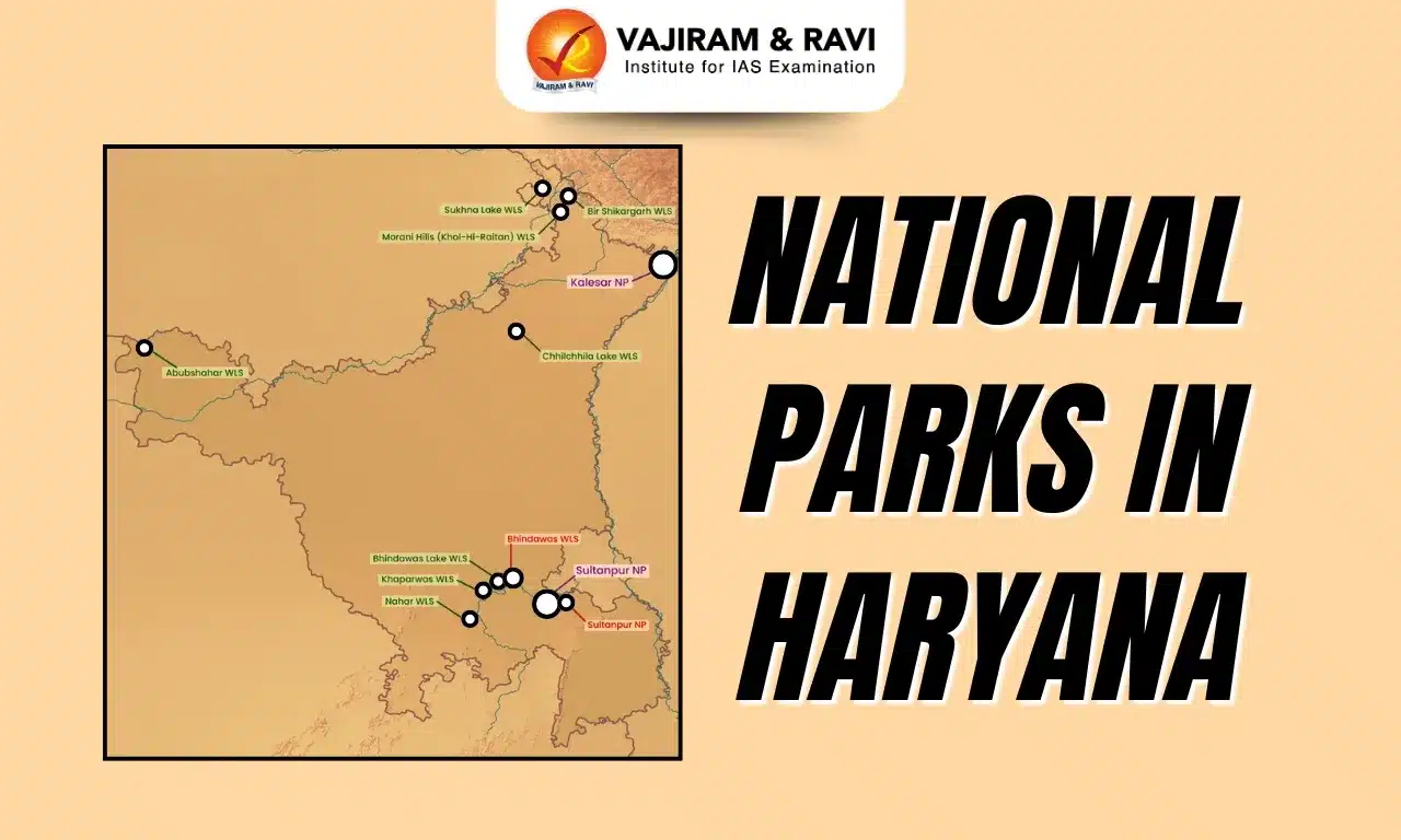
  • Geographic setting: Located in Eastern Himalayan foothills between Teesta and Jaldhaka rivers.
  • River system: Jaldhaka River (tributary of Brahmaputra) shapes floodplain grasslands and wildlife movement corridors.
  • Vegetation type: Sal forests, savannah grasslands, and moist deciduous formations
  • Flagship Species: Indian one-horned rhinoceros population.

  • Other fauna: Gaur, Asian elephant, sloth bear, sambar, hog deer.
  • Habitat: Riverine grasslands and moist deciduous forests.
  • Ecological Value: Supports Terai ecosystem continuity with Jaldapara and Chapramari.

Jaldapara National Park

Jaldapara National Park protects extensive grasslands supporting India’s second-largest rhinoceros population.
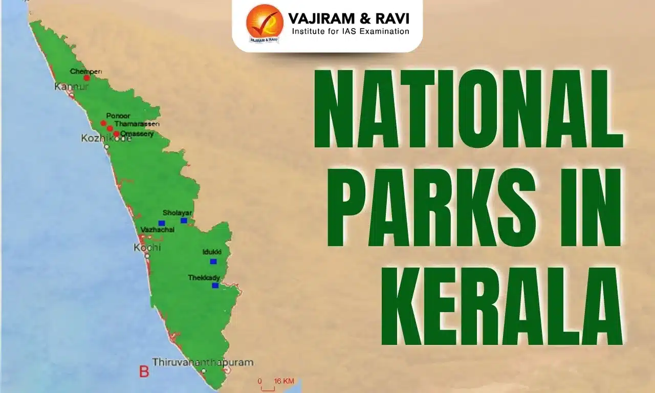
  • Location: Situated along Torsa River in Eastern Himalayan foothills.
  • Habitat type: Savannah grasslands with tall elephant grasses and seasonal wetlands.
  • Rhinoceros Population: Second-largest after Kaziranga National Park
  • Elephant Corridor: Chilapata Forest connects Buxa and Jaldapara.
  • Major fauna: Rhinoceros, Asian elephant, leopard, gaur, hog deer.
  • Ecological importance: Critical for grassland-dependent megafauna conservation.
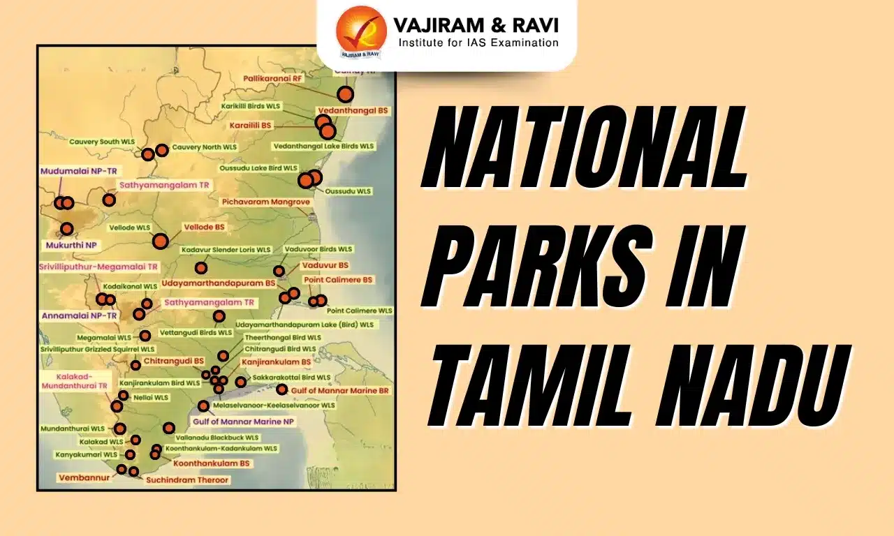
Neora Valley National Park

Neora Valley National Park protects pristine Himalayan biodiversity in Kalimpong region, known for minimal human interference.

  • Location: Situated in Kalimpong district along Eastern Himalayan ranges.
  • Biodiversity status: One of the least disturbed forest tracts in West Bengal.
  • Vegetation: Himalayan broadleaf forests with bamboo and oak dominance.
  • Altitude: Ranges from subtropical to temperate forests.
  • Flagship species: Red panda, classified as endangered globally.
  • Mammalian diversity: Leopard, black bear, golden cat, Himalayan flying squirrel.
  • Floral richness: Rhododendron, ferns, sal, and diverse understory plants.

Singalila National Park

Singalila National Park protects high-altitude ecosystems along the Singalila Ridge.

  • Location: Spread across Darjeeling district along India-Nepal border.
  • Altitudinal range: Includes alpine meadows and temperate forest belts.
  • Vegetation types: Coniferous, broadleaf, and mixed Himalayan forests.
  • Unique Species: Pangolin and yellow-throated marten.
  • Iconic fauna: Red panda, clouded leopard, Himalayan black bear.
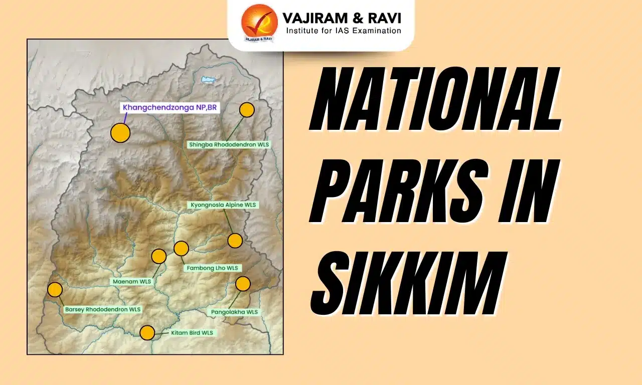
  • Floral diversity: Famous for seasonal rhododendron blooms.
  • Ecological role: Protects fragile montane ecosystems, migratory corridors and counter endemism.

Buxa National Park

Buxa National Park combines plains and hill ecosystems along the Indo-Bhutan border.

  • Location: Lies in Alipurduar region along Indo-Bhutan international boundary.
  • Habitat diversity: Evergreen, semi-evergreen, deciduous forests and grasslands.
  • Major mammals: Bengal tiger, Asian elephant, gaur, sambar.
  • Carnivore diversity: Leopard, clouded leopard, fishing cat present.
  • Avifauna richness: Hornbills, floricans, migratory falcons recorded.
  • Conservation threats: Flooding, habitat fragmentation, elephant poaching risks.

Tiger Reserves in West Bengal

West Bengal has two official Tiger Reserves under Project Tiger, vital for Bengal tiger survival. India has 58 tiger reserves managed by NTCA. The reserves in West Bengal are mangrove based Sundarbans and forested Buxa landscape. They focus on long term protection of Royal Bengal Tiger populations and maintaining predator-prey balance and ecosystem stability.

Sunderban Tiger Reserve

Sundarban Tiger Reserve protects the world’s only mangrove tiger population.

  • Area coverage: Total area about 2584.89 square kilometres including core and buffer.
  • Global uniqueness: Only mangrove forest with significant tiger population.
  • Tiger status: Minimum 79 tigers recorded through camera trapping.
  • Biodiversity richness: Dolphins, crocodiles, terrapins, marine turtles.

Buxa Tiger Reserve

Buxa Tiger Reserve conserves diverse forest ecosystems across plains and hills.

  • Area coverage: Total area 760.87 square kilometres including core and buffer.
  • Floral diversity: Over 350 tree species and rich orchid diversity.
  • Faunal range: Tigers, leopards, elephants, pangolins, diverse birds.
  • Conservation status: Low tiger density with intensive monitoring initiatives.

Wildlife Sanctuaries in West Bengal

West Bengal has sixteen Wildlife Sanctuaries that complement National Parks and Tiger Reserves. These sanctuaries protect riverine forests, wetlands, grasslands, mangroves, and urban biodiversity pockets. They support endangered species like fishing cat, Indian rhinoceros, elephants, migratory birds, and amphibians. Sanctuaries such as Sundarbans, Mahananda, Chapramari, and Senchal play a key role in landscape connectivity, ecological stability, and conservation education across the state’s diverse ecological zones.

Wildlife Sanctuaries in West Bengal List

Major Wildlife Sanctuaries of West Bengal represent diverse habitats and species protection priorities. There are 16 sanctuaries in West Bengal:

  1. Sundarbans Wildlife Sanctuary: Mangrove habitat protecting tigers, crocodiles, dolphins, and estuarine biodiversity.
  2. Mahananda Wildlife Sanctuary: Himalayan foothill forests sheltering elephants, leopards, and rich birdlife.
  3. Jaldapara Wildlife Sanctuary: Grassland ecosystem supporting Indian rhinoceros and migratory ungulates.
  4. Buxa Wildlife Sanctuary: Forest corridors linking Bhutan landscapes and North Bengal biodiversity.
  5. Chapramari Wildlife Sanctuary: Contiguous with Gorumara, supporting elephants and grassland fauna.
  6. Senchal Wildlife Sanctuary: Highland forests near Darjeeling protecting montane flora and birds.
  7. Sajnekhali Wildlife Sanctuary: Northern Sundarbans zone supporting otters, reptiles, and birds.
  8. Haliday Island Wildlife Sanctuary: Island ecosystem within Sundarbans Biosphere Reserve.
  9. Lothian Island Wildlife Sanctuary: Coastal island protecting mangrove and estuarine species.
  10. Jorepokhri Salamander Sanctuary: Last refuge of Himalayan salamander in Darjeeling.
  11. Ballavpur Wildlife Sanctuary: Small forest patch conserving dry deciduous species.
  12. Bethuadahari Wildlife Sanctuary: Forest reserve supporting deer and small carnivores.
  13. Bibhutibhushan Wildlife Sanctuary: Wetland forest supporting avifauna and amphibians.
  14. Chintamani Kar Bird Sanctuary: Urban bird sanctuary preserving local and migratory species.
  15. Pakhi Bitan Bird Sanctuary: Riverine bird habitat near Teesta Barrage.
  16. Raiganj Bird Sanctuary: Important nesting ground for migratory birds in North Bengal.

Ramsar Sites in West Bengal

Ramsar Sites in West Bengal highlight internationally significant wetlands supporting biodiversity and livelihoods.

  • East Kolkata Wetlands: World’s largest sewage-fed aquaculture system maintaining urban ecological balance.
  • Sundarban Wetland: India’s largest Ramsar Site with extensive mangrove biodiversity and ecosystem services.
Also Check
National Parks in Uttar Pradesh National Parks in Bihar
National Parks in Assam National Parks in Uttarakhand
National Parks in West Bengal National Parks in Arunachal Pradesh
National Parks in Andhra Pradesh National Parks in Chhattisgarh
National Parks in Goa National Parks in Jharkhand
National Parks in Gujarat National Parks in Kerala
National Parks in Haryana National Parks in Madhya Pradesh
National Parks in Himachal Pradesh National Parks in Maharashtra
National Parks in Karnataka National Parks in Odisha
National Parks in Manipur National Parks in Mizoram
National Parks in Meghalaya National Parks in Nagaland
National Parks in Telangana National Parks in Rajasthan
National Parks in Tamil Nadu National Parks in Sikkim
National Parks in Tripura

National Parks in West Bengal FAQs

Q1: How many National Parks are there in West Bengal?

Ans: West Bengal has six national parks, including Sundarbans, Gorumara, Jaldapara, Neora Valley, Singalila, and Buxa National Park.

Q2: Which is the most famous National Parks in West Bengal?

Ans: Sundarbans National Park is the most famous, known globally for mangrove forests and Royal Bengal Tigers.

Q3: Which National Parks in West Bengal are famous for one-horned rhinoceros?

Ans: Jaldapara National Park is famous for having the largest population of Indian one-horned rhinoceros after Kaziranga.

Q4: Which National Parks in West Bengal are known for Red Pandas?

Ans: Singalila National Park and Neora Valley National Park are known habitats of the endangered red panda.

Q5: Are there Tiger Reserves within National Parks in West Bengal?

Ans: Yes, Sundarbans and Buxa are designated Tiger Reserves under Project Tiger while also having national park status.

National Parks in Meghalaya, Wildlife Sanctuaries, Protected Areas

National Parks in Meghalaya

National Parks are large natural or near-natural areas legally protected to conserve ecosystems, species, and ecological processes while allowing education, research, and recreation. According to the IUCN, a protected area is a clearly defined geographical space managed through legal or effective means to ensure long-term conservation of nature, ecosystem services, and cultural values. These areas prevent habitat loss, protect endangered wildlife, conserve rivers and forests, and support climate regulation, biodiversity security, and sustainable livelihoods for local communities over long periods.

Protected Areas in Meghalaya

Meghalaya has a well-defined protected area network covering 1,133.9 square kilometres, about 5.06% of the state’s area.

  • Total Coverage: Protected areas span forests, hills, river valleys, and high-altitude ecosystems.
  • Category Range: Network includes national parks, wildlife sanctuaries, and a biosphere reserve.
  • Biodiversity Role: Areas support in-situ conservation of rare and endangered species.
  • Legal Protection: All sites are notified under wildlife conservation laws.
  • Ecological Value: These areas preserve habitats critical for mammals, birds, and plants.

Also Read: National Parks in India

National Parks in Meghalaya

Meghalaya has two National Parks that form the backbone of its wildlife conservation framework. These parks protect core forest ecosystems of the Garo Hills, safeguard river origins, and conserve rare flora and fauna. Together, they cover over 260 square kilometres and represent evergreen, semi-evergreen, and deciduous forest types. They also support endangered mammals like hoolock gibbons, elephants, and rare carnivores. Both parks play a crucial role in maintaining ecological stability, preserving genetic diversity, and supporting surrounding wildlife corridors.

Balpakram National Park

Balpakram National Park lies in the South Garo Hills near the India–Bangladesh border and is known for its deep gorges and plateau landscapes.

  • Location: Situated south of Garo Hills close to the international border.
  • Area Size: Covers about 220 square kilometres of protected forest.
  • Habitat Type: Dominated by subtropical evergreen and grassland ecosystems.
  • Key Mammals: Supports tiger, elephant, red panda, and wild water buffalo.
  • Carnivore Diversity: Home to marbled cat and Asian golden cat populations.

Nokrek National Park

Nokrek National Park forms the ecological core of the Nokrek Biosphere Reserve in the Garo Hills.

  • Geographic Setting: Located on the Tura Mountain Range near Nokrek Peak.
  • Elevation: Nokrek Peak rises to 1,418 metres above sea level.
  • Area Coverage: National park spans about 47.48 square kilometres.
  • Vegetation Types: Contains evergreen, semi-evergreen, and deciduous forests.
  • Faunal Importance: Habitat for hoolock gibbon, red panda, and Asian elephant.

Wildlife Sanctuaries in Meghalaya

Wildlife sanctuaries in Meghalaya complement national parks by protecting smaller but ecologically vital habitats. These sanctuaries conserve riverine forests, limestone landscapes, and species-specific habitats. They support diverse primates, birds, small carnivores, and rare plants. Meghalaya’s sanctuaries are crucial for conserving fragmented wildlife populations and maintaining ecological connectivity. Together, they protect species such as slow loris, macaques, clouded leopard, otter, and numerous bird species across different districts.

Siju Wildlife Sanctuary

Siju Wildlife Sanctuary lies along the Simsang River in South Garo Hills and is known for bird diversity.

  • Location: Situated on Simsang River banks in South Garo Hills district.
  • Area Size: Covers approximately 5.81 square kilometres.
  • Established Year: Notified as a sanctuary in 1979.
  • Habitat Focus: Protects riverine forests and wetland ecosystems.
  • Faunal Value: Important refuge for birds and small mammals.

Nongkhyllem Wildlife Sanctuary

Nongkhyllem Wildlife Sanctuary protects forest ecosystems in the Ri-Bhoi district near Assam border.

  • District Location: Located in Ri-Bhoi district of Meghalaya.
  • Area Extent: Encompasses about 29 square kilometres.
  • Notification Year: Declared a wildlife sanctuary in 1981.
  • Ecological Role: Conserves subtropical forests and wildlife corridors.
  • Fauna Presence: Supports deer, primates, and diverse bird species.

Baghmara Wildlife Sanctuary

Baghmara Wildlife Sanctuary is globally known for conserving unique carnivorous plants.

  • River Association: Located on banks of Someshwari River in Garo Hills.
  • Area Size: Extremely small sanctuary covering about 0.02 square kilometres.
  • Year Established: Declared protected in 1984.
  • Botanical Importance: Protects rare pitcher plant species.
  • Conservation Value: Focuses on plant-specific habitat preservation.

Narpuh Wildlife Sanctuary

Narpuh Wildlife Sanctuary safeguards forest biodiversity in the East Jaintia Hills region.

  • Regional Location: Situated in East Jaintia Hills district.
  • Area Coverage: Spreads across about 59.90 square kilometres.
  • Establishment Year: Notified as a sanctuary in 2014.
  • Habitat Type: Comprises dense forest and hilly terrain ecosystems.
  • Wildlife Role: Provides shelter to mammals, birds, and small carnivores.
Also Check
National Parks in Uttar Pradesh National Parks in Bihar
National Parks in Assam National Parks in Uttarakhand
National Parks in West Bengal National Parks in Arunachal Pradesh
National Parks in Andhra Pradesh National Parks in Chhattisgarh
National Parks in Goa National Parks in Jharkhand
National Parks in Gujarat National Parks in Kerala
National Parks in Haryana National Parks in Madhya Pradesh
National Parks in Himachal Pradesh National Parks in Maharashtra
National Parks in Karnataka National Parks in Odisha
National Parks in Manipur National Parks in Mizoram
National Parks in Meghalaya National Parks in Nagaland
National Parks in Telangana National Parks in Rajasthan
National Parks in Tamil Nadu National Parks in Sikkim
National Parks in Tripura

National Parks in Meghalaya FAQs

Q1: How many National Parks are there in Meghalaya?

Ans: Meghalaya has two National Parks: Balpakram National Park and Nokrek National Park.

Q2: What area of Meghalaya is under protected areas?

Ans: Protected areas cover about 5.06% of Meghalaya’s total geographical area.

Q3: Which National Park is part of a Biosphere Reserve in Meghalaya?

Ans: Nokrek National Park forms the core area of the Nokrek Biosphere Reserve.

Q4: Why is Balpakram National Park important for wildlife conservation?

Ans: It protects diverse habitats supporting rare species like tiger, elephant, and red panda.

Q5: Which sanctuary in Meghalaya is famous for pitcher plants?

Ans: Baghmara Wildlife Sanctuary is known for conserving rare pitcher plant species.

South Button Island National Park, Location, Features, Biodiversity

South Button Island National Park

South Button Island National Park is a small but beautiful protected area located in the Andaman and Nicobar Islands of India. Surrounded by clear blue waters, it is known for its peaceful environment and rich marine life. The park is especially famous for its coral reefs, colorful fish, and diverse underwater ecosystem. Though small in size, it plays an important role in marine biodiversity conservation and maintaining the ecological balance of the region. 

South Button Island National Park Highlights

  • South Button Island National Park is a beautiful marine park known for its crystal-clear turquoise waters, colorful coral reefs, and rich marine life, making it a perfect spot for nature lovers and adventure seekers.
  • It was established in 1987 and is a part of the Rani Jhansi Marine National Park, located in the Andaman and Nicobar Islands near Swaraj Dweep (Havelock Island).
  • Despite covering a very small area (around 5 sq km), it is one of the smallest national parks in India, yet it holds great ecological importance due to its vibrant biodiversity.
  • The park is famous for its white sandy beaches, gentle waves, and peaceful environment.

South Button Island National Park Flora (Plant Life)

  • The island has dense tropical vegetation with a mix of trees, shrubs, and coastal plants, giving it a rich green cover despite its small size.
  • Important plant species include Rattan palm (Calamus palustris), Dinochloa andamanica (climbing bamboo), and trees like Dipterocarpus, Artocarpus, and Canarium.
  • Other notable species such as Hopea odorata, Caryota mitis, and Sideroxylon add to the island’s biodiversity.
  • The most significant feature is the presence of shallow-water coral reefs, which act as the main “underwater vegetation” supporting marine life.
  • These coral reefs are visible even at shallow depths, making the ecosystem unique and visually stunning.

South Button Island National Park Fauna (Animal Life)

  • Since the island is very small, large terrestrial mammals are absent, but it is extremely rich in marine biodiversity.
  • The surrounding waters are home to animals like Dugongs, Dolphins, Sea turtles, and even Blue whales, making it ecologically important.
  • A wide variety of colorful fishes such as Snappers, Butterflyfish, Lionfish, Angelfish, and Barracuda can be easily spotted.
  • Marine creatures like Octopuses, Nudibranchs, Shrimps, and Manta rays thrive in the coral reef ecosystem.
  • The island is also a breeding ground for Sea turtles, which adds to its conservation value.
  • In terms of birdlife, species like the White-bellied sea eagle and the Edible-nest swiftlet (endemic subspecies) are commonly found.

South Button Island National Park Climate

  • The park experiences a tropical oceanic climate, which keeps the weather pleasant for most of the year.
  • The average temperature ranges between 20°C to 30°C, making it comfortable for visitors.
  • The region receives heavy rainfall during the monsoon season (June to October), which may affect travel plans.

Significance of South Button Island National Park

  • South Button Island National Park holds great importance as a marine biodiversity hotspot, where rich coral reefs support a wide variety of fish, sea turtles, and other marine species.
  • It plays a key role in conservation of coral ecosystems, which are very sensitive and important for maintaining the ecological balance of ocean life.
  • The park is a part of the Rani Jhansi Marine National Park, making it an important component of a larger protected marine area in the Andaman and Nicobar Islands.
  • It is especially significant as a breeding and nesting ground for sea turtles and a habitat for rare species like the Dugong (sea cow) and White-bellied sea eagle.
  • Being one of the smallest national parks in India, it shows how even a small area can have high ecological and environmental value.
  • The park also promotes eco-tourism activities like snorkeling and scuba diving, helping people learn about and appreciate marine conservation.
  • Its clear waters and healthy coral reefs act as a natural indicator of a clean and well-preserved marine environment.

South Button Island National Park FAQs

Q1: What is South Button Island National Park famous for?

Ans: It is famous for its crystal-clear waters, colorful coral reefs, and rich marine biodiversity, making it ideal for snorkeling and scuba diving.

Q2: Where is South Button Island National Park located?

Ans: It is located in the Andaman and Nicobar Islands, near Swaraj Dweep (Havelock Island), and is part of the Rani Jhansi Marine National Park.

Q3: Why is South Button Island National Park important?

Ans: The park is important for marine biodiversity conservation, especially for protecting coral ecosystems and species like sea turtles and dugongs.

Q4: What type of climate does the park have?

Ans: The park has a tropical oceanic climate with temperatures ranging from 20°C to 30°C and heavy rains during monsoon (June-October).

Q5: What kind of animals can be seen in South Button Island National Park?

Ans: Visitors can spot Dugongs, Dolphins, Sea turtles, Blue whales, and fish like Barracuda, Snappers, and Butterflyfish.

National Parks in Himachal Pradesh, Map, Wildlife Sanctuaries

National Parks in Himachal Pradesh

There are five National Parks in Himachal Pradesh that protect some of India’s most fragile Himalayan ecosystems. These parks span cold deserts, glacier-fed valleys, alpine meadows, and Shivalik foothills. Great Himalayan National Park is the only UNESCO World Heritage Site in the state. Pin Valley represents cold desert ecology, while Inderkilla and Khirganga strengthen forest connectivity in Kullu. Simbalbara safeguards Shivalik sal forests and acts as a wildlife corridor with Haryana.

Protected Areas in Himachal Pradesh

Himachal Pradesh has a vast protected area network conserving Himalayan biodiversity across altitudes, river basins, forests, glaciers, and cold deserts.

  1. National Parks: Five parks protecting alpine, subalpine, and Shivalik ecosystems.
  2. Wildlife Sanctuaries: Twenty-eight notified sanctuaries covering diverse mountain habitats.
  3. Ramsar Sites: Three internationally important wetlands supporting migratory birds.
  4. Ecosystem Coverage: Ranges from cold deserts to sal forests and alpine meadows.

National Parks in Himachal Pradesh

National Parks in Himachal Pradesh and other protected areas are officially recognised  regions created to conserve wildlife, forests, rivers, and fragile ecosystems. They restrict human activities such as hunting, logging, mining, and construction. Protected areas include National Parks, Wildlife Sanctuaries, Biosphere Reserves, and Ramsar Sites. These regions protect endangered species, regulate ecological balance, preserve genetic diversity, and safeguard watersheds that support rivers, agriculture, and climate stability across Himalayan landscapes and foothill regions.

Great Himalayan National Park (Kullu)

Great Himalayan National Park lies in the Kullu Valley formed by the Beas River and marks a biogeographic transition zone.

  1. Location: Situated at Indomalayan-Palearctic biogeographic junction.
  2. Establishment: Constituted in 1984 and notified as National Park in 1999.
  3. Global Status: Declared UNESCO World Heritage Site for biodiversity value.
  4. Topography: Features glaciers, peaks, meadows, and dense conifer forests.
  5. Vegetation: Ranges from temperate forests to subalpine ecosystems.
  6. Major Flora: Includes spruce forests, horse chestnut, and alpine grasslands.
  7. Major Fauna: Bharal, snow leopard, Himalayan brown bear, Himalayan tahr.
  8. Hydrology: Feeds Tirthan, Sainj, Jiwa Nal, and Parvati rivers.
  9. Connectivity: Linked with Pin Valley, Rupi Bhaba, and Kanawar sanctuaries.

Pin Valley National Park (Lahaul & Spiti)

Pin Valley National Park lies in the cold desert of Spiti and protects trans-Himalayan ecosystems.

  1. Location: Situated in Spiti Valley of Lahaul and Spiti district.
  2. Biosphere Context: Part of Cold Desert Biosphere Reserve.
  3. River System: Pin River joins Spiti River, a Sutlej tributary.
  4. Climate Zone: Characterized by extreme cold desert conditions.
  5. Vegetation: Dominated by alpine grasses and sparse shrubs.
  6. Wildlife: Supports snow leopard and Himalayan ibex populations.
  7. Cultural Landscape: Inhabited by Tibetan Buddhist communities.
  8. Heritage Sites: Houses monasteries like the historic Kungri Gompa.
  9. Boundaries: Adjacent to GHNP and Rupi Bhaba Wildlife Sanctuary.

Inderkilla National Park (Kullu)

Inderkilla National Park lies within the Kullu Valley and forms a forest continuity zone.

  1. Location: Situated in Kullu district along Beas River valley.
  2. River Support: Beas River provides essential water for wildlife.
  3. Ecosystem Type: Elevation supports temperate to alpine forests.
  4. Major Fauna: Includes black bear, common leopard, Himalayan ibex.
  5. Landscape Role: Acts as corridor with GHNP and Khirganga Park.
  6. Connectivity: Linked with Sainj and Tirthan Wildlife Sanctuaries.
  7. Conservation Value: Maintains genetic flow between protected forests.

Khirganga National Park (Kullu)

Khirganga National Park lies in Parvati Valley and protects high-altitude ecosystems.

  1. Location: Located in Parvati River basin of Kullu Valley.
  2. Tourism Context: Near Manikaran Sahib and trekking routes.
  3. Vegetation: Dominated by dry alpine scrub and grasslands.
  4. Wildlife: Supports snow leopard, ibex, bharal, brown fox.
  5. Park Linkage: Adjacent to GHNP and Inderkilla National Park.
  6. Geothermal Feature: Known for natural hot springs.

Simbalbara National Park (Sirmaur)

Simbalbara National Park lies in Shivalik foothills along Himachal-Haryana border.

  1. Location: Situated in Paonta Valley of Sirmaur district.
  2. Alternate Name: Also known as Colonel Sher Jung National Park.
  3. Size: Among India’s smallest national parks at around 28 square kilometres.
  4. Landscape: Located in Shivalik range influenced by Yamuna River.
  5. Vegetation: Dense sal forests with open grassy glades.
  6. Fauna: Leopard, sambhar, goral, chital, barking deer, nilgai.
  7. Corridor Role: Connected with Kalesar Wildlife Sanctuary, Haryana.

Wildlife Sanctuaries in Himachal Pradesh

Himachal Pradesh has twenty-eight Wildlife Sanctuaries protecting river basins, alpine zones, glaciers, forests, and wetlands. These sanctuaries conserve endangered species like snow leopard, musk deer, Himalayan ibex, and migratory birds. Many lie along major rivers such as Beas, Sutlej, Ravi, Chenab, and Yamuna. Several sanctuaries also protect sacred landscapes, high-altitude lakes, wetlands, and cultural heritage sites across the Lesser, Greater, and Trans-Himalayan ranges.

Wildlife Sanctuaries in Himachal Pradesh List

These sanctuaries conserve specific habitats, species, and river ecosystems across the state.

  1. Chandratal Wildlife Sanctuary: High-altitude lake ecosystem supporting snow leopard and ibex.
  2. Dhauladhar Wildlife Sanctuary: Lesser Himalayan forest with oak, deodar, and Hanuman Tibba peak.
  3. Kais Wildlife Sanctuary: Declared to protect endangered musk deer population.
  4. Kalatop-Khajjiar Wildlife Sanctuary: Deodar forests near Ravi River with pheasants and serow.
  5. Kugti Wildlife Sanctuary: High-altitude sanctuary between Ravi and Chenab rivers.
  6. Lippa Asrang Wildlife Sanctuary: Kinnaur sanctuary known for snow leopard presence.
  7. Pong Dam Lake Wildlife Sanctuary: Man-made wetland on Beas River supporting migratory birds.
  8. Rakchham Chitkul Wildlife Sanctuary: Sangla Valley sanctuary along Baspa River.
  9. Renuka Wildlife Sanctuary: Natural freshwater wetland near Yamuna tributary.
  10. Rupi Bhaba Wildlife Sanctuary: Sutlej riverine sanctuary linking Pin Valley and Govind Park.
  11. Churdhar Wildlife Sanctuary: Named after Churdhar Peak and sacred Shirgul shrine.
  12. Kibber Wildlife Sanctuary: Trans-Himalayan sanctuary along Spiti River.
  13. Manali Wildlife Sanctuary: Close to Manali town with riverine forests.
  14. Sech Tuan Nala Wildlife Sanctuary: Chamba district sanctuary conserving Himalayan fauna.
  15. Simbalbara Wildlife Sanctuary: It is recognised both as National Park as well as sanctuary.
  16. Shikari Devi Wildlife Sanctuary: Named after hilltop temple in Mandi district.
  17. Talra Wildlife Sanctuary: Protected forest landscape in Sirmaur district.
  18. Daranghati Wildlife Sanctuary: Upper Sutlej basin forest supporting diverse ungulates.
  19. Nargu Wildlife Sanctuary: Mandi district sanctuary with rich Himalayan biodiversity.
  20. Chail Wildlife Sanctuary: High-altitude forests near historic Chail town.
  21. Tundah Wildlife Sanctuary: Chamba region sanctuary protecting alpine meadows.
  22. Tirthan Wildlife Sanctuary: River-fed forest ecosystem linked with GHNP.
  23. Majathal Wildlife Sanctuary: Lesser Himalayan sanctuary with steep forested slopes.
  24. Gamgul Siyabehi Wildlife Sanctuary: Kangra region sanctuary with mixed forests.
  25. Gobind Sagar Wildlife Sanctuary: Sutlej reservoir ecosystem near Bhakra Dam.
  26. Shilli Wildlife Sanctuary: It is the smallest wildlife sanctuary in India.

Ramsar Site in Himachal Pradesh

Himachal Pradesh has three Ramsar-designated wetlands of international ecological importance. These Ramsar Sites conserve wetlands critical for migratory birds, freshwater ecology, river systems, and climate regulation across Himalayan landscapes.

  1. Chandra Taal: High-altitude lake near Kunzum Pass supporting snow leopard habitat.
  2. Pong Dam Lake: Beas River reservoir on migratory bird flyway.
  3. Renuka Lake: Natural freshwater wetland with karst formations and cultural significance.
Also Check
National Parks in Uttar Pradesh National Parks in Bihar
National Parks in Assam National Parks in Uttarakhand
National Parks in West Bengal National Parks in Arunachal Pradesh
National Parks in Andhra Pradesh National Parks in Chhattisgarh
National Parks in Goa National Parks in Jharkhand
National Parks in Gujarat National Parks in Kerala
National Parks in Haryana National Parks in Madhya Pradesh
National Parks in Himachal Pradesh National Parks in Maharashtra
National Parks in Karnataka National Parks in Odisha
National Parks in Manipur National Parks in Mizoram
National Parks in Meghalaya National Parks in Nagaland
National Parks in Telangana National Parks in Rajasthan
National Parks in Tamil Nadu National Parks in Sikkim
National Parks in Tripura


National Parks in Himachal Pradesh FAQs

Q1: How many National Parks are there in Himachal Pradesh?

Ans: Himachal Pradesh has five National Parks: Great Himalayan, Pin Valley, Inderkilla, Khirganga, and Simbalbara National Parks.

Q2: Which National Park in Himachal Pradesh is a UNESCO World Heritage Site?

Ans: Great Himalayan National Park in Kullu district is the only UNESCO World Heritage Site in Himachal Pradesh.

Q3: Which National Park represents the cold desert ecosystem of Himachal Pradesh?

Ans: Pin Valley National Park represents the cold desert ecosystem and is located in the Spiti Valley of Lahaul and Spiti district.

Q4: How many Wildlife Sanctuaries are there in Himachal Pradesh?

Ans: Himachal Pradesh has 28 Wildlife Sanctuaries protecting forests, rivers, alpine zones, and wildlife species.

Q5: How many Ramsar Sites are present in Himachal Pradesh?

Ans: Himachal Pradesh has three Ramsar Sites: Chandra Taal, Pong Dam Lake, and Renuka Lake.

National Parks in Bihar, Tiger Reserve, Wildlife Sanctuaries

National Parks in Bihar

National Parks and other protected areas are legally designated regions created to conserve wildlife, forests, wetlands, rivers and unique ecosystems. In India, these areas are notified under the Wildlife Protection Act 1972, to ensure long term protection of biodiversity. National Parks receive the highest level of protection with strict limits on human activity, while Wildlife Sanctuaries, Tiger Reserves and Ramsar wetlands allow regulated conservation based use. These protected areas help maintain ecological balance, protect endangered species, conserve genetic diversity and support climate resilience through forests and wetlands.

Protected Areas of Bihar

Bihar’s protected areas include national parks, wildlife sanctuaries, tiger reserves, bird sanctuaries and riverine conservation zones, covering forests, wetlands and rivers.

  • National Park: Valmiki National Park is the only national park in the state.
  • Tiger Reserves: Valmiki Tiger Reserve is currently  identified for tiger conservation with the proposal of a new Kaimur Reserve.
  • Wildlife Sanctuaries: Large forest and wetland sanctuaries across plains and plateaus.
  • Bird Sanctuaries: Oxbow lakes, dams and wetlands protecting migratory birds.
  • River Sanctuaries: Ganga stretch conserved for Gangetic dolphins and aquatic fauna.

National Parks in Bihar

Bihar has only one National Park- Valmiki National Park, located in the northernmost part of the state along the Indo Nepal border. Despite limited forest cover compared to central India, Bihar’s protected areas are ecologically significant due to their location in the Gangetic Plains, Himalayan foothills and Vindhyan landscapes. Valmiki National Park forms the core of Bihar’s tiger conservation efforts and connects with forest landscapes of Nepal. The state also supports wildlife through sanctuaries, tiger reserves, bird habitats and riverine protected zones.

Valmiki National Park

Valmiki National Park is Bihar’s only National Park in India, located in West Champaran district along the Indo Nepal border.

  1. Geographical Location: Situated in Shivalik foothills, bordered by Nepal and Gandak River.
  2. Area Coverage: Forms core zone of Valmiki Tiger Reserve spread over nearly 900 sq km.
  3. River Systems: Harha and Masan rivers originate here, forming Burhi Gandak downstream.
  4. Vegetation Types: Moist deciduous forests, semi evergreen patches, grasslands and wetlands.
  5. Major Mammals: Bengal tiger, leopard, sloth bear, black bear, Indian gaur and rhinoceros.
  6. Deer Species: Spotted deer, sambar, barking deer and hog deer widely distributed.
  7. Tribal Presence: Tharu tribe is the dominant indigenous community around the park.
  8. Bird Diversity: Himalayan terai birds, migratory waterfowl and forest species recorded.

Tiger Reserves in Bihar

Bihar has important tiger landscapes supporting conservation of big cats and forest corridors. Currently Bihar has only one recognised Tiger Reserve at Valmiki National Park with confirmed Breeding of Tigers. Although the state is set to get the second Tiger reserve within the Kaimur Wildlife Sanctuary which has received the permit from the Government and remains for the NTCA approval.

Valmiki Tiger Reserve

Valmiki Tiger Reserve is Bihar’s flagship conservation area and the 18th tiger reserve of India.

  1. Location: Situated in West Champaran along Nepal border in Shivalik foothills.
  2. Total Area: About 899 sq km including core and buffer zones.
  3. Core Habitat: Nearly 598 sq km notified as critical tiger habitat.
  4. Forest Types: Sal forests, mixed deciduous forests, swamps and grasslands.
  5. River Network: Gandak, Pandai, Manor, Harha and Masan rivers flow through reserve.
  6. Tiger Population: Tiger numbers increased from single digits to over 20 recently.
  7. Mammal Diversity: Over 50 mammal species recorded by Zoological Survey of India.
  8. Reptiles and Amphibians: Crocodiles, gharials, pythons, king cobra and hill turtles present.
  9. Bird Species: More than 240 bird species including vultures and Himalayan terai birds.

Wildlife Sanctuaries in Bihar

Bihar has a diverse network of wildlife sanctuaries protecting forests, wetlands, rivers and bird habitats. These sanctuaries are spread across Gangetic plains, Chota Nagpur plateau edges and Vindhyan ranges. They support mammals, birds, reptiles and aquatic species, many of which are endangered. Wetland sanctuaries like Kanwar Jheel are internationally important, while river sanctuaries protect India’s national aquatic animal. Forest sanctuaries such as Bhimbandh and Kaimur maintain ecological stability and act as wildlife corridors in eastern India.

Wildlife Sanctuaries in Bihar List

Bihar’s major sanctuaries conserve unique ecosystems ranging from forests to oxbow lakes and rivers. The list of major wildlife sanctuaries in Bihar has been given below:

  • Bhimbandh Wildlife Sanctuary: Large forest sanctuary south of Ganges with geothermal hot springs.
  • Gautam Buddha Wildlife Sanctuary: Cross state sanctuary with sal forests and large carnivores.
  • Kaimur Wildlife Sanctuary: Bihar’s largest sanctuary and important tiger corridor.
  • Kanwar Jheel Wildlife Sanctuary: Asia’s largest freshwater oxbow lake and Ramsar site.
  • Udaipur Wildlife Sanctuary: Wetland sanctuary on Gandaki floodplain supporting migratory birds.
  • Vikramshila Gangetic Dolphin Sanctuary: 60 km Ganga stretch protecting endangered dolphins.
  • Pant Rajgir Wildlife Sanctuary: Hill forest sanctuary around ancient Rajgir landscape.
  • Nagi Nakti Bird Sanctuaries: Important bird area supporting thousands of migratory birds.

Ramsar Sites in Bihar

Bihar’s Ramsar wetlands are internationally important oxbow lakes and bird sanctuaries that support migratory birds, endangered species, flood regulation and local livelihoods across the Gangetic plains. There are total 6 Ramsar Sites in Bihar including recently recognised areas:

  1. Kanwar Taal (Begusarai): Asia’s largest freshwater oxbow lake supporting critically endangered vultures and waterbirds.
  2. Nagi Bird Sanctuary (Jamui): Man made wetland hosting large congregations of bar headed geese.
  3. Nakti Bird Sanctuary (Jamui): Dam reservoir evolved into a major habitat for migratory ducks.
  4. Gokul Jalashay (Bhagalpur): Oxbow lake along Ganga supporting birds and local fisheries.
  5. Udaipur Jheel (Bhagalpur): Wetland within wildlife sanctuary aiding groundwater recharge.

Gogabeel Lake (Katihar): Floodplain wetland important for local biodiversity and fisheries.

Also Check
National Parks in Uttar Pradesh National Parks in Bihar
National Parks in Assam National Parks in Uttarakhand
National Parks in West Bengal National Parks in Arunachal Pradesh
National Parks in Andhra Pradesh National Parks in Chhattisgarh
National Parks in Goa National Parks in Jharkhand
National Parks in Gujarat National Parks in Kerala
National Parks in Haryana National Parks in Madhya Pradesh
National Parks in Himachal Pradesh National Parks in Maharashtra
National Parks in Karnataka National Parks in Odisha
National Parks in Manipur National Parks in Mizoram
National Parks in Meghalaya National Parks in Nagaland
National Parks in Telangana National Parks in Rajasthan
National Parks in Tamil Nadu National Parks in Sikkim
National Parks in Tripura

National Parks of Bihar FAQs

Q1: How many National Parks are there in Bihar?

Ans: Bihar has only one National Park, Valmiki National Park, located in West Champaran district.

Q2: Why is Valmiki National Park important?

Ans: It is Bihar’s only National Park and a major habitat for Bengal tigers and rich forest biodiversity.

Q3: Is Valmiki National Park also a Tiger Reserve?

Ans: Yes, Valmiki National Park forms the core area of the Valmiki Tiger Reserve.

Q4: Where is Valmiki National Park situated?

Ans: It is located along the Indo Nepal border in the Shivalik foothills of northern Bihar.

Q5: What type of wildlife is found in Valmiki National Park?

Ans: The park hosts tigers, leopards, bears, deer species, reptiles and over 240 bird species.

National Parks in Telangana, Map, Wildlife Sanctuaries, Tiger Reserves

National Parks in Telangana

National Parks in Telangana are legally notified regions created to conserve wildlife, forests, and ecological systems under the Wildlife (Protection) Act, 1972. Wildlife Sanctuaries permit limited human activity, while National Parks allow no human use except regulated conservation work. There are 574 Wildlife Sanctuaries covering 127,241.24 square kilometres and 107 National Parks in India spanning 44,402.95 square kilometres. These areas safeguard biodiversity, maintain ecological balance, protect endangered species, and preserve natural habitats critical for long-term environmental sustainability and climate resilience.

Protected Areas in Telangana

Telangana has a legally protected conservation network covering 7,260 square kilometres, forming 27% of the state’s forest area.

  • Ecological Coverage: Protected Areas preserve forests, rivers, reservoirs, and wildlife corridors.
  • Legal Framework: All areas are notified under the Wildlife Protection Act, 1972.
  • Biodiversity Strength: The state hosts 2,939 plant species and 365 bird species.
  • Faunal Diversity: Telangana supports 103 mammal and 28 reptile species.
  • Conservation Network: Includes Wildlife Sanctuaries, National Parks, and Tiger Reserves.
  • Landscape Variety: Ranges from dry deciduous forests to riverine ecosystems.
  • Threat Mitigation: Protected Areas reduce habitat loss and species decline.
  • Community Interface: Tribal livelihoods coexist under regulated conservation norms.
  • Ecological Balance: These zones stabilize food chains and water systems.

National Parks in Telangana

Telangana has three National Parks notified in 1994, each serving as a strictly protected ecosystem with zero human interference except permitted conservation activities. These parks are located in and around Hyderabad and collectively cover approximately 19.615 square kilometres. Despite their small size, they act as critical green lungs, preserve native dry deciduous vegetation, and support herbivores, carnivores, reptiles, and birds. Their legal status ensures maximum habitat protection, scientific monitoring, and long-term ecological stability in rapidly urbanizing landscapes.

Kasu Brahmananda Reddy National Park

Kasu Brahmananda Reddy National Park is a dense forest island surrounded by Jubilee Hills and Banjara Hills in Hyderabad.

  • Urban Forest Core: Preserves native forest inside a highly urbanized city.
  • Year of Notification: Declared a National Park in 1994.
  • Area Coverage: Spreads across 1.425 square kilometres.
  • Ecological Role: Regulates city temperature and air quality.
  • Vegetation Type: Supports dry deciduous forest species.
  • Faunal Presence: Habitat for birds, reptiles, and small mammals.
  • Conservation Value: Acts as Hyderabad’s primary biodiversity refuge.

Mahaveer Harina Vanasthali National Park

Mahaveer Harina Vanasthali National Park is a protected deer habitat located on Hyderabad’s outskirts.

  • Deer Conservation: Primarily protects spotted deer populations.
  • Year of Establishment: Notified as National Park in 1994.
  • Area Extent: Covers approximately 14.59 square kilometres.
  • Naming Origin: Named after Jain saint Lord Mahavir.
  • Habitat Type: Dry deciduous forest and grassland mosaic.
  • Faunal Diversity: Supports deer, reptiles, and avian species.
  • Ecological Importance: Maintains prey base for regional predators.

Mrugavani National Park

Mrugavani National Park is a compact conservation zone safeguarding dry forest biodiversity near Hyderabad.

  • Geographic Location: Situated on the outskirts of Hyderabad city.
  • Year of Declaration: Established as National Park in 1994.
  • Area Size: Covers about 3.60 square kilometres.
  • Key Species: Home to spotted deer and wild boars.
  • Predator Presence: Supports fox populations.
  • Vegetation Profile: Dry deciduous forest dominated landscape.
  • Conservation Role: Preserves native fauna near urban settlements.

Tiger Reserves in Telangana

Telangana has two notified Tiger Reserves forming the backbone of large-scale wildlife conservation.

  1. Amrabad Tiger Reserve: India’s second-largest reserve spanning 2,166.37 square kilometres, hosting tiger, leopard, nilgai, sambar, star tortoise, mugger crocodile, and yellow-throated bulbul, while supporting Chenchu tribal livelihoods.
  2. Kawal Tiger Reserve: Covers 892.23 square kilometres with dry deciduous forests, bordered by Godavari River, and supports tiger, gaur, sloth bear, cheetal, chausingha, and barking deer amid conservation challenges.

Wildlife Sanctuaries in Telangana

Wildlife Sanctuaries form the largest share of Telangana’s protected conservation framework. There are 9 Wildlife Sanctuaries in Telangana as discussed below:

  1. Eturnagaram Wildlife Sanctuary: Located in Dandakaranya forests, traversed by Godavari River, and hosts Medaram Jatara with Koya tribal presence.
  2. Kinnersani Wildlife Sanctuary: Surrounds Kinnerasani Reservoir and connects ecologically with Eturnagaram Sanctuary.
  3. Lanja Madugu Siwaram Sanctuary: Situated on Godavari River bank, protecting marsh crocodile habitats.
  4. Manjeera Crocodile Sanctuary: Riverine ecosystem around Manjeera Reservoir supporting mugger crocodiles and freshwater turtles.
  5. Pranahita Wildlife Sanctuary: Located along Pranahita River, famous for blackbuck populations near Kaleswaram.
  6. Pakhal Wildlife Sanctuary: Built around historic Pakhal Lake near Warangal, conserving forest-lake ecosystems.
  7. Pocharam Wildlife Sanctuary: Located in Medak and Nizamabad districts around Pocharam Lake.
  8. Kawal Wildlife Sanctuary: Dry deciduous forest zone forming core of Kawal Tiger Reserve.
  9. Amrabad Wildlife Sanctuary: Former Nagarjunasagar-Srisailam segment now forming Telangana’s primary tiger landscape.
Also Check
National Parks in Uttar Pradesh National Parks in Bihar
National Parks in Assam National Parks in Uttarakhand
National Parks in West Bengal National Parks in Arunachal Pradesh
National Parks in Andhra Pradesh National Parks in Chhattisgarh
National Parks in Goa National Parks in Jharkhand
National Parks in Gujarat National Parks in Kerala
National Parks in Haryana National Parks in Madhya Pradesh
National Parks in Himachal Pradesh National Parks in Maharashtra
National Parks in Karnataka National Parks in Odisha
National Parks in Manipur National Parks in Mizoram
National Parks in Meghalaya National Parks in Nagaland
National Parks in Telangana National Parks in Rajasthan
National Parks in Tamil Nadu National Parks in Sikkim
National Parks in Tripura

National Parks in Telangana FAQs

Q1: How many National Parks are there in Telangana?

Ans: Telangana has three National Parks: Kasu Brahmananda Reddy, Mahaveer Harina Vanasthali, and Mrugavani National Parks.

Q2: How many Protected Areas exist in Telangana?

Ans: The state has 14 Protected Areas, including 9 Wildlife Sanctuaries, 2 Tiger Reserves, and 3 National Parks.

Q3: Which is the largest Tiger Reserve in Telangana?

Ans: Amrabad Tiger Reserve is the largest in Telangana and the second largest Tiger Reserve in India.

Q4: What is the total area covered by Protected Areas in Telangana?

Ans: Protected Areas in Telangana cover about 7,260 square kilometres, nearly 27% of the state’s forest area.

Q5: Which endangered species are found in Telangana’s Protected Areas?

Ans: Key endangered species include tiger, leopard, gaur, four-horned antelope, blackbuck, marsh crocodile, and yellow-throated bulbul.

National Parks in Mizoram, Map, Wildlife Sanctuaries, Tiger Reserve

National Parks in Mizoram

National Parks and other protected areas are legally defined natural regions created to conserve ecosystems, wildlife species, and ecological processes over long periods. According to the IUCN, these areas are clearly identified geographical spaces managed through legal means to protect biodiversity, ecosystem services, and cultural values. National Parks specifically focus on preserving large natural landscapes with minimal human interference while supporting education, research, recreation, and conservation-compatible tourism without harming wildlife or habitats.

Protected Areas in Mizoram

Mizoram has a well-defined protected area network conserving fragile Indo-Burma biodiversity hotspot ecosystems across hills, forests, rivers, and wetlands.

  • Total Protected Area Coverage: 1,240.75 square kilometres forming 5.88% of state area.
  • Legal Framework: All areas notified under state forest and wildlife protection laws.
  • Ecological Significance: Part of Indo-Burma global biodiversity hotspot.
  • Habitat Diversity: Includes montane forests, river valleys, wetlands, and hill ecosystems.
  • Species Protection: Supports threatened mammals, birds, reptiles, and endemic flora.

Also Read: National Parks in India

National Parks in Mizoram

Mizoram has two notified National Parks covering ecologically sensitive hill ecosystems within the Patkai mountain range. These parks conserve high-altitude forests, river catchments, and rare wildlife species adapted to mountainous terrain. Located near international borders with Myanmar, both parks are vital for transboundary wildlife movement and biodiversity continuity. Together, they protect semi-evergreen and sub-montane forests supporting endangered mammals and birds while maintaining watershed stability for major rivers feeding the Barak and Kaladan basins.

Phawngpui Blue Mountain National Park

Phawngpui Blue Mountain National Park protects Mizoram’s highest peak and fragile high-altitude ecosystems along the India-Myanmar border.

  • Location and District: Situated in Lawngtlai district near Myanmar international boundary.
  • Altitude Significance: Covers Phawngpui peak rising to 2,157 metres above sea level.
  • Mountain Range: Part of Mizo Hills within the larger Patkai mountain system.
  • River System: Kolodyne River flows along eastern boundary forming international border.
  • Major Mammals: Supports slow loris, tiger, leopard, serow, and goral populations.
  • Key Avifauna: Habitat of Mrs. Hume’s pheasant, Mizoram’s state bird.

Murlen National Park

Murlen National Park conserves dense forest ecosystems of eastern Mizoram close to the Myanmar border.

  • Location and District: Located in Champhai district near Chin Hills of Myanmar.
  • Geographical Setting: Lies within Mizo Hills, part of the Patkai range.
  • Nearby Protected Areas: Situated south of Lengteng Wildlife Sanctuary.
  • River Systems: Influenced by Tiau, Tuivai, and Champhai river catchments.
  • Vegetation Type: Dominated by semi-evergreen and sub-montane forests.
  • Major Mammals: Tiger, leopard, Himalayan black bear, serow, hoolock gibbon present.
  • Important Birds: Mrs. Hume’s pheasant and hill myna frequently recorded.

Tiger Reserves in Mizoram

Mizoram has one officially designated Tiger Reserve forming the largest protected forest landscape in the state. Located in western Mizoram, the reserve plays a critical role in conserving apex predators and maintaining ecological balance across the Lushai Hills. Although tigers were not recorded during the 2018 census, recent sightings confirm habitat viability. The reserve also supports globally significant clouded leopard populations and functions as a crucial watershed for major river systems.

Dampa Tiger Reserve

Dampa Tiger Reserve is Mizoram’s largest protected area conserving predator-rich forest ecosystems of the Lushai Hills.

  • Location and District: Situated in Mamit district within Lushai Hills of Mizoram.
  • Area Coverage: Spans approximately 500 square kilometres of dense forest.
  • Tiger Status: No tiger in 2018 census, recent sightings confirm presence.
  • Clouded Leopard Importance: One of South and Southeast Asia’s highest populations.
  • Highest Peak: Chhawrpialtlang rises to 1,095 metres above sea level.
  • Other Peaks: Dampatlang at 869 metres and Pathlawilunglentlang at 780 metres.
  • River Drainage: Kaladan River drains west, Teirei River drains eastern slopes.
  • Major Mammals: Tiger, Indian leopard, clouded leopard recorded.
  • Key Birds: Great hornbill represents major avifaunal species.
  • Conservation Threats: Shifting cultivation, oil palm expansion, teak plantations.

Wildlife Sanctuaries in Mizoram

Mizoram’s wildlife sanctuaries complement National Parks by protecting river valleys, forest corridors, wetlands, and border ecosystems critical for regional biodiversity conservation.

  • Khawnglung Wildlife Sanctuary: Located in Lunglei district within Lushai Hills protecting forested hill landscapes.
  • Lengteng Wildlife Sanctuary: Situated in Champhai district north of Murlen National Park conserving eastern hill forests.
  • Ngengpui Wildlife Sanctuary: Located in Lawngtlai district along Ngengpui River valley joining Kolodyne River.
  • Tawi Wildlife Sanctuary: Positioned in Serchhip district southwest of Murlen supporting mid-hill forest ecosystems.
  • Thorangtlang Wildlife Sanctuary: Located in Lunglei district near Indo-Bangladesh border conserving border forests.
  • Tokalo Wildlife Sanctuary: Situated in Saiha district south of Ngengpui protecting southern forest landscapes.
  • Pualreng Wildlife Sanctuary: Located in Kolasib district conserving northern forest ecosystems and corridors.

Ramsar Site in Mizoram (Pala Wetland)

Pala Wetland is Mizoram’s only Ramsar-recognised wetland supporting aquatic biodiversity within the Indo-Burma hotspot.

  • Local Names: Known as Pala Tipo, Pala Lake, and Palak Dil locally.
  • Sanctuary Linkage: Forms core ecological component of Palak Wildlife Sanctuary.
  • Biodiversity Hotspot: Located within Indo-Burma global biodiversity hotspot region.
  • Major Mammals: Supports sambar deer, barking deer, and endangered hoolock gibbon.
  • Ecological Role: Maintains wetland biodiversity, water regulation, and habitat stability.
Also Check
National Parks in Uttar Pradesh National Parks in Bihar
National Parks in Assam National Parks in Uttarakhand
National Parks in West Bengal National Parks in Arunachal Pradesh
National Parks in Andhra Pradesh National Parks in Chhattisgarh
National Parks in Goa National Parks in Jharkhand
National Parks in Gujarat National Parks in Kerala
National Parks in Haryana National Parks in Madhya Pradesh
National Parks in Himachal Pradesh National Parks in Maharashtra
National Parks in Karnataka National Parks in Odisha
National Parks in Manipur National Parks in Mizoram
National Parks in Meghalaya National Parks in Nagaland
National Parks in Telangana National Parks in Rajasthan
National Parks in Tamil Nadu National Parks in Sikkim
National Parks in Tripura

National Parks in Mizoram FAQs

Q1: How many National Parks are there in Mizoram?

Ans: Mizoram has two National Parks: Phawngpui Blue Mountain National Park and Murlen National Park.

Q2: Which is the highest National Park in Mizoram?

Ans: Phawngpui Blue Mountain National Park is the highest, located at 2,157 metres above sea level.

Q3: Does Mizoram have a Tiger Reserve?

Ans: Yes, Dampa Tiger Reserve is the only Tiger Reserve in Mizoram.

Q4: Which bird is the state bird found in Mizoram’s protected areas?

Ans: Mrs. Hume’s pheasant is the state bird and is found in Phawngpui and Murlen regions.

Q5: What is the Ramsar site of Mizoram?

Ans: Pala Wetland, also known as Palak Lake, is Mizoram’s only Ramsar-designated site.

National Parks in Jharkhand, Map, Wildlife Sanctuaries, Tiger Reserves

National Parks in Jharkhand

National Parks in Jharkhand are the areas that have been established to conserve wildlife, forests, rivers, and fragile ecosystems. National Parks in India receive the highest level of protection under the Wildlife Protection Act 1972, prohibiting grazing, forestry, and human exploitation. Wildlife Sanctuaries allow limited human activity under regulation, while Tiger Reserves focus on long-term tiger conservation using core and buffer zones. These protected areas help maintain biodiversity, safeguard endangered species, support ecological balance, and preserve genetic resources for future generations through scientific management and monitoring.

Protected Areas in Jharkhand

Jharkhand has diverse protected areas spread across plateau, hill, forest, and riverine landscapes.

  1. National Parks: Highest legal protection areas conserving entire ecosystems.
  2. Tiger Reserves: Landscapes focused on tiger survival and prey conservation.
  3. Wildlife Sanctuaries: Areas protecting specific fauna, flora, and habitats.
  4. Bird Sanctuaries: Wetlands conserving migratory and resident bird species.
  5. Ramsar Sites: Internationally important wetlands recognized for biodiversity value.

National Parks in Jharkhand

Jharkhand has only one National Park, Betla National Park, making it extremely significant for biodiversity conservation in eastern India. Located on the Chota Nagpur Plateau, it forms the core of the Palamau Tiger Reserve and includes Mahuadanr Wolf Sanctuary. The park protects tropical deciduous forests dominated by sal and bamboo, river systems like the North Koel, and diverse wildlife including tigers, elephants, gaur, and wolves. Betla also holds historical importance, tribal heritage, and was among India’s earliest Project Tiger landscapes.

Betla National Park

Betla National Park is Jharkhand’s only National Park, notified in 1986 and spread over 231.67 square kilometres in Latehar and Palamu districts.

  1. Location: Situated on Chota Nagpur Plateau across Latehar and Palamu districts.
  2. River System: North Koel River flows through, forming seasonal waterfalls.
  3. Forest Type: Dominated by sal, bamboo, mahua, semal, and mixed deciduous vegetation.
  4. Faunal Diversity: Tigers, elephants, gaur, sloth bear, wolves, chital, sambhar present.
  5. Avifauna: Hornbills, black ibis, quails, Indian pitta frequently recorded.
  6. Conservation Status: Core area of Palamau Tiger Reserve under Project Tiger.
  7. Unique Feature: Includes Mahuadanr Wolf Sanctuary, India’s first wolf sanctuary.
  8. Cultural Aspect: Inhabited historically by Oraon and Munda tribal communities.

Tiger Reserve in Jharkhand

Jharkhand has one Tiger Reserve, Palamau Tiger Reserve, which is among the nine original tiger reserves notified in India under Project Tiger. Spread across Latehar and Garhwa districts, it covers 1,129.93 square kilometres with clearly demarcated core and buffer zones. The reserve has undulating terrain, valleys, hills, and dry deciduous forests dominated by sal. Despite challenges like difficult terrain and left-wing extremism, it supports tigers, elephants, leopards, wolves, and rich prey diversity, making it ecologically critical for eastern India.

Palamau Tiger Reserve

Palamau Tiger Reserve forms the backbone of tiger conservation in Jharkhand.

  1. Area Coverage: Core 414.08 square kilometres, buffer 715.85 square kilometres.
  2. Rivers: North Koel, Auranga, and Burha rivers drain the reserve.
  3. Forest Types: Dry and moist deciduous sal forests with bamboo brakes.
  4. Wildlife Richness: Tigers, elephants, leopards, wolves, wild dogs recorded.
  5. Biodiversity Data: 39 mammals, 170 birds, and 8 reptile species documented.
  6. Historical Importance: First tiger pugmark census conducted here in 1934.

Wildlife Sanctuaries in Jharkhand

Jharkhand has a well-distributed network of Wildlife Sanctuaries conserving elephants, leopards, wolves, deer, birds, and dry deciduous forest ecosystems. These sanctuaries protect important corridors, hill ranges, river valleys, and plateau forests across the state. Many sanctuaries are contiguous, forming larger conservation landscapes along Bihar and Chhattisgarh borders. They support endangered species, migratory birds, and unique habitats while also acting as buffers for the Palamau Tiger Reserve and contributing to ecological connectivity across eastern India.

Wildlife Sanctuaries in Jharkhand List

Jharkhand has eleven notified Wildlife Sanctuaries with distinct ecological roles.

  1. Palamu Wildlife Sanctuary: Large sanctuary supporting elephants, gaur, and sambhar within Project Tiger landscape.
  2. Hazaribagh Wildlife Sanctuary: Dry deciduous forest north of Ranchi, notable for panther and wild vulture presence.
  3. Mahuadanr Wolf Sanctuary: India’s first wolf sanctuary and breeding ground for Indian grey wolf.
  4. Dalma Wildlife Sanctuary: Important elephant corridor in Dalma Hills linking forest patches.
  5. Topchanchi Wildlife Sanctuary: Small sanctuary near Parasnath Hills with dry sal forests.
  6. Lawalong Wildlife Sanctuary: River-bounded sanctuary connected to Gautam Budha and Koderma forests.
  7. Koderma Wildlife Sanctuary: Dry deciduous forest adjacent to Gautam Budha Sanctuary supporting leopards.
  8. Parasnath Wildlife Sanctuary: Located in Parasnath Hills, sacred to Jainism and rich in fauna.
  9. Palkot Wildlife Sanctuary: River-drained hilly forest connected to Saranda and Dalma landscapes.
  10. Gautam Budha Wildlife Sanctuary: Spread across Jharkhand and Bihar with mixed deciduous forests.
  11. Udhwa Lake Bird Sanctuary: Only bird sanctuary of Jharkhand supporting migratory waterfowl.

Ramsar Site in Jharkhand

Jharkhand has one Ramsar Site, Udhwa Lake Bird Sanctuary, recognized internationally for wetland biodiversity.

  1. Location: Situated in Sahibganj district along the Ganga River.
  2. Wetland Structure: Comprises Pataura Lake and Barhel Lake connected by channels.
  3. Biodiversity Value: Supports over 140 bird species including migratory waterfowl.
  4. Threatened Species: Habitat for band-tailed fish eagle, common pochard, lesser adjutant stork.
  5. Cultural Importance: Named after saint Uddhava and linked to the historic 1763 battle site.
Also Check
National Parks in Uttar Pradesh National Parks in Bihar
National Parks in Assam National Parks in Uttarakhand
National Parks in West Bengal National Parks in Arunachal Pradesh
National Parks in Andhra Pradesh National Parks in Chhattisgarh
National Parks in Goa National Parks in Jharkhand
National Parks in Gujarat National Parks in Kerala
National Parks in Haryana National Parks in Madhya Pradesh
National Parks in Himachal Pradesh National Parks in Maharashtra
National Parks in Karnataka National Parks in Odisha
National Parks in Manipur National Parks in Mizoram
National Parks in Meghalaya National Parks in Nagaland
National Parks in Telangana National Parks in Rajasthan
National Parks in Tamil Nadu National Parks in Sikkim
National Parks in Tripura

National Parks in Jharkhand FAQs

Q1: How many National Parks are there in Jharkhand?

Ans: Jharkhand has only one National Park, Betla National Park, notified in 1986 in the Palamu-Latehar region.

Q2: Which Tiger Reserve is located in Jharkhand?

Ans: Palamau Tiger Reserve is the only Tiger Reserve in Jharkhand and one of India’s original nine Project Tiger reserves.

Q3: Which Wildlife Sanctuary in Jharkhand is famous for wolves?

Ans: Mahuadanr Wolf Sanctuary is famous as India’s first sanctuary dedicated to the Indian grey wolf.

Q4: How many Wildlife Sanctuaries are there in Jharkhand?

Ans: Jharkhand has eleven notified Wildlife Sanctuaries protecting forests, wildlife corridors, and wetlands.

Q5: Which is the Ramsar Site in Jharkhand?

Ans: Udhwa Lake Bird Sanctuary in Sahibganj district is the only Ramsar Site in Jharkhand.

National Parks in Odisha, Map, Wildlife Sanctuaries, Tiger Reserves

National Parks in Odisha

National Parks in Odisha are large, legally protected natural areas created to conserve entire ecosystems, ecological processes, and native wildlife with minimal human interference. As per the IUCN definition, protected areas are clearly defined geographical spaces managed through legal means to ensure long-term conservation of nature, ecosystem services, and cultural values. The National Parks in India support biodiversity conservation, climate regulation, water security, scientific research, education, and sustainable eco-tourism while maintaining ecological balance across landscapes and biogeographic zones.

Protected Areas in Odisha

Odisha has a well-distributed protected area network covering coastal, plateau, mangrove, riverine, and Eastern Ghats ecosystems.

  • National Parks: Highest legal protection areas conserving entire ecosystems.
  • Wildlife Sanctuaries: Areas allowing limited regulated human activities.
  • Tiger Reserves: Landscapes prioritizing tiger and prey conservation.
  • Ramsar Sites: Wetlands of international importance under Ramsar Convention.
  • Biosphere Reserves: Large regions integrating conservation with livelihoods.

National Parks in Odisha

There are two officially notified National Parks in Odisha, namely- Bhitarkanika and Similipal. These represent coastal mangrove and plateau forest ecosystems respectively. These parks protect globally significant biodiversity including mangroves, estuarine crocodiles, melanistic tigers, elephants, orchids, and migratory birds. Similipal was declared Odisha’s second National Park in 2025, becoming India’s 107th National Park. Together, these parks secure key habitats, regulate hydrology, support climate resilience, and serve as biodiversity strongholds within the Eastern Ghats and coastal ecological systems.

Bhitarkanika National Park

Bhitarkanika National Park conserves India’s second-largest mangrove ecosystem within a complex estuarine river network. The key features of the Bhitarkanika National Park has been listed below:

  • Location: It is located within the Kendrapara district of Odisha.
  • Area: It is spread over 145 sq km covering a vast area.
  • Ecosystem Type: Mangrove forests influenced by Brahmani, Baitarani, and Dhamra rivers.
  • Crocodile Habitat: Largest breeding ground of saltwater crocodiles in India.
  • Turtle Nesting: Adjacent Gahirmatha beach hosts world’s largest Olive Ridley rookery.
  • Bird Diversity: Bagagahana heronry supports thousands of nesting waterbirds.
  • Hydrology: Interlinked creeks, canals, and tidal channels shape unique estuarine ecology.

Similipal National Park

Similipal National Park protects a large plateau forest ecosystem within the Eastern Ghats landscape. The major highlights of Similipal National Park has been given below:

  • Location: It is located in the Mayurbhanj district of Odisha.
  • Area: It covers area of about 845.70 sq km
  • Tiger Uniqueness: World’s only natural habitat of wild melanistic tigers.
  • Species Richness: Home to 40 Bengal tigers and 25% of Odisha’s elephants.
  • Floral Diversity: Supports 104 orchid species including several endemics.
  • Geography: Surrounded by plateaus with Meghashini and Khairiburu highest peaks.
  • Waterfalls: Barehipani and Joranda rank among India’s tallest waterfalls.

Tiger Reserves in Odisha

Odisha has two notified tiger reserves and one approved reserve expanding tiger conservation landscapes. The list of existing and proposed Tiger Reserves in Odisha has been given below:

  1. Similipal Tiger Reserve: Largest reserve protecting melanistic tigers, elephants, and Eastern Ghats forests across Mayurbhanj district.
  2. Satkosia Tiger Reserve: Combines Satkosia Gorge and Baisipalli sanctuaries conserving riverine forests along Mahanadi gorge.
  3. Debrigarh Tiger Reserve (Proposed): NTCA-approved sanctuary near Hirakud reservoir, strengthening central Indian tiger corridor connectivity.

Wildlife Sanctuaries in Odisha

Odisha hosts a diverse network of Wildlife Sanctuaries covering rivers, forests, hills, wetlands, and coastlines. There are total 19 Wildlife Sanctuaries in Odisha as listed below:

  1. Badrama Wildlife Sanctuary: Located near Hirakud reservoir, protecting moist deciduous forests and elephant habitats.
  2. Baisipalli Wildlife Sanctuary: Part of Satkosia landscape along Mahanadi gorge with rich riverine biodiversity.
  3. Balukhand Konark Wildlife Sanctuary: Coastal sanctuary protecting dunes, casuarina plantations, blackbucks, and spotted deer.
  4. Chandaka Dampara Wildlife Sanctuary: Elephant reserve near Bhubaneswar supporting migratory elephant corridors.
  5. Debrigarh Wildlife Sanctuary: Forested hills near Hirakud reservoir with leopard and bird diversity.
  6. Hadgarh Wildlife Sanctuary: Catchment of Salandi river supporting elephants and linking Similipal landscape.
  7. Kapilash Wildlife Sanctuary: Elephant corridor between Mahanadi and Brahmani rivers near Cuttack.
  8. Kothagarh Wildlife Sanctuary: Eastern Ghats forest connected with Karlapat and Satkosia landscapes.
  9. Lakhari Valley Wildlife Sanctuary: Eastern Ghats sanctuary drained by Rushikulya river system.
  10. Nandankanan Wildlife Sanctuary: Urban-proximate sanctuary known for captive breeding of lions and crocodiles.
  11. Satkosia Gorge Wildlife Sanctuary: River gorge ecosystem with moist deciduous and riverine forests.
  12. Sunabeda Wildlife Sanctuary: Proposed tiger reserve adjoining Udanti-Sitanadi landscape of Chhattisgarh.
  13. Karlapat Wildlife Sanctuary: Eastern Ghats sanctuary in Kalahandi supporting leopards and deciduous forests.
  14. Khalasuni Wildlife Sanctuary: Adjacent to Badrama, protecting forested hills and wildlife corridors.
  15. Kuldiha Wildlife Sanctuary: Forested hills linked to Similipal through narrow ecological corridors.
  16. Gahirmatha Marine Wildlife Sanctuary: World’s largest Olive Ridley turtle nesting beach along Odisha coast.
  17. Chilika Nalabana Wildlife Sanctuary: Core bird habitat within Chilika lagoon hosting migratory waterfowl.
  18. Bhitarkanika Wildlife Sanctuary: Larger mangrove landscape surrounding Bhitarkanika National Park.
  19. Similipal Wildlife Sanctuary: Buffer zone around national park allowing regulated human activities.

Ramsar Site in Odisha

Odisha has six Ramsar wetlands recognized for global ecological importance.

  1. Chilika Lake: Asia’s largest brackish lagoon supporting Irrawaddy dolphins and migratory birds.
  2. Bhitarkanika Mangroves: Mangrove wetland protecting saltwater crocodiles and Olive Ridley turtles.
  3. Ansupa Lake: Odisha’s largest freshwater lake formed by Mahanadi oxbow system.
  4. Hirakud Reservoir: Major flood-regulating wetland supporting fish and waterbird diversity.
  5. Satkosia Gorge: Riverine wetland with endangered turtles and Eastern Ghats biodiversity.
  6. Tampara Lake: Coastal freshwater lagoon aiding flood control and fishery resources.
Also Check
National Parks in Uttar Pradesh National Parks in Bihar
National Parks in Assam National Parks in Uttarakhand
National Parks in West Bengal National Parks in Arunachal Pradesh
National Parks in Andhra Pradesh National Parks in Chhattisgarh
National Parks in Goa National Parks in Jharkhand
National Parks in Gujarat National Parks in Kerala
National Parks in Haryana National Parks in Madhya Pradesh
National Parks in Himachal Pradesh National Parks in Maharashtra
National Parks in Karnataka National Parks in Odisha
National Parks in Manipur National Parks in Mizoram
National Parks in Meghalaya National Parks in Nagaland
National Parks in Telangana National Parks in Rajasthan
National Parks in Tamil Nadu National Parks in Sikkim
National Parks in Tripura

National Parks in Odisha FAQs

Q1: How many National Parks are there in Odisha?

Ans: Odisha has two national parks: Bhitarkanika National Park and Similipal National Park.

Q2: Which National Park in Odisha is famous for melanistic tigers?

Ans: Similipal National Park is globally known for hosting the world’s only wild melanistic tigers.

Q3: Which ecosystem is protected by Bhitarkanika National Park?

Ans: Bhitarkanika protects India’s second-largest mangrove ecosystem with estuarine and tidal habitats.

Q4: How many Tiger Reserves are officially notified in Odisha?

Ans: Odisha has two notified tiger reserves: Similipal and Satkosia, with Debrigarh approved as the third.

Q5: Which Ramsar site in Odisha is the largest coastal lagoon in India?

Ans: Chilika Lake is India’s largest coastal lagoon and the first Ramsar site of the country.

National Parks in Assam, Tiger Reserves, Wildlife Sanctuaries

National Parks in Assam

National Parks in Assam and other protected areas are legally notified regions created to conserve wildlife, forests, wetlands, and natural ecosystems. They restrict human activities like hunting, logging, and settlement. The biodiversity is protected through National Parks in India, Wildlife Sanctuaries, Tiger Reserves, Biosphere Reserves, Ramsar wetlands, and Elephant Reserves, ensuring habitat security, ecological balance, climate regulation, and long-term survival of endangered flora and fauna.

Protected Areas in Assam

The Protected Areas in Assam safeguards ecosystems across forests, wetlands, and floodplains. These include:

  1. National Parks: 8 legally notified parks protect core ecosystems.
  2. Wildlife Sanctuaries: 20 sanctuaries including proposed areas.
  3. Tiger Reserves: 3 reserves under Project Tiger.
  4. Biosphere Reserves: Manas and Dibru-Saikhowa designated.
  5. World Heritage Sites: Kaziranga and Manas recognised globally.
  6. Ramsar Site: Deepor Beel listed for wetland conservation.
  7. Important Bird Areas: 46 Important Bird Areas identified.
  8. Elephant Reserves: 5 notified elephant landscapes.

National Parks in Assam

Assam is one of India’s richest biodiversity states, located in the Eastern Himalayas and Brahmaputra floodplains. It hosts grasslands, wetlands, tropical forests, and river ecosystems. Assam has eight National Parks, two Biosphere Reserves, three Tiger Reserves, one Ramsar Site, and forty six Important Bird Areas, making it a global conservation hotspot.

[my_image src="https://vajiramias.sgp1.cdn.digitaloceanspaces.com/wp/current-affairs/2025/12/National-Parks-in-Assam-1.webp?v=2" size="full" align="none" width="auto" height="388px" alt="National Parks in Assam map" title="National Parks in Assam"]

Kaziranga National Park

Kaziranga represents the Brahmaputra floodplain grassland ecosystem and supports the world’s largest population of one-horned rhinoceros.

  1. Location and Landscape: Situated across Nagaon, Golaghat, and Sonitpur districts along Brahmaputra floodplains.
  2. Global Significance: Holds over seventy percent of the world’s one-horned rhinoceros population.
  3. Tiger Prey Base: Highest prey biomass density supporting strong tiger populations in India.
  4. Big Five Census: Recorded rhino 1855, wild buffalo 1431, elephant 1246, tiger 85.
  5. Unique Mammals: Eastern swamp deer survives only here within India.
  6. Bird Diversity: Home to 480 recorded bird species including 25 globally threatened.
  7. Aquatic Systems: Contains over 150 perennial water bodies supporting fish breeding.
  8. Floral Diversity: Supports more than 32 aquatic plant species.
  9. Reptile Presence: Hosts seven turtle and tortoise species.
  10. Tourism Value: Elephant and jeep safaris enable close wildlife observation.

Manas National Park

Manas lies in Himalayan foothills and showcases exceptional natural beauty with high biodiversity richness.

  1. Geographical Setting: Located in western Assam’s bhabar foothill zone along Bhutan border.
  2. Protected Status: Declared Tiger Reserve, National Park, Biosphere Reserve, World Heritage Site.
  3. Area Coverage: National Park covers 500 square kilometres.
  4. Species Protection: Hosts over twenty-two Schedule I endangered species.
  5. UNESCO Value: Recognised for outstanding natural beauty and ecological processes.
  6. Mammal Diversity: Nearly sixty mammal species recorded.
  7. Bird Richness: Over five hundred bird species documented.
  8. Floral Composition: Contains eighty-nine tree species and forty-nine shrubs.
  9. Butterfly Diversity: Supports more than two hundred butterfly species.
  10. Aquatic Fauna: Records seventy-nine fish species including rare turtles.

Dibru-Saikhowa National Park

Dibru-Saikhowa is a riverine biosphere reserve shaped by Brahmaputra dynamics.

  1. Area and Status: Covers 340 square kilometres as National Park and Biosphere Reserve.
  2. Unique Habitat: Formed after the 1950 Assam earthquake.
  3. Mammal Records: Thirty-six mammal species including feral horses.
  4. Aquatic Mammals: Supports Gangetic river dolphins.
  5. Bird Importance: Recognised Important Bird Area with 382 bird species.
  6. Migratory Birds: Major wintering site for long-distance migratory birds.
  7. Wetland Ecology: Extensive river islands and marsh ecosystems.
  8. Vegetation Feature: Noted for natural regeneration of Salix trees.
  9. Reptile Presence: Hosts turtles and diverse wetland reptiles.
  10. Conservation Role: Protects floodplain biodiversity under dynamic river systems.

Nameri National Park

Nameri protects riverine forests along Assam-Arunachal border.

  1. Location: Situated in Sonitpur district adjoining Arunachal Pradesh.
  2. Area: National Park covers 200 square kilometres.
  3. Tiger Reserve Core: Forms core zone of Nameri Tiger Reserve.
  4. River System: Jia Bhoroli river defines southwestern boundary.
  5. Mammal Diversity: Supports tiger, elephant, gaur, and dhole.
  6. Rare Species: Habitat for hispid hare and slow loris.
  7. Bird Significance: Known for white-winged wood duck.
  8. Raptors Presence: Records fish eagles and vultures.
  9. Reptile Diversity: Includes king cobra and softshell turtles.
  10. Eco-tourism: Popular for regulated river rafting activities.

Orang National Park

Orang represents floodplain grassland biodiversity on Brahmaputra’s northern bank.

  1. Historical Status: Oldest declared game reserve in Assam.
  2. Area: Covers 78.80 square kilometres.
  3. Breeding Ground: Important fish breeding habitat.
  4. Key Mammals: Supports rhinoceros and tiger populations.
  5. Elephant Groups: Known for male elephant bachelor herds.
  6. Bird Diversity: Records 222 bird species.
  7. Florican Habitat: Second-highest Bengal florican concentration.
  8. Reptiles: Hosts python and king cobra.
  9. Turtles: Supports seven turtle and tortoise species.
  10. Riverine Ecology: Maintains Brahmaputra floodplain ecosystem integrity.

Dehing Patkai National Park

Dehing Patkai protects Assam Valley tropical wet evergreen forests.

  1. Area: Covers 111.19 square kilometres.
  2. Location: Spread across Dibrugarh and Tinsukia districts.
  3. Forest Type: Known for dense wet evergreen forests.
  4. Elephant Reserve: Part of Dehing-Patkai Elephant Reserve.
  5. Rare Mammals: Habitat for Chinese pangolin and clouded leopard.
  6. Primate Diversity: Supports hoolock gibbon and macaques.
  7. Bird Species: Hosts hornbills and rare forest birds.
  8. Reptile Presence: Includes king cobra and monitor lizard.
  9. Historic Landmarks: Near Stillwell Road and Digboi refinery.
  10. Conservation Value: Protects eastern Himalayan forest biodiversity.

Raimona National Park

Raimona forms a transboundary forest landscape in Bodoland.

  1. Geographical Spread: Located along Indo-Bhutan international boundary.
  2. Connectivity: Links Bhutan and West Bengal protected areas.
  3. Vegetation: Moist deciduous and semi-evergreen forests dominate.
  4. Flagship Species: Asian elephant and Bengal tiger present.
  5. Golden Langur: Endemic endangered primate and Bodoland mascot.
  6. Avifauna: Supports white-bellied heron and Bengal florican.
  7. River Boundaries: Defined by Sankosh and Saralbhanga rivers.
  8. Landscape Role: Acts as ecological corridor.
  9. Forest Integrity: Maintains Himalayan foothill ecosystems.
  10. Biodiversity Value: Protects rare fauna across political borders.

Sikhna Jwhwlao National Park

Sikhna Jwhwlao strengthens Bodoland’s conservation network.

  1. Notification Year: Declared National Park in 2025.
  2. Area Coverage: Encompasses 316.29 square kilometres.
  3. Regional Importance: Third National Park in Bodoland.
  4. Biosphere Link: Part of Manas Biosphere Reserve.
  5. Ecological Corridor: Connects four protected forest landscapes.
  6. Butterfly Diversity: Records over 460 butterfly species.
  7. Flagship Mammals: Supports tiger, rhinoceros, elephant.
  8. Primate Species: Habitat for golden langur.
  9. Border Location: Lies along Indo-Bhutan boundary.
  10. Conservation Status: Enhances protected area coverage in Assam.

Tiger Reserves in Assam

Assam hosts three tiger reserves protecting grassland and forest tigers. Assam has three Tiger Reserves: Kaziranga, Manas and Nameri, protecting floodplain grasslands, riverine forests, and Himalayan foothills. These reserves conserve high tiger prey density, transboundary habitats, elephants, and rich biodiversity under Project Tiger, strengthening long-term wildlife protection.

  1. Manas Tiger Reserve
  2. Nameri Tiger Reserve
  3. Kaziranga Tiger Reserve

Manas Tiger Reserve

Manas Tiger Reserve protects transboundary tiger populations.

  1. Established: 1973; covering 2837.12 square kilometres.
  2. Landscape: Himalayan foothill forests and grasslands.
  3. Tiger Count: Thirty-one tigers recorded in 2016-17.
  4. Elephant Presence: Over one thousand elephants documented.

Nameri Tiger Reserve

Nameri secures riverine forest tigers.

  1. Declared: 2000; spanning 344 square kilometres.
  2. Core Area: National Park forms reserve core.
  3. Habitat Type: Riverine forests and grasslands.
  4. Species Protection: Supports tiger prey species.

Kaziranga Tiger Reserve

Kaziranga safeguards floodplain tigers.

  1. Notified: 2006; covering 858.98 square kilometres.
  2. High Prey Density: Supports India’s richest tiger prey base.
  3. Landscape: Grassland and wetland mosaic.
  4. Tiger Security: Ensures long-term tiger viability.

Wildlife Sanctuaries in Assam

Wildlife Sanctuaries complement National Parks by protecting specific habitats and species. Assam’s sanctuaries cover grasslands, wetlands, hill forests, and floodplains. They conserve endangered mammals, migratory birds, orchids, primates, reptiles, amphibians, and fishes. Many sanctuaries act as ecological corridors supporting seasonal wildlife movement during floods, particularly between Kaziranga, Karbi Anglong, and riverine landscapes.

Wildlife Sanctuaries in Assam List

The wildlife sanctuaries of Assam conserve diverse ecosystems and species. There are total 20 sanctuaries in Assam, as listed below:

  • Garampani Wildlife Sanctuary: Hot springs and orchids support elephant, tiger, and  hornbills.
  • Laokhowa Wildlife Sanctuary: Floodplain grasslands support rhinoceros and wild buffalo populations.
  • Bornadi Wildlife Sanctuary: Created for pygmy hog and hispid hare conservation.
  • Chakrasila Wildlife Sanctuary: Second natural habitat of golden langur.
  • Burachapori Wildlife Sanctuary: Grassland mosaic supports Bengal florican.
  • Panidehing Wildlife Sanctuary: Wetland attracts migratory waterfowl concentrations.
  • Hollongapar Gibbon Sanctuary: Protects India’s only ape species.
  • Pabitora Wildlife Sanctuary: World’s highest rhino density recorded.
  • Sonai Rupai Wildlife Sanctuary: Himalayan foothill forests with elephants.
  • Bherjan-Borajan-Padumoni Sanctuary: Primate-rich fragmented forest blocks.
  • East Karbi Anglong Sanctuary: Kaziranga landscape connectivity zone.
  • Nambor Wildlife Sanctuary: Orchid-rich tropical forests.
  • Marat Longri Sanctuary: Elephant reserve component.
  • Nambor-Doigrung Sanctuary: Hot springs and gaur habitat.
  • Amchang Wildlife Sanctuary: Urban fringe forest near Guwahati.
  • Dehing Patkai Sanctuary: Wet evergreen forest biodiversity.
  • Borail Wildlife Sanctuary: Moist evergreen hill forests.
  • Deepor Beel Sanctuary: Wetland bird habitat near Guwahati.
  • Bordoibam Bilmukh Sanctuary: Proposed bird breeding sanctuary.
  • North Karbi Anglong Sanctuary: Flood refuge for Kaziranga wildlife.

Ramsar Sites in Assam

Assam has one internationally recognised Ramsar wetland at Deepor Beel declared in 2002 and covering 4.1 square kilometres of area. Its features are:

  1. Wetland Type: Permanent freshwater lake of Brahmaputra paleo-channel.
  2. Bird Richness: Records over 219 bird species.
  3. Migratory Birds: Hosts Siberian crane and waterfowl.
  4. Fish Diversity: Over fifty commercially viable fish species.
  5. Floral Diversity: Supports giant water lily and hydrophytes.
  6. Conservation Value: Important Bird Area of global priority.
Also Check
National Parks in Uttar Pradesh National Parks in Bihar
National Parks in Assam National Parks in Uttarakhand
National Parks in West Bengal National Parks in Arunachal Pradesh
National Parks in Andhra Pradesh National Parks in Chhattisgarh
National Parks in Goa National Parks in Jharkhand
National Parks in Gujarat National Parks in Kerala
National Parks in Haryana National Parks in Madhya Pradesh
National Parks in Himachal Pradesh National Parks in Maharashtra
National Parks in Karnataka National Parks in Odisha
National Parks in Manipur National Parks in Mizoram
National Parks in Meghalaya National Parks in Nagaland
National Parks in Telangana National Parks in Rajasthan
National Parks in Tamil Nadu National Parks in Sikkim
National Parks in Tripura

National Parks in Assam FAQs

Q1: How many National Parks are there in Assam?

Ans: Assam has eight National Parks protecting floodplains, wetlands, grasslands, and forest ecosystems.

Q2: Which is the most famous National Park in Assam?

Ans: Kaziranga National Park is the most famous for one-horned rhinoceros and high tiger density.

Q3: Which National Parks in Assam are UNESCO World Heritage Sites?

Ans: Kaziranga National Park and Manas National Park are UNESCO World Heritage Sites.

Q4: Which National Park in Assam has the highest bird diversity?

Ans: Manas National Park records over 500 bird species, making it the richest in avifauna.

Q5: Which is the latest National Park in Assam?

Ans: Sikhna Jwhwlao National Park is the latest recognised National Park in Assam notified in 2025.

Enquire Now